Like many regions of the United States, the state of California is a topographical marvel. Tourists from all over the world travel here to get a taste of its famous mountains, lakes, rivers, and cities – all of which have something to offer even the most picky of explorers.
A huge state that stretches across the western US coast from north to south, California should definitely be on the top of your bucket list if you're someone who enjoys learning about topography.
What is the topography of California?
Overall, California has one of the most varied topographical landscapes in all the United States. Home to thousands of mountains, hills, valleys, lakes, rivers, and creeks – California has something to offer everyone.
Because of this variety, it’s hard to categorize the topography of California exactly, but it’s safe to say it’s a state of extremes that vary wildly. For example, the state is home to:
-
Over 8000 named mountain peaks
-
Nearly 200,000 miles of rivers, 2,000 of which are “wild”
-
More than 3,000 lakes and reservoirs in it’s hydrological system
-
The 54,000 square mile Mojave desert, among others
-
Elevations ranging from 282 feet below to 14,505 feet above sea level
California’s topographical mapping history is unique too – with geologic mapping of California starting around 200 years ago. Due to its extensive natural wealth in the form of rare earth minerals and metals, California began being mapped by cartographers through geological survey and mineralogical firms starting in the 1800’s, a tradition that’s carried over into modern day.
Not only that, but the state is also located along the San Andreas Fault, a massive fault that comprises part of the boundary between the North American and Pacific tectonic plates. This fault is expected to cause a massive earthquake within the coming decades, with the potential for billions in damage.
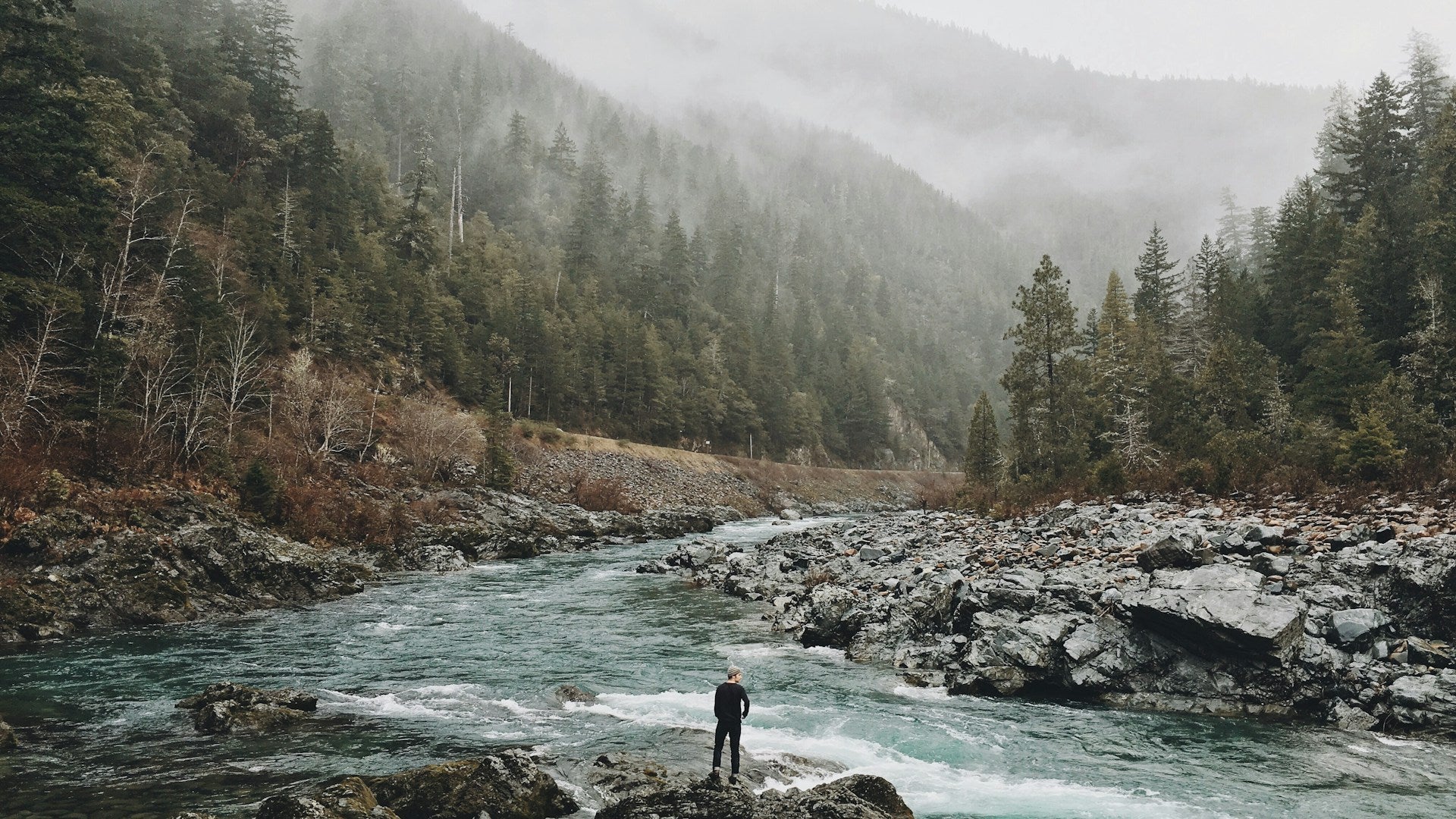
Coastal California
The coast of California is home to three main mountain ranges: the Northern Coast Ranges, Transverse Ranges, and Southern Coast Ranges which stretch along its incredibly tall coastline from north to south.
On the coastline itself, sandy beaches and dunes are common, as well as picturesque cliffs and rocky shores full of tidepools. Southern California is one of the top surfing destinations in the world, with surfable waves found throughout the year – in the north, surfing is possible, but the water is cold.
Large tidal estuaries like the San Francisco Bay are aided by major rivers – the state’s coastal plains are fed by thousands of creek and stream branches before they spill into the sea, making California a hydrological mapping marvel as well in addition to its topographical features.
What makes California's topography so unique?
If you look at a map of California, you may notice its peculiar geographic setup: it’s essentially just a bunch of mountains surrounding one massive fertile valley, tailor-fit for large-scale agriculture.
The Central Valley of California was slowly formed over millions of years, with tectonic shifts changing the surrounding mountains until they formed a sort of bowl making up California’s modern day edges.
This unique geography means California is now home to both millions of diverse wild plant and animal species and able to produce immense amounts of agricultural products for the entire world.
California's interesting elevation
The lowest elevation point in California is at 282 feet below sea found at the bottom of Badwater Basin, a water basin with a highly relevant name – as it’s found within Death Valley National Park. Death Valley is a desert region known for both deadly summers and beautiful flower bloom events, located in eastern California.
The highest elevation point in California is the 14,505 feet tall peak of Mount Whitney, located within Sequoia National Park around 100 miles from Death Valley. Interestingly, this peak is also the highest in all of the continental US, not just California.
Aside from these low and high points, the general elevation of California is super varied; after all, elevation is essentially the same thing as topography. But in general, California is one of the best states for those who love challenging outdoor experiences – hiking, trekking, skiing, snowboarding – the changing elevations of the Golden State tend to attract adrenaline junkies from all over.
Mountains and more in California
Home to thousands of peaks, the state of California’s hundreds of mountain ranges twist and connect along its topographical landscape – these same mountains are responsible for the formation of the state’s desert regions, due to their overarching rain shadows.
Some of the most famous mountains in California include:
-
The Klamath Mountains, a northerly range considered a wild area of California
-
The Cascades, a range of mountains extending north into British Columbia
-
The Sierra Nevada Range, which is around 400 miles long
-
Mount Shasta, a popular ski and snowboarding destination
-
Mount Whitney, the tallest mountain in California
These are just a few examples – the state is so packed full of mountains and valleys, it’s hard to choose a favorite. Due to the mountainous nature of many regions in California, some areas of the state are sparsely populated or hard to navigate, especially during the winter when roads can become completely blocked off from snowfall (like the Sierra Nevada area).
Dry regions and deserts
California isn’t considered a desert overall, but it is home to a handful of deserts. The largest deserts in California are the Mojave, Colorado, and Great Basin Deserts. All of these deserts are home to unique and interesting ecosystems – and they’re all located at drastically different elevations.
The Colorado Desert has the lowest overall elevation, and is home to diverse species of flora and fauna like cacti – as a section of the larger Sonoran Desert, this desert mainly sits below 1,000 feet in elevation.
The Mojave and Great Basin Deserts are located at higher elevations, mainly above 2,000 feet in elevation, with peaks over 9,000 feet in the latter. Because of the high elevations of these deserts snowfall does occur, despite abnormally warm summer months.
California elevation and relief maps by Muir Way
Whether you live in the state or you’re looking for a California topographic map for art enthusiasts in your life, you may want to take a look at some of the detailed physical California maps available at Muir Way.
-
For lovers of colorful maps, check out our 1944 raised relief map of California
-
If you’re a national park explorer, try our vintage 1955 Yosemite park map
We also stock a wide selection of other kinds of US related topographic maps and international maps: you can find maps depicting elevation in our topo series, water system related maps in our hydrology series, and mountain range posters within our range series.
Beyond the topography of California
Going a bit further than topography, we can also discuss California's geography, size, climate, and bordering oceans among other features. If you look at a California map, you'll realize the state is situated in a pretty unique region of the world, giving it many special properties.
Located in the western most region of the US, California is perhaps the most famous west coast state of the US – with Oregon and Washington right behind it. In terms of global climate regions, the state is found within the Mediterranean climate zone – with three different main areas, defined a bit further down.
Attributes of the Pacific Coast
To the west, California is bordered by the Pacific Ocean – this is the ocean the island state of Hawaii is located in as well. As the largest ocean in the world, the Pacific Ocean’s persistent crashing amongst the coastal regions of California has produced one of the most beautiful and easily-driven coastlines in the world.
How big is California?
It makes sense that California is so varied topographically when you consider its size of 163,696 square miles, which is larger than entire countries such as the United Kingdom, Spain, Vietnam, and Japan.
This massive scale has allowed the state to develop a unique landscape of topographic marvels and varying climate regions. Not only that, but the population size of the state is around 39 million as of 2023 – around the same size as Canada’s entire population.
What is the climate like in California?
Because of its massive size, especially north-to-south, California varies in terms of climate:
-
Along its coast, the state is generally cooler – with foggy and rainy beaches common up north and sunny, swimmable beaches down south
-
In the north, the state generally has a moderate, Mediterranean climate with warm summers and moderate winters
-
In the south, Californians experience generally warm temperatures all year, with a bit of rain during the winter near cities like San Diego
-
Further inland, you’ll find many mountainous and desert regions with unique climates – these are regions of extreme heat and cold
These moderate climate zones are one of the main reasons so many people choose to live in California, along with bustling agricultural industry hubs and tech-focused cities.
Final thoughts
There's a reason everyone wants to live in or visit California, as it has something to offer almost anyone. Whether you're an outdoor adrenaline junkie or prefer to just relax in a cozy urban setting, the Golden State has you covered. However, if you do decide to come visit – hopefully you'll be one of the few to truly appreciate the state's topography.