


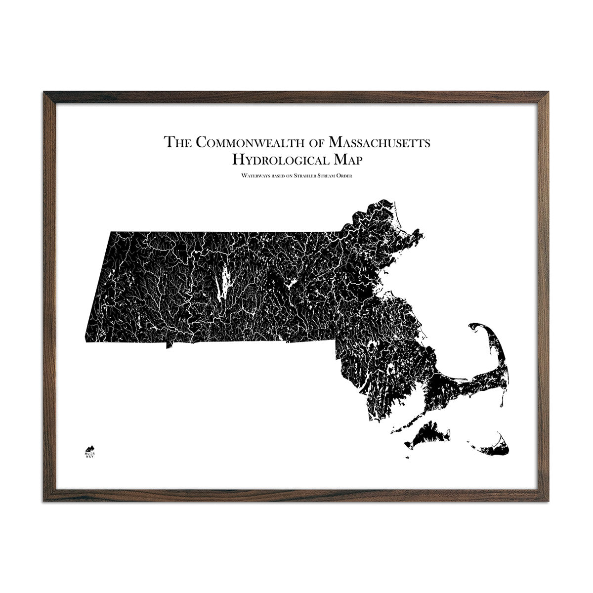
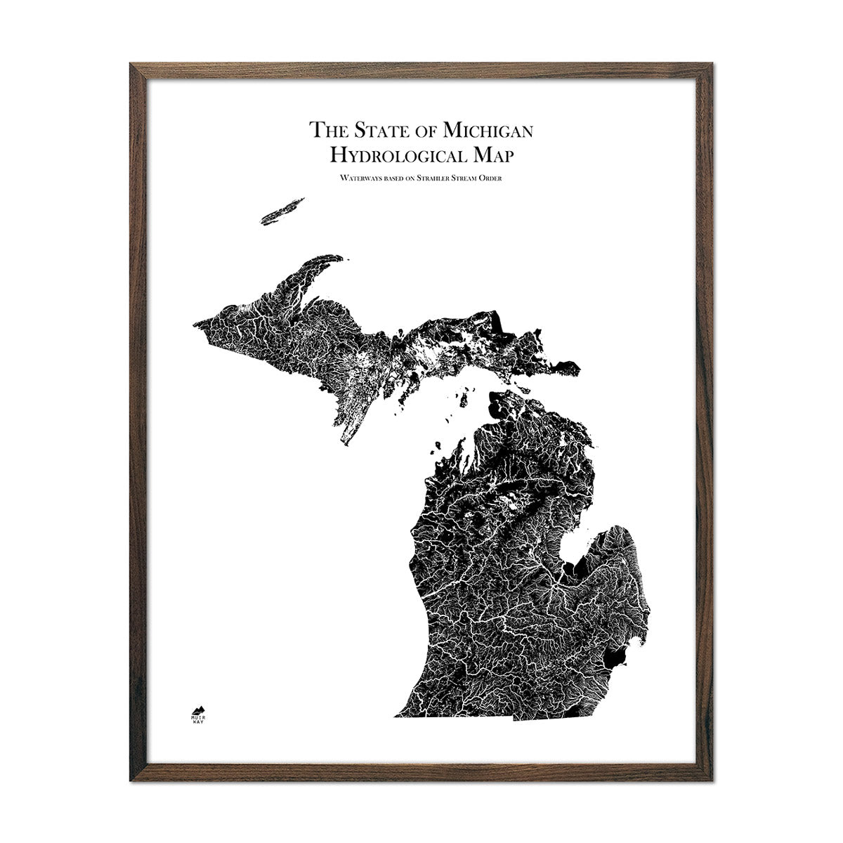
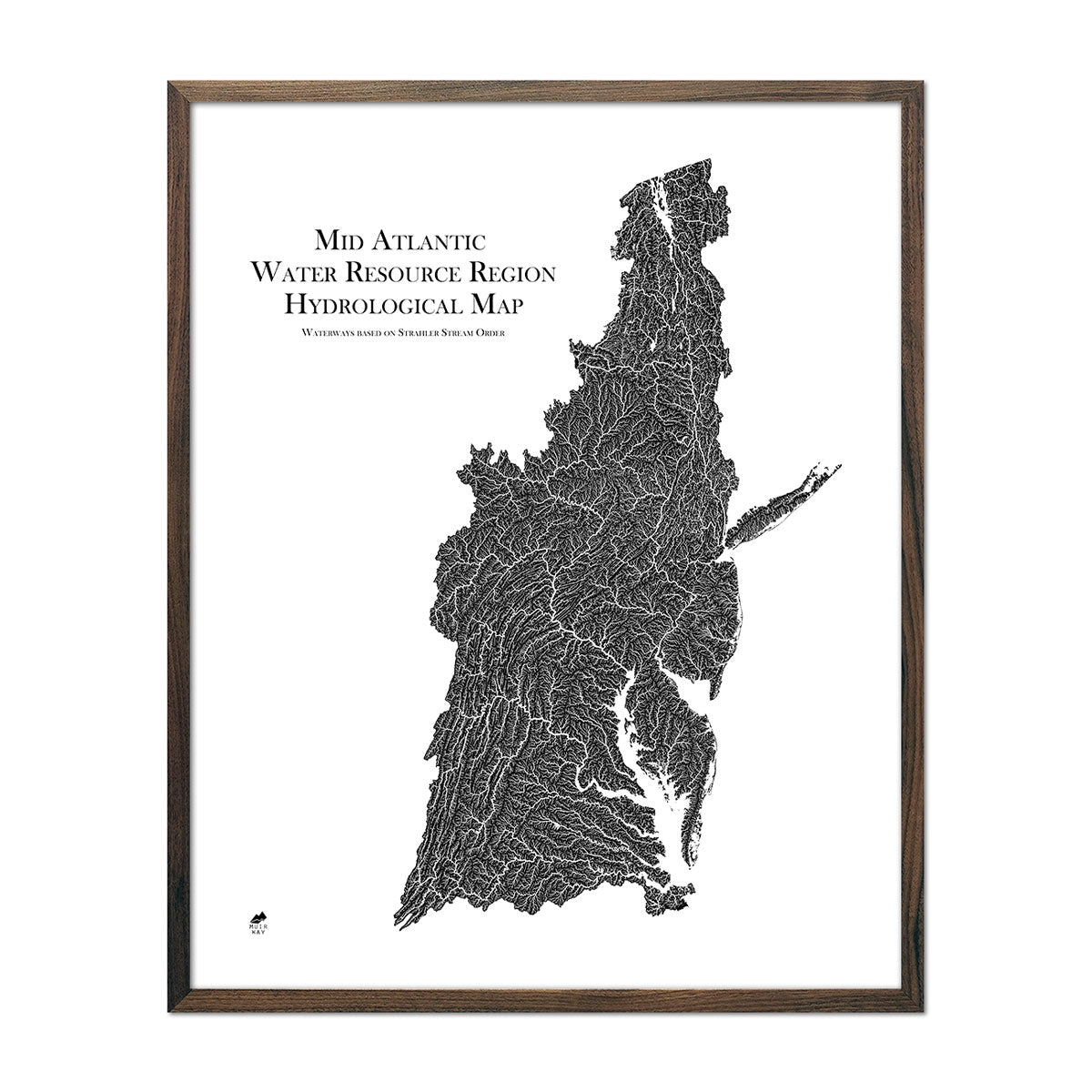
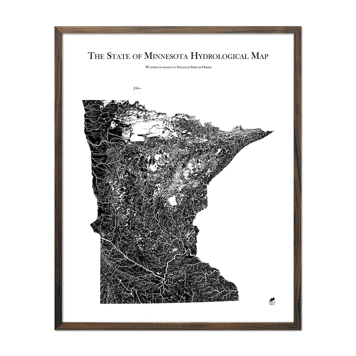
Hydrology Series
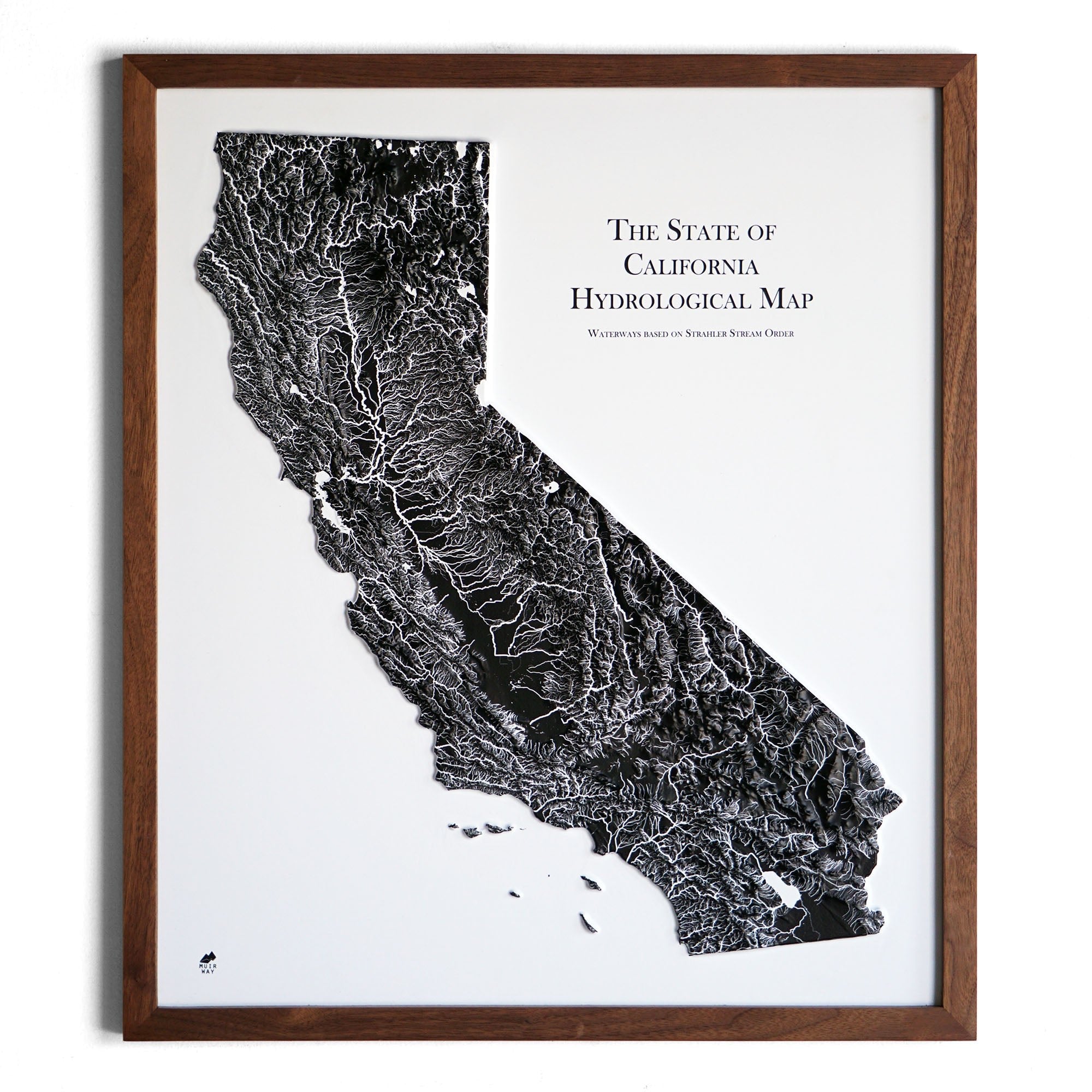
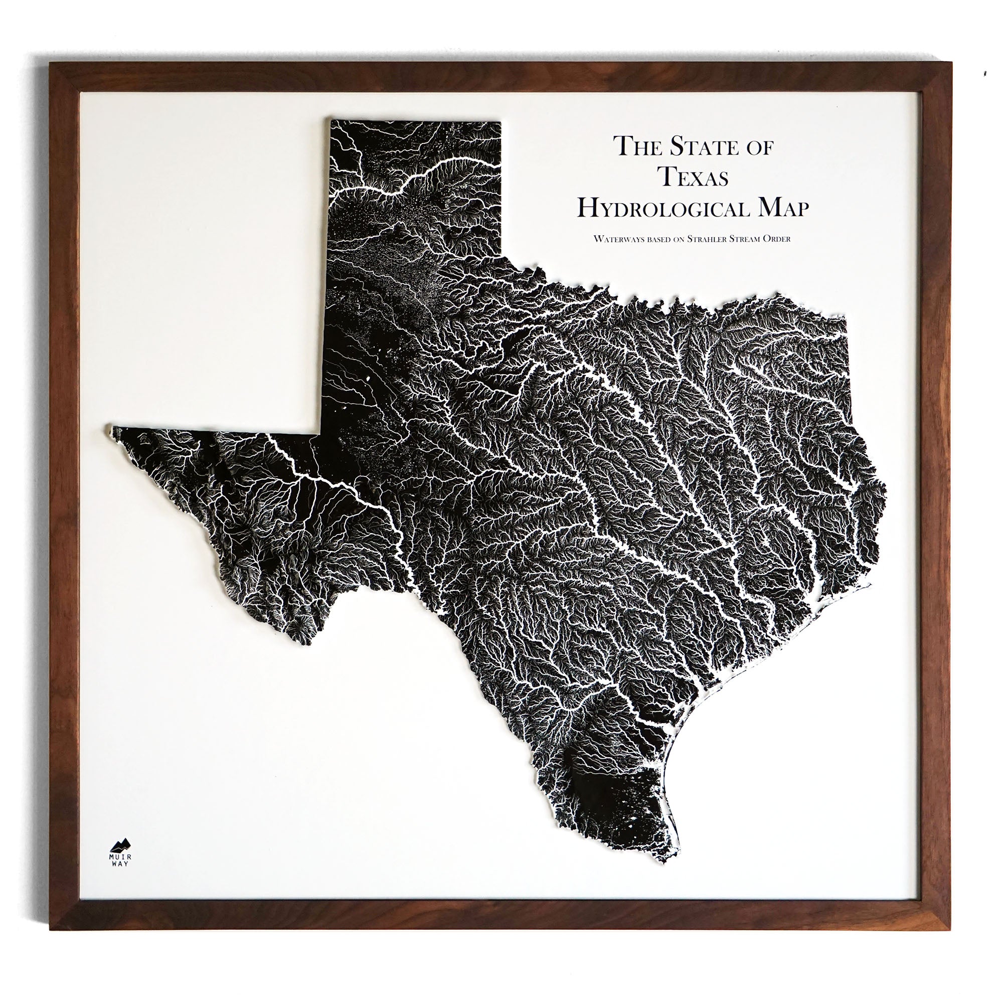
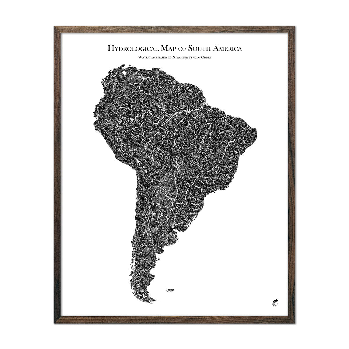
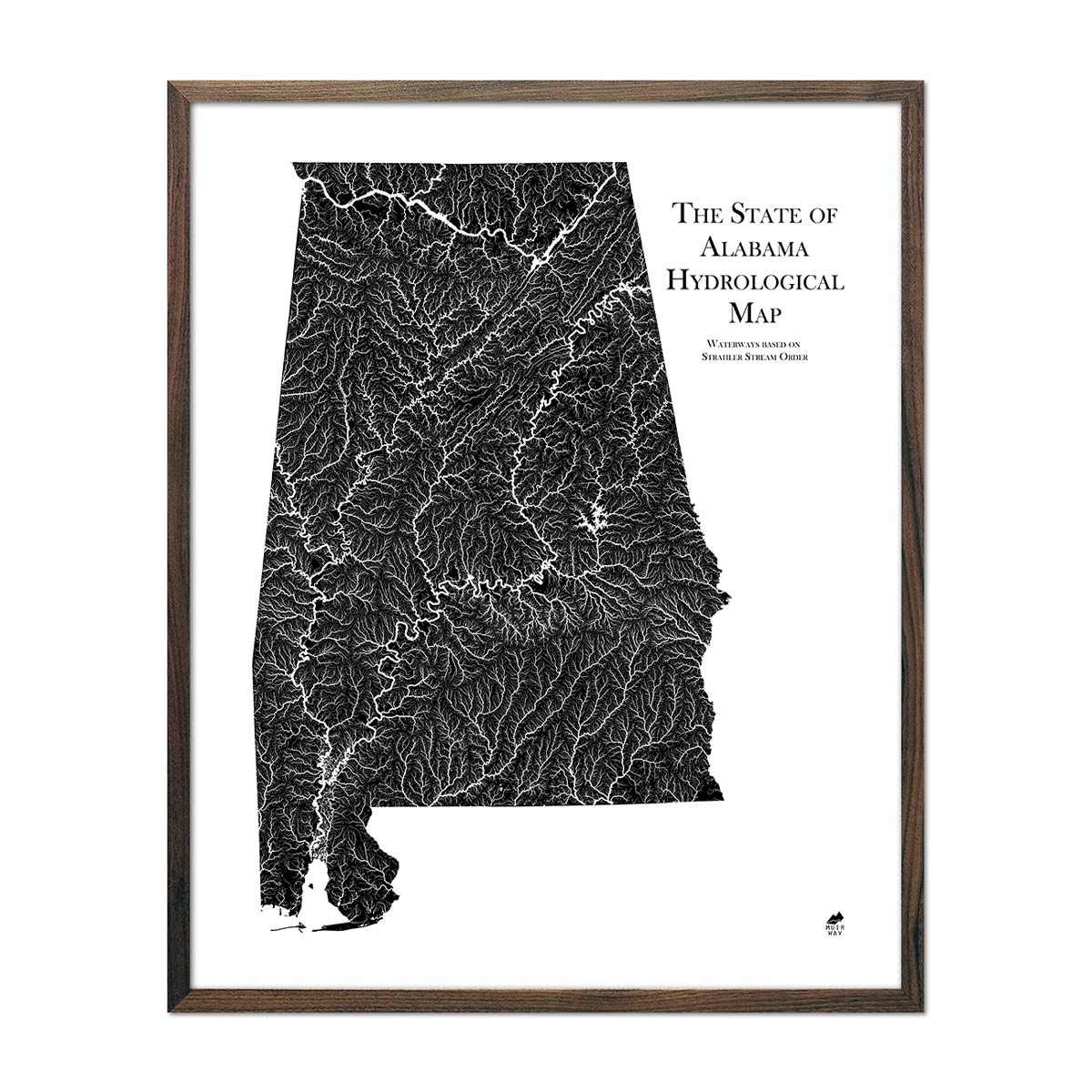
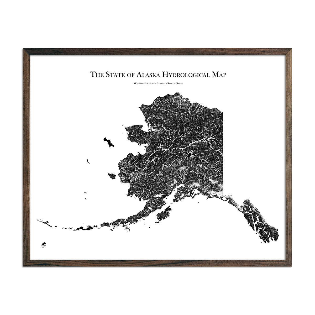
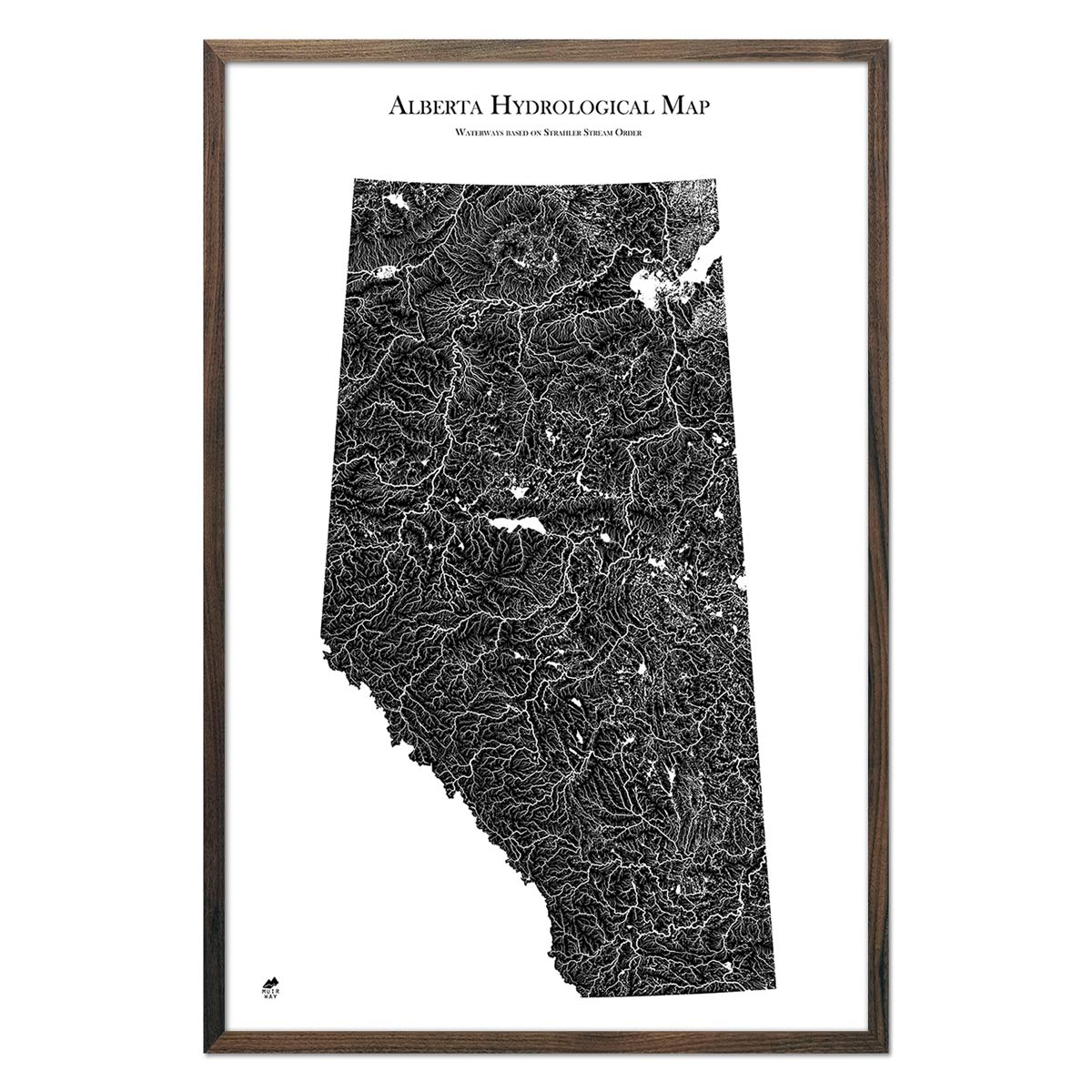
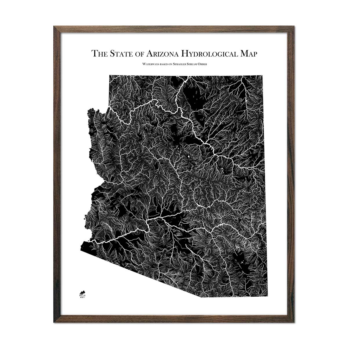
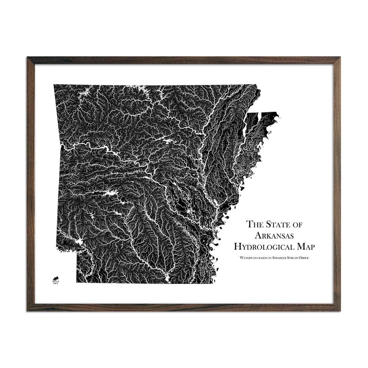
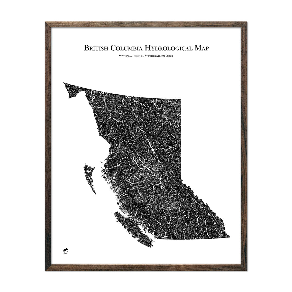
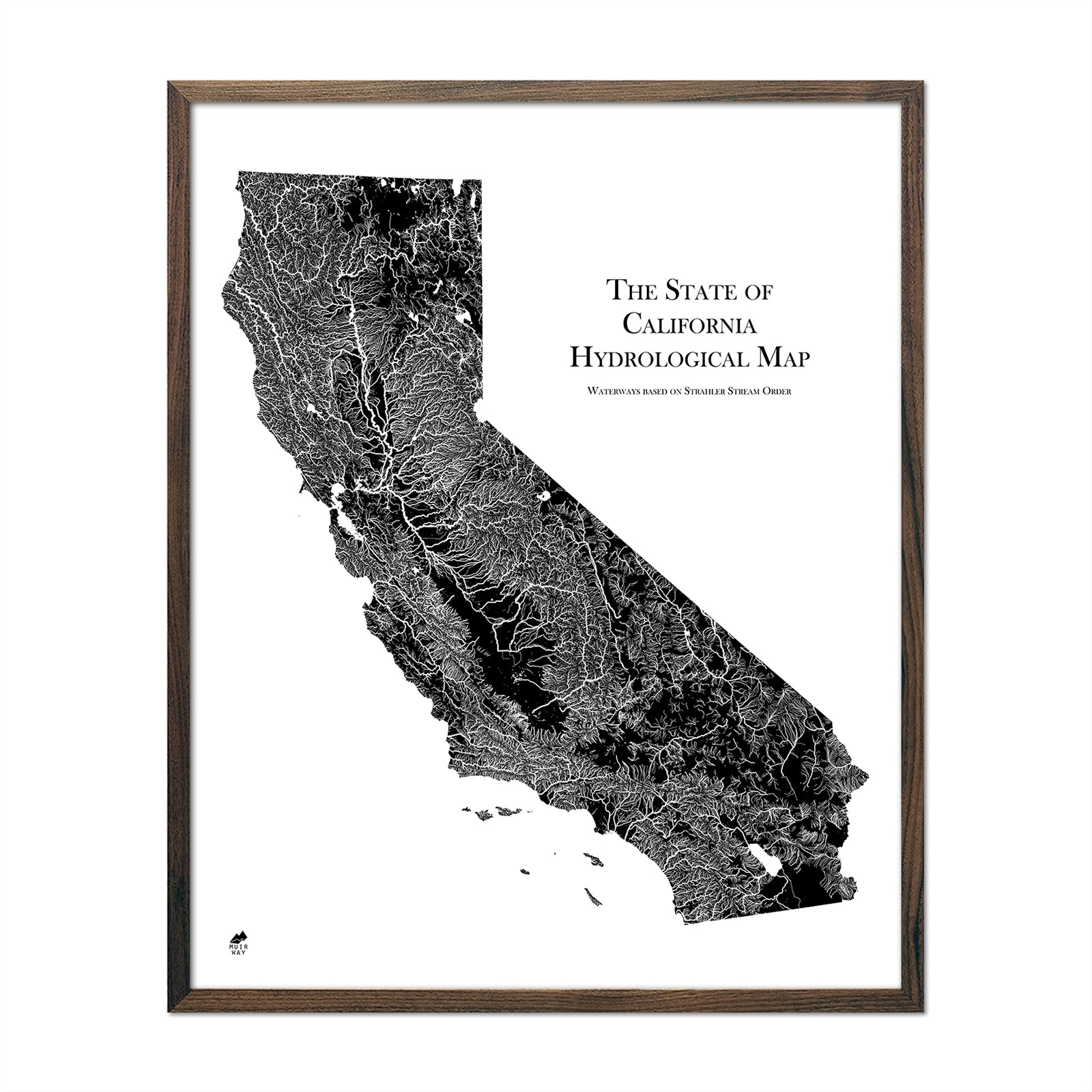
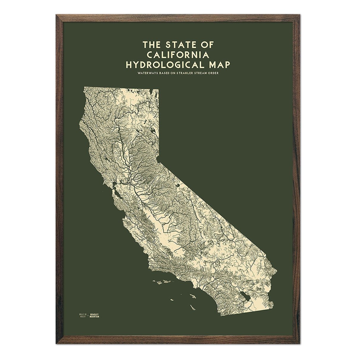
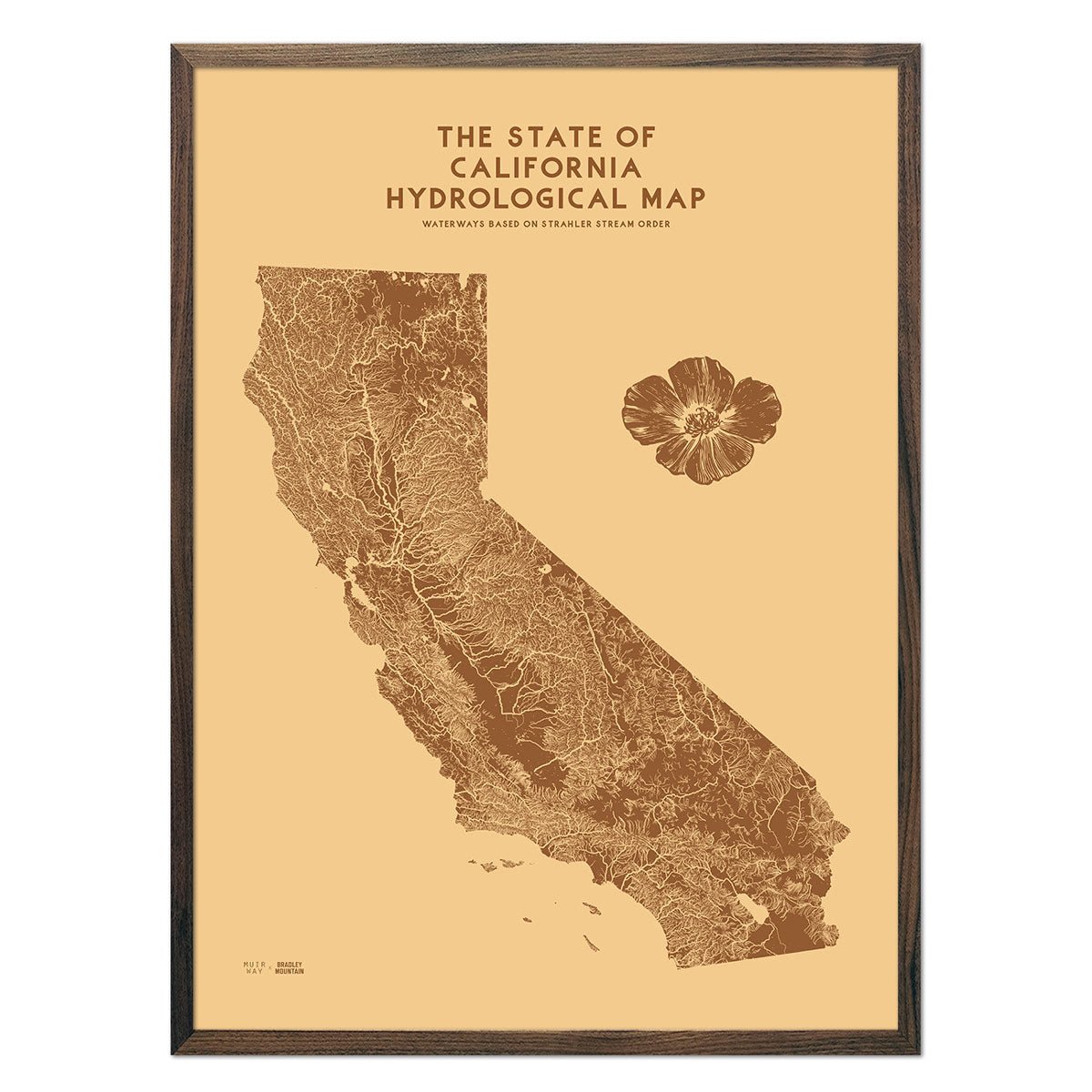
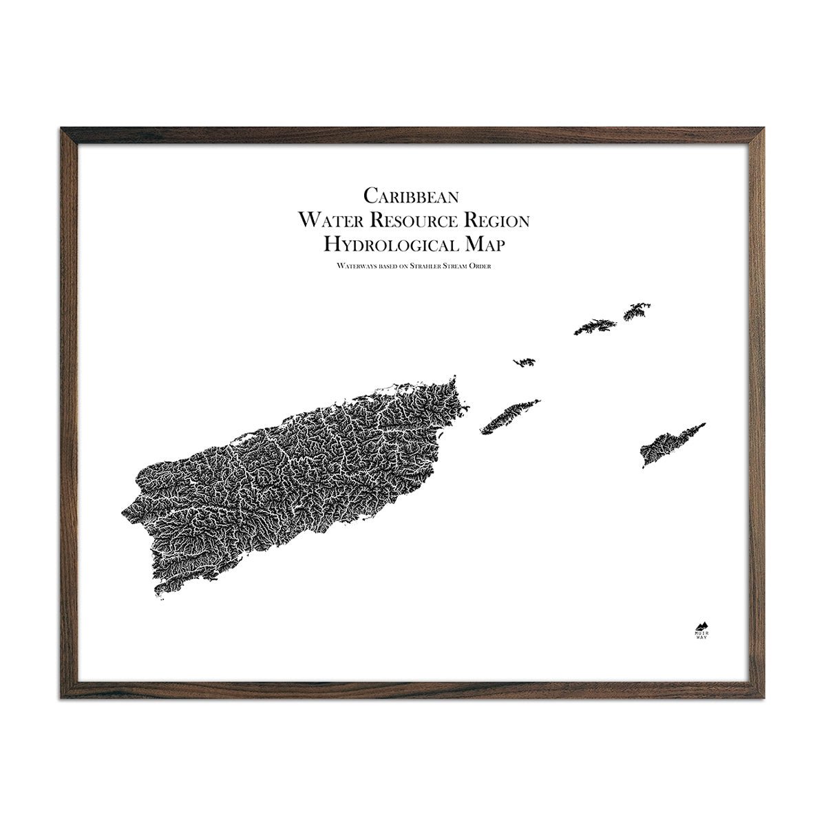
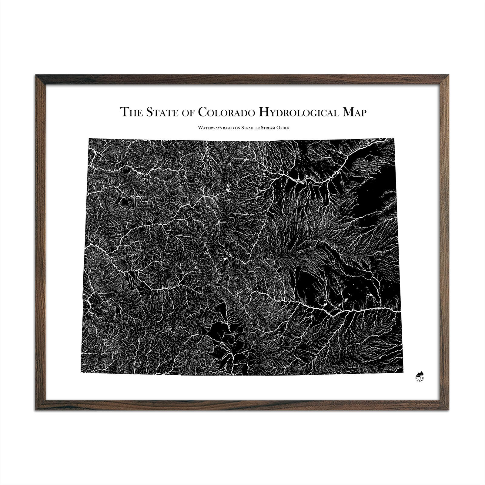
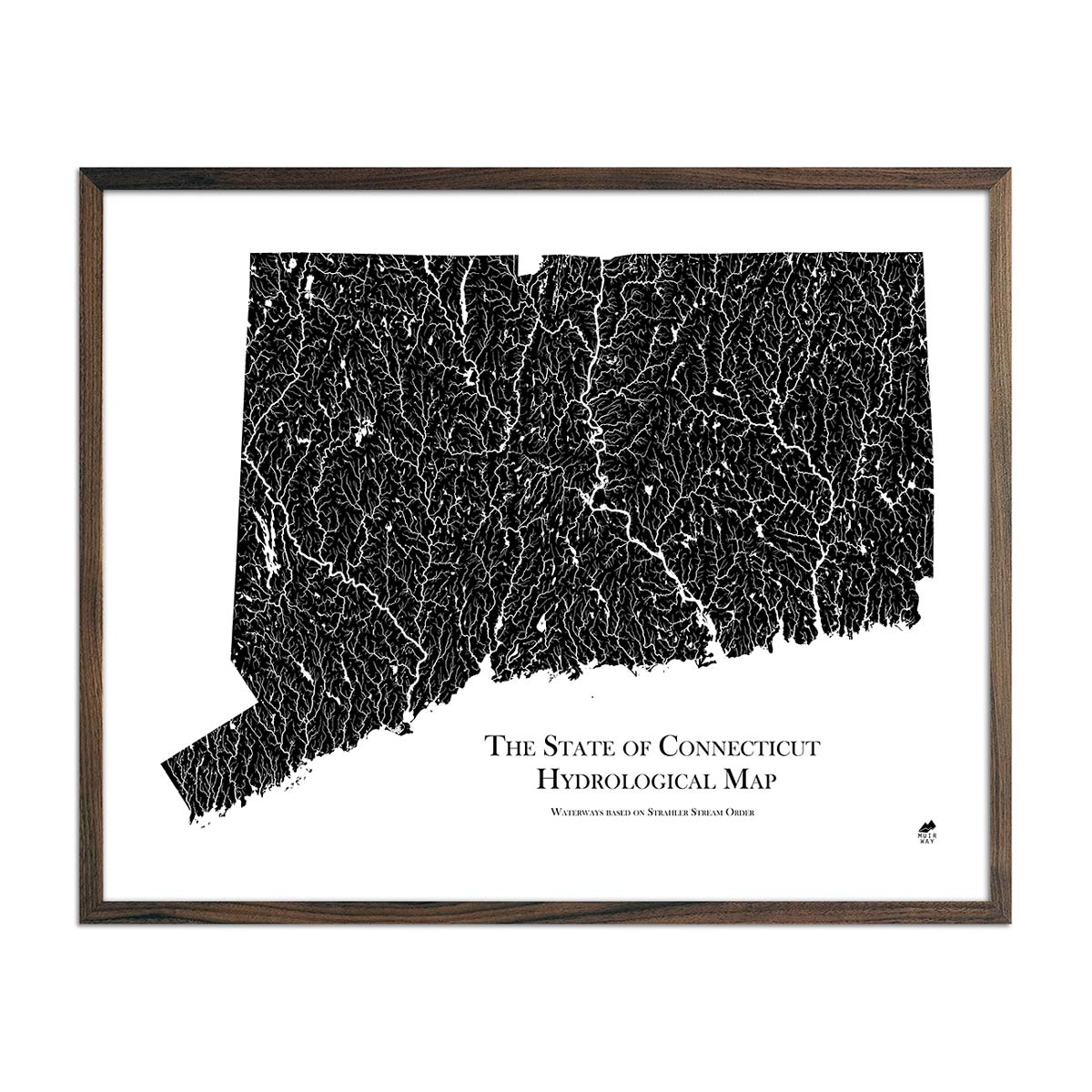
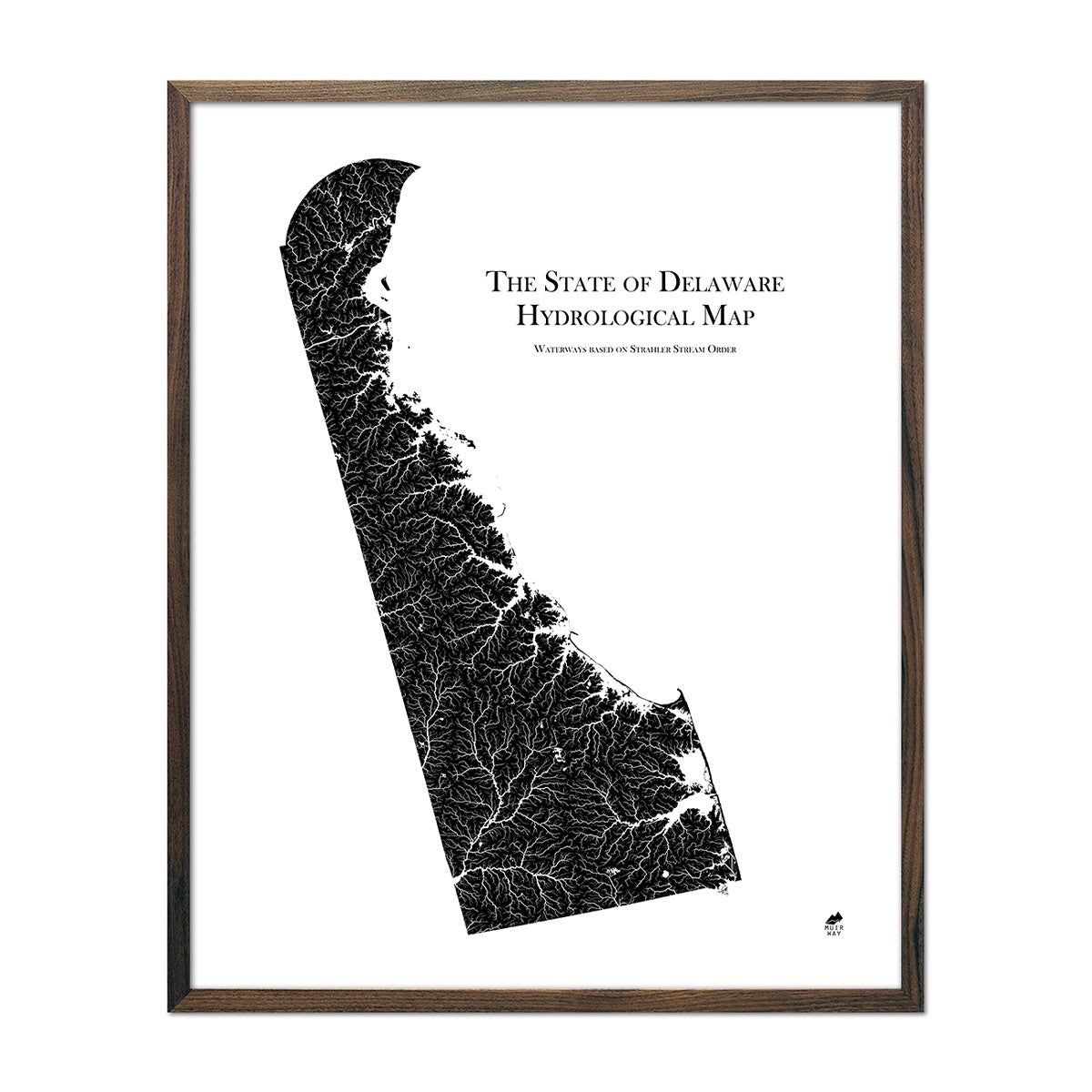
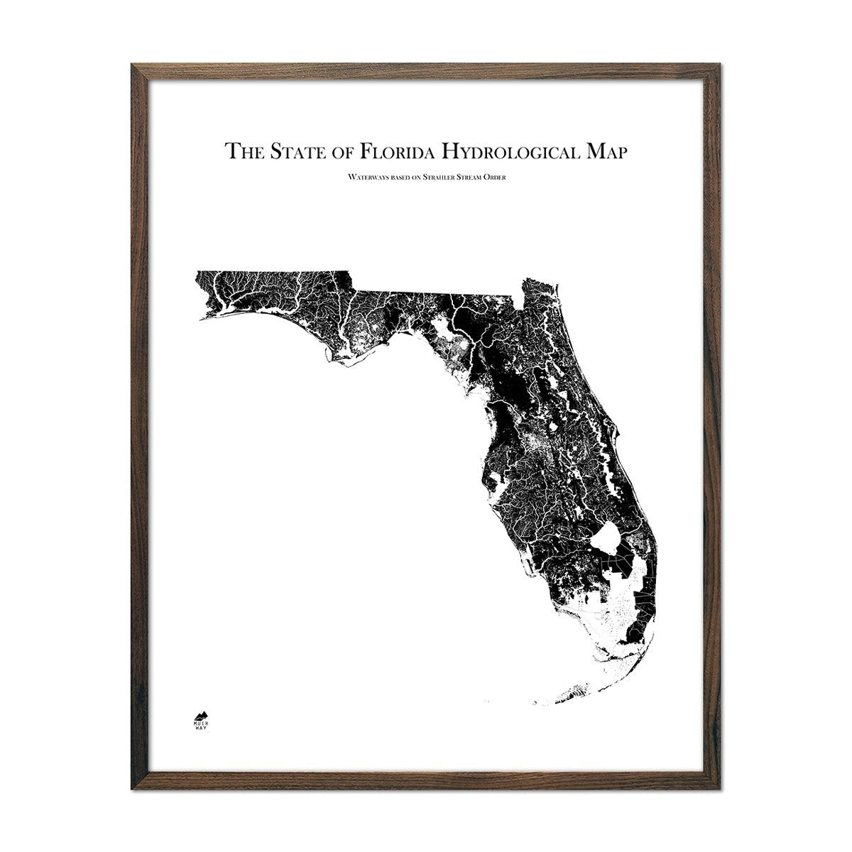
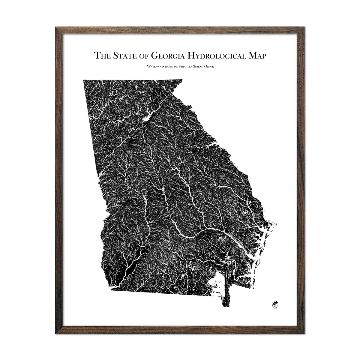
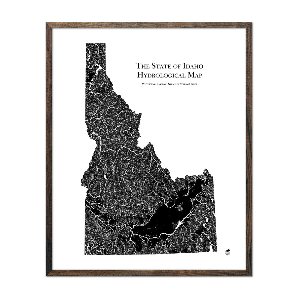
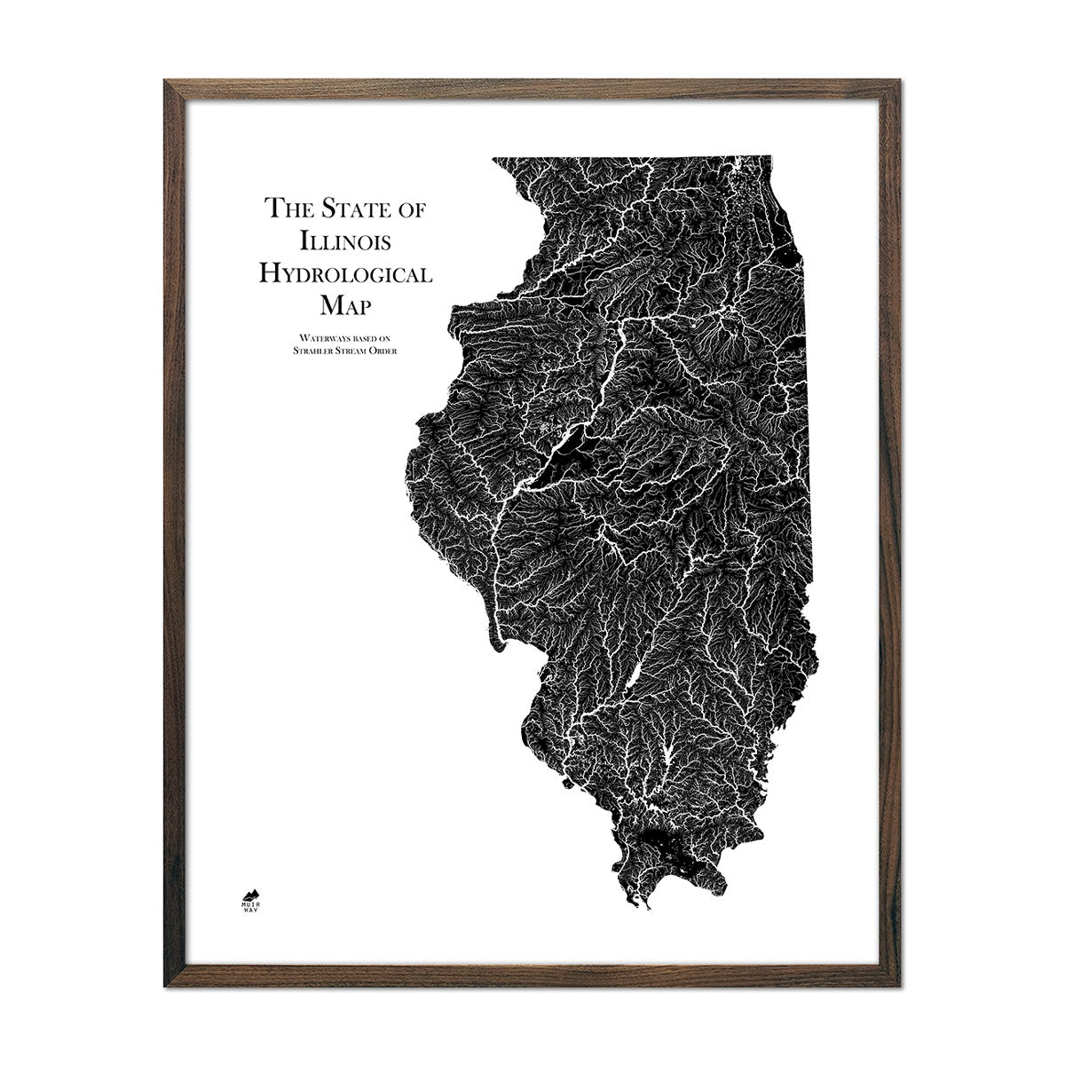
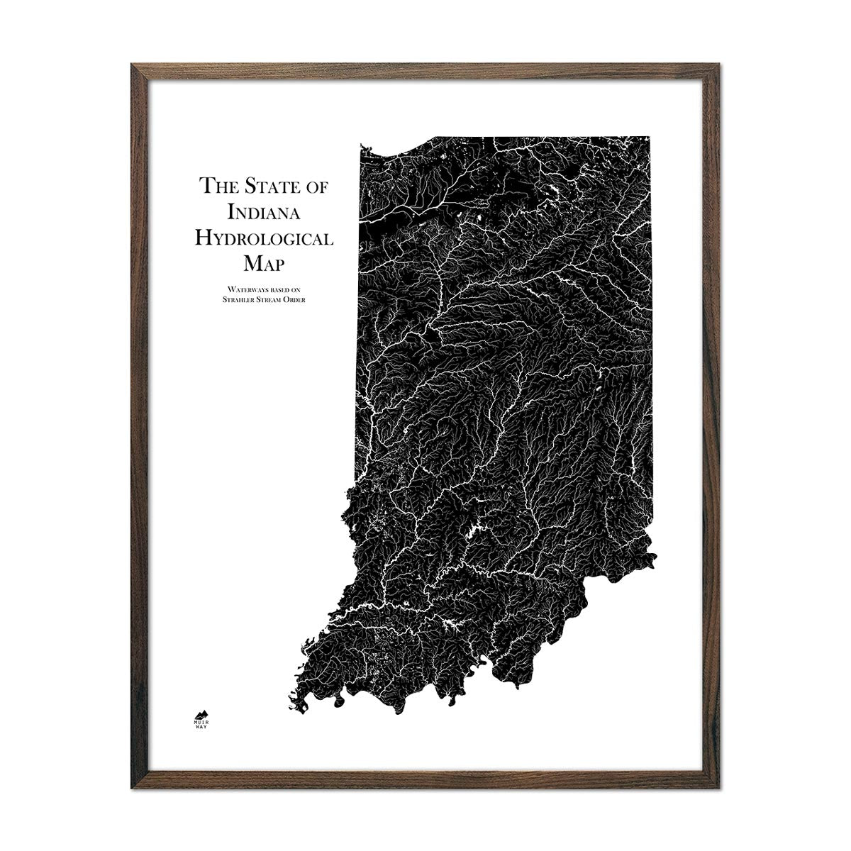
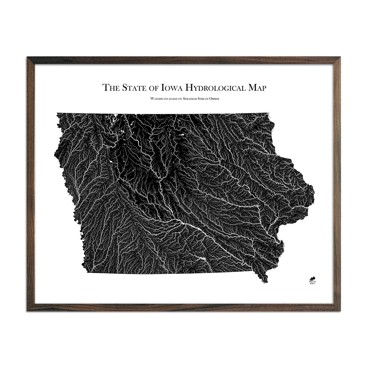
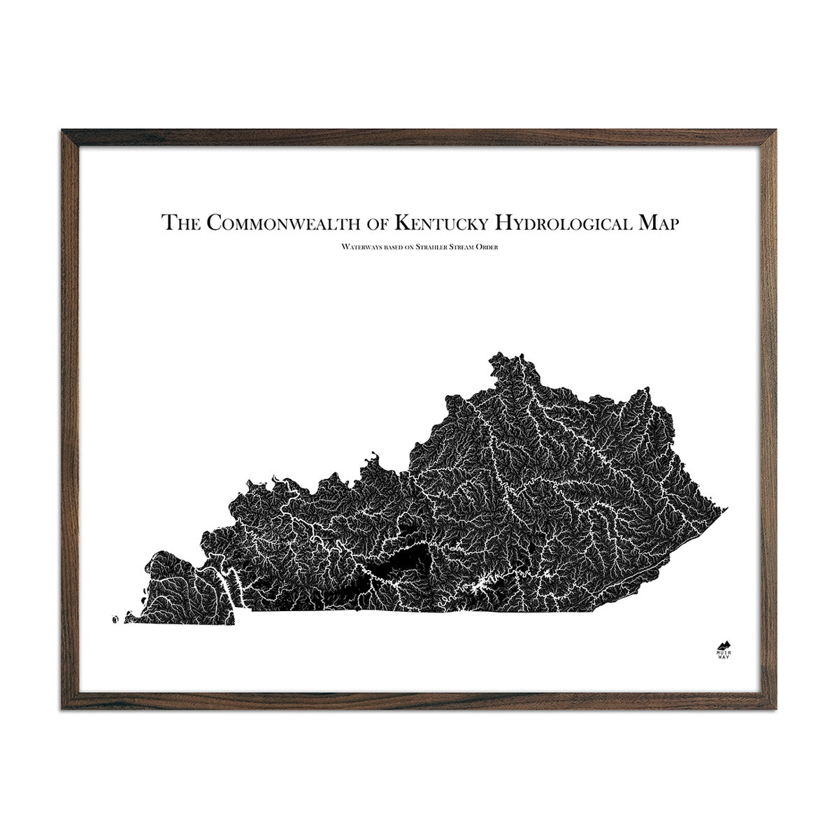
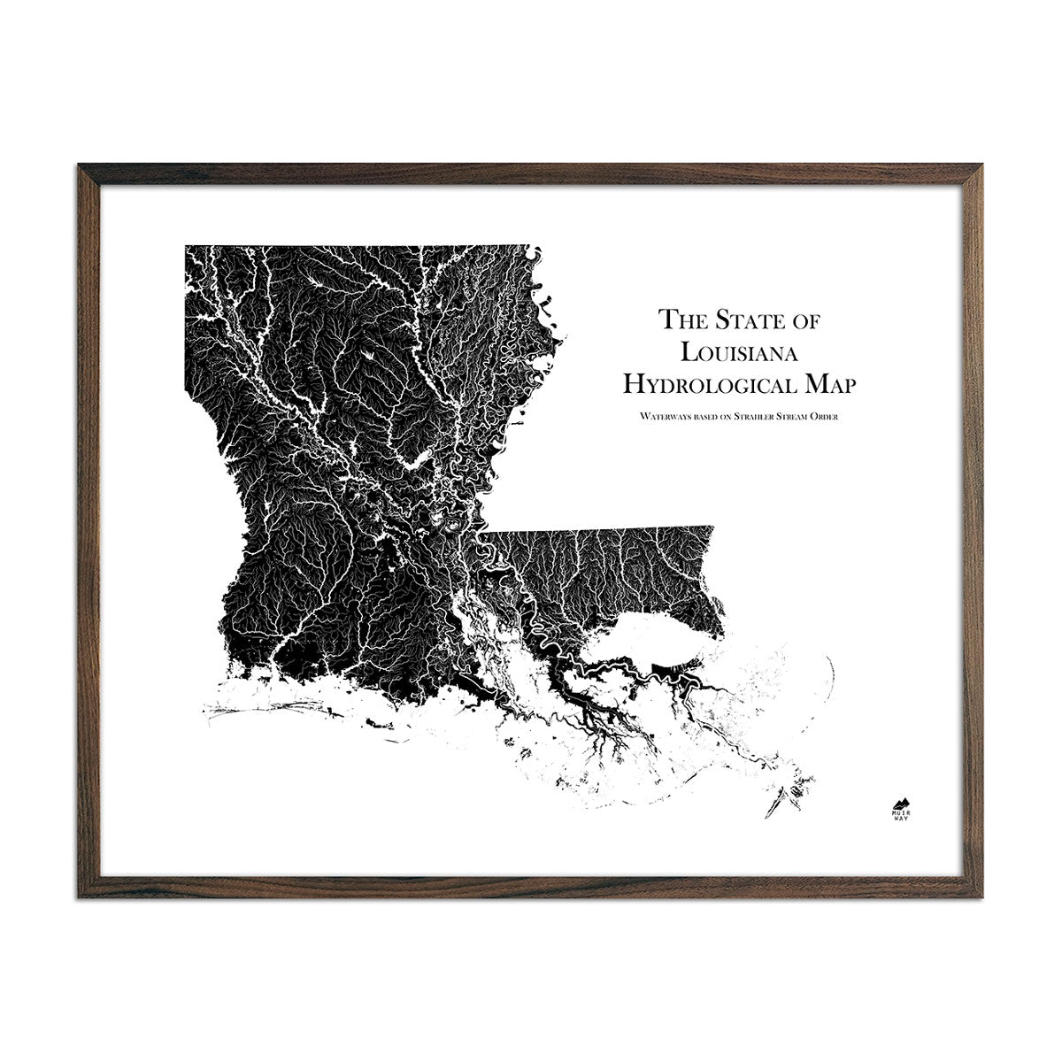
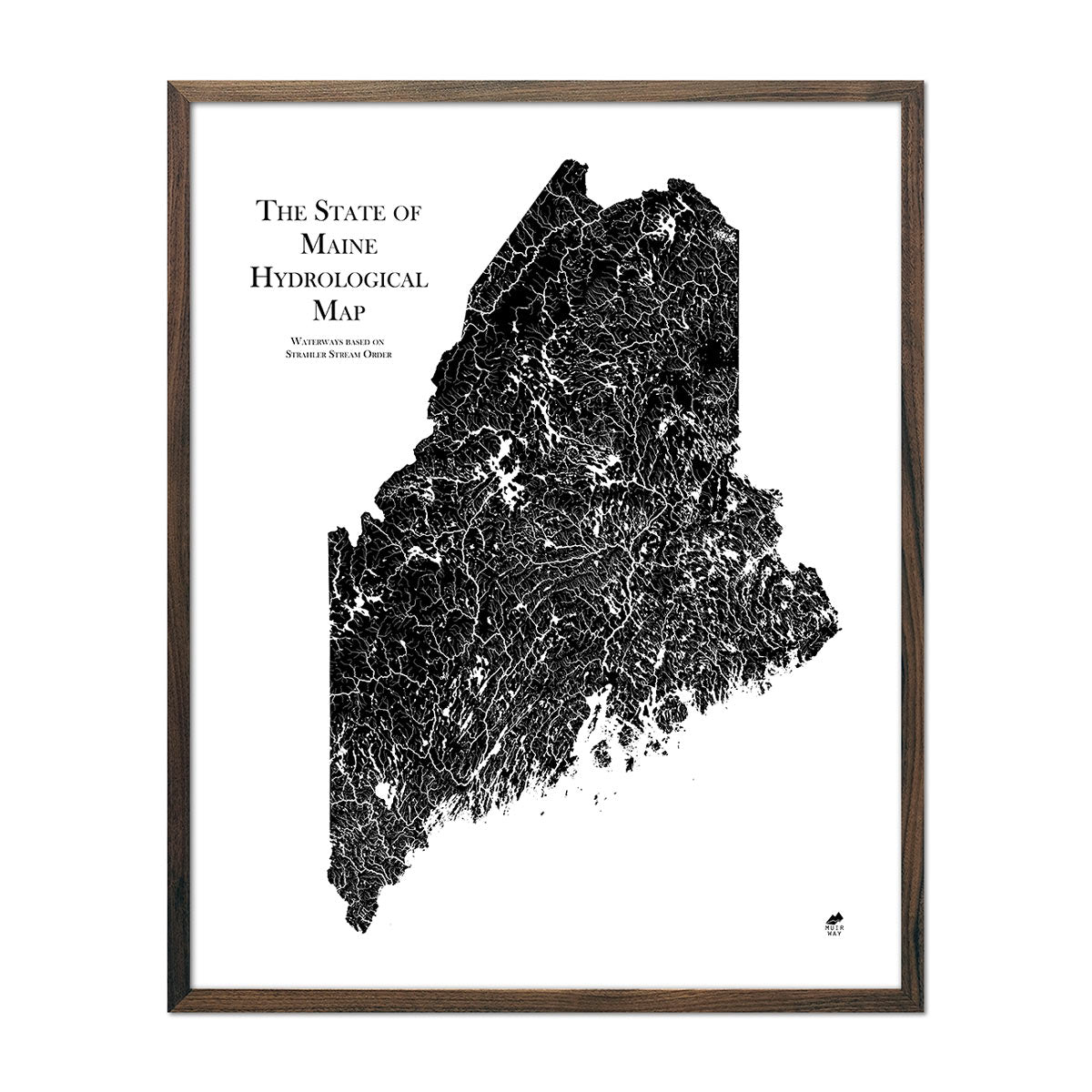
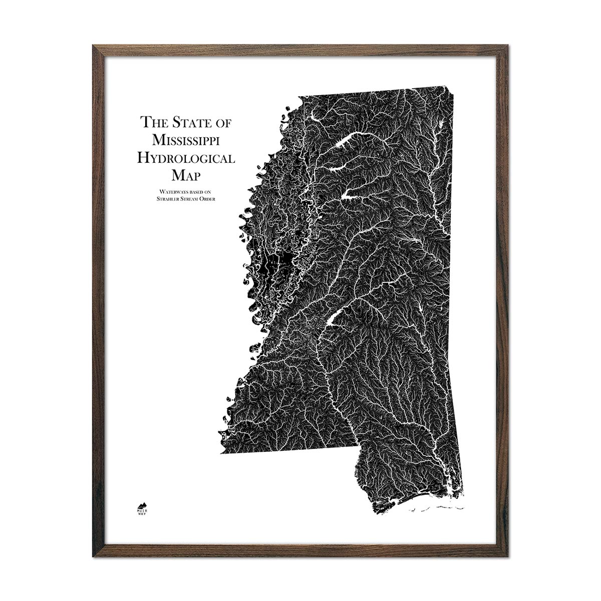
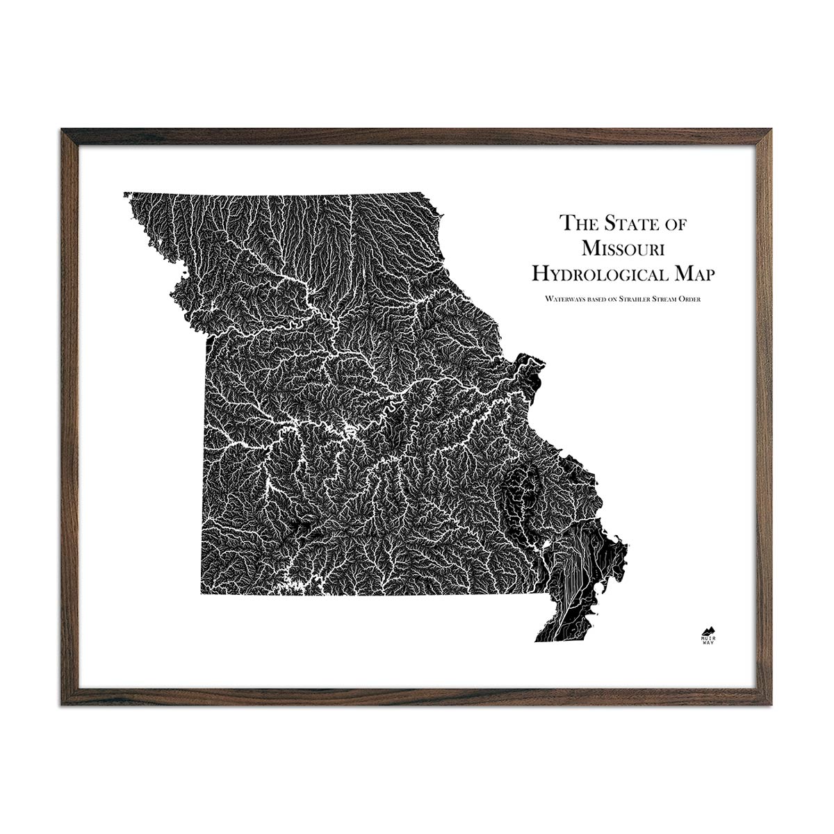
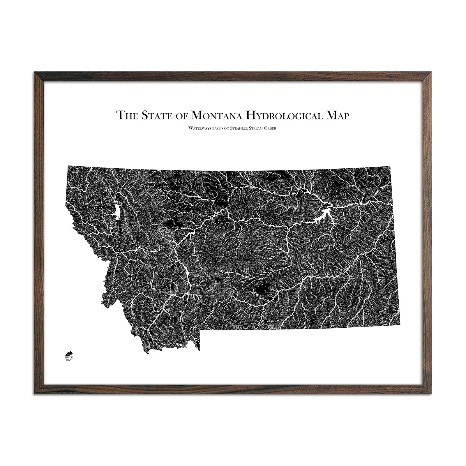
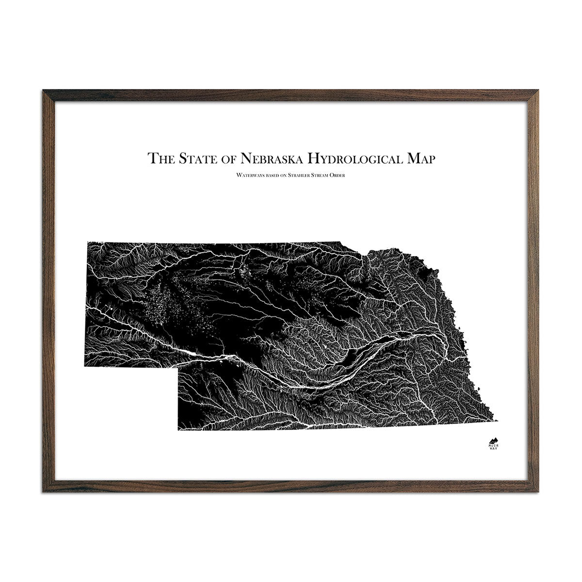
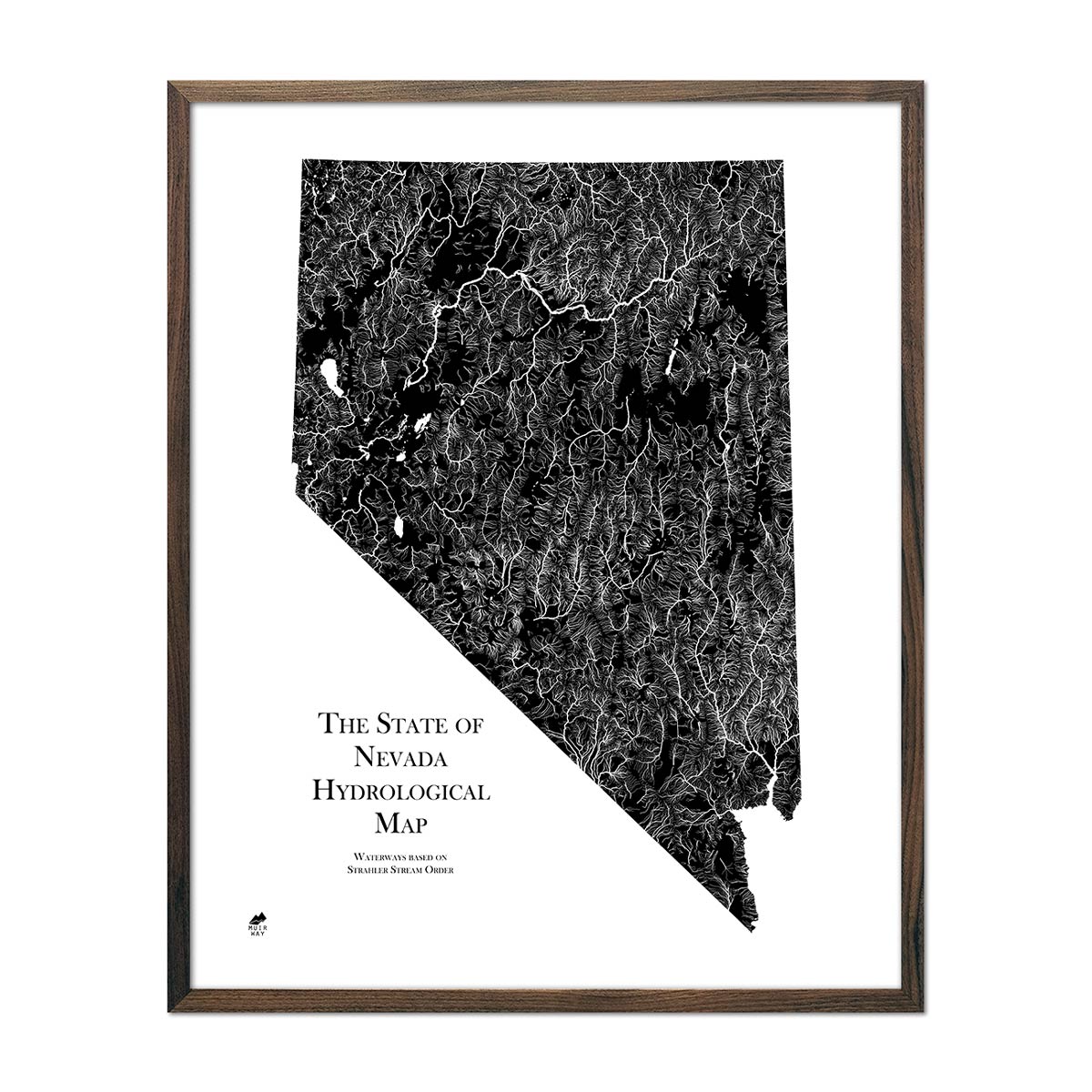
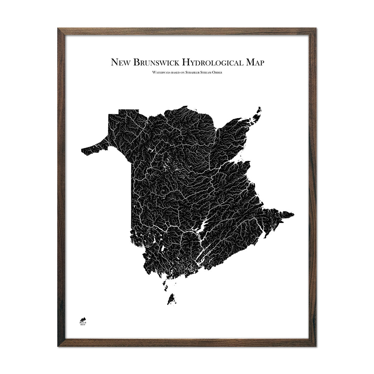
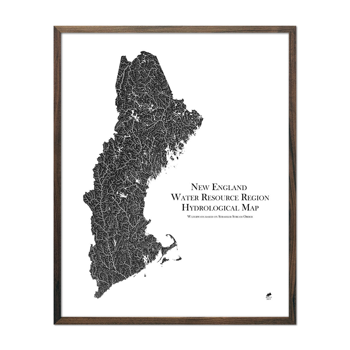
Hydrological maps display all waterways in their characteristic dendritic graphic format, while we offer a choice of color to suit your personal style and home decor. Our map makers (cartographers) have used the Strahler Stream Order method to create maps that accurately depict river-and-stream order ranked by importance (runoff and size). Hydrology maps can be delineated either by political boundaries, like state or country, or by natural or watershed boundary, like by river system or continent.
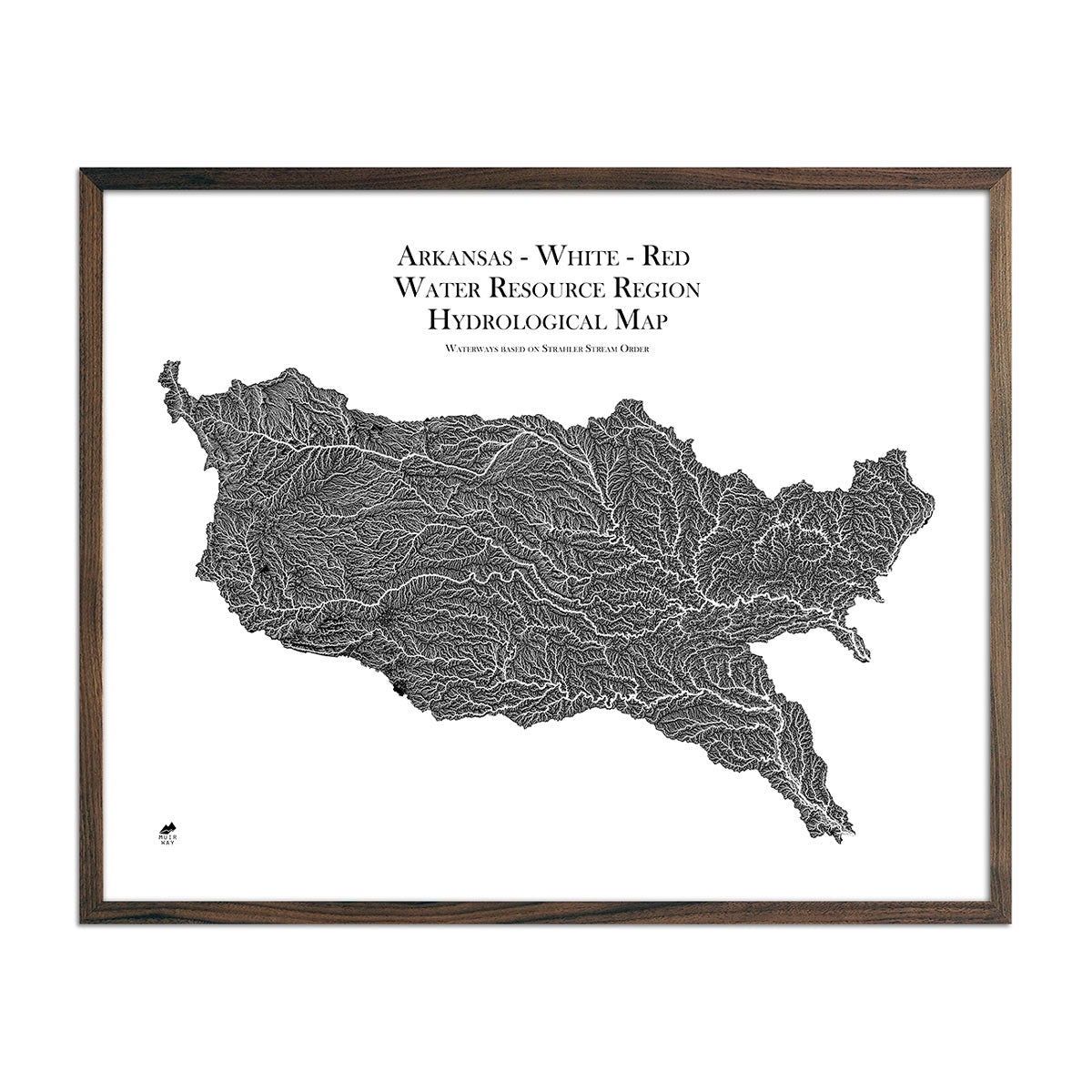
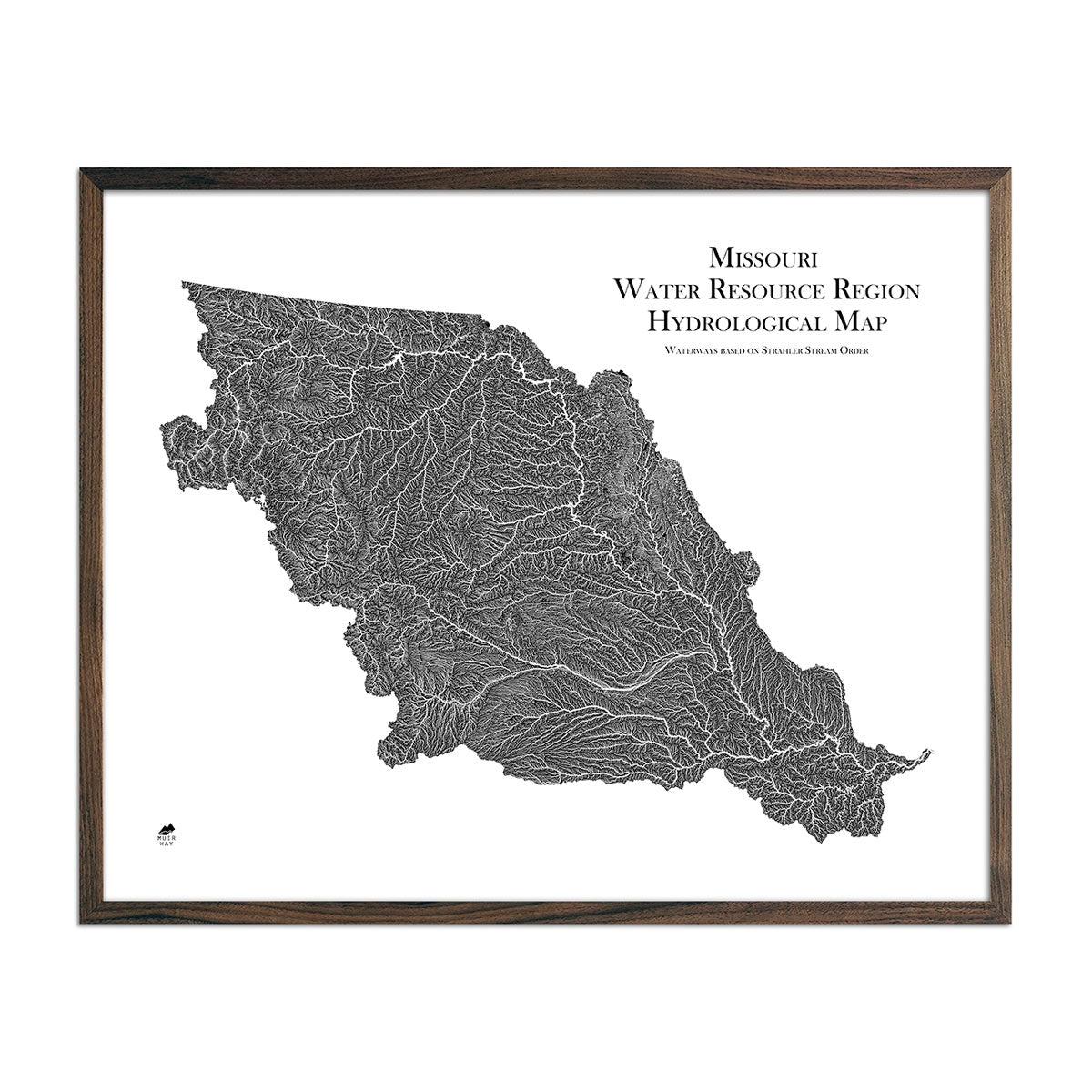
What is a Watershed Map?
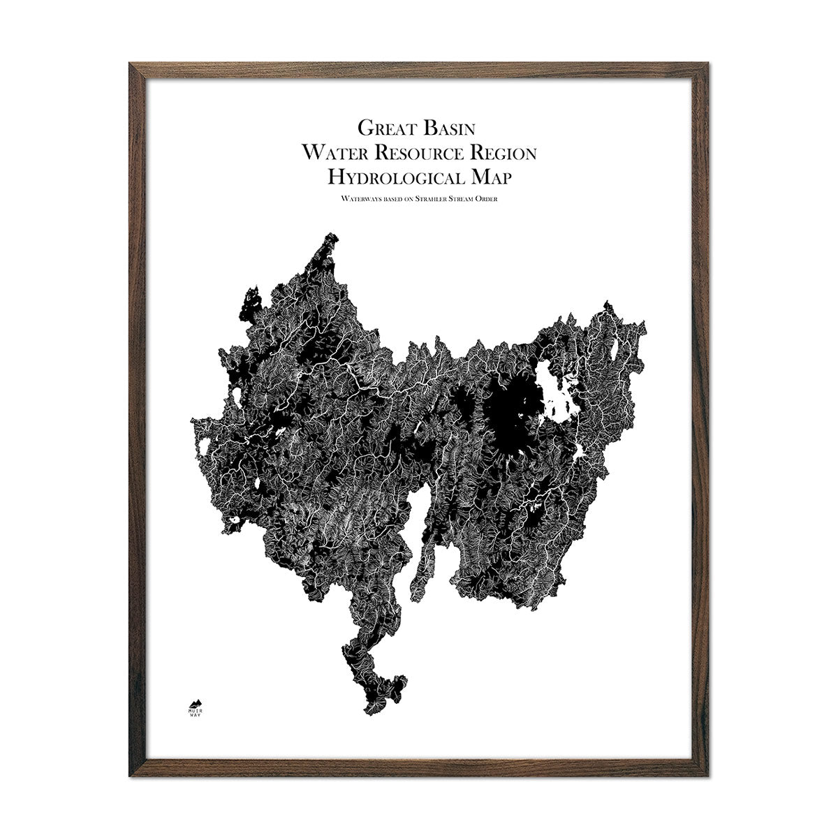
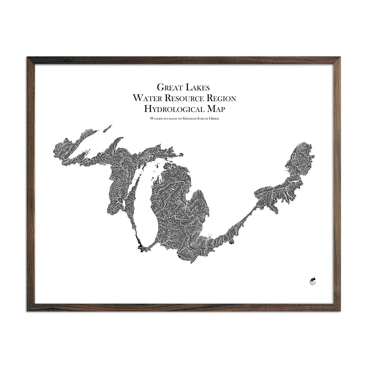
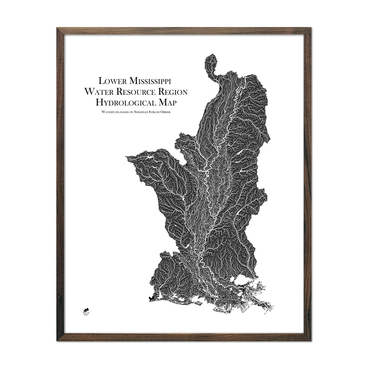
Watershed maps are hydrological maps that use the watershed or drainage basin as a mapping boundary, rather than man-made political boundaries. This creates waterway maps that display the same river system or drainage basin, often sharing the same river mouth. Our hydrological data is sourced from the United States Geological Survey (USGS). Examples of our watershed maps include those of the Lower Mississippi, Ohio, Great Basin, or Missouri River system maps.
What Kinds of Waterways are Included in a Hydrological Map?
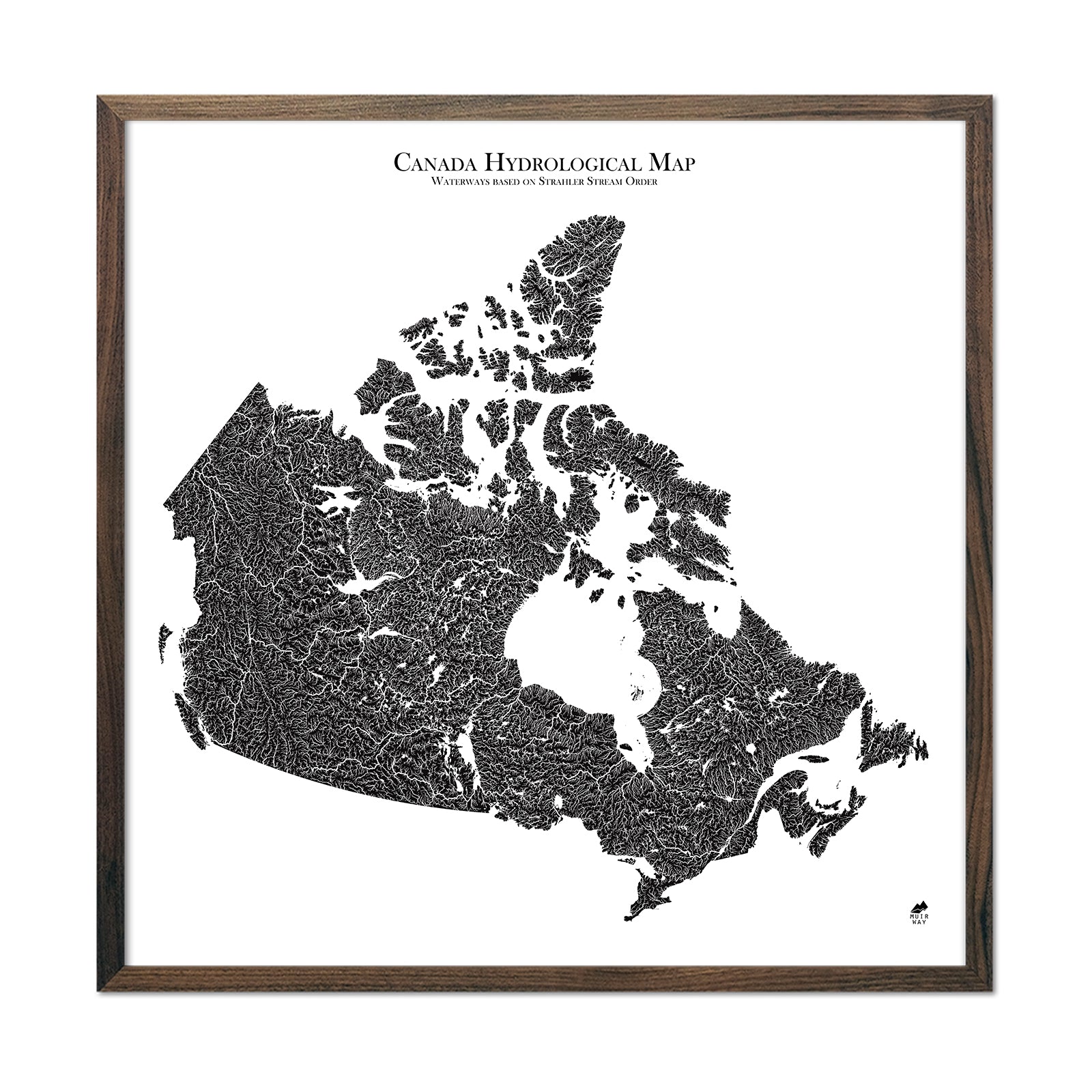
Our hydrological and waterway maps include all rivers and water bodies that can be graphically represented at the scale of the map produced. Our hydrology maps are extremely detailed, with details more evident on larger print sizes. In using the Strahler Stream Order method, we size the rivers on the map to represent their order of importance. This ensures streams are not lost due to their tiny size relative to map coverage area, and can be represented alongside more sizable rivers, waterways, and lakes. Coastlines, gulfs, sounds, lakes, reservoirs, and wetlands are also represented on our maps and are done so true to size and location: minimum size being 0.2 mile diameter water bodies on state maps, to 2 mile diameter water bodies on national and continental maps. We have produced content for numerous North American drainage basins and all USA states, and Canadian provinces and territories.
What are the Most Popular Hydrology Water Maps?
-
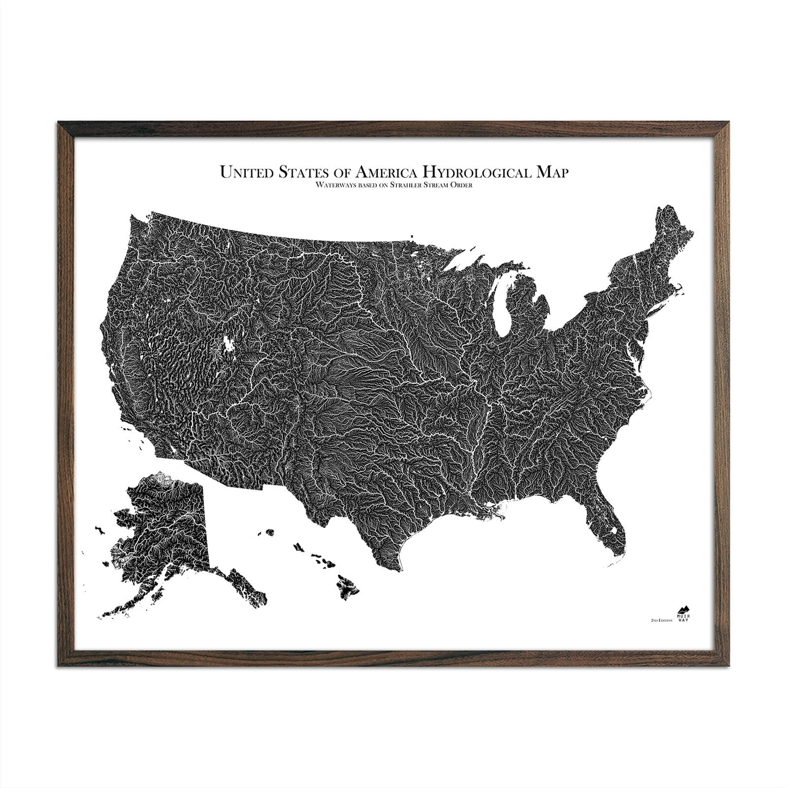
US Hydrological Map
Compiled with US Geological Survey (USGS) data and using the Strahler Stream Order method, this national waterway map beautifully illustrates the rivers, lakes, and all other water bodies of the USA lower-48, Alaska, and Hawaii. Our grand rivers are all beautifully illustrated from source to mouth, including the Columbia, Colorado, Rio Grande, Mississippi-Missouri, St. Lawrence and Great Lakes, the Hudson, Susquehanna, and countless others.
- Washington Hydrology Series Map
Compiled with US Geological Survey (USGS) data and using the Strahler Stream Order method, this state waterway map beautifully illustrates the rivers, lakes, and all other water bodies of Washington State from the Pacific coast and Puget Sound to the vast Columbia River basin. - Hydrological Map of North America
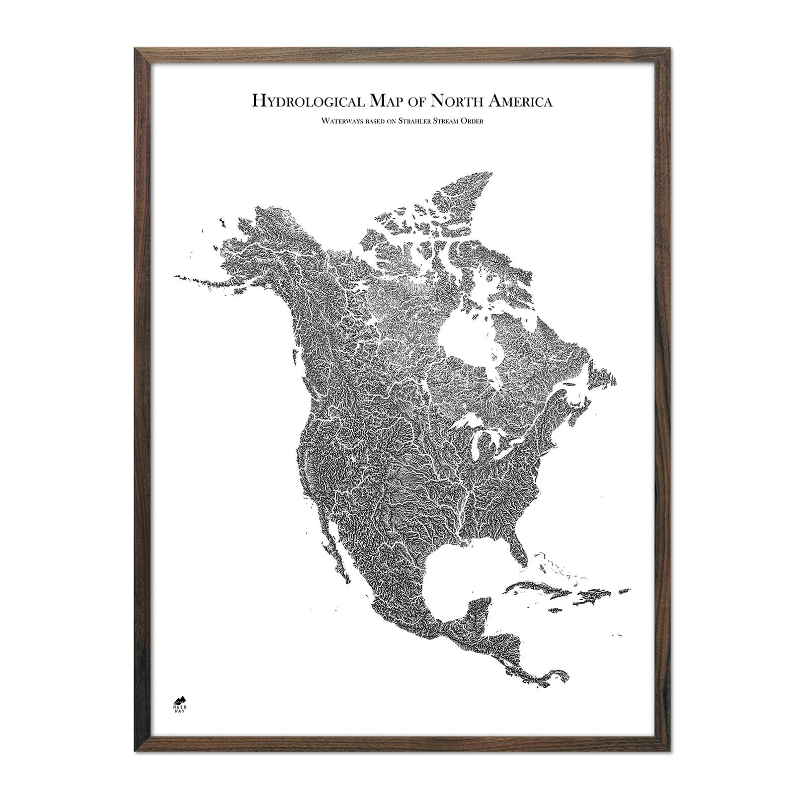
Compiled with US Geological Survey (USGS) data and using the Strahler Stream Order method, this state waterway map beautifully illustrates the rivers, lakes, and all other water bodies of the entire continent, from Ellesmere Island and Alaska, to Panama and the Greater Antilles in the Caribbean. All major rivers are beautifully represented, including the Yukon, Mackenzie, Fraser, and Columbia, to the Rio Grande, Mississippi-Missouri, and St. Lawrence.
