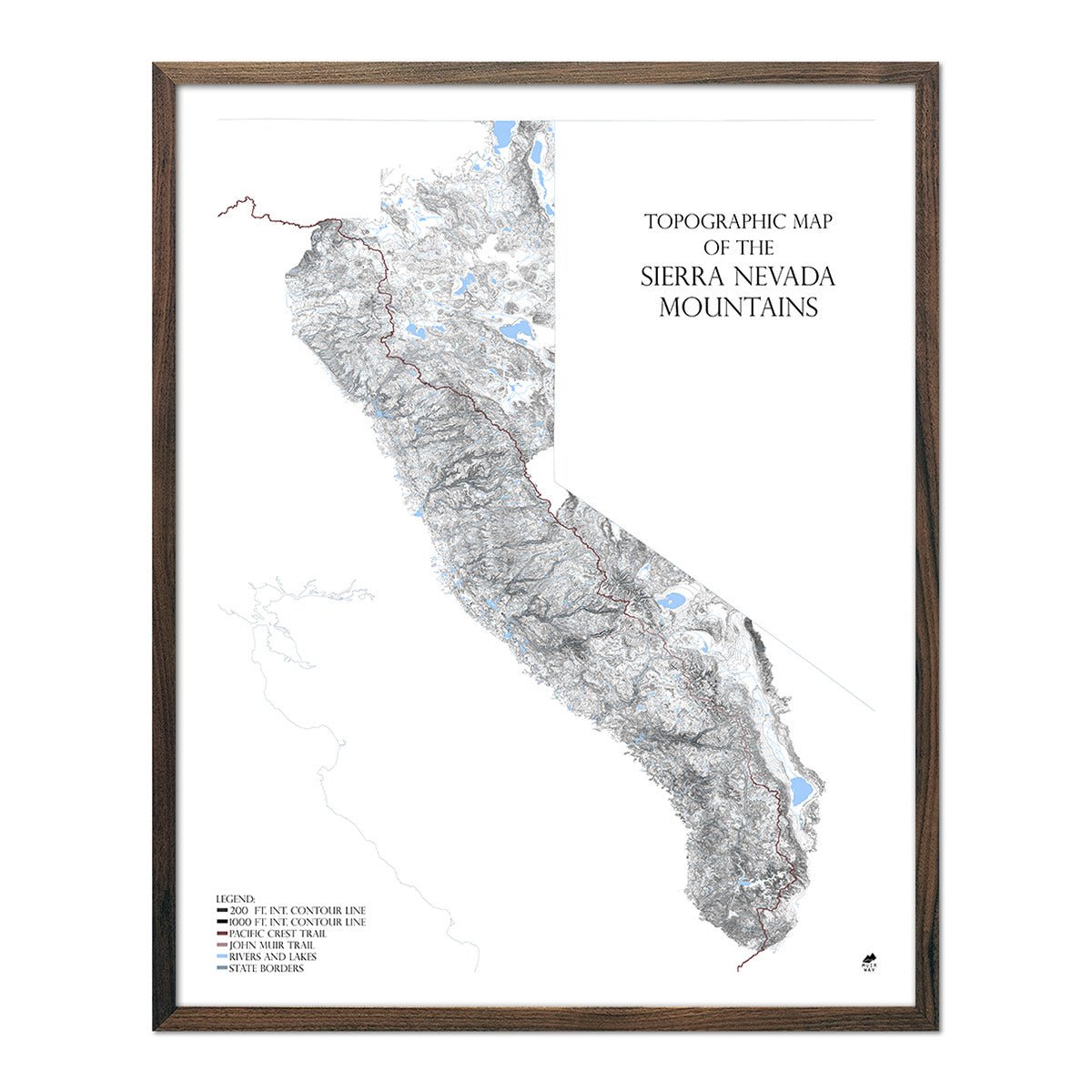
Our range series of maps brings mountains to life in a way that map lovers will applaud; through USGS-sourced contour lines and bodies of water, rendered with extreme detail. The Sierra Nevada Range Map covers this California mountain range from the Oregon border in the north, to Tehachapi in the south. This map includes famous natural wonders like Lassen Volcanic, Yosemite, Sequoia, and Kings Canyon National Parks.
The overall visual effect is beautiful topography, represented in exquisite detail. Up close, you step into the mountains, where you can identify summits, canyons, valleys, rivers, and lakes. No towns, roads, or human features, other than the Pacific Crest Trail and John Muir Trails, are included to keep the landforms as nature intended.
To construct this map, we used the borders provided by the Sierra Nevada Conservancy, which does not include the Lake Tahoe region. We feel this is the most accurate representation of the Sierra Nevada Mountain Range.

We believe our Range Series is absolutely unique. Nothing like this has been attempted before: vast mountain landscapes as works of topographical art.


