


Nevada Map Prints, Elevation & Relief Maps
Once you have stepped foot in Nevada, you know that its natural beauty will never leave you. Far more than home to world famous Las Vegas, Nevada is home to several national and state parks including Great Basin, Red Rock Canyon and Lake Meade. Whether you have made Nevada your home, or you just passed through, Muir Way gives you the chance to take a piece of this beauty home in one of their 3 dimensional maps.
What makes Muir Way maps of Nevada unique?
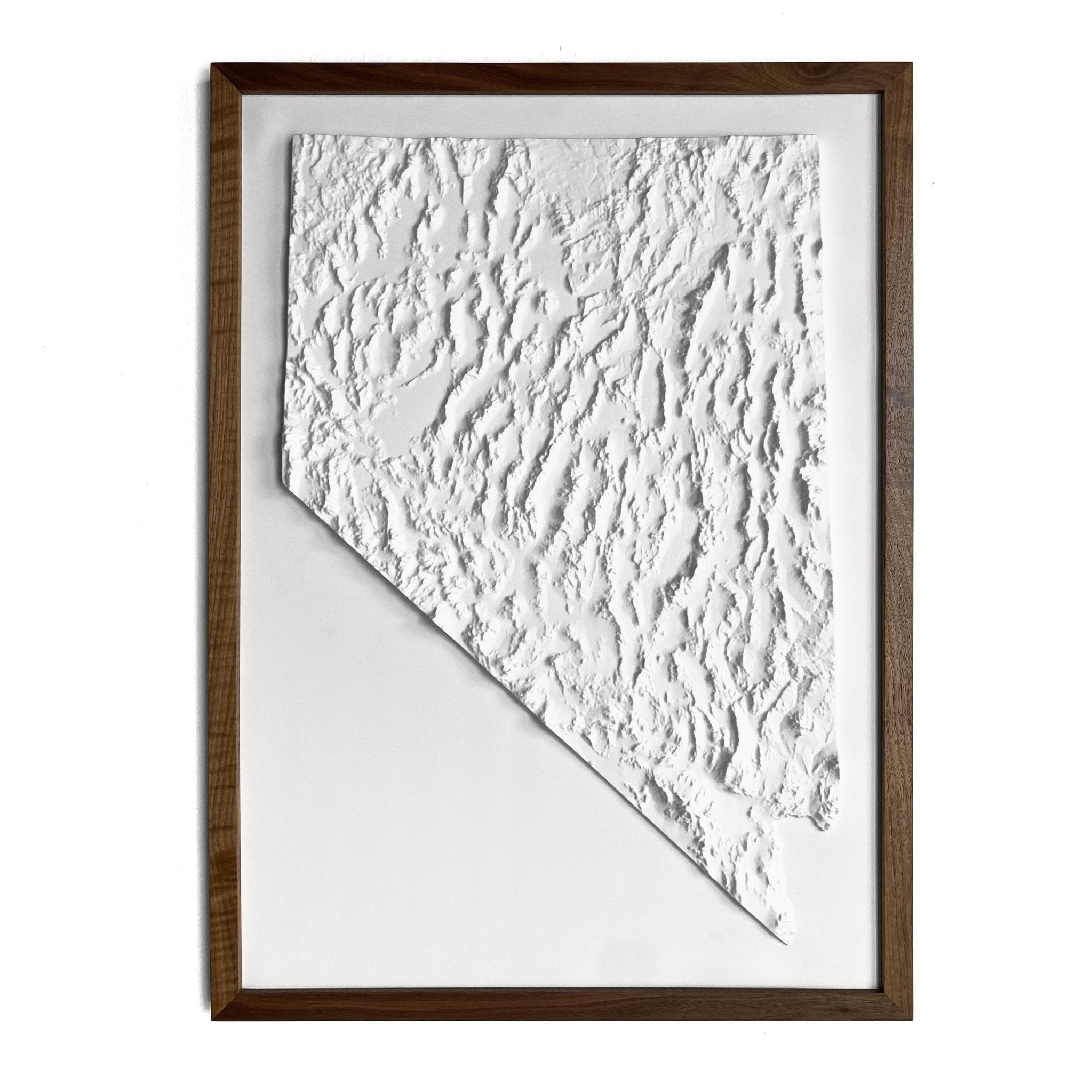
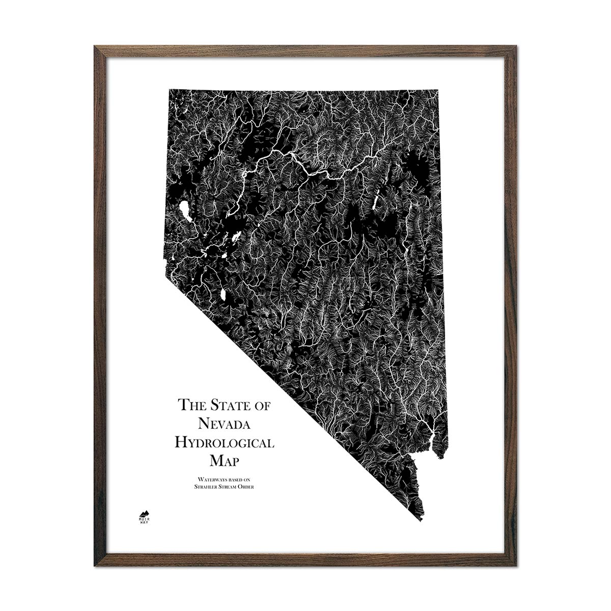
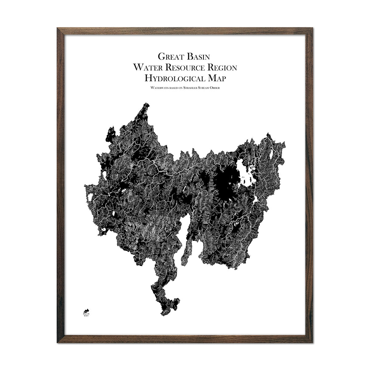
A Muir Way Nevada map is far more than a factory made poster. The craftsmanship of each map brings an heirloom quality that will last generations. Each map is custom printed using archival inks and fine art paper certified to last 100 years. Muir Way elevation maps use hand-shaded relief and Digital Elevation Data and combine that with historical map terrain. These artistic elements create the illusion of a 3 dimensional piece despite the map being on a flat surface. Muir Way hydrological maps depict every river and body of water over .2 miles in diameter in the state of Nevada.
Can I get a framed Nevada map?
Yes! Many of our Nevada maps are available printed on fine art paper or as beautiful gallery-wrapped canvas, and all paper prints are available professionally custom-framed with real wood. For a framed Nevada map, choose from several different colors and wood finishes to perfectly match your décor. If you’d prefer to use your own frame, all of our maps come in standard frameable sizes for easy hanging and gift giving.
Does a Muir Way map of Nevada make a good gift?
Muir Way Nevada maps are a popular gift choice for special holidays, anniversaries, or as a thank-you gift for someone special. An Nevada national parks map from Muir Way makes an ideal gift for outdoor enthusiasts, and our state relief map can be a perfect graduation gift for a student about to leave home for the first time. And, of course, any Muir Way map is a wonderful gift for someone whose home state is Nevada but who no longer lives there. Our maps also make beautiful corporate gifts that will remind your clients or colleagues of you every time they see it.
How should I display my Nevada map on the wall?
Our maps are designed to offer crisp detail and great visual effect whether viewing up close or from across the room. Hang a framed wall map at eye level, or purchase several and arrange them near each other for a complementary series. Our hydrological maps come in several colors or the quintessential black and white, and our geological relief maps feature brilliant colors. No matter which you choose, you’re sure to find an Nevada illustration that will look right at home.
What are the different types of maps of Nevada available on Muir Way?
Our Nevada maps are available in several different styles, including:
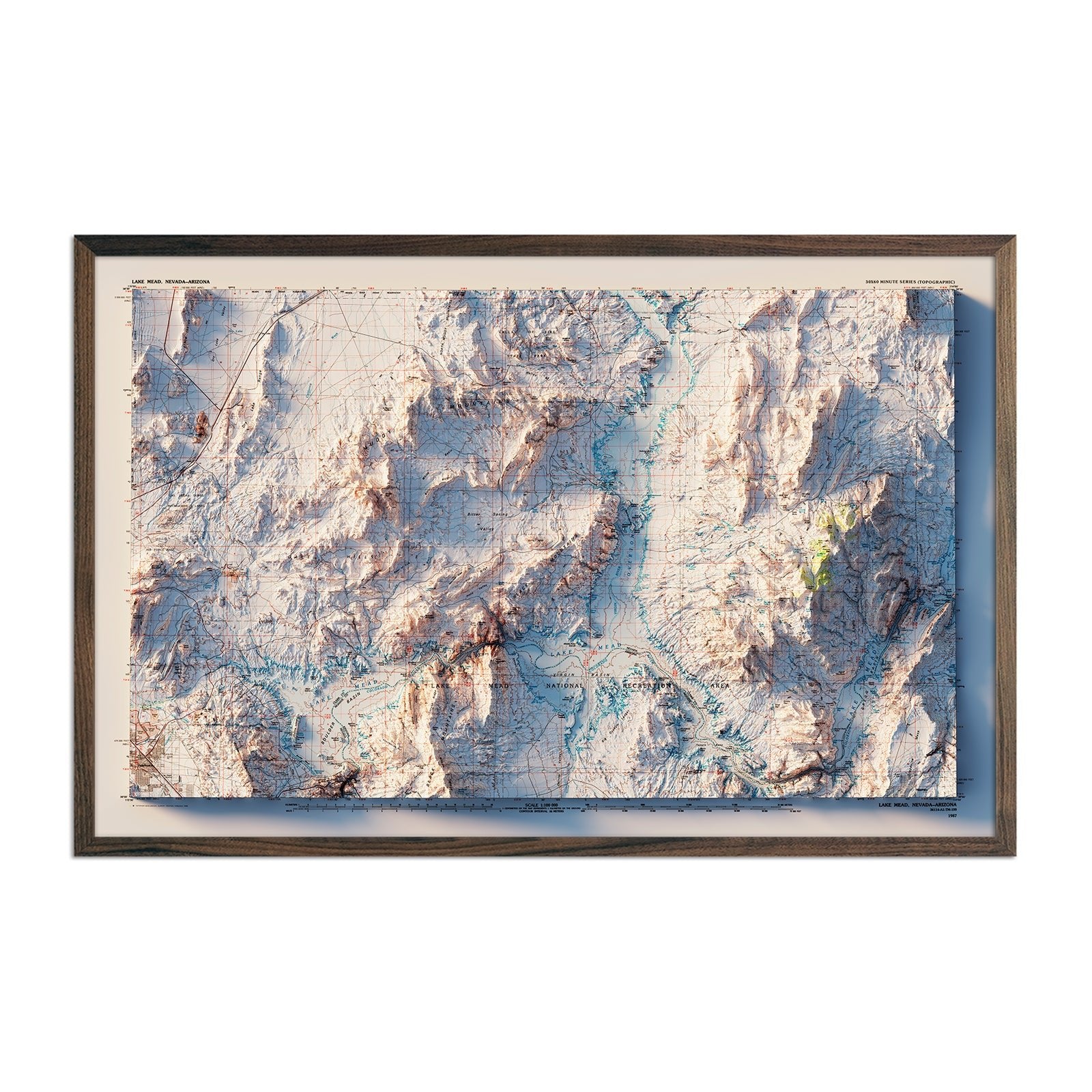
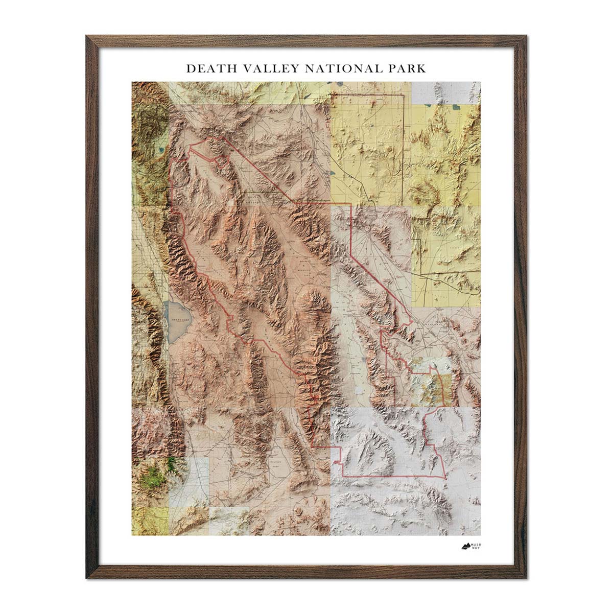
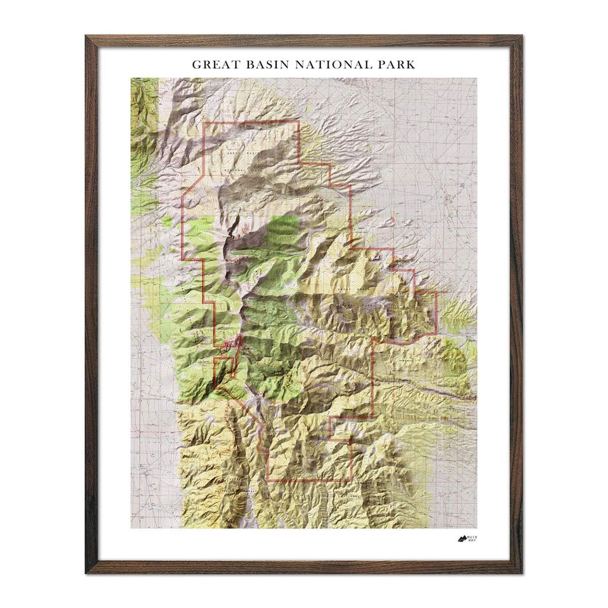
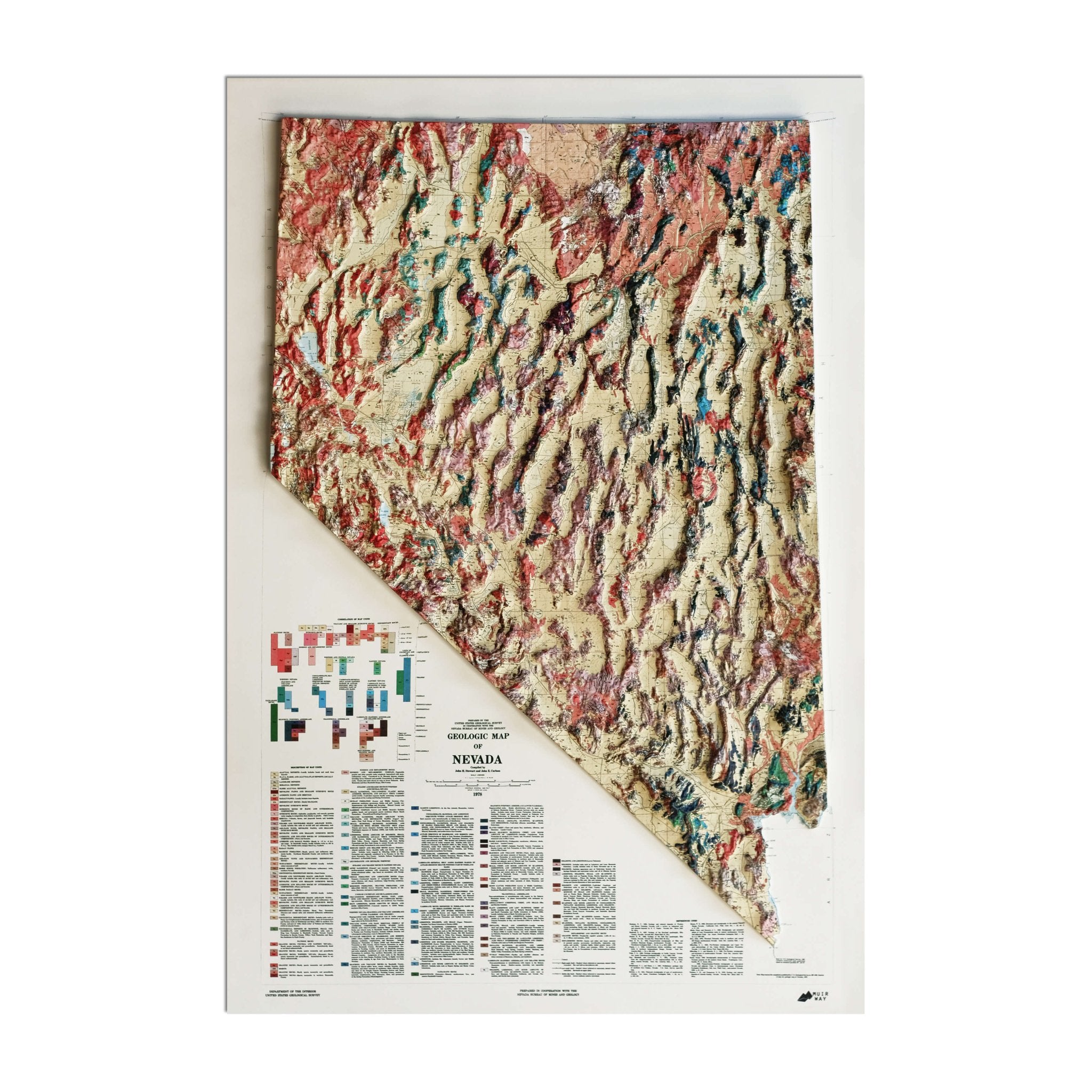
Navada relief maps - Relief maps of Nevada combine historical map landscapes with modern technology to showcase the varying terrain of the state. Nevada's mountains, plateaus and grasslands are all illustrated. Muir Way recreated the original 1978 Nevada Geological map, as well as relief maps of Death Valley and the Great Basin.
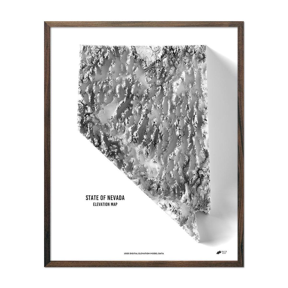
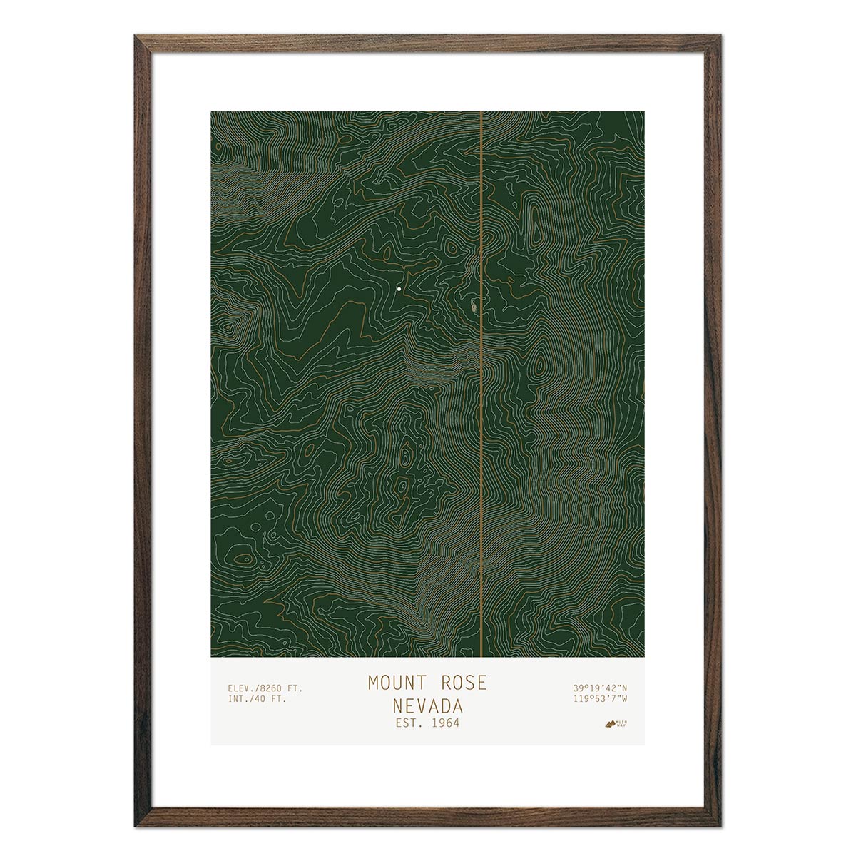
Nevada elevation maps - The Muir Way Nevada elevation map also uses Digital Elevation Data from the USGS to create a high-contrast 3-dimensional effect in stunning black and white.
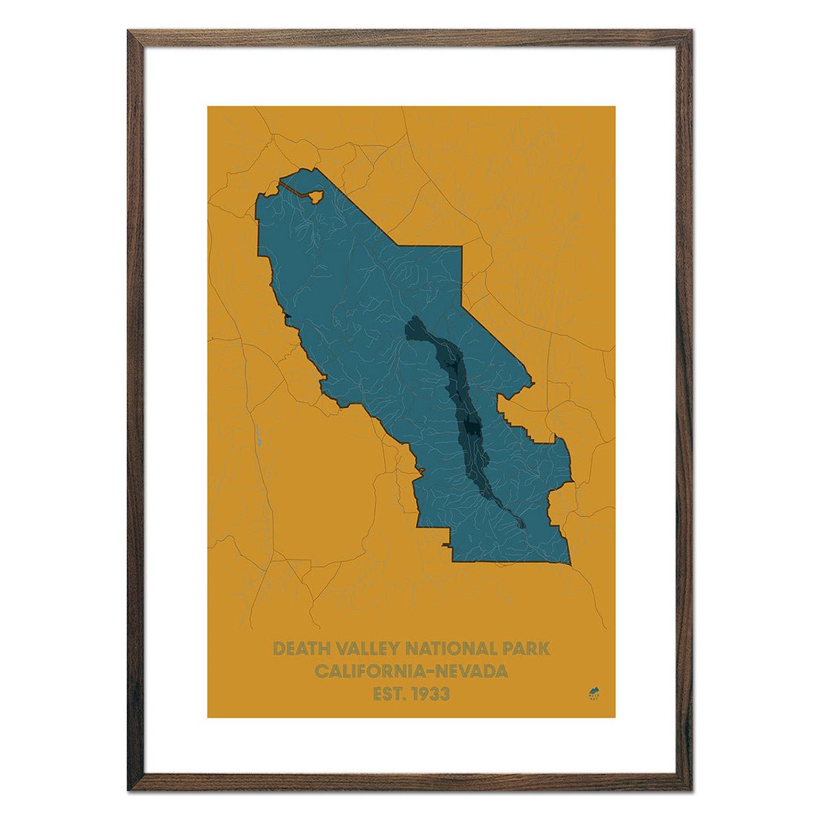
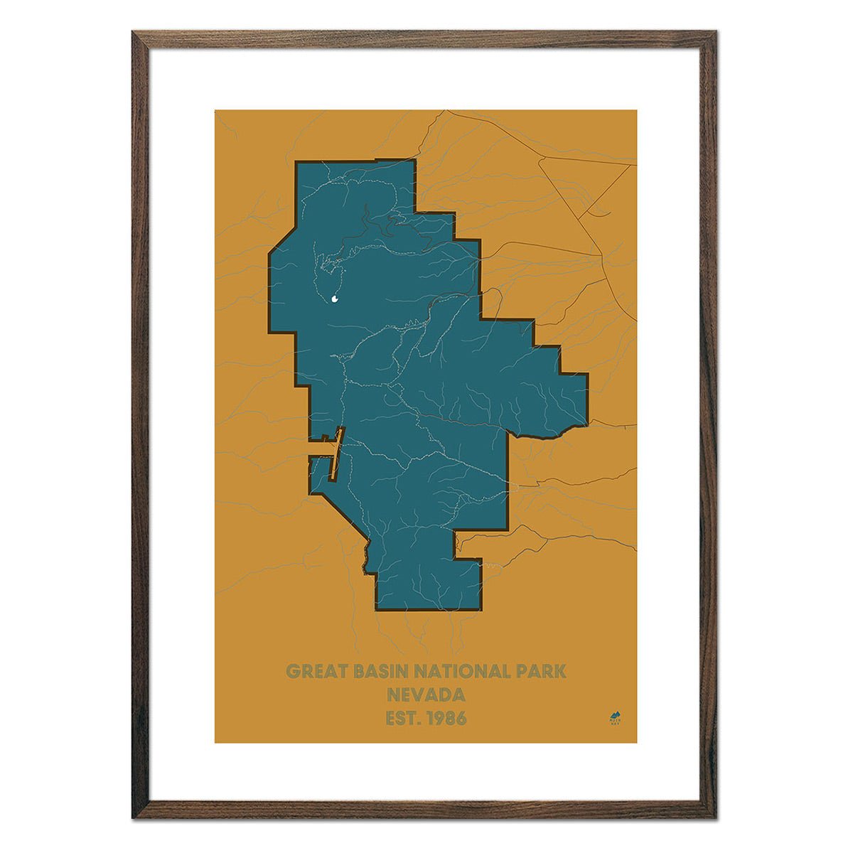
Nevada hydrological maps - Nevada hydrological maps are designed with such intricate attention to detail that they look as stunning from across a room as they do up close. The Great Basin, Pacific Northwest and Lower Colorado hydrological maps each give a glimpse at the waterways leading in and out of Nevada.
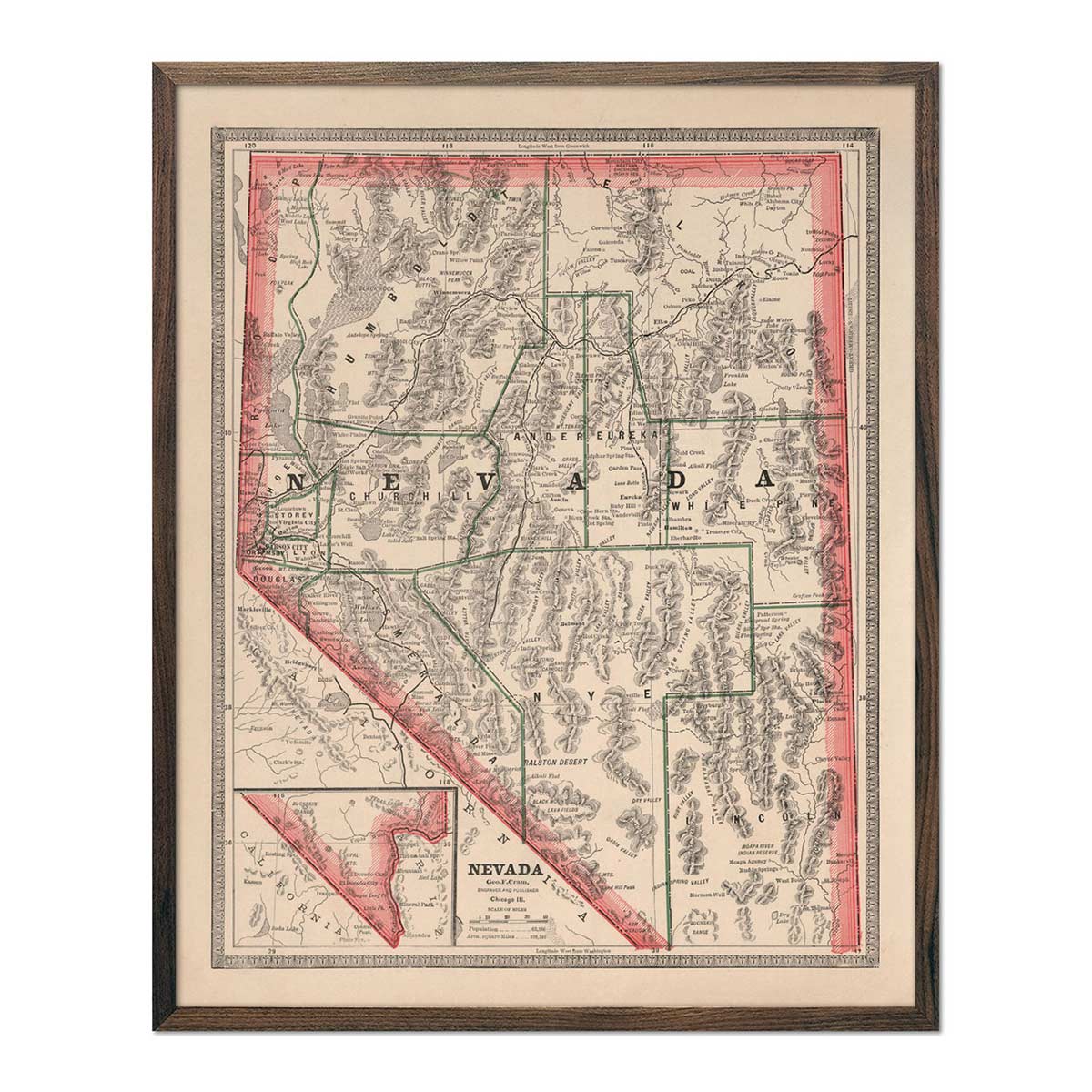
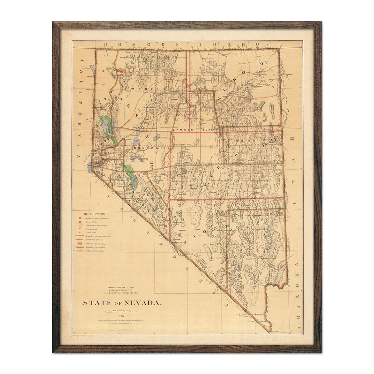
Enhanced vintage maps of Nevada - Muir Way offers a vintage map of Nevada dated from 1876 and 1883. Although these maps are not 3 dimensional, they feature an historically accurate record of the state at those times.
Nevada National Park maps - Our National Park Series of maps comes with a clean, modern aesthetic, representing the outline of the Great Basin and Death Valley National Parks. The maps include major landforms, roads, and trails.
If you like our collection of Nevada maps, you may also be interested in maps of our other Mountain States. Click below to browse: