


Idaho Map Prints Hyrdrological & Relief Maps
Our custom printed Idaho wall maps bring the majesty of “The Gem of the Mountains” to your home or office. From our stunning elevation maps and geological relief maps to our meticulously restored historical maps, every product we offer reflects the high quality and attention to detail our customers have come to love and expect from Muir Way.
What makes Muir Way maps of Idaho unique?
Muir Way maps of Idaho are much different than a standard glossy poster. In addition to custom printing every Idaho map using archival inks and fine art paper certified to last 100 years, our map artwork is designed to bring new light to the beautiful terrain it features. Our Idaho elevation maps apply hand-shaded relief and Digital Elevation Data to create a 3D illusion on a flat surface, and our hydrological maps depict every river in the state--even intermittent streams--and every body of water over 0.2 miles in diameter. The meticulous craftsmanship and handcrafted design we bring to our maps creates heirloom quality artwork built to last.
Does my Idaho map come framed?
Many of our Idaho maps are available on both fine art paper and beautiful gallery-wrapped canvas, and all are available custom-framed with real wood, or unframed if you prefer to use your own. If you’d like to purchase your Idaho wall map framed, there are several colors and wood finishes to choose from. If you’d prefer to use your own frame, all of our maps are available in standard frameable sizes.
Does a Muir Way map of Idaho make a good gift?
Muir Way maps make great gifts! Our custom-printed Idaho maps are a popular gift choice for holidays, anniversaries, as a thank-you gift or a retirement gift. Our maps also make a unique corporate gift that will remind clients and colleagues of you every time they see it. A Yellowstone National Park map from Muir Way makes an ideal gift for outdoor enthusiasts, and our state relief map can be a perfect graduation gift for a student about to leave home for the first time, or a reminder of home for someone whose home state is Idaho but who no longer lives there. But don’t take our word for it - our thousands of happy customer reviews are a testament to the quality we stand by when you give one of our maps as a gift.
Where should I display my Idaho map?
Whether hanging a map in your living room, office, bedroom, hallway, or study, our maps are designed to offer crisp detail and great visual effect whether viewing up close or from across the room. From the classroom to the kitchen, our maps are an eye-catching and sophisticated addition to any decor. Hang a framed wall map as a central focus, or purchase several and arrange them near each other for a complementary series. No matter which you choose, you’re sure to find a map that will look right at home.
What are the different types of maps of Idaho available on Muir Way?
Our Idaho maps are available in several different styles, including:
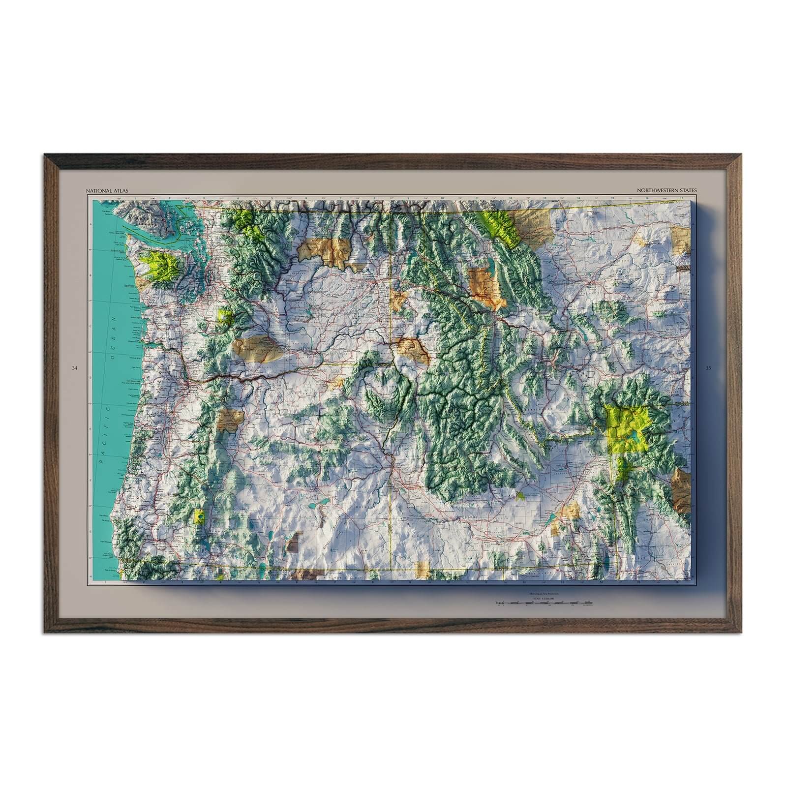
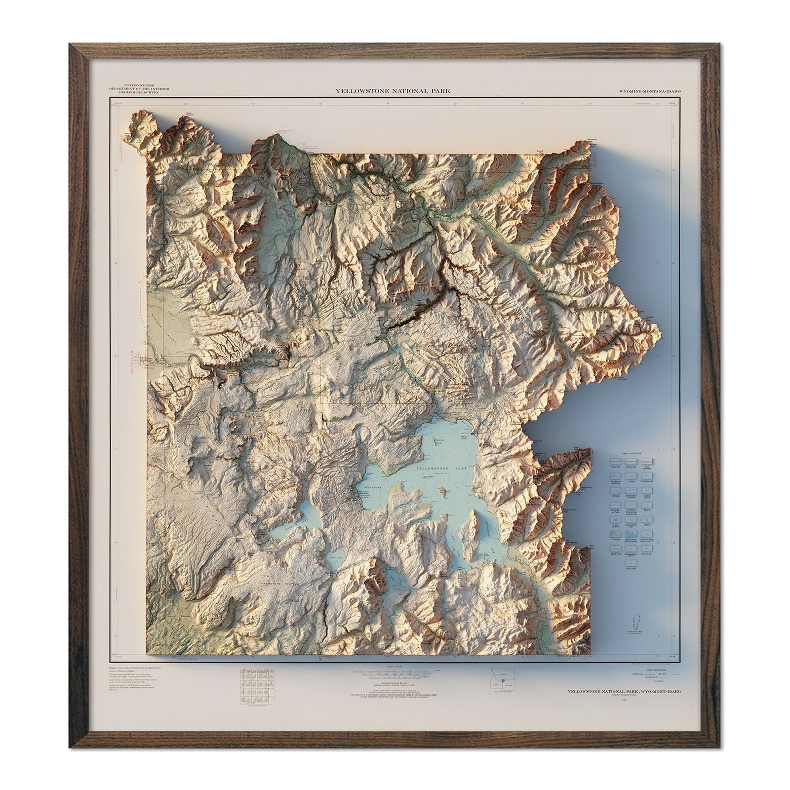
Idaho relief maps - Our relief maps of Idaho and Yellowstone combine historical map landscapes with modern technology to showcase Idaho’s mountainous terrain in a new and exciting way. Using Digital Elevation Data and hand-shading, we custom enhance vintage maps to create a striking 3D effect on a flat surface.
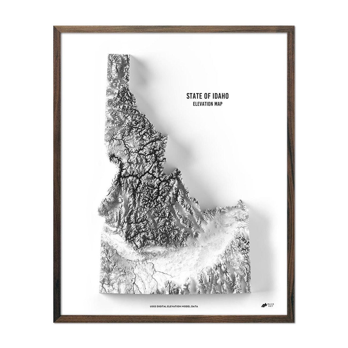
Idaho elevation map - Our state of Idaho elevation map also uses Digital Elevation Data from the USGS to create a high-contrast 3-dimensional effect, this time in stunning black and white.
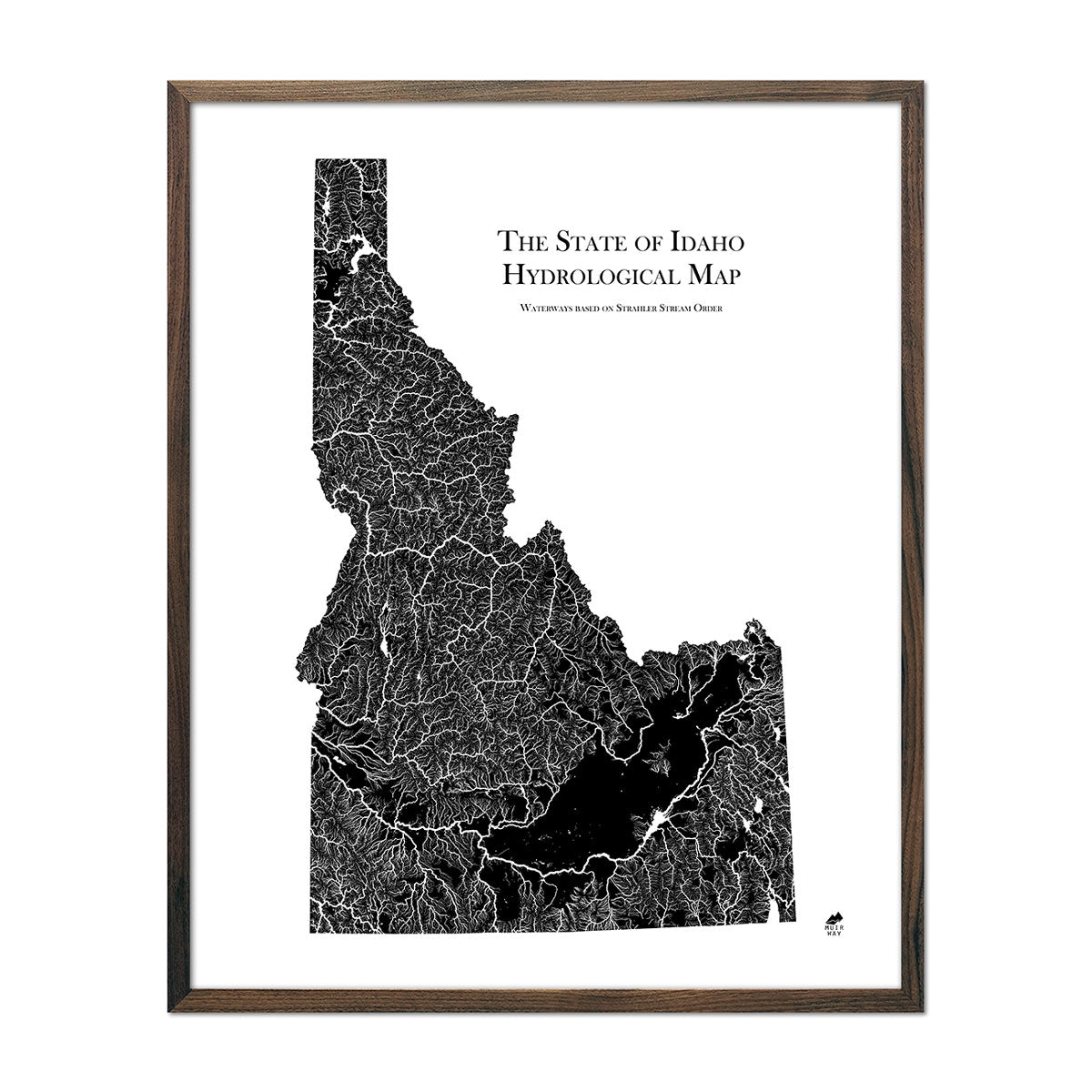
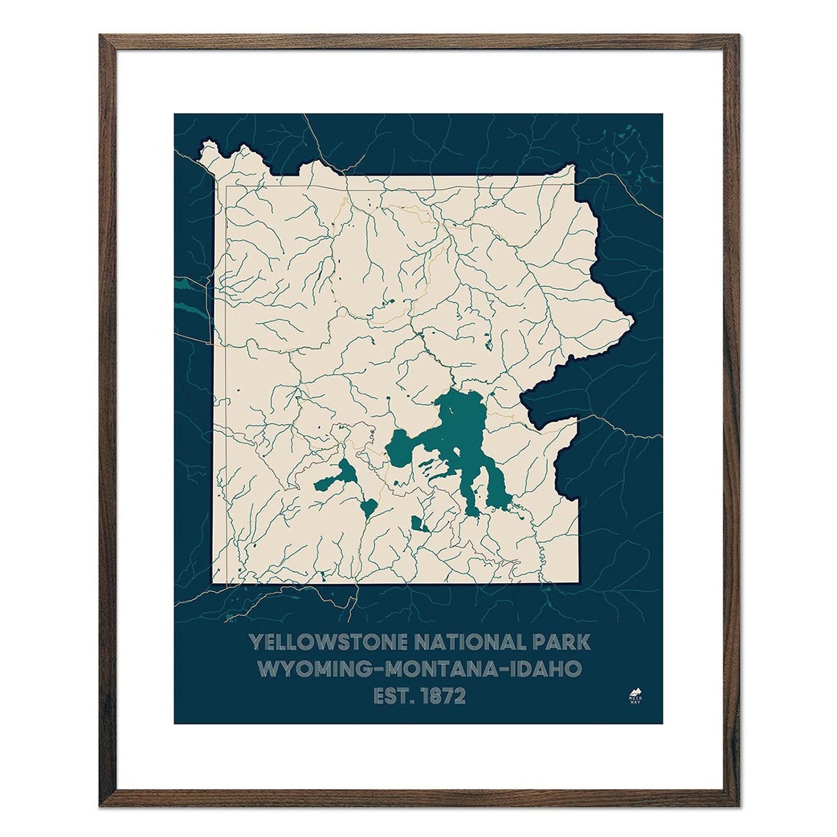
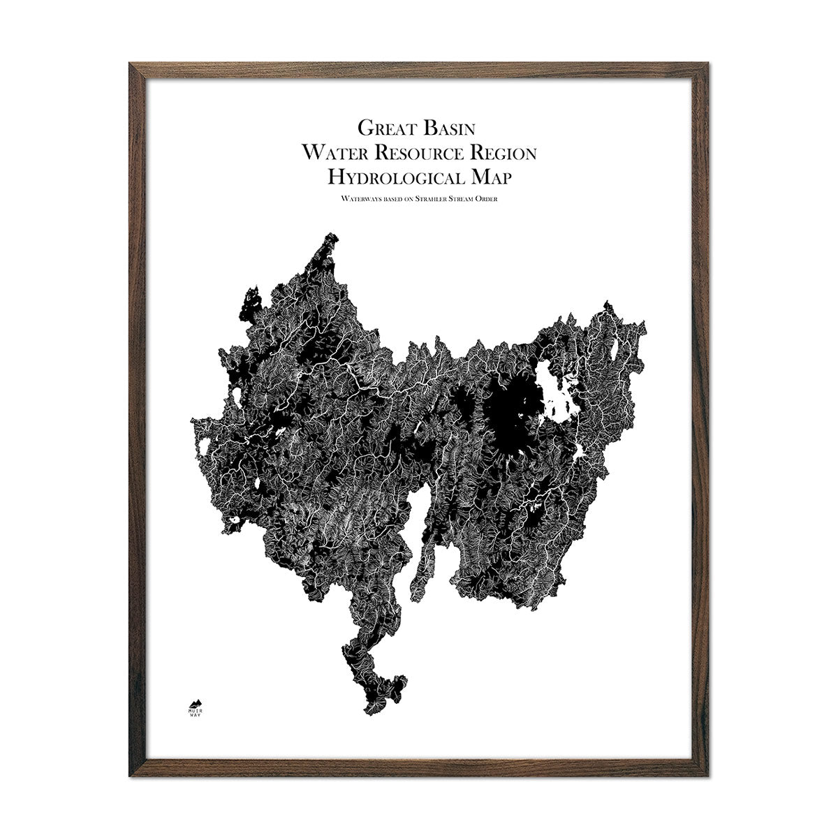
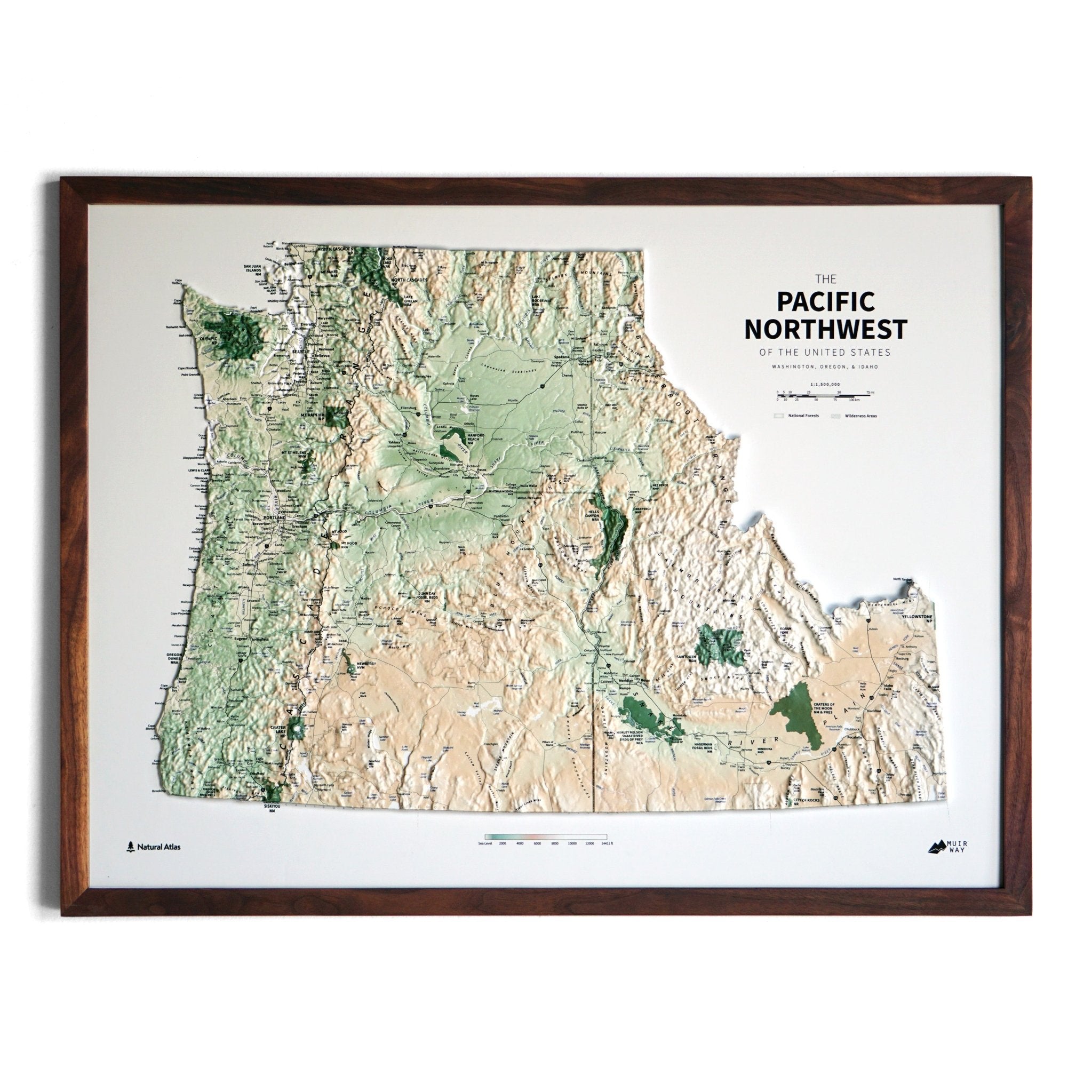
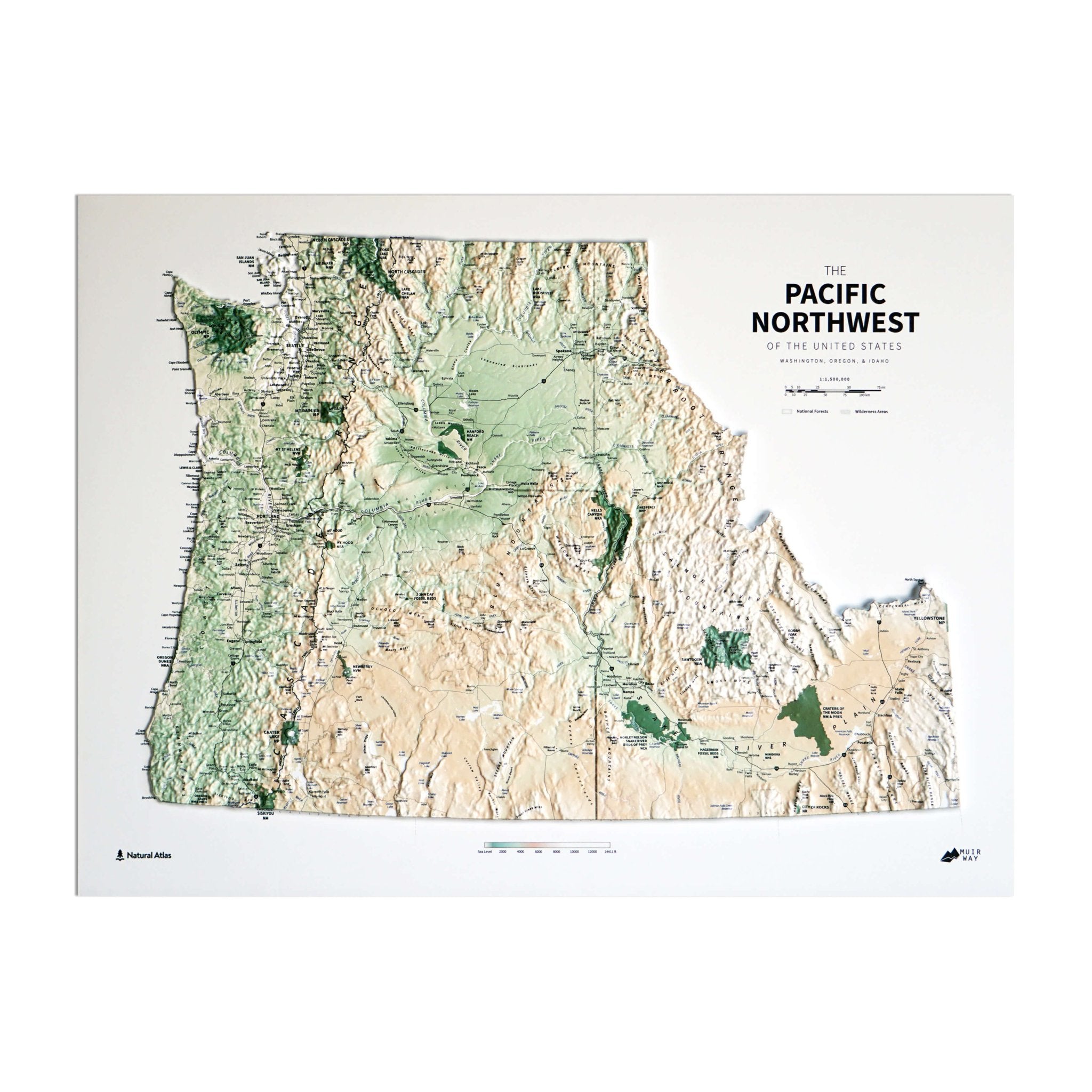
Idaho hydrological maps - Our Idaho hydrological maps look beautiful from across a room and provide meticulous detail when viewed up close. Follow the interconnected trails of every single river and intermittent stream, as well as all bodies of water greater than 0.2 mi in diameter. For even better viewing, we apply a method called the Strahler Stream Order to show the hierarchy of streams as they flow from their source, with rivers shown thicker as they acquire the flow of tributaries. For an expanded view, try our Pacific Northwest hydrological map or our Great Basin Region hydrological map. Available in black and white or a choice of solid colors.
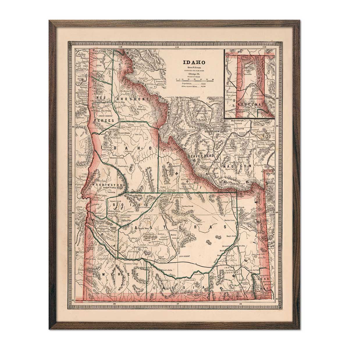
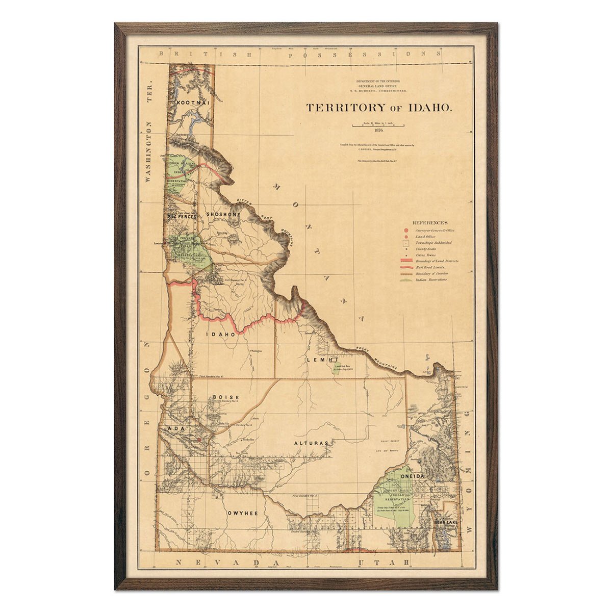
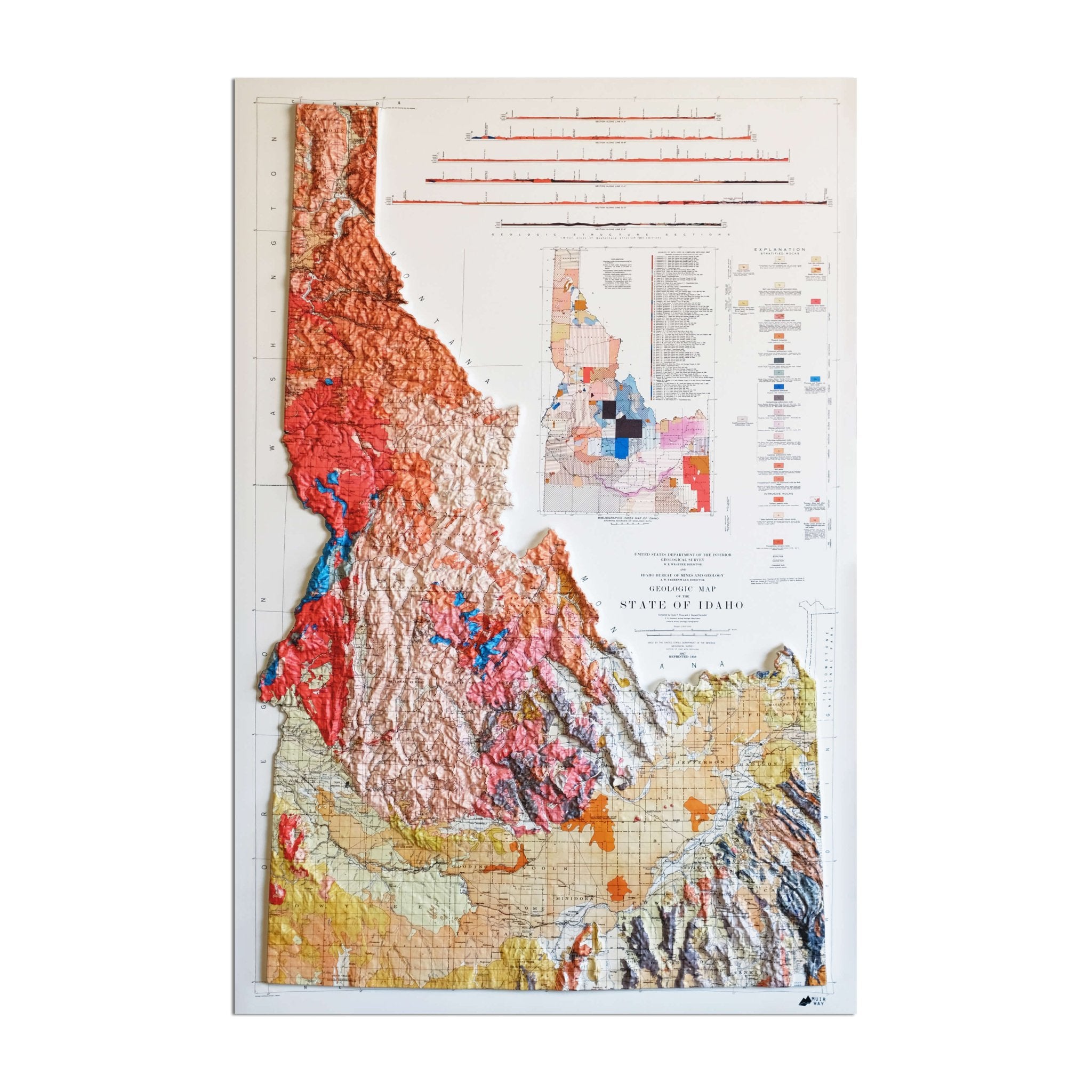
Enhanced vintage maps of Idaho - If you like vintage maps, you’ll love our regional 1883 map of Idaho and 1876 Idaho Territory vintage map. Unlike our relief maps, Muir Way enhanced historical maps don’t feature elevation, but they do feature a record of history carefully restored to maintain its vintage charm without the wear & tear.
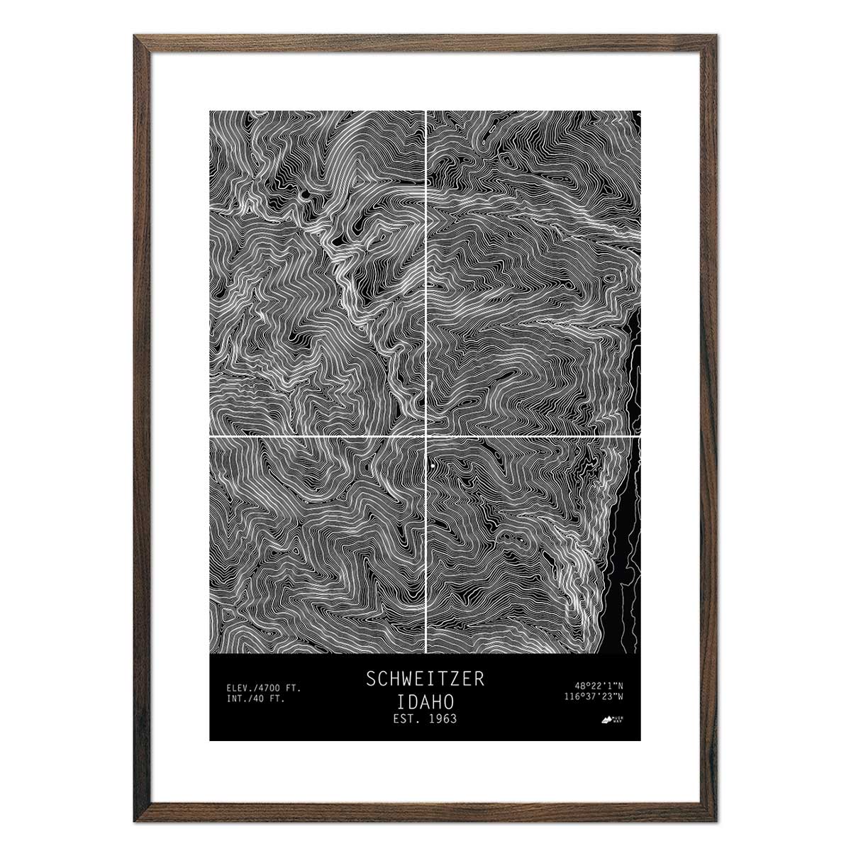
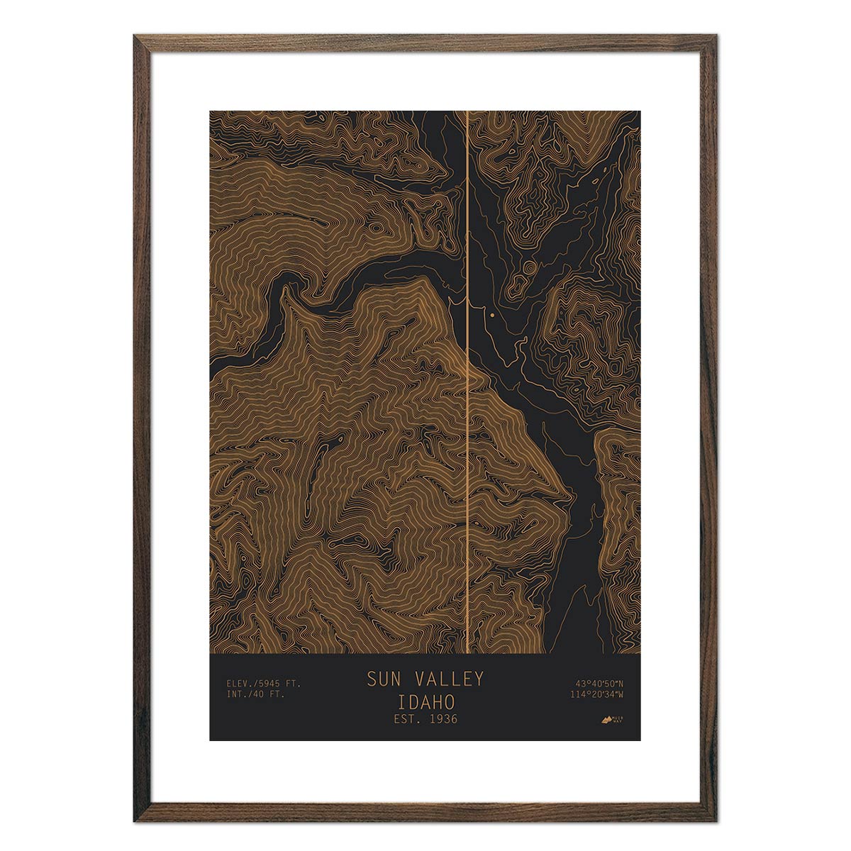
Idaho Topographical maps - Our crisp and colorful Idoho topo maps showcase Idaho’s variegated terrain and are available in a wide variety of color combinations. Display a topo map of Silver, Idaho, Sun Valley, Bogus Basin or Schweitzer in your home or office.
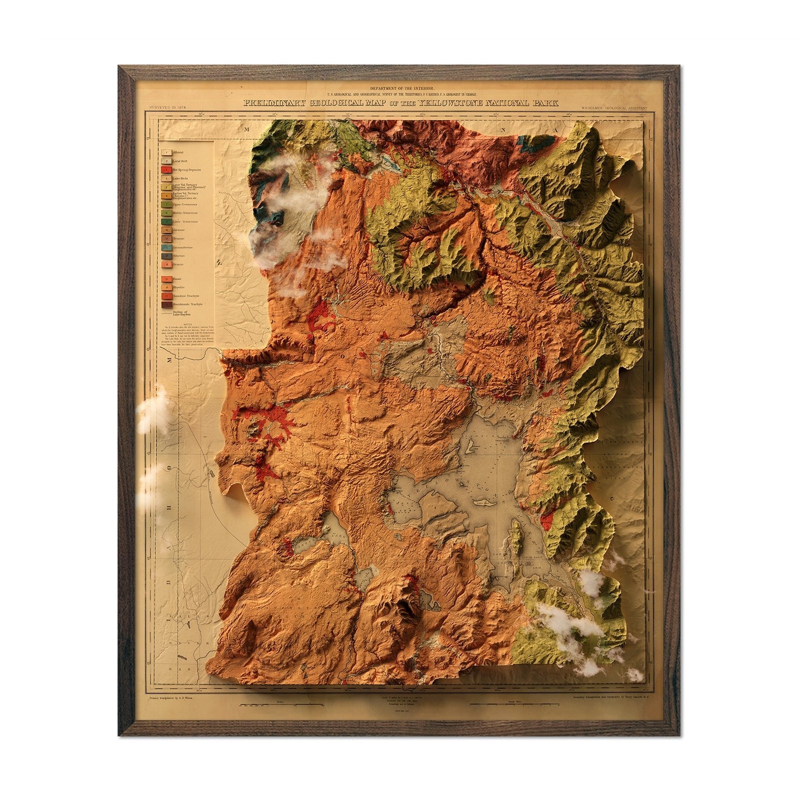
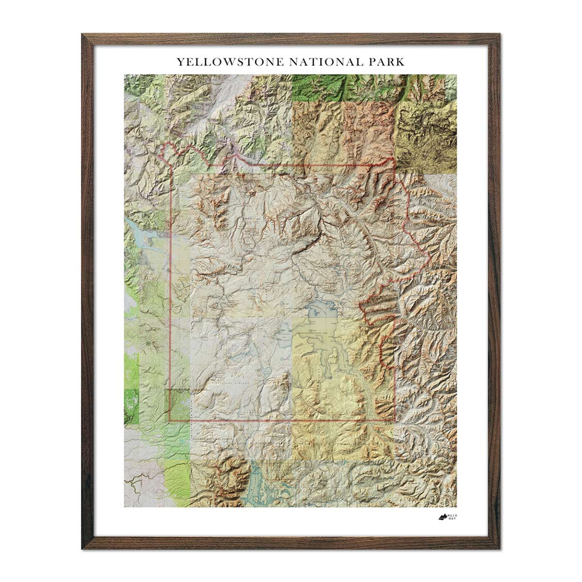
Yellowstone National Park maps - We have three beautiful Yellowstone National Park maps to choose from - our Yellowstone Relief Map, our standard Yellowstone National Park map (available in several colors), and our enhanced 1878 Yellowstone relief map.
What are some prominent features on the map of Idaho?
When we say Idaho has mountainous terrain, we aren’t kidding. Home to over 80 mountain ranges, Idaho contains some of the most rugged terrain in the United States. Most notably, Idaho contains a portion of the Rocky Mountains, but there is a lot more to Idaho’s landscape.
In addition to mountains, you’ll find stunning waterways, including the Shoshone Falls on the Snake River. These amazing waterfalls are higher than Niagara Falls, with an elevation drop of 212 feet. Speaking of depth, Idaho is also home to Hells Canyon which contains a gorge that runs deeper than The Grand Canyon.
Major rivers in Idaho include the Coeur D’Alene, St. Joe River, Snake River, Kootenai River, among others, and major Idaho lakes include the American Falls Reservoir, Bear Lake, Lake Pend Oreille, and Coeur D’Alene Lake. All of these are visible on our Idaho hydrological maps.
No matter which Idaho state map you choose, you’ll enjoy an up-close look at a state known for its jaw-dropping mountains, scenic wilderness, and of course, potatoes.
What are the regions in Idaho?
Idaho is geologically comprised of three main regions:
- The Rocky Mountains - the largest region in Idaho extending from its northern panhandle all the way south along the Wyoming border. This region contains Borah Peak, Idaho’s tallest mountain, at 12,662 feet above sea level. Among the numerous mountain ranges in this region, Idaho also hosts part of the Continental Divide, the Snake River, Hells Canyon, the Bighorn Crags, and other notable landmarks.
- The Columbia Plateau - famous for hosting the majority of Idaho’s potato crops as well as sugar beets. This region enters Idaho from Washington at the base of the Idaho panhandle and follows the Snake River in the south, creating the Snake River Plain where crops are grown.
- The Basin & Range Region -located in southeastern Idaho. The Basin & Range Region is home to grassy plateaus, and deep mountain valleys.
If you like our collection of Idaho maps, you may also be interested in maps of our other Mountain States. Click below to browse:
