


Montana Map Prints, Hydrological & Relief Maps
Whether you’re from Montana, like to visit there with family, or Big Sky Country just holds a special place in your heart, our custom printed Montana wall maps are designed to bring the spirit of the American West to any home or office. From our stunning elevation maps and geological relief maps to our meticulously restored historical maps, every product we offer is hand-crafted and reflects the high quality and attention to detail our customers have come to love and expect from Muir Way.
What makes Muir Way maps of Montana unique?
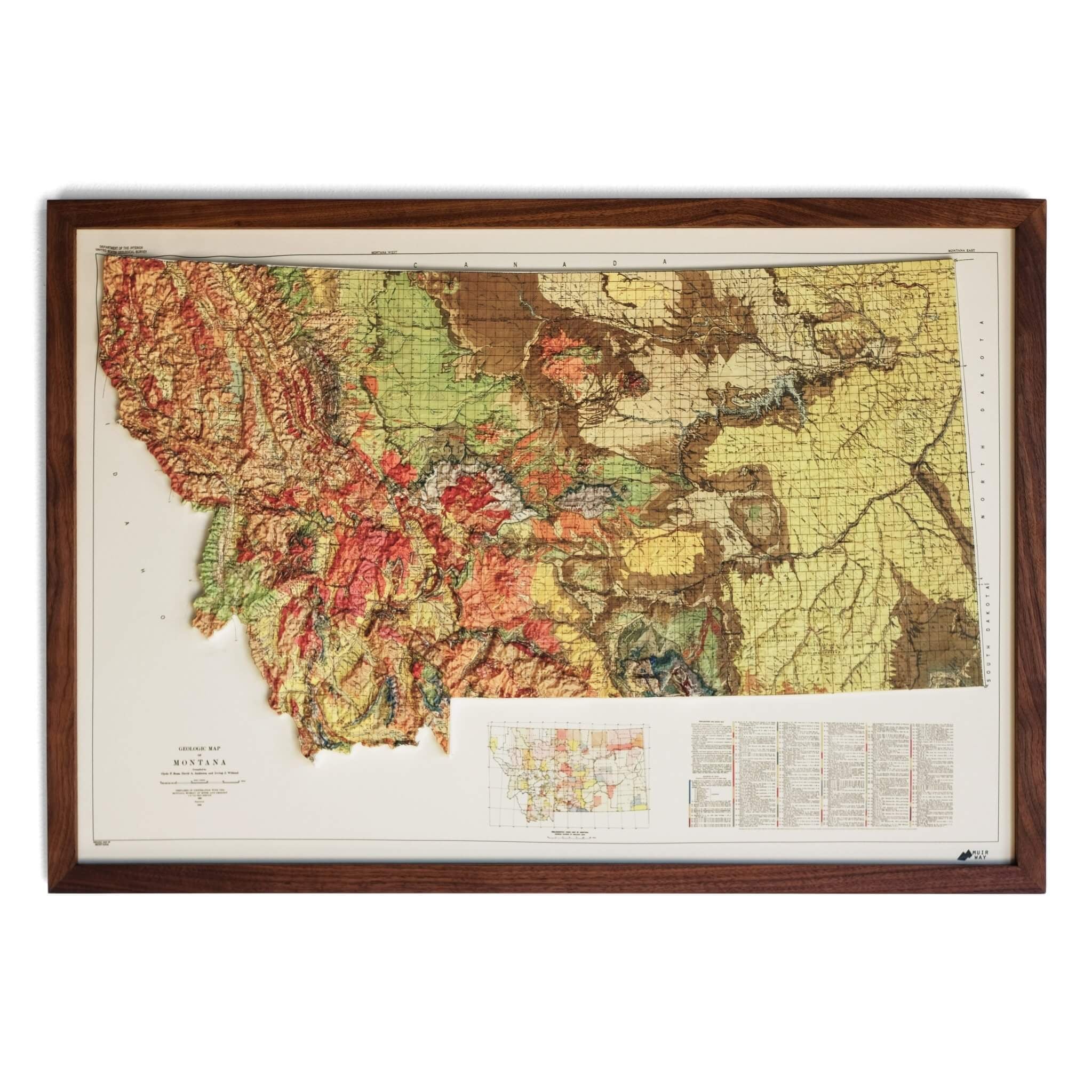
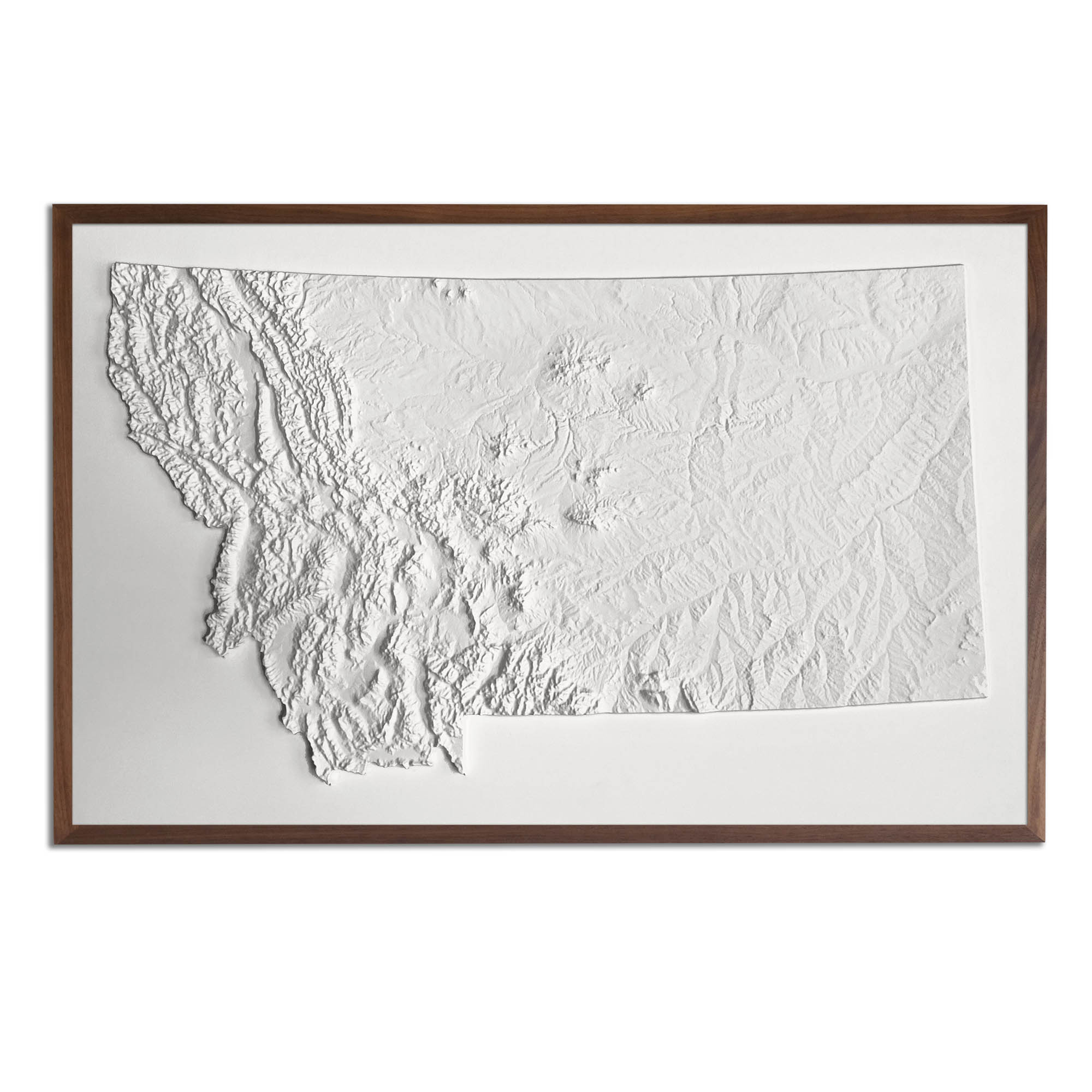
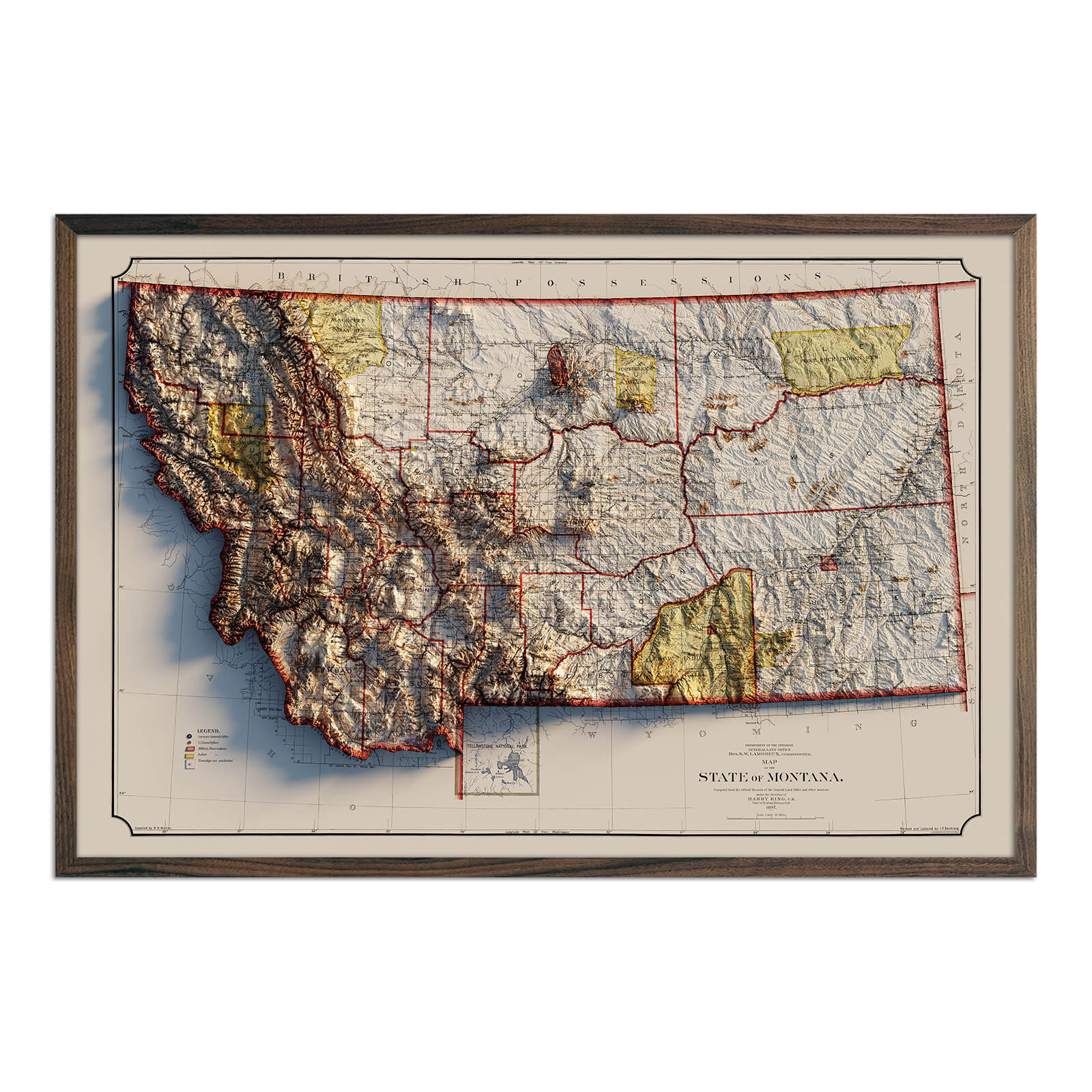
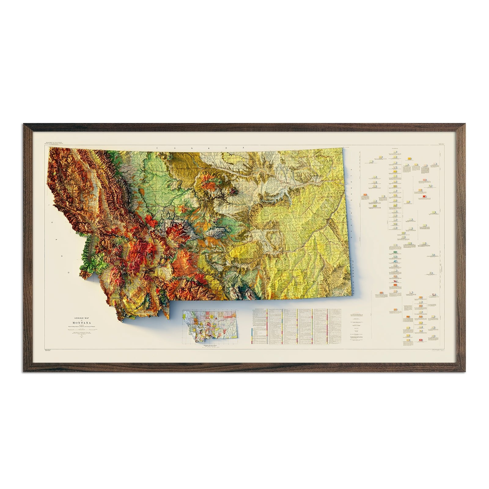
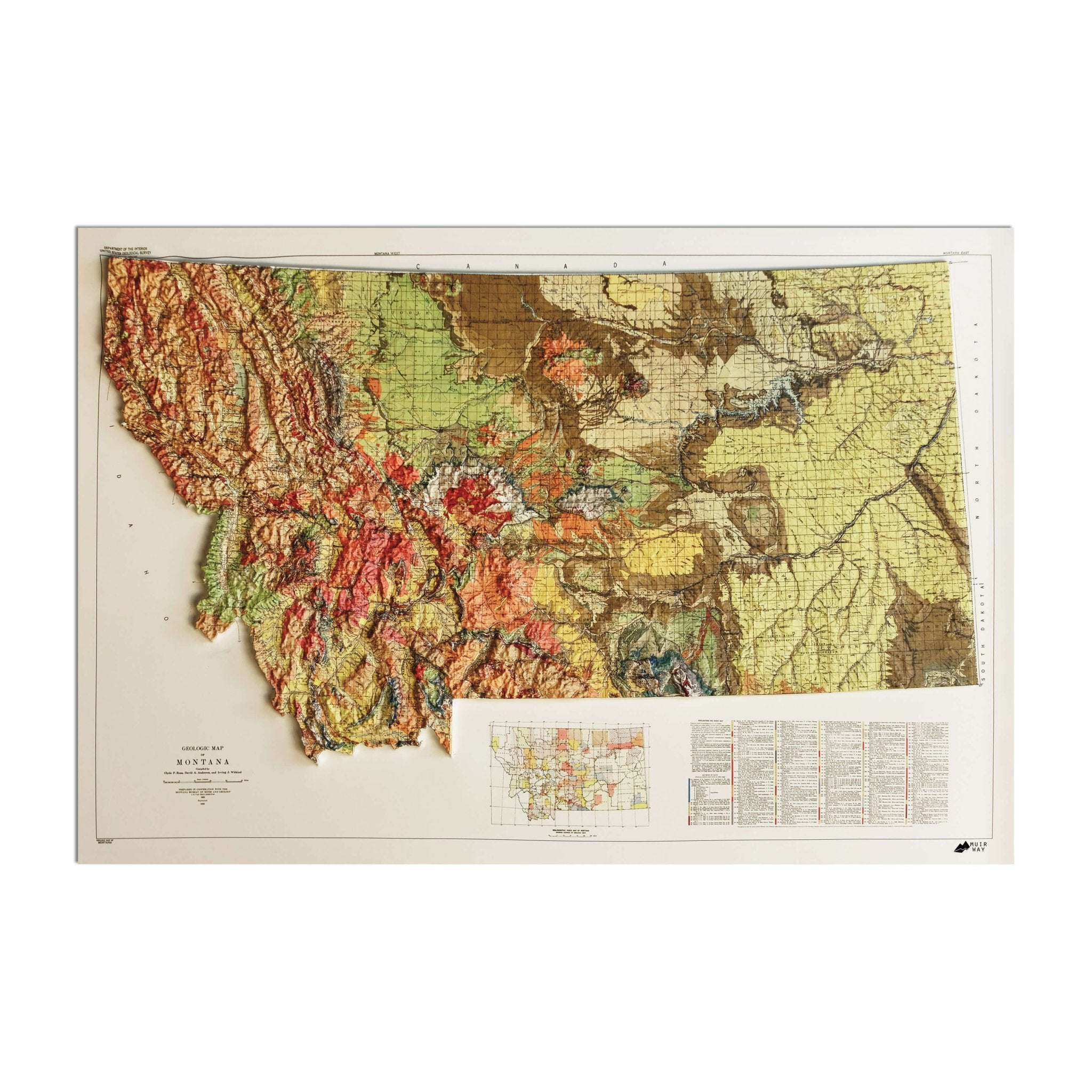
Far more than a traditional glossy poster, a Montana wall map from Muir Way is a work of art. In addition to custom printing every Montana map using archival inks and fine art paper certified to last 100 years, our maps use exclusive techniques to shed new light on the beautiful terrain they feature. For example, our Montana relief maps and elevation maps use hand shading to create a stunning three-dimensional effect on a flat surface, and our hydrological maps depict every river in the state--even intermittent streams--in crisp detail. The meticulous craftsmanship we pride ourselves on creates heirloom quality artwork to last for generations.
Can I get my Montana map framed?
Yes! All of our Montana maps are available for purchase professionally custom-framed with real wood in an array of colors and finishes to match your décor. If you’d prefer to use your own frame, all of our maps are also available unframed and come in standard frameable sizes for easy gift giving.
Is a Muir Way map of Montana a good gift idea?
Absolutely. Our custom-printed maps make excellent gifts for everything from graduations to going away parties, anniversaries, holidays, and ‘just because’. A Montana wall map from Muir Way makes an ideal gift for outdoor enthusiasts, but can also be a perfect gift for newlyweds moving away from home for the first time, or a reminder of home for someone whose home state is Montana but who no longer lives there. Our maps also make memorable corporate gifts for both colleagues and clients that will bring you and your company to mind every time the recipient looks at their wall. Perfect for ‘the person who has everything’, our maps are well received and our thousands of happy customer reviews are a testament to the quality we stand by when you purchase one of our maps as a gift.
How should I display my Montana map?
Our maps are designed to offer crisp detail and great visual effect whether viewing up close or from across the room. Whether it's your living room, bedroom, or home office, you're sure to get compliments on your map from any visitor. Place a large wall map at eye level in a location where passersby can approach to look closer, or purchase several and arrange them near each other for a complementary series. As for color choices, our hydrological maps come in several colors, and our geological relief and elevation maps feature brilliant colors as well as black and white. No matter which you choose, you’re sure to find a Montana illustration that will suit your surroundings.
What are the different types of maps of Montana available on Muir Way?
Our Montana maps are available in several different styles, including:
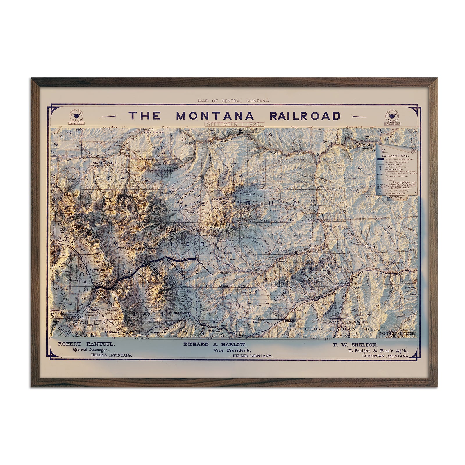
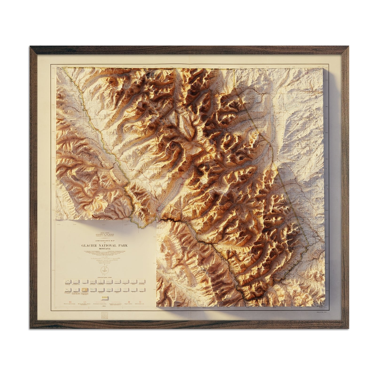
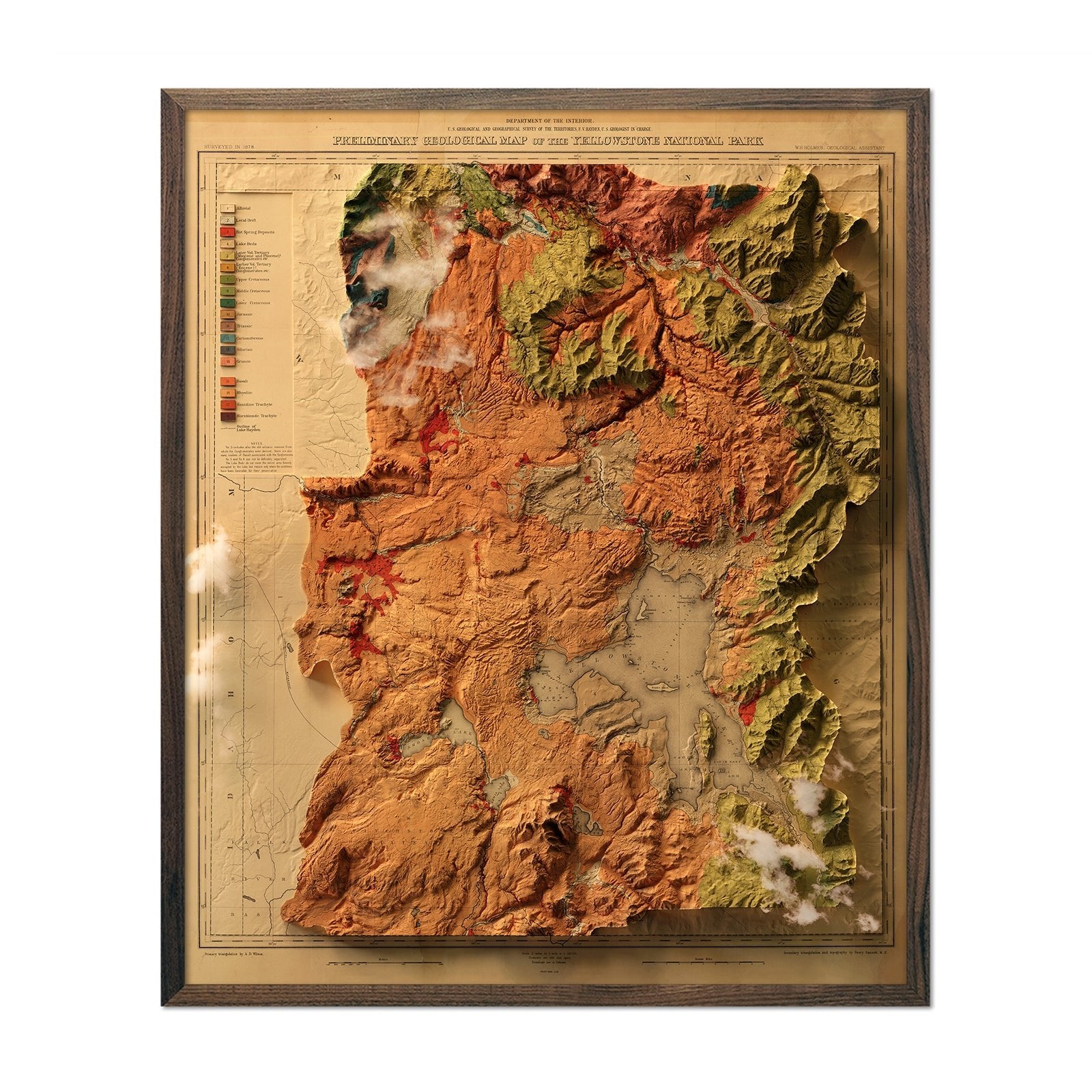
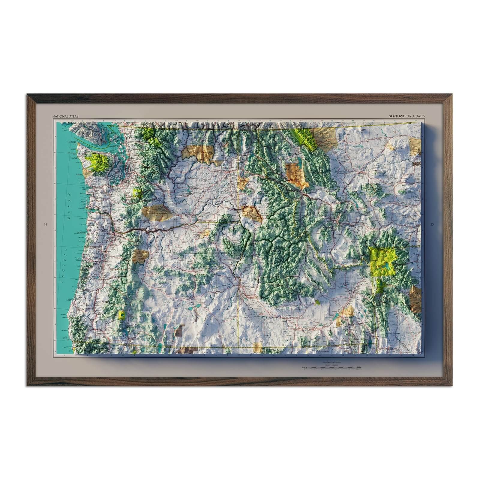
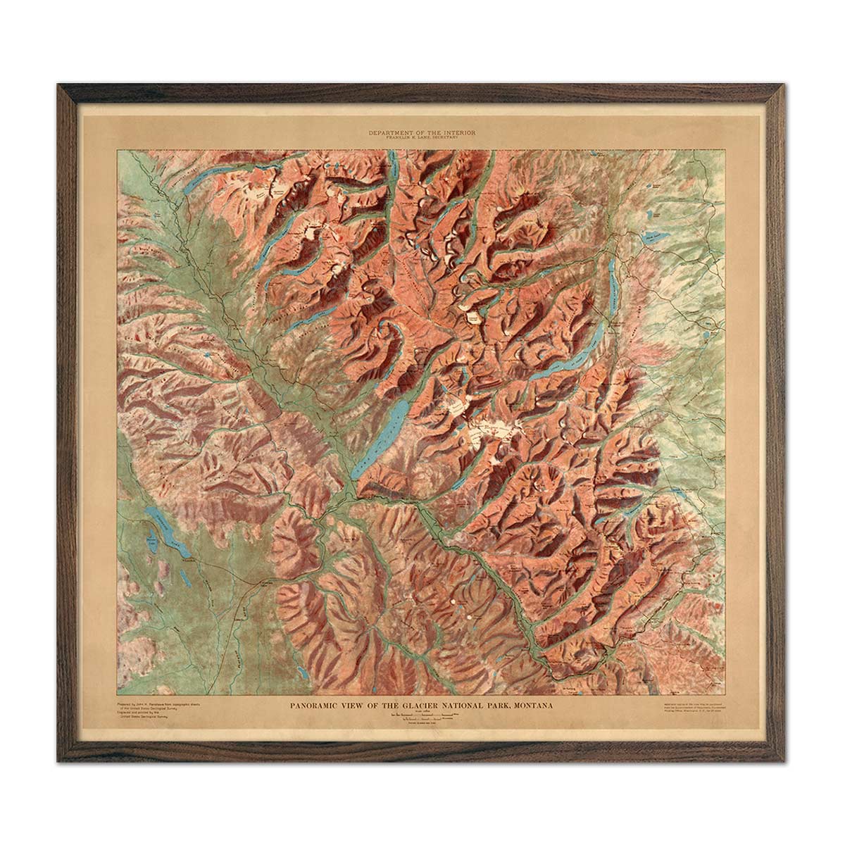
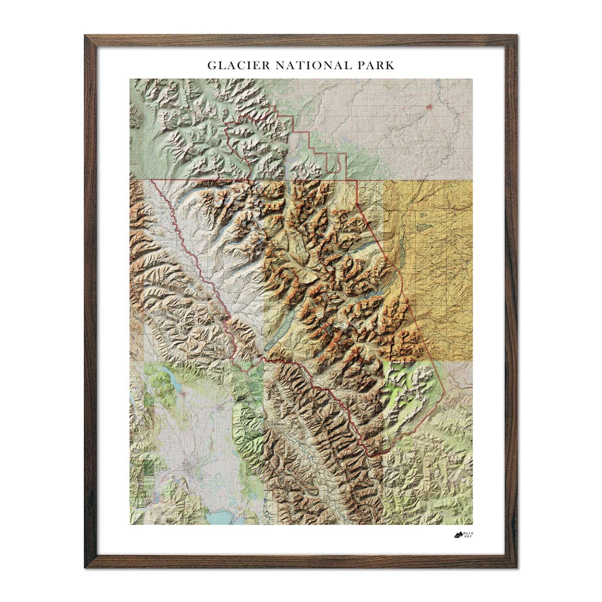
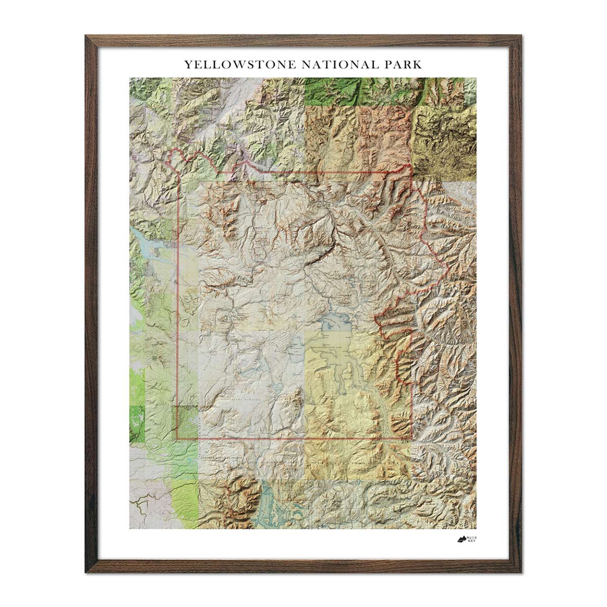
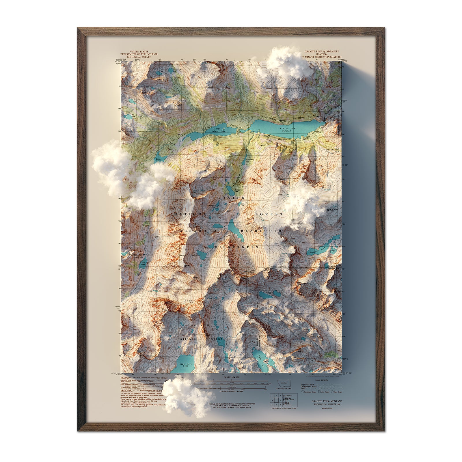
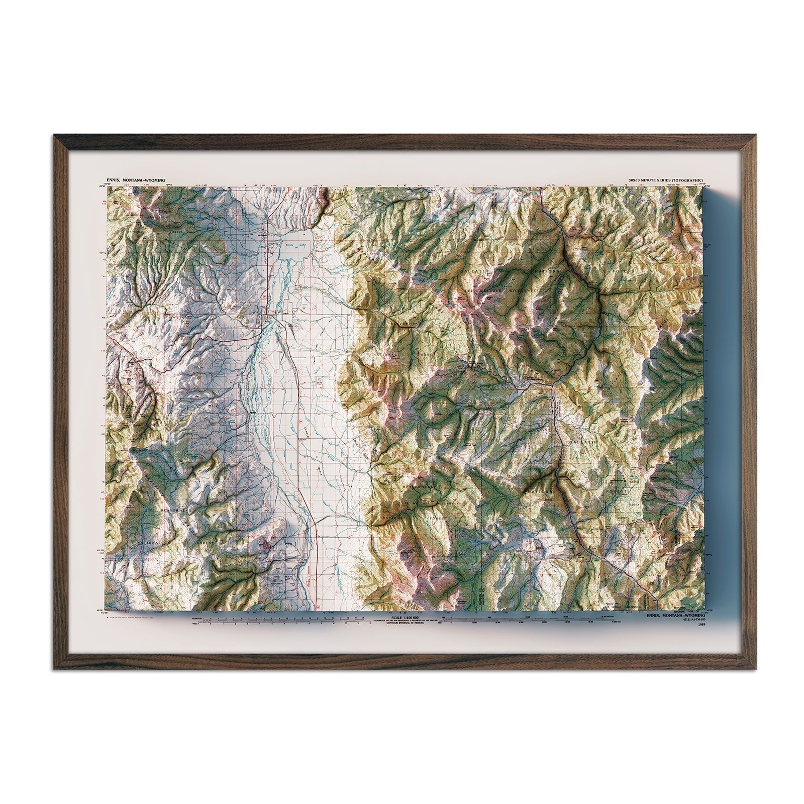
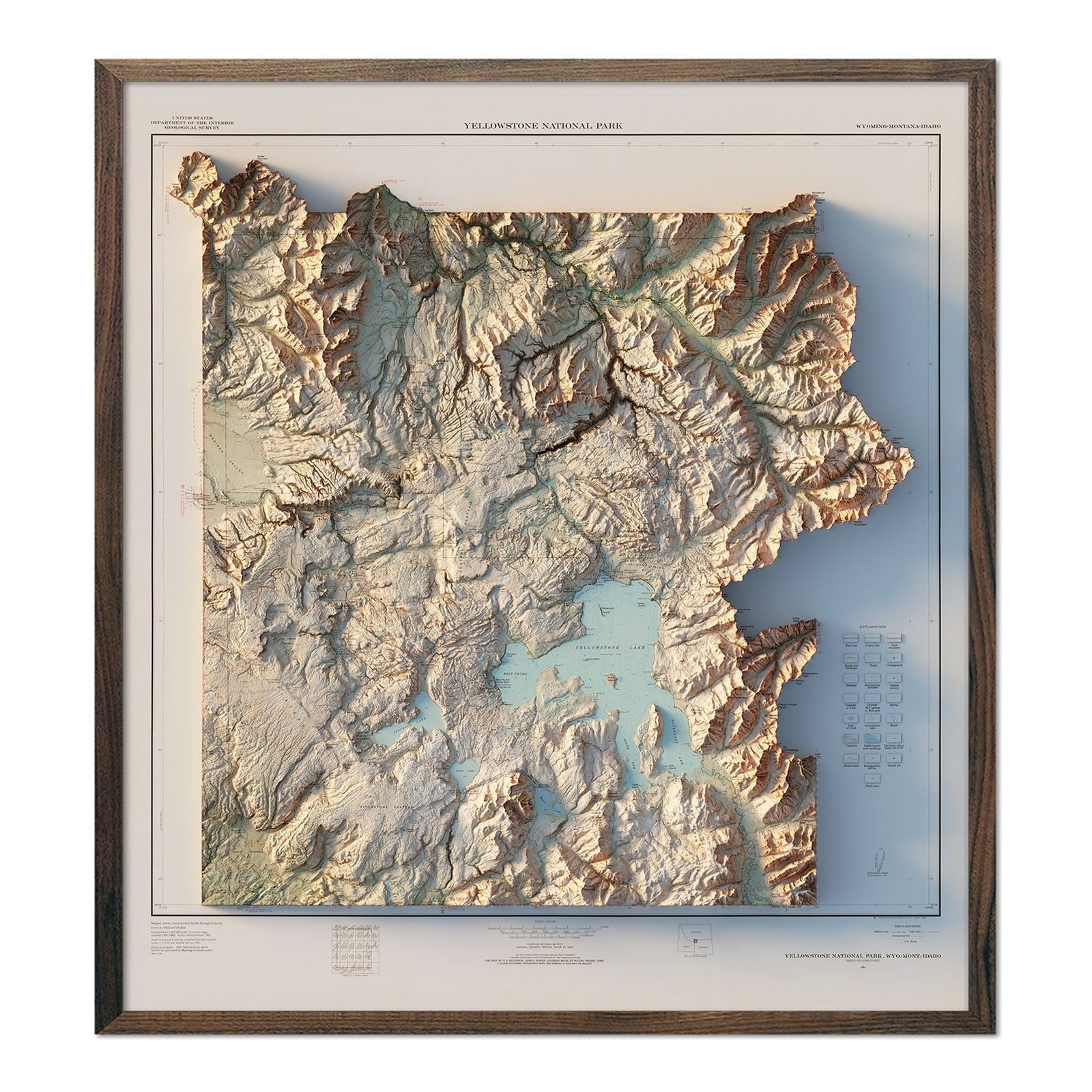
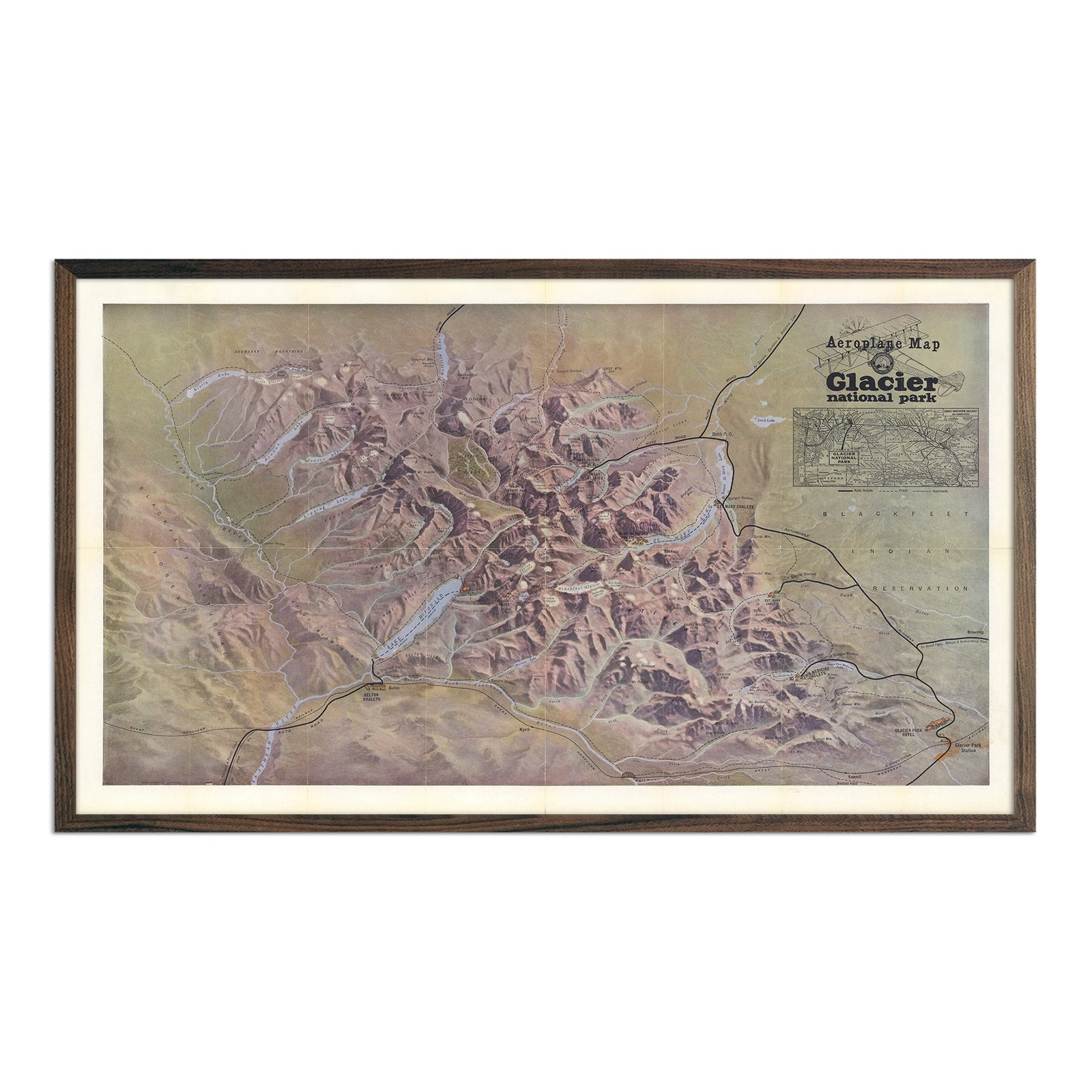
Montana relief maps - Our relief maps of Montana combine historical map landscapes with modern technology to showcase Montana’s beautiful topography in an exciting new way. Applying hand shading over Digital Elevation Data, we custom enhance vintage maps to bring a vibrant, three-dimensional effect on a flat surface. Choose from our 1897 Montana relief map, or one of our more specific Montana relief maps such as our 1878 Yellowstone National Park relief map, 1899 Montana Railroad relief map, or 1915 Glacier relief map.
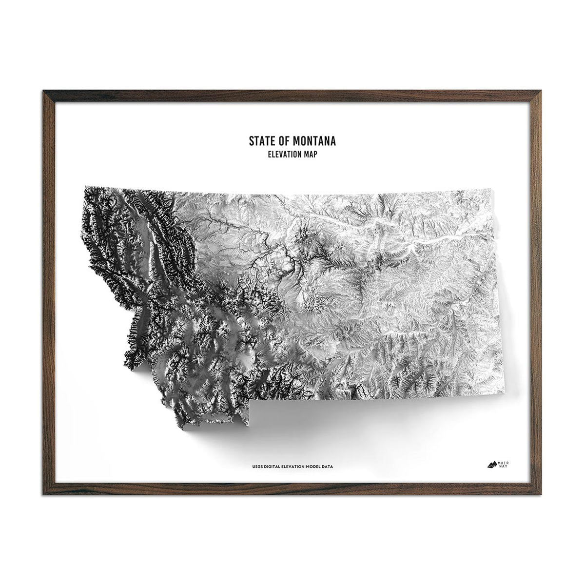
Montana elevation maps - Like our relief maps, our Montana elevation map also uses Digital Elevation Data from the USGS with hand shading, but this map is featured in black and white and removes all other geological keys and text overlays so that the state is the star against a crisp white background.
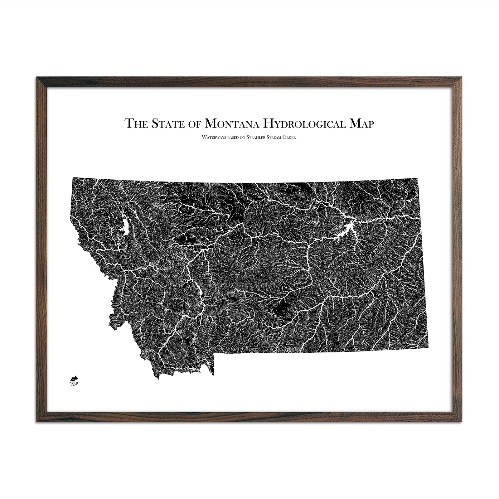
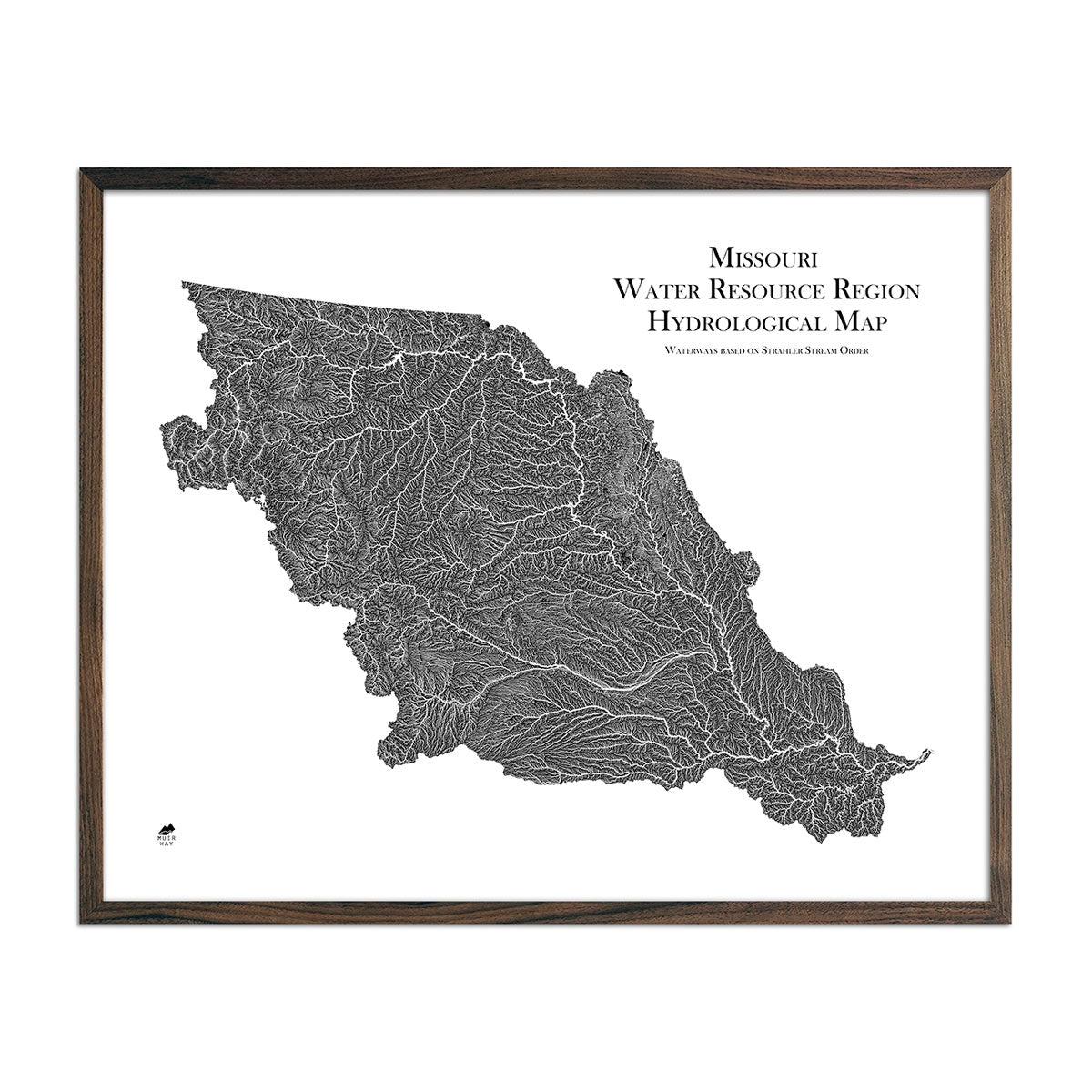
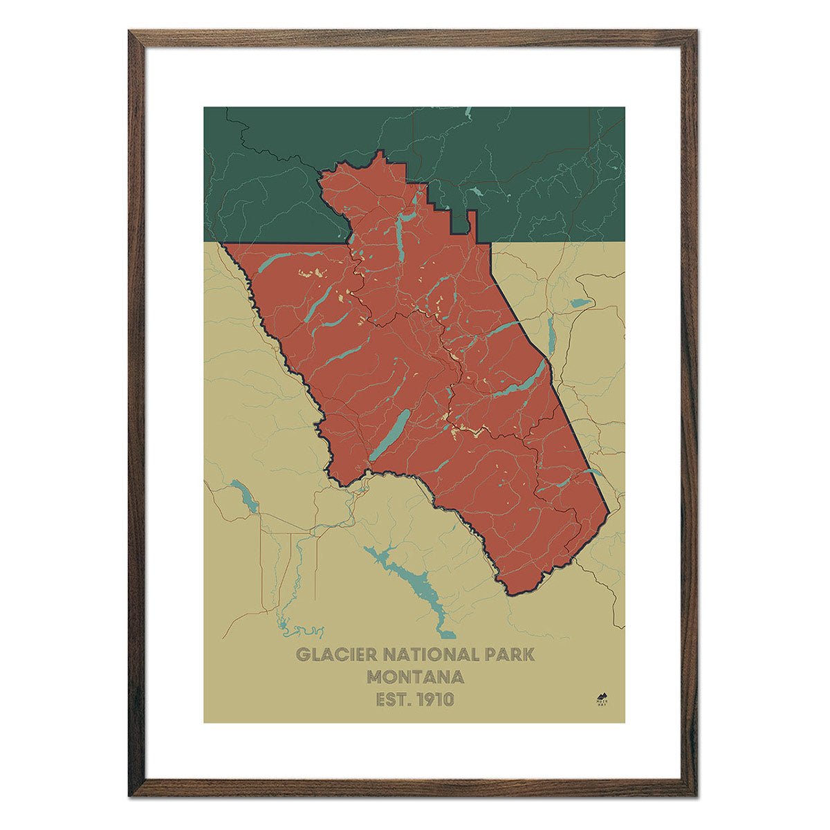
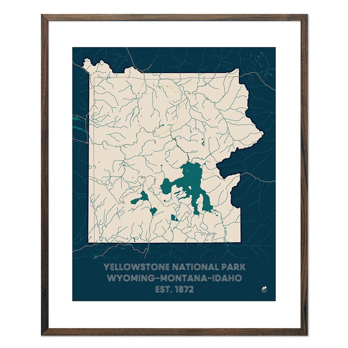
Montana hydrological maps - Our hydrology maps look beautiful from across a room and deliver minute detail up close, and are available in multiple colors. Whether following the interconnected trails of water on our Montana hydrological map or one of our regional hydrology maps featuring Montana, you’ll be able to view every single river and intermittent stream, as well as all bodies of water greater than 0.2 mi in diameter. To make it easy to follow the flow of Montana’s waterways, we apply a method called the Strahler Stream Order to show the hierarchy of streams as they flow from their source, with rivers shown thicker as they acquire the flow of tributaries.
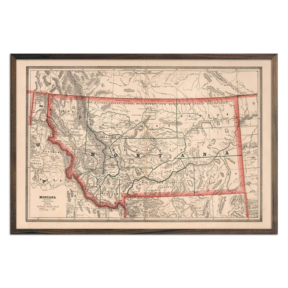
Vintage Montana maps - If you like vintage maps, you’ll love our 1872 Montana and Wyoming territories map. Our historical maps don’t feature elevation, but what they do feature is a record of history beautifully printed and ready to display. These are replicas of authentic vintage maps, carefully restored to maintain their vintage charm without the wear and tear.
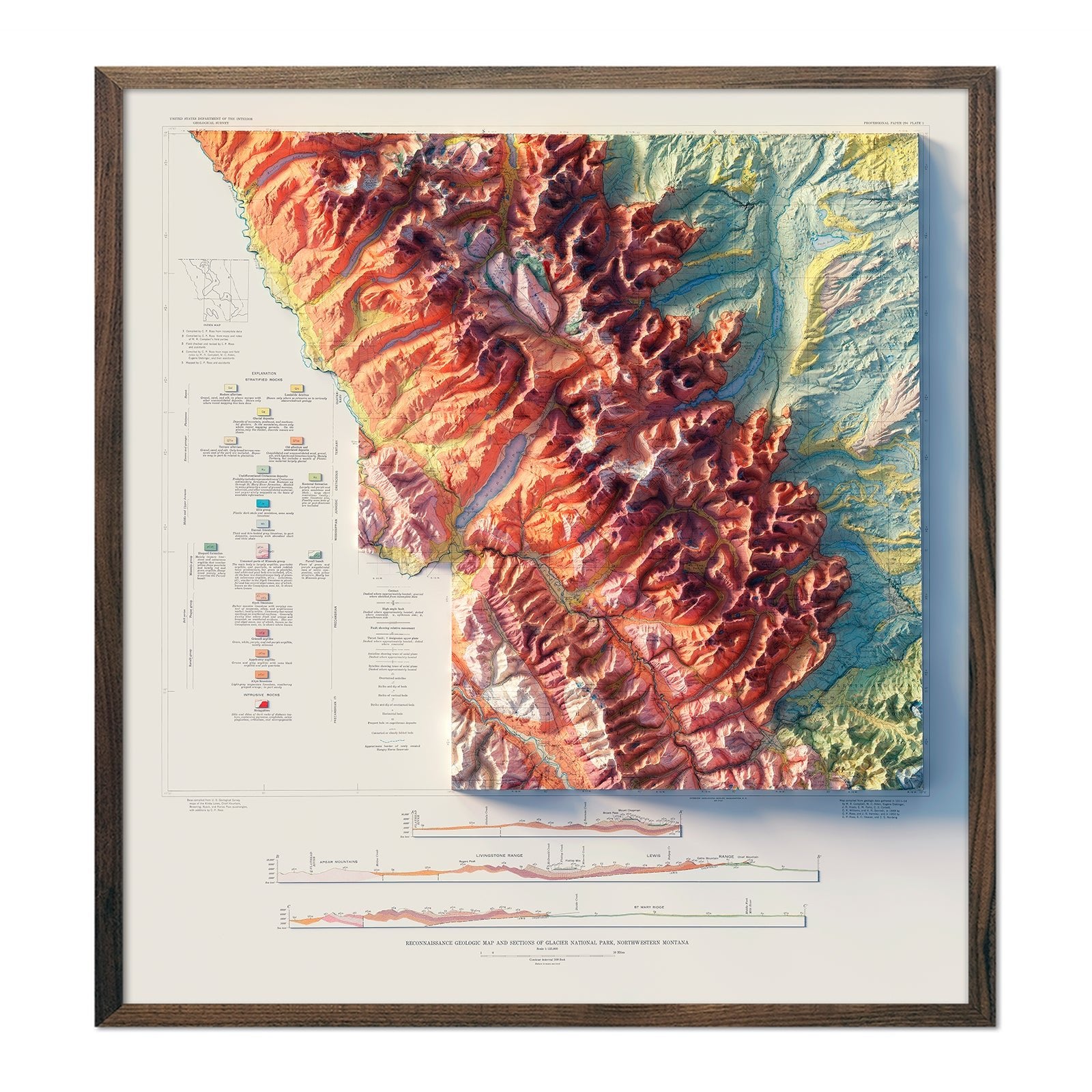
Montana national park maps - Choose from a selection of beautiful maps commemorating Montana’s incredible national parks. From Glacier National Park to vintage maps of Yellowstone, there are several different national park maps available in styles ranging from relief maps to topographical maps, vintage maps and more.
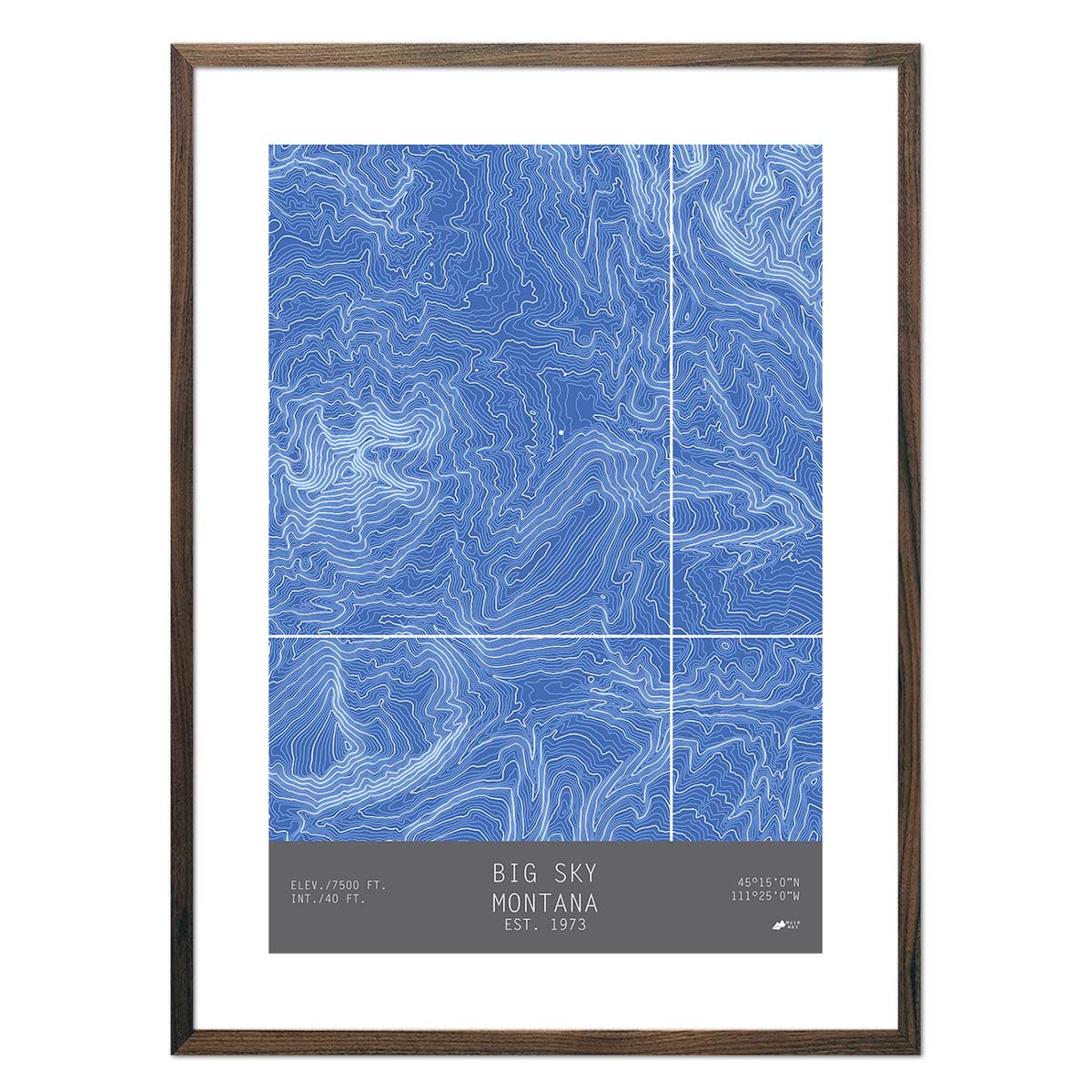
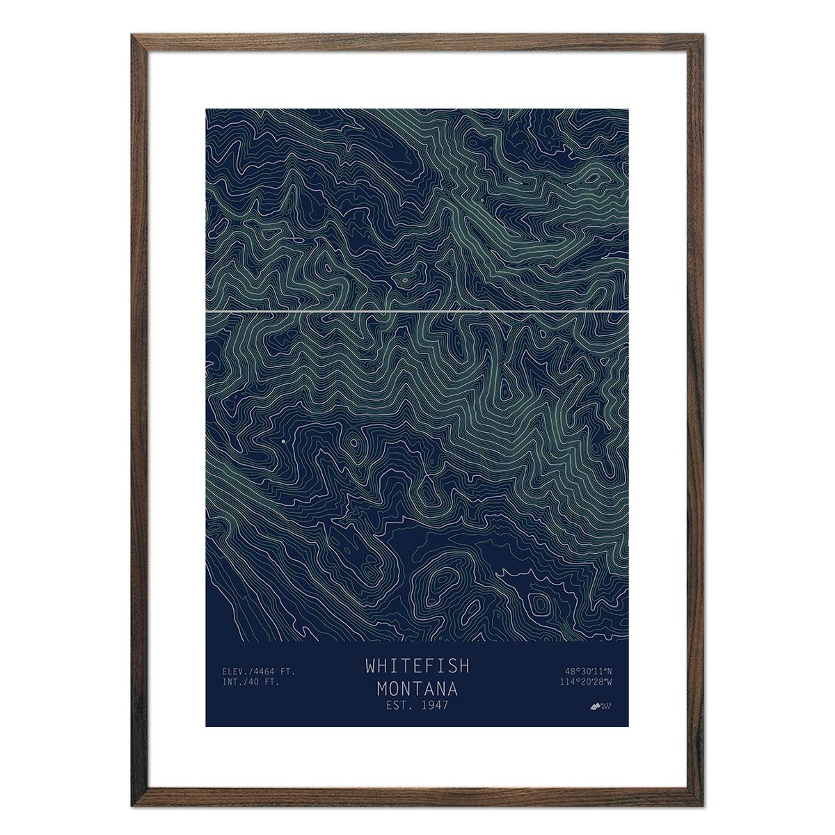
Montana topographical maps - Enjoy the crisp and clean aesthetic of our hand-designed topographical maps, featuring Montana landmarks like Big Sky, Bridger Bowl, and Whitefish.
What are some prominent features on the map of Montana?
The fourth largest state in the nation, Montana holds thousands of square miles of majestic landscapes, including incredible national parks like Yellowstone and Glacier National Park.
Montana’s name means ‘mountainous’, and it’s easy to see why as it’s home to the Rocky Mountains. Our elevation and relief maps of Montana show the Rockies in beautiful detail.
With prominent waterways like the Missouri and Yellowstone Rivers and the Continental Divide, Montana’s waterways are on full display in our hydrological map series.
On our vintage relief maps of Montana, you can see how elevation meets modern civilization with a mix of mountainous terrain and clearly marked state counties and cities.
No matter which Montana state map you choose, you’ll enjoy an up-close look at a state known for the majesty of its landscape, from mountains to plains.
What are the regions in Montana?
Montana is divided into two geographical regions:
- The Great Plains - The eastern 3/5 of Montana is home to the Great Plains region, blanketed by gently rolling flatlands with intermittent hills and wide river valleys. This region is home to some mountain ranges including the Bear Paws, Judith, Big Snowy, and Little Rocky Mountains. The badlands in the southeast display natural stone column formations in beautiful colors.
-
The Rocky Mountain Region - The western 2/5 of Montana is comprised of the Rocky Mountain Region. This area contains flat, grassy valleys in between mountains covered in coniferous forests, many of which are snow-capped for the majority of the year.
Notable landforms in Montana include the Northern Shortgrass Prairie, the driest and westernmost part of the North American grasslands, as well as the Wyoming Basin.
If you like our collection of Montana maps, you may also be interested in maps of our other Mountain States. Click below to browse:
