


Wisconsin Map Art, Hydrological & Shaded Relief Maps
Our custom printed Wisconsin wall maps are beautifully rendered from a combination of historical data, modern technology, and hand design. From our eye-catching elevation maps and geological relief maps to our meticulously restored historical maps, every map of Wisconsin we offer reflects the high quality and attention to detail our customers have come to love and expect from Muir Way. See why a map of the Dairy State from Muir Way is more than your typical wall map.
What makes Muir Way maps of Wisconsin unique?
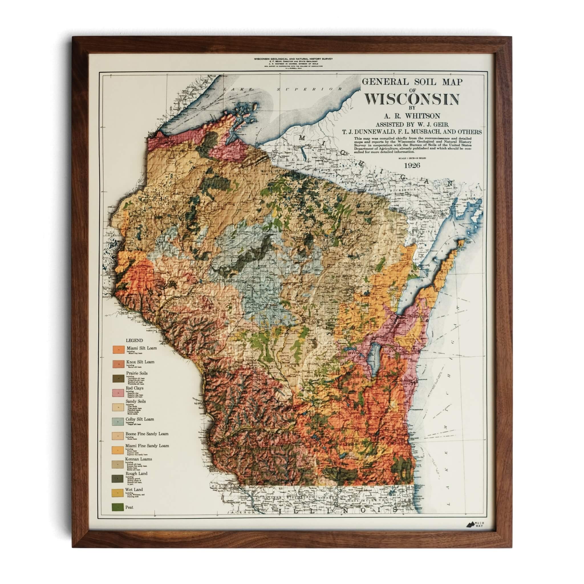
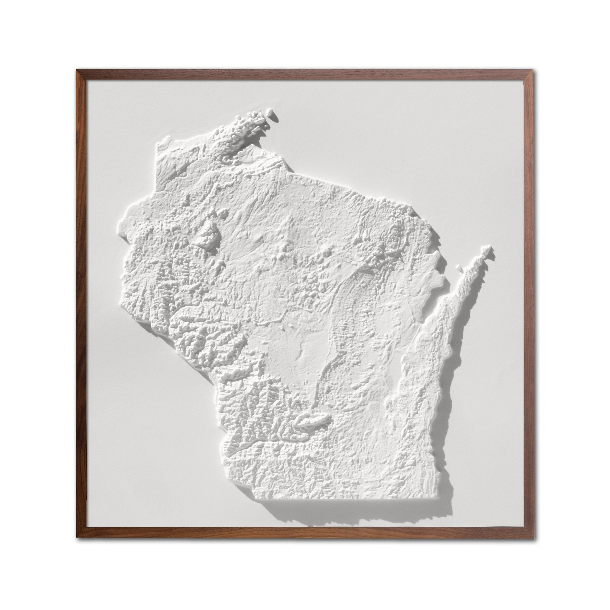
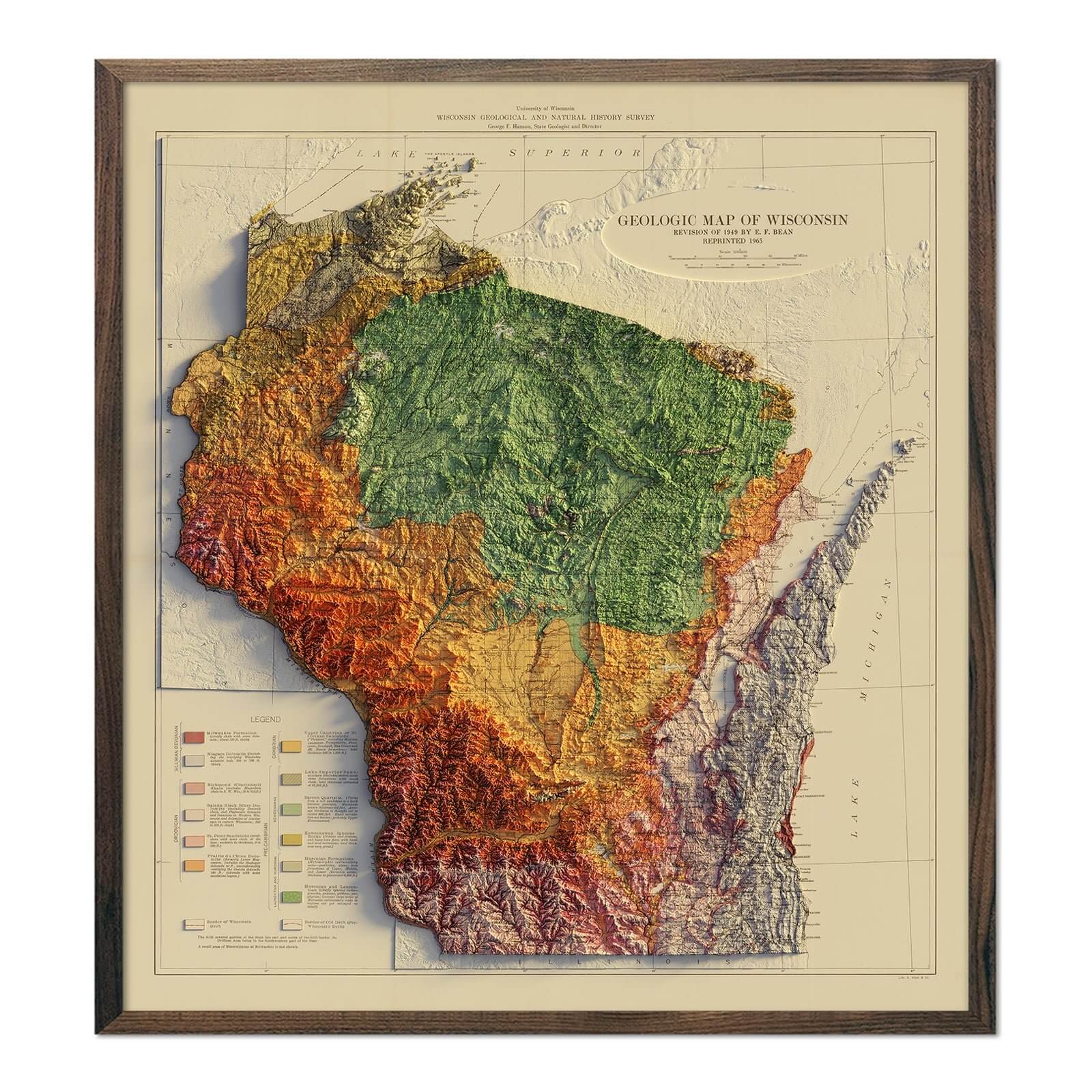
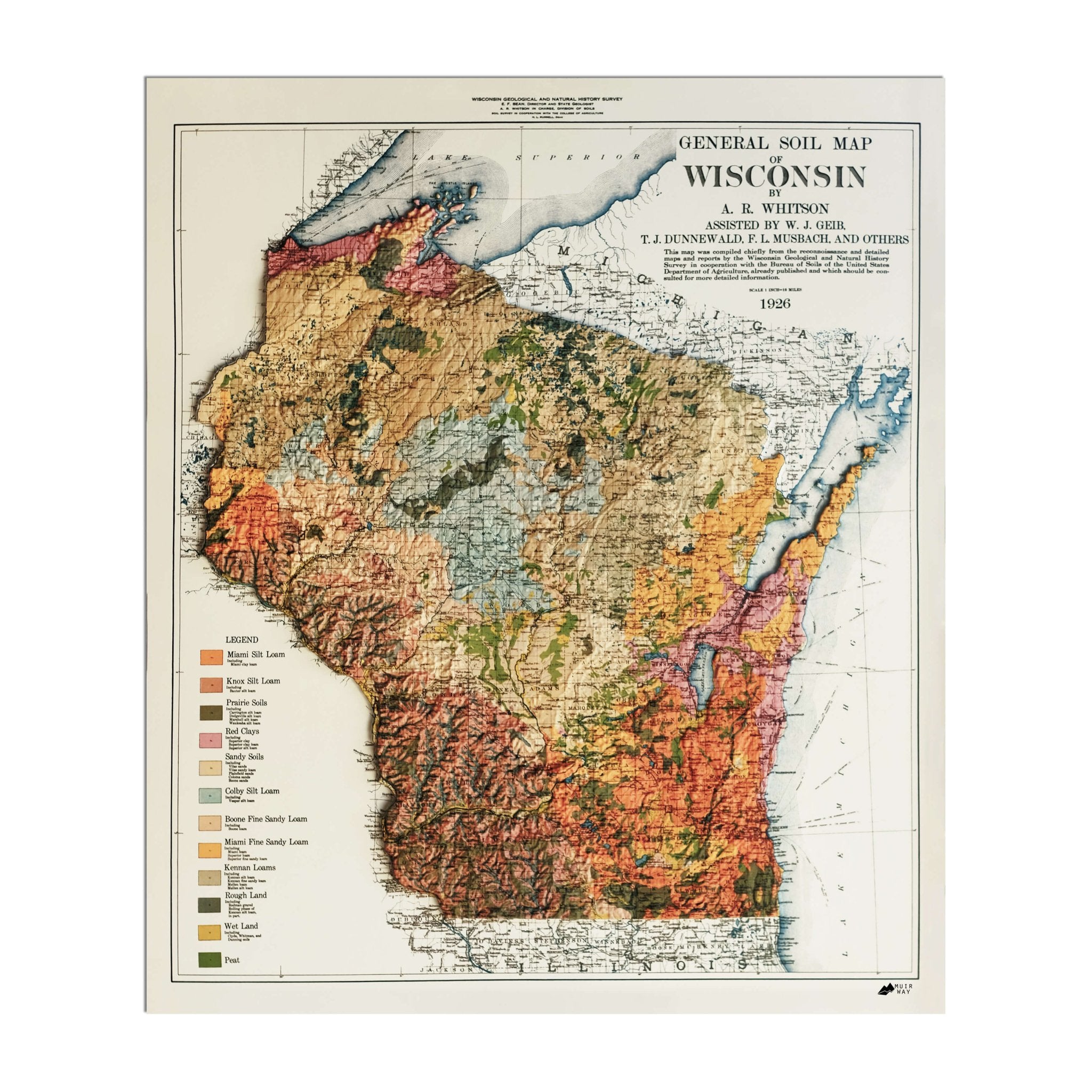
When you purchase a Wisconsin wall map from Muir Way, you will get a custom-printed archival piece of art, not just a mass-produced print. Unlike a glossy poster, our maps are printed on archival fine art paper and are certified to last 100 years. The artwork on our maps is designed to bring new light to the beautiful terrain it features. Our elevation maps incorporate hand-shaded relief and Digital Elevation Data with historical map data, creating a unique 3D effect on a flat surface, and our hydrological maps depict every river and stream in crisp detail. The meticulous craftsmanship and design we bring to our Wisconsin maps create heirloom quality artwork to last for generations.
Does my Wisconsin map come framed?
It can! You can purchase your Wisconsin map professionally custom-framed with real wood, or unframed if you prefer to use your own. If you’d like to purchase a framed Wisconsin wall map, there are several different wood finishes to choose from. If you’d prefer to use your own frame, all of our maps come in standard sizes for easy gift giving.
Does a Muir Way map of Wisconsin make a good gift?
Yes! Our custom-printed maps of Wisconsin make the perfect gift for outdoor enthusiasts, to commemorate anniversaries, or as a thank-you gift for someone special. Memorialize the experience of a special holiday to the Dells of the Wisconsin River, the Great Lakes, or any of the other amazing Wisconsin landscapes. One of our state relief maps can be a perfect graduation gift for a student about to leave home for the first time, or a reminder of home for someone from Wisconsin but who no longer lives there. Our maps also make beautiful corporate gifts that will remind your clients or colleagues of you every time they see it.
Where should I display my Wisconsin map?
Our maps are eye-catching from across the room and up close. Hang a framed wall map as a central focus, or purchase several maps in a similar style or from a particular region and arrange them near each other for a complementary series. Our hydrological maps come in several colors or the classic black and white, and our geological relief maps feature vibrant colors. No matter which you choose, you’re sure to find a Wisconsin map that will look right at home.
What are the different types of maps of Wisconsin available on Muir Way?
Our Wisconsin maps are available in several different styles, including:
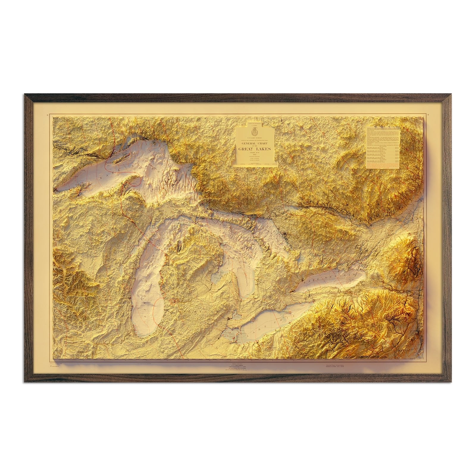
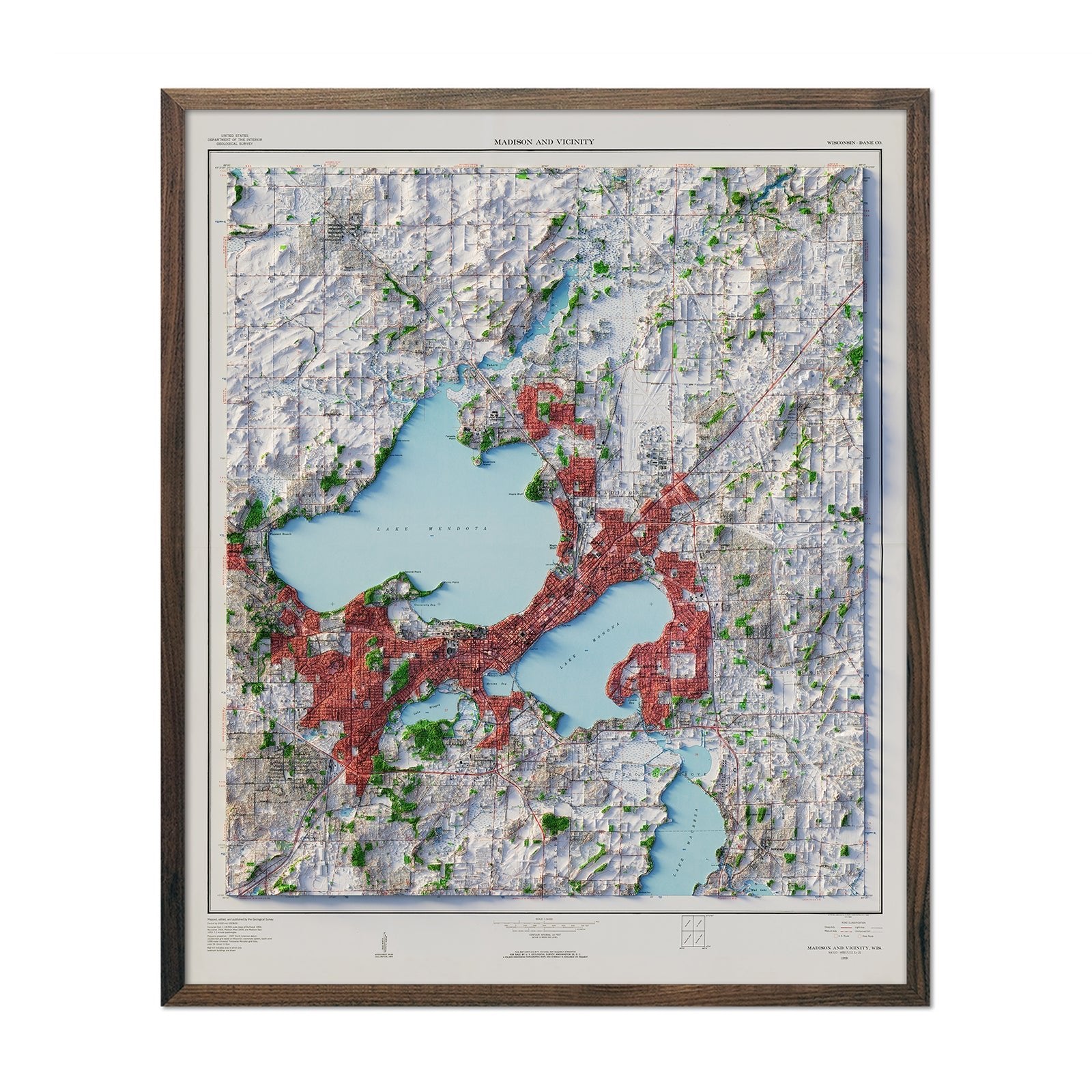
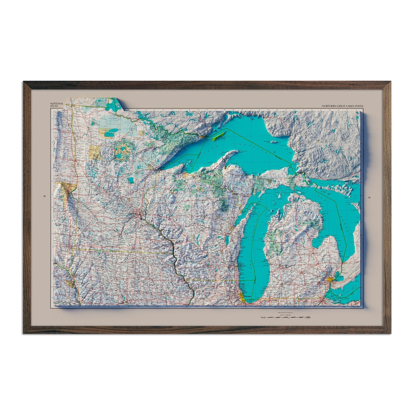
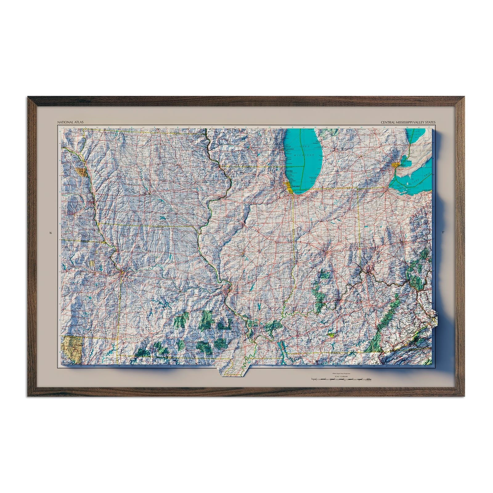
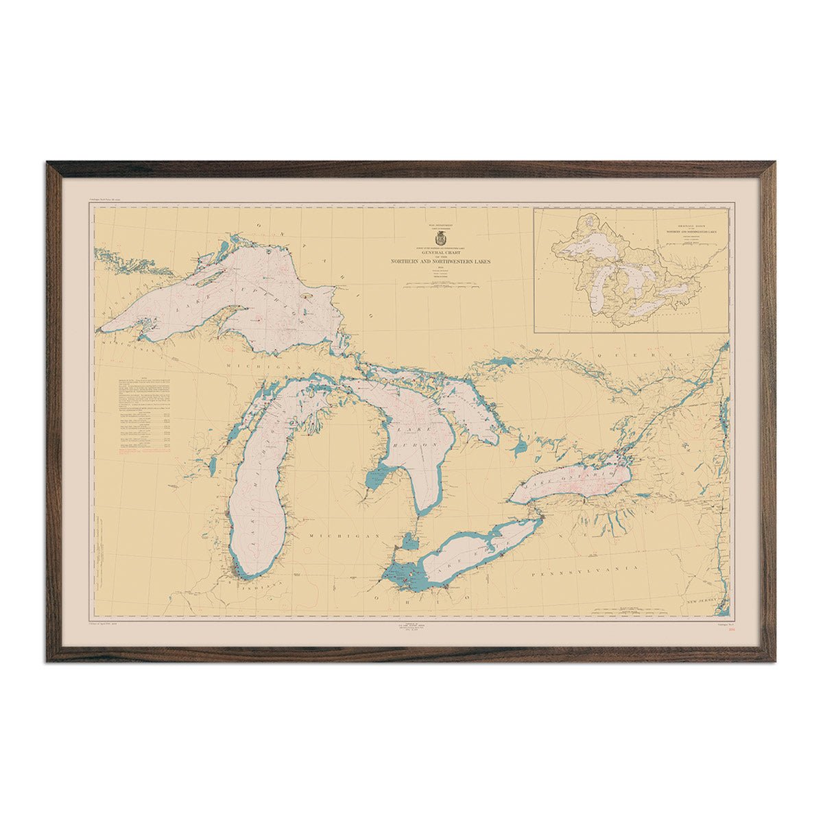
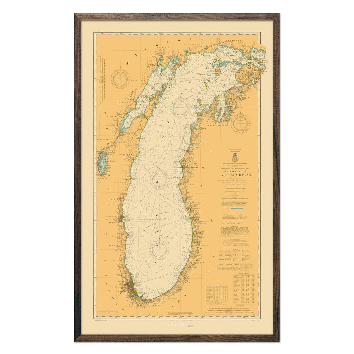
Wisconsin Relief maps - Our relief maps of Wisconsin bring historical map landscapes together with modern technology to show Wisconsin’s lakes and forests in a new way. Using Digital Elevation Data and hand-shaded relief, we custom enhance vintage maps to create a 3D effect on a 2D surface. See Wisconsin’s varied terrain in vibrant colors on our 1965 Wisconsin relief map or get a broader view with our Great Lakes 1955 relief map.
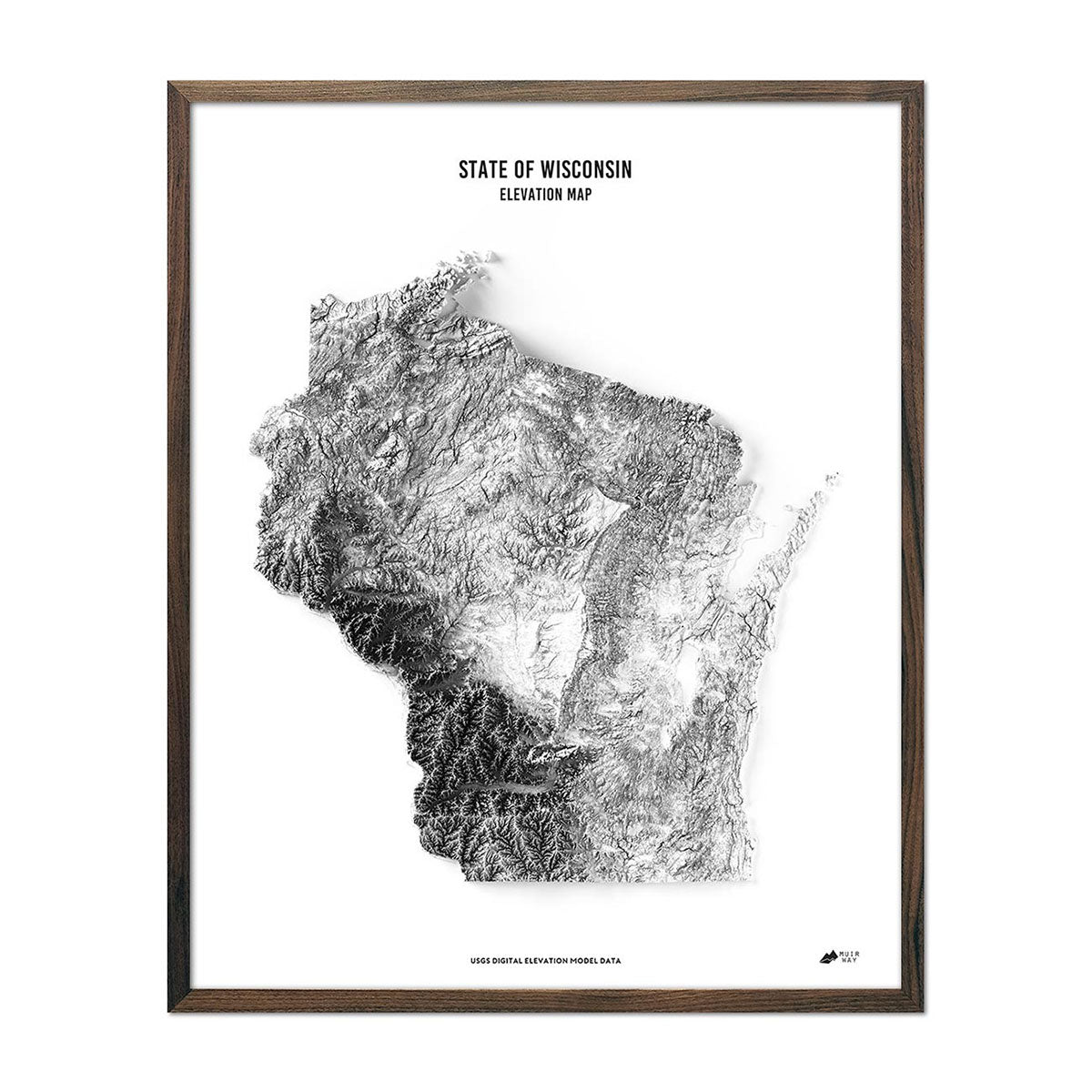
Wisconsin elevation maps - Our Wisconsin elevation map uses Digital Elevation Data from the USGS and hand-shaded relief just like our relief maps to create a high-contrast 3-dimensional effect in stunning black and white.
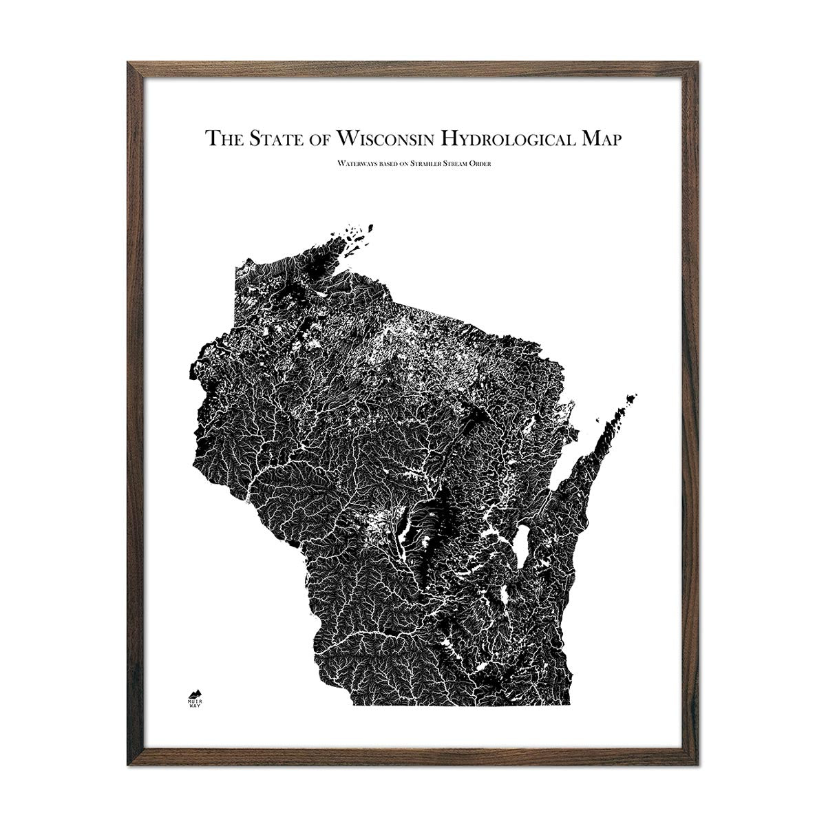
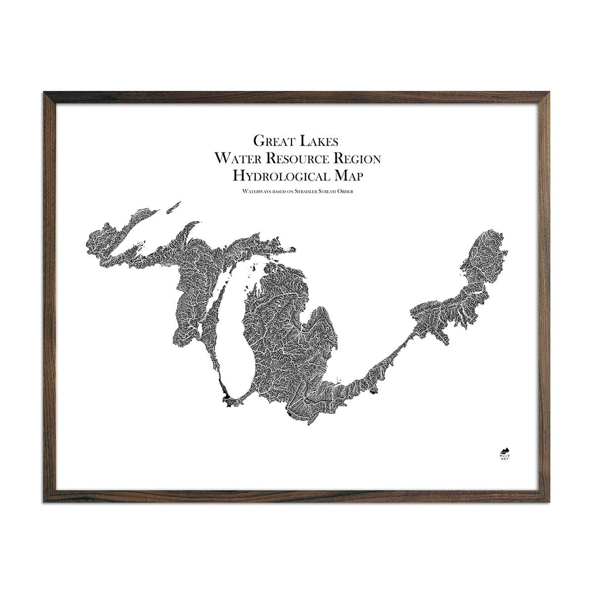
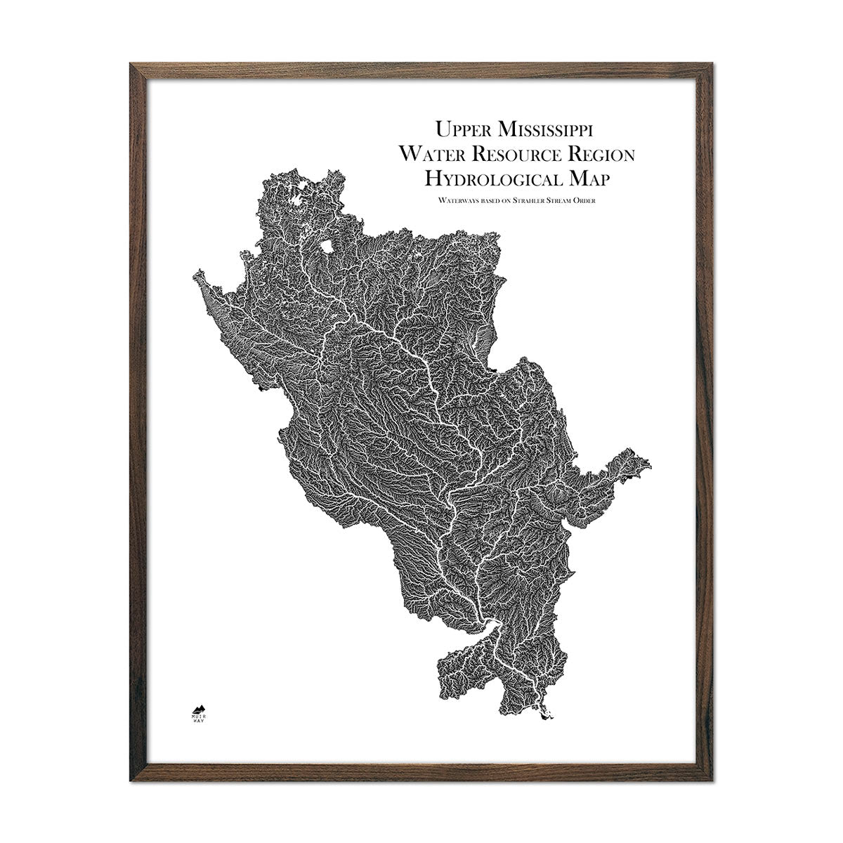
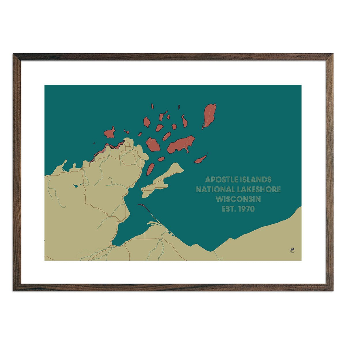
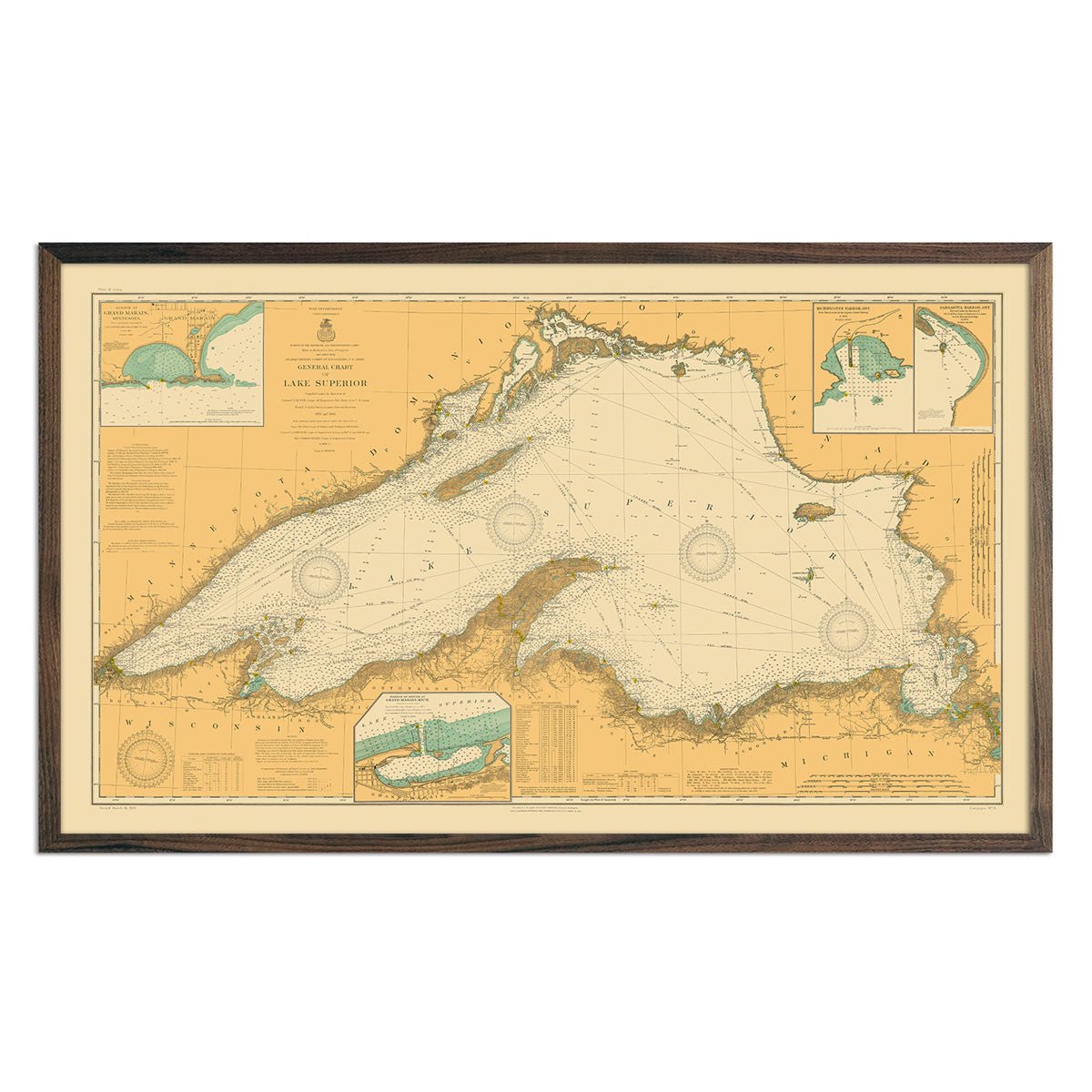
Wisconsin hydrological maps - Our hydrological maps showcase the intricate network of waterways, from sprawling lakes to narrow tributaries that flow into larger rivers. Trace Wisconsin’s waterways on our Wisconsin Hydrology Series map and you’ll see every body of water greater than 0.2 mi in diameter. What makes our hydrological maps unique? We apply a method called the Strahler Stream Order to show the hierarchy of streams as they flow from their source, with rivers shown thicker as they acquire the flow of tributaries. Map available in black, blue, or green. Want to see the ‘big picture’? See our Great Lakes Hydrology Series map for watersheds across much of North America including Wisconsin, or the Upper Mississippi Hydrology Series map.
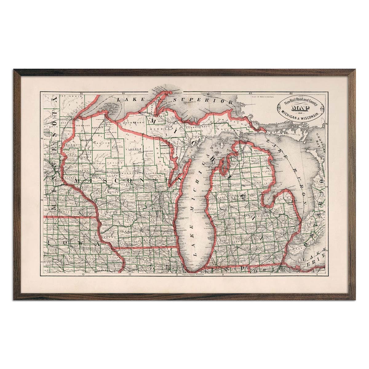
Enhanced vintage Wisconsin maps - Enjoy the history and charm of vintage maps in a new way with our Michigan and Wisconsin 1883 map. Unlike our elevation maps, Muir Way historical maps don’t feature enhanced elevation effects, but they do feature a record of history beautifully restored to retain its vintage charm without the wear & tear. Our vintage Wisconsin maps are also custom printed using archival materials.
What are some prominent features on the map of Wisconsin?
Situated between the Great Lakes and the Mississippi River, Wisconsin’s geographical terrain features a variety of environments, including vast pine and hardwood forests in the northwest, sandstone formations and bluffs in the southwest, glacial lakes, and winding rivers.
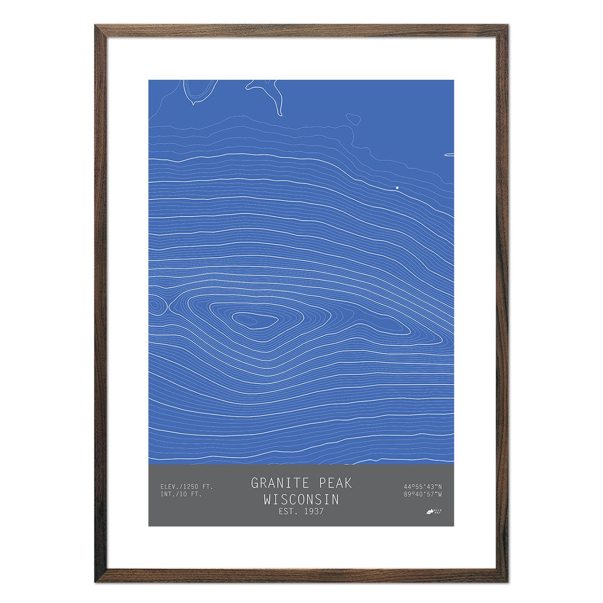
Granite Peak in Rib Mountain State Park features skiing and snowmobiling. We’ve captured its contours in one of our TOPO series maps. Each line of our Granite Peak, Wisconsin map represents a particular elevation, so you can determine the degree of a slope by how close the lines are to one another.
Lake Superior and Lake Michigan border the state to the east. The Door Peninsula, which separates Green Bay from Lake Michigan features limestone outcrops, bluffs and sand dunes.
The Mississippi River makes up much of the state’s western border. This includes the Driftless Area, which is a region in the southwest of the state that was not covered by glaciers. Unlike the rest of the state, it is characterized by ridges and deep valleys.
What are the regions in Wisconsin?
Wisconsin has five main geographical regions:
- Lake Superior Lowland (Superior Coastal Plain) - The Lake Superior Lowland in the far north of the state is an area of land along Lake Superior. It is a mostly plain that gently slopes towards Lake Superior. Covered in hardwood forests, it includes the Bayfield Peninsula which is Wisconsin’s northernmost point and provides stunning views of Lake Superior.
- Northern Highland - Stretching from Minnesota to Michigan, the Northern Highland has vast mixed hardwood and coniferous woods. The area includes Chequamegon-Nicolet National Forest and the state's highest point, Timms Hill.
- Driftless Area - This is the only area of the state that was not covered by glaciers during the last ice age. However, it was still influenced by glaciers as the area is characterized by bluffs carved by water as those glaciers melted.
- Central Plain and Western Upland - Home of the Dells of the Wisconsin River, the Central Plain is also home to much of Wisconsin’s rich farmland. The Western Upland in the southwest of the state, is characterized by a rugged landscape of mixed forest and farmland, including bluffs along the Mississippi River.
- Eastern Ridges and Lowlands - This is the most populated area of Wisconsin. It is a flat area marked by two ridges that includes many farms and orchards.
If you like our collection of Wisconsin maps, you may also be interested in maps of other Midwest states. Click below to browse:
