


Minnesota Map Prints, Elevation & Shaded Relief Maps
Are you in search of a beautiful map of Minnesota to hang in your office or home? Whether you’re originally from Minnesota, have family there, or the Land of 10,000 Lakes holds a special place in your heart, our selection of Minnesota maps from Muir War are the perfect piece of art and crafted to last for generations to come.
What makes Muir Way maps of Minnesota unique?
When you buy a Minnesota map from Muir Way, you get a museum-quality map made in the USA, custom-printed on fine art paper using archival materials, not a rolled up glossy poster.
Each purchase of a Minnesota map through Muir Way also supports organizations that work to preserve, protect, and restore wild places and natural resources in the USA.
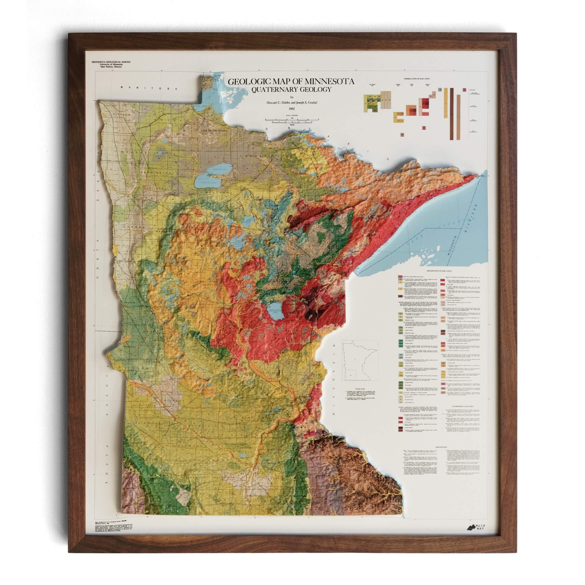
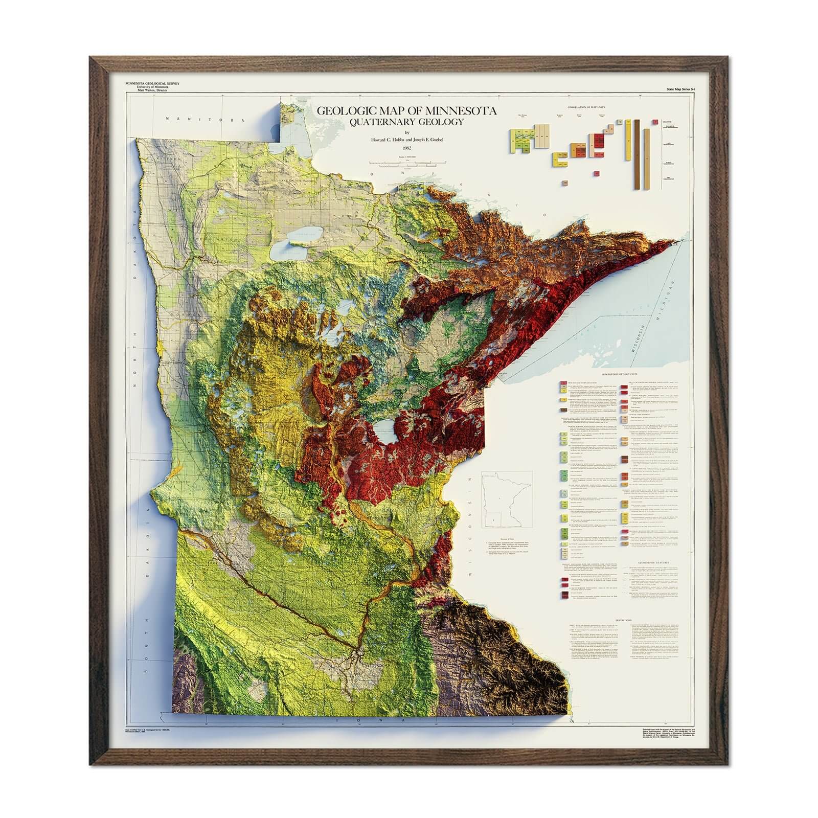
Our elevation maps incorporate shaded relief and Digital Elevation Data with historical map imagery for a three-dimensional effect on a flat surface, and our hydrological maps depict every river in the state--even intermittent streams--and every body of water over 0.2 miles in diameter in crisp detail. Each of our Minnesota maps is designed to be a work of art that you can enjoy for years.
Can I get my Minnesota map framed?
Yes! Many of our Minnesota maps are available on both fine art paper and rich gallery-wrapped canvas, and all can be purchased custom-framed with real wood. If you’d like to purchase your Minnesota artwork framed, you can choose from several different colors and wood finishes. If you’d prefer to frame your Minnesota map yourself, all of our unframed maps come in standard frameable sizes for easy gift giving.
Is a Muir Way map of Minnesota a good gift idea?
Whether you are looking for a gift for an anniversary, birthday, special occasion, or as a way to say thank you, a Muir Way map is the perfect gift. Our custom printed maps make great gifts for recent graduates, new retirees, newlyweds, outdoor enthusiasts, and also make unique and memorable corporate gifts for colleagues and clients alike.
How should I display my Minnesota map?
Our maps are designed to make an impact whether viewing up close or from across the room. Hang a framed wall map as a focal point above a mantel or sofa, or purchase several and arrange them near each other for a complementary series. Our selection of maps includes everything from bright colors to black and white, so you’re sure to find something that suits your space. No matter which you choose, you’re sure to find a Minnesota illustration that will look right at home.
What are the different types of maps of Minnesota available on Muir Way?
Our Minnesota maps are available in several different styles, including:
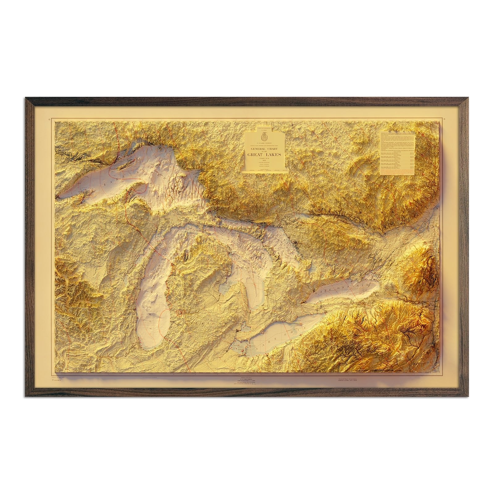
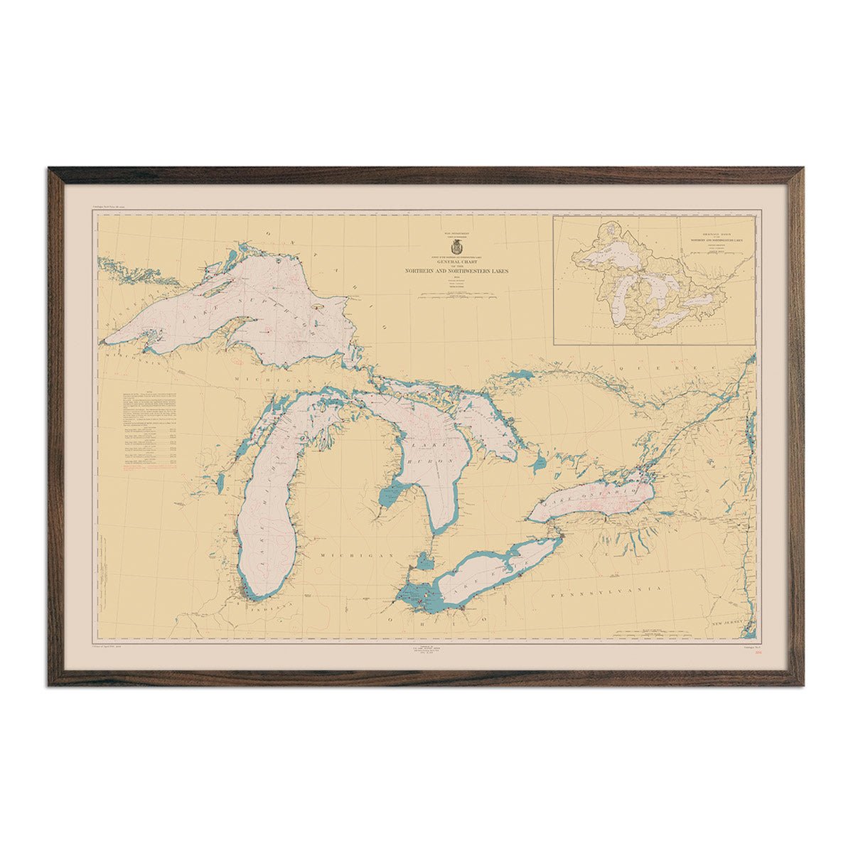
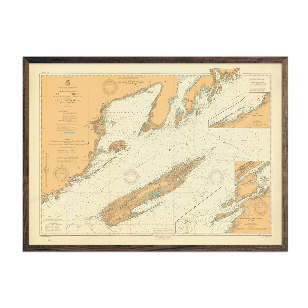
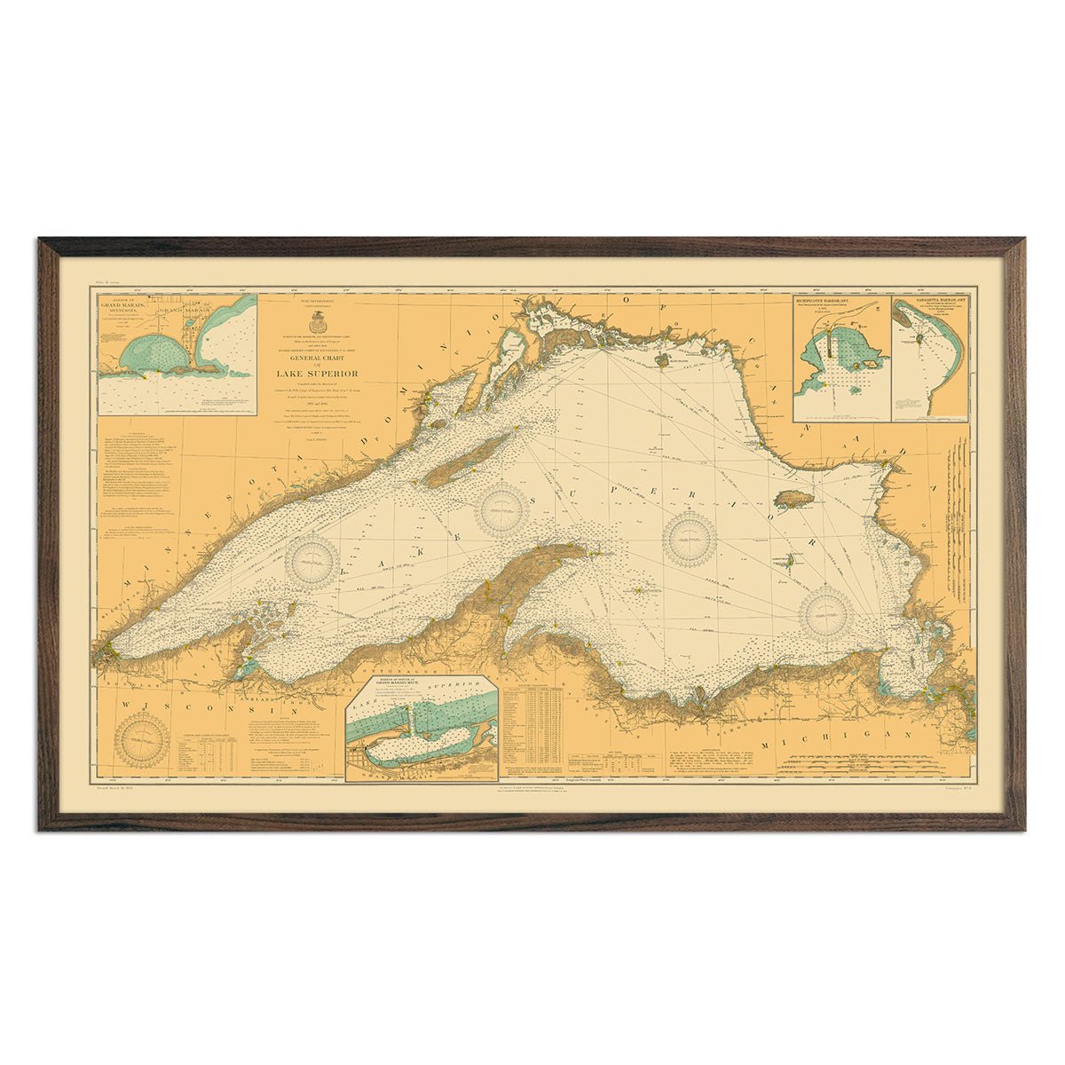
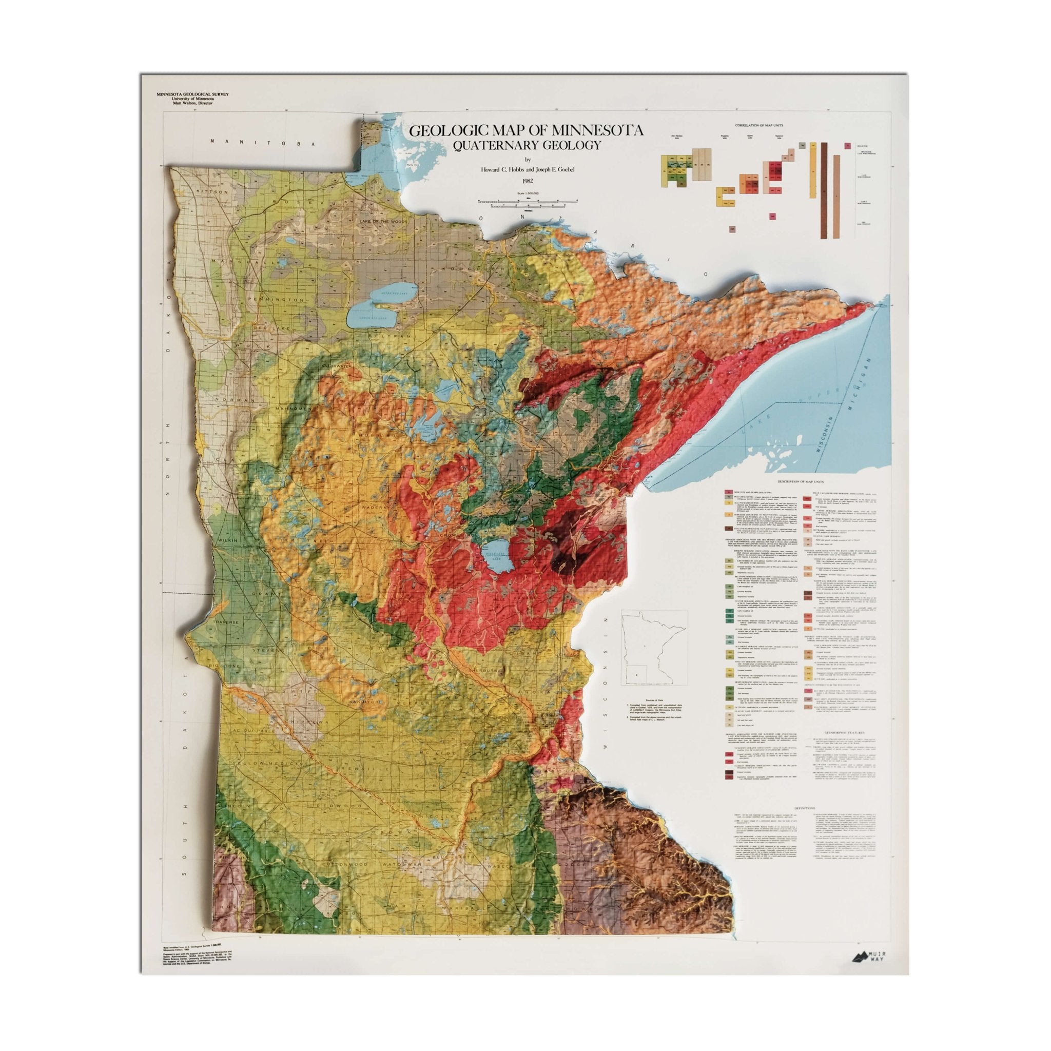
Minnesota relief maps - Our relief maps of Minnesota apply hand shading on top of vintage map imagery combined with USGS Digital Elevation Data to give the illusion of images popping off the page. Choose from our 1982 Minnesota Relief map, showcasing Minnesota’s varied elevation in a beautiful color-coded display, or our 1955 Great Lakes relief map for a closer look at the Great Lakes region.
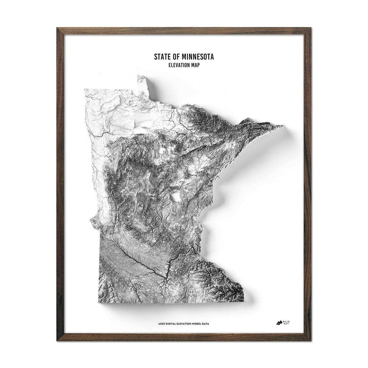
Minnesota elevation maps - Our Minnesota elevation map also uses Digital Elevation Data from the USGS to create a three-dimensional effect, but in this map, all color-coding, labeling, and other text has been removed and the topography is rendered in stunning black and white against a crisp, white background, allowing the state to really stand out in a clean and modern way.
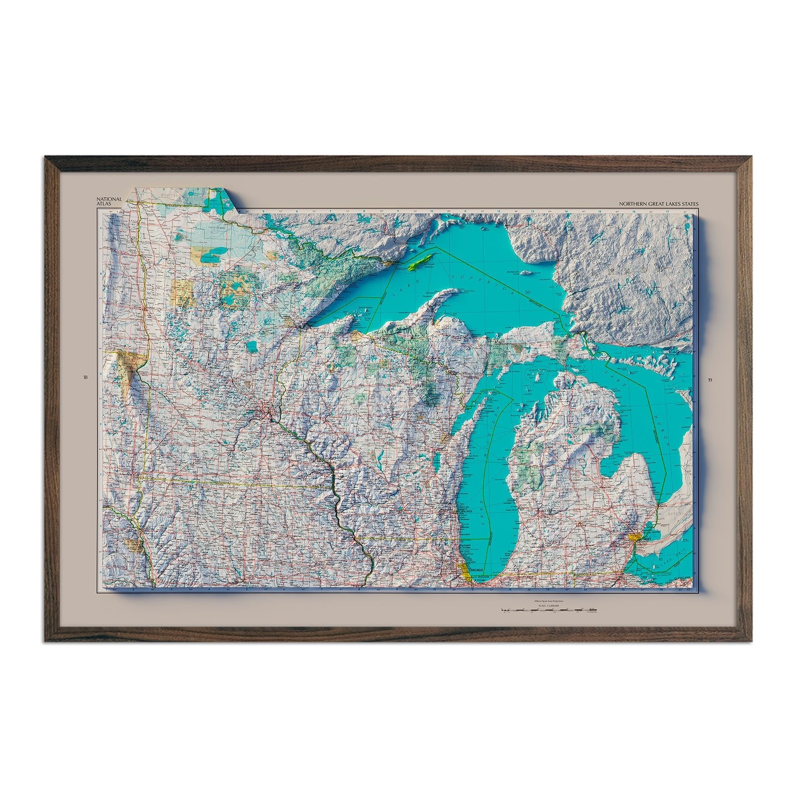
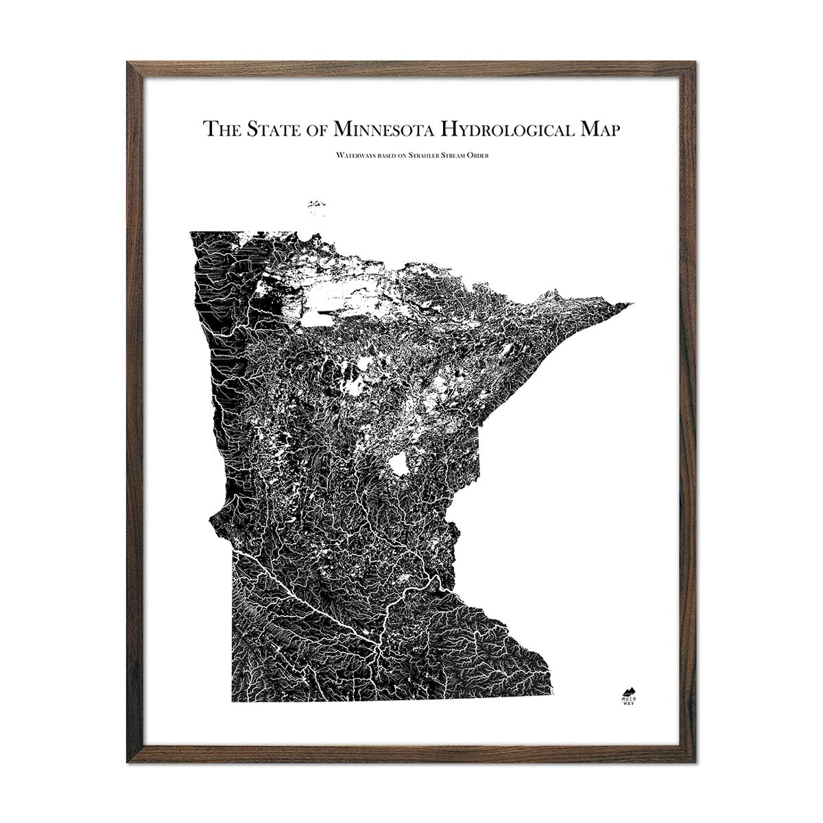
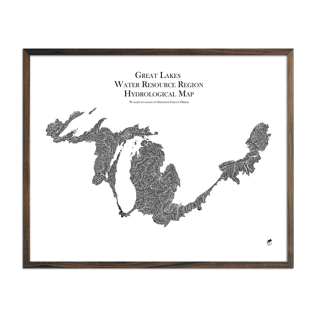
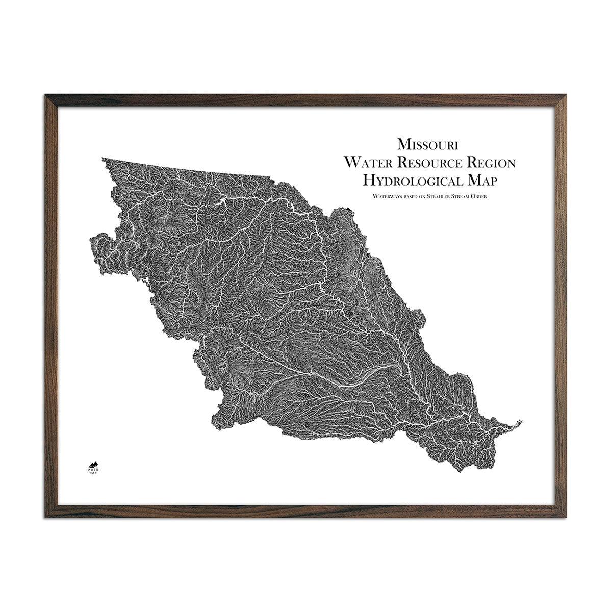
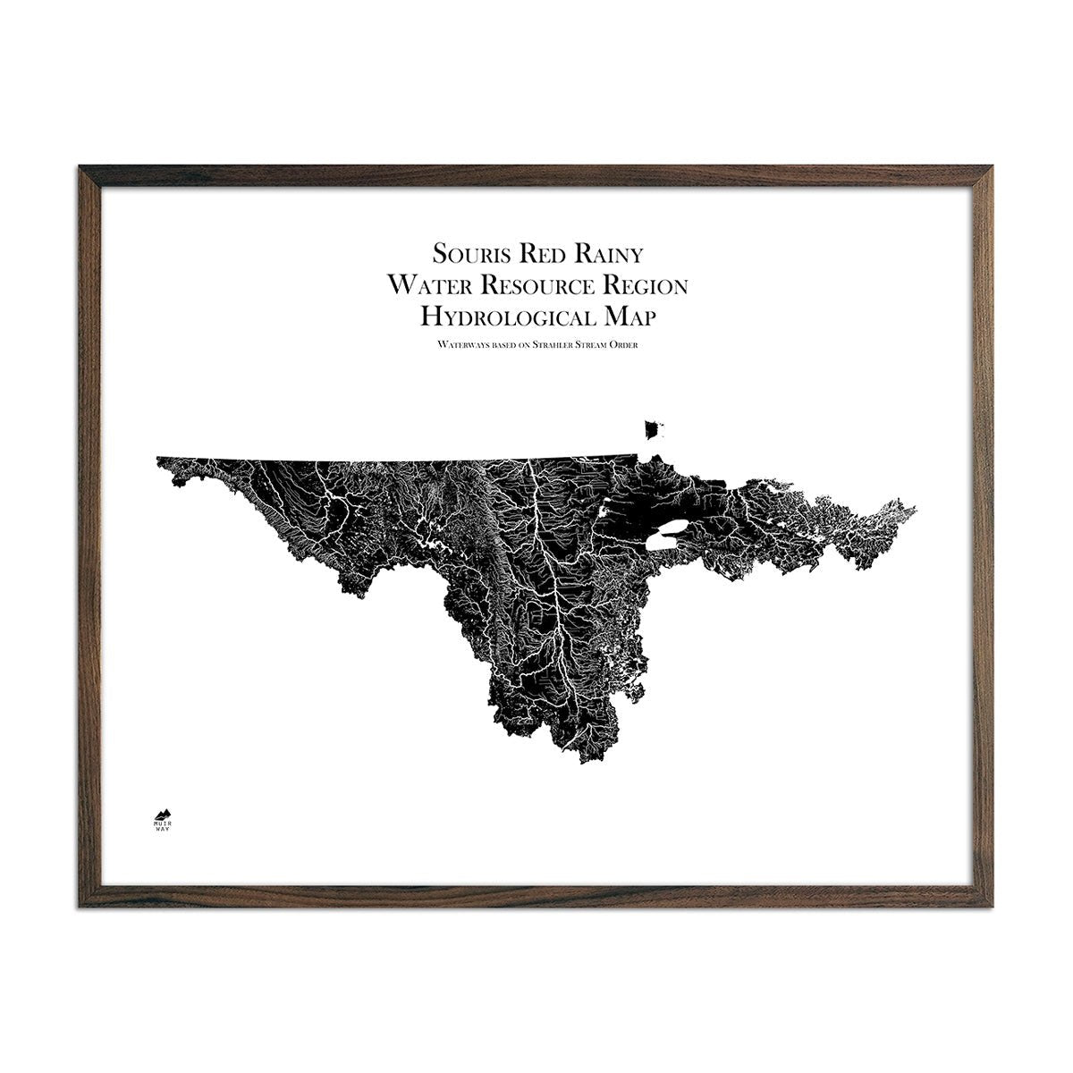
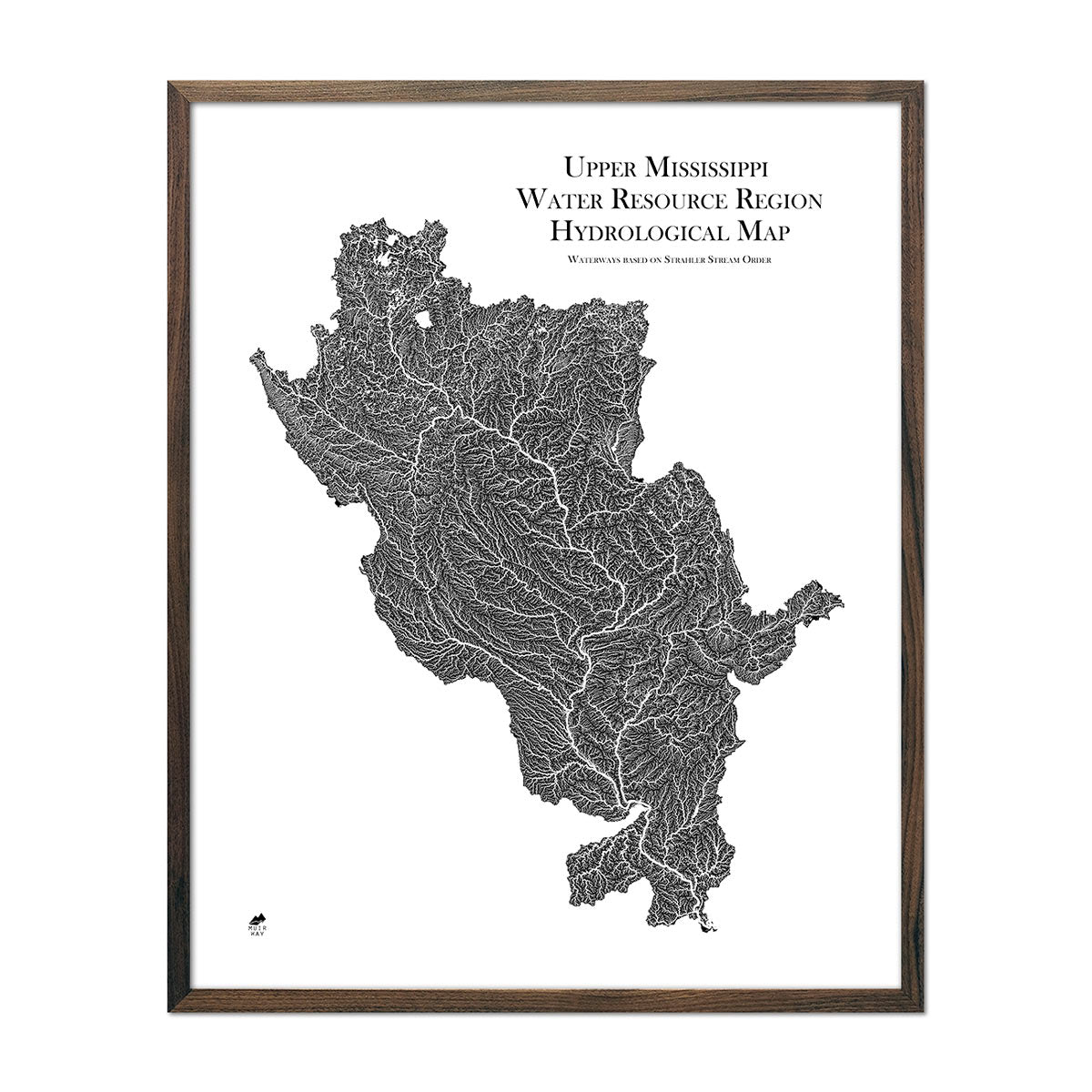
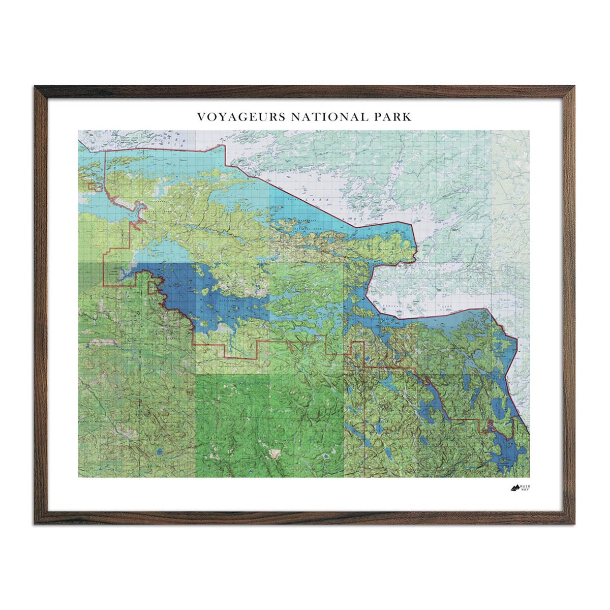
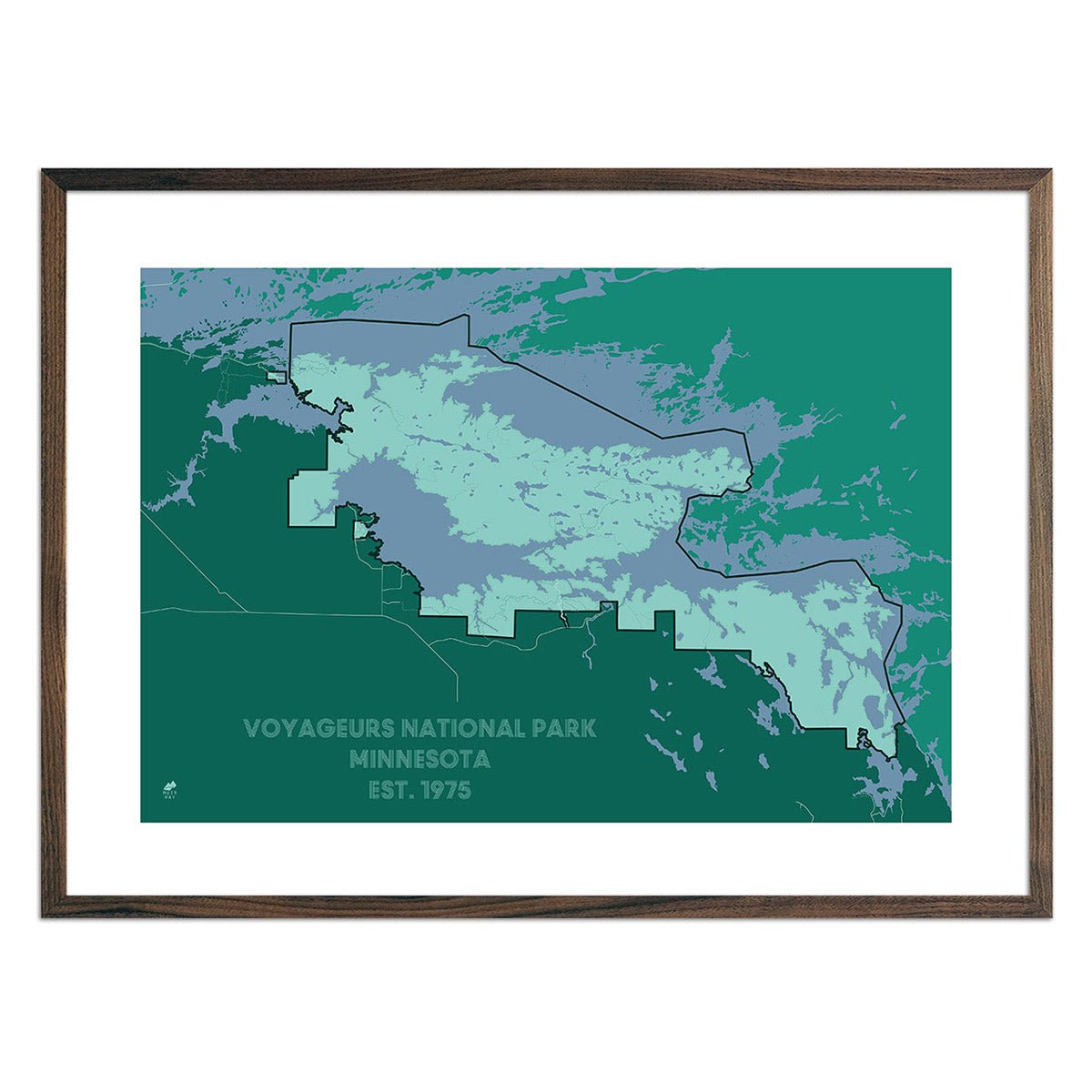
Minnesota hydrological maps - Our hydrological maps catch the eye from afar and delight in the details up close, and are available in black and white as well as multiple colors to suit your décor. On our Minnesota hydrological map, you can trace every single river and intermittent stream, as well as all bodies of water greater than 0.2 mi in diameter. We also feature regional hydrological maps that include areas of Minnesota such as our Great Lakes hydrological map and Souris-Red-Rainy regional hydrological map, among others.
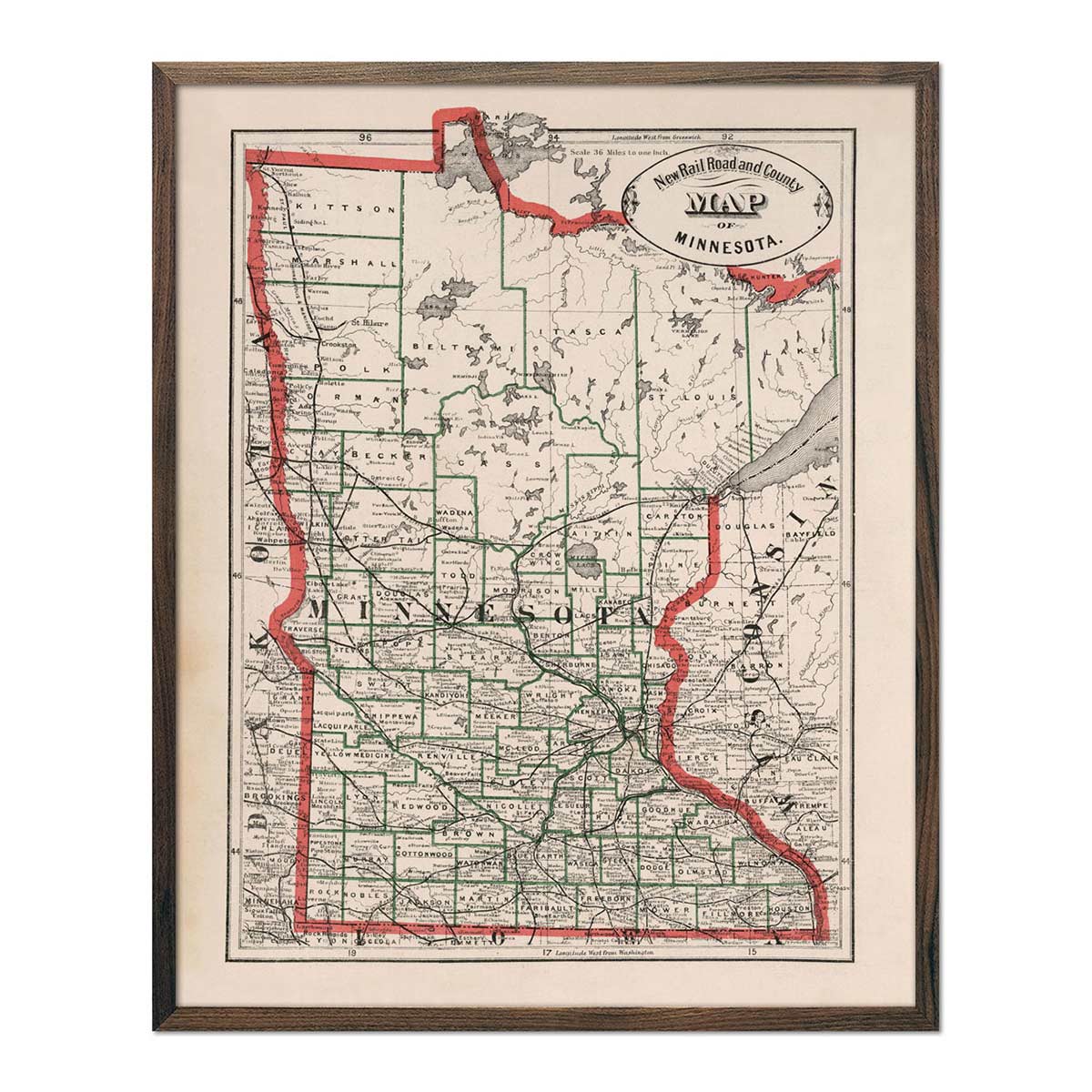
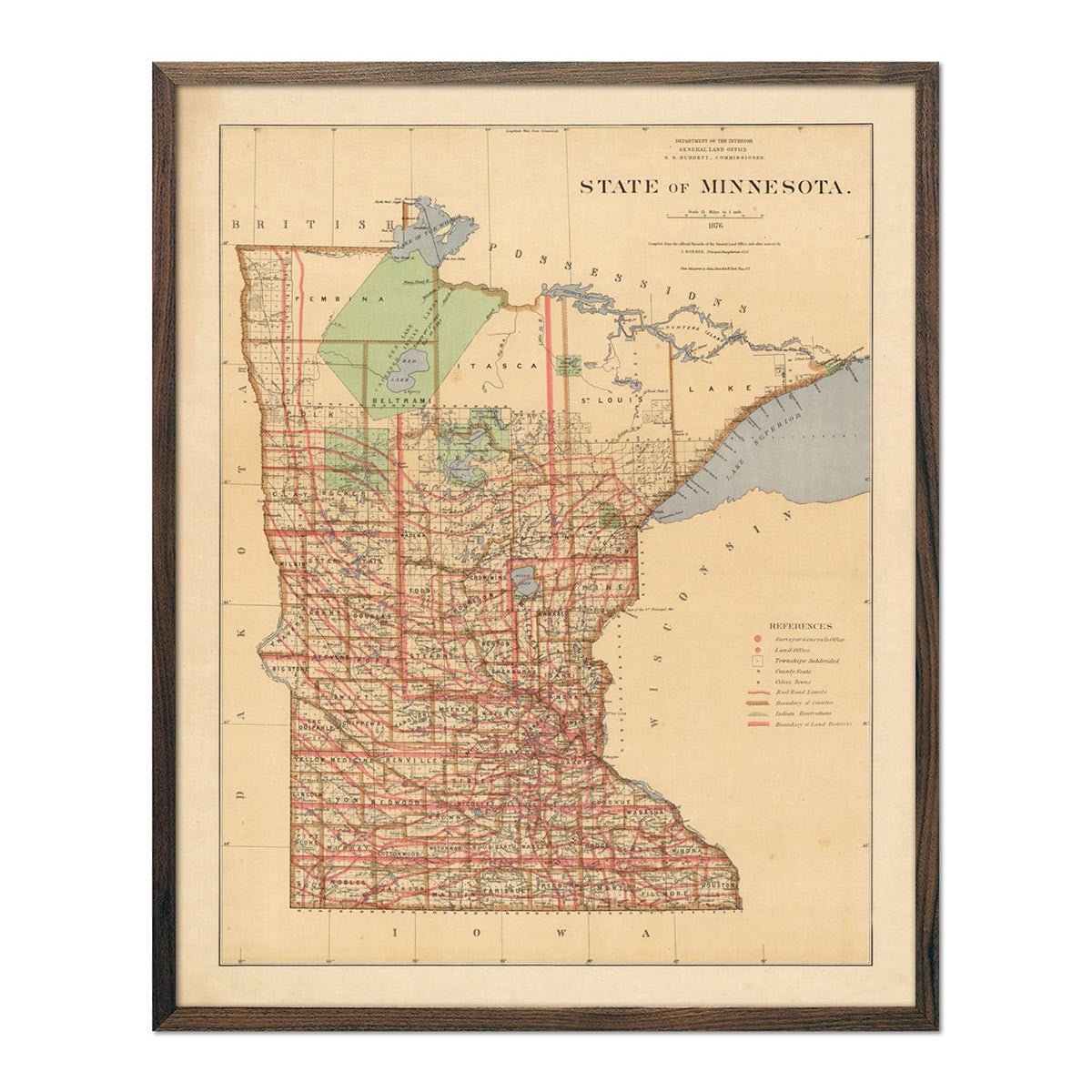
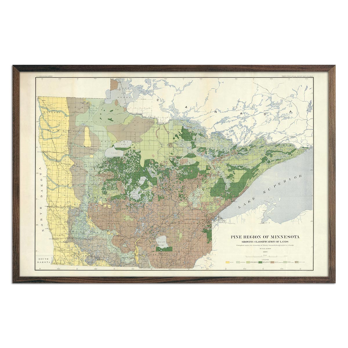
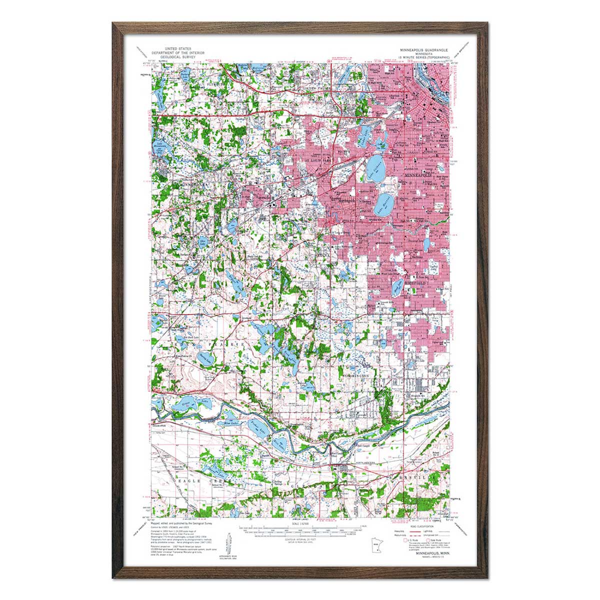
Vintage maps of Minnesota - If you like vintage maps, you’ll love our beautifully restored 1883 railroad and county Minnesota state map, 1876 state map of Minnesota, and 1954 vintage map of Minneapolis. Unlike our relief map series, our historical maps are enhanced only in the way that they’ve been ‘cleaned up’ while still preserving their vintage charm, as opposed to having a three-dimensional effect. Our vintage maps are reproduction prints, carefully restored to maintain their vintage appeal without the wear & tear, and come custom printed using archival materials to preserve a snapshot of history for years to come.
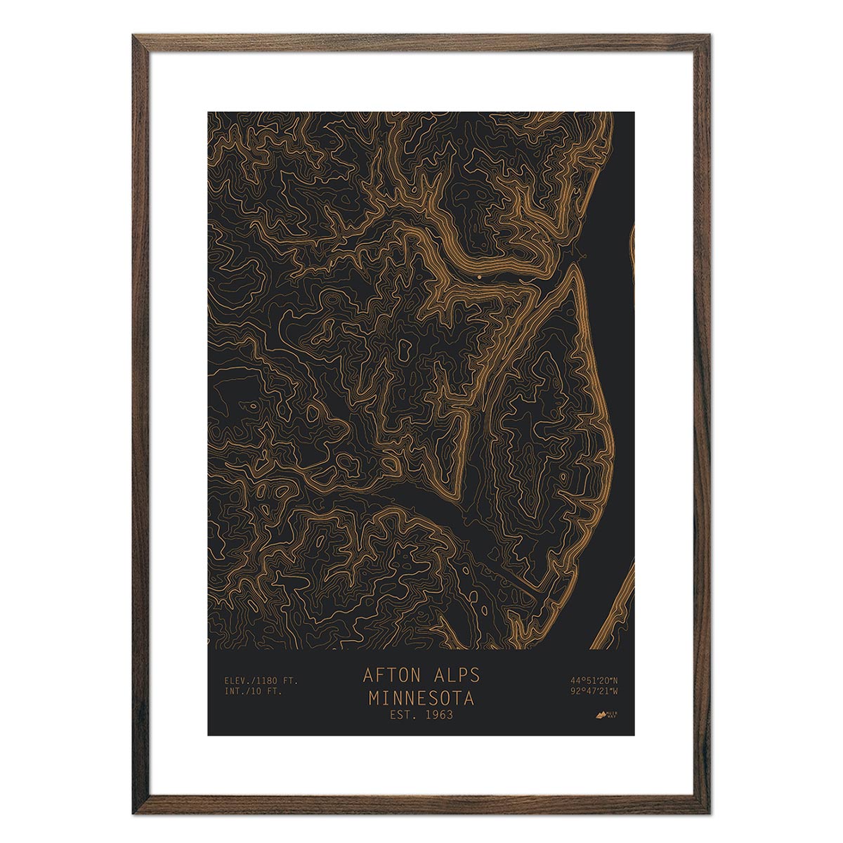
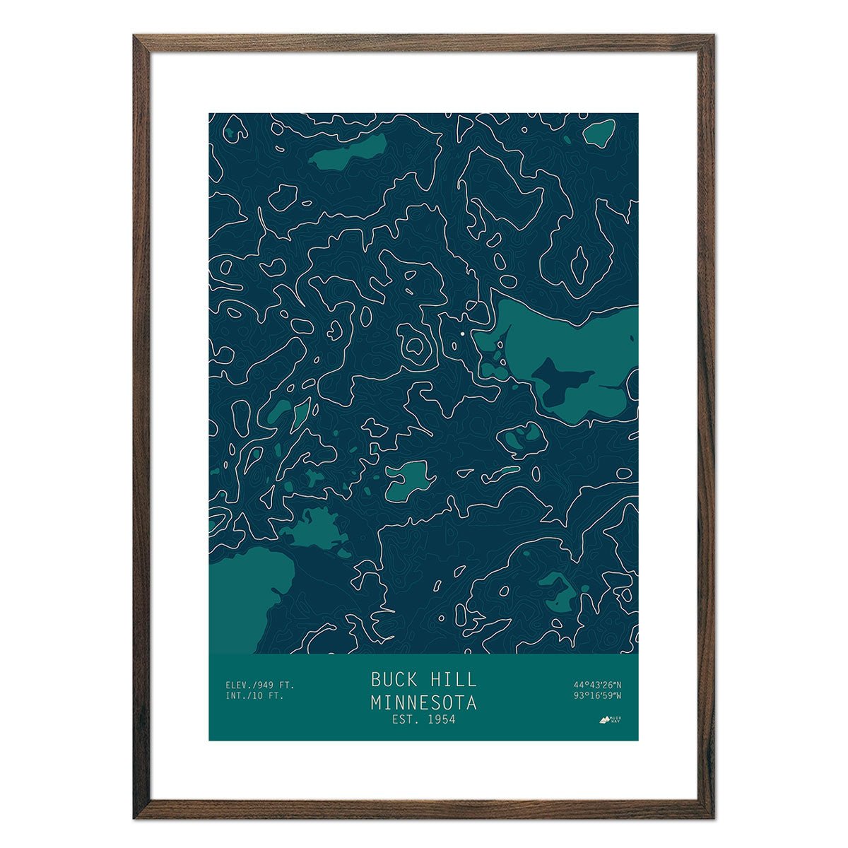
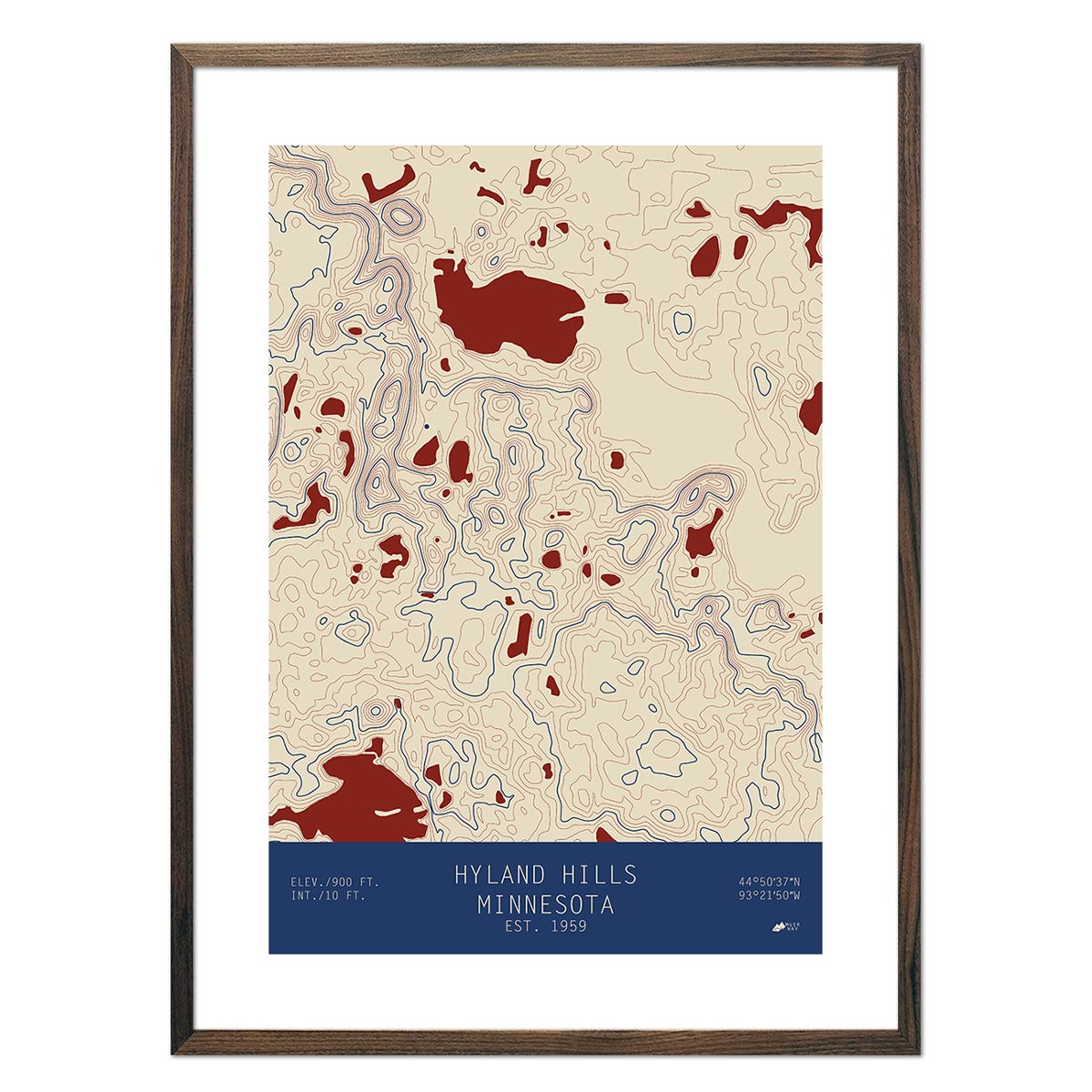
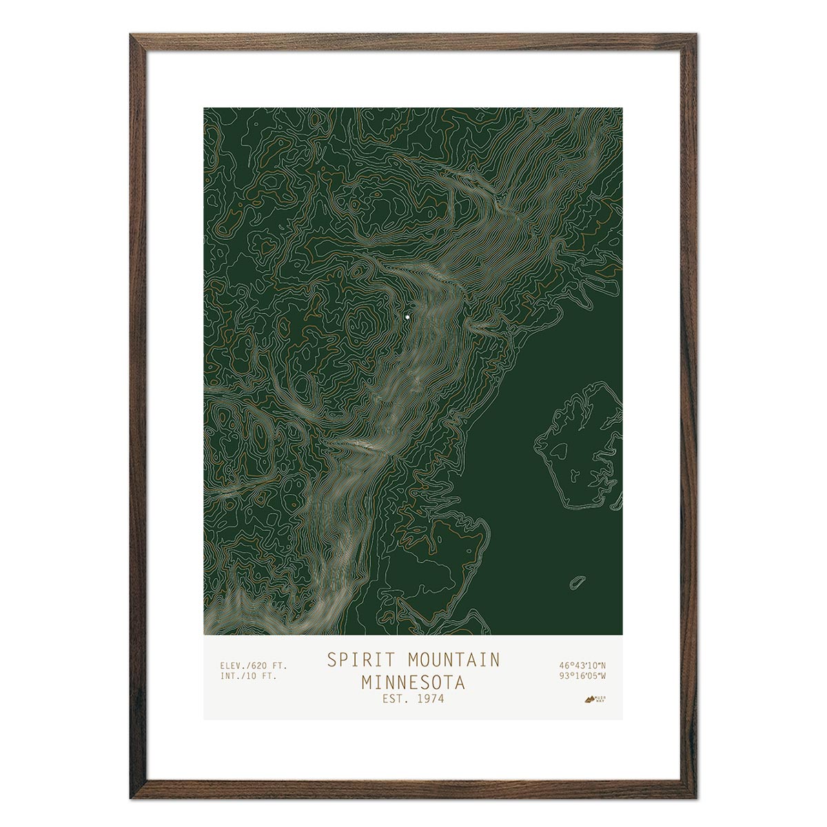
Minnesota topographical maps - We also offer clean and sophisticated topographical maps of Minnesota, including locations like Afton Alps, Buck Hill, Hyland Hills, and Spirit Mountain.
What are some prominent features on the map of Minnesota?
Minnesota covers an area of 86,943 sq. km. Minnesota on the US map makes up around 2.25 percent of the country and is the 12th largest state. This state was covered by glaciers during the Ice Age.
When the ice melted, it created a very unique landscape. It also contributed to Minnesota's nickname of the land of 10,000 lakes.
On a map of Minnesota, you will find rolling hills and plains. However, you will also find thousands of freshwater lakes, an unbelievable number of small streams, and many rivers. The Minnesota hydrological map showcases the connections of the unique rivers, streams, and lakes.
In addition to hills, plains, and lots of water, you will also find mountains in Minnesota. The Mesabi Range and the Misquah hills can be found in Minnesota. The highest point in Minnesota is in Cook County. Eagle Mountain has a peak of 2,301 feet.
What are the regions in Minnesota?
Minnesota has four geographical regions:
- Superior Upland - This region consists of most of the northern half of the state from the north-central region to the shores of Lake Superior. It is a popular vacation destination and also home to Eagle Mountain.
- Young Drifts Plain - Covering most of the southern and central parts of Minnesota, the Young Drifts Plain is the most populous part of the state and includes Minneapolis and St. Paul.
- Dissected Till Plains - This region is in the southwestern corner of Minnesota and is a popular farming region.
- Driftless Area - Located in the southeastern part of Minnesota, you will find many historic towns and the Mayo Clinic in Rochester. The Driftless Area has many valleys created by fast-flowing rivers and streams and is next to the Mississippi River.
If you like our collection of Minnesota maps, you may also be interested in maps of other Midwest states. Click below to browse:
