


Nebraska Map Prints, Hydrological & Elevation Maps
Whether you’re from Nebraska, like to visit there with family, or the Tree Planters’ State holds a special place in your heart, our custom printed Nebraska wall maps bring the heart of the American Midwest to any home or office. From our eye-catching “jump off the page” elevation maps and geological relief maps to our vintage charm of our restored historical maps, every Nebraska map we offer reflects the high quality and attention to detail our customers have come to love and expect from Muir Way.
What makes Muir Way maps of Nebraska unique?
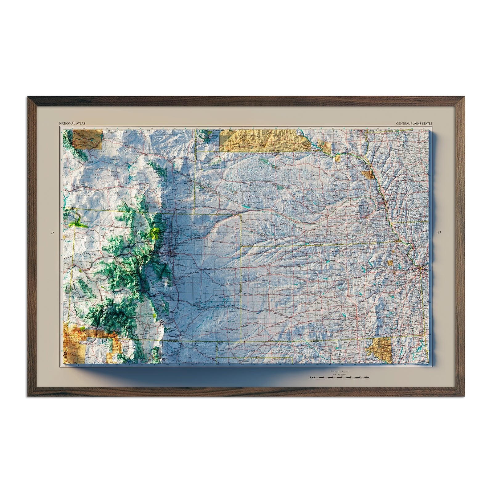
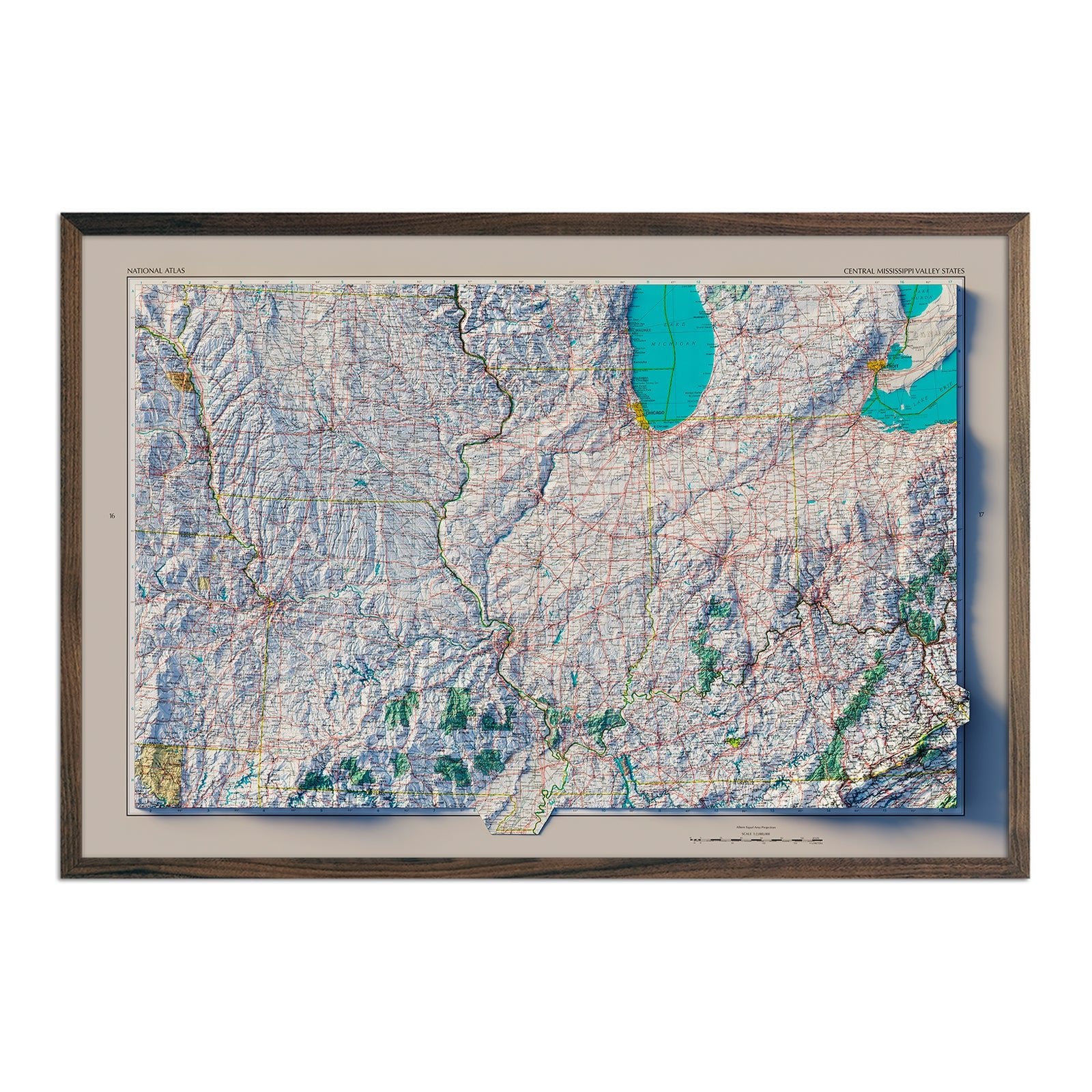
When you purchase a Muir Way Nebraska wall map, you’re purchasing a work of art designed and crafted to last for generations. In addition to custom printing every Nebraska map using archival inks and fine art paper certified to last 100 years, our artwork transforms traditional map imagery in a new and exciting way. For example, our elevation maps incorporate hand-shaded relief and Digital Elevation Data with historical map terrain for a three dimensional effect on a flat surface, and our hydrological maps allow viewers to trace every body of water in the state greater than 0.2 miles in diameter. The meticulous detail and craftsmanship we bring to our maps creates heirloom quality pieces to stand the test of time.
Can I get my Nebraska map framed?
Yes! Many of our Nebraska maps can be printed on either fine art paper or beautiful gallery-wrapped canvas, and all are available unframed or professionally custom-framed with real wood. If you’d like to purchase your Nebraska map framed, you can choose from several different colors and wood finishes to perfectly match your décor. All of our maps come in standard sizes for easy gift giving and framing if you choose to frame your map yourself.
Is a Muir Way map of Nebraska a good gift idea?
One reason our customers love our maps is because it enables them to give the perfect gift to that “person who has everything”. Our custom-printed Nebraska maps are a perfect gift for a loved one from Nebraska who no longer lives there, or a college graduate about to leave home for the first time. In addition to standard gift-giving occasions like holidays and birthdays, our maps also make excellent retirement gifts, going-away presents, wedding gifts, or corporate gifts for colleagues and clients alike.
How should I display my Nebraska map?
You should hang your Nebraska state map in a place that will bring you joy. This might be above a mantel or sofa as a main focal point in your living room, or behind your desk in an office. Hang one large wall map or several related maps in a series. These high-quality, eye-catching maps work in a living room, office, bedroom, hallway, or study. We have maps to suit every décor, from the bright colors of our relief maps to classy black and white in our elevation maps, to the bold and clean lines of our topographical and national park maps. No matter which Nebraska map you choose, you’re sure to find a map that will look right at home on any wall of your home or office.
What are the different types of maps of Nebraska available on Muir Way?
Our Nebraska maps are available in several different styles, including:
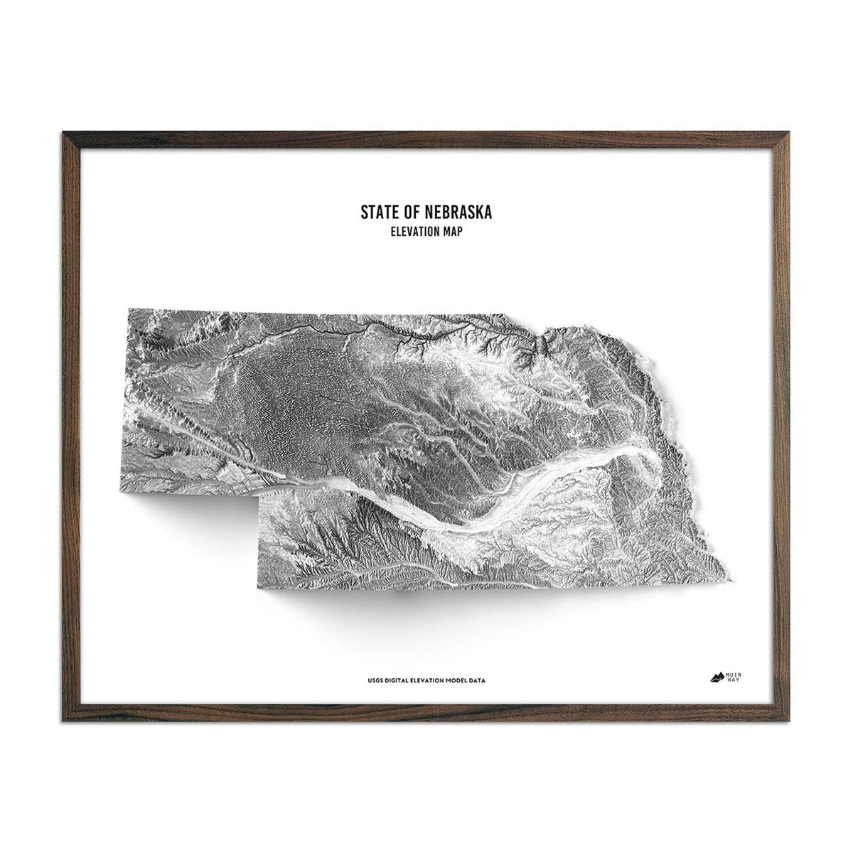
Nebraska elevation maps - Our state of Nebraska elevation map uses Digital Elevation Data from the USGS to create a high-contrast 3-dimensional effect in stunning black and white, providing crisp detail and a refreshing view of Nebraska’s native landscape.
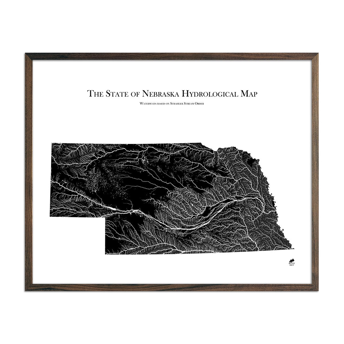
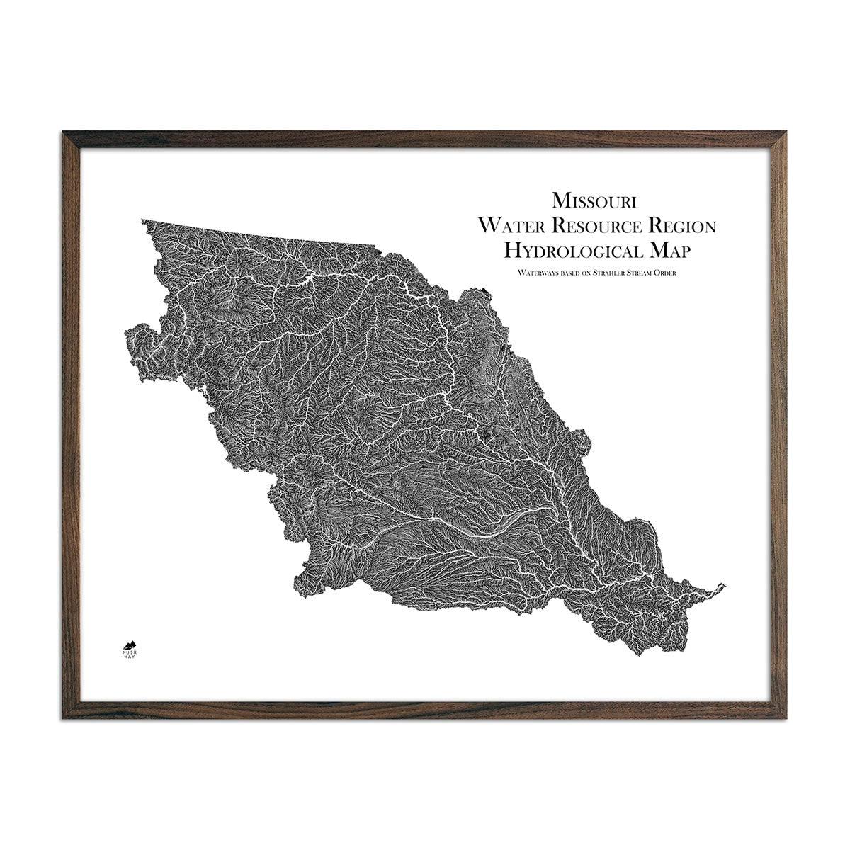
Nebraska hydrological maps - Our hydrological maps are designed to look beautiful from across a room and to deliver meticulous detail up close, and are available in multiple colors. Whether following the interconnected trails of water on our Nebraska hydrological map or our Missouri regional hydrological map, you’ll be able to view every single river and intermittent stream, as well as all bodies of water greater than 0.2 mi in diameter. For extra clarity, we apply a method called the Strahler Stream Order to show the hierarchy of streams as they flow from their source. Rivers are shown thicker as they acquire tributaries, making it easier to trace water from its source throughout the state.
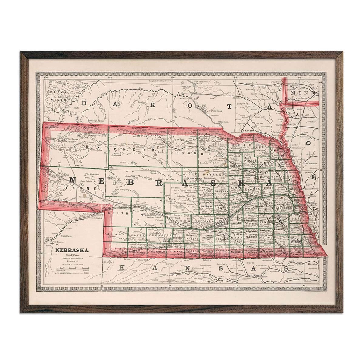
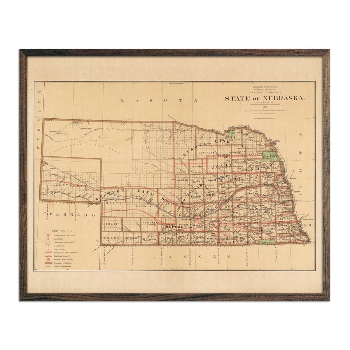
Enhanced vintage Nebraska maps - If you like the charm of old maps, you’ll love our enhanced vintage maps of Nebraska. Our vintage maps are different from our elevation and relief maps in that they are not designed to look three dimensional. They’re reproduction prints of real vintage maps, carefully restored to maintain their charm without the wear & tear. As with all Muir Way maps, our historical Nebraska maps come custom printed using archival materials to preserve a snapshot of history for years to come. View our Nebraska State 1876 map and our 1883 vintage Nebraska map, originally published in Cram’s Unrivaled Family Atlas of the World.
What are some prominent features on the map of Nebraska?
Our elevation and relief maps of Nebraska show Nebraska’s terrain in crisp detail, from the sweeping flatlands of the Dissected Till Plains to the hilly region of Loess in the Great Plains.
Home to prominent waterways such as the Missouri River and Lewis and Clark Lake, Nebraska’s bodies of water are on full display with our hydrological maps.
With prominent land formations such as the Central Mixed-grass Prairie, Central Shortgrass Prairie, and the West River area, you’ll enjoy an up-close look at sloping valleys, even canyons and bluffs in a state known for its agriculture and striking rock formations.
What are the regions in Nebraska?
Nebraska has two separate ecoregions (geographical regions with similar biotic and abiotic features):
- Dissected Till Plains - This region in the eastern part of Nebraska spreads across much of Iowa, northwestern Missouri and even small parts of other states like Illinois, Minnesota and Kansas. The Dissected Till plains feature flat and rolling terrain that gently slopes toward the Mississippi and Missouri River Valleys. This region is home to a lot of farm country producing crops such as corn, soybeans, sorghum and more.
- Great Plains - Situated to the west of the Dissected Till Plains, the Great Plains region extends into Wyoming and Colorado. It contains a mix of flatlands, hills, and lakes and wetlands, and the Loess area (approx. 7,000 square miles) is used for farming.
If you like our collection of Nebraska maps, you may also be interested in maps of other Midwest states. Click below to browse:
