Great product,,,,efficient transaction,,,,great communication.
Great product,,,,efficient transaction,,,,great communication
| Map Quality & Detail |
Rated 5 out of 5
|
|---|---|
| Shipping & Customer Service |
Rated 5 out of 5
|
Currently 10 people are looking at this product
Real 3D Raised Relief Map
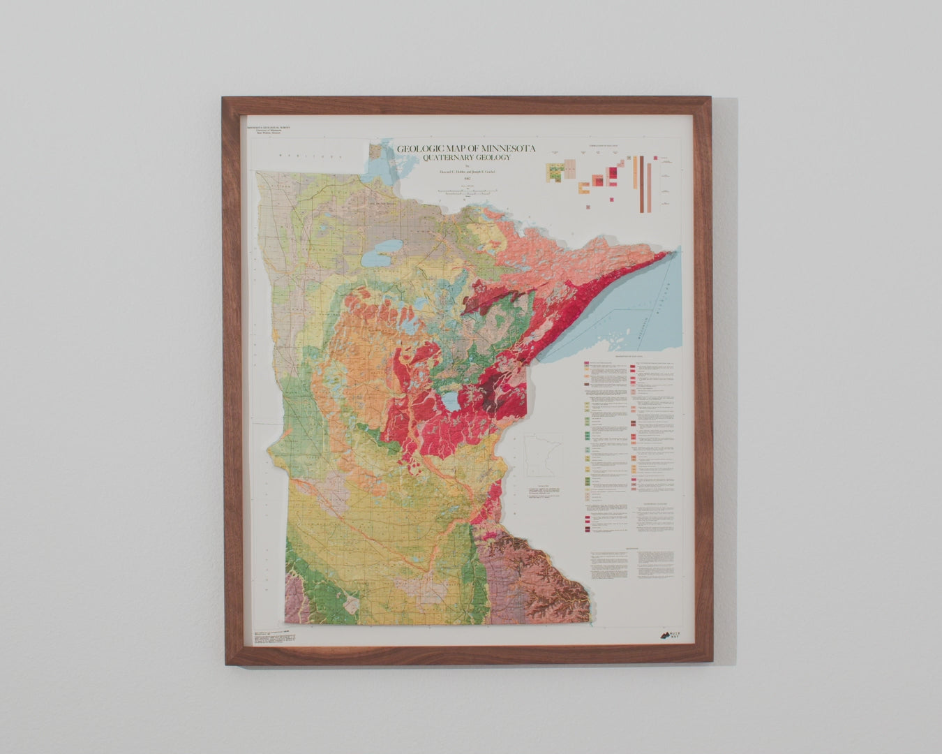
Minnesota's Mesabi Iron Range takes its name from an Ojibwe word for "Big Man Mountain," and it has shaped the state's economy since prospectors discovered a major hematite deposit near Mountain Iron in 1890. The ore that followed helped build U.S. Steel, the world's first billion-dollar corporation, and when the richest natural ore ran low after World War II, Minnesota engineer Dr. Edward W. Davis pioneered a new process for extracting iron from taconite rock — an innovation voters backed decisively, approving the 1964 Taconite Amendment with 86 percent support and keeping the Range at work for generations. This 1982 map traces that landscape, now rendered in true three-dimensional relief.
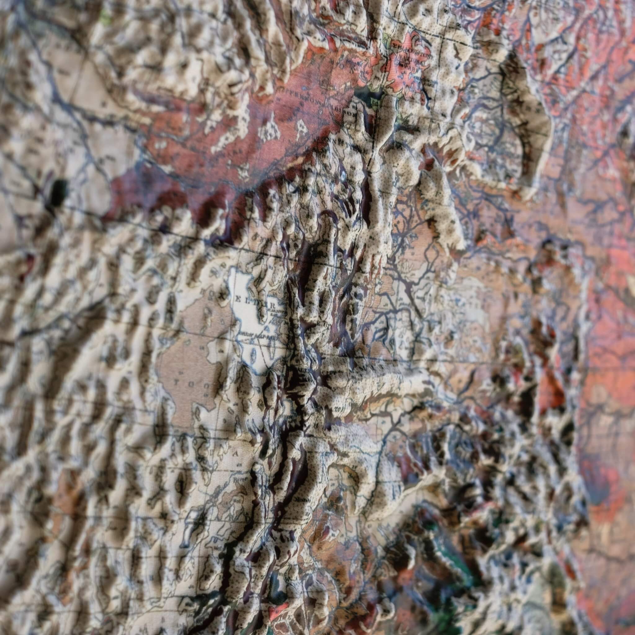
To create this piece, the original historical map is printed in full color, then heated and vacuum-formed over a precisely sculpted three-dimensional mold. That mold is built from modern digital elevation data, so every rise and ridge of the Range you see is genuine raised, textured topography — not a flat illustration, but terrain you can actually feel.
Our framed maps have no glass or acrylic covering them, so you're free to reach out and touch the map, tracing the terrain and exploring its intricacies with your fingertips.
For the flat, framed fine-art-print version of this map, click here.
PLEASE NOTE: You will love this map if you embrace its anomalies. When the plastic is heated and stretched over the 3D mold, the image may be altered, causing warped lines and text around higher elevations. The fine print on plastic is not as sharp as on paper, sometimes rendering very small text illegible.
- Size - unframed 28x24 inches
- Size - framed 29x25 inches
- Material - plastic mounted on foamboard
- Handmade real Walnut frame available
- Individually made in our San Diego, CA shop

FREE SHIPPING within the contiguous US
Shipping times - not including transit:
- Unframed maps - 3-5 business days
- Made-to-order framed maps - 3-4 weeks
RETURN POLICY
We accept returns within 30 days of purchasing your unframed map. There are NO restocking fees but return shipping costs are at the customer's expense. Returned maps must be in new condition with no visible marks or damage. Please email us at [email protected] with your order # to receive detailed instructions. Unauthorized returns may not be accepted and do not guarantee a refund.
If prints are shipped back to us and are not in new condition, we offer a store credit or can return them to you.
*Framed Prints – We do not accept returns or exchanges on framed prints because they are custom-made to order. If your order arrives damaged or wrong, please email us at [email protected] so we can correct it for you. We will require pictures of the damaged print and the shipping container it arrived in.
Each frame is handmade by a local craftsman.
- Real Walnut hardwood (not veneer)
- Frames vary in color and grain
- 7/8" face x 1" deep
- Finished back – paper dust cover, rubber bumpers, and hanging wire
- No acrylic or glass on front
Vacuum-formed over a precision 3D mold, real raised terrain
Every ridge, valley, and peak is actually there. You feel it, not just see it.
Molds cut from NASA elevation data for accurate topography
Precise data used to create the most detailed raised relief maps available.
No glass, no acrylic, every map is made to be touched
Run your fingers across the Rockies or trace the Appalachians. The map wants to be touched.

Highly formable plastic mounted onto foam core
Vacuum-formed to replicate every ridge and valley, mounted on foam core for rigidity and easy framing.
Each map individually made in our San Diego, CA shop

Not printed and boxed at scale. Every relief is hand-formed by our small studio team.
USA-made materials, a portion of profits supports outdoor charities
Sierra Club, Leave No Trace, and Waterkeeper Alliance protect the places these maps depict.

Handmade from real walnut, no pressed wood, no veneer
Real hardwood grain, not a stained lookalike. Built by local craftsmen to last.
Open-face design with no glazing, so the terrain stays touchable
Nothing between you and the landscape. The frame protects without hiding.
Framing adds about one inch to each dimension
A slim profile that fits your wall, not a bulky box that dominates it.
The original map designs are of historical maps. We use scans of the old maps and georeference them with modern elevation data to align the raised terrain with the map. Then, we cut a detailed mold for the map. The maps get printed, heated, and vacuum formed onto the mold. We remove the newly formed map from the mold, cut it, and mount it onto matboard for a rigid raised relief map. The 3D maps we sell are only available by Muir Way.
No, we offer each map in a single size because they are vacuum formed to a particular 3D mold that takes approximately 40 hours to cut.
The maps are printed on a thick, highly formable plastic that is highly formable under extreme heat and mounted on foamboard.
For any reason, you can send back the print within 30 days of receiving it for a full refund. The print must be in new condition. We do not accept returns on framed prints. Please email [email protected] for return authorization.
Unframed maps ship out in 1-2 days and framed maps ship out in 2-3 weeks of ordering. Please also allow transit time from our shop in San Diego.

No, our frames do not have glass over the 3D prints so you can touch the protruding terrain. If you prefer glass, your local frame shop can make a deeper frame that will allow for the glass.

Ours are inspired by those older raised relief maps but our new versions are on another level of quality, precision, and craftsmanship.