


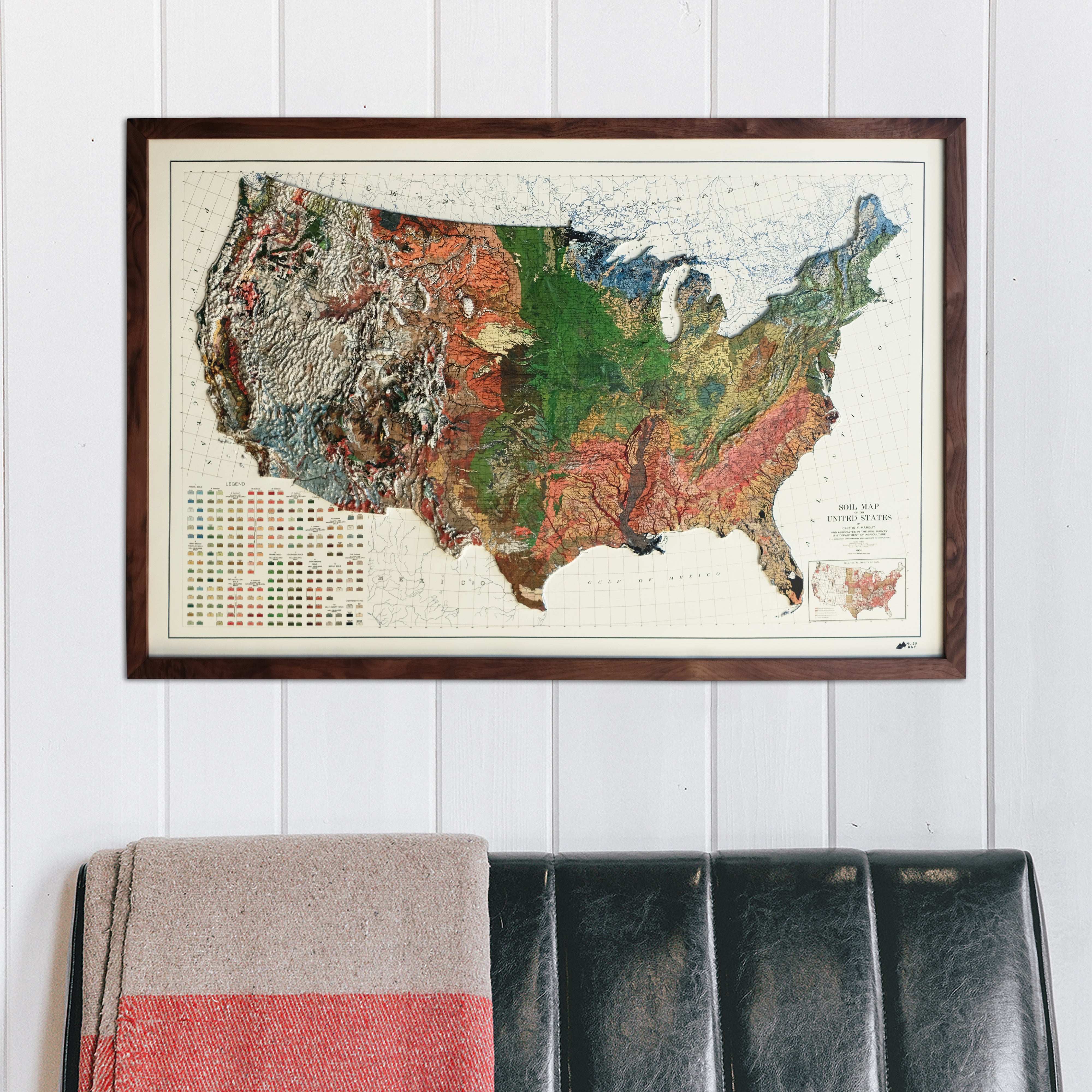
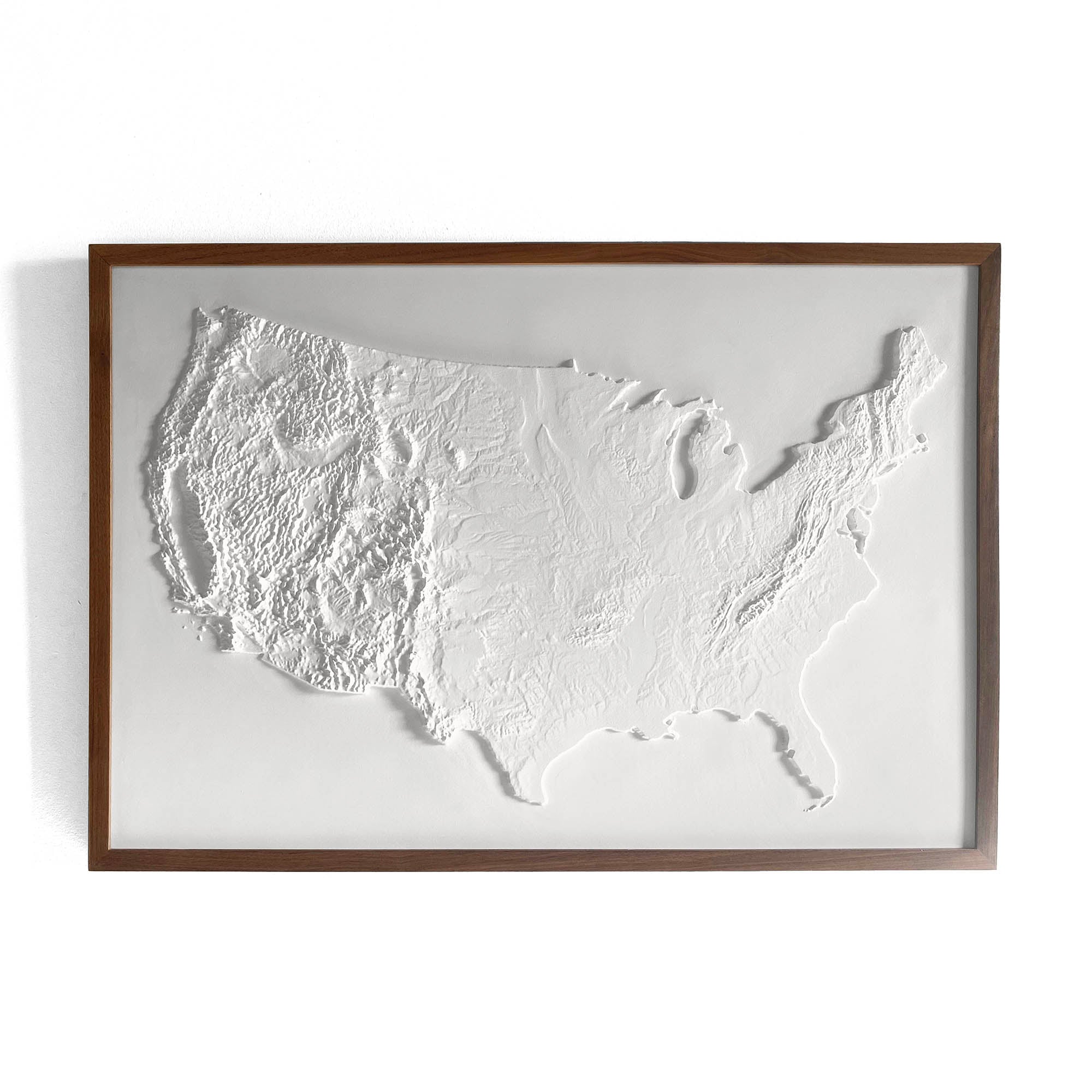
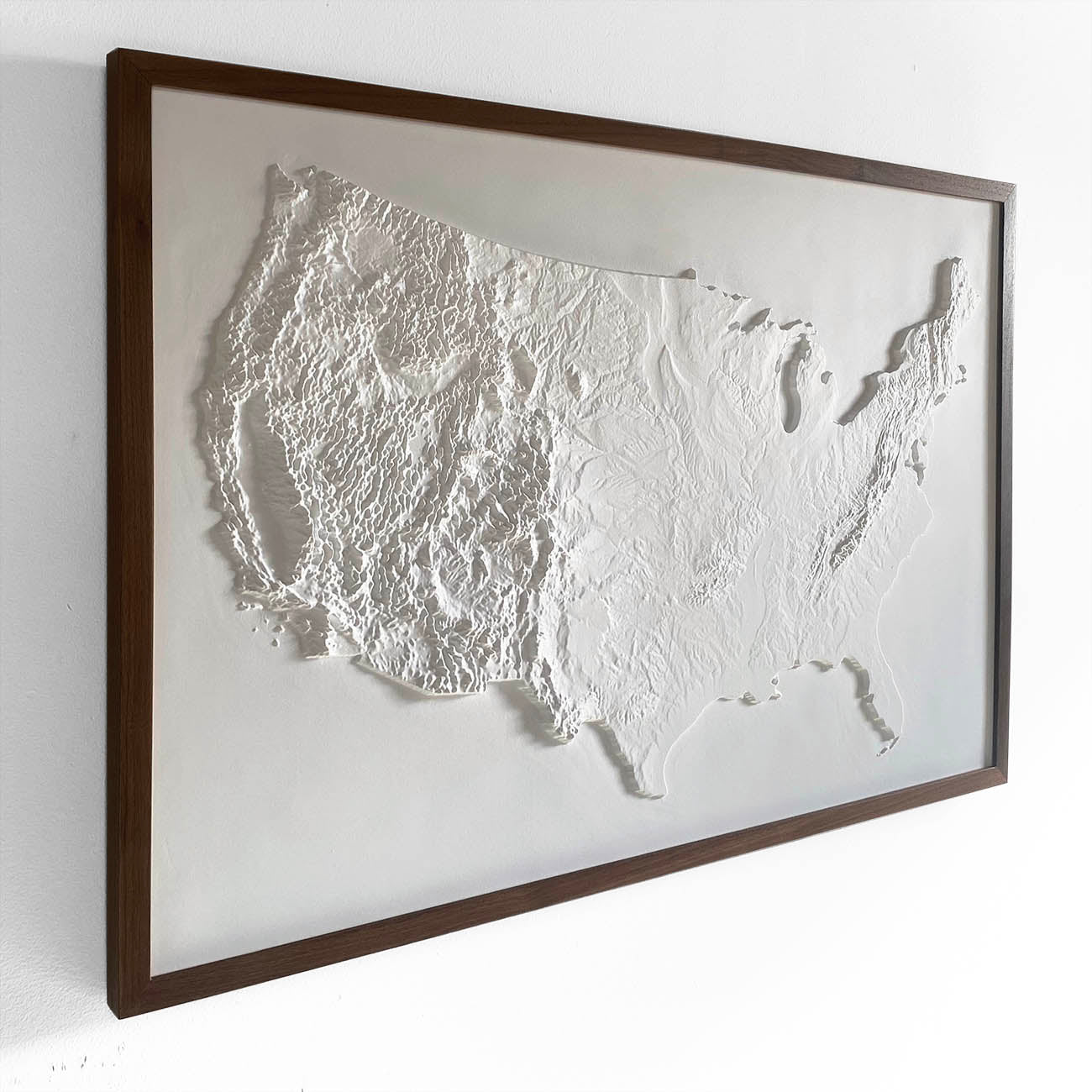
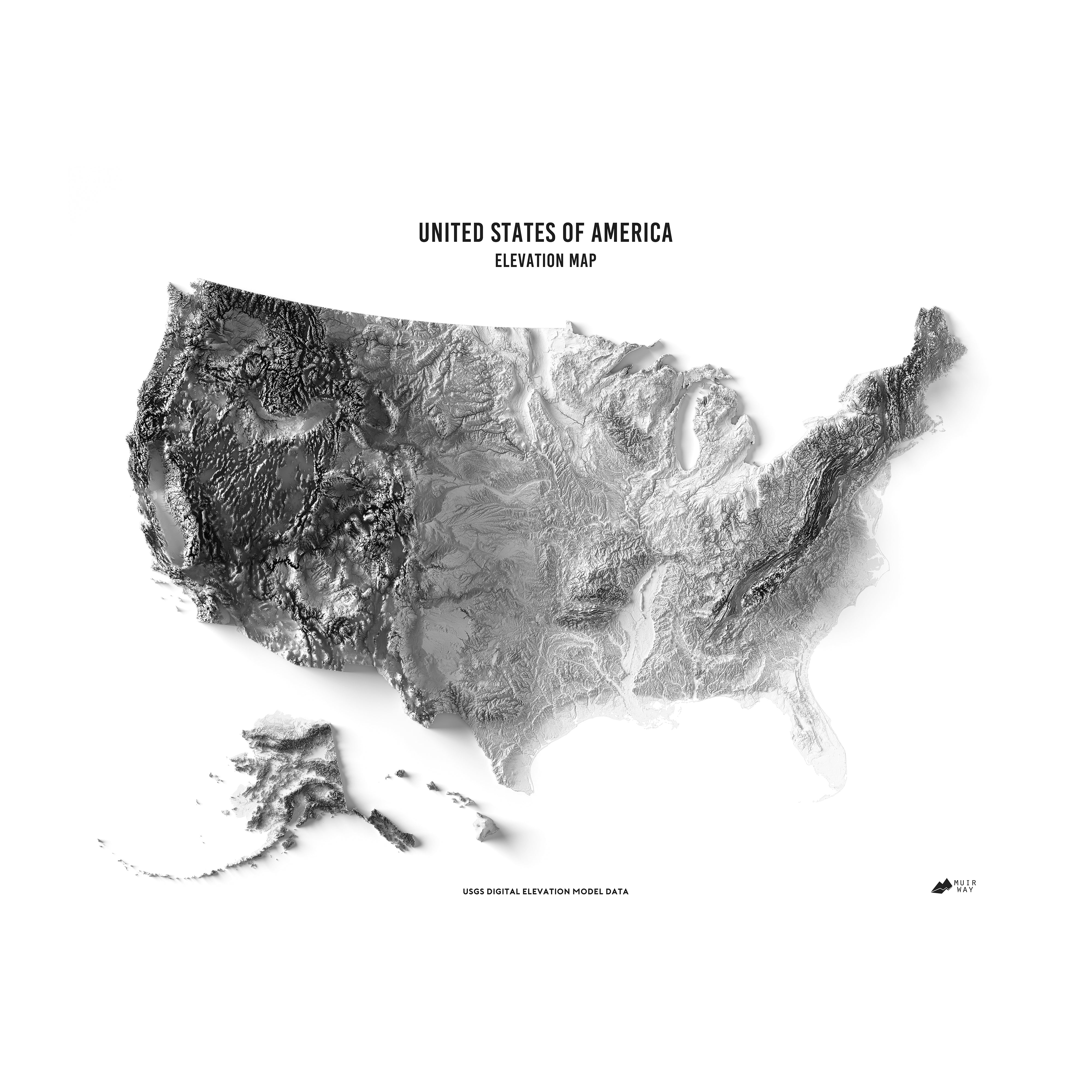
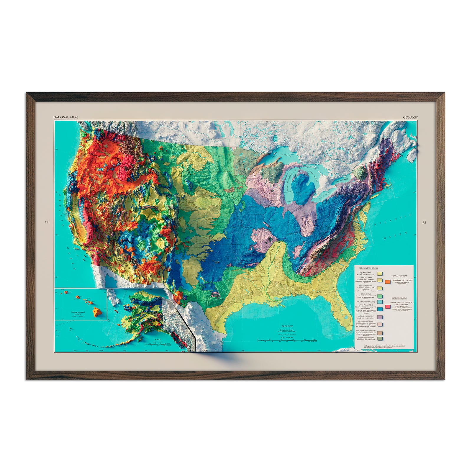
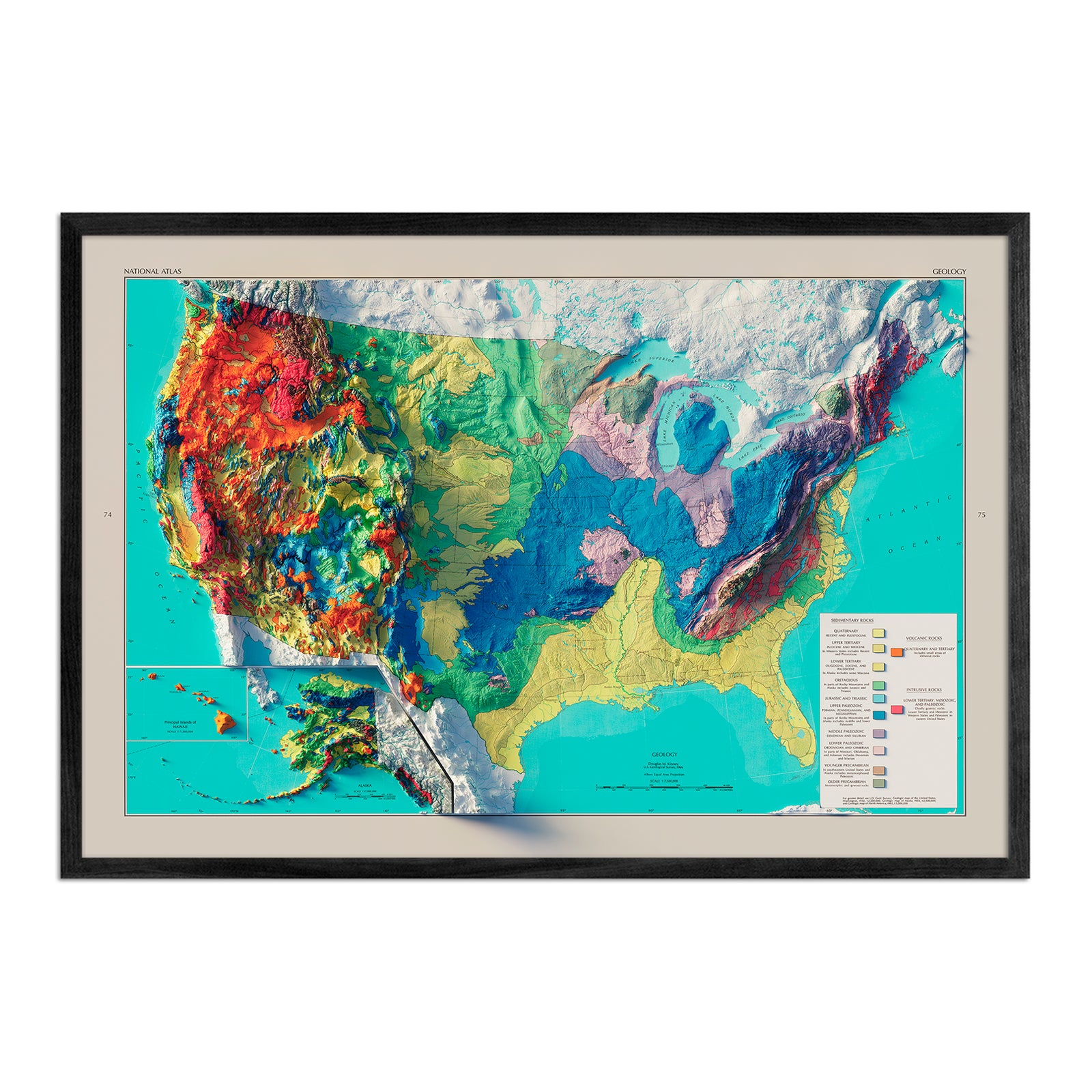
Maps of USA
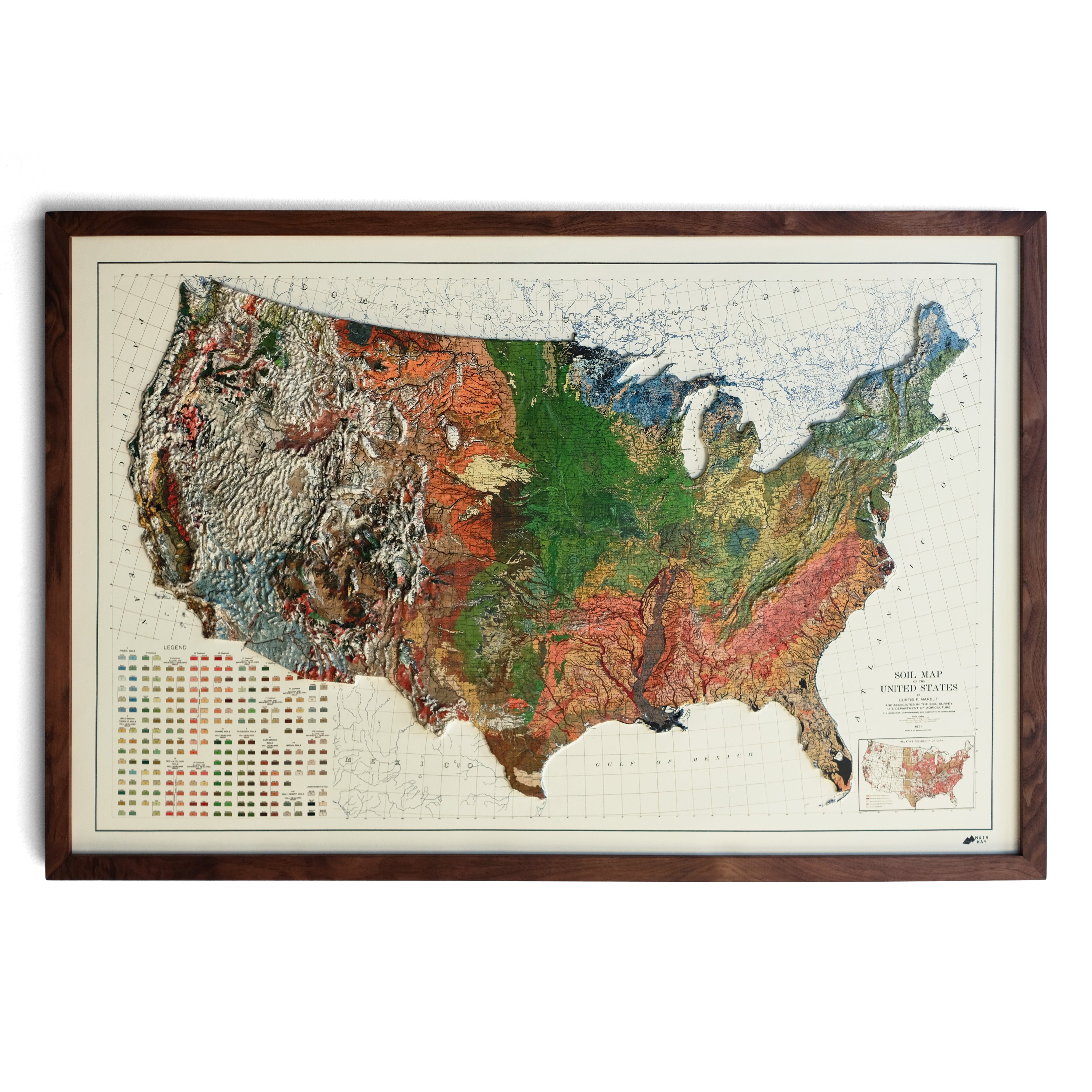
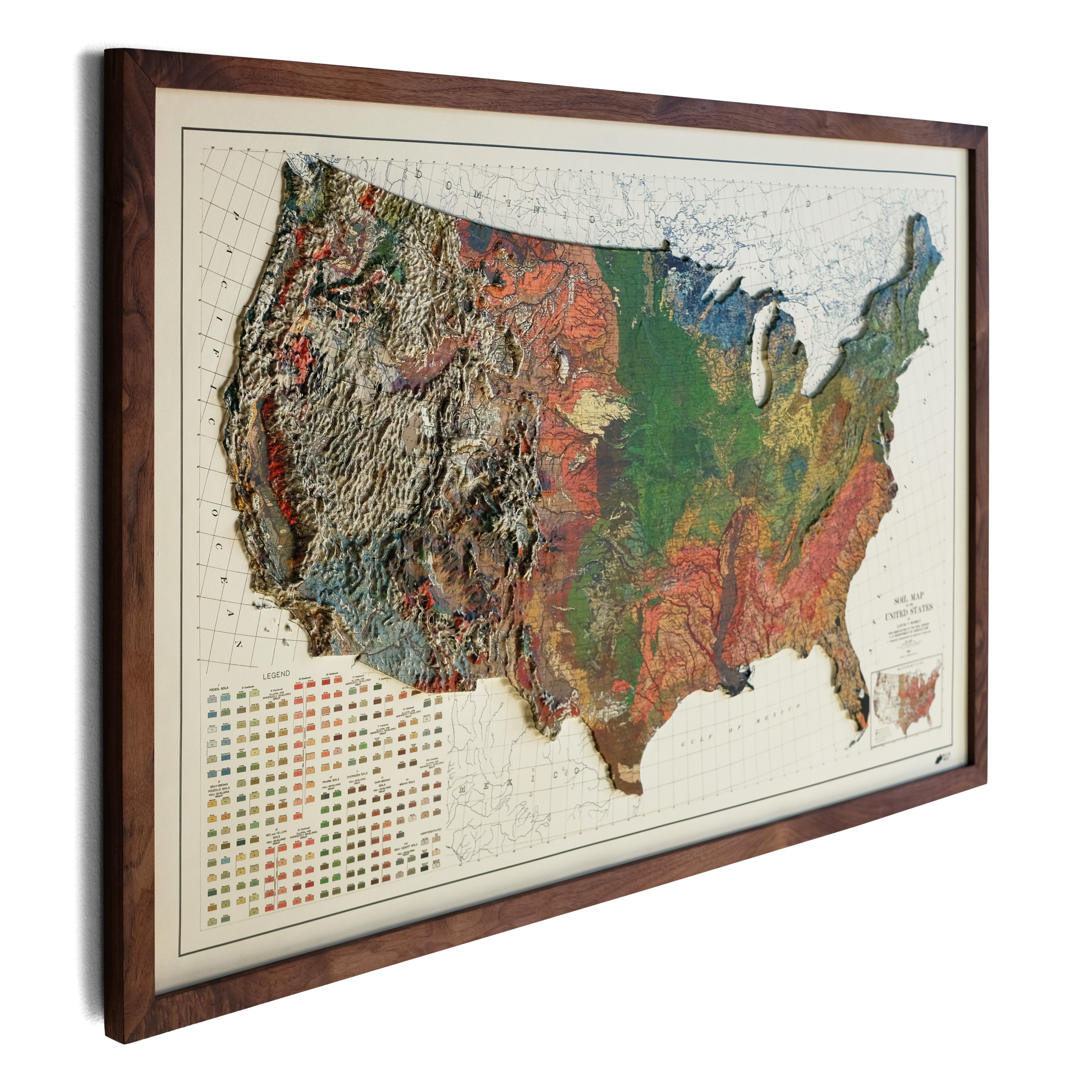


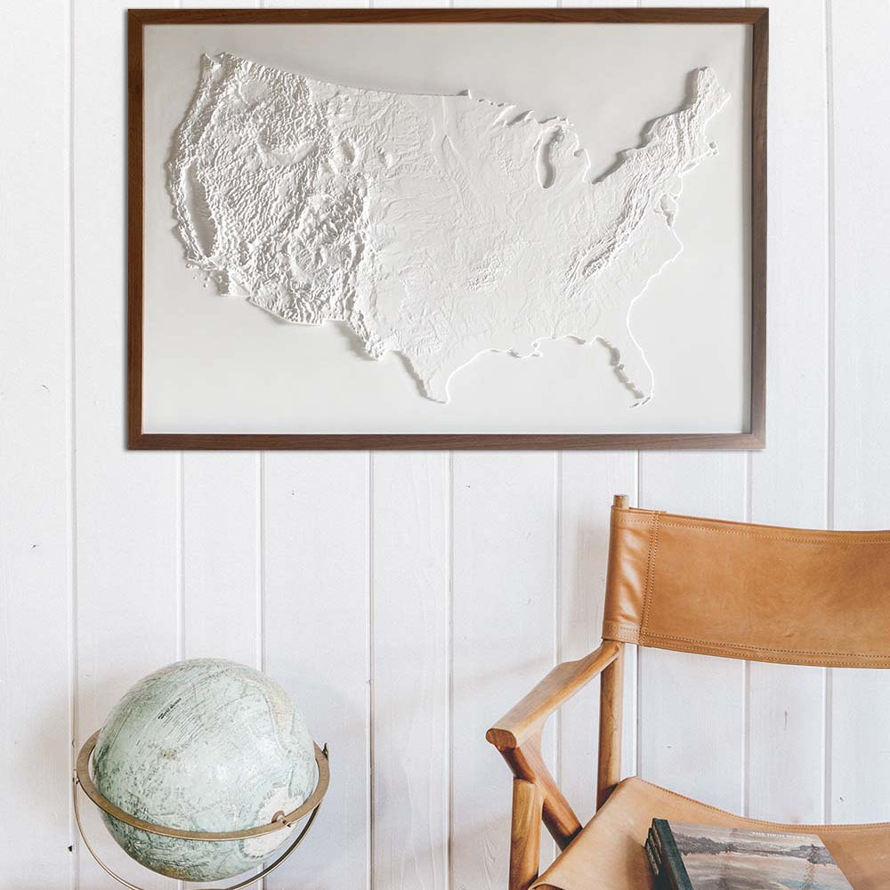
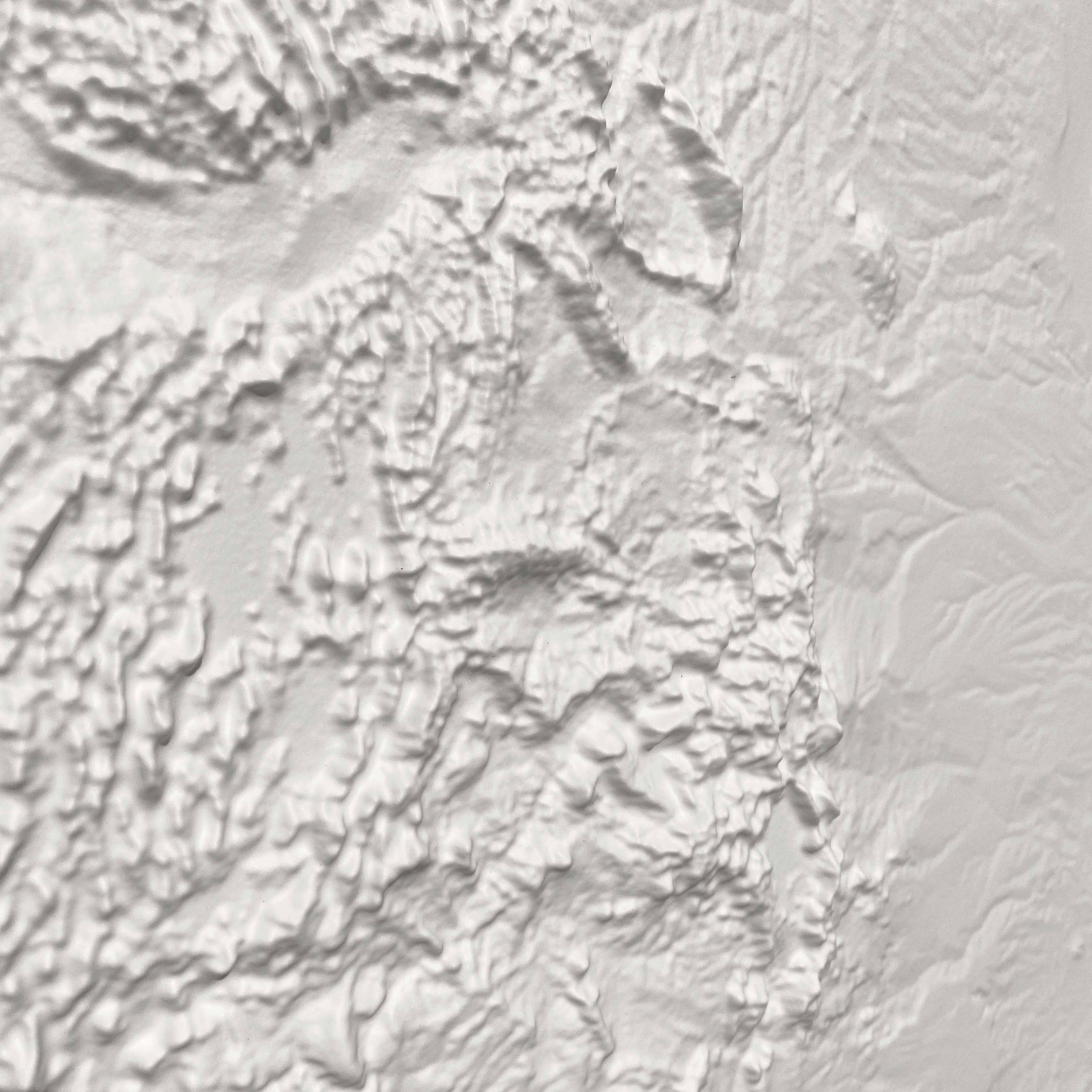

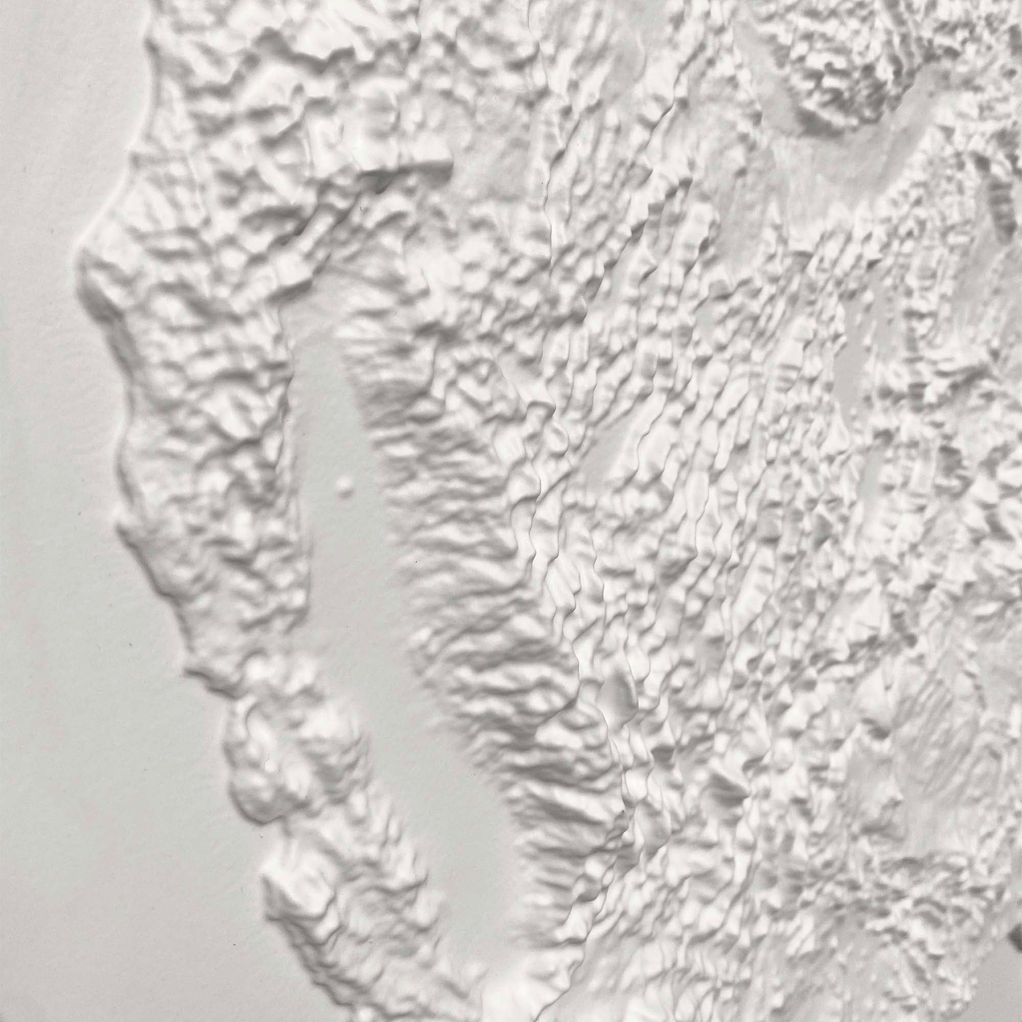
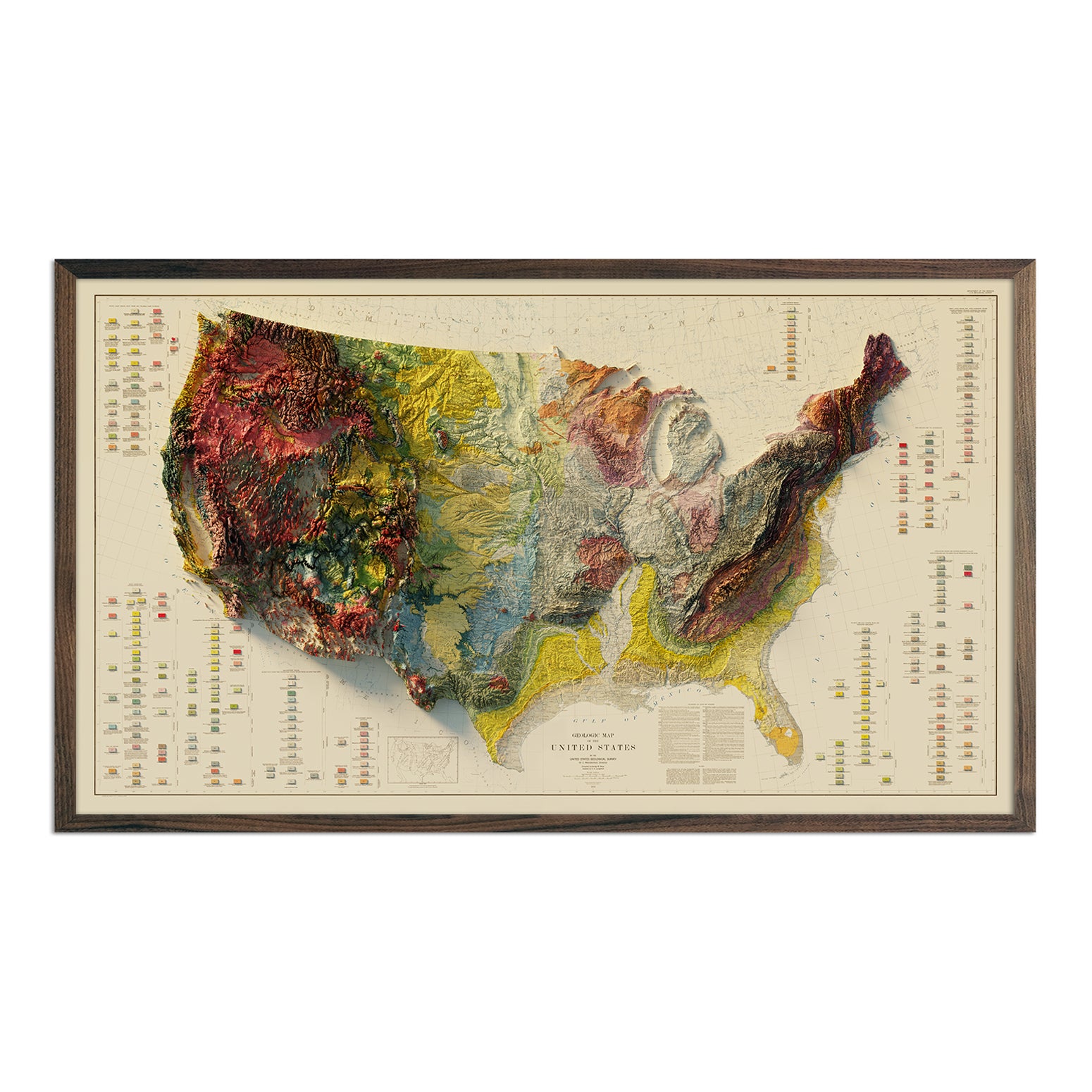

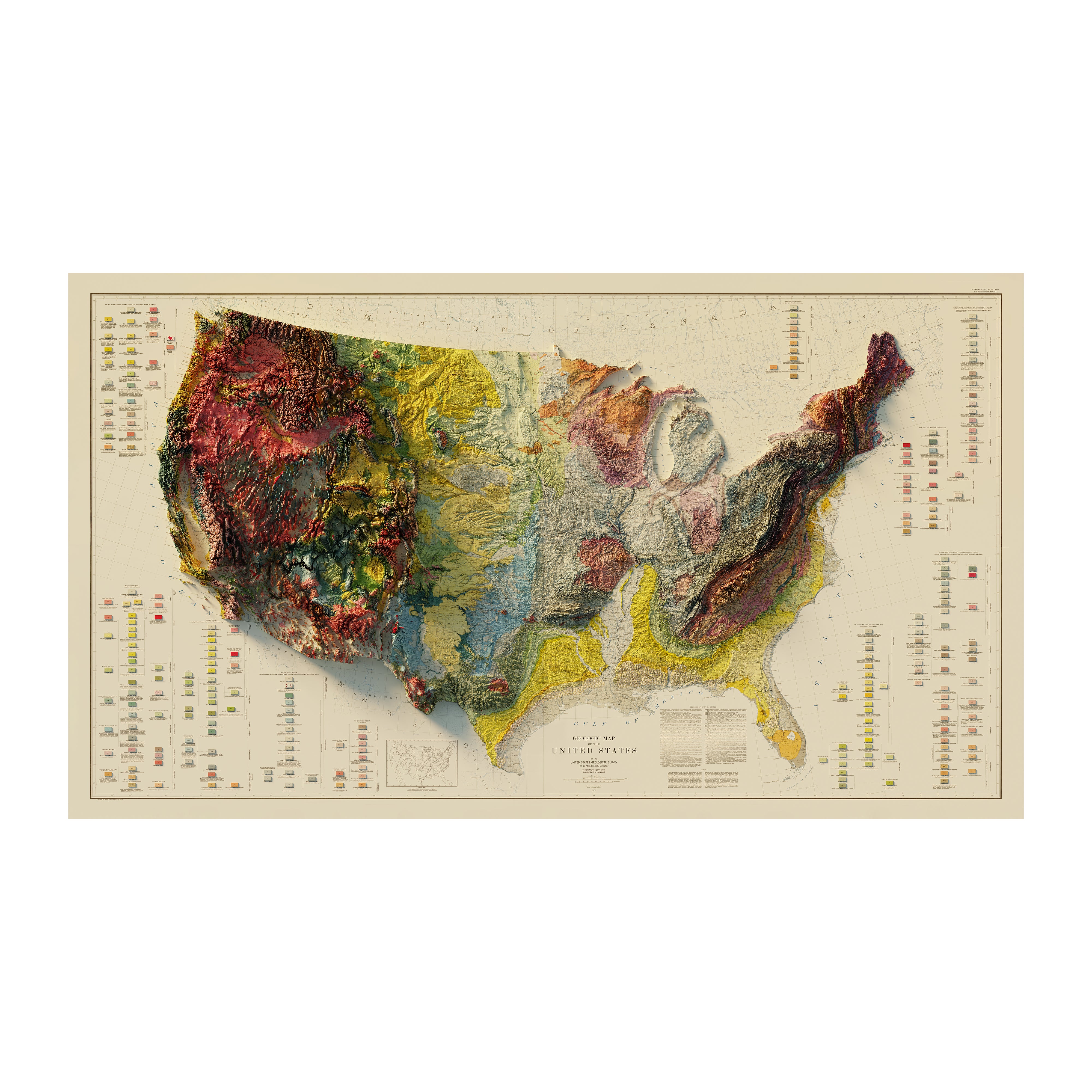
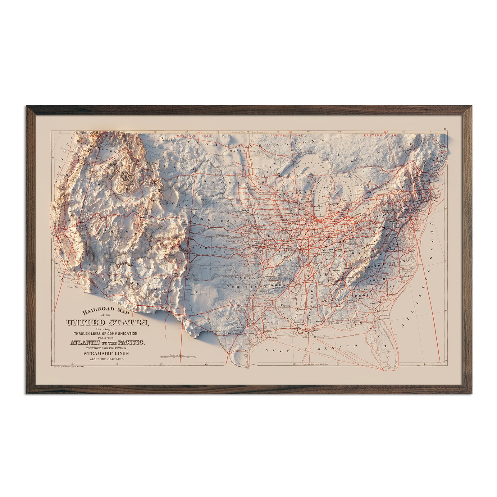

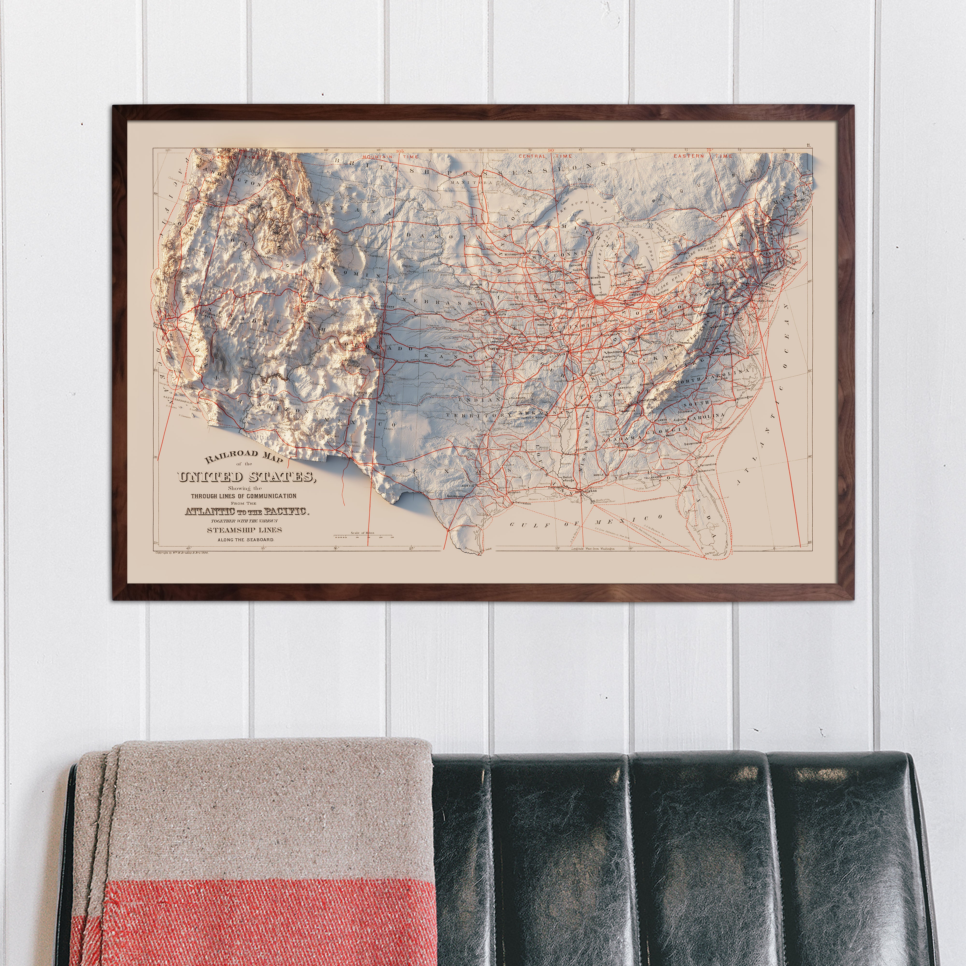
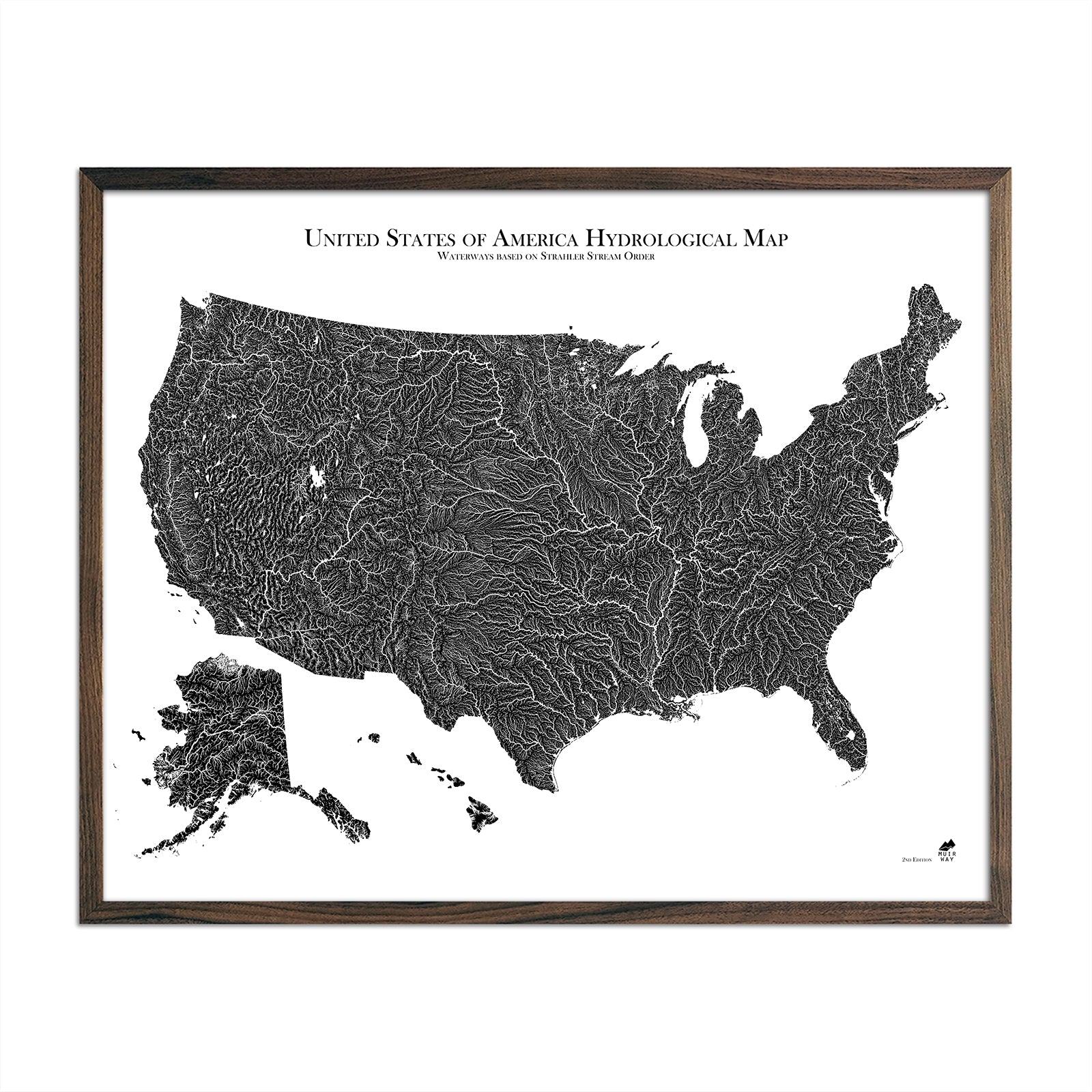

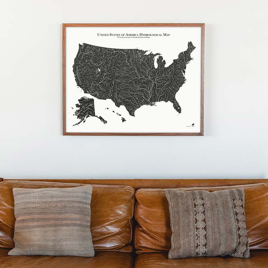
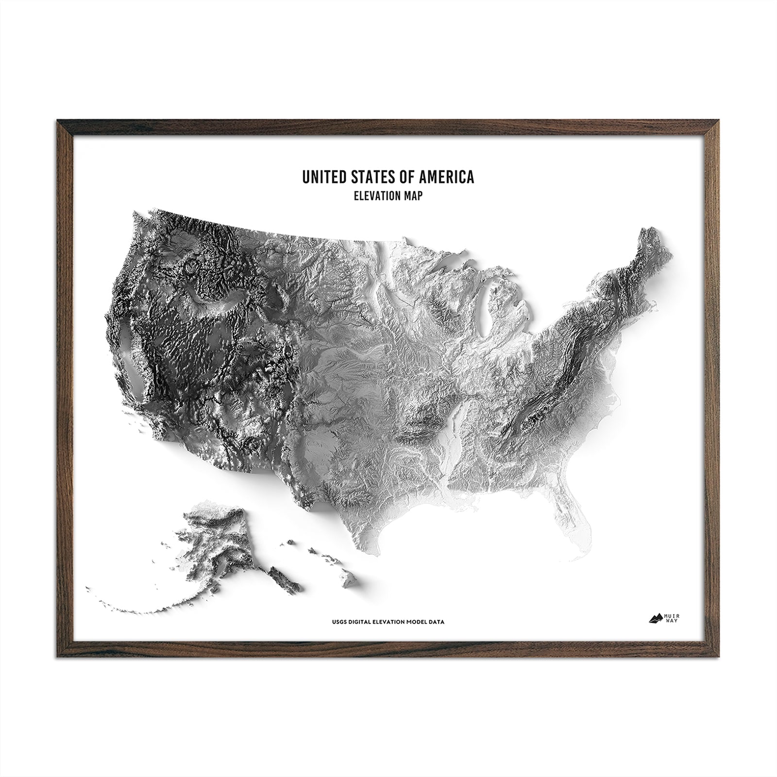
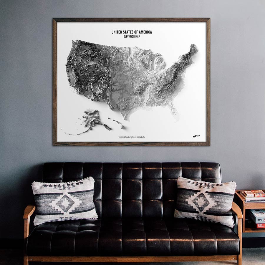
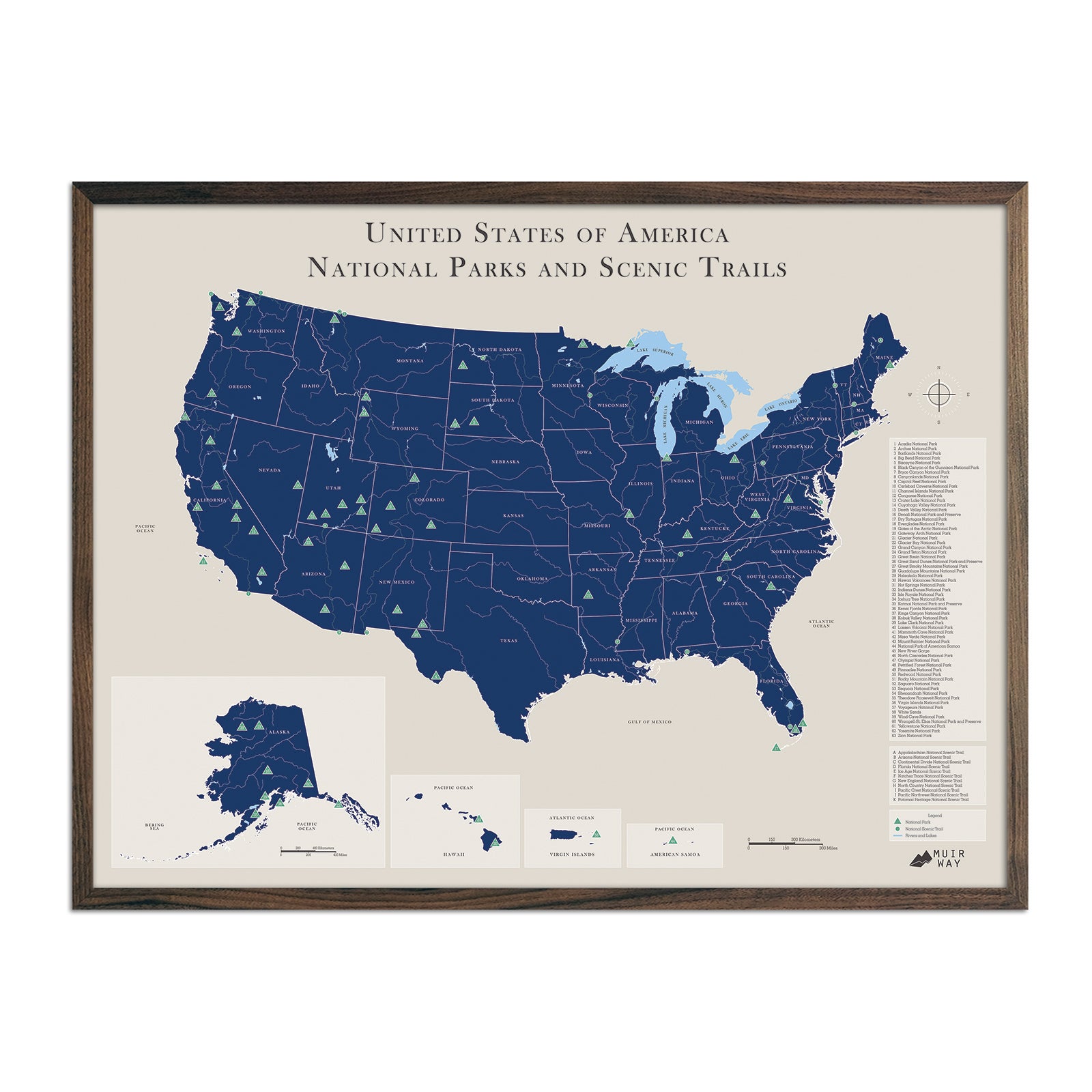
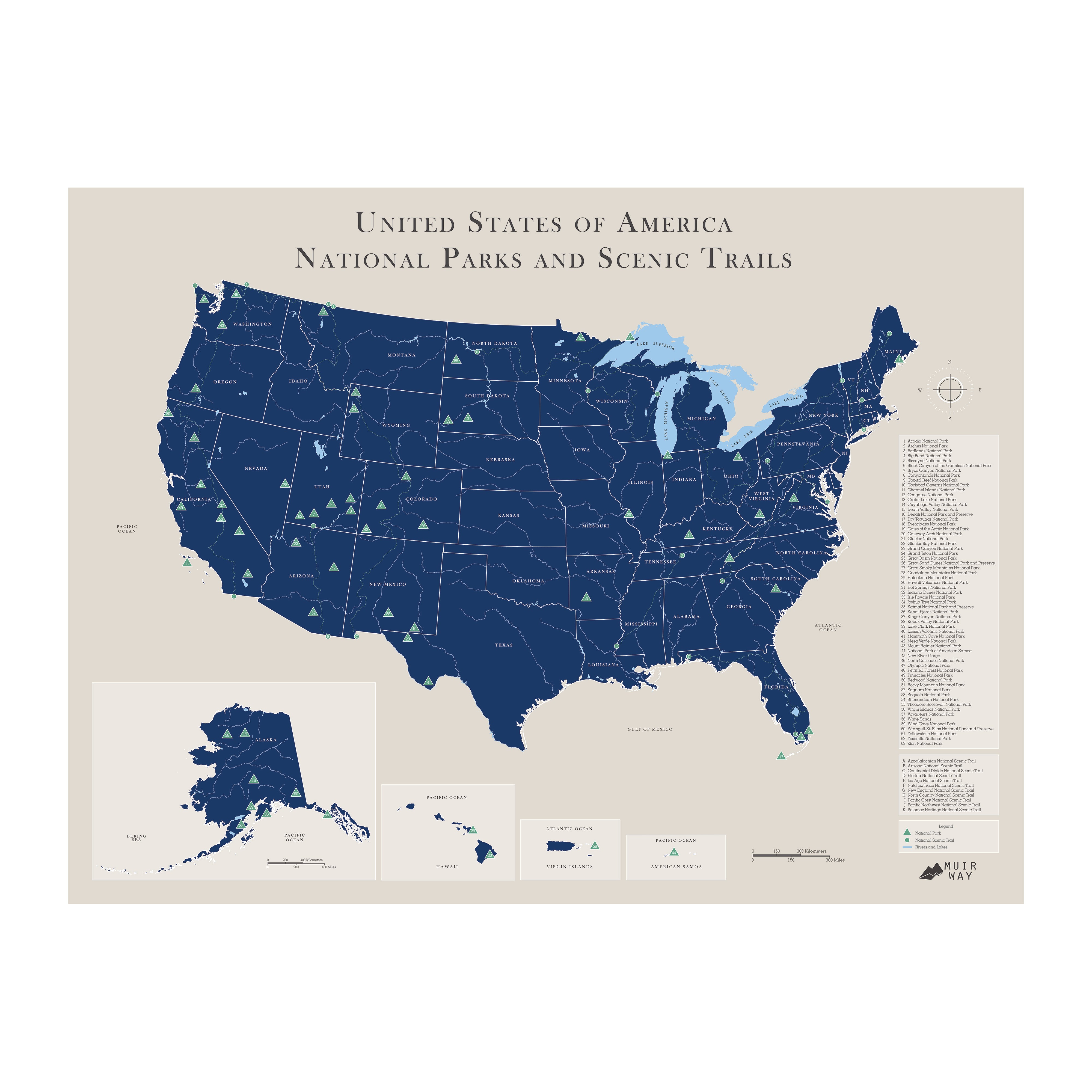

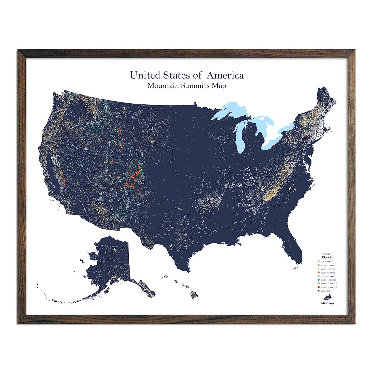
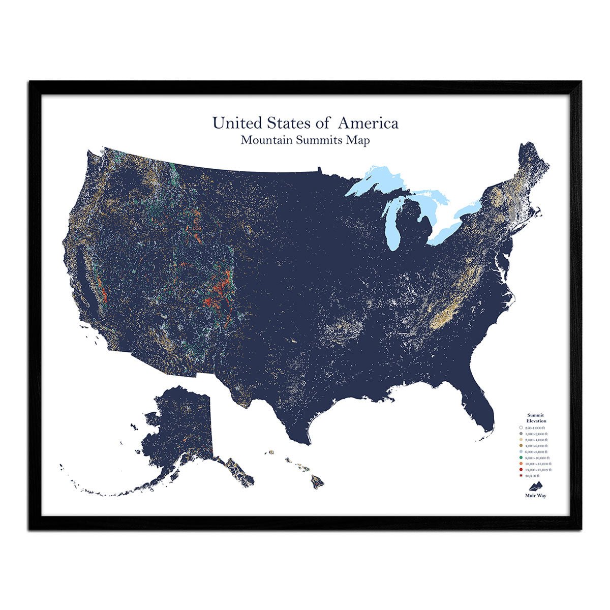
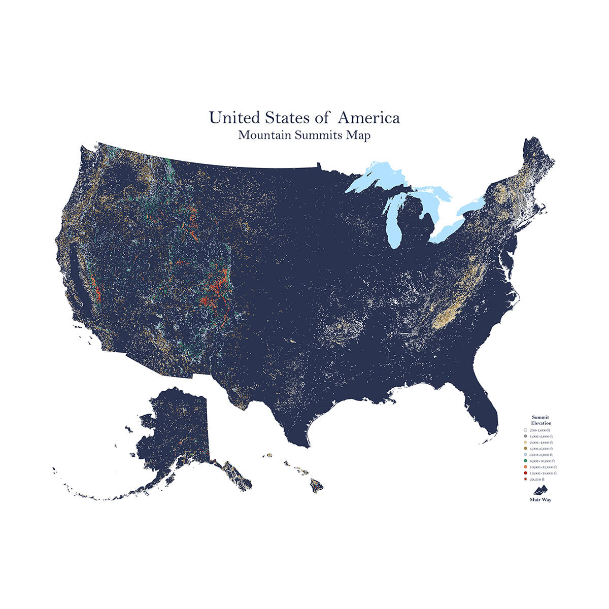

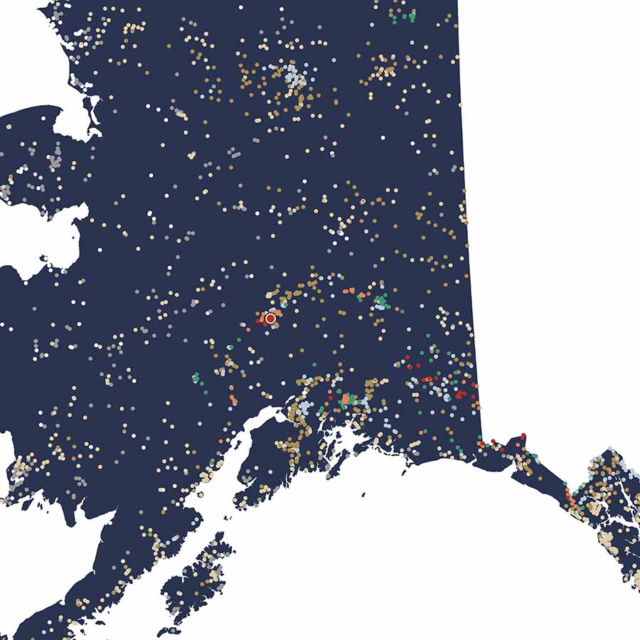

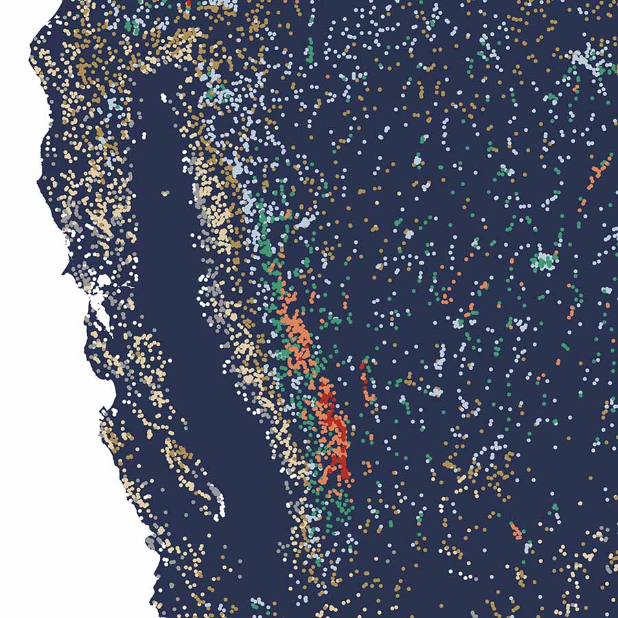
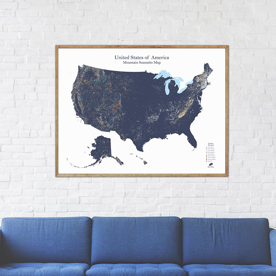
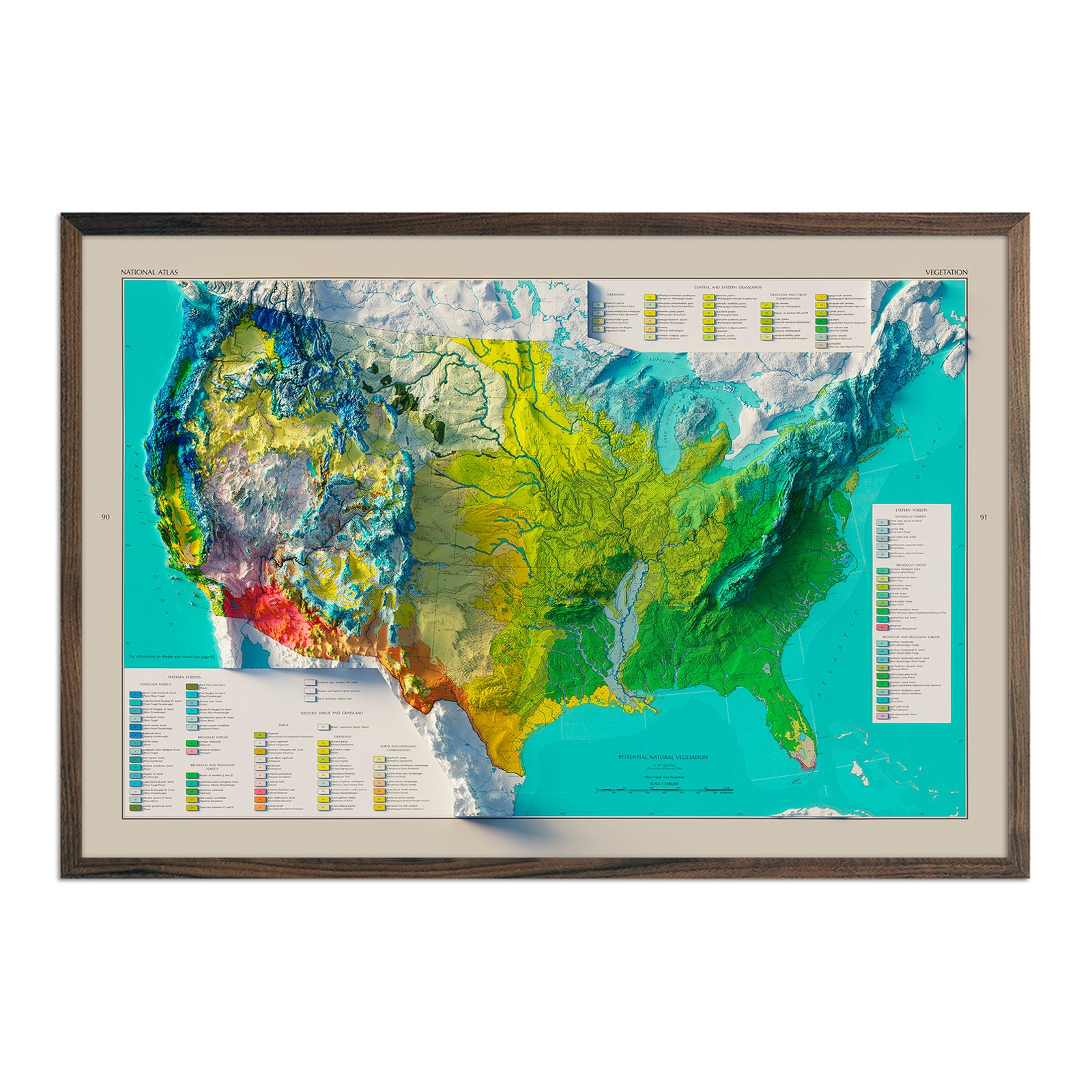
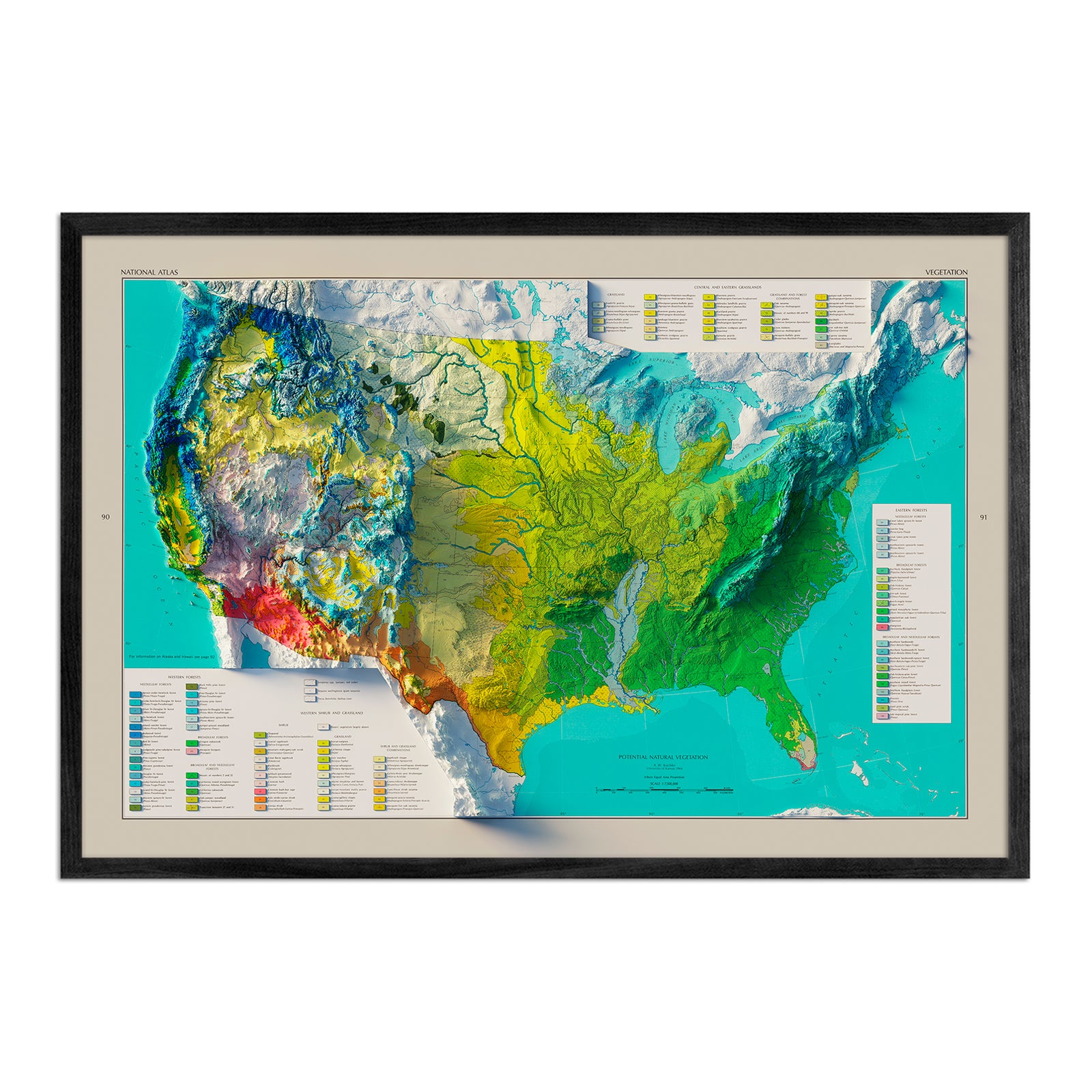
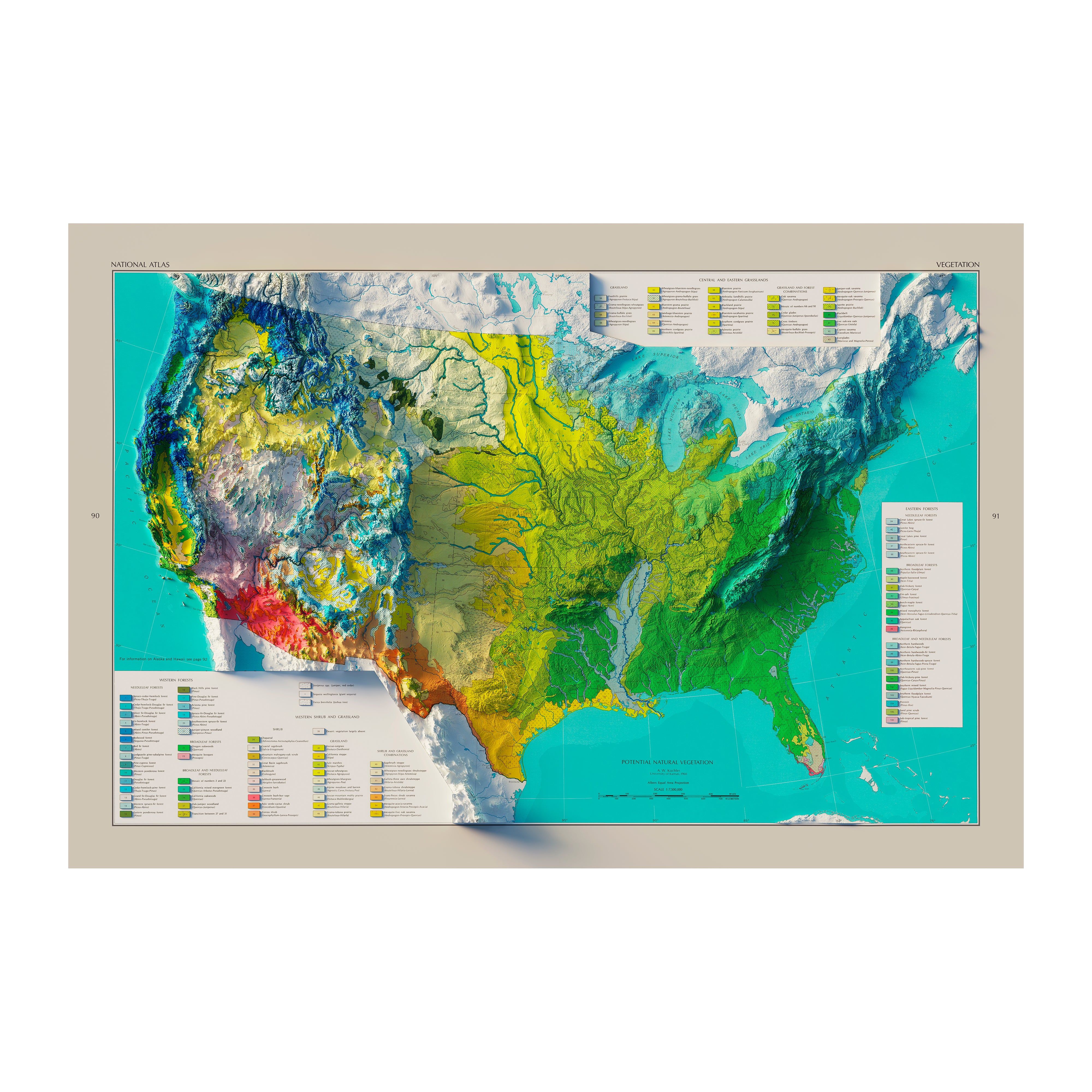

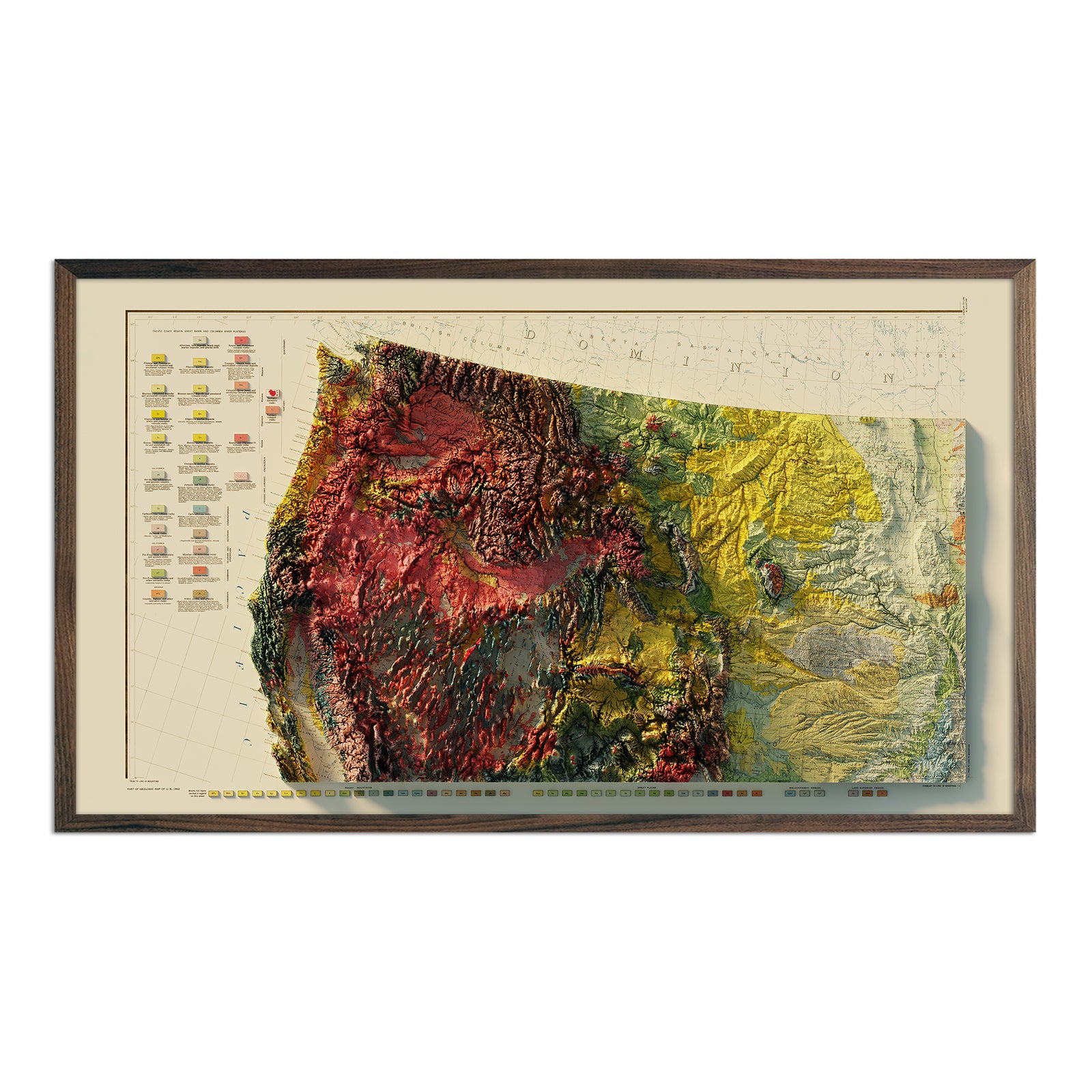

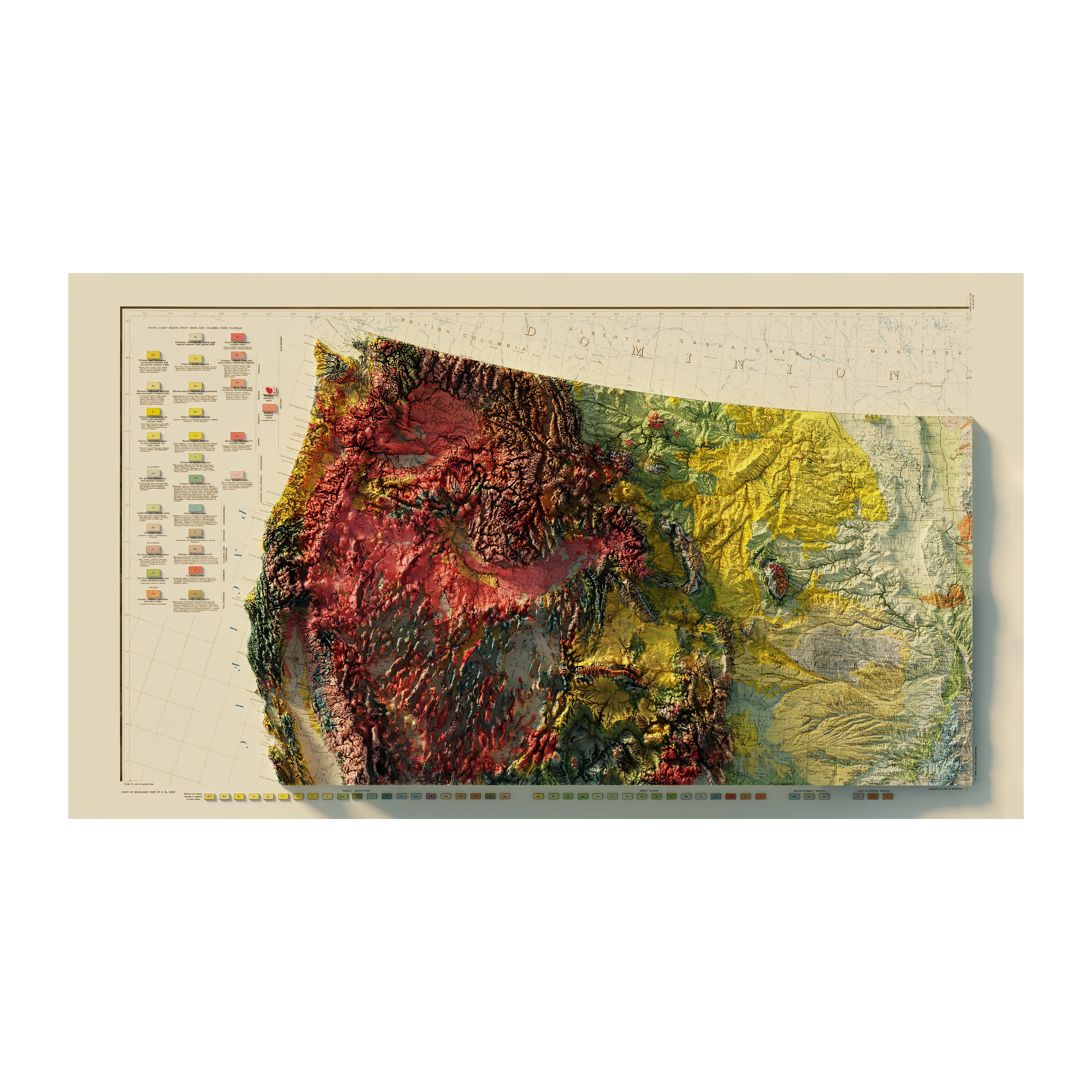
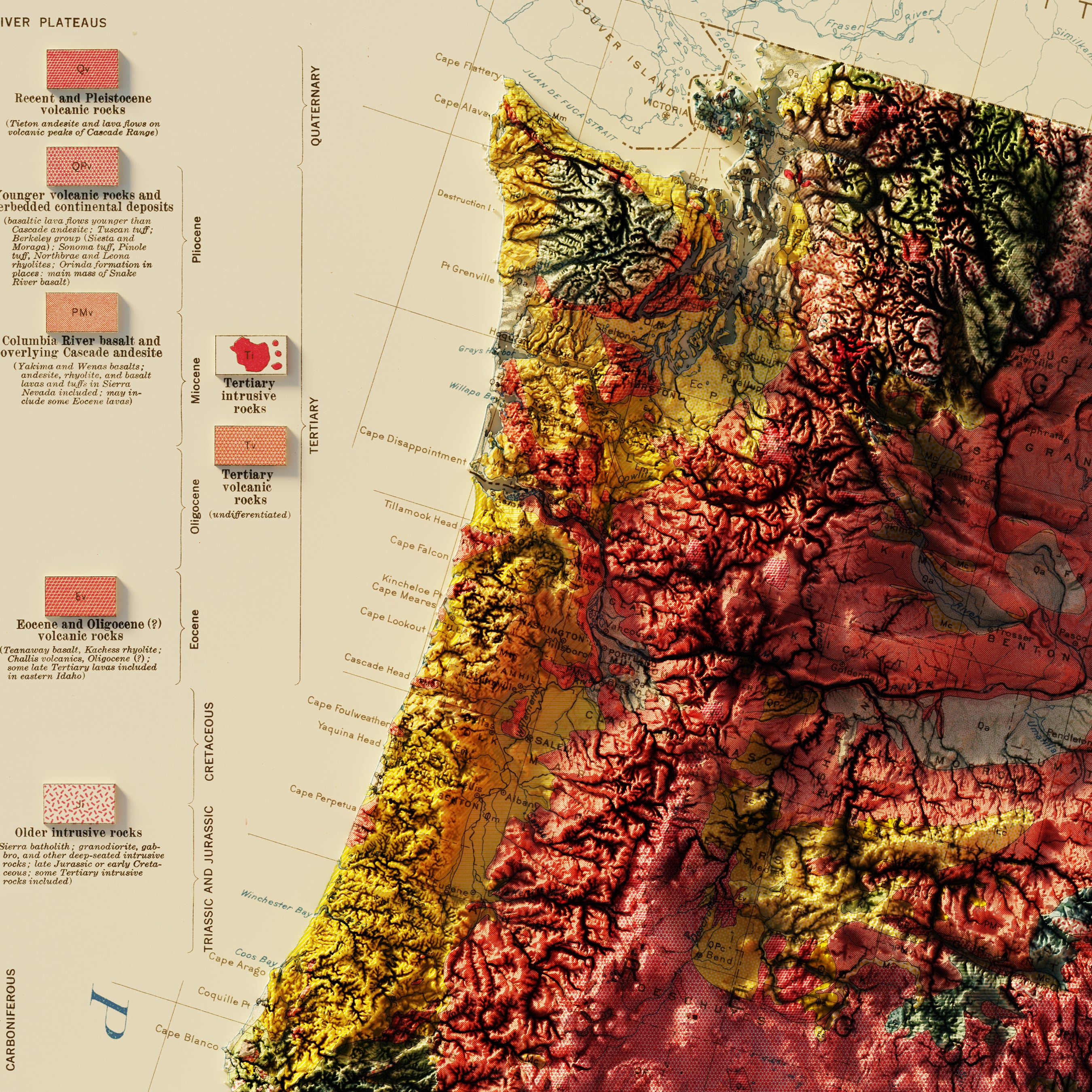
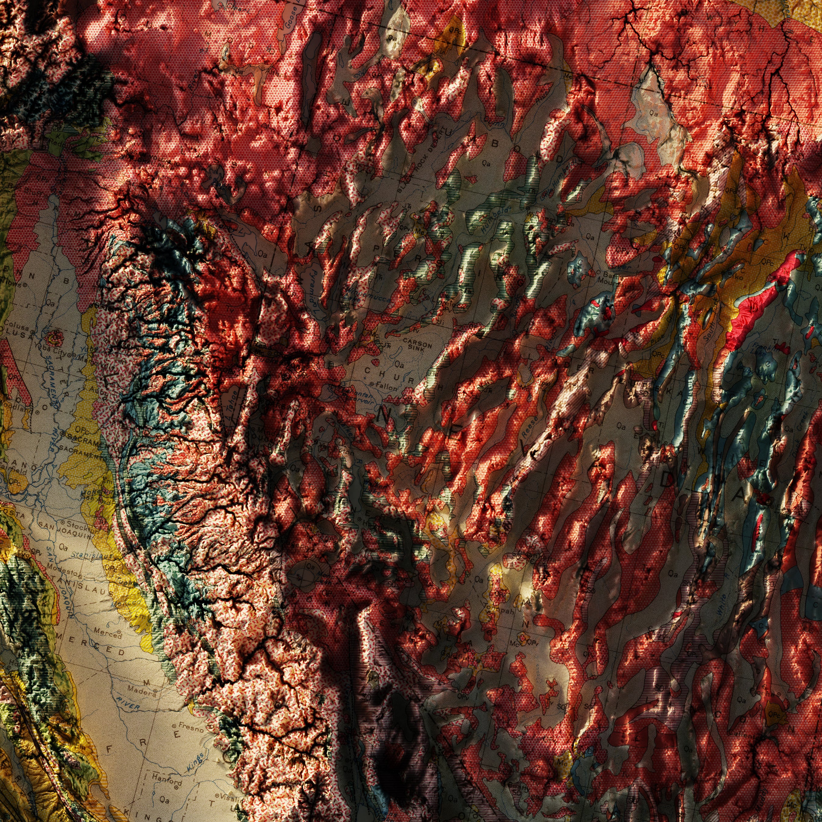
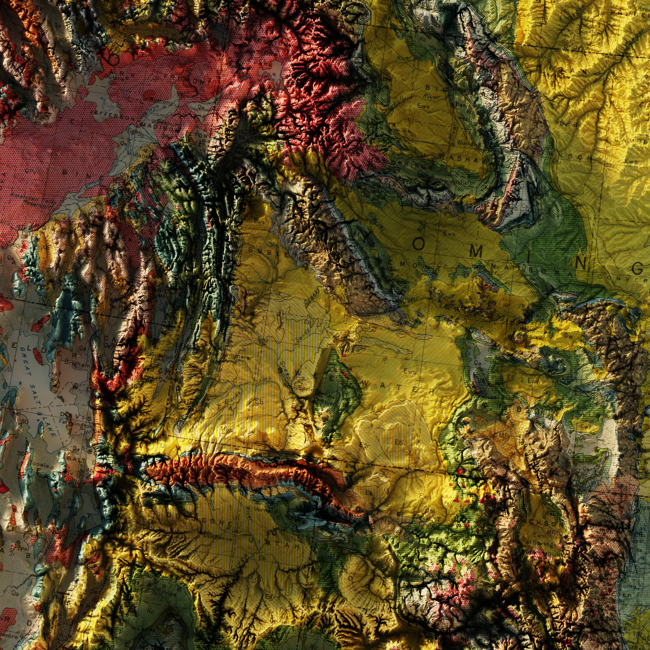
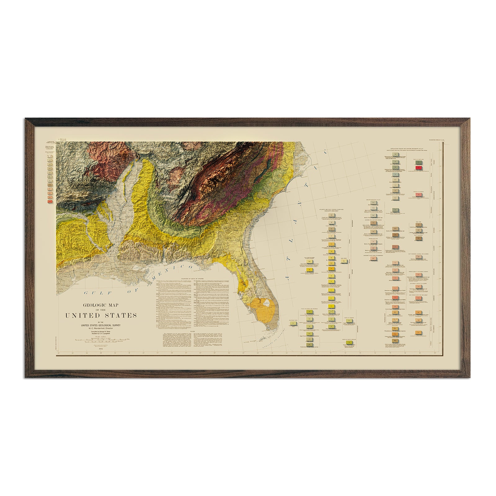
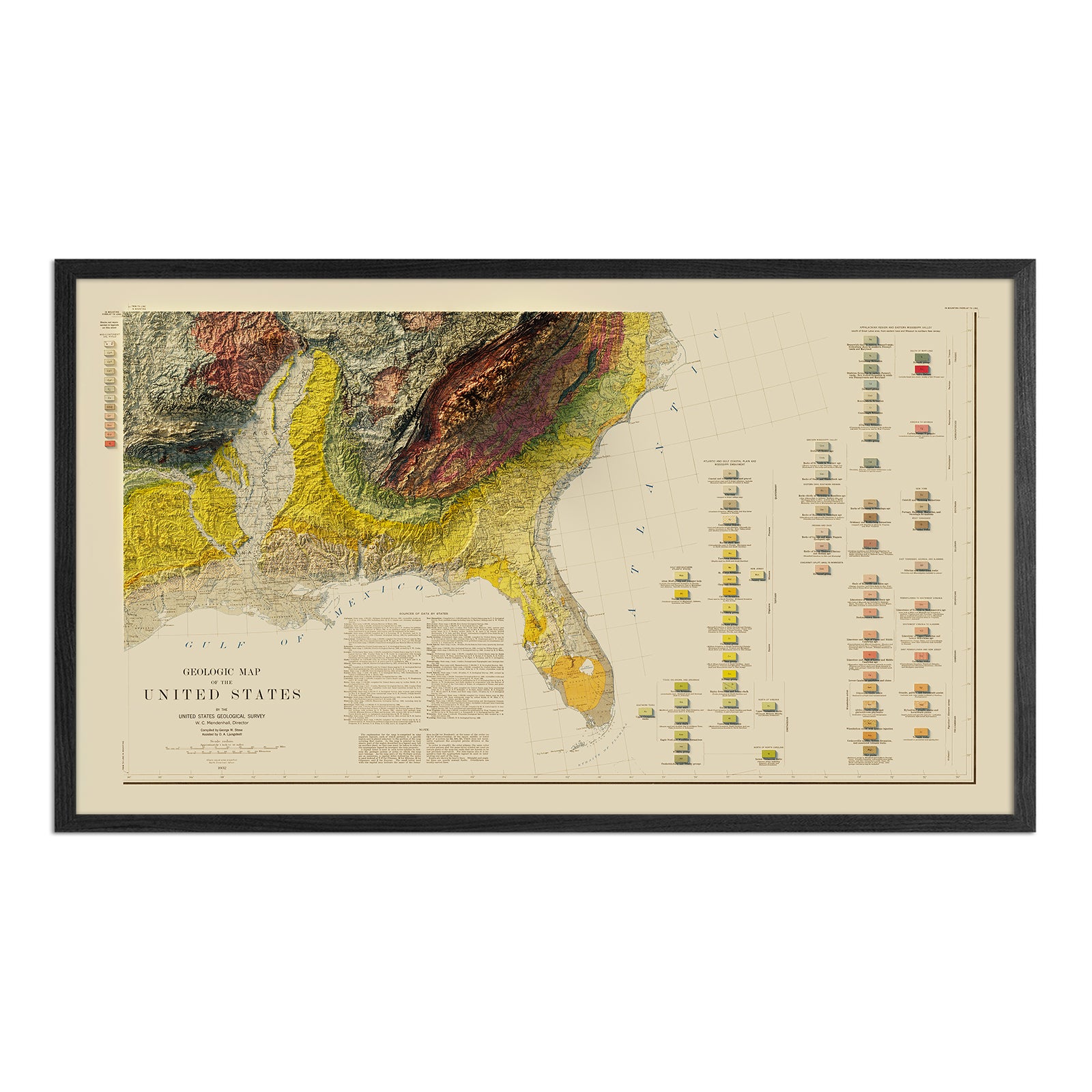
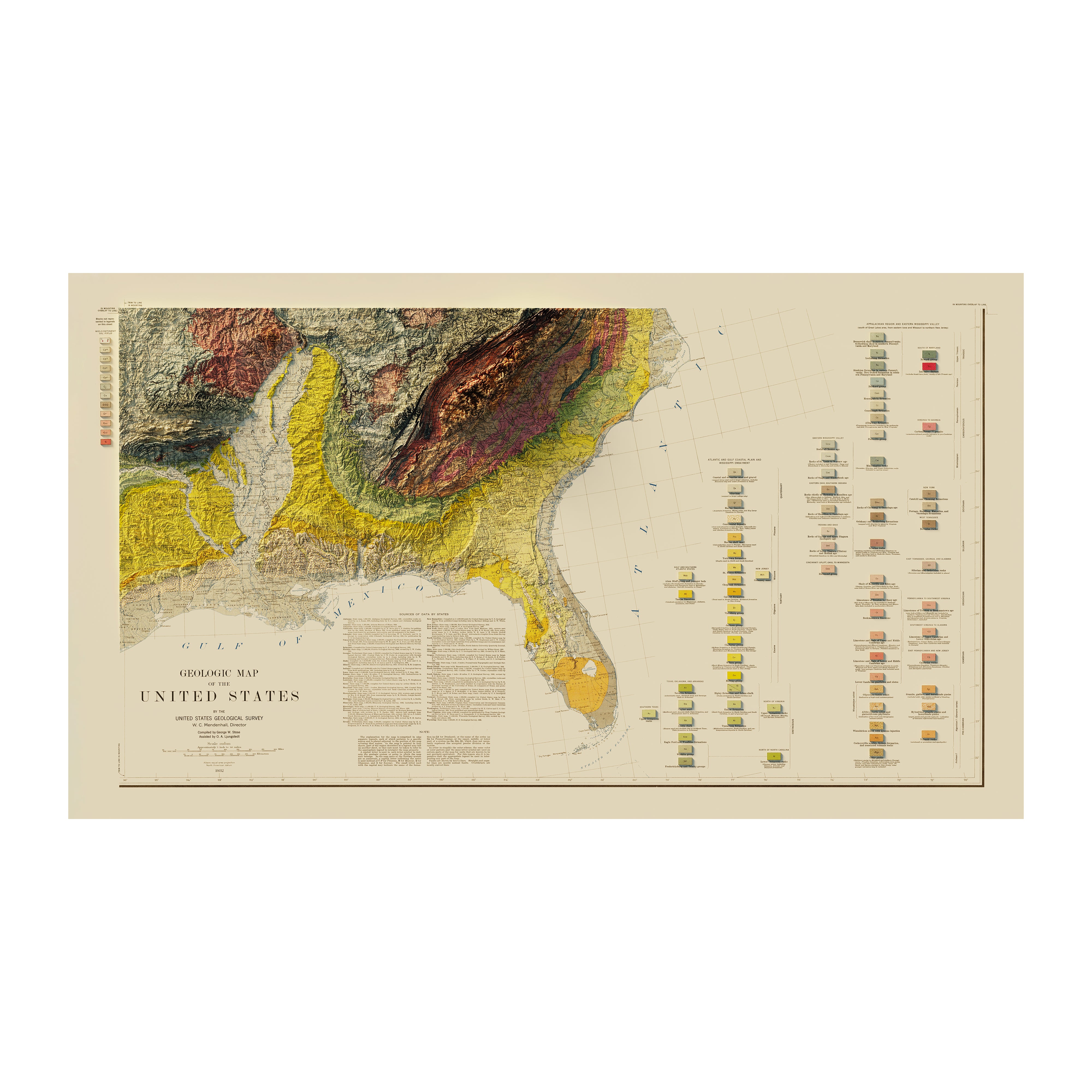
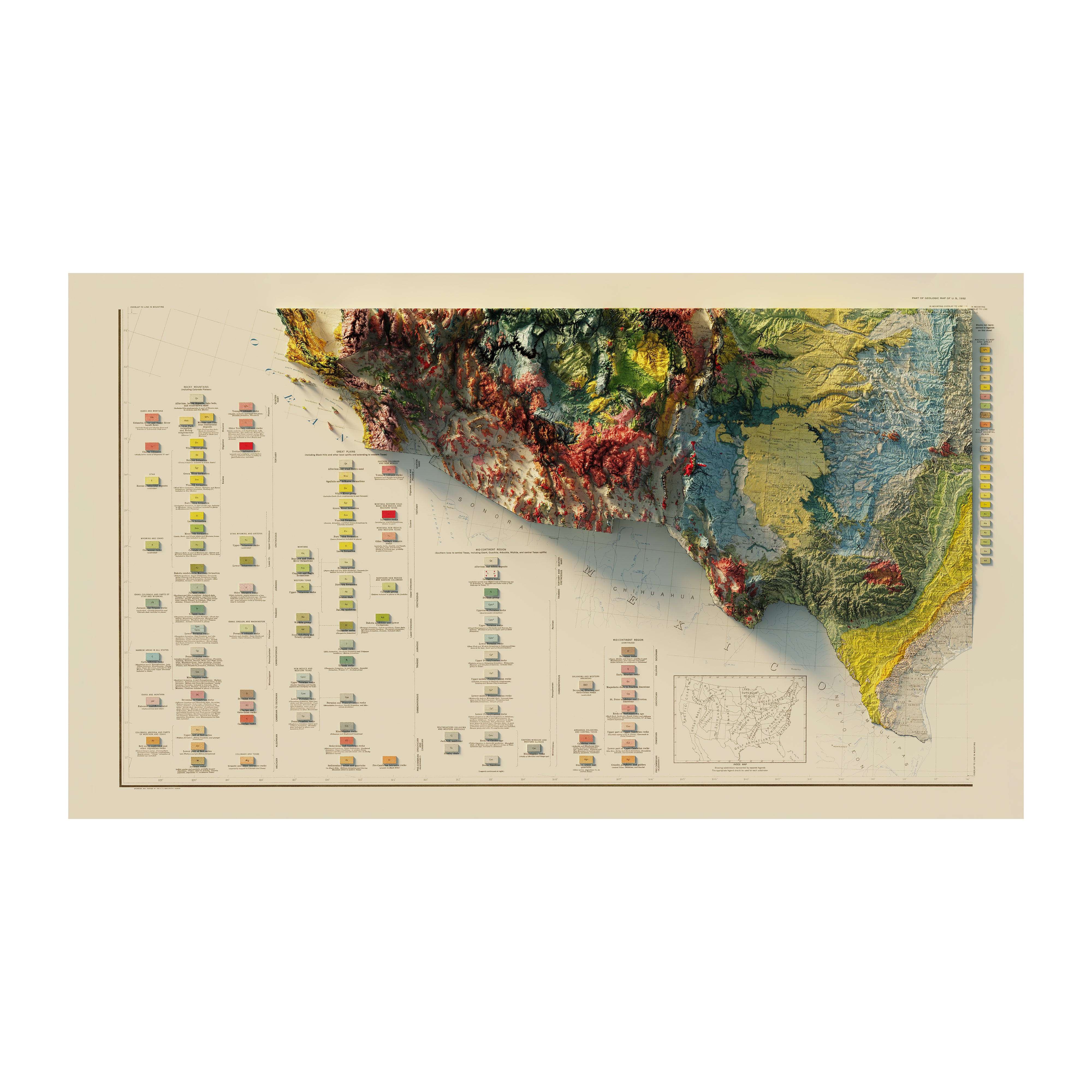


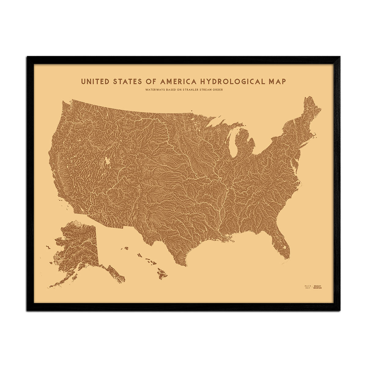
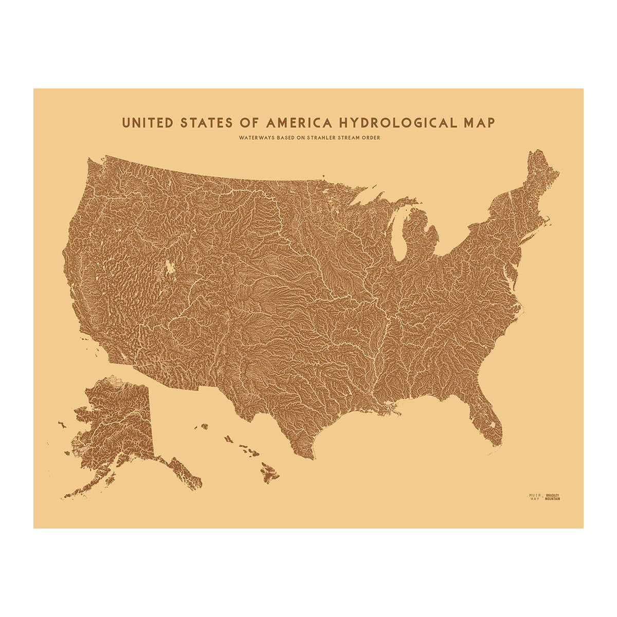

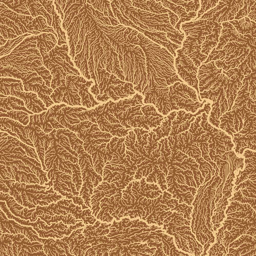
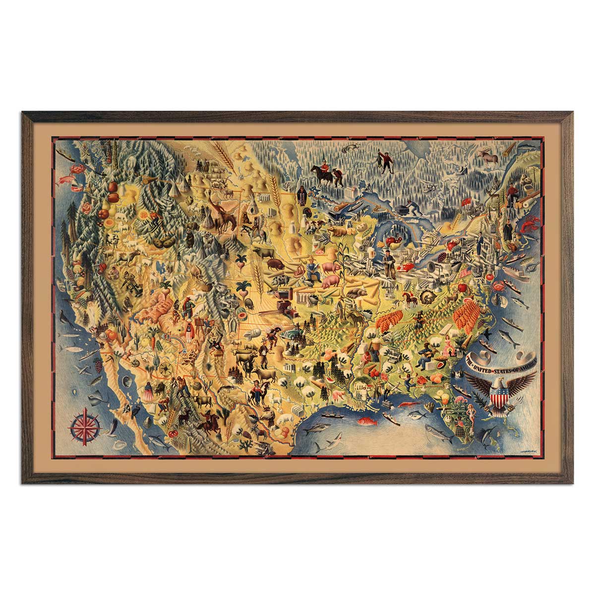
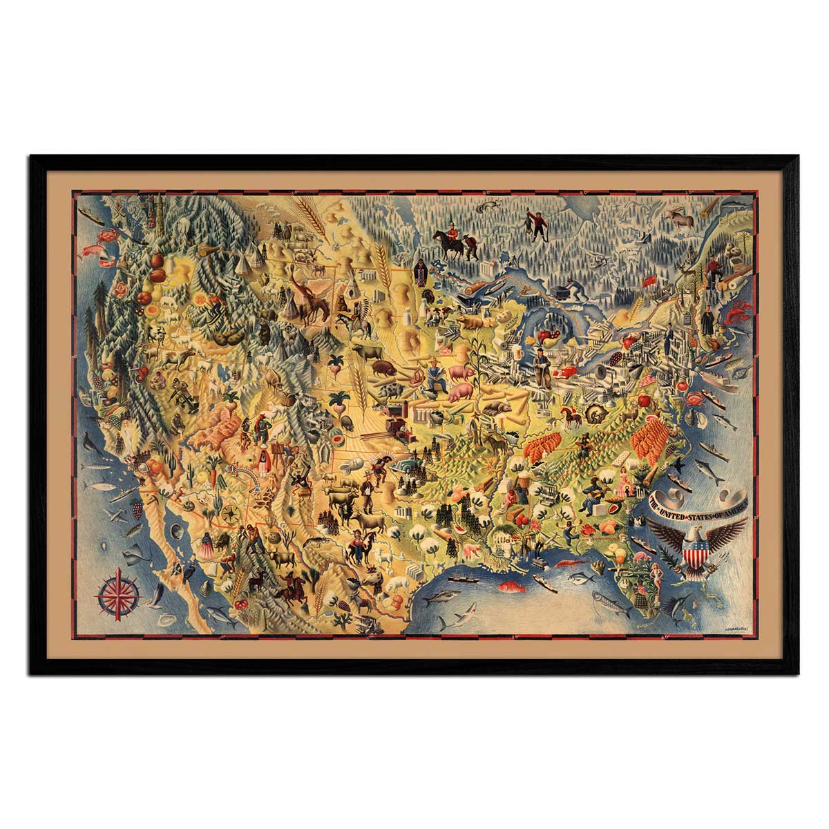
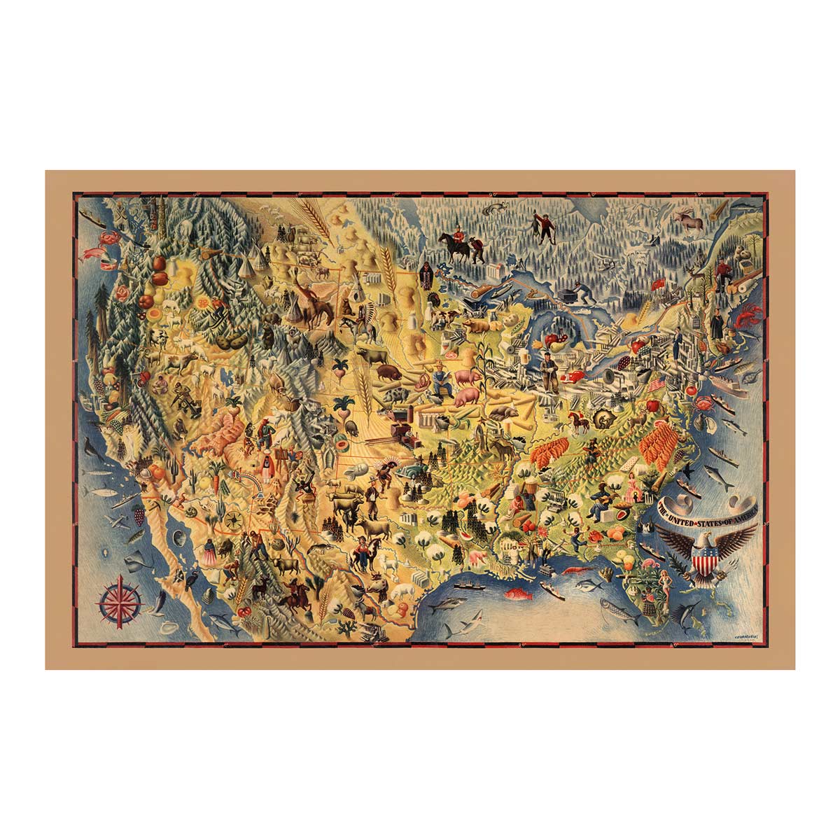

We offer an array of maps of the United States, from the national scale, to the regional scale, and down to state-by-state and even landform-by-landform. These collections include colorful and artfully cartographed US maps that accentuate certain elements of the land. These maps of the USA include hydrological maps focusing on watersheds and their associated river systems, and elevation or topographic maps that focus on the relief of the landforms, including mountains, valleys, and coastlines. Vintage maps merge shaded relief with early 1900s US Geological Survey (USGS) and geological maps. The US summit map is unique in displaying spot heights of all 250ft+ peaks in color-coded point form. National Parks Maps put the US and Canada’s favorite natural treasures on display in an array of colors in an abstract and artful manner.
About the United States
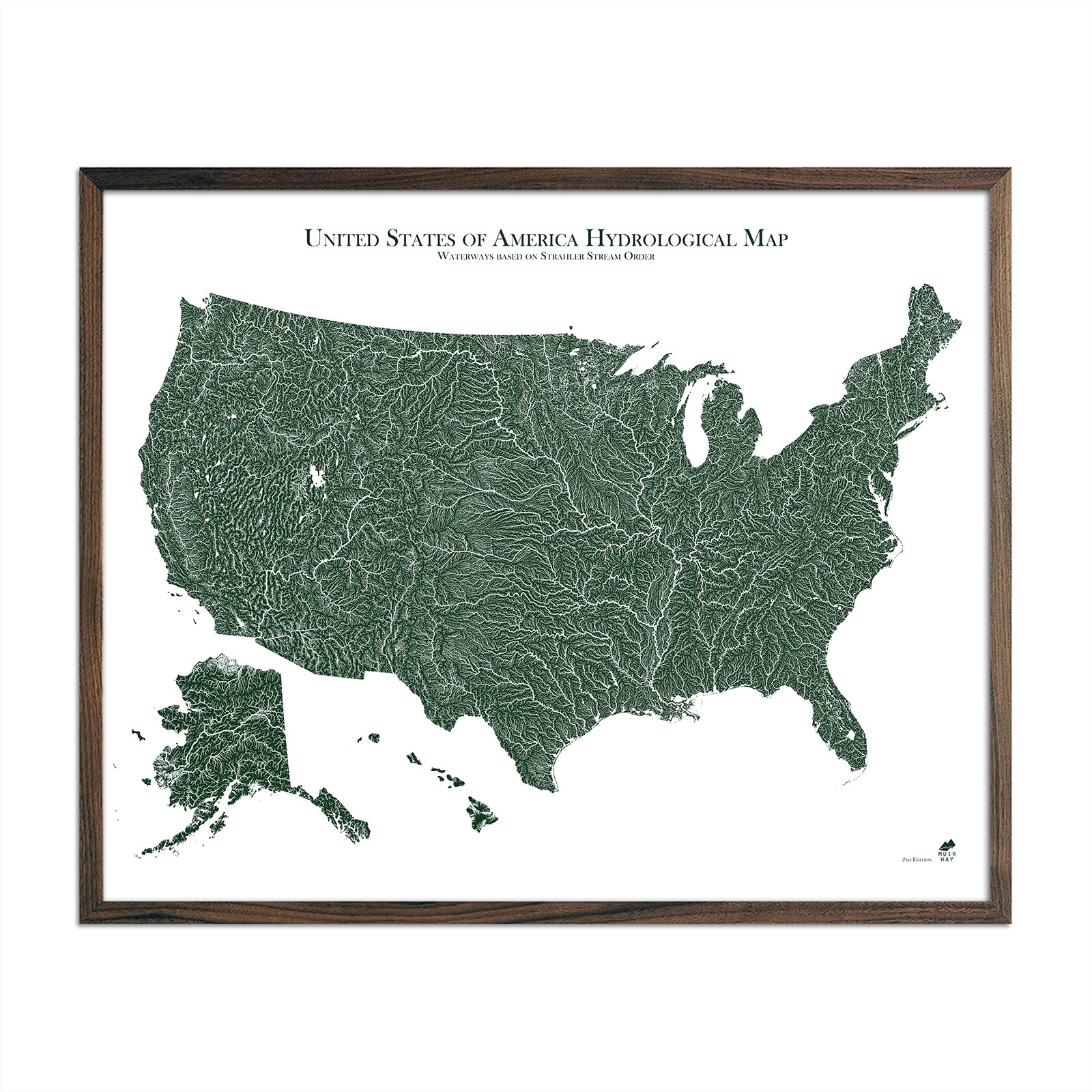
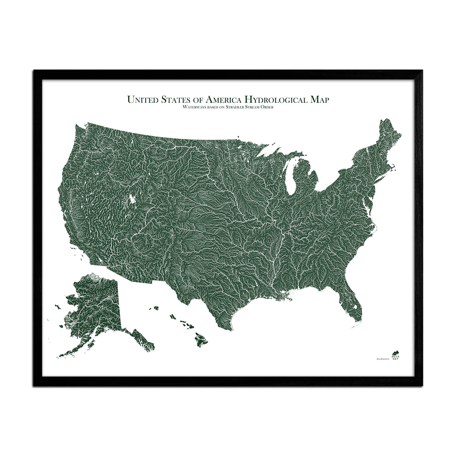
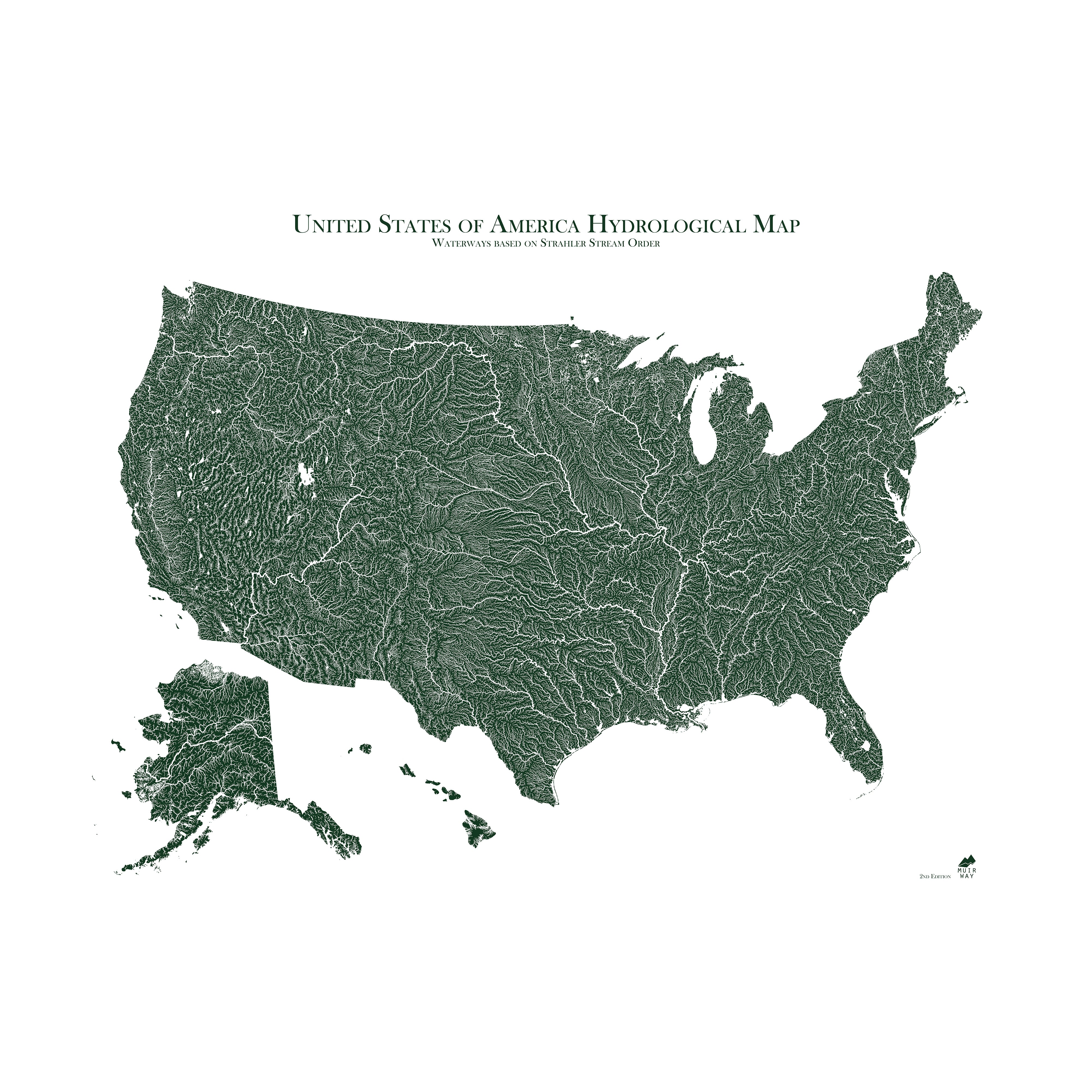
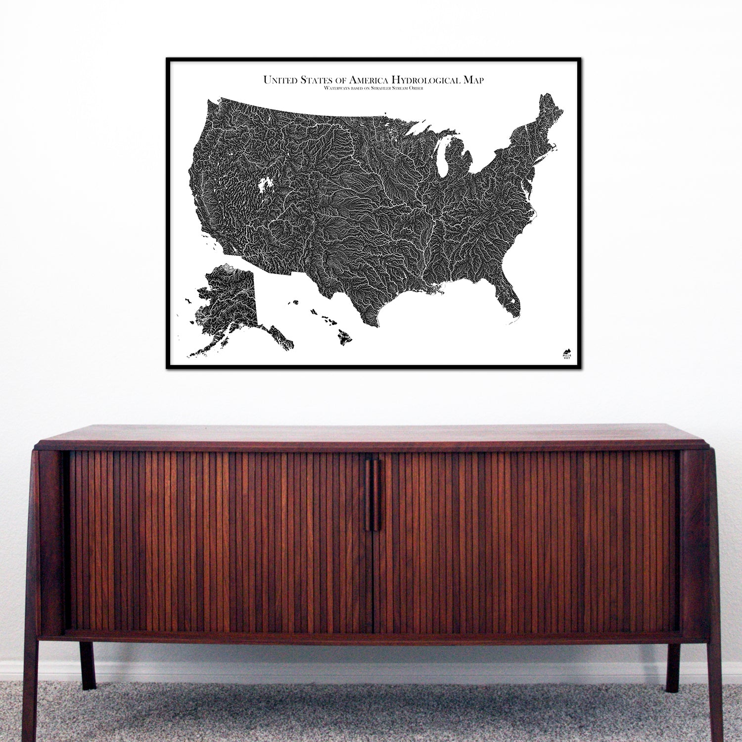
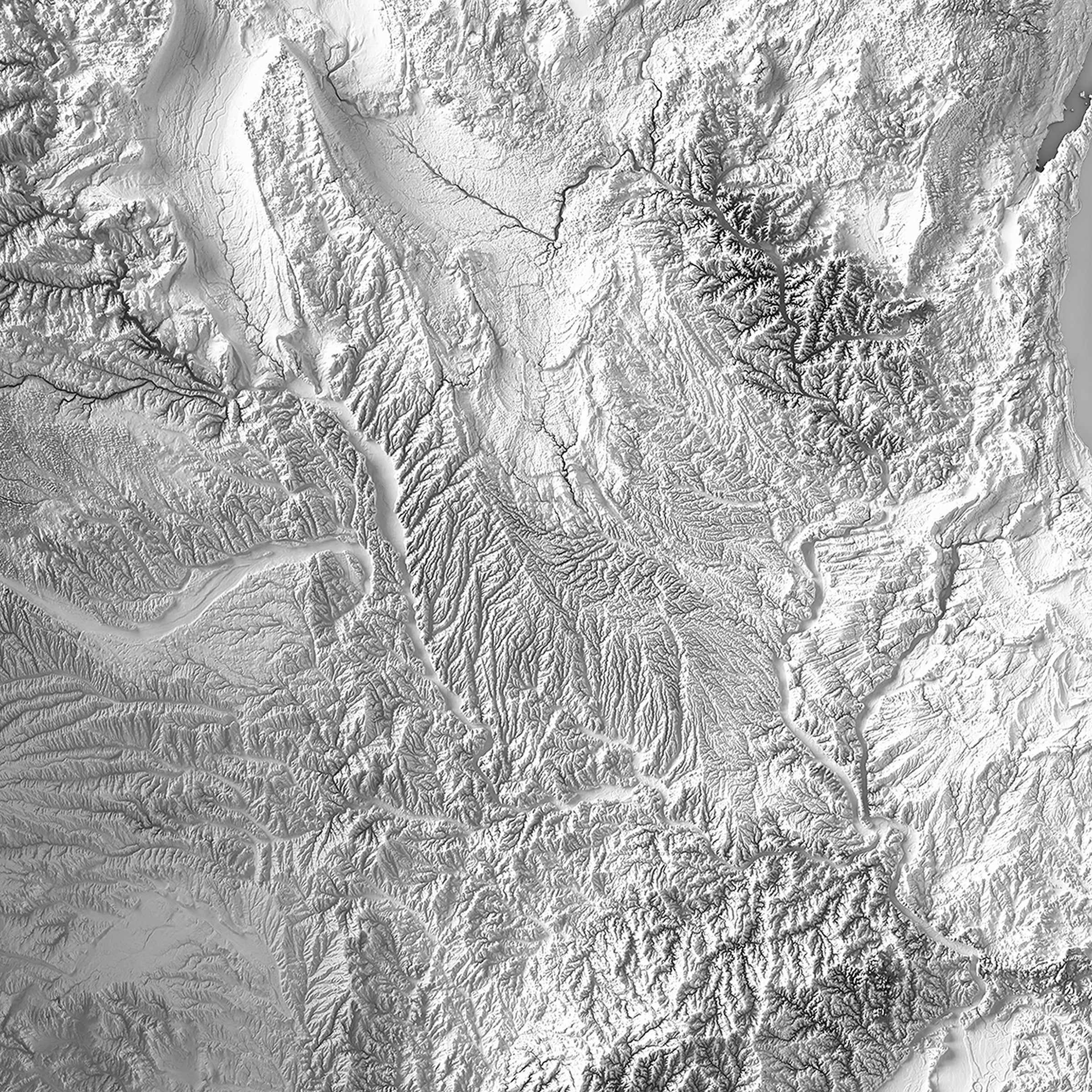
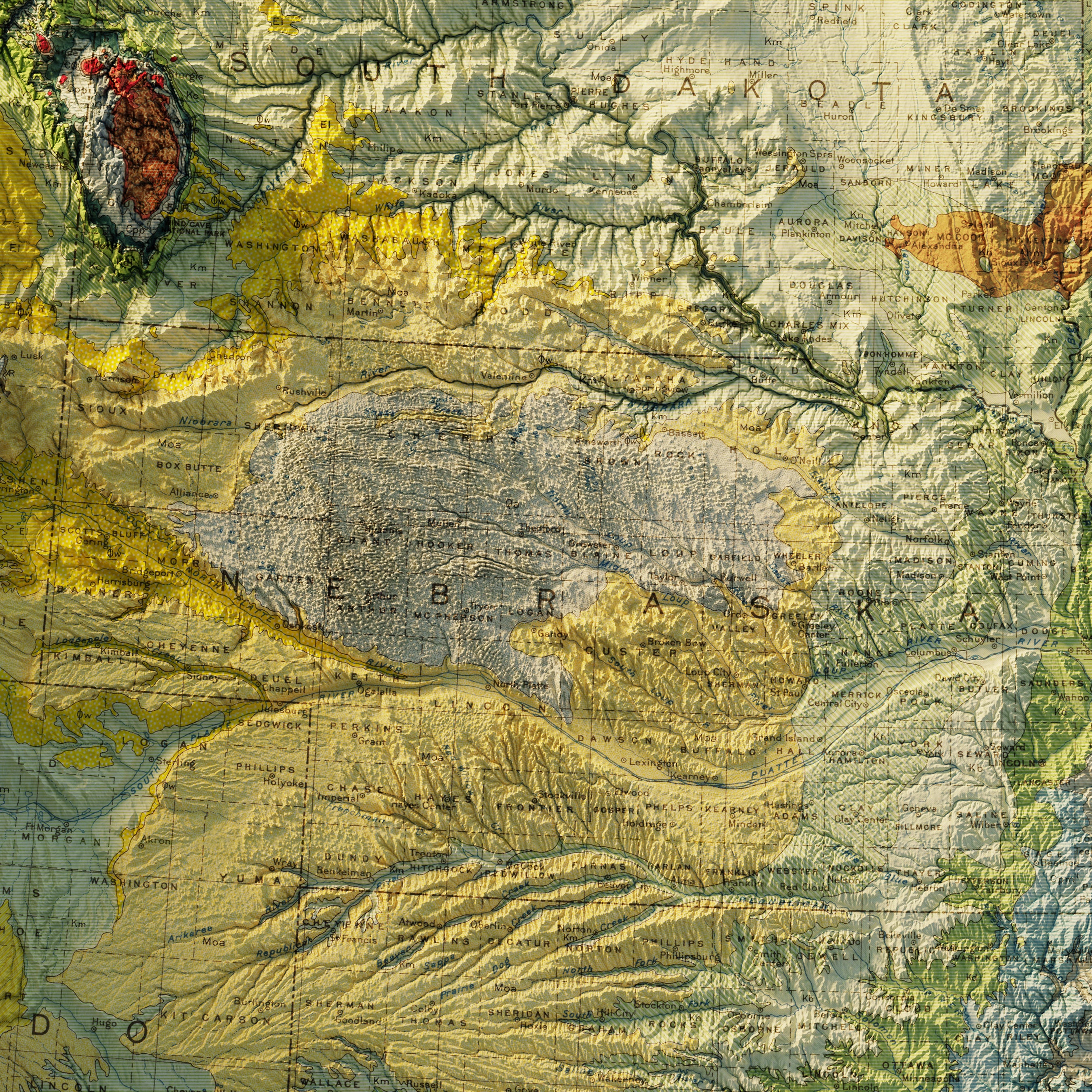
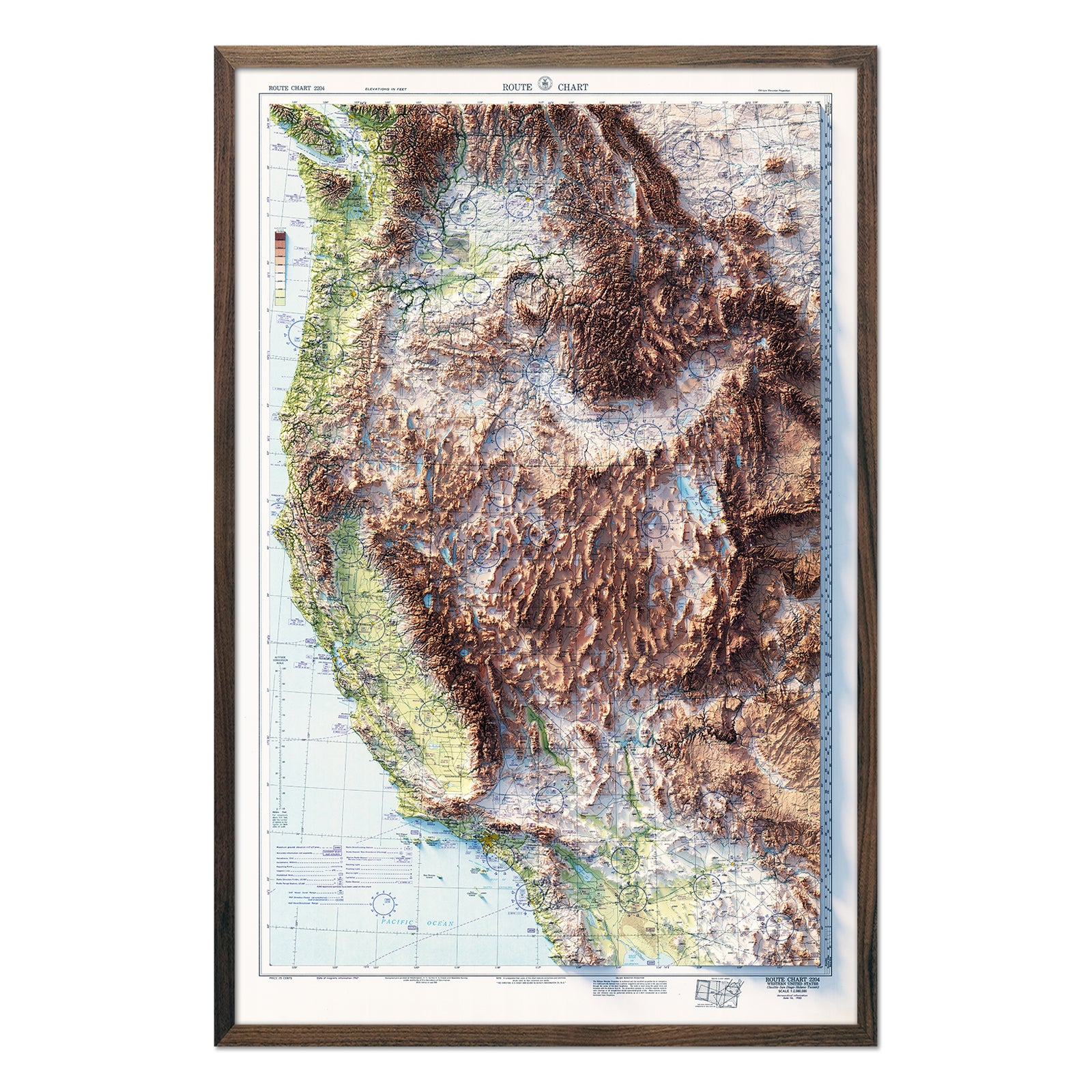
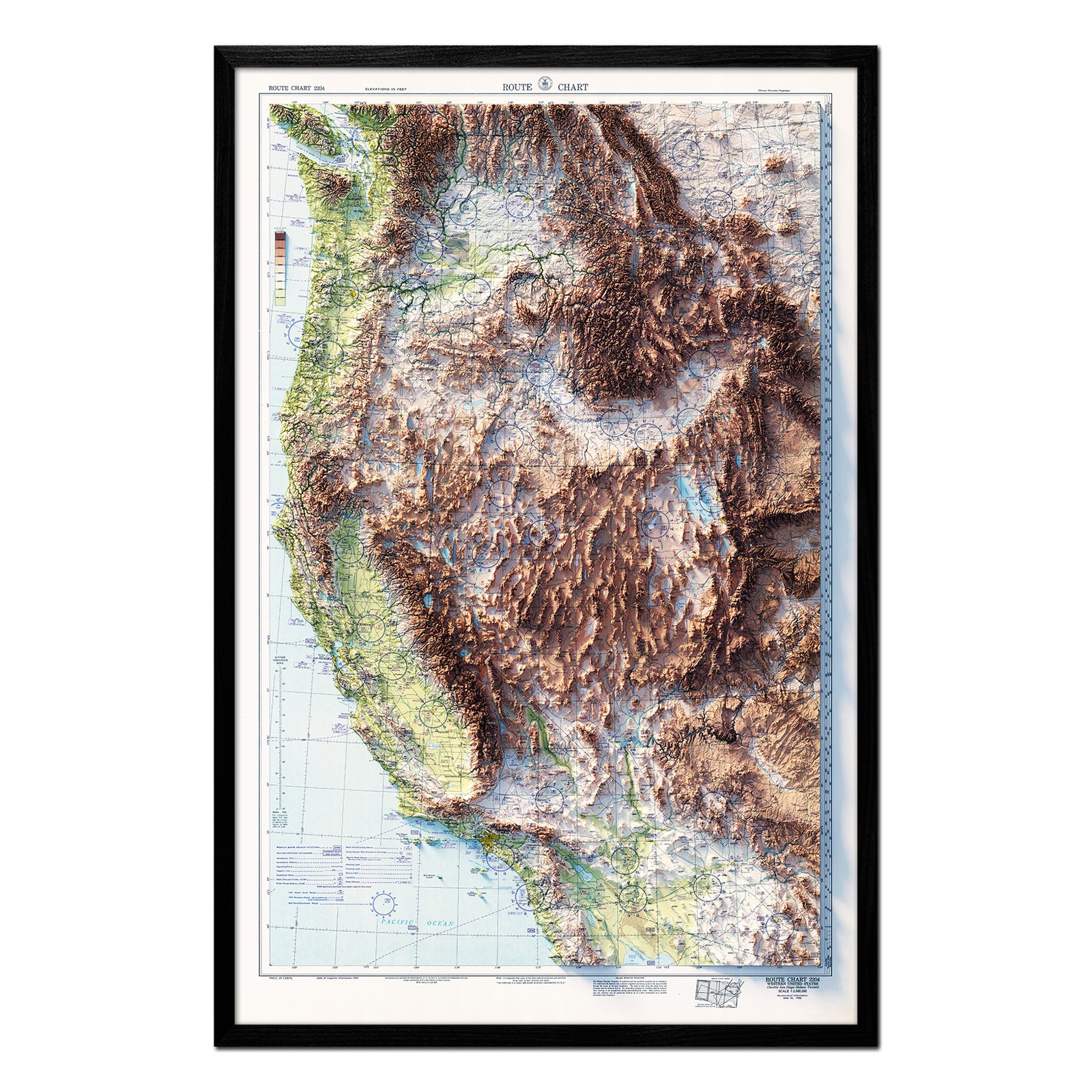
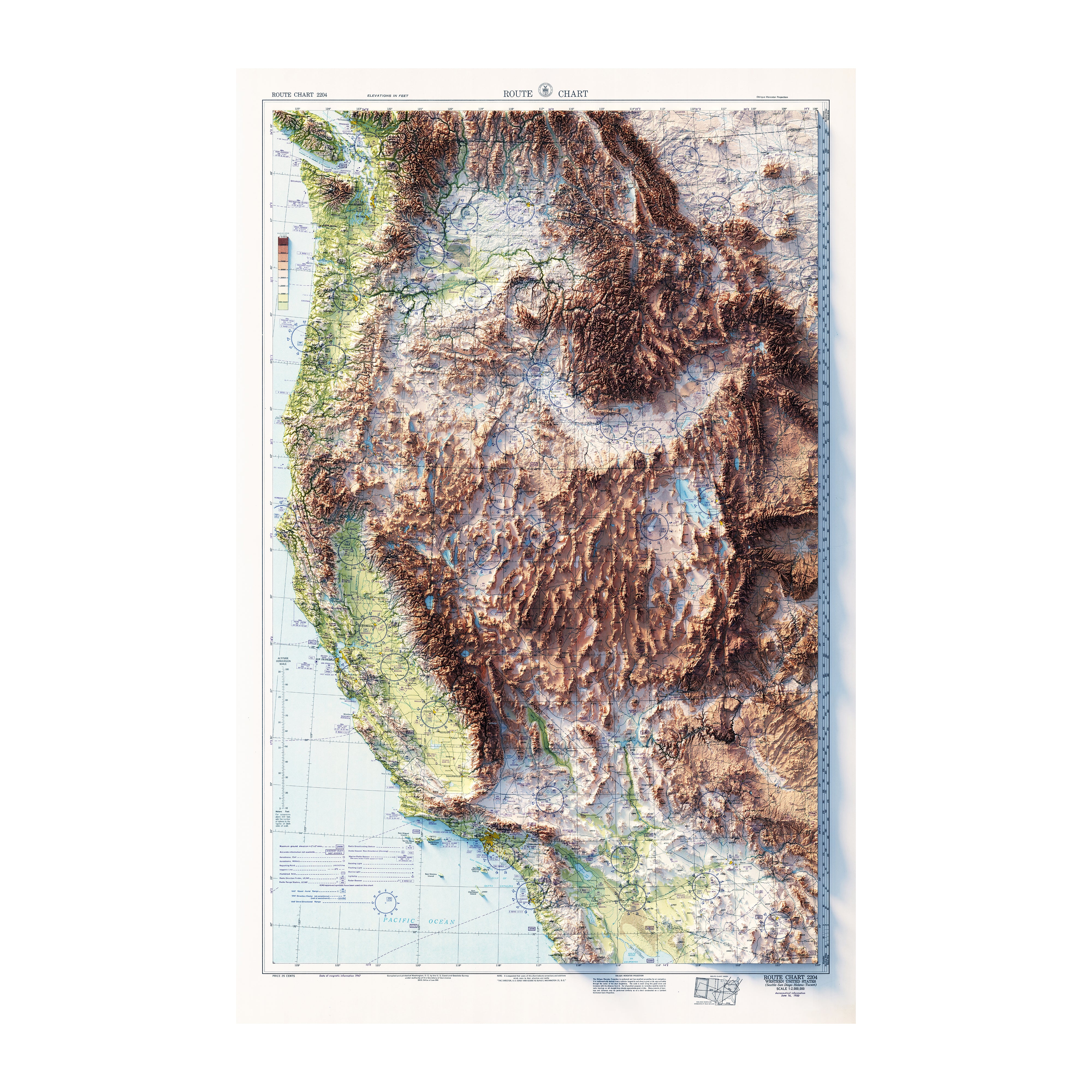
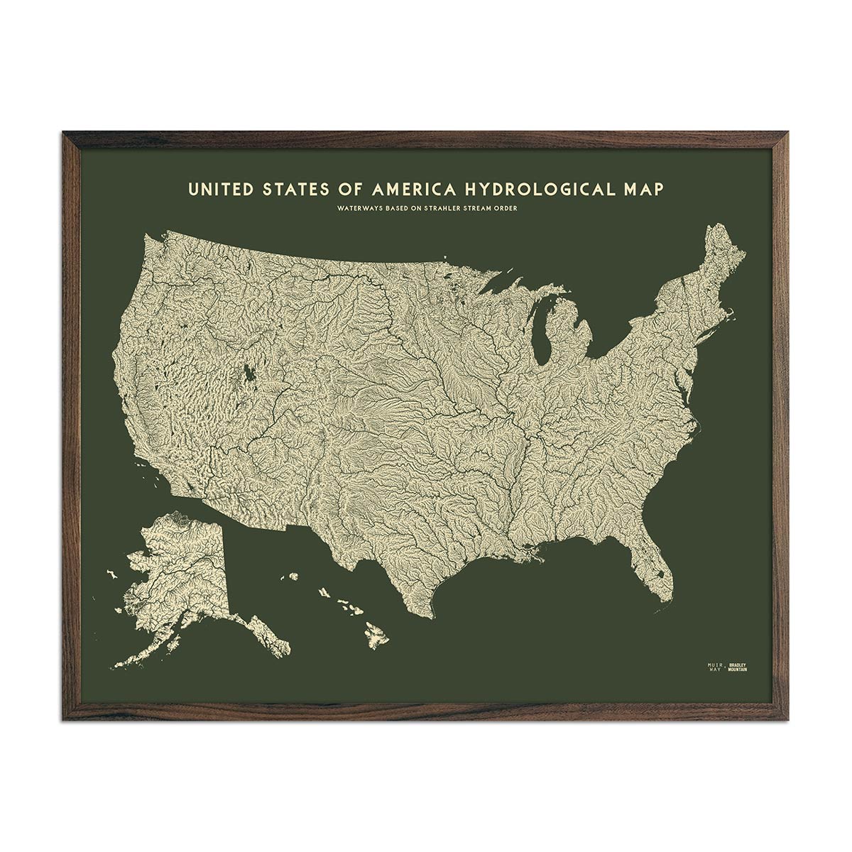
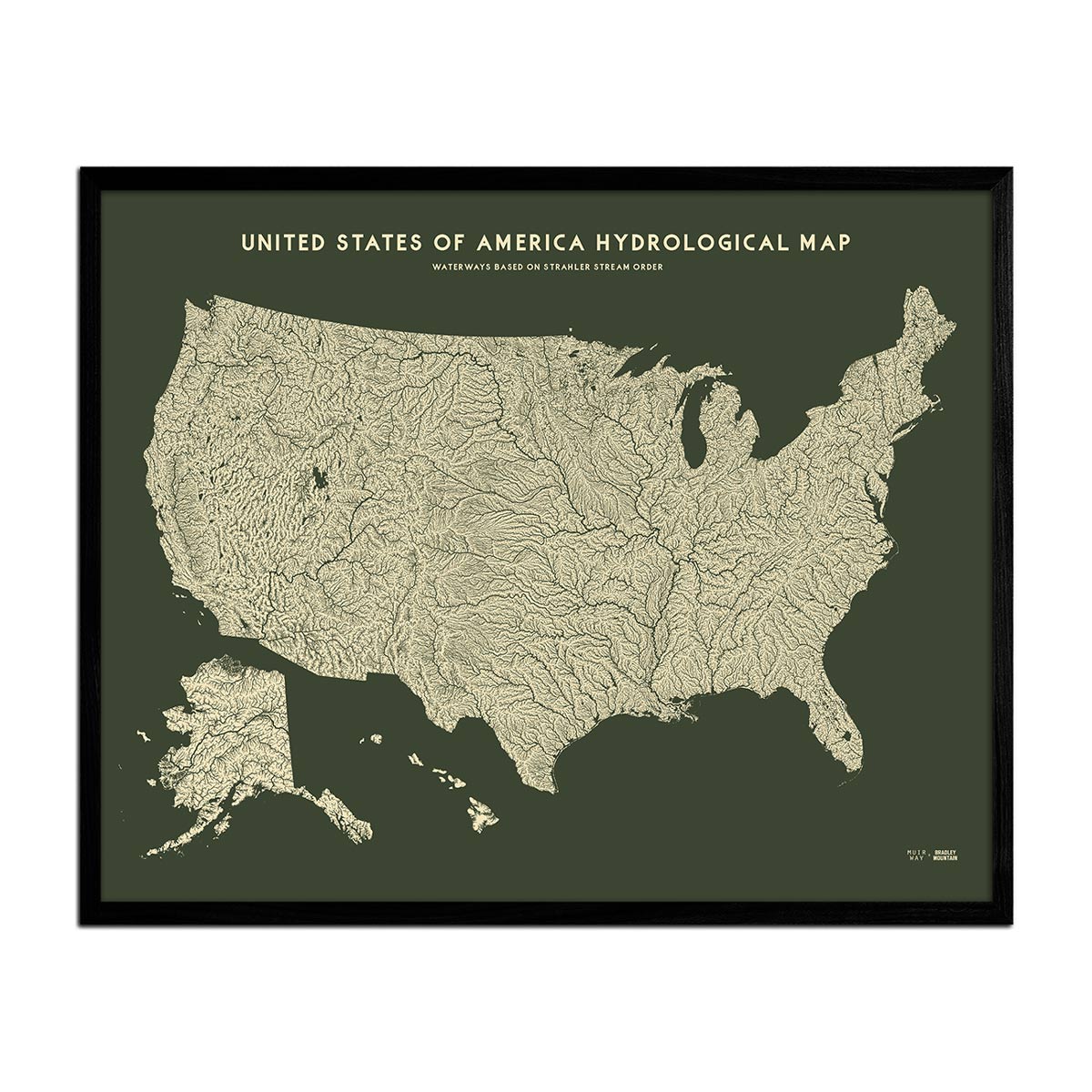
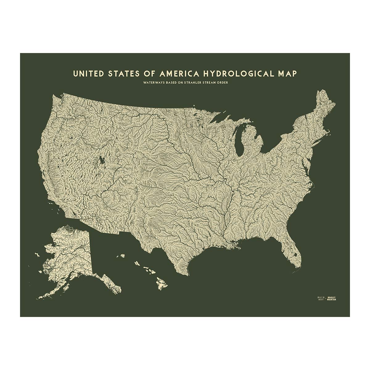
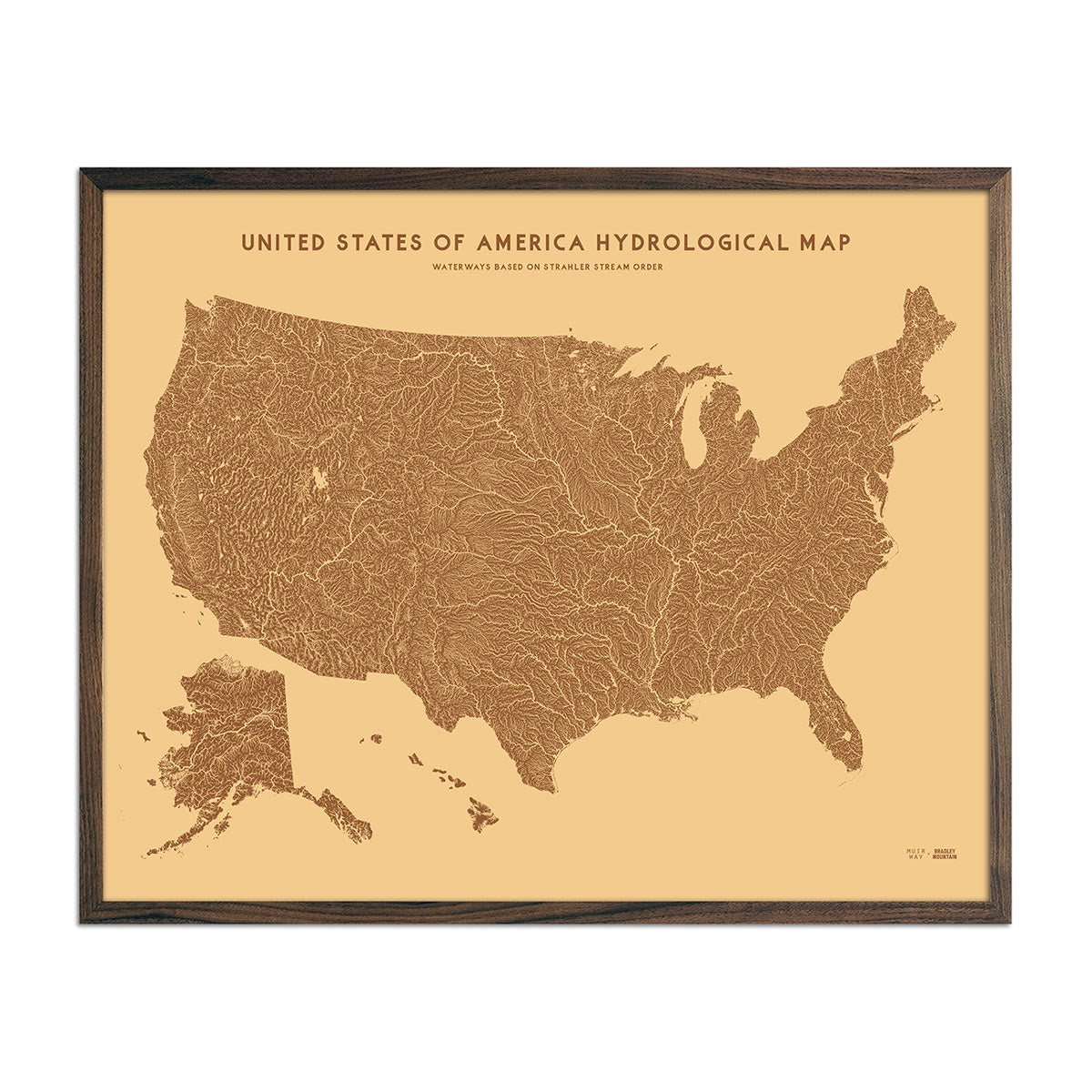
The United States of America (USA) is home to diverse landforms; from the craggy, mountainous West and the Rocky, Cascade, and Sierra Nevada mountain ranges, through the interior Great Plains and glacially-carved Great Lakes of the Heartland, to the eroded Appalachian Mountains, and coastal plains of the Atlantic and Gulf of Mexico of the East. The Missouri and Mississippi River system is the longest on the continent and drains the majority of the central states. Rivers on the west and east coasts are generally shorter, except the sizable Columbia and Snake River systems that drain much of the Pacific Northwest. Covering a total area of 3,796,742 sq. mi (9,833,520 km2), the USA is the 3rd or 4th largest country in the world (depending on the metric used) and is home to 331.4 million people. Our US maps display a variety of these features beautifully.
US Map Geography
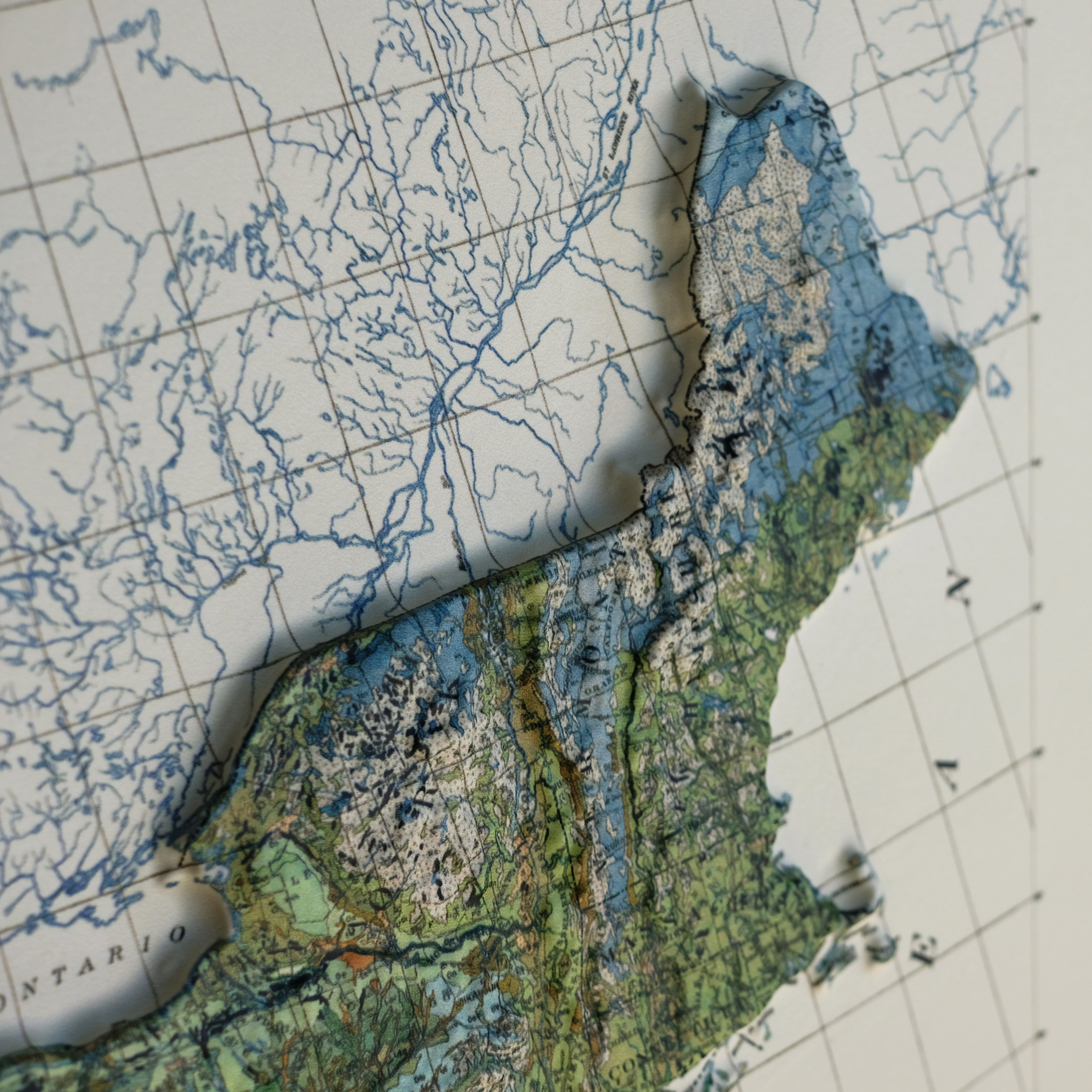
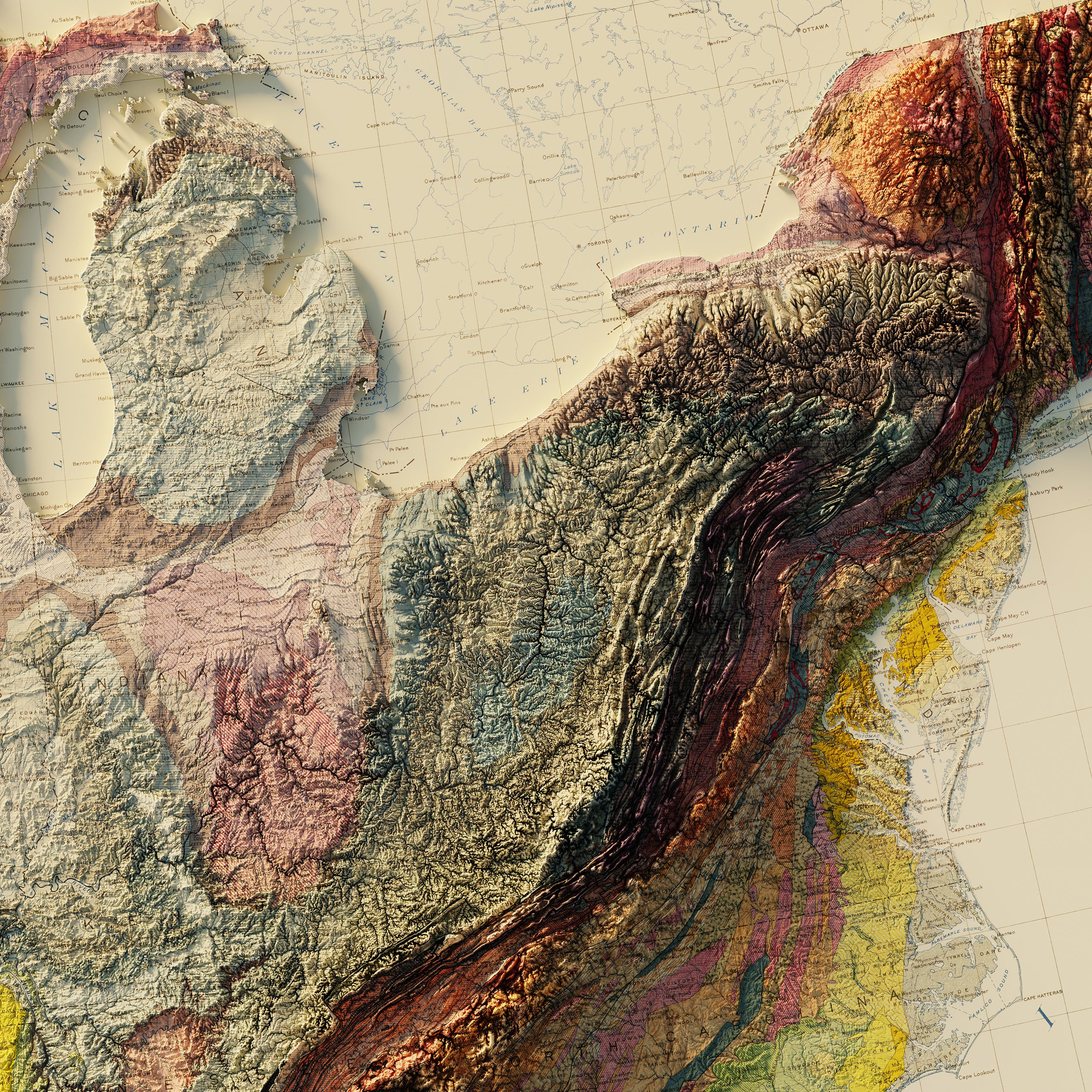
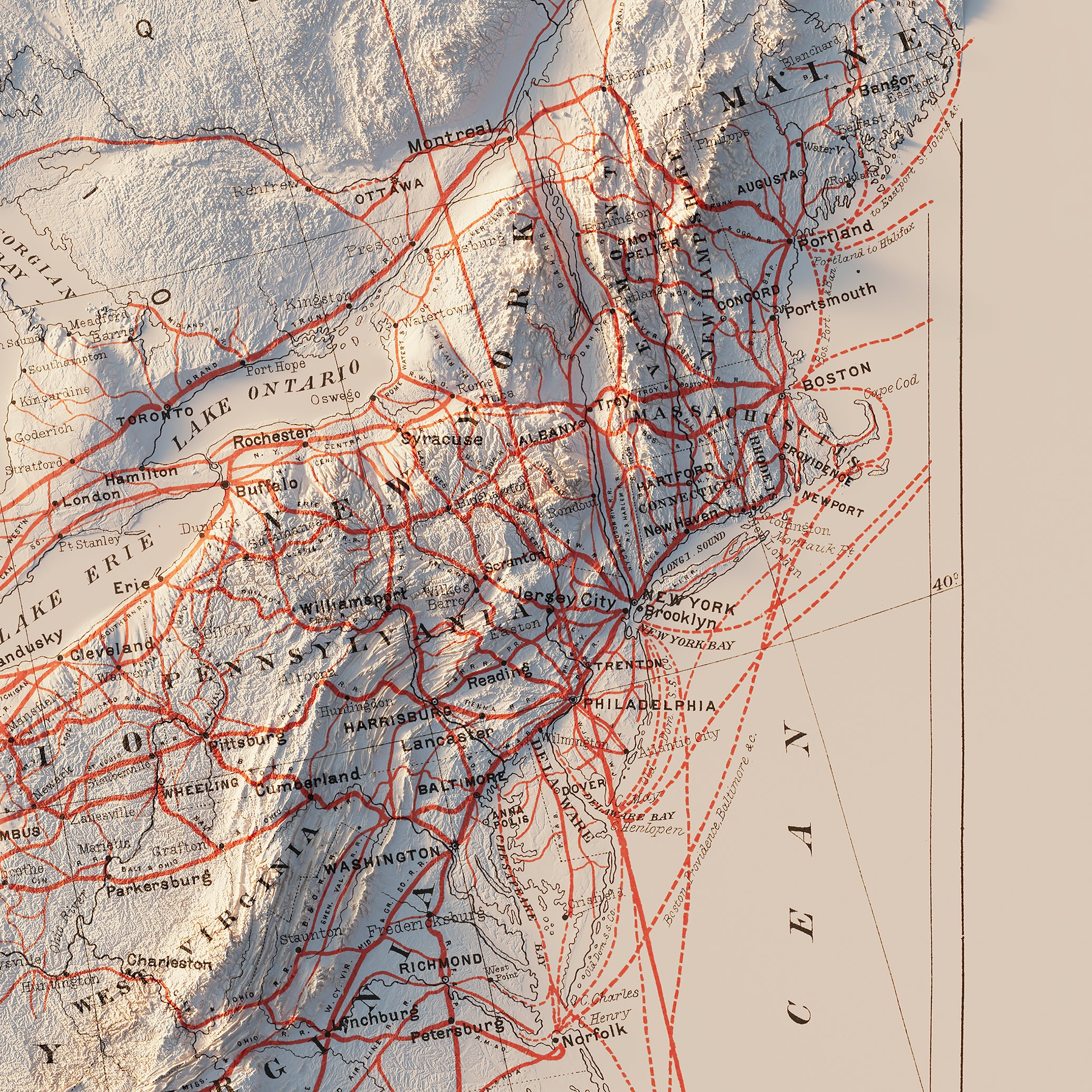
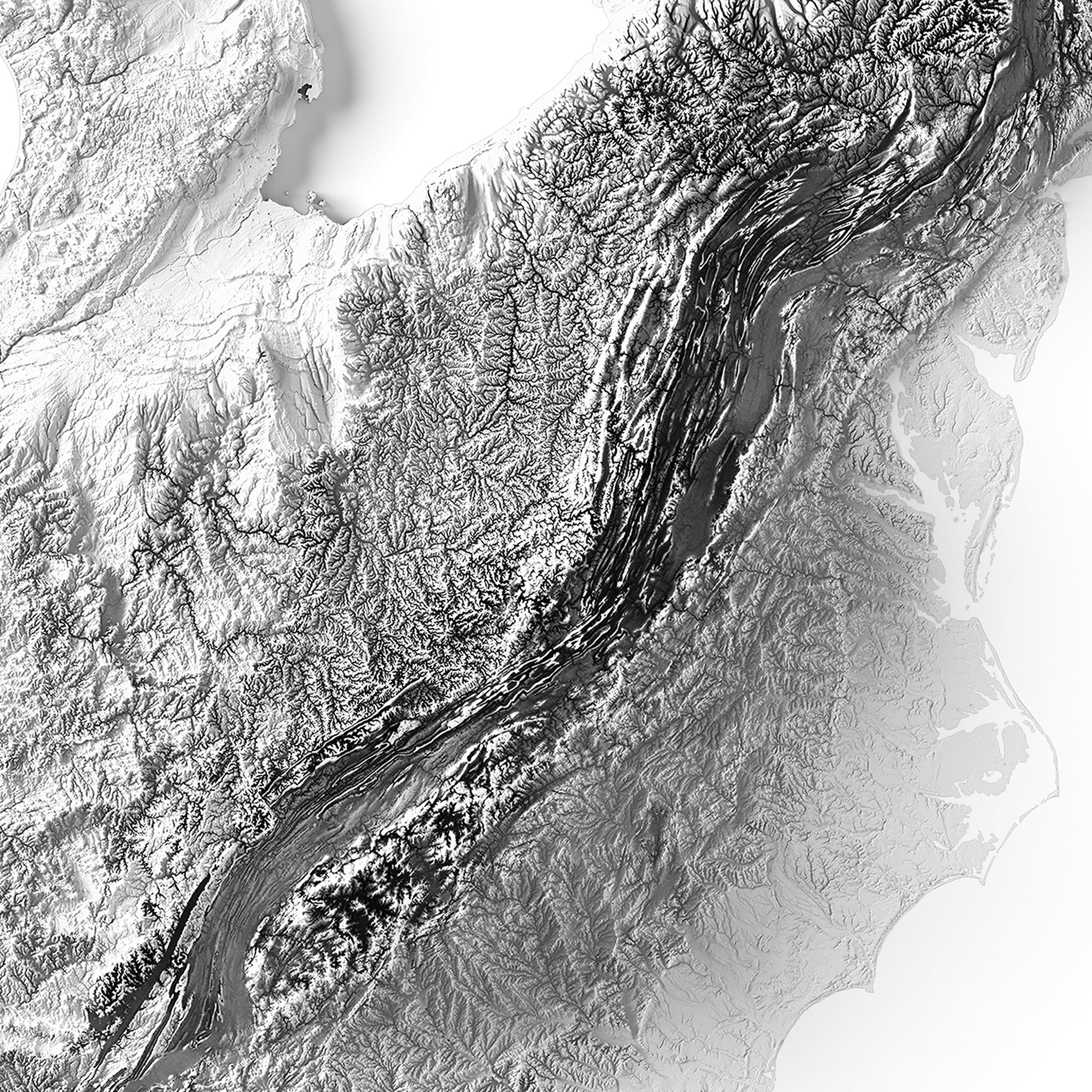
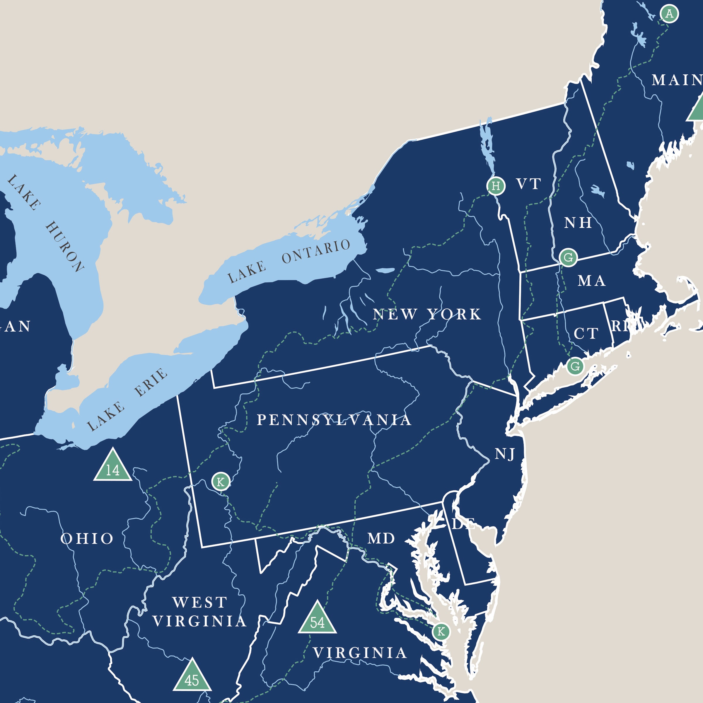
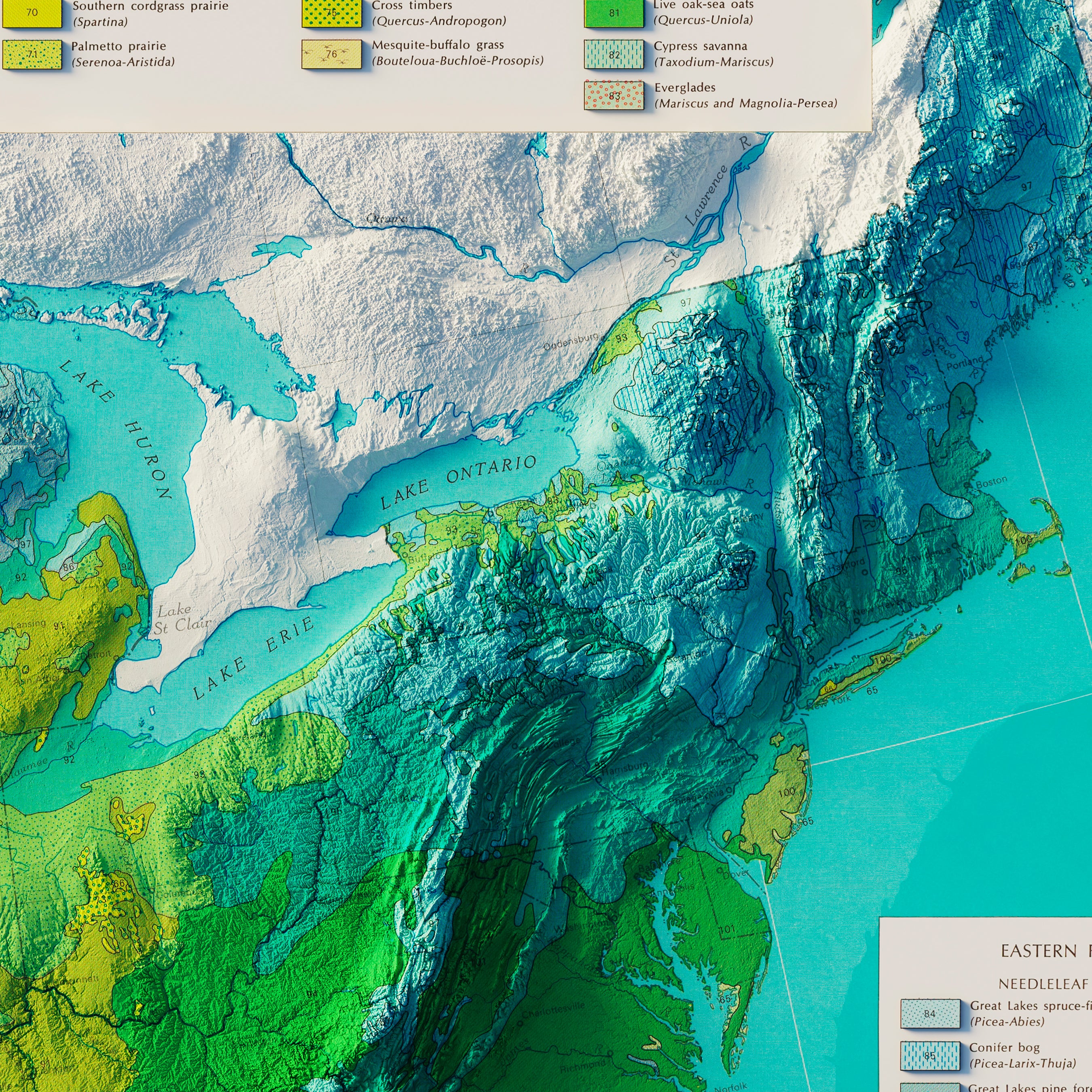
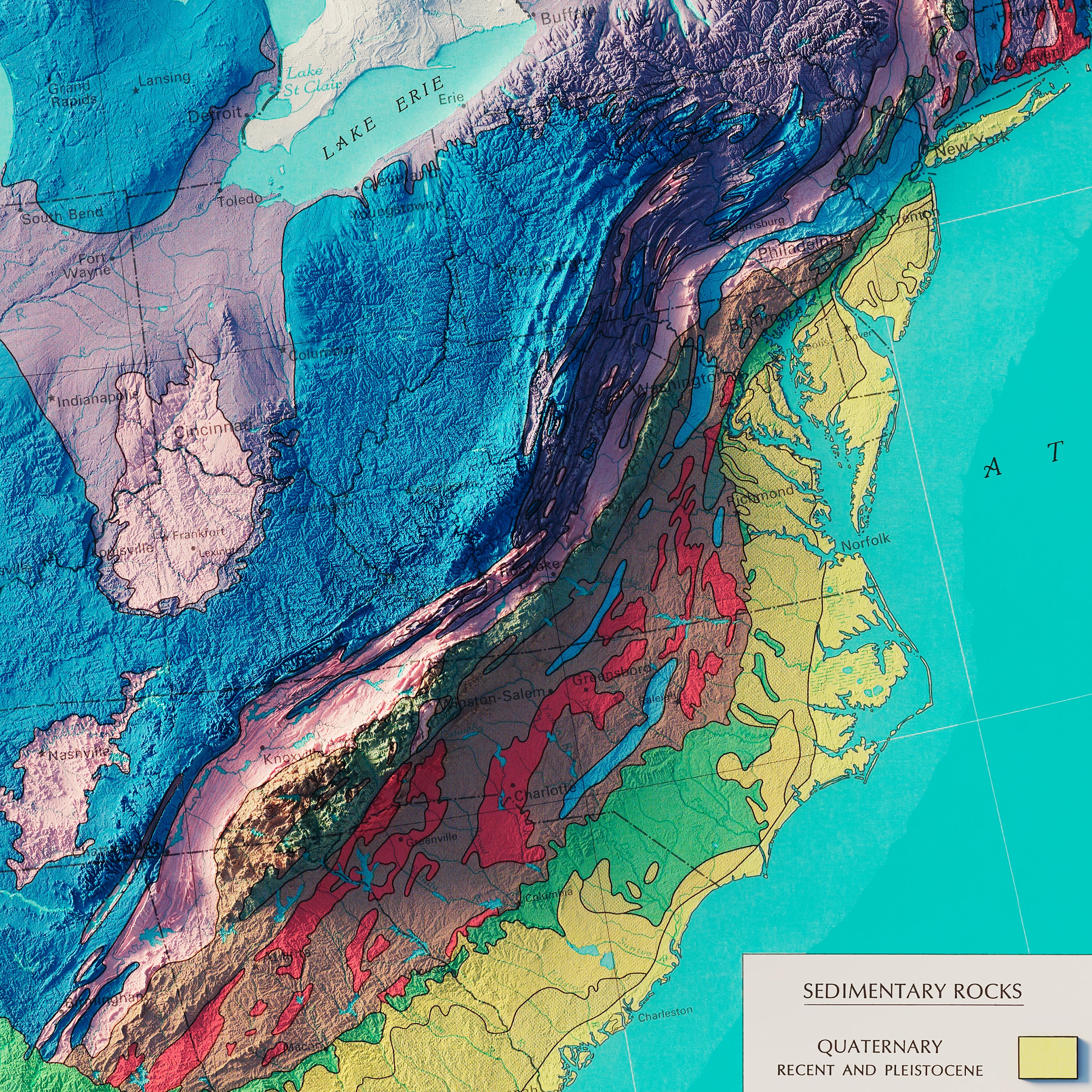
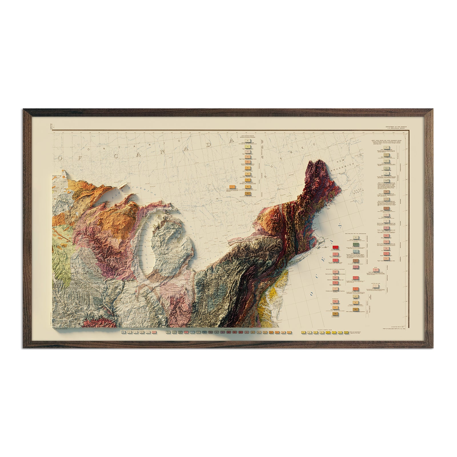
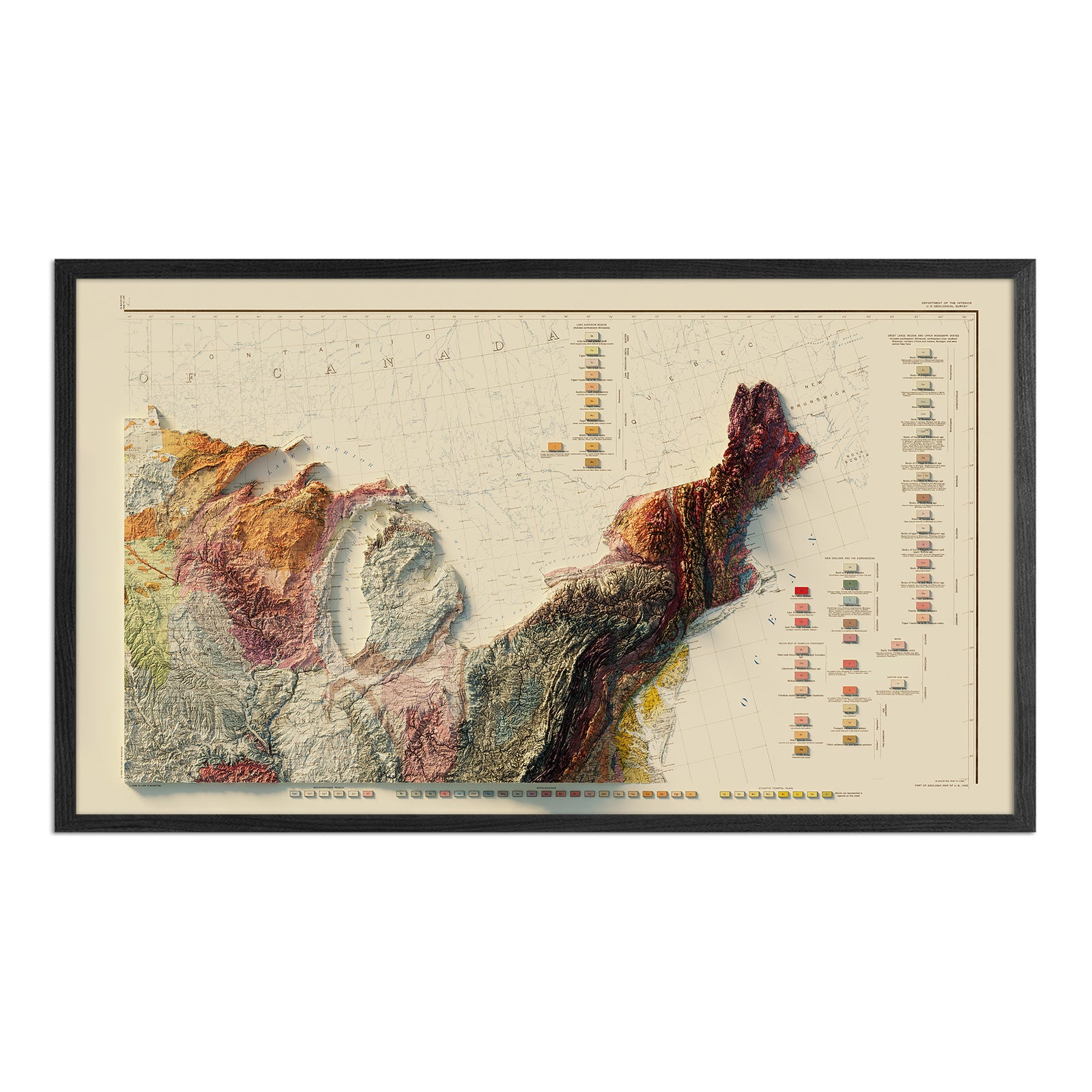
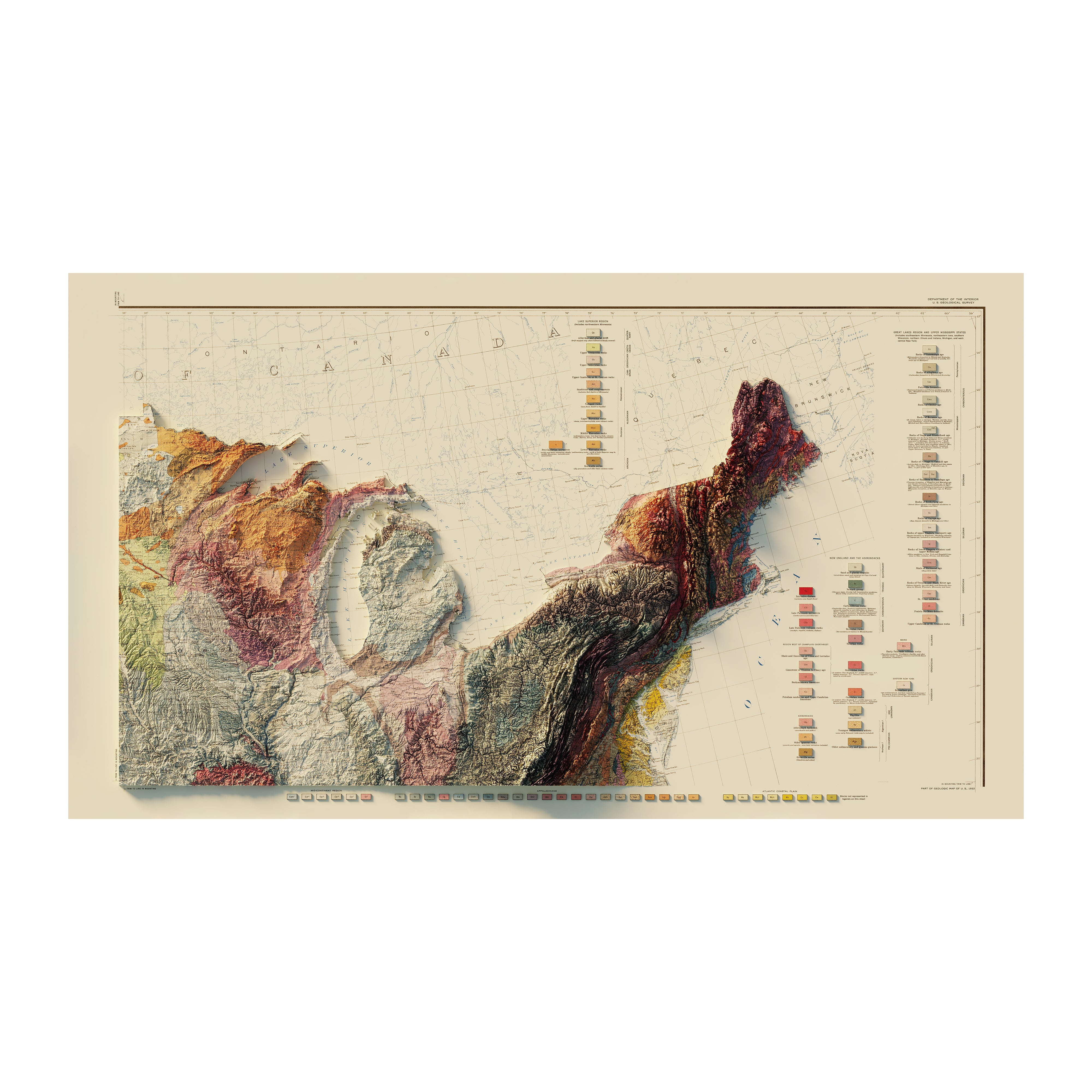
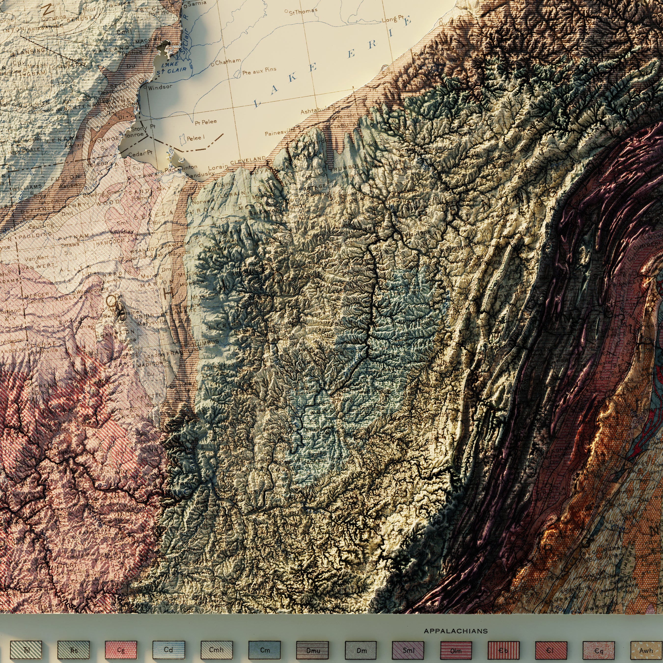
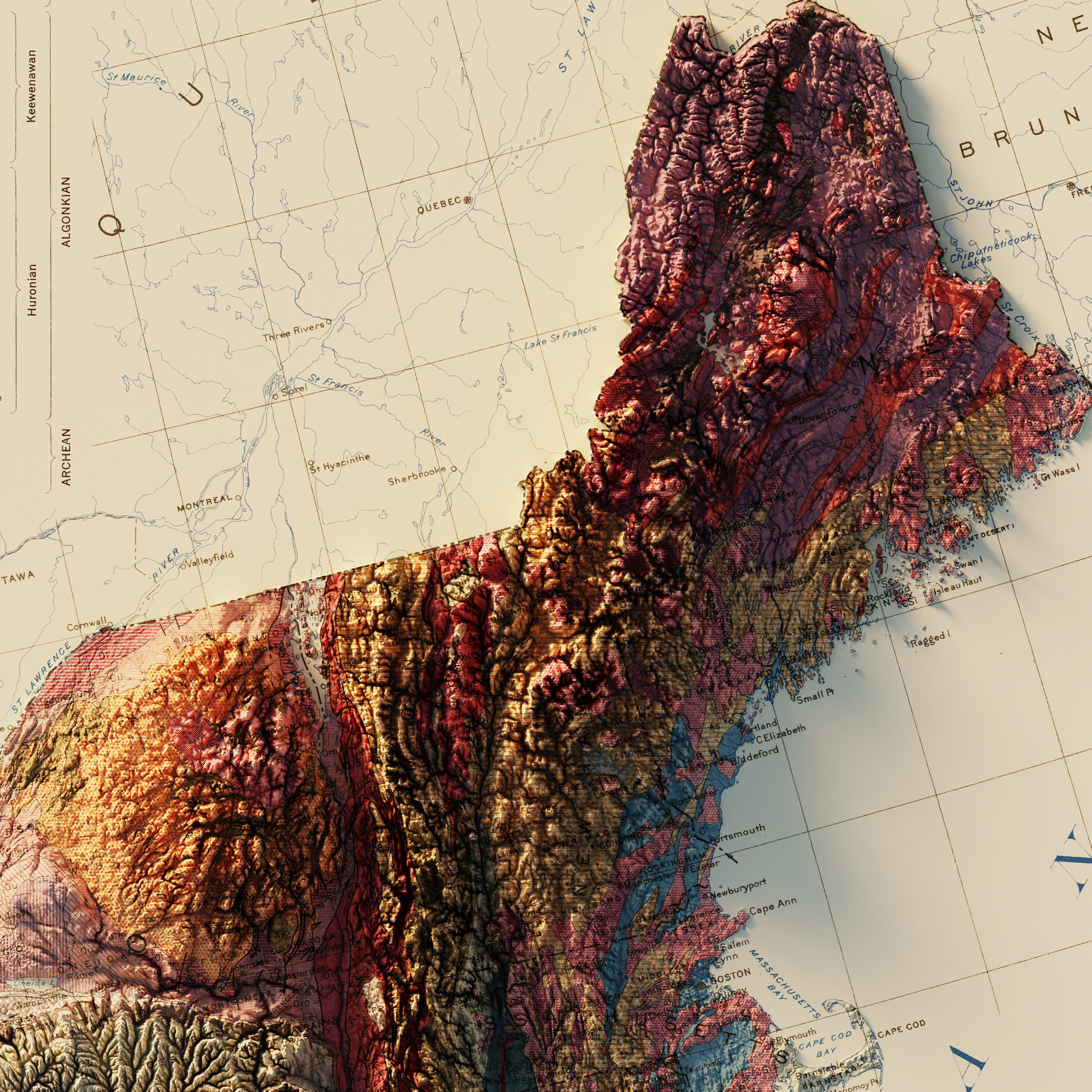
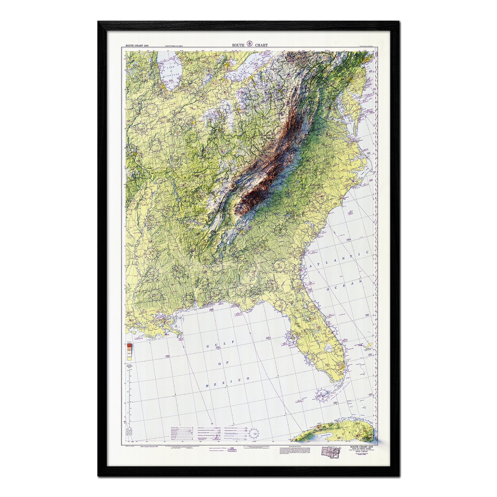
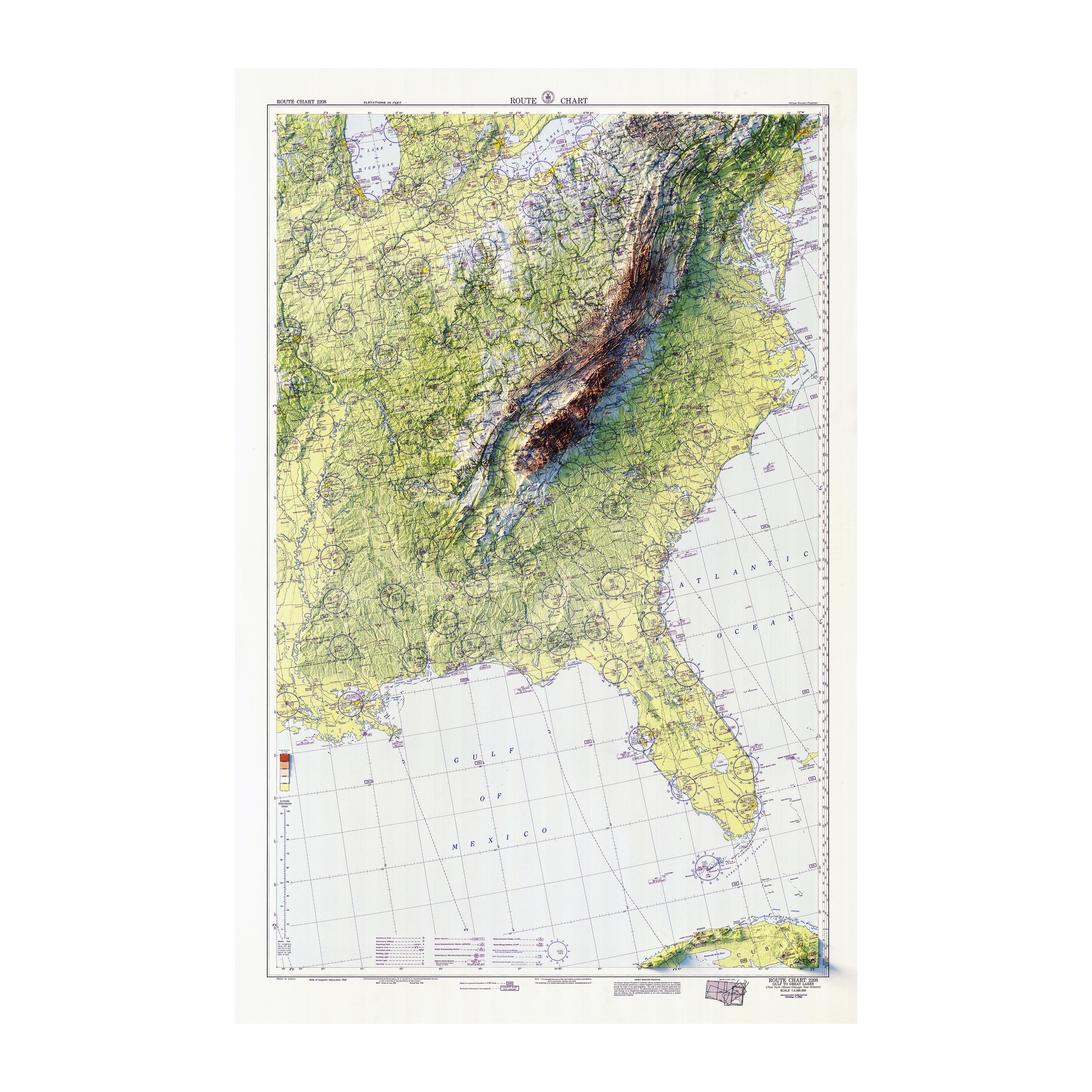
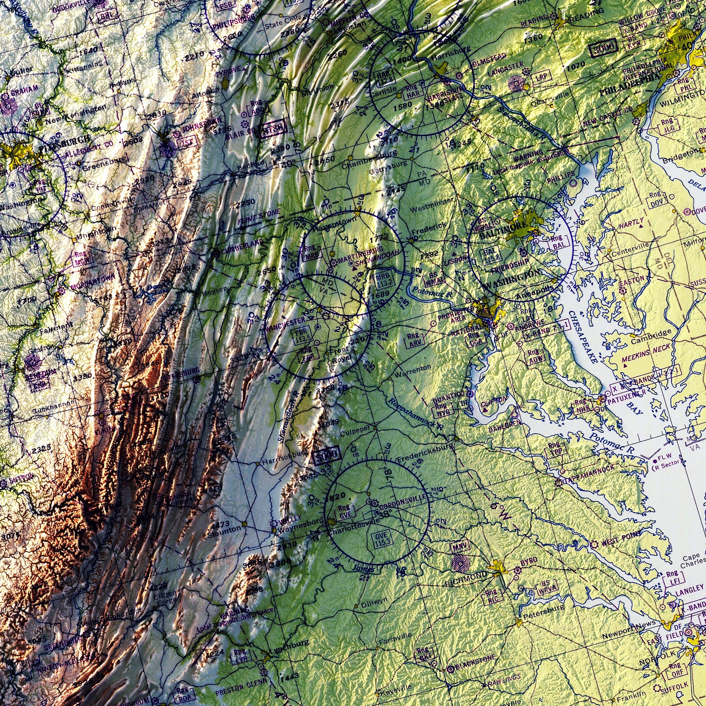
Northeast | USA map series: The interior of this US region is dominated by the northern Appalachian Mountains, including the Adirondacks, Allegheny, Catskills, Berkshires, Poconos, White, and Green Mountains. The east is a gently sloping Atlantic Coastal Plain that broadens in the south that was previously glaciated in the north. The Northeast boasts some genteel, but stunning landscapes forged by water and ice. Notable national parks include Acadia (ME), and the recently established, New River (WV) National Parks. This is also the USA’s most populous region, with cities like Boston, New York, Philadelphia and Washington, DC forming the backbone of the country’s largest megalopolis.
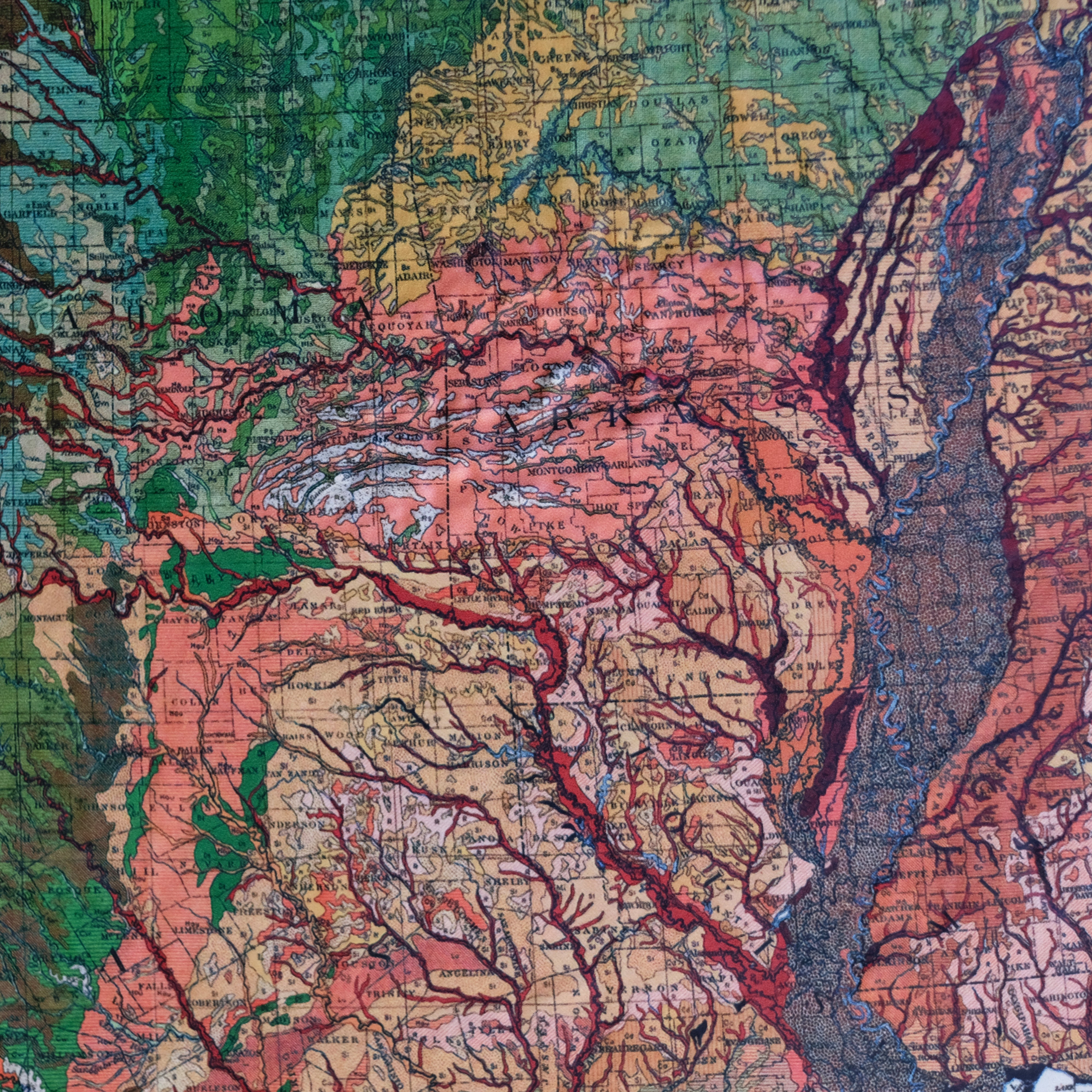
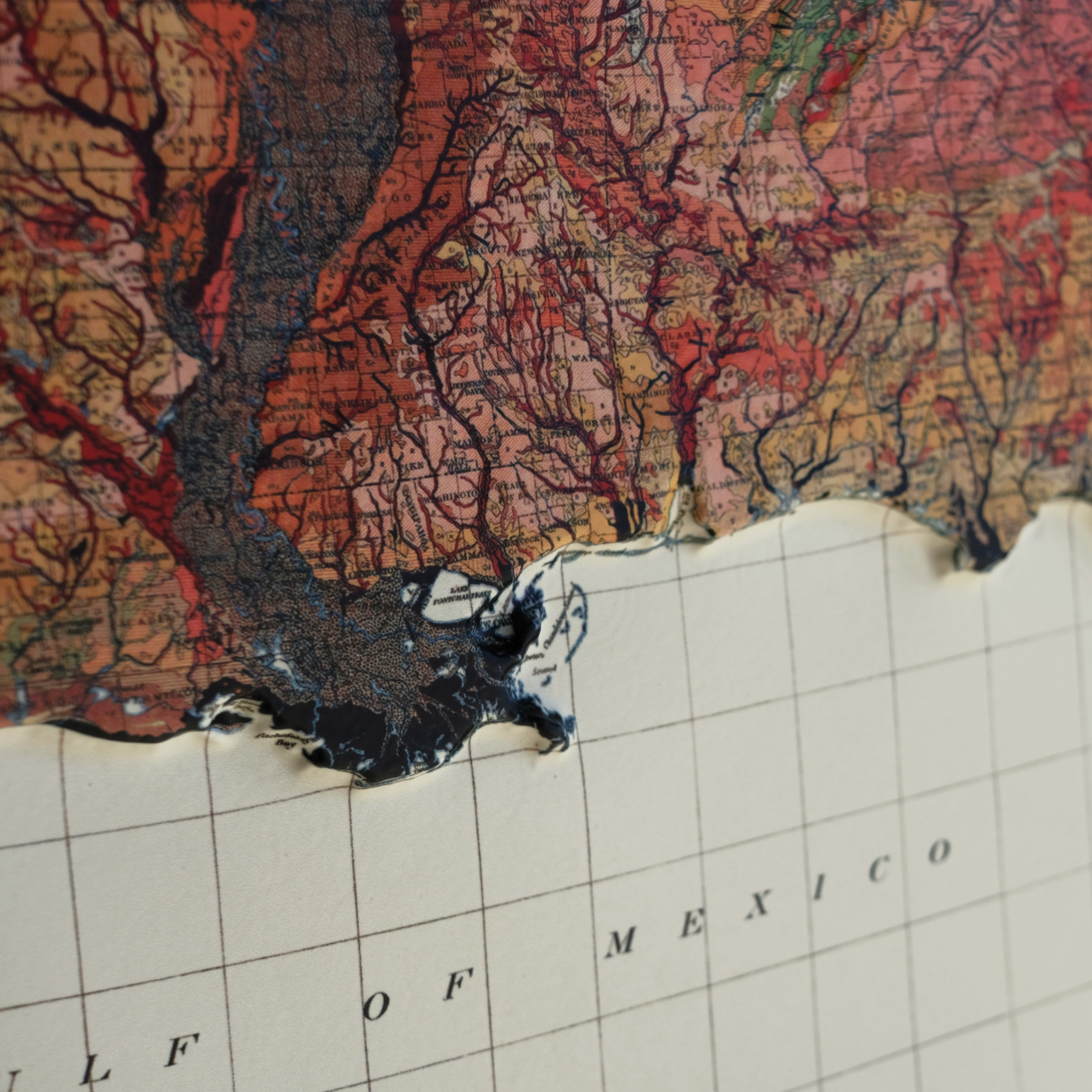
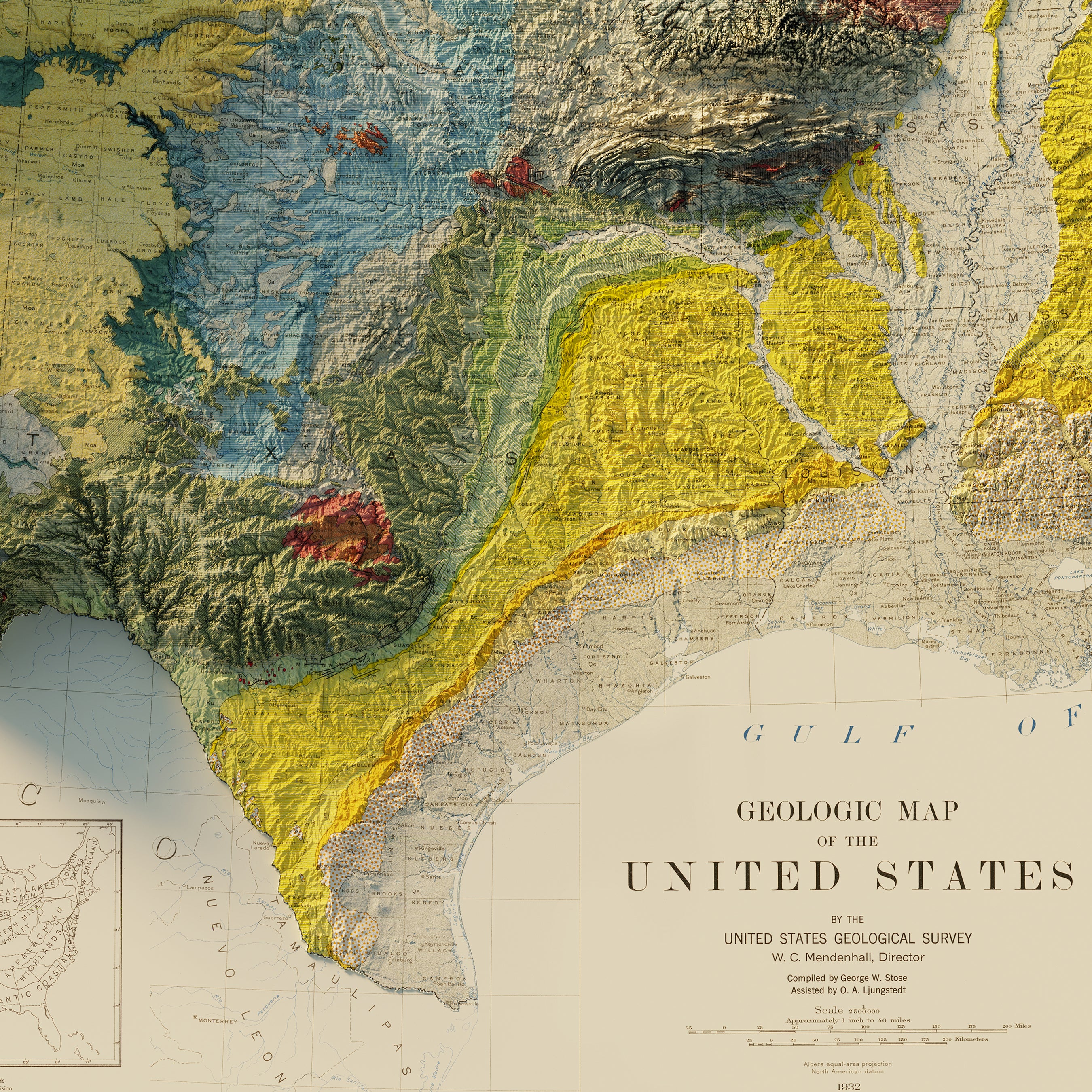
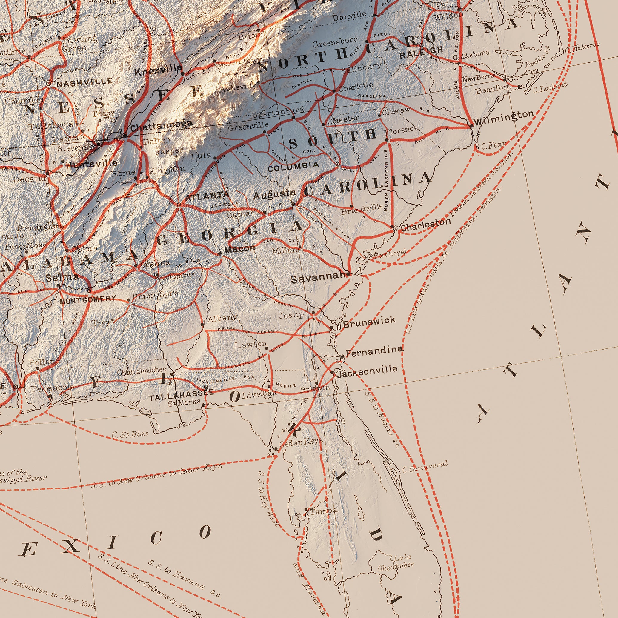
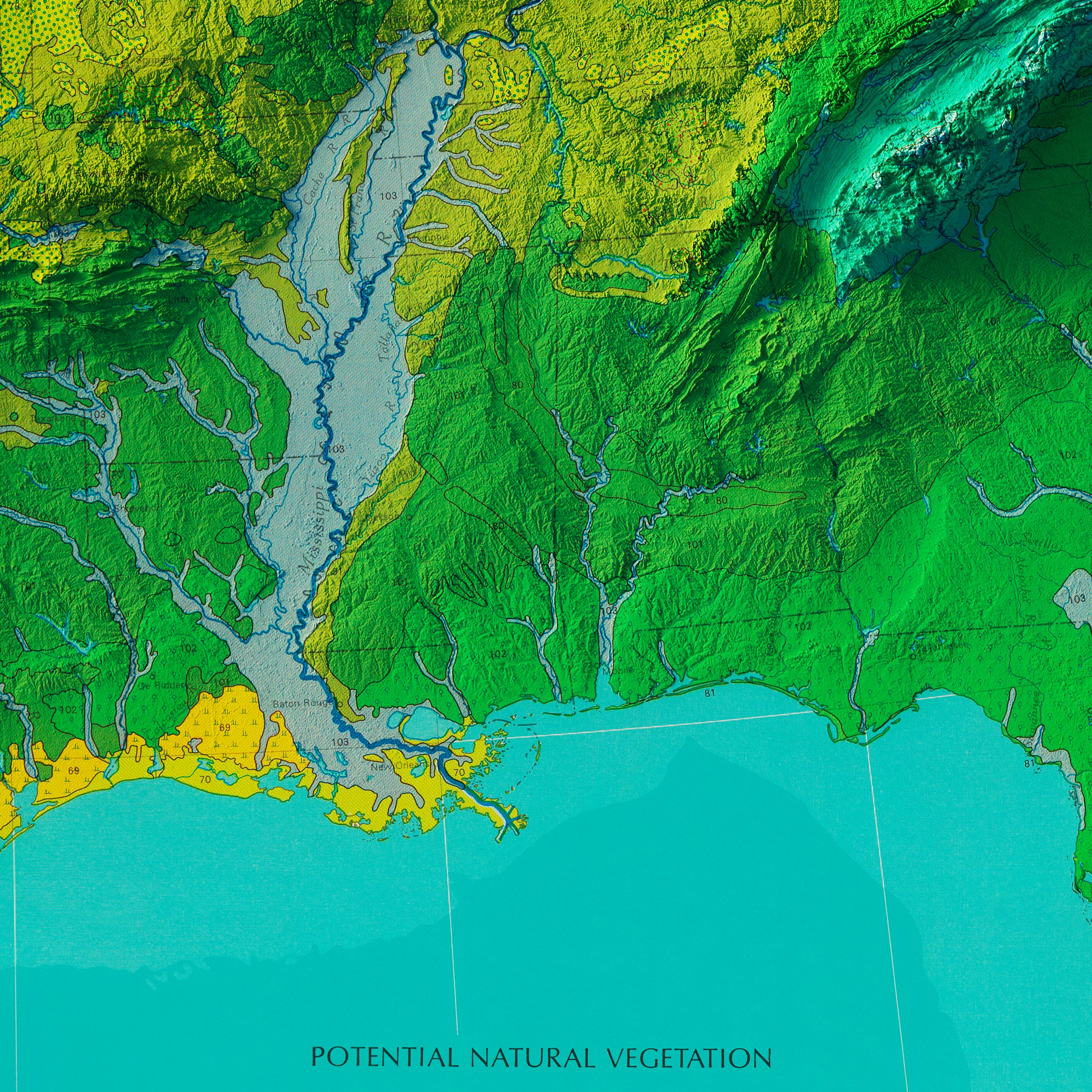
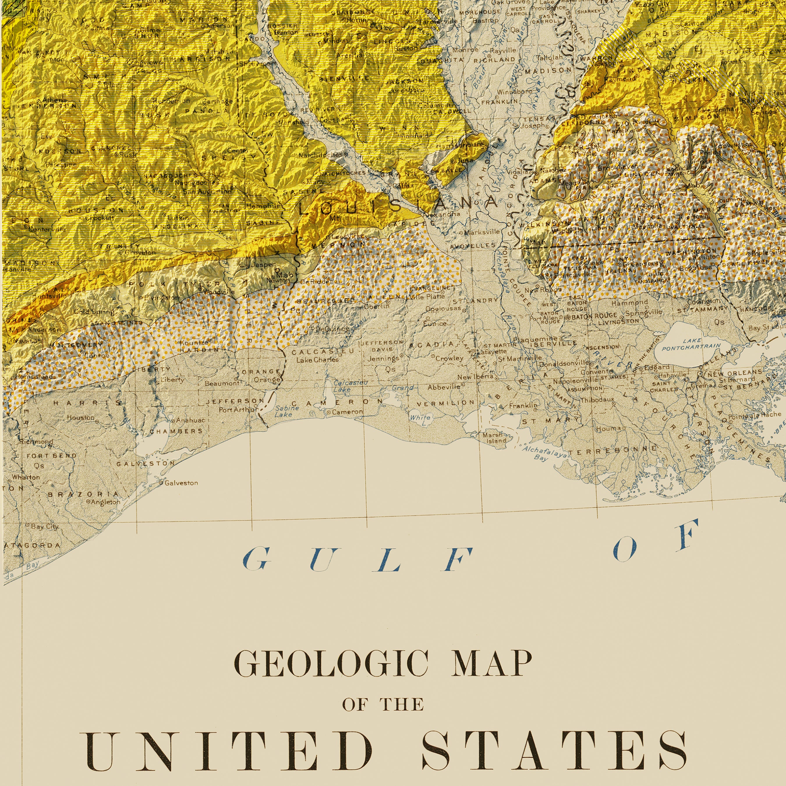
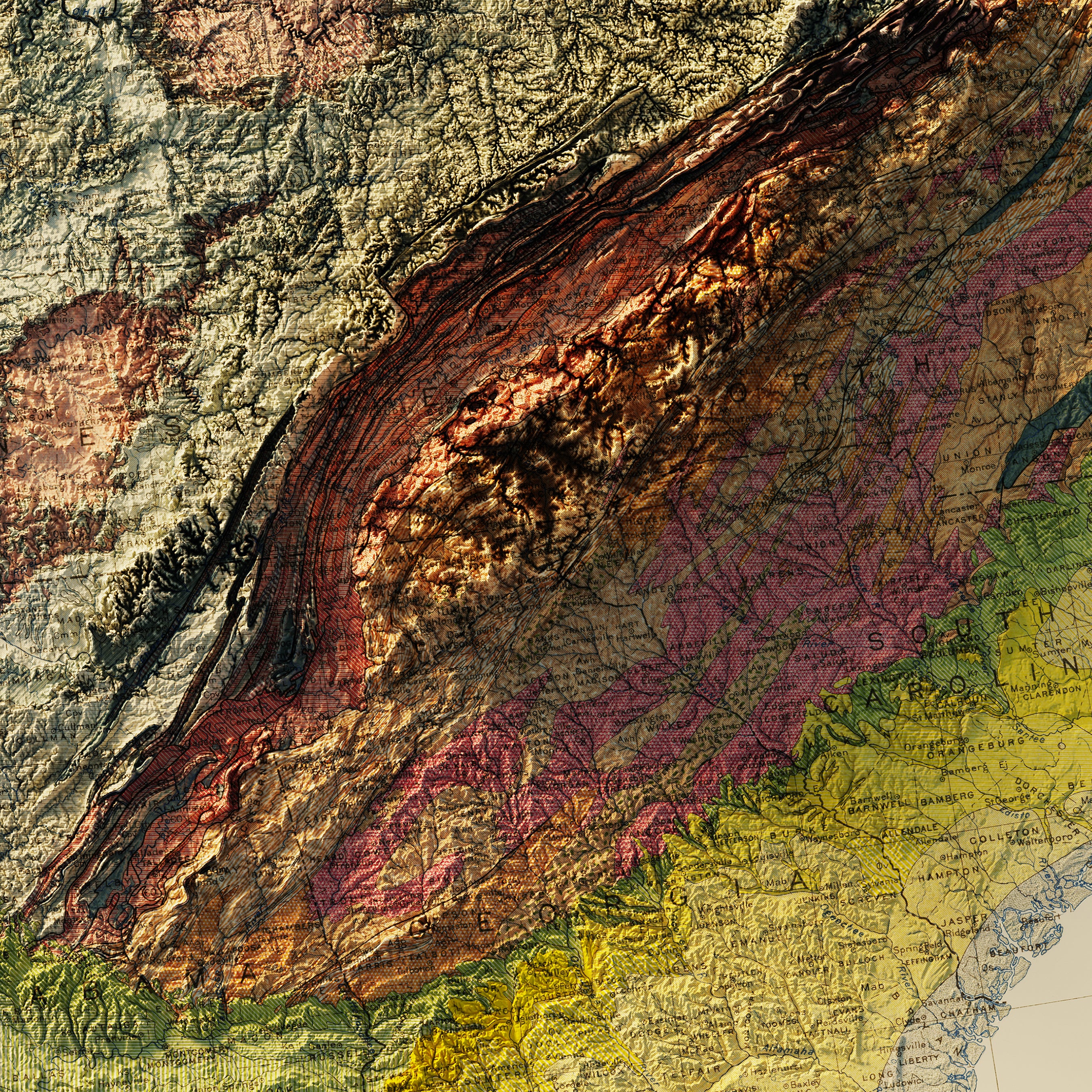
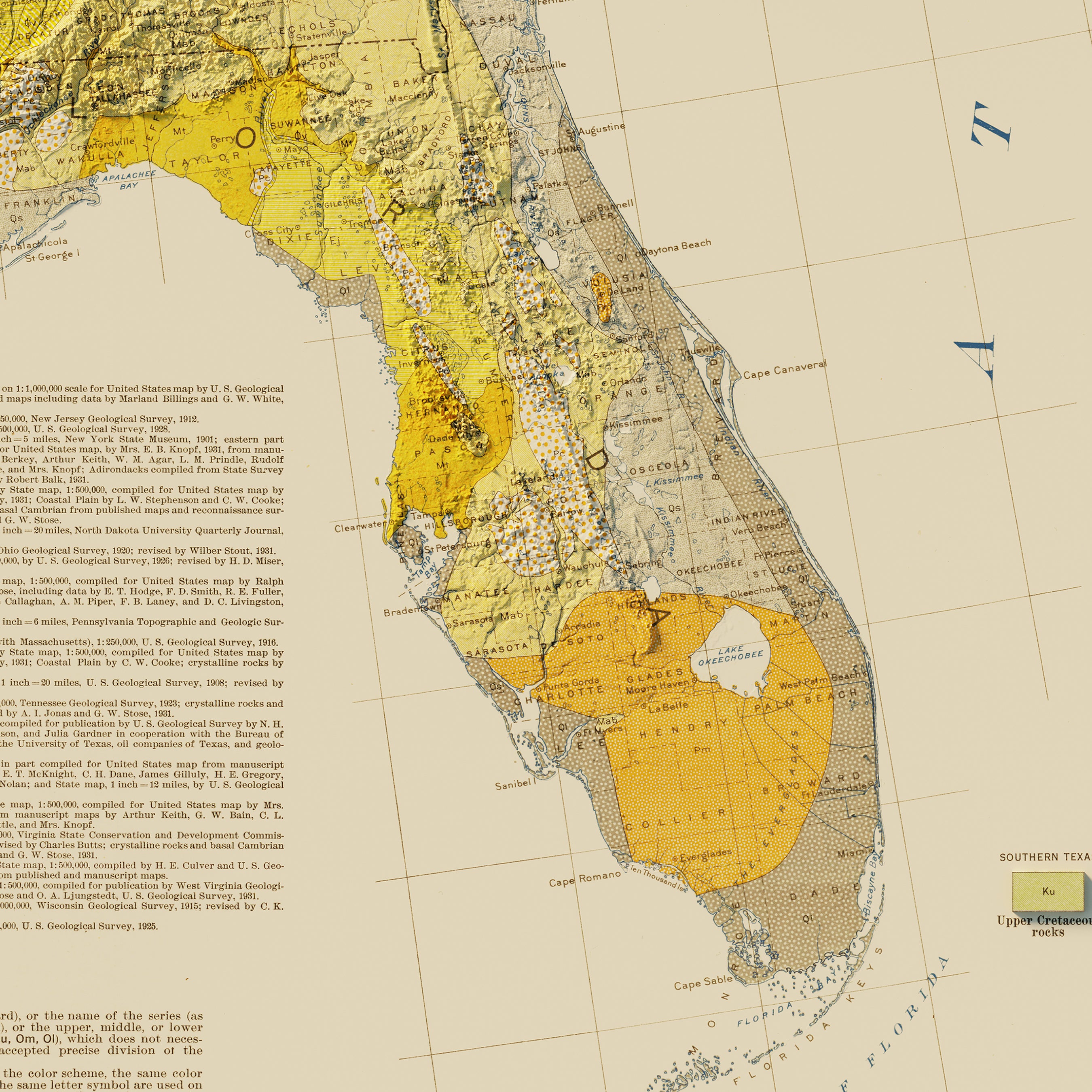
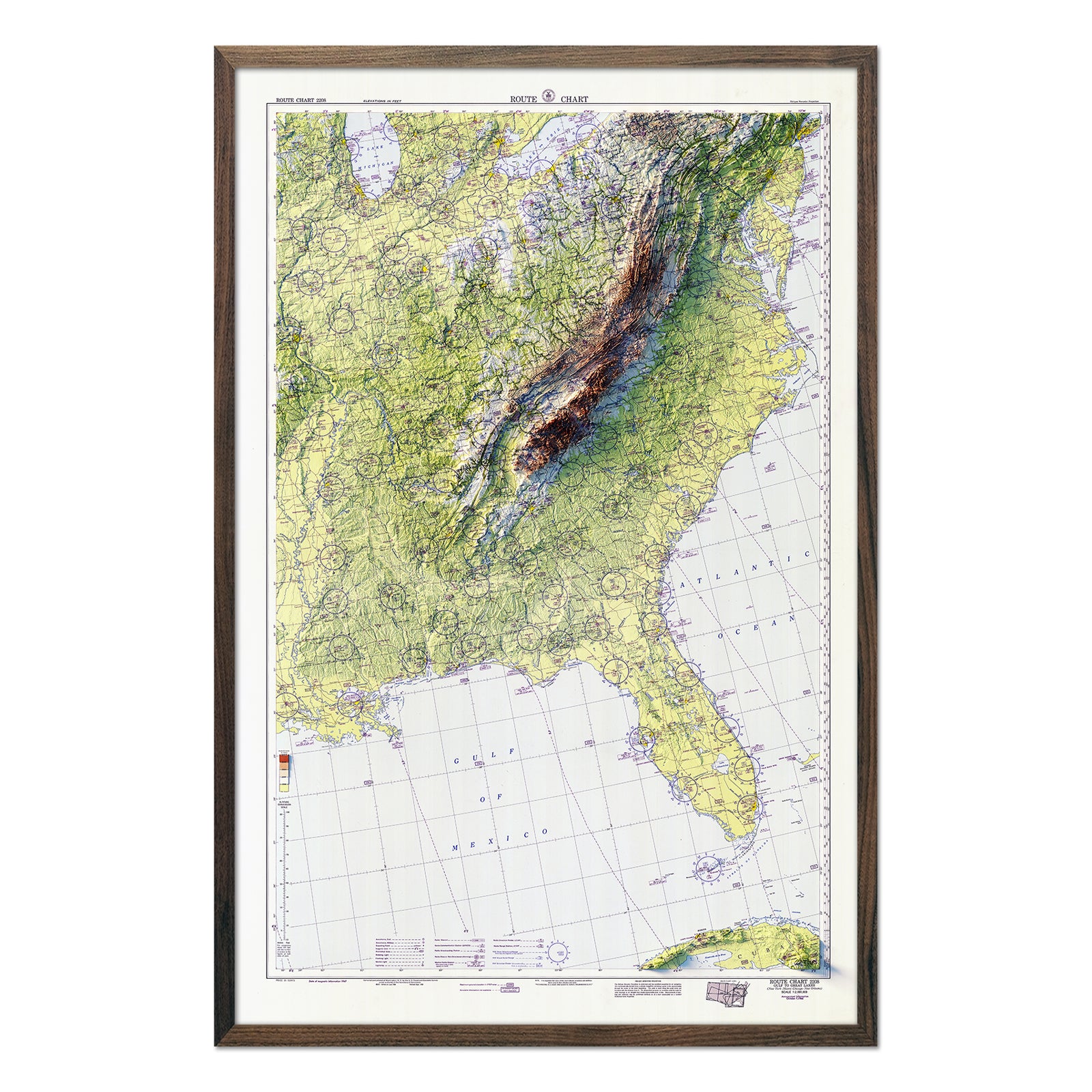
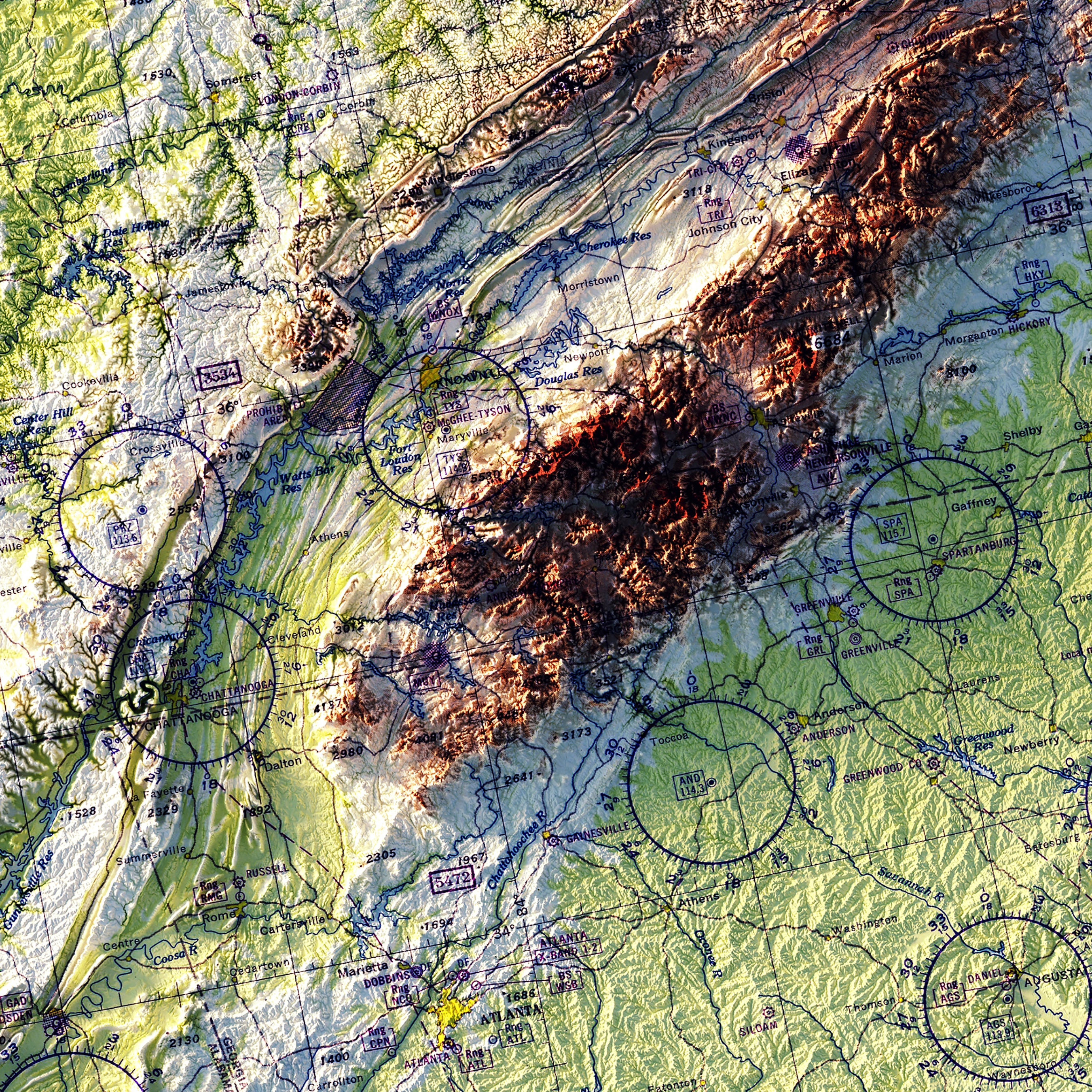
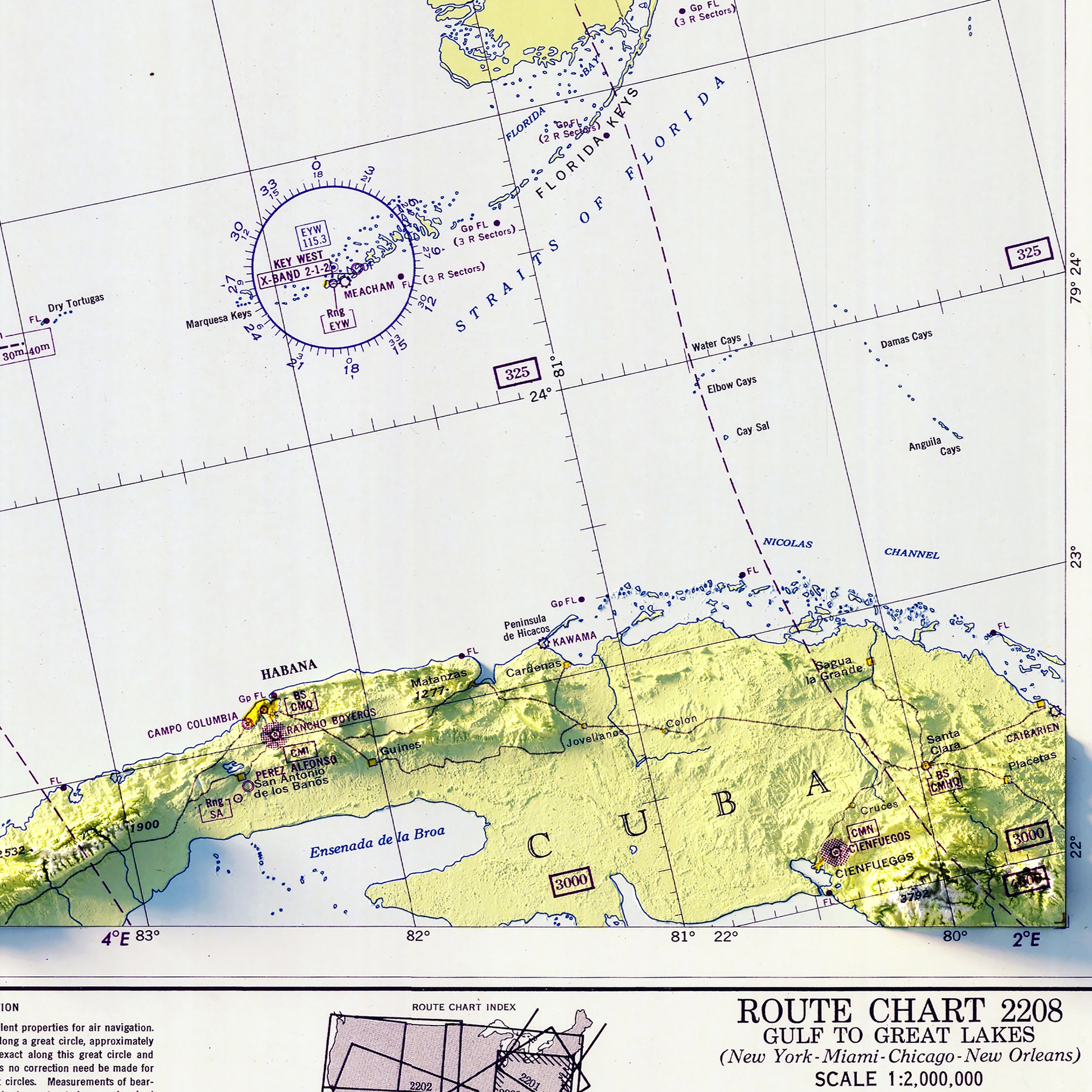
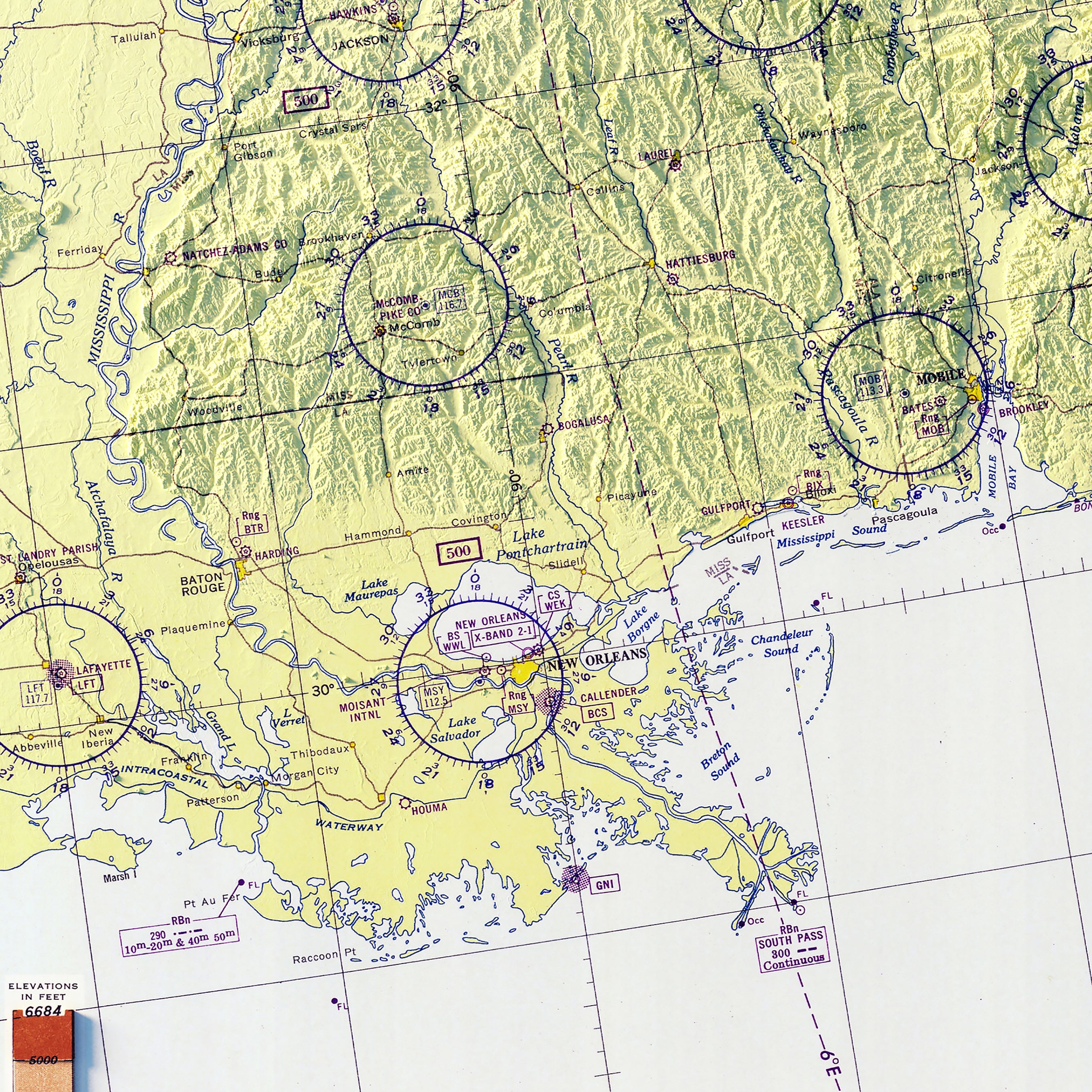
Southeast | USA map series: This humid, subtropical region has some of the USA’s richest and perhaps most vulnerable coastline. Dominant coastal landforms include intercoastal waterways and associated barrier islands, coastal swamps, bayous, large deltas, including that of the mighty Mississippi River. Florida is home to our largest wetland and subtropical wilderness, the Everglades. The land is generally flat, gently sloping upward to the Piedmont. In the far northwestern interior, the land rises to the eastern USA’s highest peak, Mt. Mitchell, in the southern Appalachian Mountains. This region is home to the Smoky Mountains National Park, our nation’s most visited natural wonder.
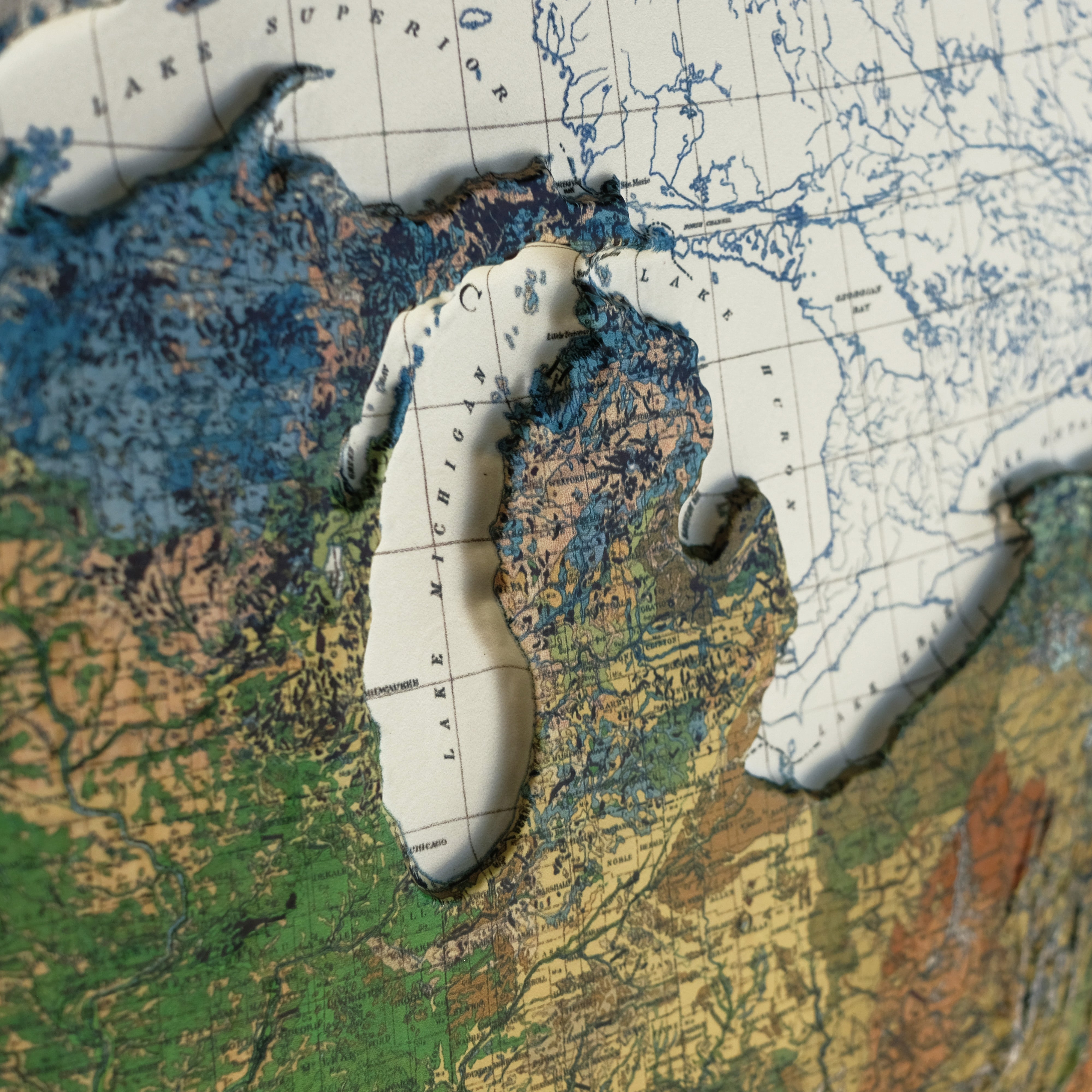
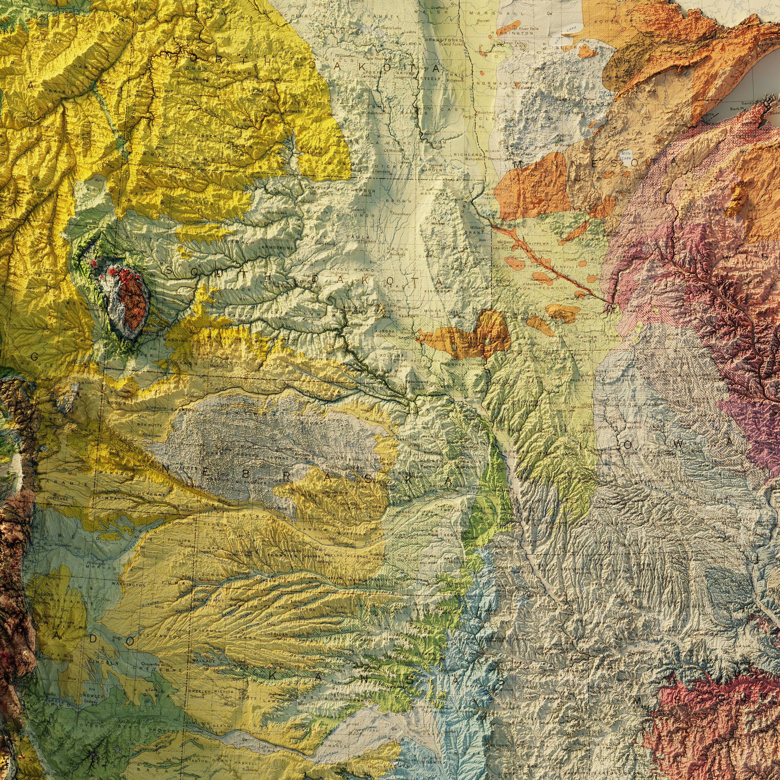
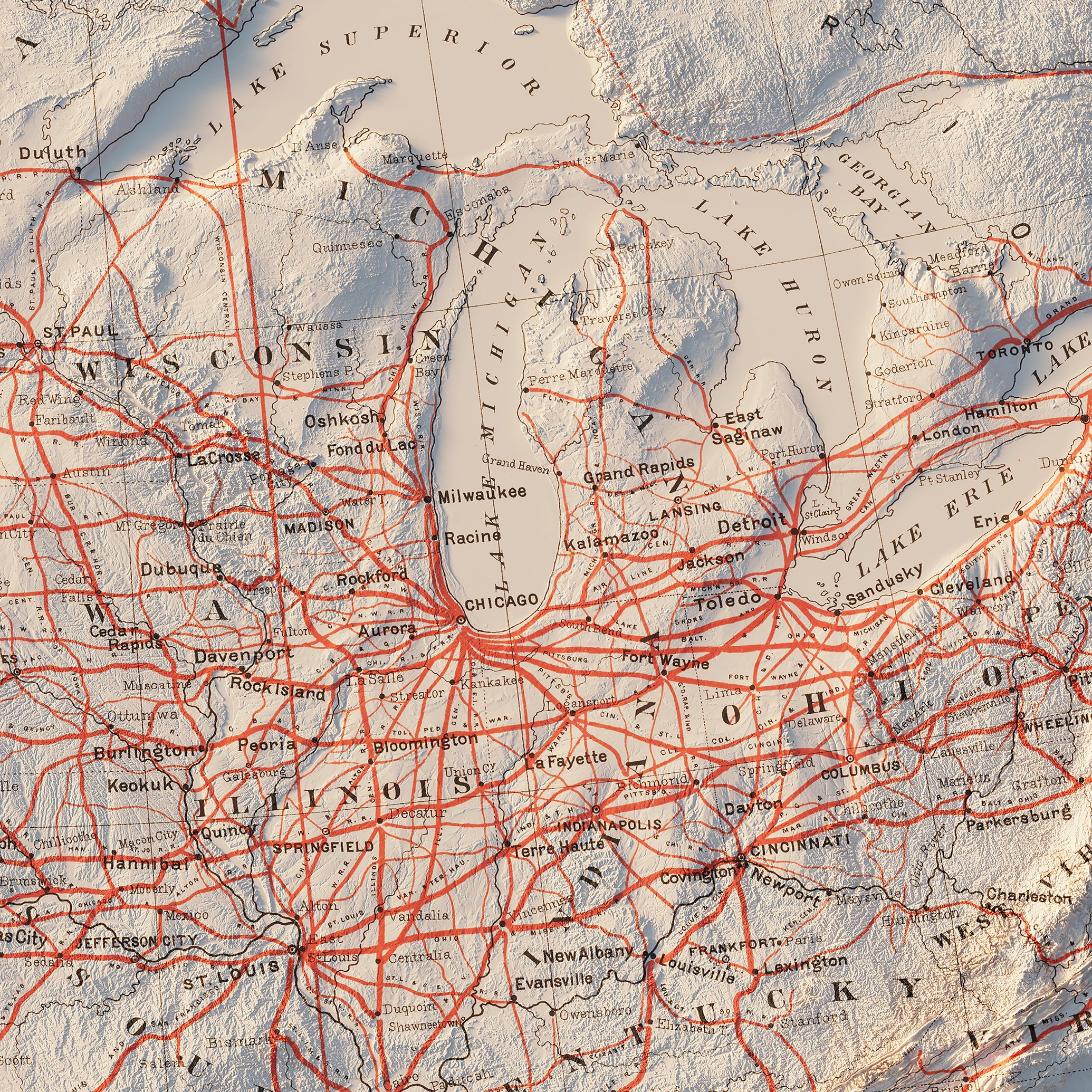
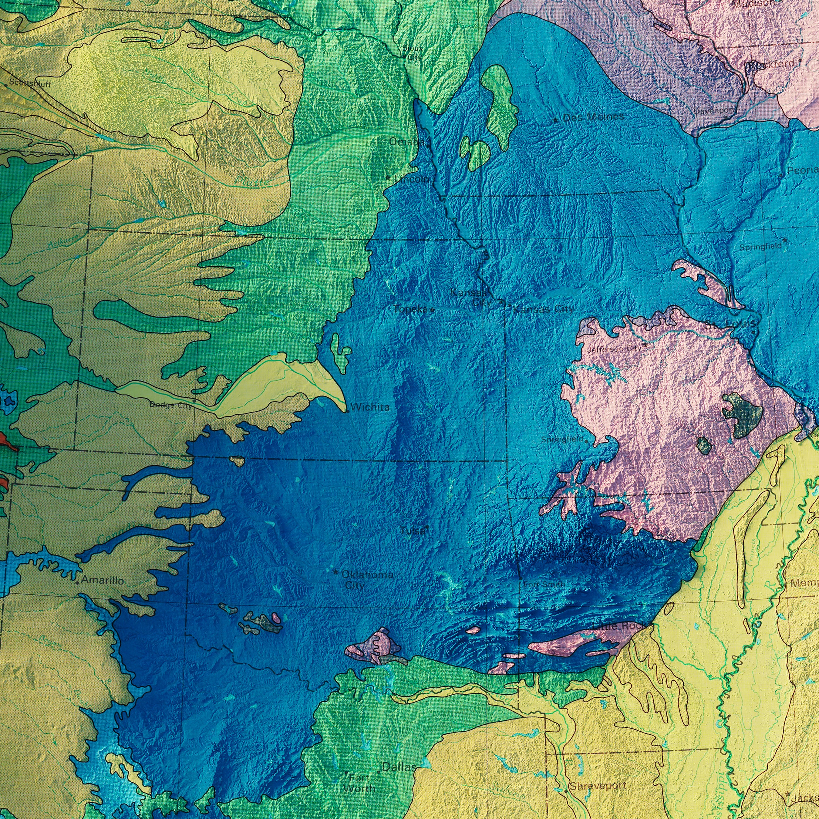
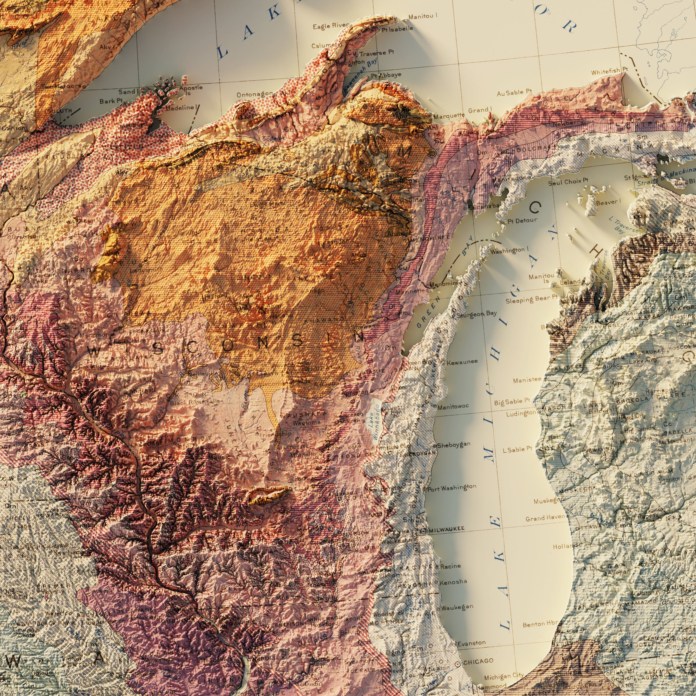
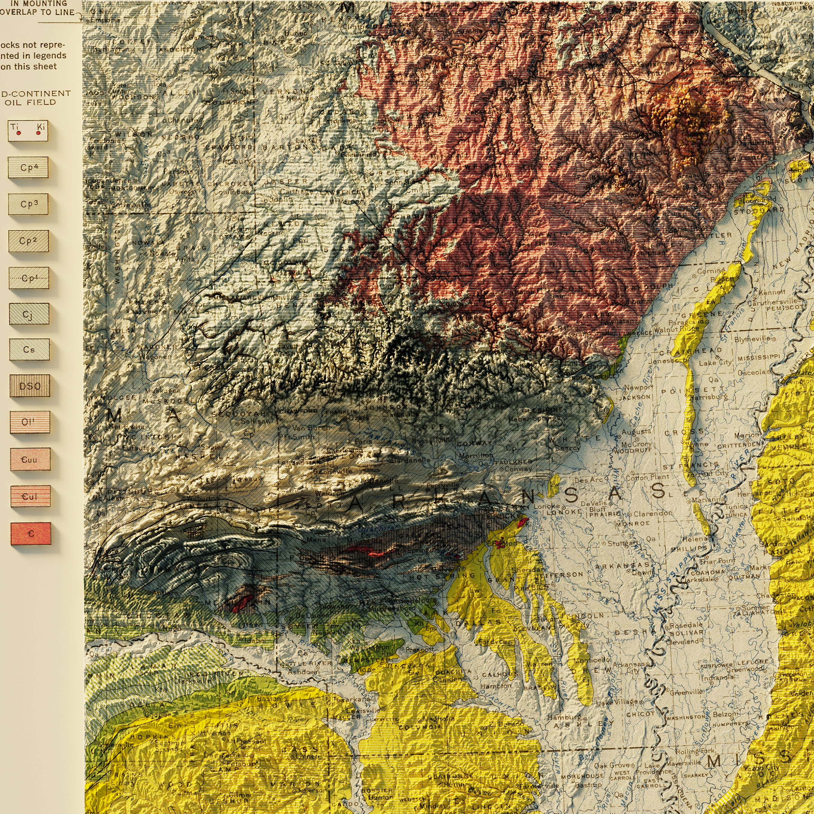
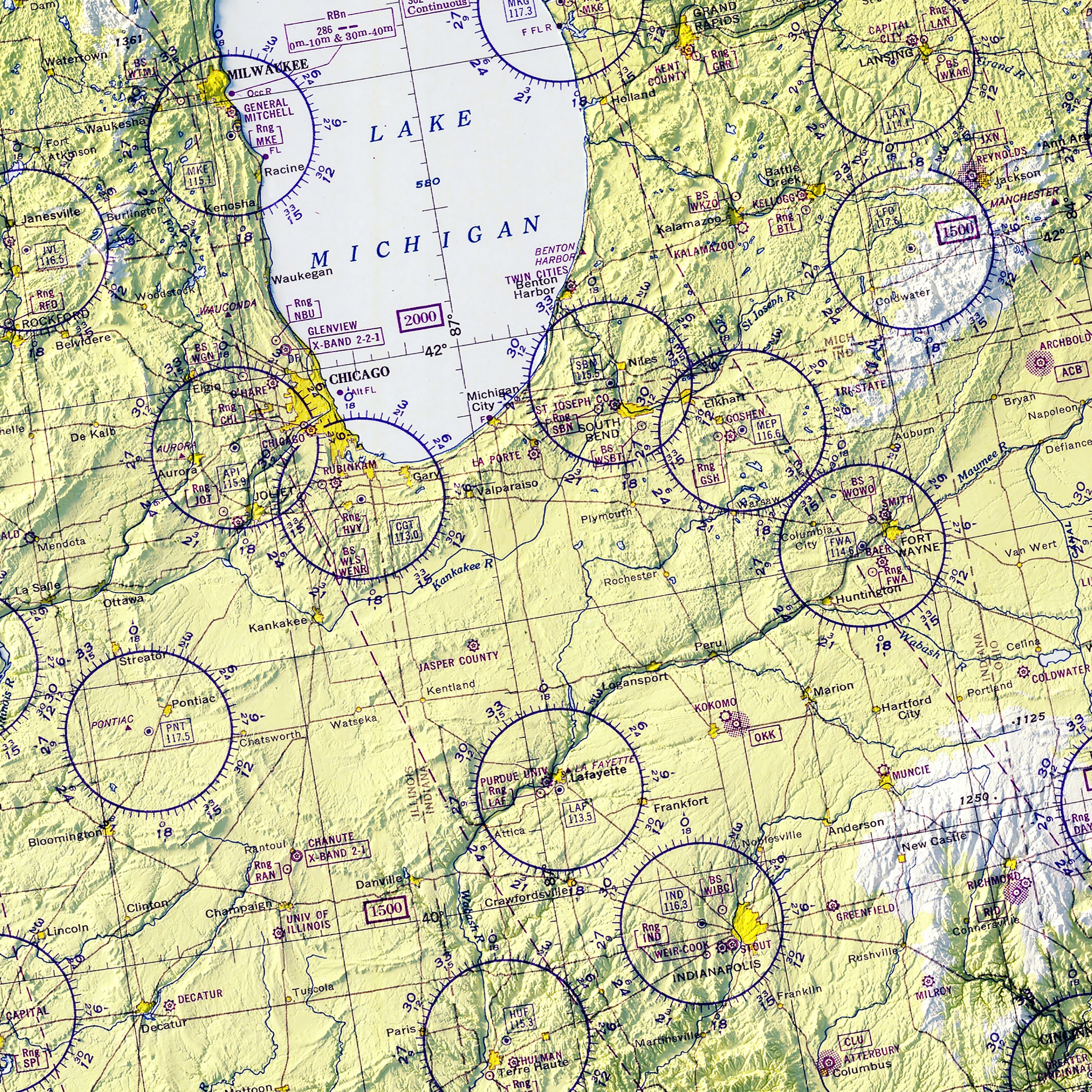
Midwest | USA map series: This US region, albeit inland, is dominated by the forces of water and ice-age glaciers, with the Wisconsin Ice Sheet having gouged its largest feature, The Great Lakes; which include Lake Superior (the world’s largest body of freshwater), Michigan, Huron, Erie, and Ontario. Upper Midwest states have coastlines the rival coastal states. To the south and west, great river systems dominate, including the Ohio, Missouri, and Mississippi Rivers. Mountains are very modest in the region and are found in northern Michigan and Minnesota, and the Ozarks to the south. Prominent cities include Chicago, Minneapolis, Detroit, Cleveland, St. Louis, Cincinnati, and Kansas City.
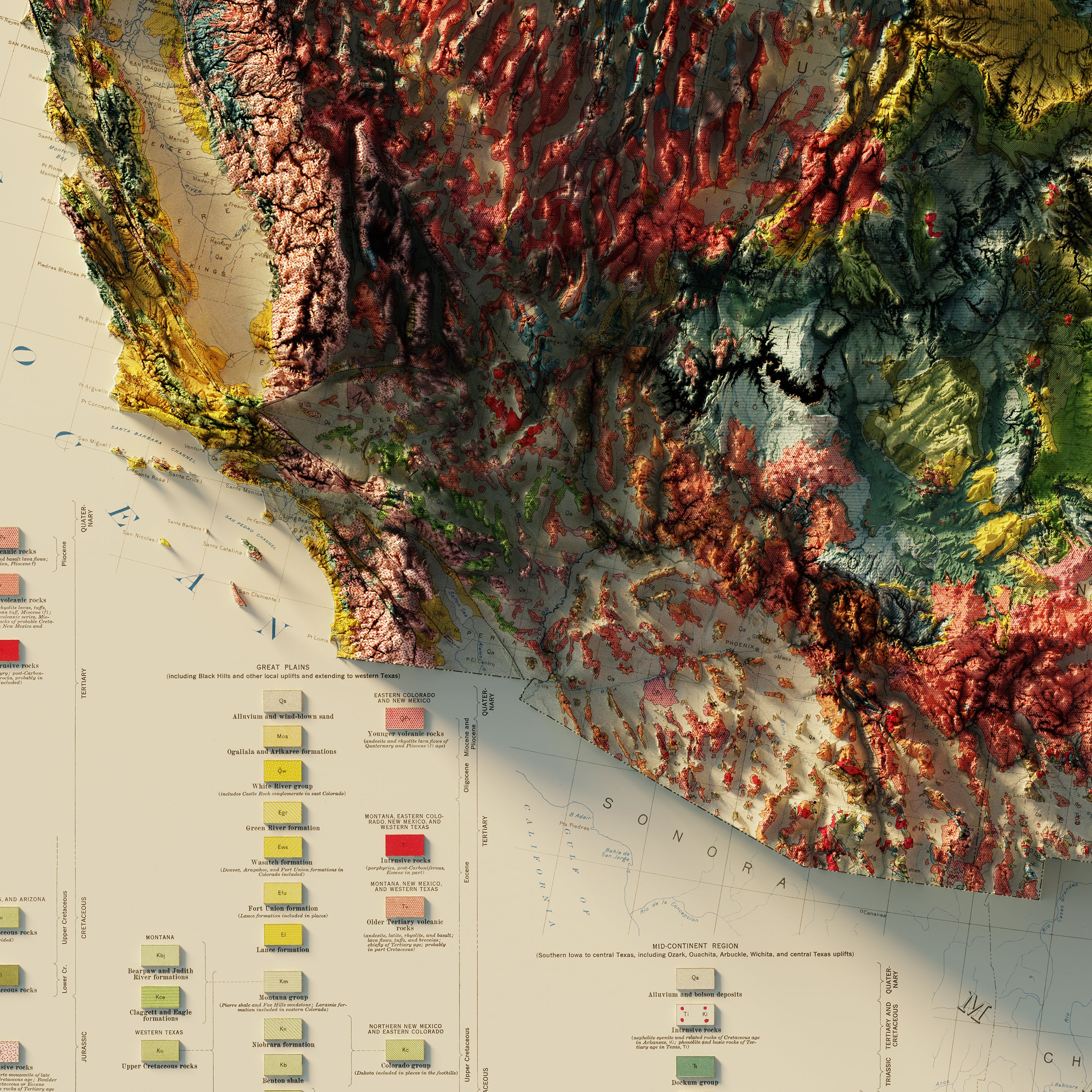
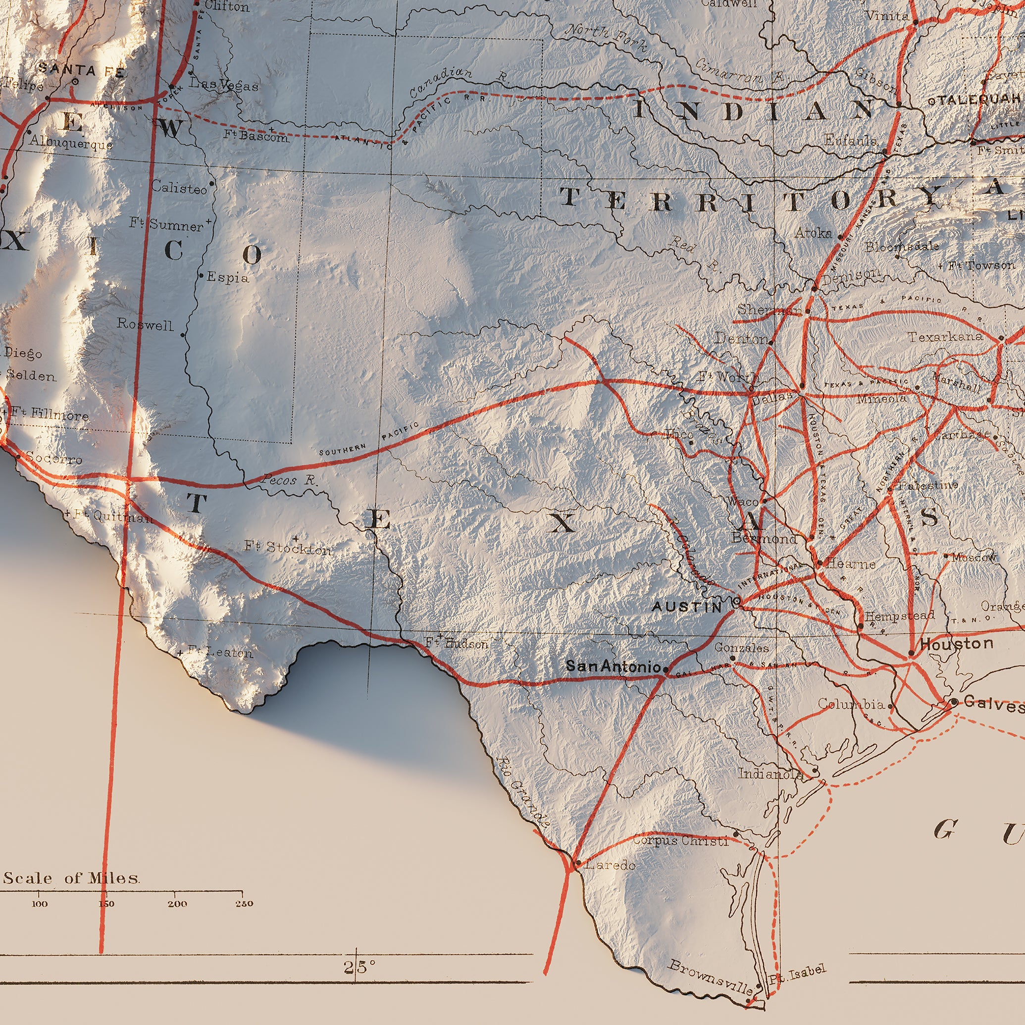
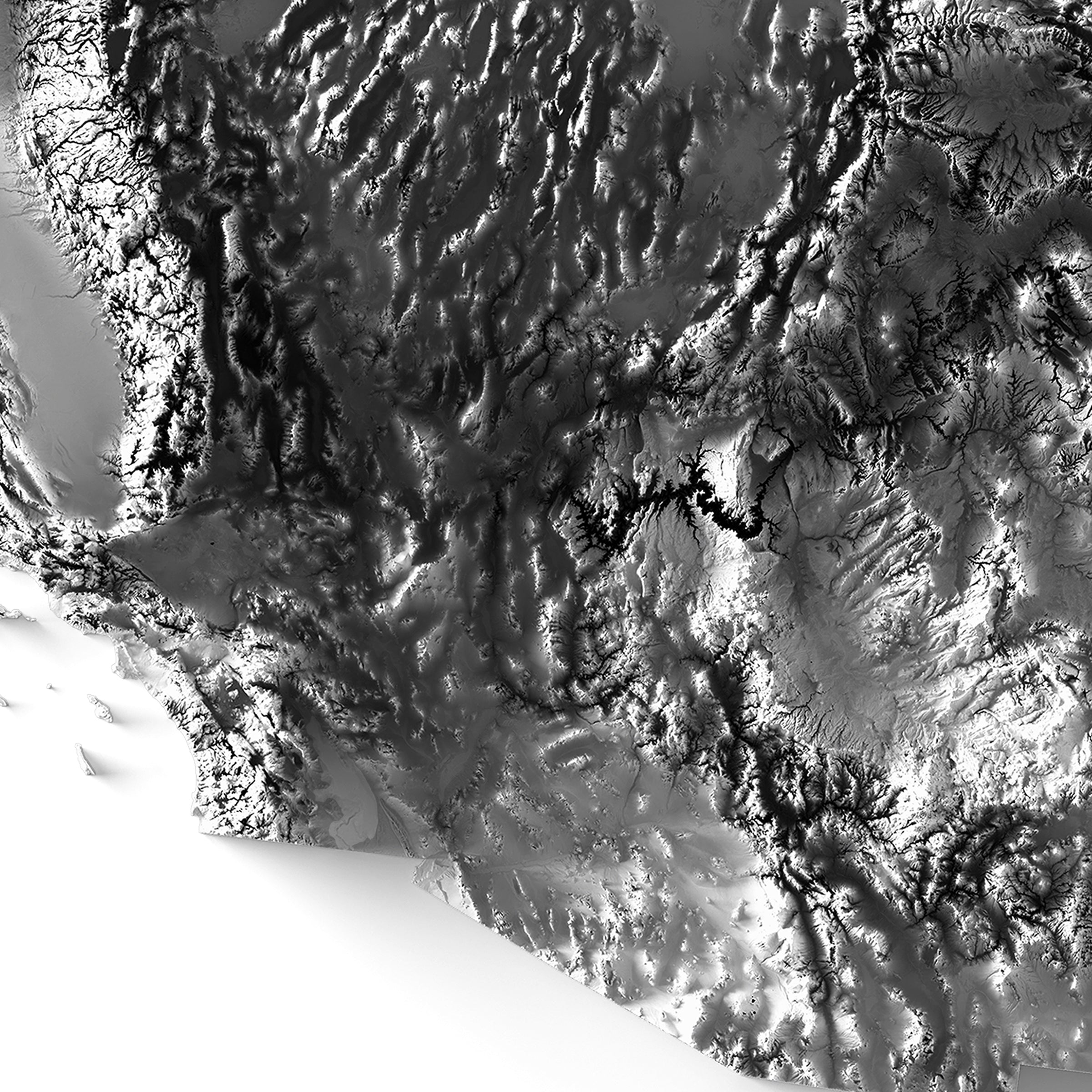
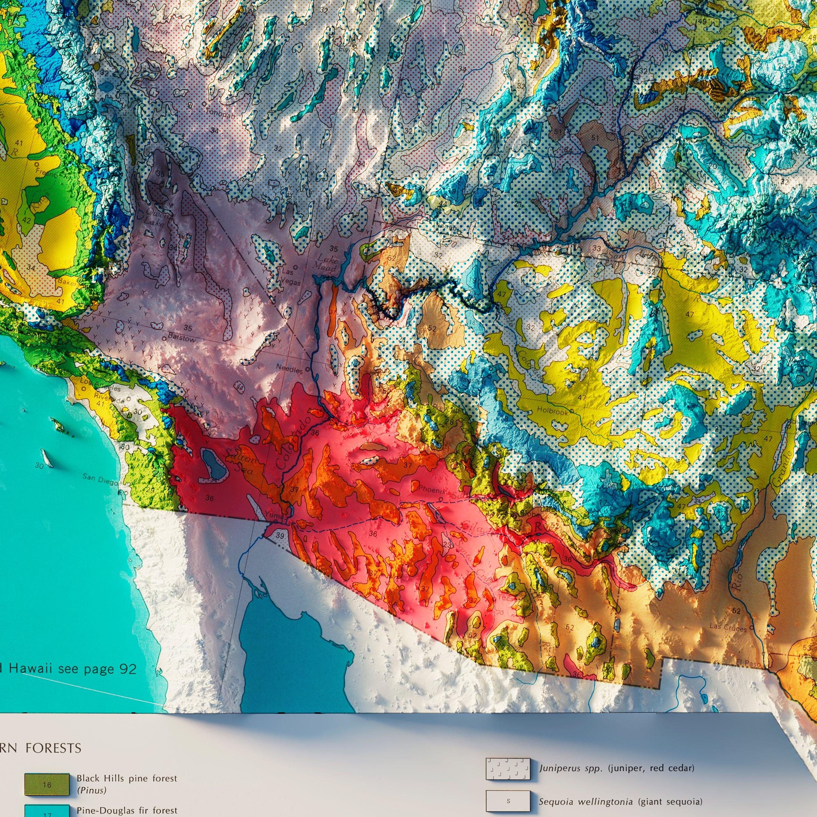
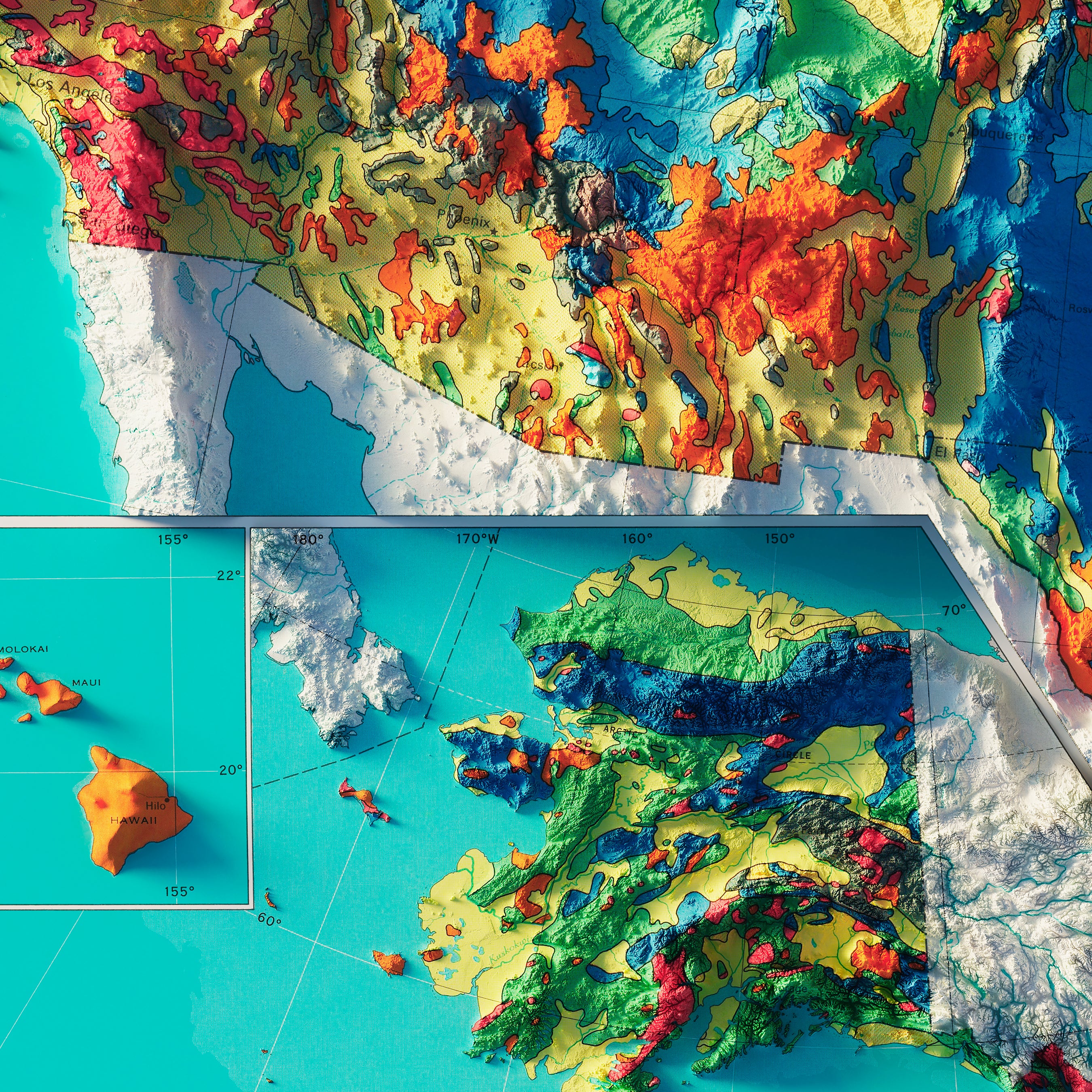
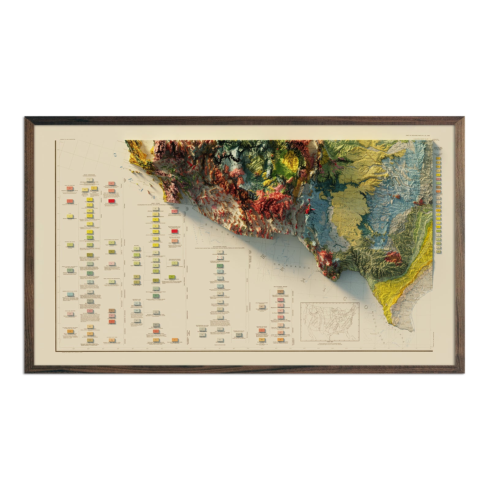
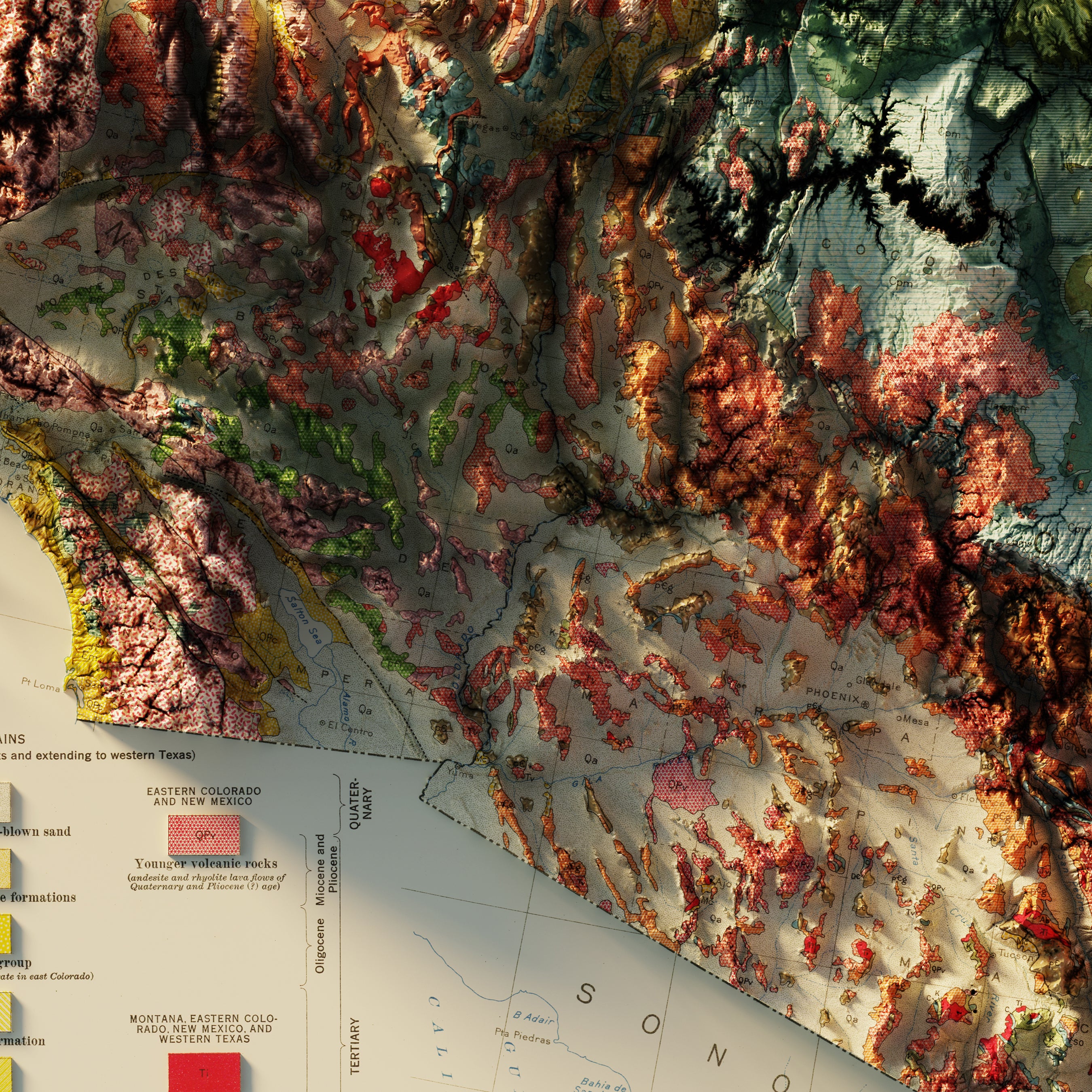
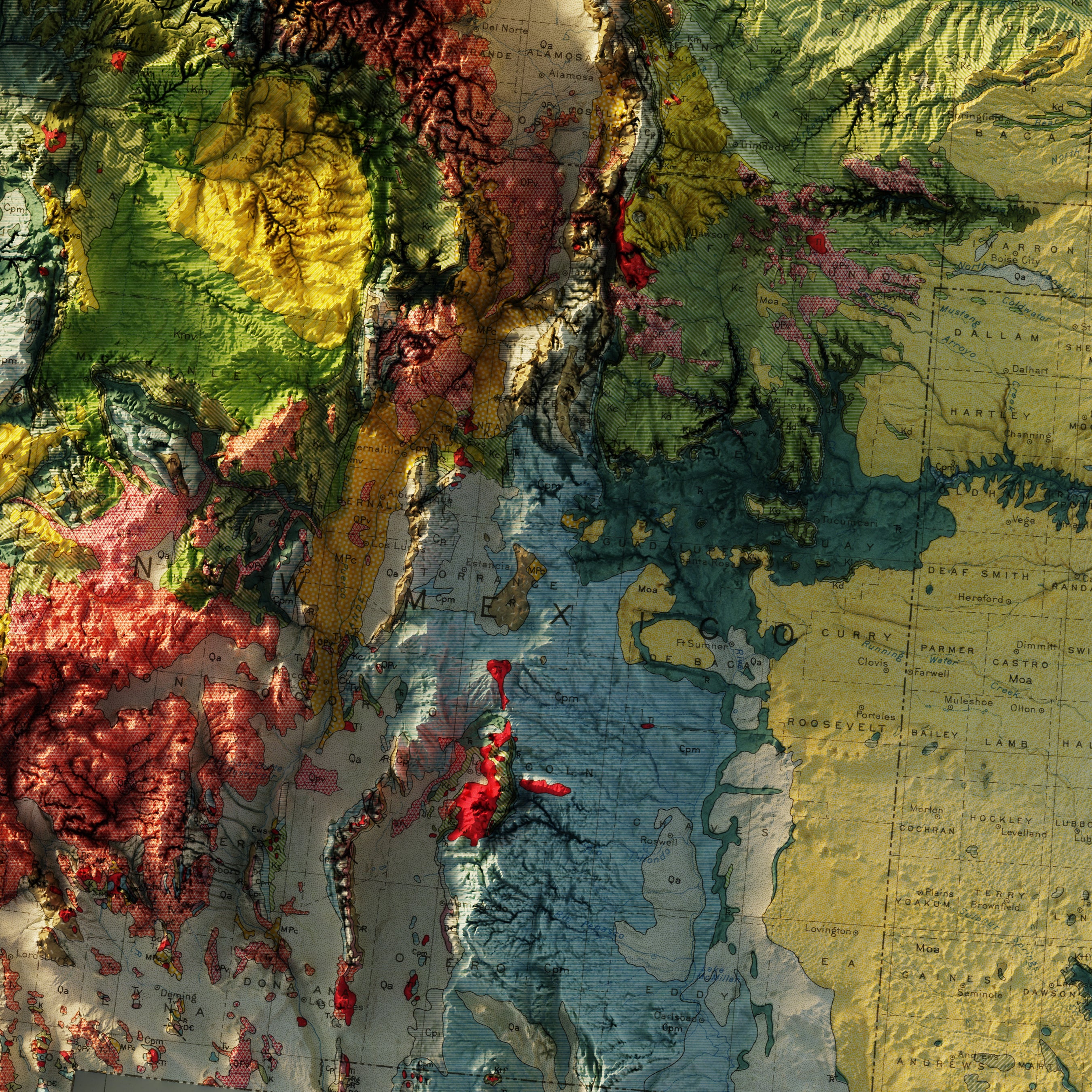
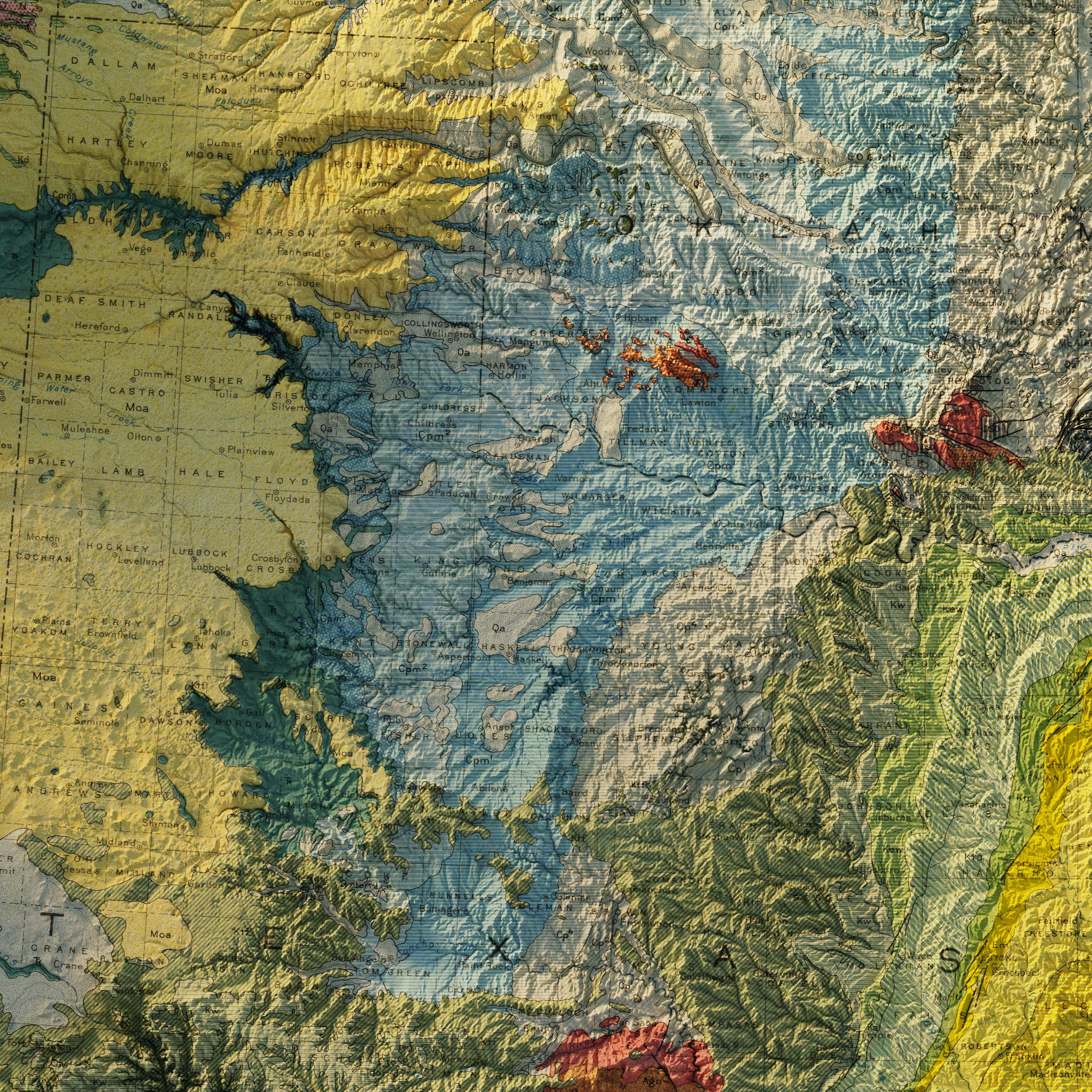
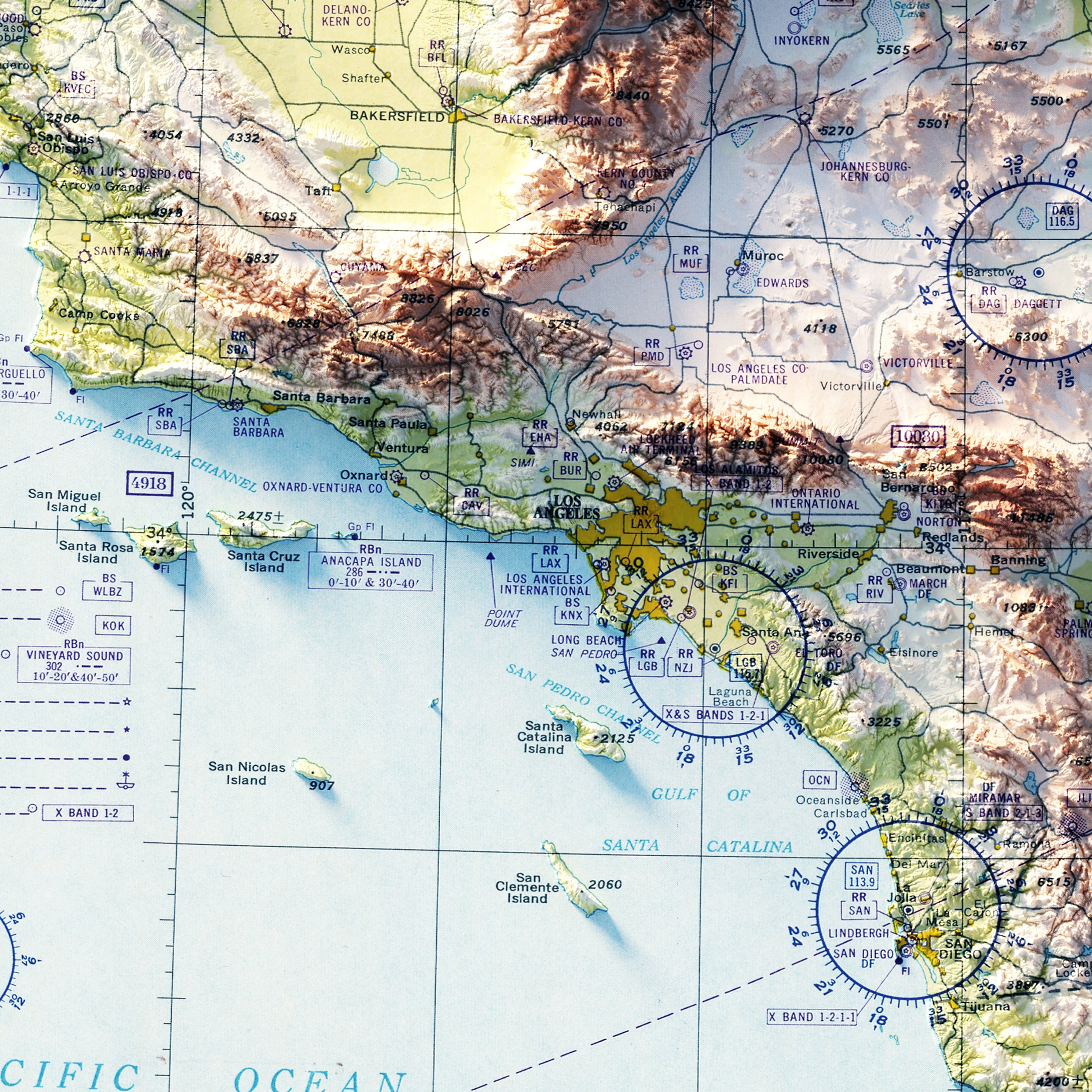
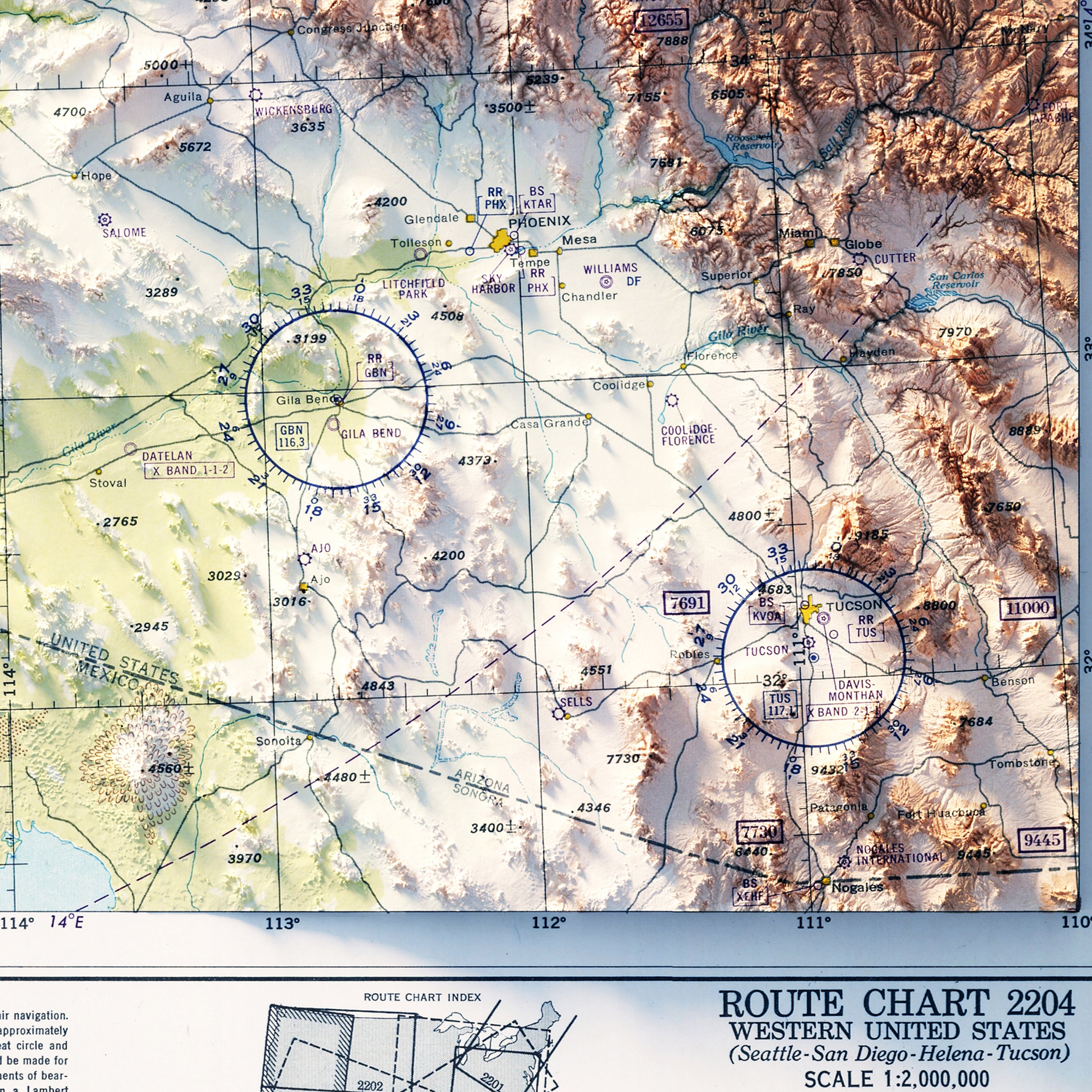
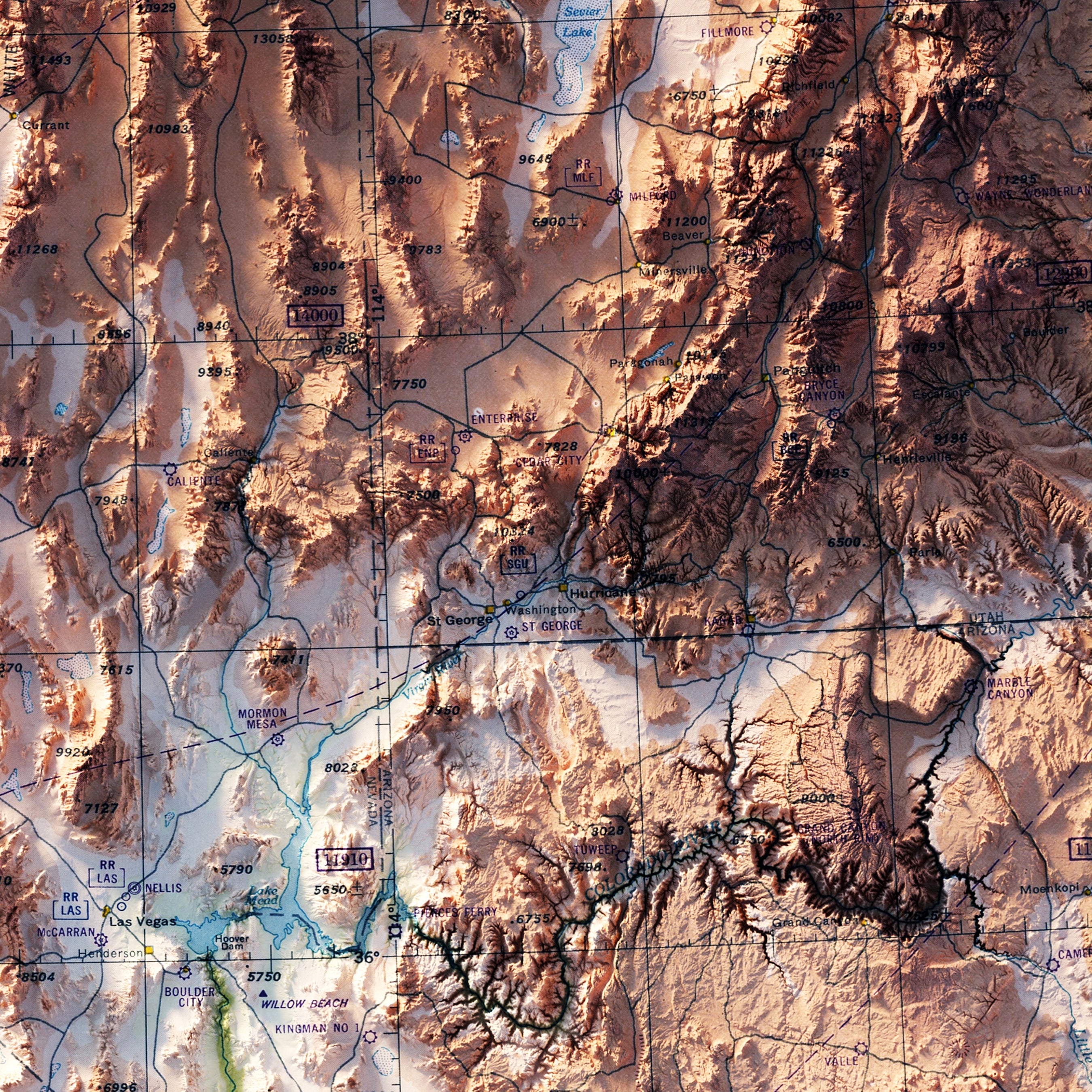
Southwest | USA map series: A mostly arid and semi-arid region of the USA synonymous with a vast array of national parks and spectacular desert and semi desert landforms. The west and central parts of the region are mountainous, boasting the southern Rocky Mountains and Sierra Nevada, Mogollon Rim, and the Hill County of Texas. Hosting the likes of Grand Canyon, Big Bend, Monument Valley, Zion, Carlsbad Caverns, Guadalupe Mountains, Saguaro, White Sands, and Death Valley national parks and monuments, few regions pack as much scenic punch. Cities in this region are more sparse, with only Austin, San Antonio, El Paso, Albuquerque, Phoenix and Las Vegas featuring prominently. This region arguably also includes Los Angeles and San Diego in Southern California.
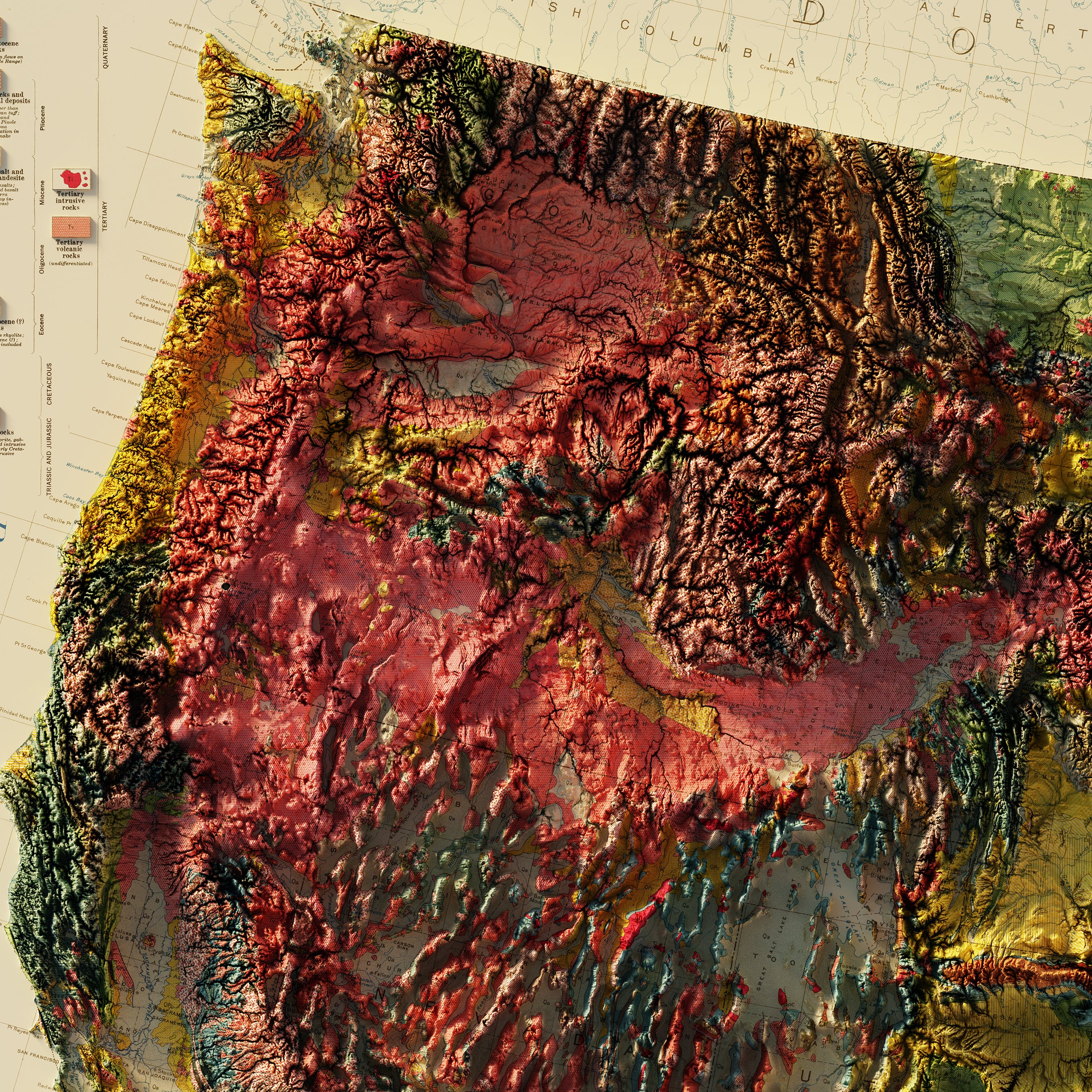
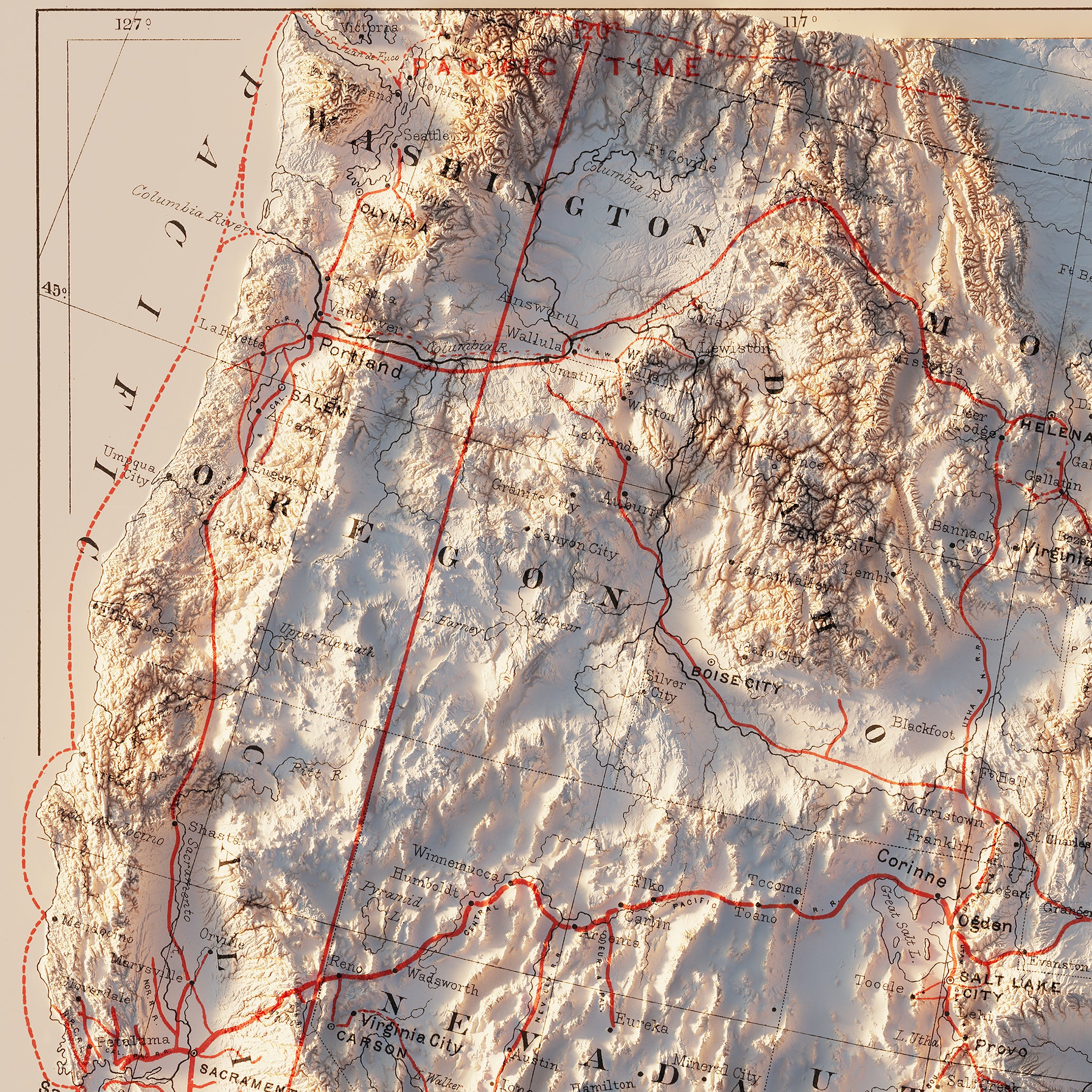
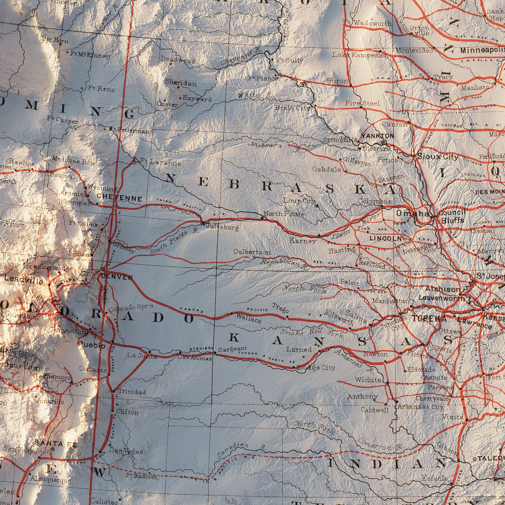
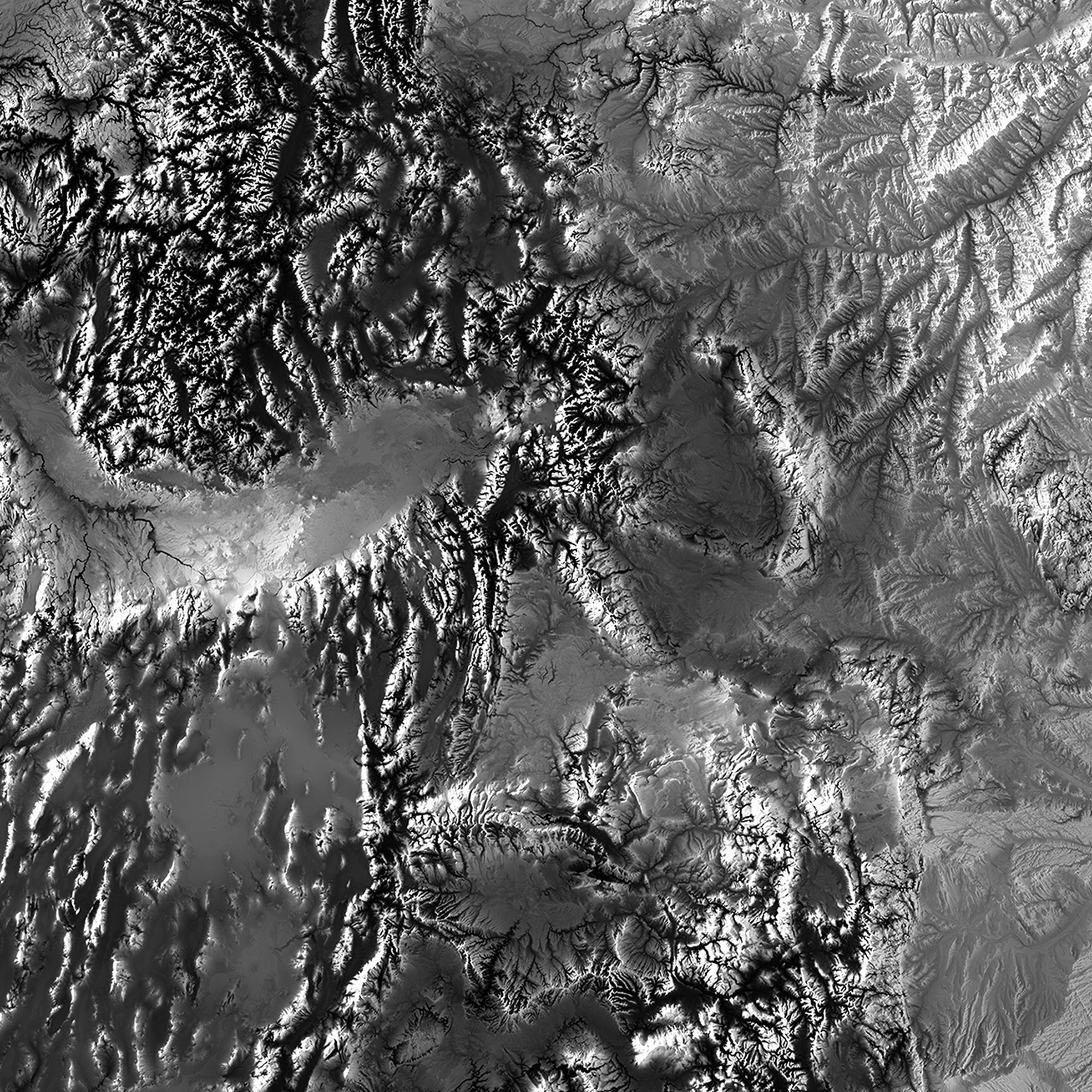
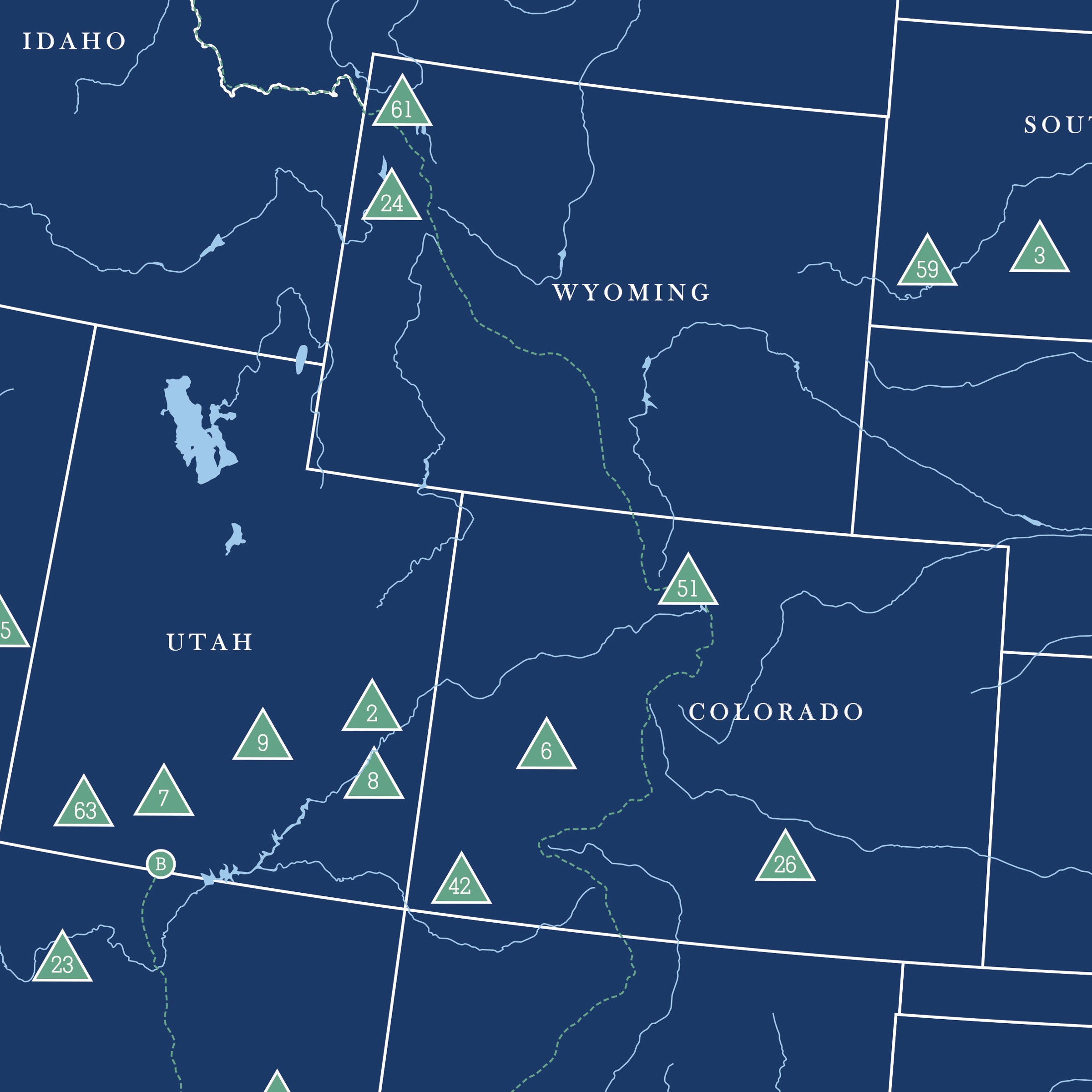
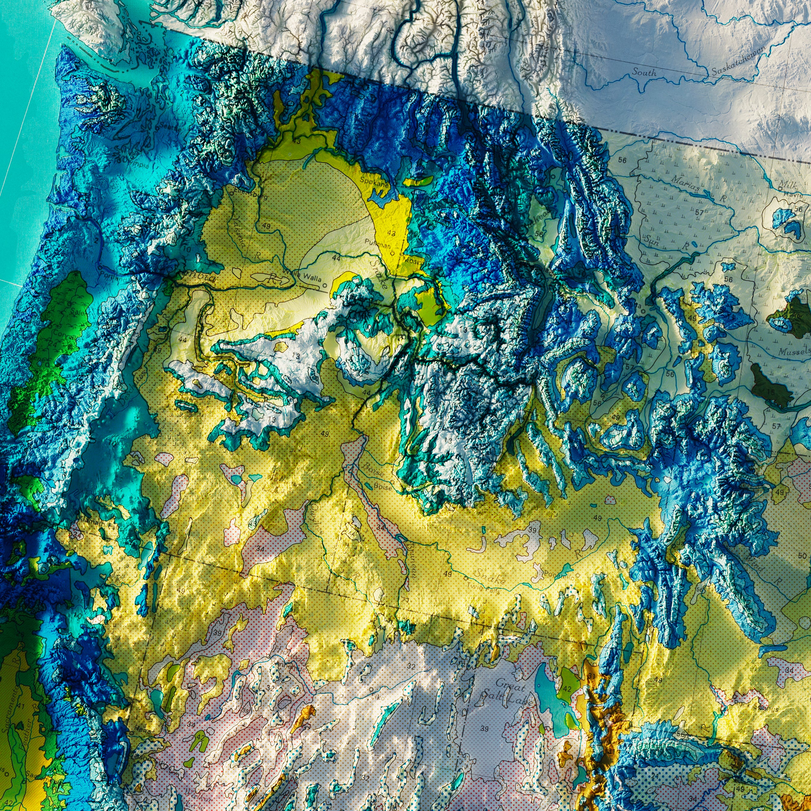
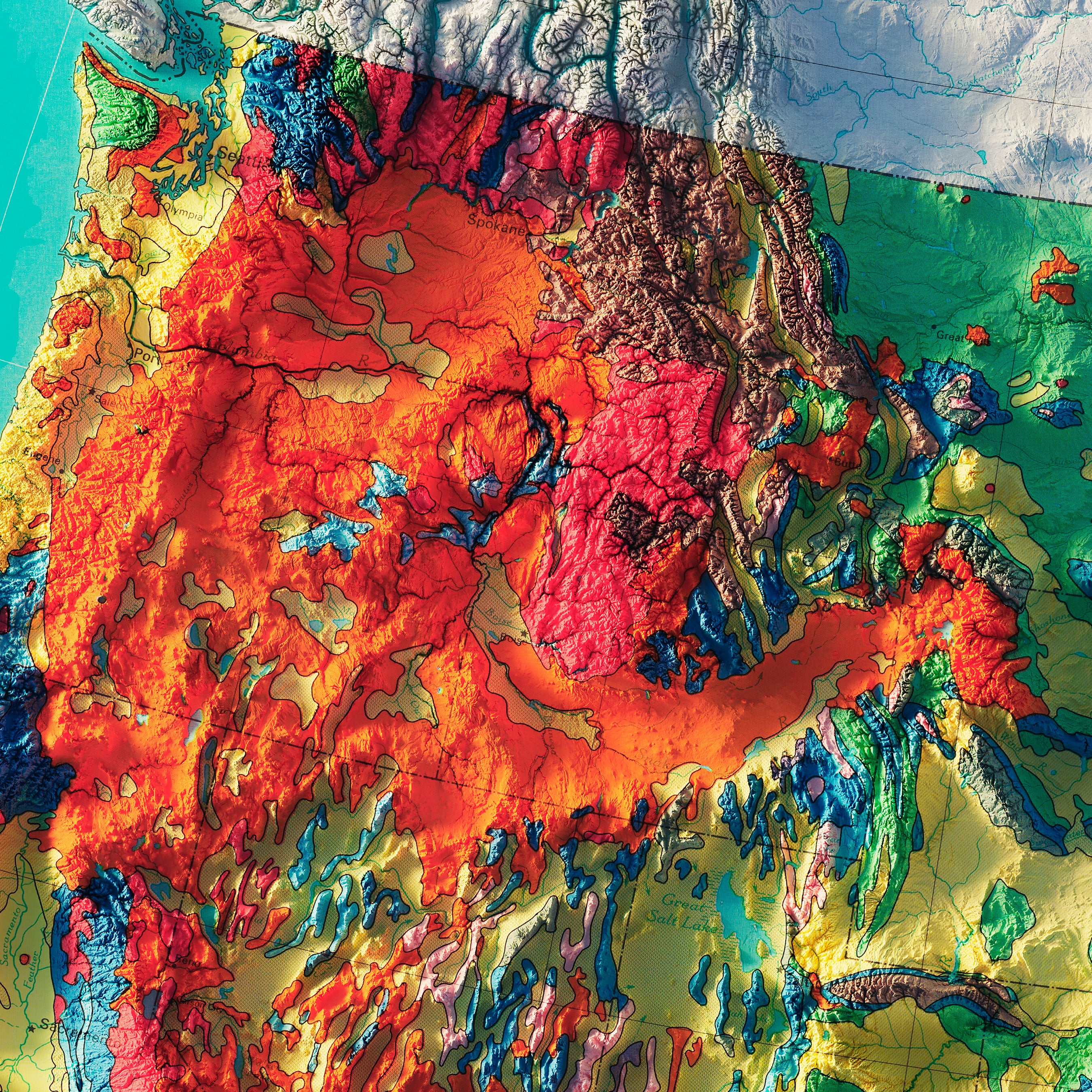
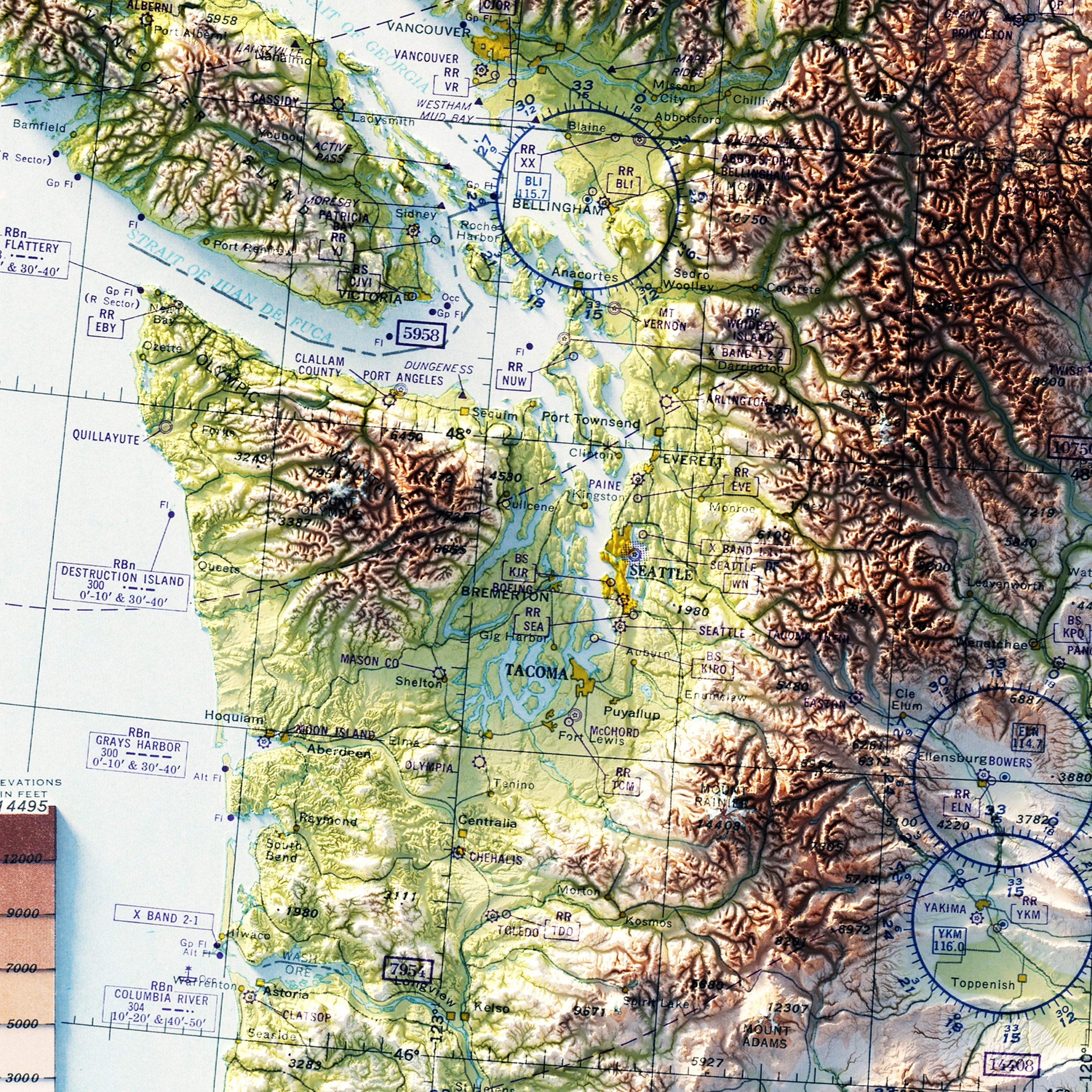
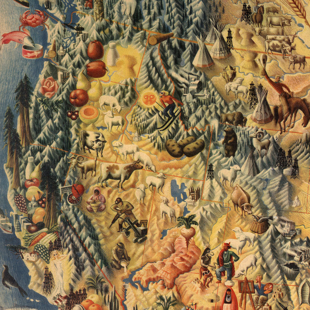
West | USA map series: The West is arguably the most geographically diverse and richly endowed natural region of the US. The West is dominated by large mountain ranges, from the Rockies in the east, to the Wasatch and Uinta Mountains and Great Basin, to the Sierra Nevada and Cascade Ranges in the far west. Numerous subranges are found virtually everywhere. The climate fosters incredible biome diversity, ranging from tundra-like alpine, to the world’s hottest arid regions, and even temperate rainforest. Accreted terranes and subduction zones along the Pacific Coast and volcanic hotspots shaped the west. The western USA remains geologically active with ongoing mountain building. Major coastal cities include Seattle, Portland, San Francisco, Los Angeles, and San Diego further south. Salt Lake City, Las Vegas, and Denver are major interior cities.
These features and more are beautifully displayed on all our regional and national maps of the USA.
US Mountains
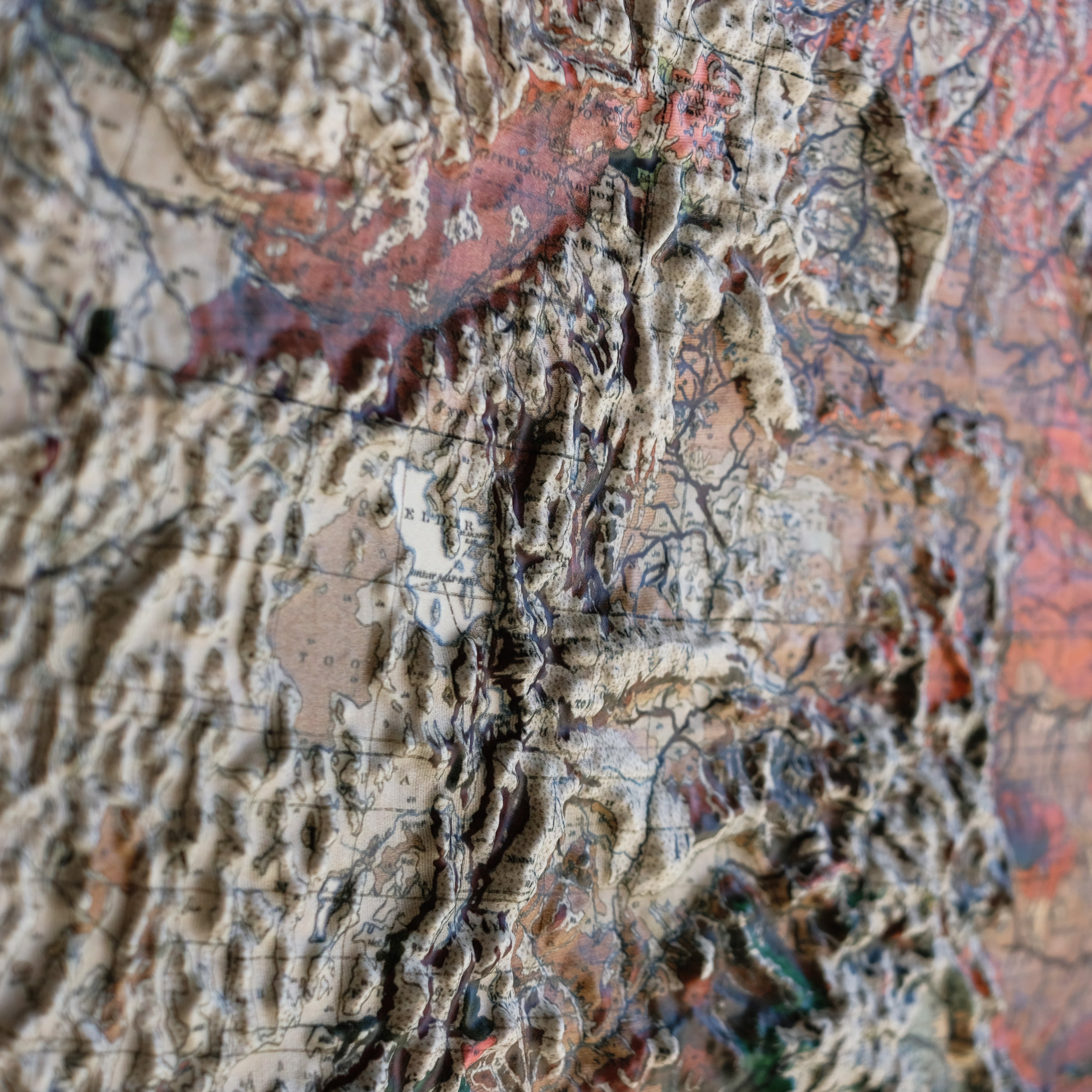
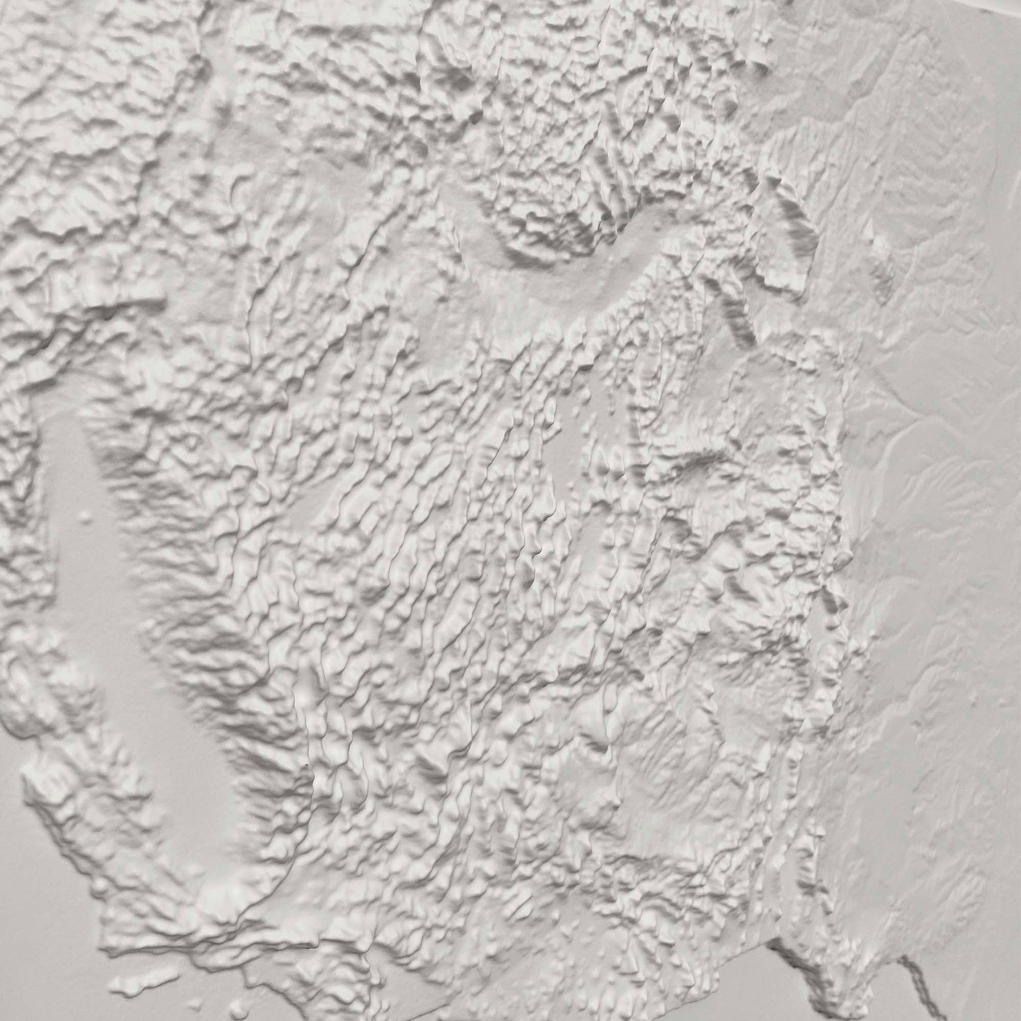
Our USA maps show the great diversity of every US mountain range from the Atlantic to the Pacific. The United States can roughly be divided into thirds, with the eastern third hosting the Appalachians and their sub-ranges of the Cumberland, Blue Ridge, Allegheny, Adirondack, Catskills, Berkshires, Poconos, White, and Blue Mountains. The central third is mostly plains or river basins, but the Ozarks and Ouachita Mountains punctuate in the south, and the Iron Ranges around Lake Superior in the north. The western third is a cornucopia of topography. The front range of the Rocky Mountains, and the Black Hills, rise steeply from the Great Plains. With geographic features and ranges almost too numerous to mention. Notable ranges are the Sacramento, San Juan, Sangre de Christo, Wasatch, Uinta, Teton, Bighorn, Absaroka, Bitterroot, Sierra Nevada, Cascades, Coastal, and Olympic mountain ranges. The Mogollon Rim forms the largest highland in the south, the Great Basin dominates the south central plateau with the Columbia Plateau in the north.
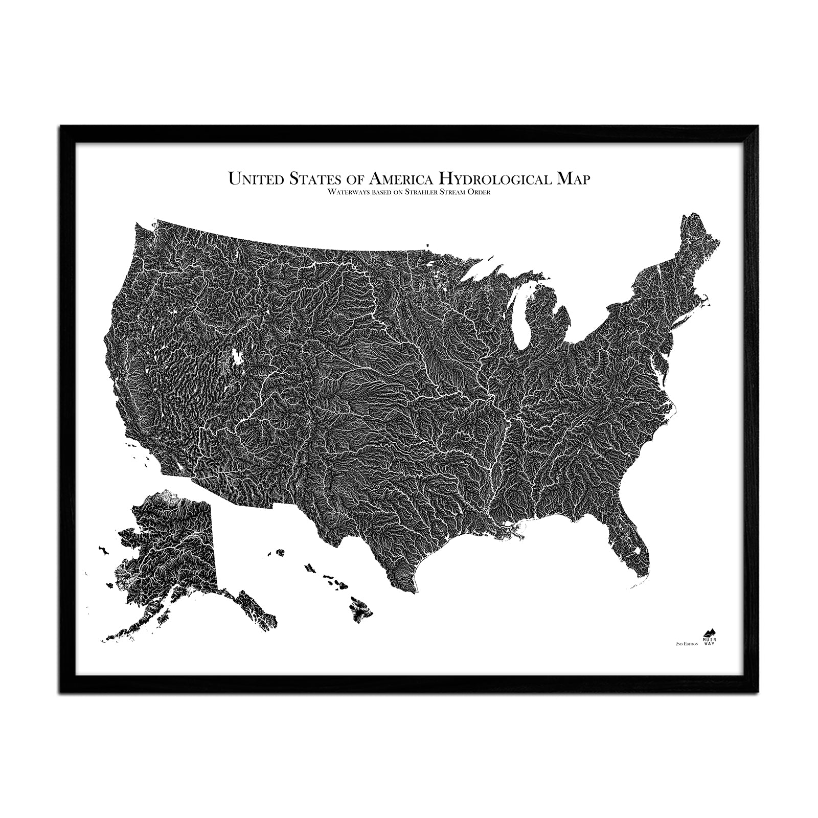
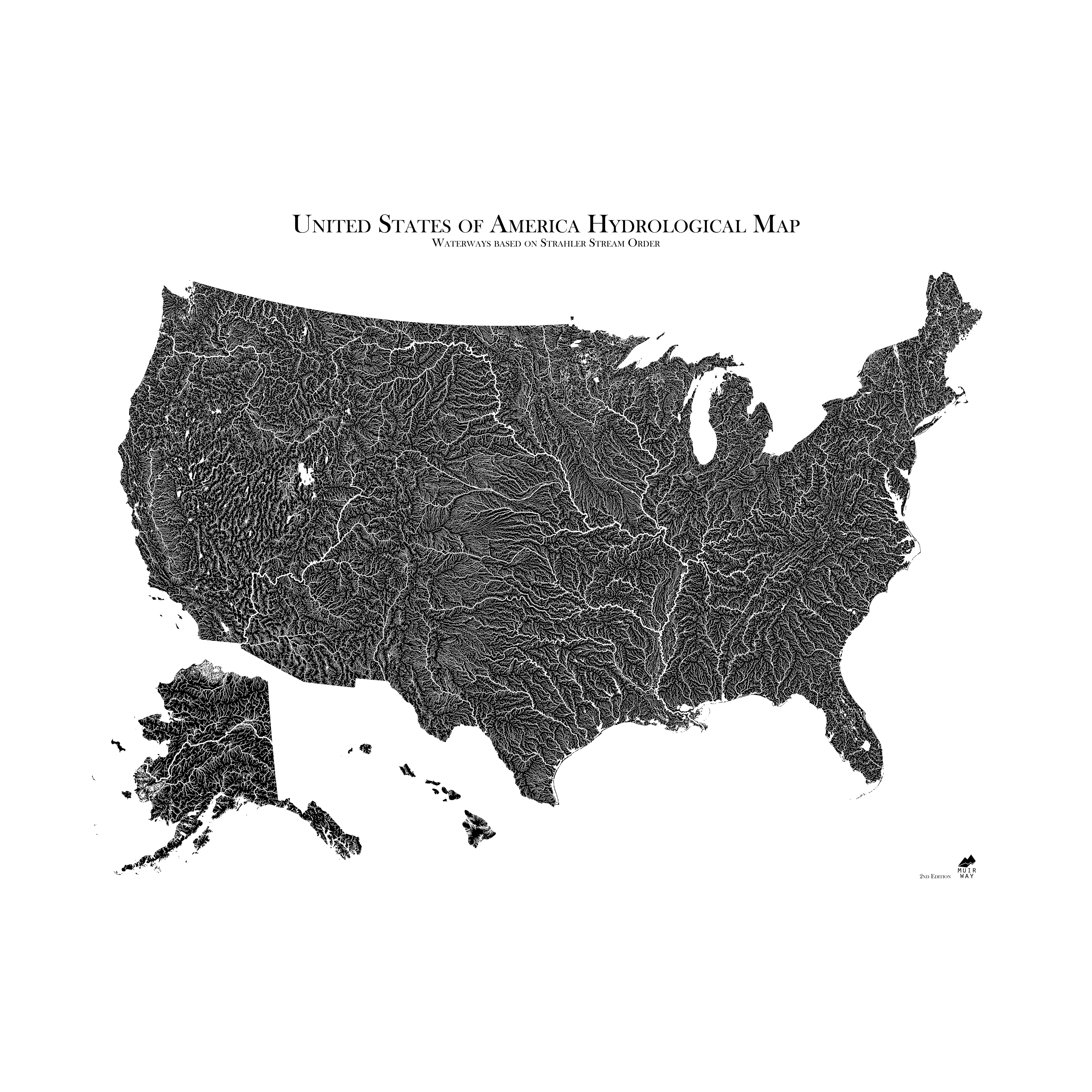
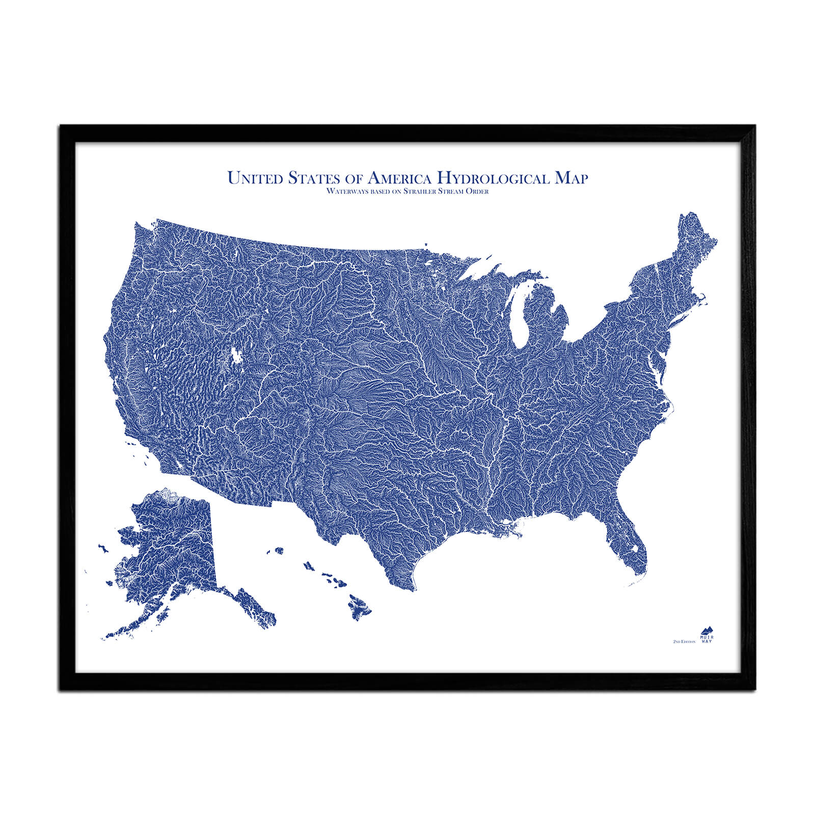
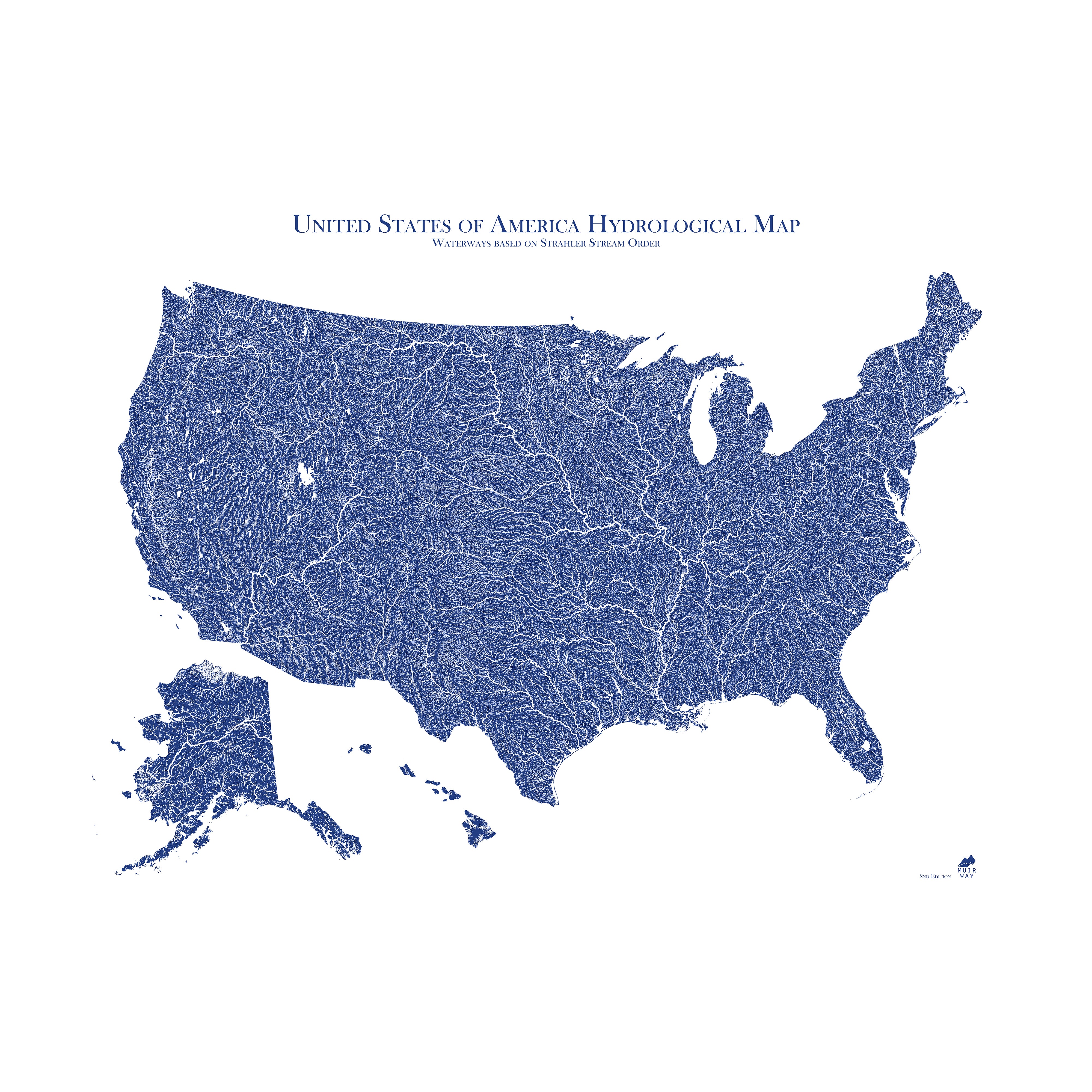
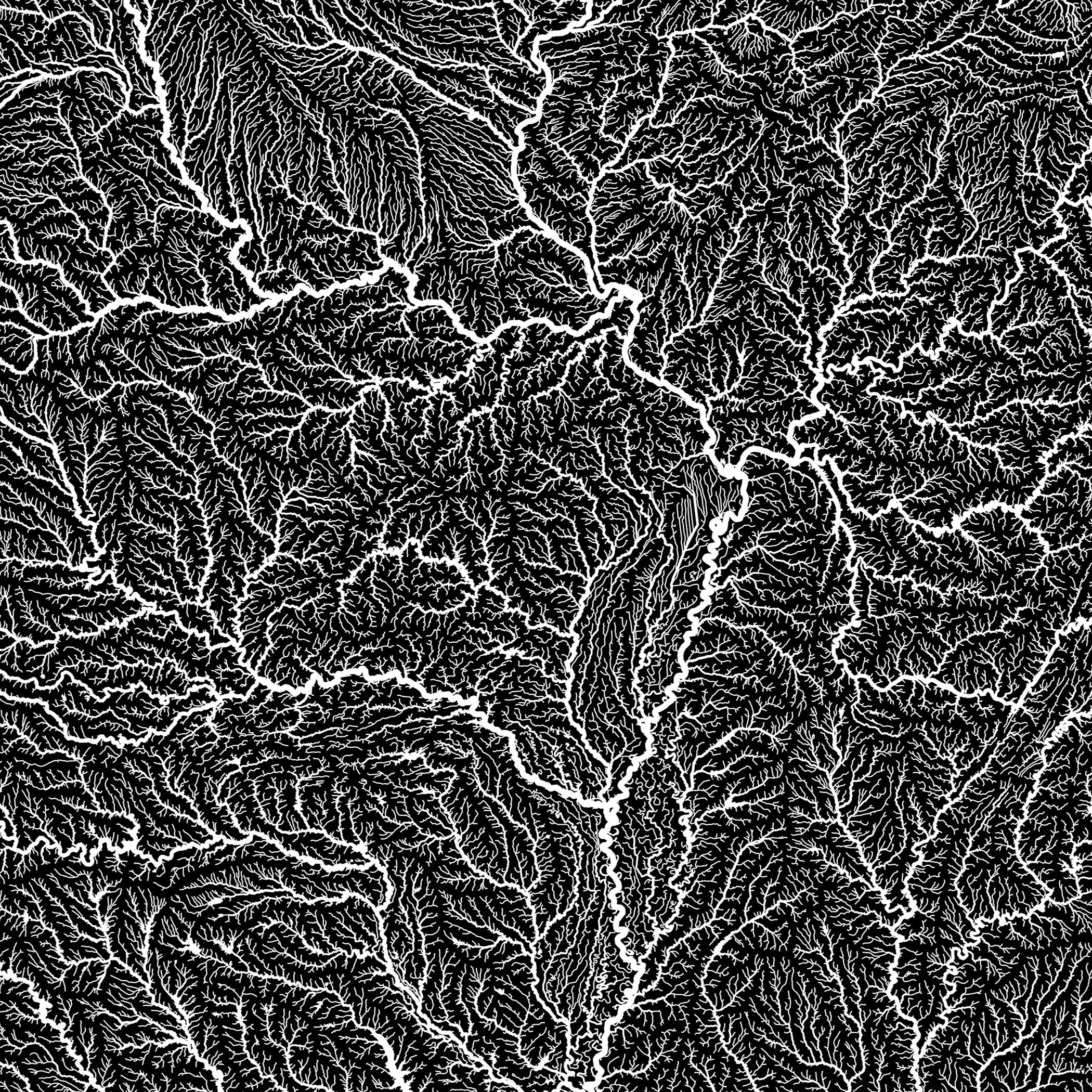
US Rivers
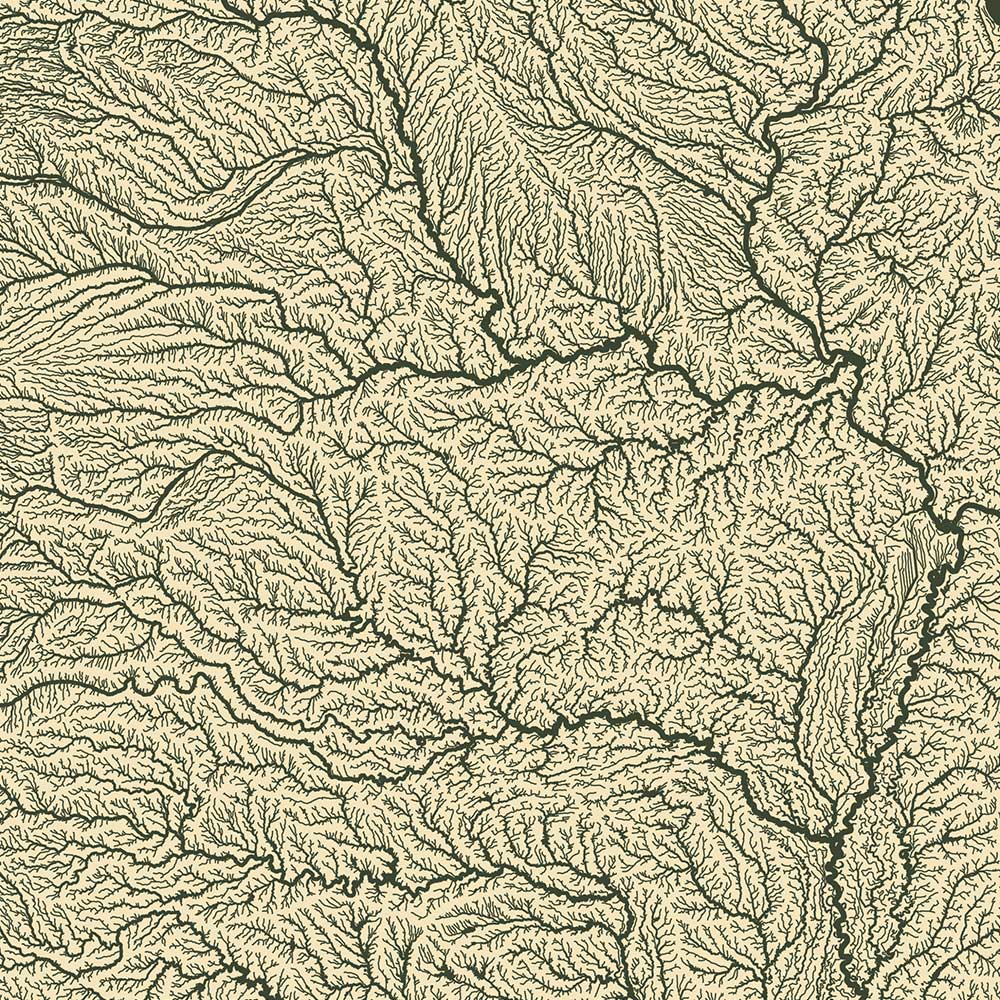
The largest rivers in the US tend to dominate central and southern sections of the USA and are clearly shown in our hydrological US maps. The largest by volume is the Mississippi River, flowing from Minnesota to the Gulf of Mexico in Louisiana. The longest river in the USA, and 4th longest in the world, is the Mississippi-Missouri river system, originating in the mountains of Montana. Notable large tributaries are the Tennessee, Ohio, Illinois, Des Moines, James, Yellowstone, Platte, Canadian, and Arkansas Rivers. The Atchafalaya and Red Rivers mouth out close to the Mississippi. The St. Lawrence River, although mouthing out in Quebec, drains all of the Great Lakes basin and is the latest Atlantic draining river system; the Susquehanna, Hudson, Santee, and St. John’s rivers are notable on the east coast. The Rio Grande and Colorado Rivers are vitally important to the US southwest. The Sacramento River is California’s largest, however the largest Pacific system is the Columbia-Snake River system, including its largest tributaries, the Pend Oreille and Willamette Rivers. The Yukon River in Alaska is the second largest Pacific-draining system.
USA State Maps
- Alabama Alaska Arizona Arkansas California Colorado Connecticut Delaware Florida Georgia Hawaii Idaho Illinois Indiana Iowa Kansas Kentucky Louisiana Maine Maryland Massachusetts Michigan Minnesota Mississippi Missouri Montana Nebraska Nevada New Hampshire New Jersey New Mexico New York North Carolina North Dakota Ohio Oklahoma Oregon Pennsylvania Rhode Island South Carolina South Dakota Tennessee Texas Utah Vermont Virginia Washington West Virginia Wisconsin Wyoming


