


Texas Hydrological & Shaded Relief Map Prints
Whether you are from Texas or like to visit the Lone Star states’ incredible landscapes, our custom printed Texas wall maps will bring the state to life. Our maps are beautifully rendered from a combination of historical data, modern technology, and hand design. From our eye-catching elevation maps and geological relief maps to our meticulously restored historical maps, every map of Texas we offer reflects the high quality and attention to detail our customers have come to love and expect from Muir Way. See why a map of Texas from Muir Way is more than your typical wall map.
What makes Muir Way maps of Texas unique?
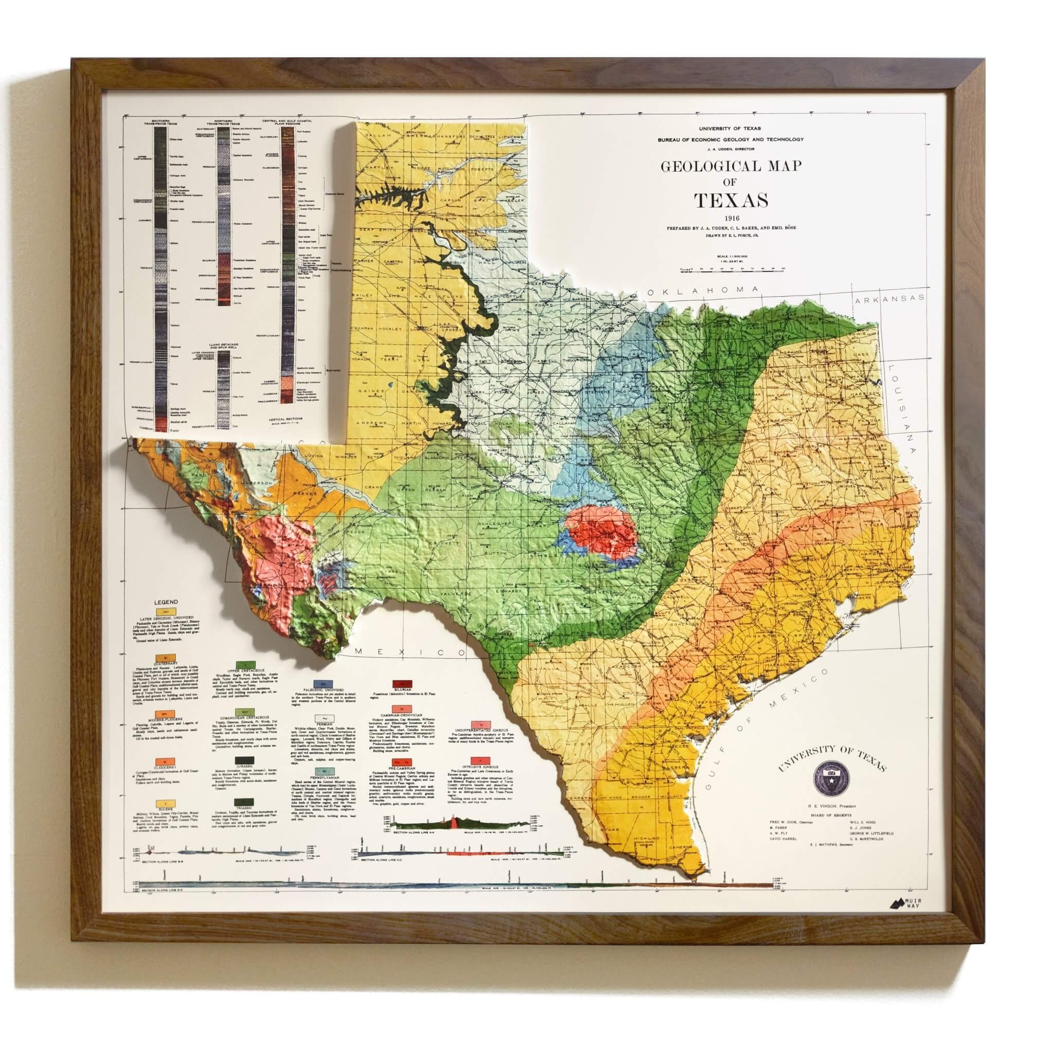
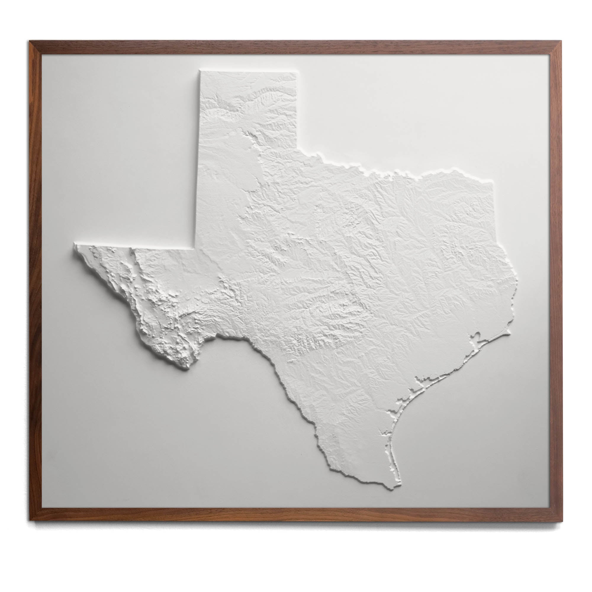
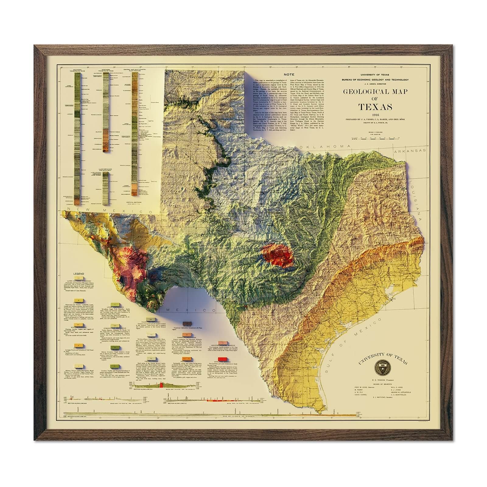
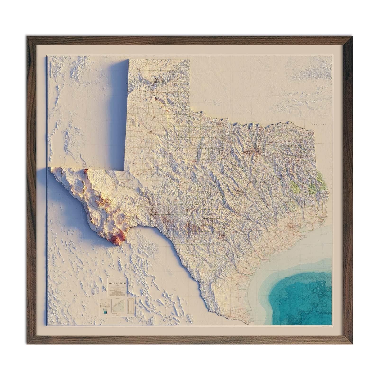
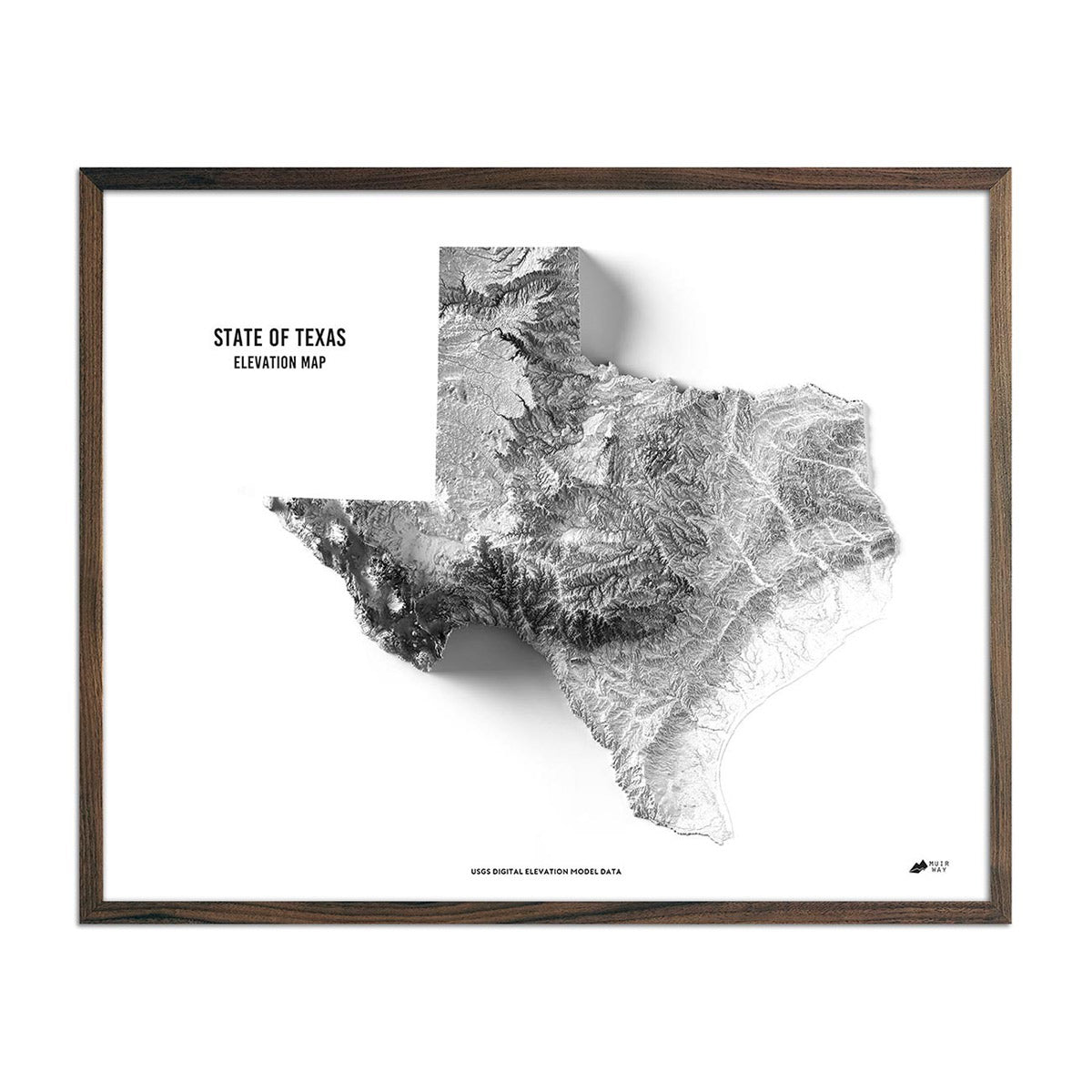
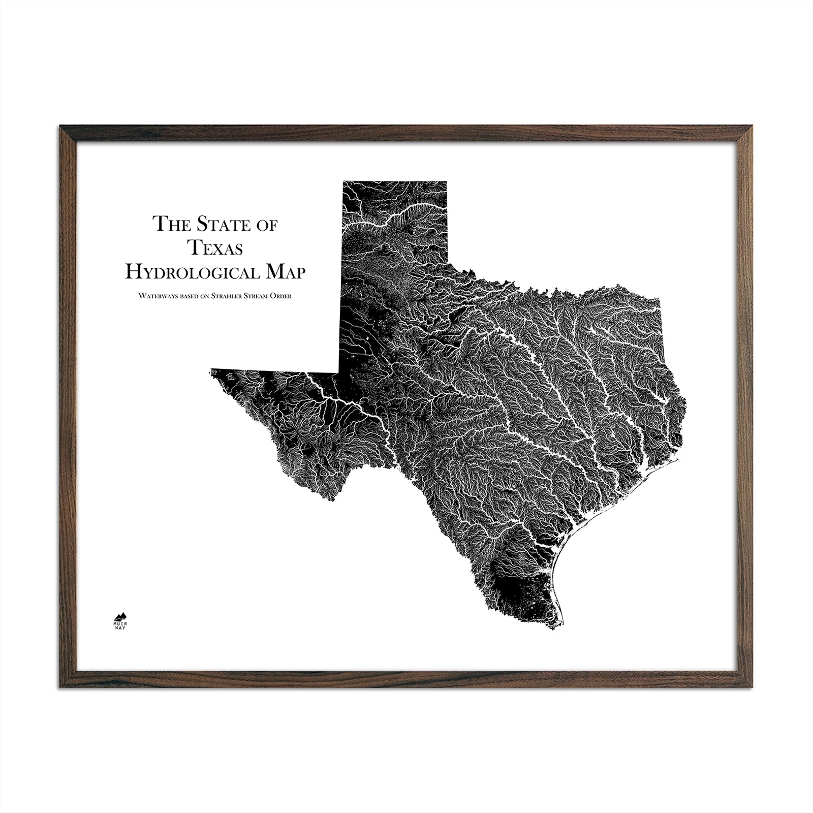
When you purchase a map of Texas from Muir Way, you are not purchasing a mass-produced poster or generic print. We custom print every Texas map using archival inks and fine art paper certified to last 100 years. And the artwork of our maps themselves is designed to bring new light to the beautiful terrain they feature. For example, our elevation maps incorporate hand-shaded relief and Digital Elevation Data with historical map terrain for a unique 3D effect on a flat surface, and our hydrological maps depict every river in the state--even intermittent streams--and every body of water over 0.2 miles in diameter in crisp detail. We create beautiful, heirloom-quality maps meant to last for generations.
Does my Texas map come framed?
It can! You can purchase your Texas map professionally custom-framed with real wood, or unframed if you prefer to use your own. If you’d like to purchase a framed Texas wall map, there are several different wood finishes to choose from. If you’d prefer to use your own frame, all of our maps come in standard sizes for easy gift giving.
Does a Muir Way map of Texas make a good gift?
Yes! Our custom-printed maps of Texas make the perfect gift for outdoor enthusiasts, to commemorate anniversaries, or as a thank-you gift for someone special. Memorialize the experience of a special holiday to Padre Island National Seashore, or any of the other amazing Texas landscapes. One of our state relief maps can be a perfect graduation gift for a student about to leave home for the first time, or a reminder of home for someone from Texas but who no longer lives there. Our maps also make beautiful corporate gifts that will remind your clients or colleagues of you every time they see it.
Where should I display my Texas map?
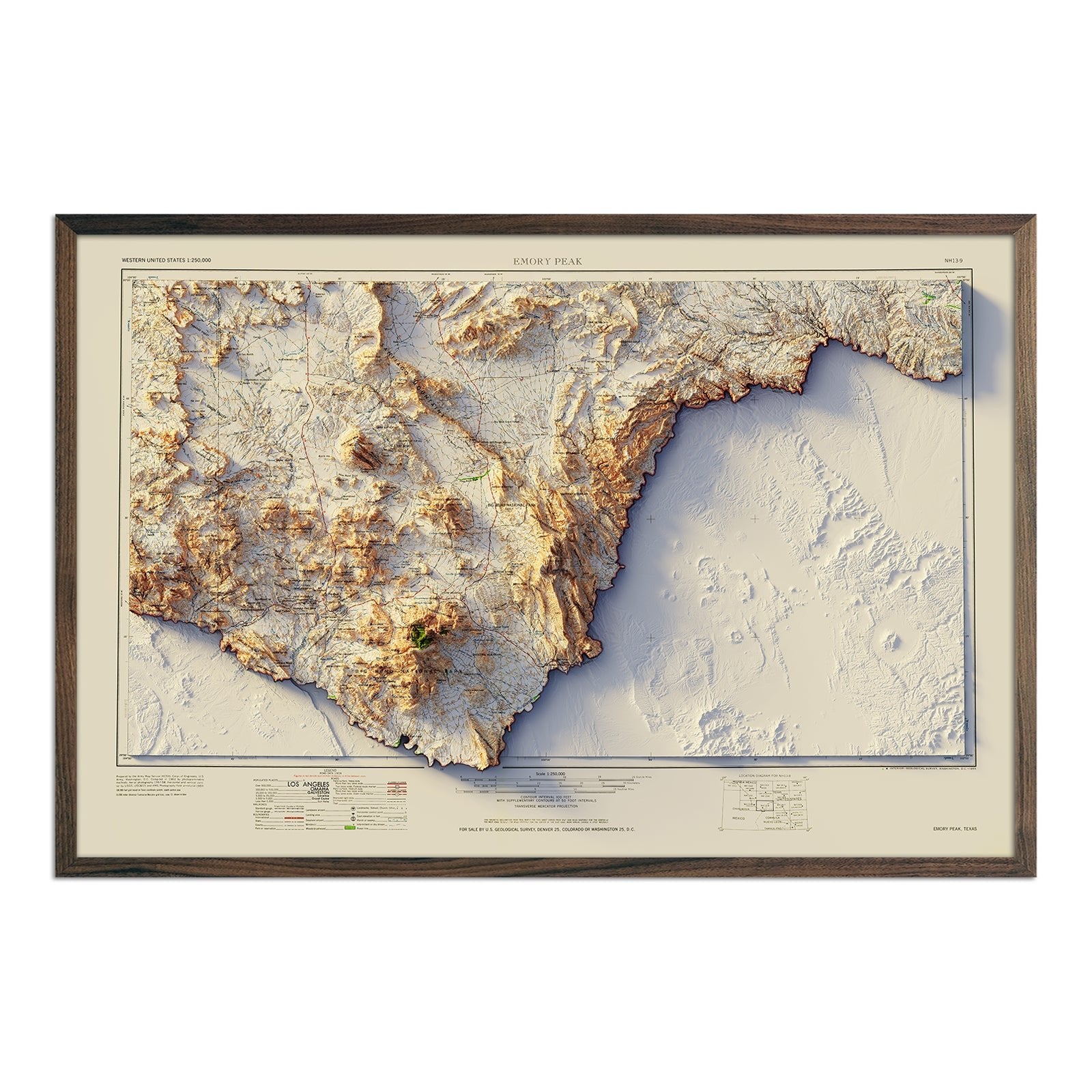
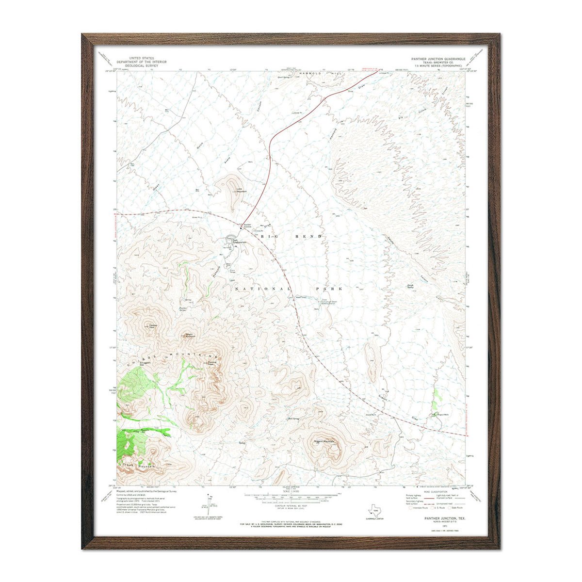
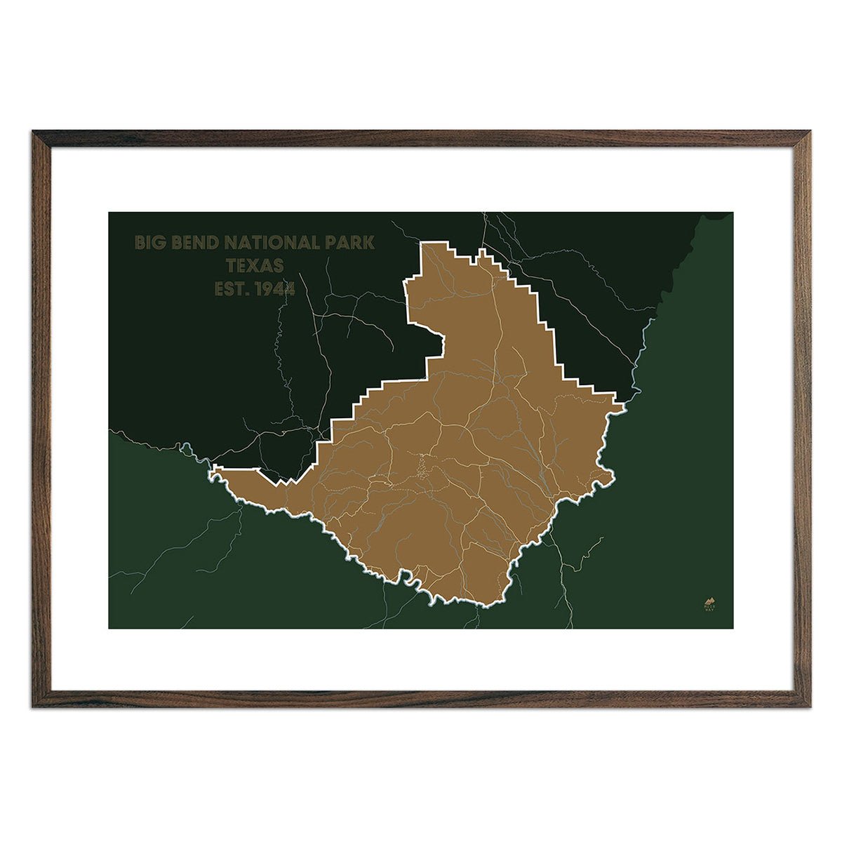
Our maps are designed to show crisp detail from across the room and up close. Hang a framed wall map as a central focus or purchase several maps in a similar style or from a particular region and arrange them near each other for a complementary series. Our hydrological maps come in several colors or the classic black and white, and our geological relief maps feature vibrant colors. Make a series of the Big Bend Relief map, the Big Bend National Park map and the Big Bend National Park 1971 USGS map. No matter which you choose, you’re sure to find a Texas map that will look right at home.
What are the different types of maps of Texas available on Muir Way?
Our Texas maps are available in several different styles, including:
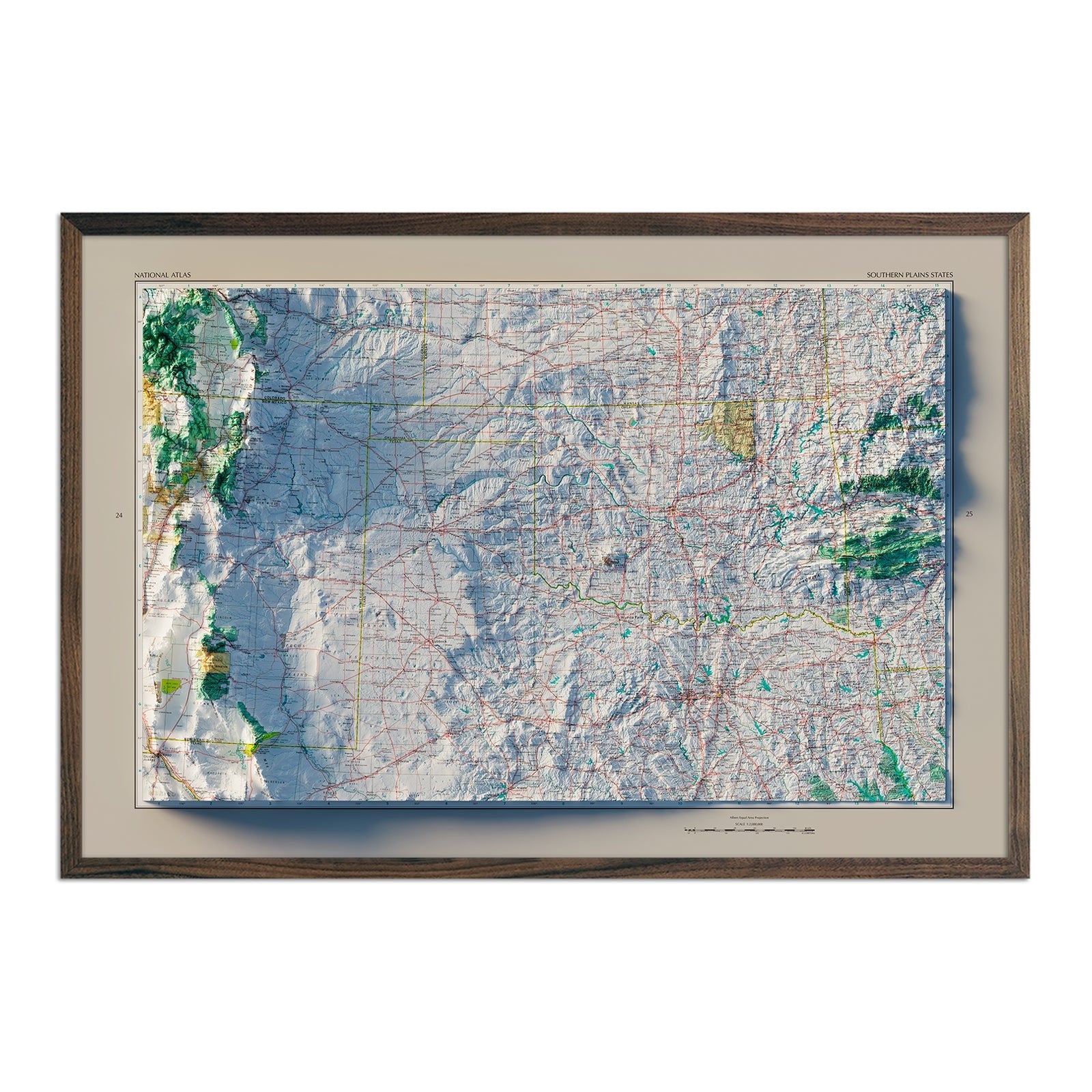
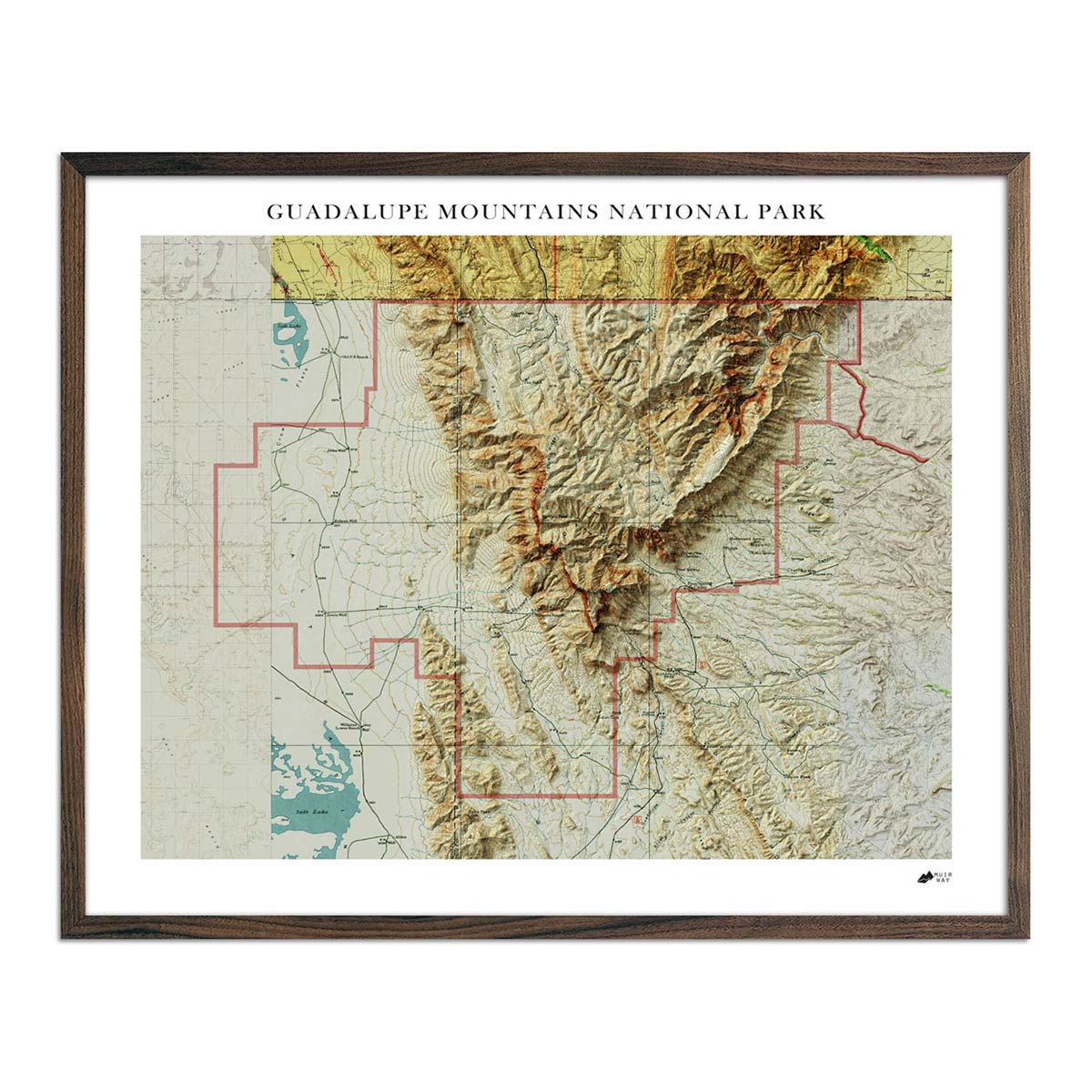
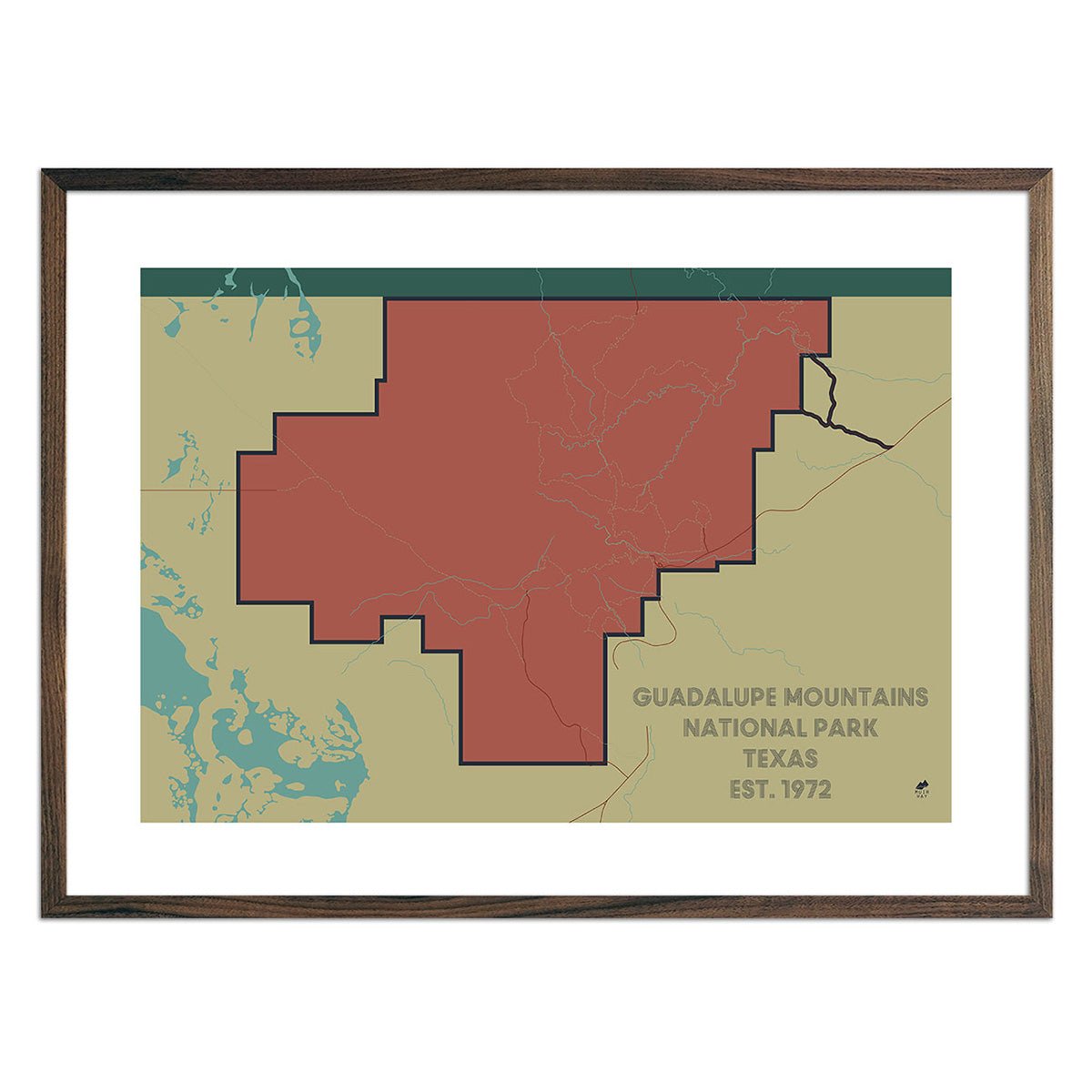
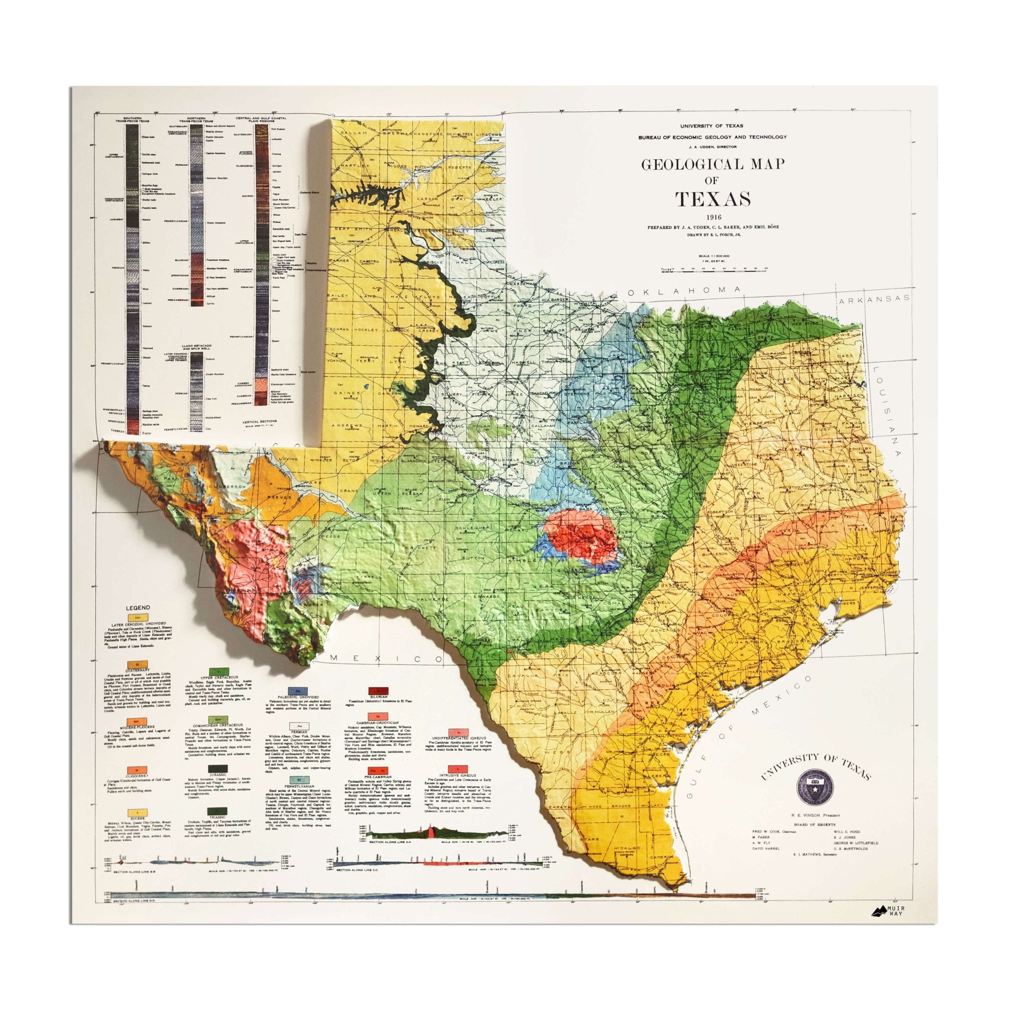
Texas Relief maps - Our relief maps of Texas bring historical map landscapes together with modern technology to show Texas’s landscapes in a new way. Using Digital Elevation Data and hand-shaded relief, we custom enhance vintage maps to create a 3D effect on a 2D surface. See Texas’ spectacular terrain in vibrant colors on our Texas 1916 relief map, and then compare time frames with the Texas 1982 relief map. Take a more focused view with our Guadalupe Mountains relief map.
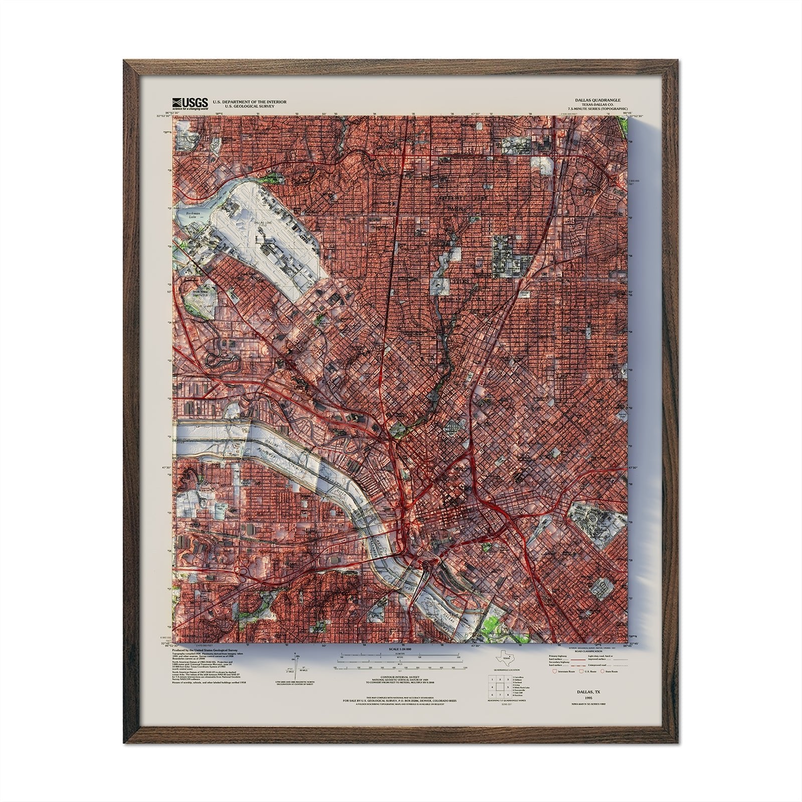
Texas elevation maps - Our Texas elevation map uses Digital Elevation Data from the USGS and hand-shaded relief just like our relief maps to create a high-contrast 3-dimensional effect in stunning black and white.
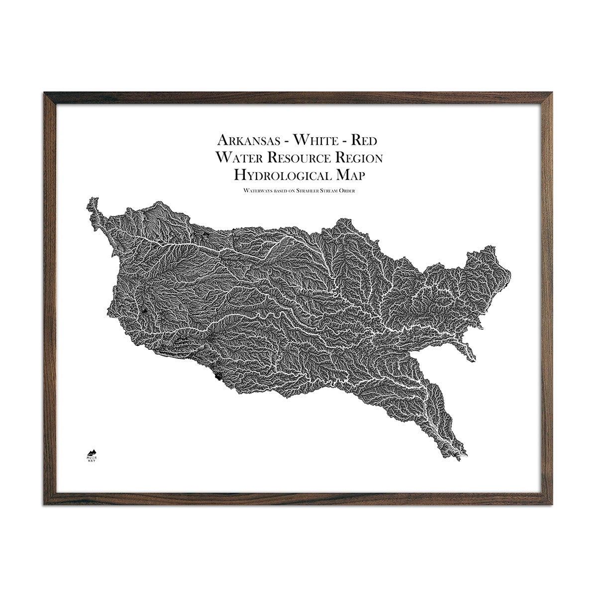
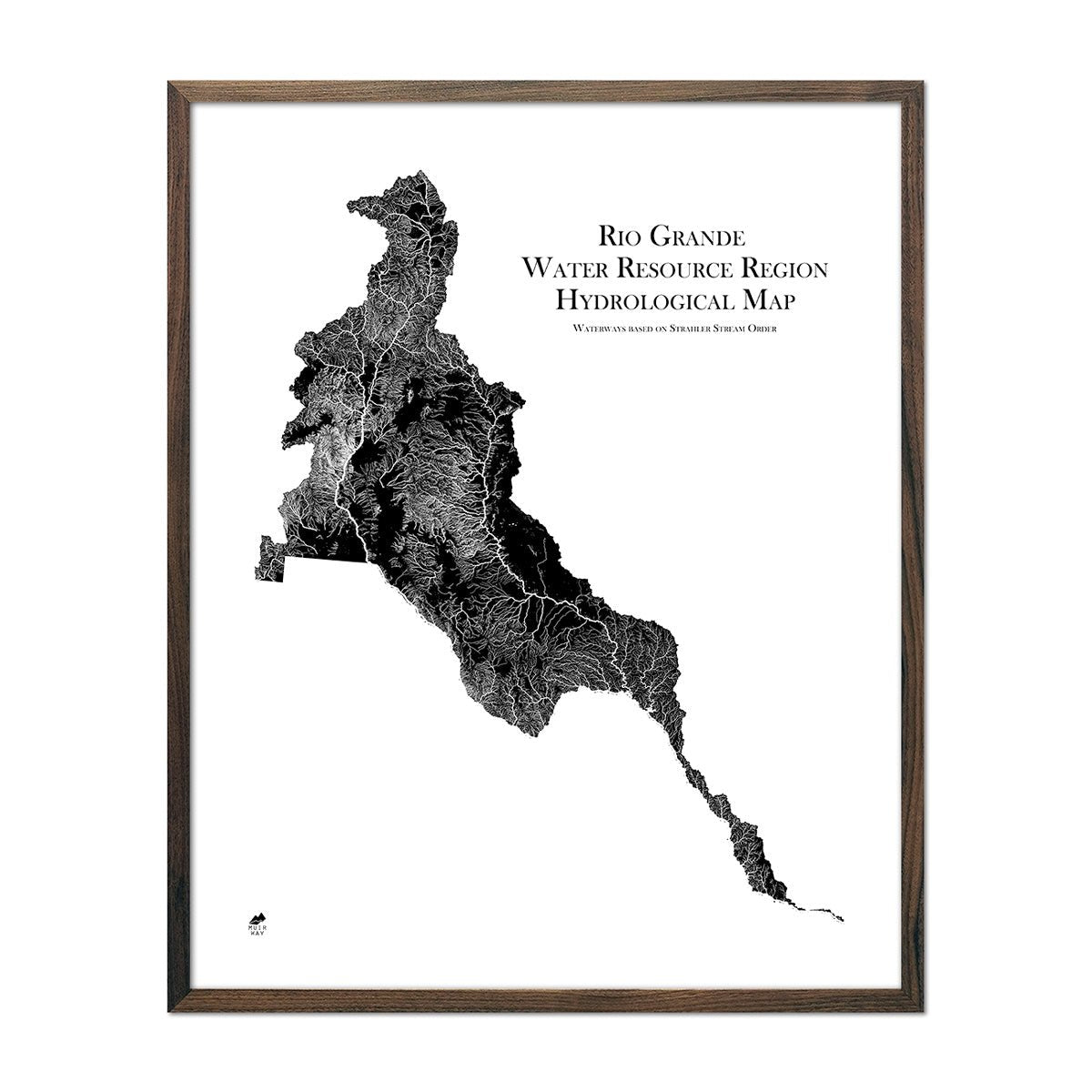
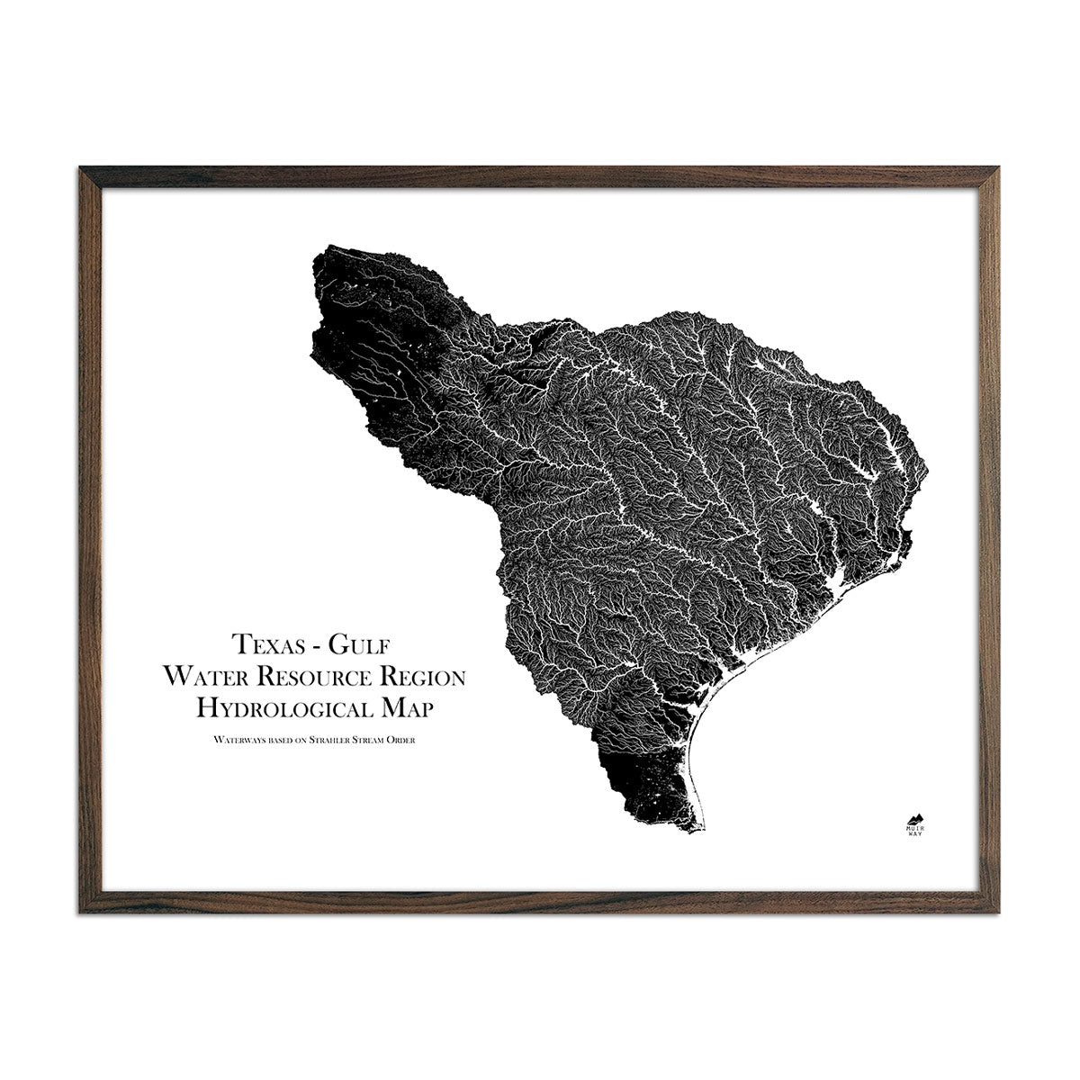
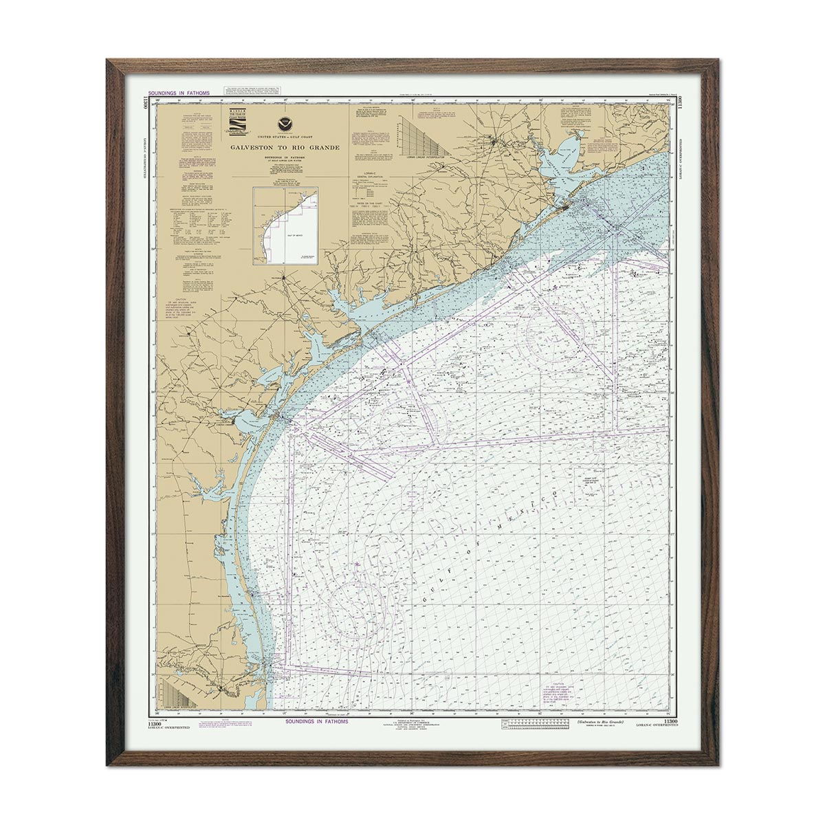
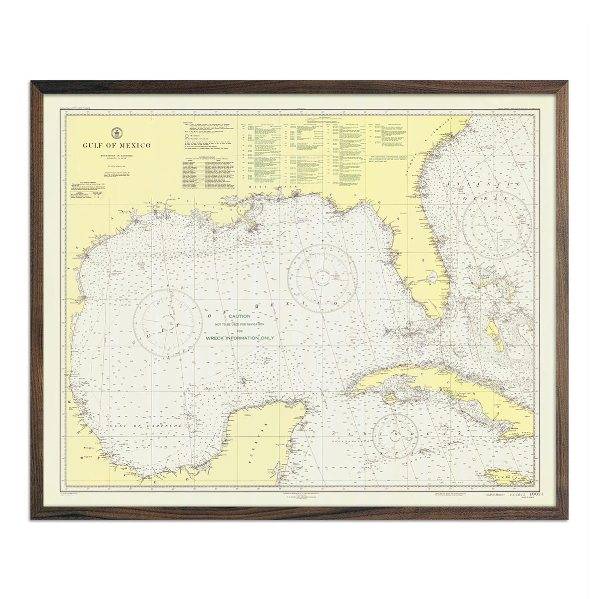
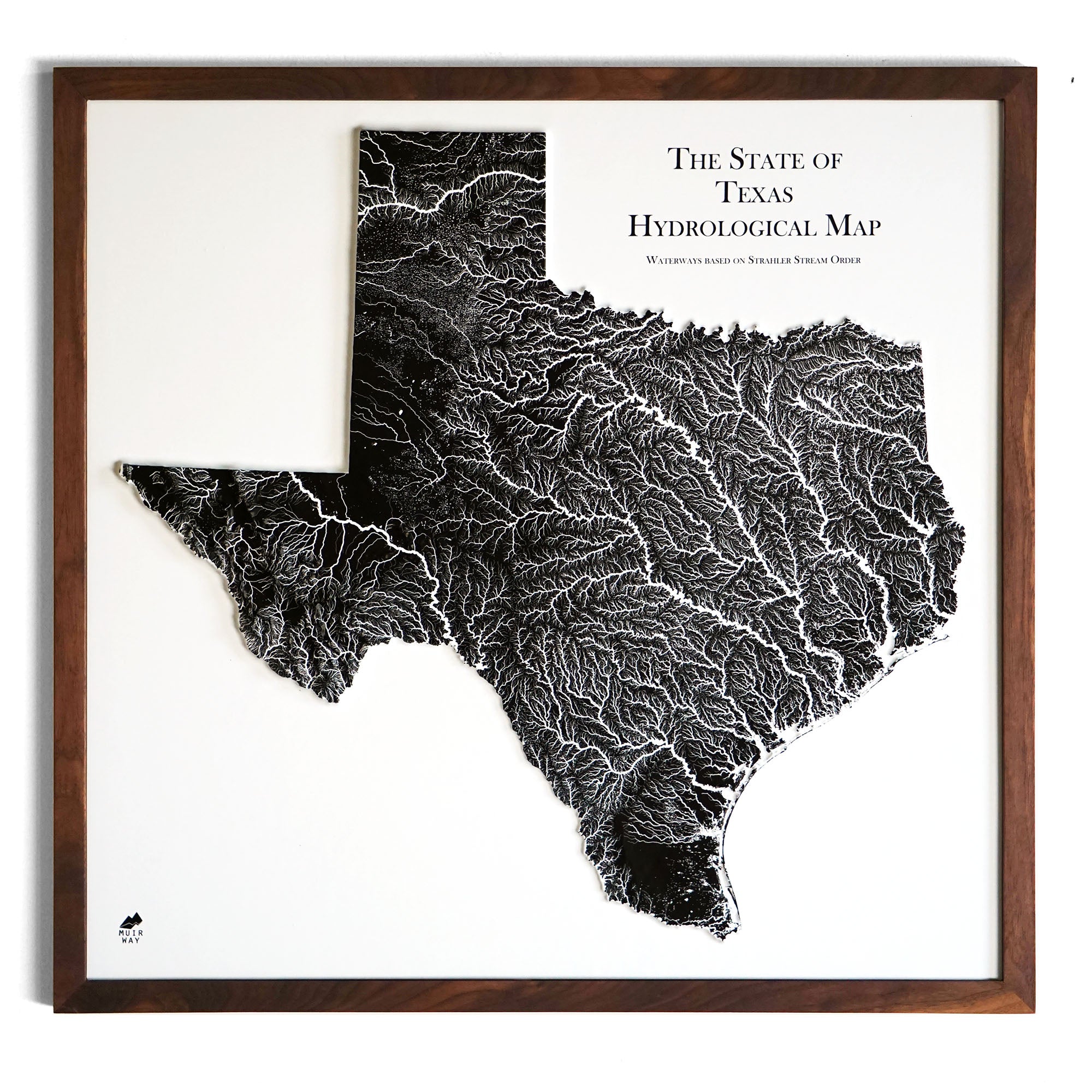
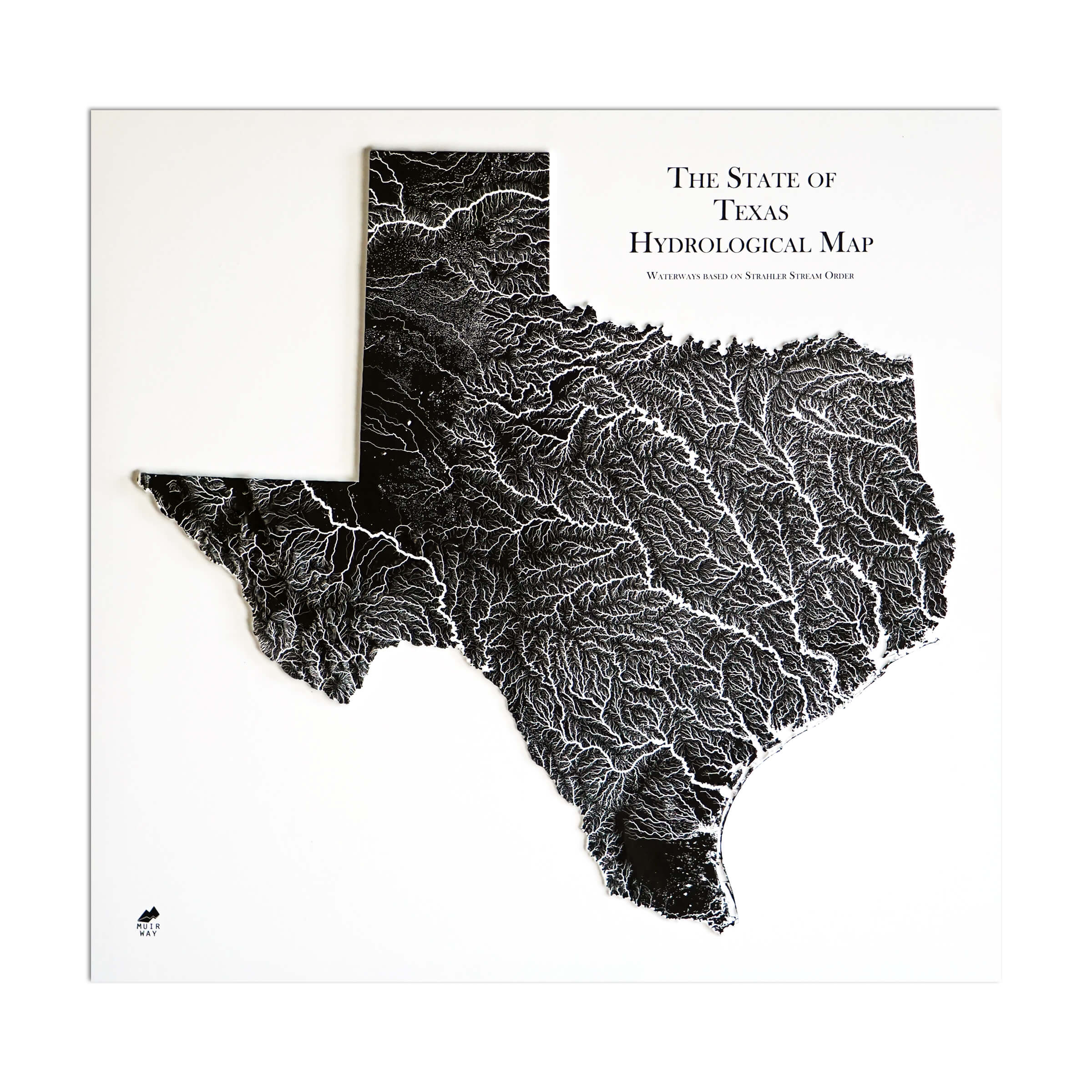
Texas hydrological maps - Our hydrological maps showcase the intricate network of waterways, from sprawling lakes to narrow tributaries that flow into larger rivers. Trace Texas’ waterways on our Texas hydrological map and you’ll see every body of water greater than 0.2 mi in diameter. What makes our hydrological maps unique? We apply a method called the Strahler Stream Order to show the hierarchy of streams as they flow from their source, with rivers shown thicker as they acquire the flow of tributaries. Map available in black, blue, or green. Want to see the ‘big picture?’ See our Texas-Gulf regional hydrological map. We also offer the Rio Grande regional hydrological map and the Arkansas-White-Red regional hydrological map.
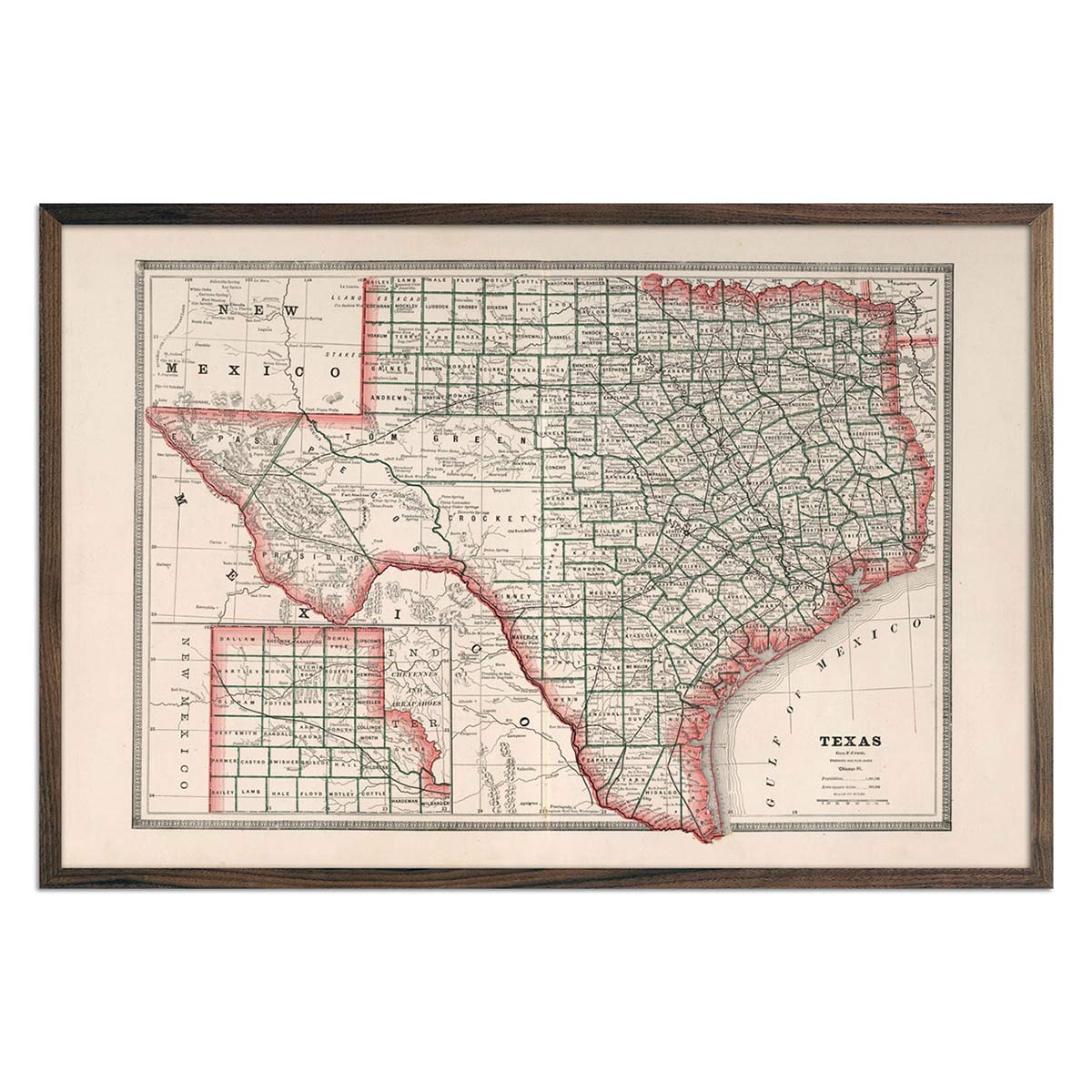
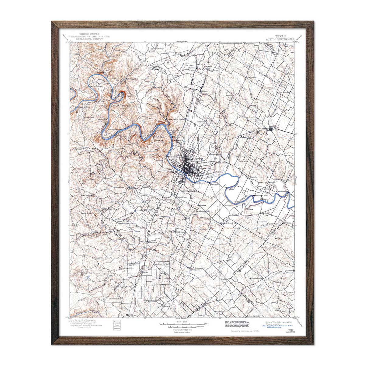
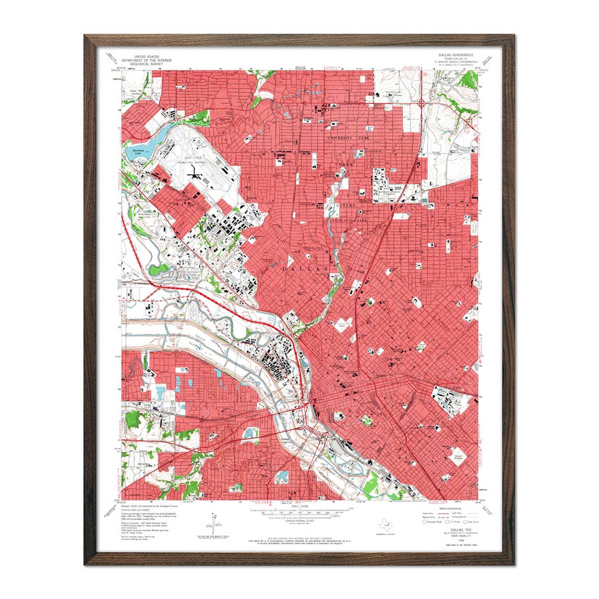
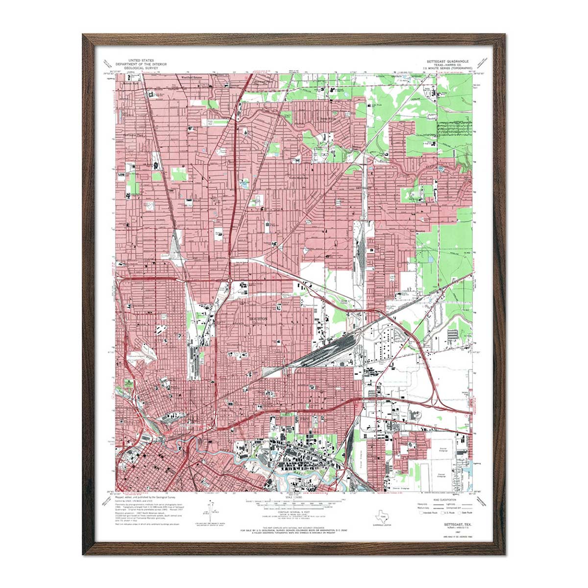
Enhanced vintage Texas maps - Enjoy the history and charm of vintage maps in a new way with our Texas 1883 map. Explore the old streets of Austin with our Austin, TX 1941 USGS map. Unlike our elevation maps, Muir Way historical maps don’t feature enhanced elevation effects, but they do feature a record of history beautifully restored to retain its vintage charm without the wear & tear. Our vintage Texas maps are also custom printed using archival materials.
What are some prominent features on the map of Texas?
Texas is the biggest state in the lower 48. The state extends nearly 1,000 miles from north to south and about the same distance from east to west.
Texas is made up of a series of vast regions, including high plains, mountains, fertile farmland, and coastland. Flat, low prairies extend from the Gulf of Mexico inland to form a fertile area that is perfect for farming and cattle raising. The land near the coast is marshy and swampy. The Great Plains stretch across the north and west parts of the state. In the western part of Texas are the state’s only mountains. It is bordered on the south by the Rio Grande River, marking the boundary between the United States and Mexico.
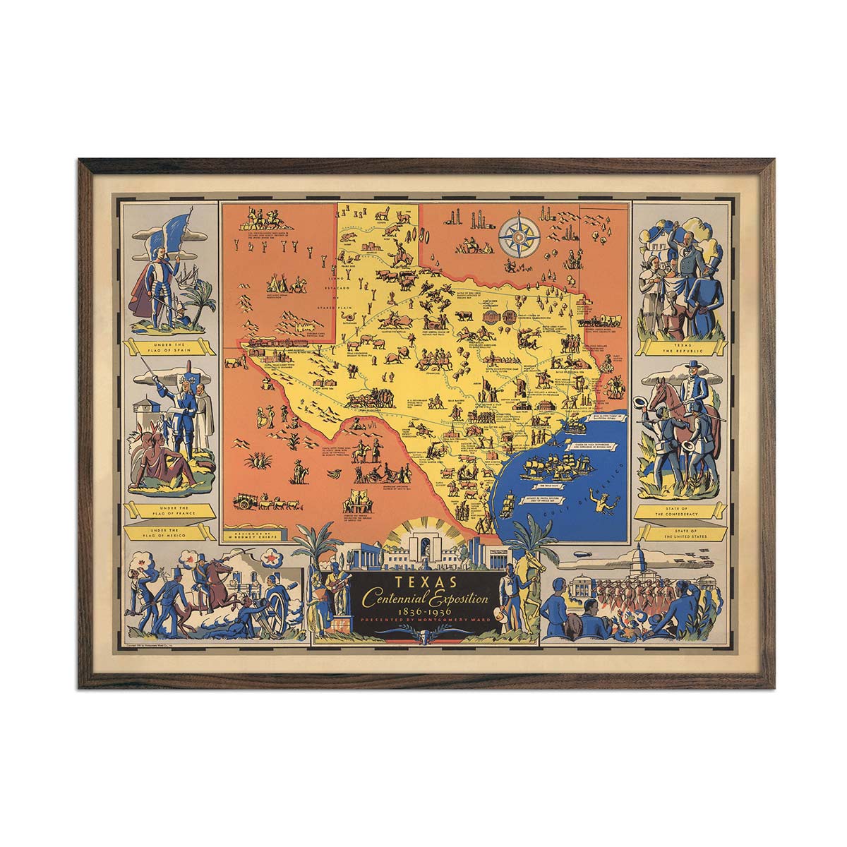
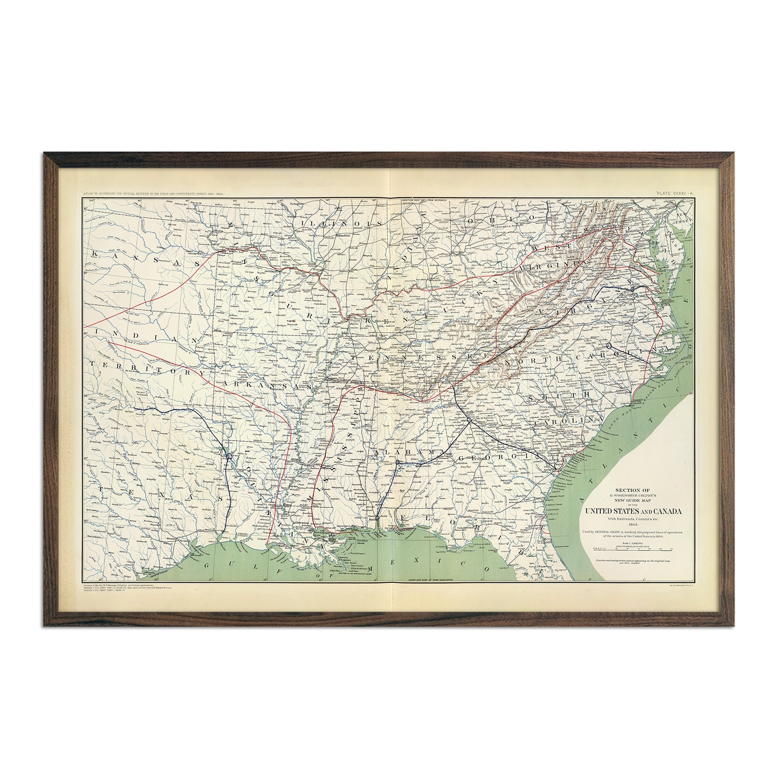
Experience some of the fascinating history and geography of the state with our Texas Centennial Exposition 1936 map. Marking the 100-year anniversary of Texas’s independence from Mexico, it shows a number of historical vignettes as well as landmarks, railroads, rivers, and mountains.
In the Panhandle of the state is Palo Duro Canyon, the second largest canyon in the United States. 120 miles long and up to 1000 feet deep, it also contains spectacular natural formations like caves and hoodoos.
The Natural Bridge Caverns, located in Texas Hill Country, have a number of amazing geographic formations, including a 60ft limestone bridge that was formed when a sinkhole collapsed below it.
In Central Texas is a massive pink granite dome called the Enchanted Rock. Perfect for hiking, camping and rock climbing, it is also home to a variety of animals and plants.
What are the regions in Texas?
Texas has seven main geographical regions:
- Big Bend Country Region - In the far west Texas, this region is filled with rugged plateaus and desert mountains. The area includes the only mountains in the state, including the Chisos Mountains and the Davis Mountains. The region is named after the big bend of the Rio Grande River, which makes up its western border.
- Gulf Coast Region - The Gulf Coast region stretches along the Gulf of Mexico. Covering 624 miles, it is filled with marshes, bays, barrier islands, prairies, beaches, and isolated stretches of seashore.
- Hill Country Region - The Texas Hill Country is located in the central area of the state. It is a transitional area that roughly marks the border between the American Southeast and the Southwest. It is hilly with steep canyons, lakes, springs, and caves. The Hill Country has beautiful natural attractions, including the Guadalupe River, and the Natural Bridge Caverns.
- Panhandle Plains Region - This includes the northernmost area of Texas. The region contains the mostly flat, treeless grassland of the Great Plains. The western and eastern parts of this region are marked by canyons with flowing rivers and tributaries.
- Piney Woods Region - The easternmost region of Texas, it is sometimes called Deep East Texas. It is primarily forests of pine and cypress trees. Swamps are common here, particularly in the southernmost area of the region which is called the Big Thicket.
- Prairies and Lakes Region - The Prairies and Lakes region is in north central and central Texas. The land is gently rolling, hilly, and fertile. It is a transitional area between the Piney Woods area and the Panhandle regions.
- South Texas Plains Region - The South Texas Plains region runs along the southern tip of the state. Much of the region is dry and covered with grasses, brush, and cacti. However, the Lower Rio Grande Valley has a unique ecosystem and is home to subtropical woodlands, tropical birds, and palm trees.
If you like our collection of Texas maps, you may also be interested in maps of other South Central states. Click below to browse:
