


Arkansas Map Prints, Elevation & Shaded Relief Maps
Whether you’re from Arkansas or just like to visit, our custom printed Arkansas wall maps bring a slice of the American South to any home or office. From our stunning elevation maps and geological relief maps to our meticulously restored historical maps, every product we offer reflects the high quality and attention to detail our customers have come to love and expect from Muir Way.
What makes Muir Way maps of Arkansas unique?
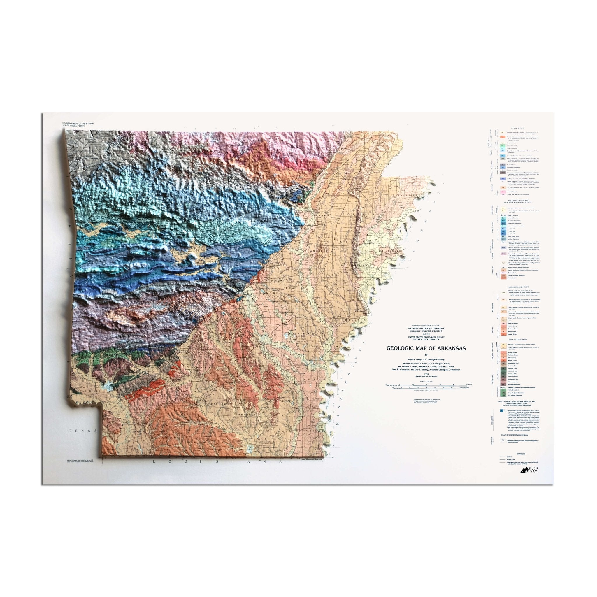
When you purchase an Arkansas wall map from Muir Way, you get an heirloom-quality piece of art, not just a poster or generic print. In addition to custom printing every Arkansas map using archival inks and fine art paper certified to last 100 years, the artwork of our maps themselves is designed to bring new light to the beautiful terrain they feature. Our elevation maps incorporate hand-shaded relief and Digital Elevation Data with historical map terrain for a stunning 3D effect on a flat surface, and our hydrological maps depict every river in the state--even intermittent streams--and every body of water over 0.2 miles in diameter in crisp detail. The meticulous craftsmanship and design we bring to our maps creates heirloom quality artwork to last for generations.
Can I get my Arkansas map framed?
Yes! Our Arkansas maps are available professionally custom-framed with real wood, or unframed. Many are also available as gallery-wrapped canvas. If you’d like to purchase your Arkansas wall map framed, you can choose from several different colors and wood finishes to perfectly match your décor. If you’d prefer to use your own frame, all of our maps come in standard frameable sizes for easy gift giving.
Is a Muir Way map of Arkansas a good gift idea?
Muir Way custom-printed maps are popular gift choices for special holidays, anniversaries, or as a thank-you gift for someone special. We see our thousands of happy customer reviews as a testament to the quality we stand by when you purchase one of our maps as a gift. An Arkansas wall map from Muir Way makes an ideal graduation gift for a student about to leave home for the first time, or a reminder of home for someone whose home state is Arkansas but who no longer lives there. Our maps also make unique and memorable corporate gifts.
How should I display my Arkansas map?
Our maps are designed to stand out whether viewing up close or from across the room. Hang a framed Arkansas wall map as a central focus, or purchase several and arrange them near each other for a complementary series. Our hydrological maps come in several colors or the quintessential black and white, and our geological relief maps feature brilliant colors. No matter which you choose, you’re sure to find an Arkansas illustration that will look right at home.
What are the different types of maps of Arkansas available on Muir Way?
Our Arkansas maps are available in several different styles, including:
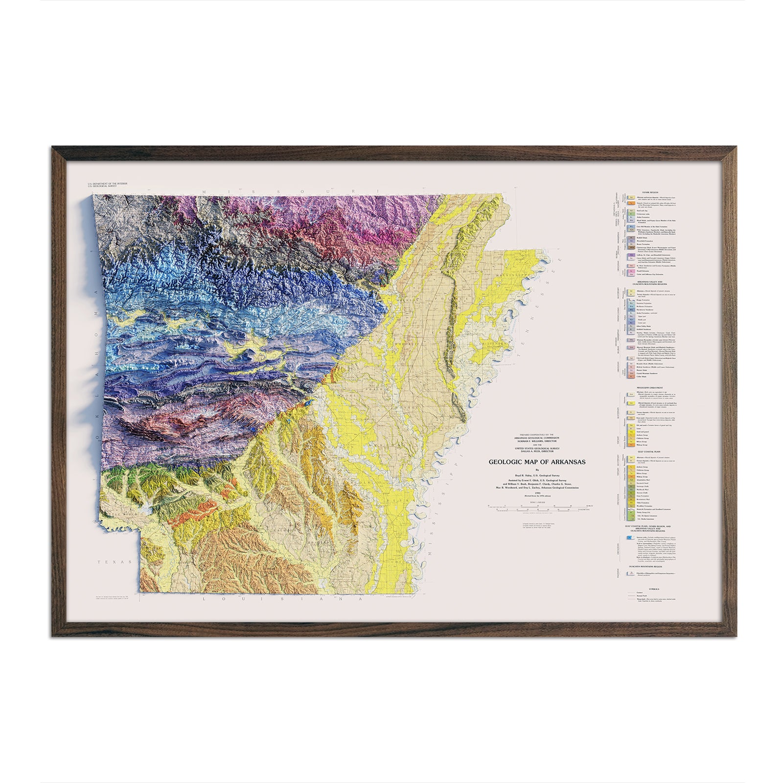
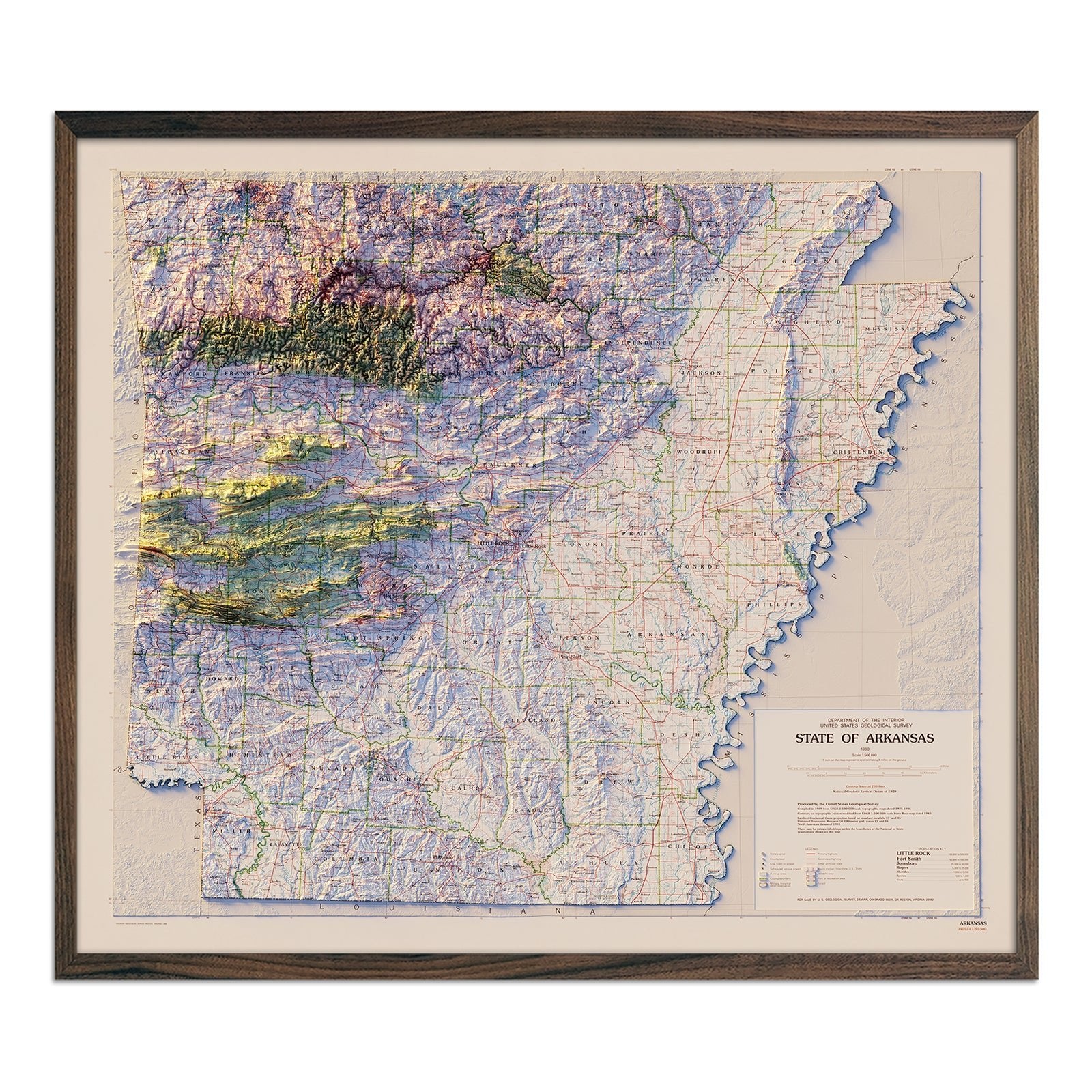
Arkansas relief maps - Our relief map of Arkansas marries 1993 historical map data with modern technology to showcase Arkansas’ beautiful topography in an exciting new (and colorful!) way. Using Digital Elevation Data and hand-shaded relief, we custom enhance vintage map imagery to create a vibrant 3D effect on a flat surface. Our geologic relief map of Arkansas is shaded and colored down to the minute detail for up-close viewing of mountains, lakes, and everything in between.
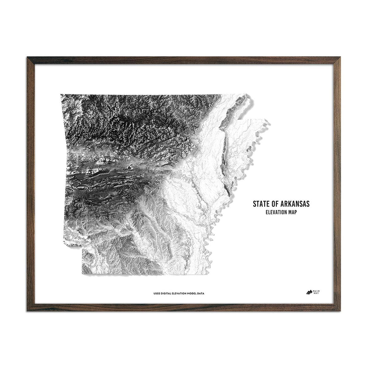
Arkansas elevation maps - Like the relief map, our state of Arkansas elevation map also uses Digital Elevation Data from the USGS to create a high-contrast 3-dimensional effect, this time in stunning black and white. USGS data is enhanced and magnified to show the contrast in elevation for a map that really pops from across the room.
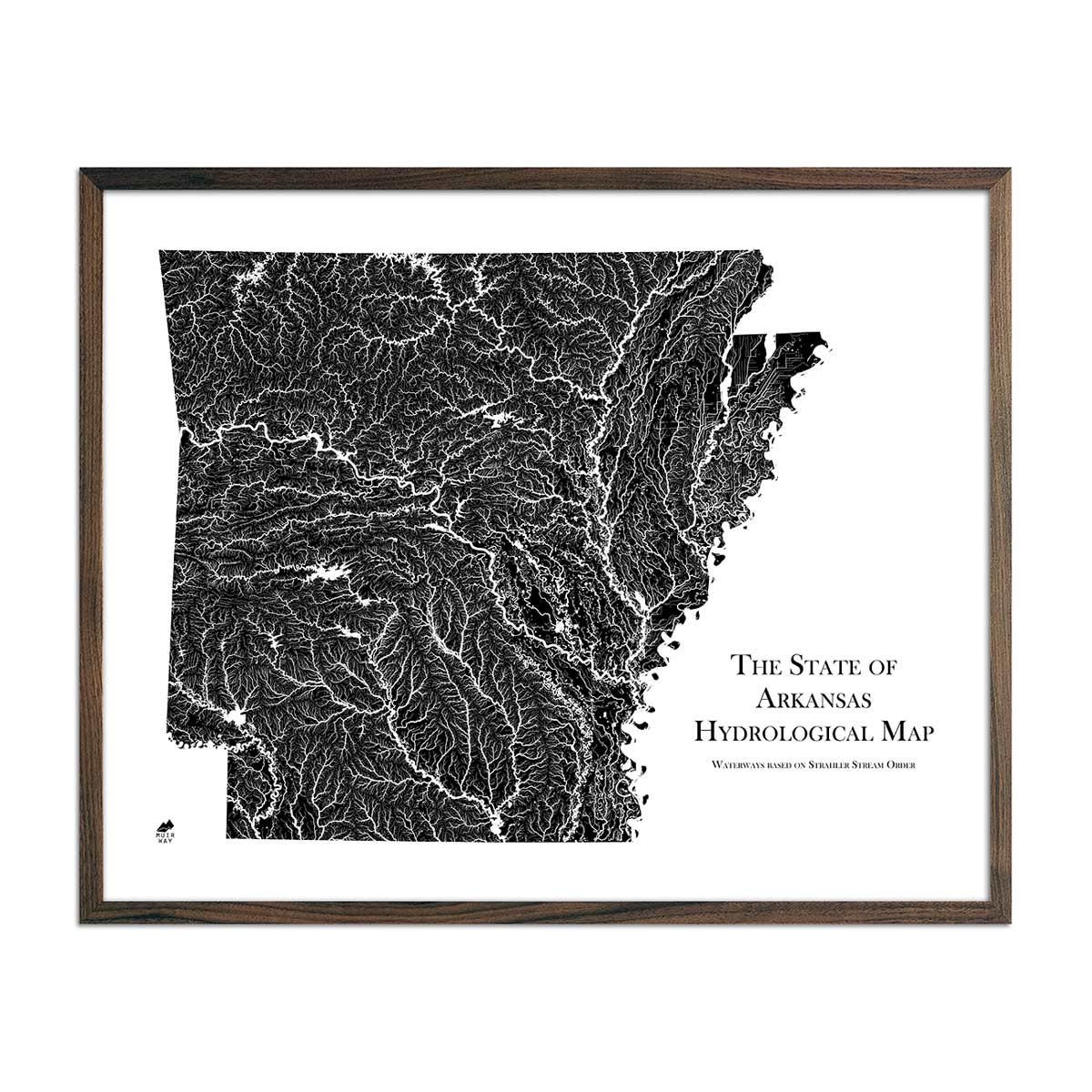
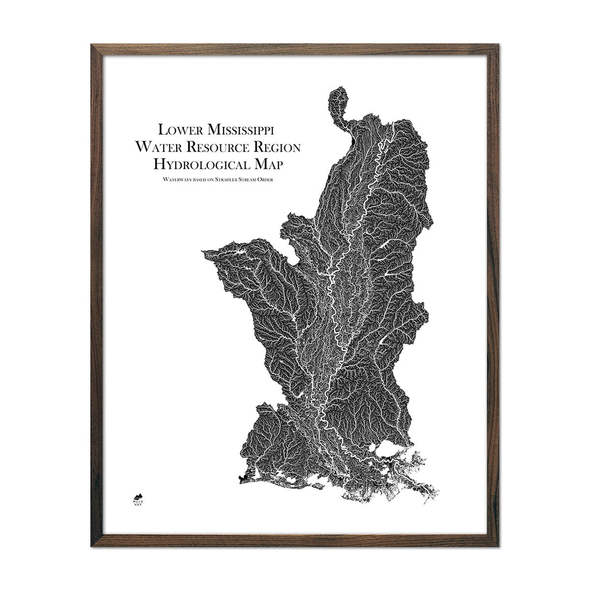
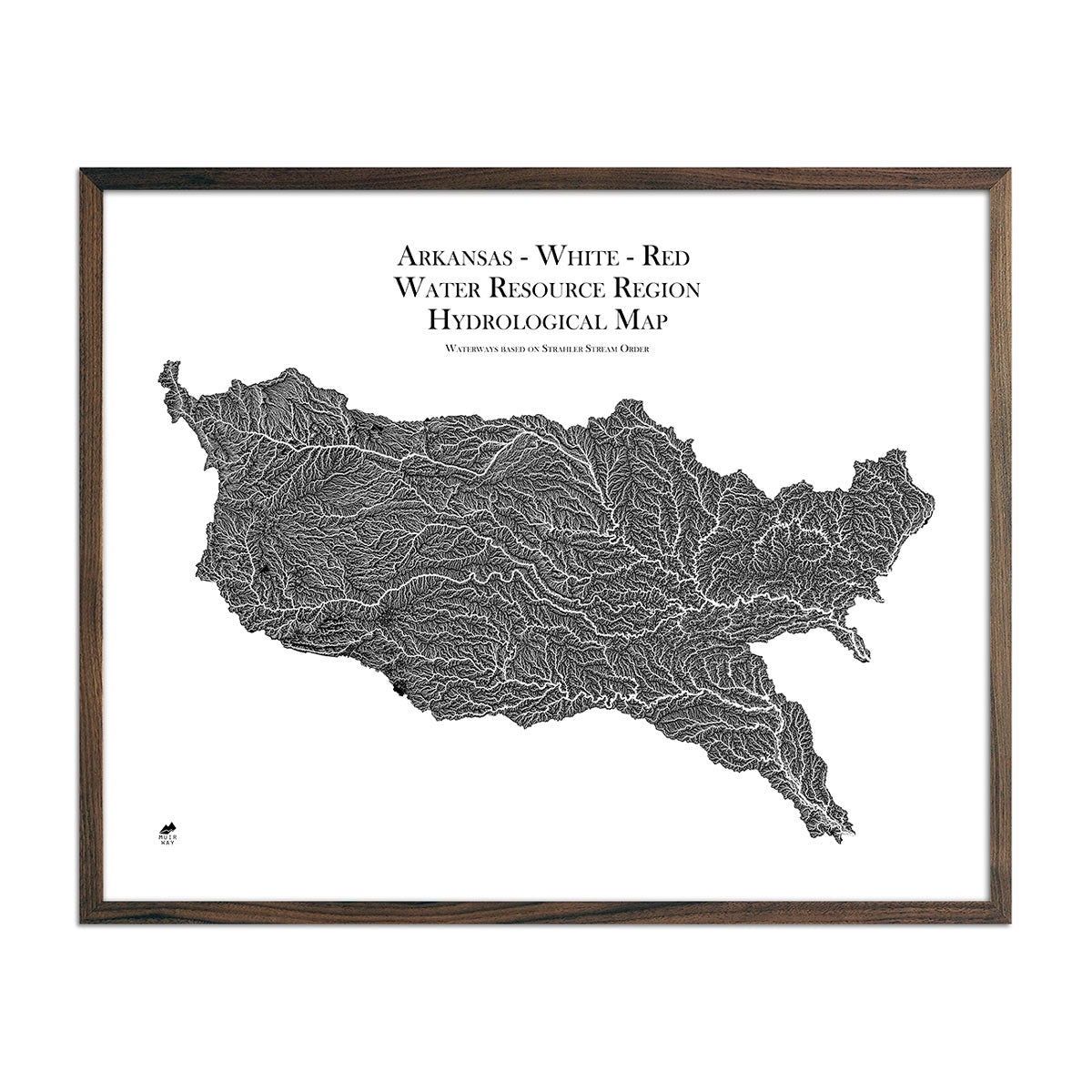
Arkansas hydrological maps - Our hydrological maps are designed to look beautiful far away and up close, and are available in black, blue, and green. Our Arkansas hydrology map is so detailed that you can actually view every single river and intermittent stream, as well as all bodies of water greater than 0.2 mi in diameter. To ease viewing and provide even better contrast, we apply a method called the Strahler Stream Order to show the hierarchy of streams as they flow from their source, with rivers shown thicker as they acquire the flow of tributaries. Trace the Mississippi River and appreciate the beauty of all of Arkansas’ interconnected waterways with our hydrology maps of Arkansas, also available in regional varieties including the white-red regional hydrology map and the Lower Mississippi Regional hydrology map.
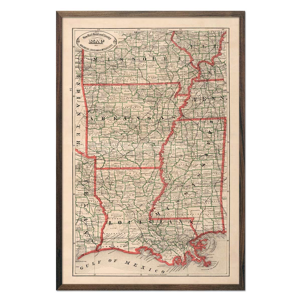
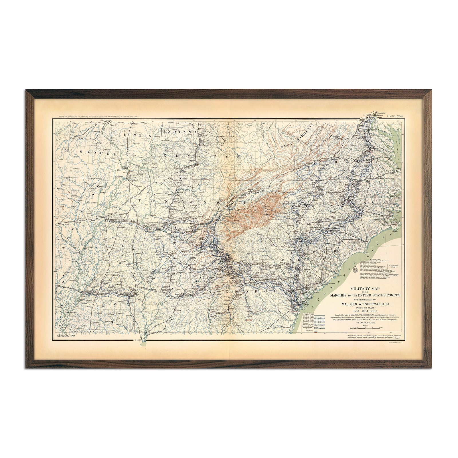
Regional vintage maps featuring Arkansas - If you like vintage maps, you’ll love our regional 1883 Arkansas, Louisiana and Mississippi map. Unlike our relief map series, our historical maps don’t feature elevation, but what they do feature is a record of history beautifully printed and ready to display. Our vintage maps are reproduction prints, carefully restored to maintain their charm without the wear & tear. As with all of our Arkansas maps, our vintage reproductions come custom printed using archival materials to preserve a snapshot of history for years to come.
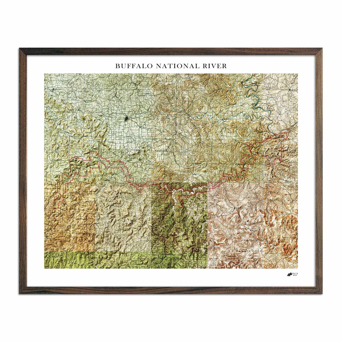
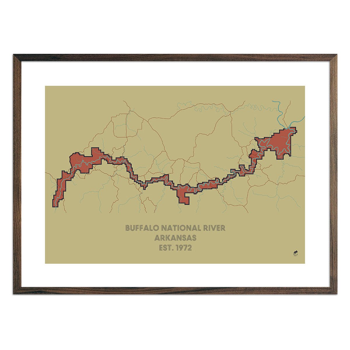
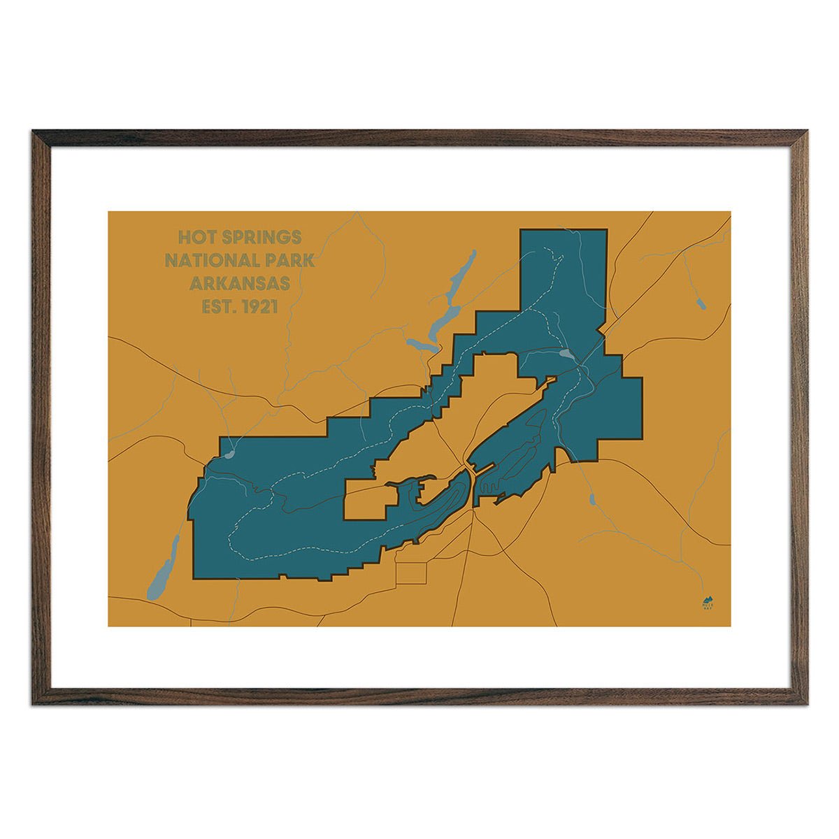
Arkansas national park and river maps - For outdoor enthusiasts, view our Hot Springs National Park map or take a trip down the Buffalo River on our Buffalo National River map and Buffalo River Relief Map.
What are some prominent features on the map of Arkansas?
There’s a reason Arkansas has earned its nickname of ‘The Natural State’! With diverse geography from the Ozark Mountains to the densely forested Arkansas Timberlands, to the shores of the Mississippi River, Arkansas provides a dazzling array of topographical and ecological environments. Our elevation and relief maps of Arkansas show Arkansas’ striking mountain ranges in full detail to give you a true sense of its variegated terrain.
Known for its array of rivers and hot springs, Arkansas also has over 600,000 acres of lakes. On our hydrology maps, you will see every twist and turn of Arkansas’ interconnected river systems and can take a look at its lakes up close. Despite being a landlocked state, Arkansas has a lot of water and our hydrology maps let your eye wander to see how it’s all connected as it flows toward the ocean.
No matter which Arkansas state map you choose, you’ll enjoy an up-close look at a state known for its diverse geography.br>
What are the regions in Arkansas?
Arkansas has seven separate natural regions:
- The Ozark Mountains - Located in northwestern Arkansas, the Ozarks are mostly steep plateaus made of limestone. Due to its rocky landscape and poor soil for farming, the Ozark region houses poultry and livestock farms and has many hickory, oak and walnut forests blanketing its rocky terrain.
- The Ouachita Mountains - South of the Arkansas River, this region contains folded mountains running east to west and hardwood forests. It is home to some of the state’s hot springs and also provides fertile soil for crops like soybeans, cotton, and corn.
- Arkansas River Valley - This 40-mile wide region carved by a river divides the Ozark and Ouachita Mountains and is home to Arkansas’ larger cities.
- Gulf Coastal Plain - despite not being located near a sea, this southwestern region was once covered by the Gulf of Mexico, hence its name. It now boasts pine forests, rolling hills, and many of Arkansas’ rivers and streams.
- Crowley’s Ridge - this crescent-shaped region features oak and hickory forests, pasture lands, and small farms, and is home to beautiful mountain flora such as the American bellflower and yellow jasmine.
- Mississippi Delta (Alluvial Plain) - bordering the Mississippi River in the eastern part of the state, the Aalluvial Plain region of Arkansas, originally Quapaw territory, is flat and fertile, providing the most agriculturally productive soil in the entire country.
If you like our collection of Arkansas maps, you may also be interested in maps of other South Central states. Click below to browse:
