


Oklahoma Map Prints, Shaded Relief & Hydrological Maps
Whether you are from Oklahoma, like to visit, or hope to see the Ozark Mountains someday, our custom printed Oklahoma wall maps will bring the state’s scenic landscapes to life. Our maps are beautifully rendered from a combination of historical data, modern technology, and hand design. From our eye-catching elevation maps and geological relief maps to our meticulously restored historical maps, every map of Oklahoma we offer reflects the high quality and attention to detail our customers have come to love and expect from Muir Way. See why a map of Oklahoma from Muir Way is more than your typical wall map.
What makes Muir Way maps of Oklahoma unique?
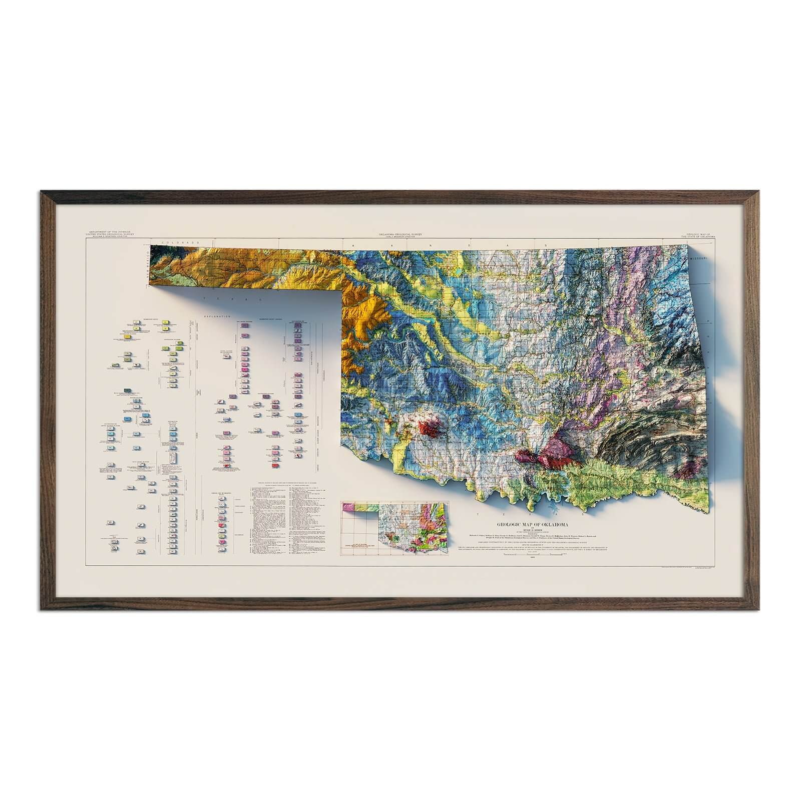
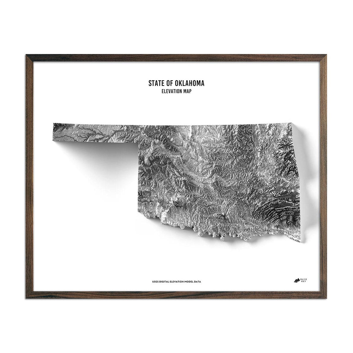
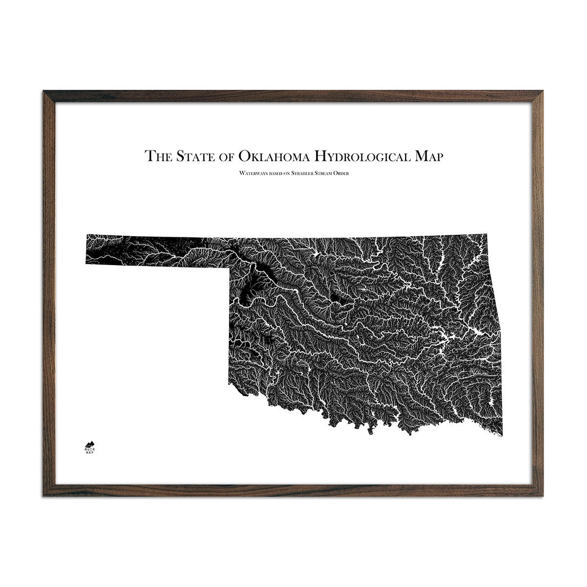
When you purchase a map of Oklahoma from Muir Way, you are not purchasing a mass-produced poster or generic print. We custom print every Oklahoma map using archival inks and fine art paper certified to last 100 years. The artwork of our maps themselves is designed to bring new light to the beautiful terrain they feature. For example, our elevation maps incorporate hand-shaded relief and Digital Elevation Data with historical map terrain for a unique 3D effect on a flat surface, and our hydrological maps depict every river in the state--even intermittent streams--and every body of water over 0.2 miles in diameter in crisp detail. We create beautiful, heirloom-quality maps meant to last for generations.
Does my Oklahoma map come framed?
It can! You can purchase your Oklahoma map professionally custom-framed with real wood, or unframed if you prefer to use your own. If you’d like to purchase a framed Oklahoma wall map, there are several different wood finishes to choose from. If you’d prefer to use your own frame, all of our maps come in standard sizes for easy gift giving.
Does a Muir Way map of Oklahoma make a good gift?
Yes! Our custom-printed maps of Oklahoma make the perfect gift for outdoor enthusiasts, to commemorate special occasions, or as a thank-you gift for someone special. Memorialize the experience of a special holiday to Black Mesa, the Gloss Mountains, or any of the other amazing Oklahoma landscapes. One of our state relief maps can be a perfect graduation gift for a student about to leave home for the first time, or a reminder of home for someone from Oklahoma but who no longer lives there. Our maps also make beautiful corporate gifts that will remind your clients or colleagues of you every time they see it.
Where should I display my Oklahoma map?
Our maps are eye-catching from across the room and up close. Hang a framed wall map as a central focus or purchase several maps in a similar style or from a particular region and arrange them near each other for a complementary series. Our hydrological maps come in several colors or the classic black and white, and our geological relief maps feature vibrant colors. No matter which you choose, you’re sure to find an Oklahoma map that will look right at home.
What are the different types of maps of Oklahoma available on Muir Way?
Our Oklahoma maps are available in several different styles, including:
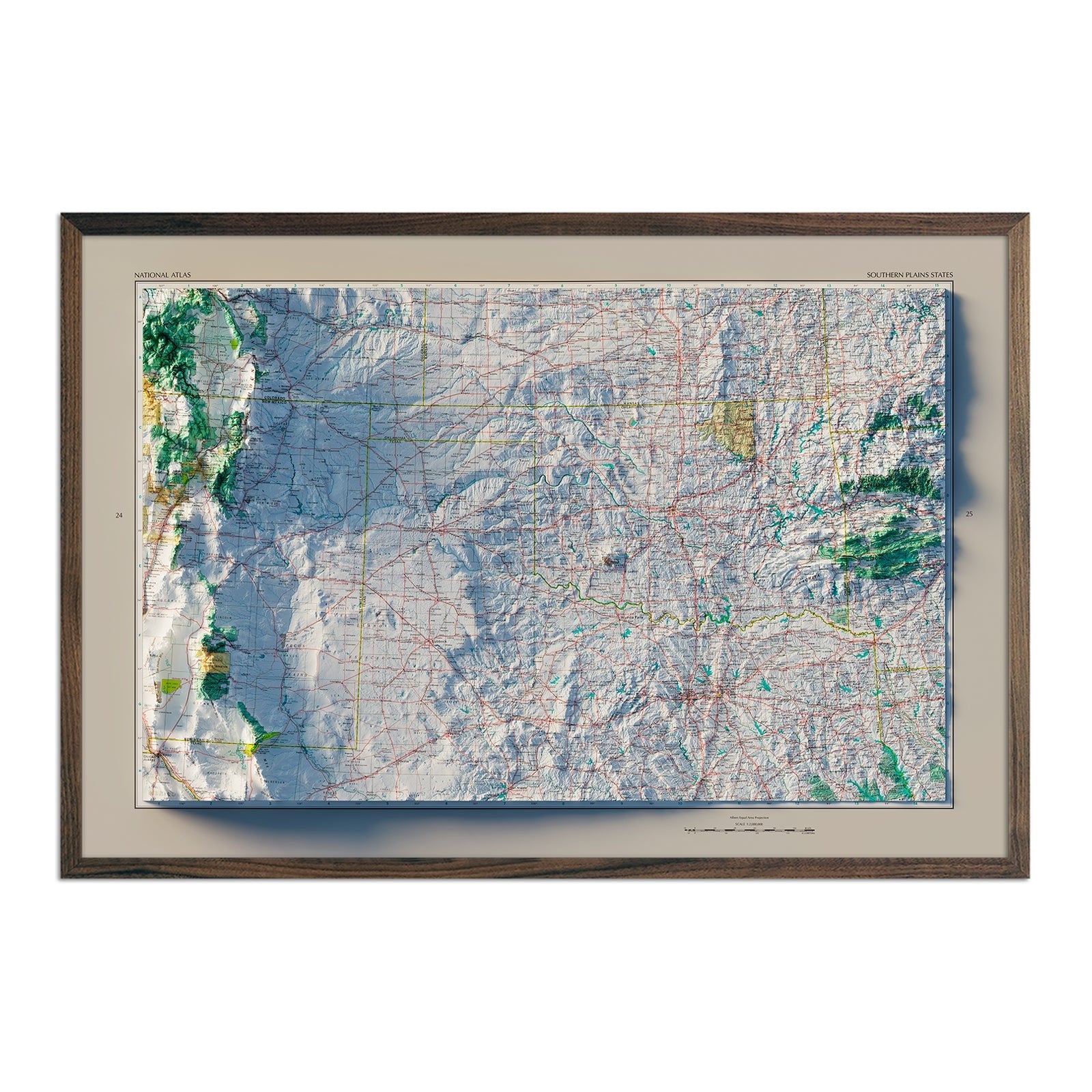
Oklahoma elevation maps - Our Oklahoma elevation map uses Digital Elevation Data from the USGS and hand-shaded relief just like our relief maps to create a high-contrast 3-dimensional effect in stunning black and white.
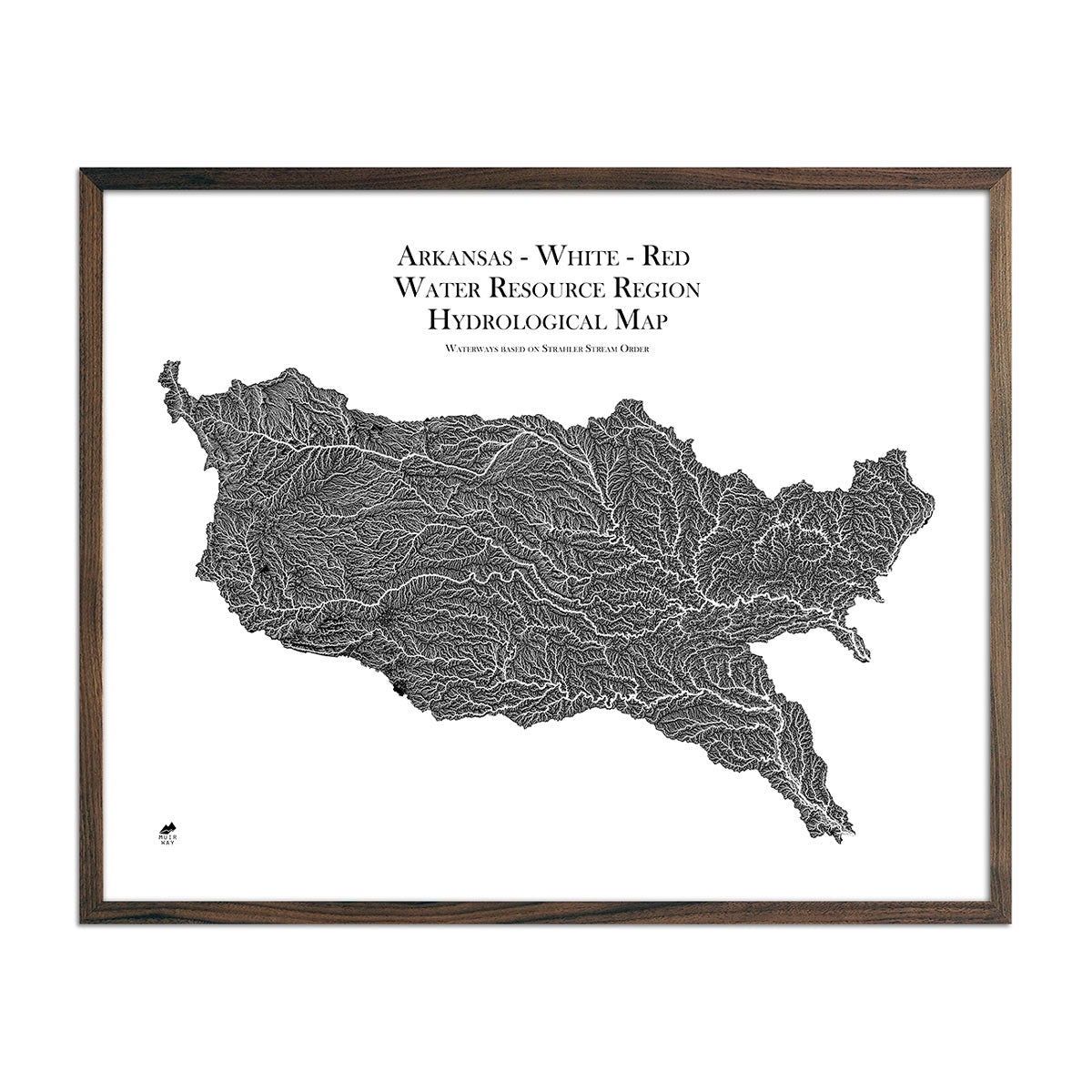
Oklahoma hydrological maps - Our hydrological maps showcase the intricate network of waterways, from sprawling lakes to narrow tributaries that flow into larger rivers. Trace Oklahoma’s waterways on our Oklahoma hydrological map and you’ll see every body of water greater than 0.2 mi in diameter. What makes our hydrological maps unique? We apply a method called the Strahler Stream Order to show the hierarchy of streams as they flow from their source, with rivers shown thicker as they acquire the flow of tributaries. Map available in black, blue, or green. Want to see the ‘big picture?’ See our Arkansas-White-Red Regional Hydrological map.
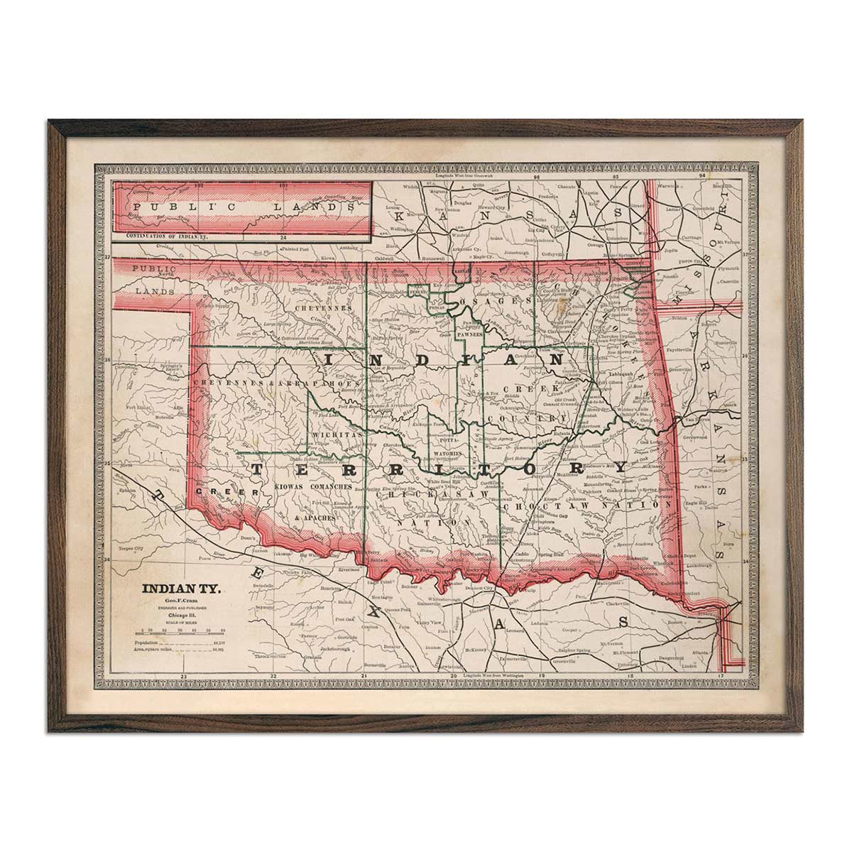
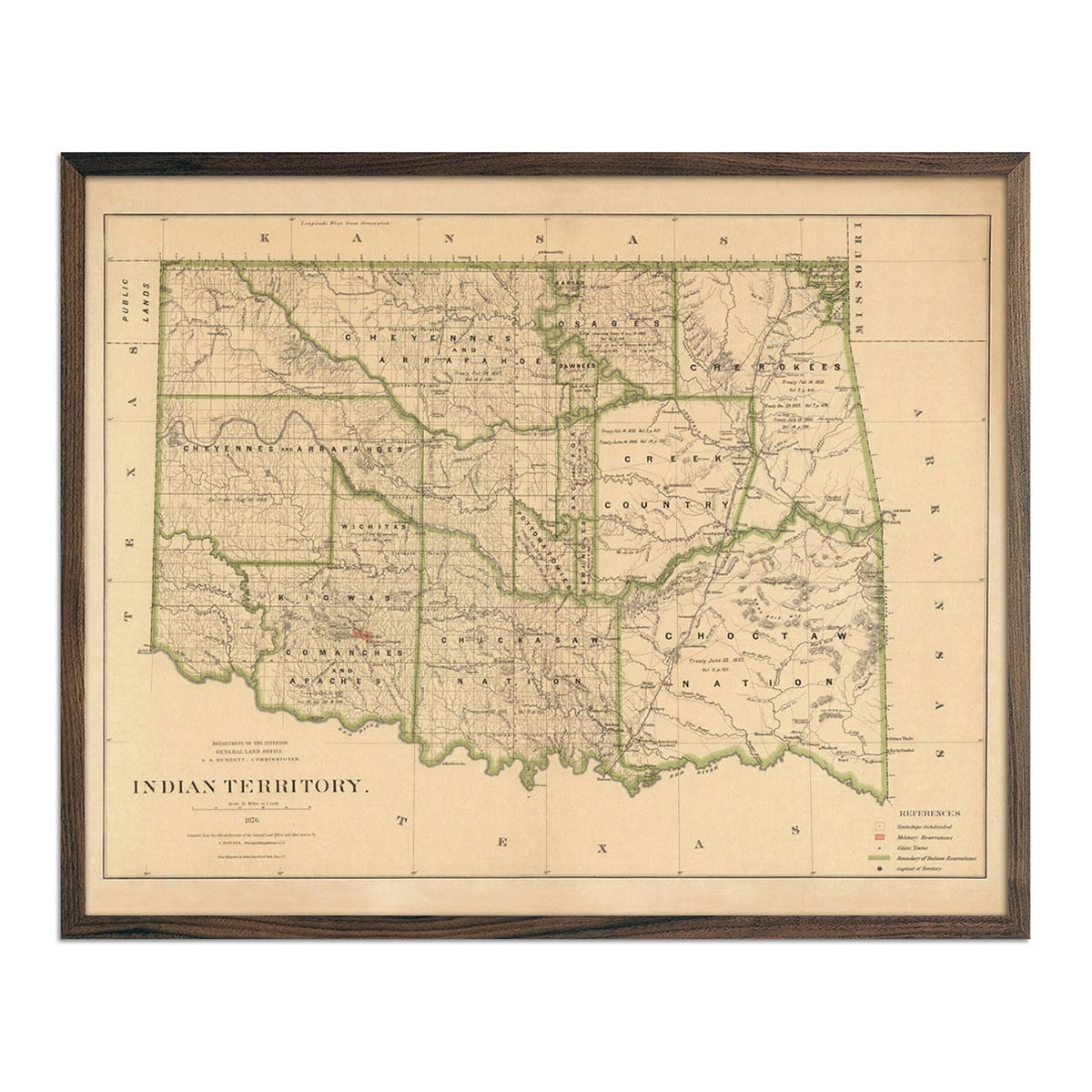
Enhanced vintage Oklahoma maps - Enjoy the history and charm of vintage maps in a new way with our Indian Territory (Oklahoma) 1876 map or our Indian Territory (Oklahoma) 1883 map. Unlike our elevation maps, Muir Way historical maps don’t feature enhanced elevation effects, but they do feature a record of history beautifully restored to retain its vintage charm without the wear and tear. Our vintage Oklahoma maps are also custom printed using archival materials.
What are some prominent features on the map of Oklahoma?
One of the most prominent features of Oklahoma is Black Mesa. It is the highest point in the state at nearly 5000 ft above sea level. Located in the Panhandle, wildlife is abundant here among the shortgrass prairie.
The Southern Great Plains cover western Oklahoma while the Osage Plains extend into the central part of the state. These are a mix of shortgrass and tallgrass plains, interspersed with wetlands, forests and savannas.
The Gloss, or Glass, Mountains run south of the Cimarron River. They are famous for their Selenite content that looks like shiny glass. The mountains sparkle when the sun hits them.
In the central north part of the state are the Great Salt Plains. This is a unique depository of red, hour-glass-shaped selenite crystals that can only be found in Oklahoma.
What are the regions in Oklahoma?
Oklahoma has 10 main geographical regions:
- The Ozark Plateau - This region spreads south and west from Missouri and Arkansas landscape. It has rivers with steep valleys separated by broad flat areas.
- The Prairie Plains - Many of Oklahoma’s farms are here. The land is rich and fertile. The area also produces much of the state’s coal and oil.
- The Ouachita Mountains - Running east to west, these sandstone ridges form rough terrain. The area has many narrow valleys with spring-fed streams.
- The Sandstone Hills Region - The Sandstone Hills range from 250 to 400 feet high and are covered in hardwood forests.
- The Arbuckle Mountains - This area covers about 1,000 square miles in south-central Oklahoma. These low mountains rise only 700 feet above the plains. The area is marked by unusual rock formations that were created by erosion in the mountains.
- The Wichita Mountains - Found in southwestern Oklahoma, these mountains have been sculpted by erosion. Much of them have been set aside as a wildlife refuge.
- The Red River Valley Region - Along the border with Texas, this area is characterized by rolling prairie with occasional forested hills. The soil is sandy and fertile with many farms located in the region.
- The Red Beds Plains - This is the largest land region in Oklahoma. These plains stretch from the Kansas border south through the center of the state.
- The Gypsum Hills - These low hills are capped with a 15 to 20 foot layer of gypsum. The Gypsum Hills sparkle in the sunlight because of the gypsum.
- The High Plains - These flat grasslands rise from about 2,000 feet above sea level to 4,973 feet above sea level. This region includes the Oklahoma Panhandle, the strip of land 166 miles long and only 34 miles wide between Colorado and Kansas in the north and Texas in the south.
If you like our collection of Oklahoma maps, you may also be interested in maps of other South Central states. Click below to browse:
