


Discover the Aloha State in a Whole New Way With Our Hawaii Relief, Elevation, & Hydrological Maps!
Venturing beyond the typical tourist view, our Hawaii map prints offer an enlightening perspective of the Aloha State. Every piece in the collection provides a unique depiction of the geographical attributes of Hawaii, an archipelago that's like no other.
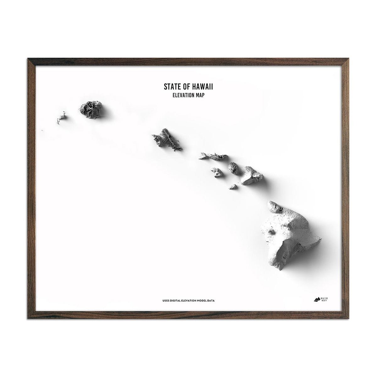
The combination of modern data and technology in our maps brings you closer to Hawaii’s captivating landscape, including its volcanic formations and striking coastlines.
With our Hawaii elevation map, you're able to explore centuries-old volcanic activities that led to the formation of this island paradise. And with our hydrological maps, you can navigate the twisting, turning view of every single river and intermittent stream throughout the state.
With unparalleled attention to detail and museum-quality materials, our Hawaii map prints are unlike any other.
Adding a Piece of Paradise to Your Home or Office
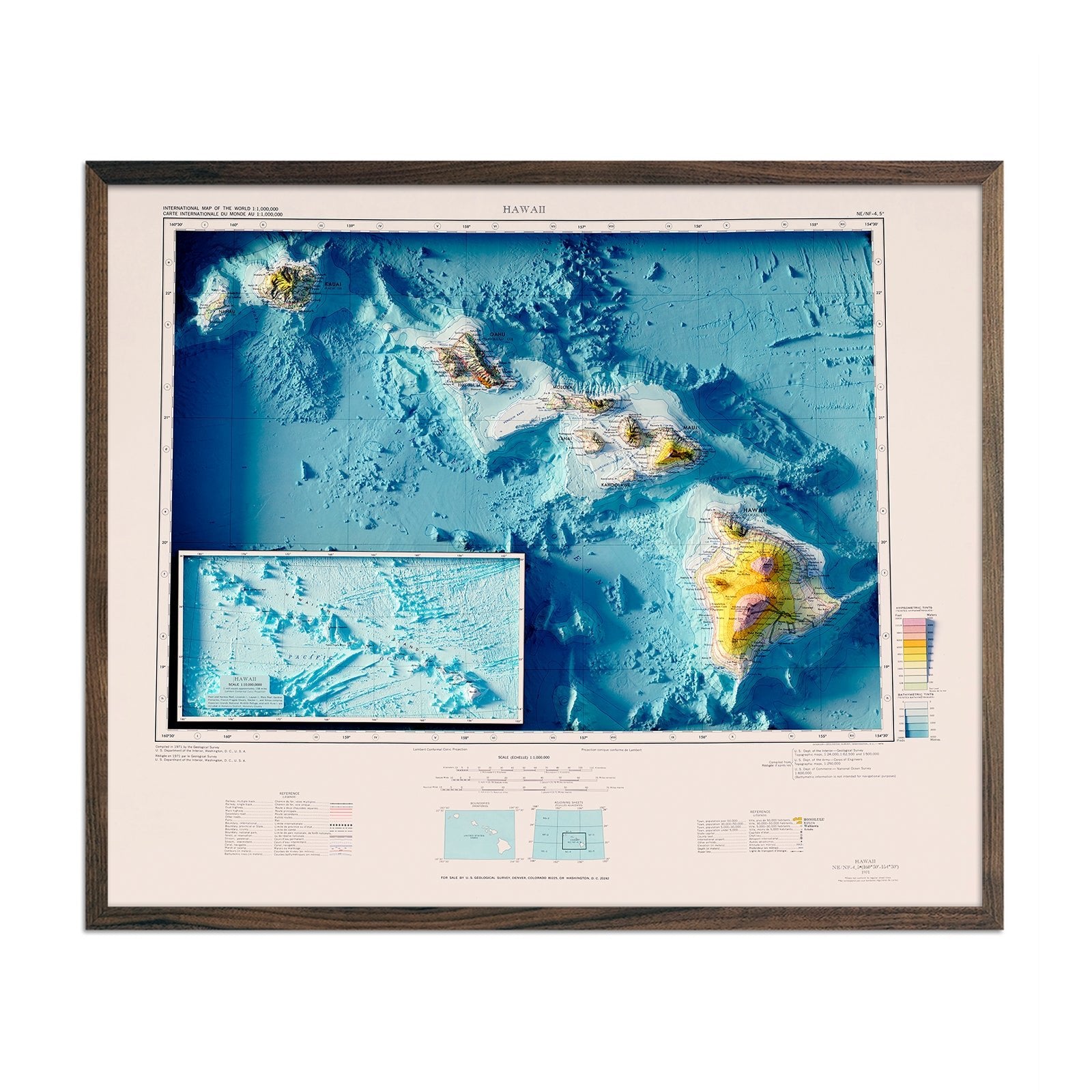
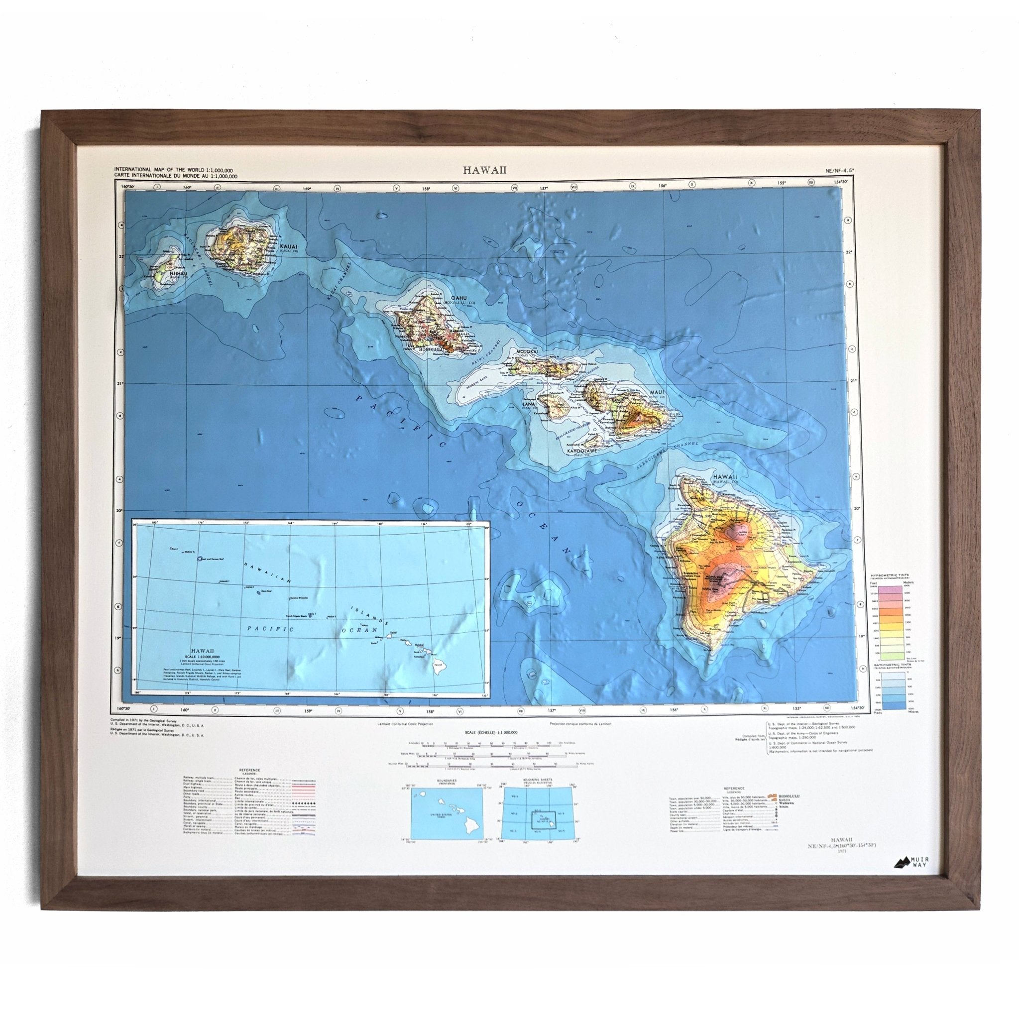
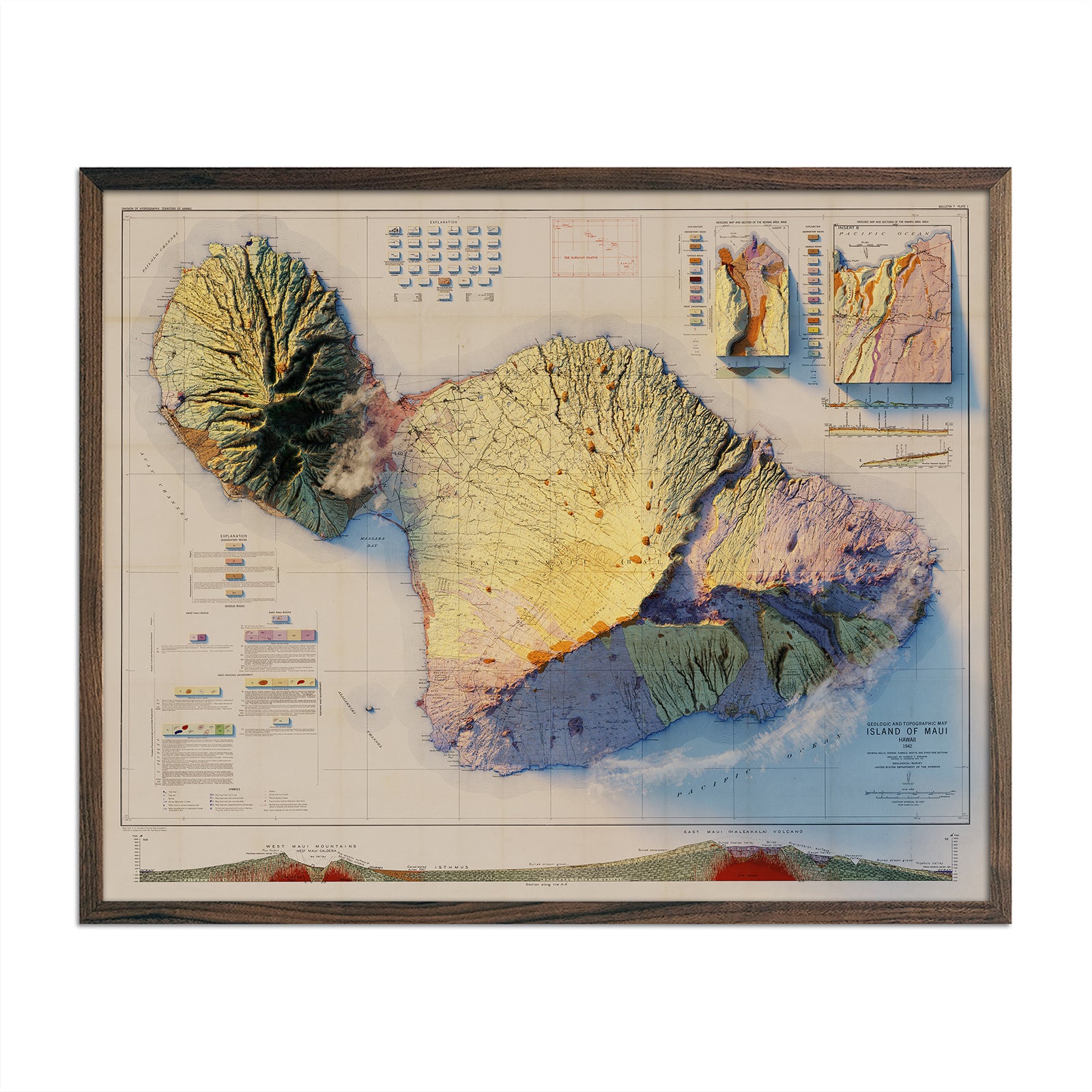
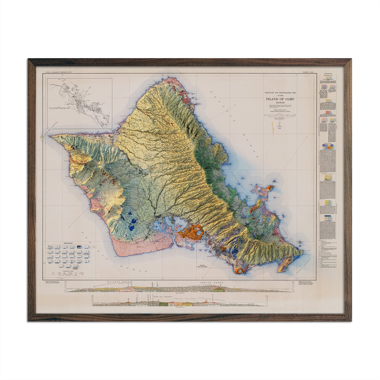
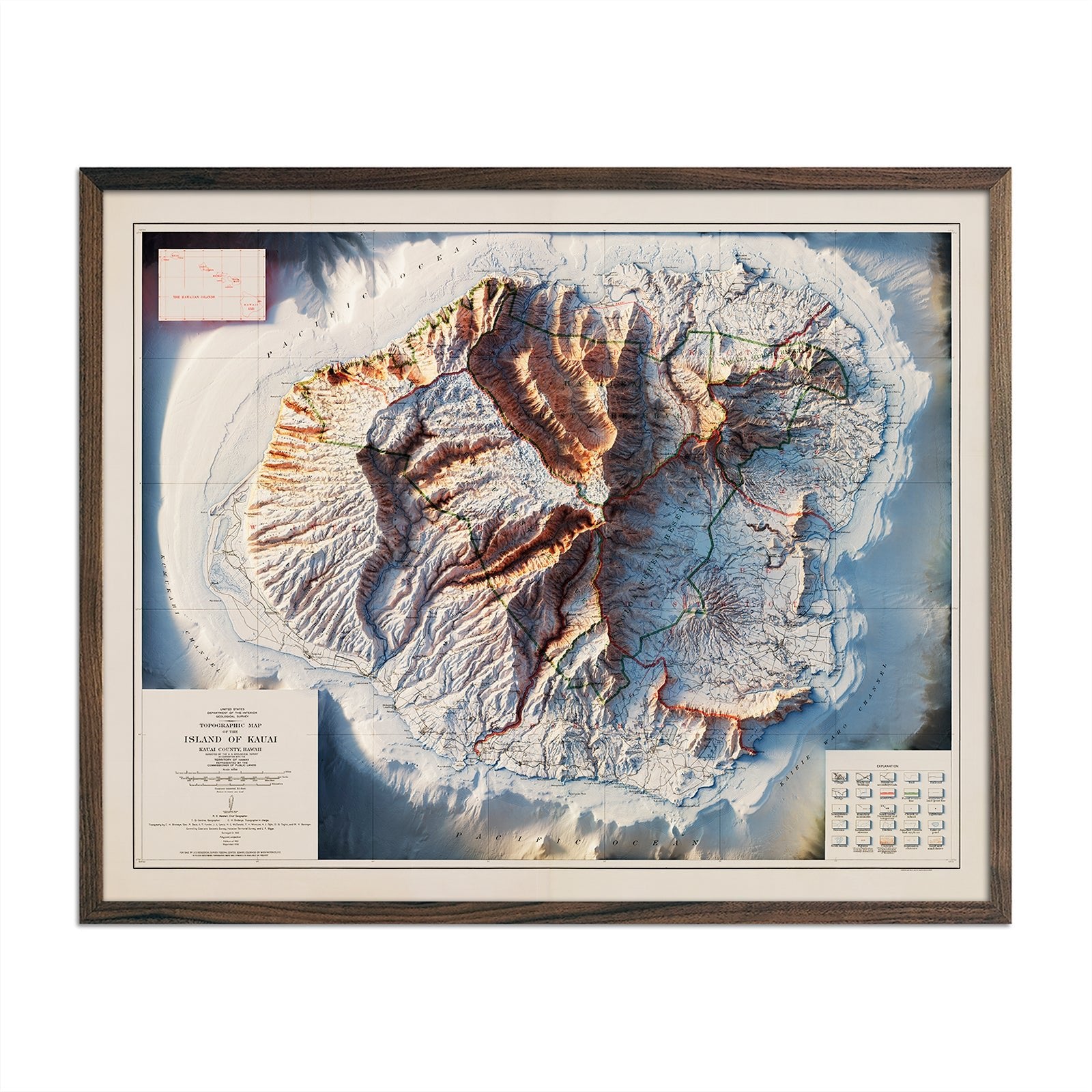
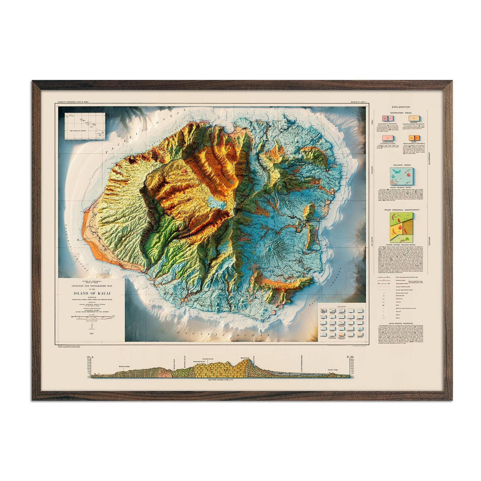
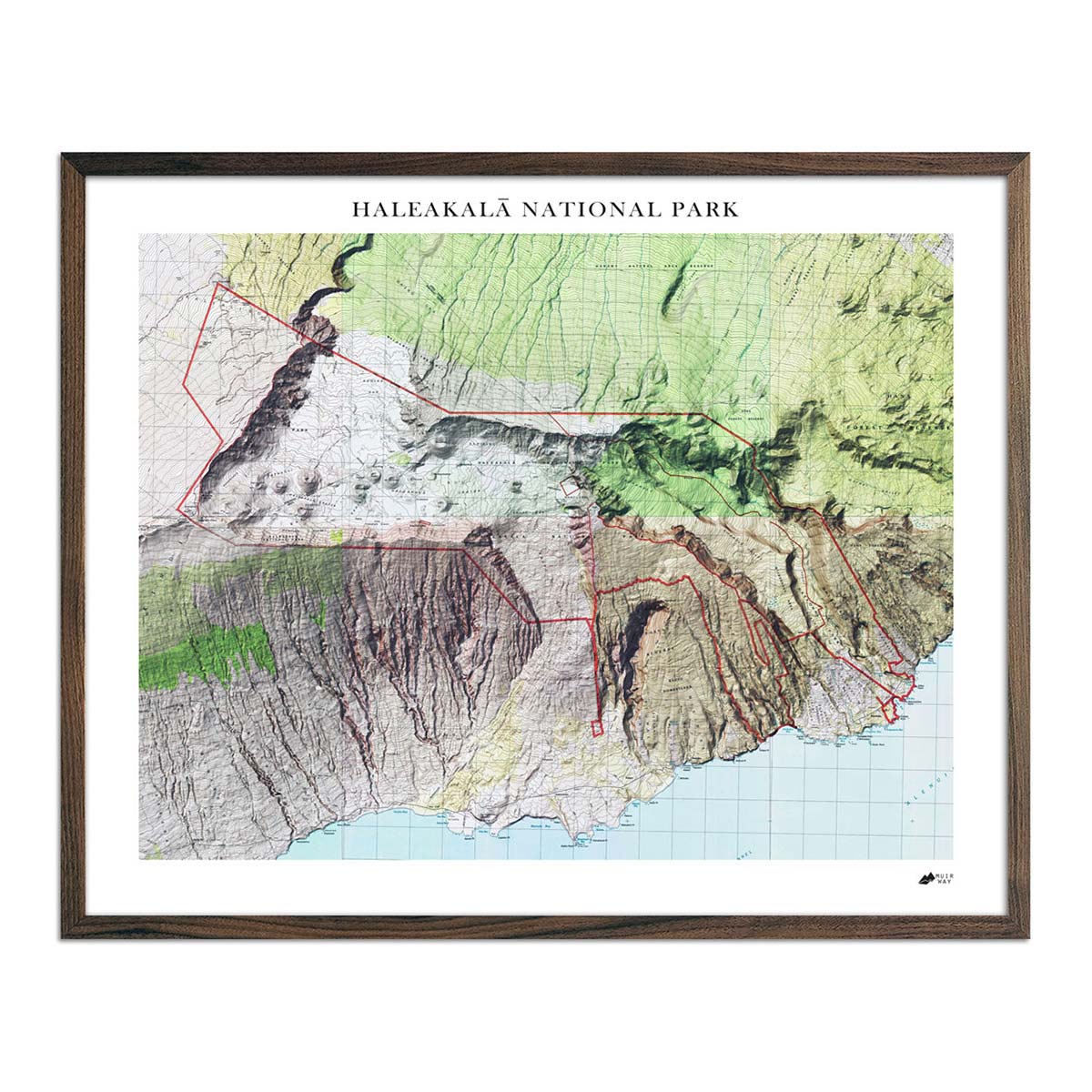
Our Hawaii relief maps bring both aesthetics and a story to your space. Each map displays detailed contours and elevations of Hawaii's varied terrain, from lava deserts and bamboo forests to jutting ocean cliffs.
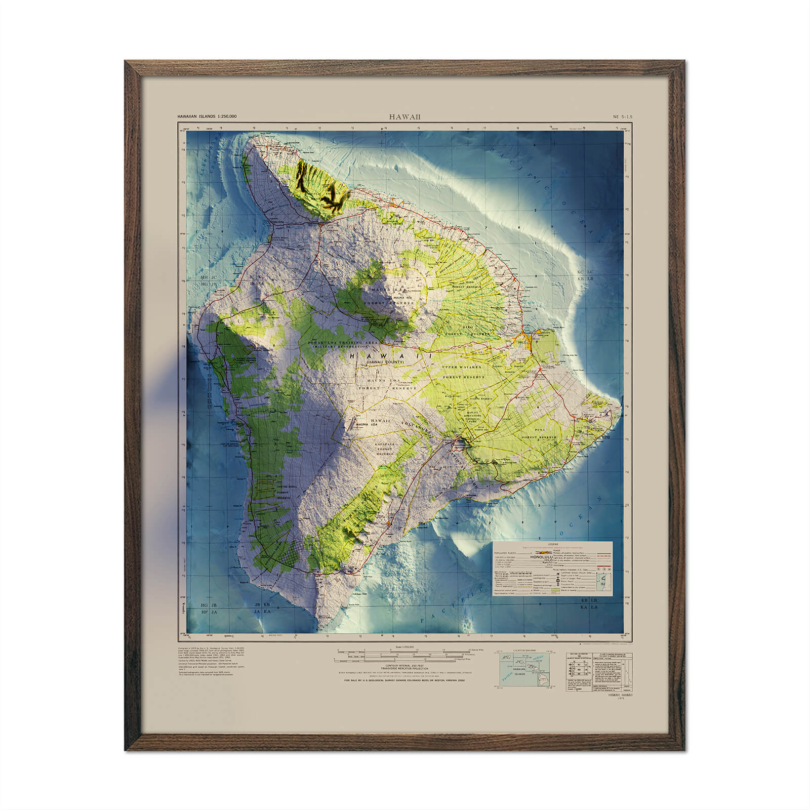
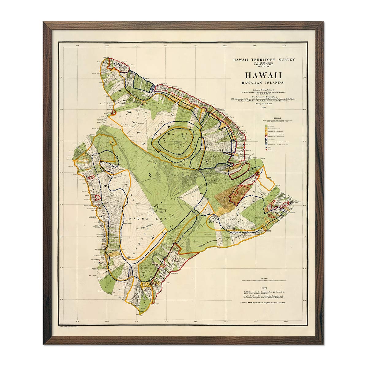
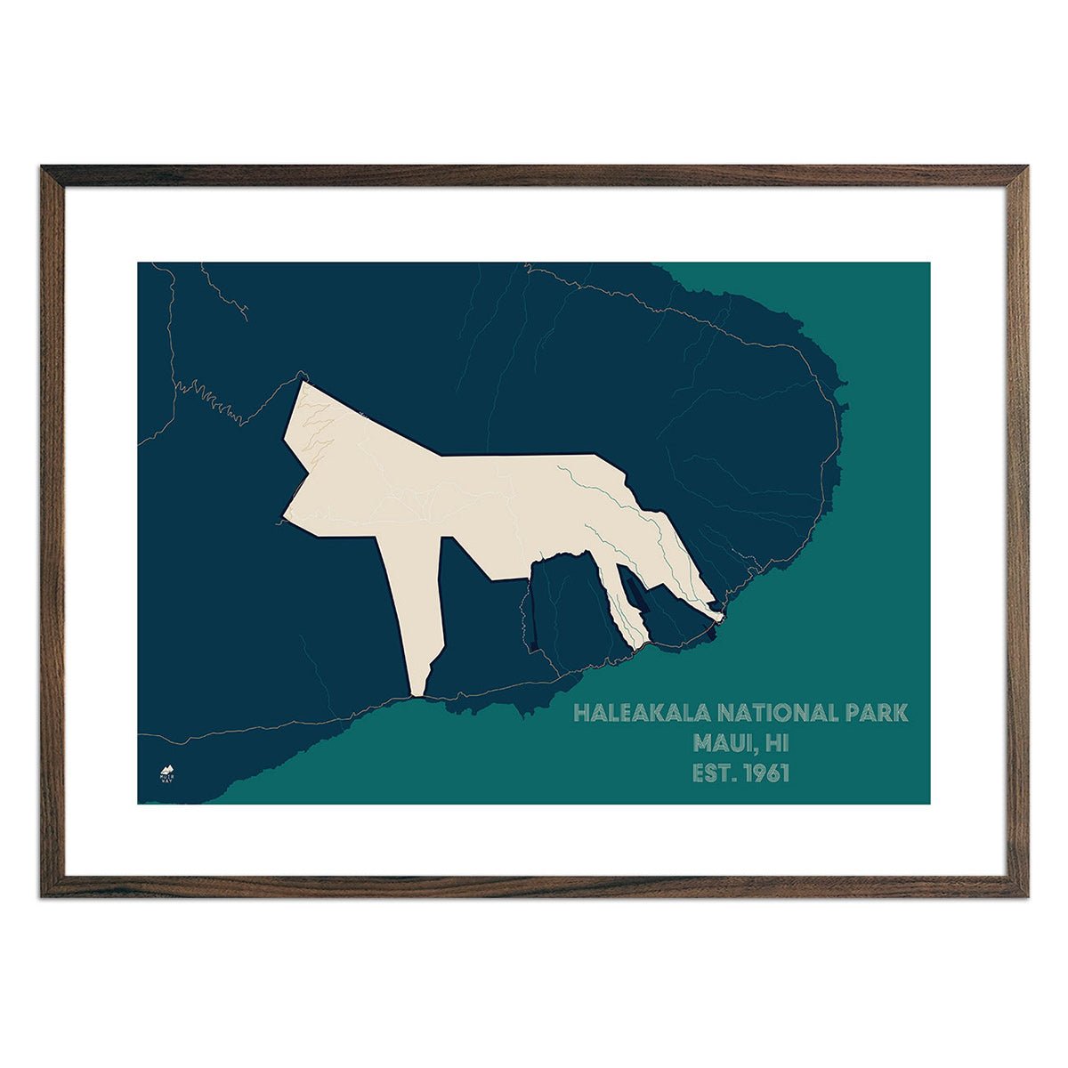
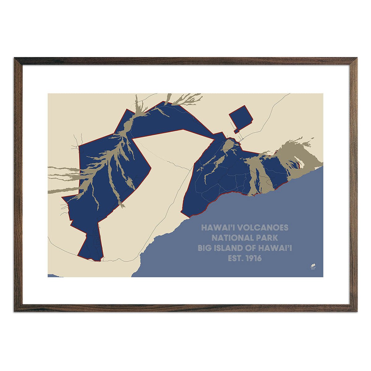
For instance, our 'Big Island' 1975 Hawaii Relief Map presents the island's complex volcanic structure in striking detail. On the other hand, our Haleakala National Park Map can serve as a memory of when you ventured out to the Hawaiian Islands.
Every piece in our collection gives a different perspective on the beautiful landscape of Hawaii.
Exploring our Collection of Hawaii Map Prints
Our Hawaii map art collection includes diverse styles that include relief maps, maps of national parks, elevation maps, hydrological maps, and vintage relief maps. The 3D effects in our relief maps bring Hawaii's terrain to life, including the peaks of the island’s six active volcanoes.
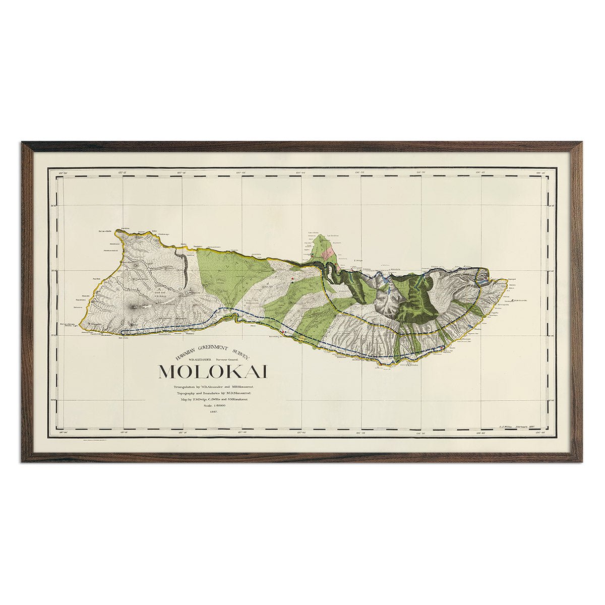
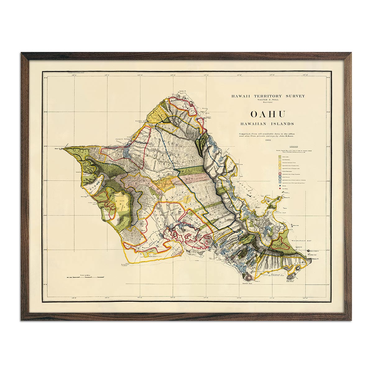
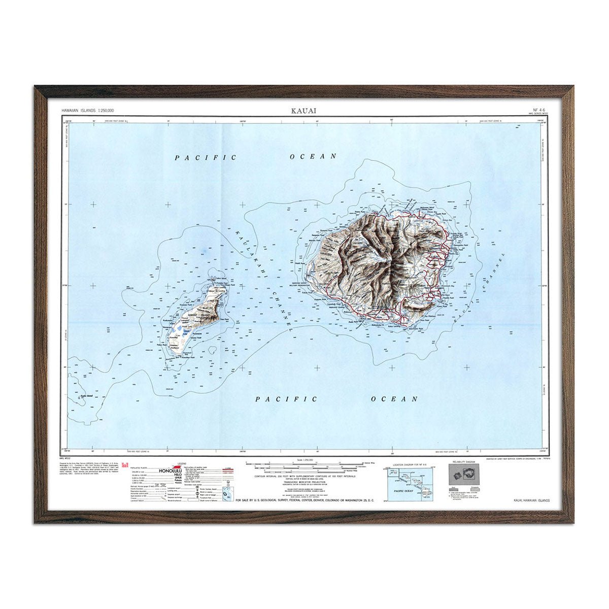
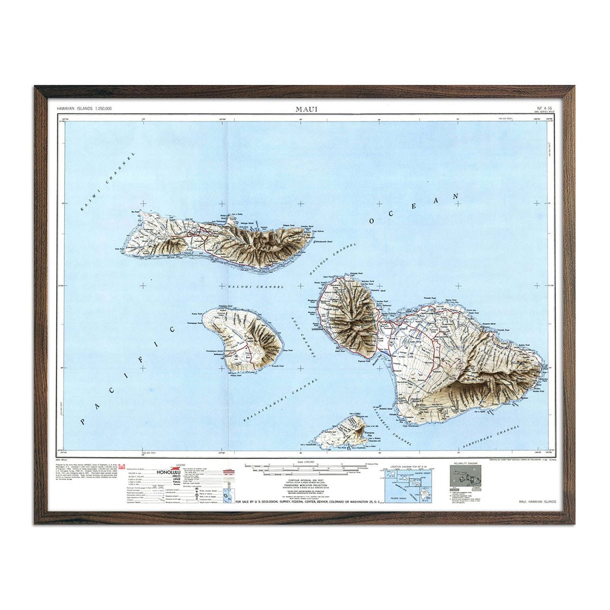
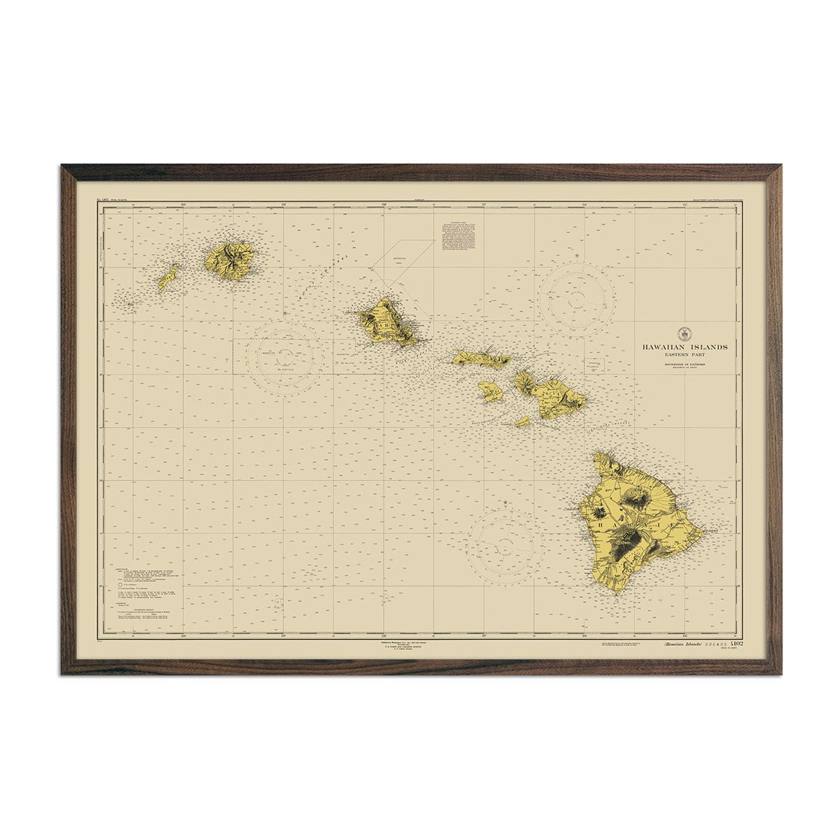
Among these, our vintage prints offer a historical view of the islands, depicting a time before Hawaii became the 50th state in 1959.
No matter which type of map you choose, these prints allow you to bring the features of Hawaii’s eight major islands - Hawai'i, Maui, O'ahu, Kaua'i, Moloka'i, Lana'i, Ni'ihau, and Kaho'olawe - into your home or office.
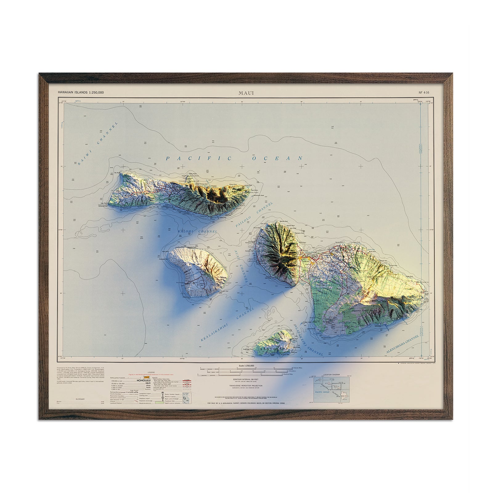
Whether it's the valleys of Maui or the variegated terrain of the Big Island - our map prints provide a detailed and immersive exploration of the heart of Hawaii and a unique way to appreciate one of the most fascinating destinations on the planet.
Take a Dive into Hawaii’s Geological History
Our maps of Hawaii go beyond the state’s elevation and hydrological features but also pay tribute to its fascinating geological history. The USGS map prints in the collection provide an alternate topographical view and allow you to explore outdated place names.
Whether you’re looking to purchase a memento of a recent vacation or aspire to visit Hawaii in the future, our collection of Hawaii maps presents an opportunity to bring home a piece of art that highlights the beauty of the Hawaiian islands.
In addition to our Hawaii collection, we carry several other collections that highlight neighboring regions of the Pacific. Our Oceanic map collection features maps of Australia, Fiji, New Zealand, and Tasmania.
