


Reviewed by Mark C.
Verified Buyer
I recommend this product
Age Range
18 - 24
I bought this
For myself
So vibrant and beautiful on the wall!
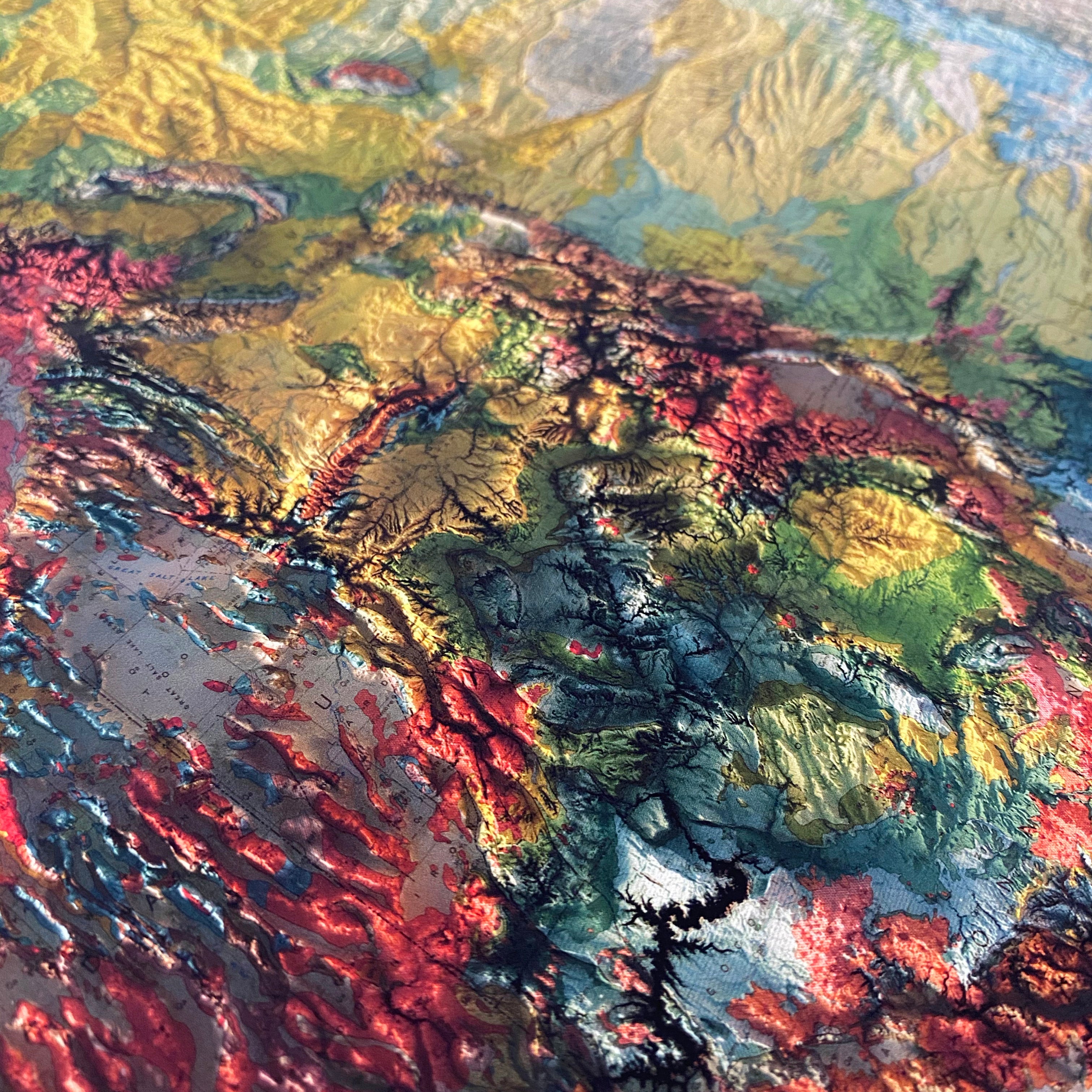
This piece is a very nice addition to my wall art collection - great to show folks the different varieties of surfaces and soils across the U.S. in a colorful manner :)
Loading...
| Map Quality & Detail |
Rated 5 out of 5
|
|---|---|
| Shipping & Customer Service |
Rated 5 out of 5
|
Was this helpful?
