Frequently asked questions
What is a vintage shaded relief map?
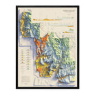
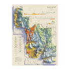
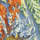
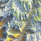
It's a single historic map with modern shaded relief added. The shading uses light and shadow, as if the sun were low in the northwest or northeast sky (it depends on the map), to make mountains, valleys and coastlines look three-dimensional. You get the color, typography and character of the original map, plus a sense of depth it never had.
How do you make vintage shaded relief maps?
We start with one original map, like the 1956 survey of Japan or the 1909 map of Alaska, and make a high-resolution scan of it. Then we georeference the digitized map, which means lining it up precisely with real-world coordinates. Finally we add hillshading made from modern digital elevation data. The relief matches the actual terrain; it isn't hand-drawn guesswork.
What makes these gallery-quality prints?
It starts with the data. Accurate shaded relief depends on precise elevation data, and we work with the best elevation data available.
Next is how that data is applied. Muir Way was one of the first to pioneer this method of adding modern relief to historic maps, and we've spent years refining it to produce maps with exceptional detail.
Then comes the print. Every map is produced on top-of-the-line printers using archival inks on heavyweight fine art paper, so the detail and color hold up for years.
Finally, framed orders are individually custom framed in real walnut wood.
Is this an antique or an original historical map?
No. It's a new, original design created by Muir Way and printed to order. The vintage map is the source material, and the added relief makes it a new work, not an antique or a straight reproduction.
Why pick a vintage map over a modern map?
Old maps have character that modern maps don't: hand-lettered typography, period color palettes, and borders, place names and territories as they were at the time. Each listing tells the story of its year, like Alaska as a district before it became a territory, or Brasília's first year as the capital.
Is the relief raised or textured?
No. The shading is printed flat on the paper, so the map frames and hangs like any fine art print. The 3D effect is purely visual. Some of our vintage maps are also available as physically raised prints; see our 3D Vintage Raised Relief Maps (muir-way.com/collections/3d-vintage-raised-relief-maps). If you're looking for terrain you can actually see and feel, browse our full 3D Raised Relief collection (muir-way.com/collections/3d-raised-relief-series).
3D Vintage Raised Relief Maps · 3D Raised Relief Maps
Does darker shading mean higher elevation?
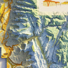
No. Shading shows the direction and steepness of slopes, not height. Dark areas are slopes facing away from the light.
Can I read the text on the map?
On many of these maps the text is hard to read. That's because of the small original font size, the age of the map, and the color and shading layered on top. Legibility varies from map to map. Maps of smaller areas, like USGS quadrangles, are usually easy to read. Maps of large areas, like the USA, North America or Europe, were originally printed very large, and at wall-art sizes most of their text is nearly impossible to read. Please look through the detail photos on each product page to judge how legible a map is before you order.
What is the cloud option?
Some maps come with an optional cloud overlay for a more atmospheric, bird's-eye look. The map is the same either way, so it's purely a style choice.
Who created this style of map?
Muir Way popularized the category: historic maps with modern shaded relief, made as wall art.
What sizes are available?
Sizes vary by map because each one keeps the proportions of the original. Most start around 16x24" or 18x24", and many go up to 30x40". Some are available in extra-large sizes such as 40x53" or 42x42". Every size can be ordered framed.
What paper do you print on?
Heavyweight archival fine art paper of the highest quality.
What frame options do you offer?
Choose black, walnut, or unframed. Both frames are made from real walnut wood, not the lesser-quality veneer you'll typically find elsewhere; the black frame is stained black. Each is handmade to order at a professional frame shop, with a 7/8" wide face and about 1-1/2" depth. Frames use Acrylite glazing, which is clearer than glass, and are finished with acid-free backing paper and a hanging wire, so they're ready to hang.
Where are your maps made?
Every map is made in the USA. Depending on your order, it's printed and shipped from our own shop in San Diego, California, or from our framing partner in Wisconsin. Unlike most wall decor companies, we don't outsource our paper prints to large print-on-demand dropshipping centers.
What places do you offer vintage shaded relief maps of?
National parks, U.S. states, cities, mountain ranges and international regions, including Alaska, Acadia, the Western Alps, Mont Blanc, Japan, Brazil, Australia and Baja.
Is a vintage shaded relief map a good gift?
Yes, especially for someone with a connection to a place: where they grew up, traveled or hiked. The historic date adds a story to the gift.
How long does it take for my order to ship?
Unframed paper prints usually ship within 1–2 days and arrive 2–5 days after they leave our shop. Framed prints are made to order and typically arrive in 3–4 weeks.
What's your return policy?
You can return unframed prints in new condition within 30 days. Please email us first so we can give you return instructions. Framed prints are custom-made to order, so we can't accept returns on them.