


Georgia Map Prints, Elevation & Shaded Relief Maps
Our custom printed Georgia wall maps are beautifully rendered from a combination of historical data, modern technology, and hand design. From our eye-catching elevation maps and geological relief maps to our meticulously restored historical maps, every map of Georgia we offer reflects the high quality and attention to detail our customers have come to love and expect from Muir Way. See why a map of The Peach State from Muir Way is more than your typical wall map.
What makes Muir Way maps of Georgia unique?
When you purchase a Georgia wall map from Muir Way, you’re not purchasing a rolled up shiny poster. You get a custom-printed archival piece of art designed to last for generations. Unlike a glossy mass-produced poster, our maps are printed on archival fine art paper and are certified to last 100 years. The artwork on our maps is designed to bring new light to the beautiful terrain it features. Our elevation maps incorporate hand-shaded relief and Digital Elevation Data with historical map data, creating a unique 3D effect on a flat surface, and our hydrological maps depict every river and stream in crisp detail. The meticulous craftsmanship and design we bring to our Georgia maps creates heirloom quality artwork we’re proud of.
Does my Georgia map come framed?
It can! You can purchase your Georgia map professionally custom-framed with real wood, or unframed if you prefer to use your own. If you’d like to purchase a framed Georgia wall map, there are several different wood finishes to choose from. If you’d prefer to use your own frame, all of our maps come in standard sizes for easy gift giving.
Does a Muir Way map of Georgia make a good gift?
Yes! Our custom-printed maps of Georgia make the perfect gift for anniversaries, weddings, college graduations, holidays, or as a thank-you gift for someone special. Perhaps your family loves to take trips to Atlanta, or you have special memories in Augusta. Perhaps you know a friend or family member who’s from Georgia and misses home. Our maps also make beautiful corporate gifts that will remind your clients or colleagues of you every time they see it.
Where should I display my Georgia map?
Our maps are eye-catching from across the room and up close. Hang a framed wall map as a central focus, or purchase several maps in a similar style or from a particular region and arrange them near each other for a complementary series. No matter which you choose, you’re sure to find a map to suit your décor.
What are the different types of maps of Georgia available on Muir Way?
Our Georgia maps are available in several different styles, including:
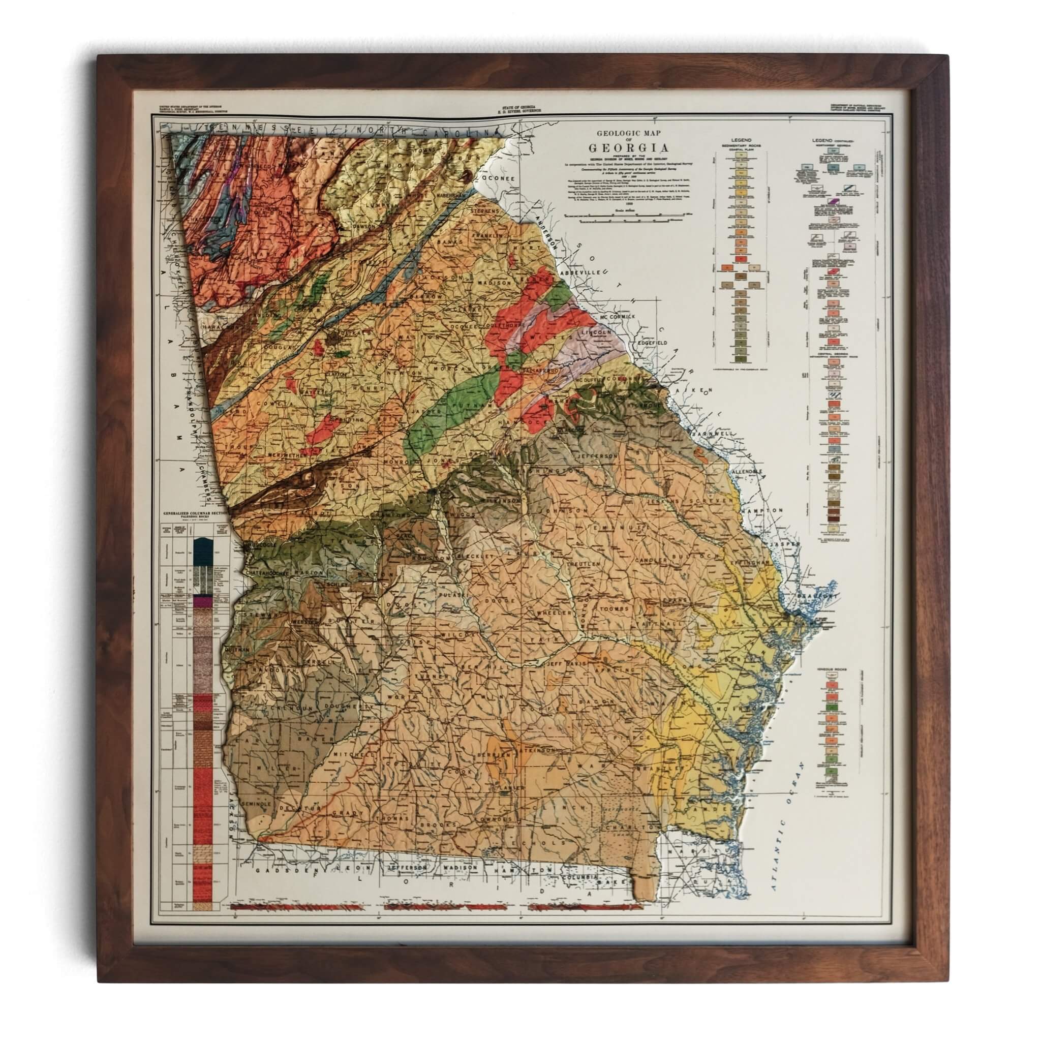
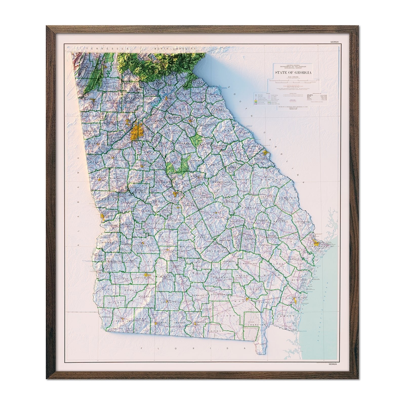
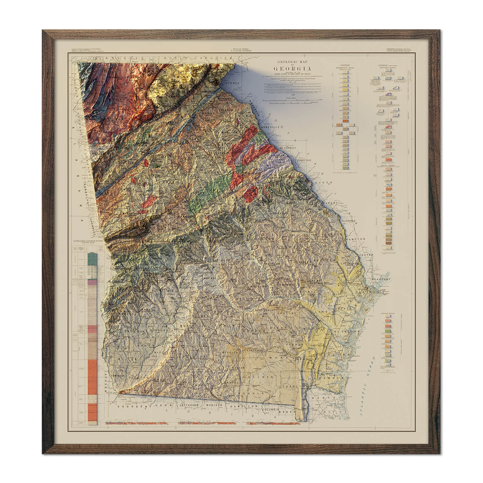
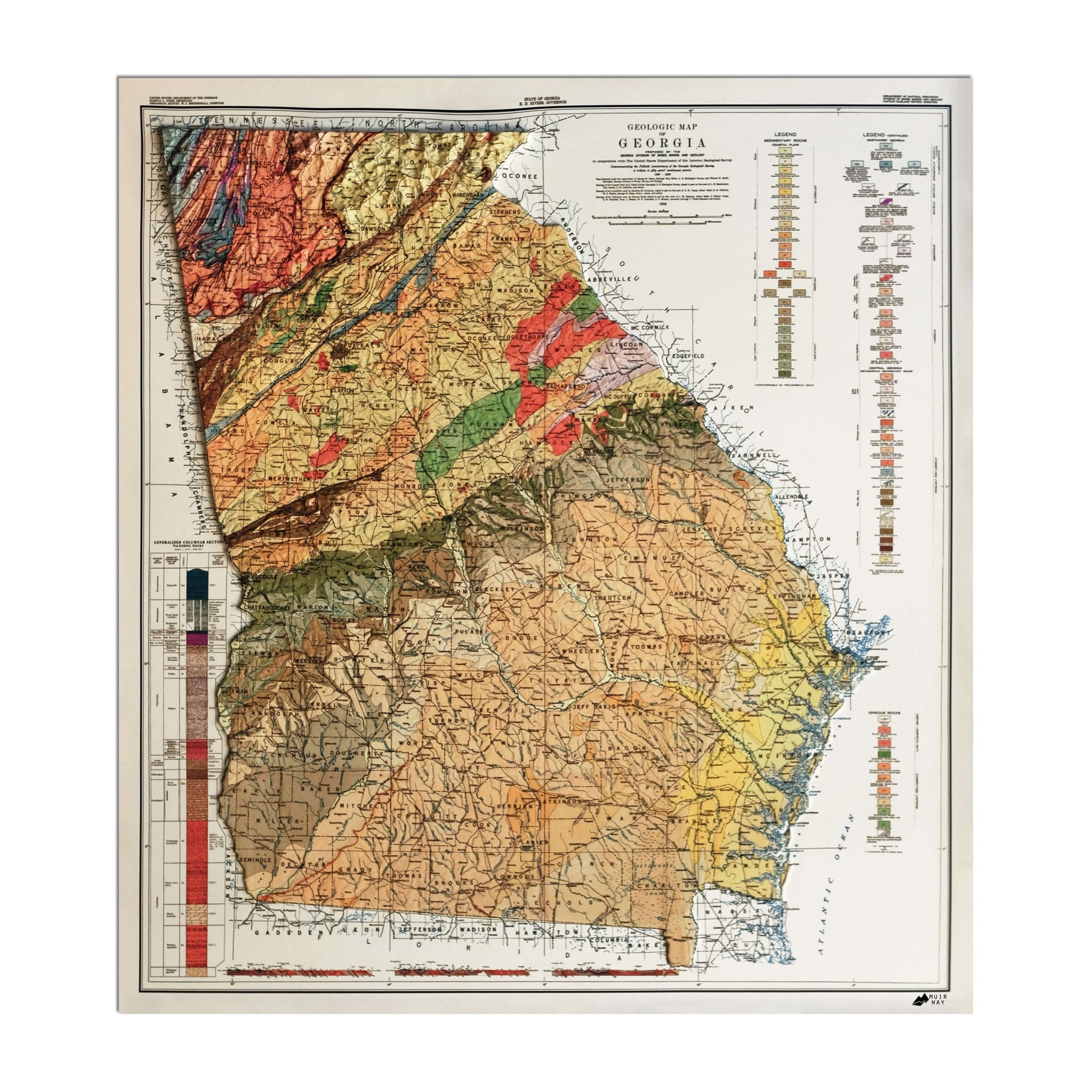
Georgia relief maps - Our relief maps of Georgia bring historical map landscapes together with modern technology to show Georgia’s geography in a new way. Using Digital Elevation Data and hand-shaded relief, we custom enhance vintage maps to create a 3D effect on a 2D surface. See Georgia’s variegated terrain in vibrant colors on our 1939 Georgia relief map, or take a closer look at Georgia’s counties outlined on our 1970 Georgia relief map.
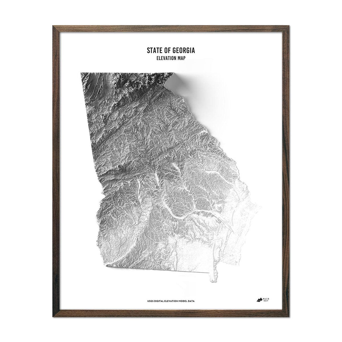
Georgia elevation maps - Our state of Georgia elevation map uses Digital Elevation Data from the USGS and hand-shaded relief just like our relief maps to create a high-contrast 3-dimensional effect in stunning black and white.
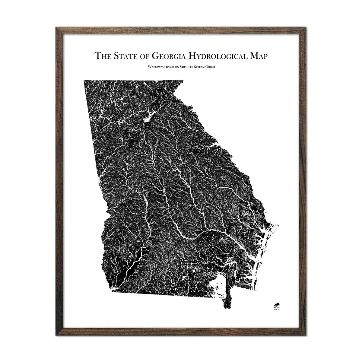
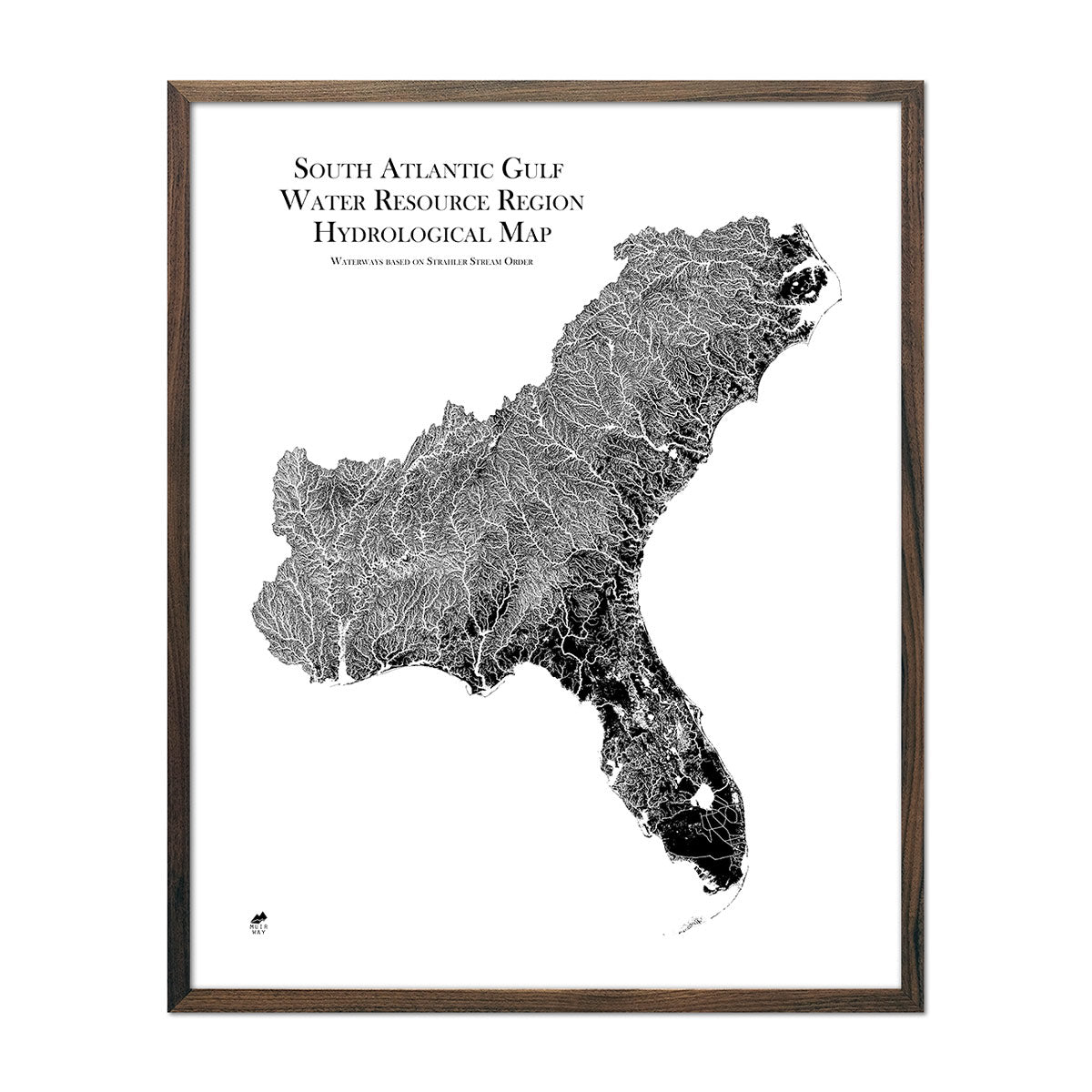
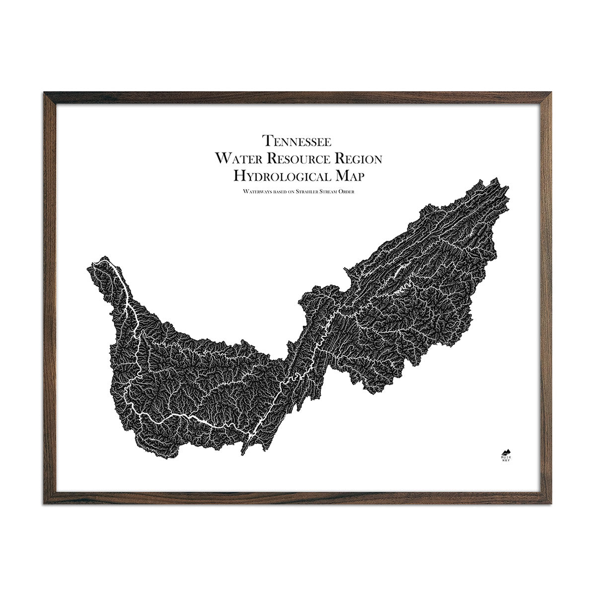
Georgia hydrological maps - Our hydrological maps showcase the intricate network of waterways, from sprawling lakes to narrow tributaries that flow into larger rivers. Trace Georgia’s waterways on our Georgia hydrological map and you’ll see every all bodies of water greater than 0.2 mi in diameter. What makes our hydrological maps unique? We apply a method called the Strahler Stream Order to show the hierarchy of streams as they flow from their source, with rivers shown thicker as they acquire the flow of tributaries. Map available in black, blue, or green. Want to see the ‘big picture’? See our South Atlantic-Gulf regional hydrological map for Georgia and its neighboring states, or Tennessee regional hydrological map.
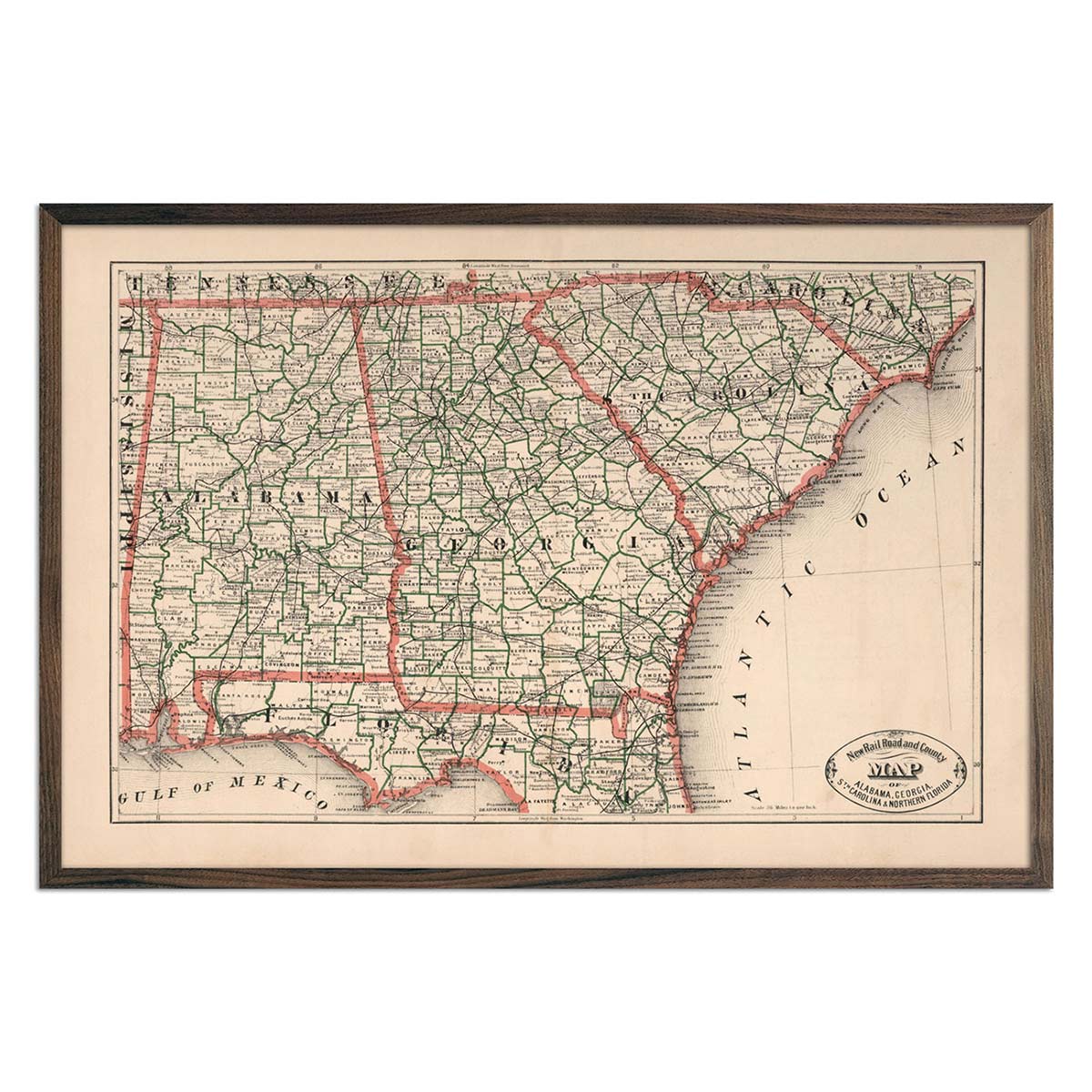
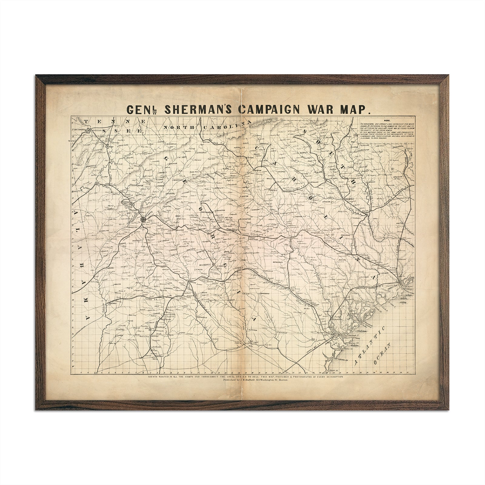
Enhanced vintage Georgia maps - Enjoy the history and charm of vintage maps in a new way with our 1883 map of Georgia, South Carolina and Northern Florida map. Unlike our elevation maps, Muir Way historical maps don’t feature enhanced elevation effects, but they do feature a record of history beautifully restored to retain its vintage charm without the wear & tear. Our vintage Georgia maps are also custom printed using archival materials.
What are some prominent features on the map of Georgia?
Georgia’s geographical terrain features a variety of environments, from the peaks of mountains to swooping valleys, hickory forests and even swamplands. Northern Georgia’s hilly landscapes and come to life on our relief maps, where Appalachian mountains meet North Carolina’s southern border.
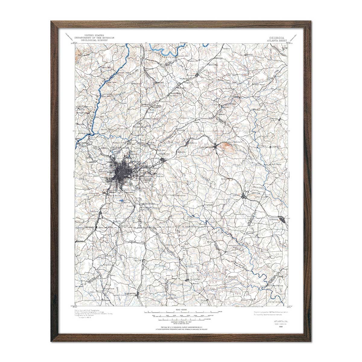
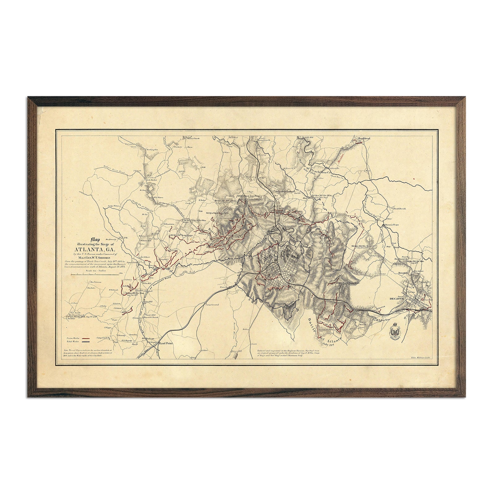
If you’re interested in tracing the streets of Georgia’s urban landscape, on our vintage map of Atlanta from 1955, you can view Atlanta’s neighborhoods as they were decades ago.
With 14 major river basins and several lakes, Georgia’s waterways not only add to its natural beauty but provide fertile ground for the state’s major crops of peanuts, pecans, vidalia onions, and of course, peaches. Our hydrological map of Georgia lets these interconnected waterways shine, from mountain streams to basins emptying into the Gulf of Mexico.
What are the regions in Georgia?
Georgia has six main geographical regions:
- Appalachian Plateau - Nestled in the northwestern corner of the state, the Appalachian Plateau’s narrow valleys and ridges sit up to 2,000 feet above sea level.
- Ridge and Valley - Also located in Georgia’s northwestern corner, the Ridge and Valley region is marked by sprawling valleys and sandstone ridges.
- Blue Ridge - This mountain range reaches peaks of 5,000 feet and is situated in Georgia’s northeastern corner. In addition to its forested peaks, this area of Georgia is also home to rivers that provide hydroelectric power.
- Piedmont - This region cuts across the center of Georgia and features a hilly landscape with beautiful waterfalls at the Fall Line.
- Atlantic and East Gulf Coastal Plains - Both the Atlantic and East Gulf Coastal Plains are marked by a flat landscape and portions of the Okefenokee Swamp. Rivers in the Atlantic Coastal Plain flow to the Atlantic Ocean, and rivers in the East Gulf Coastal Plain flow to the Gulf of Mexico.
If you like our collection of Georgia maps, you may also be interested in maps of other Southeast states. Click below to browse:
