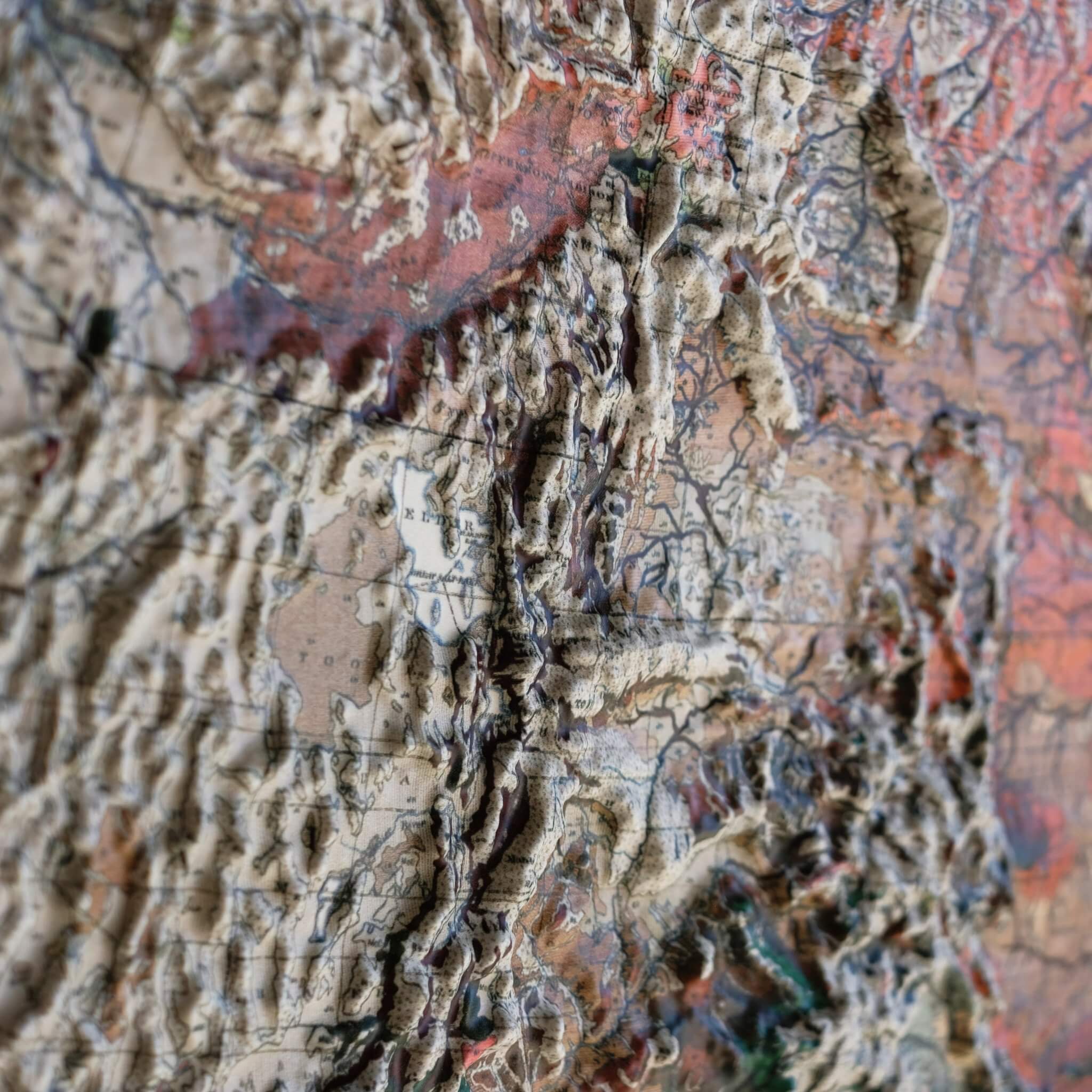
Georgia 1939 3D Raised Relief Map

Rated 4.8 out of 5
Based on 4 reviews
Regular price $ 170.00 USD
Unframed - 22 x 24 Inch

Currently 10 people are looking at this product

Precision
Precision
Cut
True Raised
True Raised
3D Topography
Handmade in
Handmade in
San Diego

Real 3D Raised Relief Map

  • Authentic Muir Way Original
  • Transformed from a flat historical map
  • Individually made in our San Diego workshop
  • Handmade hardwood frames by local craftsmen
Description

This map is based on a 1939 geological survey of Georgia, charting a state that changes character from mountain to marsh. In the north, the Blue Ridge Mountains rise to Brasstown Bald, Georgia's highest point at 4,784 feet, before the land descends into the rolling Piedmont. Where the Piedmont meets the Coastal Plain, the Fall Line's tumbling rivers once powered mill towns like Columbus, Macon, and Augusta; farther south, the Coastal Plain stretches toward the Okefenokee Swamp, one of the largest intact blackwater wetlands in North America, and the barrier-island beaches of the Golden Isles.

To create this 3D raised relief map, we georeference the original 1939 survey and combine it with modern digital elevation data to sculpt a precisely detailed 3D mold of Georgia's terrain. The full-color map is then printed, heated, and vacuum-formed over that mold, turning the flat image into genuine raised, textured relief — so the rise of the Blue Ridge toward Brasstown Bald and the flattening toward the Okefenokee are something you can trace with your fingers.

Framed versions of this map have no glass or acrylic over them, so you're free to touch the map and explore its intricacies by hand.

For the flat, framed fine-art-print version of this map, click here.

PLEASE NOTE: You will love this map if you embrace its anomalies. When the plastic is heated and stretched over the 3D mold, the image may be altered, causing warped lines and text around higher elevations. The fine print on plastic is not as sharp as on paper, sometimes rendering very small text illegible.

- Size - unframed 22x24 inches
- Size - framed 23x25 inches
- Material - plastic mounted on foamboard
- Handmade real Walnut frame available
- Individually made in our San Diego, CA shop


Shipping and Returns

FREE SHIPPING within the contiguous US

Shipping times - not including transit:
- Unframed maps - 3-5 business days
- Made-to-order framed maps - 3-4 weeks 

RETURN POLICY

We accept returns within 30 days of purchasing your unframed map. There are NO restocking fees but return shipping costs are at the customer's expense. Returned maps must be in new condition with no visible marks or damage. Please email us at [email protected] with your order # to receive detailed instructions. Unauthorized returns may not be accepted and do not guarantee a refund.

If prints are shipped back to us and are not in new condition, we offer a store credit or can return them to you. 

*Framed Prints – We do not accept returns or exchanges on framed prints because they are custom-made to order.  If your order arrives damaged or wrong, please email us at [email protected] so we can correct it for you. We will require pictures of the damaged print and the shipping container it arrived in.

Walnut Frames

Each frame is handmade by a local craftsman.

- Real Walnut hardwood (not veneer)
- Frames vary in color and grain
- 7/8" face x 1" deep
- Finished back – paper dust cover, rubber bumpers, and hanging wire
- No acrylic or glass on front

Not a print, a landscape you can run your fingers over

USA 1931 3D Raised Relief Map - Muir Way - 3D

Vacuum-formed over a precision 3D mold, real raised terrain

Every ridge, valley, and peak is actually there. You feel it, not just see it.

Molds cut from NASA elevation data for accurate topography

Precise data used to create the most detailed raised relief maps available.

No glass, no acrylic, every map is made to be touched

Run your fingers across the Rockies or trace the Appalachians. The map wants to be touched.

How we make them

FAQ

Are these 3D maps old or new?

The original map designs are of historical maps. We use scans of the old maps and georeference them with modern elevation data to align the raised terrain with the map. Then, we cut a detailed mold for the map. The maps get printed, heated, and vacuum formed onto the mold. We remove the newly formed map from the mold, cut it, and mount it onto matboard for a rigid raised relief map. The 3D maps we sell are only available by Muir Way.

Do you offer different sizes for the 3D maps?

No, we offer each map in a single size because they are vacuum formed to a particular 3D mold that takes approximately 40 hours to cut.

What materials are the 3D maps made from?

The maps are printed on a thick, highly formable plastic that is highly formable under extreme heat and mounted on foamboard.

What is your return policy?

For any reason, you can send back the print within 30 days of receiving it for a full refund. The print must be in new condition. We do not accept returns on framed prints. Please email [email protected] for return authorization.

How long does it take to get?

Unframed maps ship out in 1-2 days and framed maps ship out in 2-3 weeks of ordering. Please also allow transit time from our shop in San Diego.

Do the frames for the 3D maps have glass?

No, our frames do not have glass over the 3D prints so you can touch the protruding terrain. If you prefer glass, your local frame shop can make a deeper frame that will allow for the glass.

Are these like the ones in my classroom when I was a kid?

Ours are inspired by those older raised relief maps but our new versions are on another level of quality, precision, and craftsmanship.

average rating 4.8 out of 5
Based on 4 reviews
  • 5 Stars
    3 Reviews
  • 4 Stars
    1 Review
  • 3 Stars
    0 Reviews
  • 2 Stars
    0 Reviews
  • 1 Star
    0 Reviews
100% of reviewers would recommend this product to a friend
Map Quality & Detail
Rated 4 out of 5
Shipping & Customer Service
Rated 5 out of 5
4 Reviews
Reviewed by Christy P.
Verified Buyer
I recommend this product
Age Range
55 - 64
I bought this
For myself
Rated 5 out of 5
Review posted

Beautiful Map!

I love the map. The colors go great with my decor and the 3D is cool. Sometimes I use a magnifying glass to read the geological information and find smaller cities, but mostly it's great art. Thanks Muir Way!

Loading...
Map Quality & Detail
Rated 5 out of 5
Shipping & Customer Service
Rated 5 out of 5
Was this helpful?
Reviewed by Linda T.
Verified Buyer
I recommend this product
Age Range
55 - 64
I bought this
For myself
Rated 5 out of 5
Review posted

Georgia 3-D map

Highly impressed with the minute details of each region. I love it.

Loading...
Map Quality & Detail
Rated 5 out of 5
Shipping & Customer Service
Rated 5 out of 5
Was this helpful?
Reviewed by Nate R.
Verified Buyer
I recommend this product
Age Range
35 - 44
I bought this
For myself
Rated 4 out of 5
Review posted

Great job overall

the final product was great and i loved the frame and i loved the quality of the 3d map. Only reason for 4 stars is that at the top of the image it was a little warped you can clearly see a bend in the border lines and text at the top.

Loading...
Map Quality & Detail

Rated 4 out of 5
Shipping & Customer Service
Rated 5 out of 5
Was this helpful?
Reviewed by Skotti F.
Verified Buyer
I recommend this product
Age Range
25 - 34
I bought this
As a gift
Rated 5 out of 5
Review posted

My son loves it!

I bought the Georgia map for my son for Christmas. It was hands down his favorite gift!

Loading...
Map Quality & Detail
Rated 5 out of 5
Shipping & Customer Service
Rated 5 out of 5
Was this helpful?