


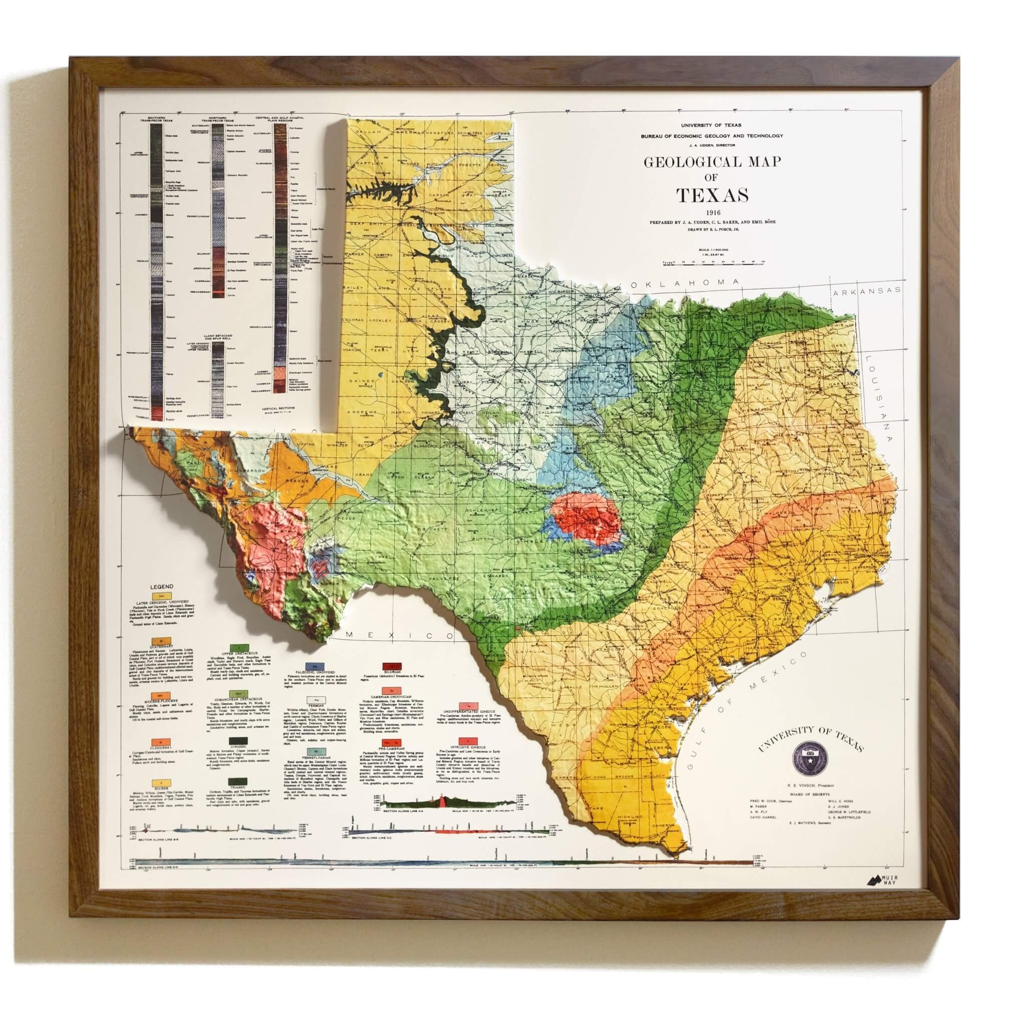
REAL 3D Raised Maps

We transform once-flat maps into stunning tactile works of art, skillfully crafted in our San Diego workshop.

How we make them


Exclusively by muir way
Reconnect with the places that move you—each one beautifully elevated in 3D.
FAQ's
Are the maps actually 3D? How are they made?
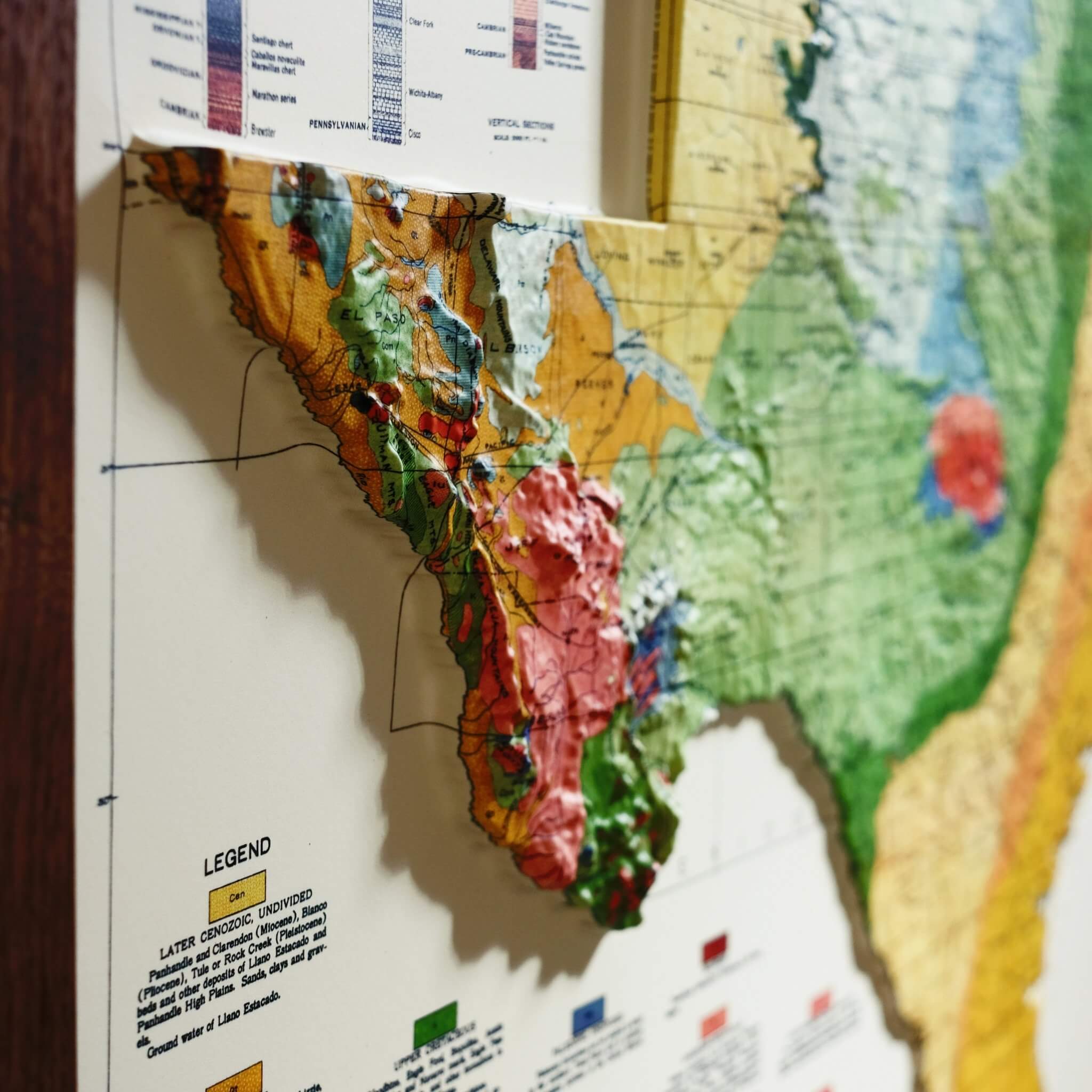
Yes. The map is printed on plastic, heated, and vacuum-formed over a precisely cut mold, then mounted to foamboard for rigidity.
What sizes do they come in?
Our 3D maps are a single size because each design uses a dedicated mold. Example (USA 1931): Unframed 38" × 25"; Framed 39" × 26".
Can I order a different size?
No. Because each map is vacuum-formed to a specific mold (which takes ~40 hours to cut), alternate sizes aren’t offered.
What are they made of?
A thick, heat-formable plastic sheet that’s vacuum-formed and then mounted to foamboard for extra rigidity.
Do they come framed? What frames do you use?
You can buy unframed or framed. Frames are handmade real Walnut (not veneer), with finished backs (paper dust cover, bumpers, hanging wire).
The frames are 7/8 inch wide by 1 inch in depth.
Is there glass or acrylic over the 3D print?
No—by design, there’s no glazing so you can touch the topography. If you want glass, a local framer can build a deeper frame to accommodate it.
Will it fit in a standard store-bought frame?
Not typically. Our maps are based on original historical prints, which often have unique, non-standard dimensions that don’t match off-the-shelf frame sizes.
Will the image have tiny distortions?
Some warped lines/text can occur in high-relief areas, and very small text may be less sharp on plastic—this is normal for thermoformed 3D maps.
Are these vintage originals or new?
They’re new versions of maps created from scans of historical maps, aligned to modern elevation data, then formed into 3D relief.
