


Qatar 1982 Map
Currently 10 people are looking at this product
At Muir Way, we believe in providing the utmost quality, design, and value.
- Lasts a lifetime
- Unsurpassed archival materials and printing
- Over 5000 5-star reviews
- 30-day returns*
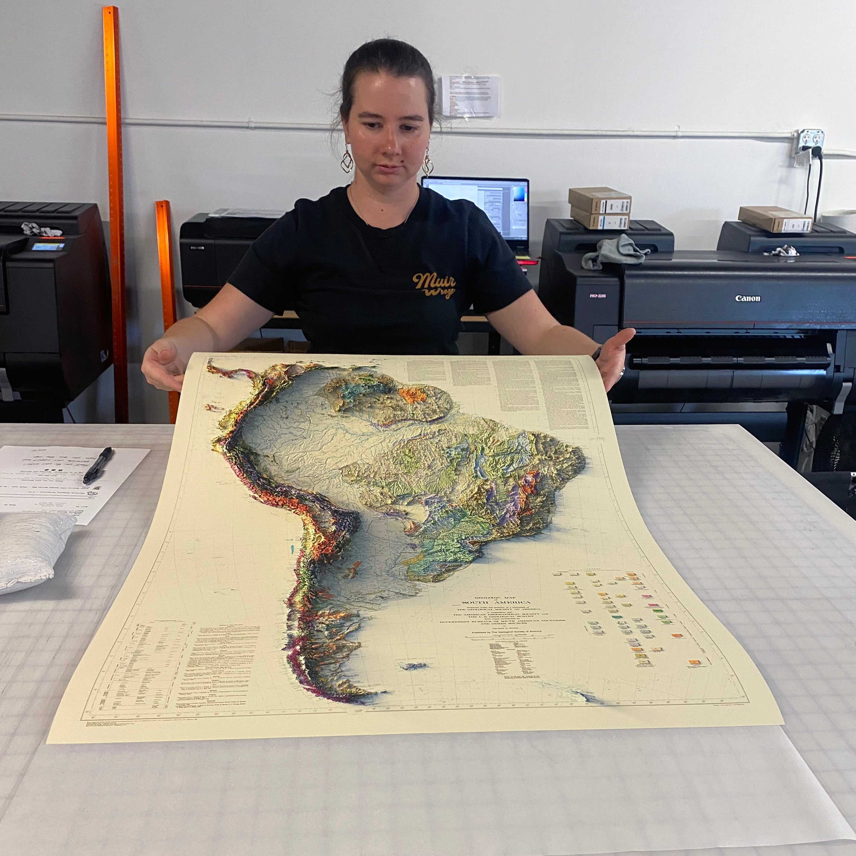
- Individually printed in our San Diego workshop
Description
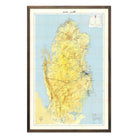
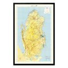
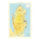
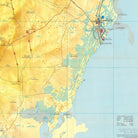
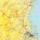
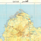
This 1982 topographical map by Qatar's Ministry of Information documents the nation just over a decade after independence, during a period of rapid infrastructure development that would reshape the Arabian Peninsula. The map was revised from aerial photography taken in 1976 and 1977, with major new developments and additional information supplied by Qatar's Engineering Services Department in 1980.
The map shows Qatar's yellow and tan peninsula against blue Arabian Gulf waters. Topographical contour lines detail the subtle elevations and coastal geography. Bilingual Arabic-English labeling (QATAR قطر) marks major settlements, road networks, and geographic features with the technical precision of official government cartography. The comprehensive legend and coordinate grid system demonstrate the mapping capabilities of Qatar's own surveyors.
This reproduction was carefully remastered from a digital scan of the original survey. It preserves the authentic detail of the 1982 source material. Made in San Diego, CA on archival paper.
Shipping and Returns
FREE SHIPPING on orders to the contiguous US over $49 with UPS ground or USPS to PO Boxes.
Unframed prints - Printed to order and shipped within 2-3 business days
Framed prints - Custom framed and will ship in 3-4 weeks
Full refund on returns of unframed paper prints within 30 days of purchase. Prints must be returned in NEW condition without creases or damage. Please email us at info@muir-way.com for instructions.
If prints are shipped back to us and are not in new condition, we offer a store credit or can return them to you.
We do NOT ACCEPT returns or exchanges on framed prints or canvas wraps because they are made to order.
Click HERE for more information on shipping and returns.
Gallery Quality
Made in the USA
We consider our maps to be works of art, so we print and frame them accordingly.
Using award-winning printers with gallery quality fine art paper and inks, our maps will exceed expectations and last a lifetime.
- Archival Paper and Inks
- 100% Cotton, OBA-Free, and Acid-Free
- Heavyweight 21.5 mil
- Certified to last 100 years
Read customer reviews HERE attesting to the quality of our prints.
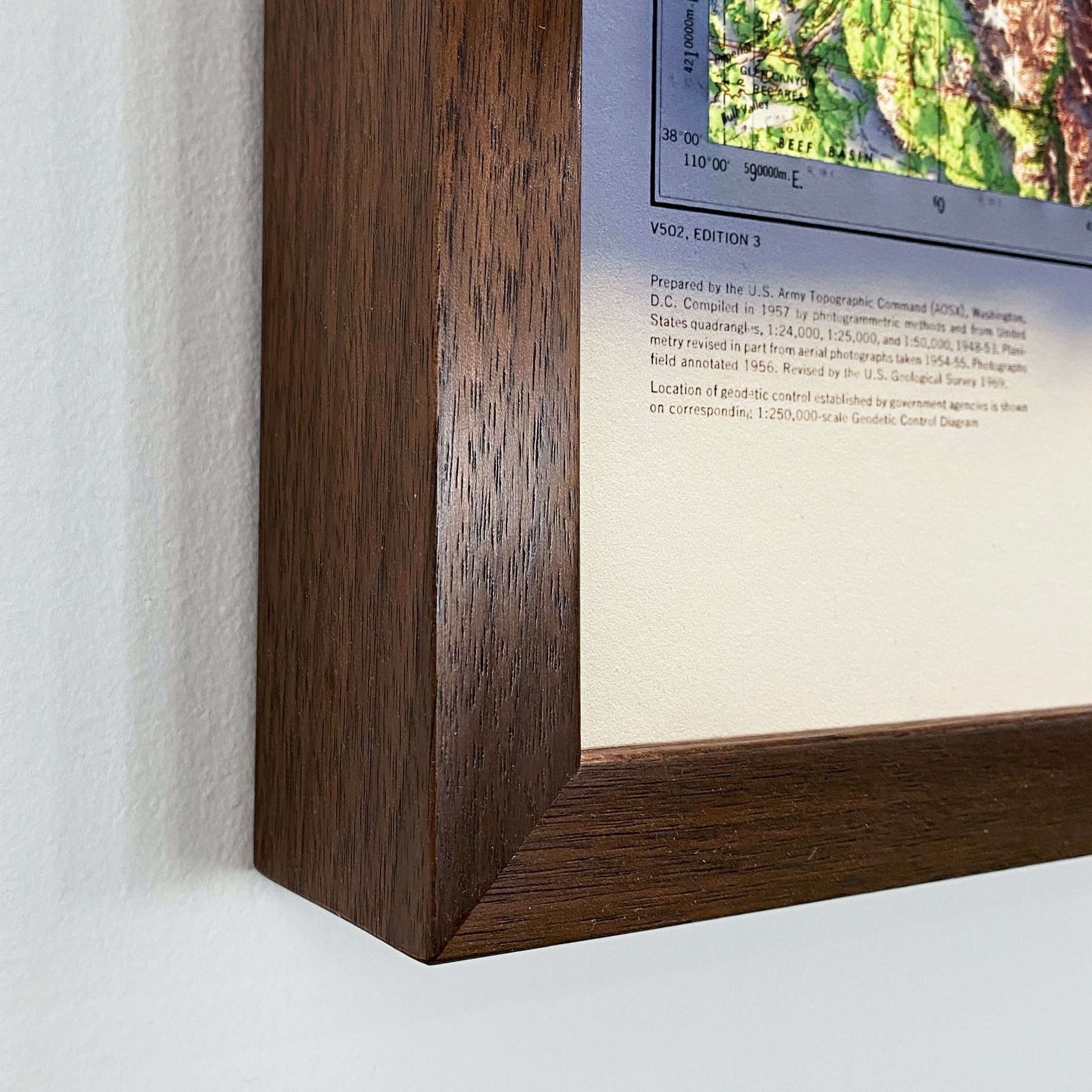
American Hardwood Frames
We use real Walnut for our frames, unlike the lesser quality veneer you will typically find elsewhere. With beautiful hardwood grain, each is handmade to order at a professional frame shop.
- 7/8 inch face and 1 1/2 inch depth
- Acrylite glazing (more clear than glass)
- Acid-free backing paper
- Hanging wire installed
Archival Inks
Each map is produced on our 12-color gicleé printers using premium inks to ensure an intricately detailed, fade-free piece with amazing colors.
Fine Art Paper
Museum-quality, 100% cotton, acid-free archival paper that’s rated to last 100+ years.
Authentic Hardwood Frames
No pressed wood, no veneer. Every custom frame is handmade from real Walnut.
Made in the usa
We individually print each order in our San Diego workshop. Even our paper is sourced from domestic manufacturers.
