


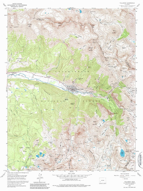
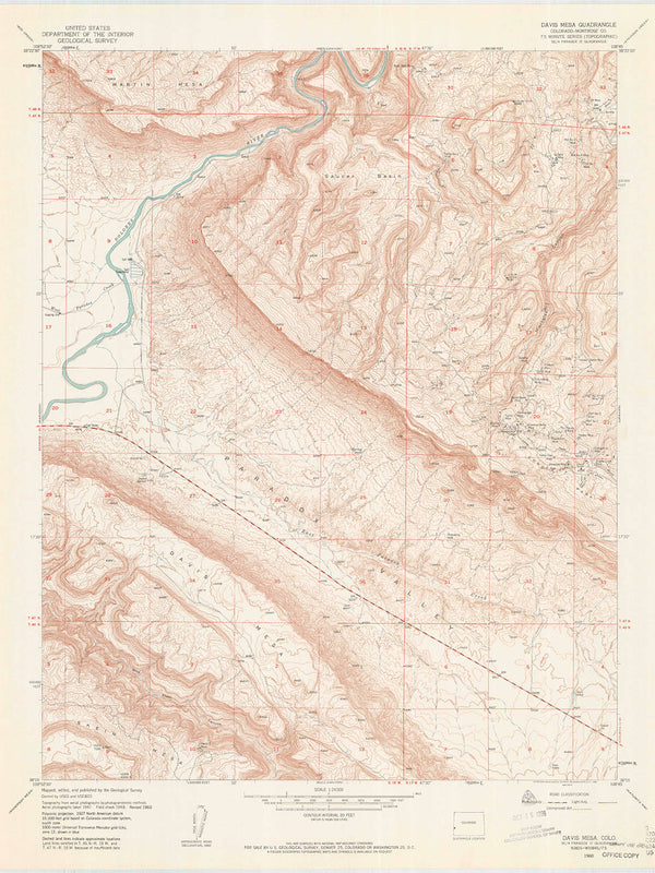
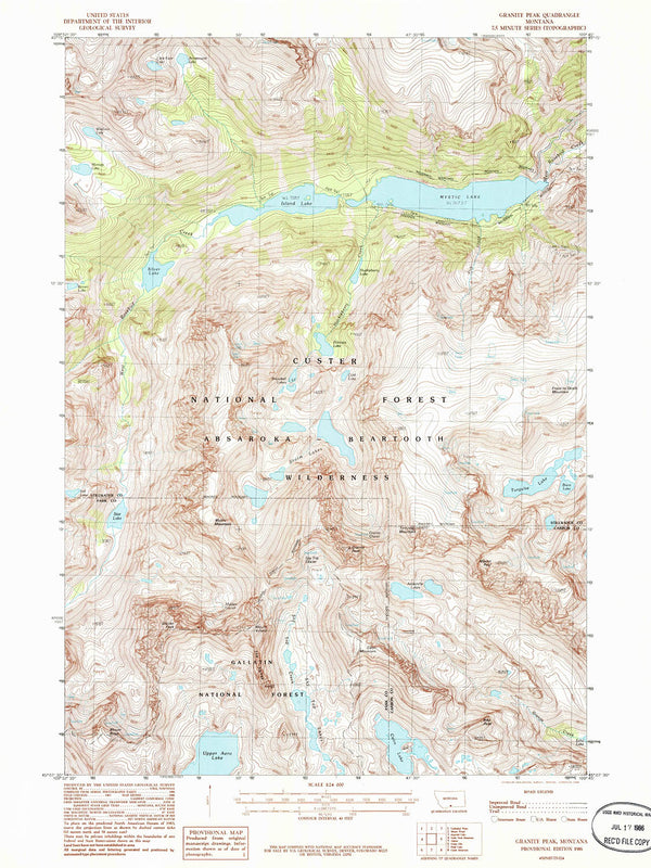
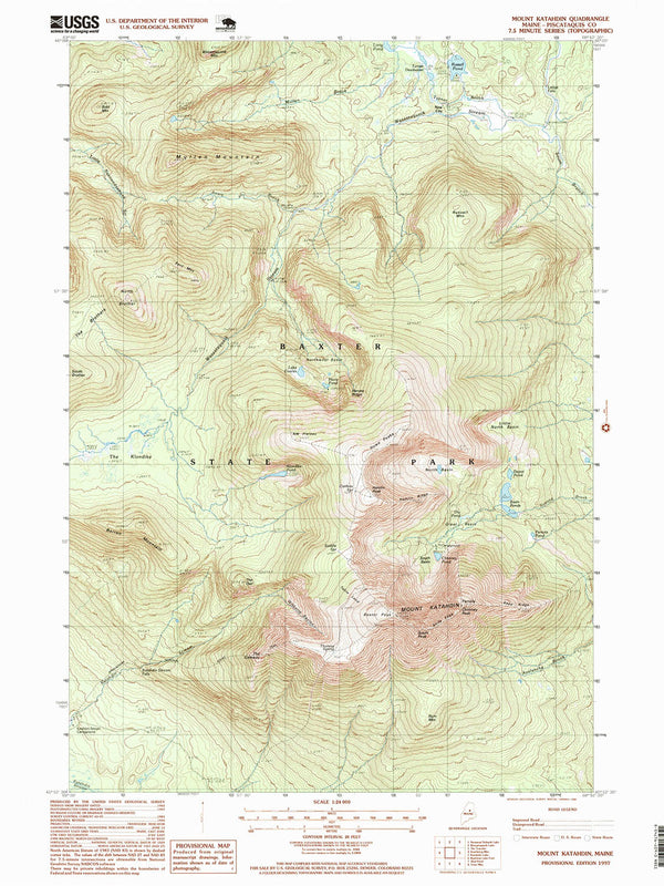
Historical USGS Topographic Maps
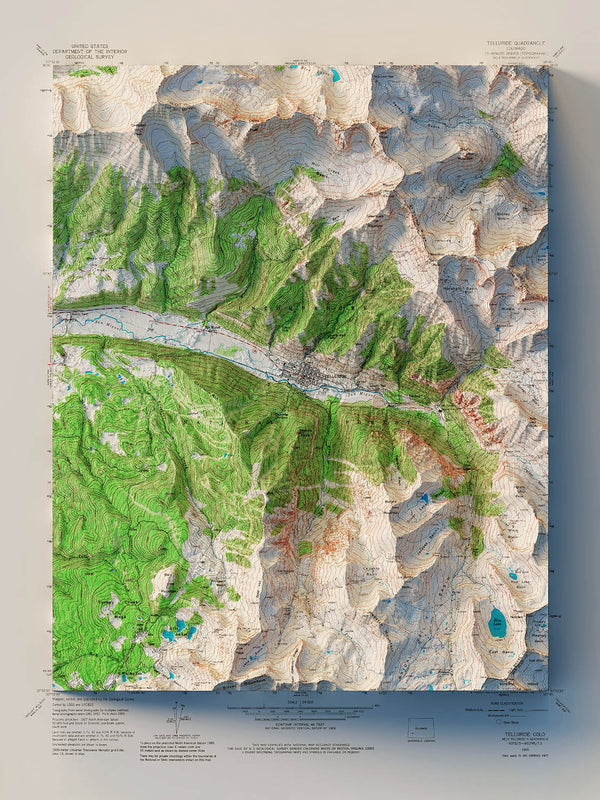
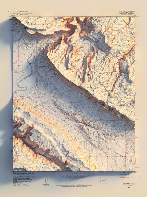
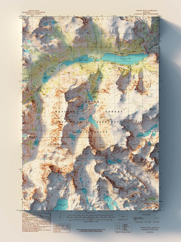
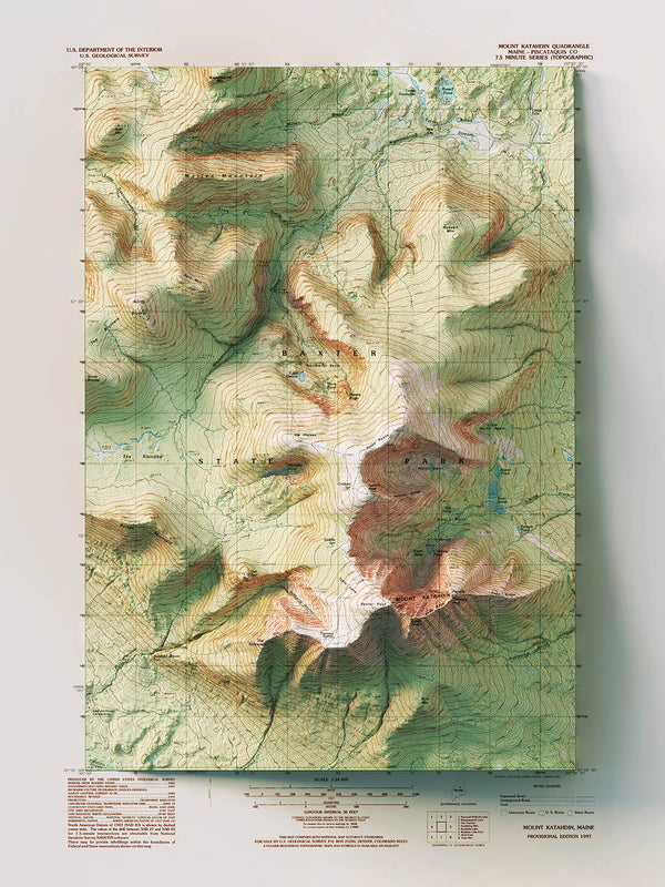
Customize any location into a 2D shaded relief map
Flat archival print with shaded relief (not a raised 3D map)
- Add custom text and icons to the map
- Any location in the United States
- Printed on museum grade fine art paper
- Proof included — you approve before we print


★★★★★ "Ordered a custom map of where we got engaged—beautiful detail and super easy proof process. Looks amazing on our wall and gets compliments all the time."
Create Your Custom Map
3 Simple Steps
Search your hometown, city, mountain, lake, etc.
Enter a location above to browse
over 178,000 historical USGS topos.
Archival Fine Art Paper — 100% Cotton / Acid Free.
Handmade to order using real American walnut.
Printed below the map in our signature style. We'll send a proof before printing.
We'll send a proof showing placement before printing.
After you checkout, we'll send you a proof within a week – you approve your map before we print.
Shipping Times (after proof approval)
Unframed: arrives in 5–7 days
Framed: arrives in 3–4 weeks
No Returns or Cancellations after 12 hrs of purchase
Your note will be printed on the packing slip.
Where People Use These
Every map is transformed by hand — here's what yours could look like.
How it works
Search any US location — a hometown, a favorite trail, a place you got engaged, a summit you conquered. We have access to over 178,000 historical USGS maps dating back to 1884.
Our team takes the original USGS source file and adds shaded relief, giving the flat topographic map the illusion of 3D. These are printed flat on fine art paper — the depth effect comes from the shading, not a raised surface.
Optionally add a custom icon pinned to any address, landmark, or GPS coordinates (+$10), or up to two lines of custom text along the bottom (+$15). We'll email you a digital proof before we print — nothing goes to press until you sign off.
Giclée-printed on heavyweight fine art paper, rated for 100+ years of display life. Unframed prints ship in 1–2 weeks, framed in 4–5 weeks. Every order ships free, and a portion of every purchase supports land conservation through Every Map Gives Back.
