


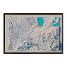
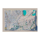
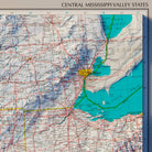
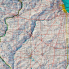
Central Mississippi Valley States 1970 Shaded Relief Map
Currently 10 people are looking at this product
At Muir Way, we believe in providing the utmost quality, design, and value.
- Lasts a lifetime
- Unsurpassed archival materials and printing
- Over 5000 5-star reviews
- 30-day returns*
- Individually printed in our San Diego workshop
Description
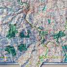
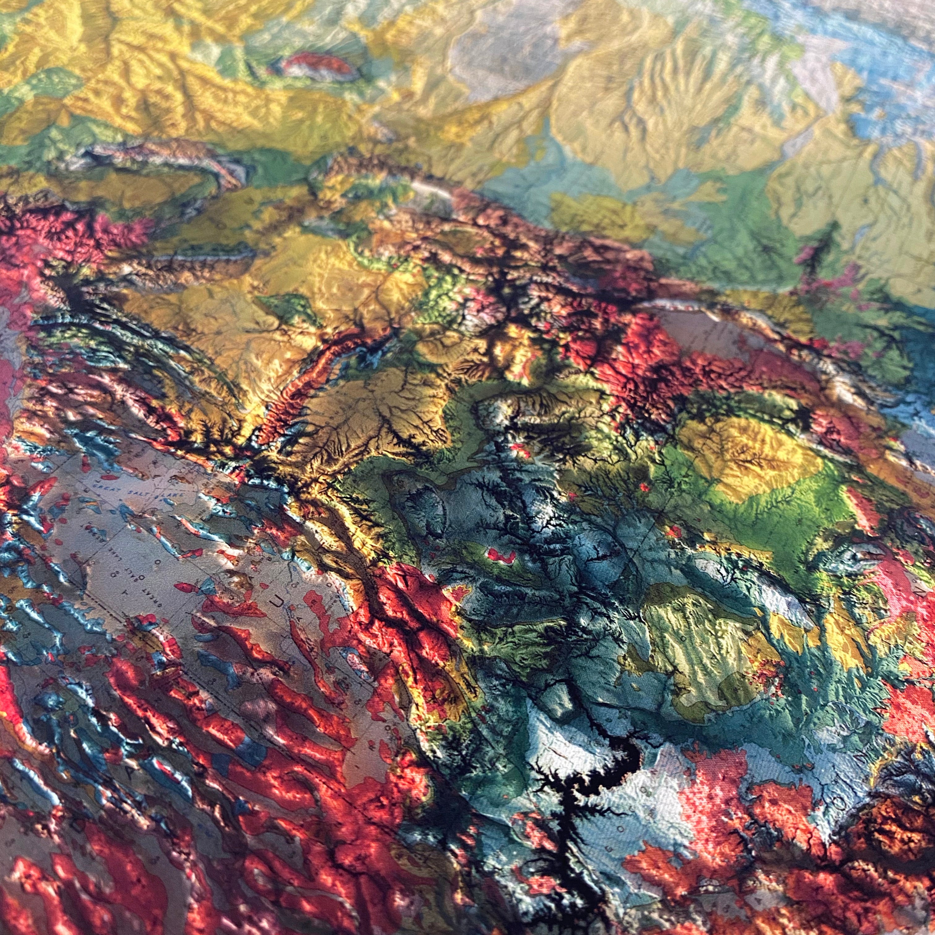
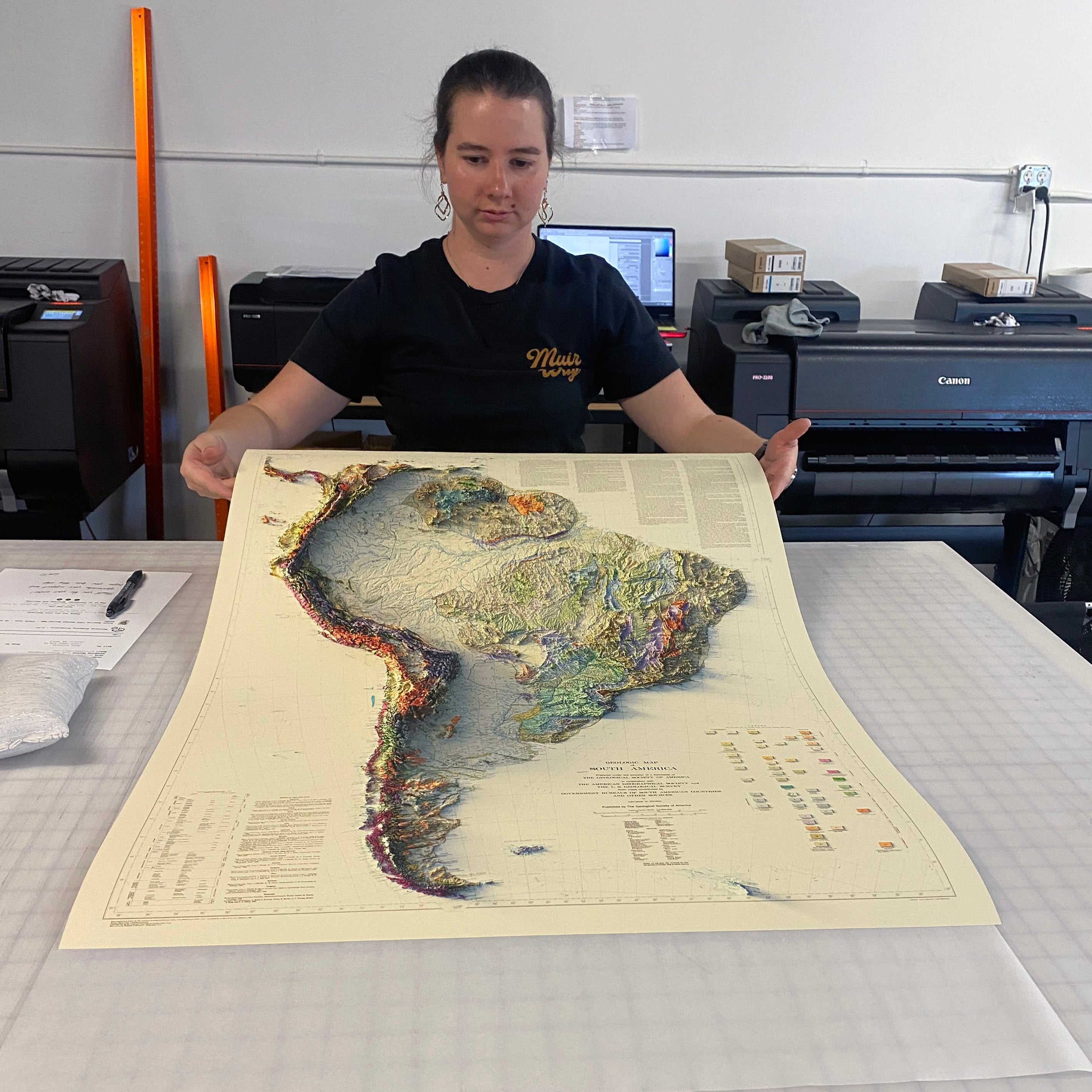
We created this map with the illusion of 3D by applying Digital Elevation Data and meticulously adding shaded relief to the landscape of the original. The map of the Central Plains States was first published as part of the 1970 United States National Atlas created by the USGS and includes political boundaries, cities, railways, roads, ferry lines, Indian reservations, national forests and parks, mountains, mesas, valleys, deserts, bodies of water, drainage, coastlines, and islands. The shading that we added is printed on the paper and is not a result of the map protruding from the surface.
This map includes all or part of the following states: Wisconsin, Michigan, Ohio, Missouri, Kansas, Kentucky, Tennessee, Nebraska, Illinois and Indiana
Please Note: Text on the map can be difficult to read due to the small font size and the age of the map. In areas where the relief shading covers the text, the underlying text is not legible. We suggest the largest size map for better details though the text may still be covered in the darker areas.
Shipping and Returns
FREE SHIPPING on orders to the contiguous US over $49 with UPS ground or USPS to PO Boxes.
Unframed prints - Printed to order and shipped within 2-3 business days
Framed prints - Custom framed and will ship in 3-4 weeks
Full refund on returns of unframed paper prints within 30 days of purchase. Prints must be returned in NEW condition without creases or damage. Please email us at info@muir-way.com for instructions.
If prints are shipped back to us and are not in new condition, we offer a store credit or can return them to you.
We do NOT ACCEPT returns or exchanges on framed prints or canvas wraps because they are made to order.
Click HERE for more information on shipping and returns.
Gallery Quality
Made in the USA
We consider our maps to be works of art, so we print and frame them accordingly.
Using award-winning printers with gallery quality fine art paper and inks, our maps will exceed expectations and last a lifetime.
- Archival Paper and Inks
- 100% Cotton, OBA-Free, and Acid-Free
- Heavyweight 21.5 mil
- Certified to last 100 years
Read customer reviews HERE attesting to the quality of our prints.
American Hardwood Frames
We use real Walnut for our frames, unlike the lesser quality veneer you will typically find elsewhere. With beautiful hardwood grain, each is handmade to order at a professional frame shop.
- 7/8 inch face and 1 1/2 inch depth
- Acrylite glazing (more clear than glass)
- Acid-free backing paper
- Hanging wire installed
Printed flat, shadows so real you'll want to touch them
Shaded relief built by georeferencing hundreds of points against modern USGS elevation data
Historic maps redrawn with modern precision. Every mountain and valley placed exactly where it belongs.
A digital light source casts the shadows, a 3D look on flat paper
The terrain looks dimensional even though the paper stays flat. All shadow, no crop.
Prints completely flat, so it works with traditional glass framing
No warping, no bumps. Slides straight into any standard frame.

12-color giclée printing with fade-resistant premium inks
Colors that hold their depth for a lifetime. Fade-resistant premium inks, not standard four-color.
100% cotton, acid-free archival paper rated to last 100+ years
Museum-grade cotton paper. Certified to outlive the wall it hangs on.
Individually printed to order in our San Diego, CA workshop
Nothing sits in a warehouse. Every print is made after you order it.

Handmade from real walnut, no pressed wood, no veneer
Real hardwood grain, not a stained lookalike.
Custom framed to order at a professional frame shop
Hand-cut and hand-finished, not pulled off a shelf. Every frame is sized to your print.
Unframed prints ship in 2–3 business days; framed in 3–4 weeks
Framing takes longer because they are handmade for your order.
Archival Inks
Each map is produced on our 12-color gicleé printers using premium inks to ensure an intricately detailed, fade-free piece with amazing colors.
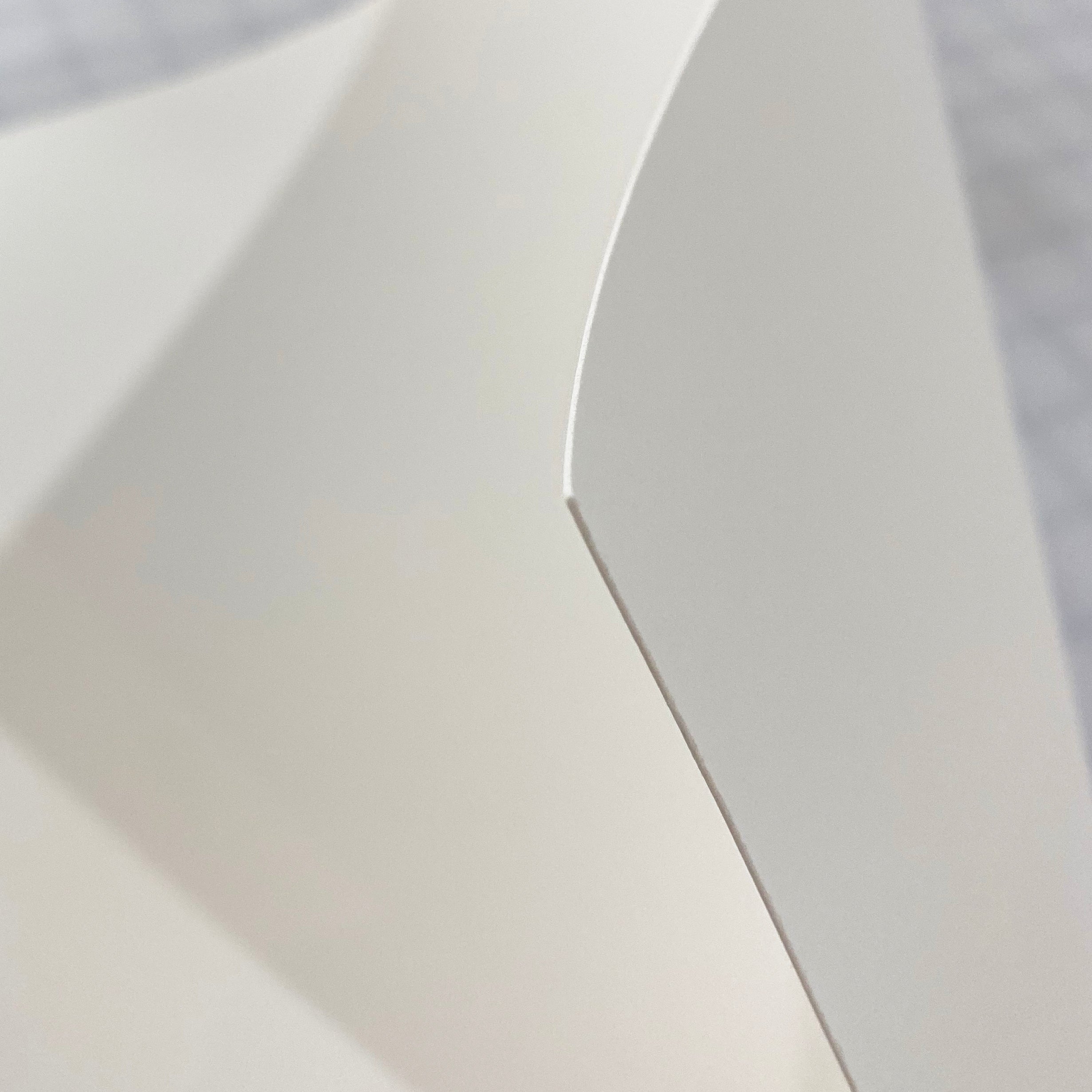
Fine Art Paper
Museum-quality, 100% cotton, acid-free archival paper that’s rated to last 100+ years.
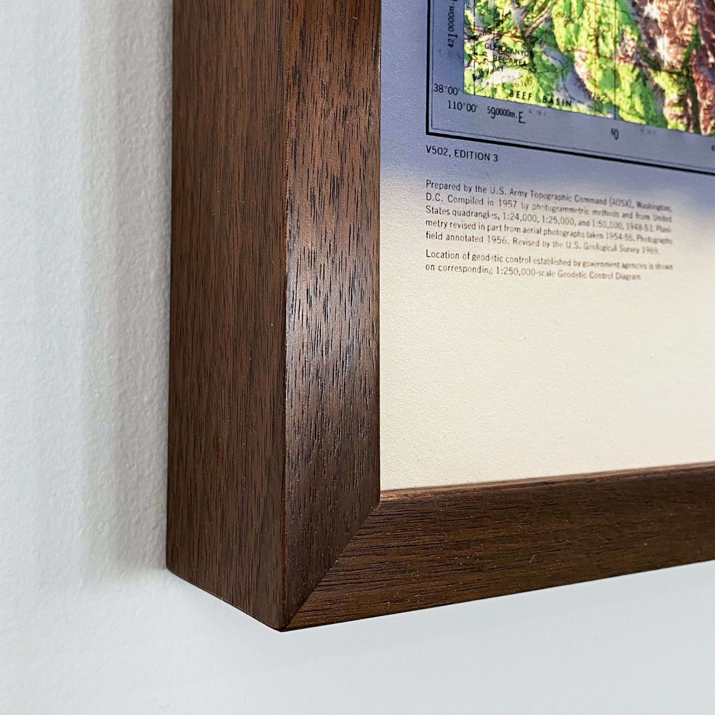
Authentic Hardwood Frames
No pressed wood, no veneer. Every custom frame is handmade from real Walnut.
Made in the usa
We individually print each order in our San Diego workshop. Even our paper is sourced from domestic manufacturers.
Archival Inks
Each map is produced on our 12-color gicleé printers using premium inks to ensure an intricately detailed, fade-free piece with amazing colors.
Fine Art Paper
Museum-quality, 100% cotton, acid-free archival paper that’s rated to last 100+ years.
Authentic Hardwood Frames
No pressed wood, no veneer. Every custom frame is handmade from real Walnut.
Made in the usa
We individually print each order in our San Diego workshop. Even our paper is sourced from domestic manufacturers.
