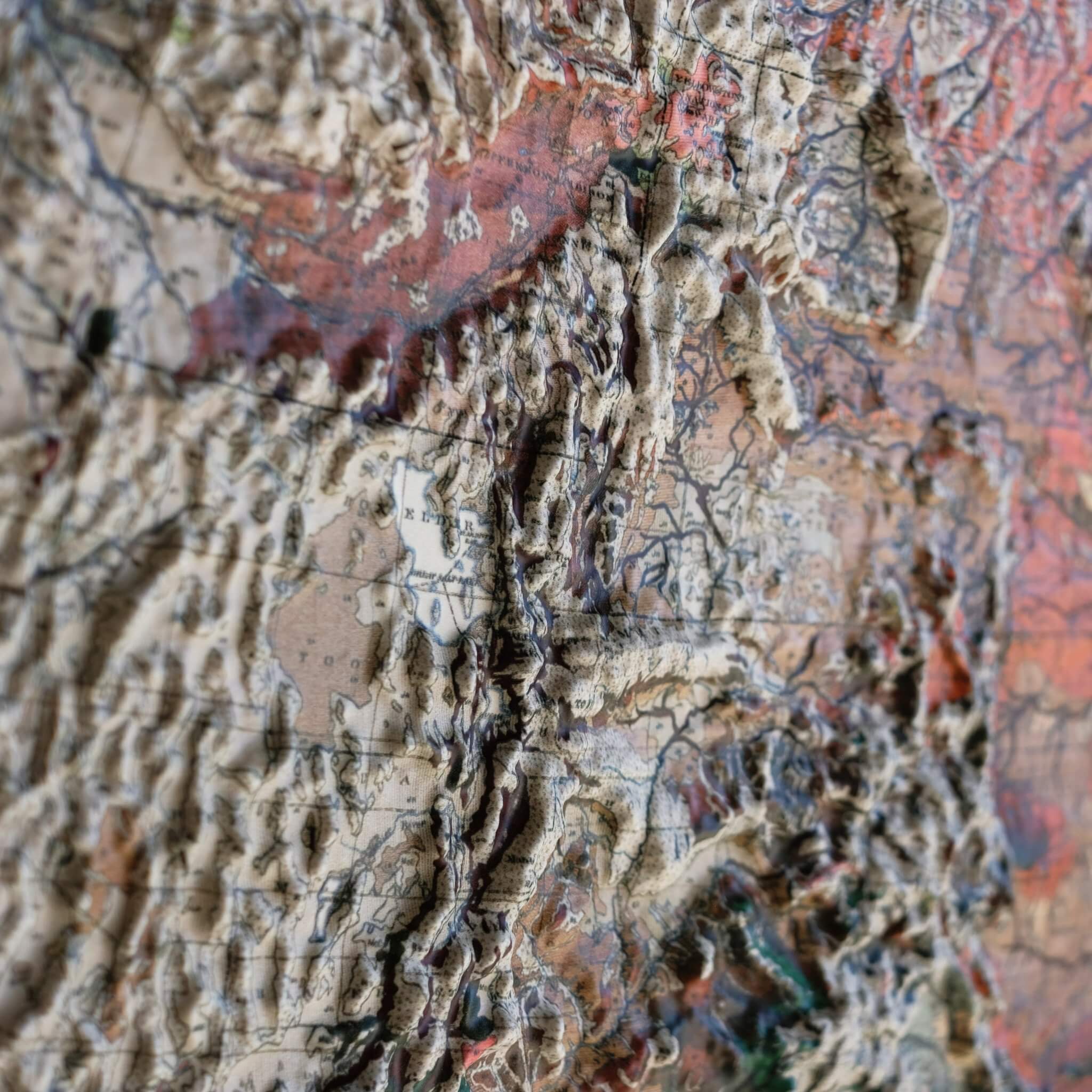
Utah's geology is remarkably varied for a single state: the Basin and Range Province's fault-block mountains stretch across the west, the layered canyon country of the Colorado Plateau dominates the south and east, and the still-rising Wasatch Range cuts through the center, marking the boundary between the two. The rock record here spans an immense stretch of time, from Cambrian-era seafloors full of trilobites to the Jurassic-age Morrison Formation, which preserves some of North America's oldest Cretaceous dinosaur fossils, and the state's canyon country holds some of the largest natural stone arches in the world. This 1980 USGS geological map captures that extraordinary terrain in vivid color and detail — and now, in true three-dimensional relief.
To create this piece, the original historical map is printed in full color, then heated and vacuum-formed over a precisely sculpted three-dimensional mold. That mold is built from modern digital elevation data, so every ridge, canyon, and slope you see is genuine raised, textured topography — not a flat illustration, but terrain you can actually feel.
Our framed maps have no glass or acrylic covering them, so you're free to reach out and touch the map, tracing mountain ranges and exploring the terrain's intricacies with your fingertips.
For the flat, framed fine-art-print version of this map, click here.
PLEASE NOTE: You will love this map if you embrace its anomalies. When the plastic is heated and stretched over the 3D mold, the image may be altered, causing warped lines and text around higher elevations. The fine print on plastic is not as sharp as on paper, sometimes rendering very small text illegible.
- Size - unframed 22x28 inches
- Size - framed 23x29 inches
- Material - plastic mounted on foam board
- Handmade real Walnut frame available
- Individually made in our San Diego, CA shop