


Factory Seconds -
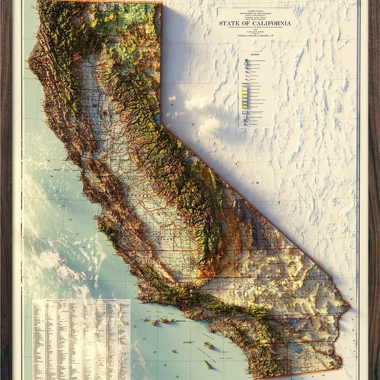
USA National Parks 3D Raised Relief Map
Pictures on this page are of first quality prints. CLICK HERE for examples of "Factory Seconds"
Real 3D Raised Relief Map
- Authentic Muir Way Original
- Transformed from a flat historical map
- Individually made in our San Diego workshop
- Handmade hardwood frames by local craftsmen
--------------------------------------
PLEASE READ:
Factory Second products are visually striking—but may have minor cosmetic or size imperfections that prevent them from being sold as First Quality. If noted in the title, Factory Seconds do not come mounted on foam core, as our First Quality pieces do.
These imperfections are purely aesthetic and may include:
- Slight surface marks or scuffs
- Small misalignment in the raised surface and the printed map
- Slight inconsistencies in printing or finishing
Factory Seconds are offered at a reduced price to give these pieces a good home rather than discarding them.
Important notes:
- Cosmetic imperfections vary from piece to piece.
- All Factory Seconds are returnable within 30 days, but are subject to a $25 restocking fee.
- Imperfections do not affect durability or structural integrity.
- Allow 7-10 business business days until they ship.
Description
3D Real raised relief to explore through touch and feel.
- Perfect as a Push Pin map
- Size - unframed 32x24 inches
- Material - plastic mounted on foamboard
- Every park in the National Park system (National Parks, Monuments, Seashore, Historical, River, Battlefield, etc.)
- Triple Crown of Hiking (Pacific Crest Trail, Continental Divide Trail, and Appalachian Trail)
- Every National Forest and Grassland
From Acadia to Zion, from Denali to Death Valley, our national parks preserve some of the grandest landscapes on the planet. With hand-placed labels and 3D raised-relief, this map showcases the parks in their unique geographic settings, from the red rocks of Utah to the distant islands of Hawaii and American Samoa. National forests, national monuments, and other National Park Service sites are shown, too, plus the Triple Crown of hiking: the PCT, CDT, and the AT. It's a gorgeous display of America's public lands and their endless potential for adventure and exploration.
Designed in partnership of Natural Atlas.
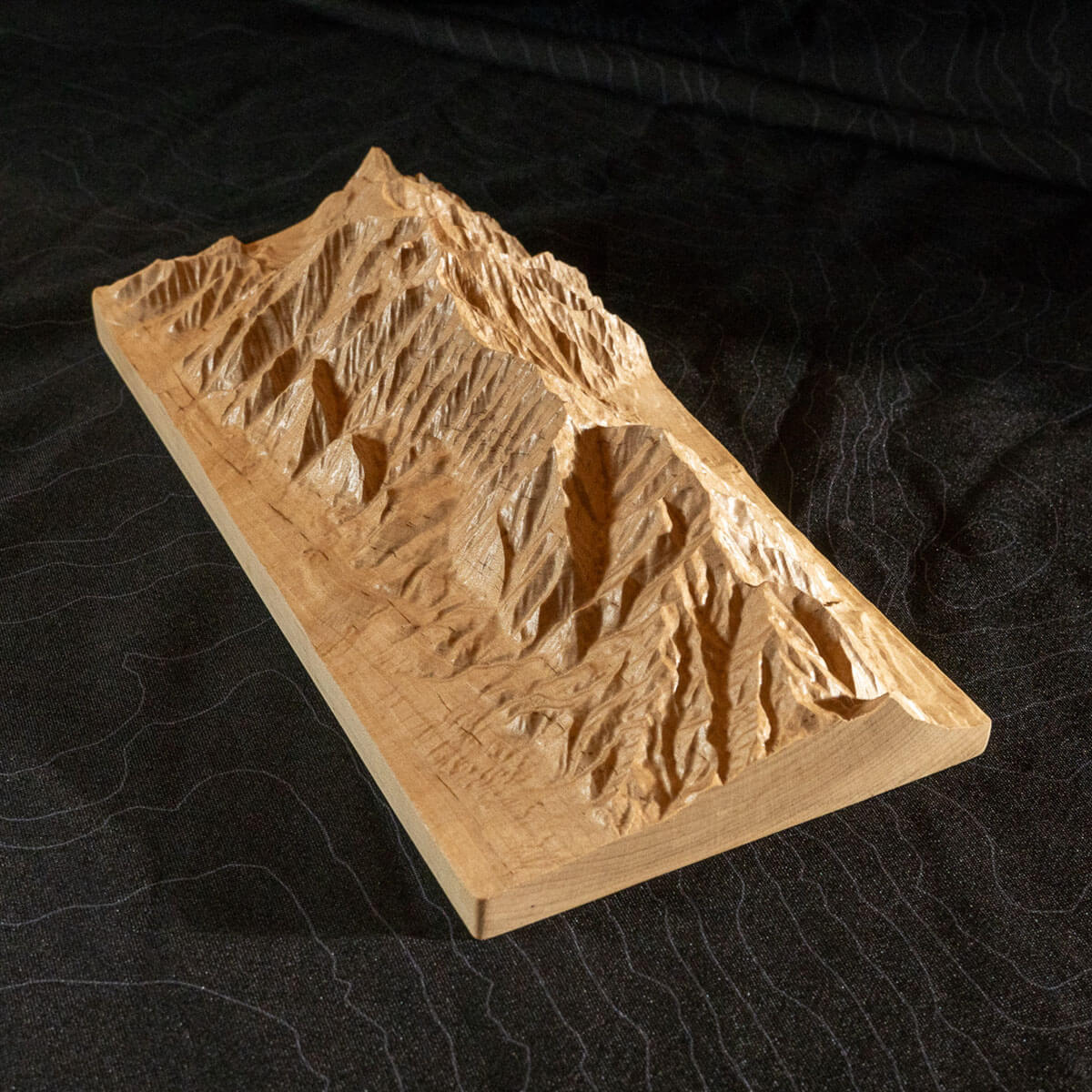
This unique map has undergone a meticulous process where it was printed, heated, and vacuum-formed over an intricately detailed 3D mold. The result is a map that allows you to visually and tactilely explore every park in the National Parks system.
How we make them


FAQ
Are these 3D maps old or new?
The original map designs are of historical maps. We use scans of the old maps and georeference them with modern elevation data to align the raised terrain with the map. Then, we cut a detailed mold for the map. The maps get printed, heated, and vacuum formed onto the mold. We remove the newly formed map from the mold, cut it, and mount it onto matboard for a rigid raised relief map. The 3D maps we sell are only available by Muir Way.
Do you offer different sizes for the 3D maps?
No, we offer each map in a single size because they are vacuum formed to a particular 3D mold that takes approximately 40 hours to cut.
What materials are the 3D maps made from?
The maps are printed on a thick, highly formable plastic that is highly formable under extreme heat and mounted on foamboard.
What is your return policy?
For any reason, you can send back the print within 30 days of receiving it for a full refund. The print must be in new condition. We do not accept returns on framed prints. Please email info@muir-way.com for return authorization.
How long does it take to get?
Unframed maps ship out in 1-2 days and framed maps ship out in 2-3 weeks of ordering. Please also allow transit time from our shop in San Diego.
Do the frames for the 3D maps have glass?
No, our frames do not have glass over the 3D prints so you can touch the protruding terrain. If you prefer glass, your local frame shop can make a deeper frame that will allow for the glass.
Are these like the ones in my classroom when I was a kid?
Ours are inspired by those older raised relief maps but our new versions are on another level of quality, precision, and craftsmanship.