


Maine Elevation & Shaded Relief Maps
Our custom printed Maine wall maps will bring the tranquility of New England’s ‘Vacationland’ to your home or office. From our eye-catching elevation maps and geological relief maps to our meticulously restored historical maps, every map of Maine we offer reflects the high quality and attention to detail our customers have come to love and expect from Muir Way.
What makes Muir Way maps of Maine unique?
When you purchase a map of Maine from Muir Way, you get a custom-printed archival piece of art designed to last for generations, not a flimsy poster in a tube. Unlike a mass-produced poster, our Maine wall maps are certified to last 100 years, and our artwork is designed to bring new light to the beautiful terrain it features. For example, our elevation maps incorporate hand-shaded relief combined with Digital Elevation Data and historical map imagery. This creates a unique 3D effect on a flat surface. The meticulous detail and craftsmanship we bring to our Maine maps creates heirloom quality artwork we’re proud of, and we can’t wait to pass that on to you.
Does my Maine map come framed?
It can! Our Maine maps are available professionally custom-framed with real wood, or unframed if you prefer to use your own. They come in standard framing sizes for easy gift-giving. If you’d like to purchase a framed Maine wall map, several different wood colors and finishes are available to choose from to suit your décor.
Does a Muir Way map of Maine make a good gift?
Our maps make great gifts! A custom-printed map of Maine can make a perfect gift for anniversaries, weddings, college graduations, holidays, or as a thank-you or retirement gift. Perhaps your family loves to vacation in Kennebunkport or Bar Harbor, or you love exploring Acadia National Park. A Maine map is also a great gift for “snowbirds” who summer in Maine but spend the cooler months elsewhere. Our maps also make memorable corporate gifts that give your clients and colleagues the opportunity to think of you every time they look across the room.
Where should I display my Maine map?
Our maps are eye-catching from across the room and up close. Hang a framed wall map as a central focus, or purchase several maps in a similar style or from a particular region and arrange them near each other for a complementary series. No matter which you choose, you’re sure to find a map that will look right at home.
What are the different types of maps of Maine available on Muir Way?
Our Maine maps are available in several different styles, including:
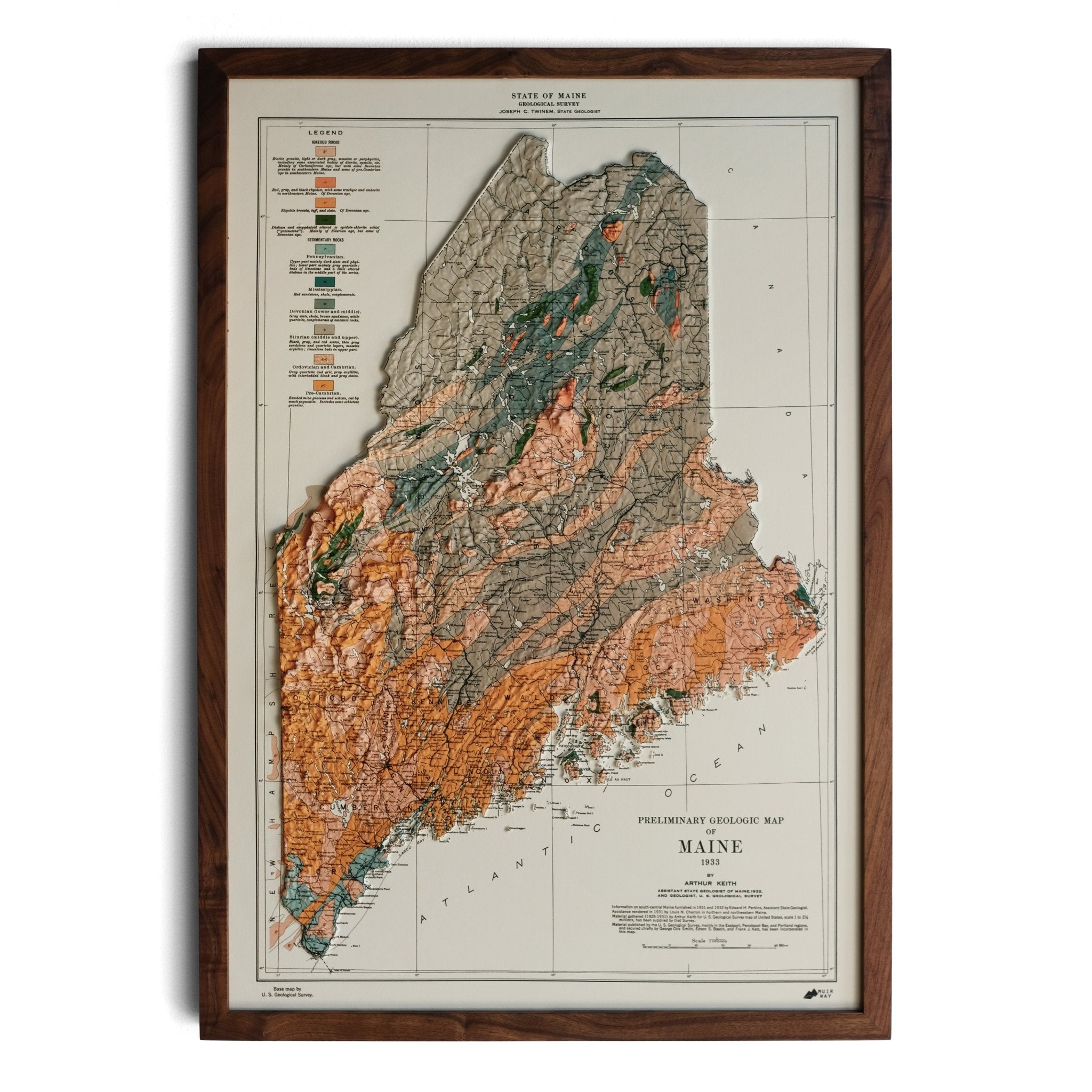
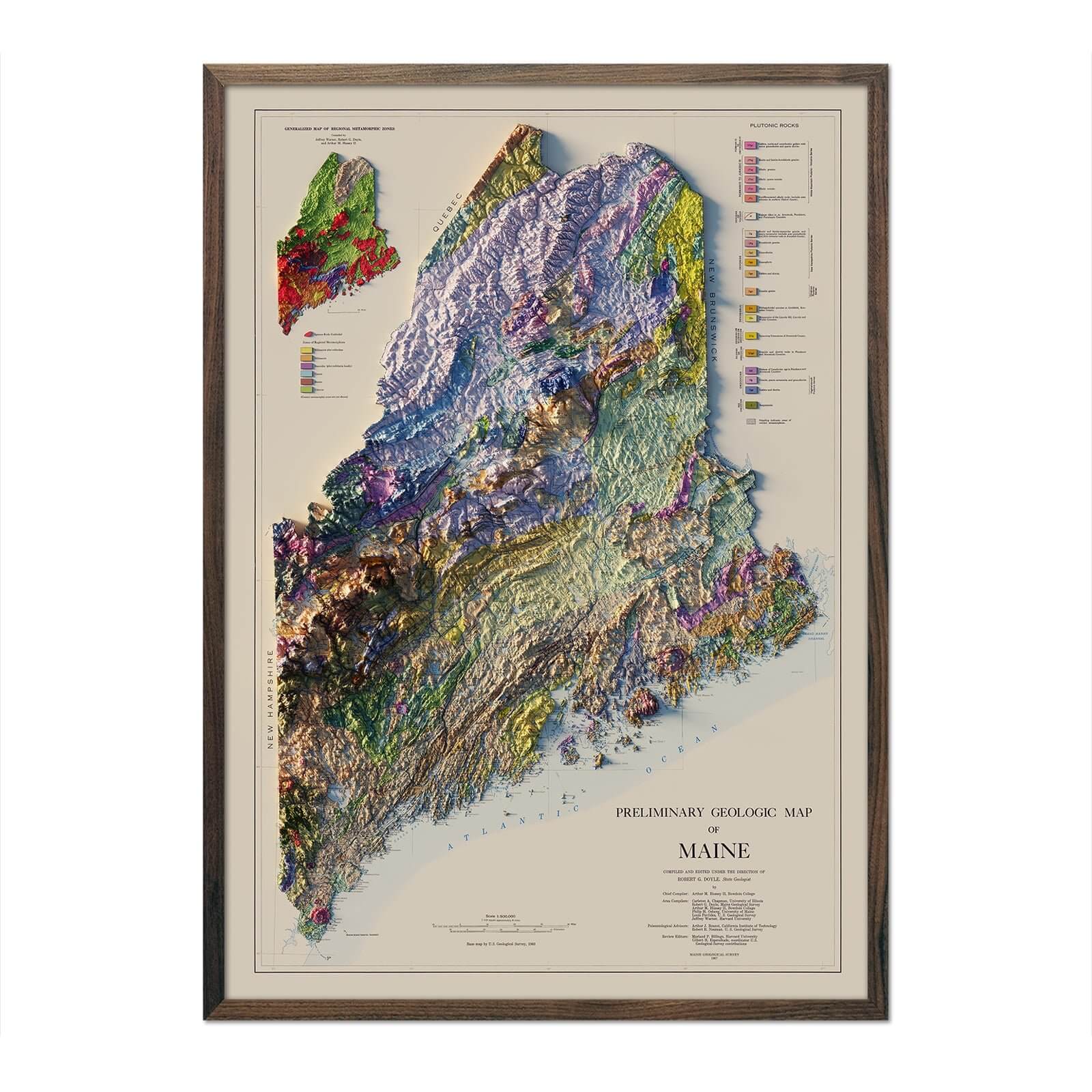
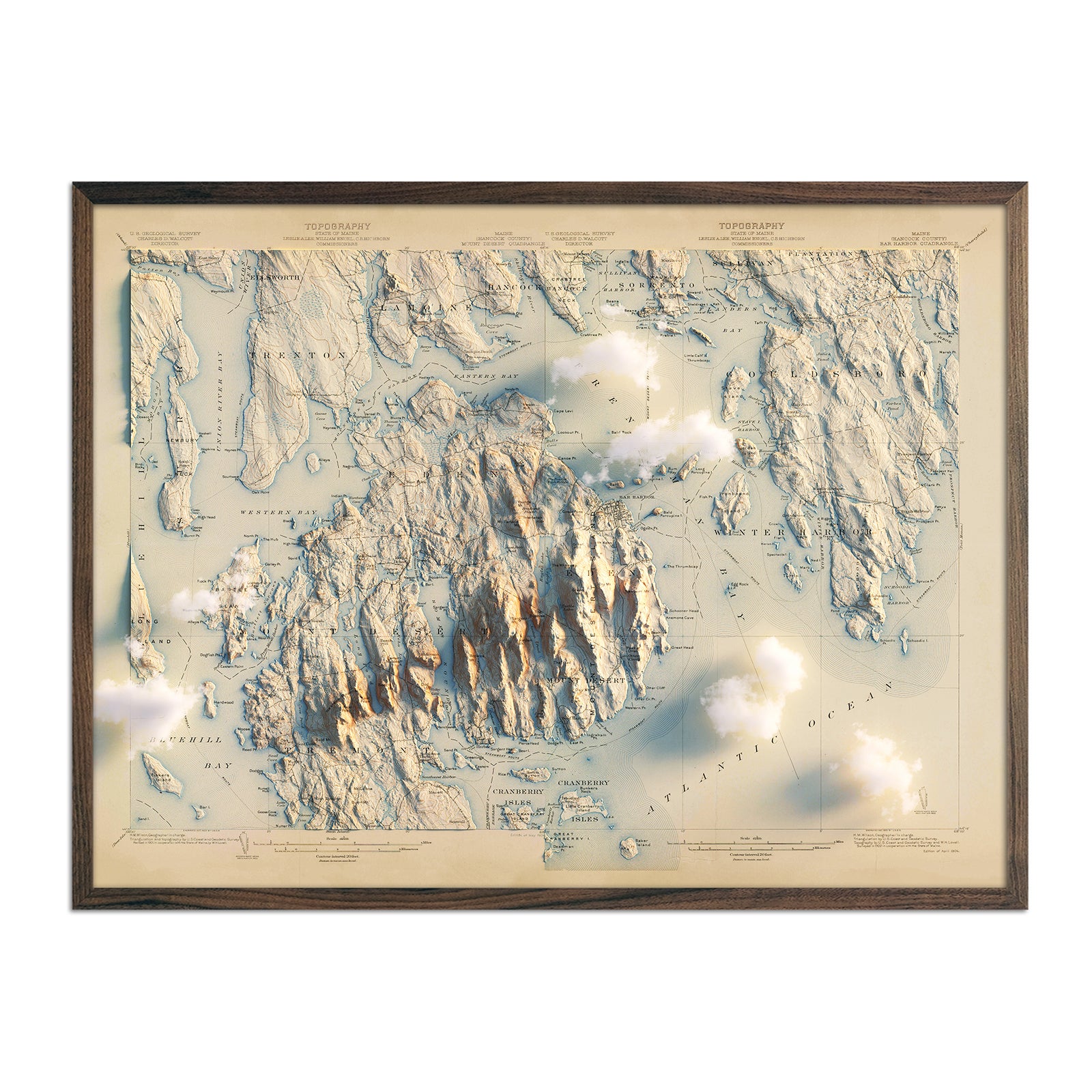
Maine Relief Maps - Get ready to see Maine as you’ve never seen it before with our custom-enhanced relief maps. We’ve taken USGS vintage map images and combined them with Digital Elevation Data and hand-shaded relief to create imagery that “pops” off the page while remaining 2-dimensional. Our 1967 Maine relief map shows the geology of the state in beautiful vibrant colors, while our 1976 Maine relief map shows elevation changes in a more monochromatic palette. If you’re looking for a map of Acadia, specifically, we also have a beautiful Acadia, Bar Harbor relief map.
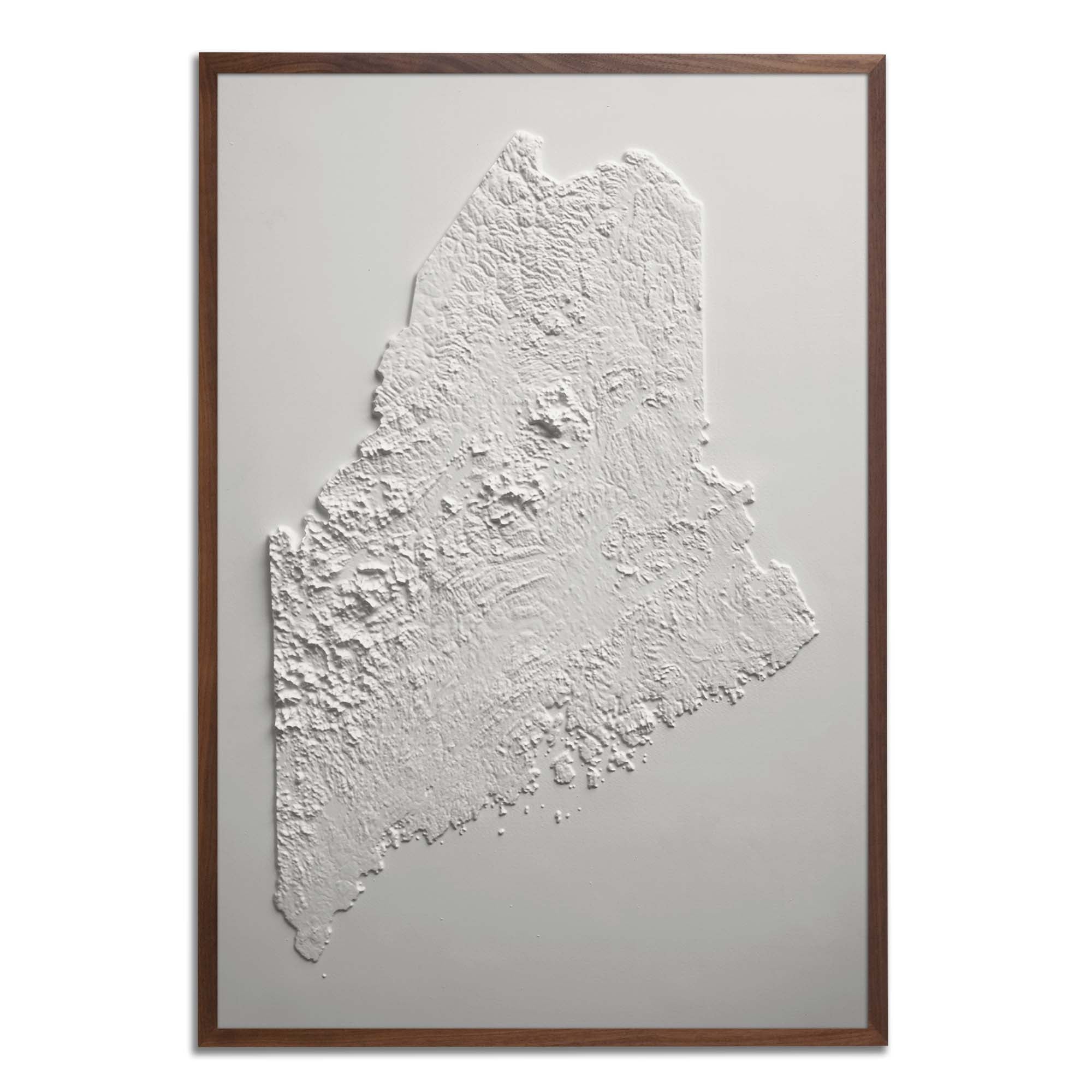
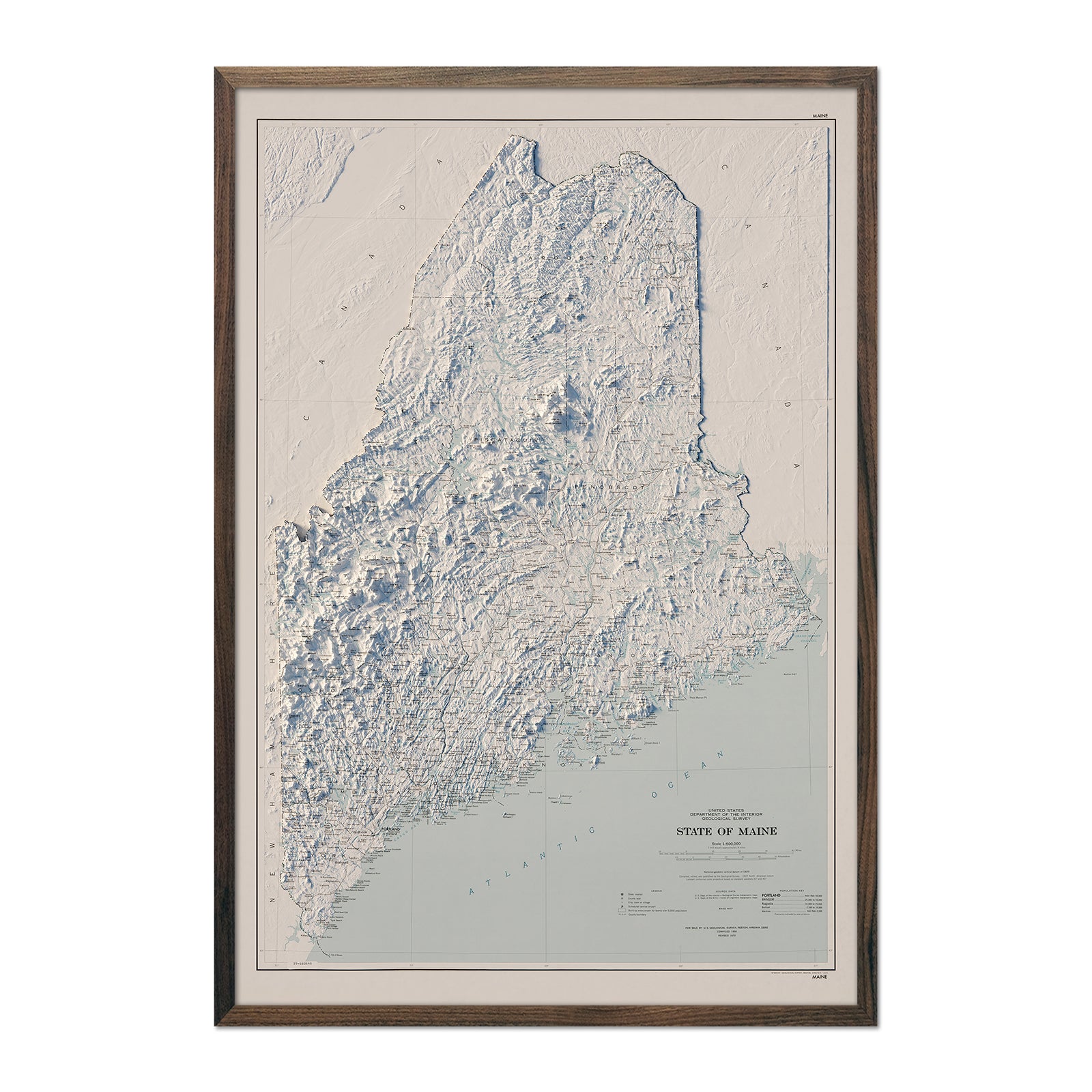
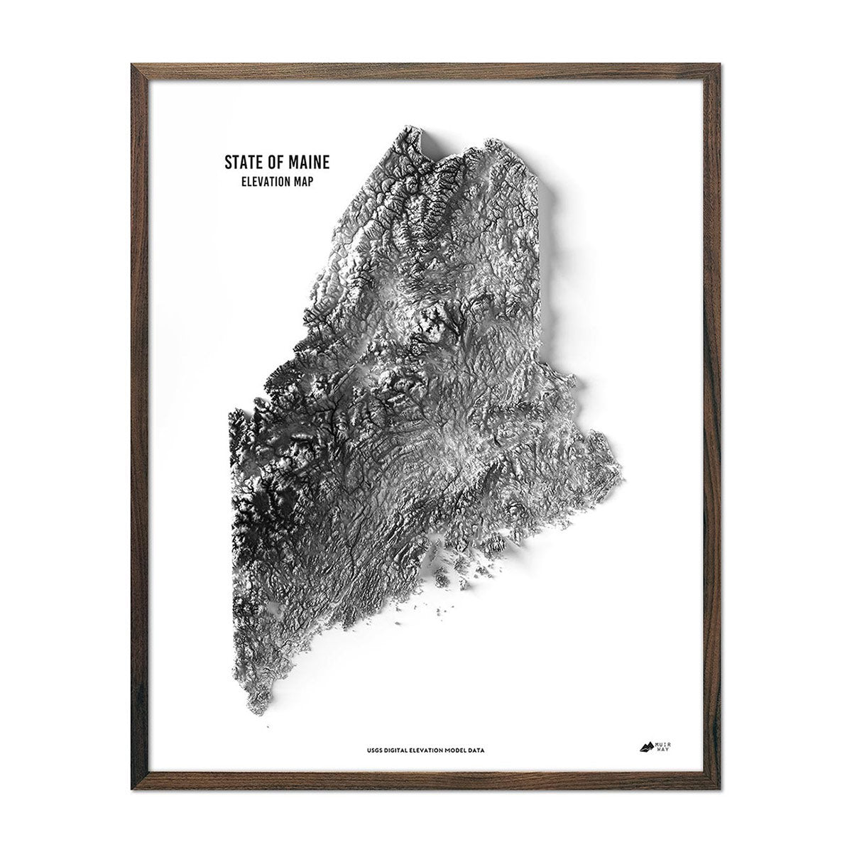
Maine elevation maps - Just like our relief maps, our state of Maine elevation map uses Digital Elevation Data from the USGS and hand-shaded relief to create a high-contrast 3-dimensional effect, but this time the state is featured in stunning black and white with a statement-making, crisp, white background.
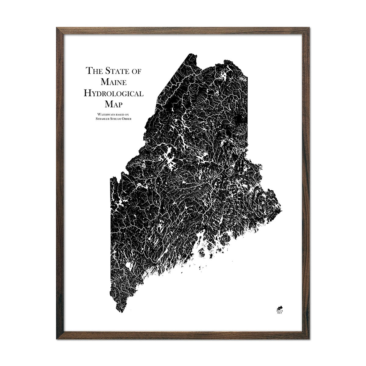
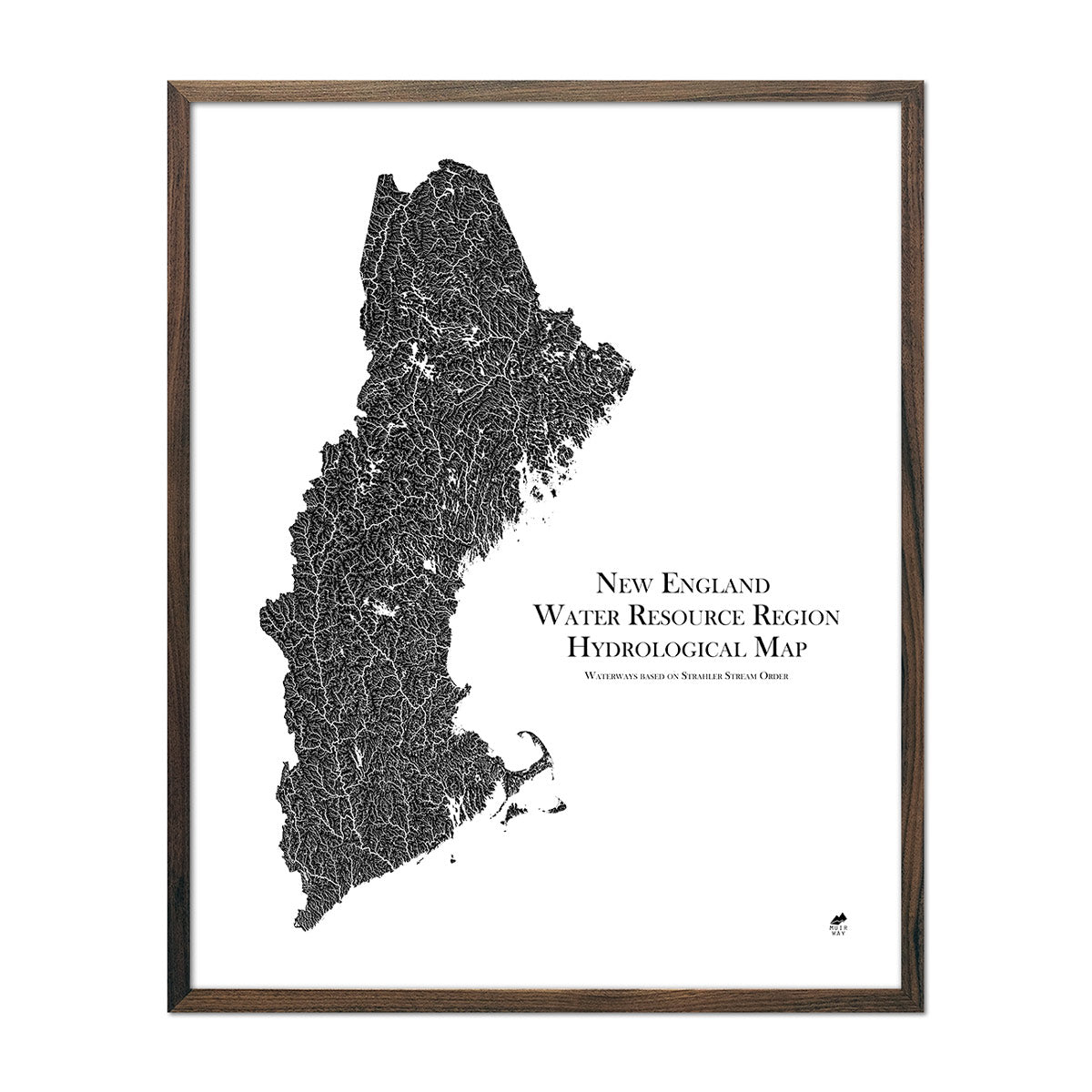
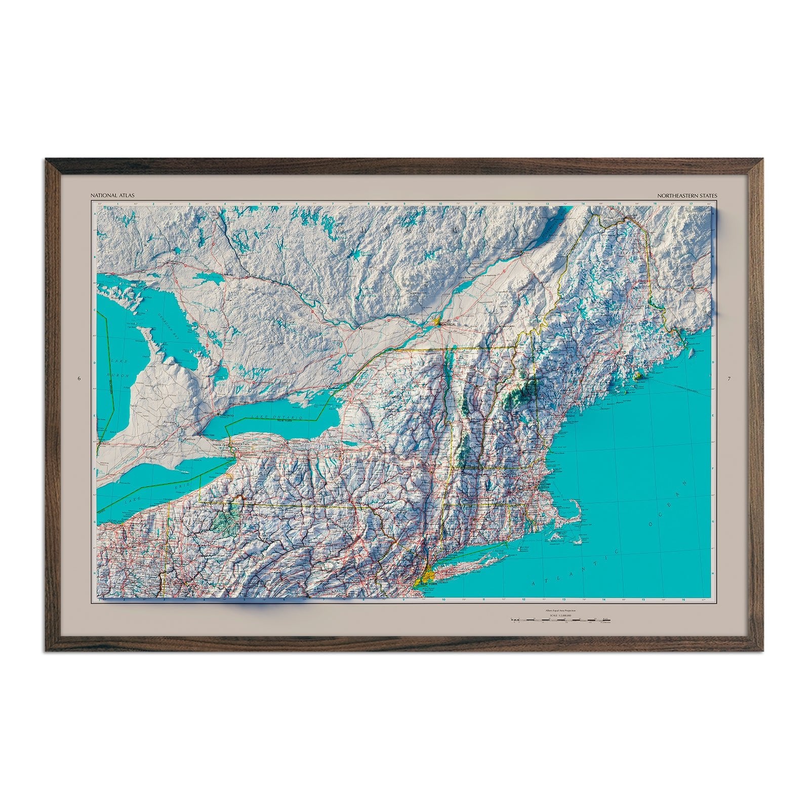
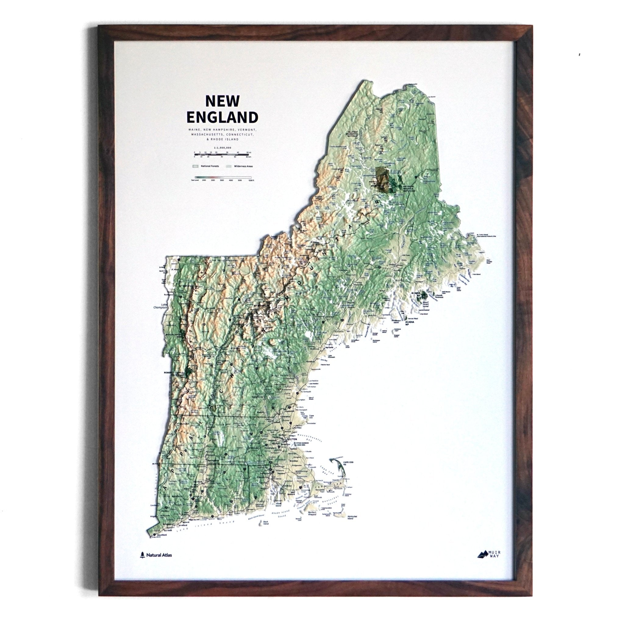
Maine hydrological maps - Maine is known for its gorgeous wilderness and is home to many beautiful lakes and rivers. Our hydrological maps showcase the intricate network of waterways, from the widest river to the smallest tributaries. Trace rivers and lakes on our Maine hydrological map and you’ll see every single river and intermittent stream, as well as all bodies of water greater than 0.2 mi in diameter. Want “the bigger picture”? Have a look at our New England regional hydrological map, showcasing all of the New England states and their waterways. What makes our hydrological maps even more special? We apply a method called the Strahler Stream Order to show the hierarchy of streams as they flow from their source, with rivers shown thicker as they acquire the flow of tributaries. Hydrological maps are available in black, blue, or green.
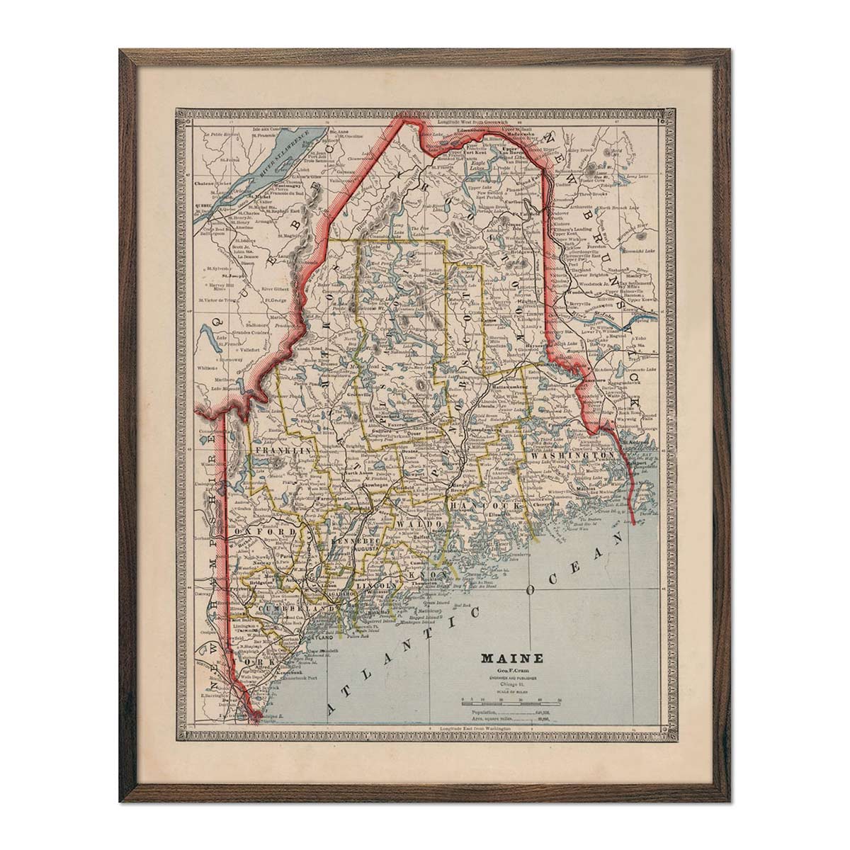
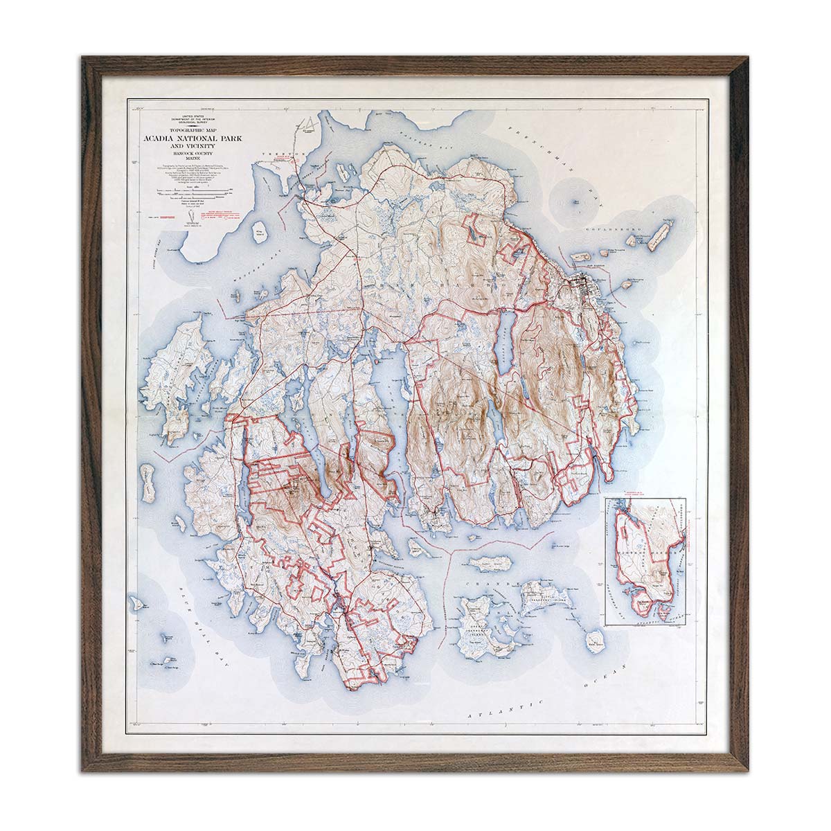
Enhanced vintage Maine maps - If you like the history and charm of vintage maps, you’ll love our 1883 map of Maine and our 1942 map of Acadia National Park. Unlike our elevation maps, Muir Way historical maps don’t feature enhanced elevation effects, but they do feature a record of history and are beautifully restored to retain their vintage charm without the wear & tear.
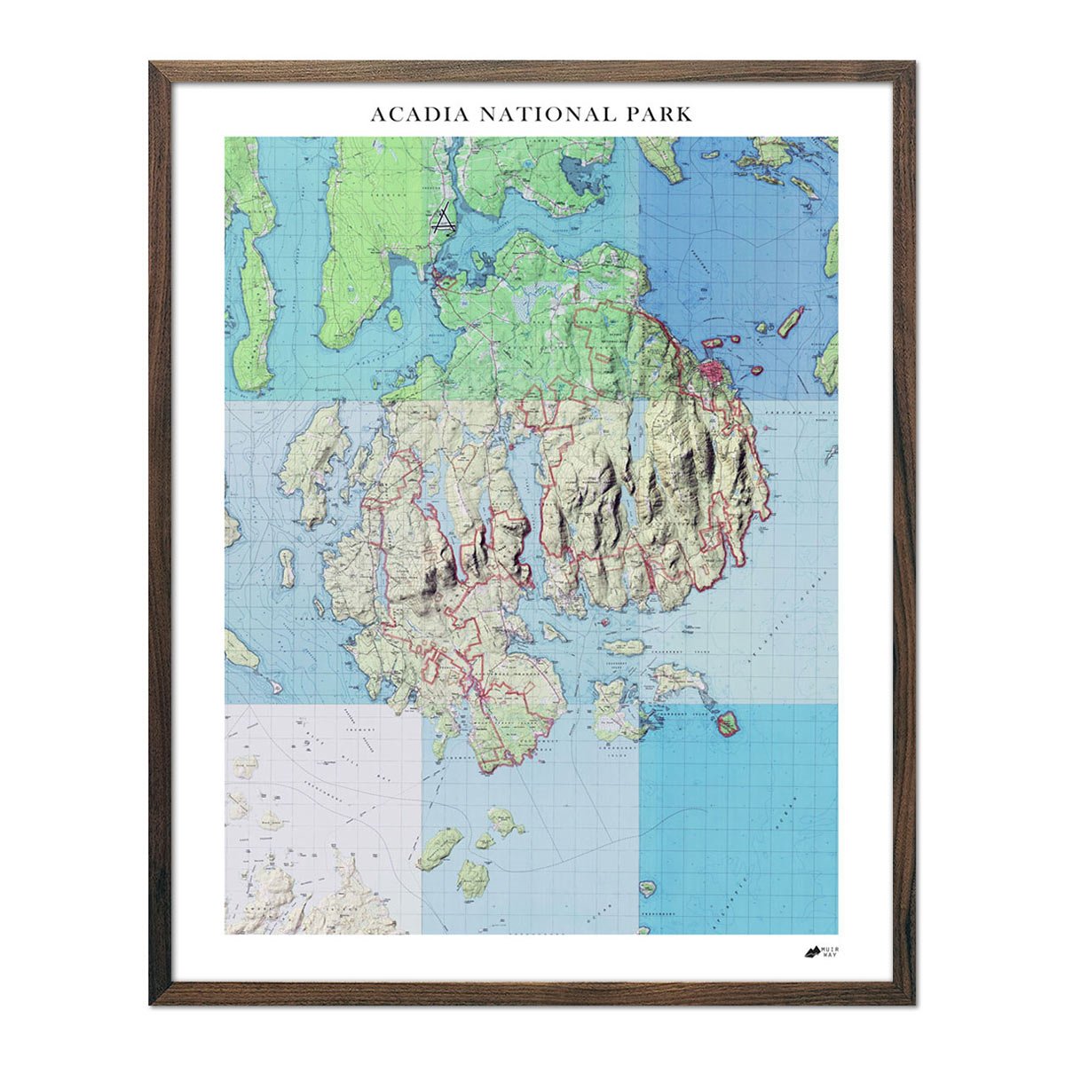
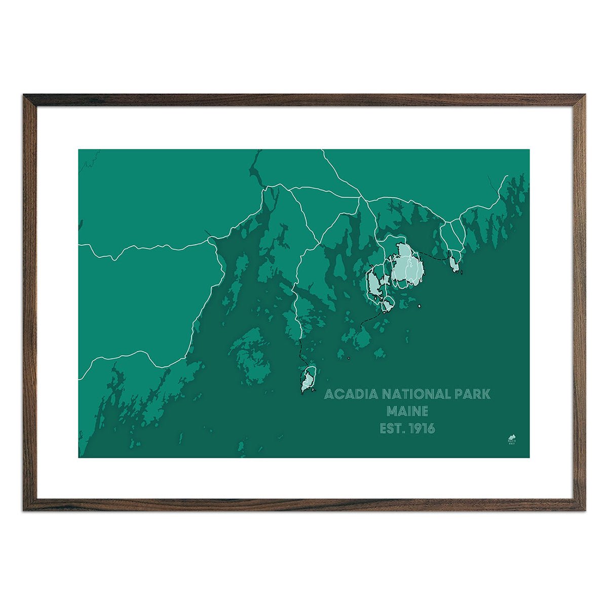
Acadia National Park maps/b> - For outdoor adventurers and nature lovers, it wouldn’t be a trip to Maine without a visit to Acadia National Park. We have several Acadia National Park maps to choose from, from our sleek and modern brochure-style Acadia maps, to our 1942 USGS Acadia National Park Map, Acadia National Park relief map, and more.
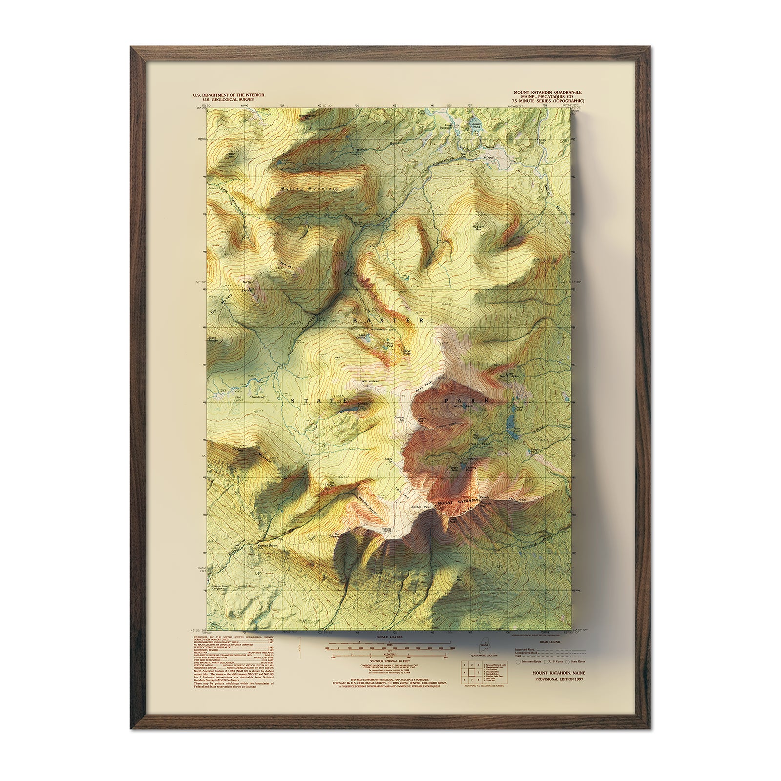
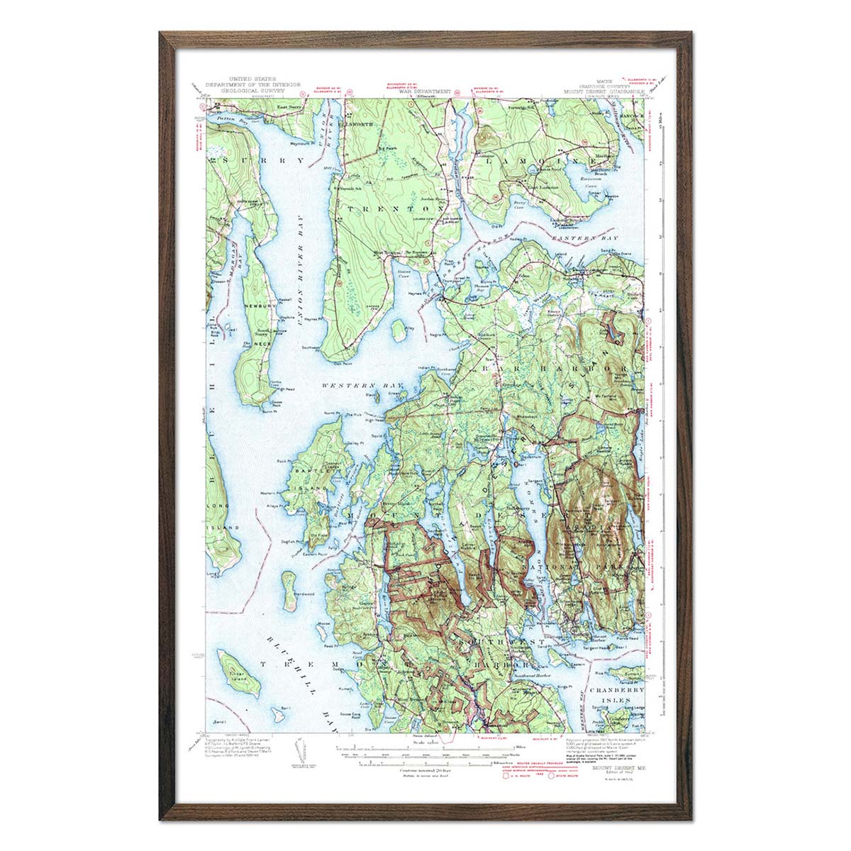
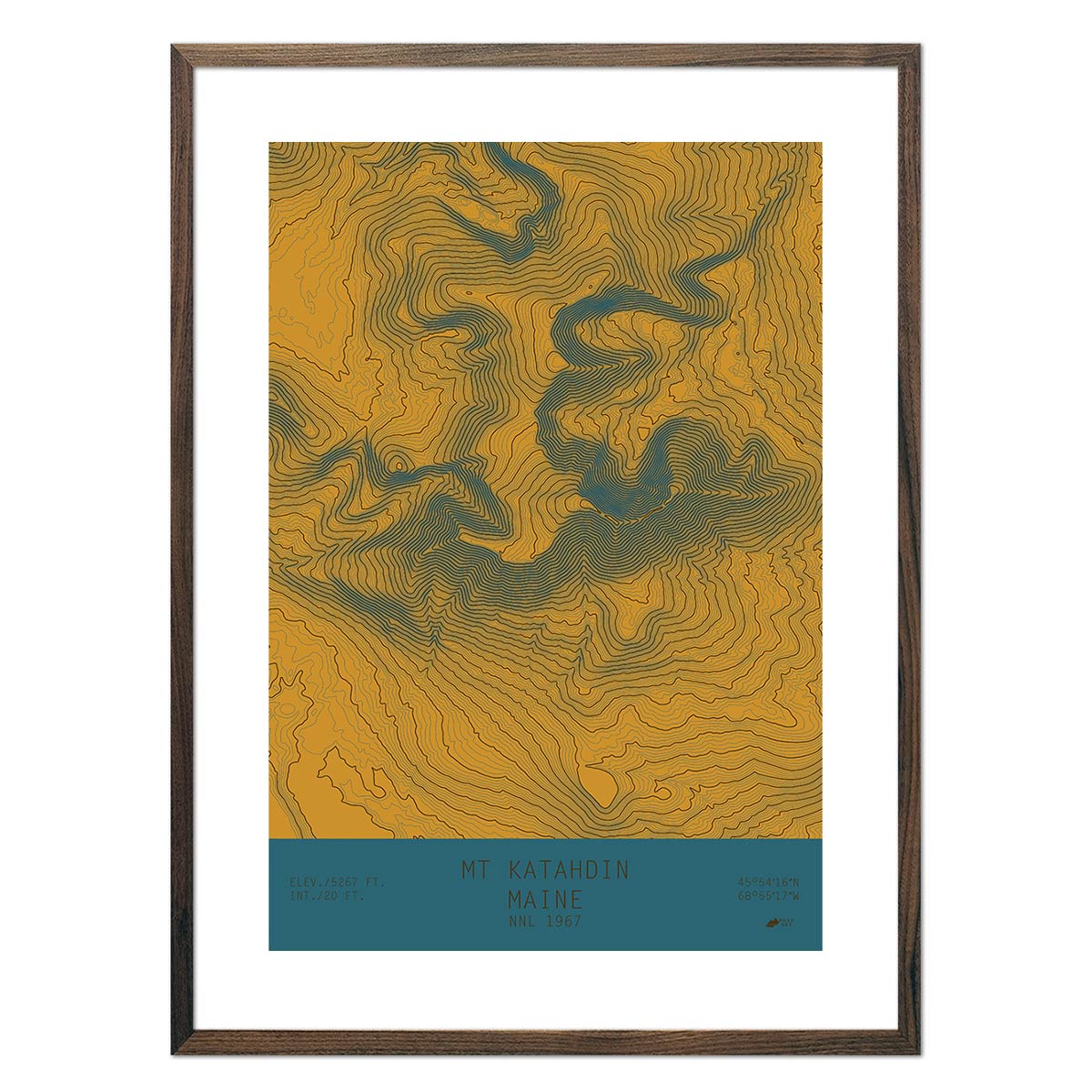
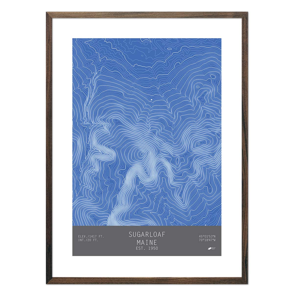
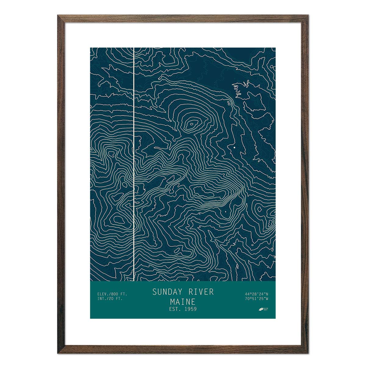
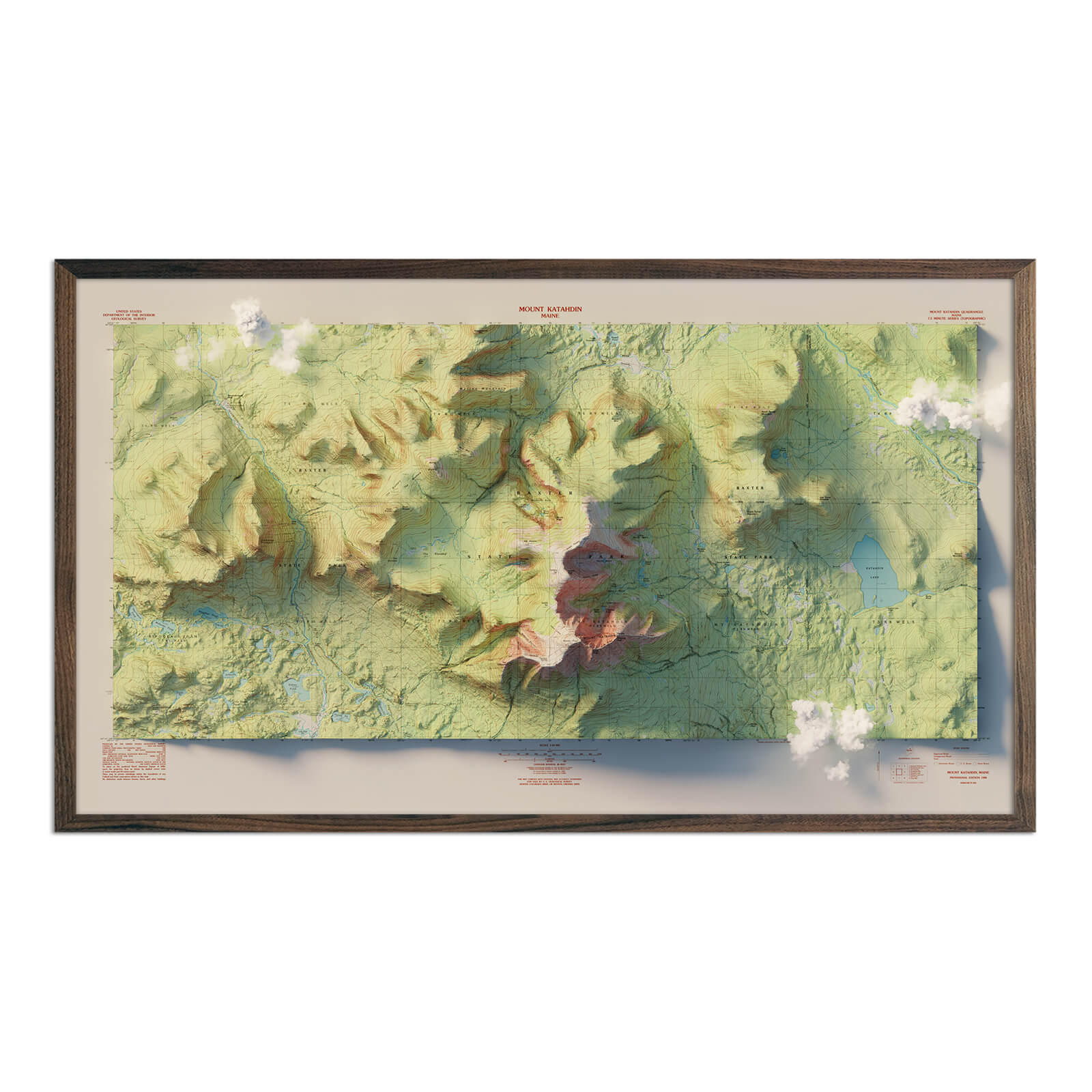
Maine Mountain and Ski Resort Topographical Maps - Commemorate a fun Maine ski trip with one of our ski resort and mountain maps. Choose from topographical maps of Mount Katahdin, Sugarloaf, or Sunday River.
What are some prominent features on the map of Maine?
Maine is New England’s northernmost state and also New England’s largest state, bordering Canada, New Hampshire and the Atlantic Ocean, and marks the end of the northern end of the Appalachian trail. Despite its size, Maine is the least densely populated state east of the Mississippi, with a majority of its population centering around the greater Portland area in the southeast. Much of Maine remains untouched wilderness, particularly in the northern area of the state. This makes Maine a great destination for outdoor adventuring, from looking for moose at Baxter State Park to climbing the peak of Mount Katahdin, swimming in the Casco Bay or canoeing on Sebago Lake. One look at a Maine map will show you the variety of beautiful landscapes to explore, from gentle hikes on lower mountains to plunging seaside cliffs, sprawling farmlands and dense pine forests (it is known as the Pine Tree state for a reason!). Maine is known for being a tranquil and scenic destination for vacationing, so much so that it’s earned its unofficial brand name “Vacationland” and the slogan - “the way life should be”.
What are the regions in Maine?
Maine has three main geographical regions:
- Coastal Lowlands - Filled with flat, sandy beaches, tidal creeks and marshes, and some higher cliffs toward the north, this region of Maine includes Mt. Desert Island which is the base of Cadillac mountain, rising to 1,530 feet above sea level.
- Eastern New England Uplands - Stretching from Canada all the way to Connecticut, the Eastern New England Uplands cuts through Maine to the northwest of the Coastal Lowlands. Maine is famous for its potatoes, and this region dotted with lakes and streams provides fertile soil for potato crops to flourish.
- White Mountains - Covering Northwestern Maine, the White Mountains region is an extension of the New Hampshire White Mountains and is home to Katahdin, Maine’s highest peak, as well as over 100 other mountains higher than 3,000 feet.
If you like our collection of Maine maps, you may also be interested in maps of other Northeast states. Click below to browse:
