


Nestled between the US and Canada, the Great Lakes are considered by many to be the crown jewel of North America. Providing water for millions of families, home to countless species of plants and animals, and key to the development of many important industries – this region is truly one of Earth’s geological marvels.
Let’s take a look into the geological history of the the Great Lakes region, and explore how their ancient story impacts our modern day world.
Where are the Great Lakes located?
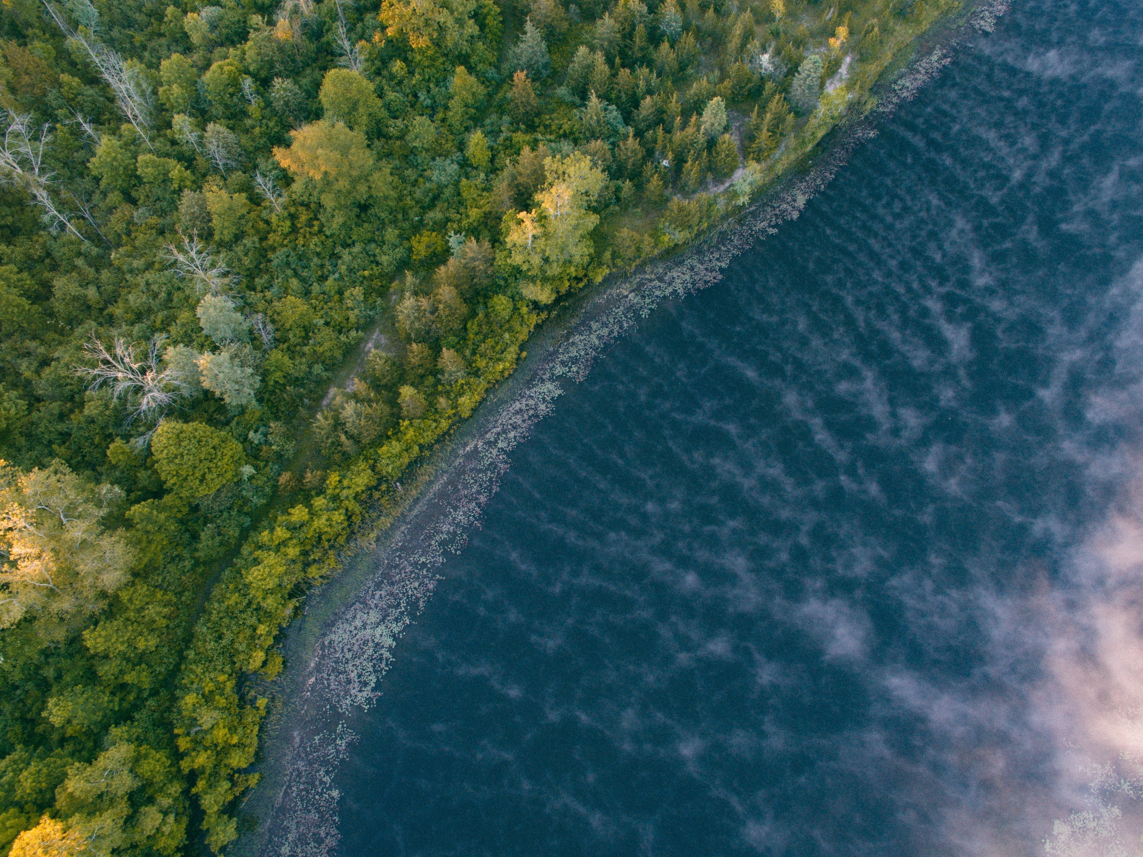
Located in the northeast-central region of North America, the five Great Lakes are the largest group of freshwater lakes in the world. Full of unique geological properties, this massive series of lakes naturally forms the Great Lakes basin, spreading out between eight US states and the Canadian province of Ontario.
Due to their insulated location and our planet’s changing climate, these lakes are perhaps the most precious natural resource maintained by the US and Canada. Not only that, but the region itself was historically the home of around twenty recorded indigenous tribes, many of which still inhabit the region today.
What are the names of the Great Lakes?
Depending on the body of water in question, the names of the Great Lakes originate either from indigenous words and phrases, or from the names given to them by non-indigenous explorers.
Here are the five names, organized by largest to smallest lake size:
-
Lake Superior, named after the French phrase Lac Supérieur, or “upper lake”
-
Lake Huron, named after the Huron people who originally inhabited the region
-
Lake Michigan, named after the Ojibwe word mishigami, or "great water”
-
Lake Erie, named after the indigenous coastal Erie tribe
-
Lake Ontario, named after the Iroquois word Ontario, meaning “sparkling water”
Keep in mind, these are just the names given to the largest lakes in the region. Thousands of other smaller lakes, rivers, and streams ebb and flow throughout this 300,000 square mile area before draining into the Great Lakes basin, as well as the Atlantic Ocean by way of the St. Lawrence River.
When and how did the Great Lakes form geologically?
Like most large bodies of freshwater on Earth, the Great Lakes were formed by ancient glaciers moving across the land, carving up and filling in valleys as their glacial lobes inched forward during the last ice age. When it comes to the Great Lakes specifically, the last glacial period occurred around 75,000 years ago.
The Wisconsin glaciation – the most recent glacial event in North America – was the primary driver of change in the geography of the Great Lakes region. Massive sheets of ice scoured the Earth’s surface, leaving behind deep depressions and pushing aside sediments like sand and gravel which now form the backbone of numerous beaches lining the shores of the five lakes.
Other sediments like clay were swept up in melting ice sheets and rain, and transported vast distances before settling down on the bottoms of future lake beds. As time went on, these glaciers retreated and began to melt, filling in the many cavernous lake basins they left behind during their endless march forward.
Surprisingly, all of this happened quite recently, at least on a geologic time scale. The Great Lakes, and by extension the Niagara River and Niagara Falls, are believed to have fully formed around 10,000 – 12,000 years ago as fresh meltwater from the Laurentide Ice Sheet began to flow into the Great Lake basins.
Understanding the Geology & Unique Features of the Great Lakes
This region of North America has some of the most fascinating geology and ecology in the world. Starting with the formation of the lakes themselves, let's see what exactly makes this area so unique.
What are the rock types of the Great Lakes?
Over a million years ago, the Great Lakes began taking shape – today, the modern day locations, depths, and climates of these lakes are still being influenced by their geology. An ancient inland sea once covered the region, leaving behind clues for geologists to study.
The basins of these huge lakes are made up of two layers of bedrock – a type of solid rock. The main rock types of the bedrock beneath each lake consist of Precambrian and Phanerozoic rocks. This includes sandstone, limestone, shale, dolomite, gypsum, salt, and various other minerals.
On top of this bedrock lies a layer of unconsolidated glacial clastic sediments. These glacial clastic sediments were left behind by the glaciation events mentioned previously, where immense amounts of pressure ground sediment into materials such as gravel, sand, and clay before they spread throughout the lake system.
Glaciers were the key factor in shaping the Great Lakes geology, and in turn, the types of rocks that modern day mining operations can access in the surrounding area. Without these icy behemoths pushing, carving, and transporting various sediments, the Great Lakes would appear quite differently today.
What are the major geographical features of the Great Lakes?
The Great Lakes are a geographic marvel, with a variety of unique features setting them apart from most other freshwater systems around the world. Here are a few of the most striking examples of geographic features within the lakes:
-
Huge networks of lakes and rivers, which eventually drain into a massive watershed
-
Large bays, many of which are important industrial shipping and manufacturing hubs
-
Access to the sea, with large shipping vessels able to reach the coast
-
Numerous peninsulas, home to major cities like Toronto, Ontario and Detroit, Michigan
-
Around 35,000 islands, home to a wide range of plants and animals
-
Wetlands, including some of the most biodiverse marshes in the world
-
Sandy beaches, popular tourist destinations which surround many of the lakes
-
Coastal dunes, including some of the biggest freshwater dunes in the world
When it comes to the water itself, the elevation and depth of the individual lakes are quite different. For example, Lake Superior has a maximum depth of around 1,332 feet, while Lake Erie’s maximum depth is only 210 feet. Not only that, but each individual lake sits at a different point above or below sea level, which changes local climate and ecology.
Are the Great Lakes freshwater?
One of the most surprising facts about the Great Lakes is that the entire system of lakes, rivers, and streams holds around 20% of the world’s total freshwater and 90% of the US supply. This incredible amount of drinkable freshwater not only supplies nearly 40 million US residents each day, it also supports a vast network of biodiverse ecosystems and human industry.
Many industrial, agricultural, and manufacturing trades rely on the nearby freshwater to keep things running smoothly. When it comes to hydroelectric power, multiple Niagara falls power stations supply New York state and Ontario with around one quarter of their daily energy needs – no small feat.
Unfortunately, the constant use of freshwater for human industry in recent years has left many regions of the Great Lakes contaminated. Microplastics, petrochemicals, and other difficult to remove pollutants are beginning to pile up, and efforts are being made to cut the flow off at the source as environmental regulations struggle to keep up.
Do the Great Lakes have tides?
If you haven’t visited the Great Lakes yourself, it’s hard to visualize just how big they are. Standing on the shores of Lake Superior, you may even think you’ve reached the coast of the Atlantic Ocean – that’s how big they are.
Because of their size, the Great Lakes do experience some level of tidal force, but it’s not enough to fall under the definition of “true tides”. Gusty winds, storms, and rapid changes in weather are almost always present somewhere in the region, but the tidal forces affecting the lakes are relatively weak, causing them to shift only a few centimeters each day.
What gemstones are found in the Great Lakes?
The vast stretching shorelines of the Great Lakes attract thousands of gem-hunters and fossil enthusiasts each year, who flock to the region looking to comb the beaches for hidden treasures. The region is home to both common varieties of gemstones and rarer, region-specific varieties that only exist within the Great Lakes basin.
Hundreds of different minerals exist along the shores, but here are some of the more coveted gemstones you may come across:
-
Lake Superior Agate, a unique mineral consisting of yellow, orange, and red bands
-
Greenstone, Michigan’s official gemstone, resembling an emerald turtle shell
-
Puddingstone, a curiously-named stone made up of both jasper and quartz
-
Yooperlite, a mineral known for it’s curious fiery glow under fluorescent light
-
Jaspilite, a gem made from bands of crimson red jasper and black hematite
In addition to gemstones, you may also stumble upon ancient fossils while exploring, such as:
-
Petoskey Stones, Michigan’s official state stone, made up of fossilized coral fragments
-
Charlevoix Stones, similar to Peroskey stones, but consisting of smaller corals
-
Horn Corals, an extinct type of coral which may be found hidden within certain rocks
Are you looking for maps of the Great Lakes region?
At Muir Way, we specialize in crafting highly-detailed geological maps, including a wide selection of vintage maps that make incredible gifts for anyone you know who appreciates the outdoors. Cartography – the art and science of map making – allows us to share our love for the natural world with others through our extensive catalog of vintage and modern maps.
While browsing any of the categories below, you’ll be able to find shaded relief maps, hydrology maps, elevation maps, nautical charts, and much more.
If you’re looking for Great Lakes maps specifically, look no further than our Great Lakes regional hydrology map and Great Lakes 1955 shaded relief map. If you want individual lake maps, we have a complete collection of nautical maps featuring Lake Superior, Lake Huron, Lake Michigan, Lake Erie, and Lake Ontario.
The Great Lakes region reaches 8 US states, and we have multiple different maps for each of these states, including: Indiana, Illinois, Ohio, Pennsylvania, Wisconsin, Michigan, Minnesota, and New York.
In addition to US states, the Canadian province of Ontario is also a part of the lake region. If you’re interested in Ontarian maps, you should definitely check out our Canadian map collection, covering all provinces including Ontario.
If you’re a fan of lakes in general, don’t miss out on any of the other lake region maps we’ve designed over the years. Two recommendations would be our Crater Lake shaded relief map, and our Lake Tahoe 1955 shaded relief map.
What unique features do the five Great Lakes have?
All five lakes in the region share a variety of similar properties, but they do also differ in many ways. Let's go over some of the more unique features each specific lake has.
Lake Superior
As you may have guessed from its name, Lake Superior is quite large. In fact, it’s the largest freshwater lake in the world – not just the US. Lake Superior itself contains around 10% of the world’s total freshwater, an incredible amount of a particularly rare resource in the grand scheme of things. This lake is so large that many of the islands contained within it have lakes and islands of their own, such as the large island of Isle Royale.
Gem and mineral hunters are big fans of the Lake Superior region, as the highly sought after lake superior agates can be found here, waiting for those with a keen eye to discover them along the sandy shores.
While the lake retains much of its water for extended periods of time, when it does flow, it streams into Lake Huron.
Lake Michigan
If you couldn’t tell from its name, Lake Michigan is located within the US – it doesn’t extend into Canada like many of the other lakes. If you’re a fan of dunes, this is the lake you’ll want to start when exploring the Great Lake region, as the lake boasts around 300,000 acres of dunes.
While all of the lakes have beaches, this is where many locals tend to spend warm summer days, hanging about the many sandy beaches that line the shores. Interestingly, the lake also has its own Bermuda Triangle – the Lake Michigan Triangle. This region, which stretches across the lake, is known for an unusually high number of unexplained disappearances, shipwrecks, and plane crashes.
Lake Huron
In geologic terms, Lakes Michigan and Huron are a single lake. Fused by the large waterways of the Straits of Mackinac, Lake Huron and Lake Michigan form a sizable super-lake that sees quite a bit of industrial shipping activity.
Shipping companies such as the aging Great Lakes Fleet use Lake Huron as well as others to transport vast amounts of bulk materials like iron ore.
Lake Huron itself is the second largest of the Great Lakes when it’s size is considered alone, and it stretches across the US-Canadian border, with both nations readily using it’s shores. Lake Huron’s shorelines are nothing to scoff at, either – it boasts the longest shoreline of all the Great Lakes if you include its nearly endless supply of small islands.
Lake Erie
The most striking and unique feature of Lake Erie is, of course, Niagara Falls. This famous waterfall, which is actually a network of three waterfalls, straddles the border between the US and Canada where over 3,000 tons of water spill into Lake Ontario every second.
Thousands of feet underneath Lake Erie – as well as beneath Lake Huron – lies another geologic marvel: huge swaths of rock salt deposits, a valuable resource left behind by Earth's ancient inland seas. Used primarily for salting icy roads and melting snow, rock salt has been a staple of the mining industry in the Lake Erie area since the 1950’s.
Lake Ontario
Fed by Niagara Falls, Lake Ontario is the last lake in the network – located far to the east. Lake Ontario connects the chain of lakes to the St. Lawrence River, which eventually spills out into the Atlantic.
Famous for its rich nearby wetlands and marshes, Lake Ontario is a popular spot for bird and wildlife enthusiasts to catch a glimpse of rare plants and animals, many of which only live within a small range near the lake.
Because of its downstream position, Lake Ontario is unfortunately home to higher concentrations of pollution. Human industrial activity along the shores of the other lakes, as well as Lake Ontario itself release large amounts of pollutants each day which collect in the surrounding bays and wetlands.
Final thoughts
Although the geology of the Great Lakes has been studied for centuries, secrets still remain. The impact of this region can’t be understated – without it, many of us would lose access to freshwater, along with many of North America’s wild plants and animals.
Scientists have unraveled the mysteries of ancient glaciers, and now look to the future with hopes of preserving this geological hotspot.
