Skip to content
Facebook
Instagram
Pinterest
Country/Region
United States (USD $)
United States (USD $)
Search
Account
Search
Cart
Popular Collections
3D Raised Relief Maps
Vintage Shaded Relief Maps
Hydrological Maps
Apparel
Best Sellers
Shop by Region
USA Maps
State Maps
International Maps
National Park Maps
Shop by Type
Collections
3D Raised Relief
Hydrology Series
2D Vintage Shaded Relief
2D Elevation Relief
Natural Atlas Maps
TOPO Series
National Park Series
2D Shaded Relief
Mountain Range
Gift Cards
3D Raised Relief Maps
Shaded Relief Maps
Hydrological Maps
Historical Prints
Illustrations and Photographs
1884 Fish Drawings
1875 Zoology Drawings
1868 Yosemite Photos
1873 Yellowstone Photos
1874 Moon Photos
Historical Maps
Astronomy
Civil War Maps
Assorted Vintage
USGS Quadrant Maps
1876 State Maps
1876 Geologic/Topographic
1883 State Maps
1904 Yellowstone Maps
1906 Hawaii Maps
1884 Fish Drawings
Astronomy
Civil War Maps
Apparel/Home Goods
Mountain Glasses
Books
Tees
Hats
Topo Blankets
Walnut Frames
Mountain Glasses
Tees
Books
About Us
Our Story
Reviews
FAQs
Shipping and Returns
Contact Us
All Muir Way Maps
Filter
Sort by
Best selling
Best selling
Alphabetically, A-Z
Alphabetically, Z-A
Date, old to new
Date, new to old
Filters
US States
Alabama
2
Arkansas
2
Connecticut
1
Delaware
2
Georgia
2
Illinois
1
Indiana
1
Kentucky
3
Louisiana
1
Maine
1
Maryland
8
Massachusetts
1
Mississippi
2
Missouri
1
New Hampshire
1
New Jersey
1
New York
2
North Carolina
3
Ohio
1
Pennsylvania
2
Rhode Island
2
South Carolina
2
Tennessee
2
Virginia
39
Washington DC
5
West Virginia
3
National Parks
Shenandoah
4
Sort by
Best selling
Alphabetically, A-Z
Alphabetically, Z-A
Date, old to new
Date, new to old
Apply
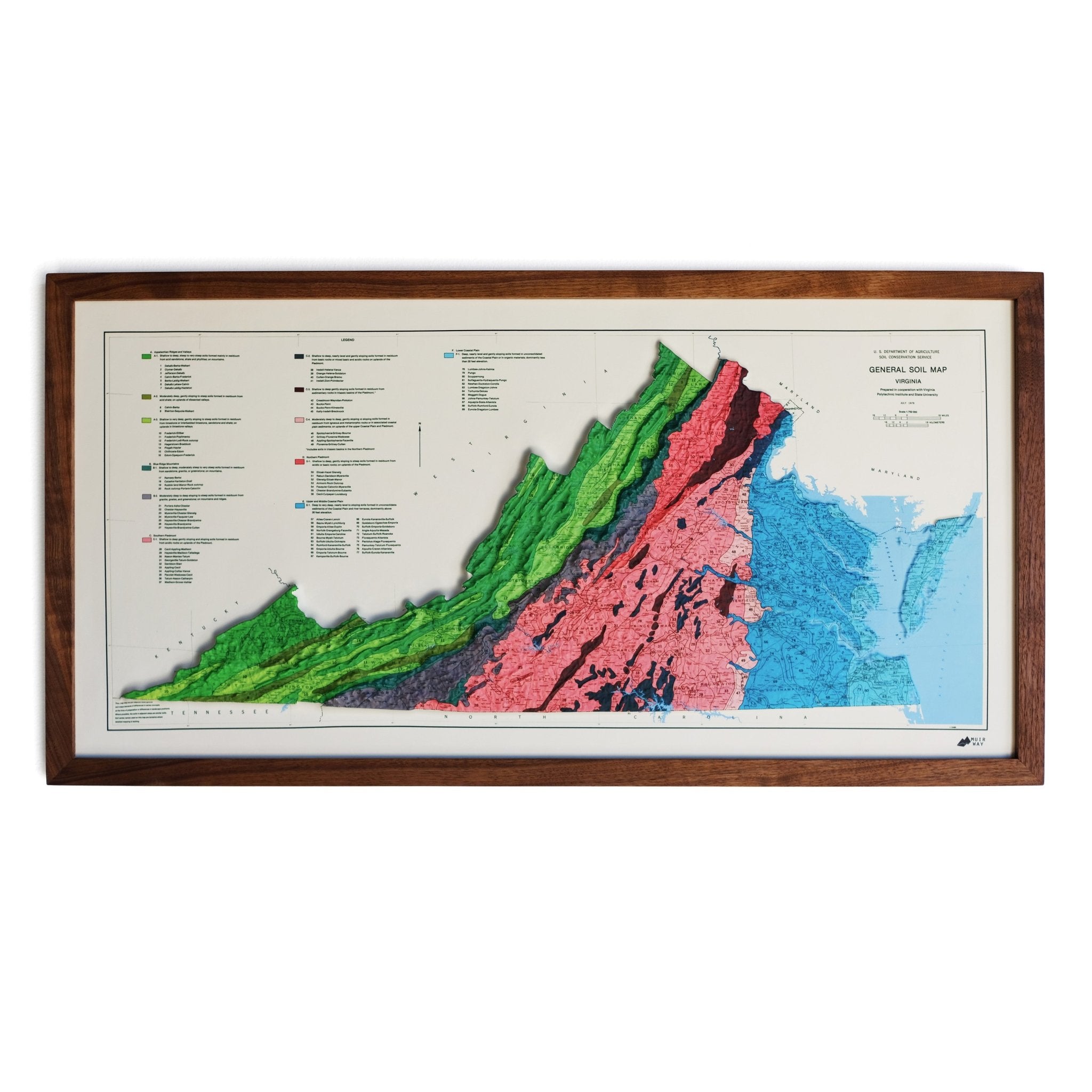
Virginia 1957 Shaded Relief Map
From
$ 79.00 USD
4.7 / 5.0
19 reviews
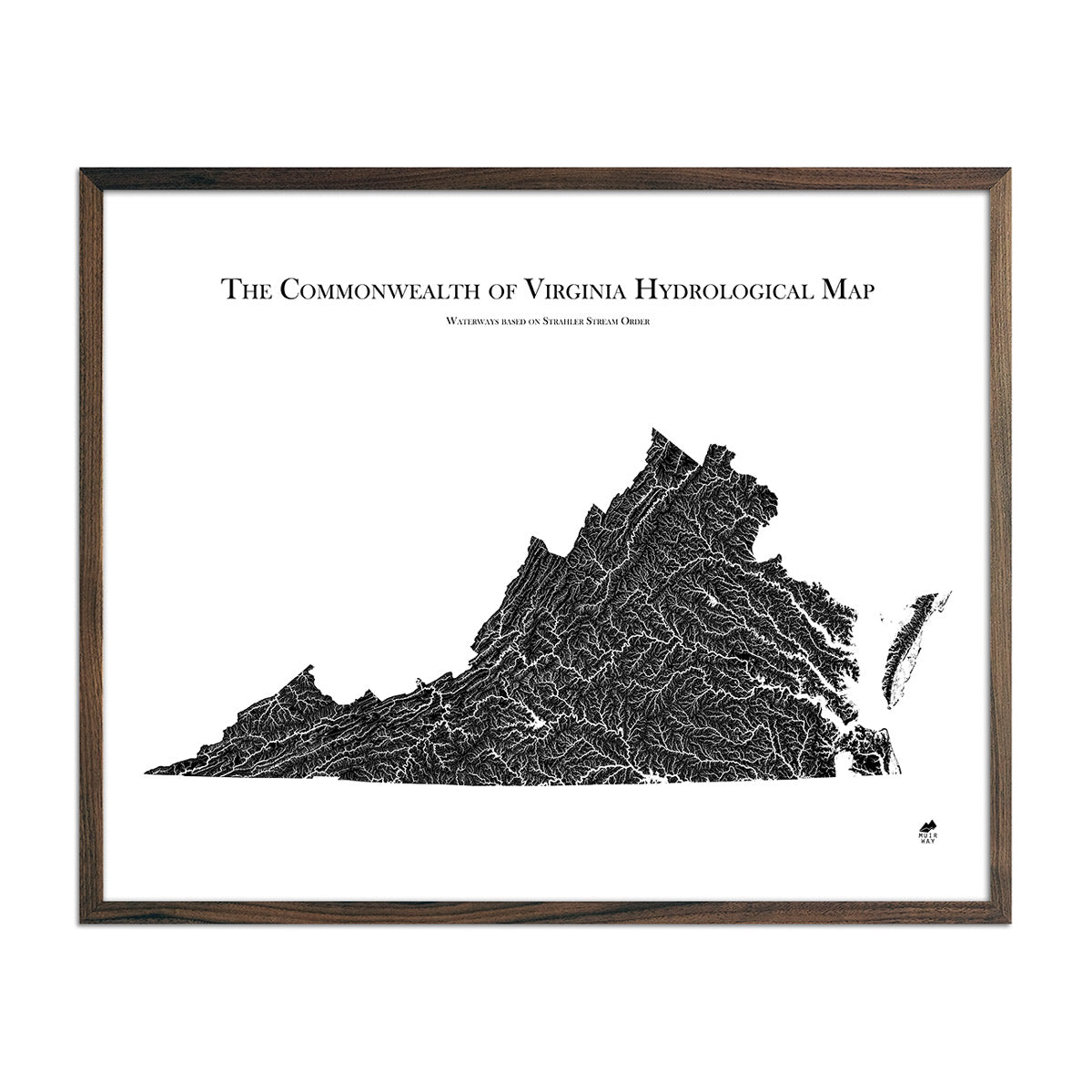
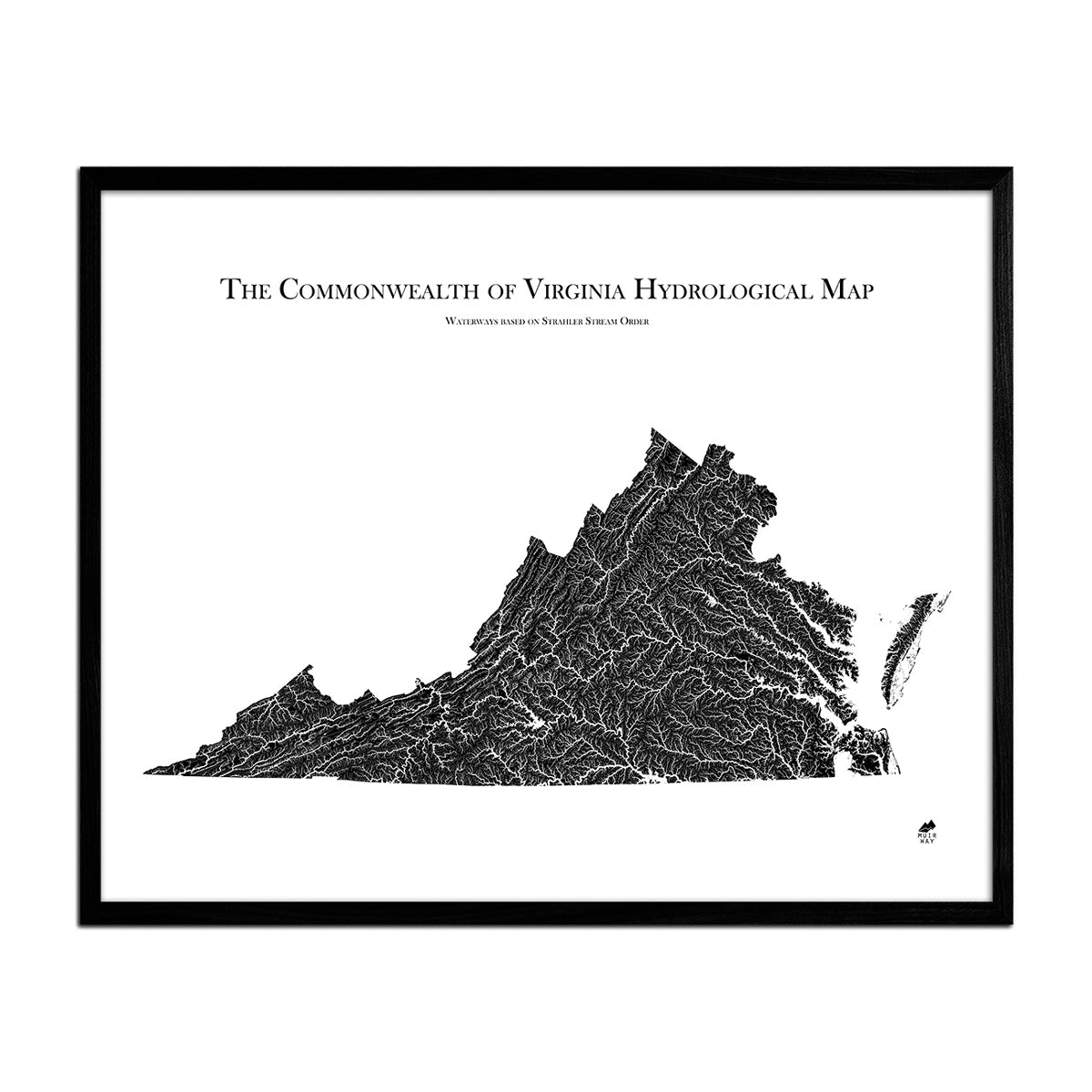
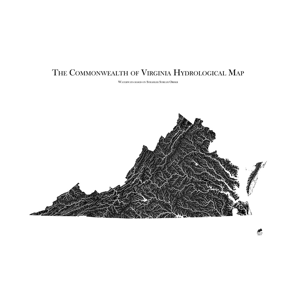
Virginia Hydrological Map
From
$ 79.00 USD
5.0 / 5.0
1655 reviews
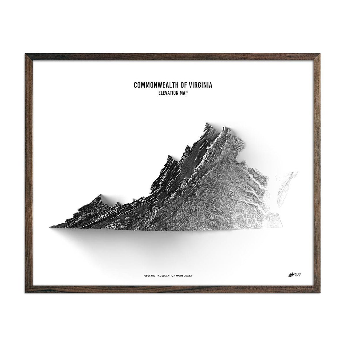
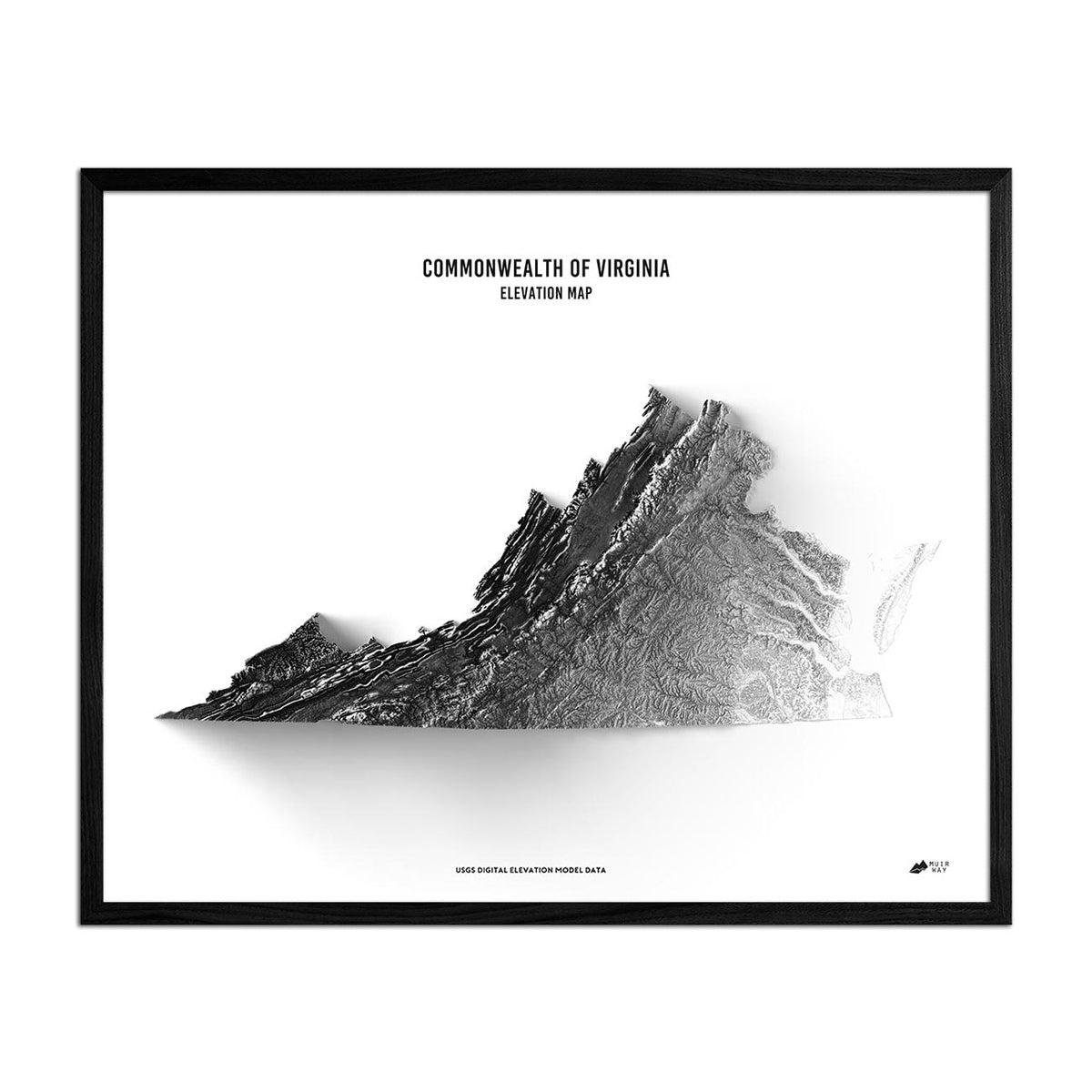
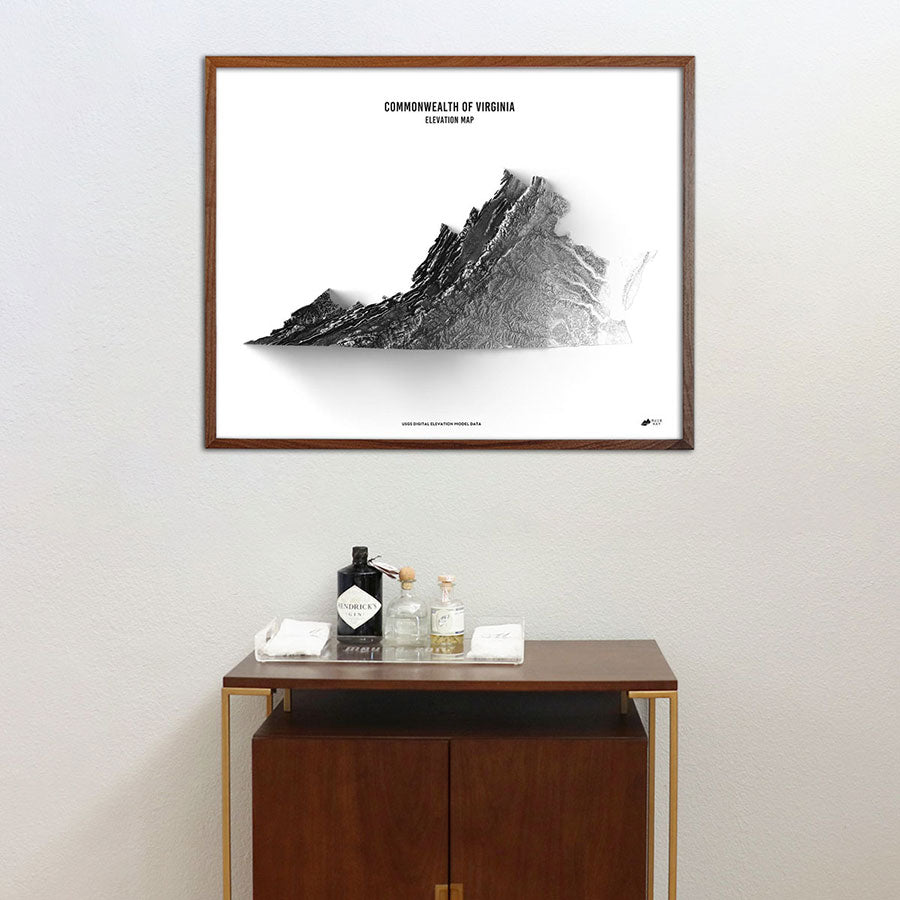
Virginia Elevation Map
From
$ 79.00 USD
4.9 / 5.0
264 reviews
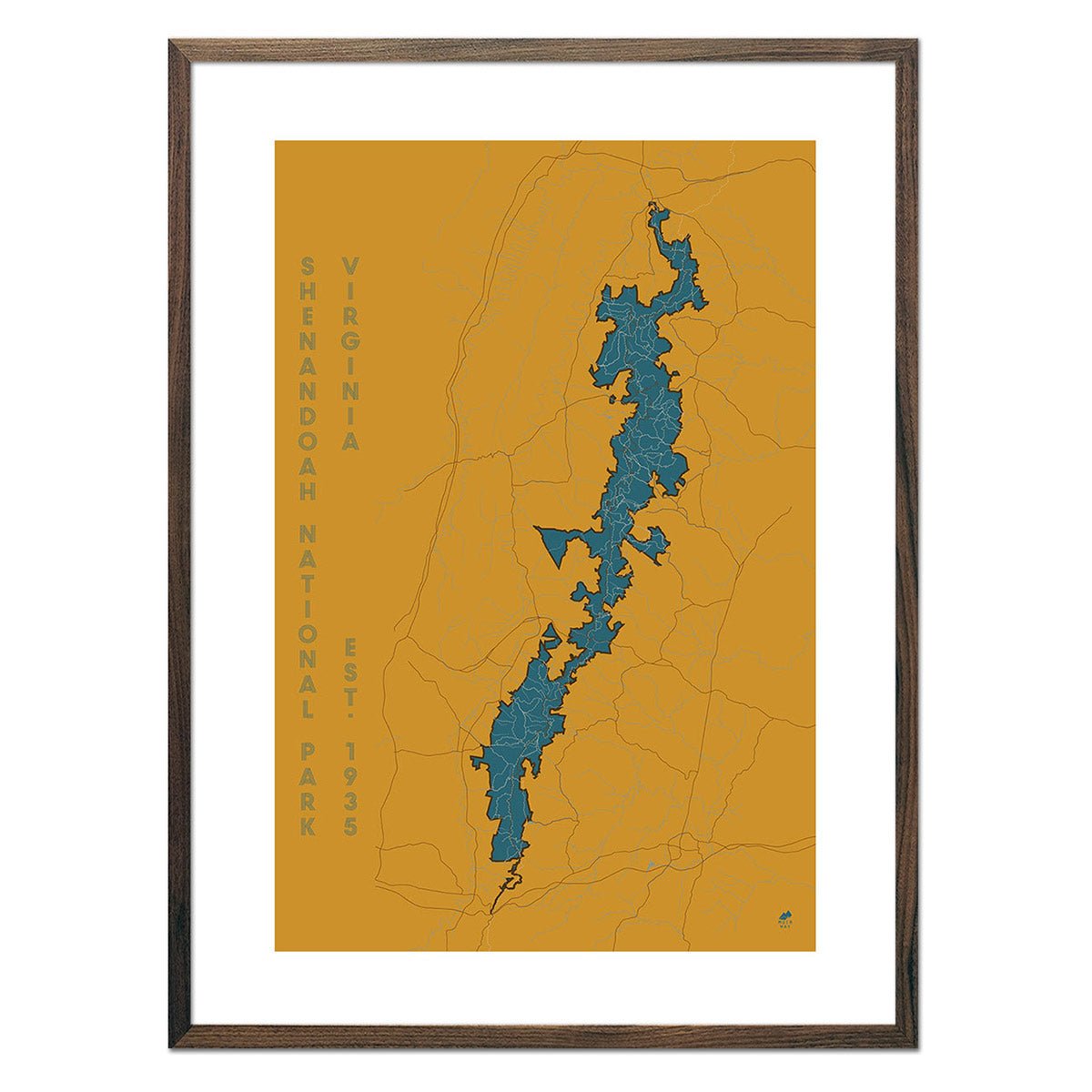
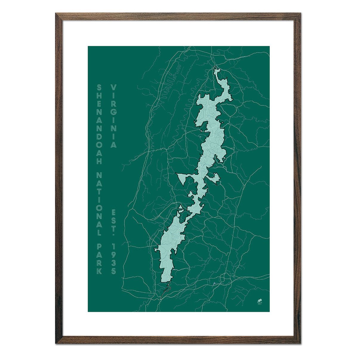
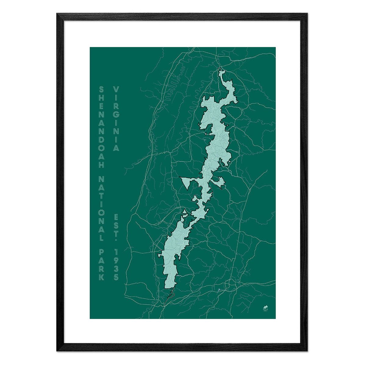
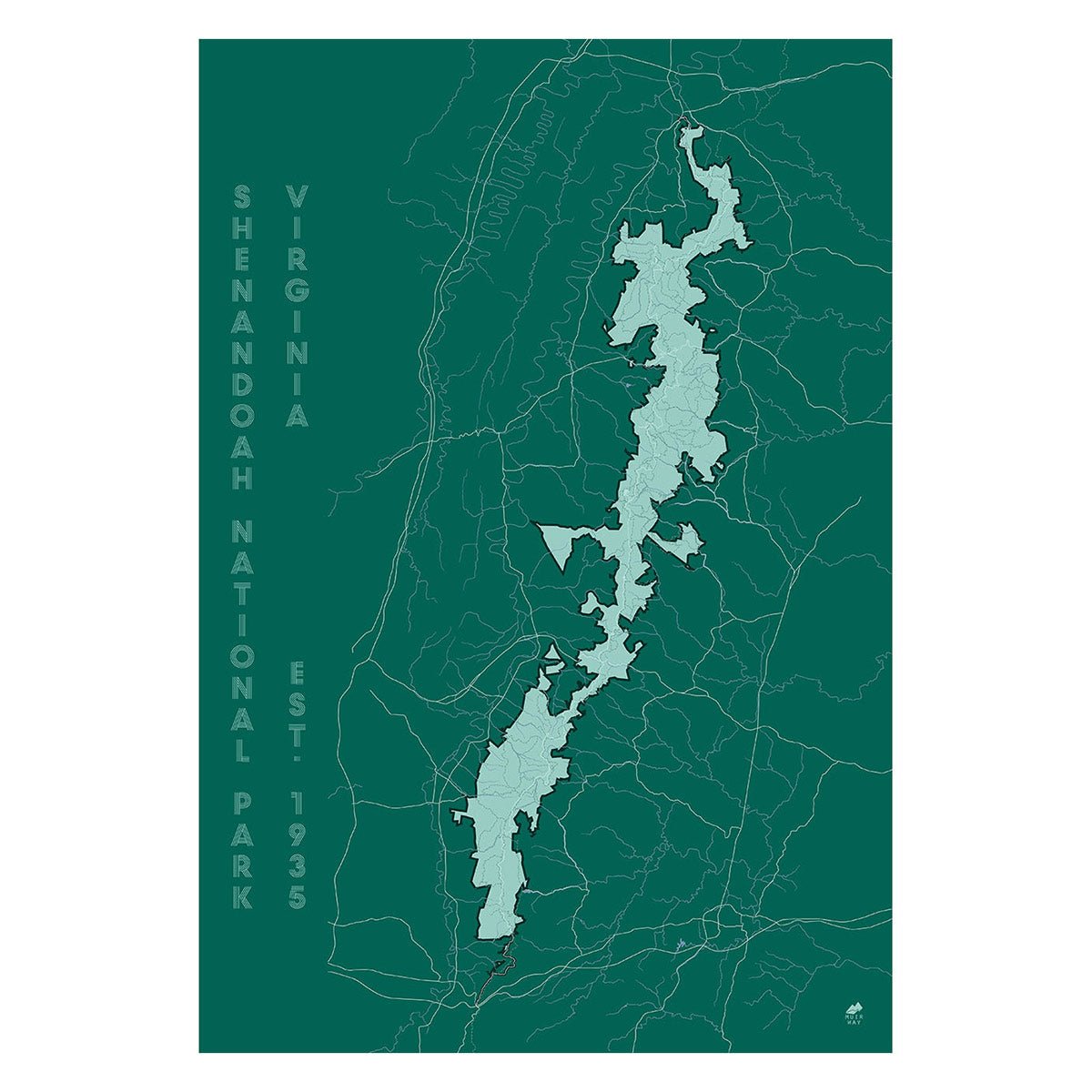
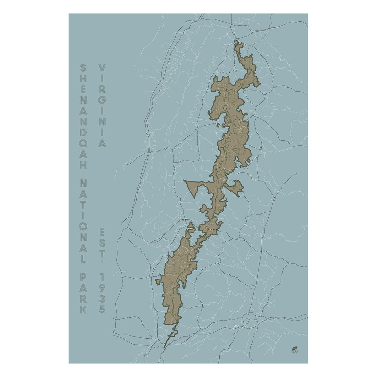
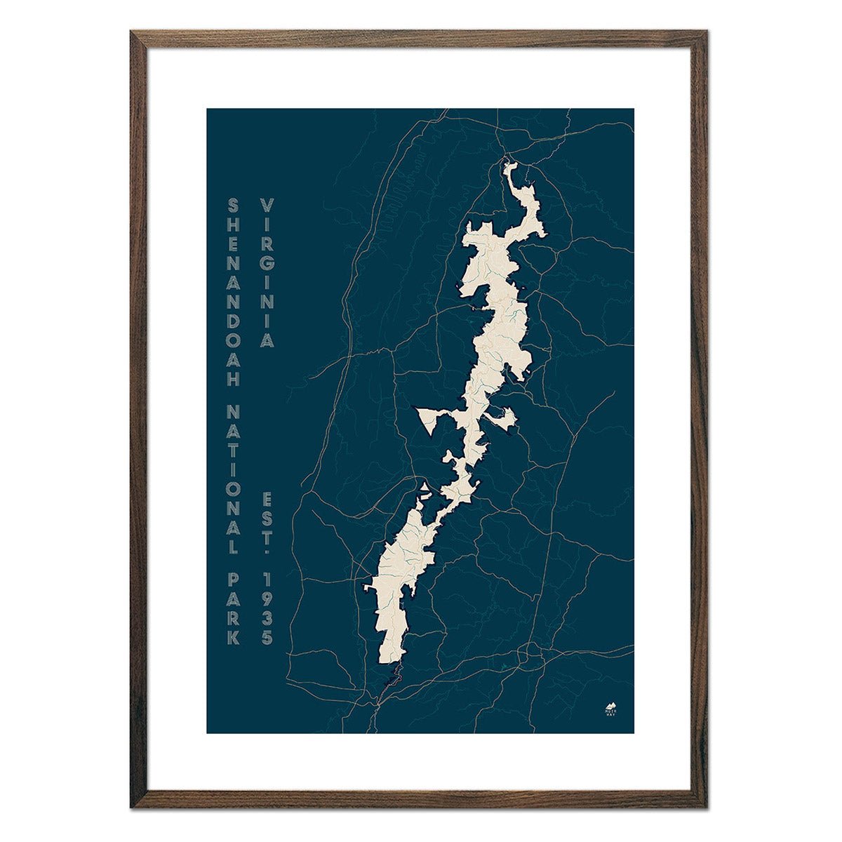
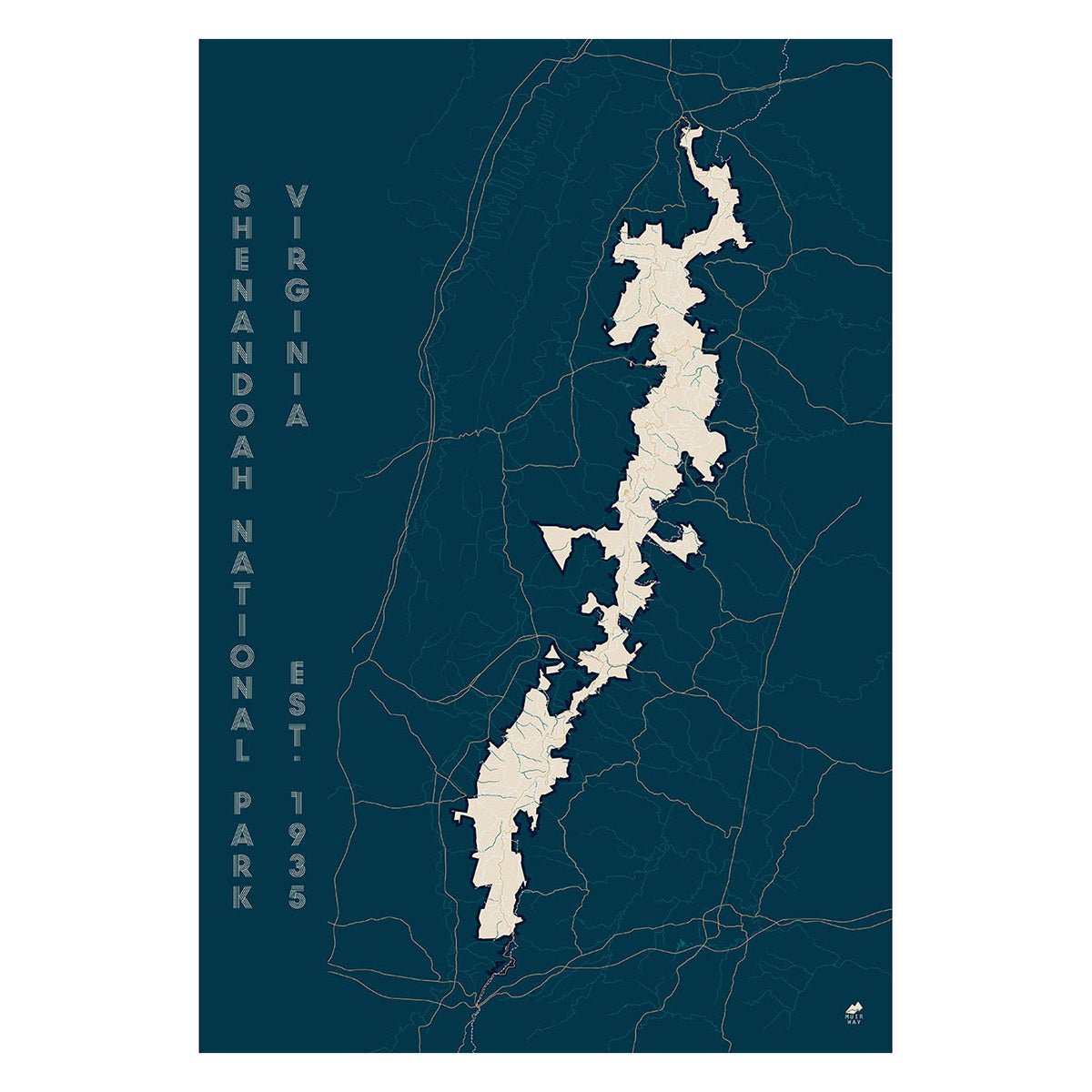
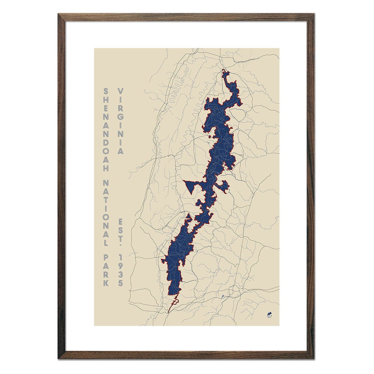
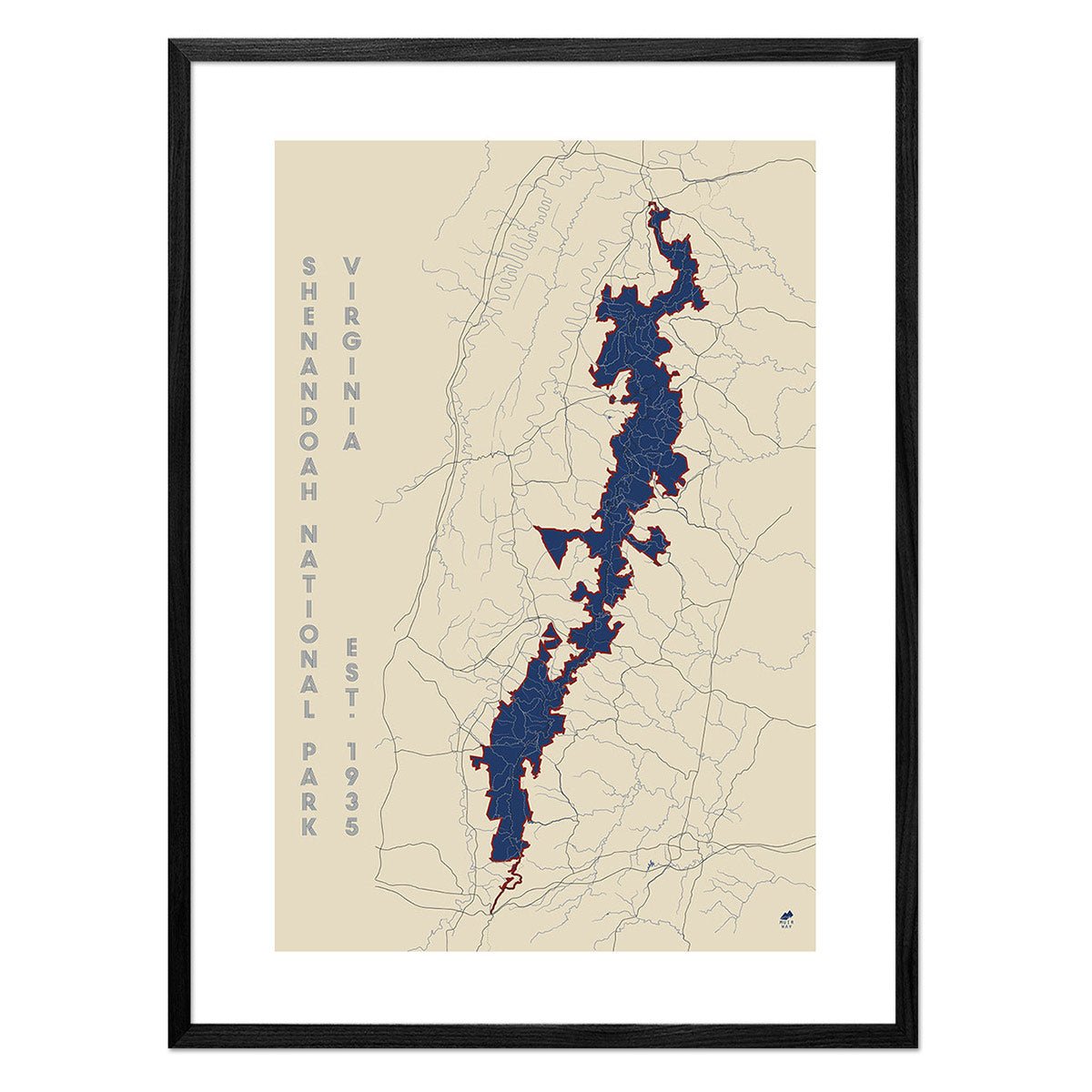
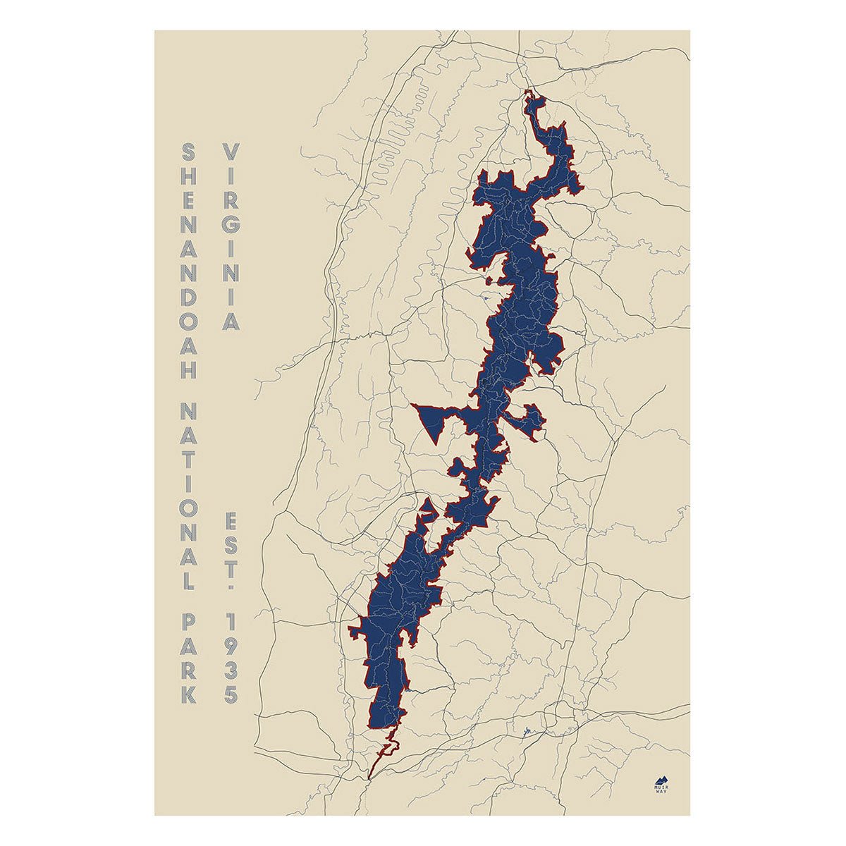
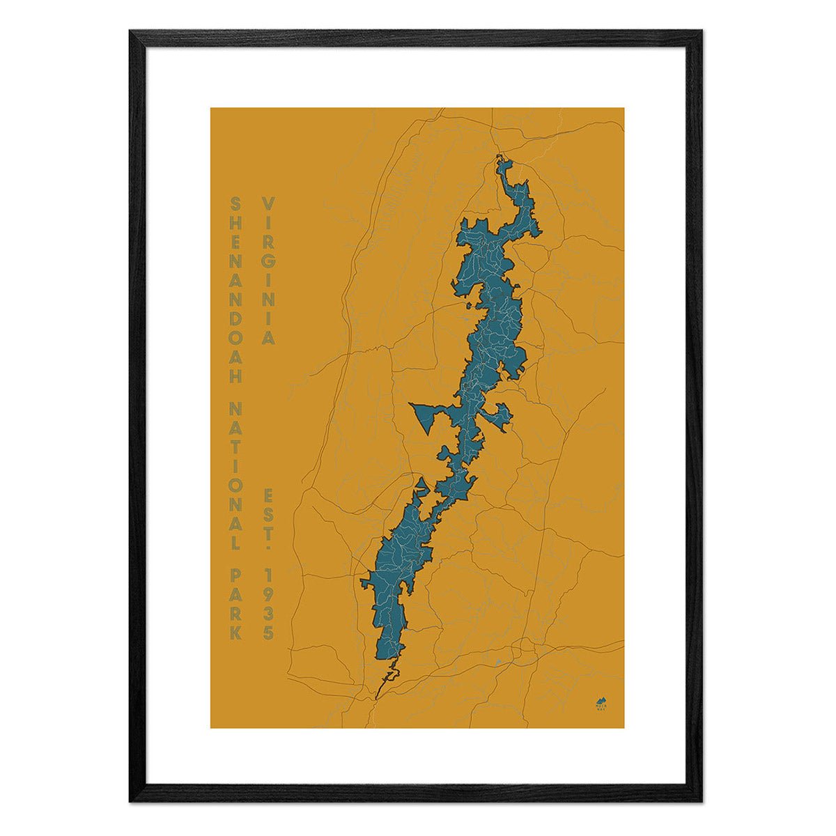
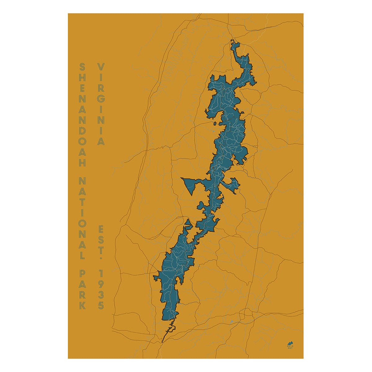
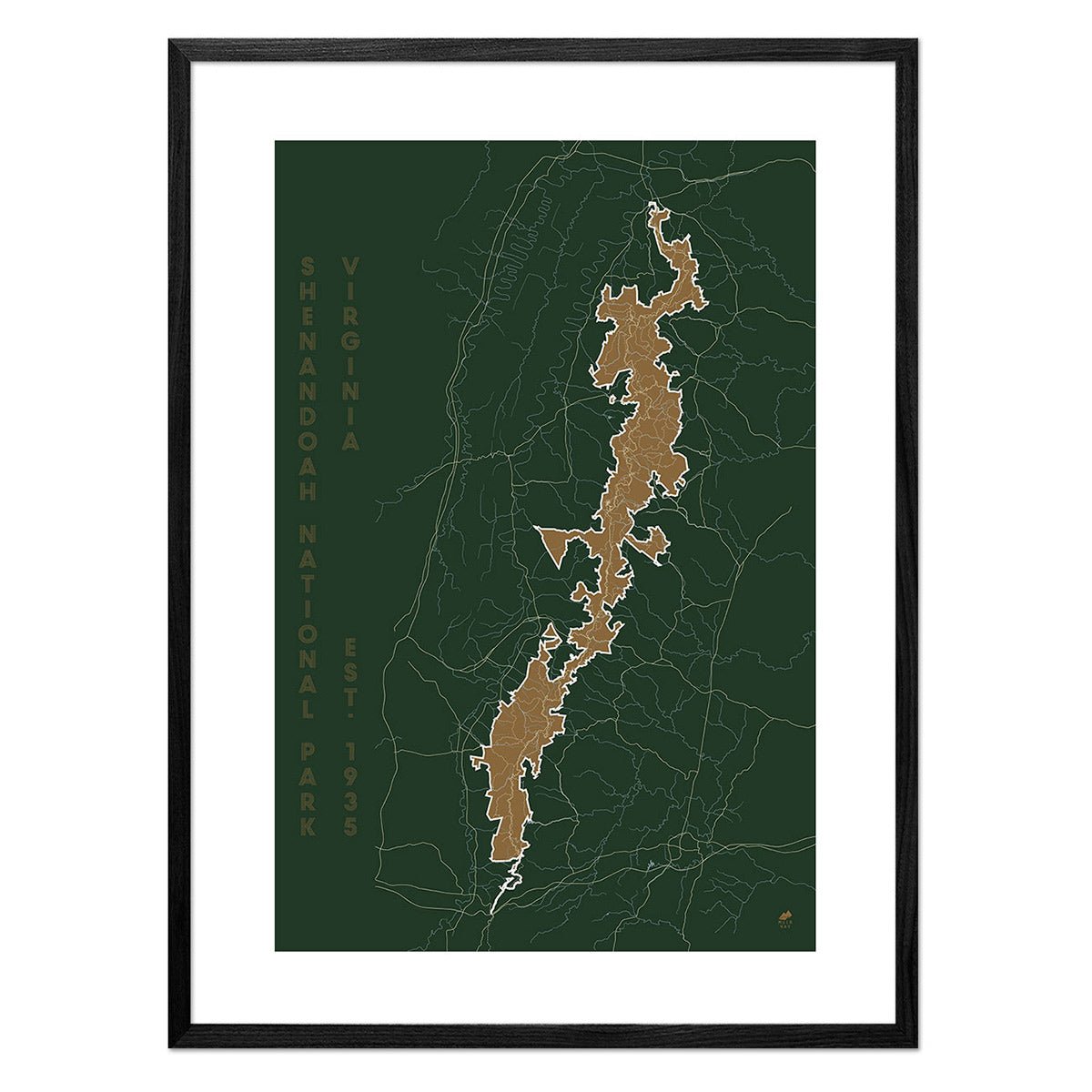
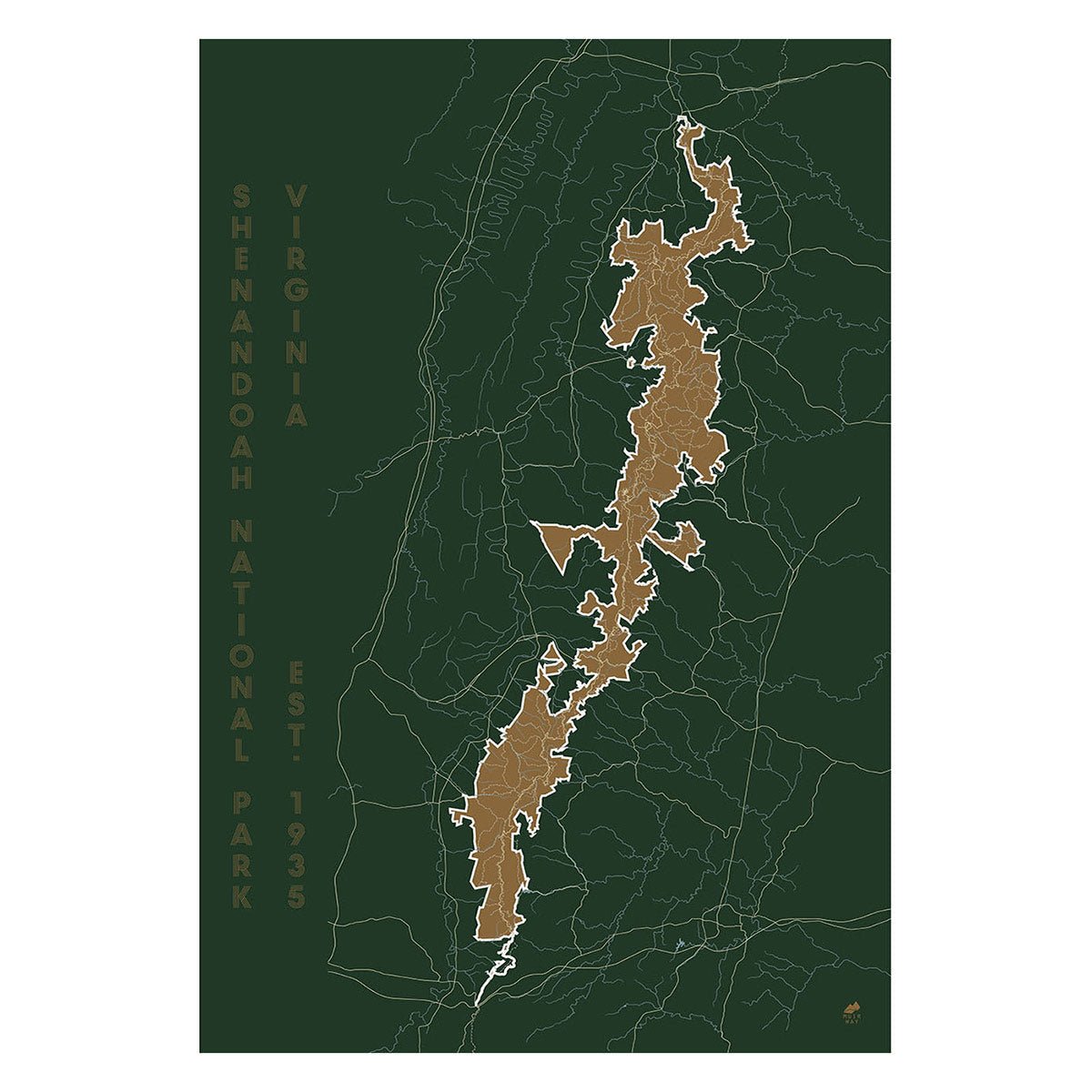
Shenandoah National Park Map
From
$ 49.00 USD
5.0 / 5.0
287 reviews
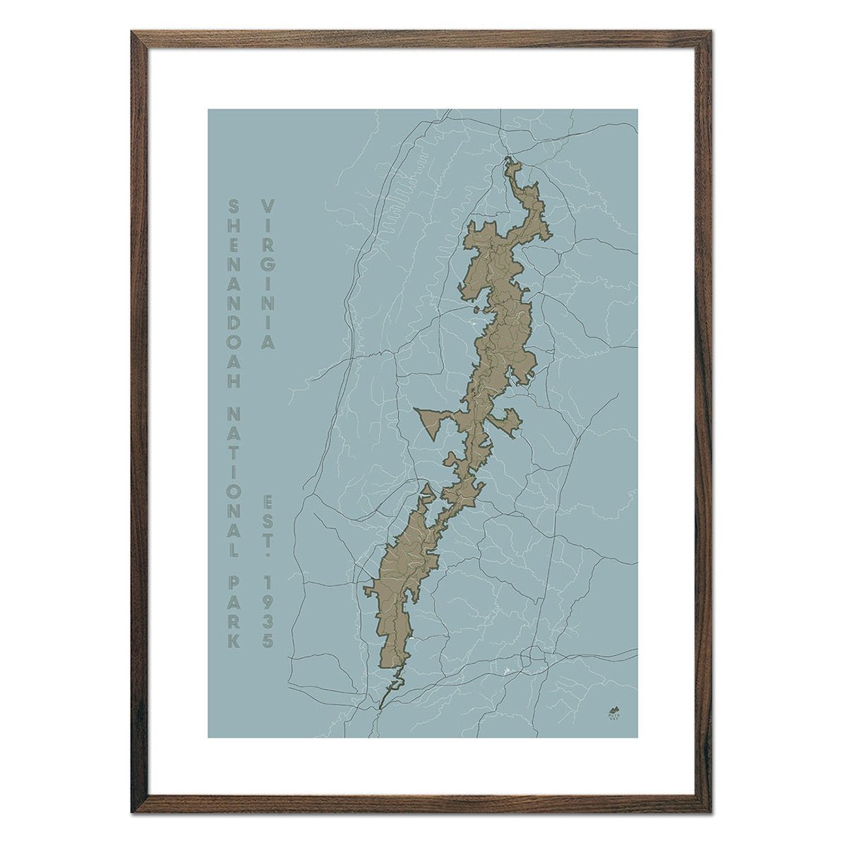
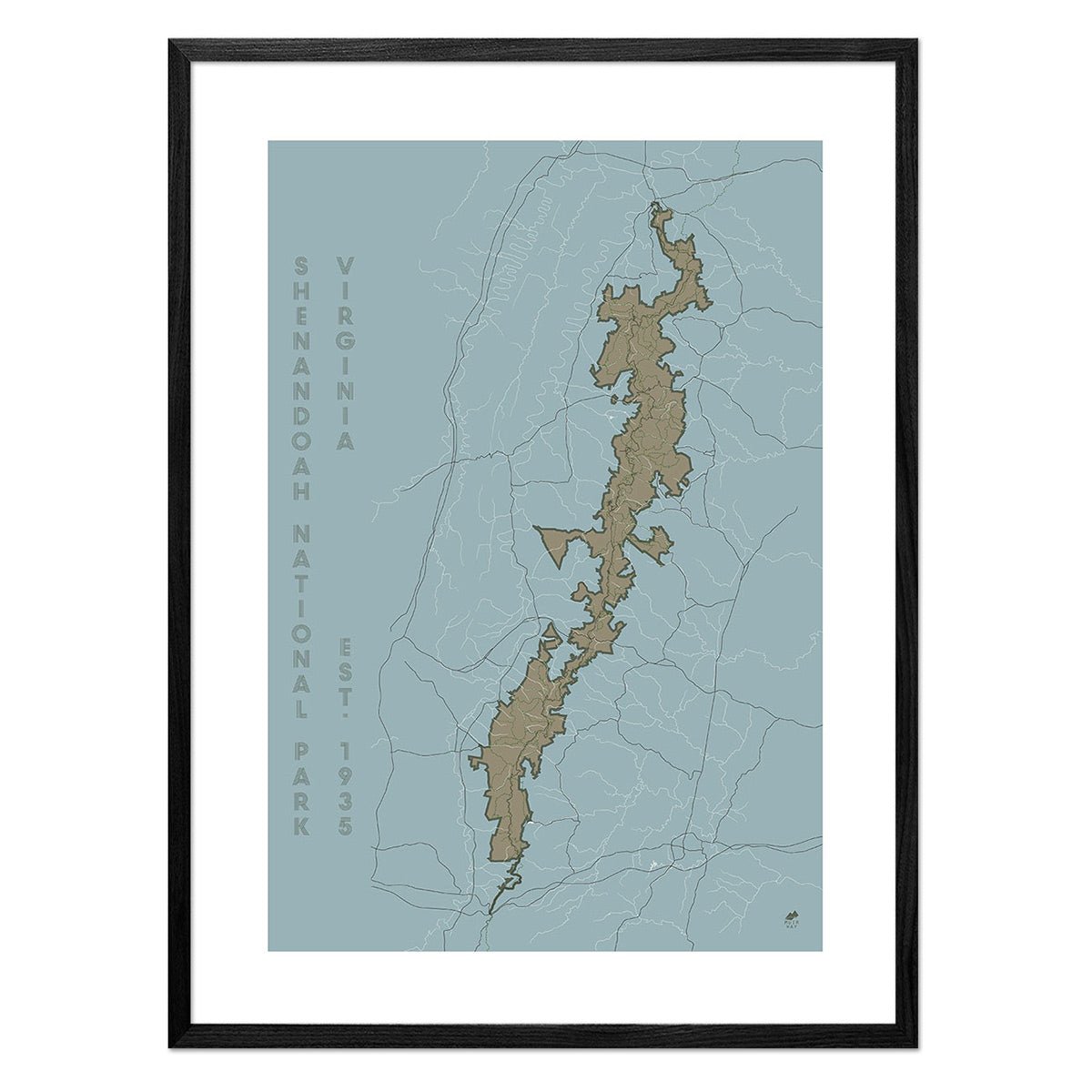
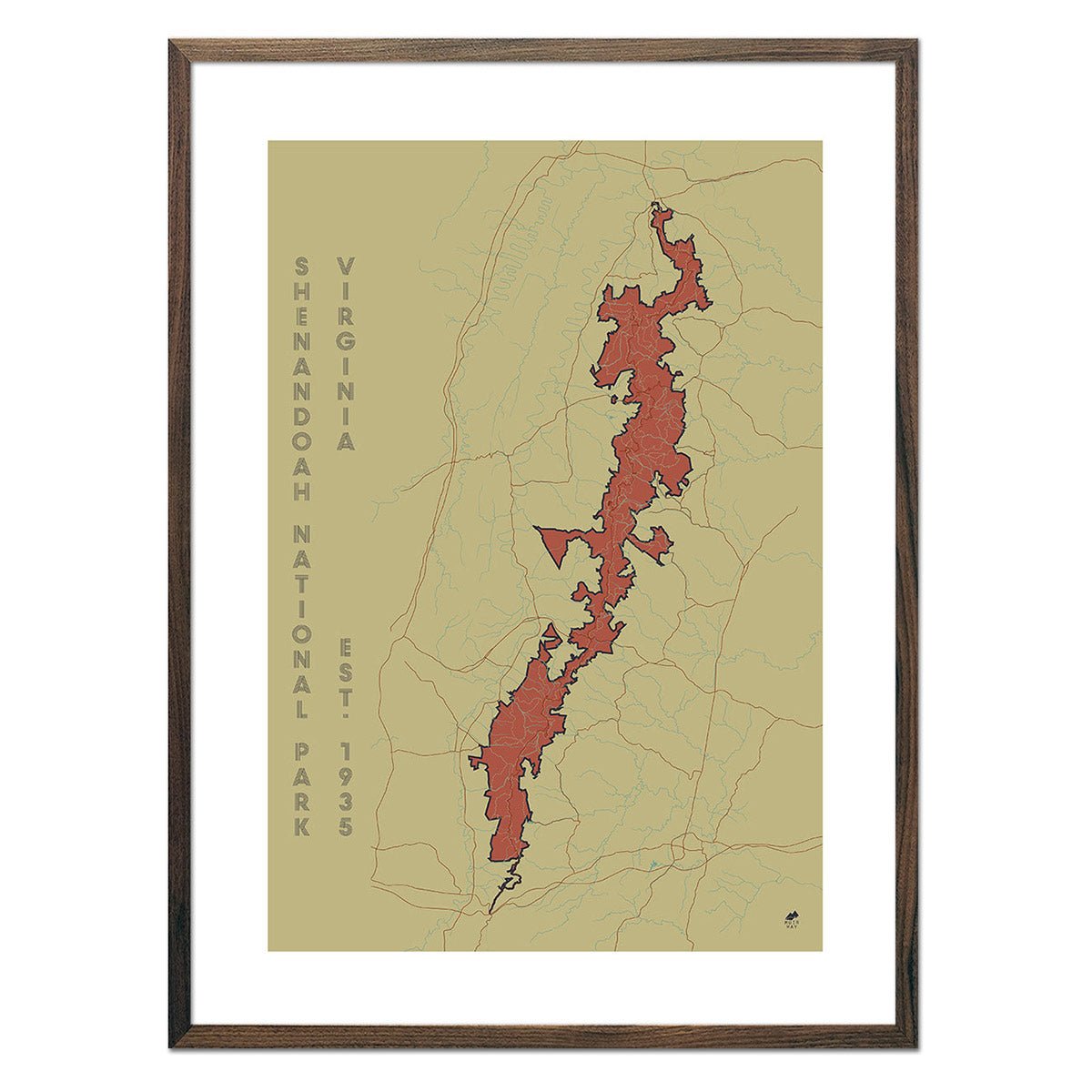
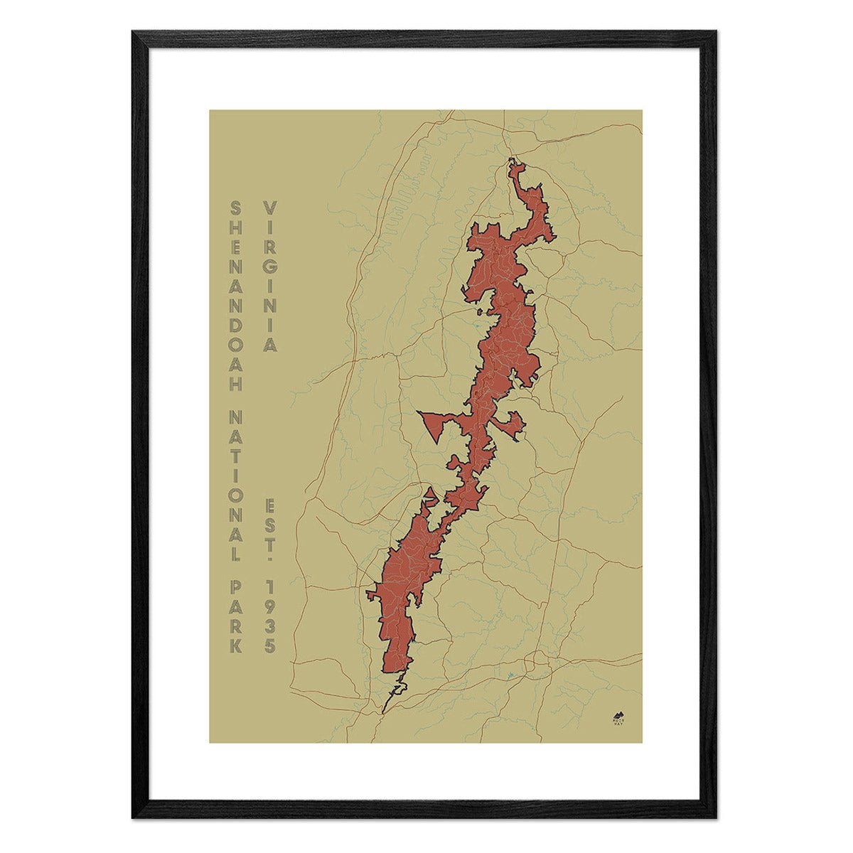
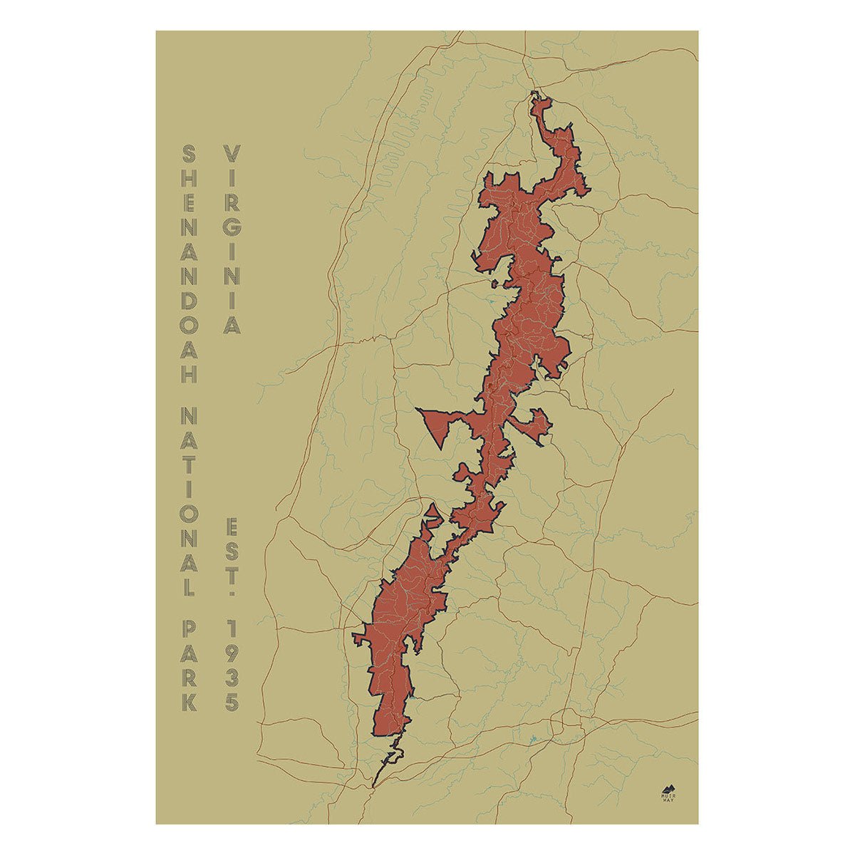
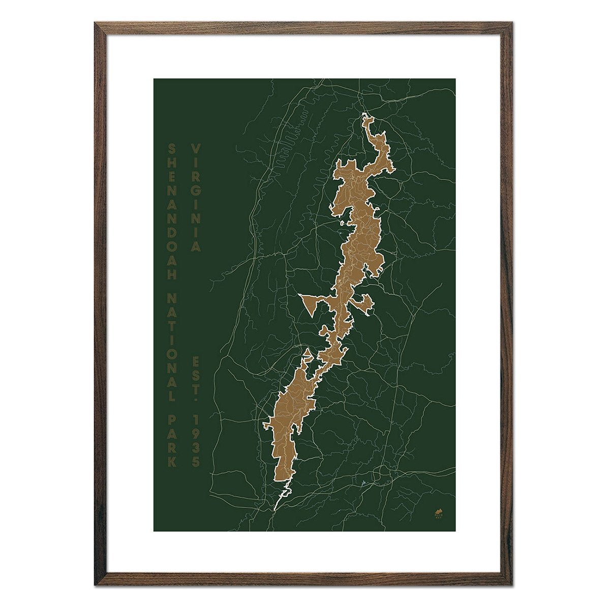
Shenandoah Shaded Relief Map
From
$ 79.00 USD
5.0 / 5.0
3 reviews
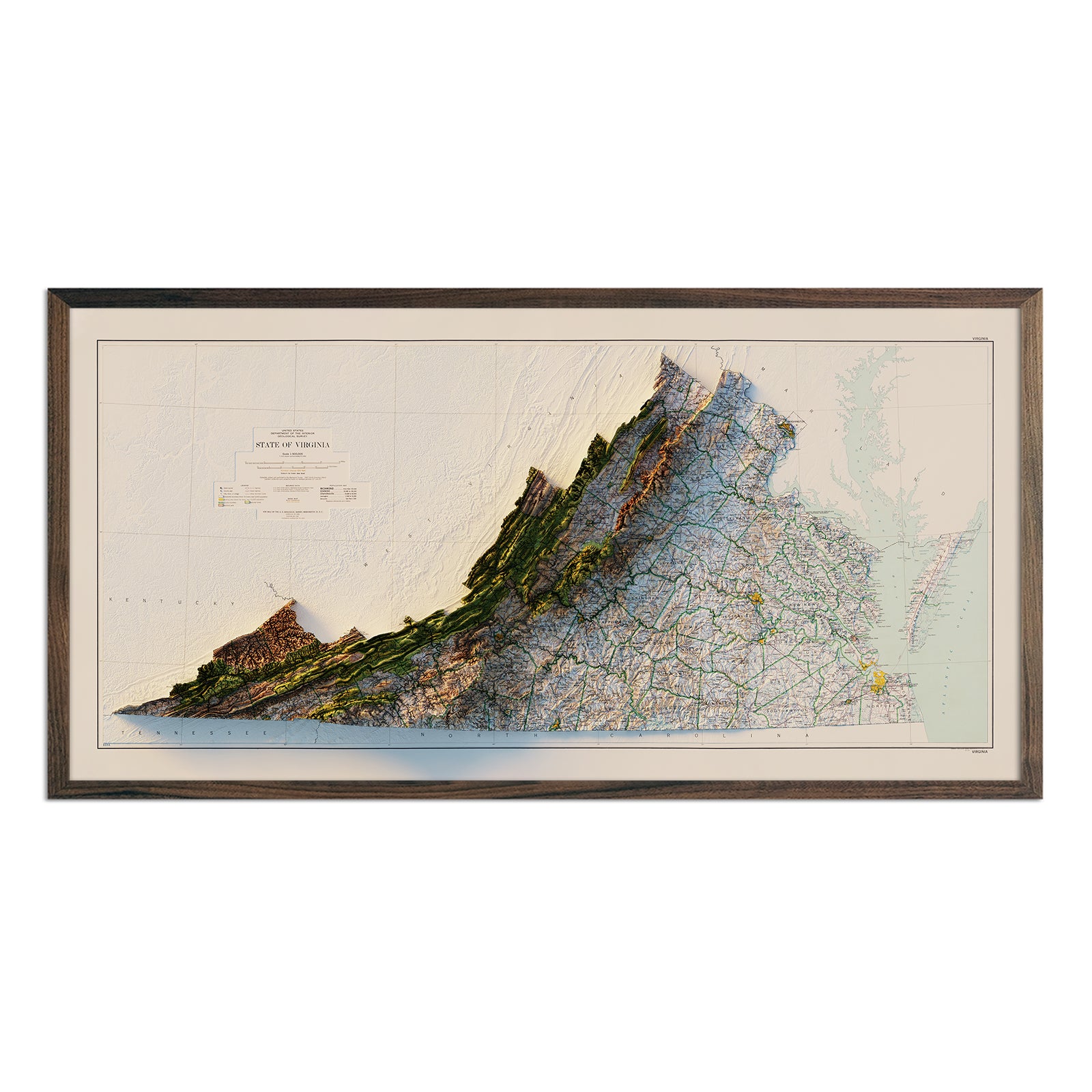
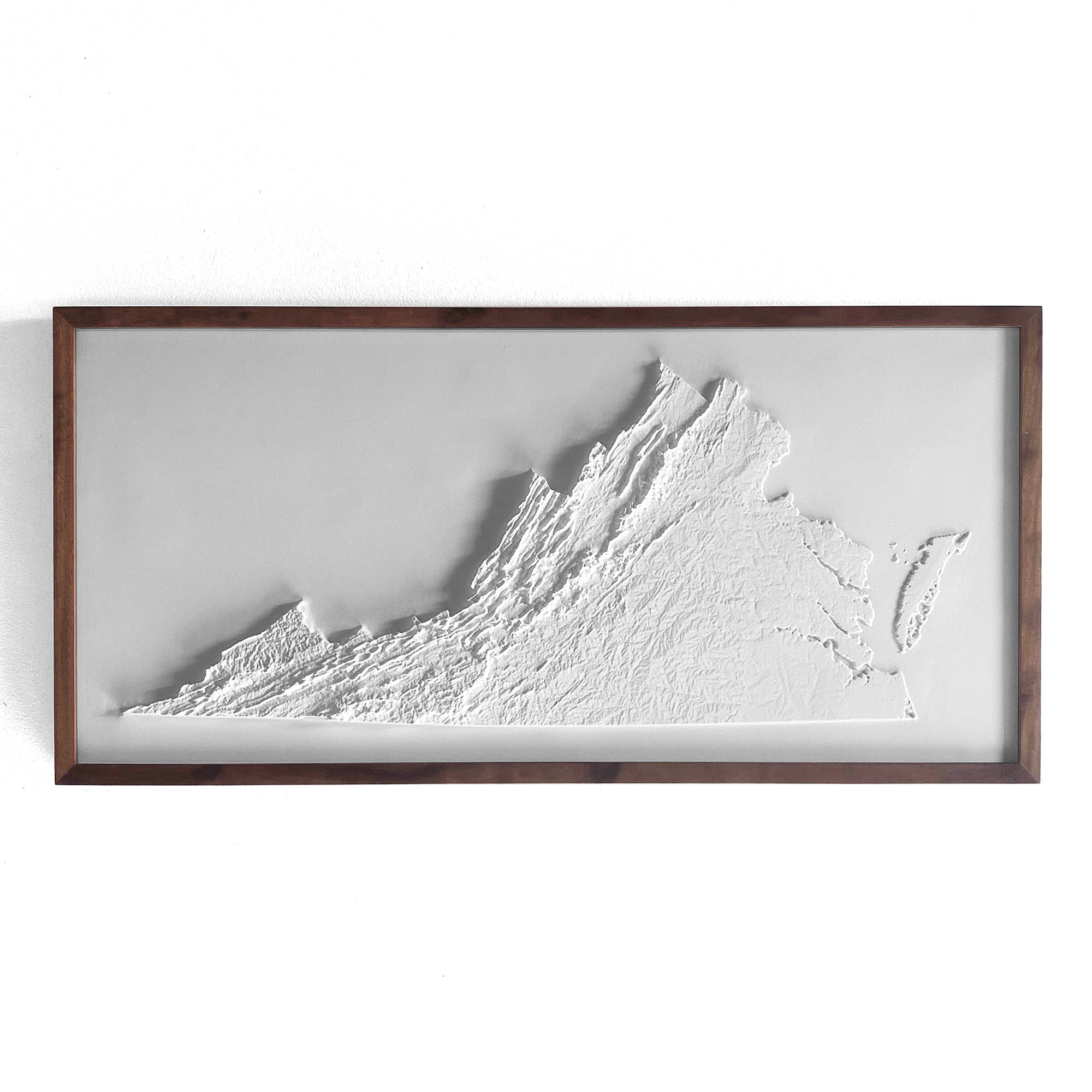
Virginia 3D Raised Relief Map
From
$ 149.00 USD
4.8 / 5.0
4 reviews
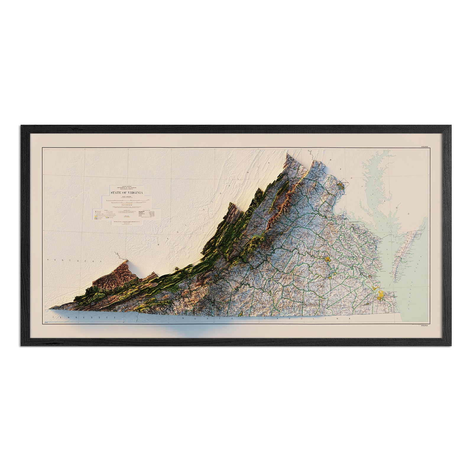
Virginia 1979 3D Raised Relief Map
From
$ 170.00 USD
5.0 / 5.0
5 reviews
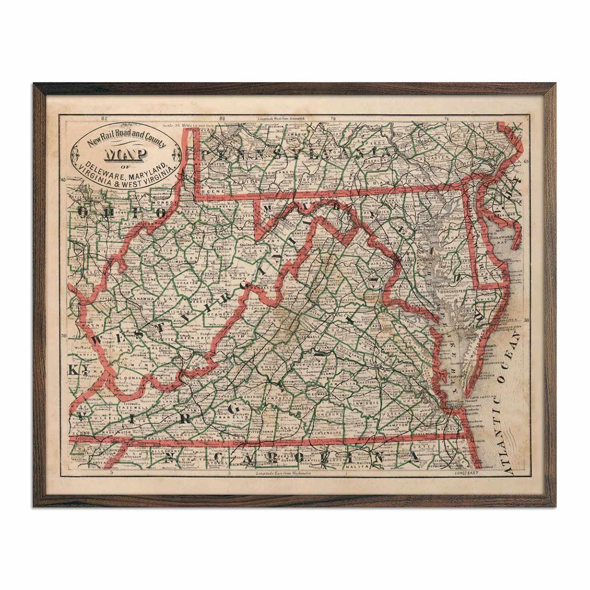
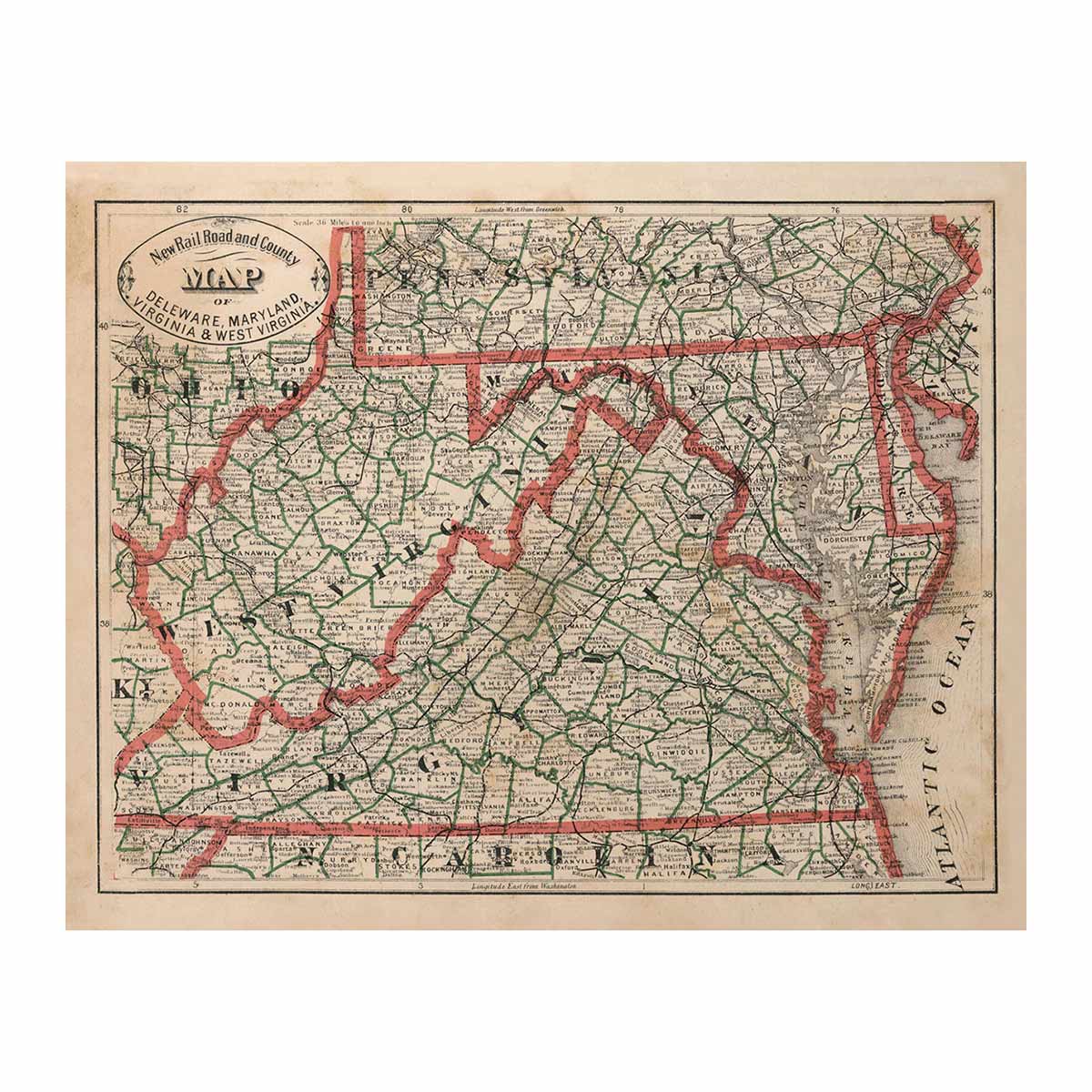
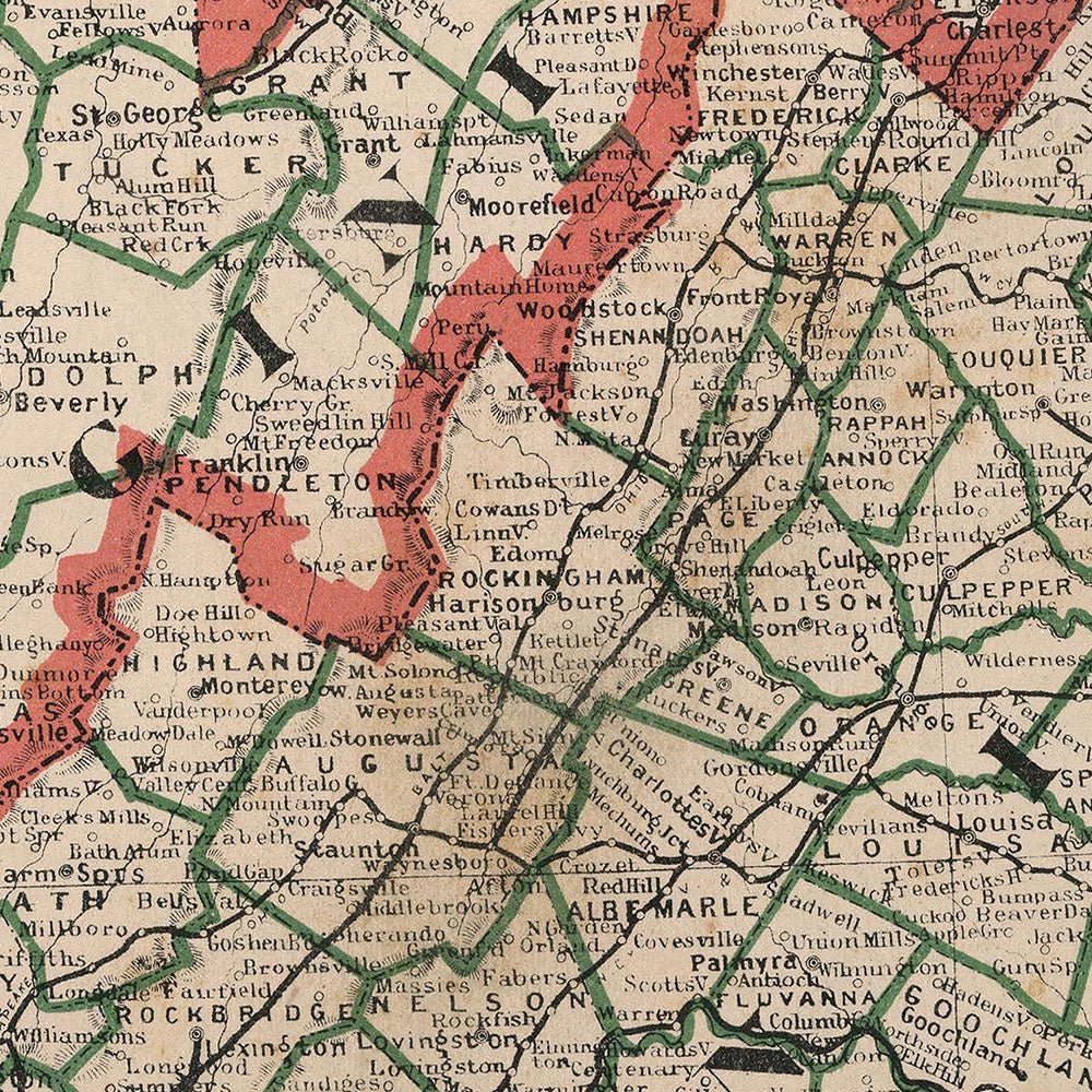
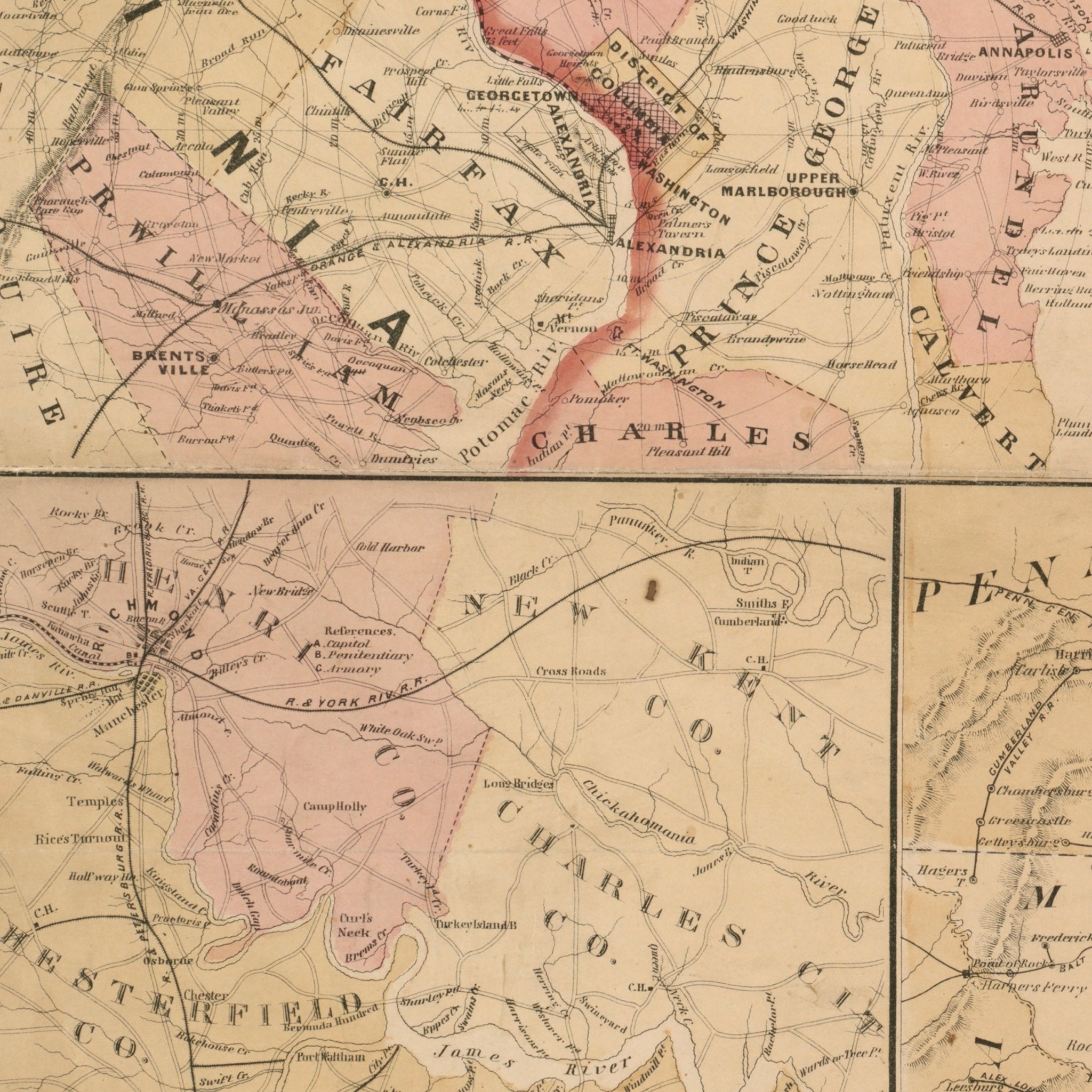
Delaware, Maryland, Virginia and West Virginia 1883 Map
From
$ 64.00 USD
5.0 / 5.0
2 reviews
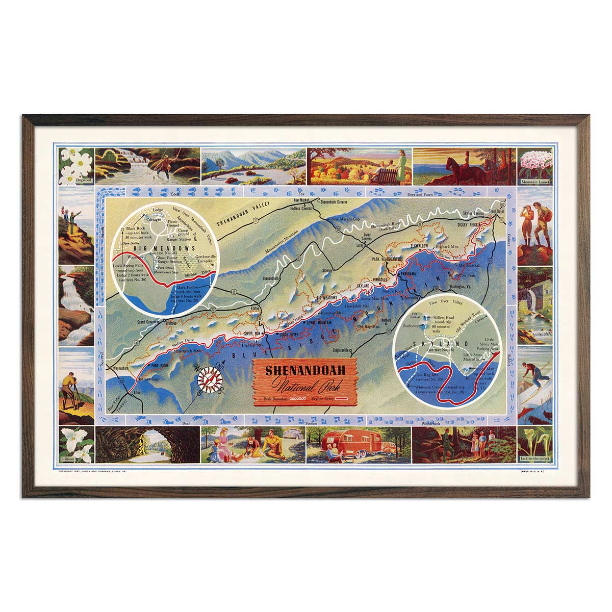
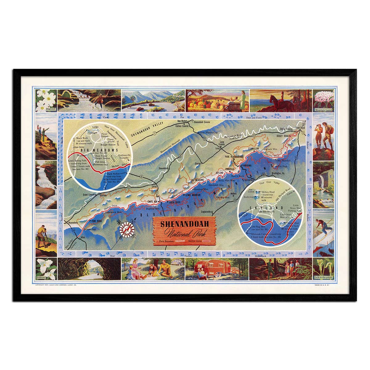
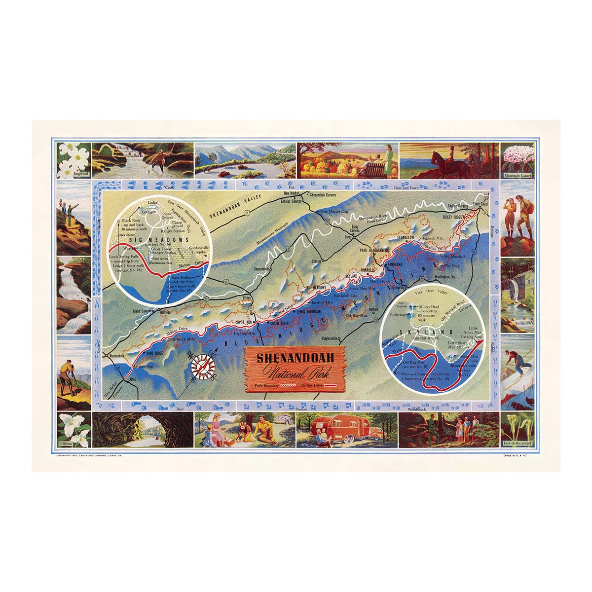
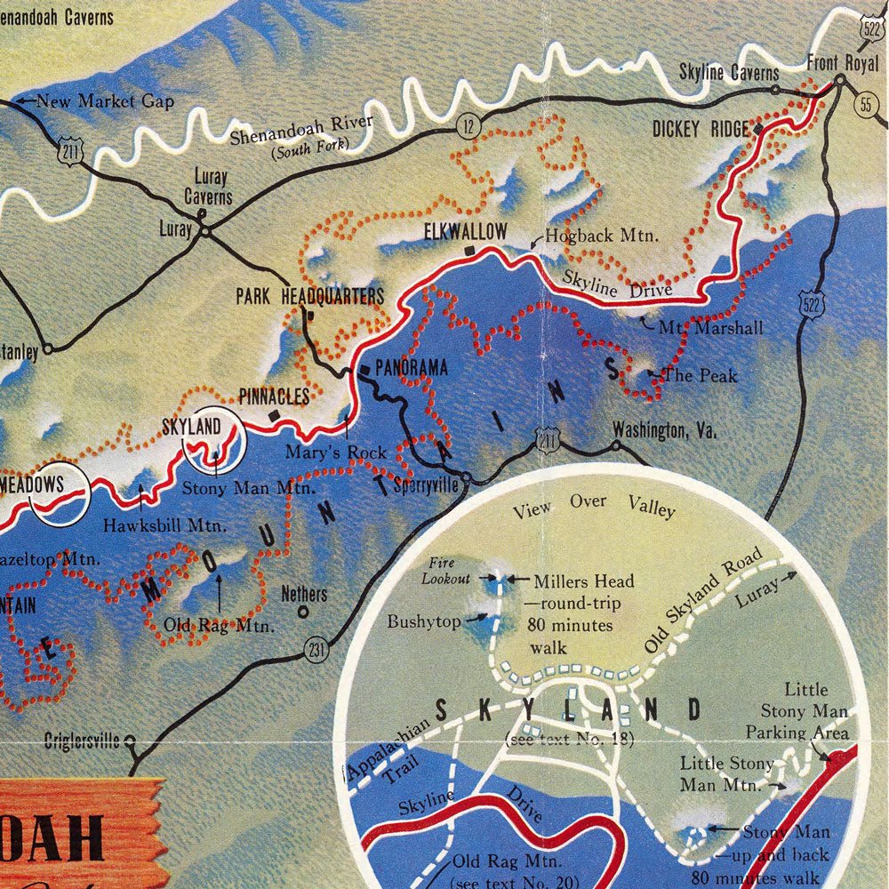
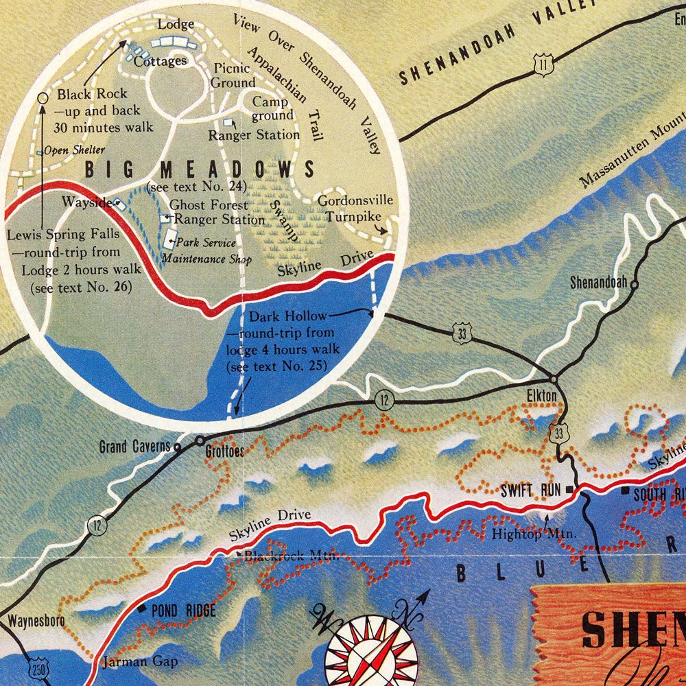
Shenandoah National Park Map 1947
From
$ 69.00 USD
5.0 / 5.0
107 reviews
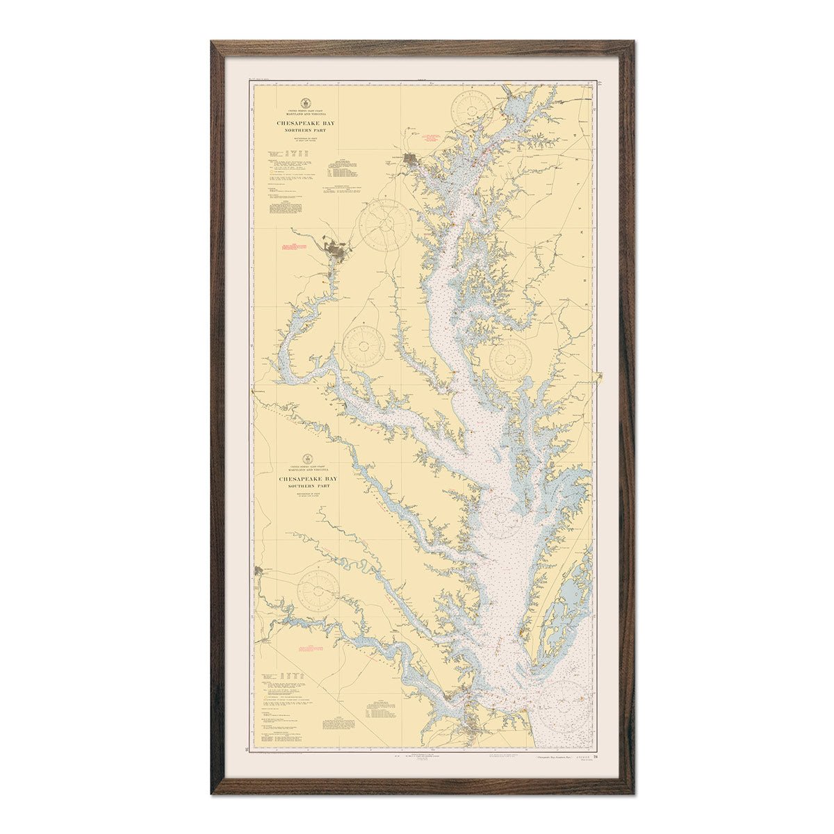
Chesapeake Bay Nautical Chart 1940
From
$ 99.00 USD
5.0 / 5.0
1 review
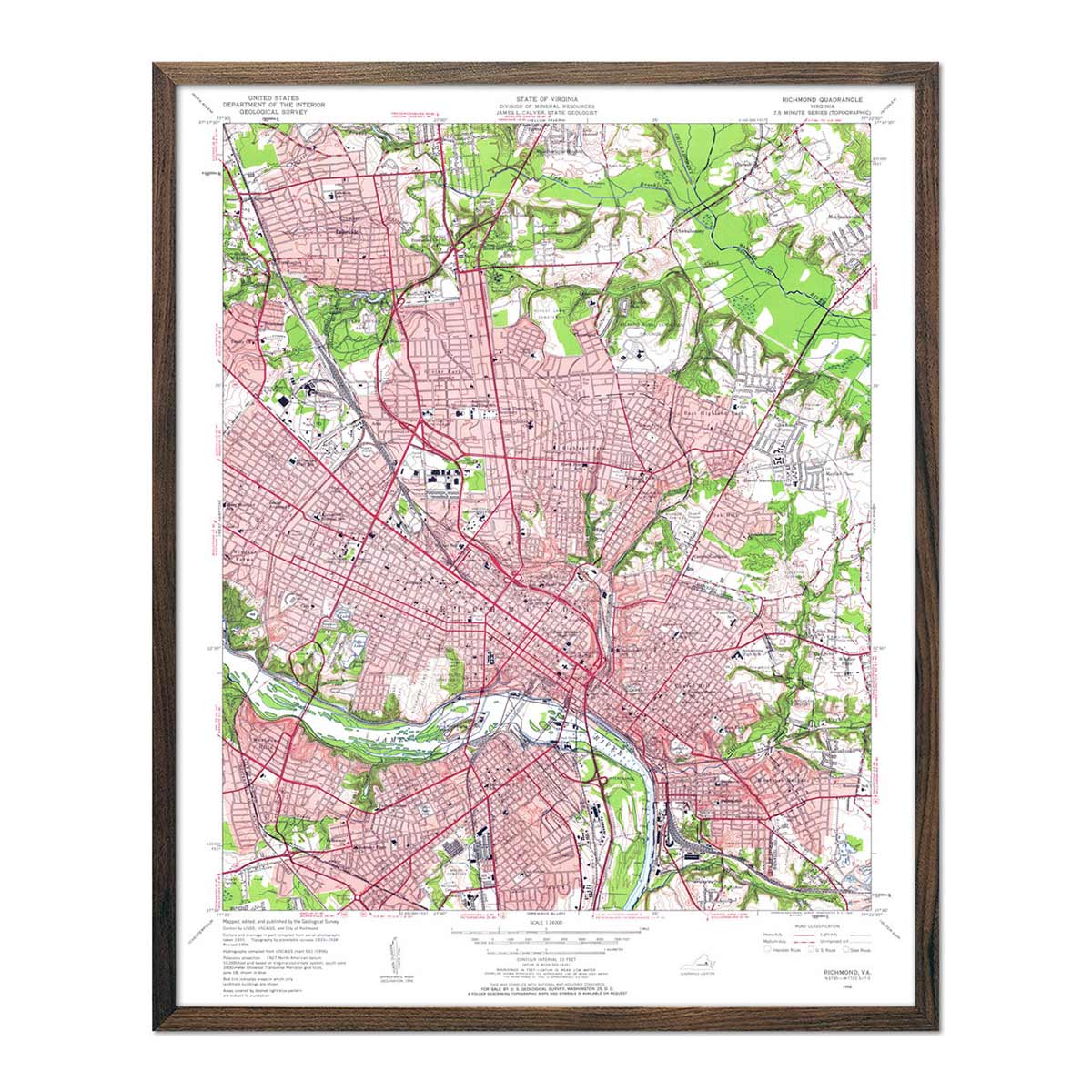
Richmond, VA 1956 USGS Map
From
$ 64.00 USD
4.9 / 5.0
144 reviews
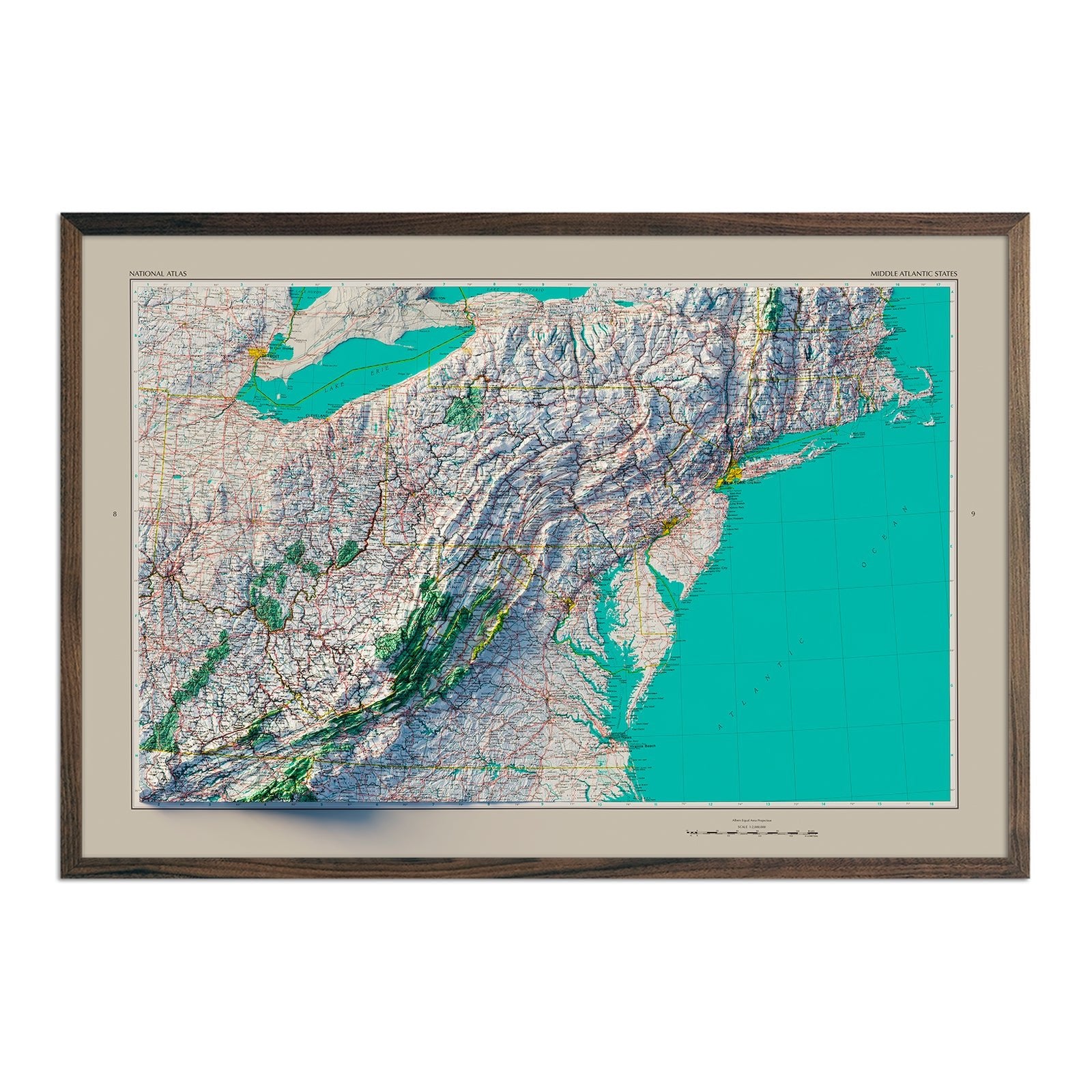
Middle Atlantic States 1970 Shaded Relief Map
From
$ 79.00 USD
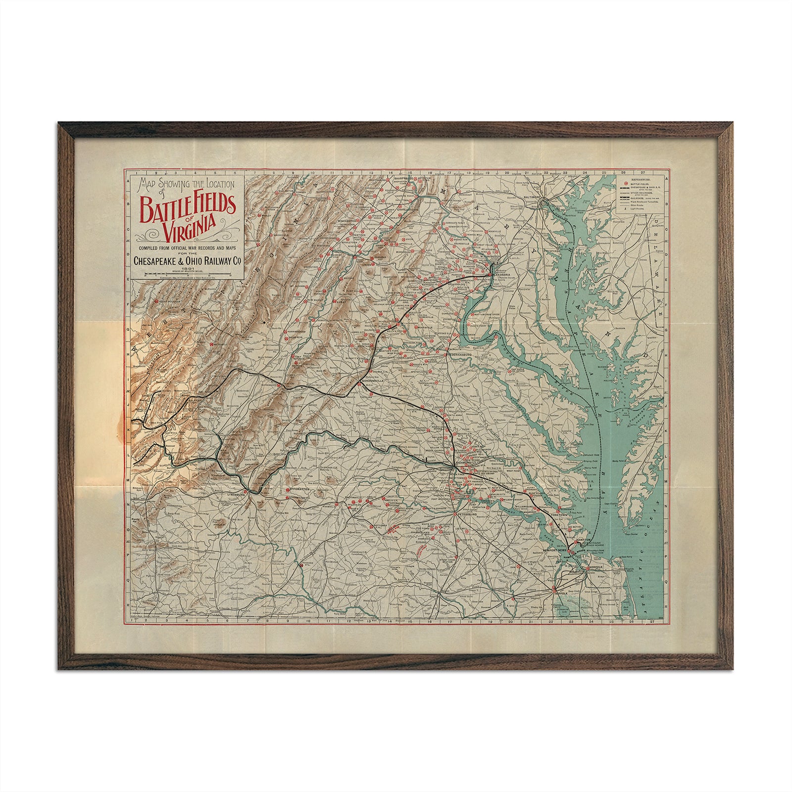
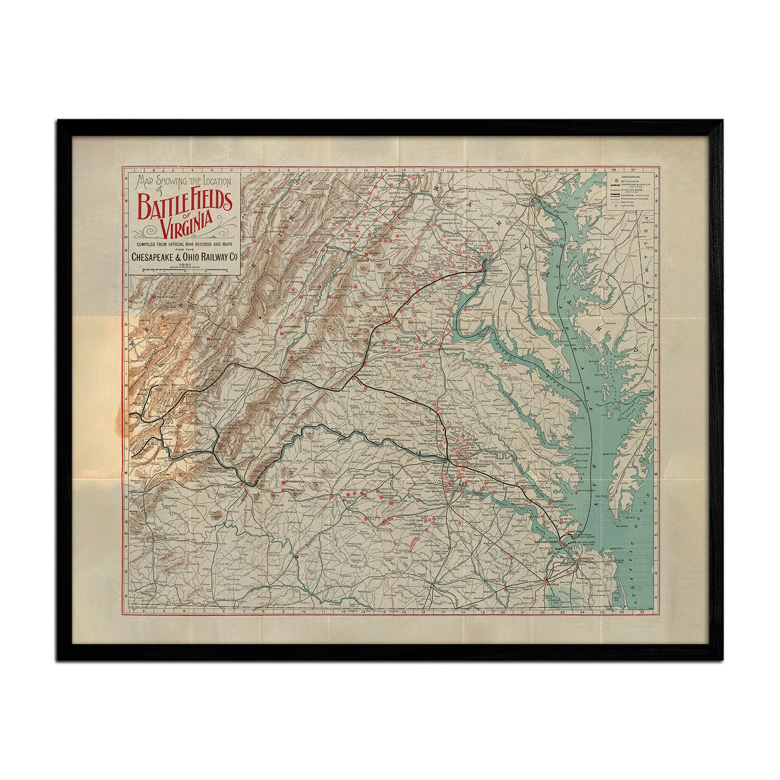
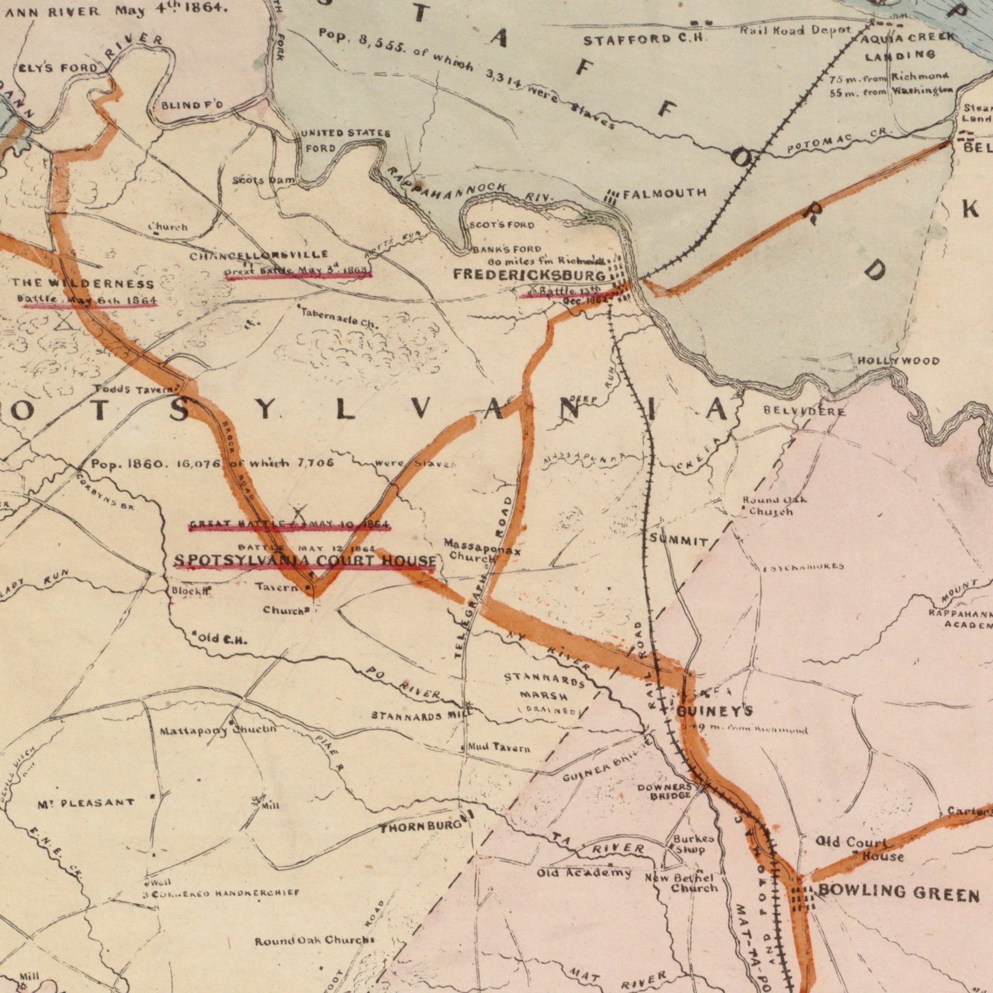
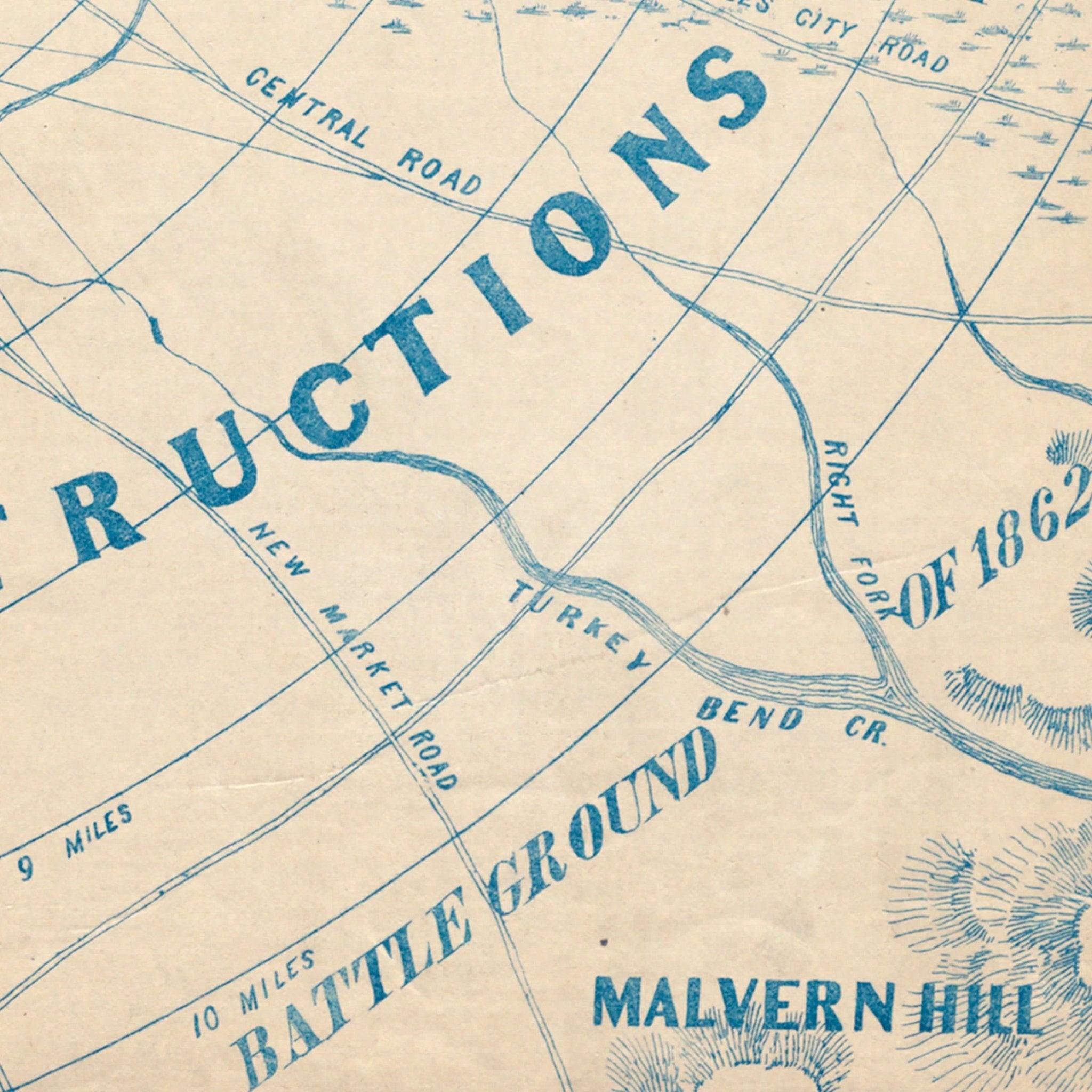
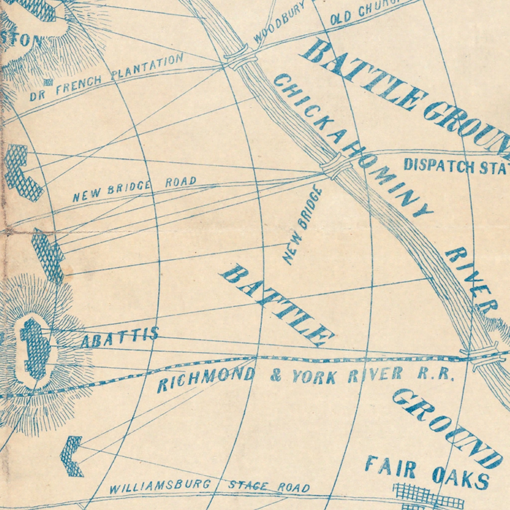
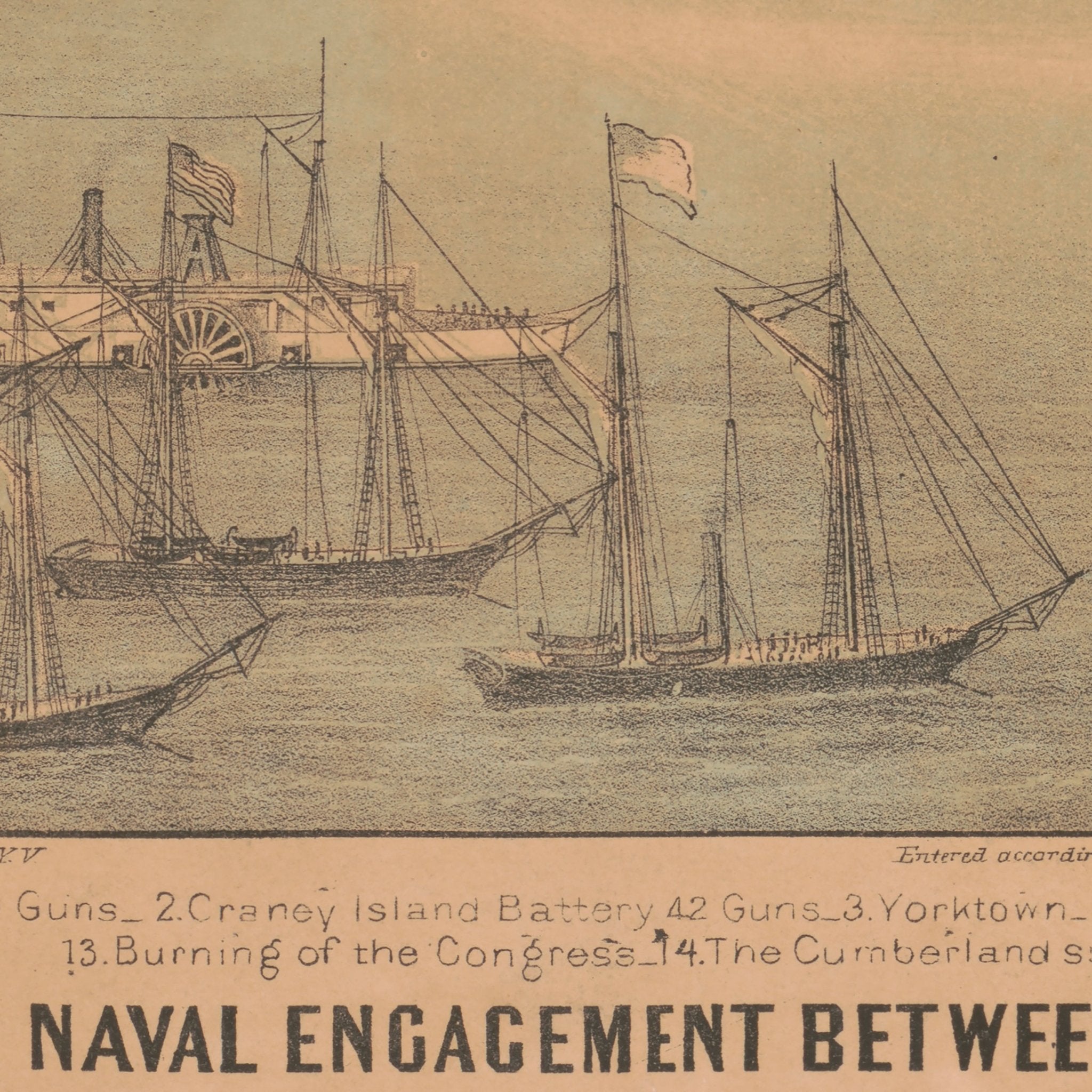
Map of the Civil War Battle Fields of Virginia
From
$ 64.00 USD
5.0 / 5.0
1 review
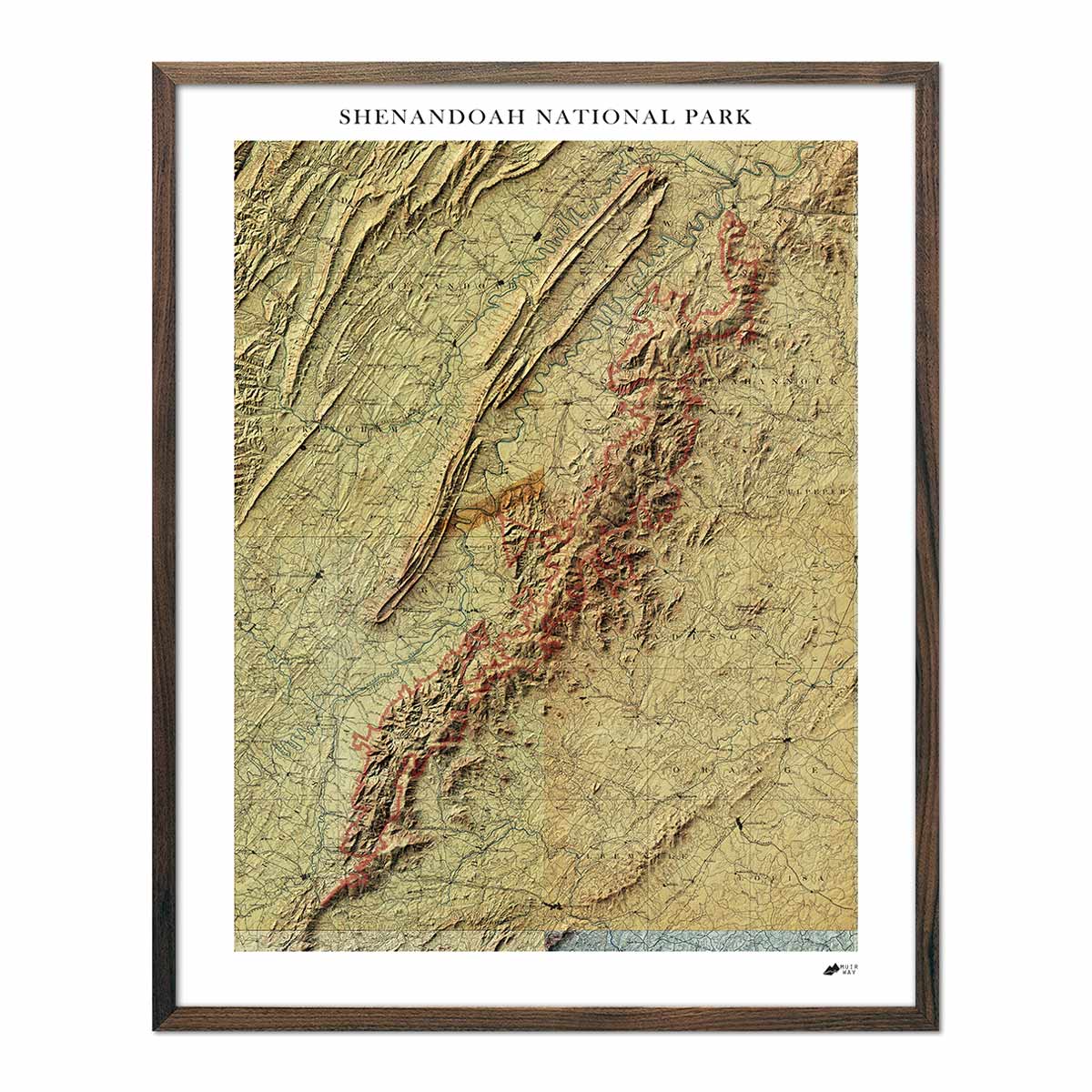
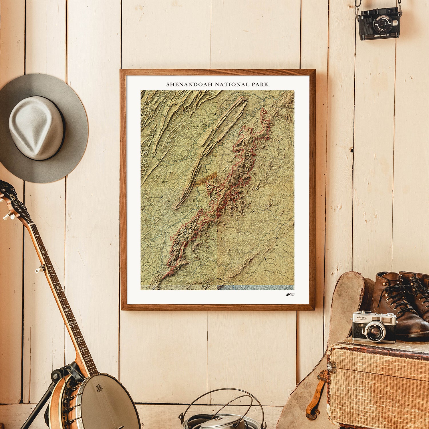
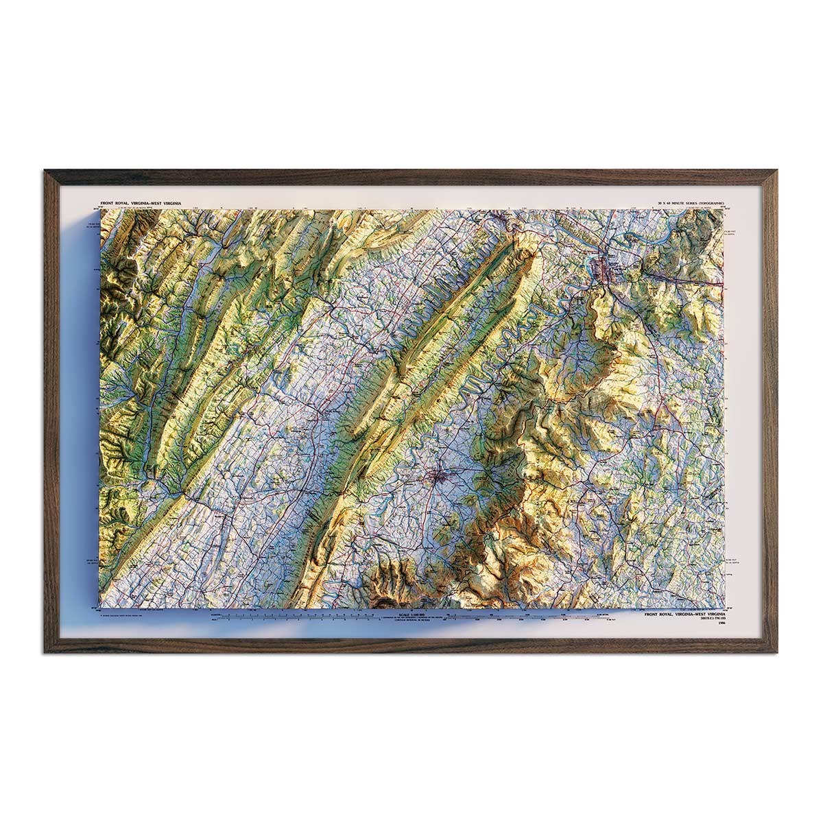
Shenandoah National Park 1986 Shaded Relief Map
From
$ 89.00 USD
5.0 / 5.0
1 review
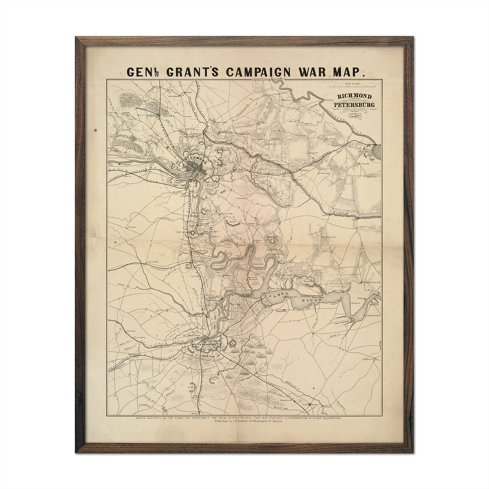
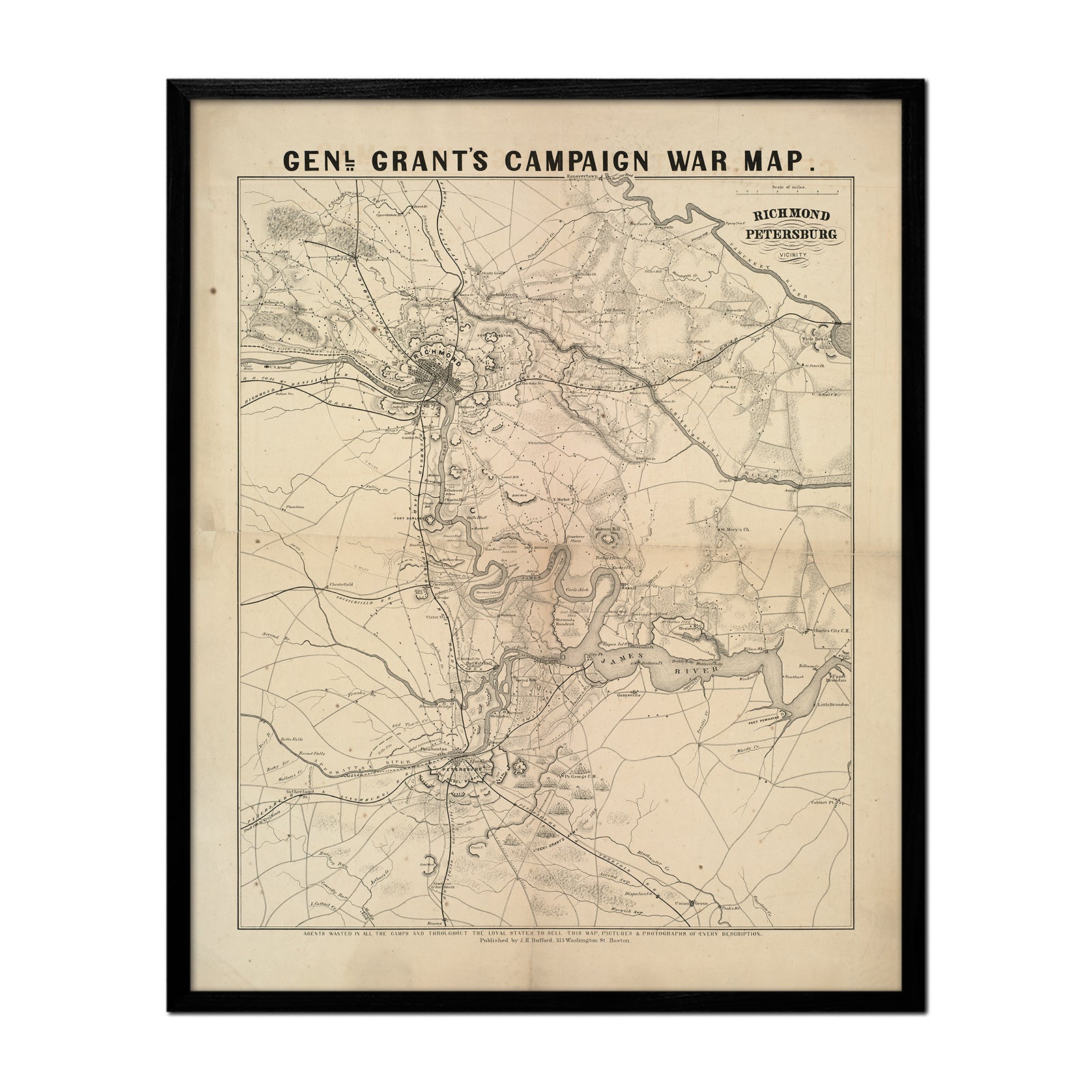
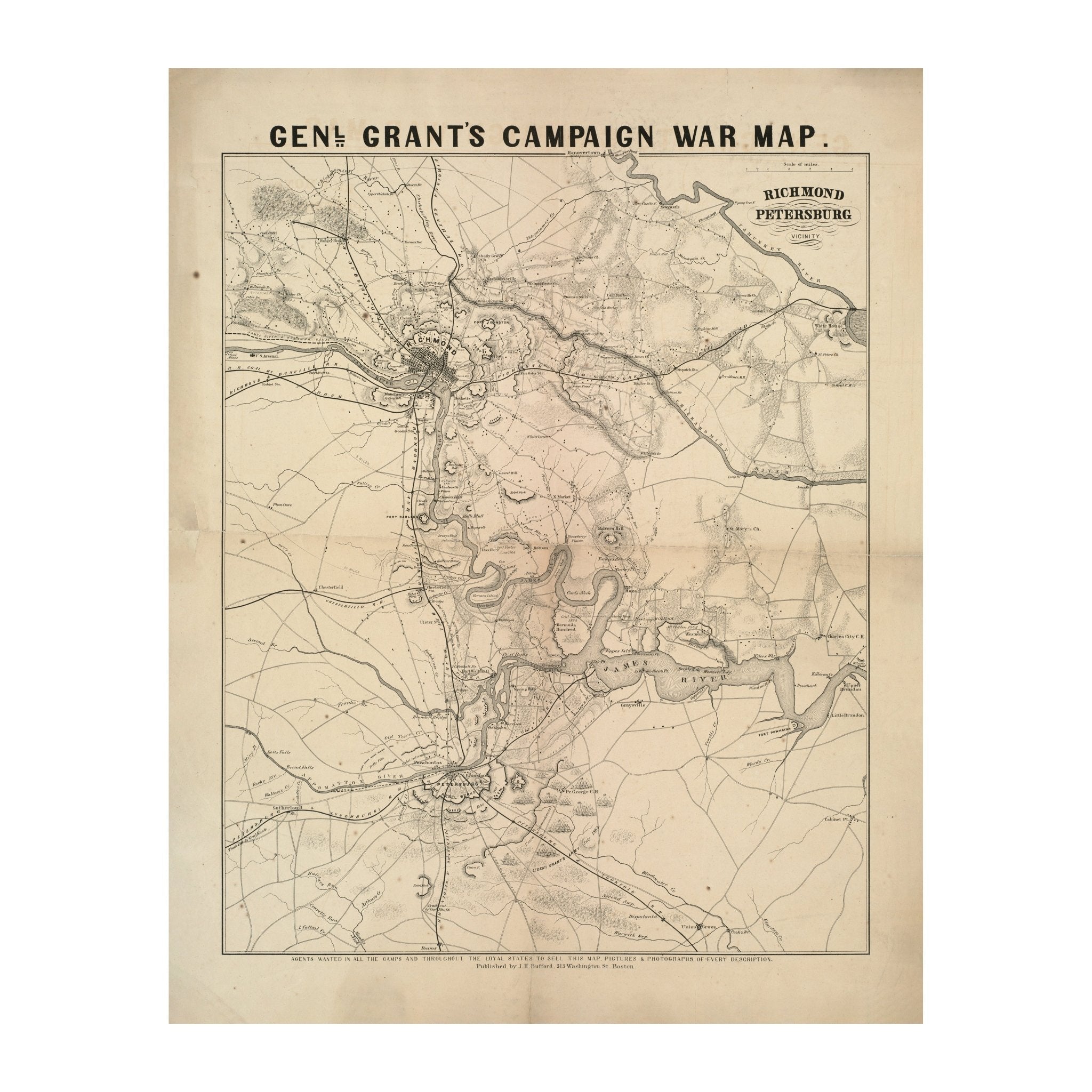
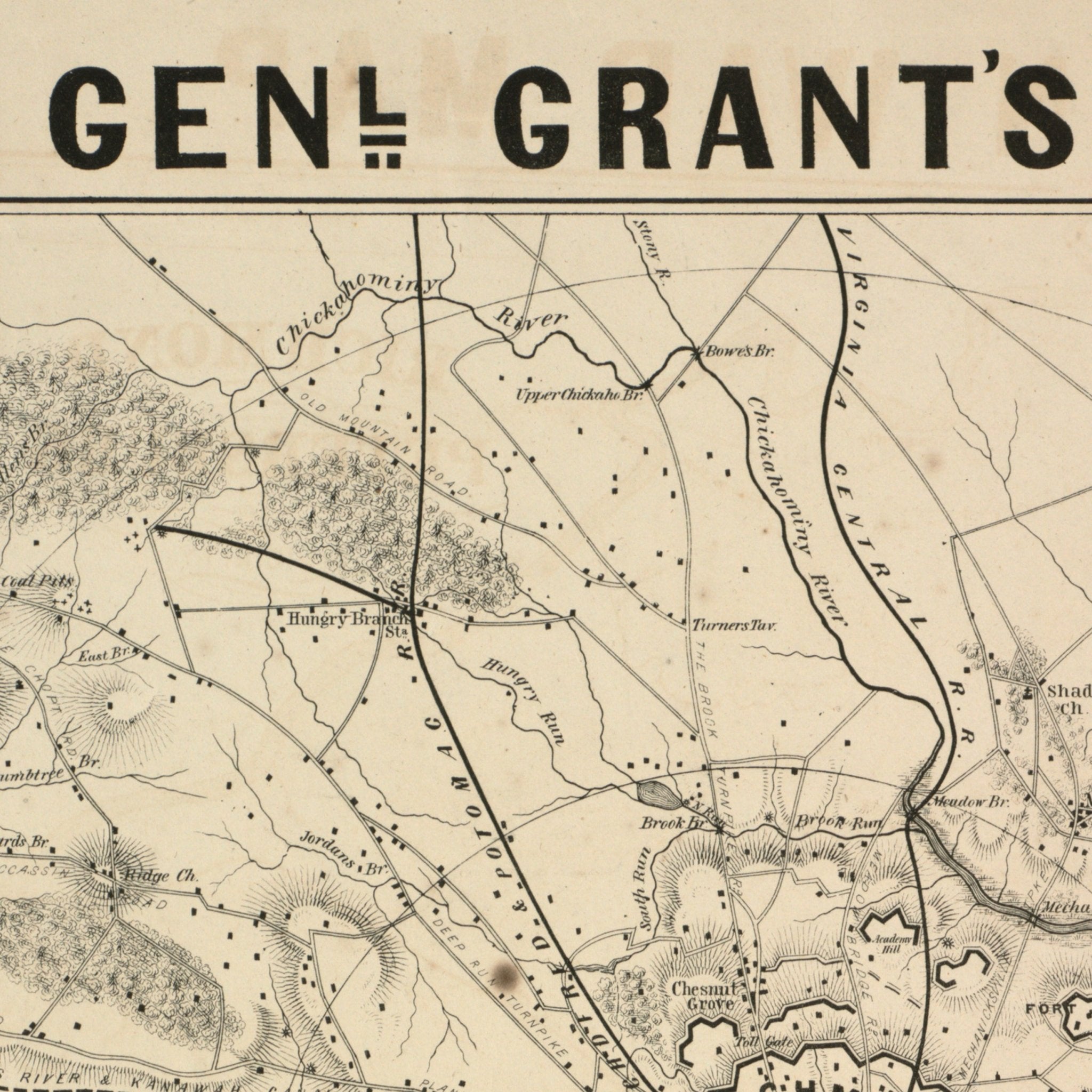
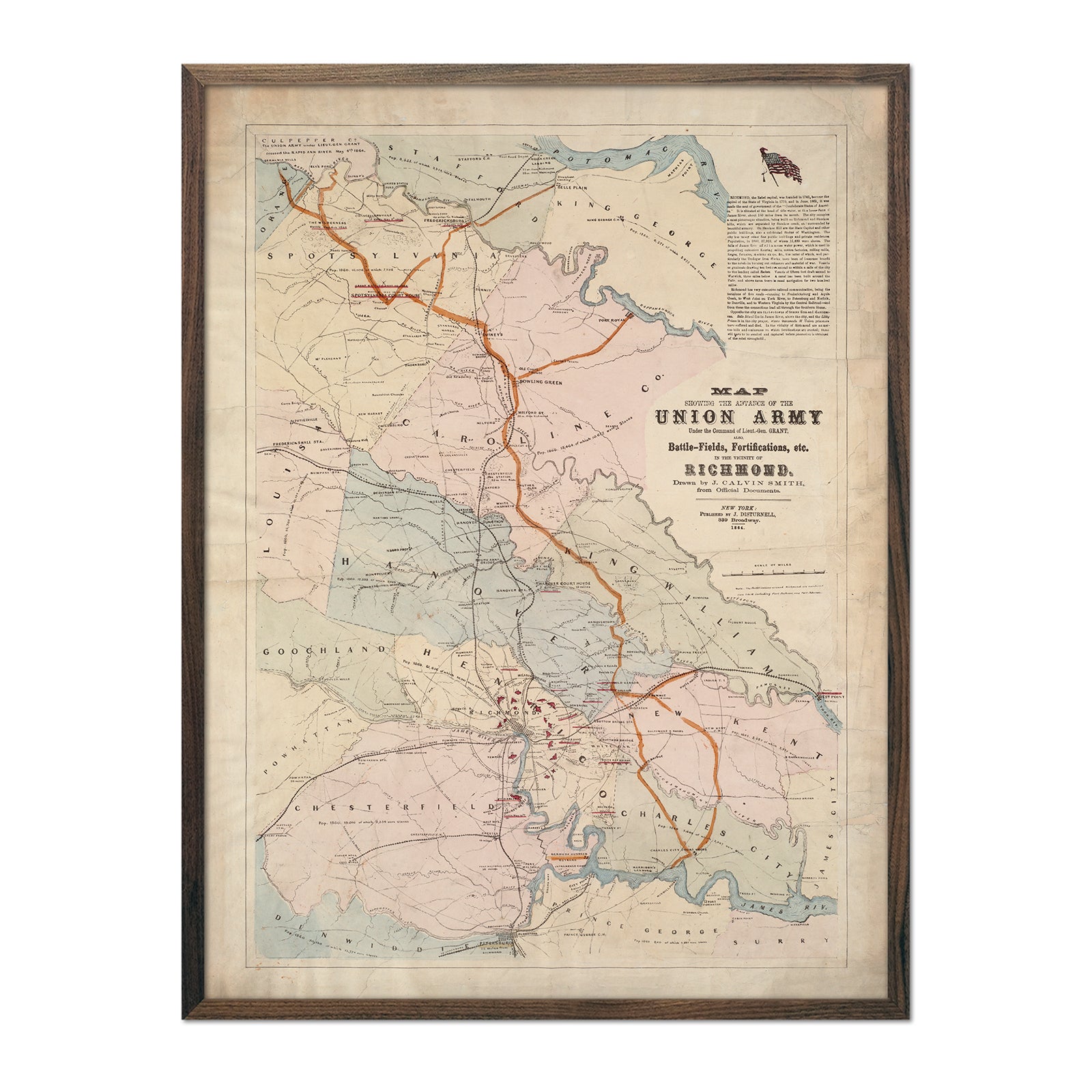
General Grant's Campaign War Map
From
$ 64.00 USD
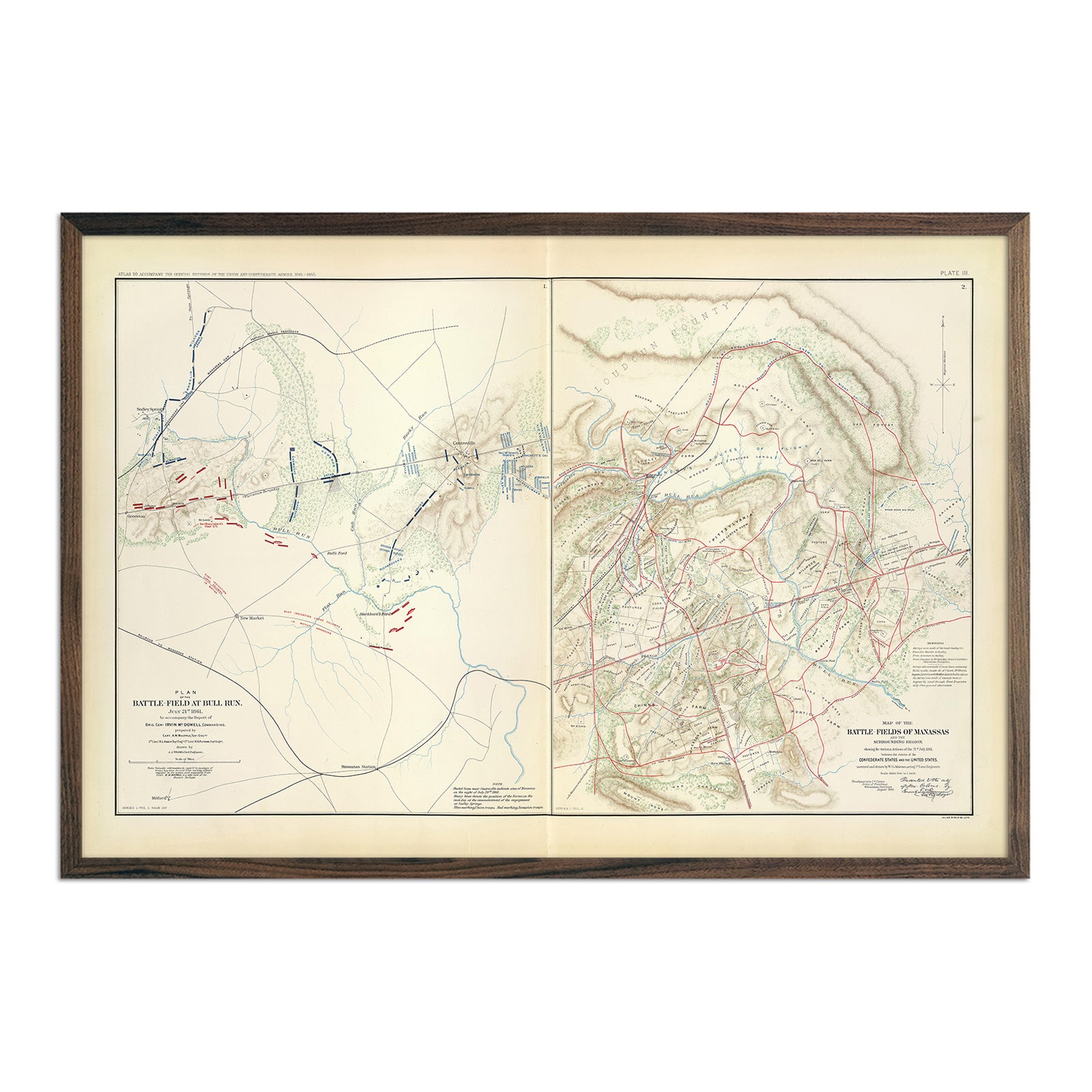
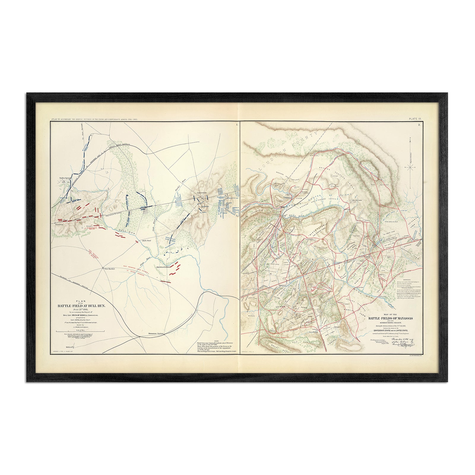
Bull Run and Manassas
From
$ 79.00 USD
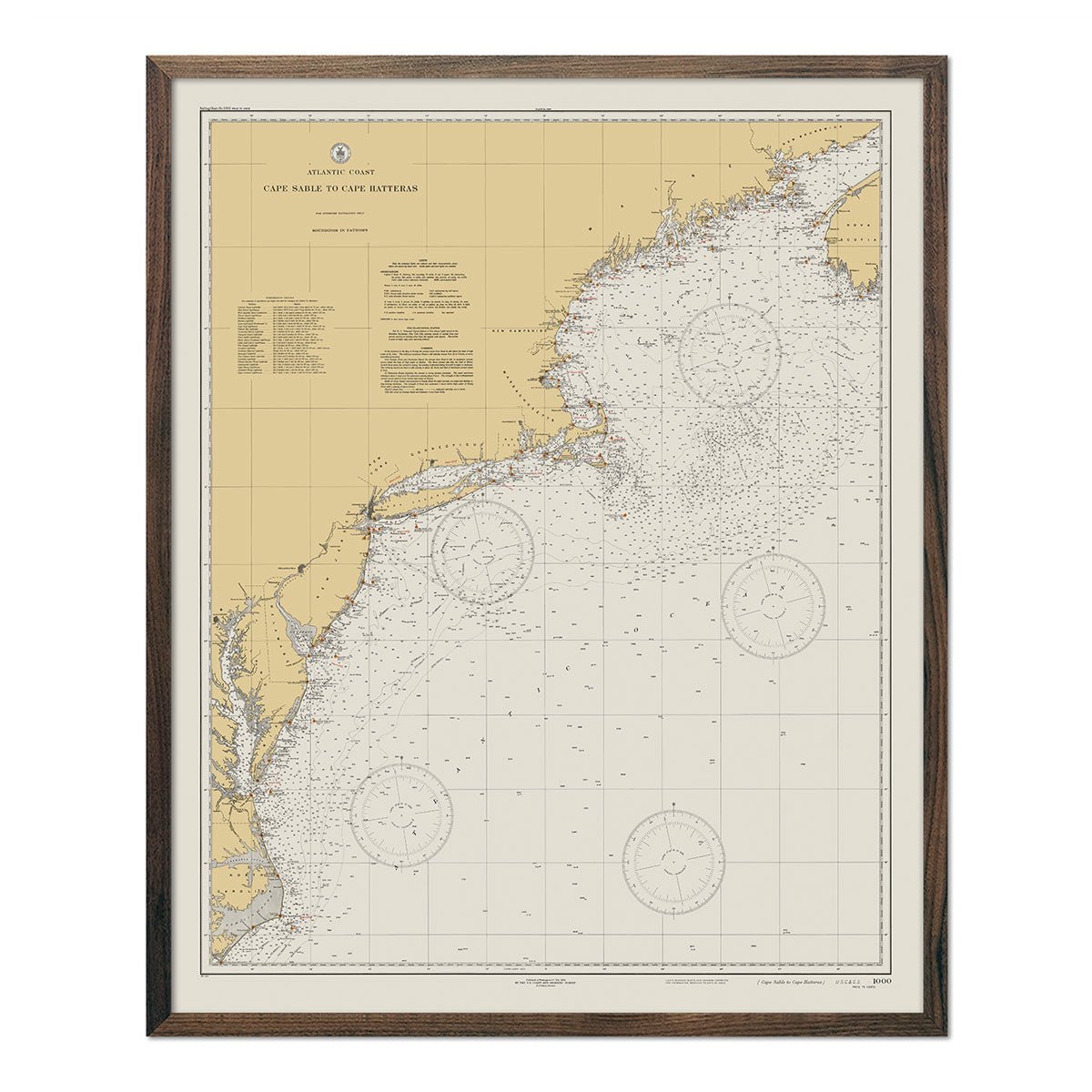
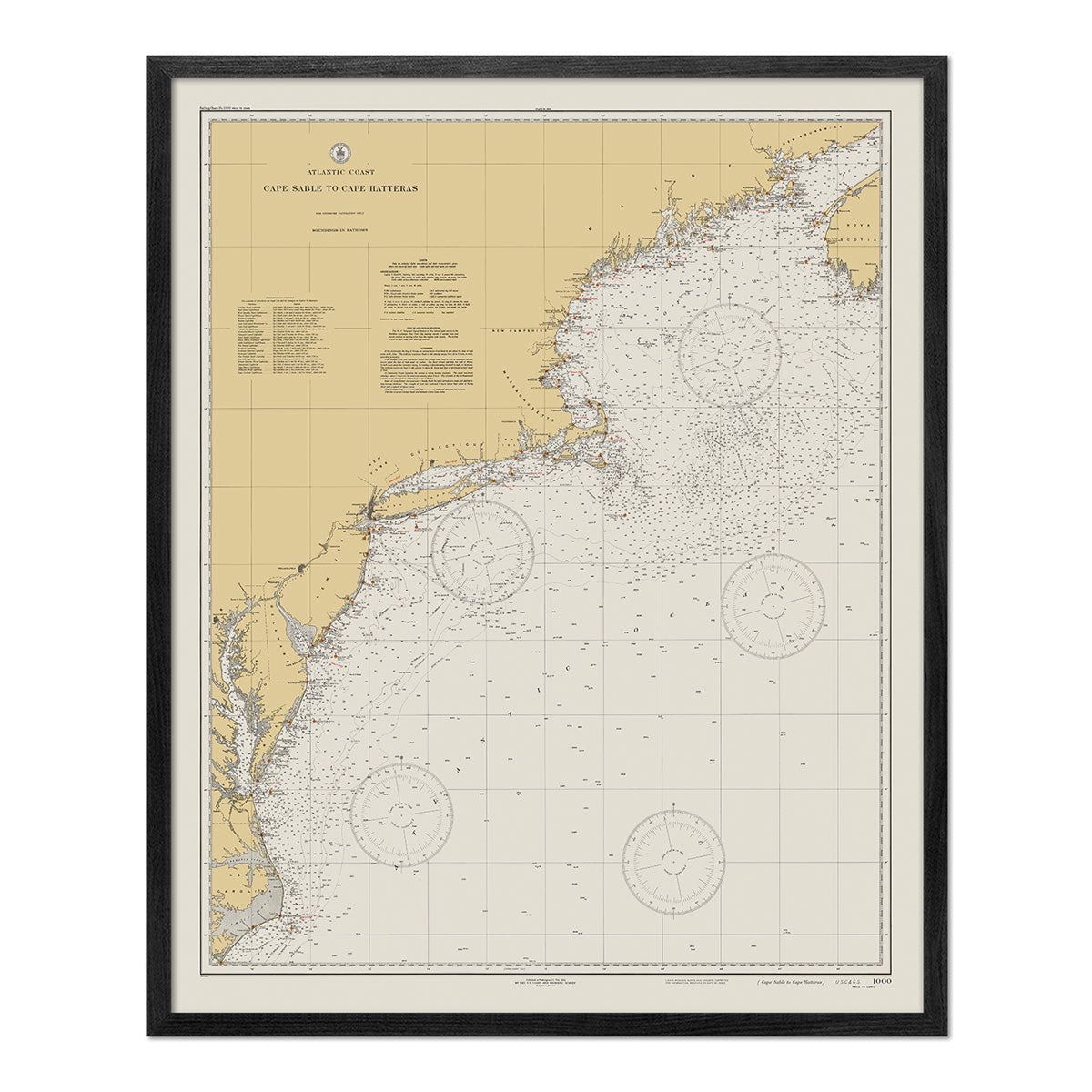
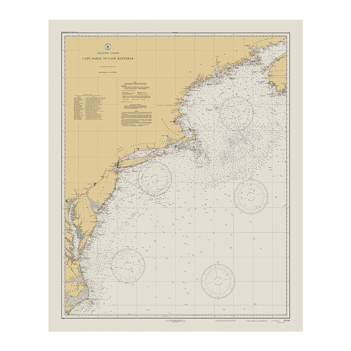
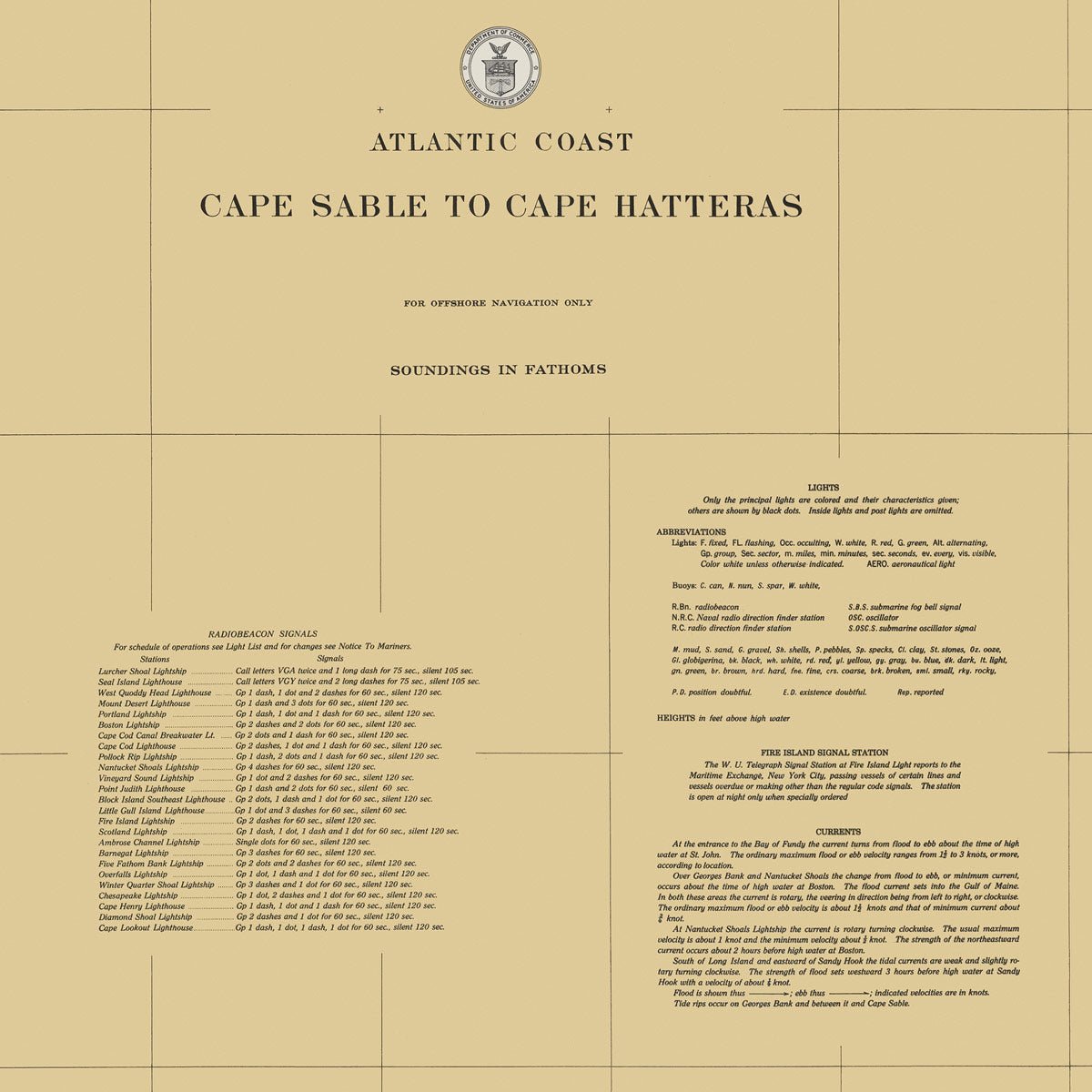
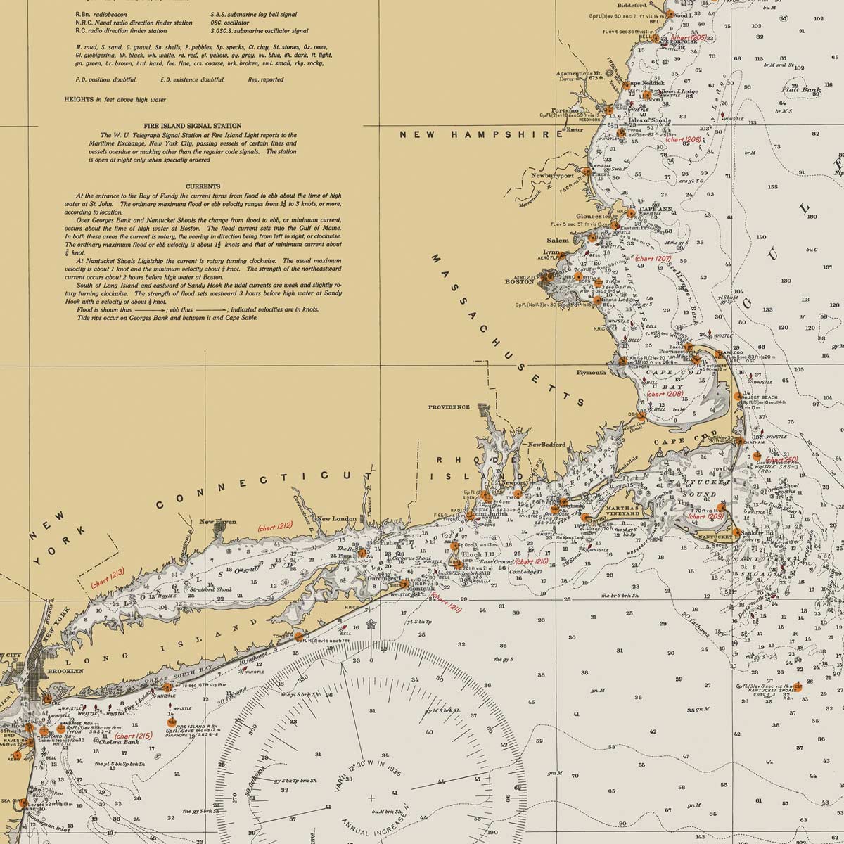
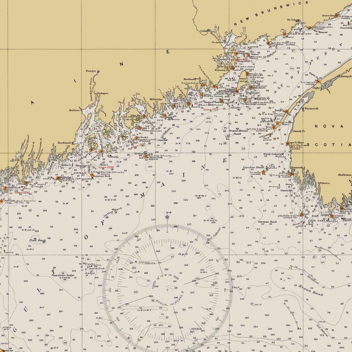
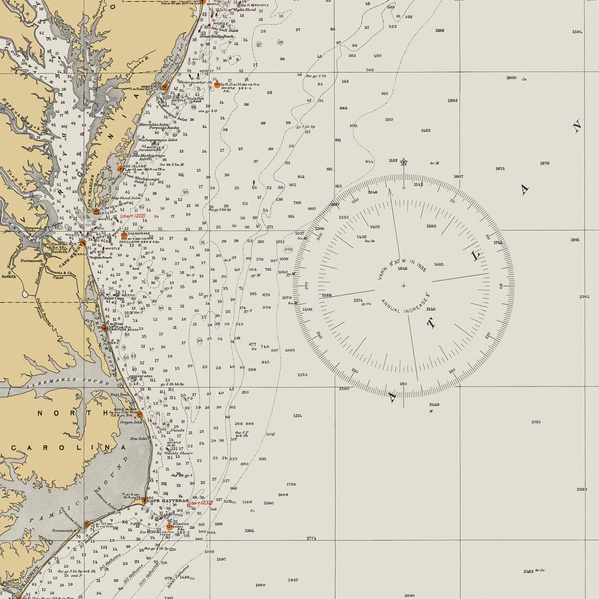
Cape Sable to Cape Hatteras Nautical Chart 1934
From
$ 64.00 USD
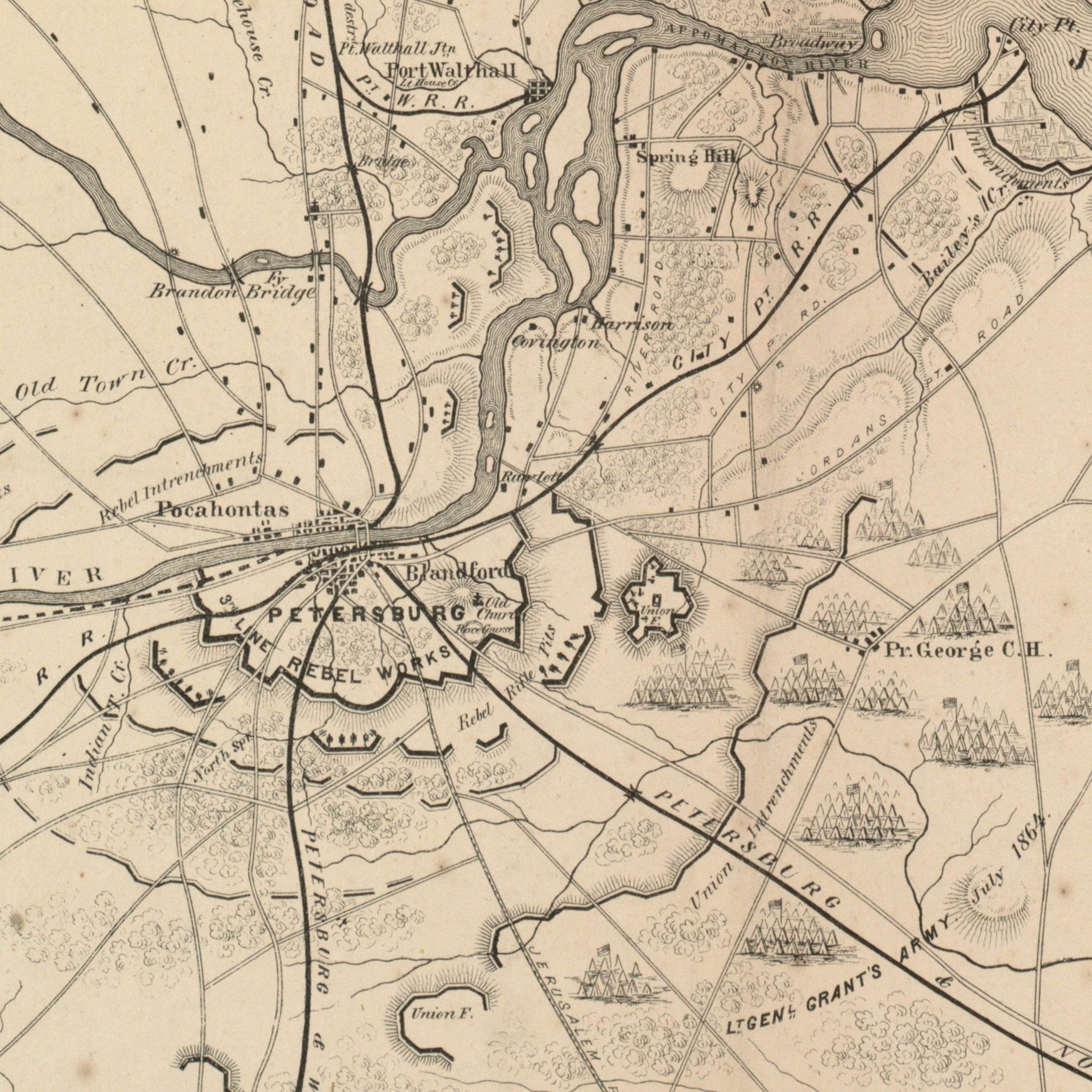
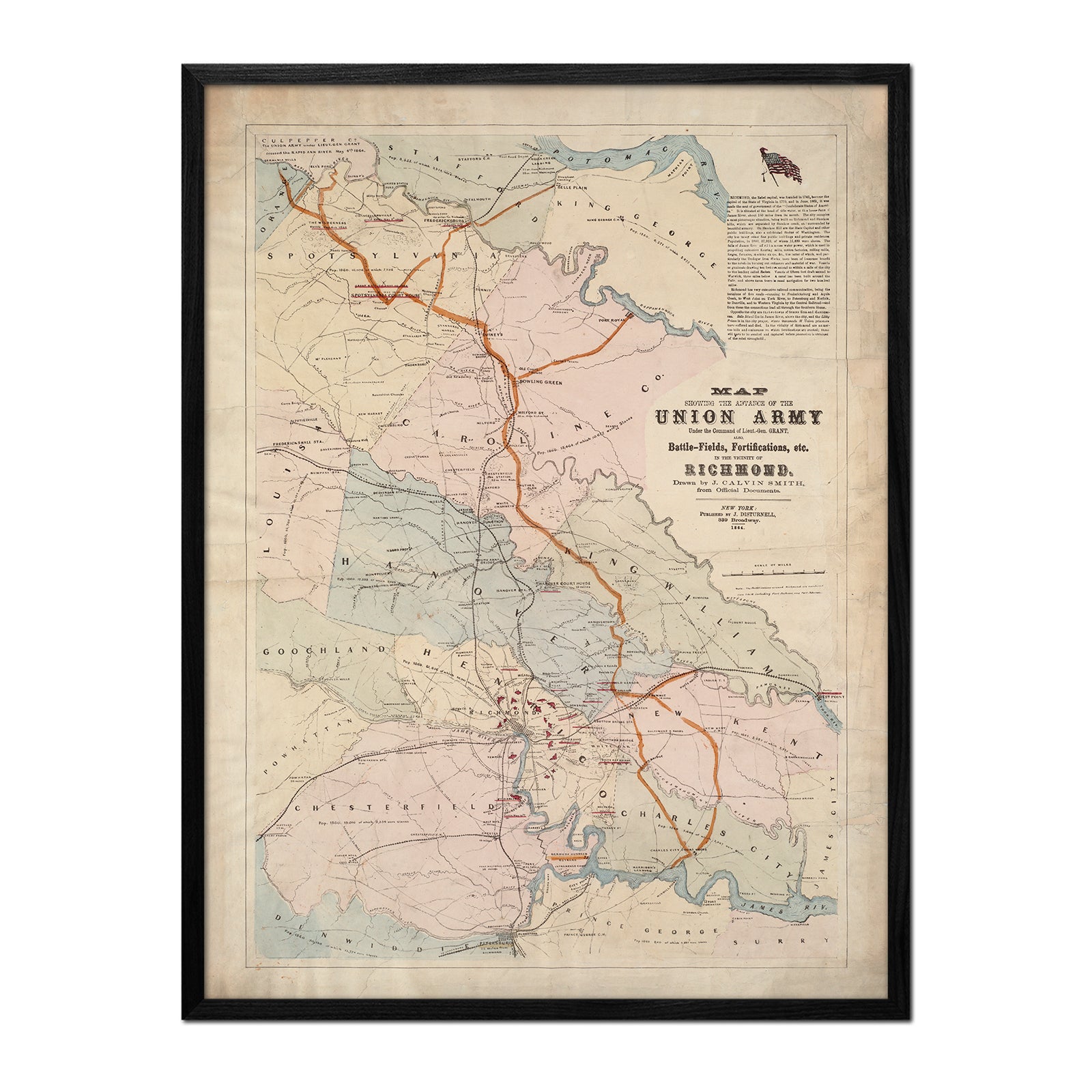
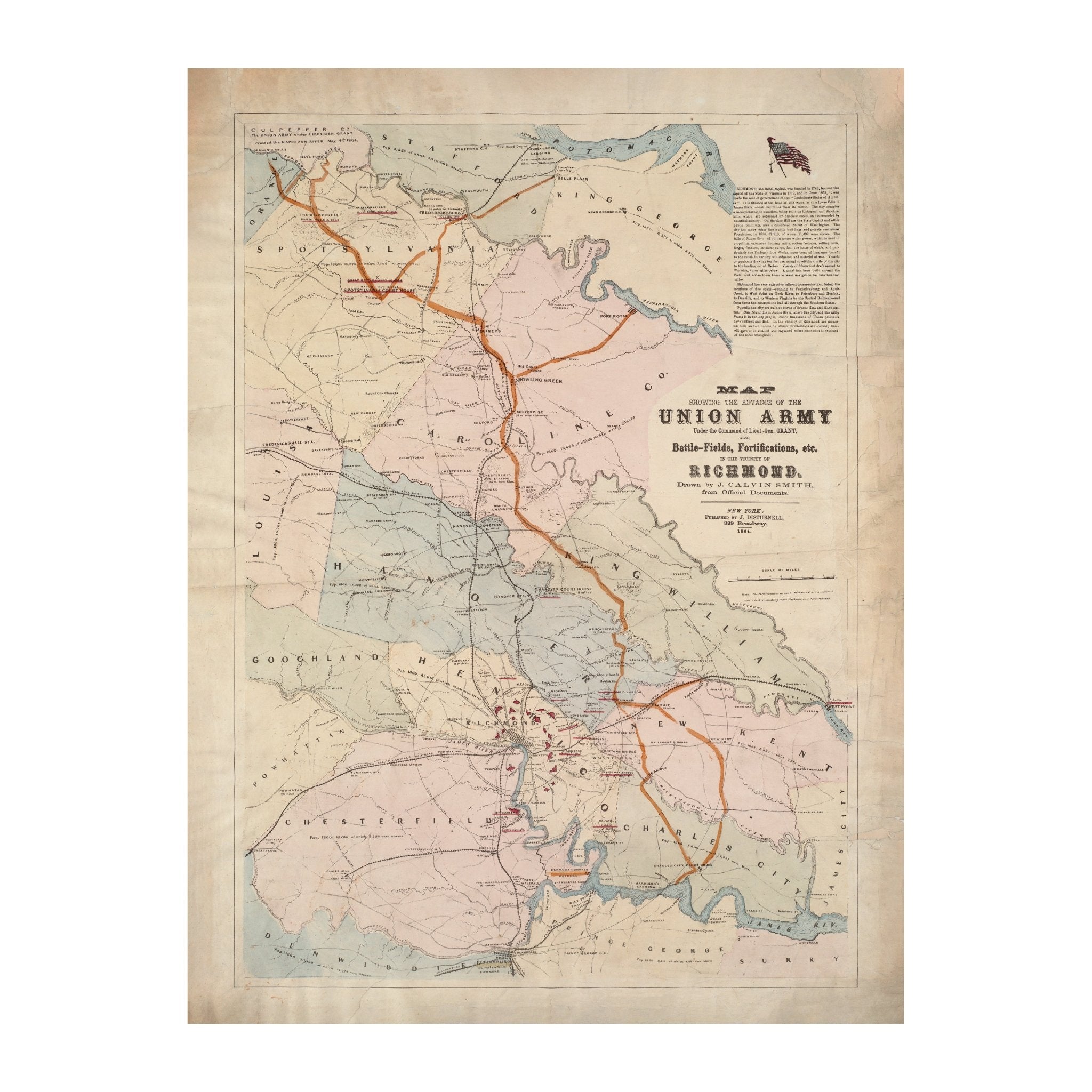
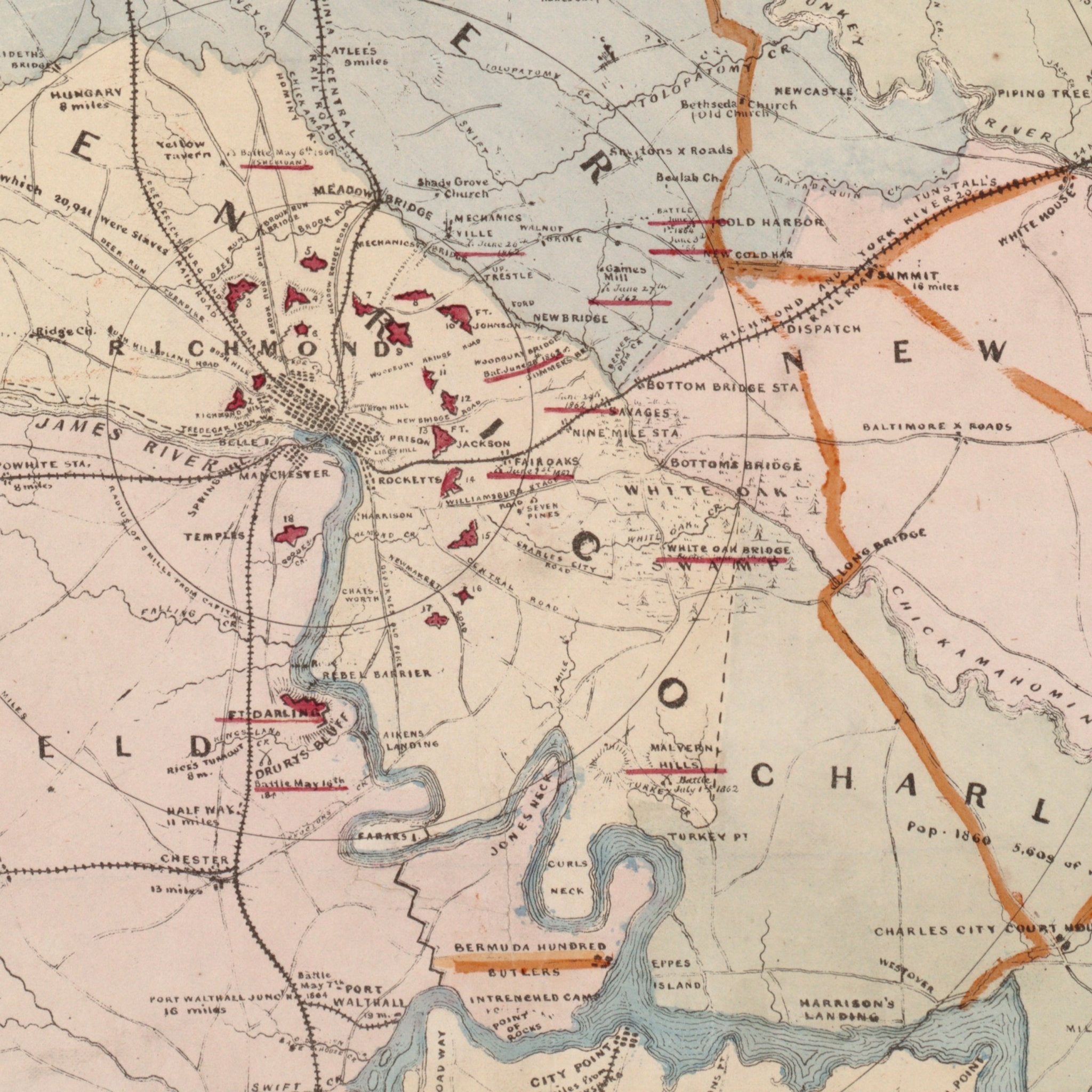
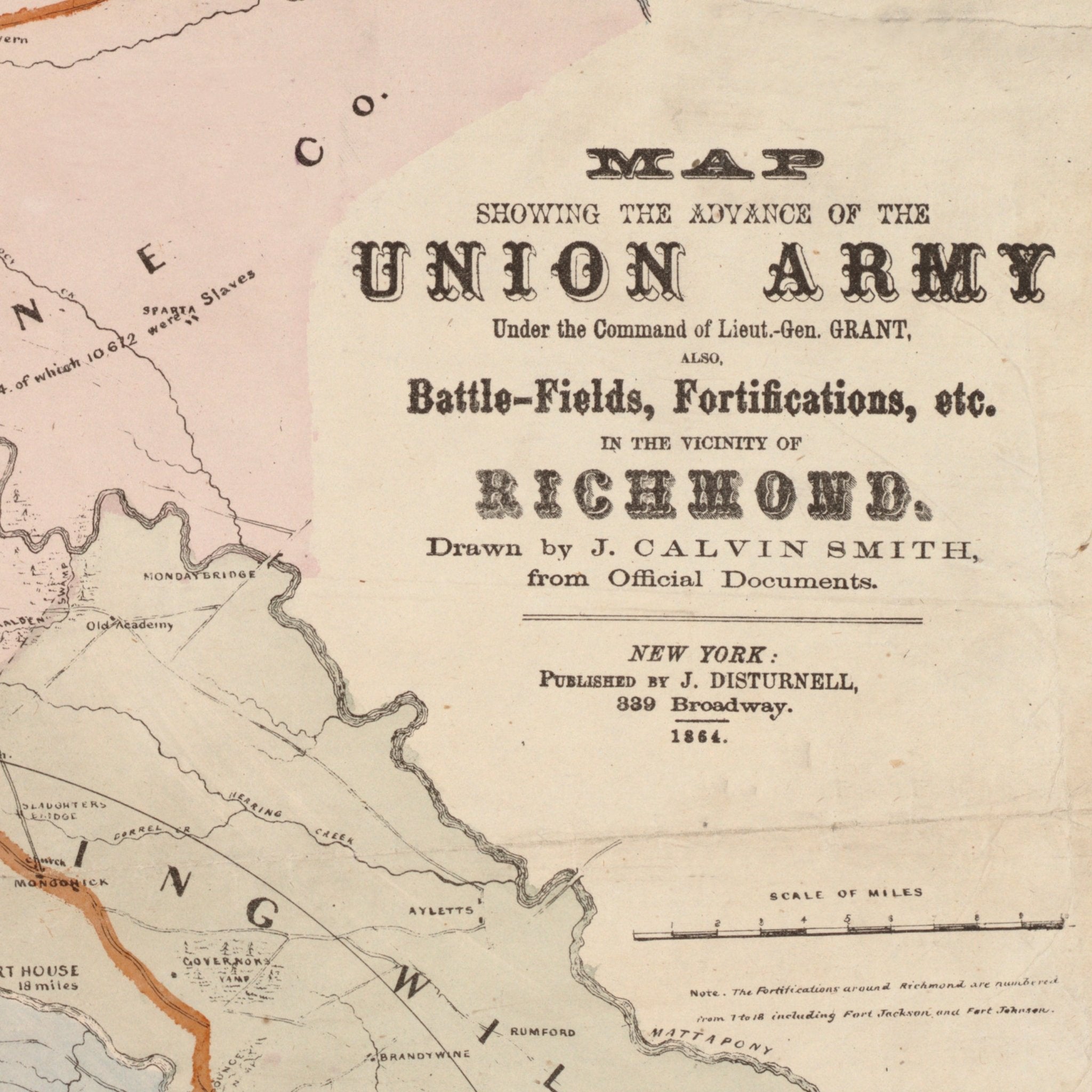
Union Army Map of Richmond
From
$ 79.00 USD
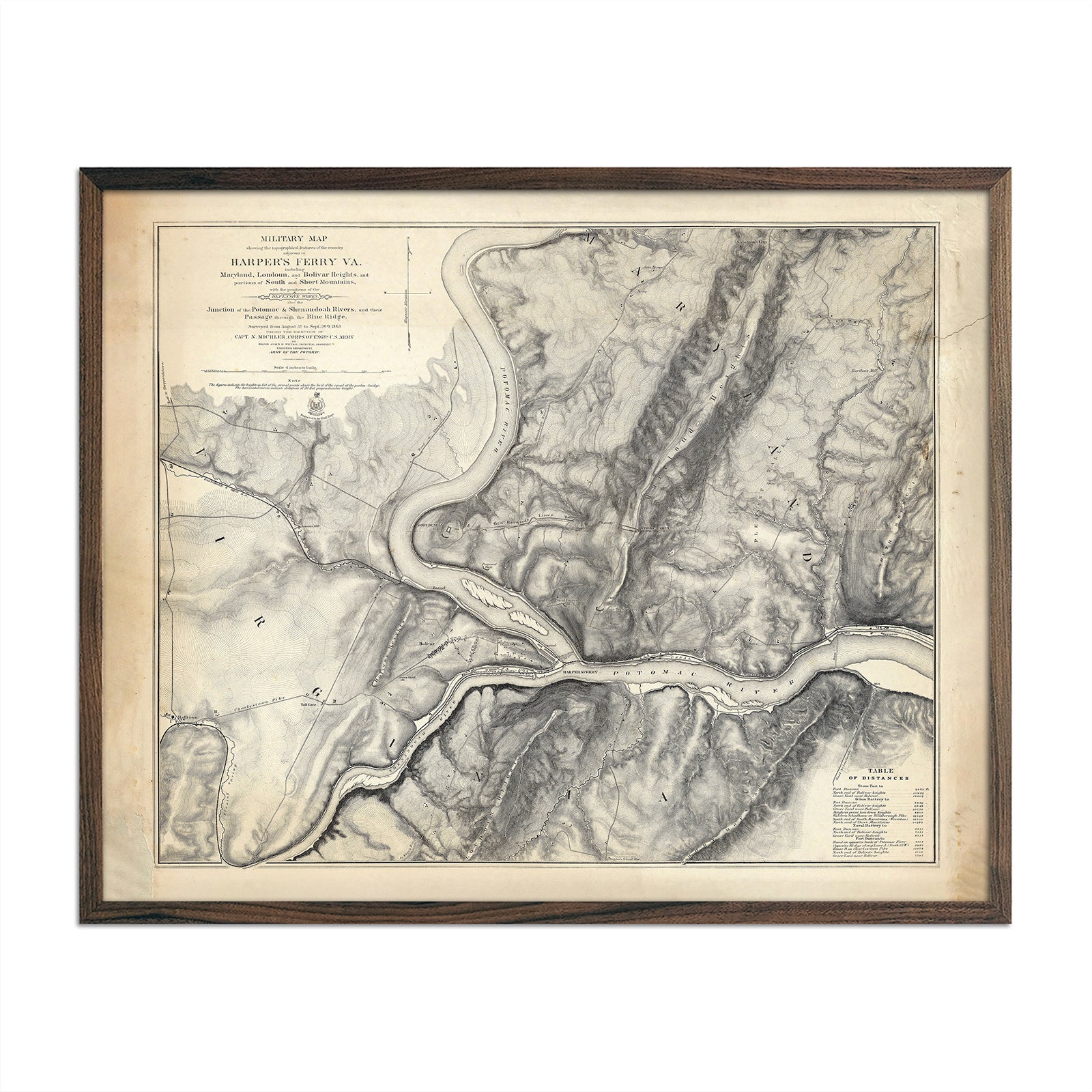
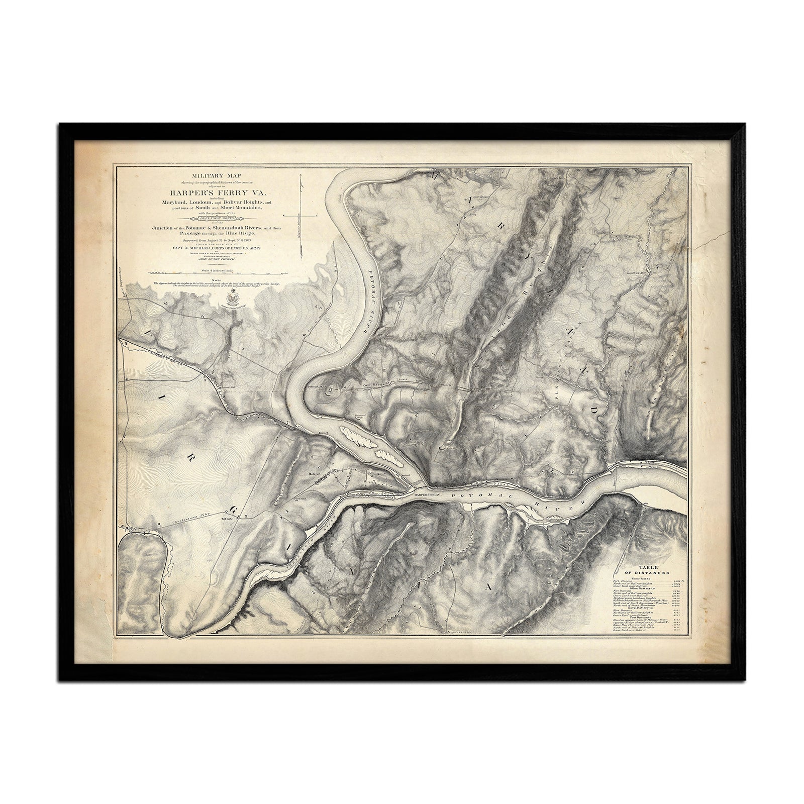
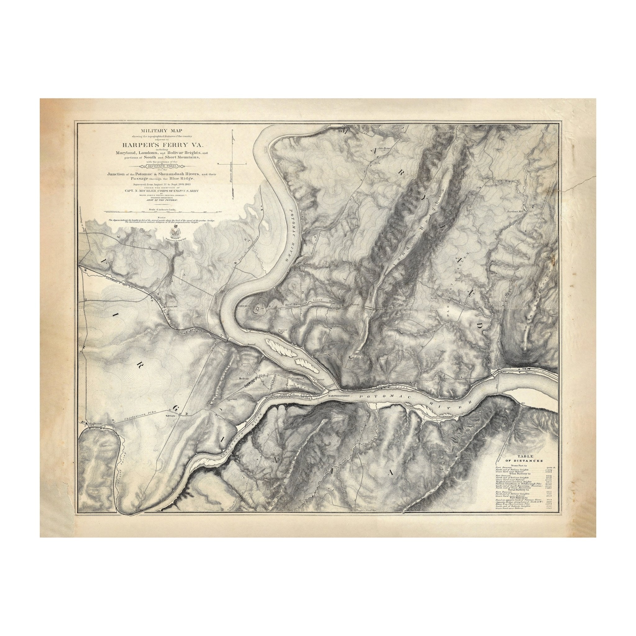
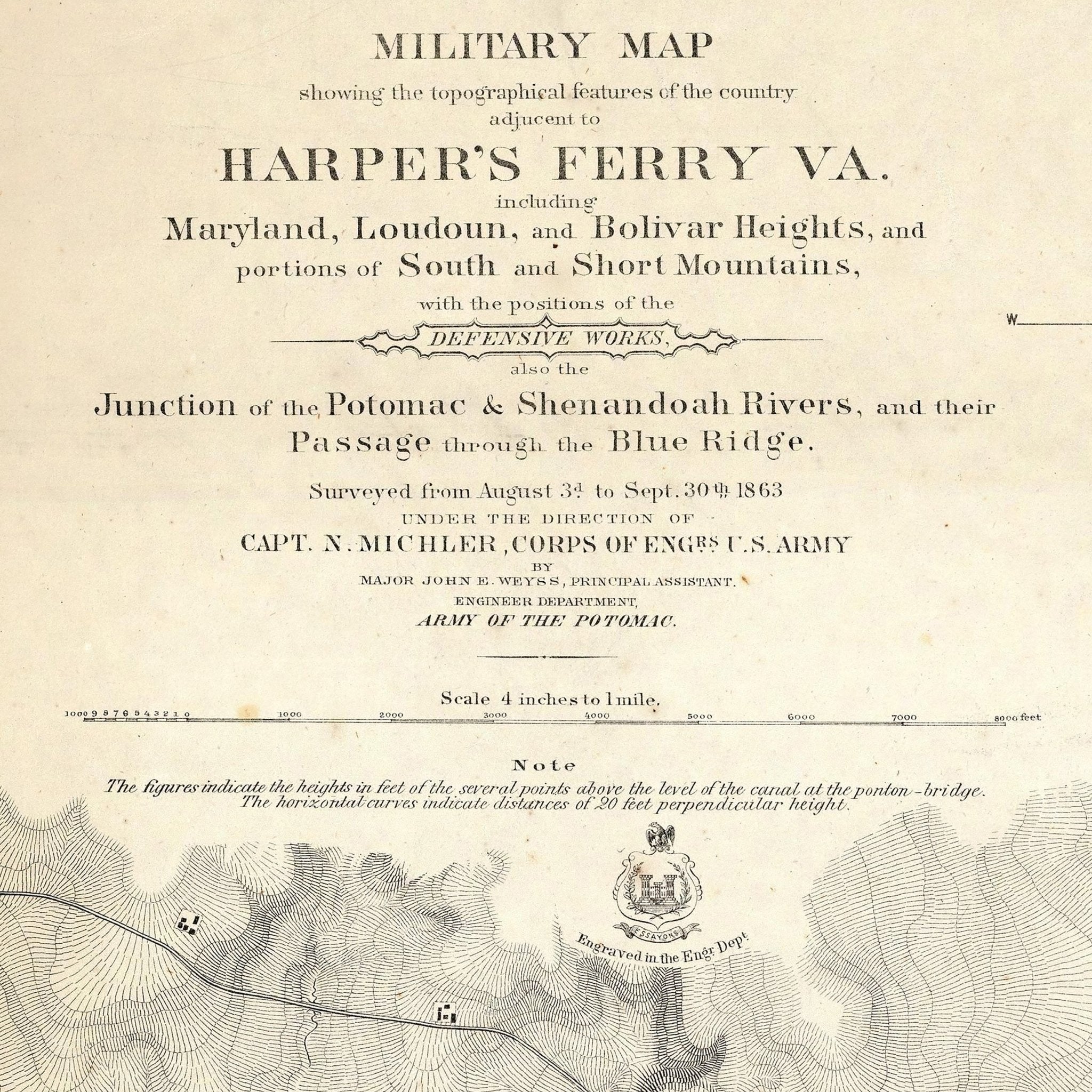
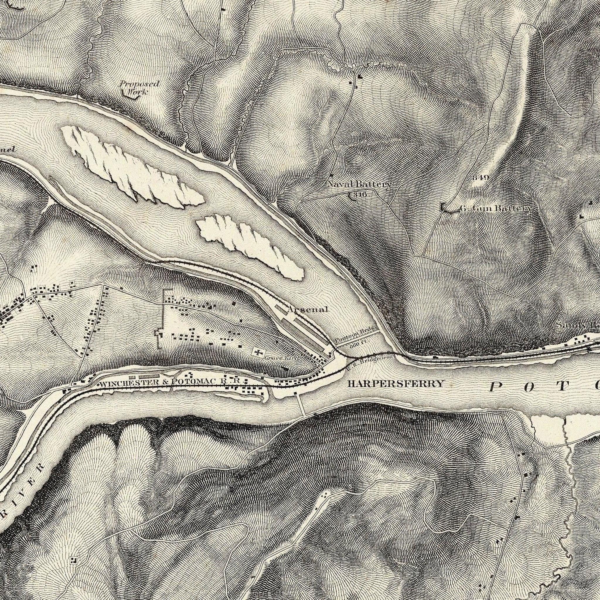
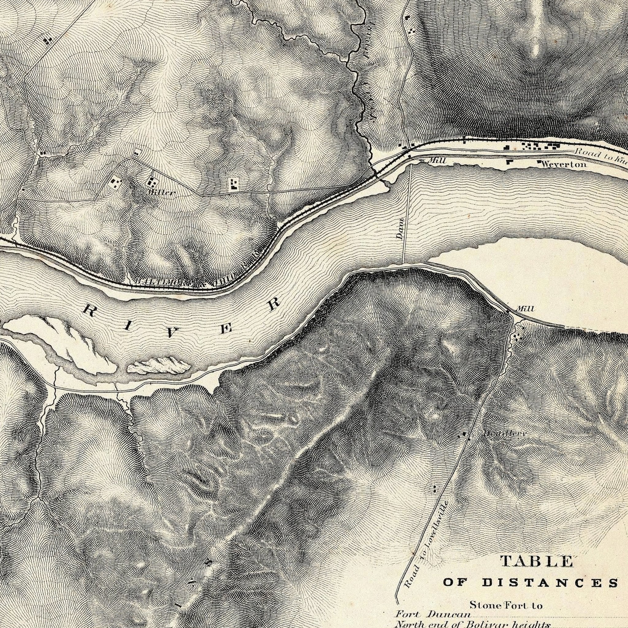
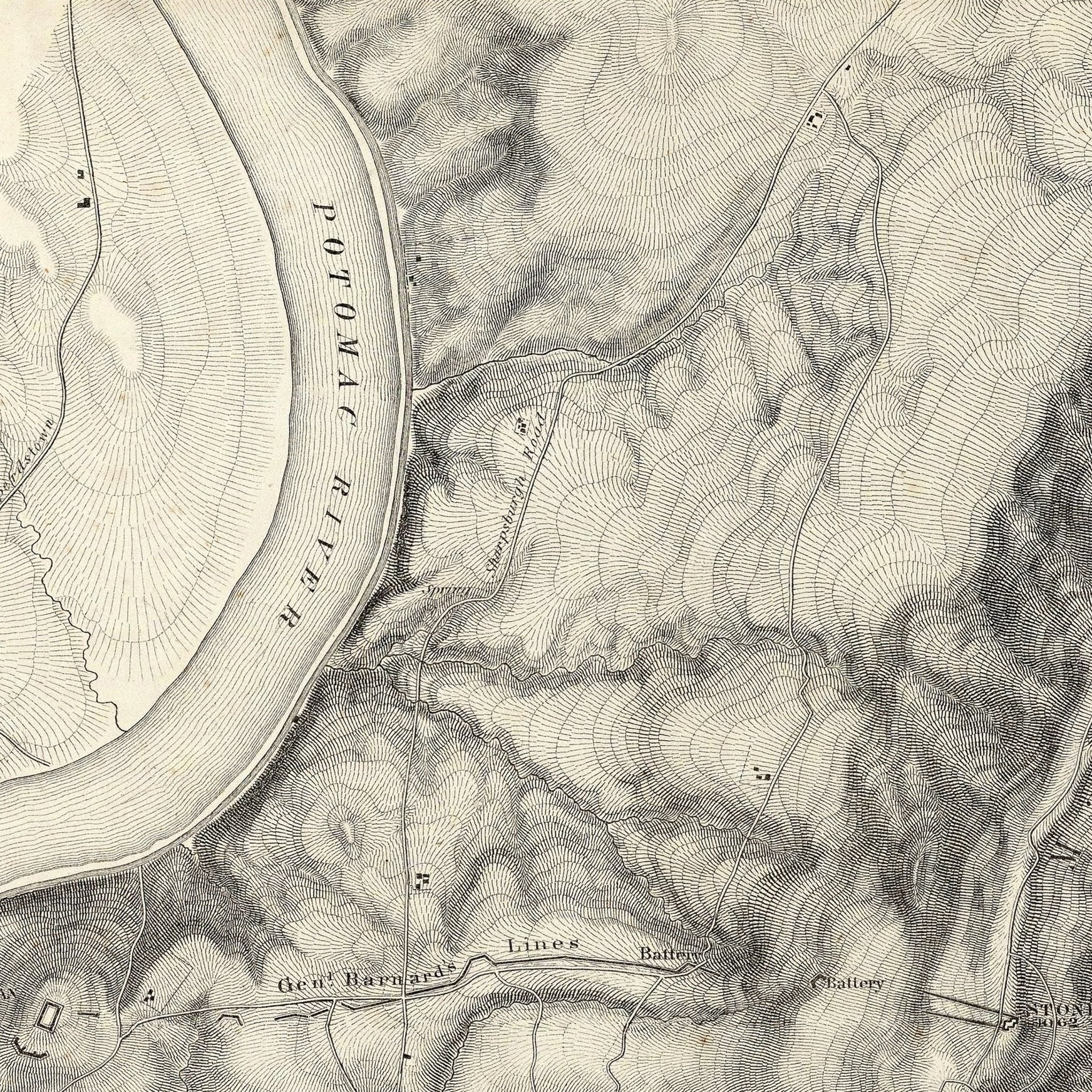
Military Map of Harper's Ferry, VA
From
$ 64.00 USD
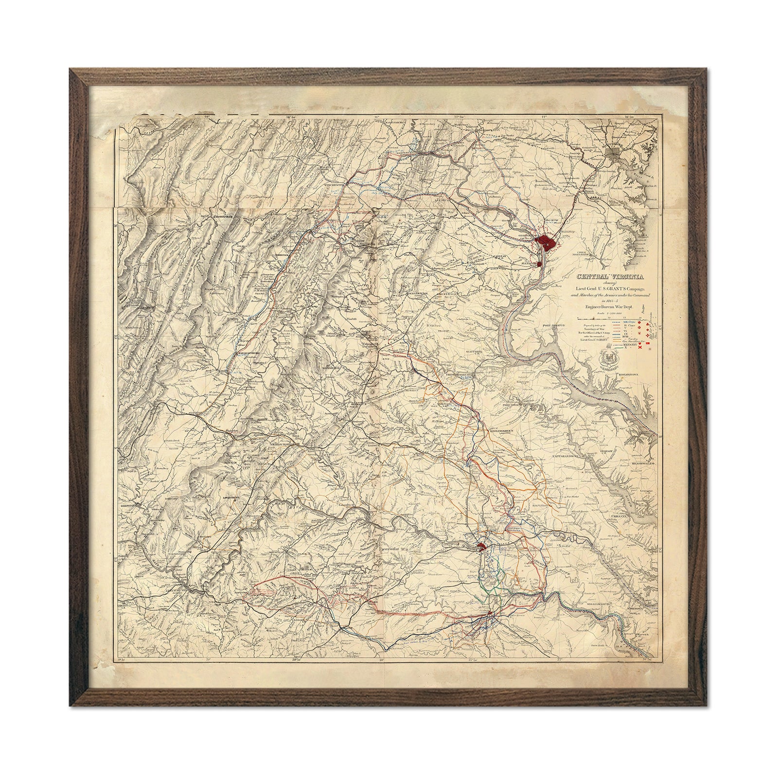
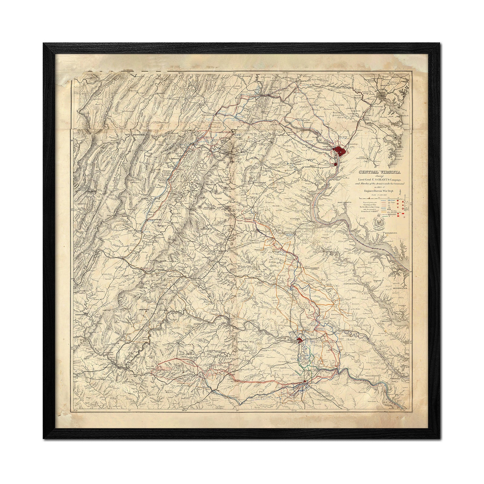
Central Virginia Map Showing Lieutenant General U.S. Grant's Campaign
From
$ 89.00 USD
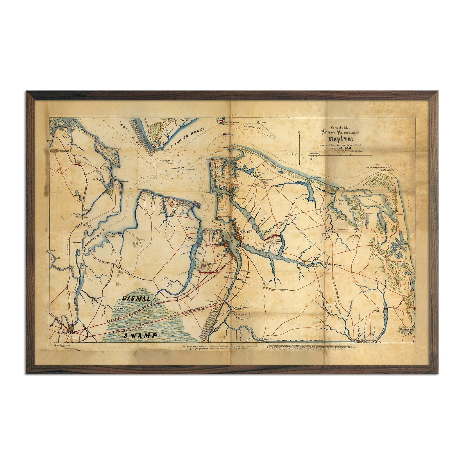
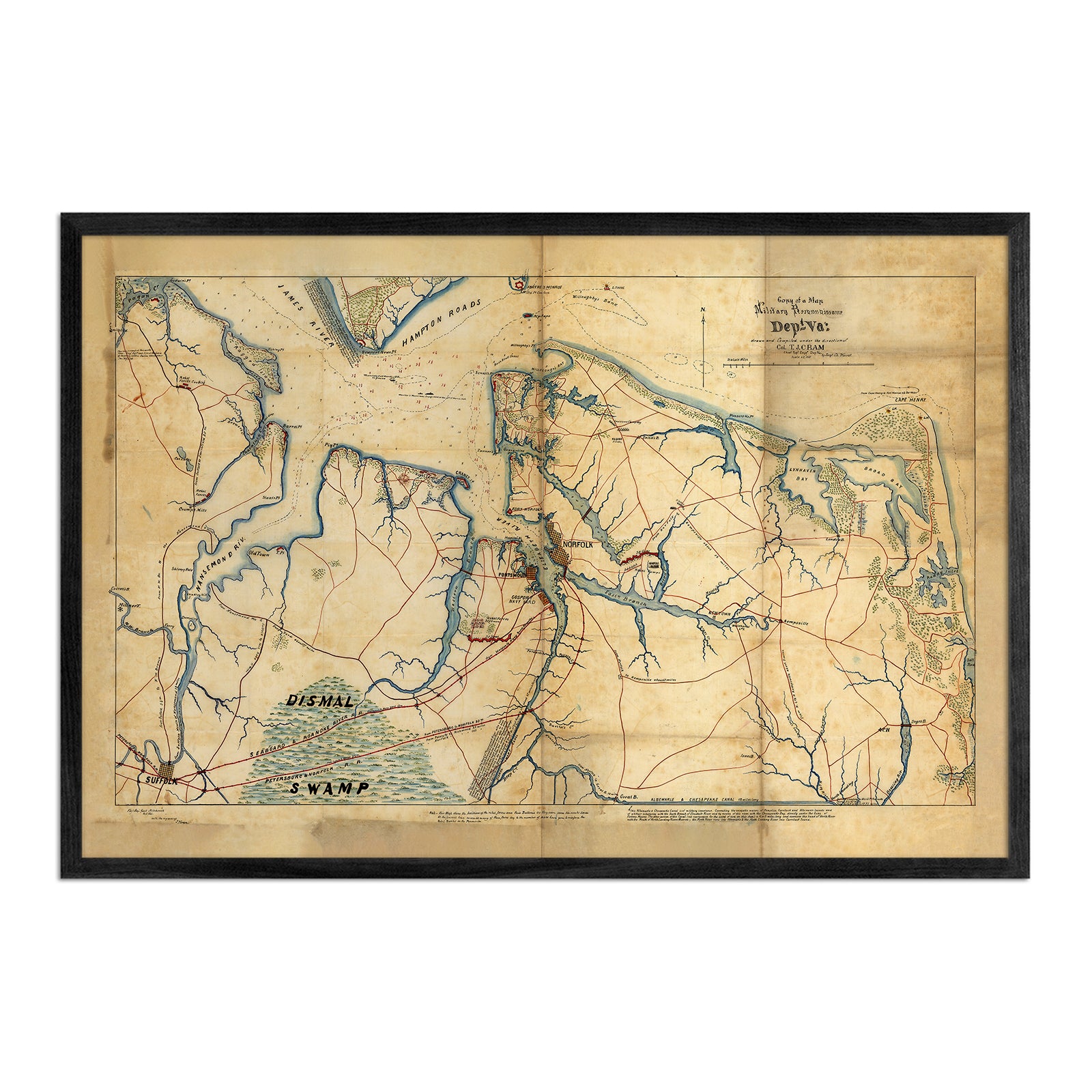
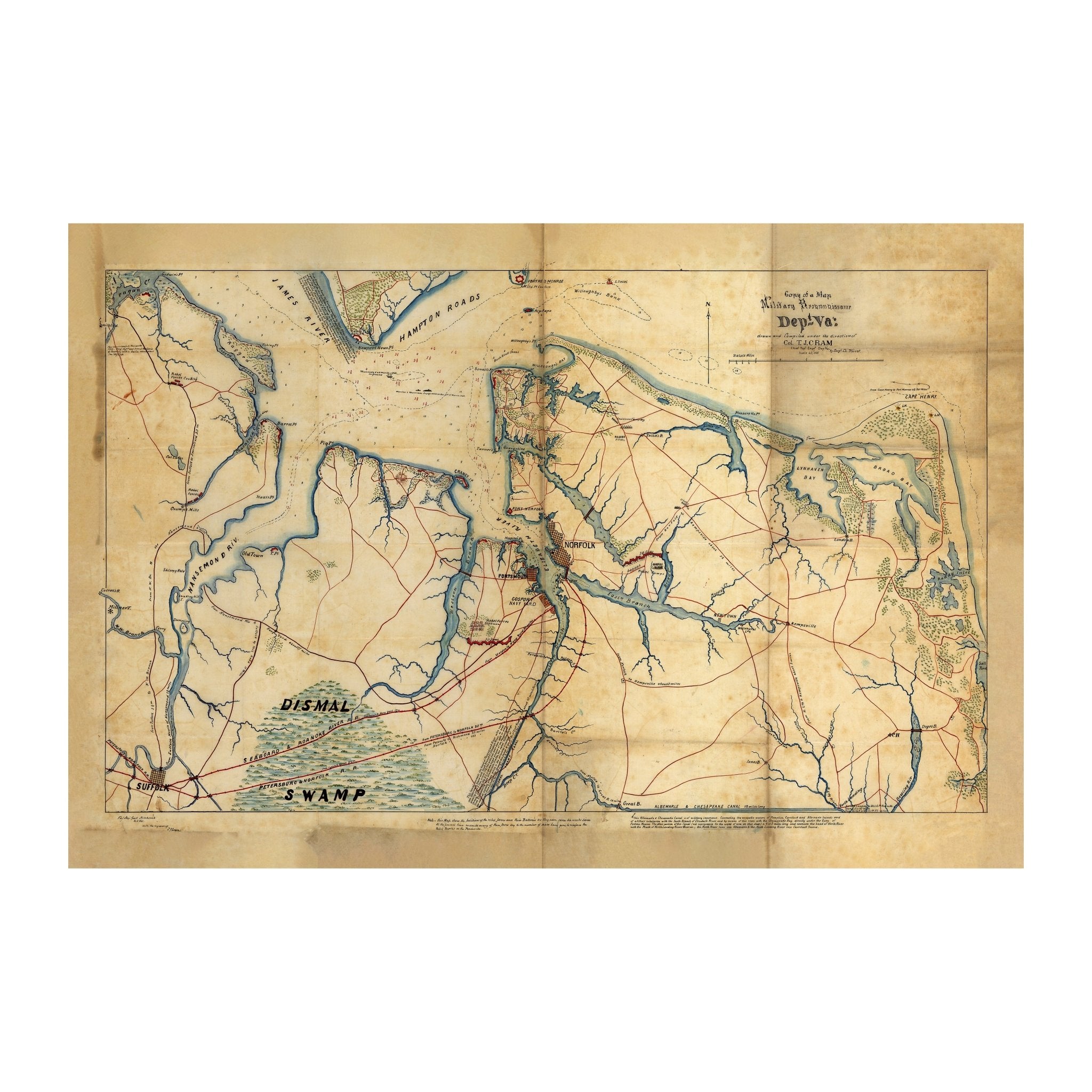
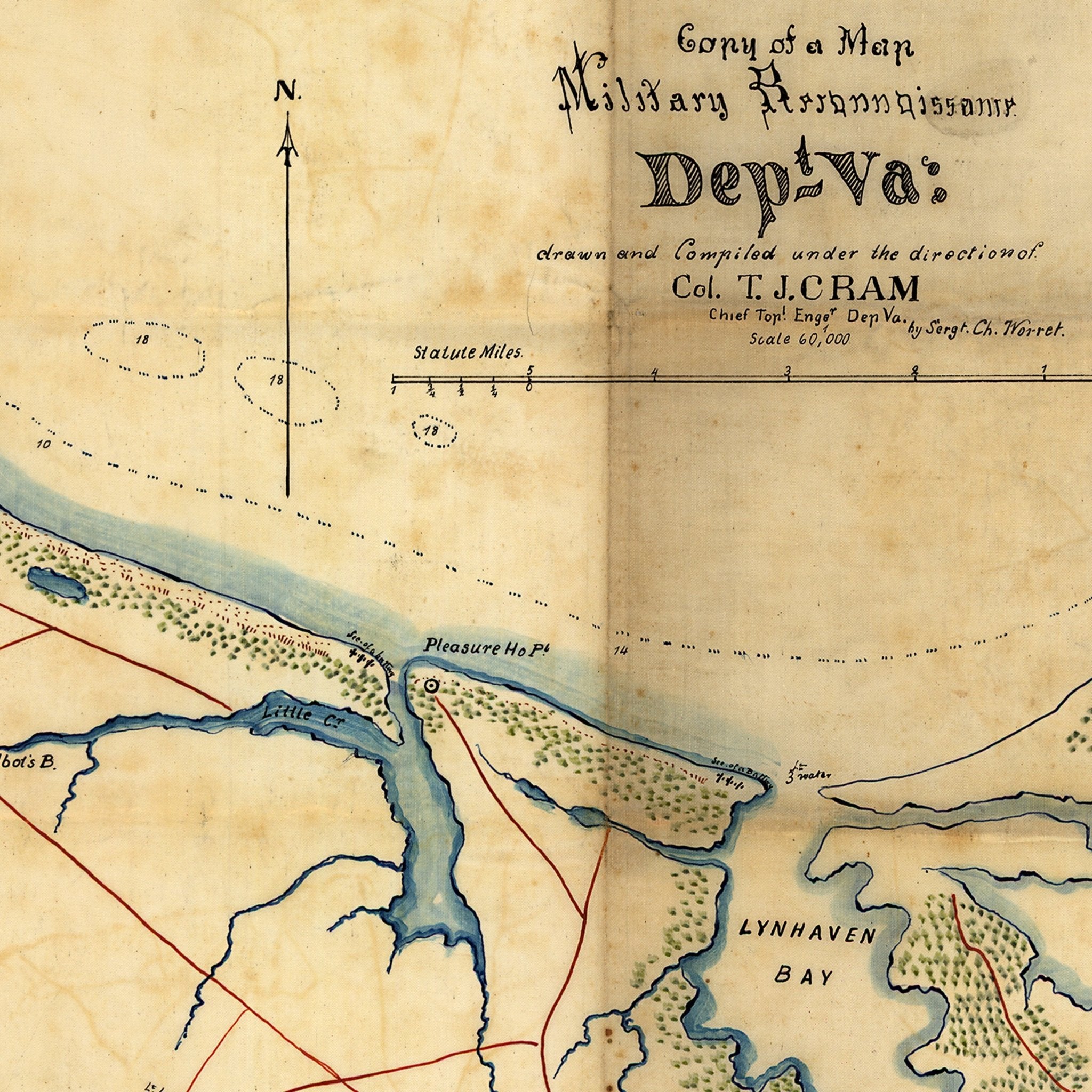
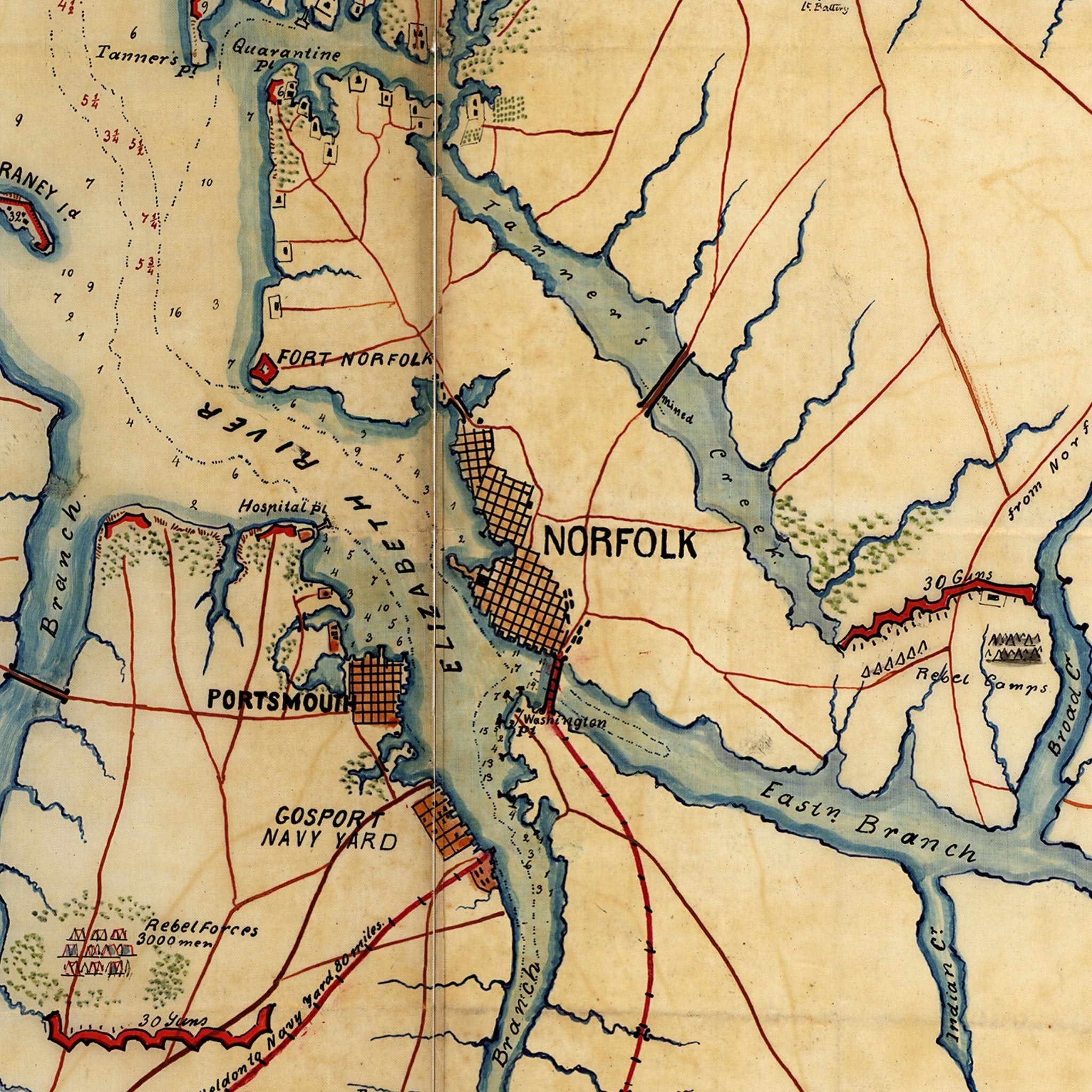
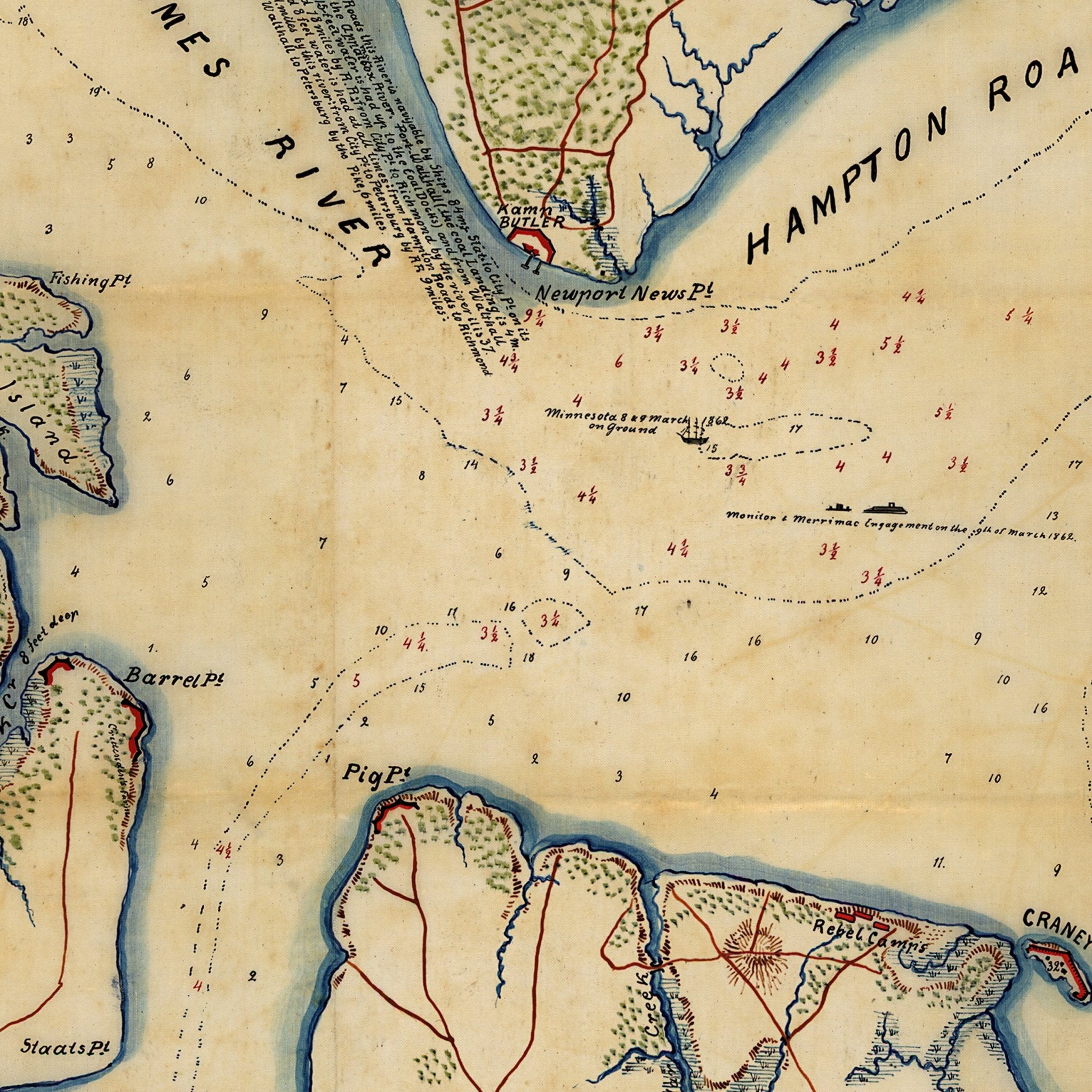
Military Map of Hampton Roads and Norfolk regions
From
$ 79.00 USD
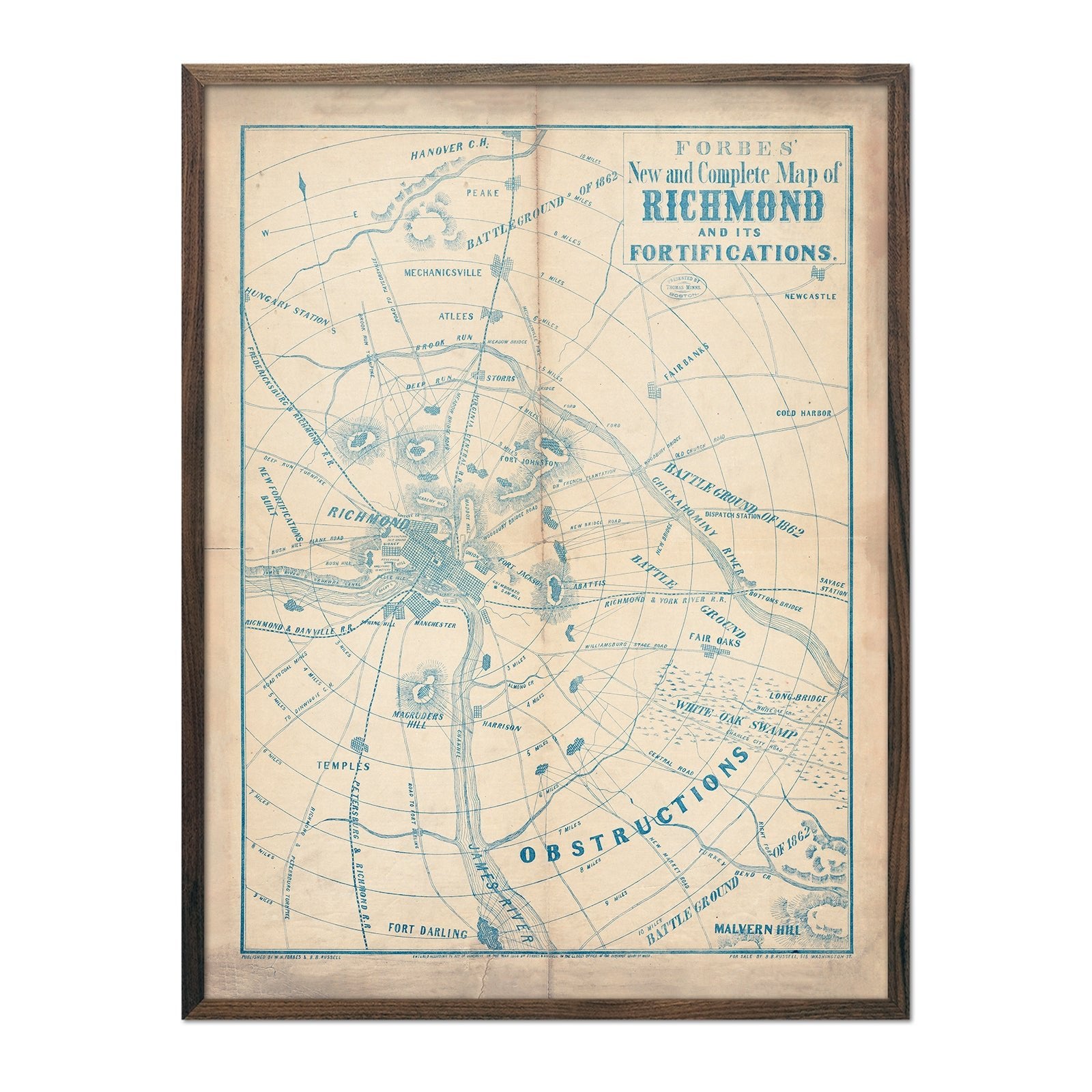
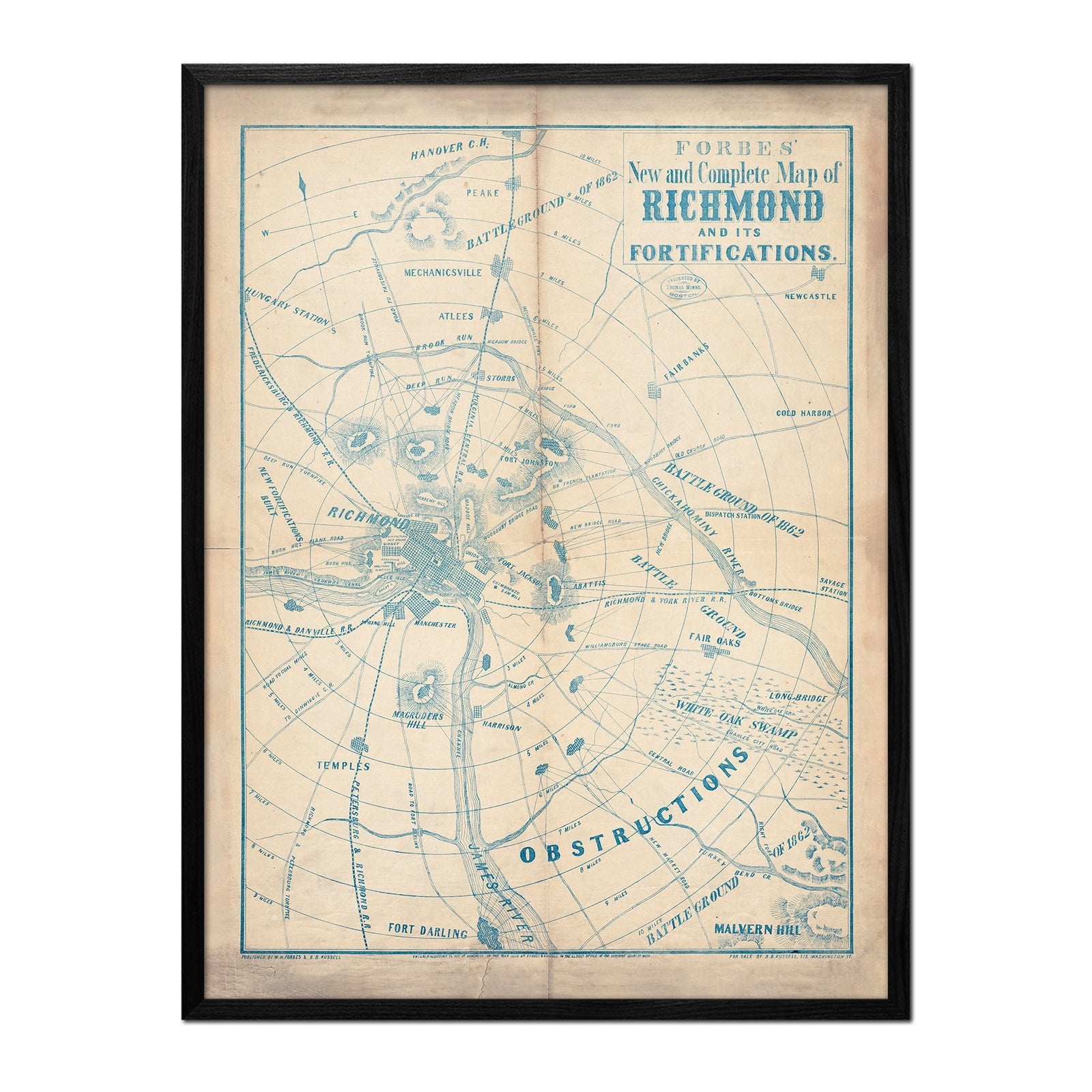
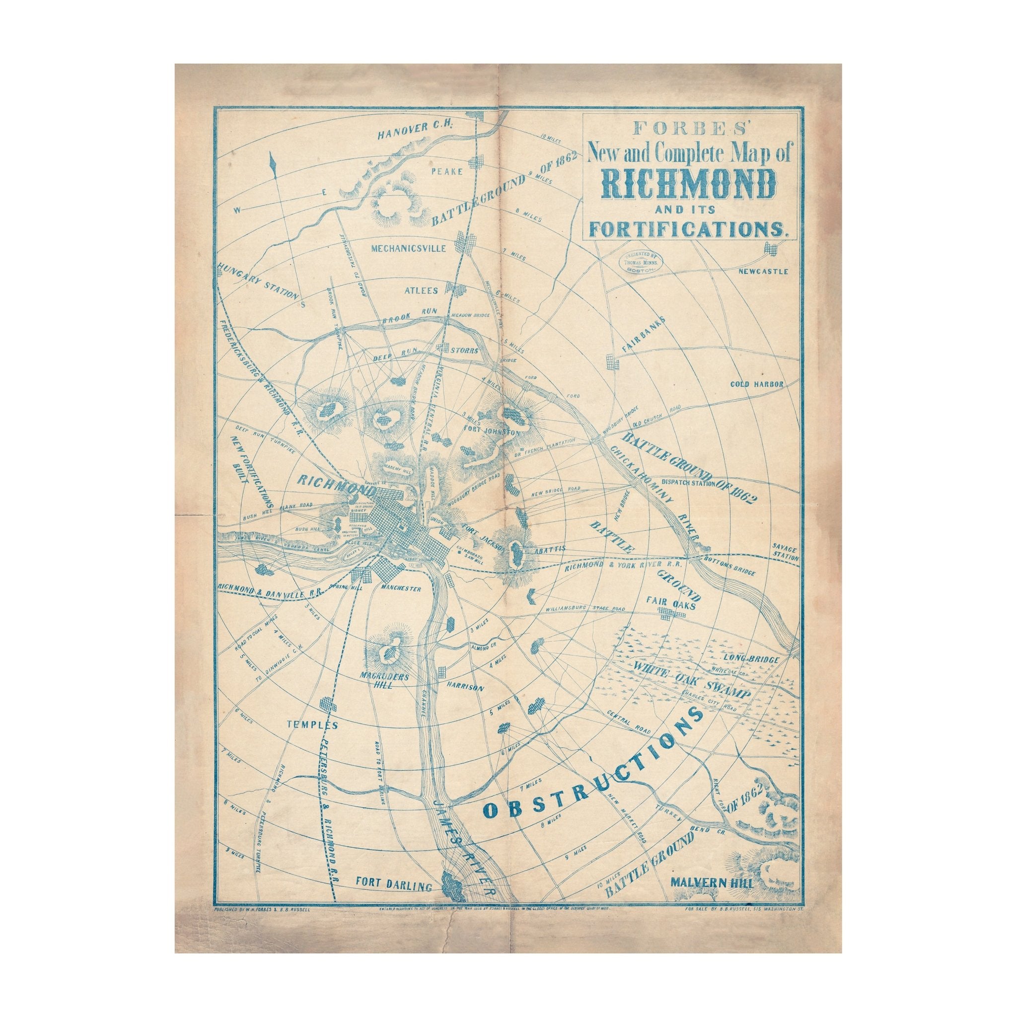
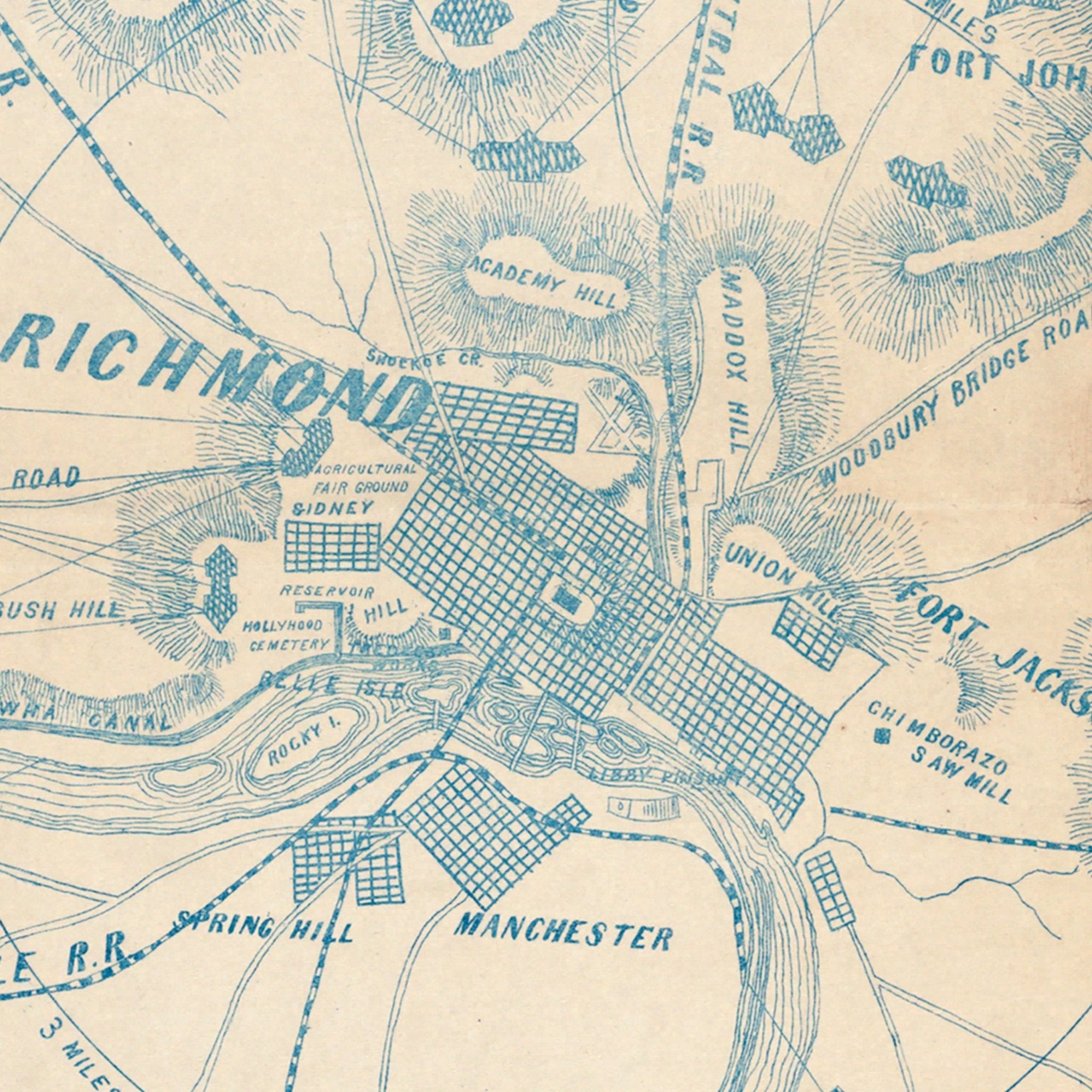
Forbes' New and Complete Map of Richmond and Its Fortifications
From
$ 79.00 USD
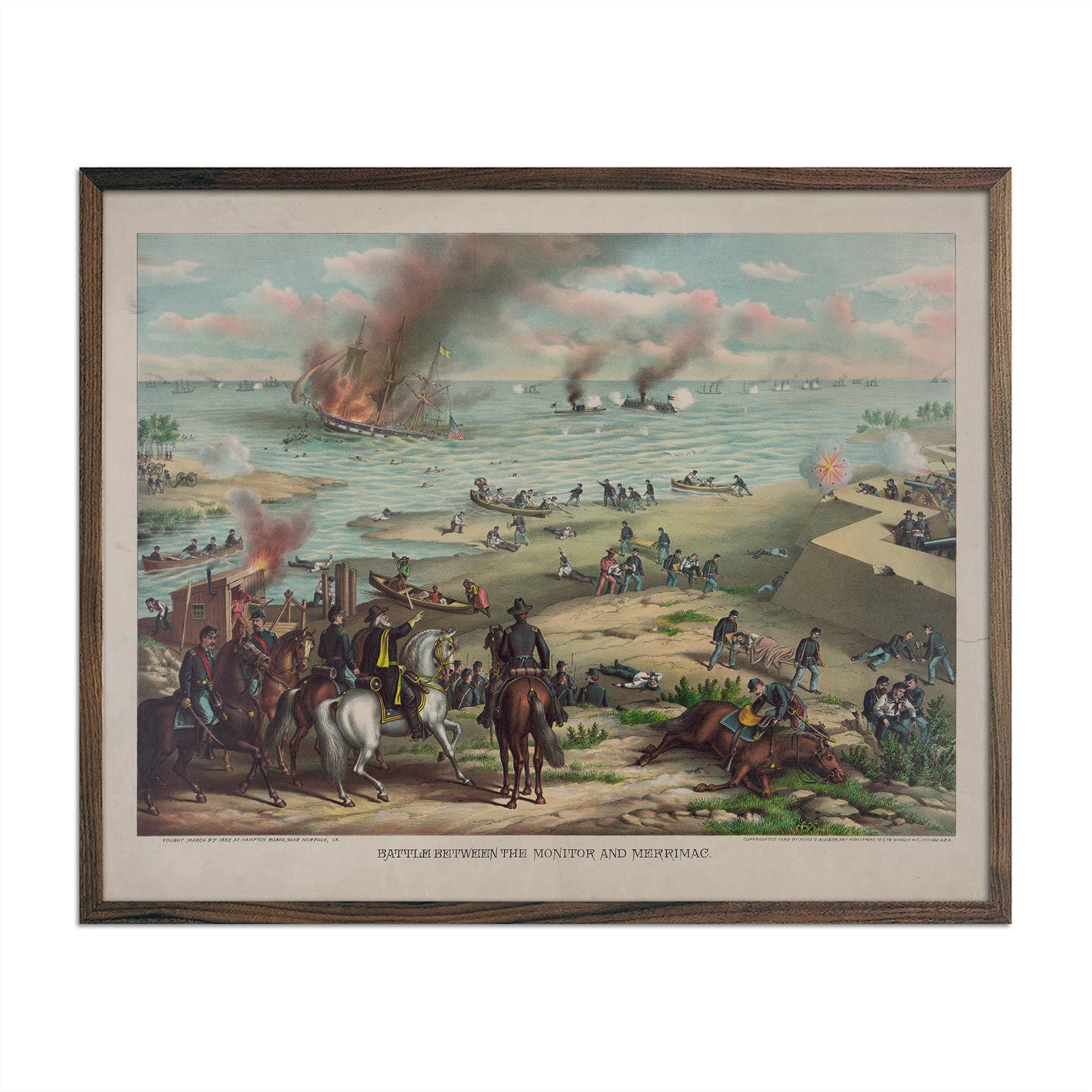
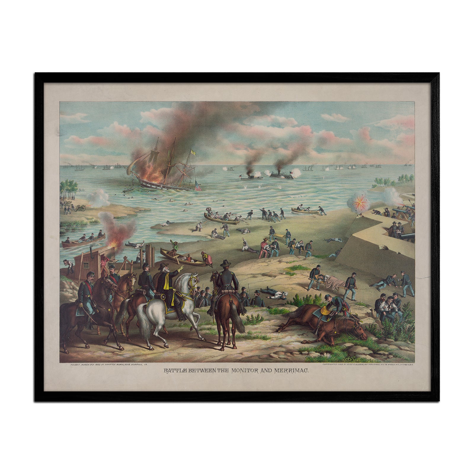
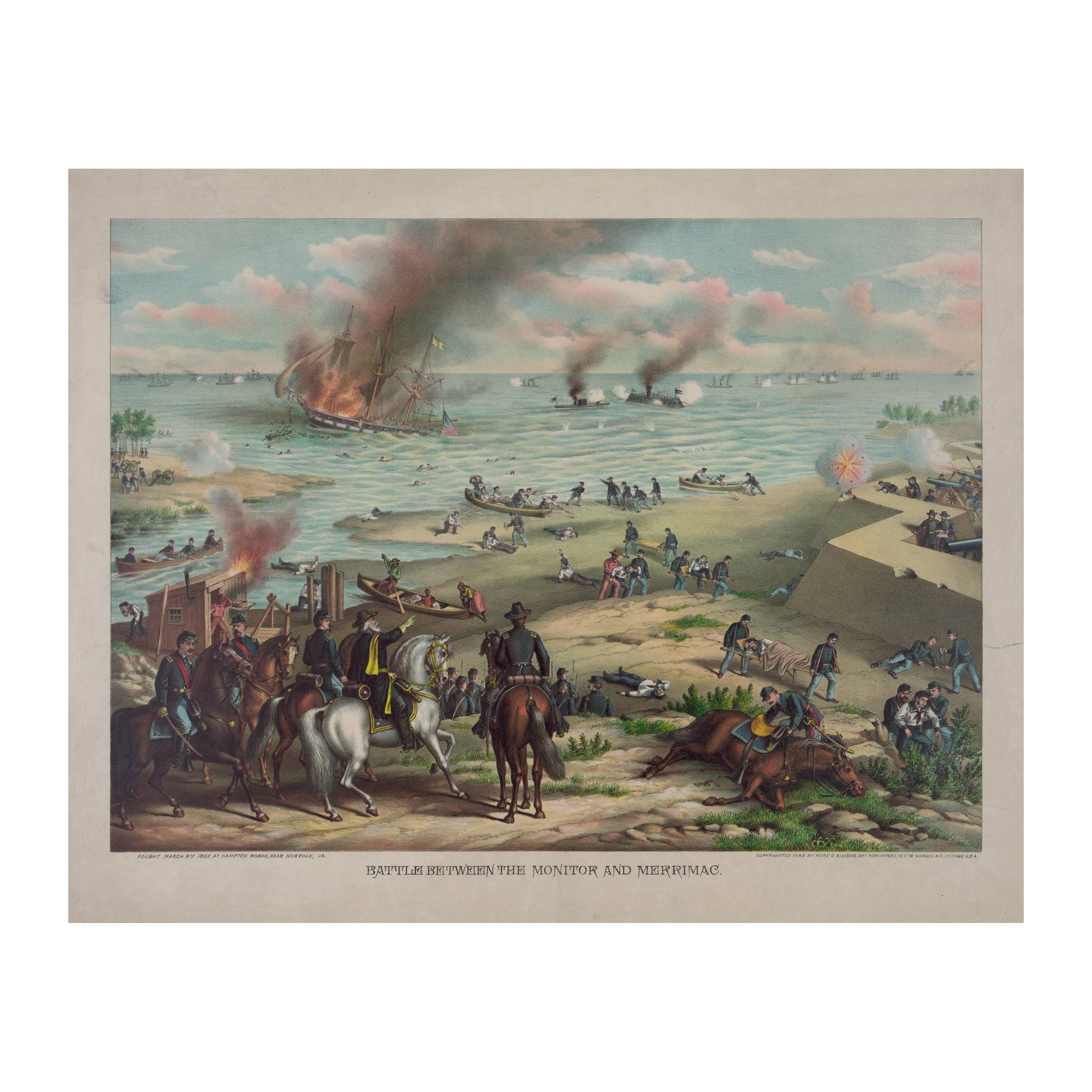
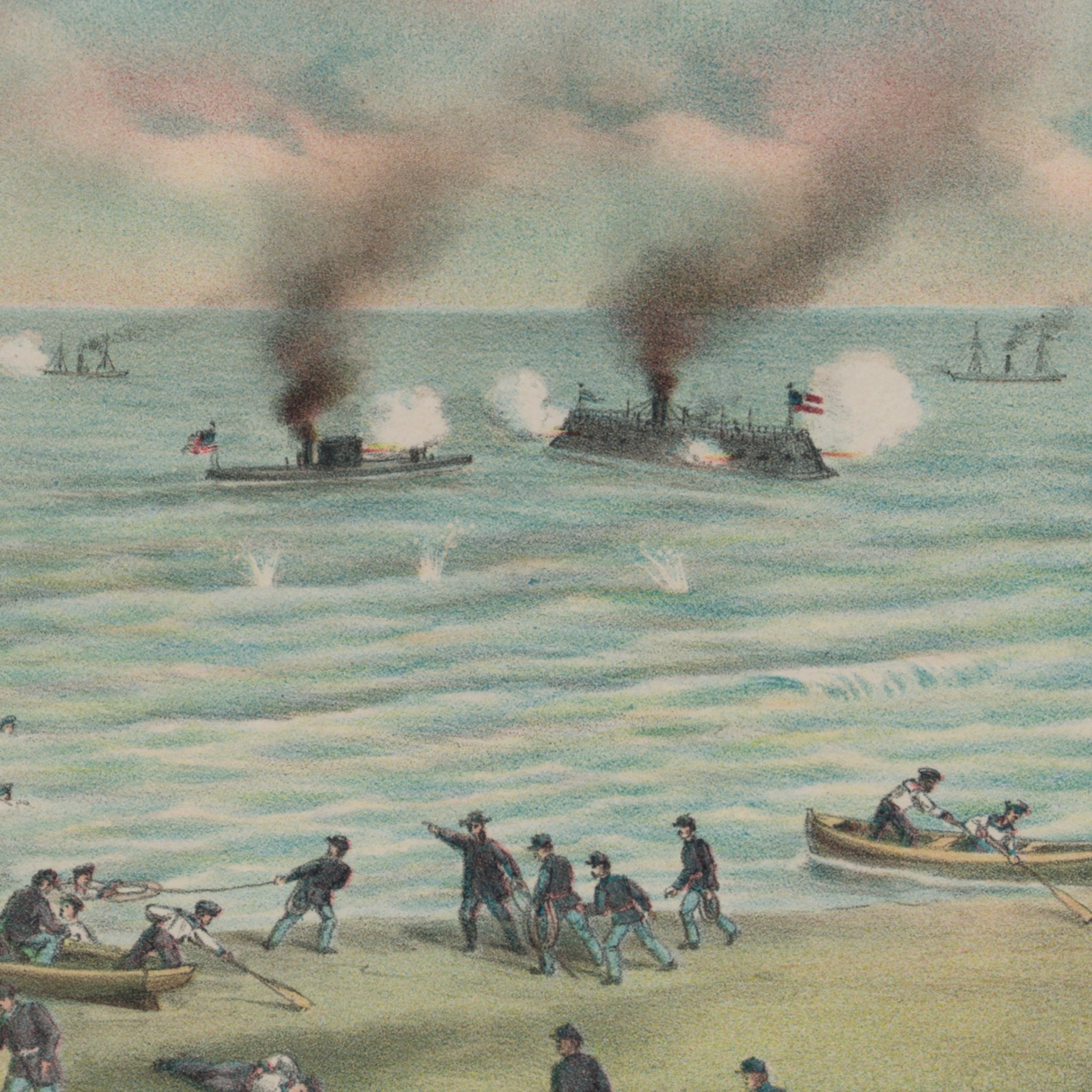
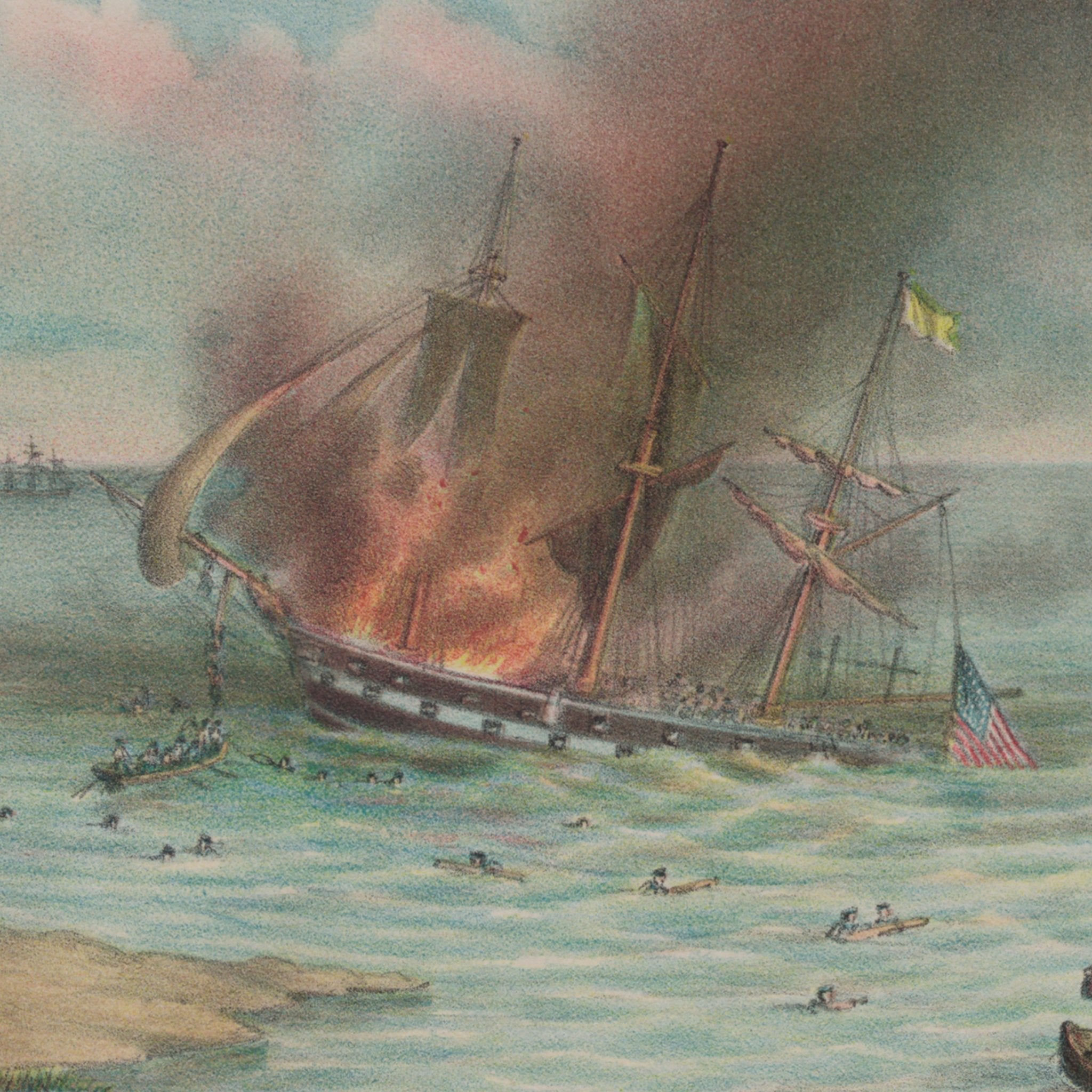
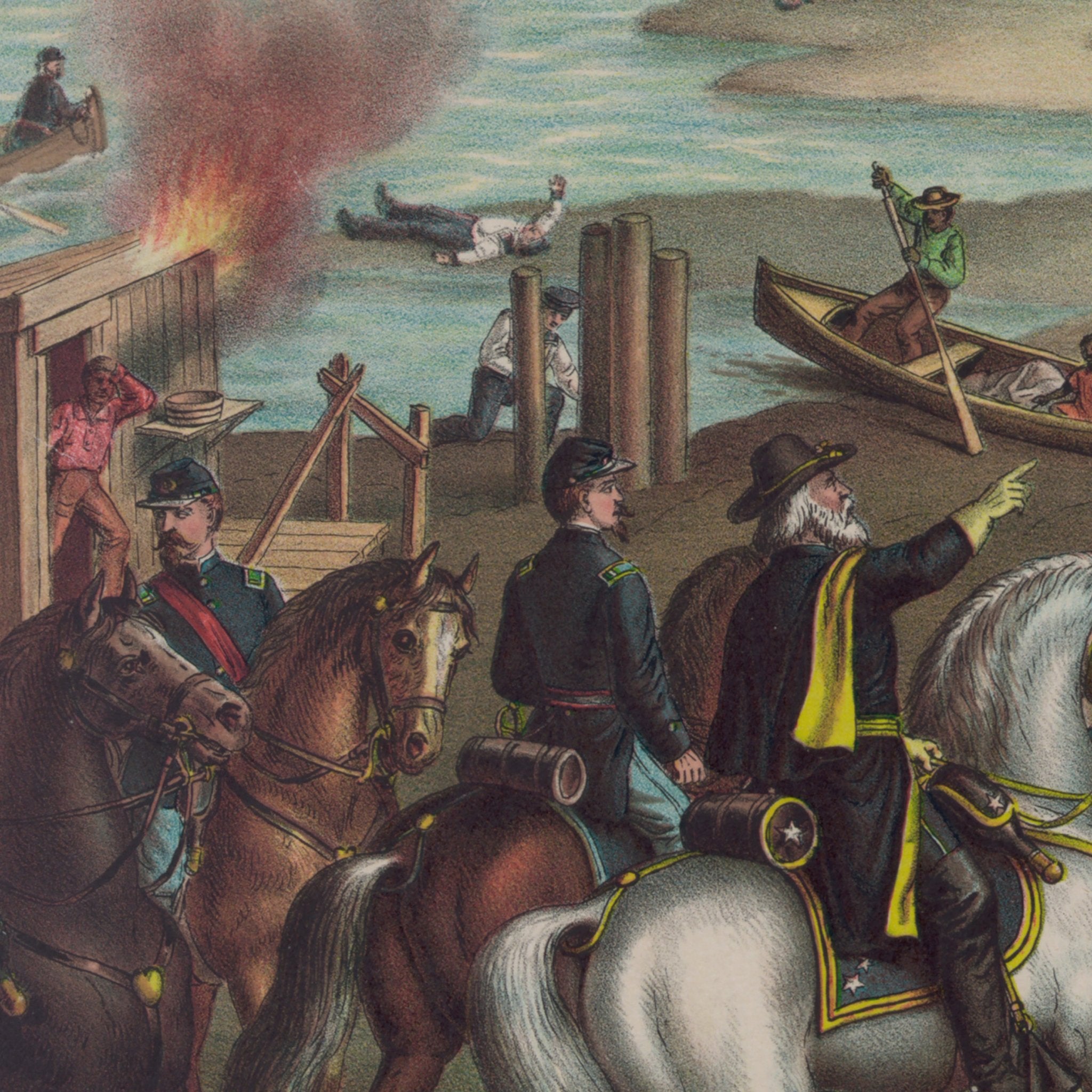
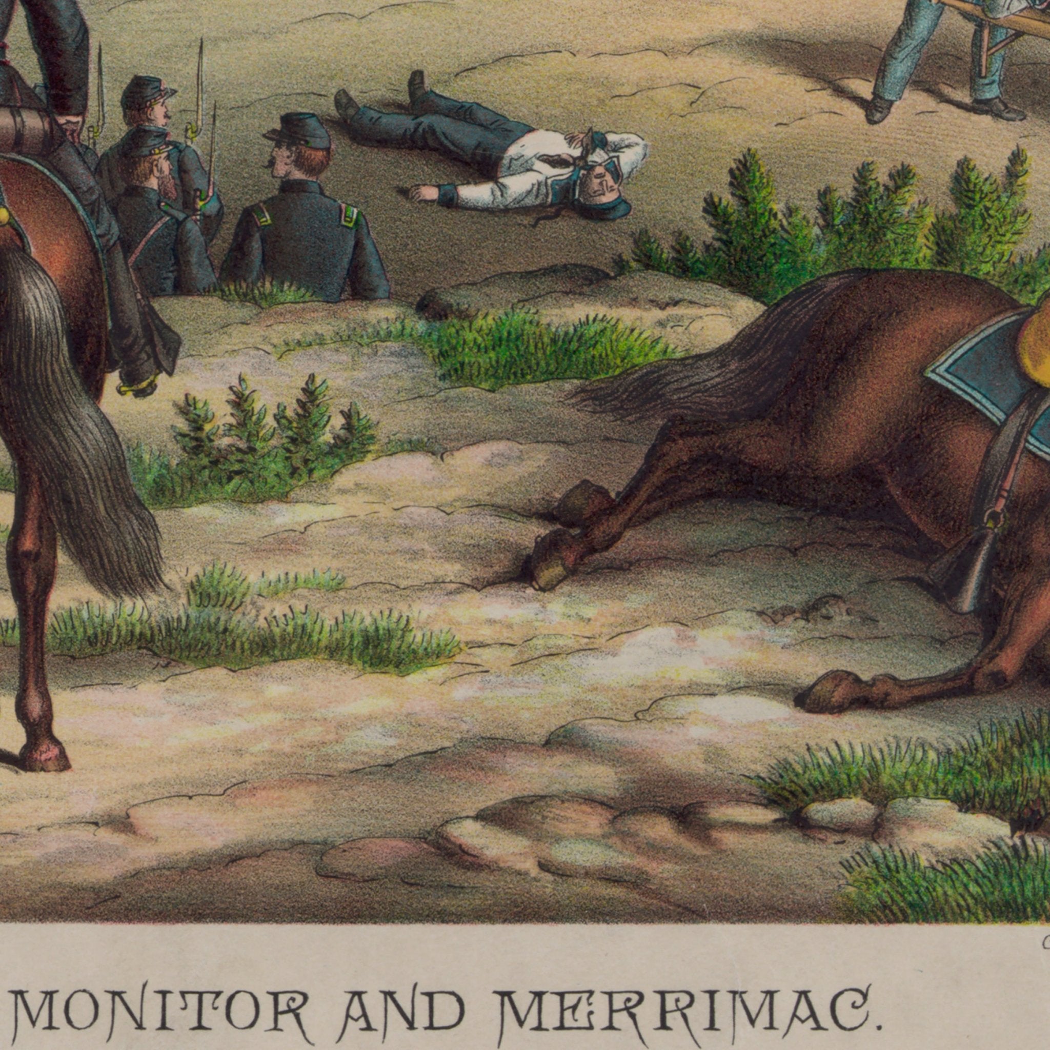
Battle between the Monitor and Merrimac
From
$ 64.00 USD
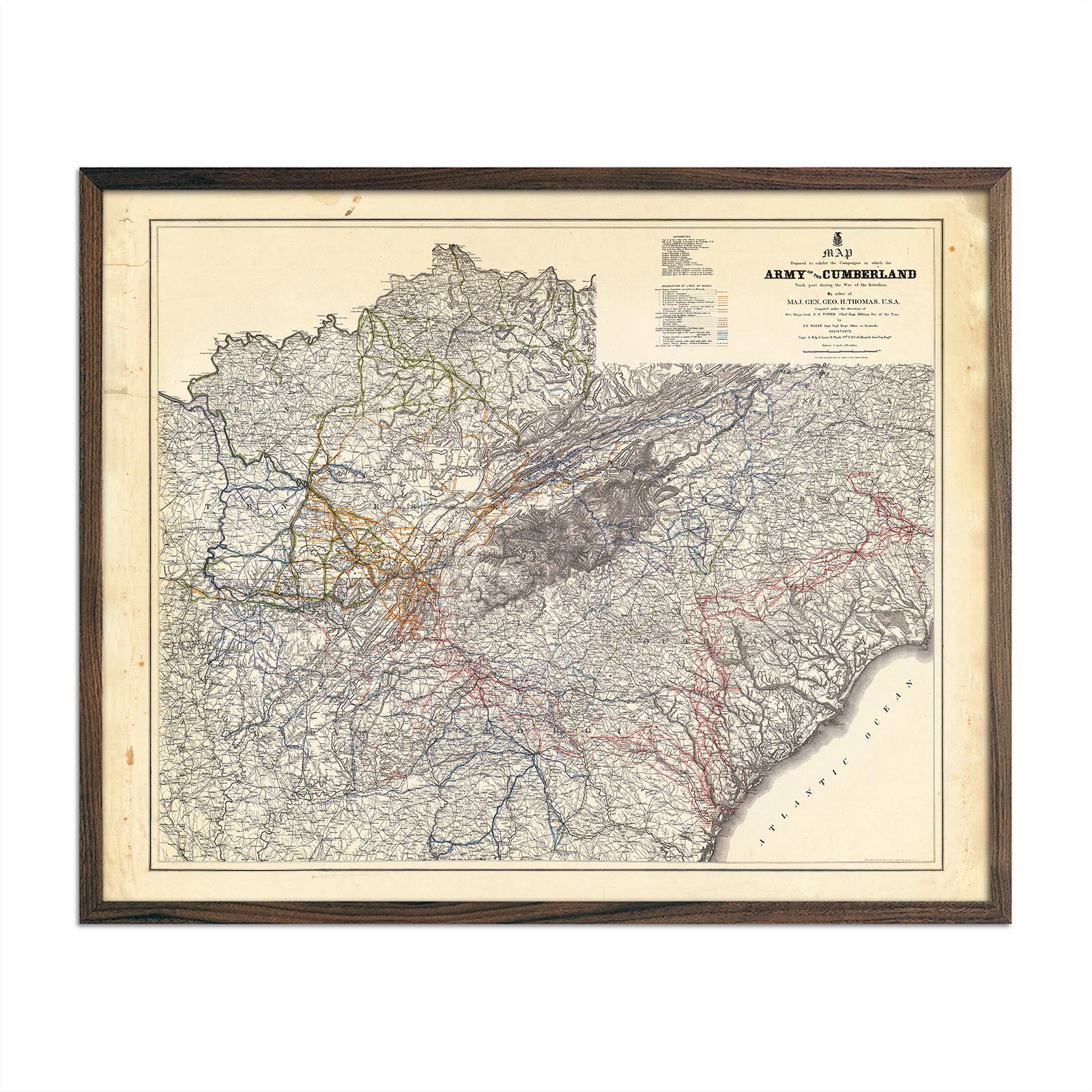
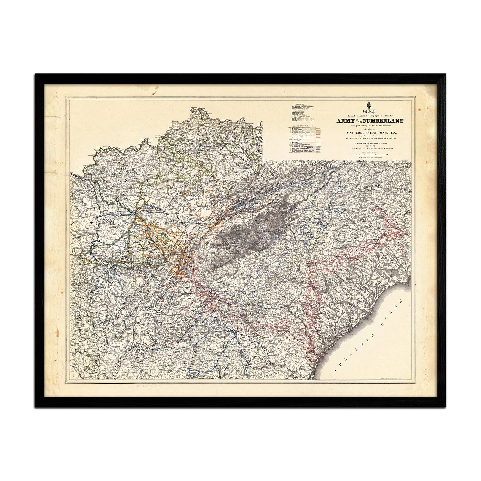
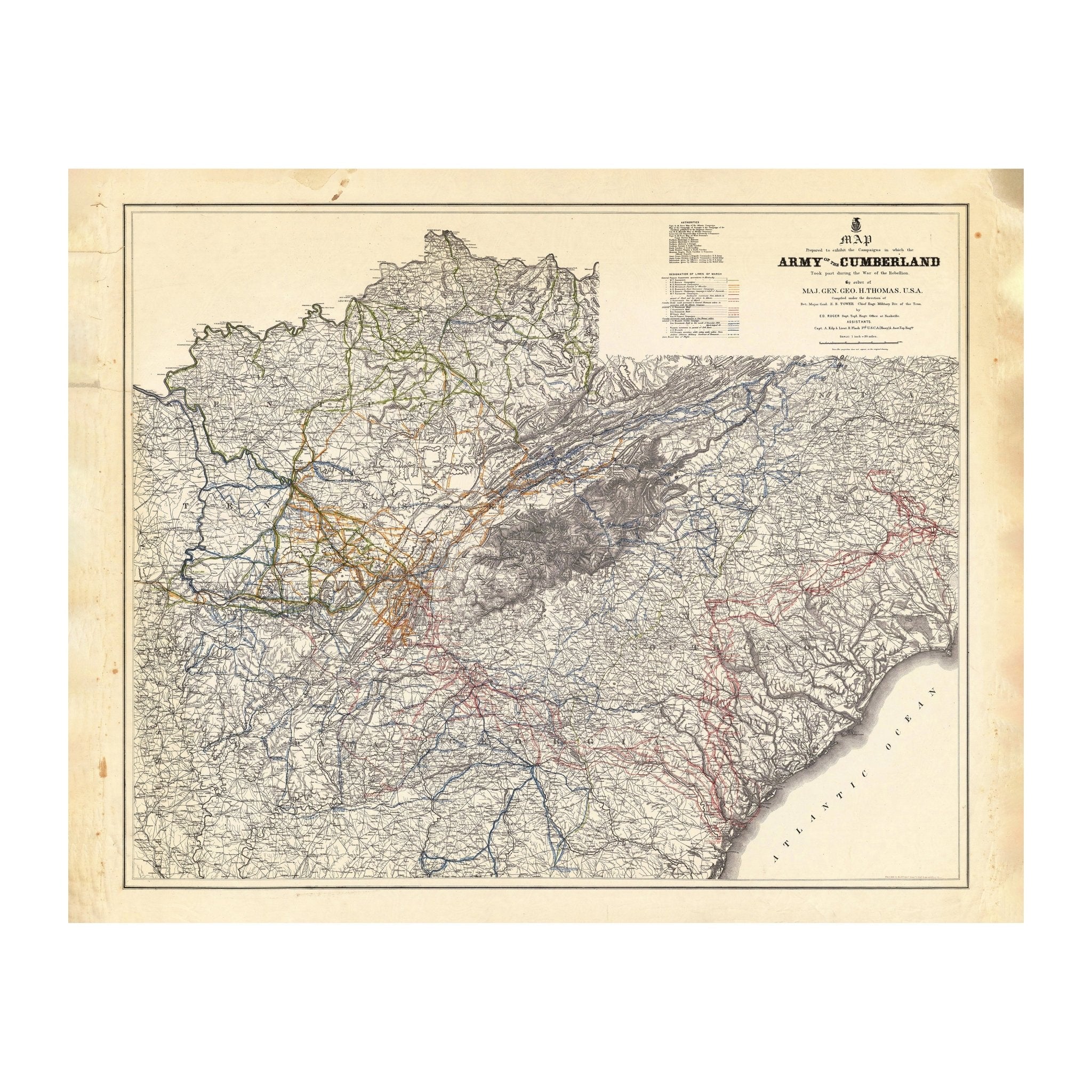
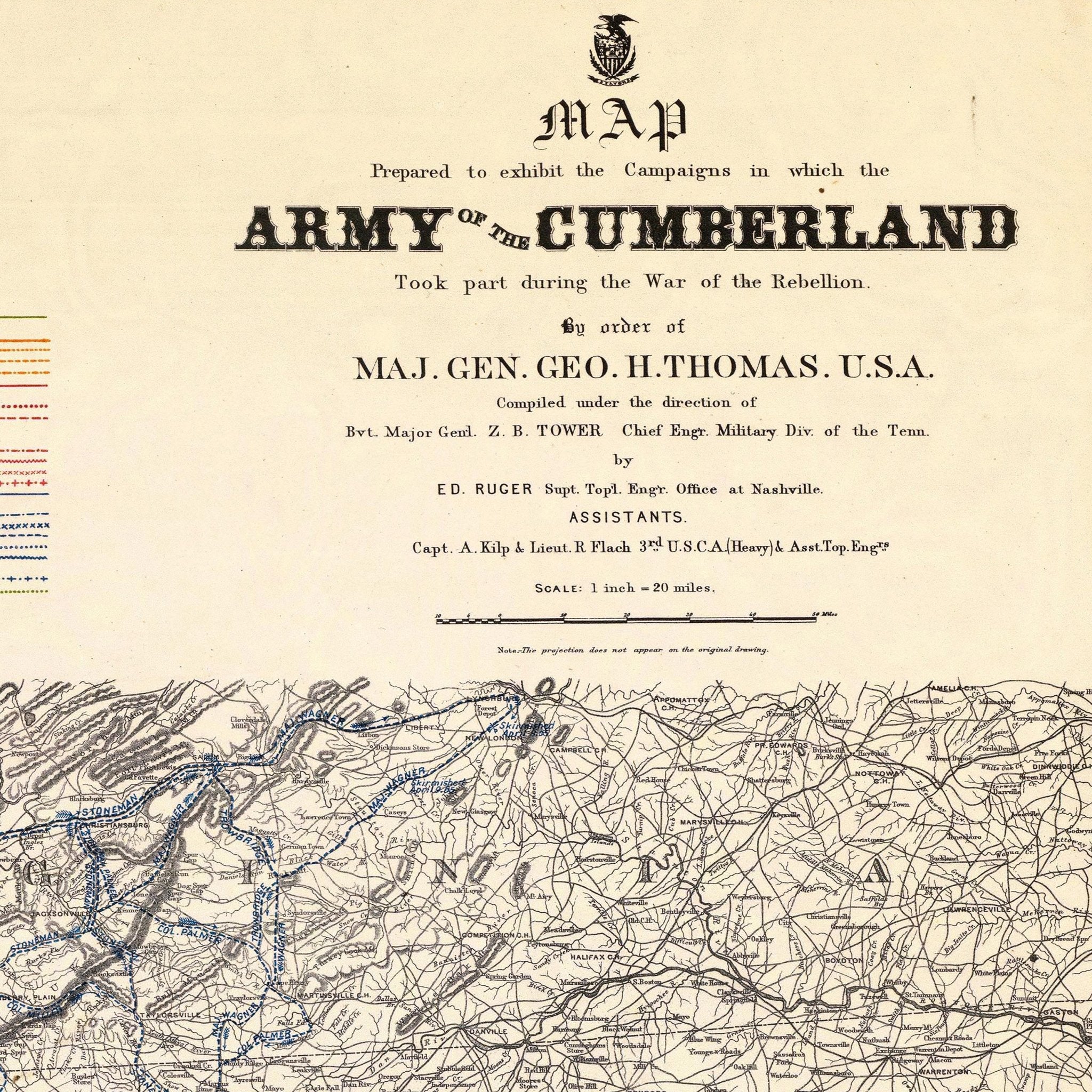
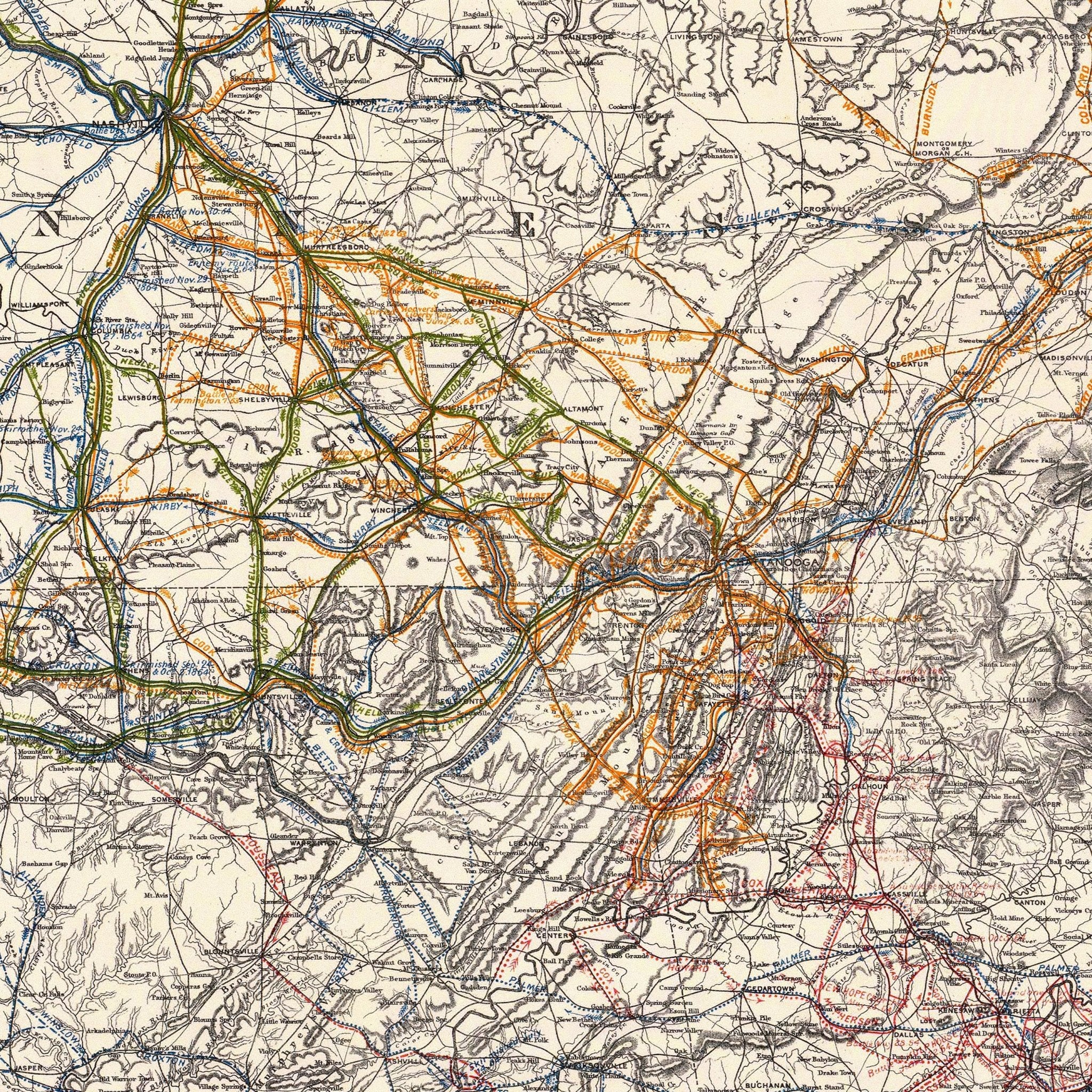
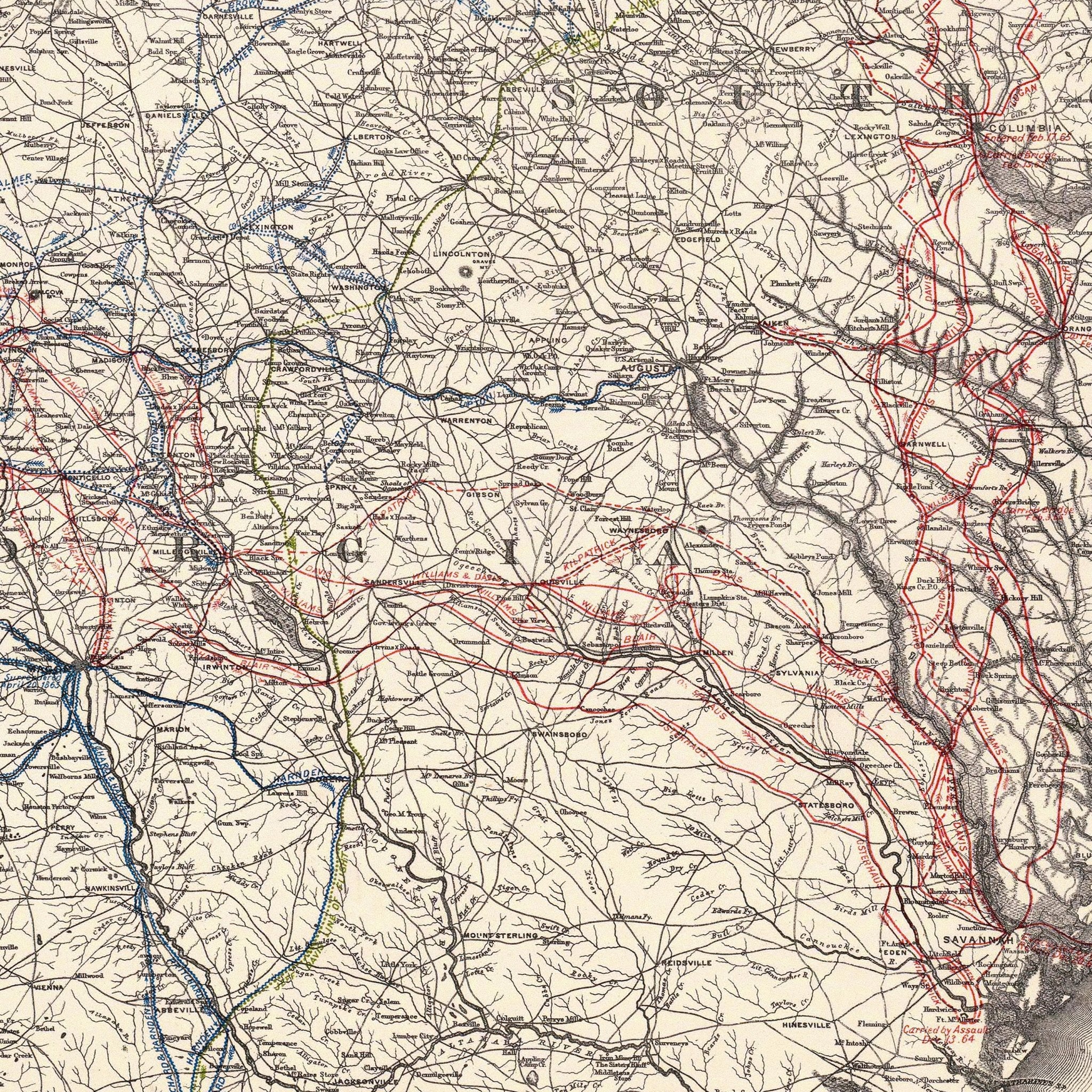
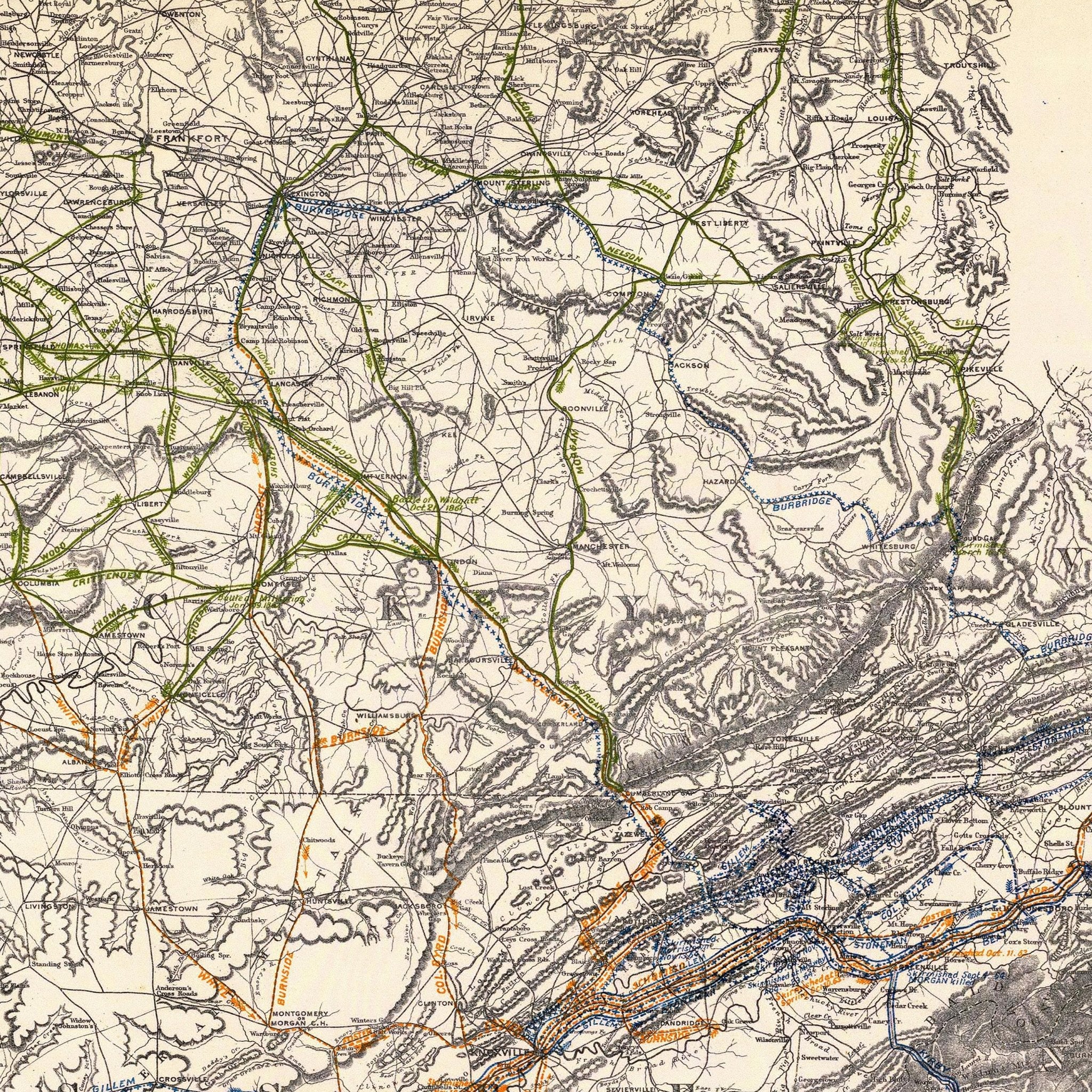
Campaigns in which Army of the Cumberland Took Part
From
$ 64.00 USD
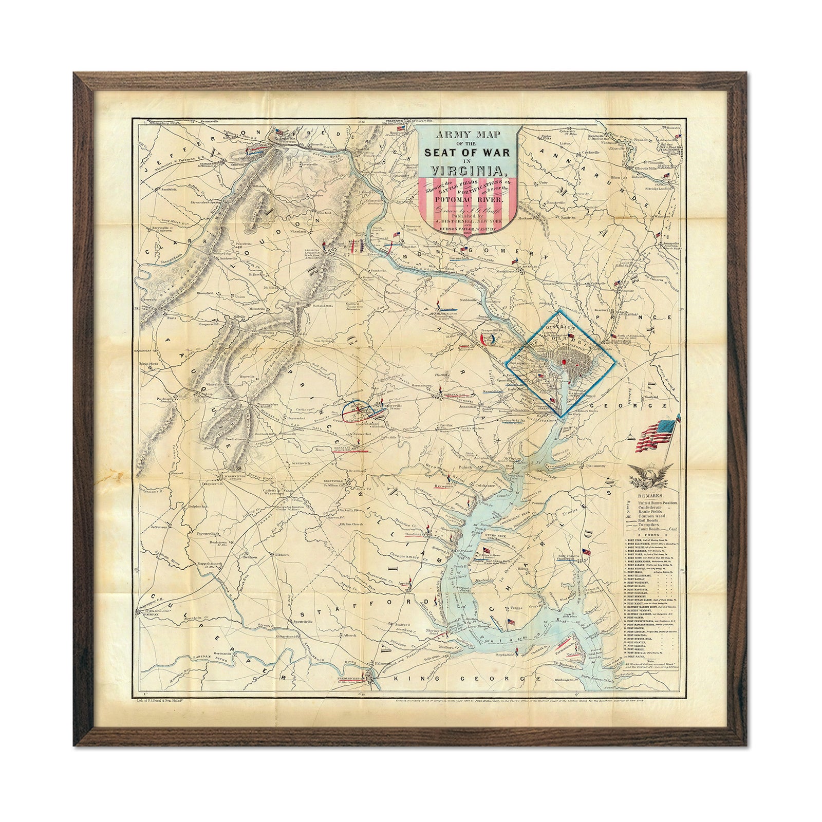
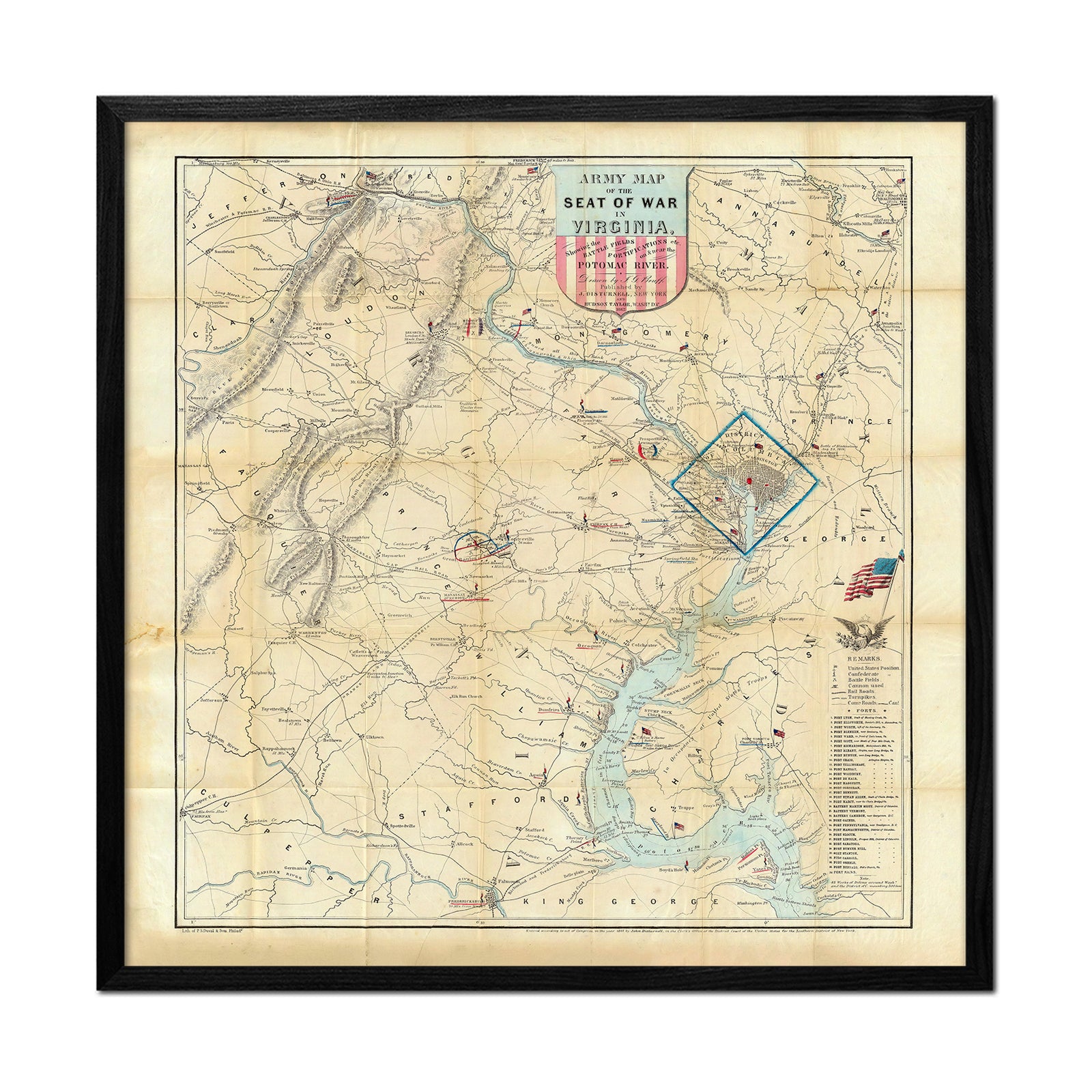
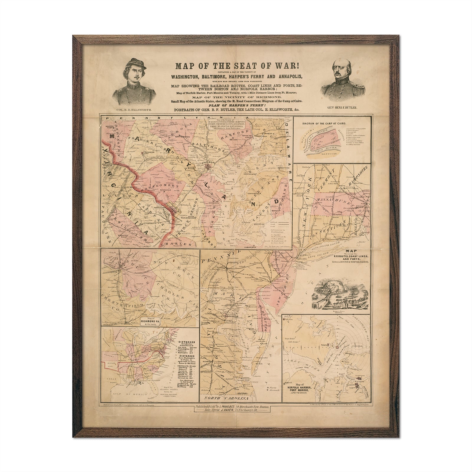
Army Map of the Seat of War in Virginia
From
$ 89.00 USD
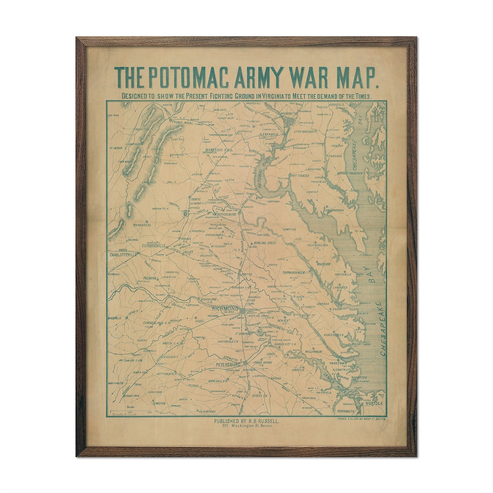
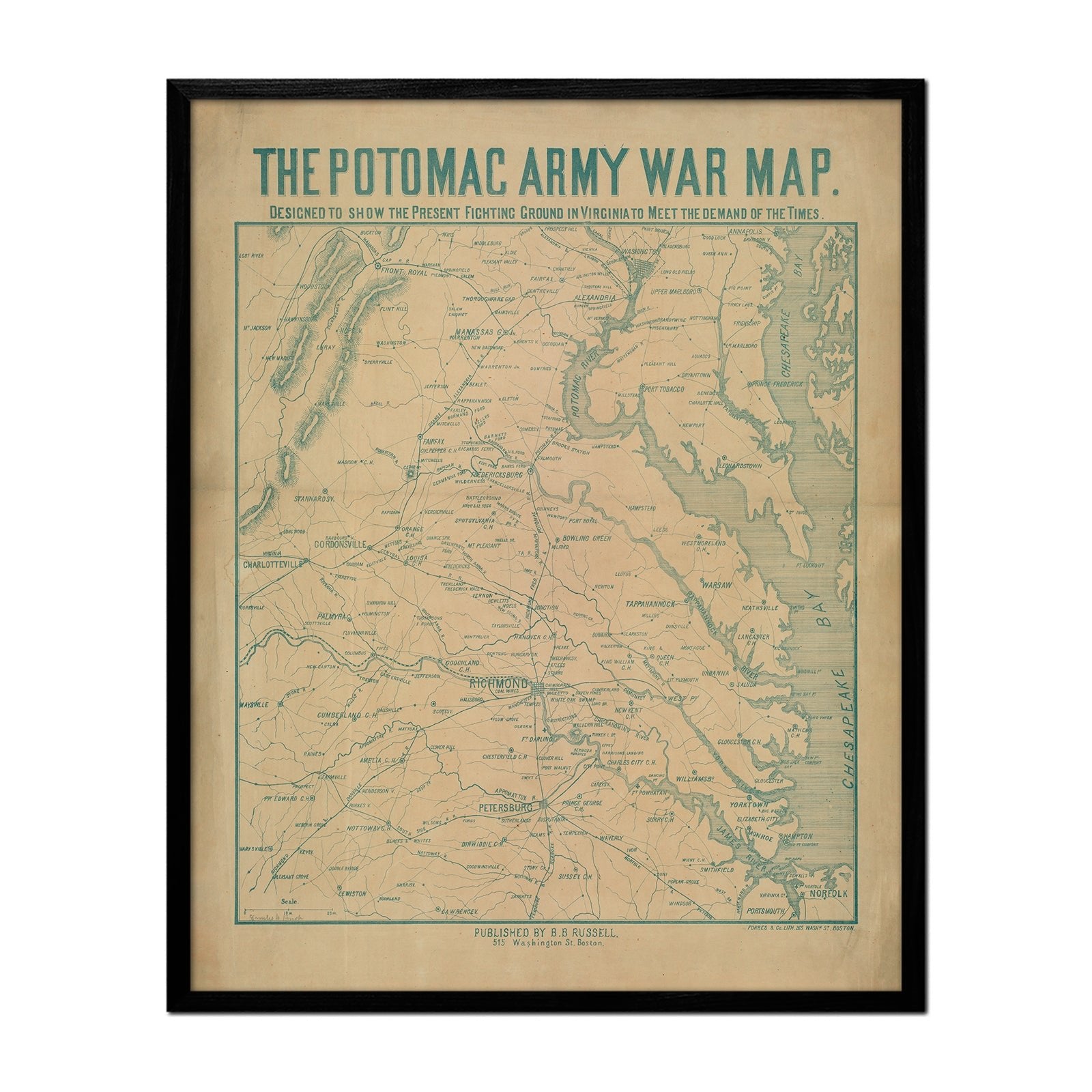
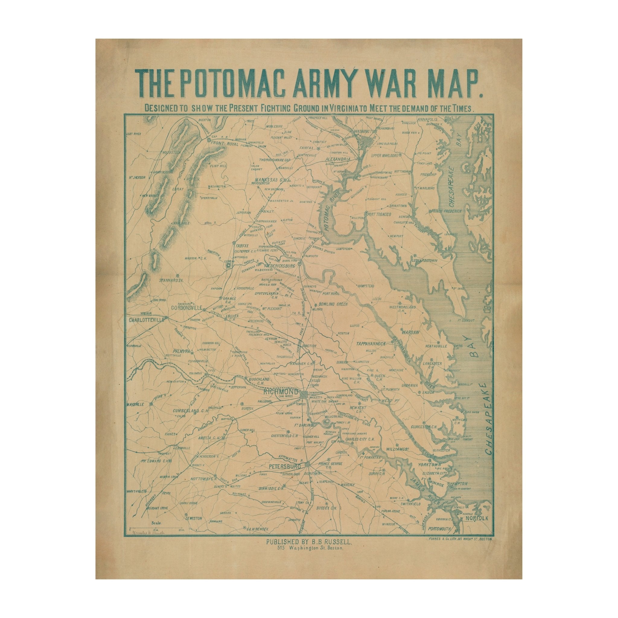
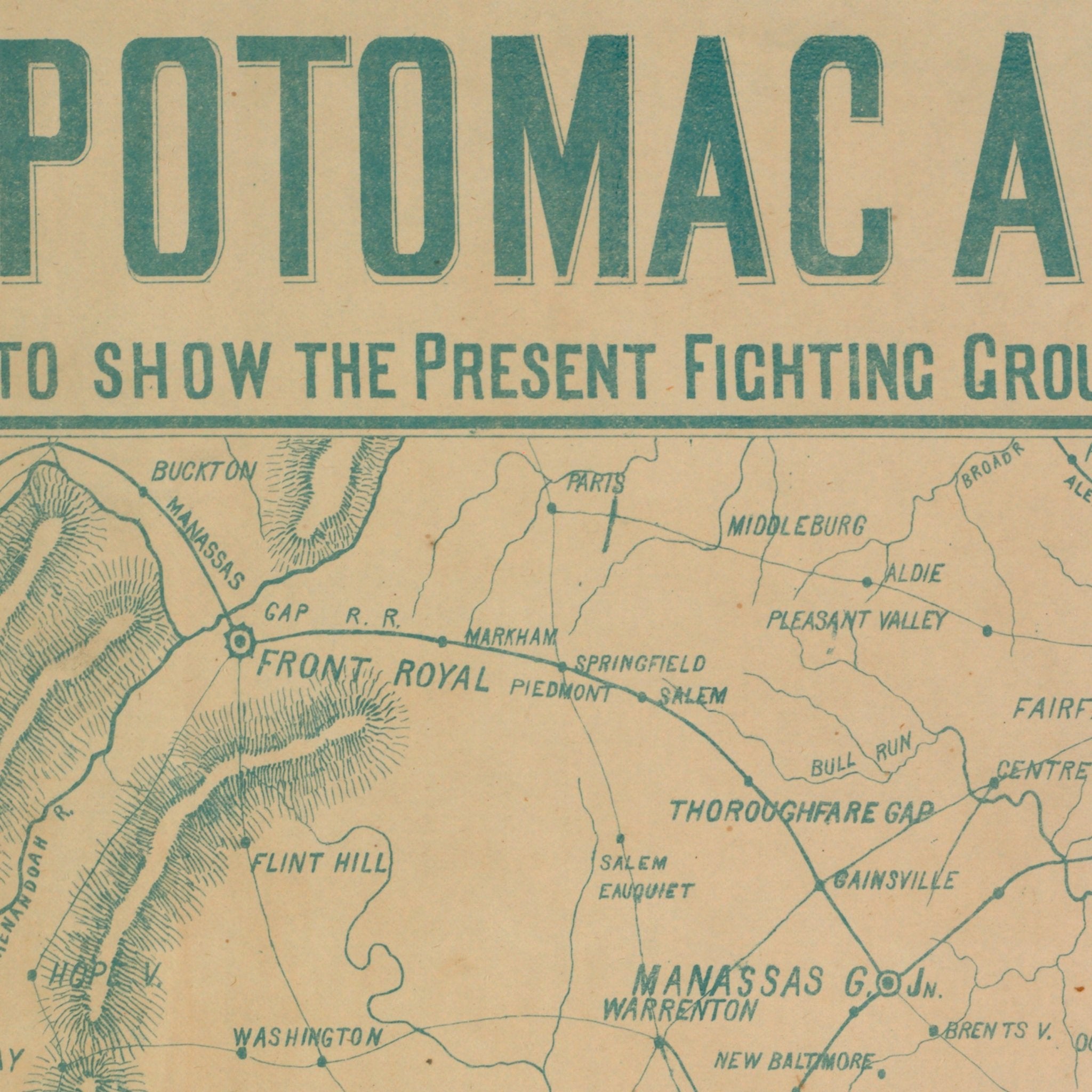
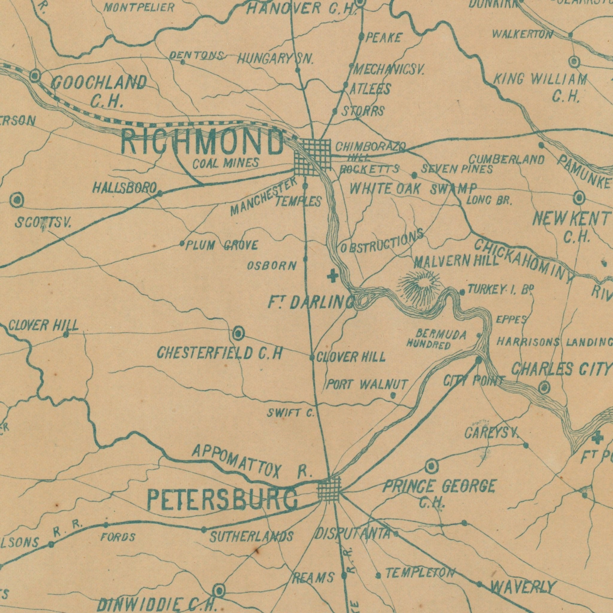
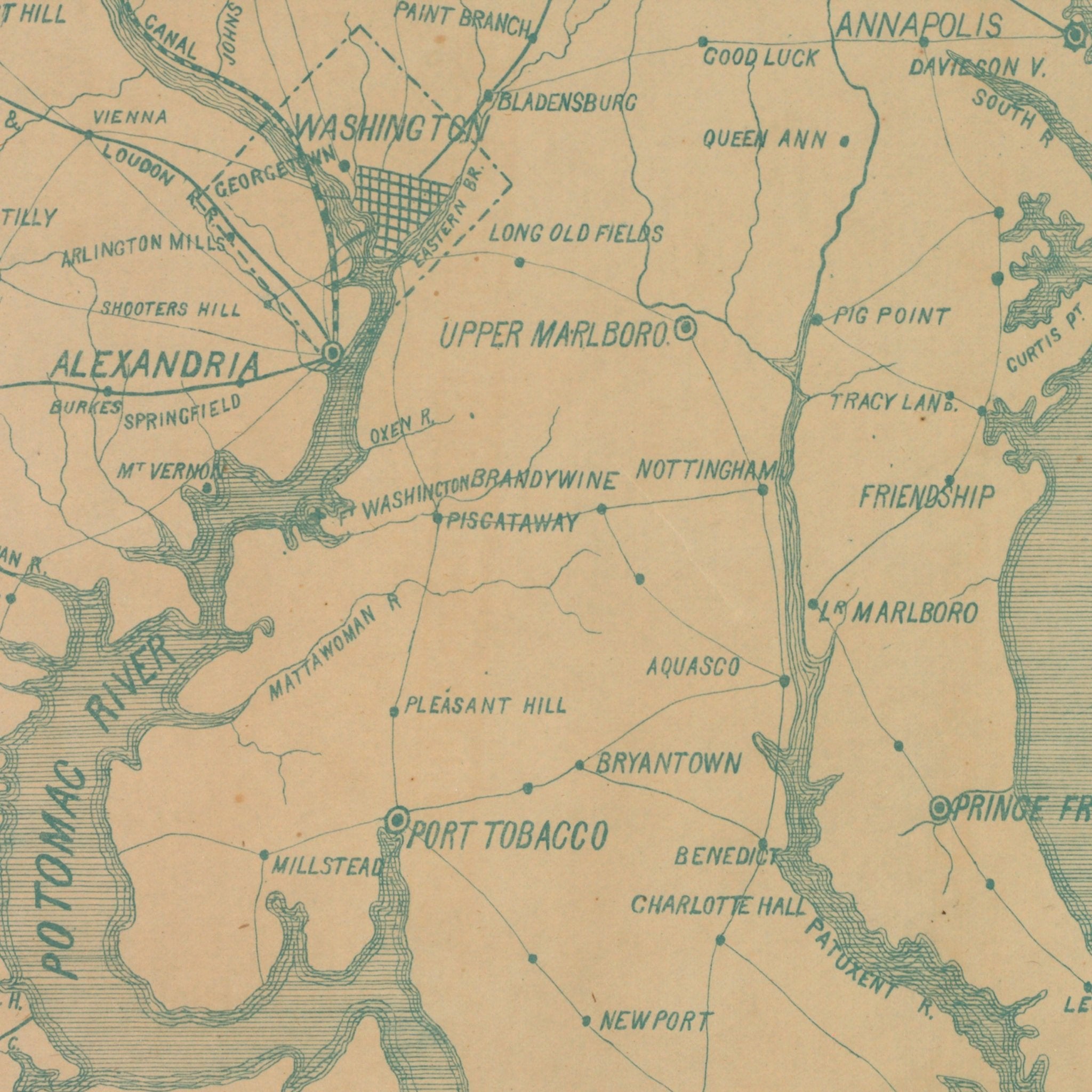
Potomac Army War Map
From
$ 64.00 USD
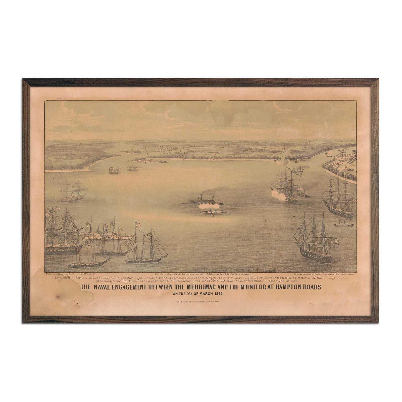
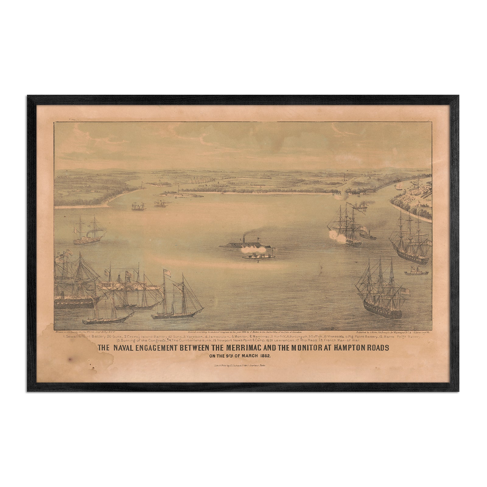
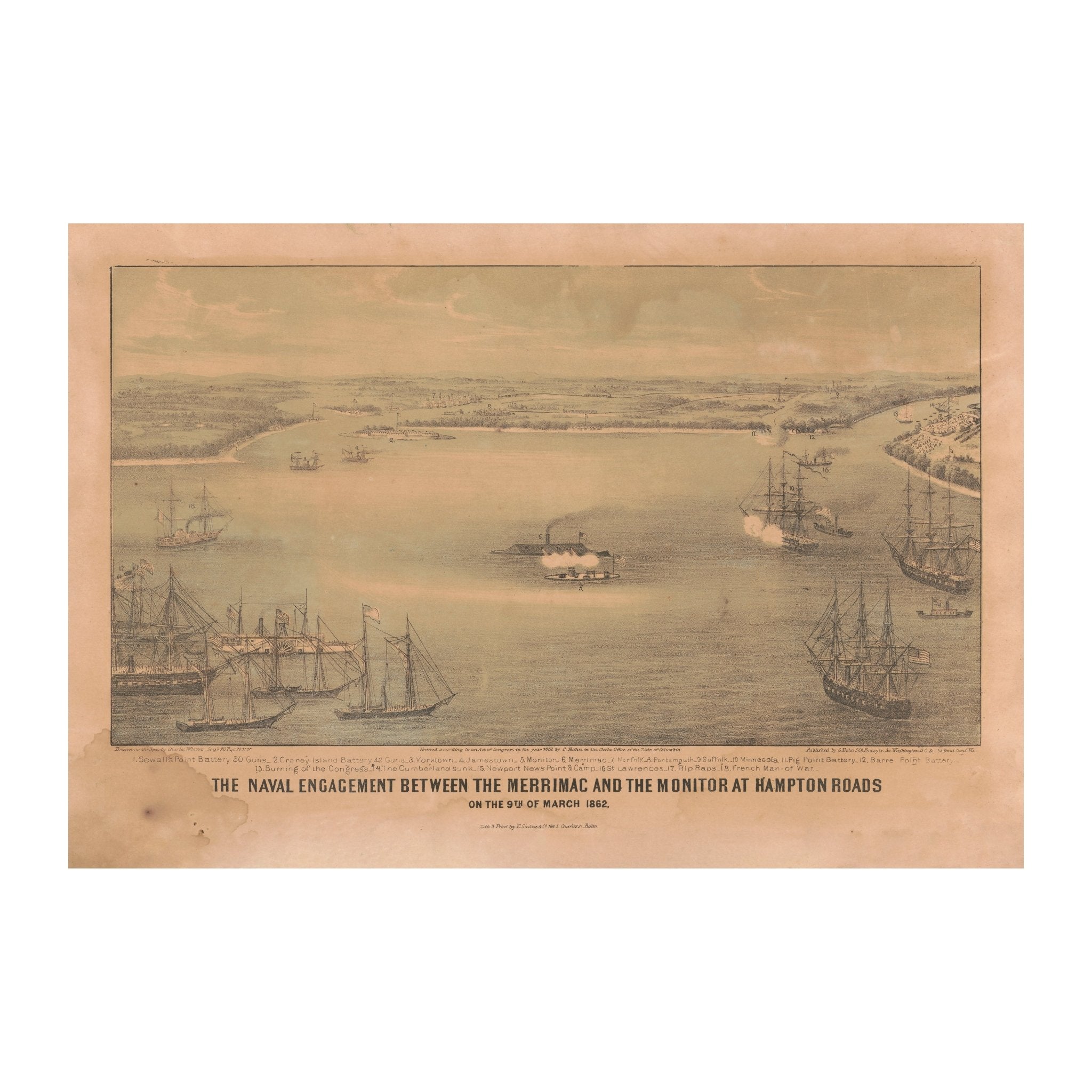
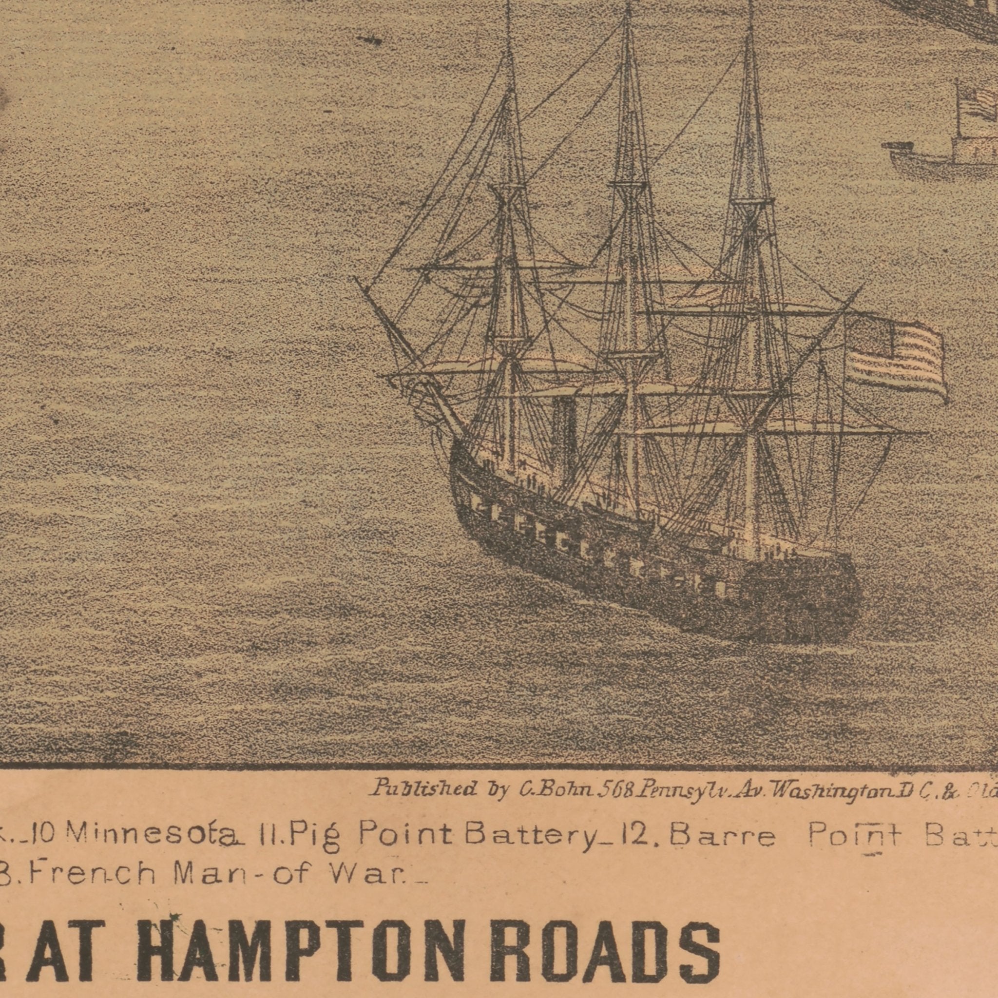
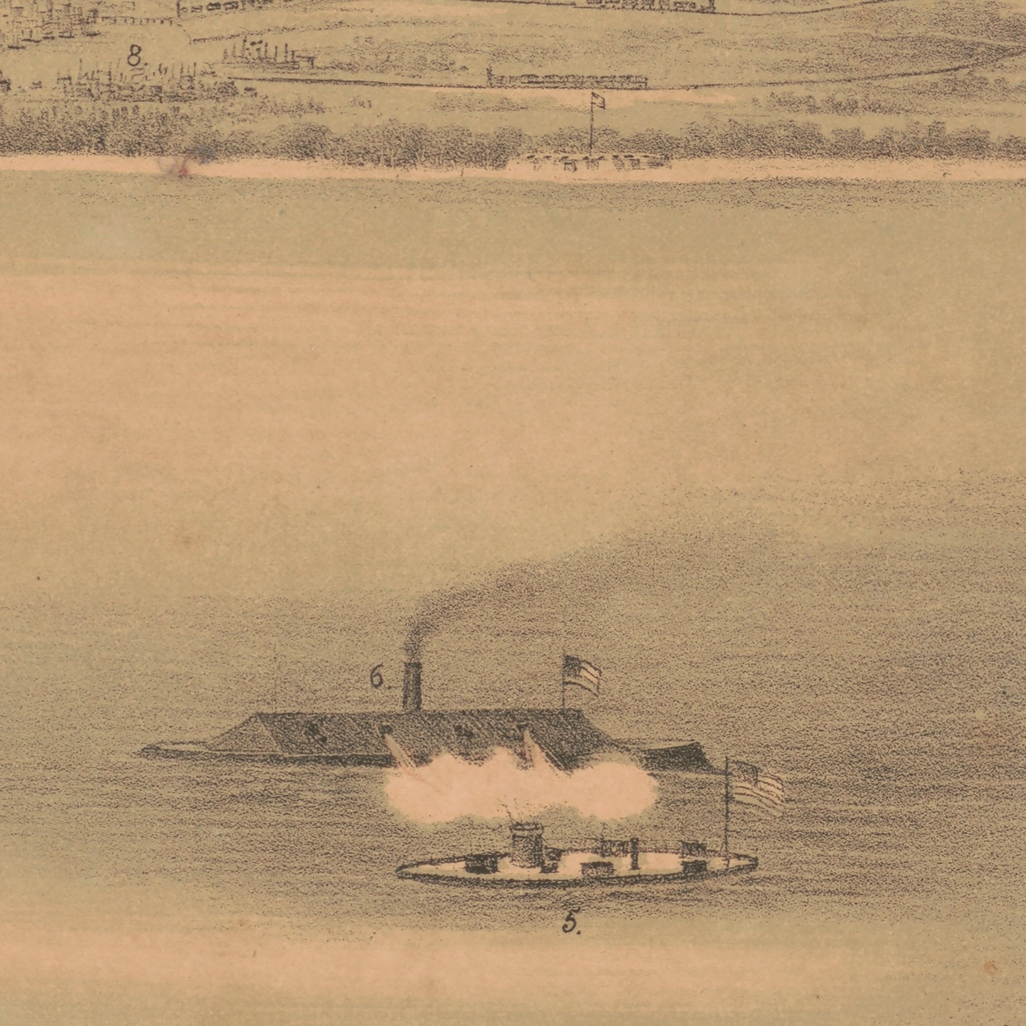
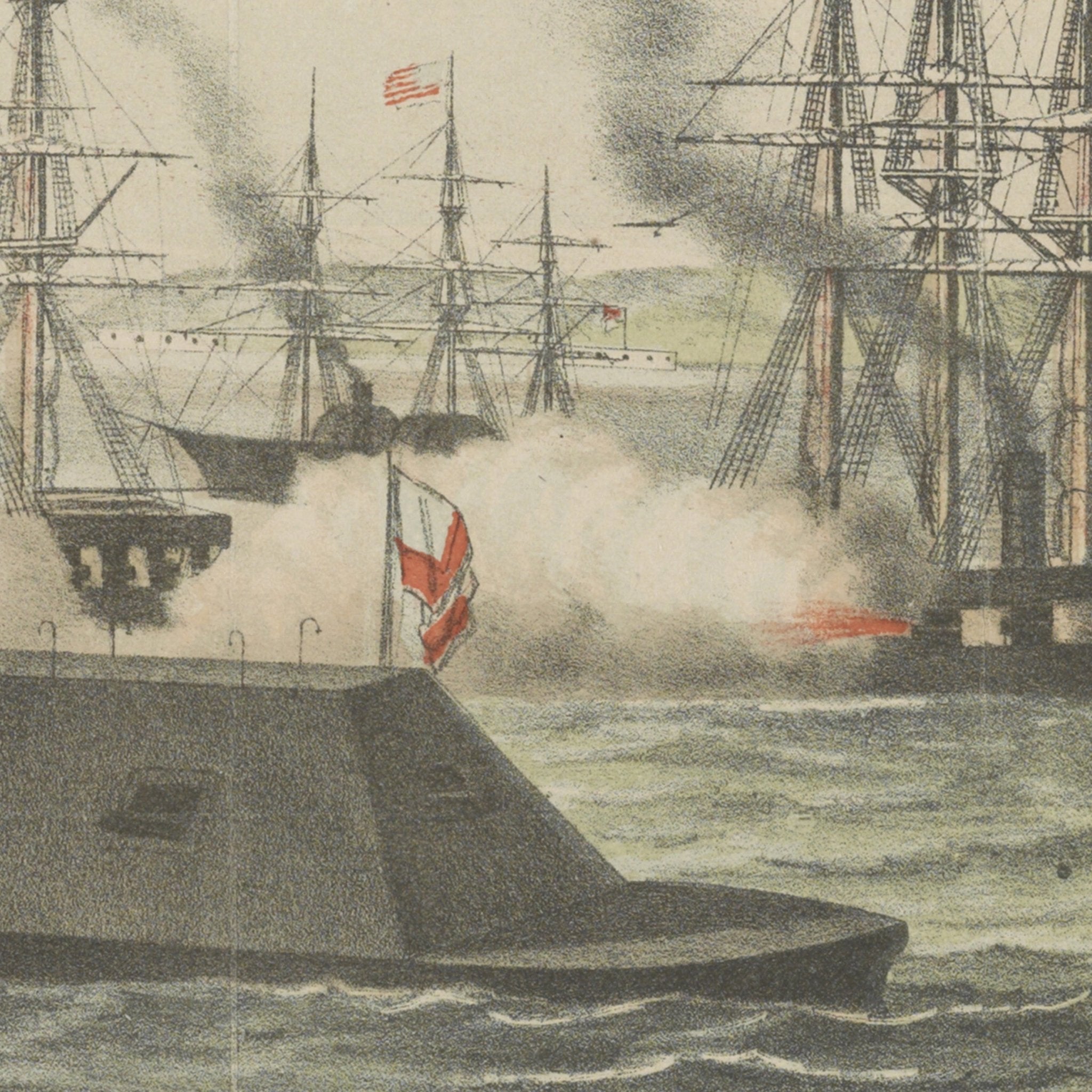
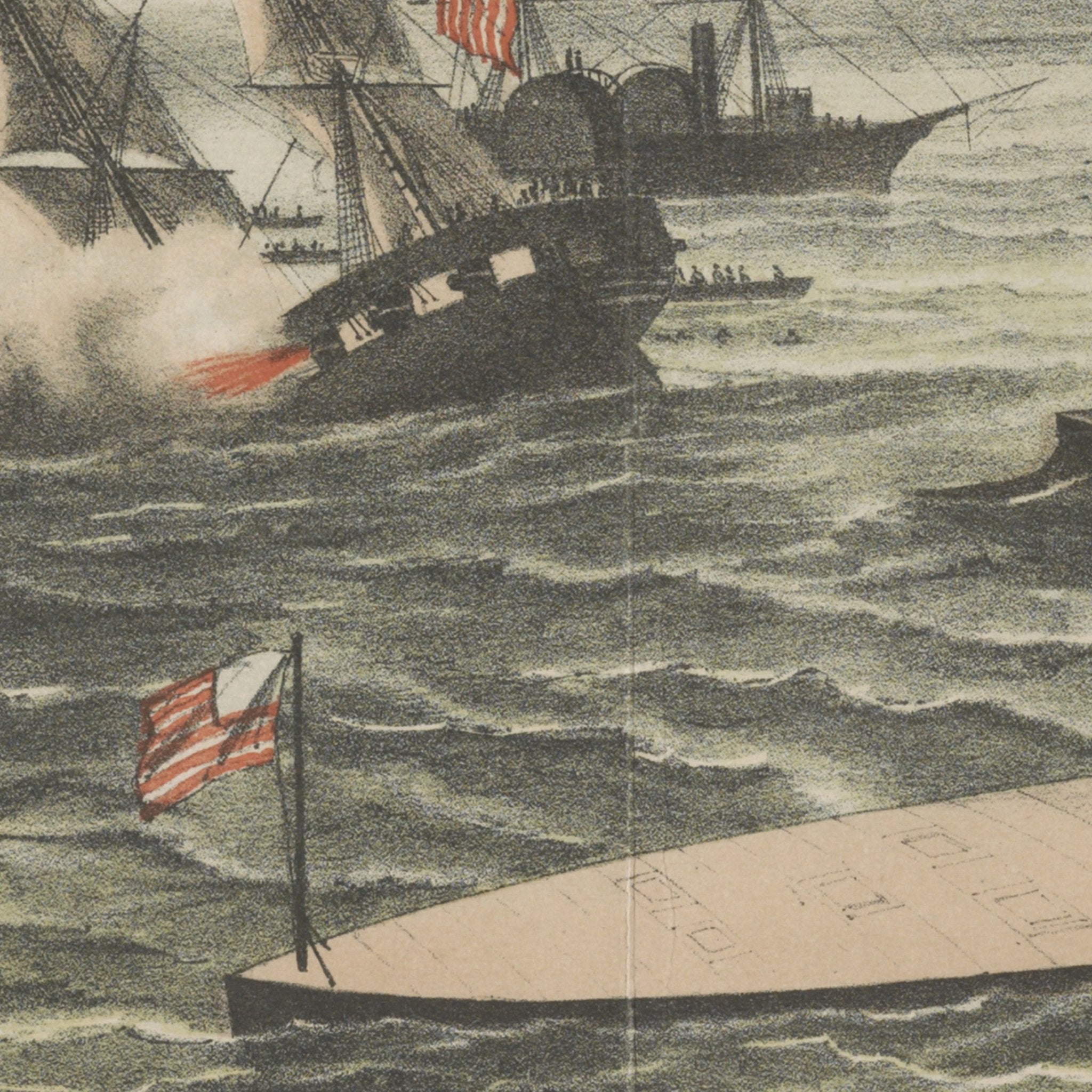
The Naval Engagement between the Merrimac and the Monitor at Hampton Roads
From
$ 79.00 USD
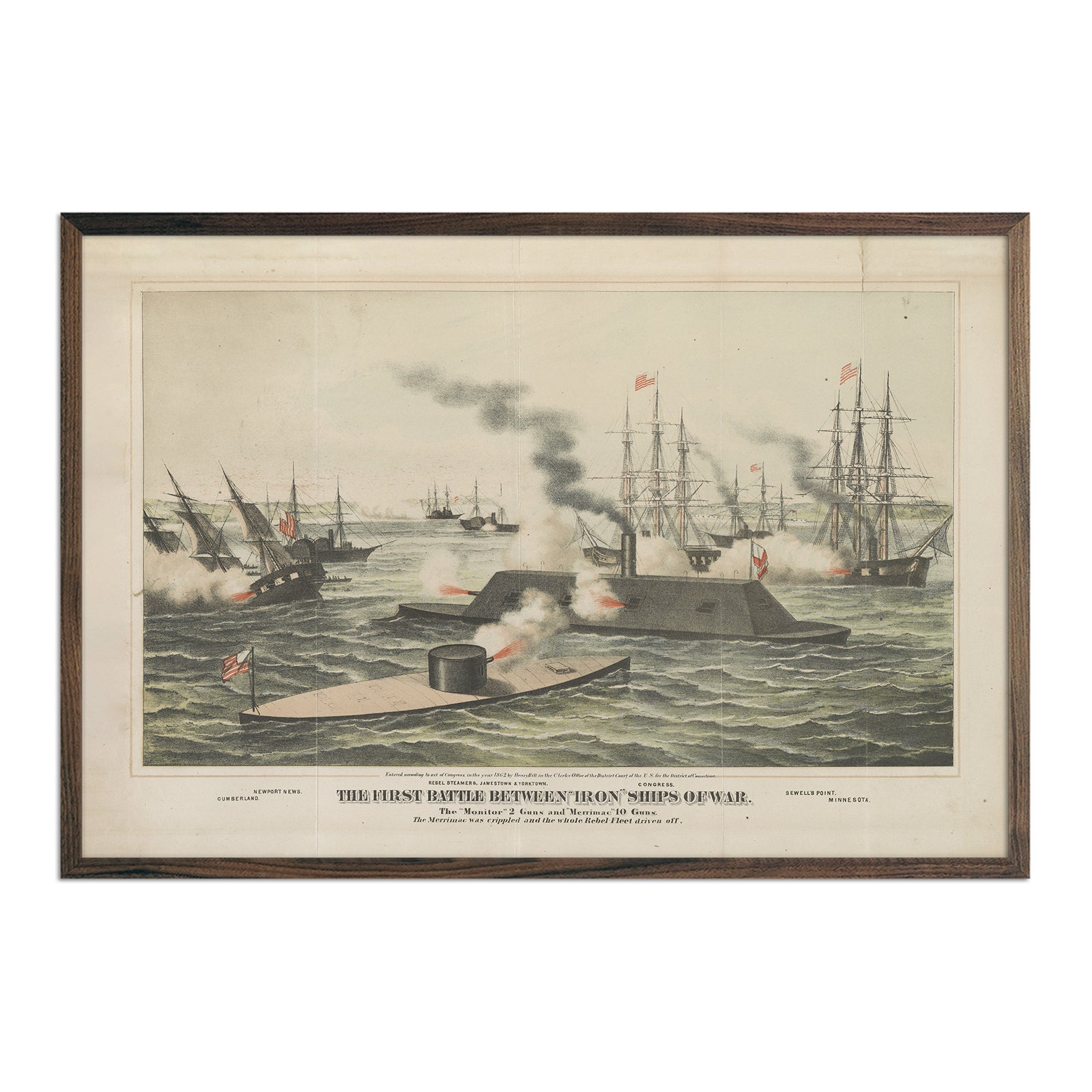
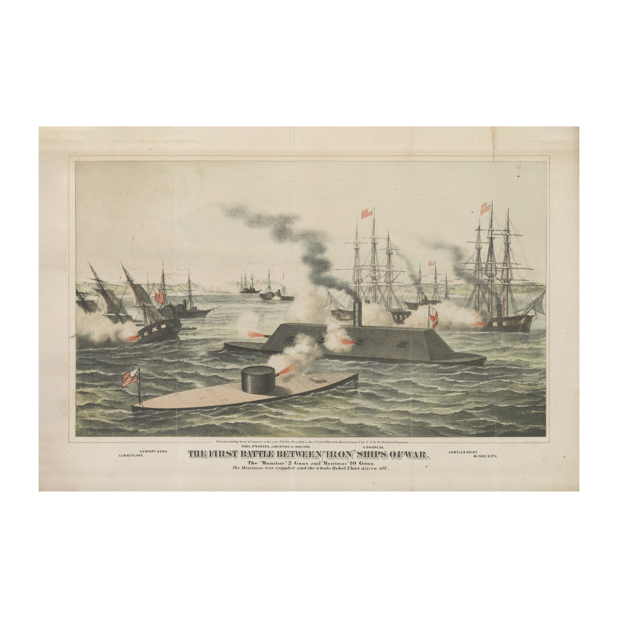
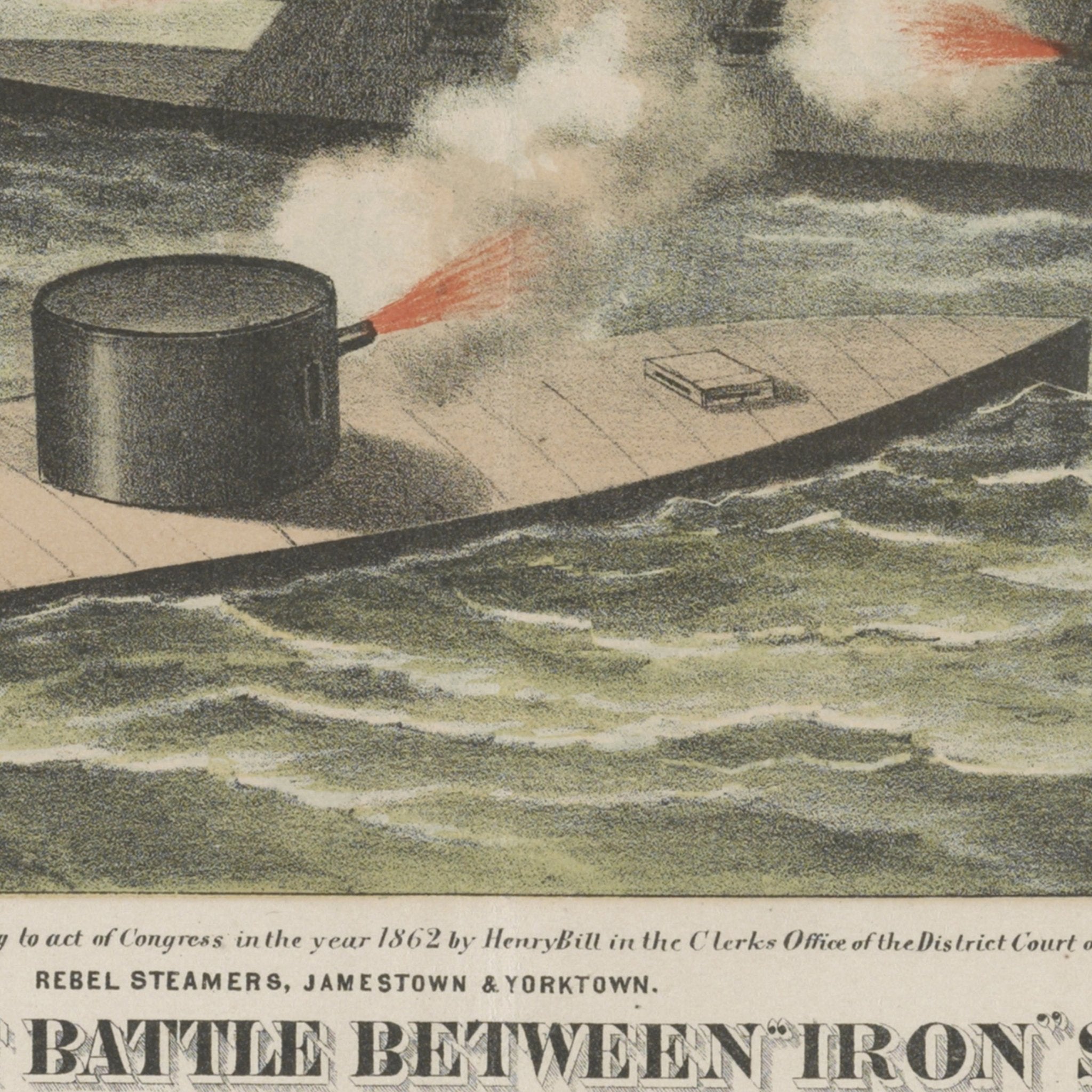
The First Battle between Iron Ships of War
From
$ 79.00 USD
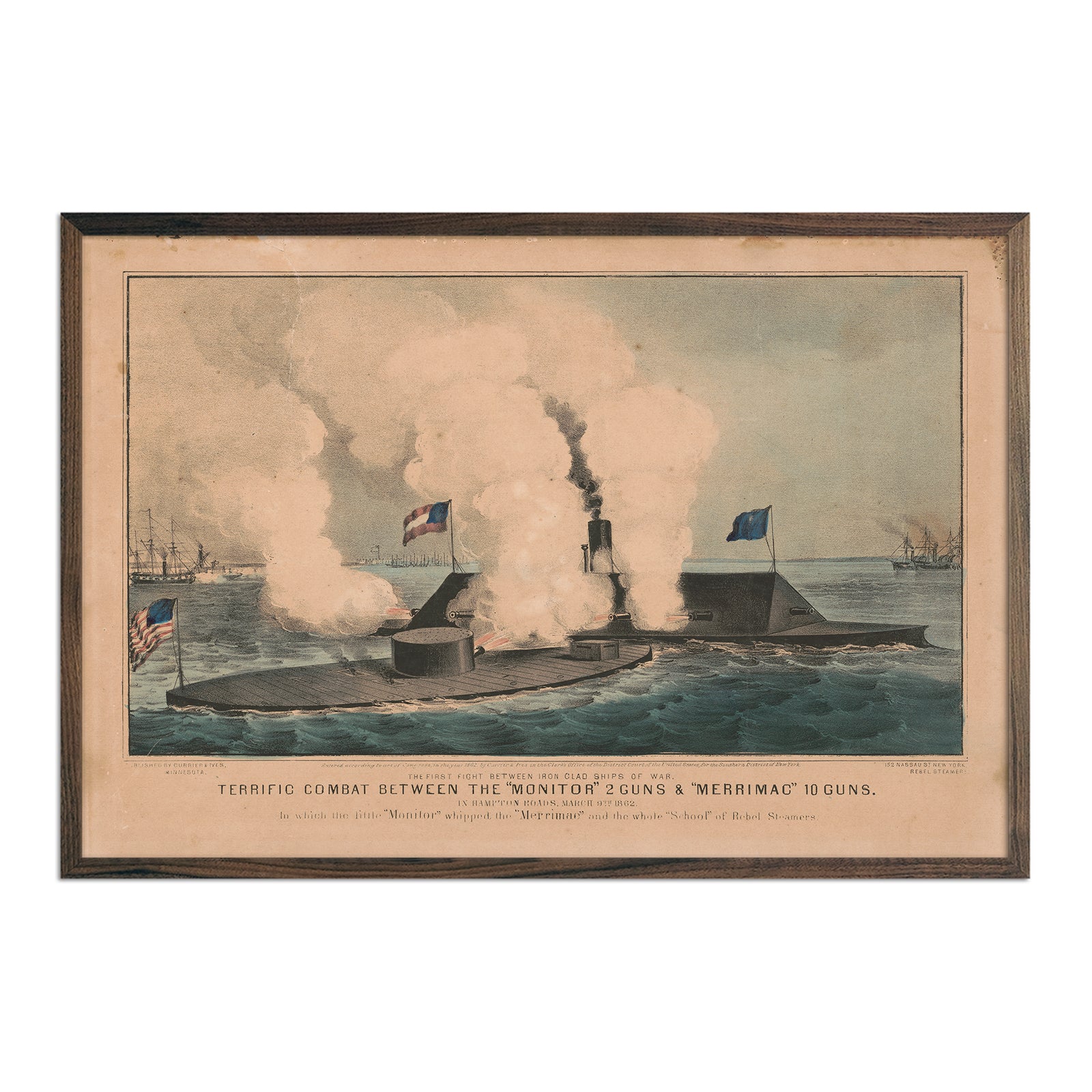
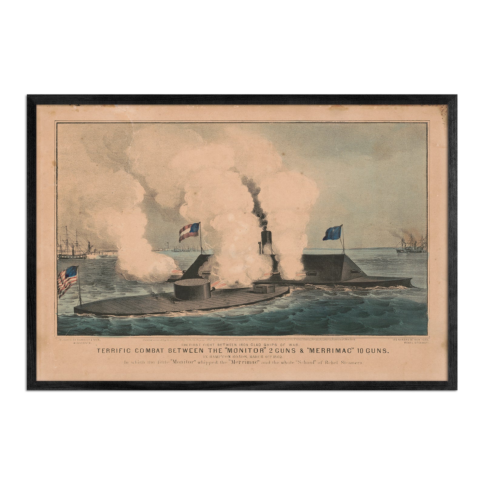
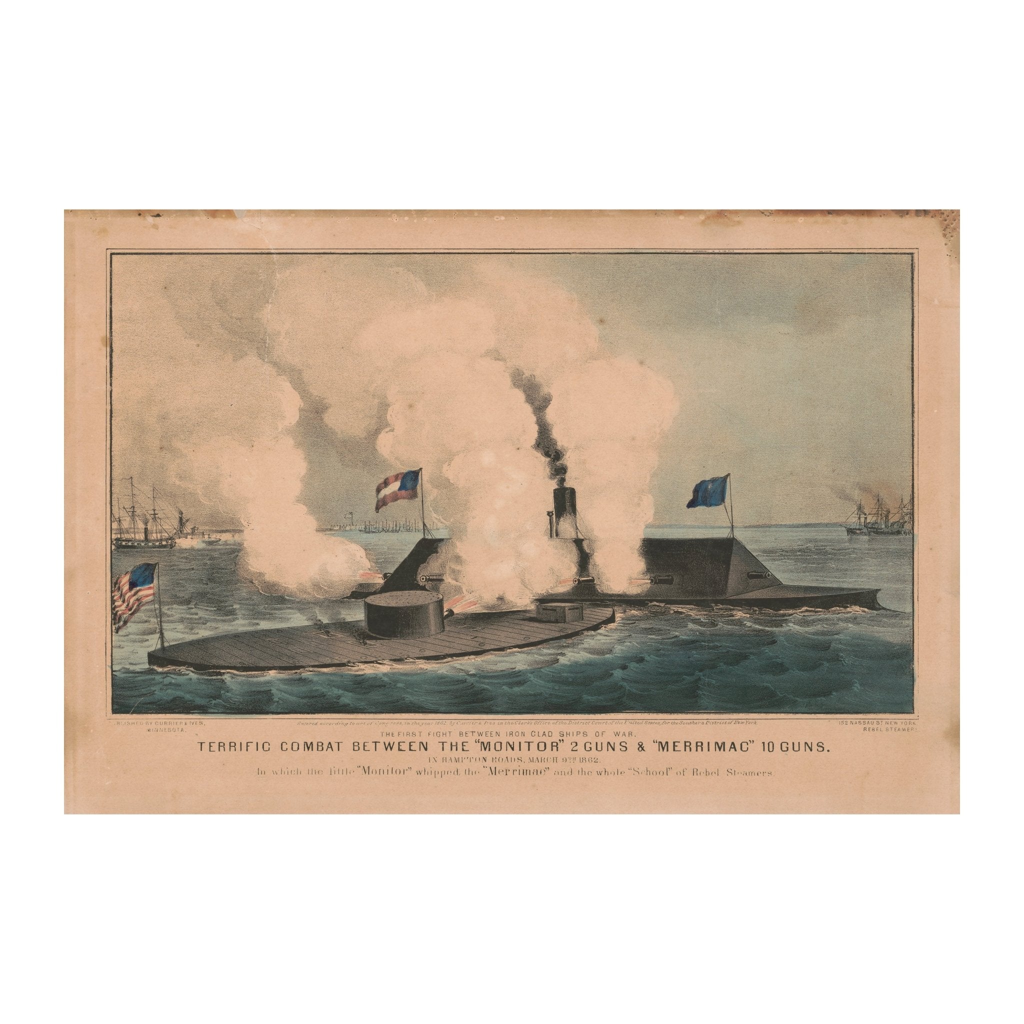
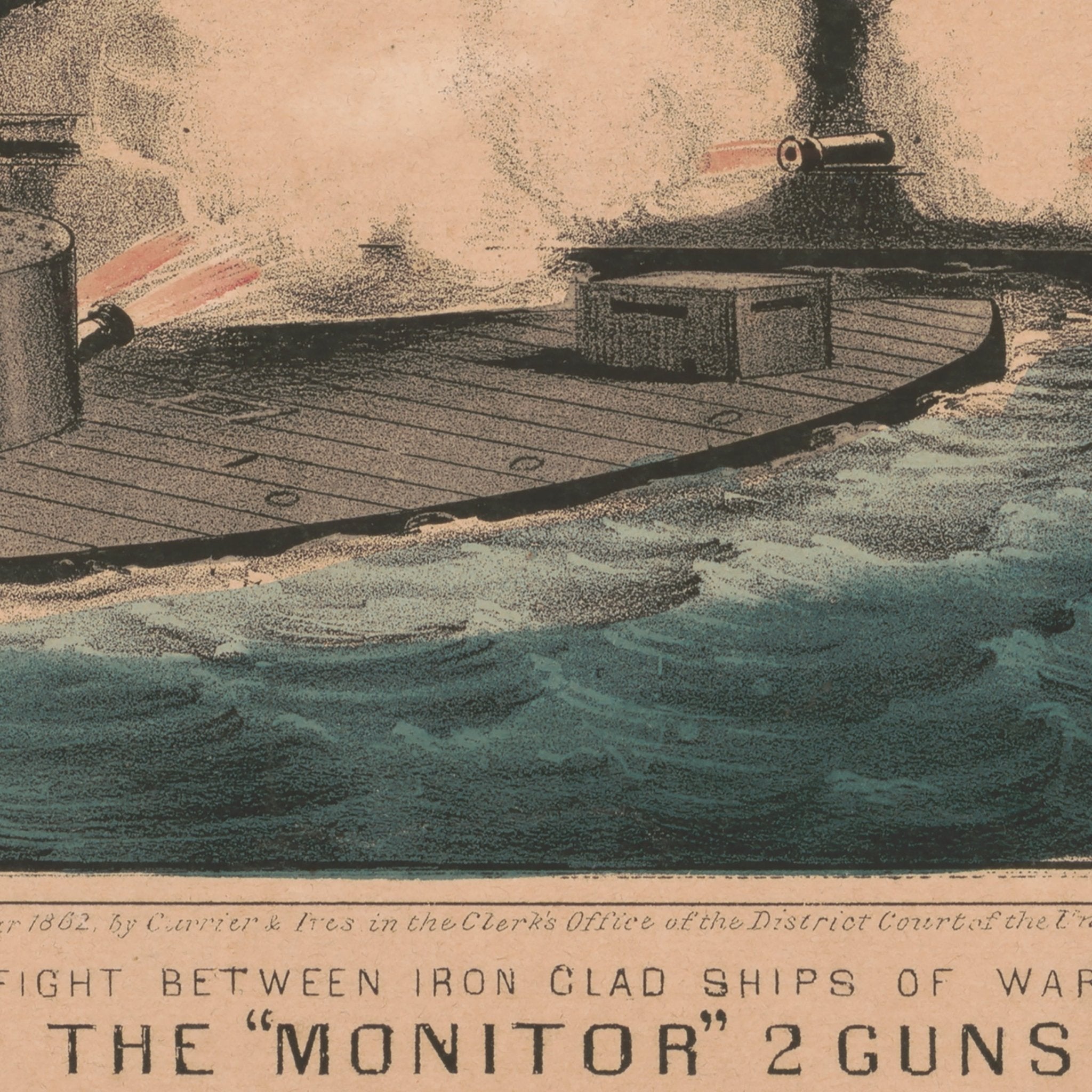
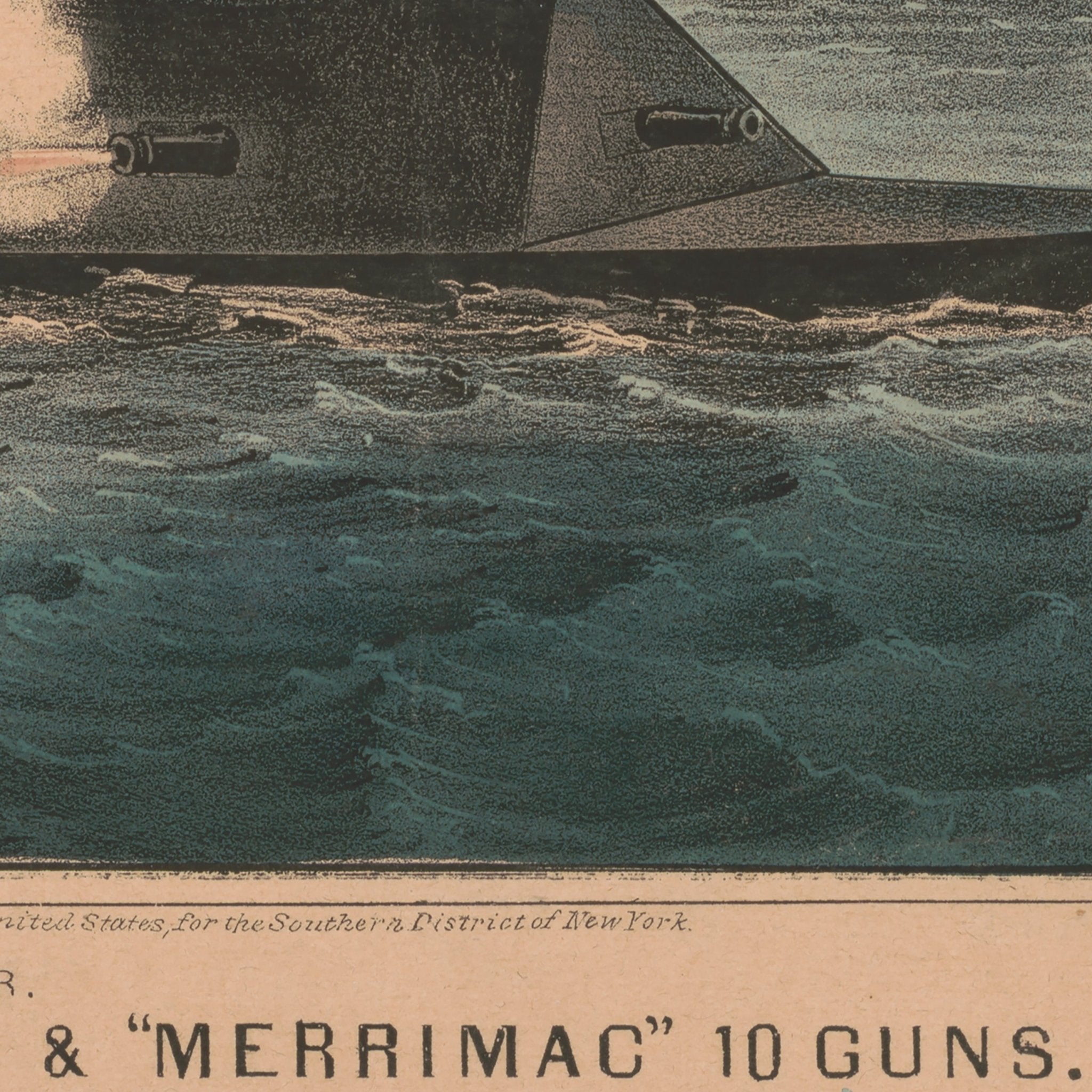
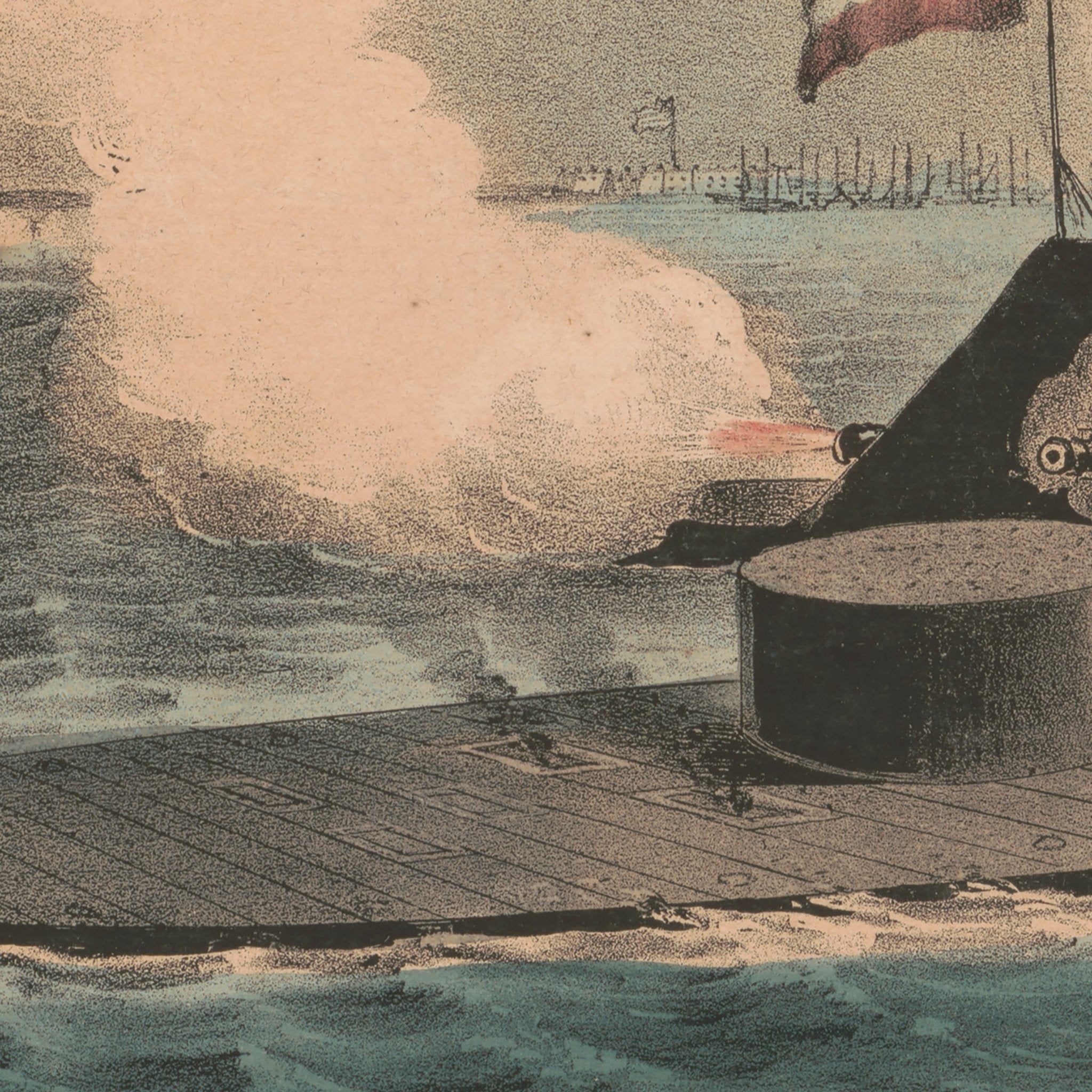
Terrific Combat between the Monitor 2 Guns & Merrimac 10 Guns
From
$ 79.00 USD
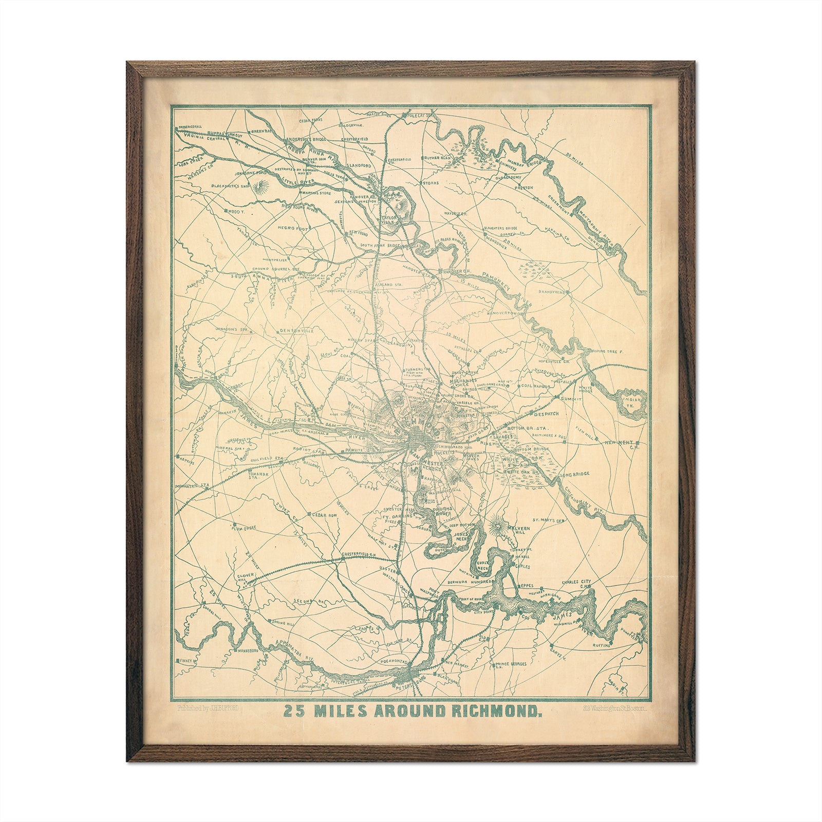
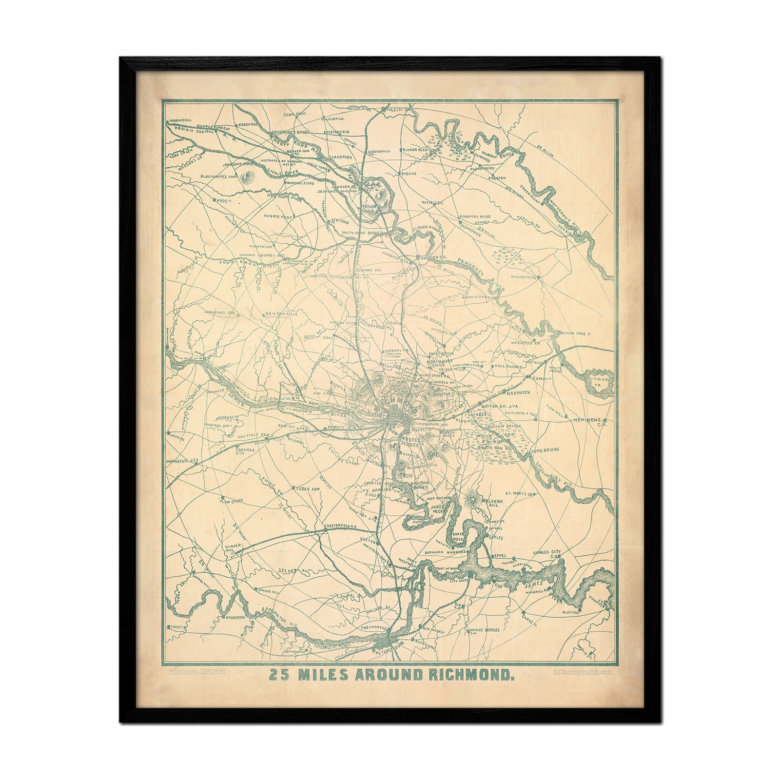
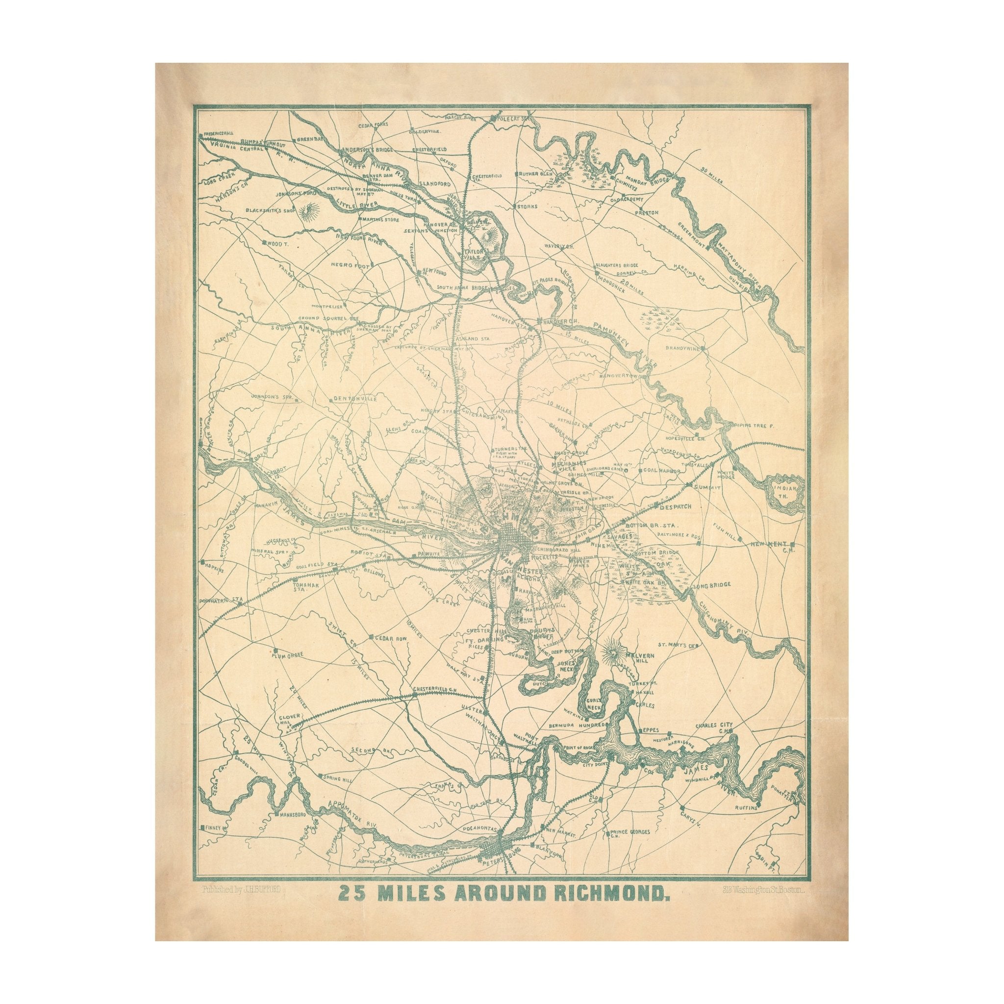
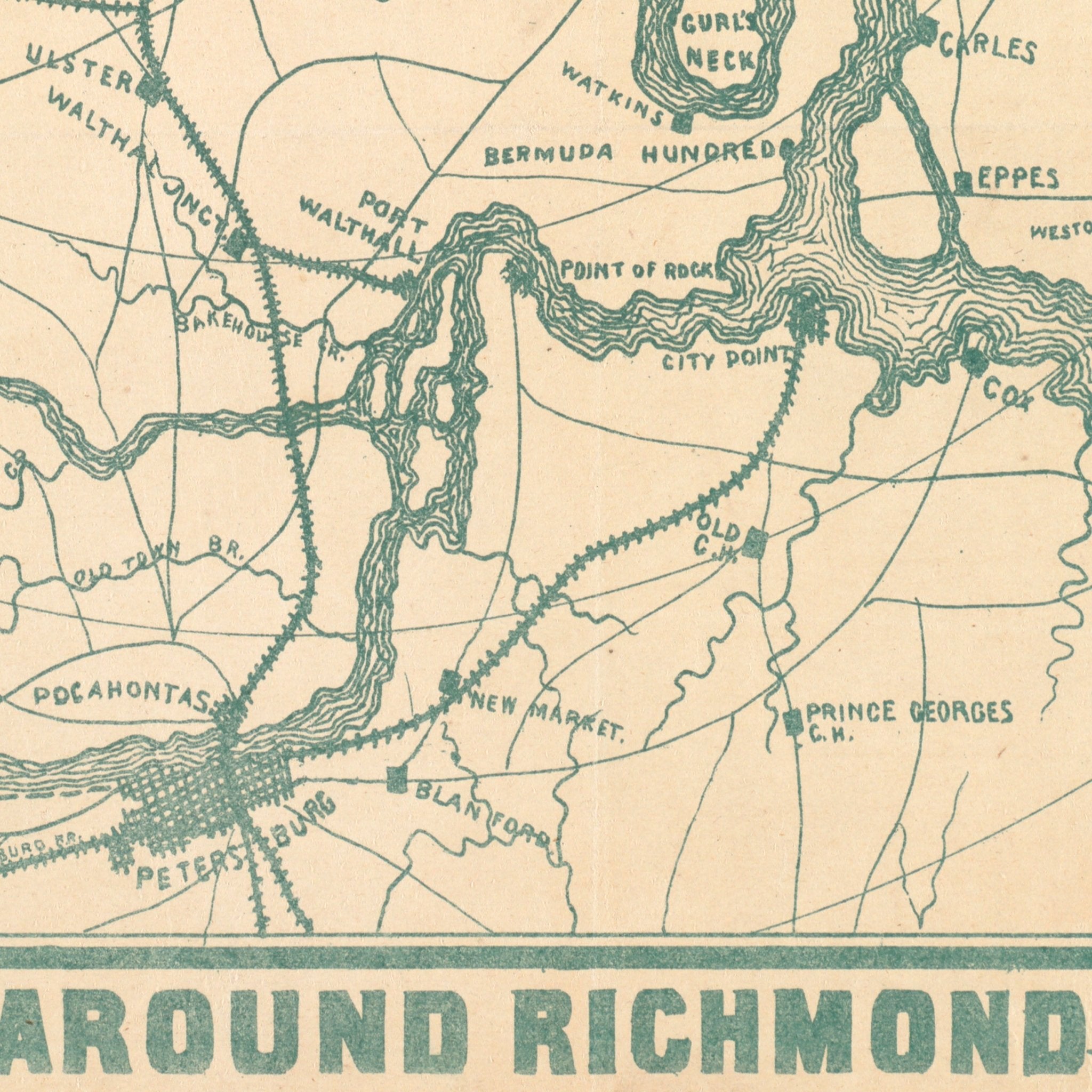
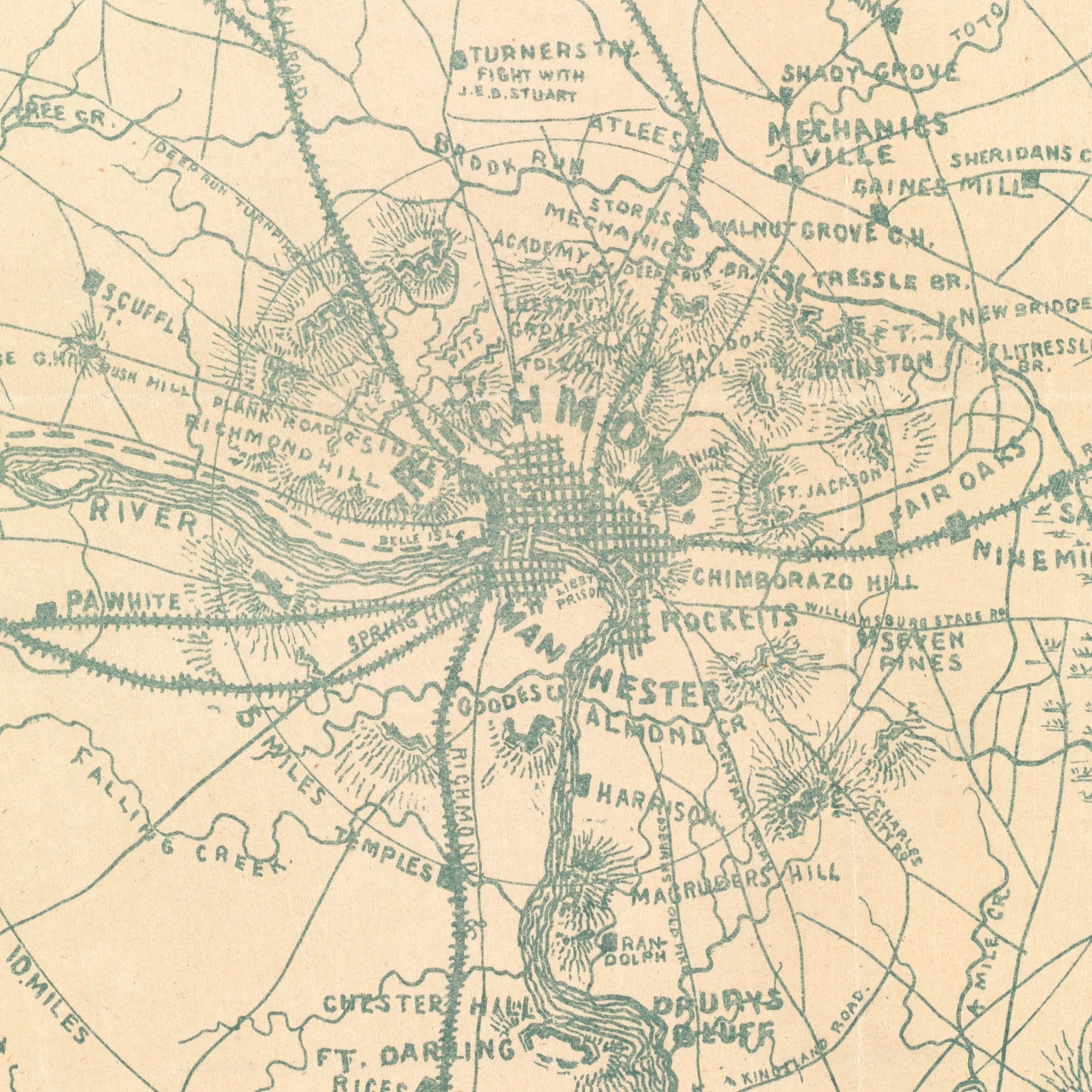
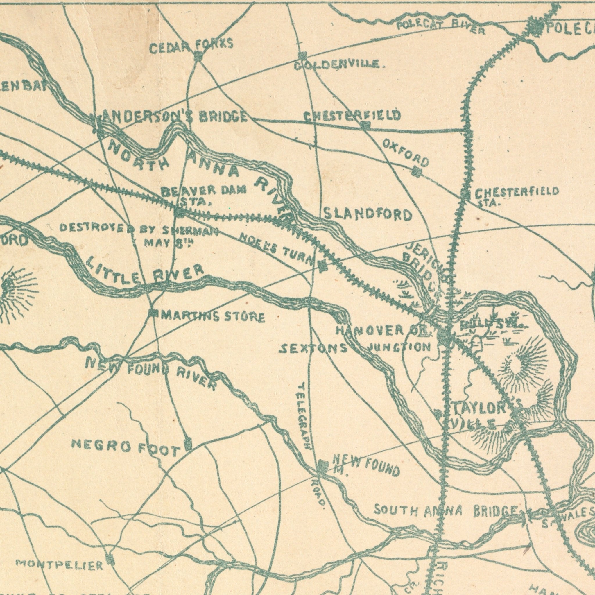
Richmond and 25 Miles Around
From
$ 64.00 USD
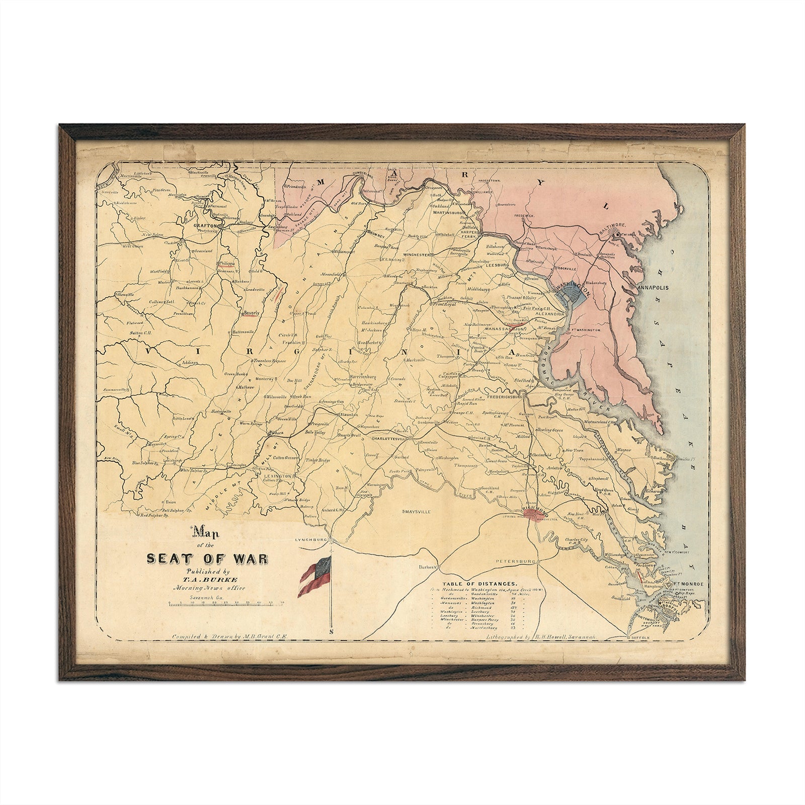
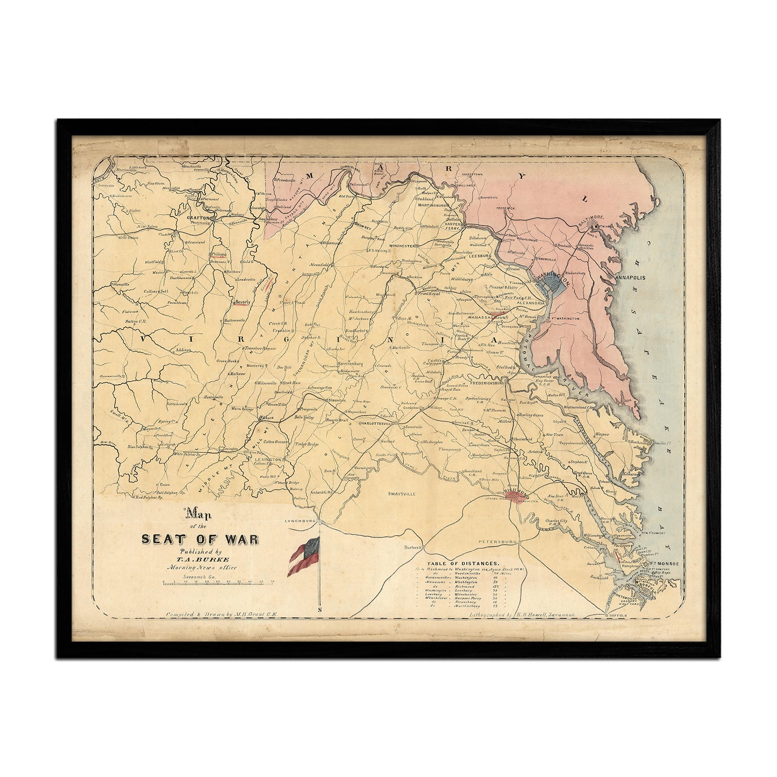
Map of the Seat of War 1861
From
$ 64.00 USD
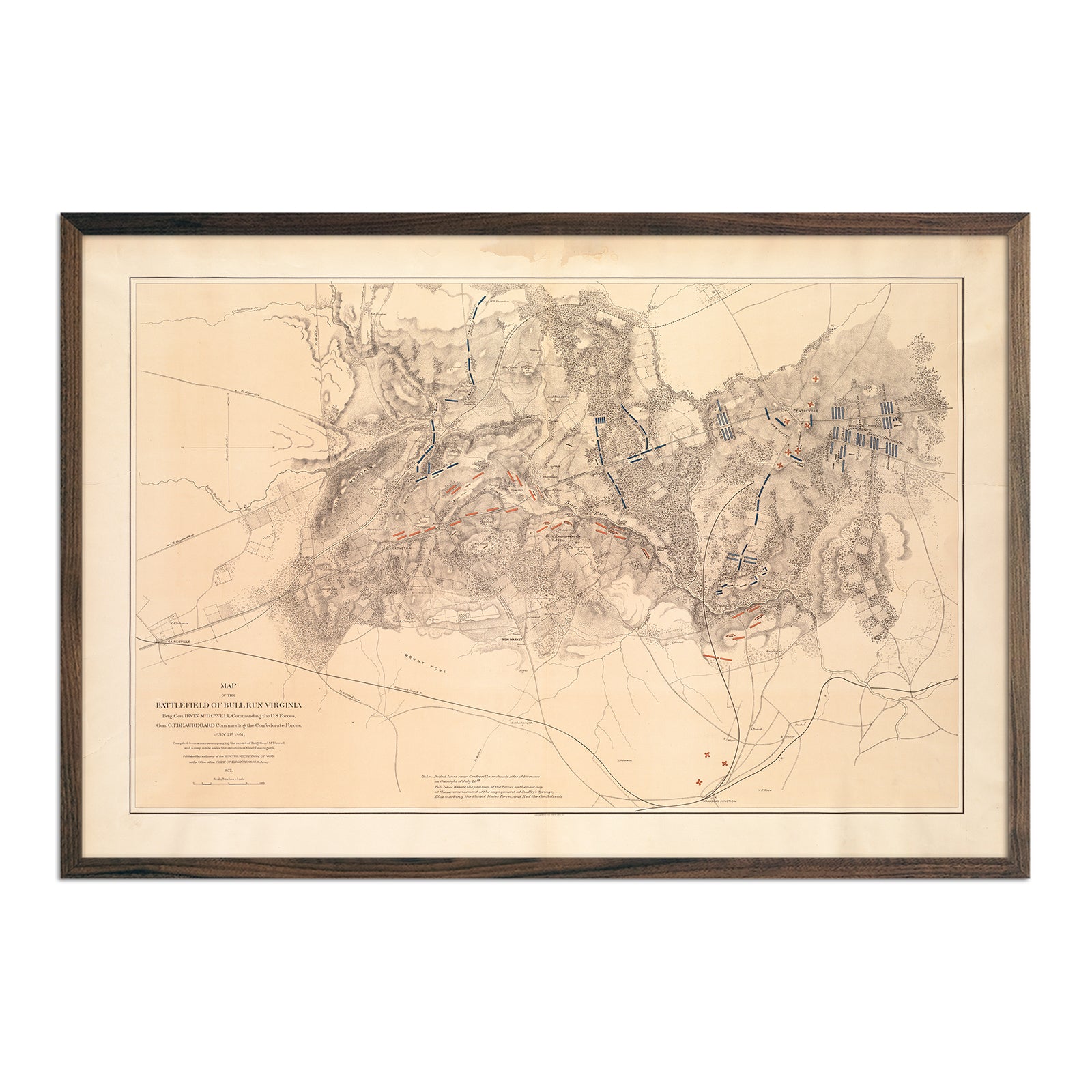
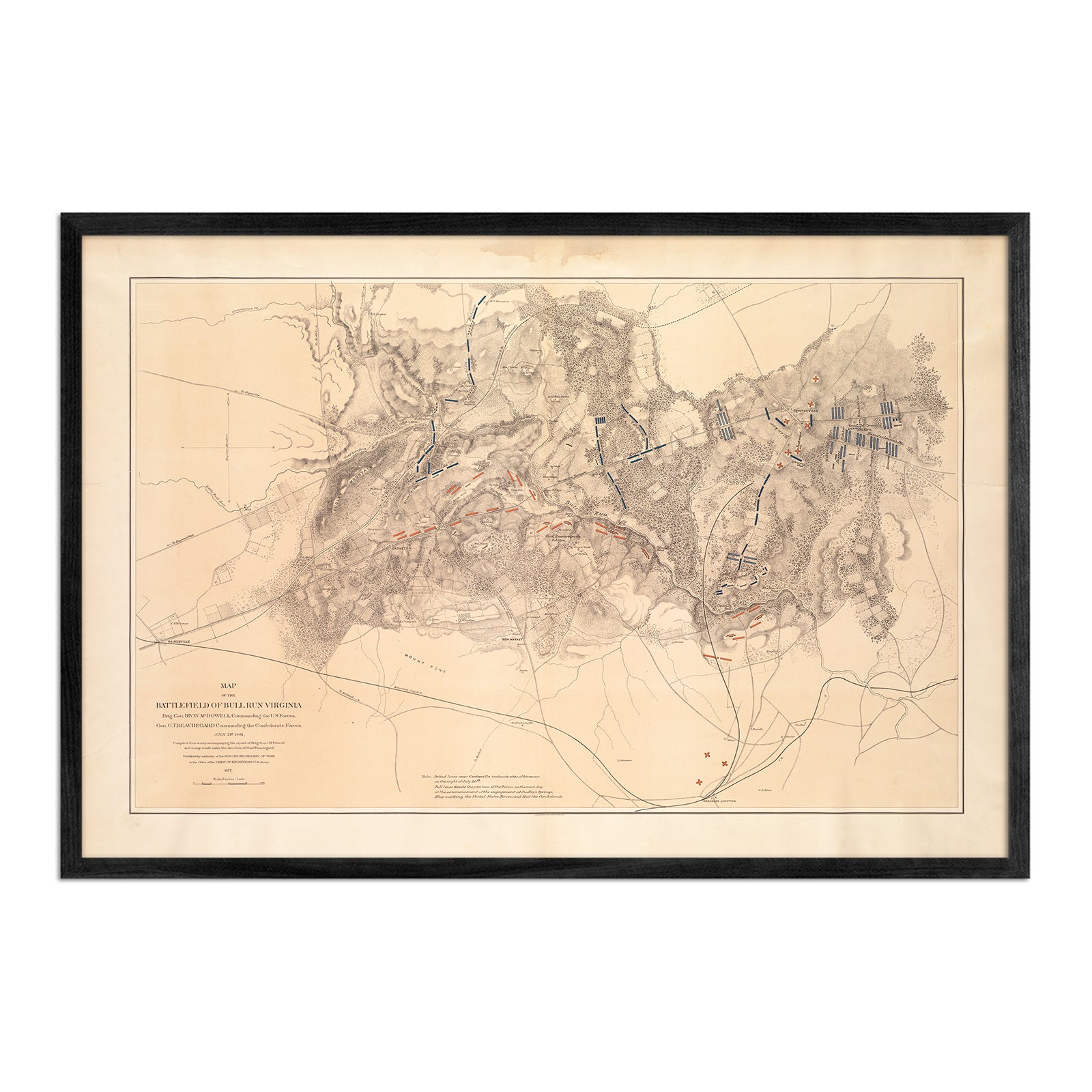
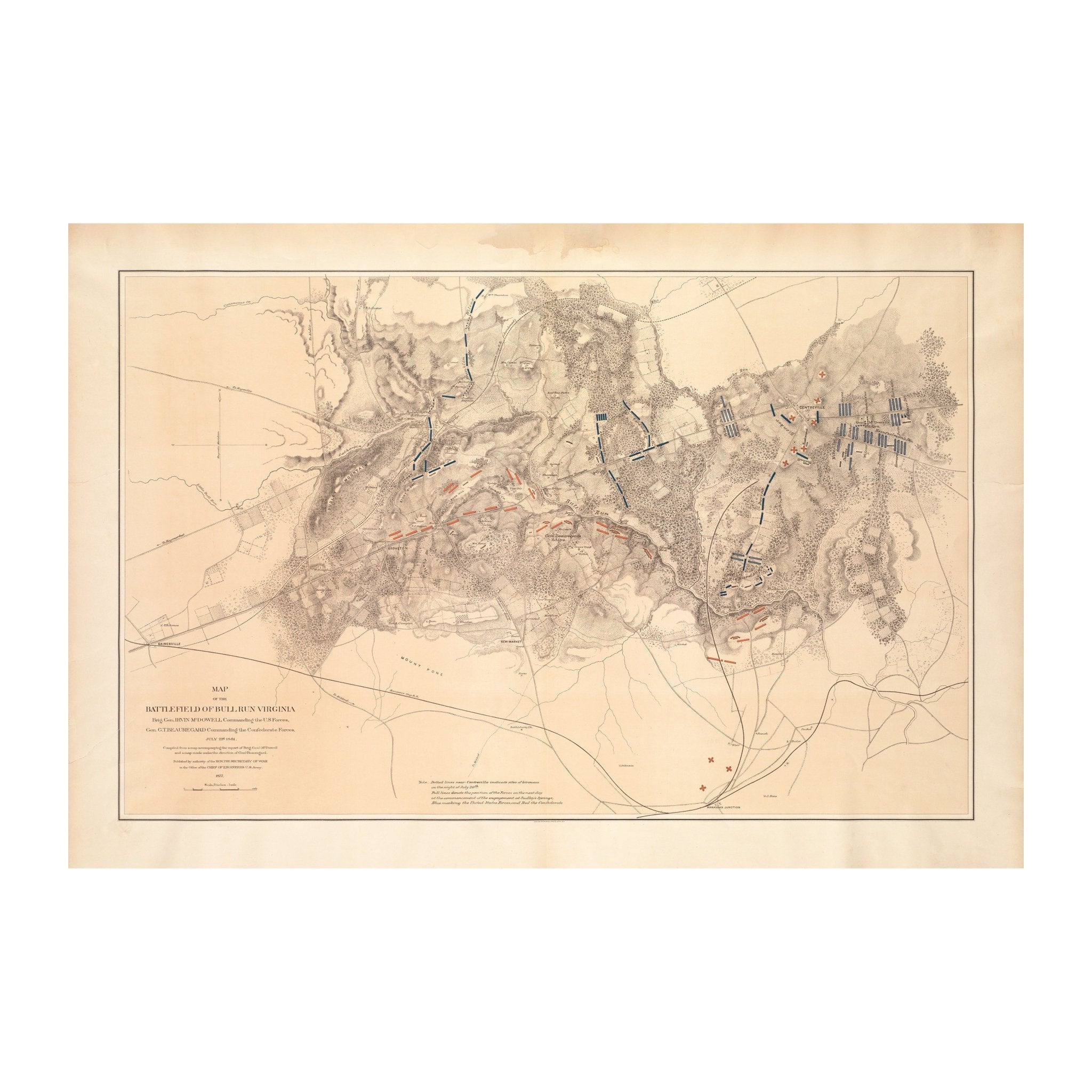
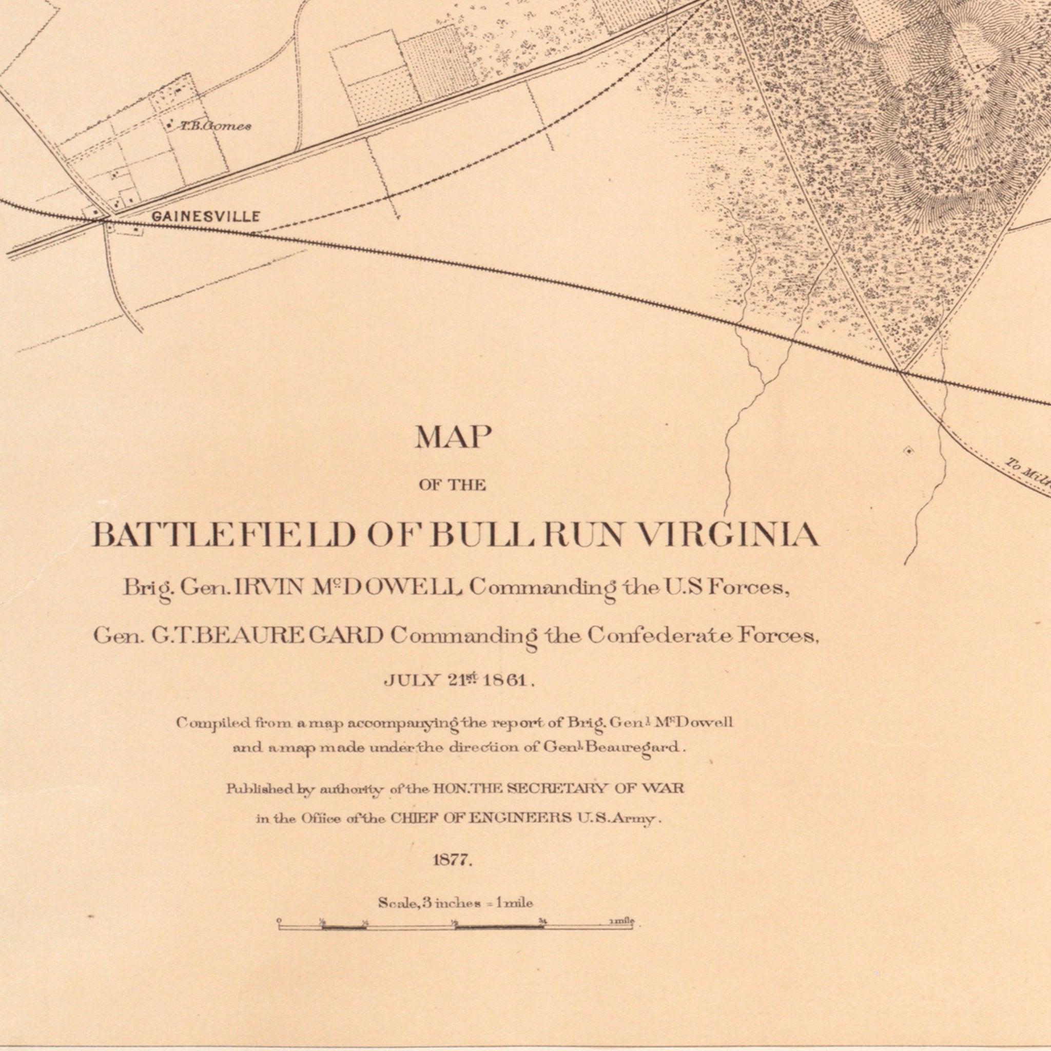
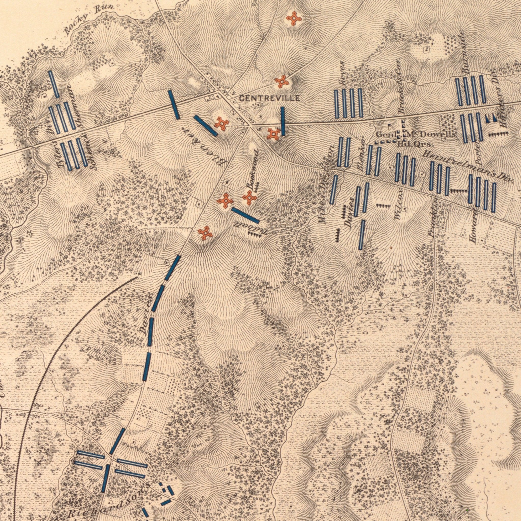
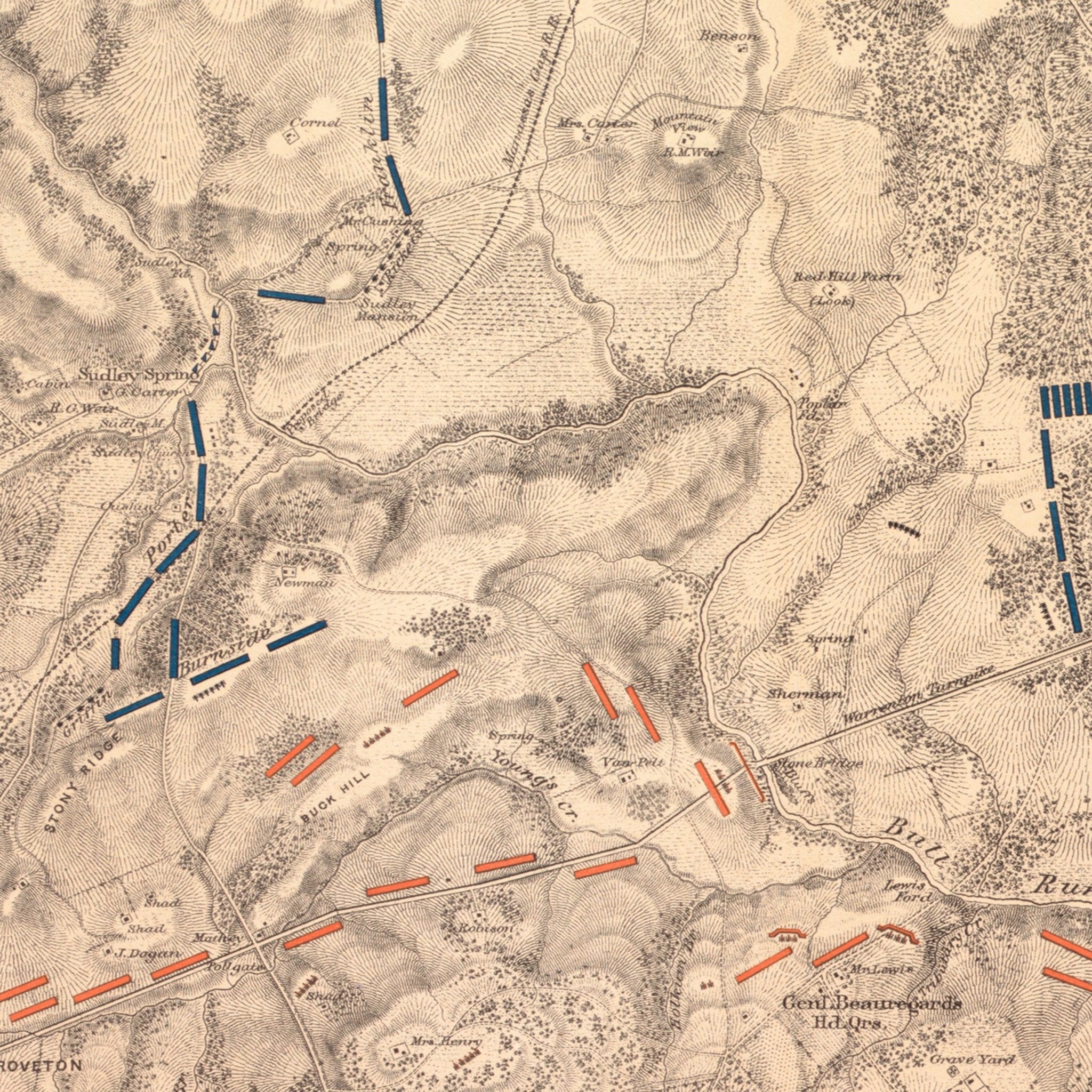
Map of the Battlefield of Bull Run
From
$ 79.00 USD
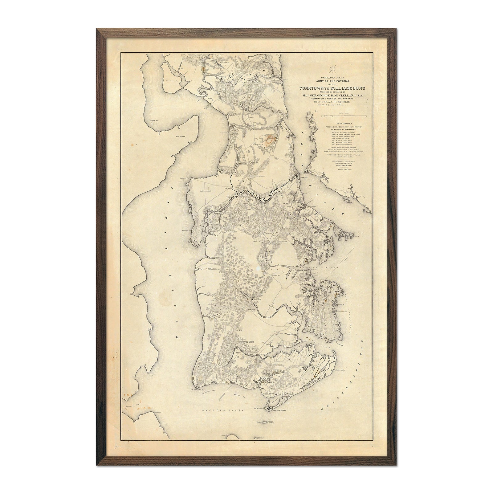
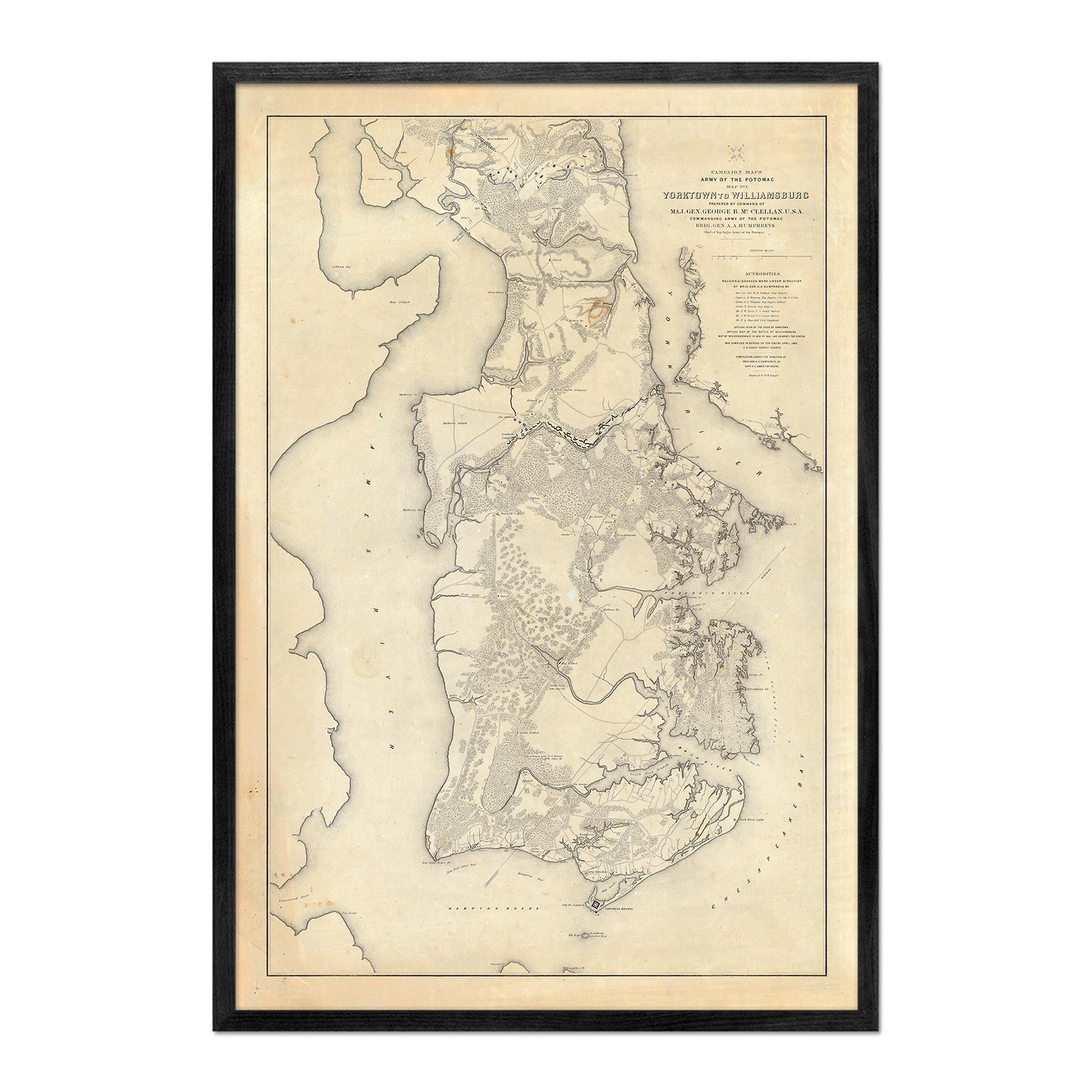
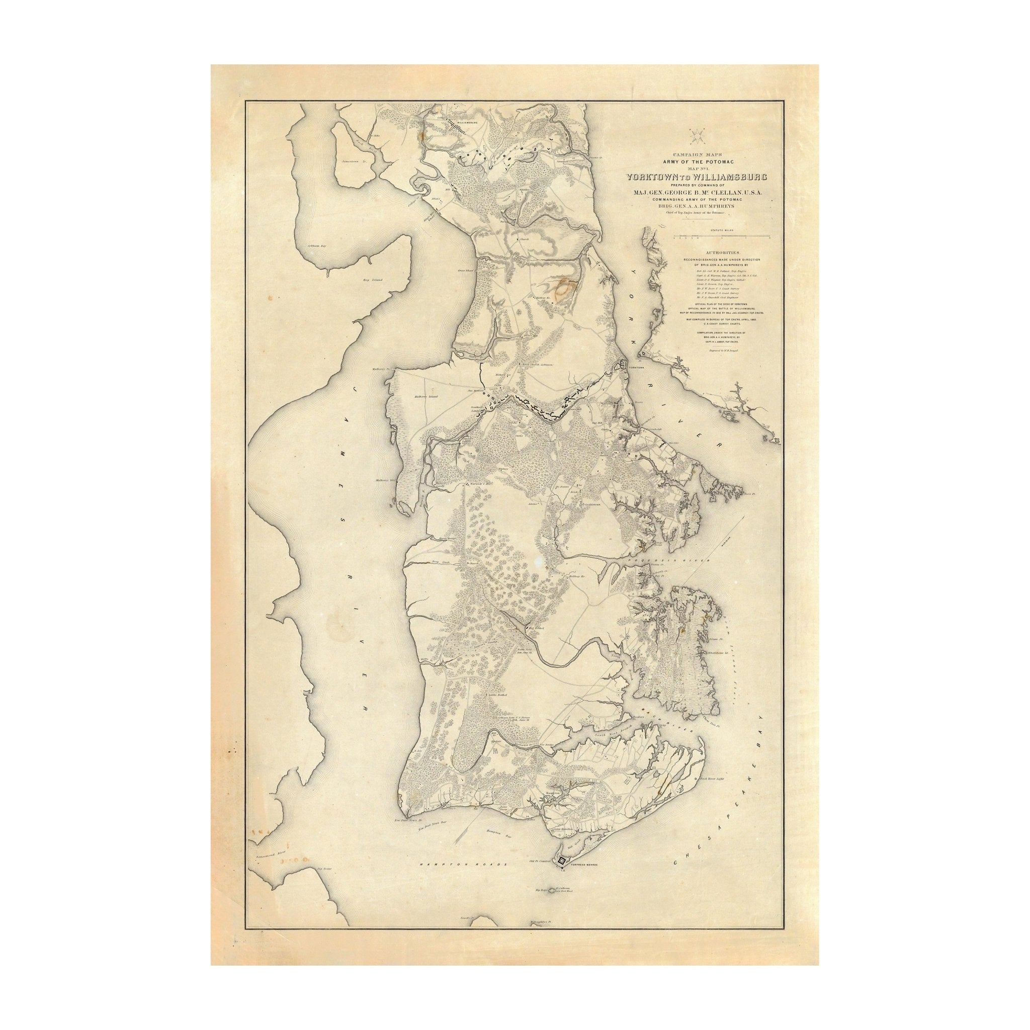
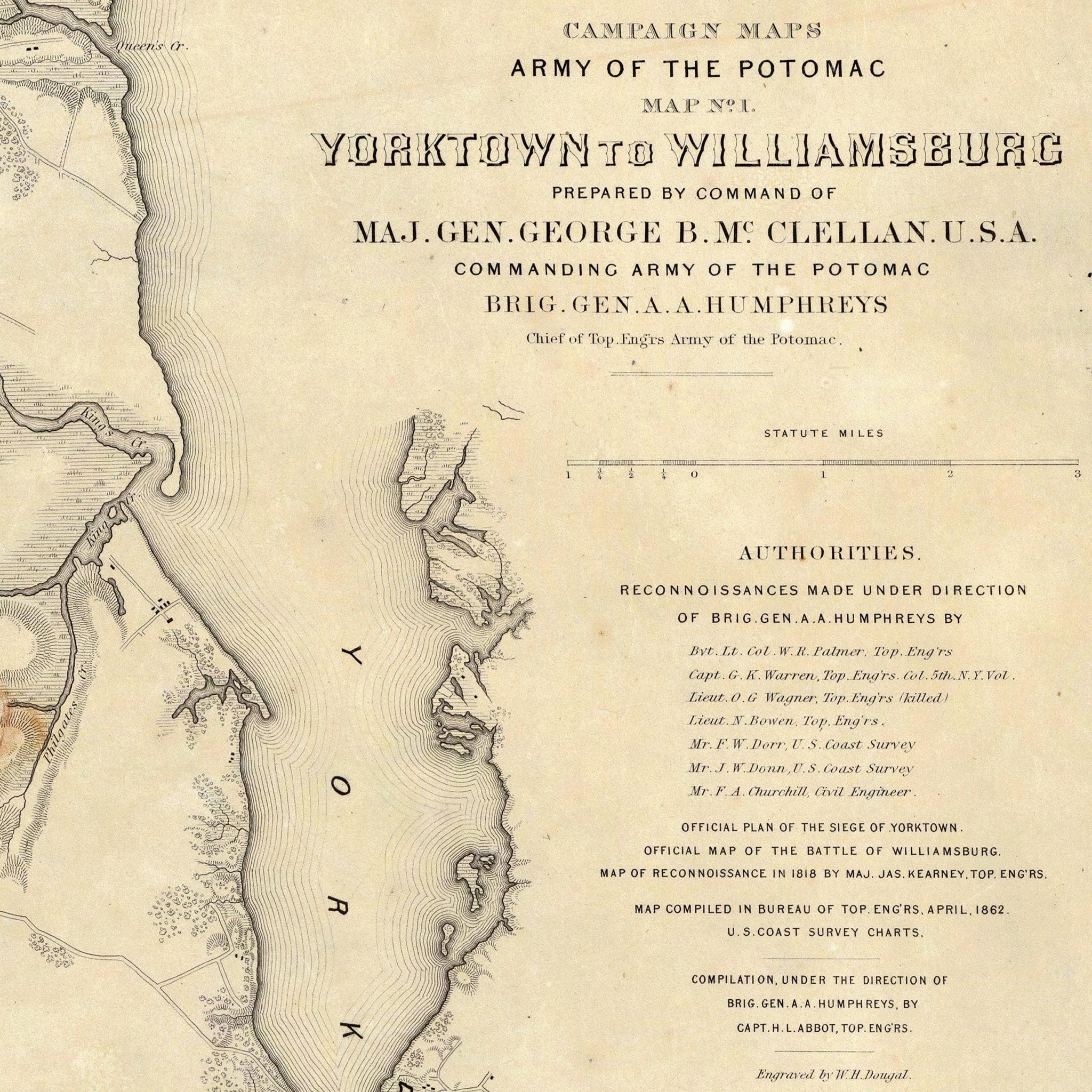
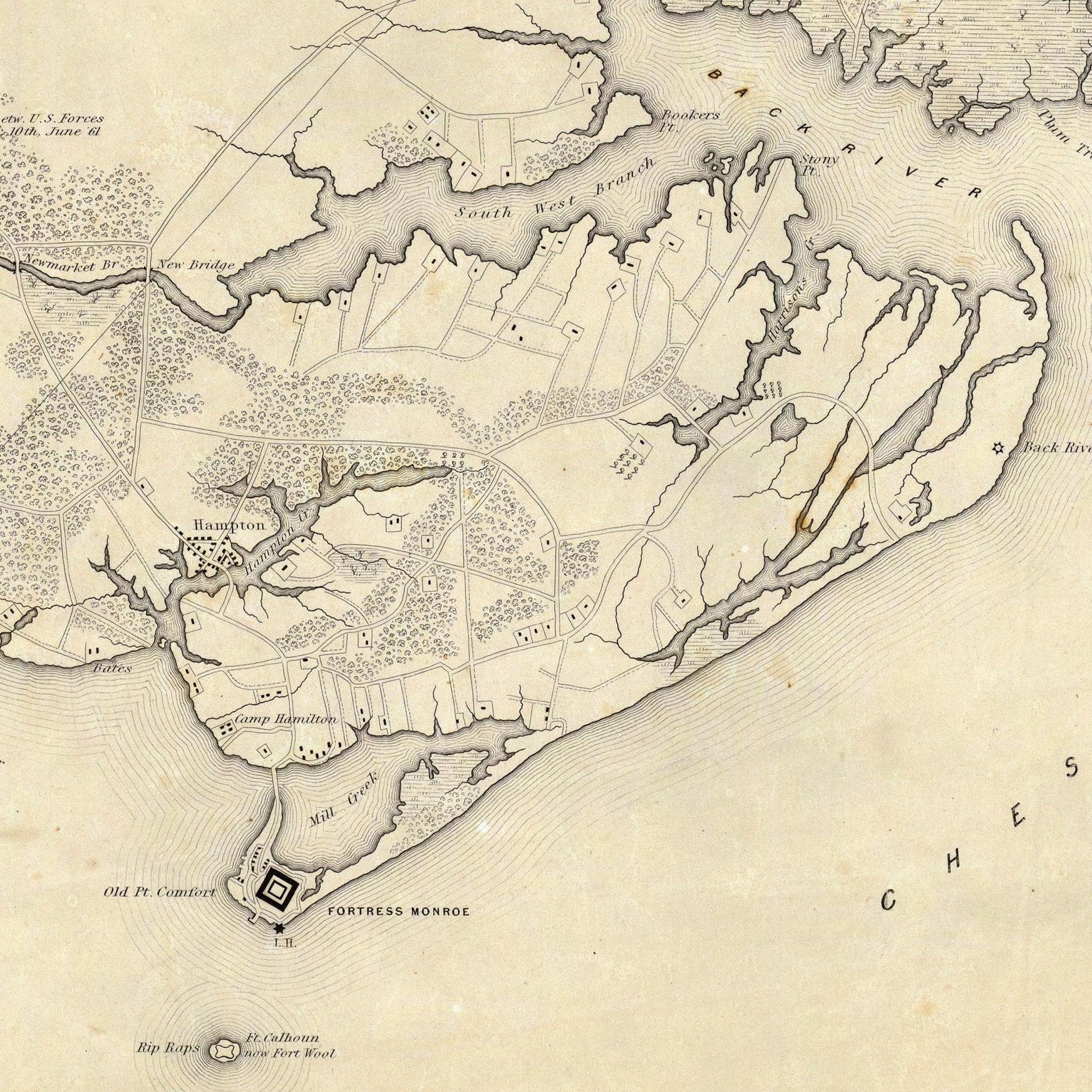
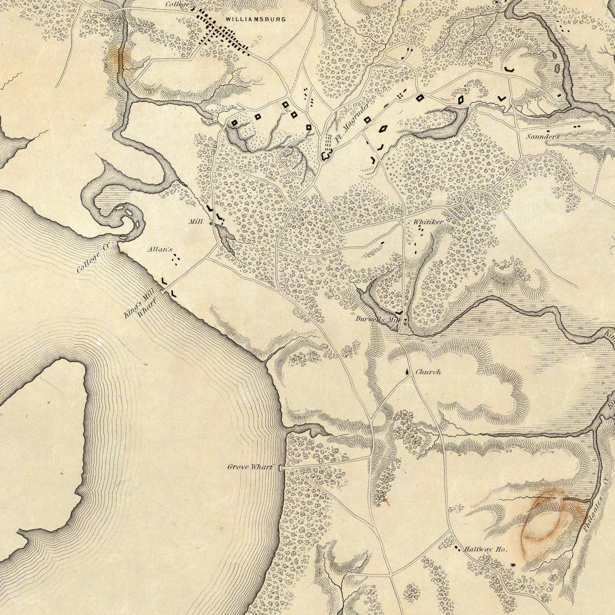
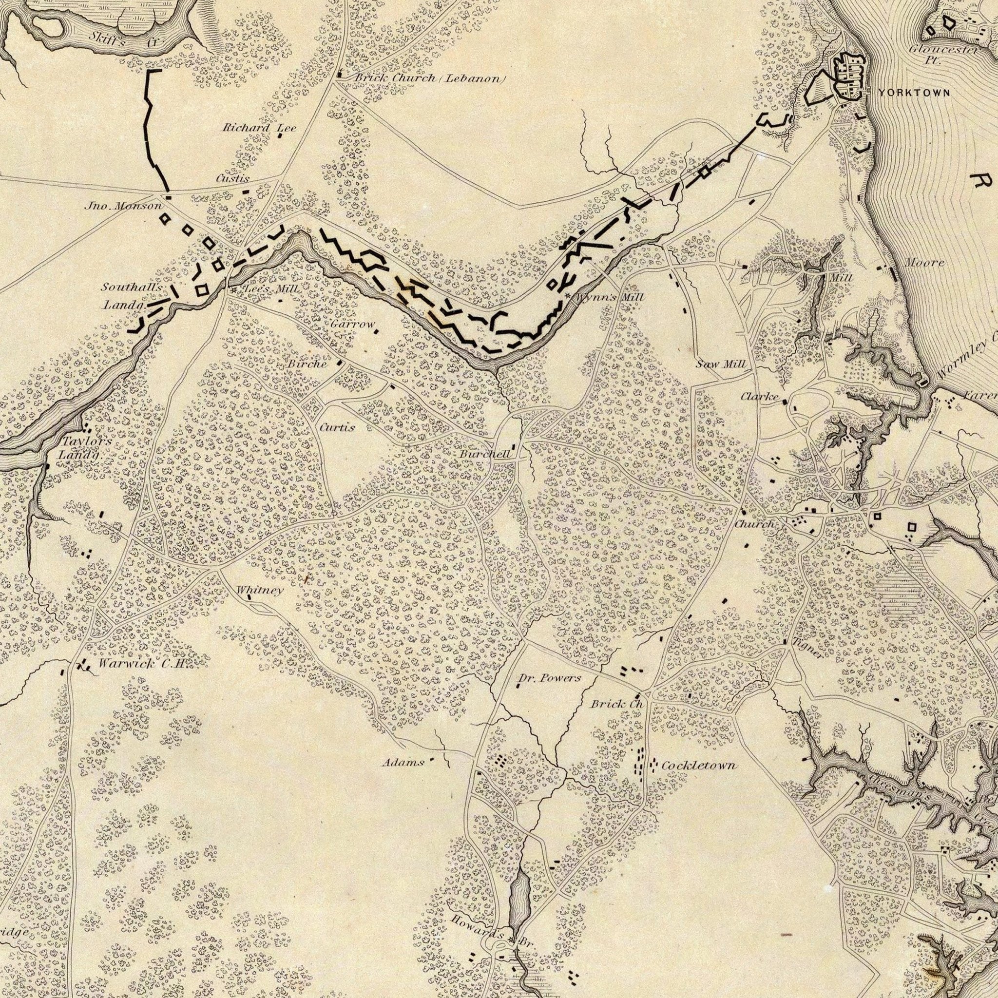
Yorktown to Williamsburg
From
$ 79.00 USD
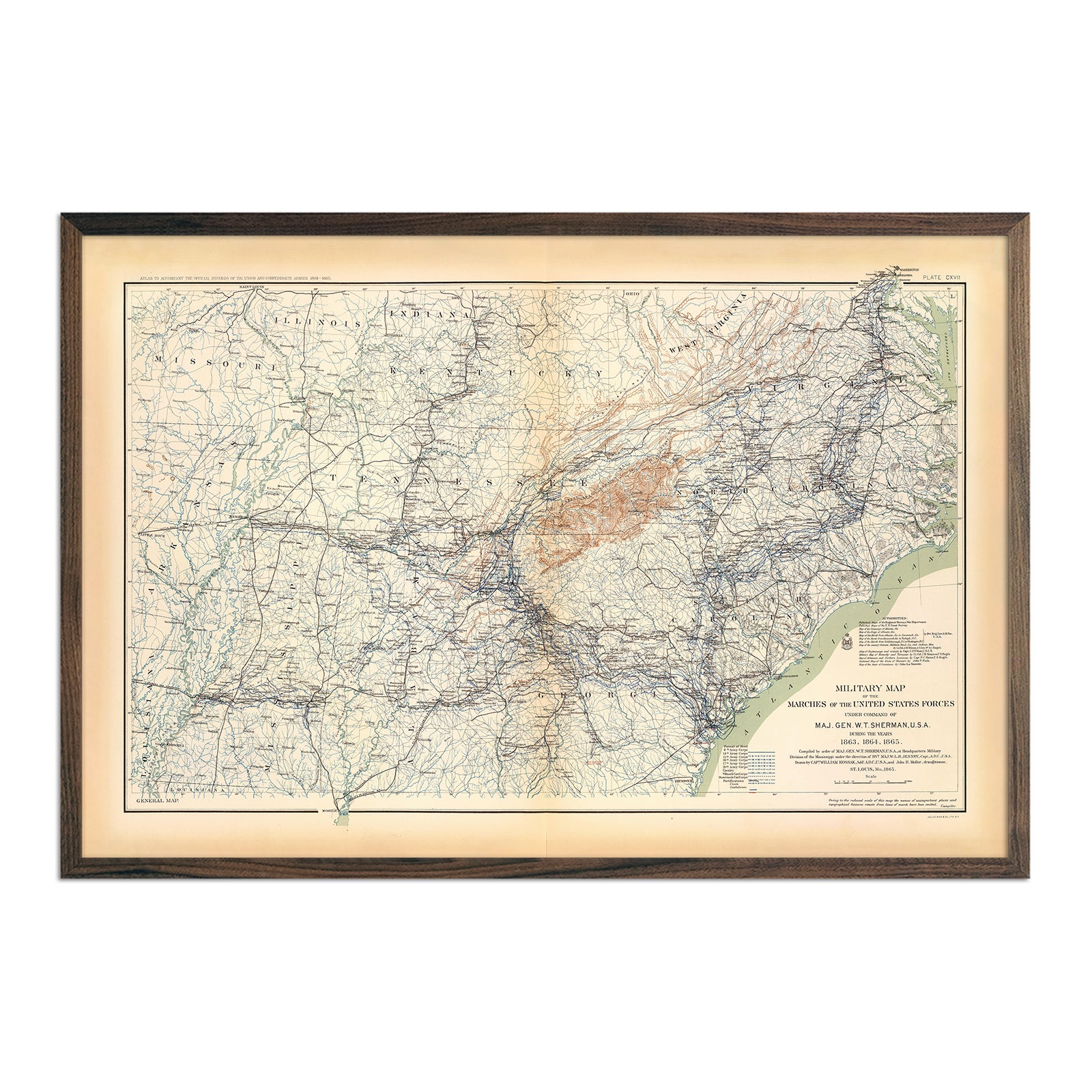
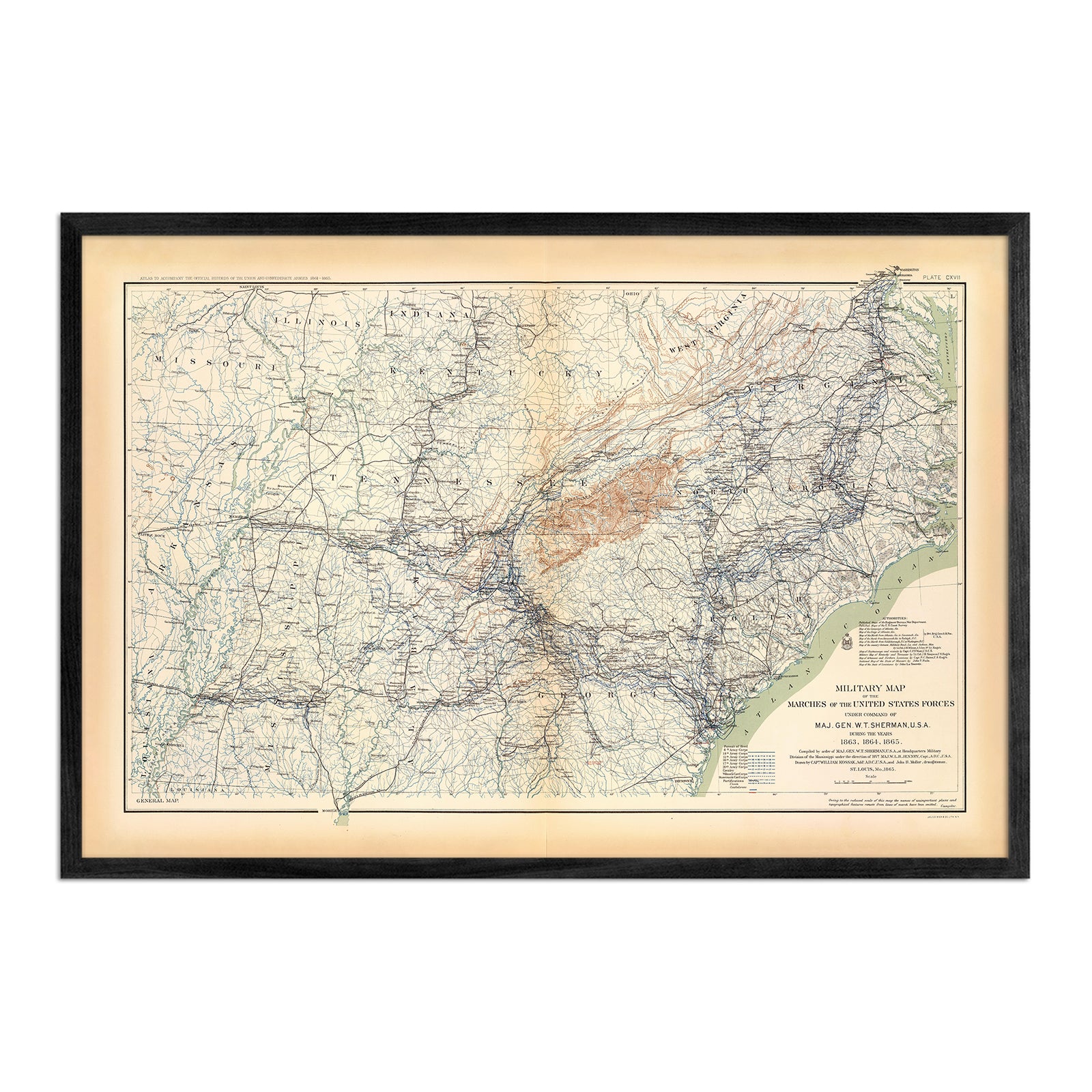
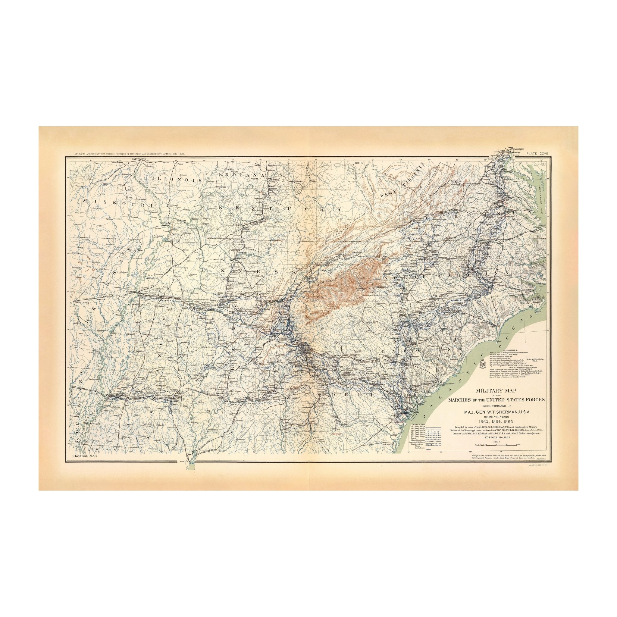
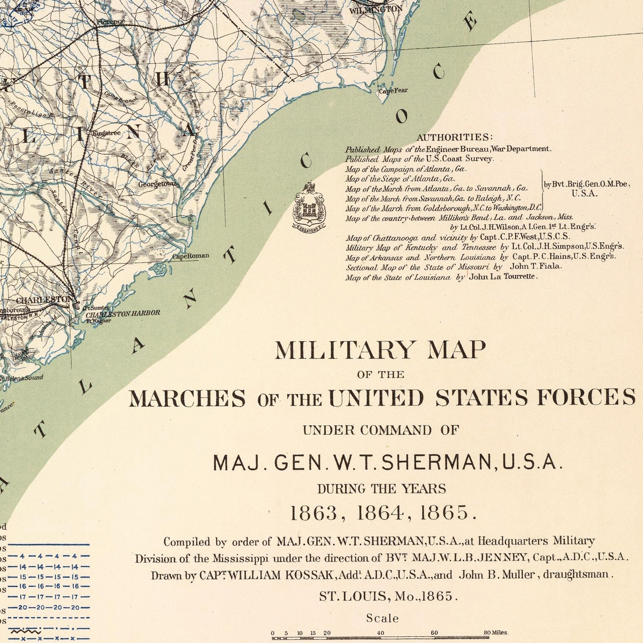
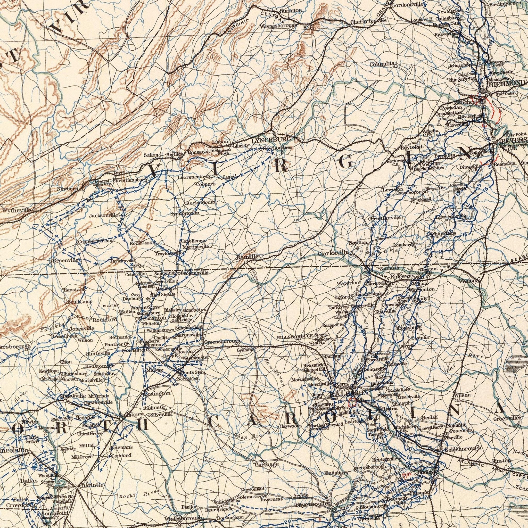
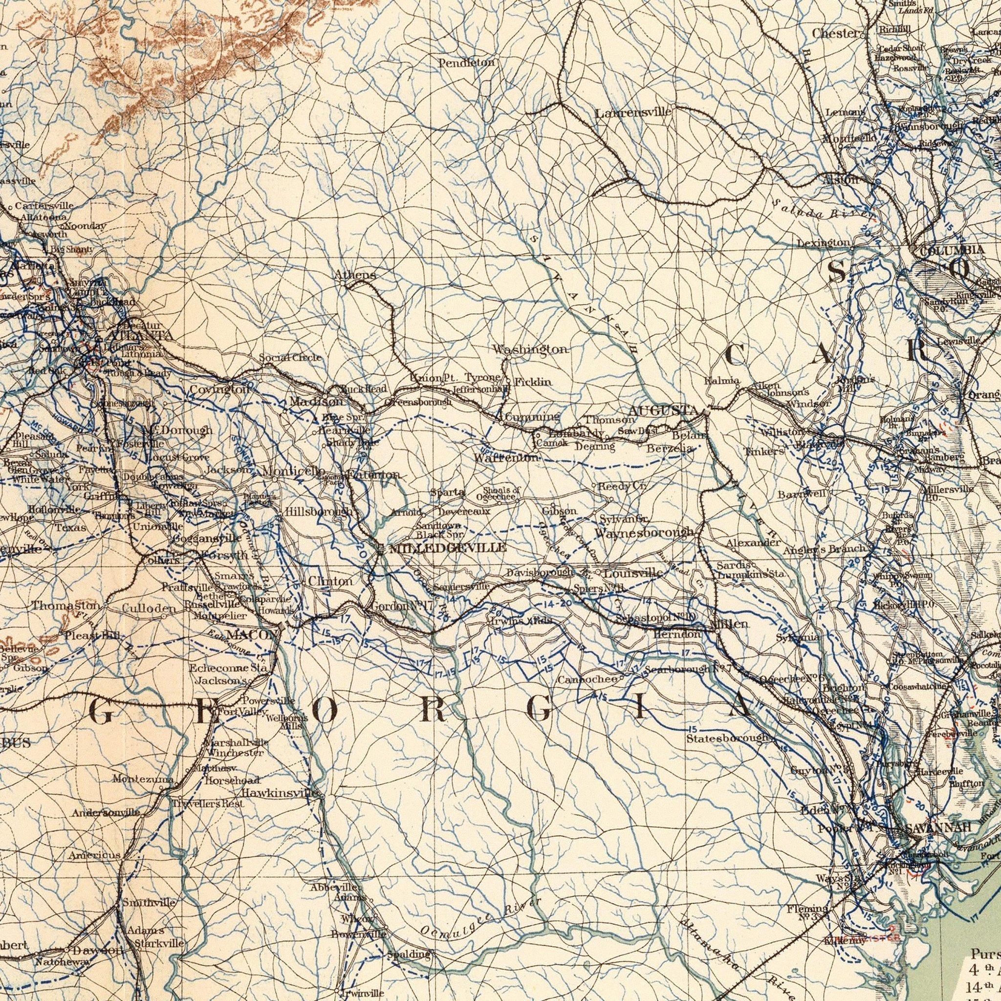
Military Map of Marches by W.T. Sherman
From
$ 79.00 USD
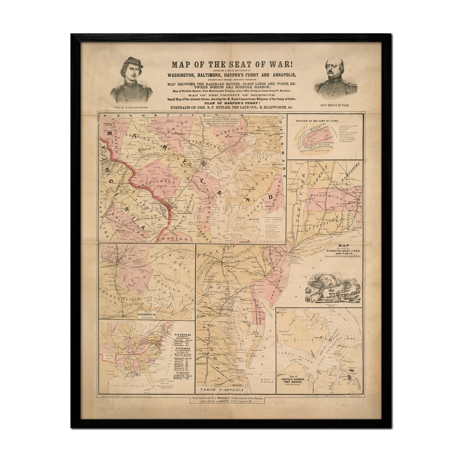
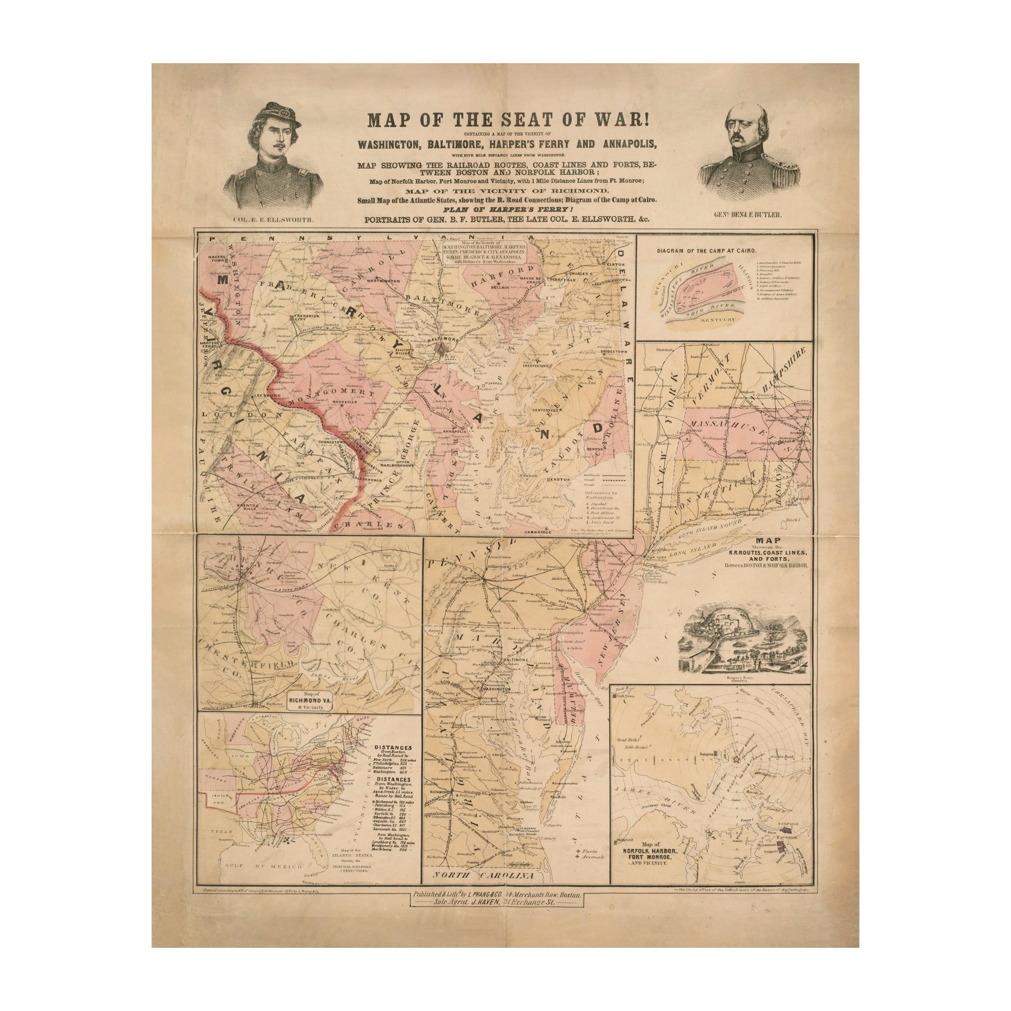
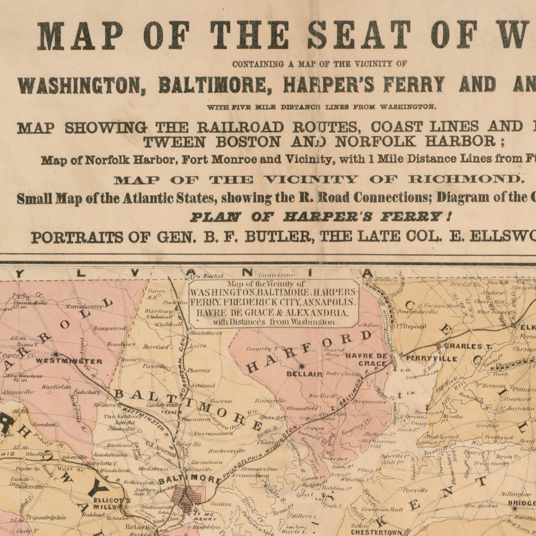
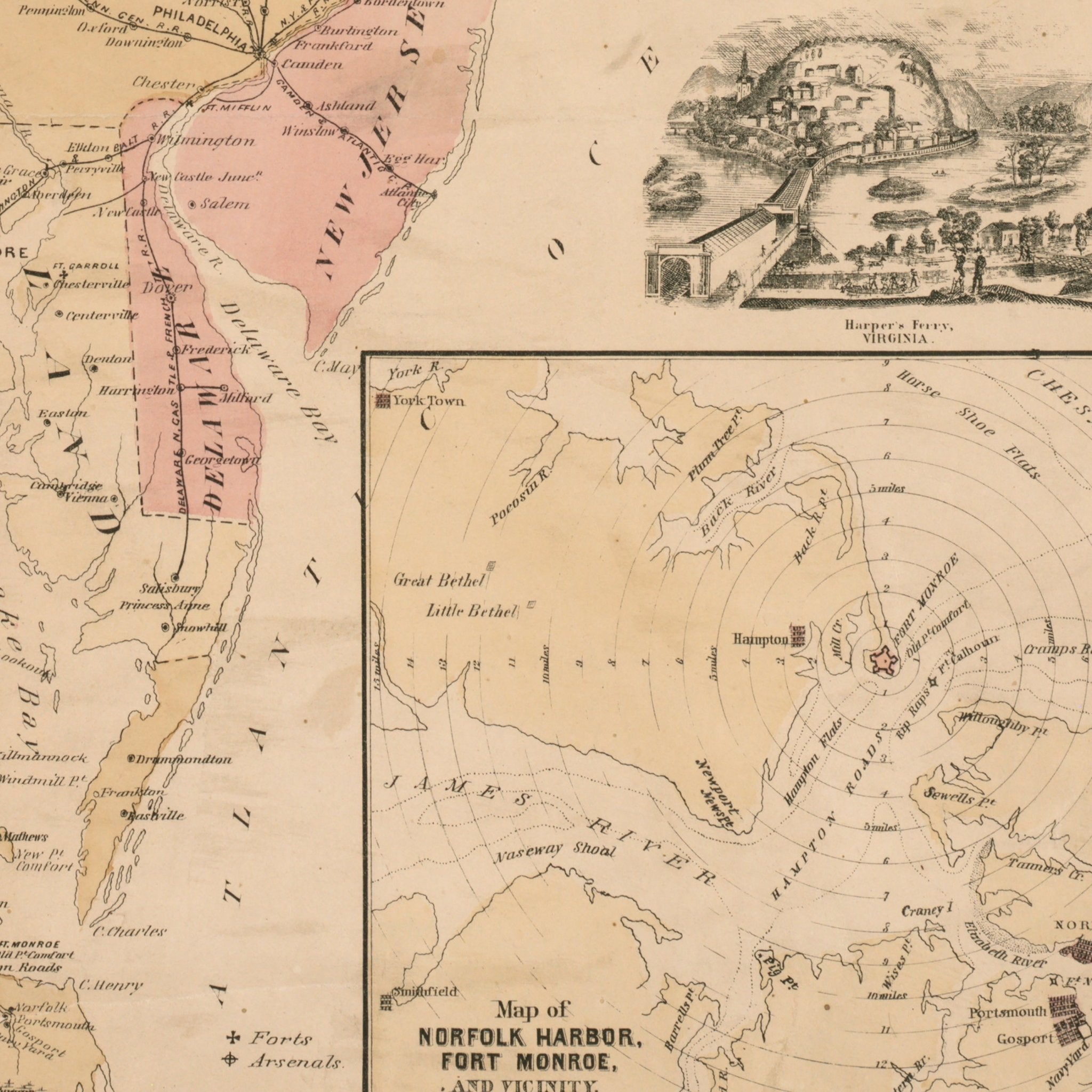
Map of the Seat of War
From
$ 64.00 USD
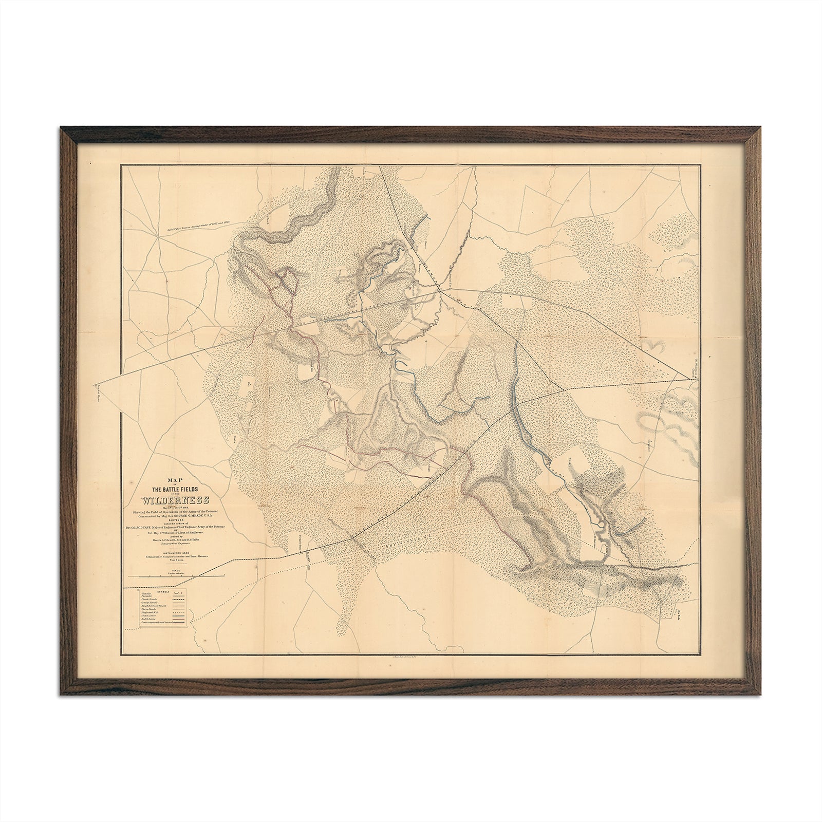
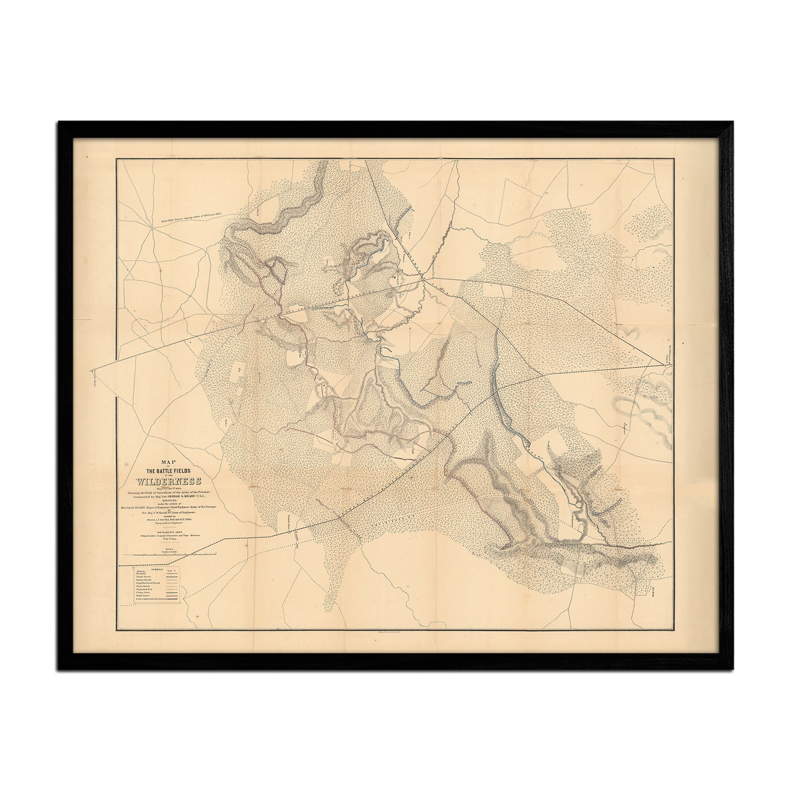
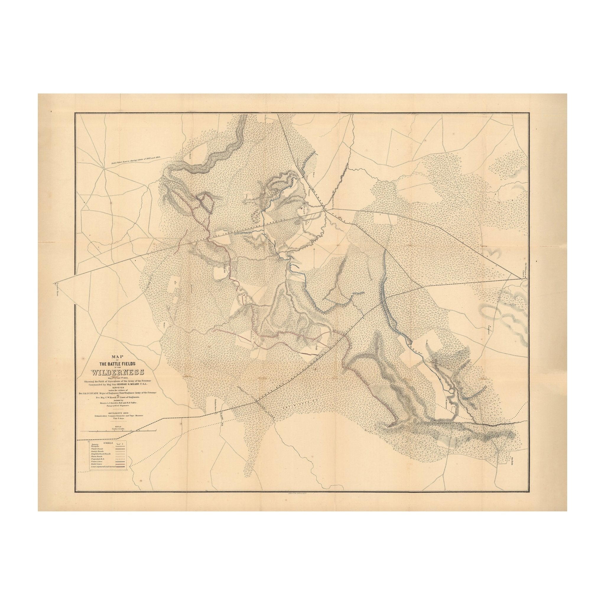
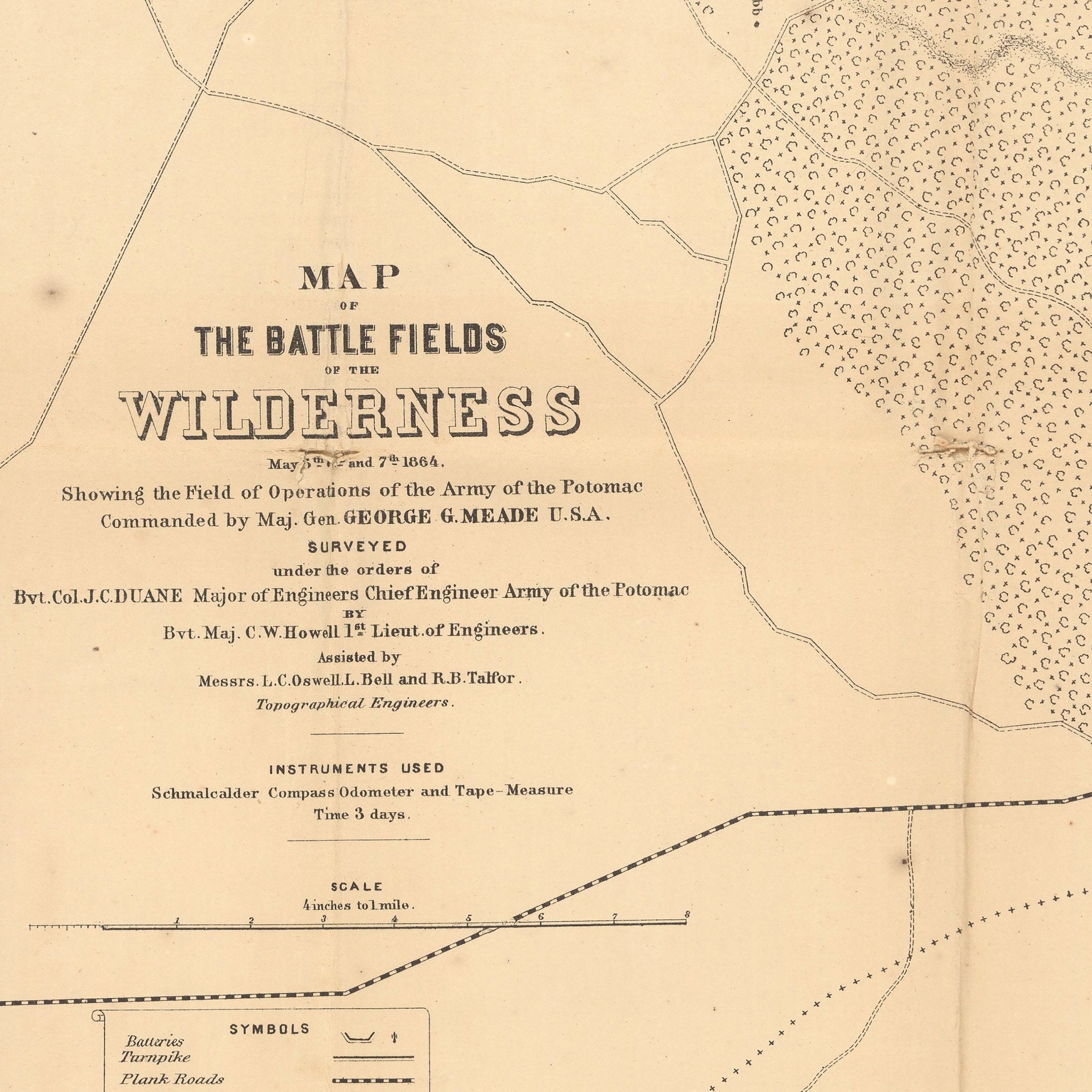
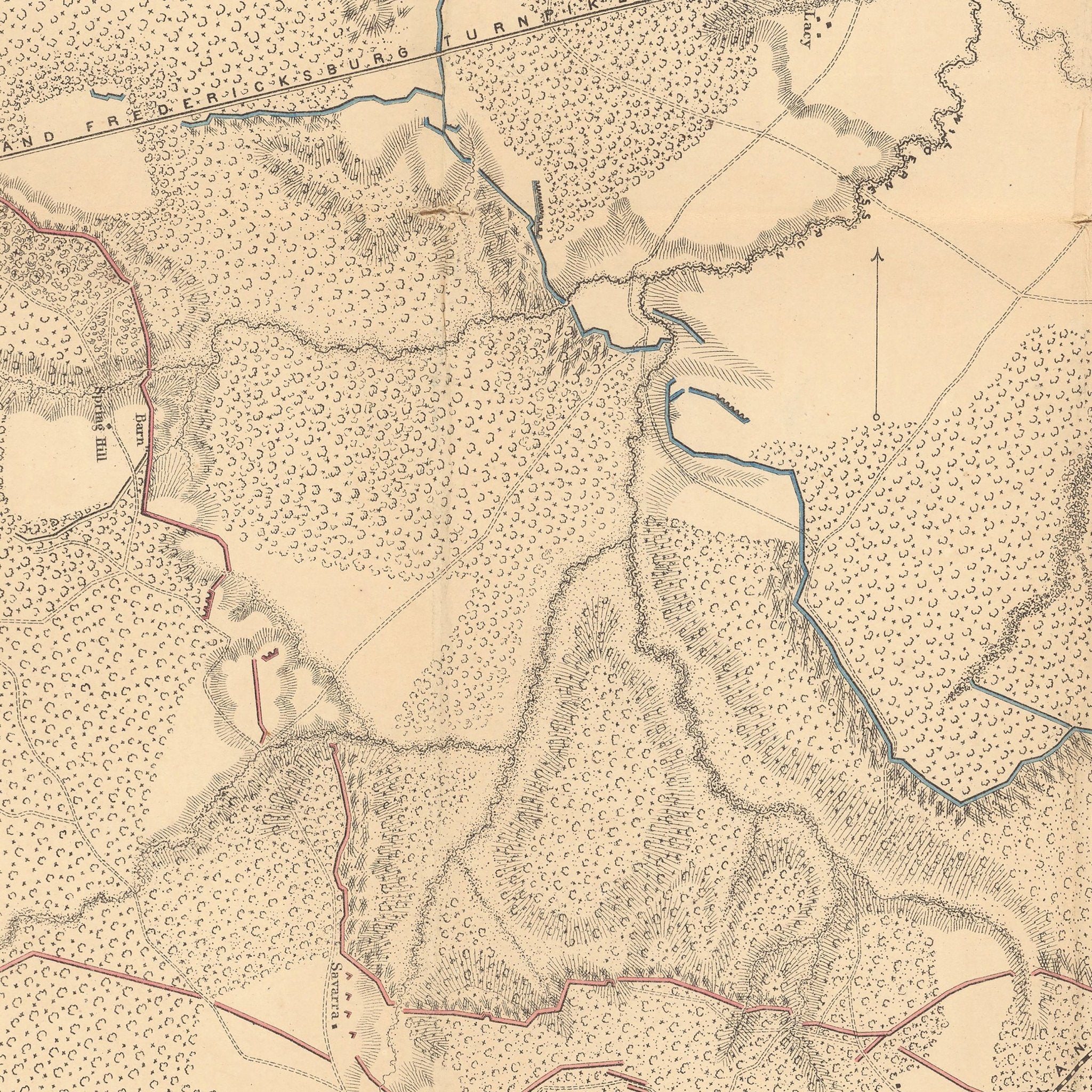
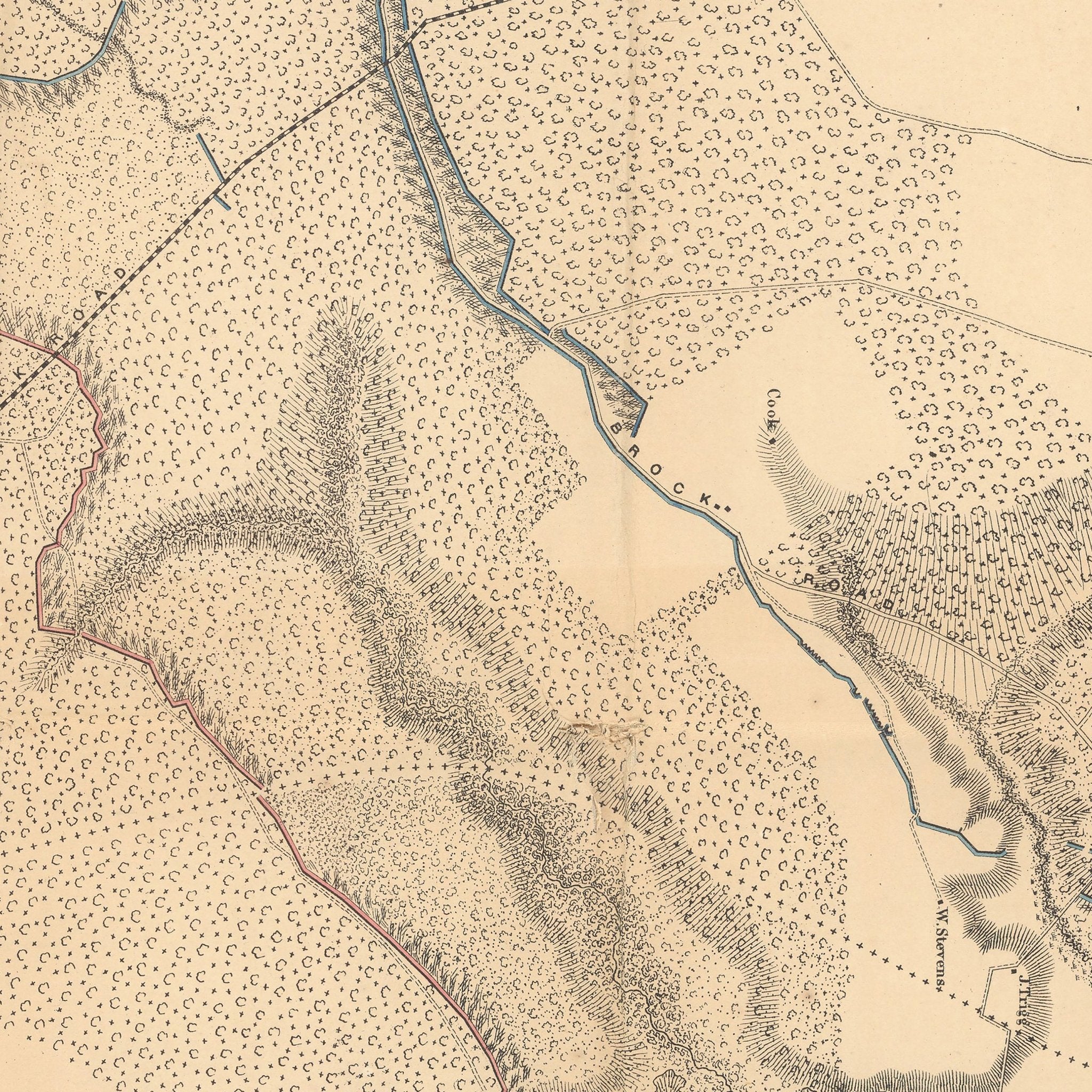
Map of the Battle Fields of Wilderness
From
$ 64.00 USD
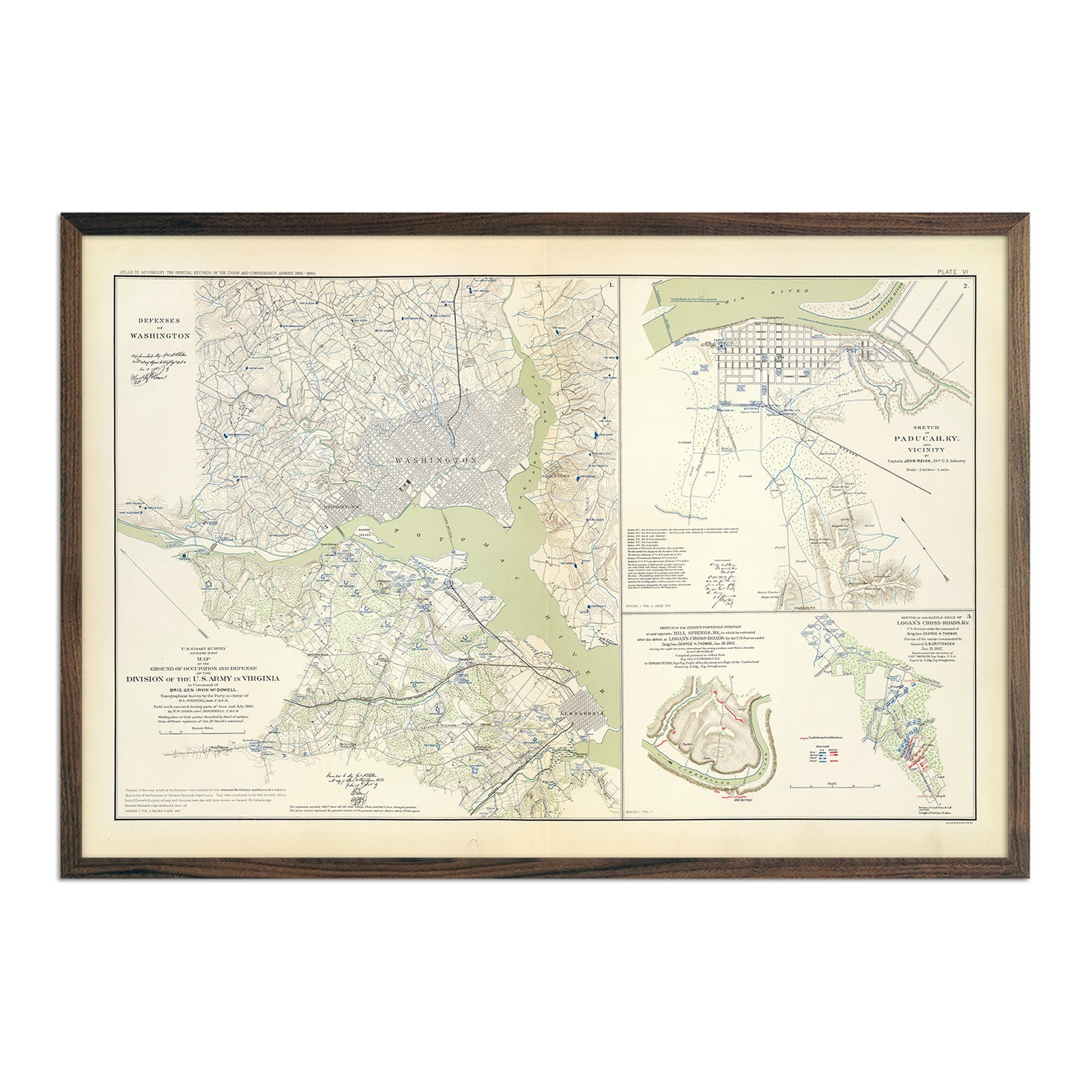
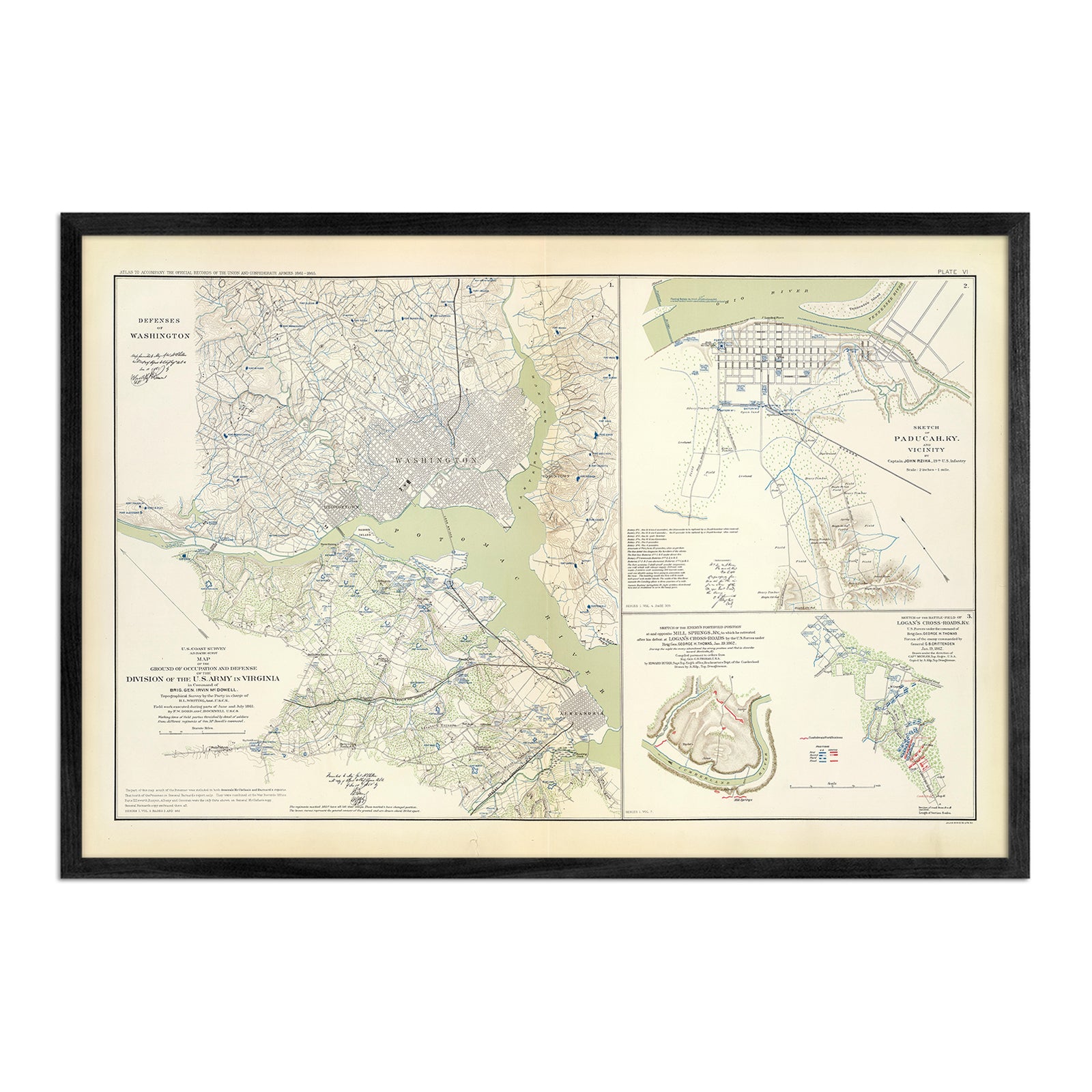
Washington Defenses
From
$ 79.00 USD
War Telegram Marking Map
From
$ 79.00 USD
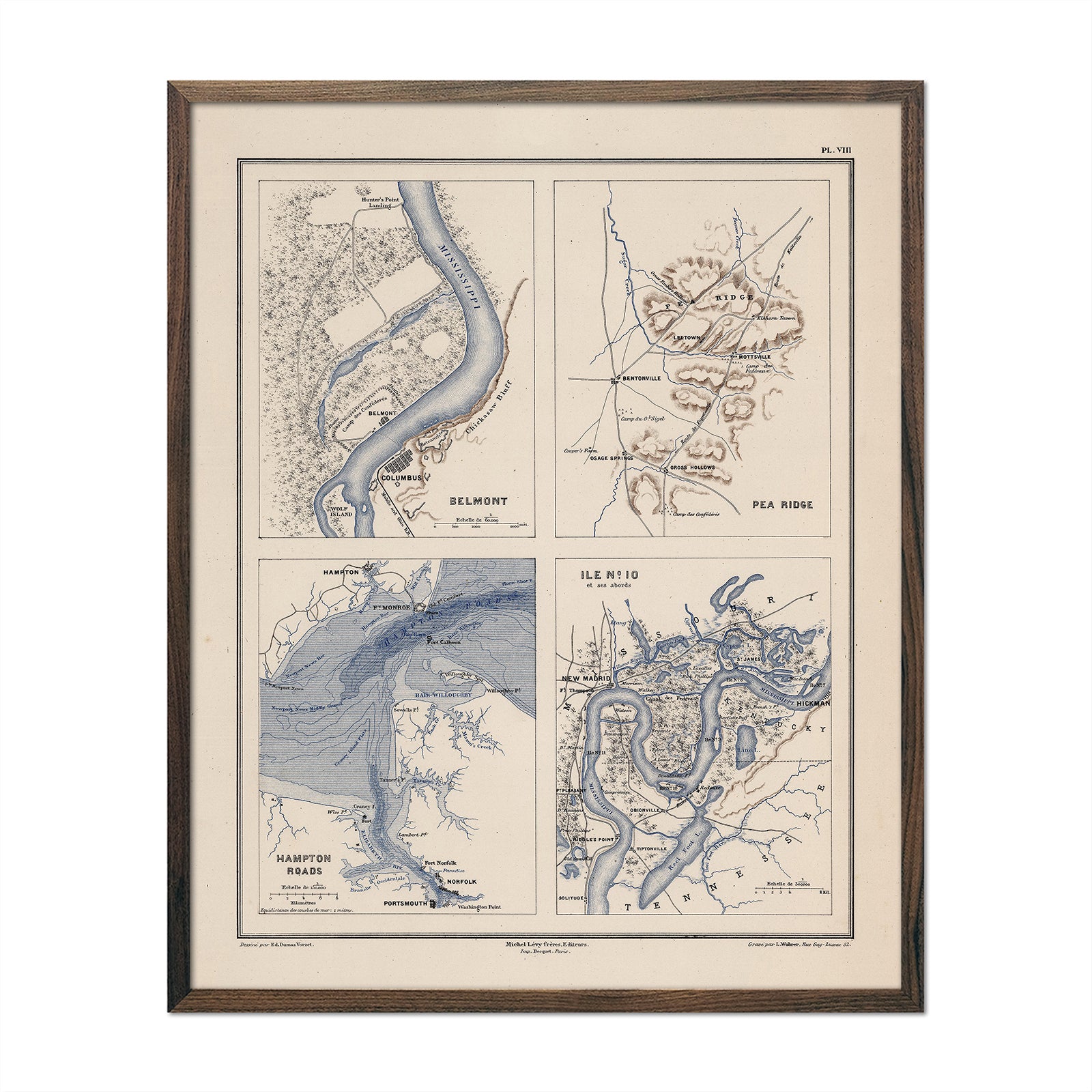
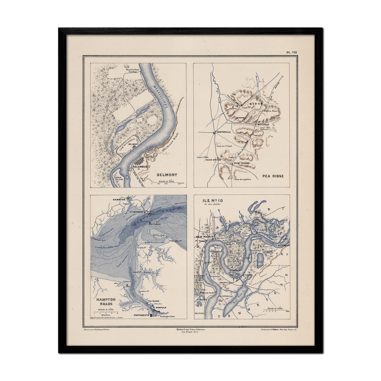
Belmont, Pea Ridge, Hampton Roads and Island Number 10
From
$ 64.00 USD
Your cart
Close
Close
Your cart is empty
Start shopping
Added to your
Cart