


North Dakota Maps


North Dakota Map Art, Elevation & Shaded Relief Maps
Whether you are from North Dakota, like to visit, or hope to see the glacial streams of the North Country someday, our custom printed North Dakota wall maps will bring the Peace Garden State to life. Our maps are beautifully rendered from a combination of historical data, modern technology, and hand design. From our eye-catching elevation maps and geological relief maps to our meticulously restored historical maps, every map of North Dakota we offer reflects the high quality and attention to detail our customers have come to love and expect from Muir Way. See why a map of North Dakota from Muir Way is more than your typical wall map.
What makes Muir Way maps of North Dakota unique?
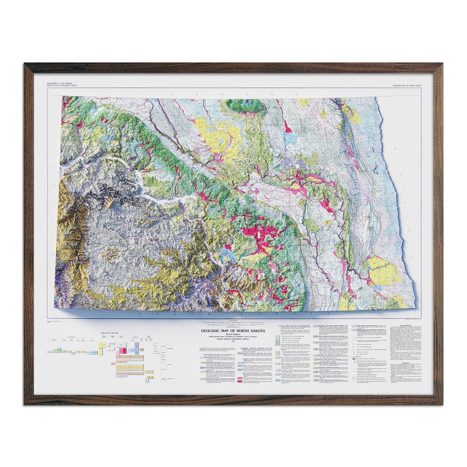
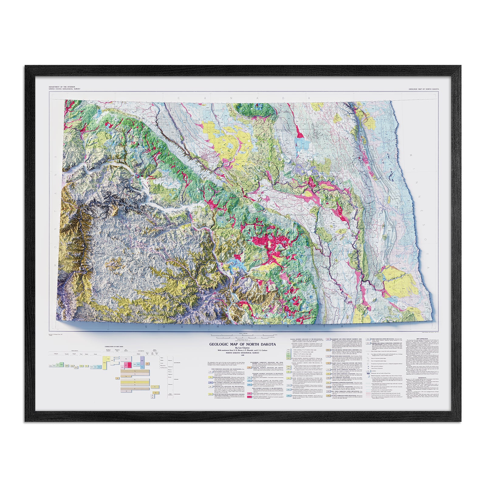
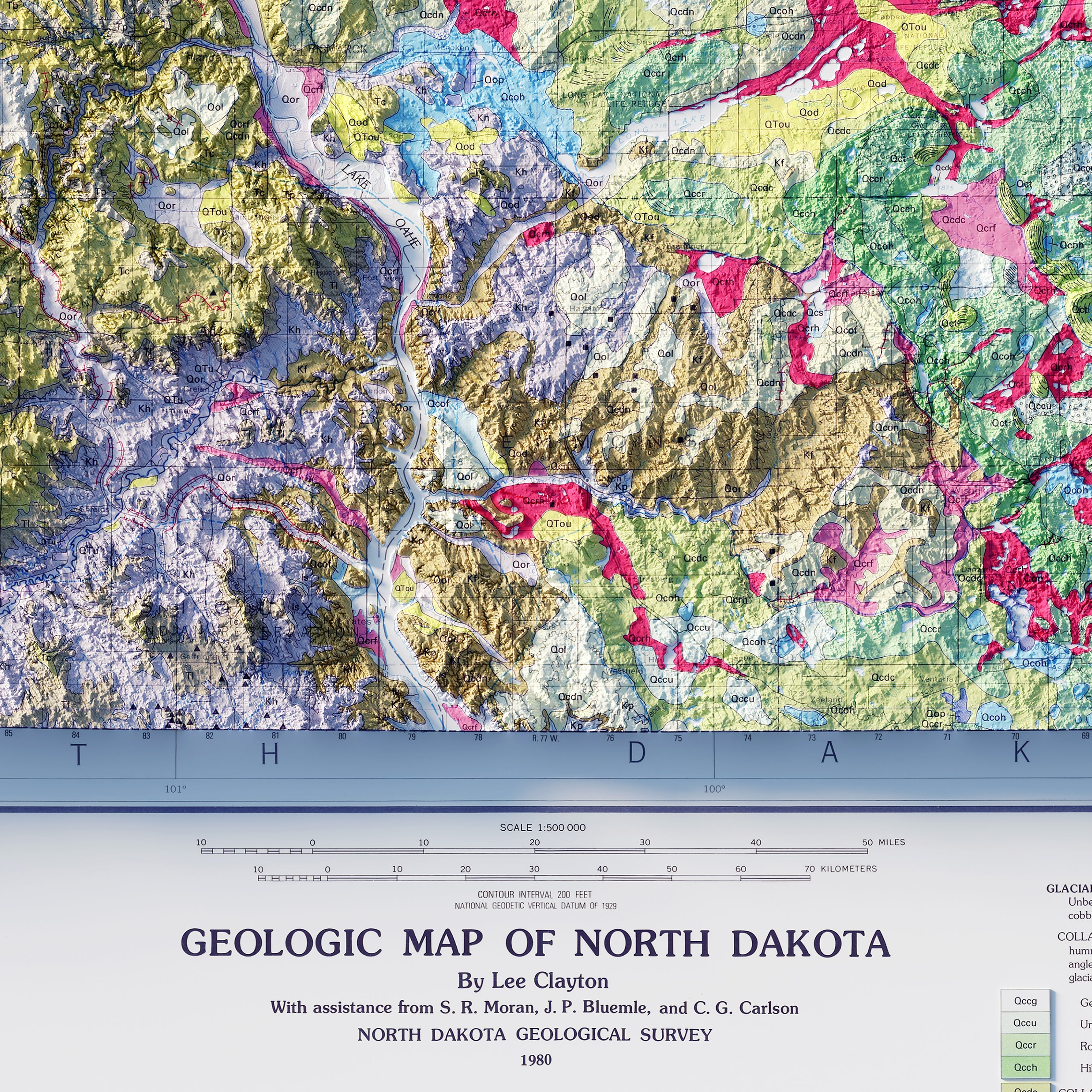
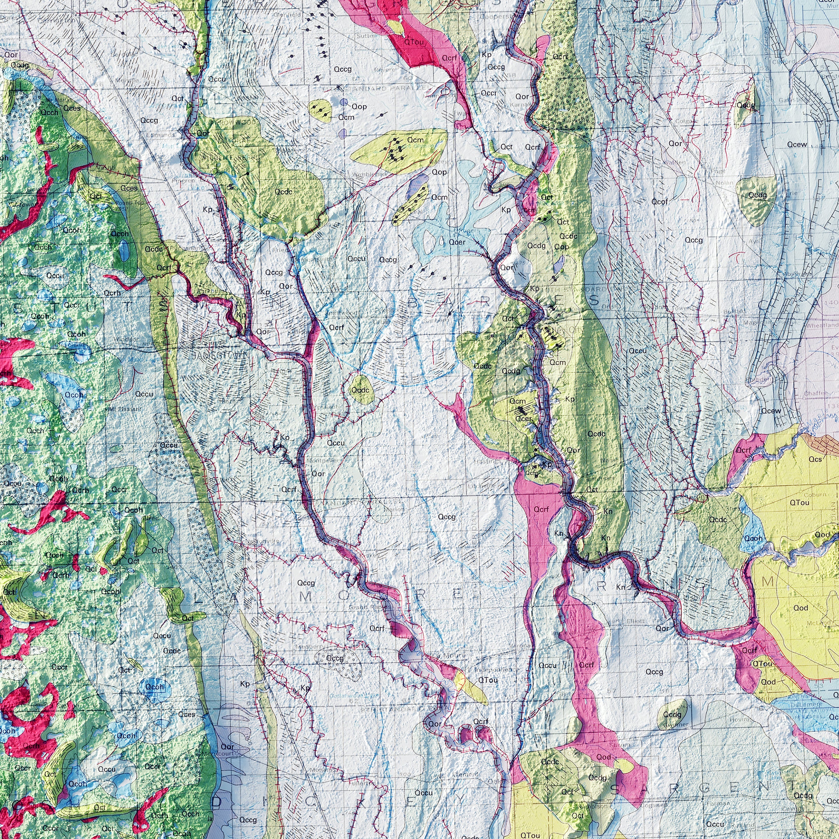
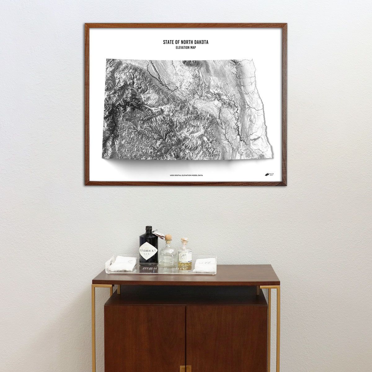
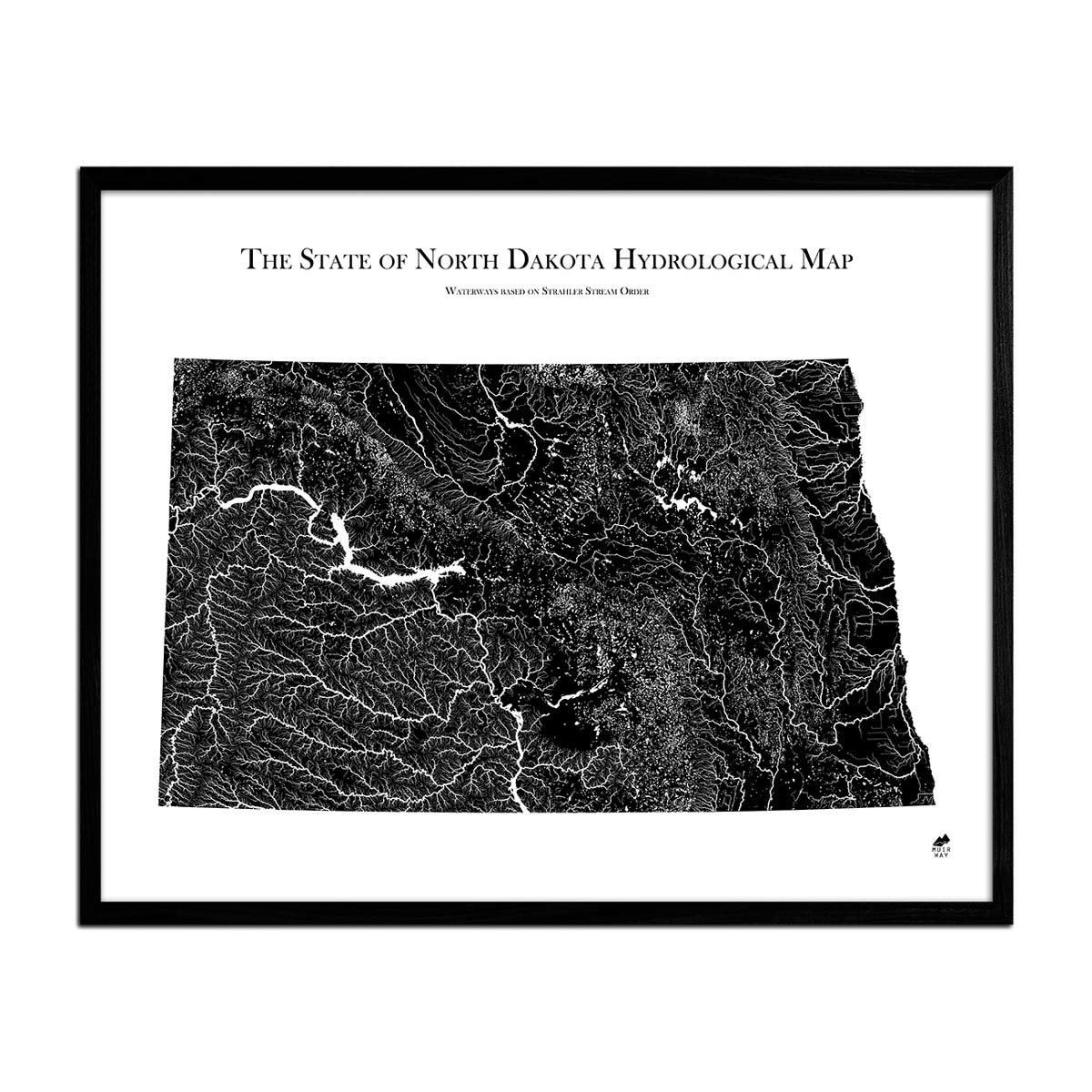
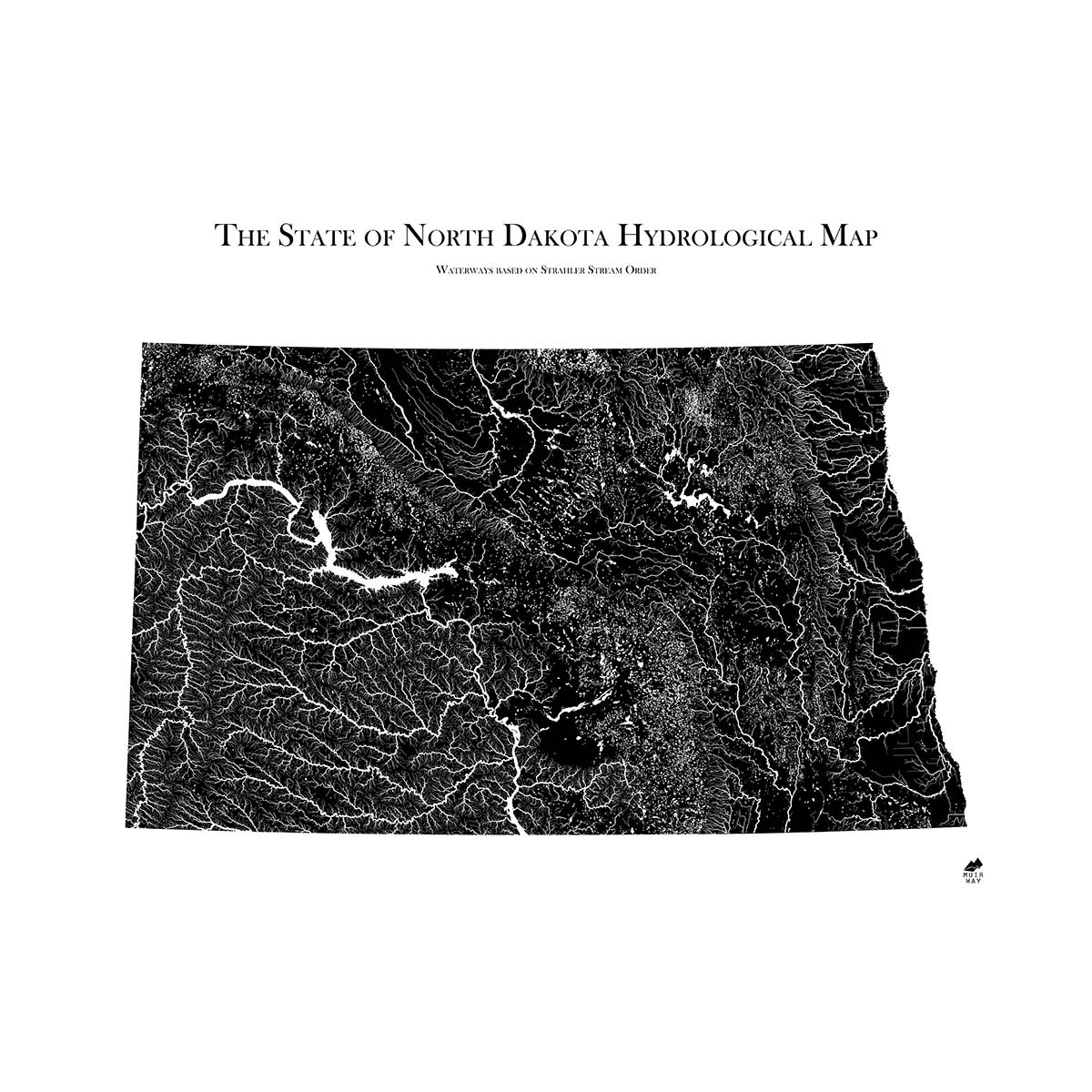
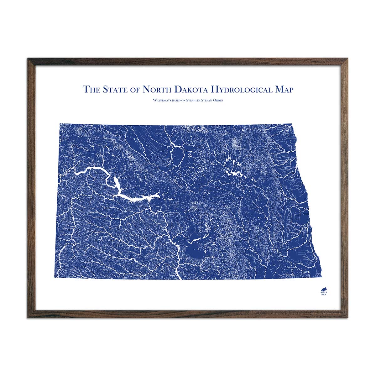
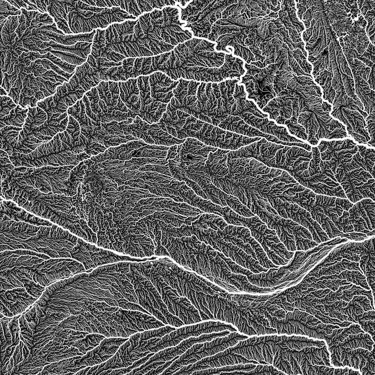
When you purchase a map of North Dakota from Muir Way, you are not purchasing a glossy poster or generic print. We custom print every North Dakota map using archival inks and fine art paper certified to last 100 years. The artwork of our maps themselves is designed to bring new light to the beautiful terrain they feature. For example, our elevation maps incorporate hand-shaded relief and Digital Elevation Data with historical map terrain for a unique 3D effect on a flat surface, and our hydrological maps depict every river in the state--even intermittent streams--and every body of water over 0.2 miles in diameter in crisp detail. We create beautiful, heirloom-quality maps meant to last for generations.
Does my North Dakota map come framed?
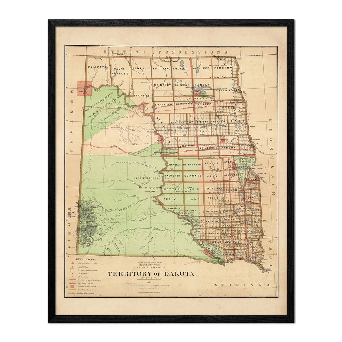
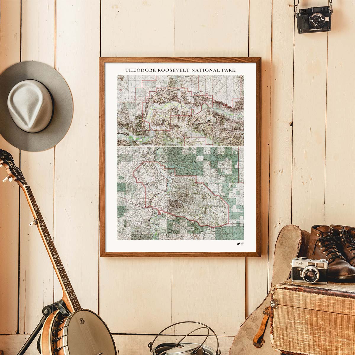
It can! You can purchase your North Dakota map professionally custom-framed with real wood, or unframed if you prefer to use your own. If you’d like to purchase a framed North Dakota wall map, there are several different wood finishes to choose from. If you’d prefer to use your own frame, all of our maps come in standard sizes for easy gift giving.
Does a Muir Way map of North Dakota make a good gift?
Yes! Our custom-printed maps of North Dakota make the perfect gift for outdoor enthusiasts, to commemorate special occasions, or as a thank-you gift for someone special. Memorialize the experience of a special holiday to the Red River, White Butte, or any of the other amazing North Dakota landscapes. One of our state relief maps can be a perfect graduation gift for a student about to leave home for the first time, or a reminder of home for someone from North Dakota but who no longer lives there. Our maps also make beautiful corporate gifts that will remind your clients or colleagues of you every time they see it.
Where should I display my North Dakota map?
Our maps are eye-catching from across the room and up close. Hang a framed wall map as a central focus or purchase several maps in a similar style or from a particular region and arrange them near each other for a complementary series. Our hydrological maps come in several colors or the classic black and white, and our geological relief maps feature vibrant colors. No matter which you choose, you’re sure to find a North Dakota map that will look right at home.
What are the different types of maps of North Dakota available on Muir Way?
Our North Dakota maps are available in several different styles, including:
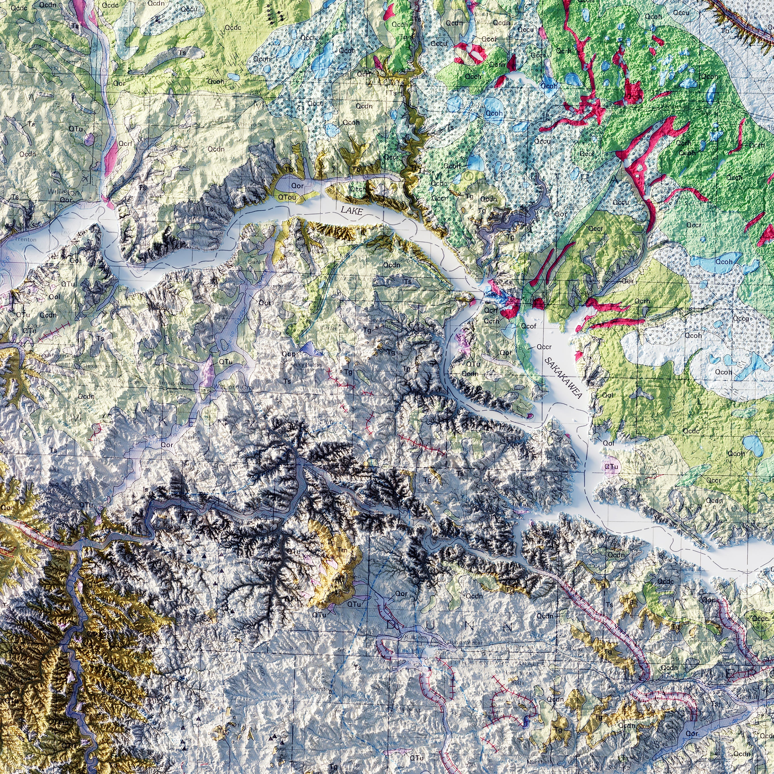
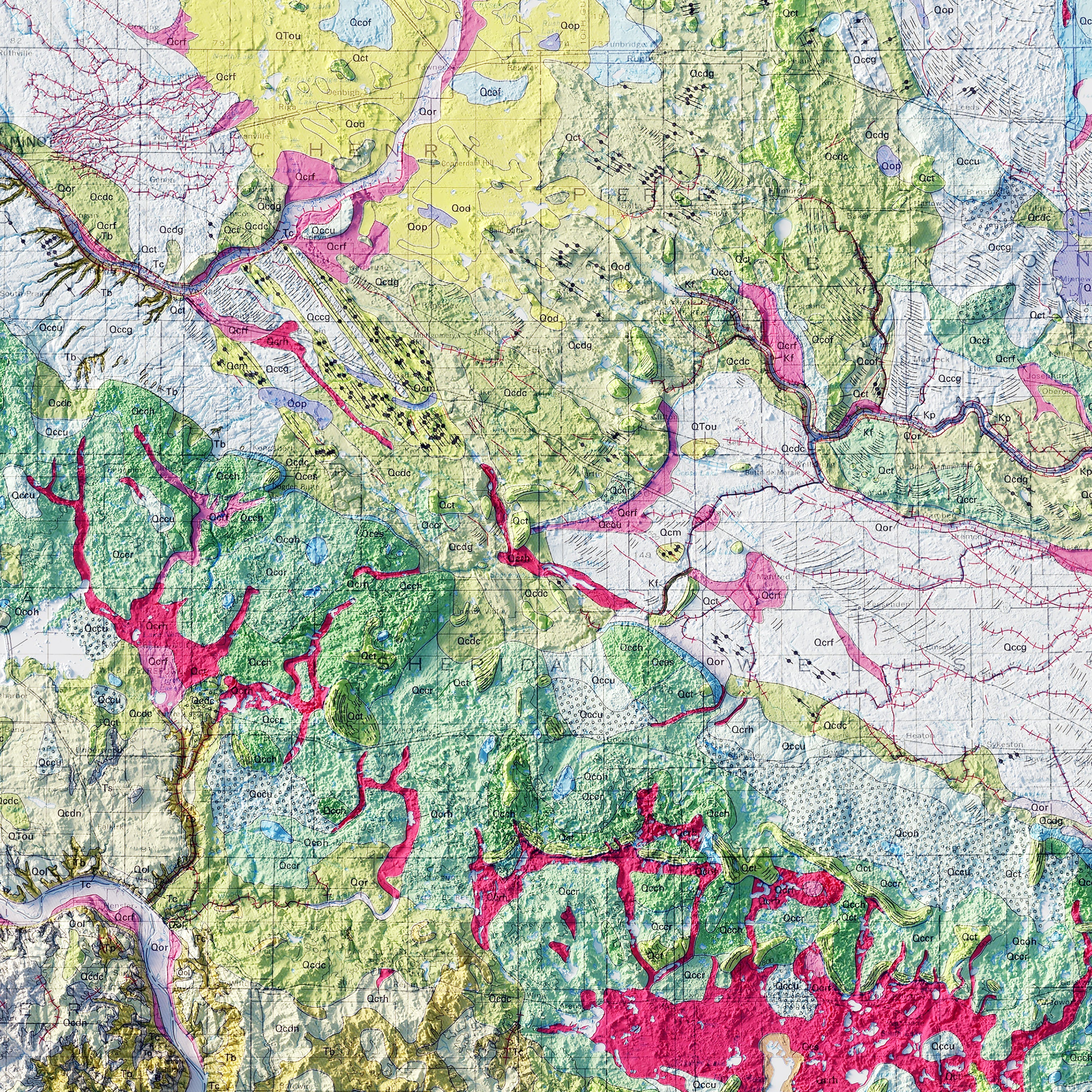
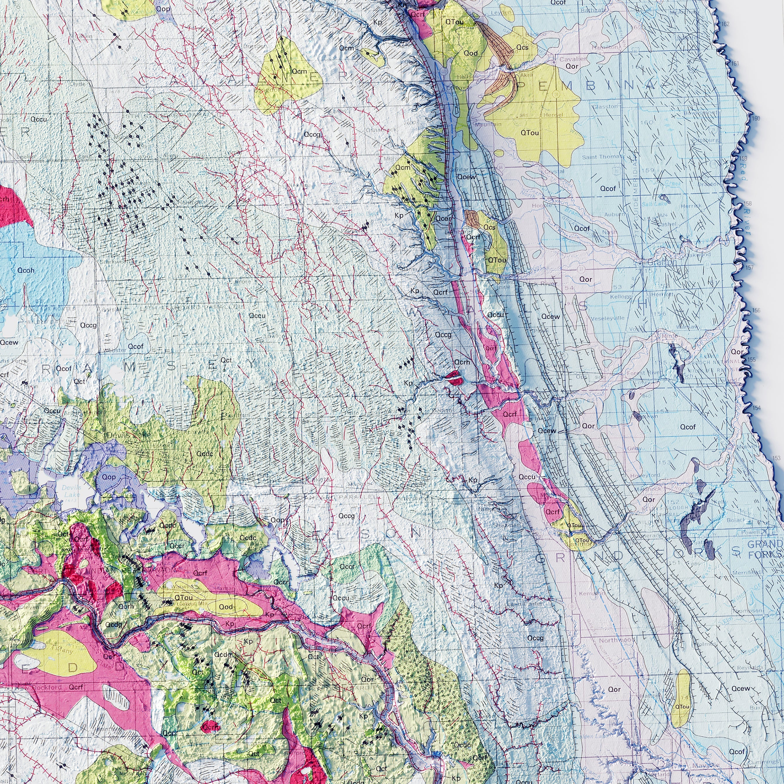
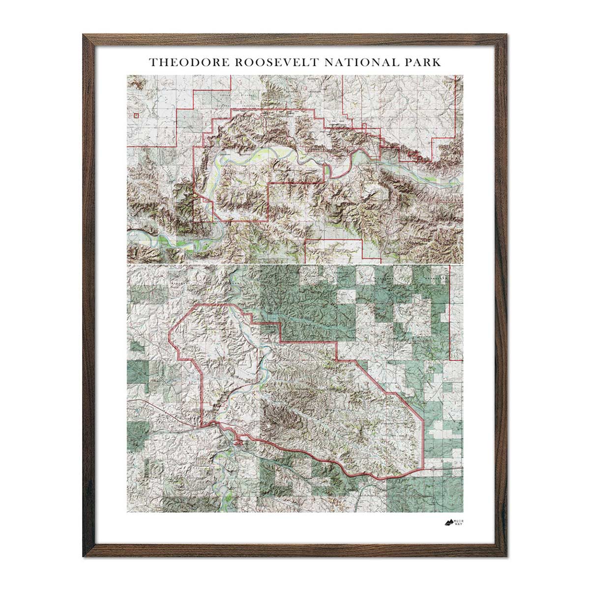
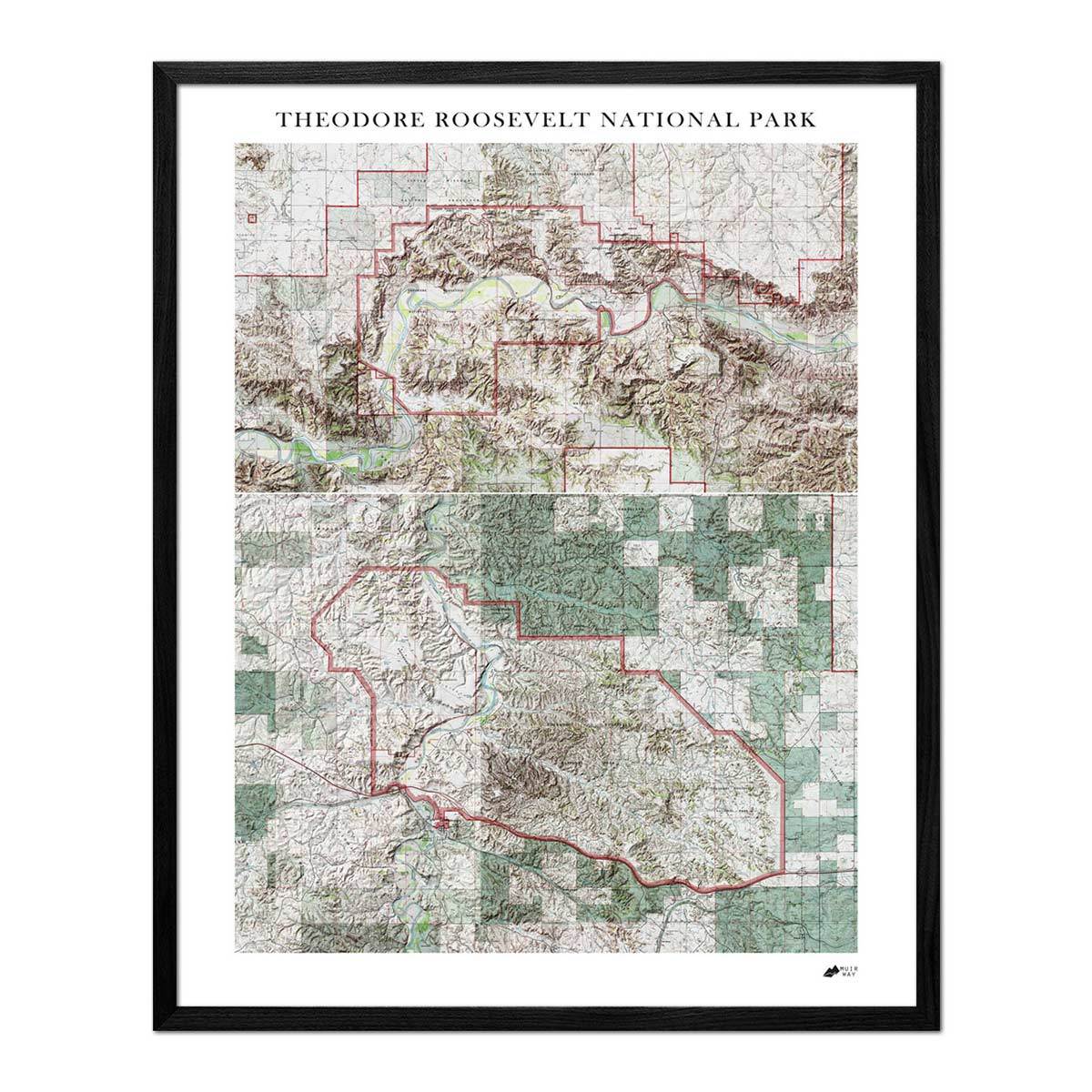
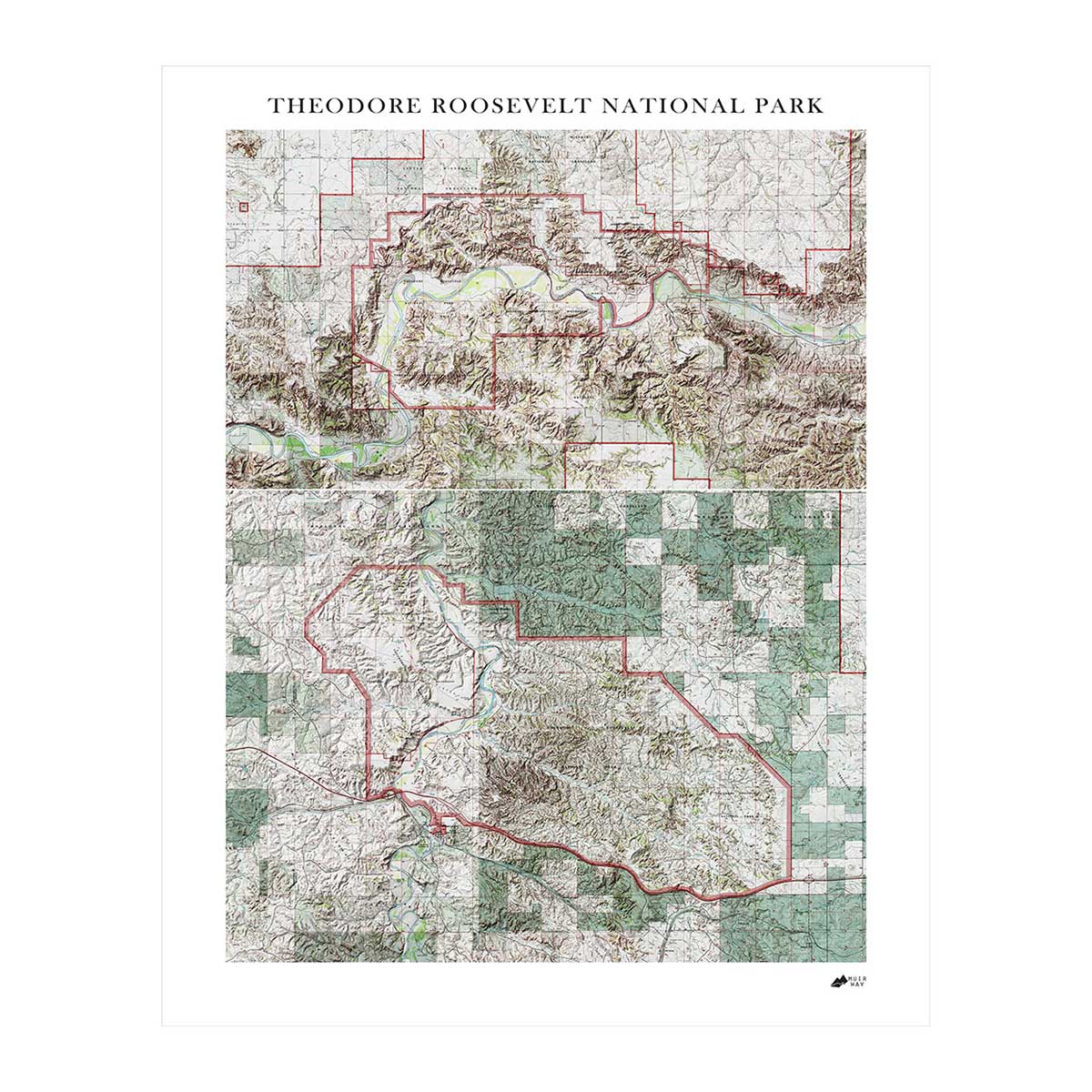
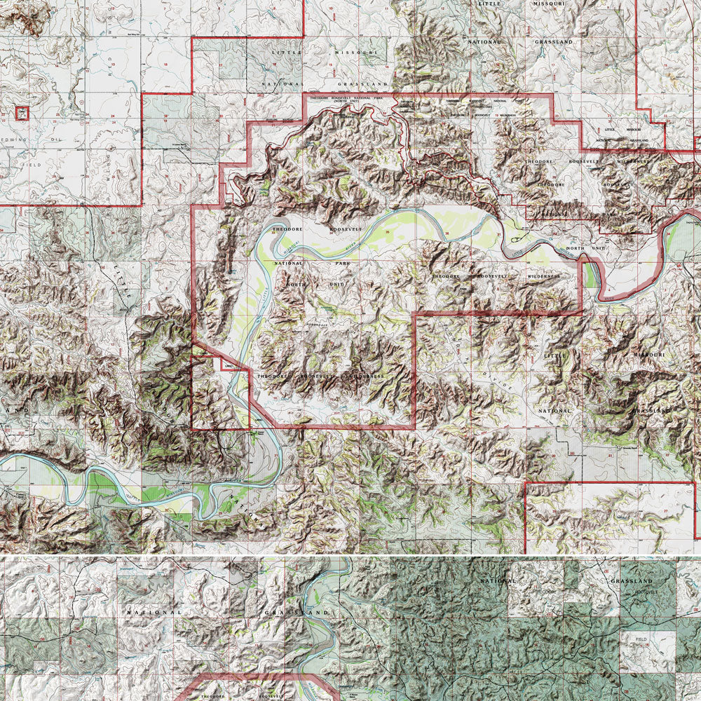
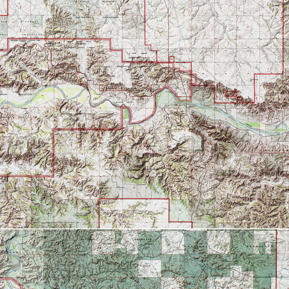
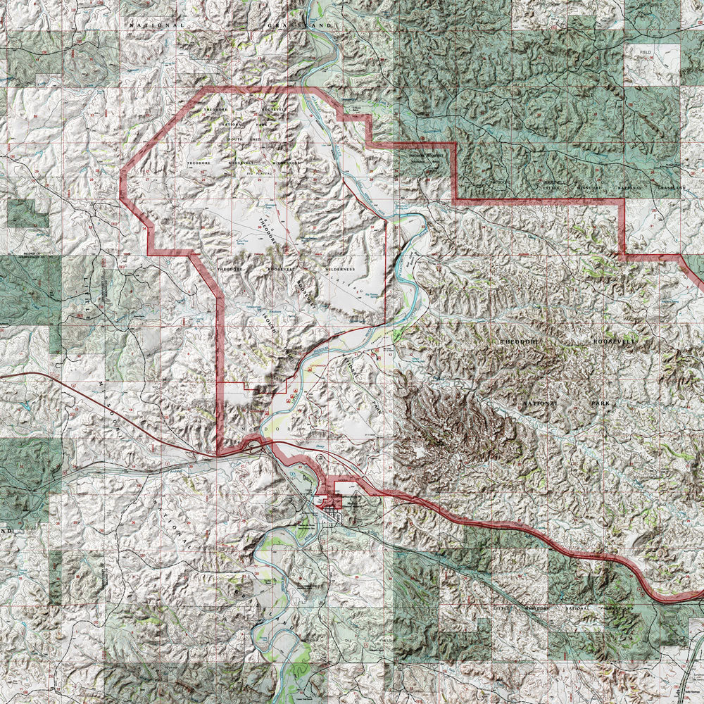
North Dakota relief maps - Our relief maps of North Dakota bring historical map landscapes together with modern technology to show the state’s landscapes in a new way. Using Digital Elevation Data and hand-shaded relief, we custom enhance vintage maps to create a 3D effect on a 2D surface. See North Dakota’s spectacular terrain in vibrant colors on our North Dakota 1980 Relief map.
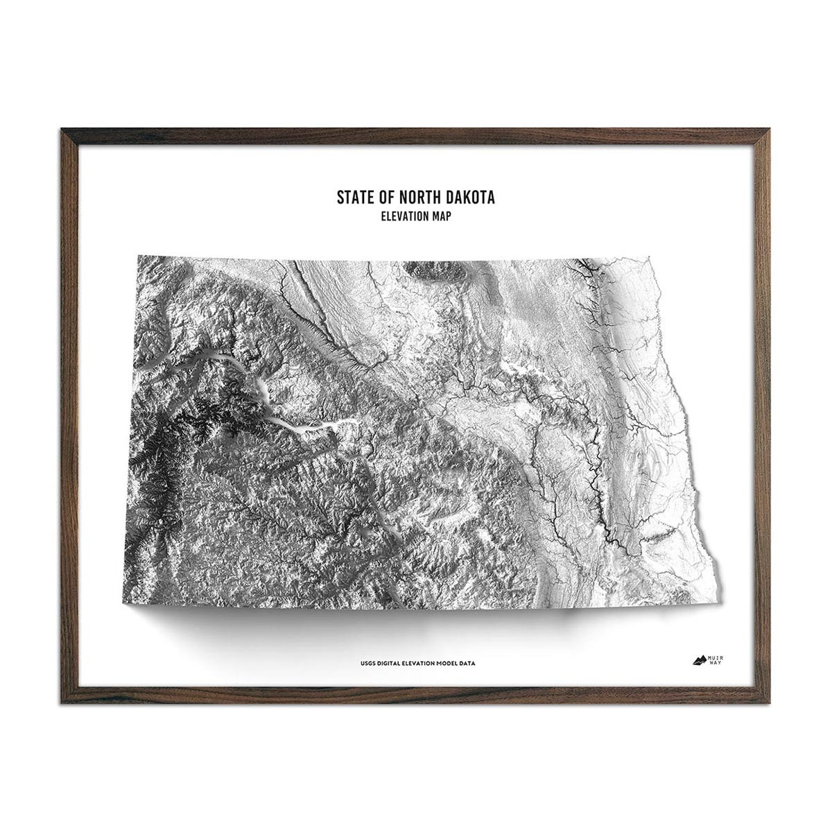
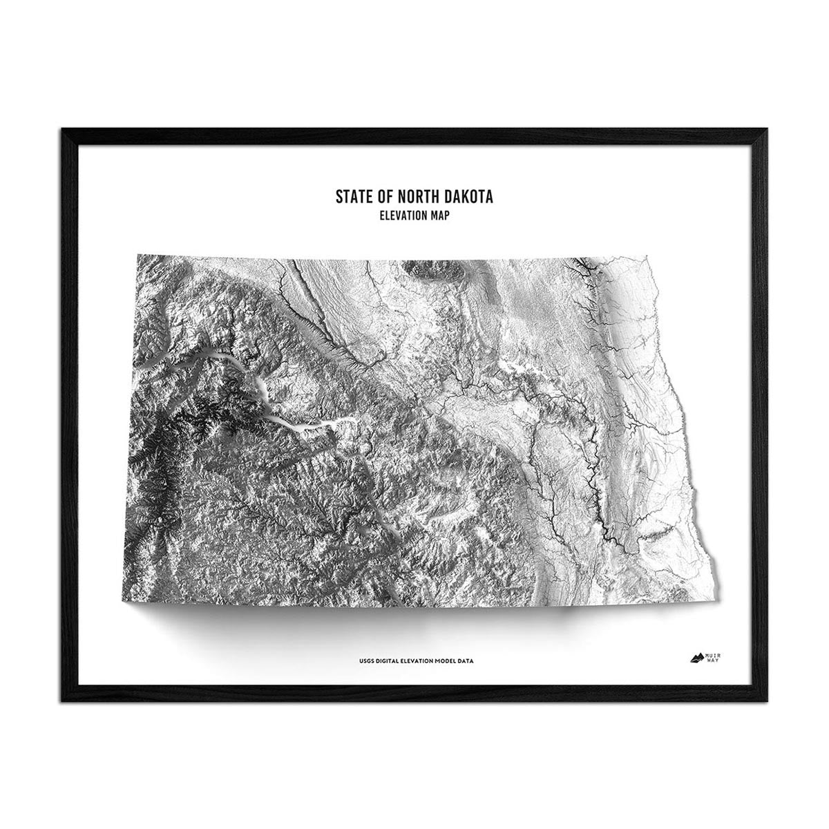
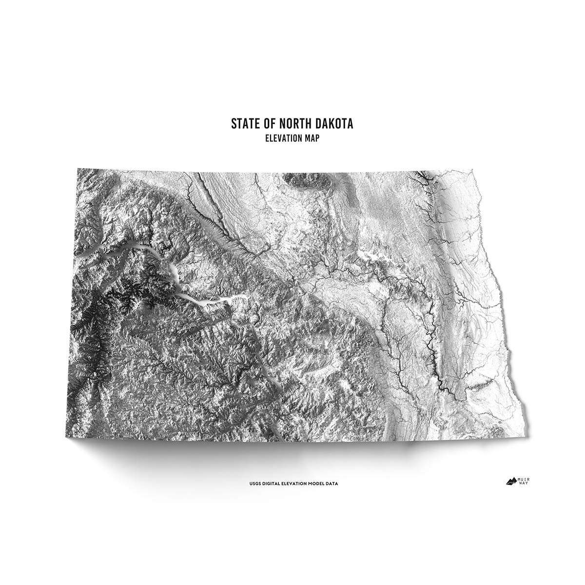
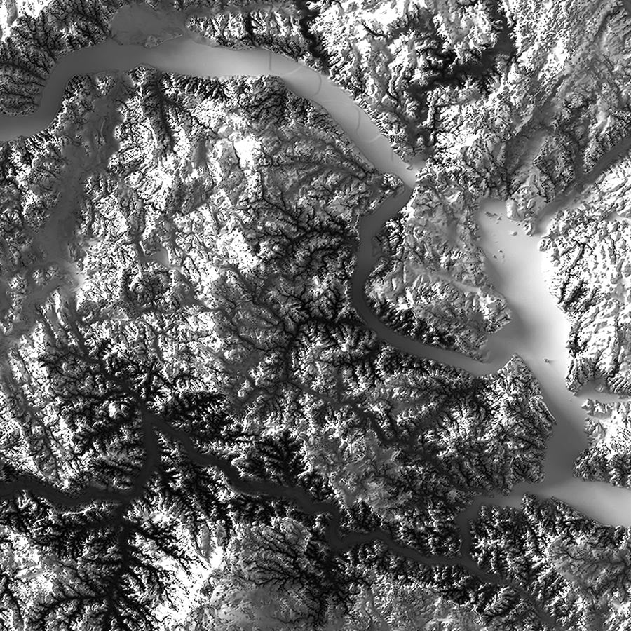
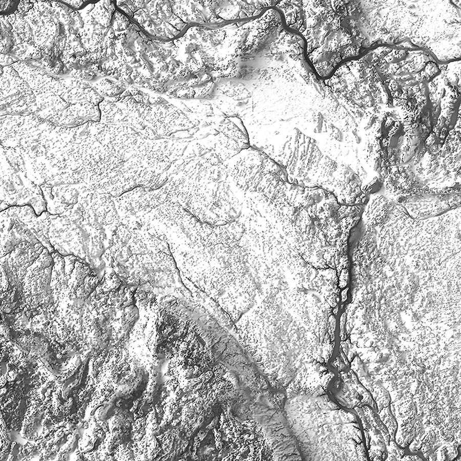
North Dakota elevation maps - Our North Dakota elevation map uses Digital Elevation Data from the USGS and hand-shaded relief just like our relief maps to create a high-contrast 3-dimensional effect in stunning black and white.
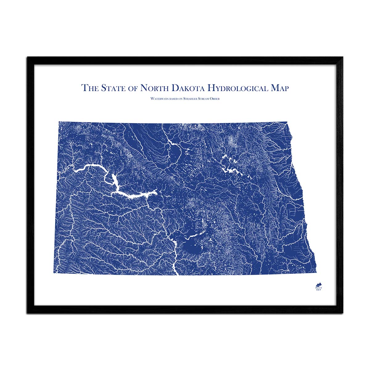
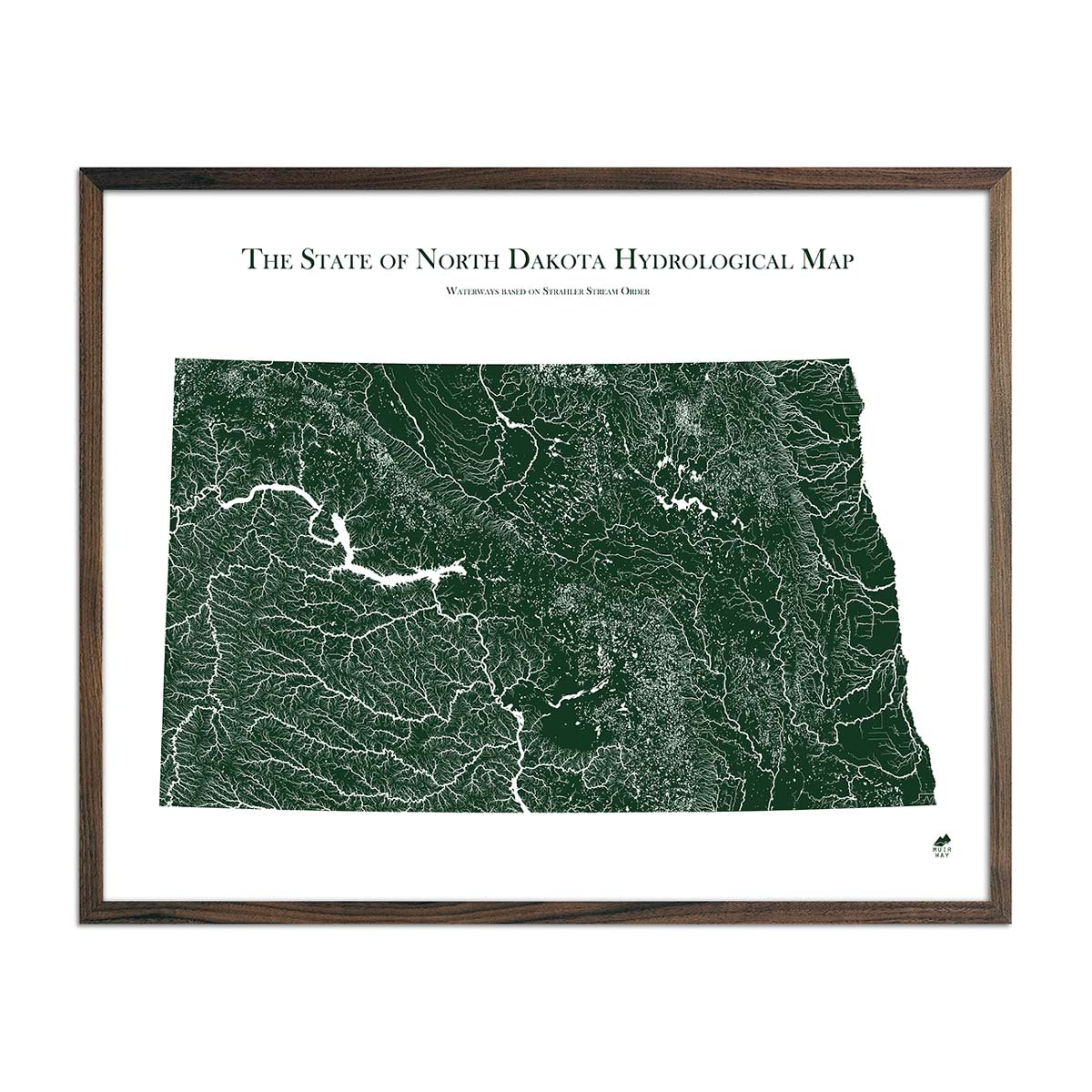
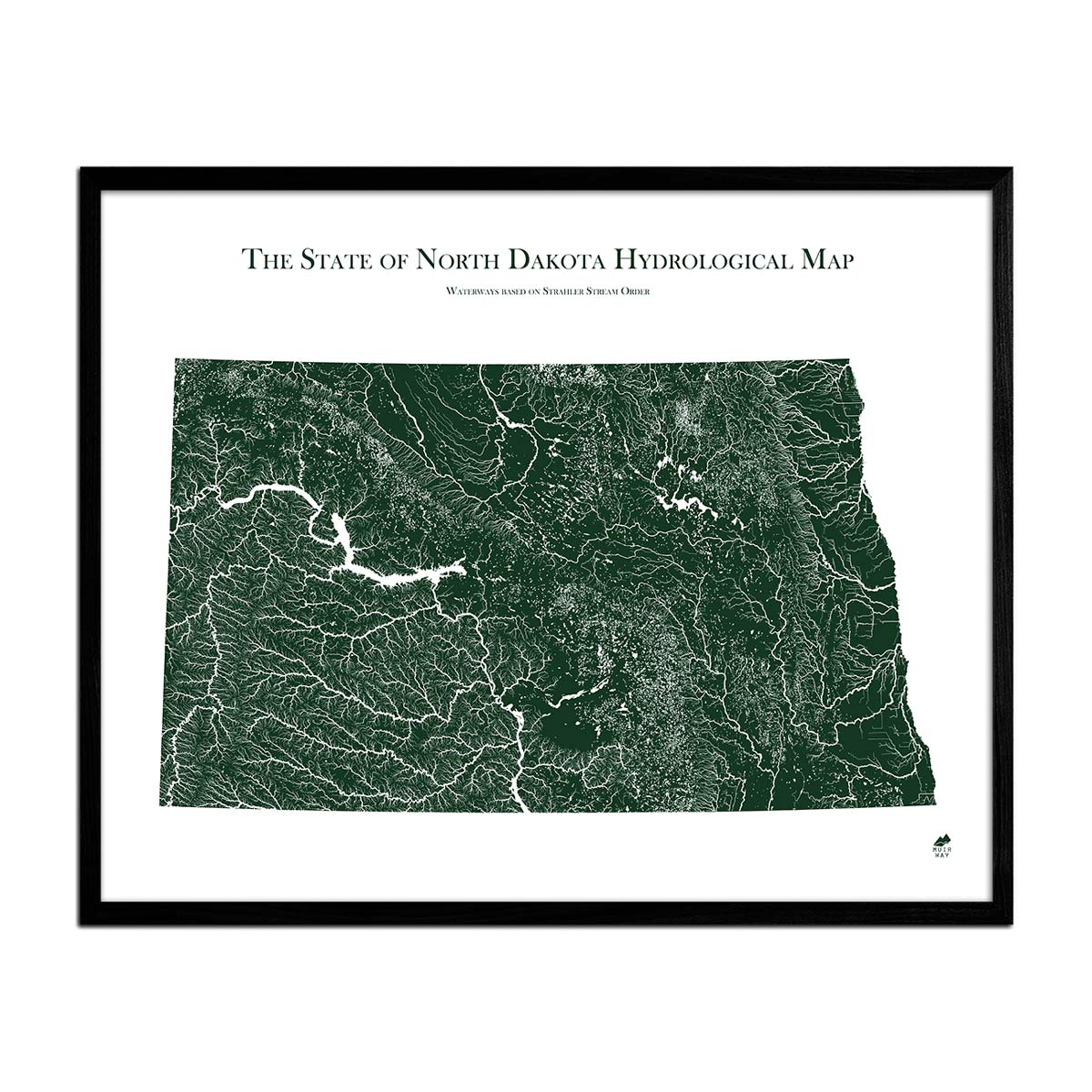
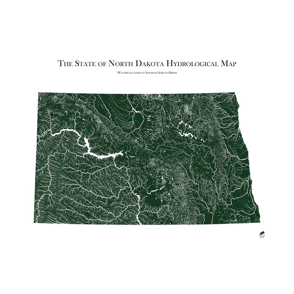
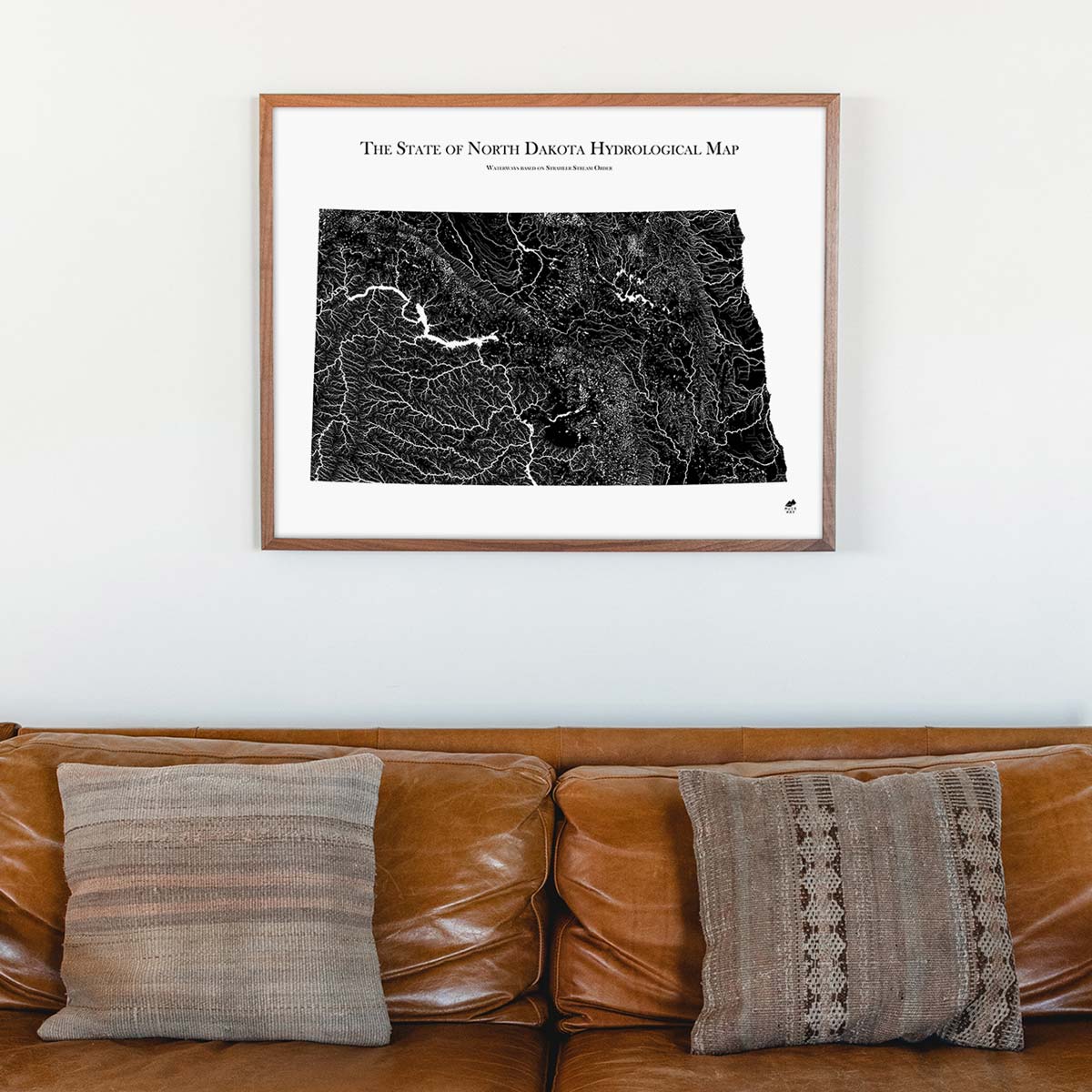
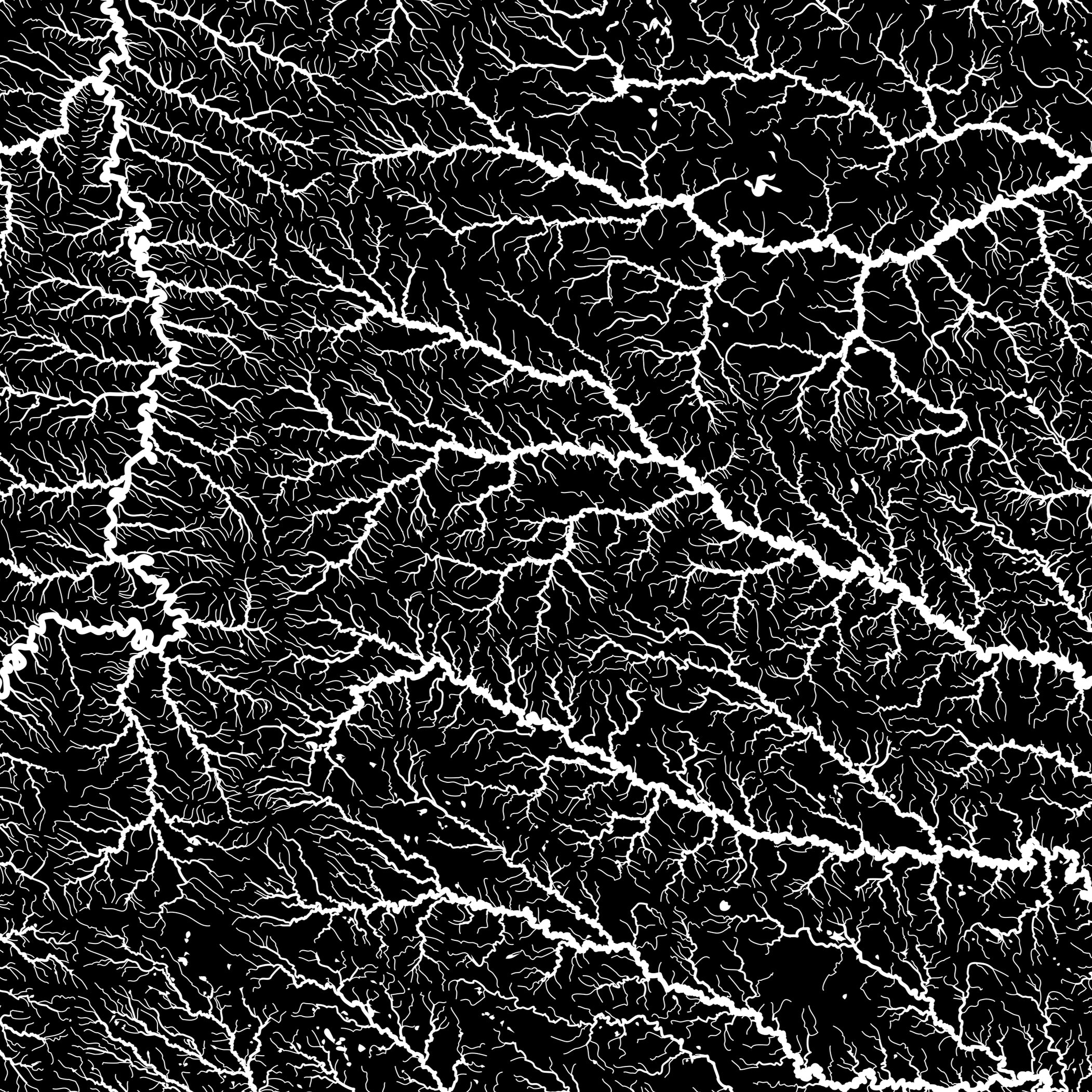
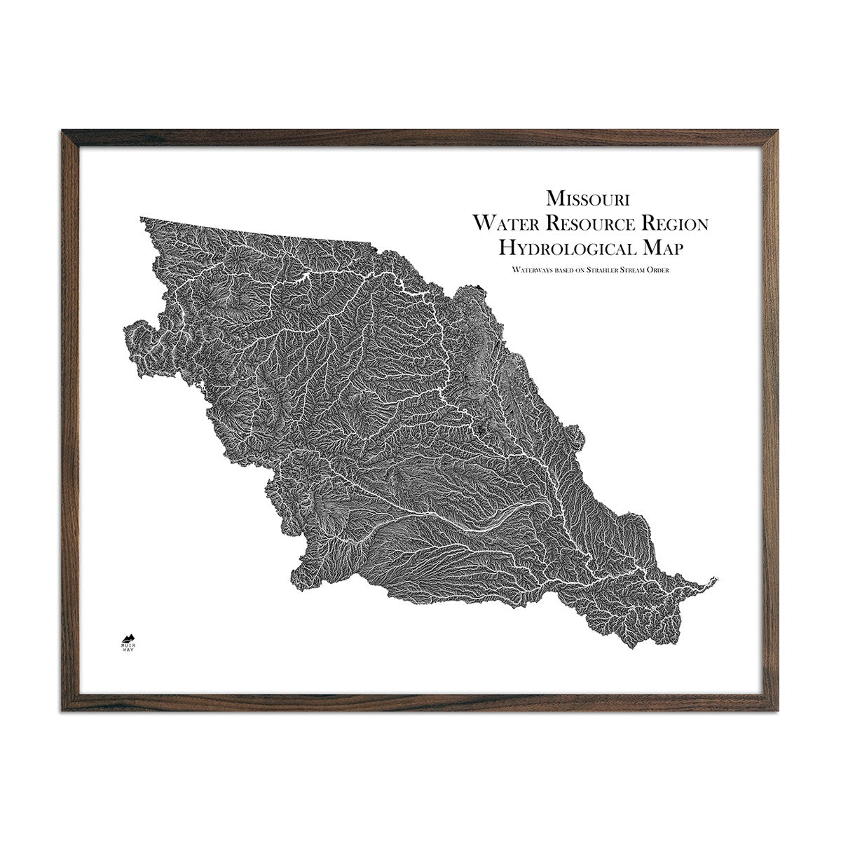
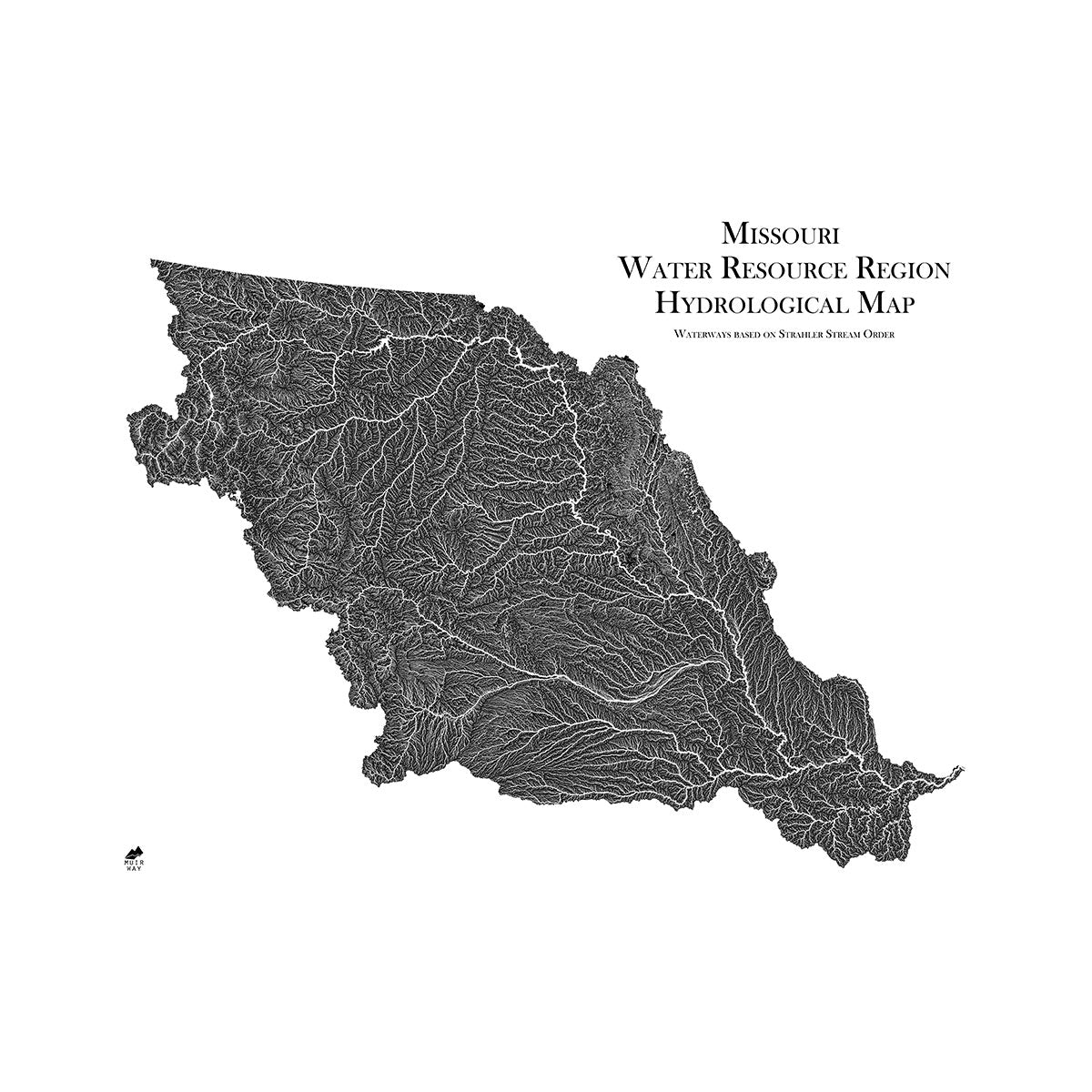
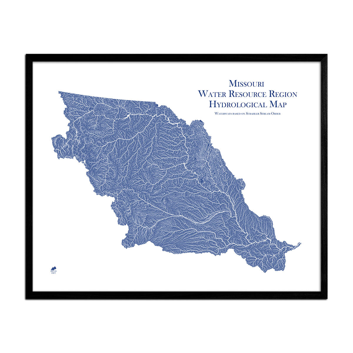
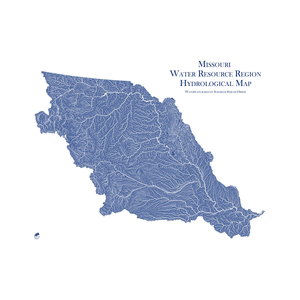
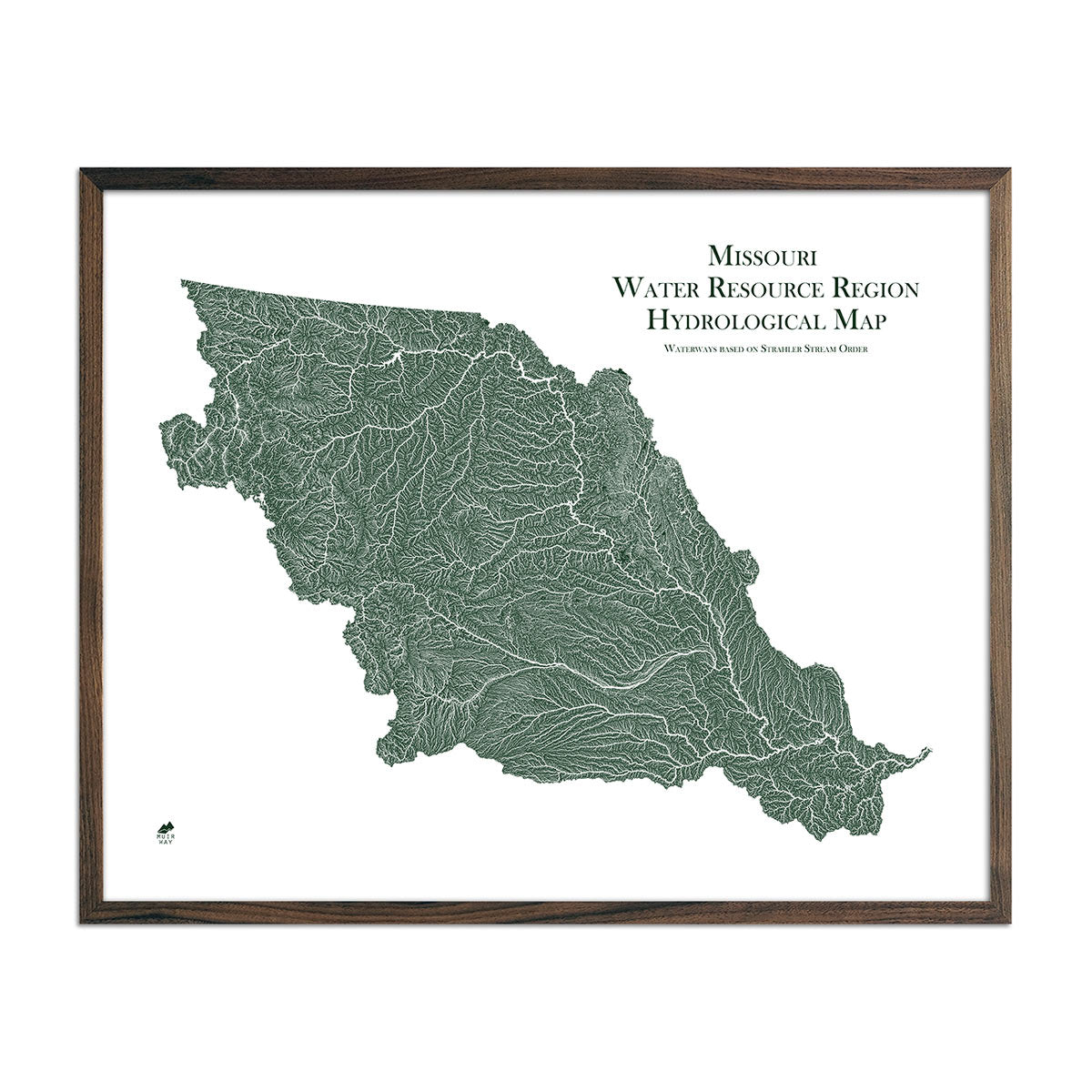
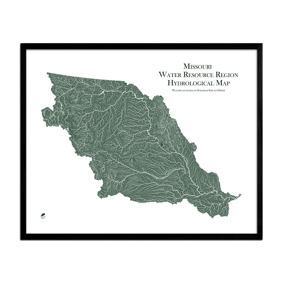
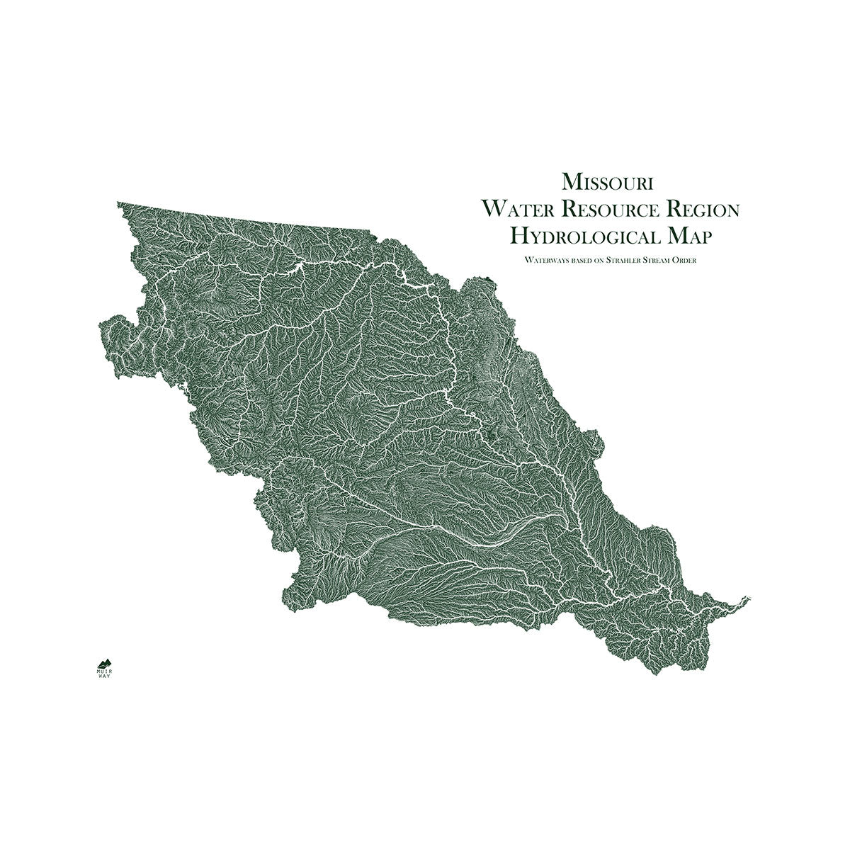
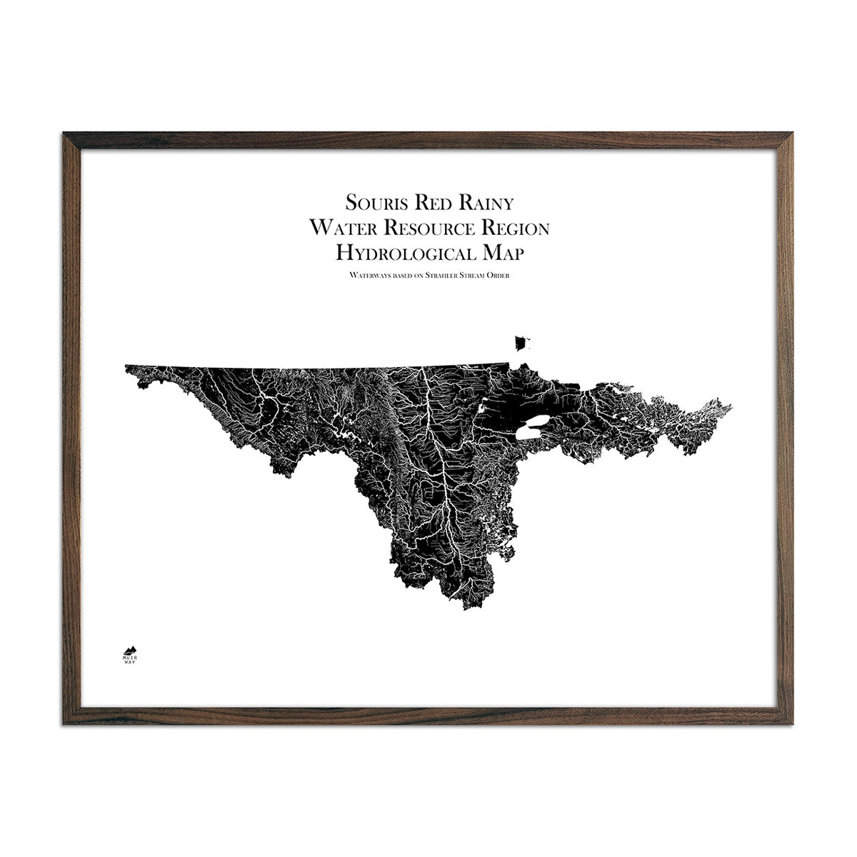
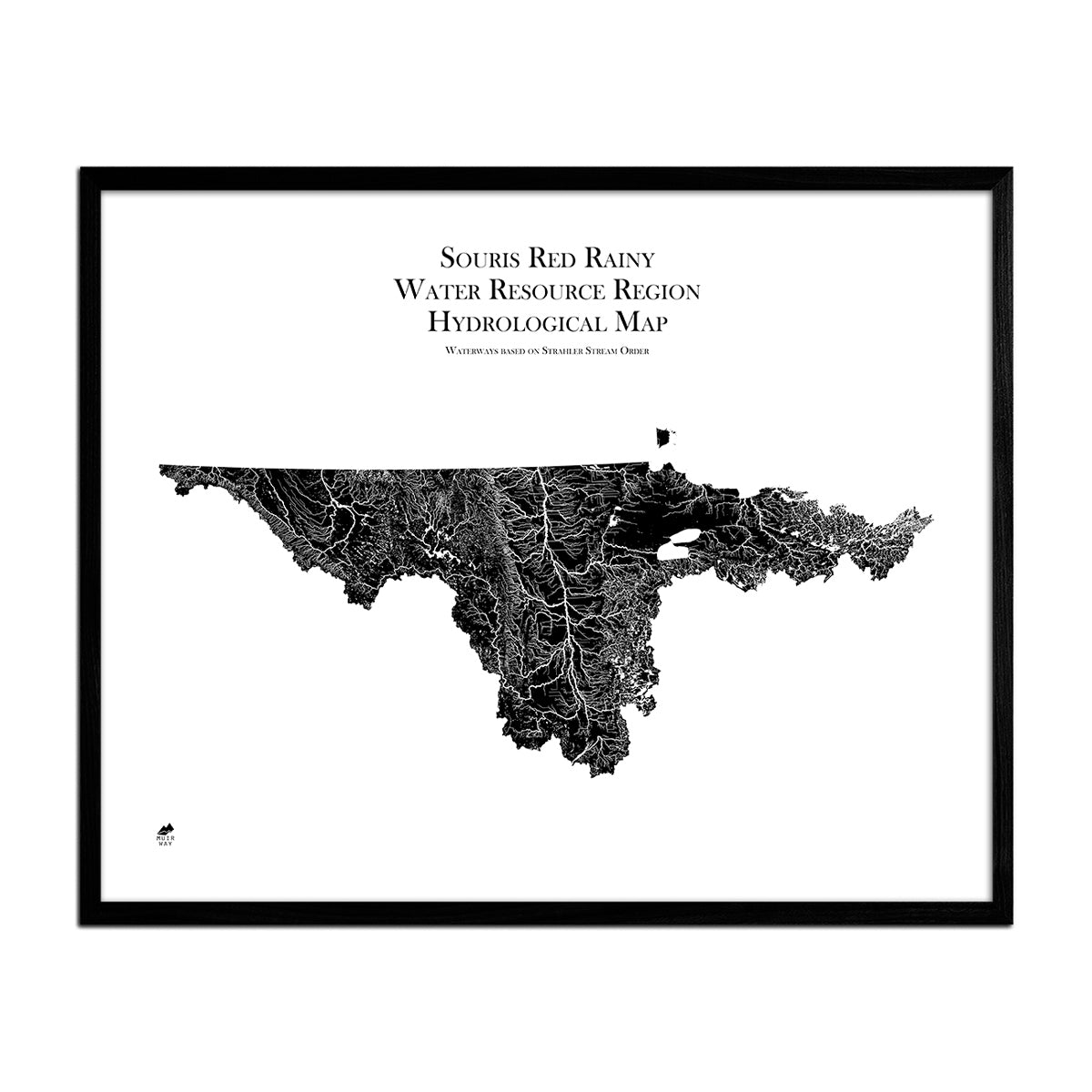
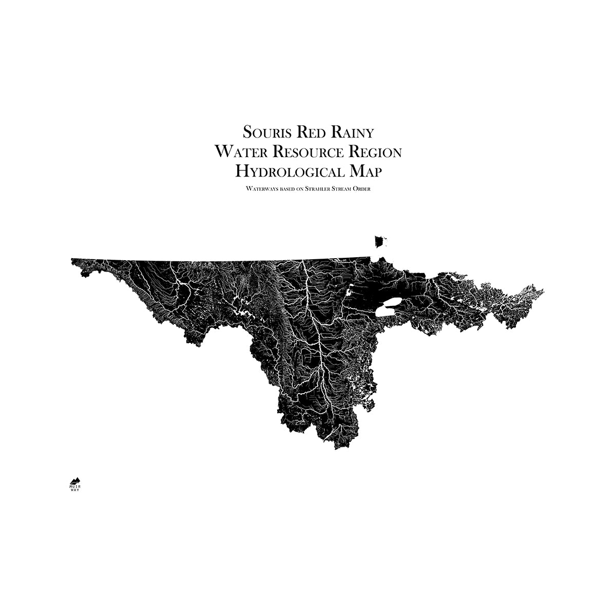
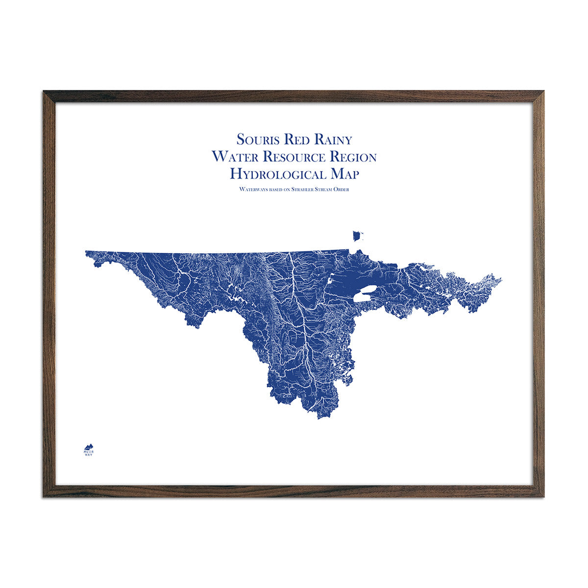
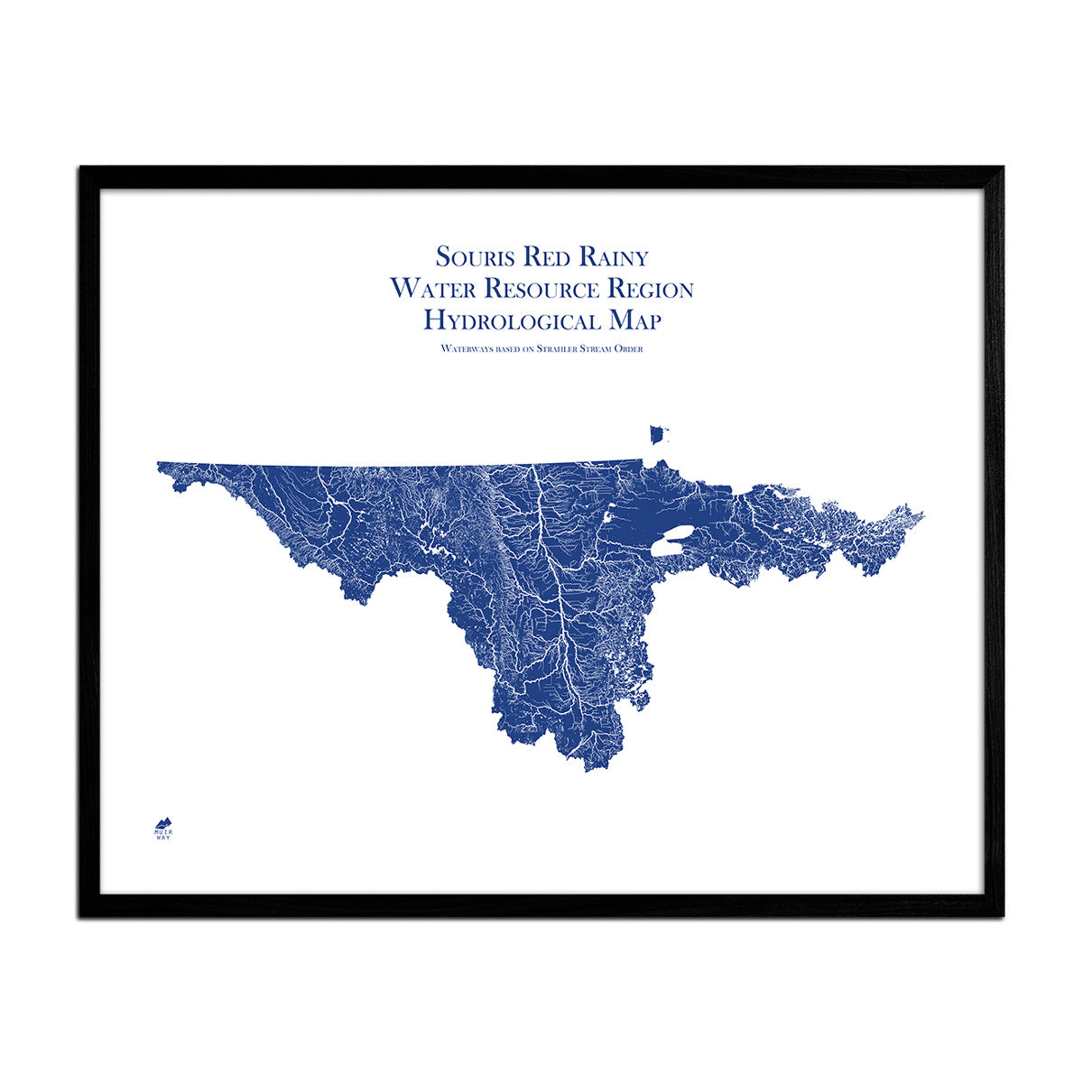
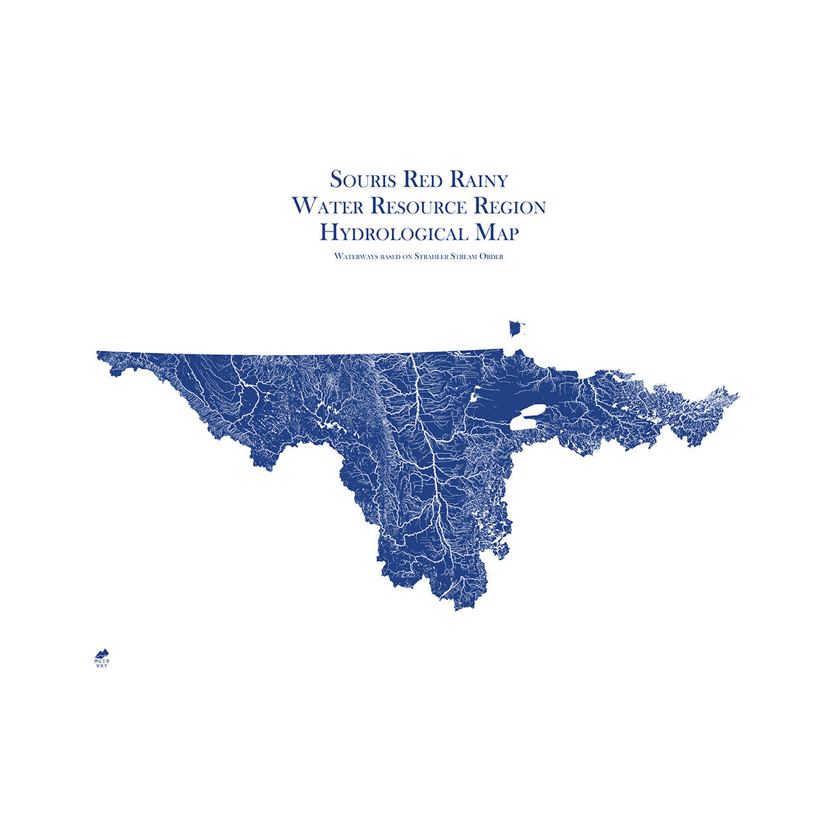
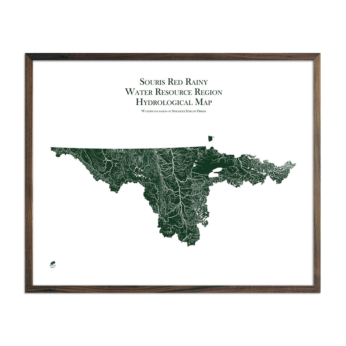
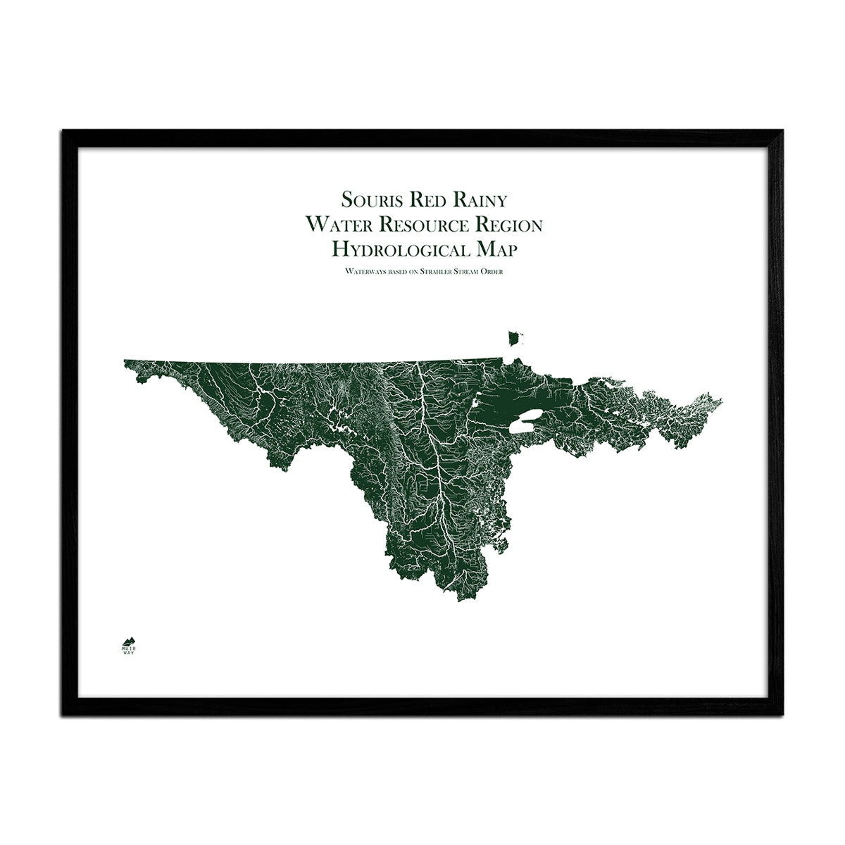
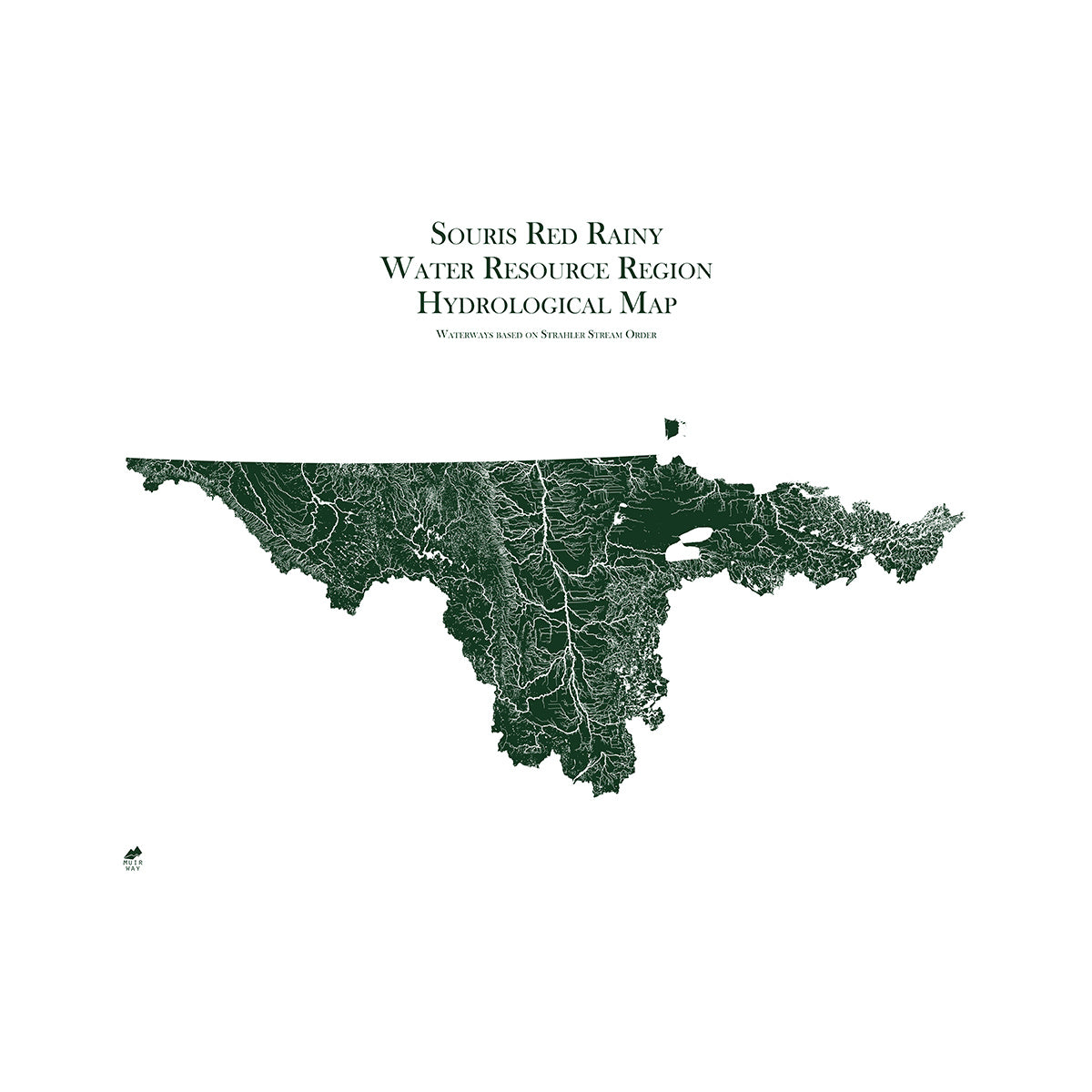
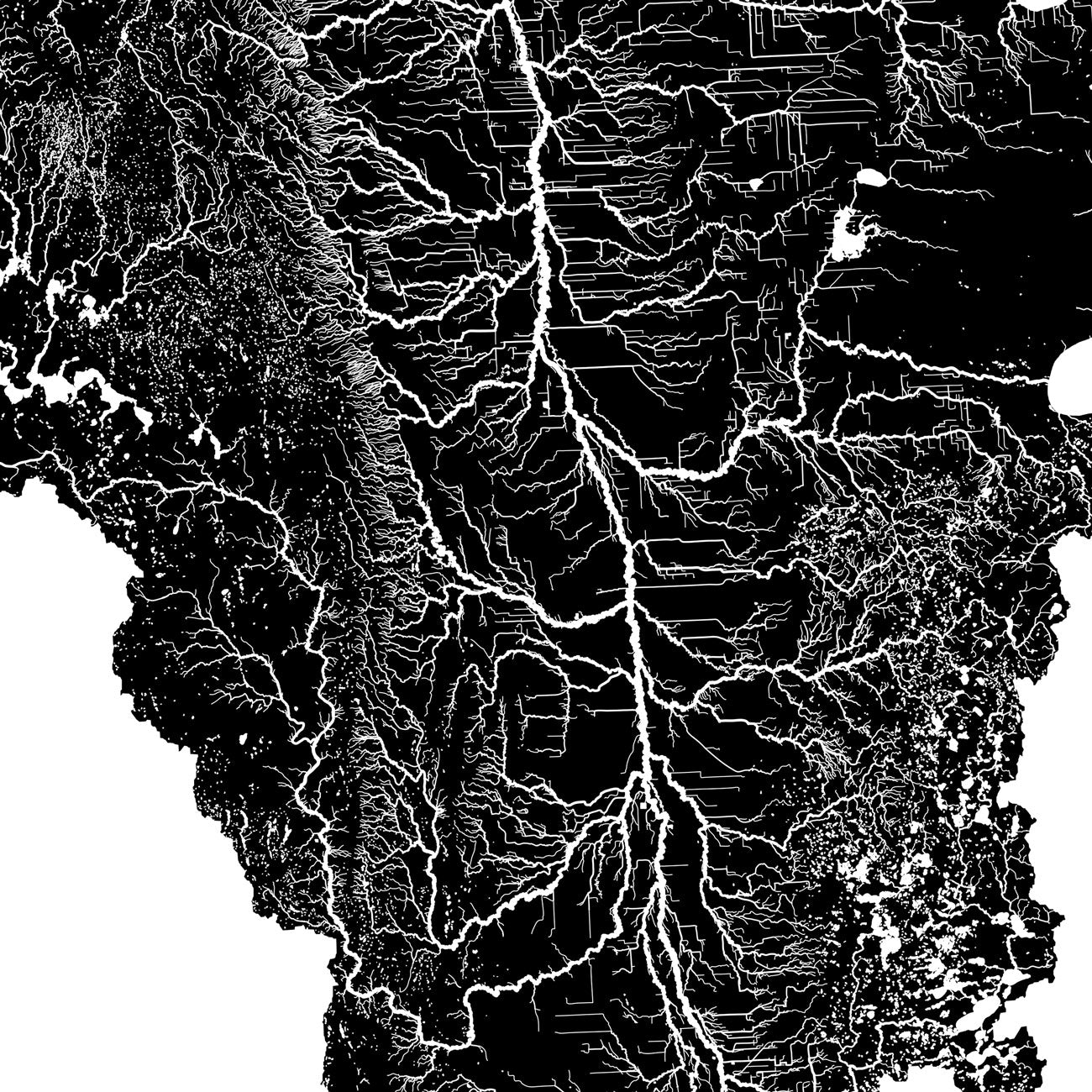
North Dakota hydrological maps - Our hydrological maps showcase the intricate network of waterways, from sprawling lakes to narrow tributaries that flow into larger rivers. Trace North Dakota’s waterways on our North Dakota hydrological map and you’ll see every body of water greater than 0.2 mi in diameter. What makes our hydrological maps unique? We apply a method called the Strahler Stream Order to show the hierarchy of streams as they flow from their source, with rivers shown thicker as they acquire the flow of tributaries. Map available in black, blue, or green. Want to see the ‘big picture?’ See our Souris-Red-Rainy regional hydrological map and our Missouri regional hydrological map.
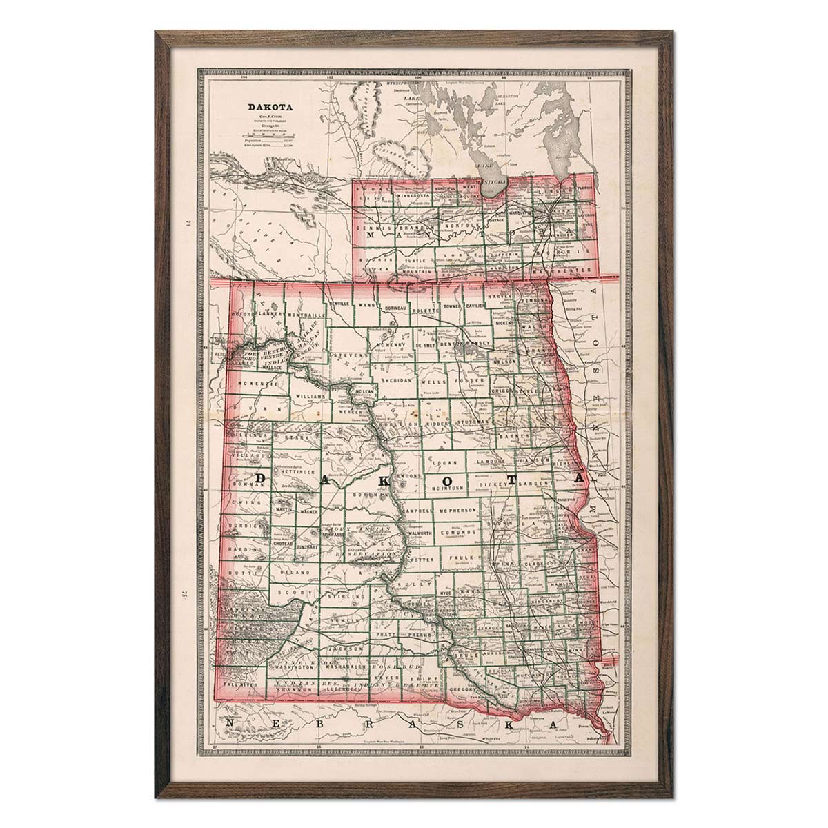
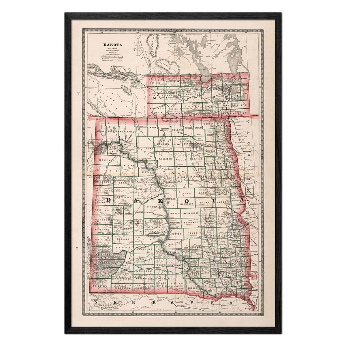
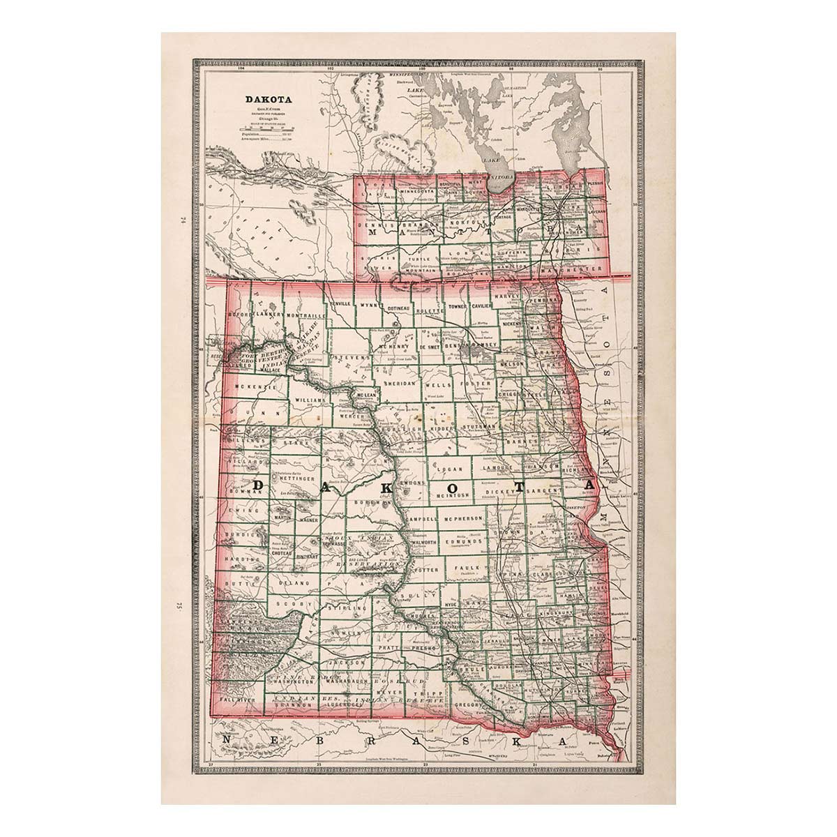
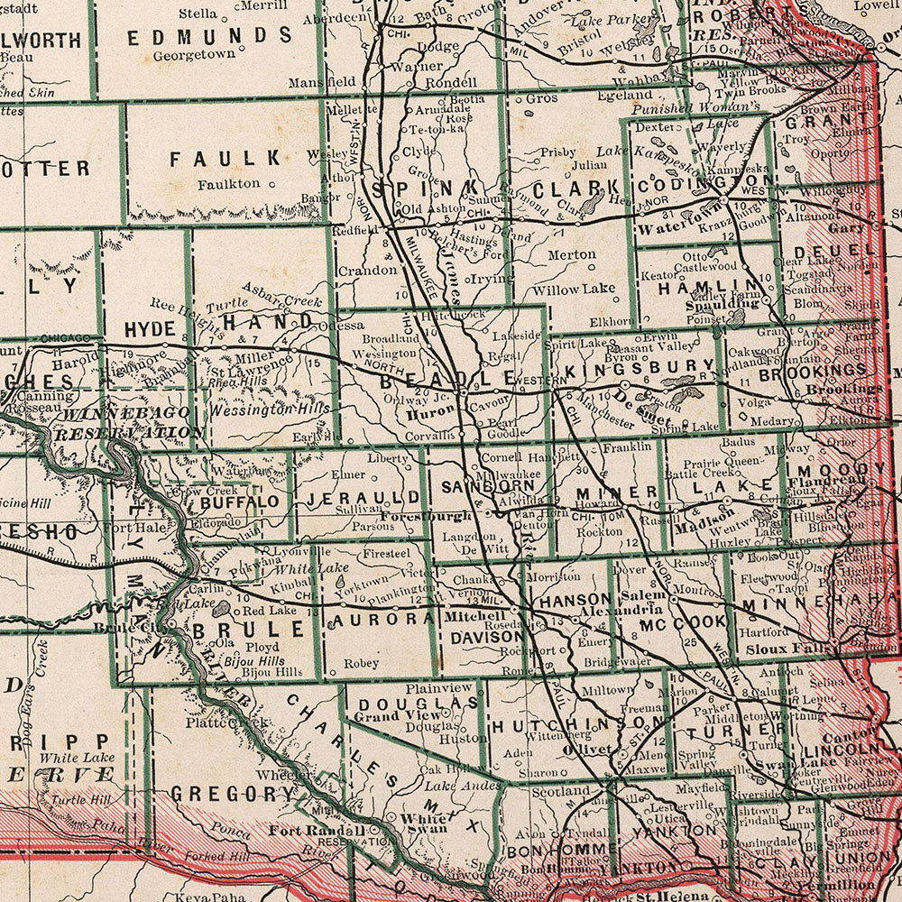
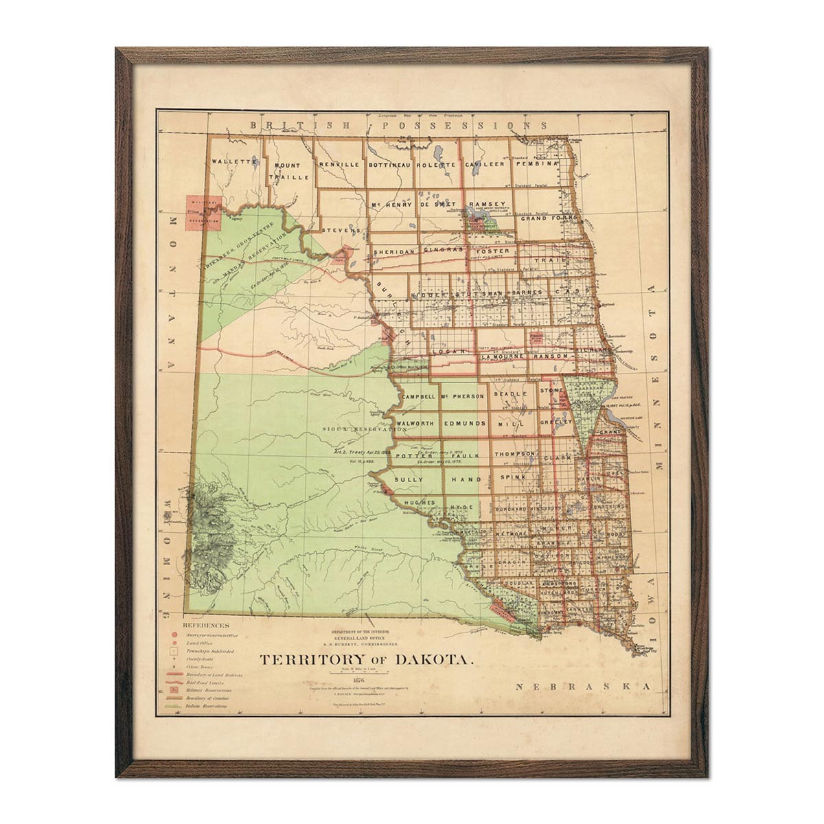
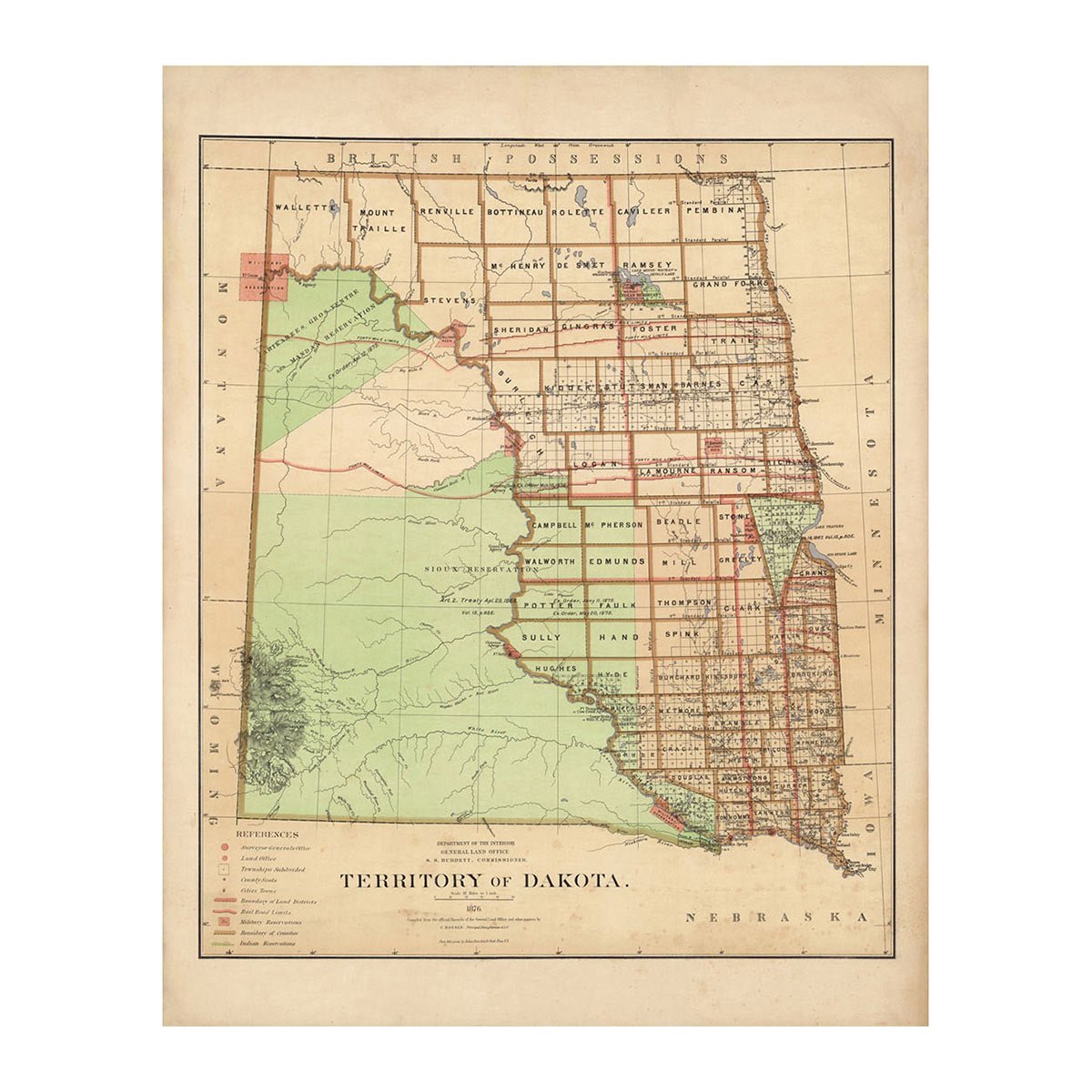
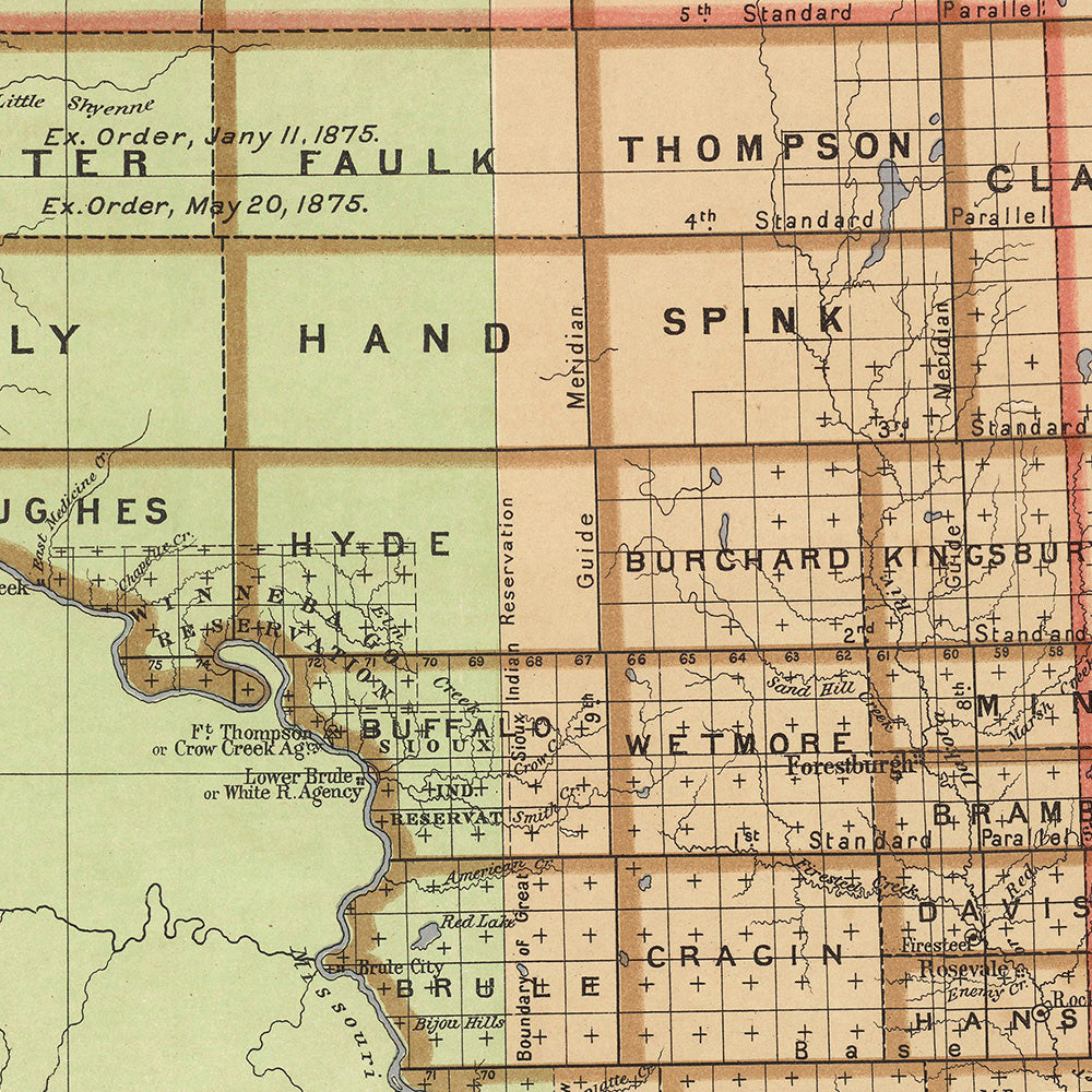
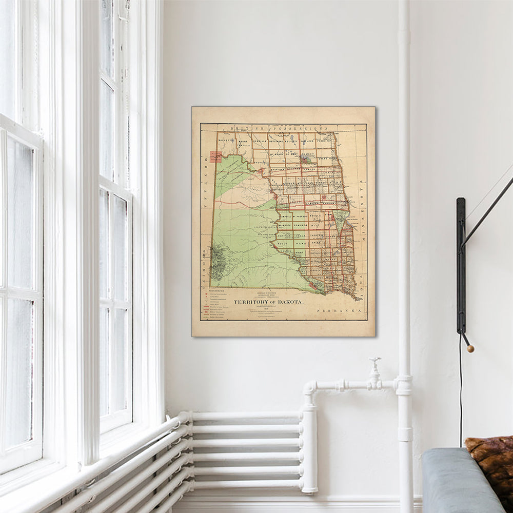
Enhanced vintage North Dakota maps - Enjoy the history and charm of vintage maps in a new way with our Dakota 1883 map or our Dakota Territory 1876 map. Unlike our elevation maps, Muir Way historical maps don’t feature enhanced elevation effects, but they do feature a record of history beautifully restored to retain its vintage charm without the wear and tear. Our vintage North Dakota maps are also custom printed using archival materials.
What are some prominent features on the map of North Dakota ?
The map of North Dakota has a number of features. The Red River is one of the few rivers in North America that flow northward. It forms at the confluence of the Bois de Sioux and Otter Tail rivers along the North Dakota and Minnesota border. The river flows across a vast, ancient lake bed rather than carving a valley as many rivers do. Because of this, it floods easily.
In the southwest corner of the state is White Butte. It is the highest point in North Dakota. Situated in the Badlands, it rises 3506 ft above sea level. The carved walls of the butte were formed over thousands of years of erosion.
In central North Dakota is Chase Lake. The lake and its surrounding land makes up Chase Lake National Wildlife Refuge. Set aside in 1908, it is one of the older wildlife refuges in the state and is home to thousands of birds, including up to 30,000 white pelicans.
What are the regions in North Dakota?
North Dakota has three main geographical regions:
- The Red River Valley - In the east is a flat area of fertile clay farmland. It was once the floor of an ancient lake. It follows the Red River, which creates the state’s eastern border with Minnesota.
- The Drift Prairie - This region is a rocky, rolling plain that is covered in glacial drift. The area is characterized by hills, valleys, lakes and wetlands. In the eastern part of the region, is Devil's Lake, North Dakota’s largest and deepest natural lake. The Turtle Mountains are also located in the northern part of the region.
- The Missouri Plateau - The state’s highest region, it includes the Badlands. These are amazing and strange monuments sculpted by wind and water into buttes, pyramids, domes, and cones colored in browns, reds, grays, and yellows.
If you like our collection of North Dakota maps, you may also be interested in maps of other Midwest states. Click below to browse:


