


Missouri Maps


Missouri Map Prints
Whether you’re from Missouri, like to visit there with family, or the Show-Me State just holds a special place in your heart, our custom printed Missouri wall maps bring a slice of the Midwest to any home or office. From our stunning elevation maps and geological relief maps to our meticulously restored historical maps, every custom map we offer reflects the high quality and attention to detail our customers have come to love and expect from Muir Way.
What makes Muir Way maps of Missouri unique?
A Muir Way map is far more than a typical glossy poster. Each of our maps is printed onto archival fine art paper using archival inks to last for generations.
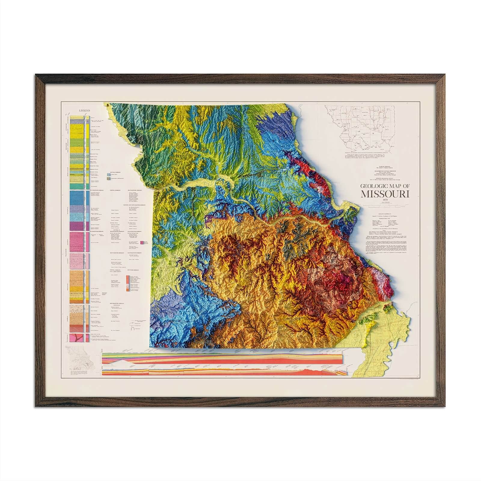
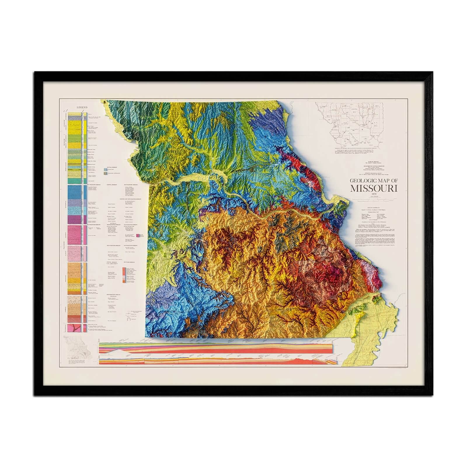
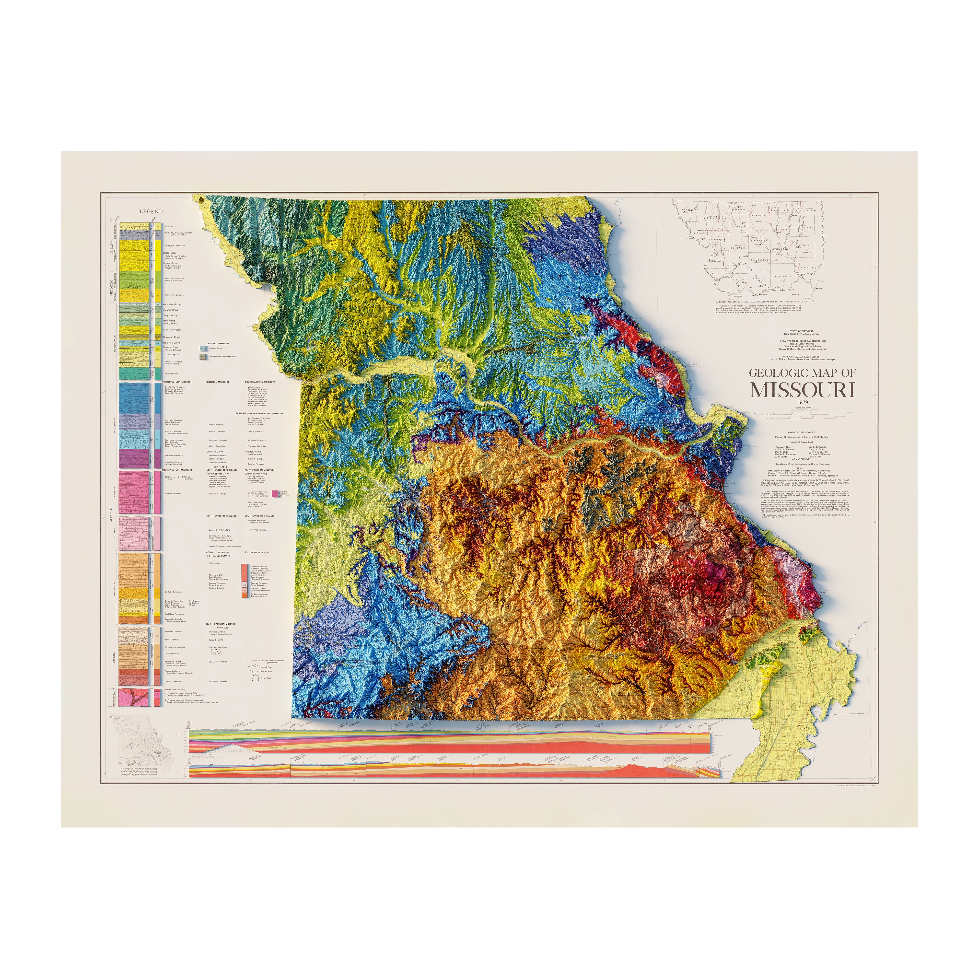
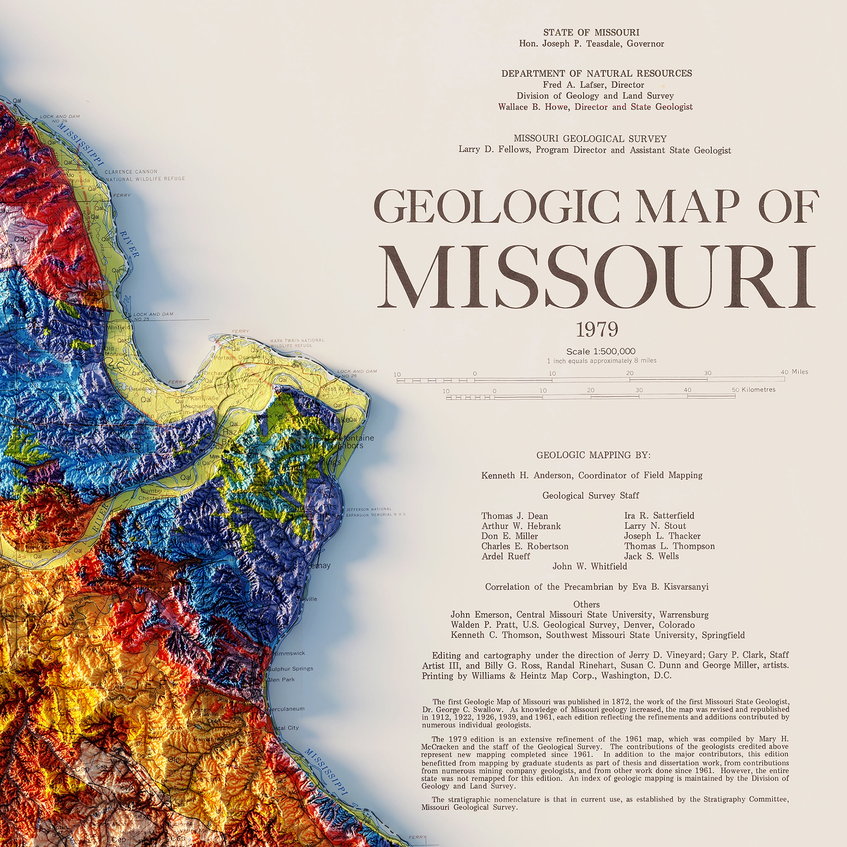
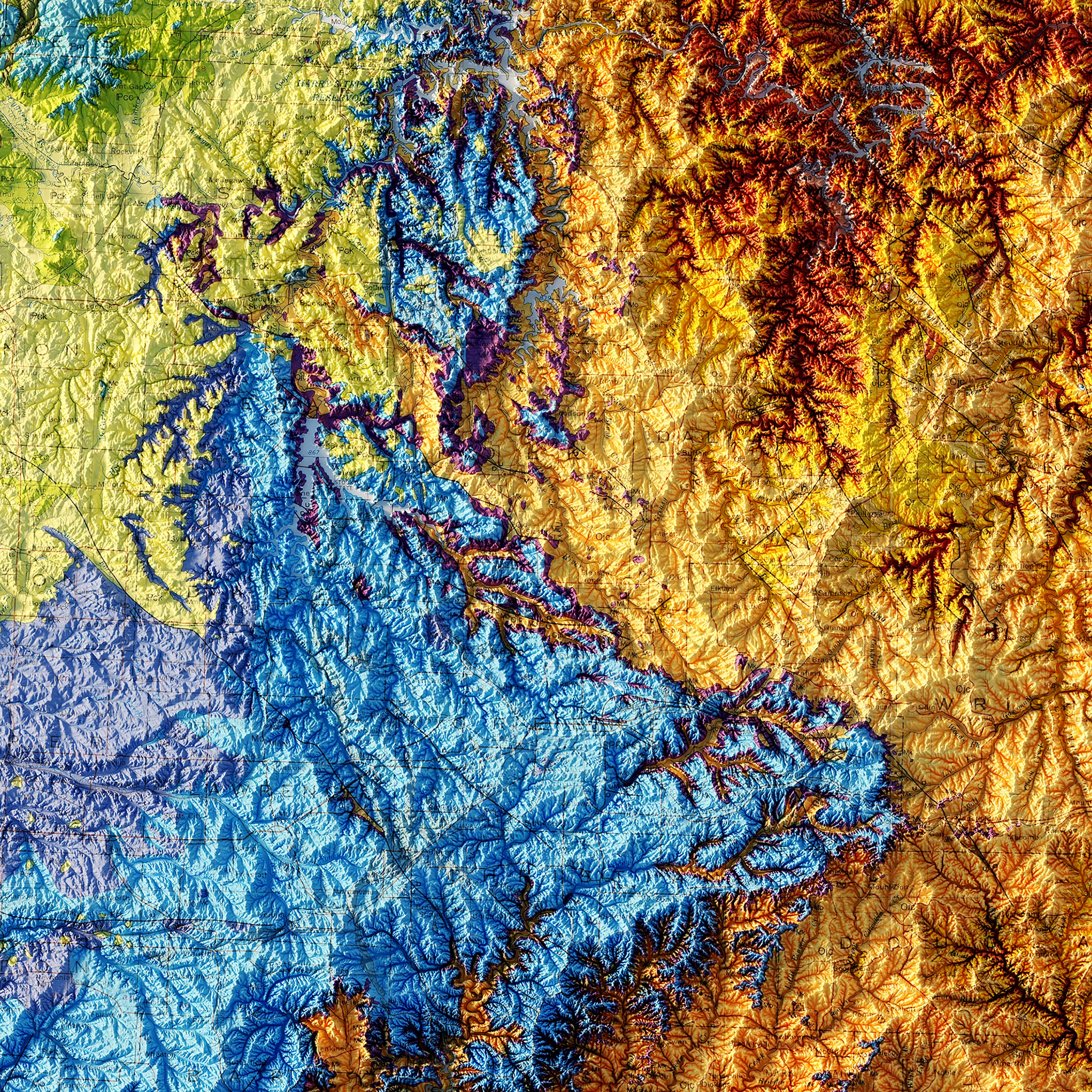
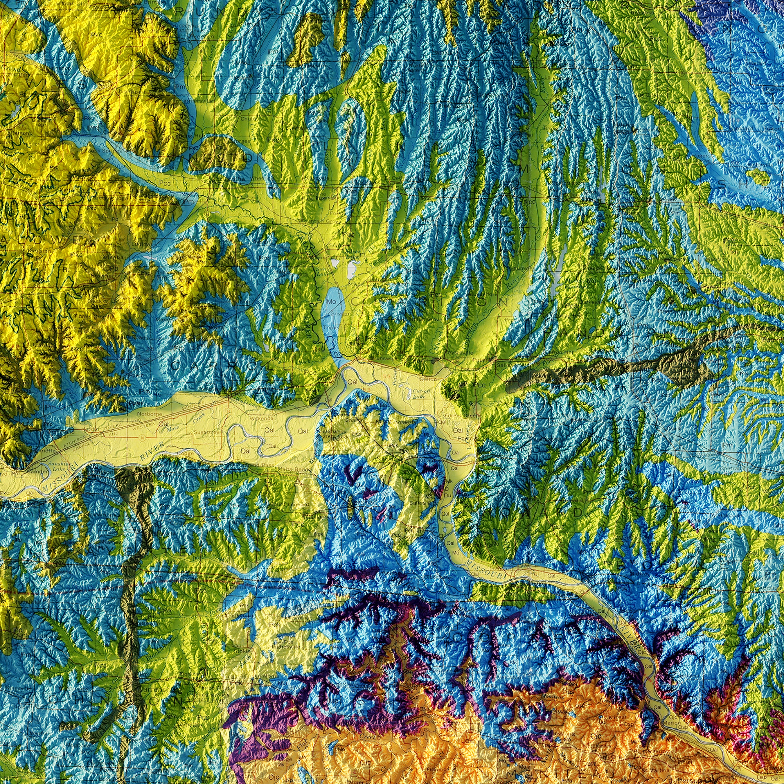
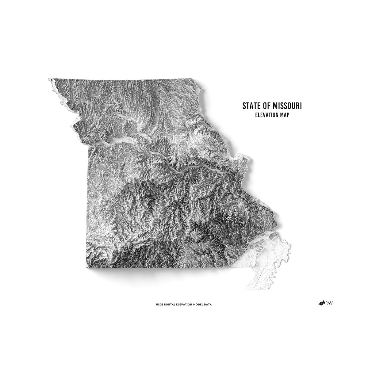
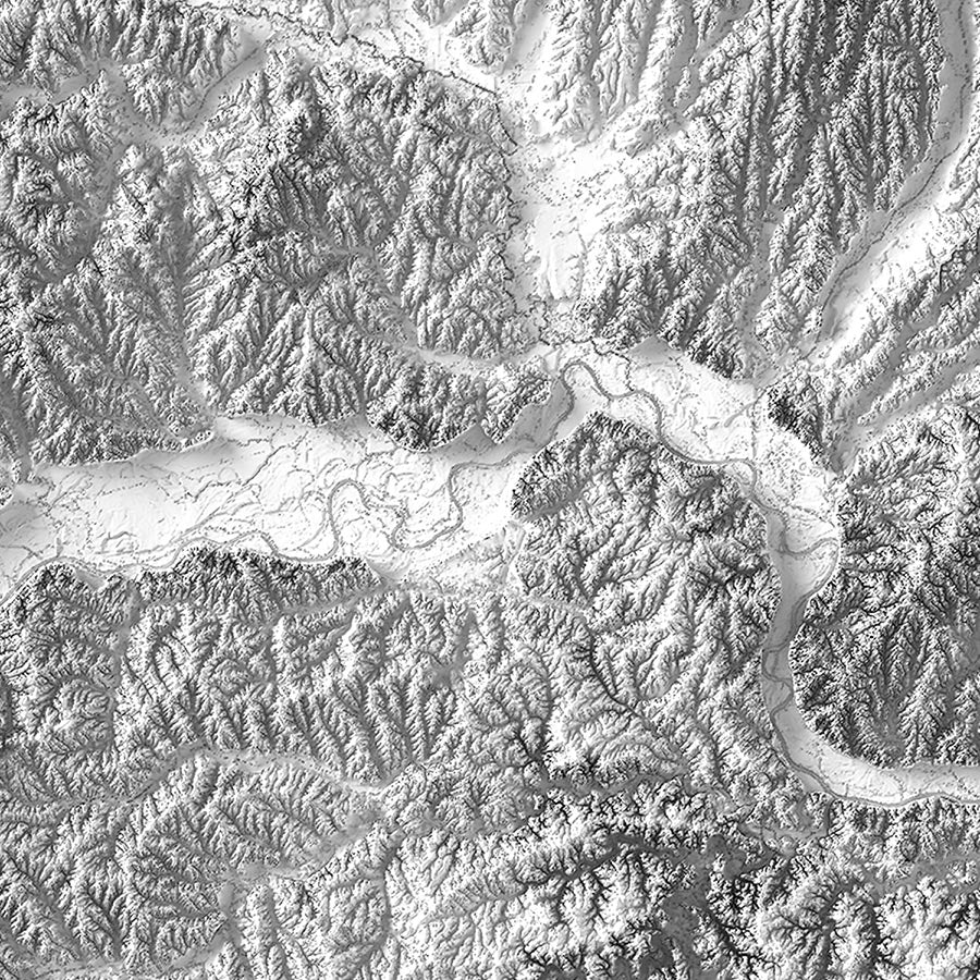
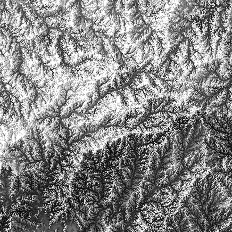
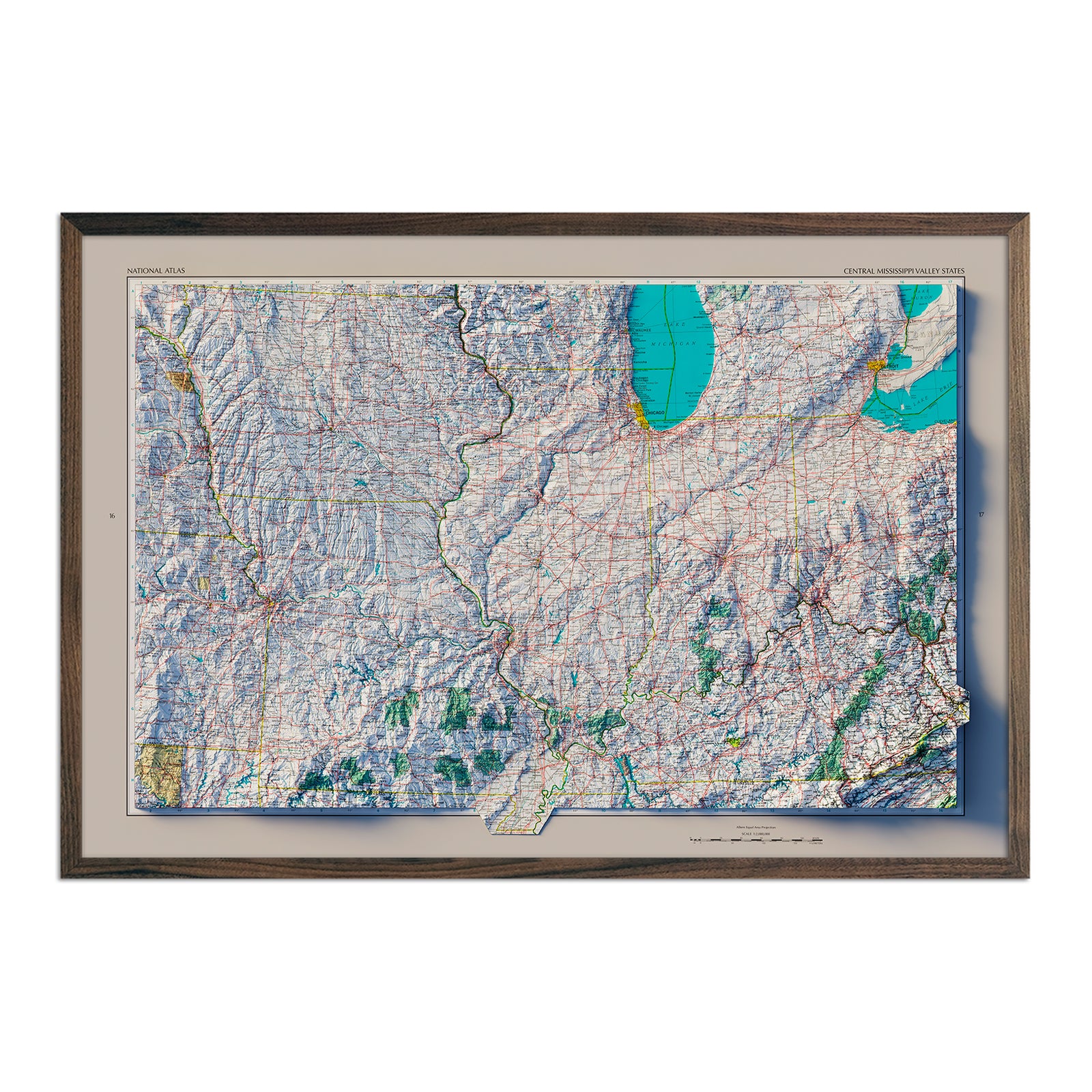
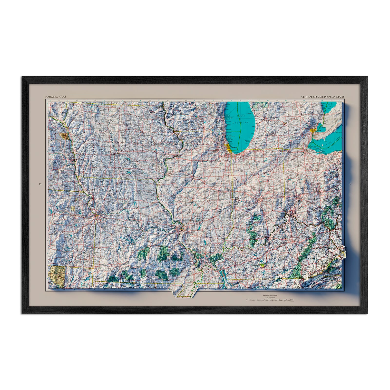
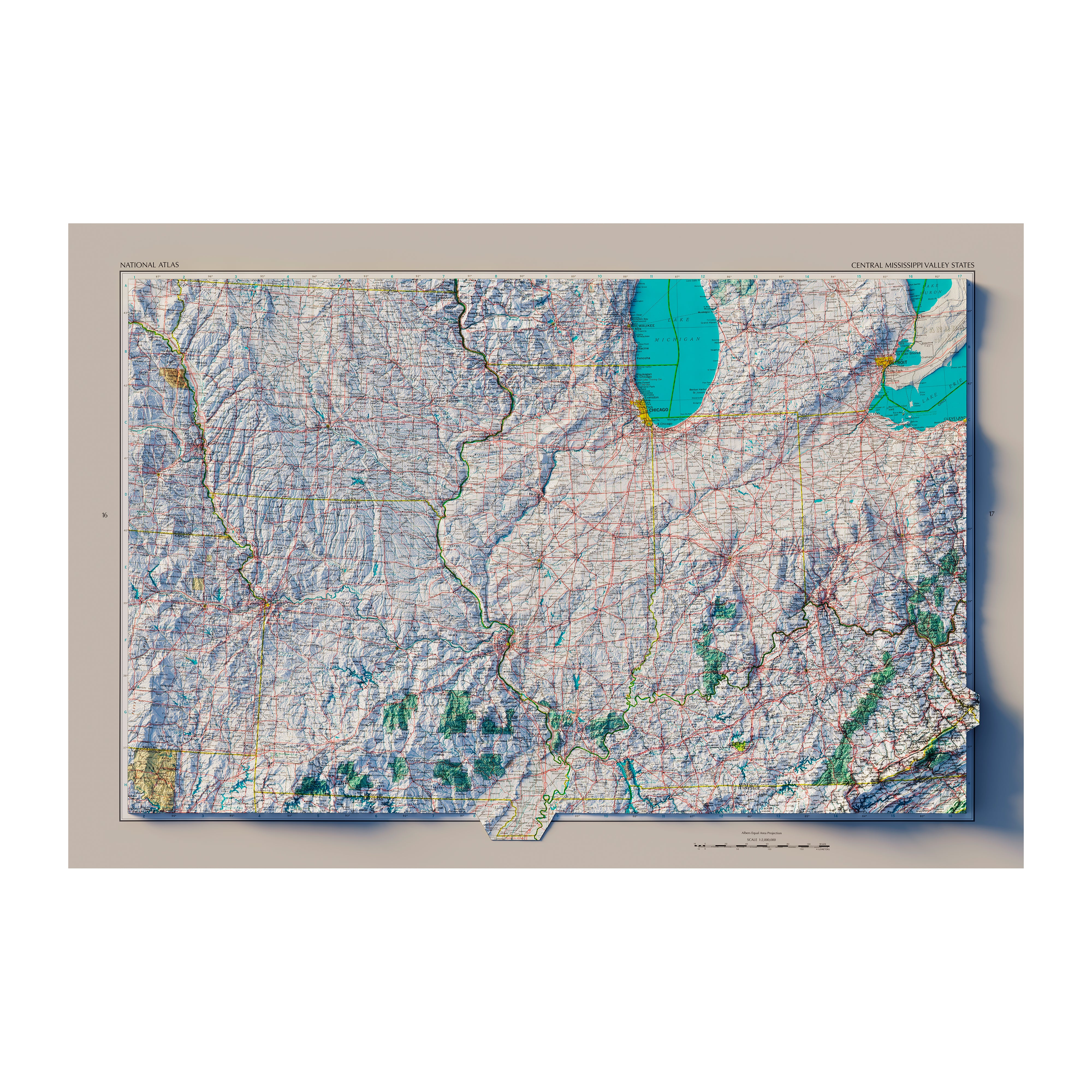
Have you noticed the way that our Missouri relief and elevation maps seem to jump off of the page? We use a combination of Digital Elevation Data and shaded relief to create a 3D illusion on a two-dimensional surface.
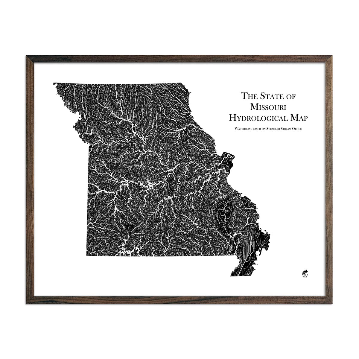
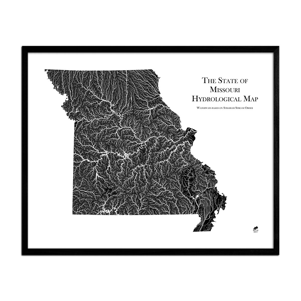
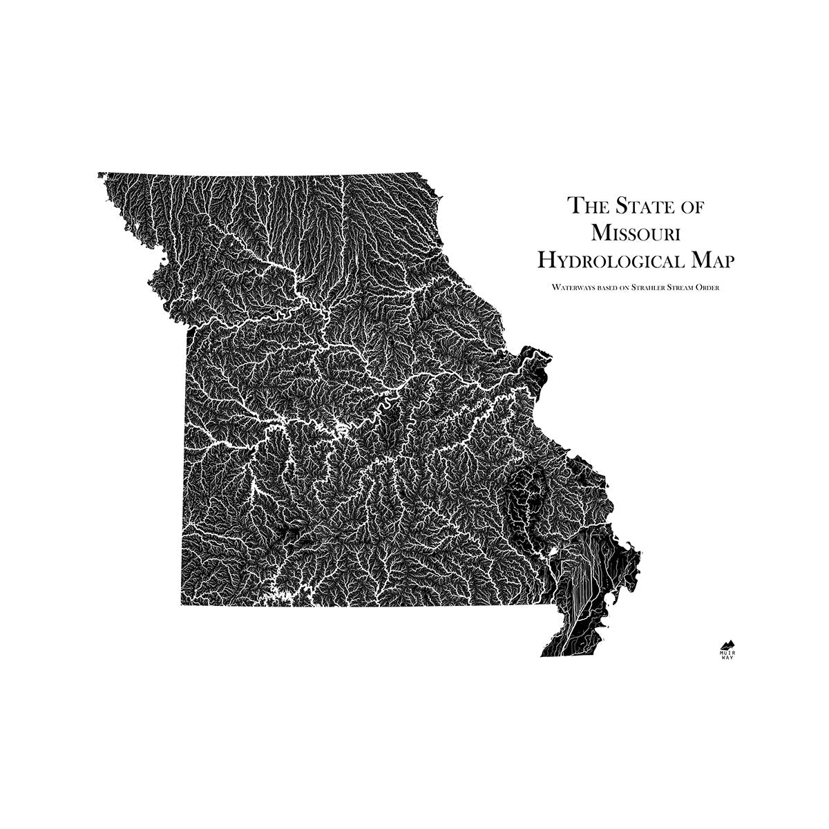
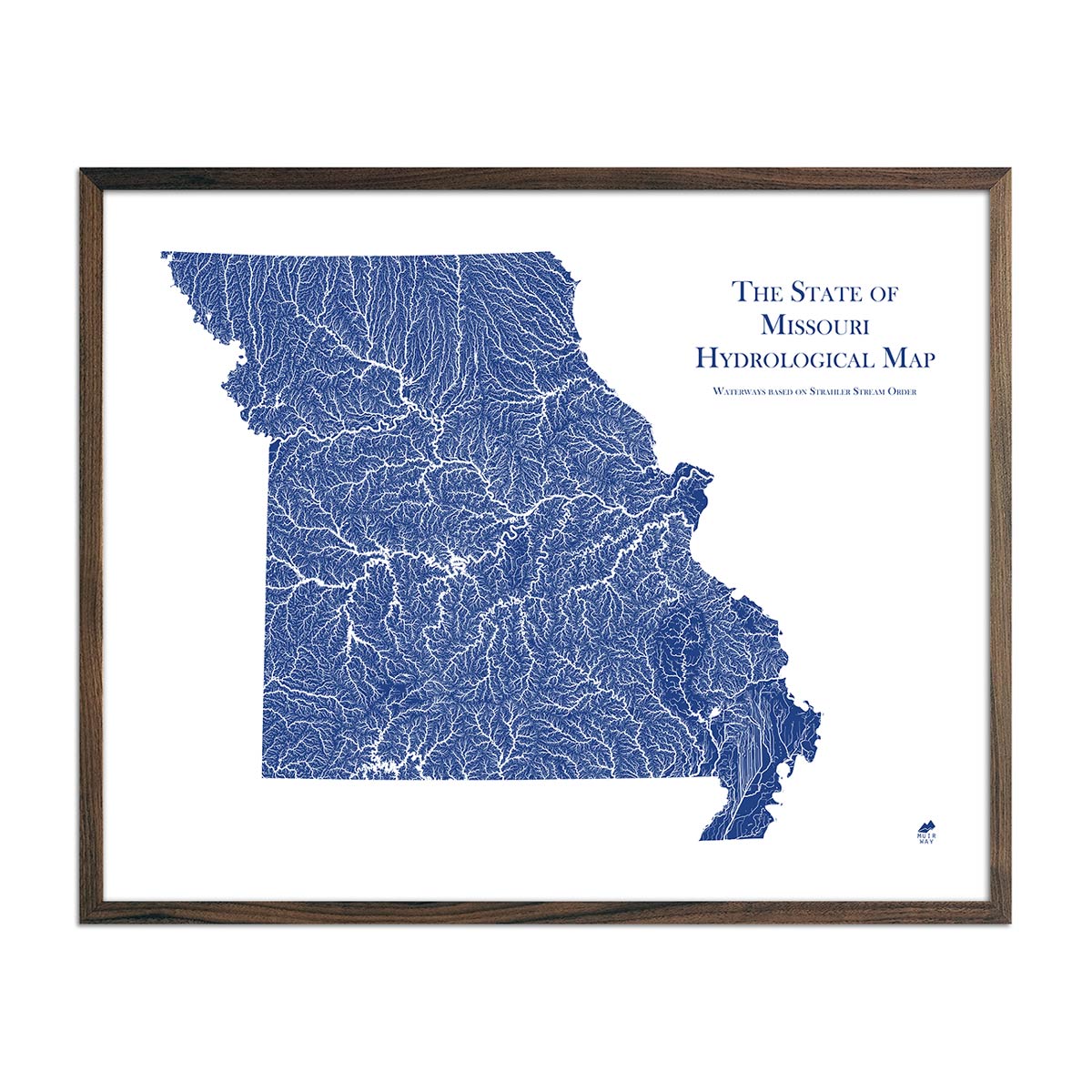
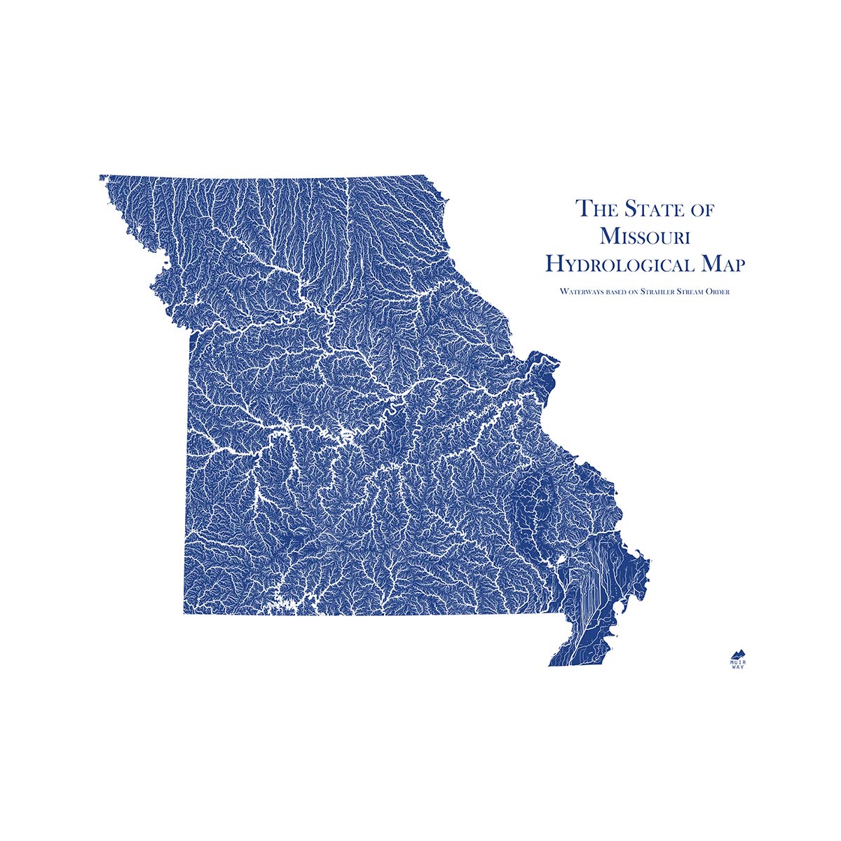
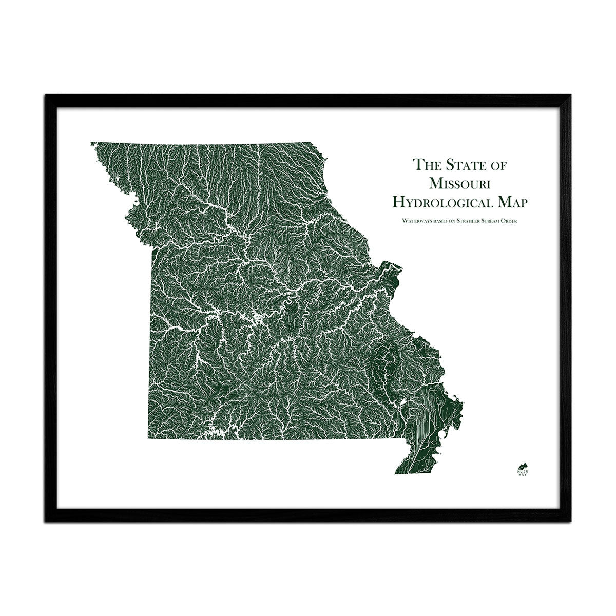
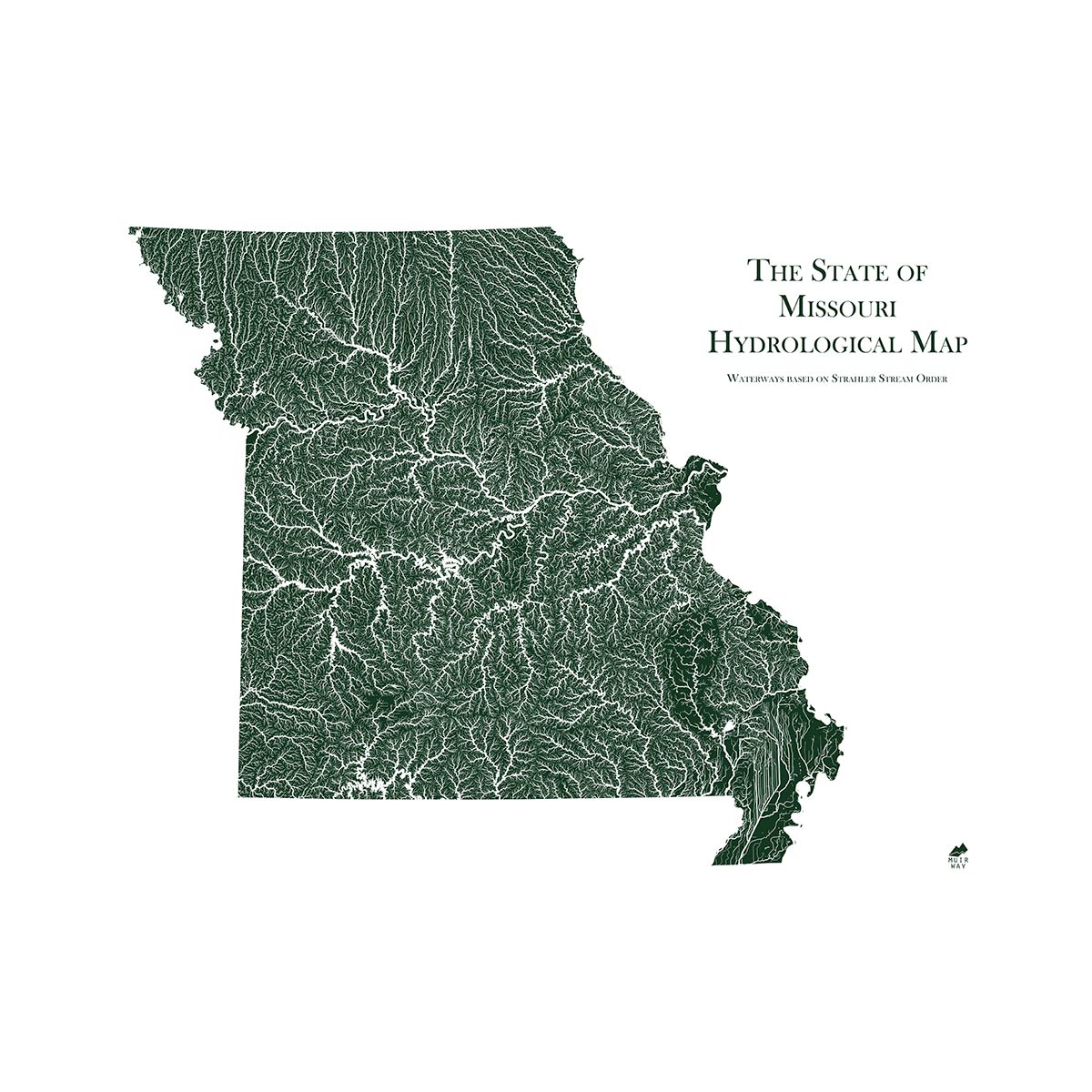
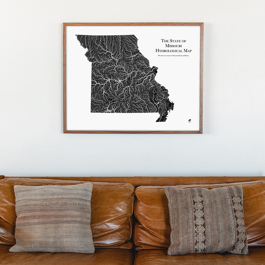
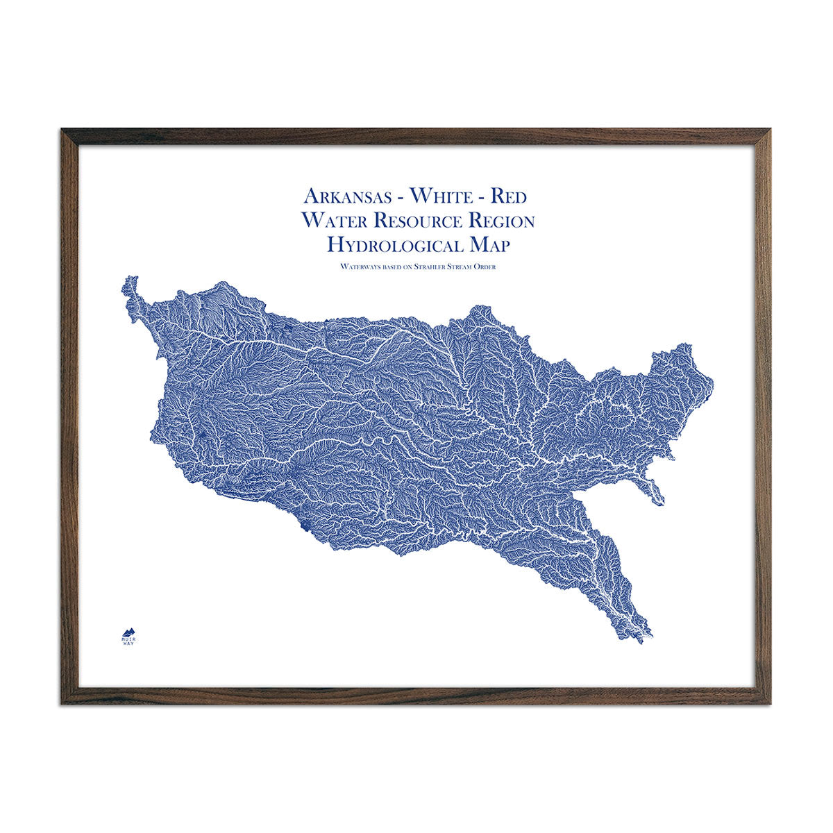
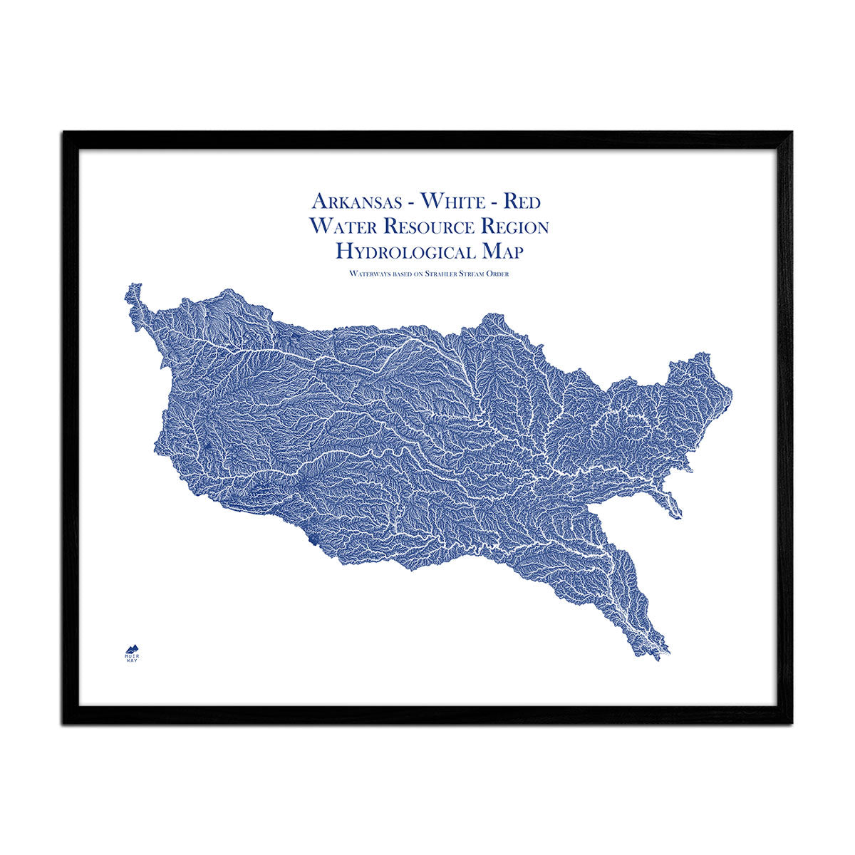
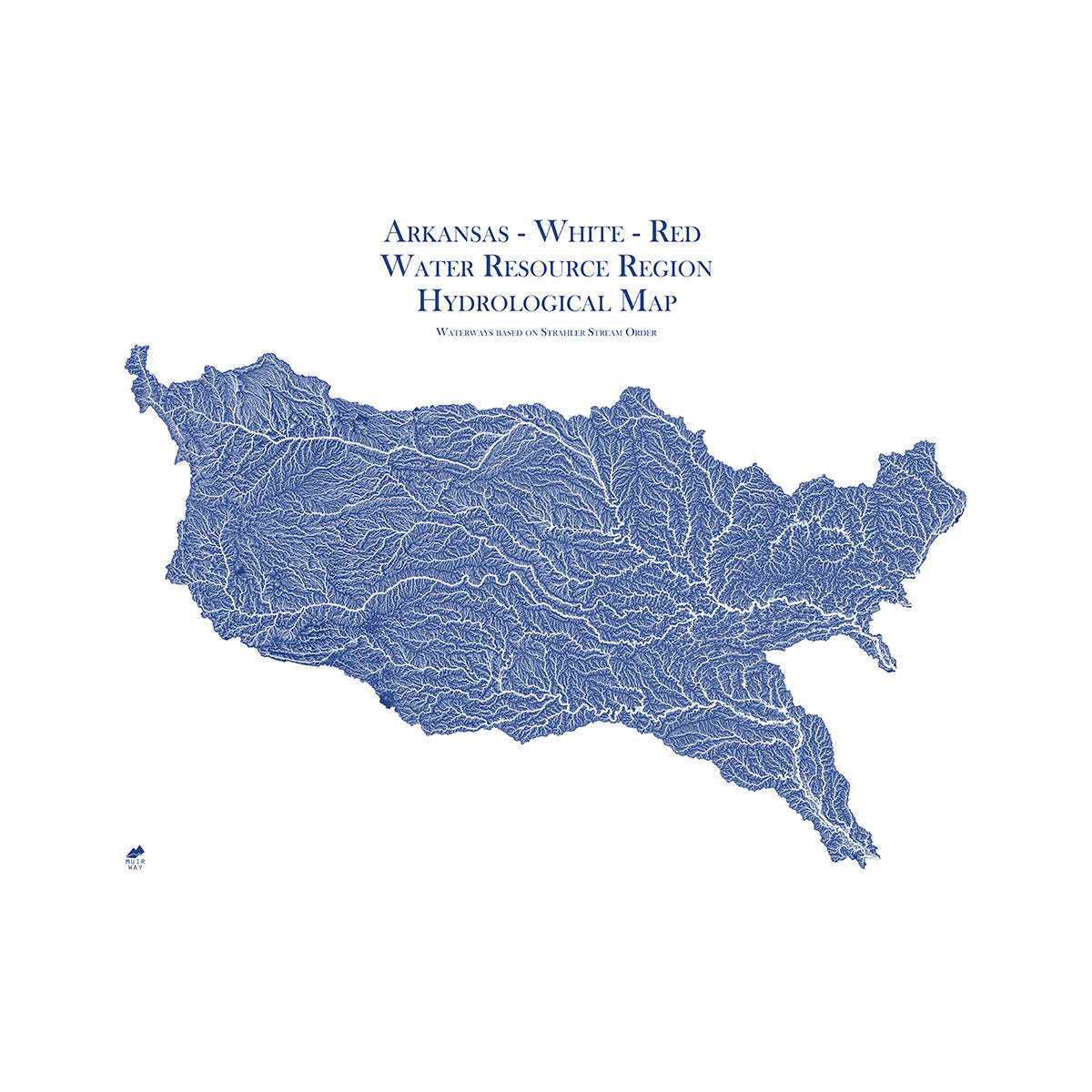
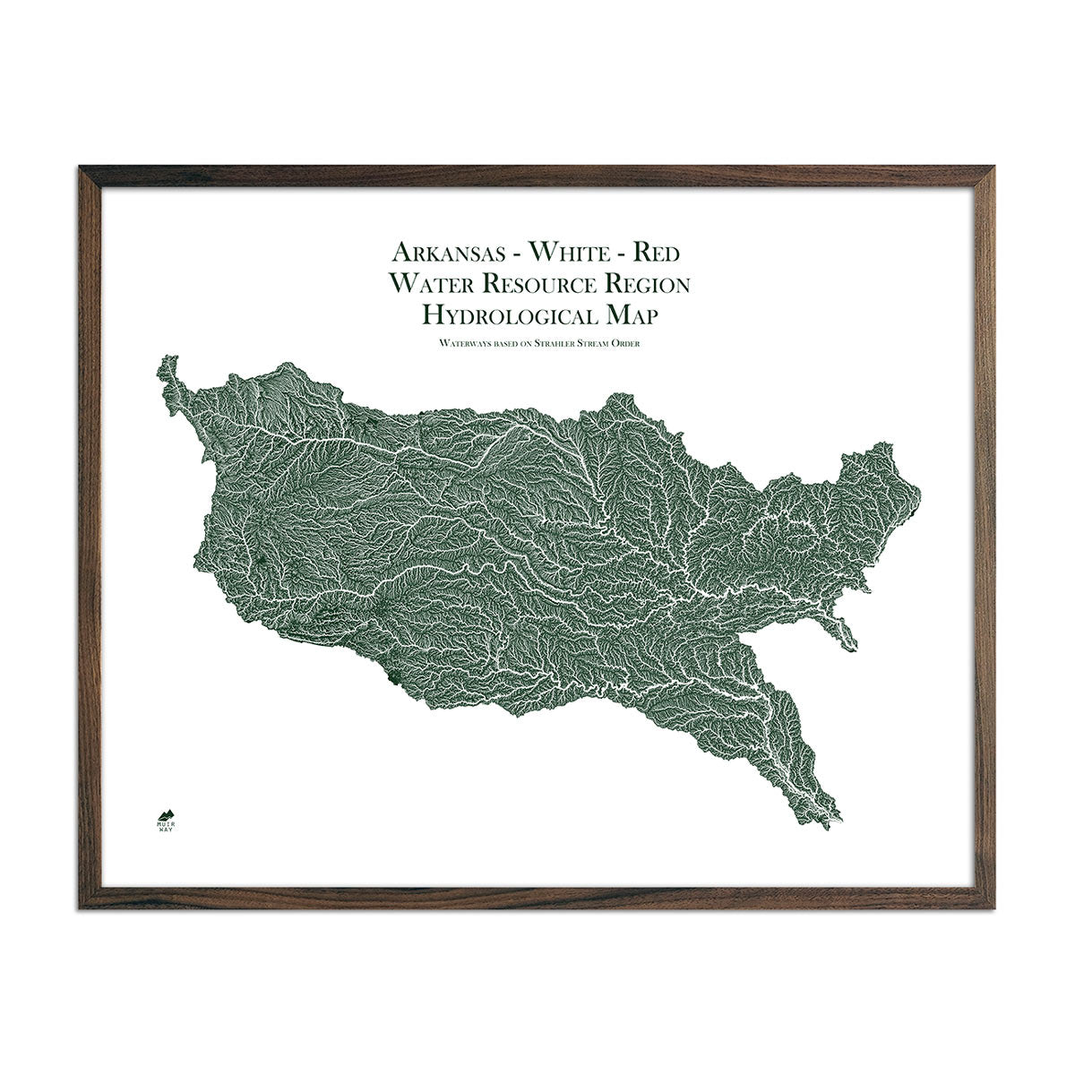
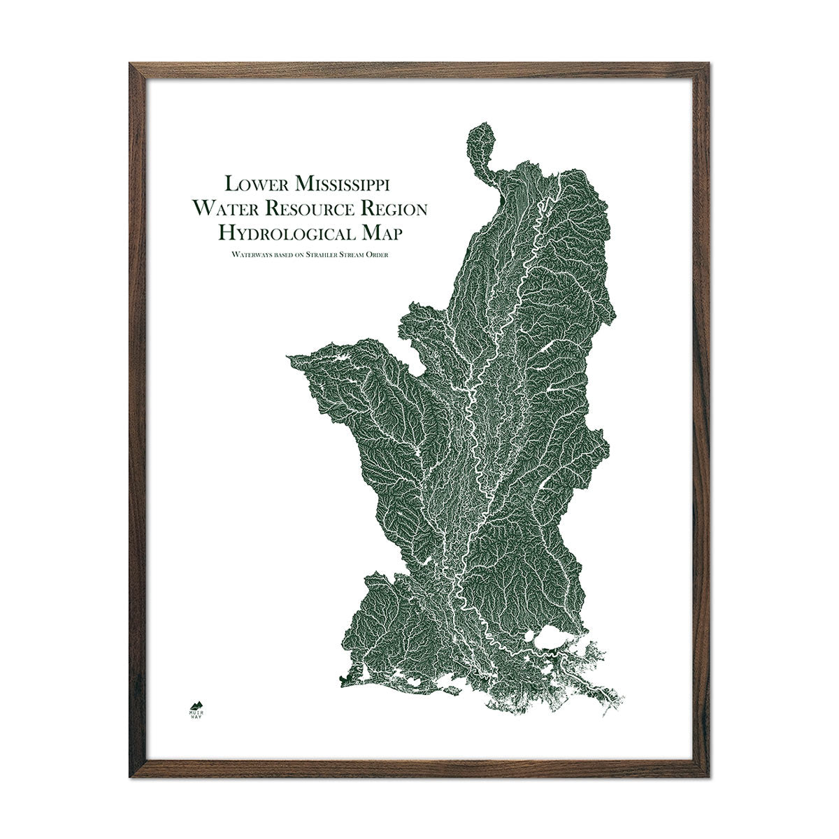
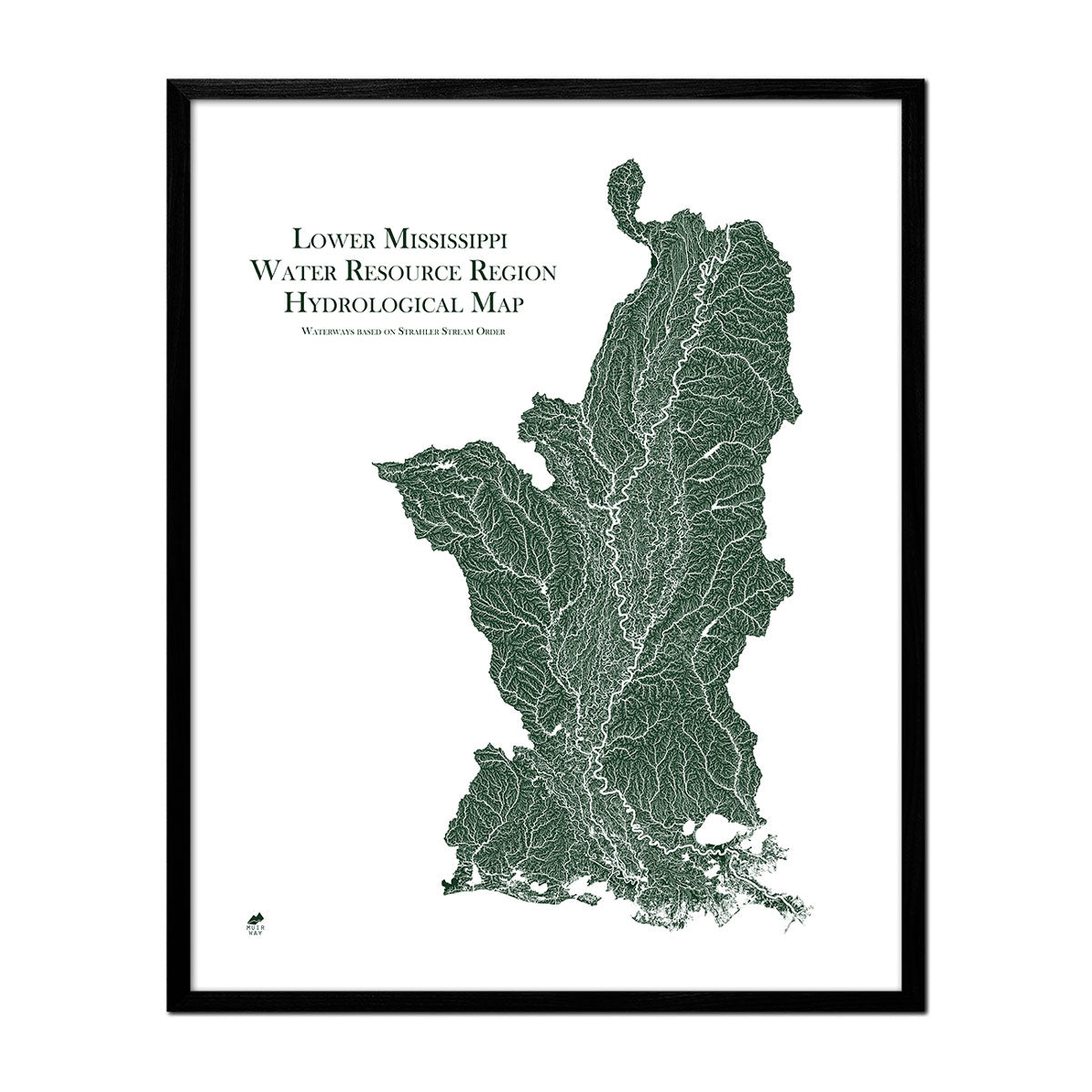
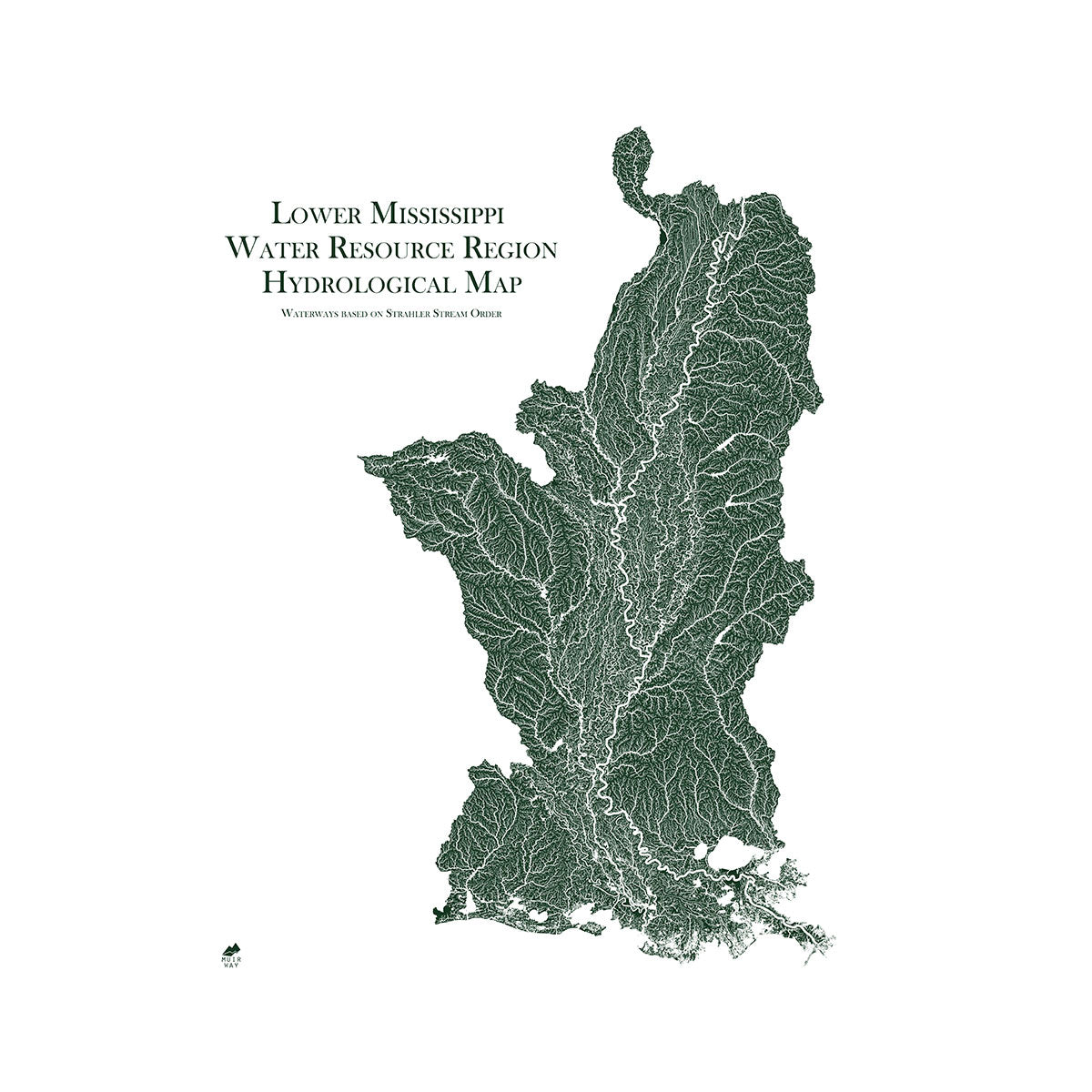
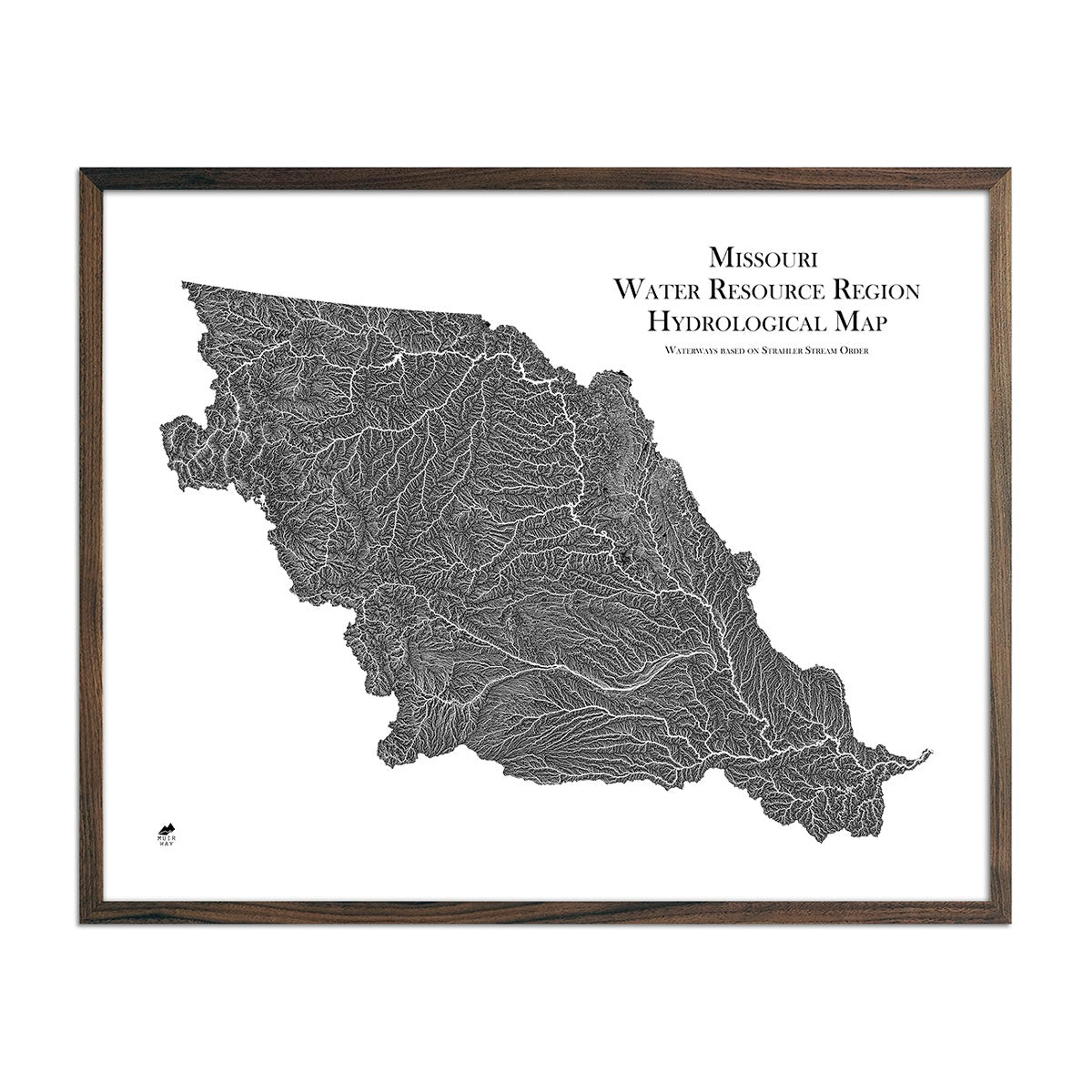
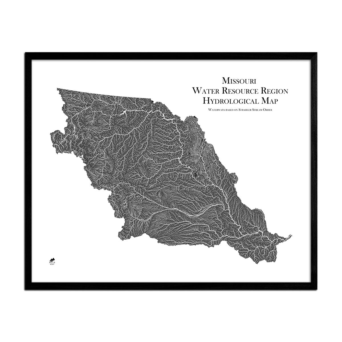
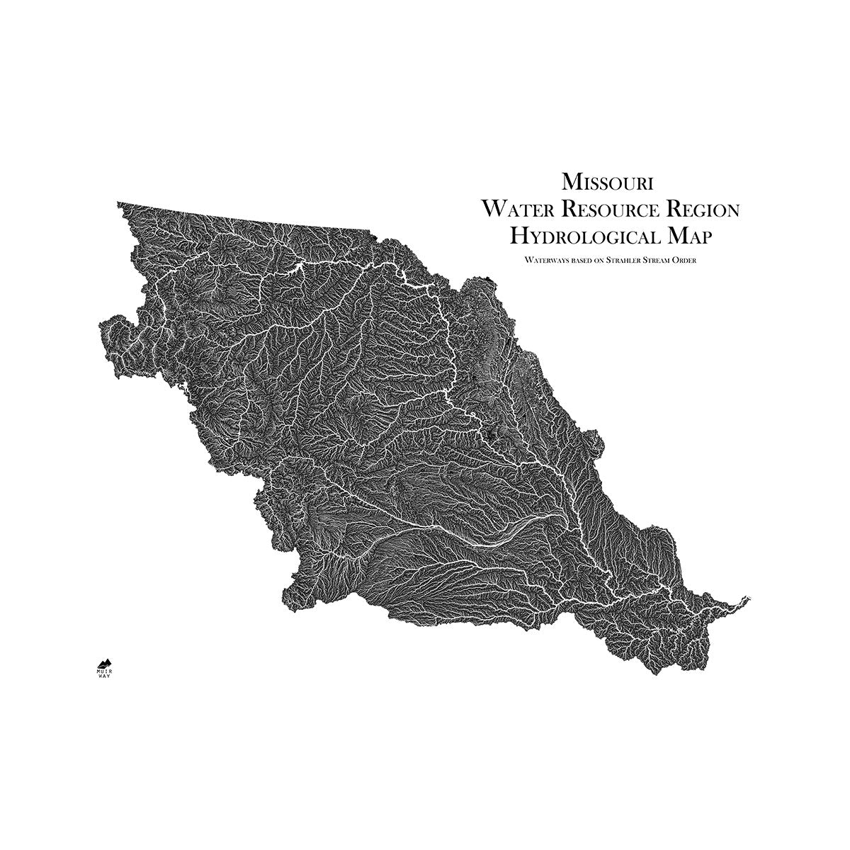
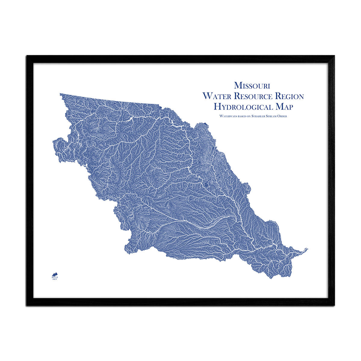
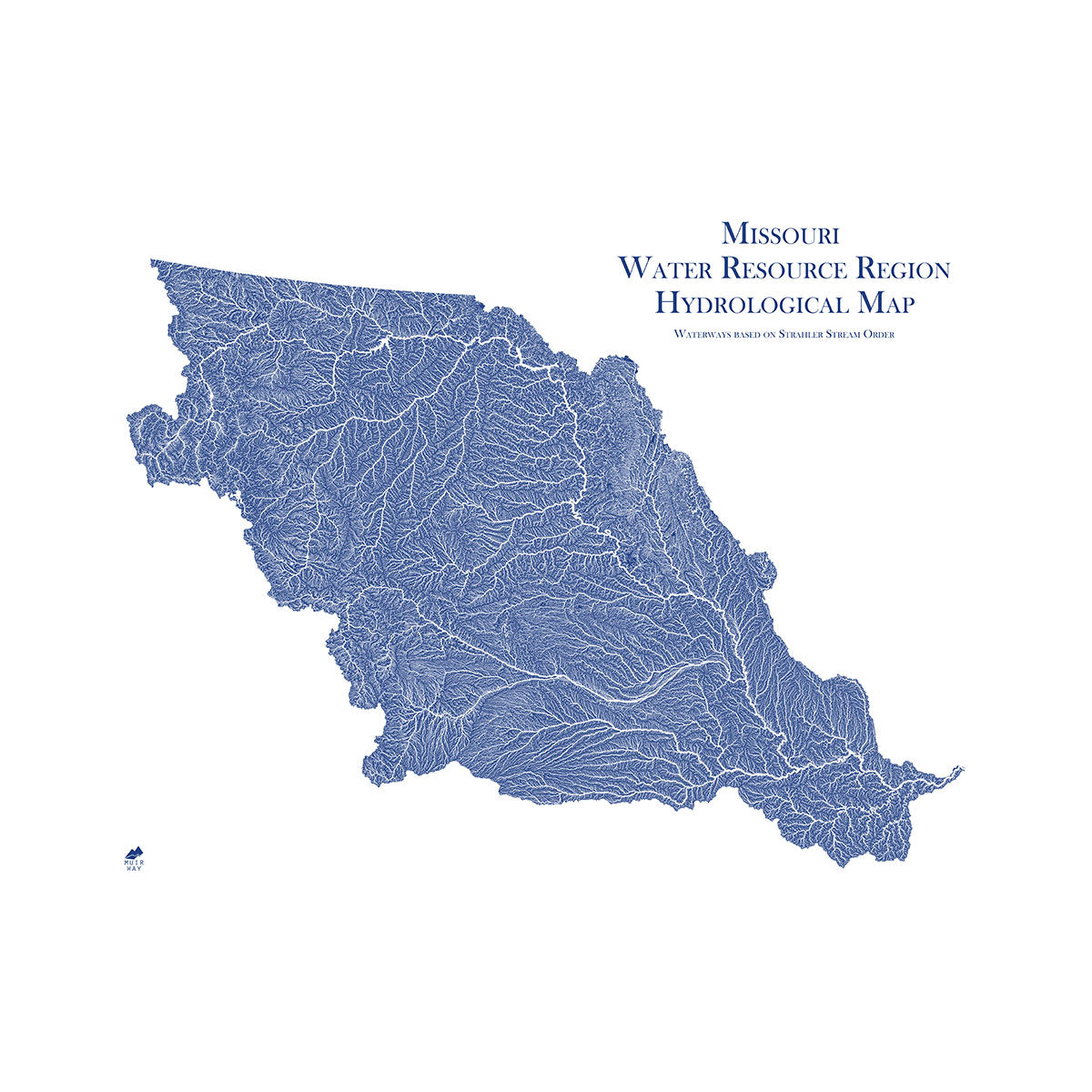
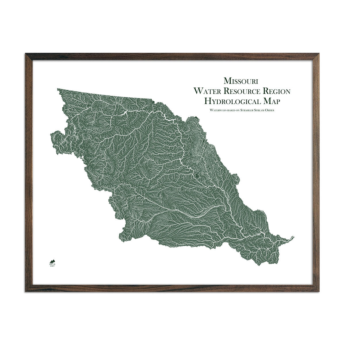
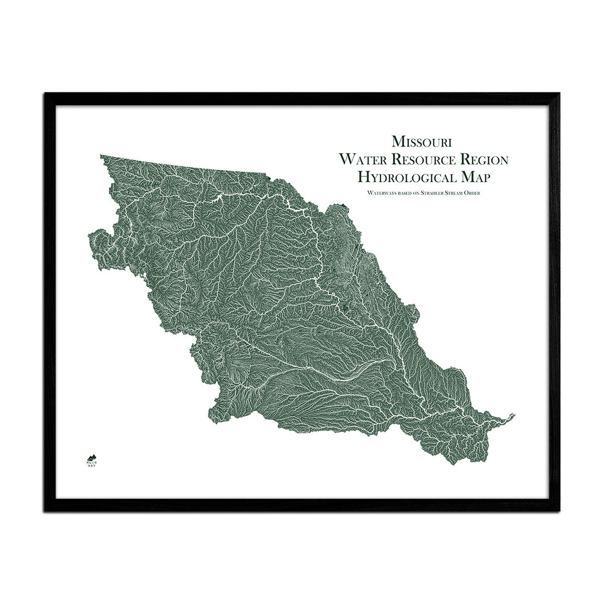
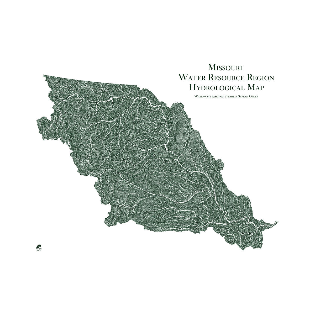
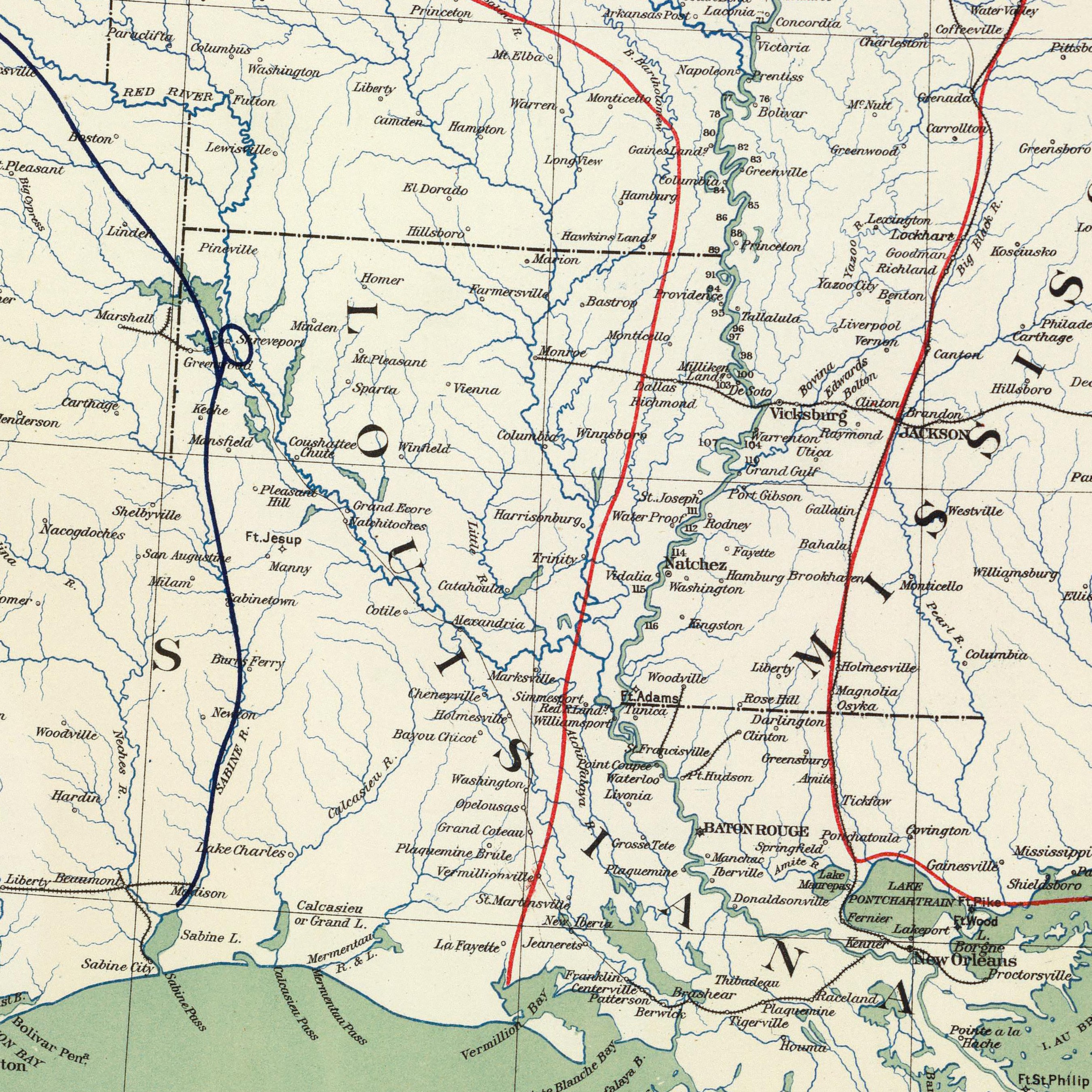
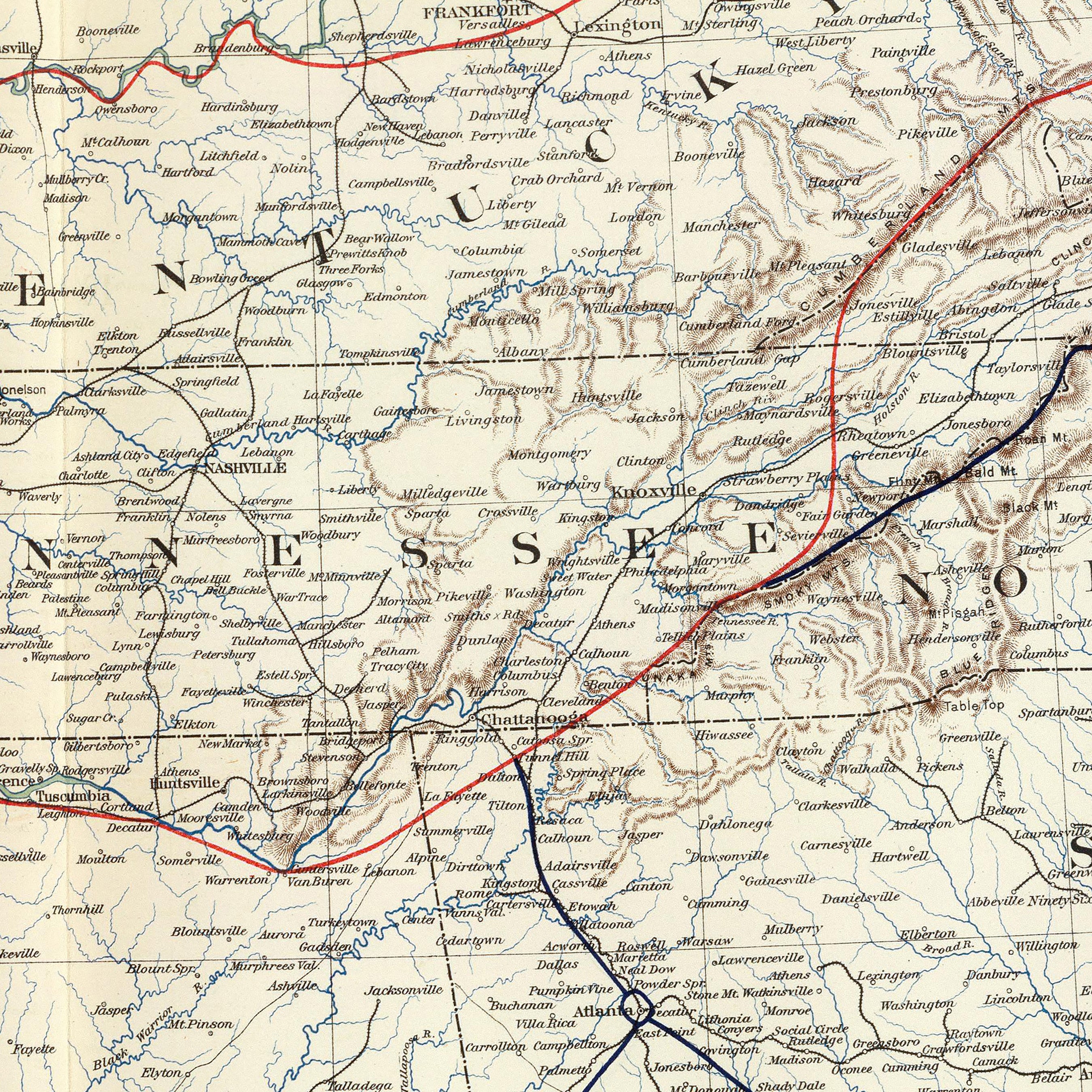
Customers also love our hydrology series maps with their bold contrast and crisp detail. Our Missouri hydrological map showcases every body of water with a diameter greater than 0.2 miles state-wide as well as rivers and intermittent streams.
Can I get my Missouri map framed?
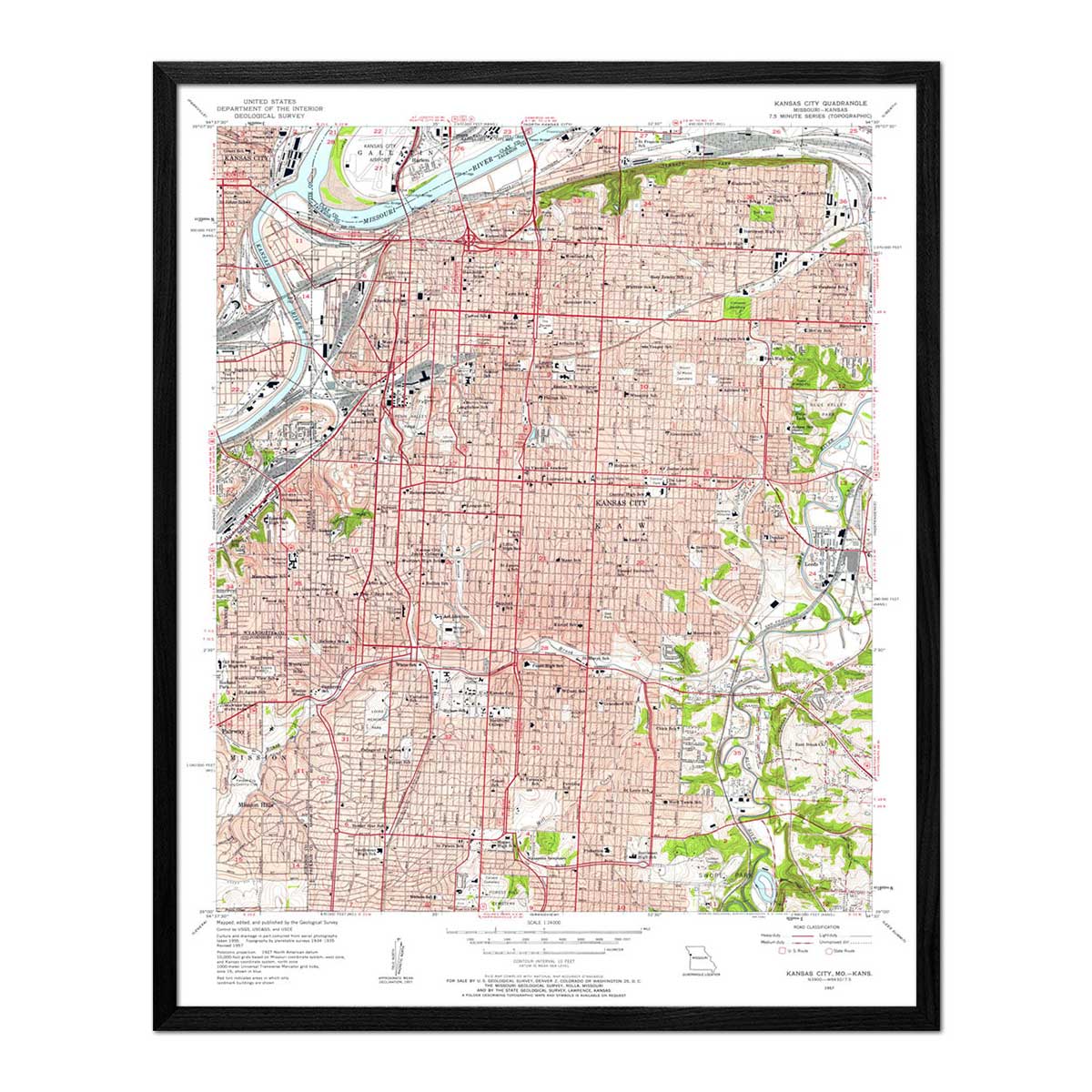
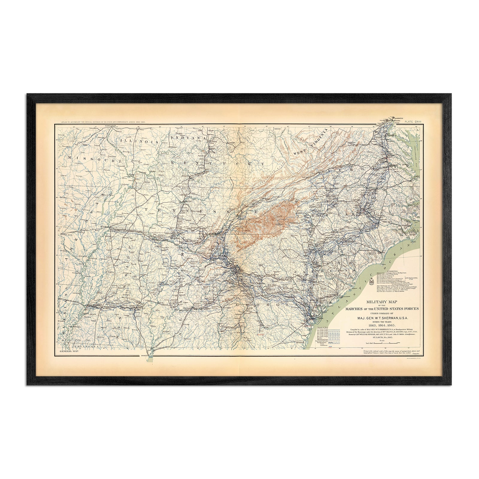
All of our Missouri maps are available framed. You can choose from several styles, including black, walnut, and natural wood. You can also purchase our prints unframed if you prefer to use your own frame.
Is a Muir Way map of Missouri a good gift idea?
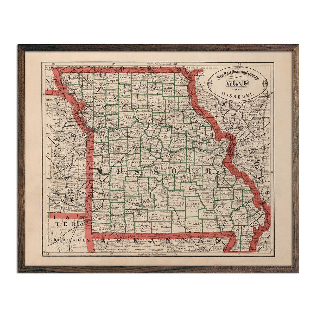
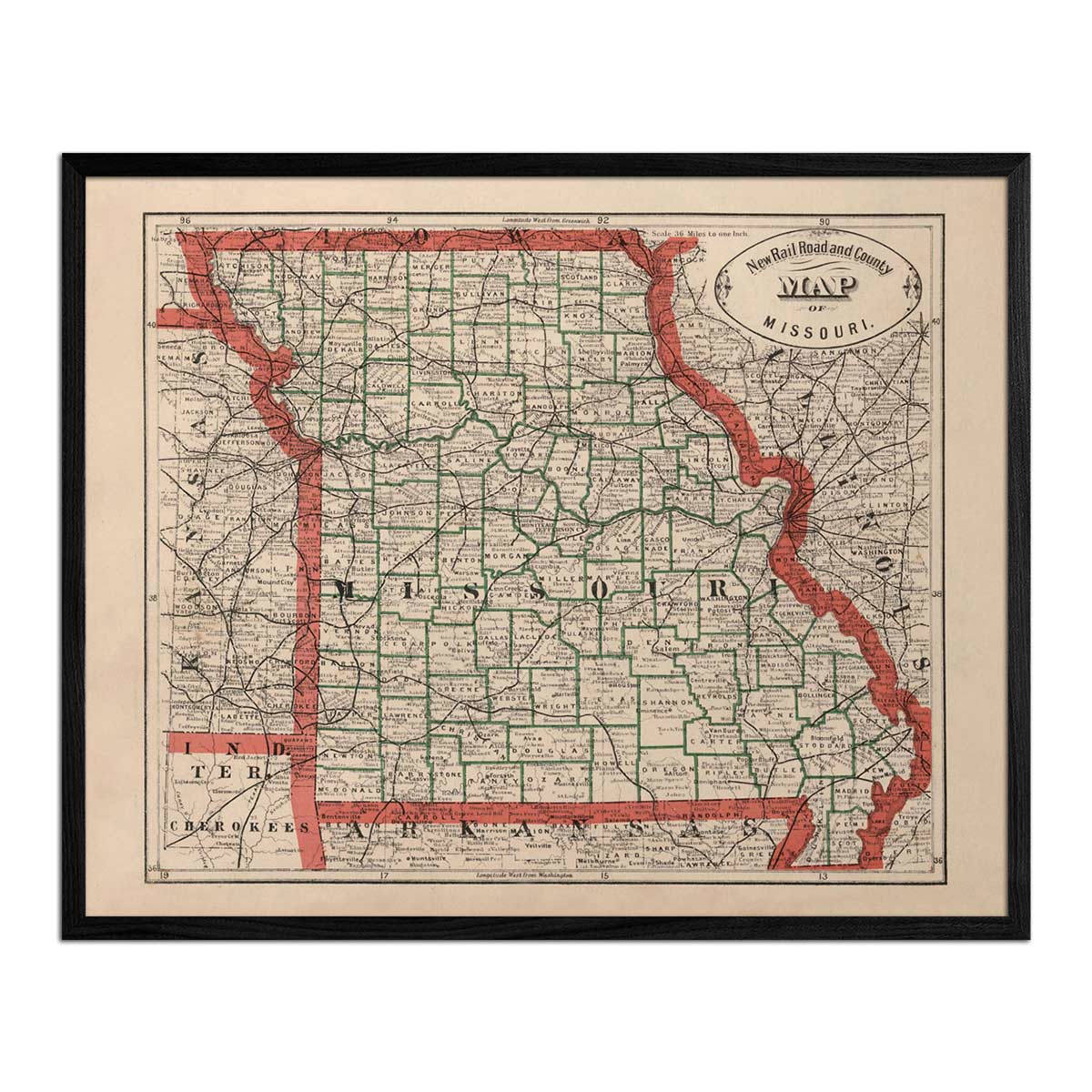
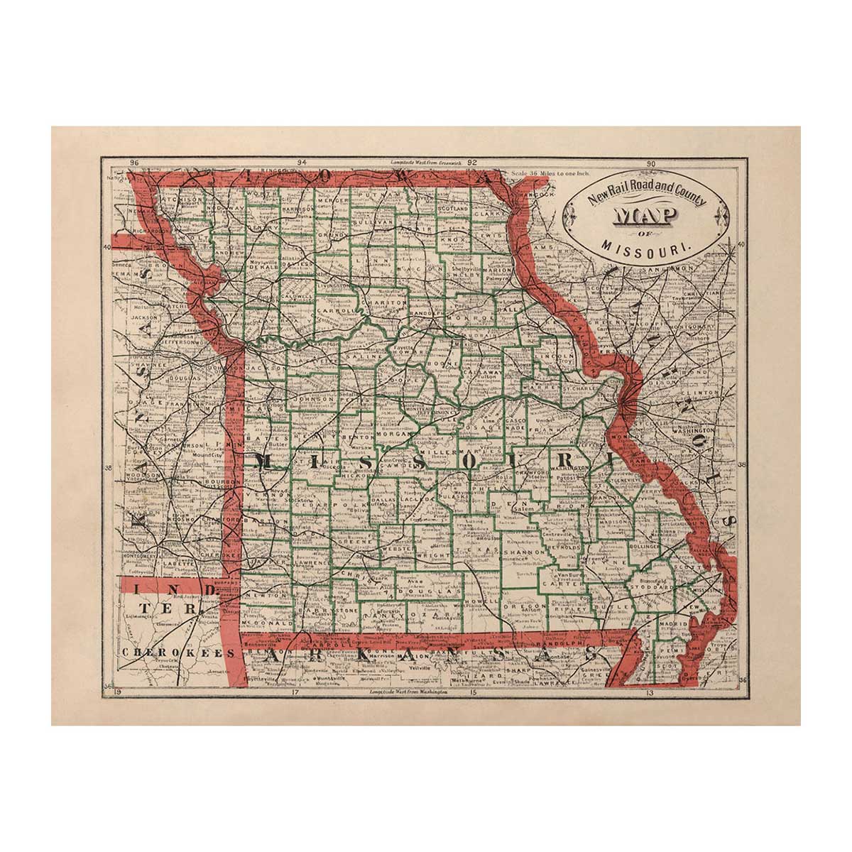
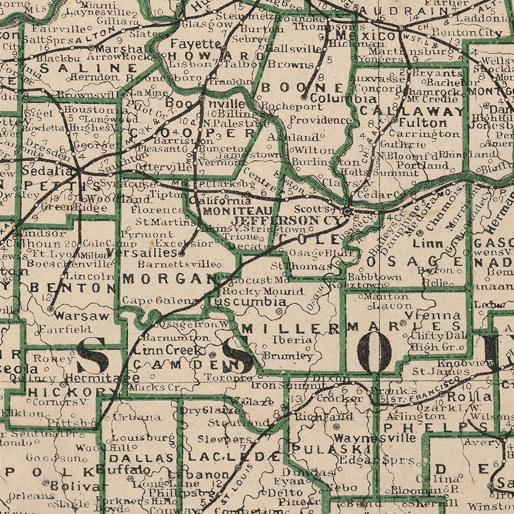
Absolutely. Our exquisite maps of Missouri make ideal gifts for any occasion. Those with a family or other connection to Missouri will treasure this memento. History buffs will love our restored vintage Missouri maps, such as the 1883 Missouri map with its characteristic vintage lettering. Whether you’re looking for a gift for a holiday, a special way to celebrate a life milestone, or a ‘just because’ gift for yourself, Muir Way maps leave a lasting impression and stand the test of time.
How should I display my Missouri map?
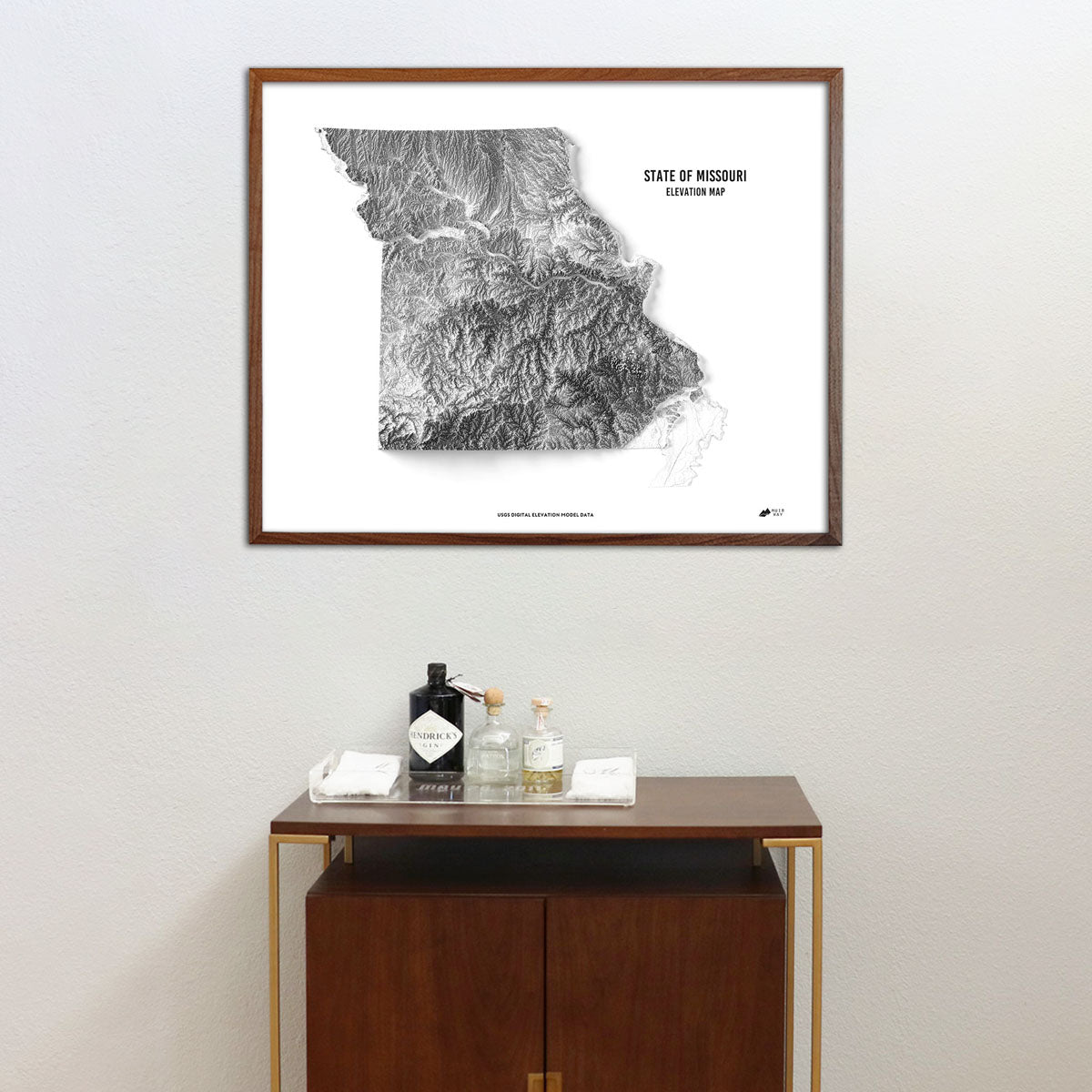
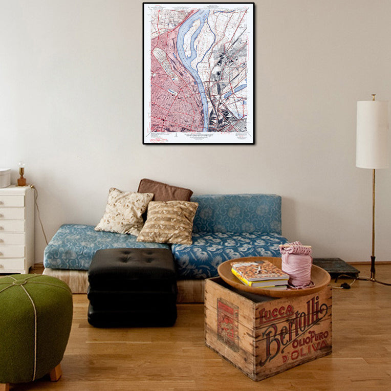
Unlike other replica maps available, Muir Way maps are designed to be the center of attention and function as a piece of wall art to suit many different settings and styles of décor. Hang your Missouri map at eye level in a bedroom or home office for a statement, or consider grouping a selection of small prints in a wall display.
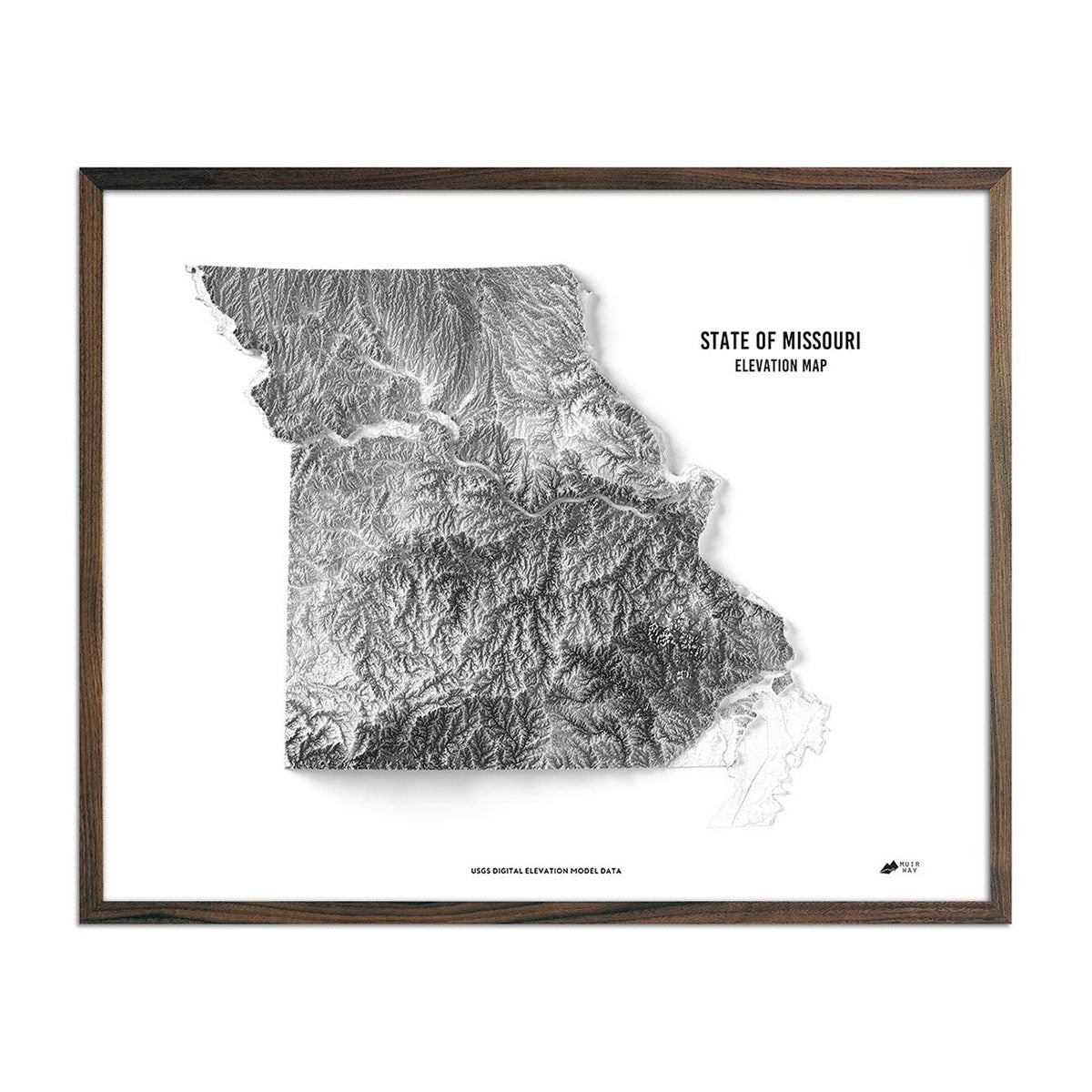
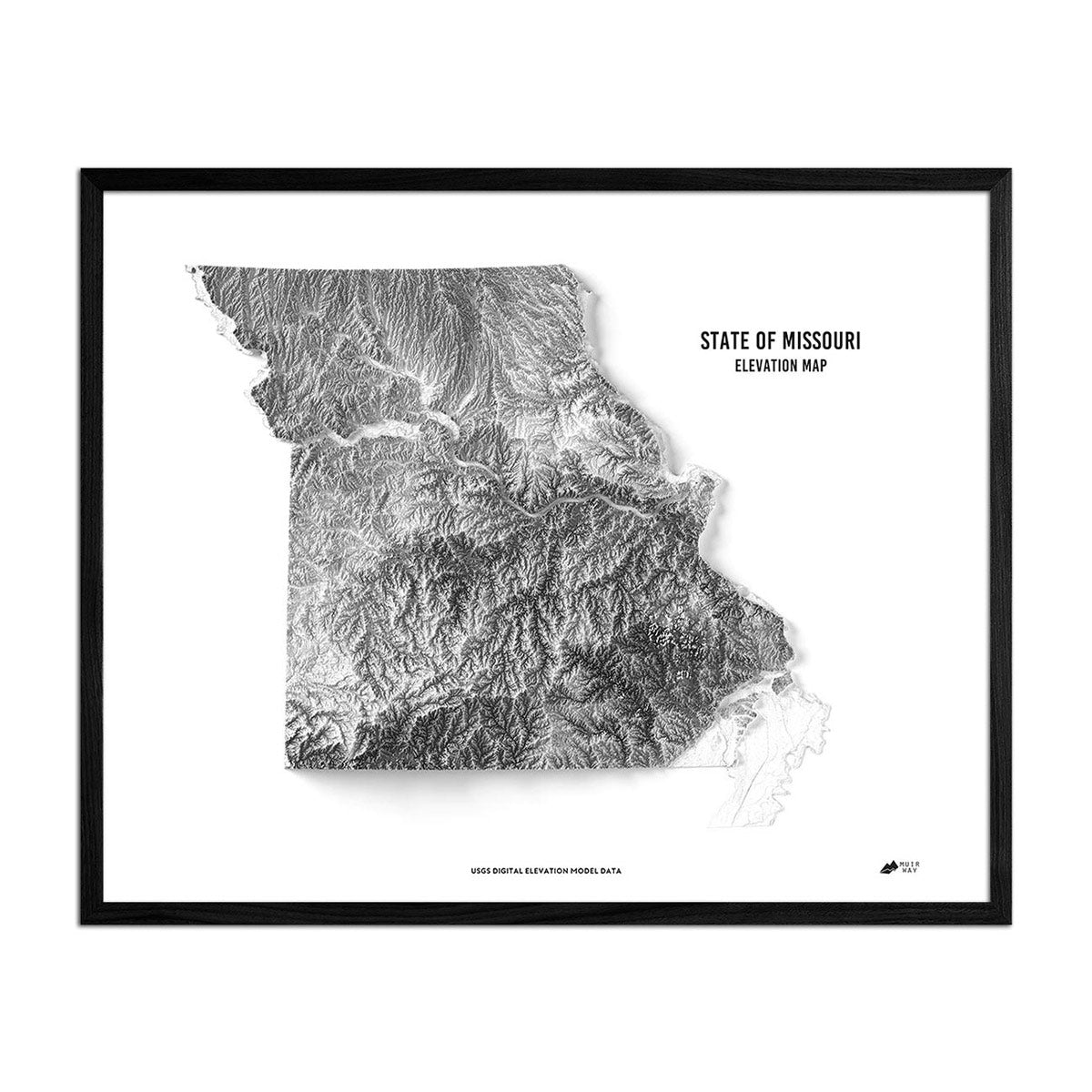
Missouri topographic maps make stunning focal points above traditional fireplaces or sofas. Choose our brightly colored Missouri 1979 Relief Map or the black and white tones of our Missouri Elevation Map. Choosing an appropriate frame will help your Missouri wall map to blend into whatever setting you decide to display it.
What are the different types of maps of Missouri available on Muir Way?
Our Missouri maps are available in several different styles, including:
Missouri relief maps - Our relief map of Missouri marries historical map landscapes with modern technology to showcase Missouri’s beautiful topography in an exciting new way. Using Digital Elevation Data and shaded relief, we custom enhance vintage map imagery to bring a vibrant, surreal 3D effect on a flat surface.
Missouri elevation maps - Our state of Missouri elevation map also uses Digital Elevation Data from the USGS to create a high-contrast 3-dimensional effect in stunning black and white, providing crisp detail and a refreshing view of Missouri’s native landscape without any other text or graphical elements, so the details of the state itself are the main focal point.
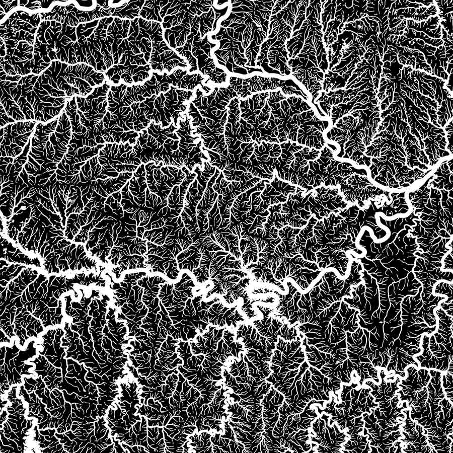
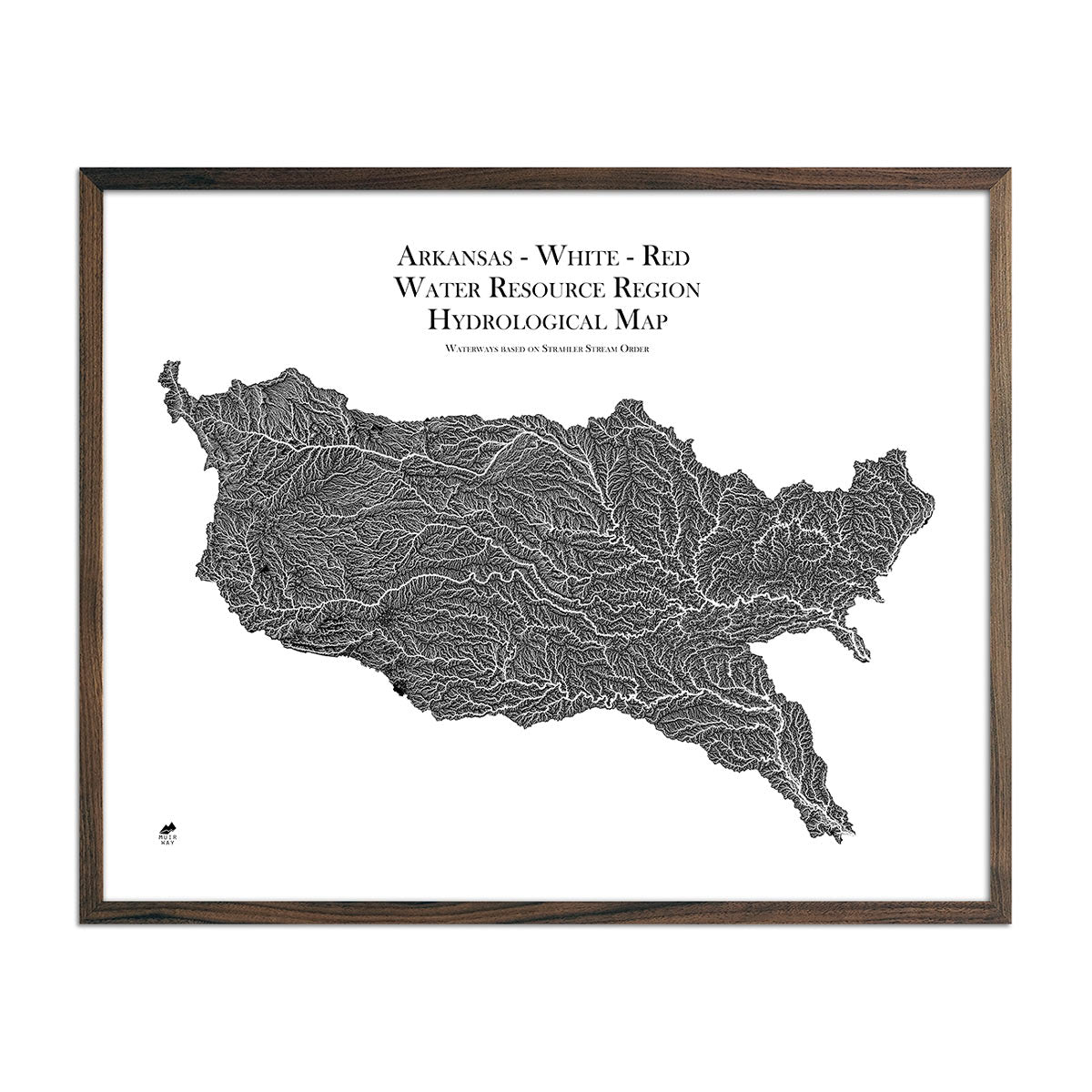
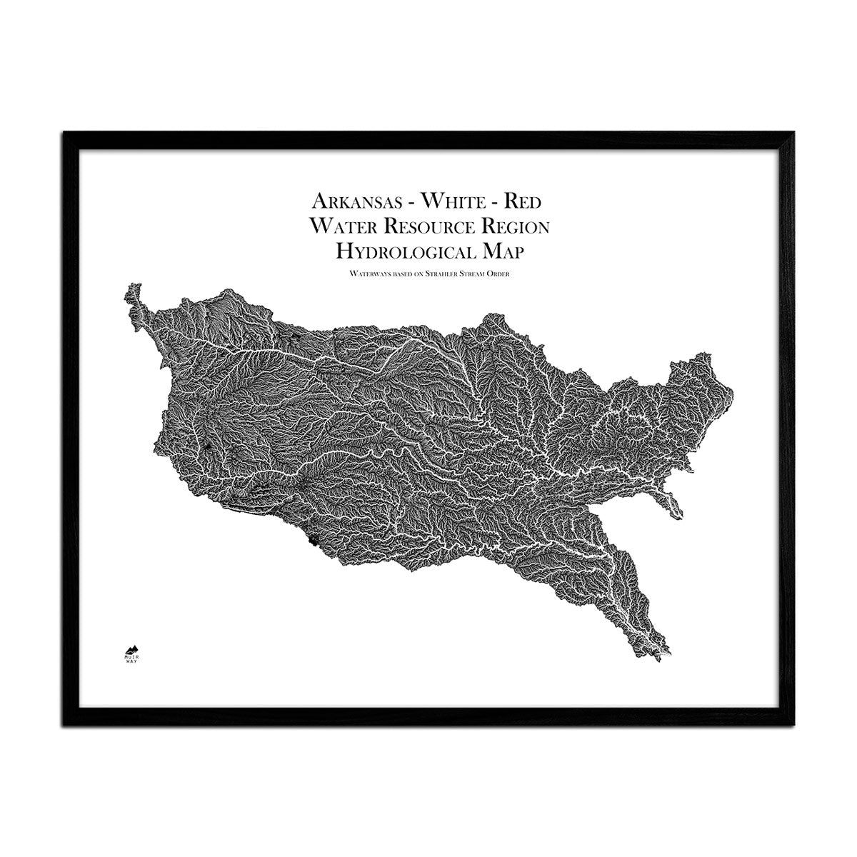
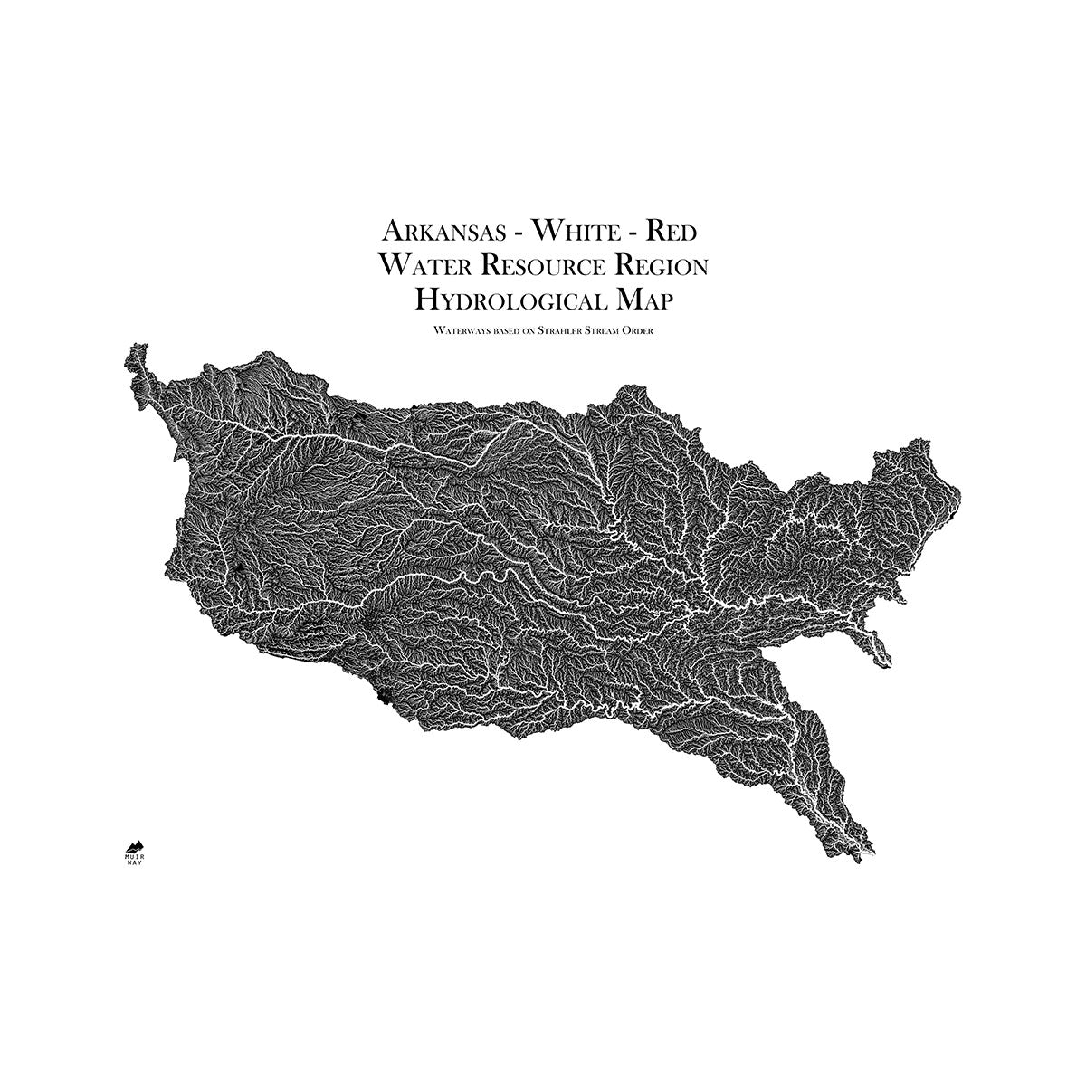
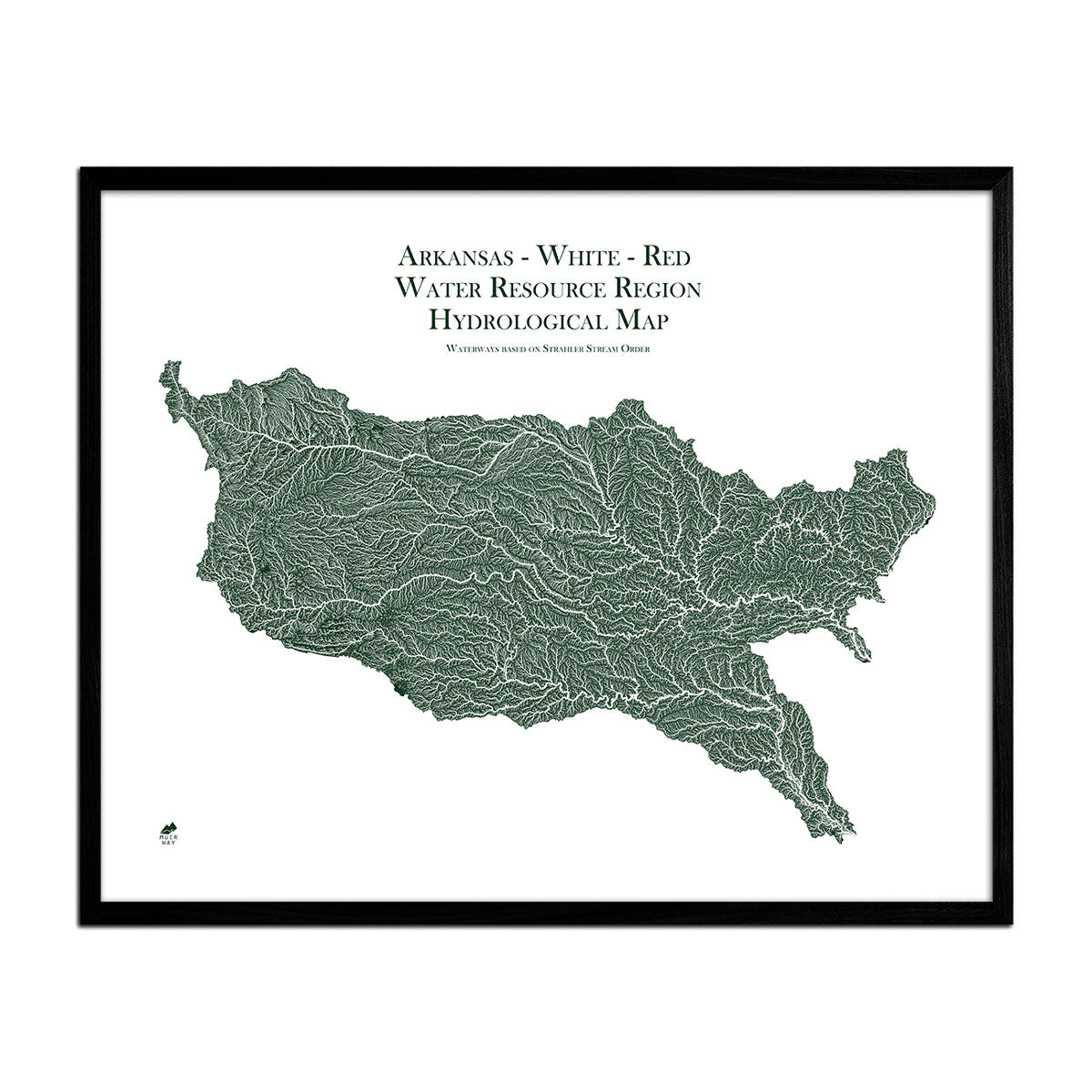
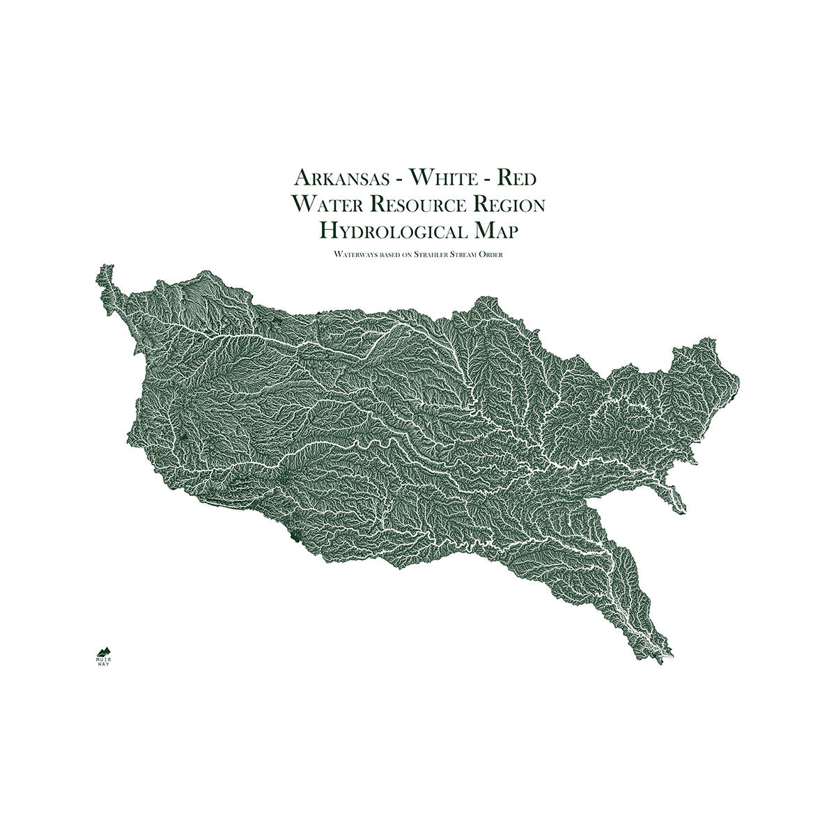
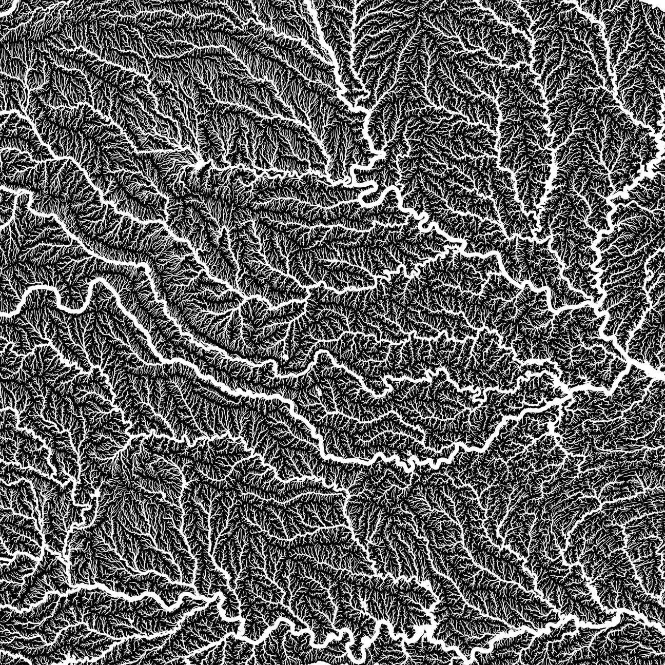
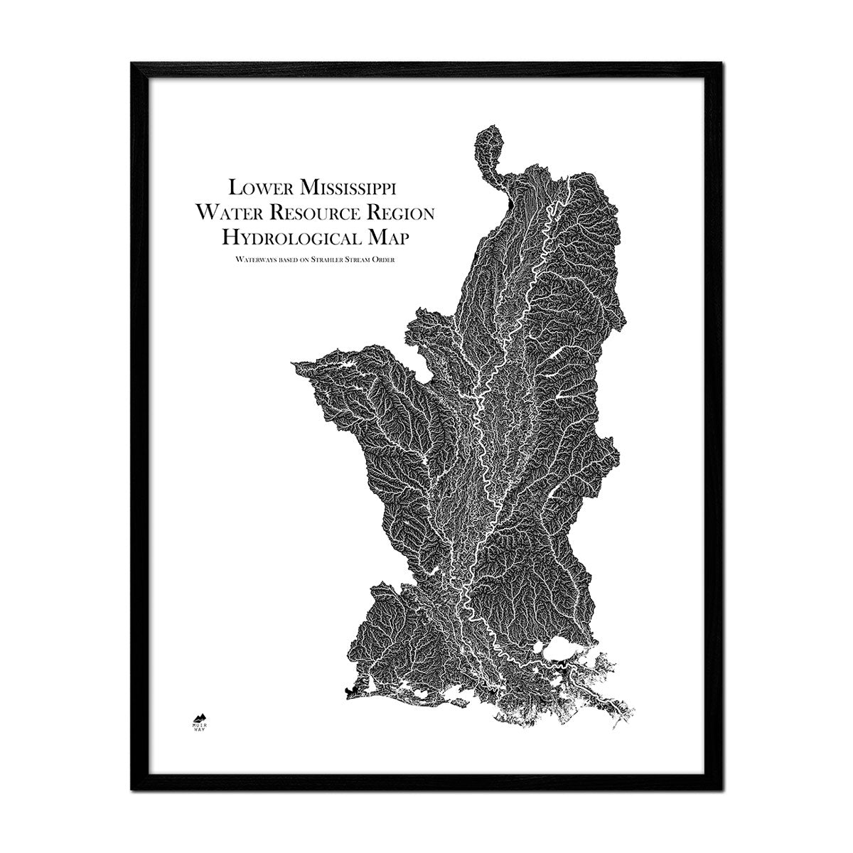
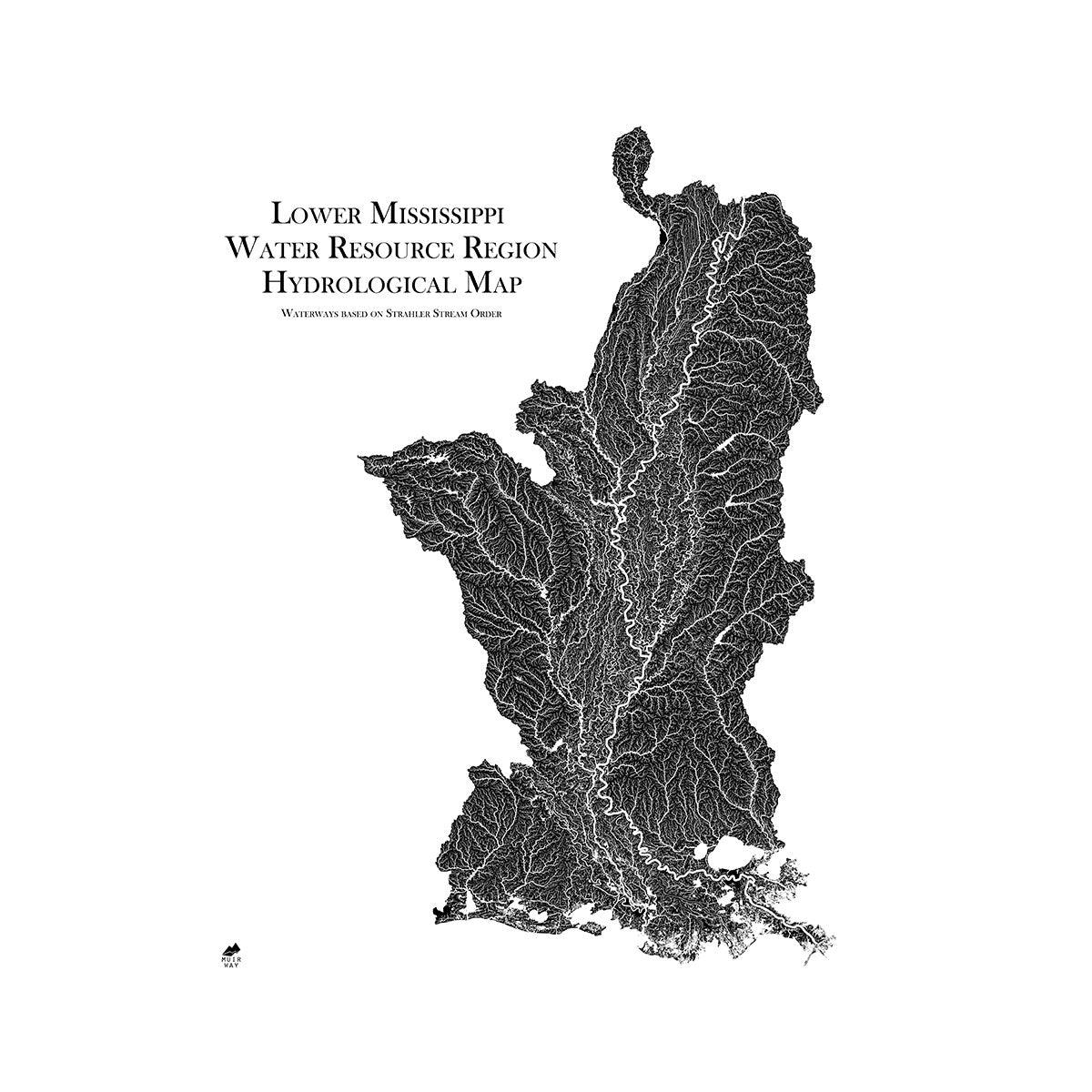
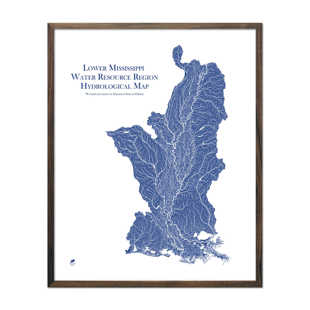
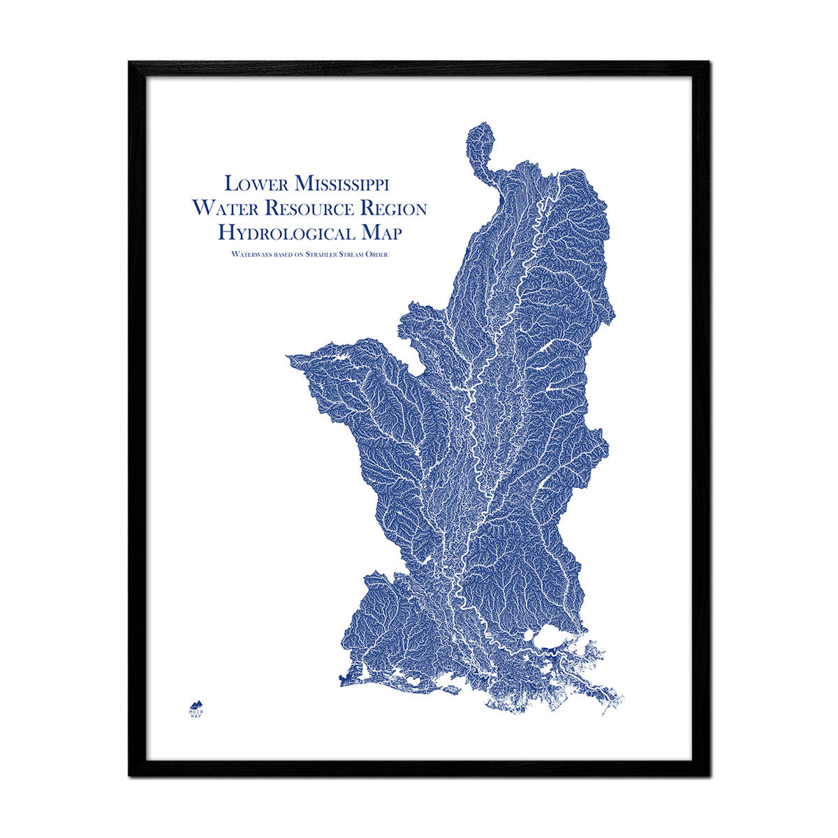
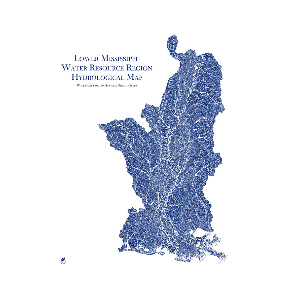
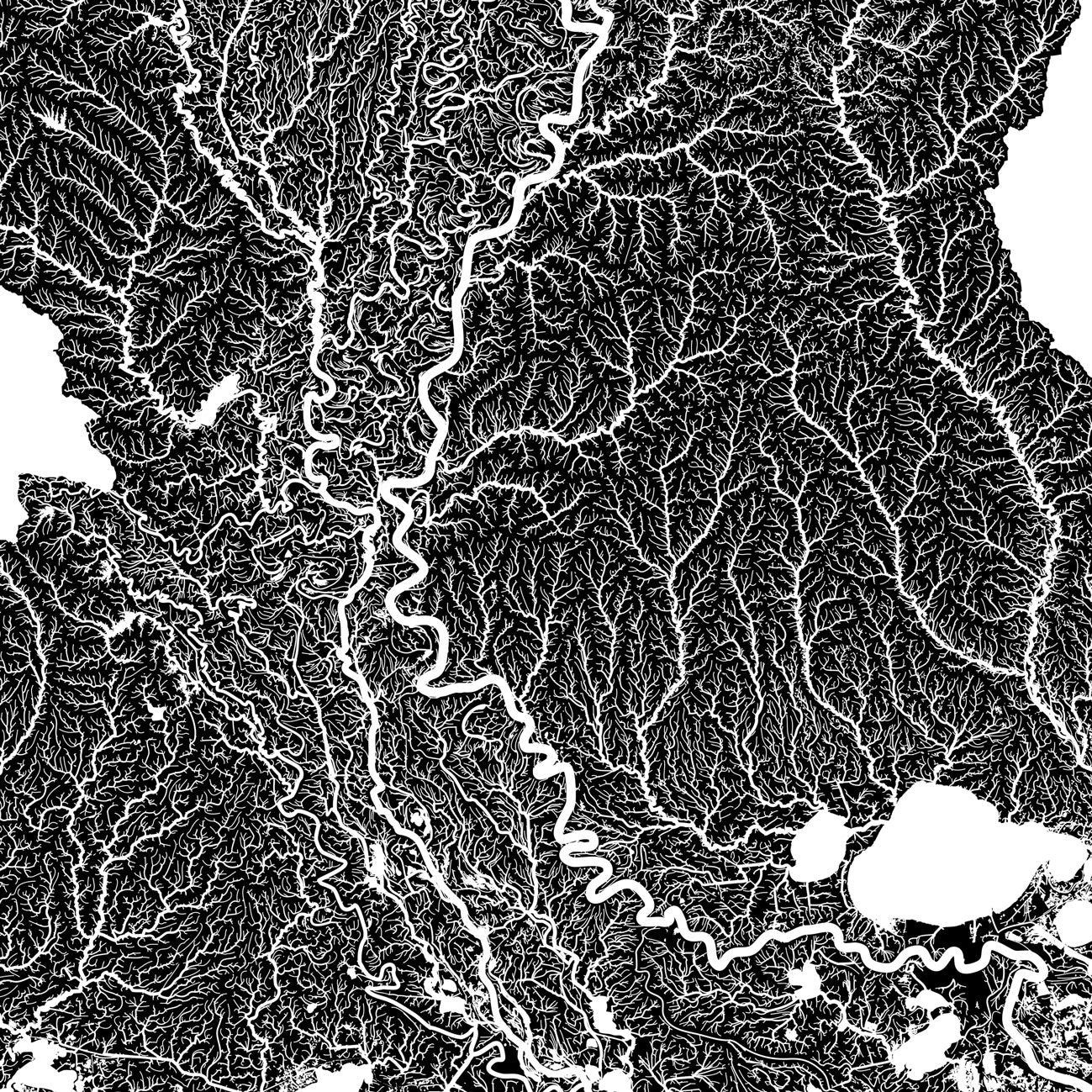
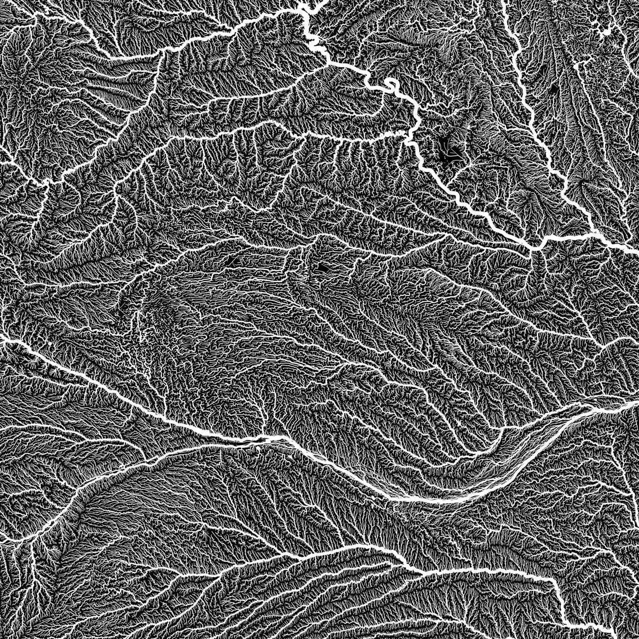
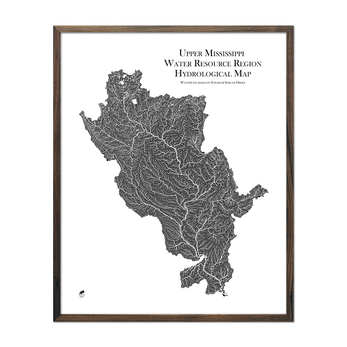
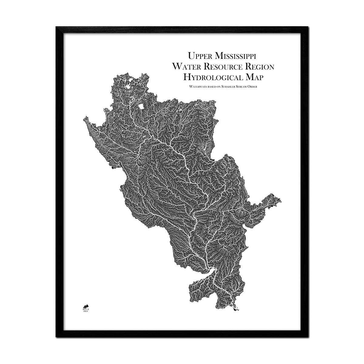
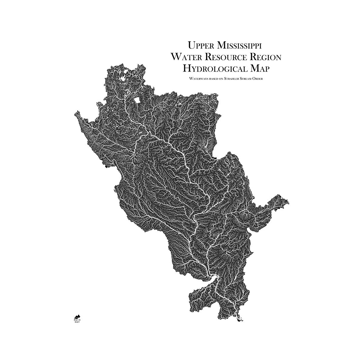
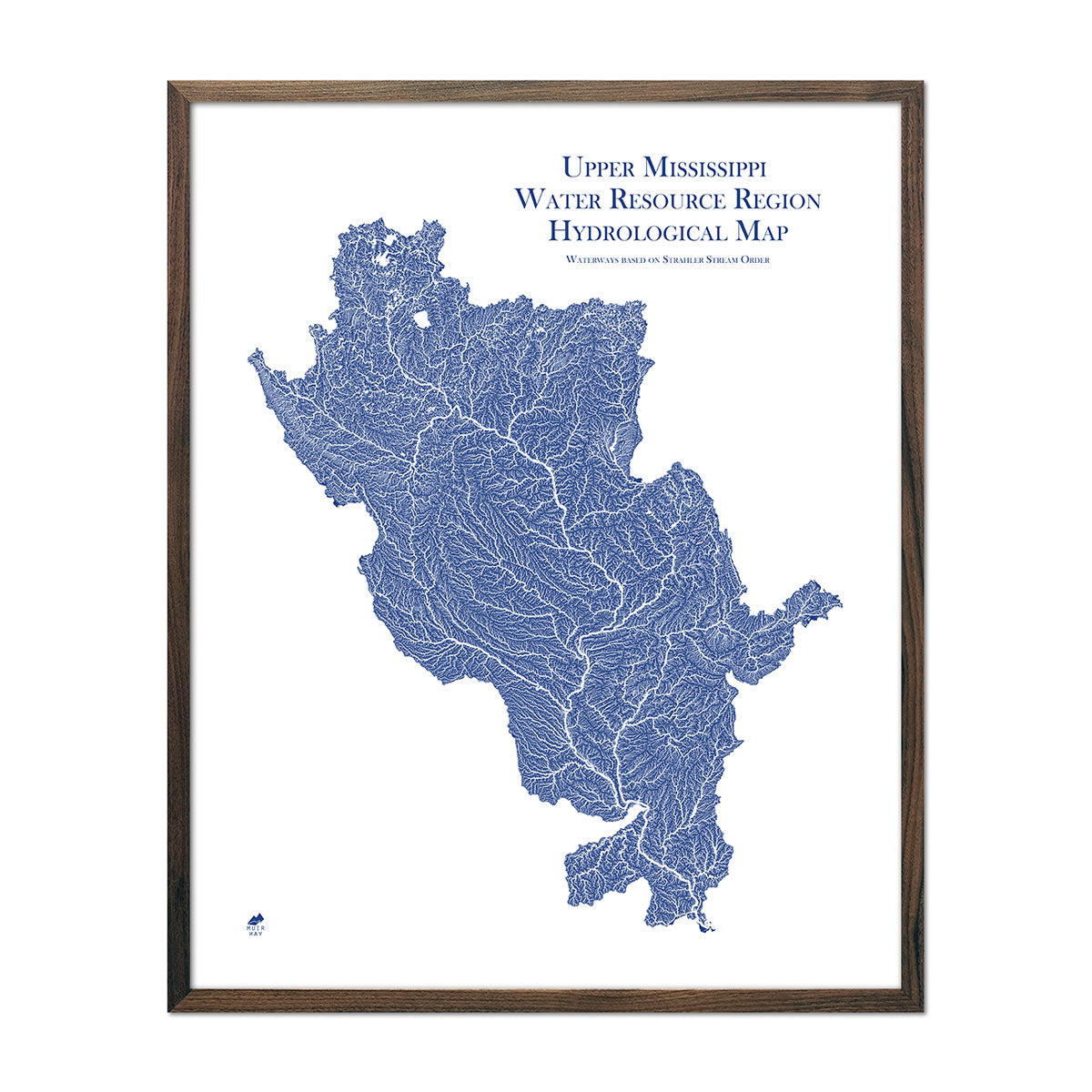
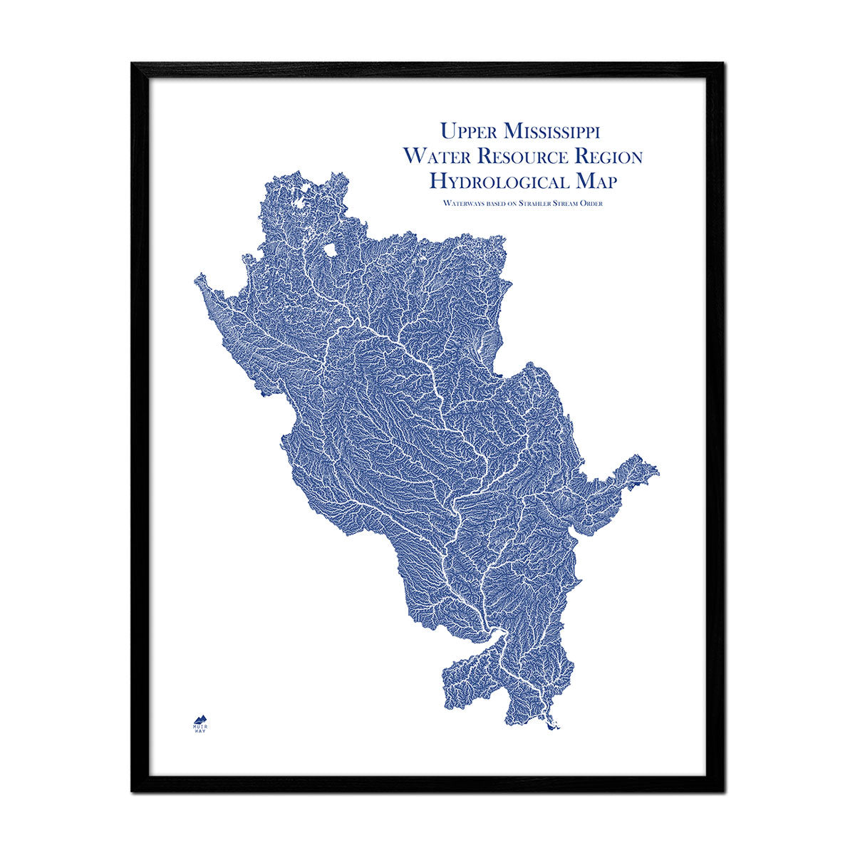
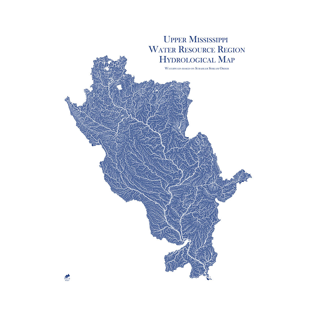
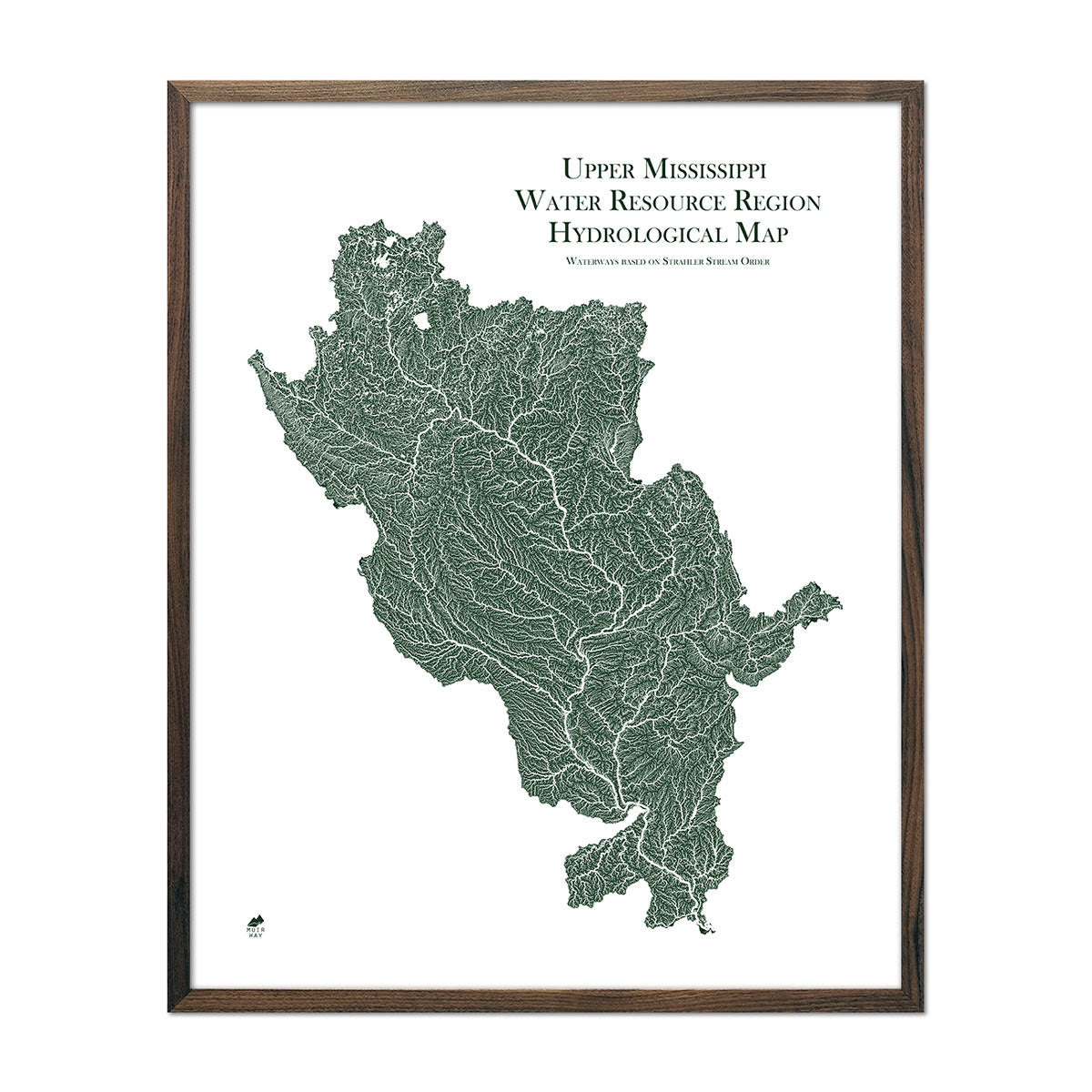
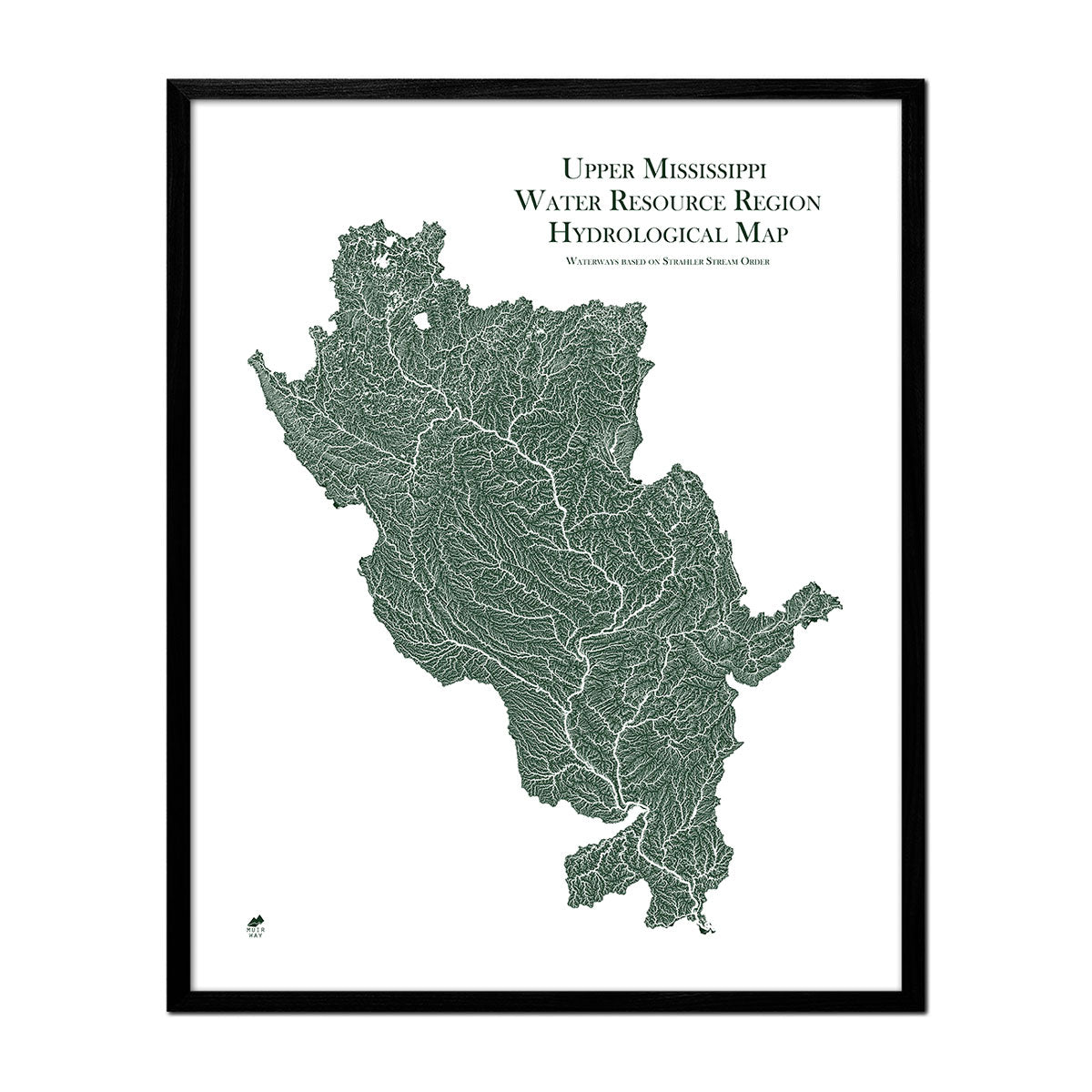
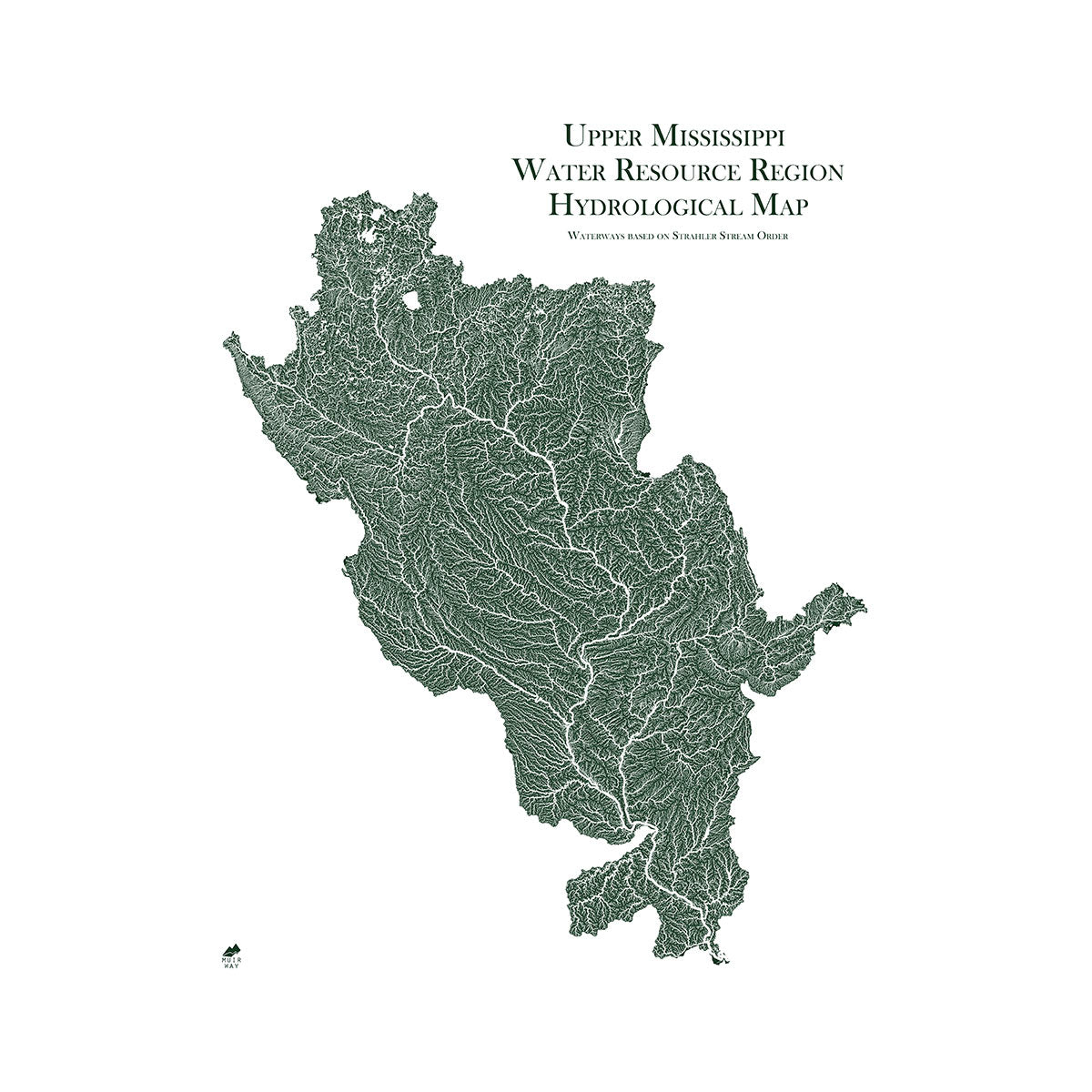
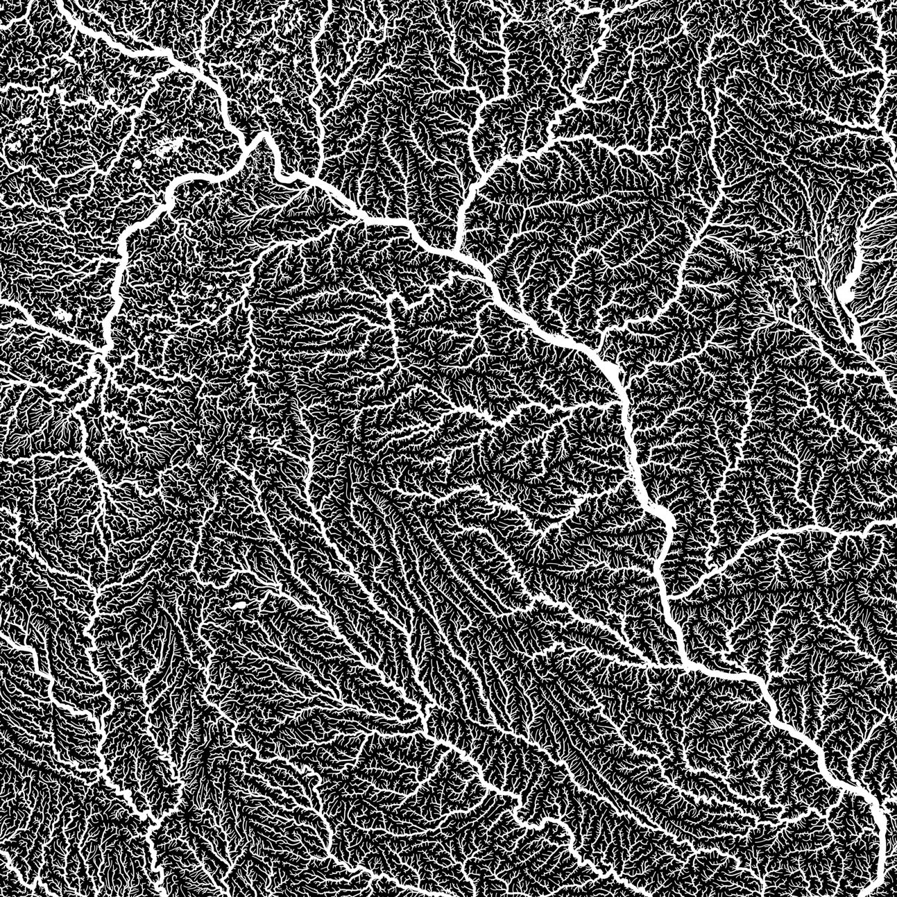
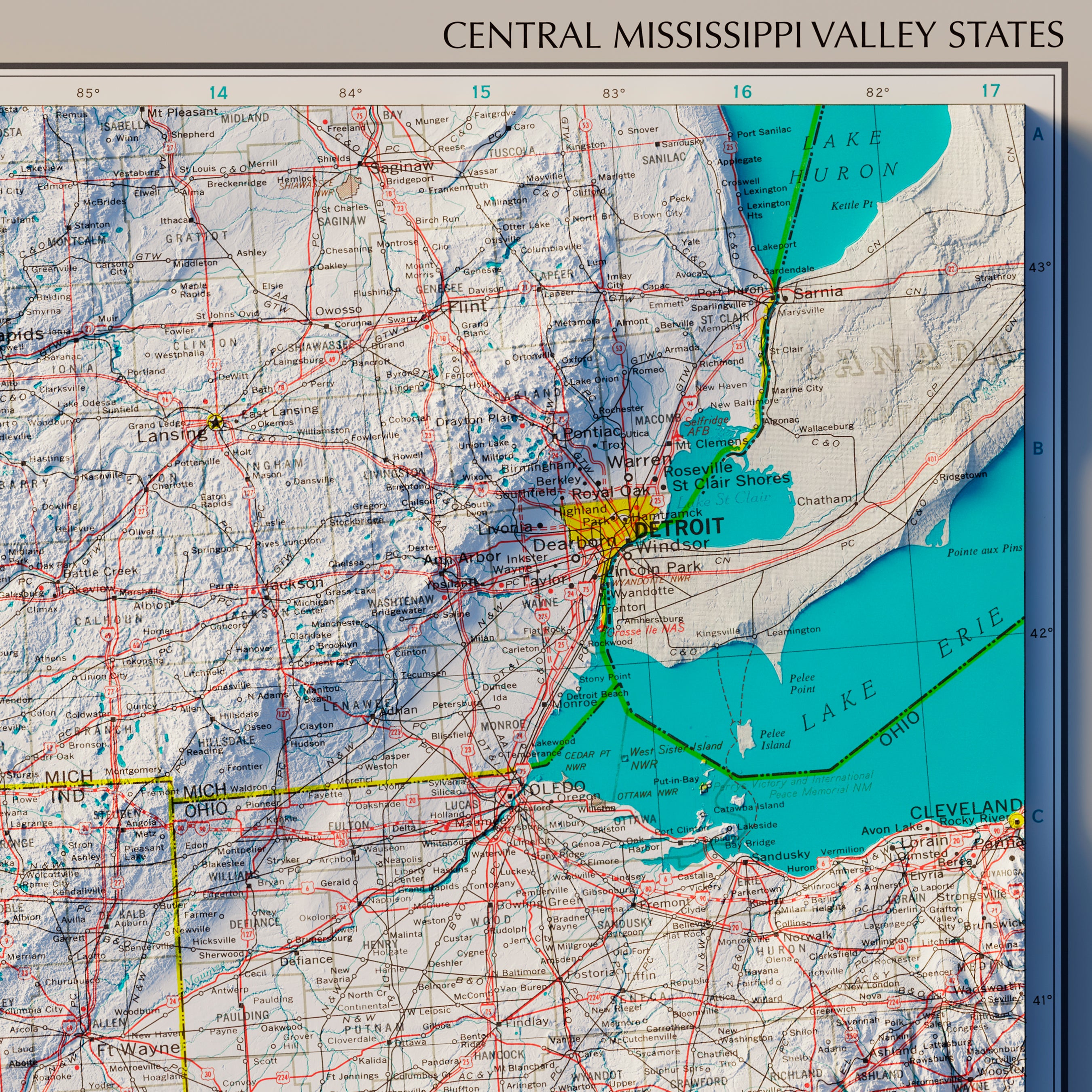
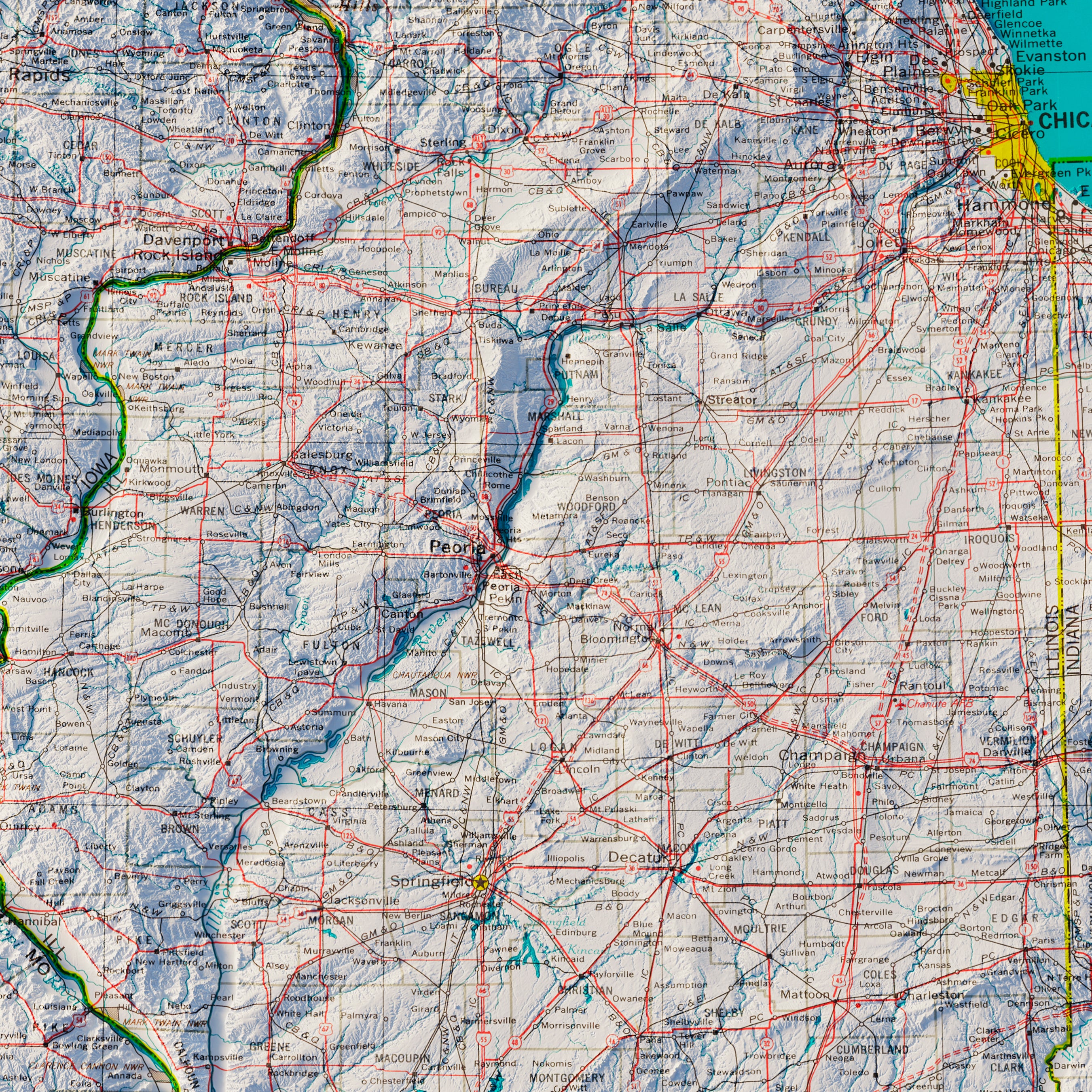
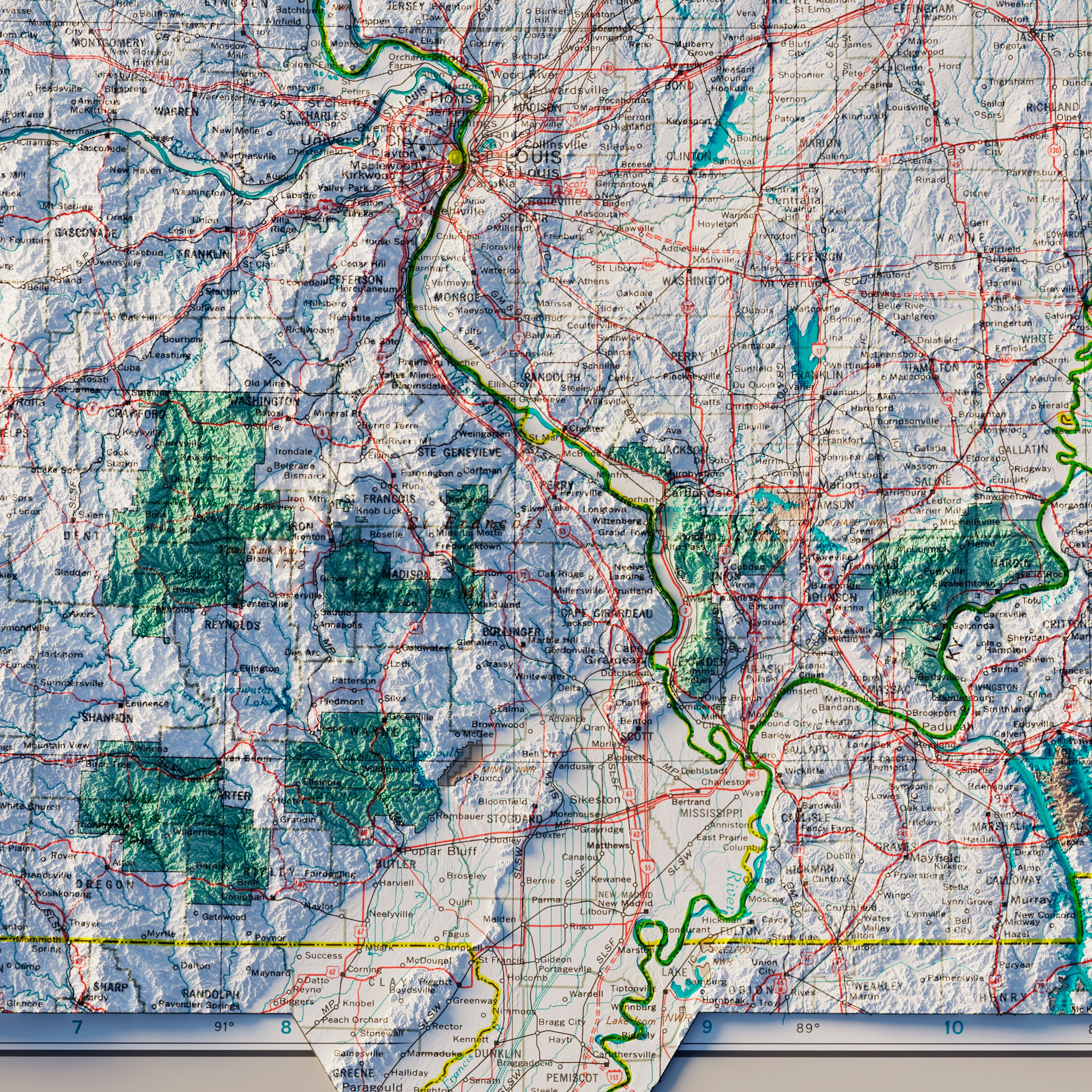
Missouri hydrological maps - Our hydrological maps are high-contrast and high-detail, designed to look beautiful from far away or up close. Our Missouri hydrological map features Missouri’s interconnected waterways, from wide rivers to intermittent streams. We use an effect called the Strahler Stream Order to highlight the hierarchy of streams. As they acquire tributaries, they are shown with thicker lines. In addition to our Missouri state hydrological map, related maps include our Arkansas-White-Red regional hydrological map, Missouri Regional hydrological map, Lower Mississippi Regional hydrological map, and Upper Mississippi Regional Hydrological map.
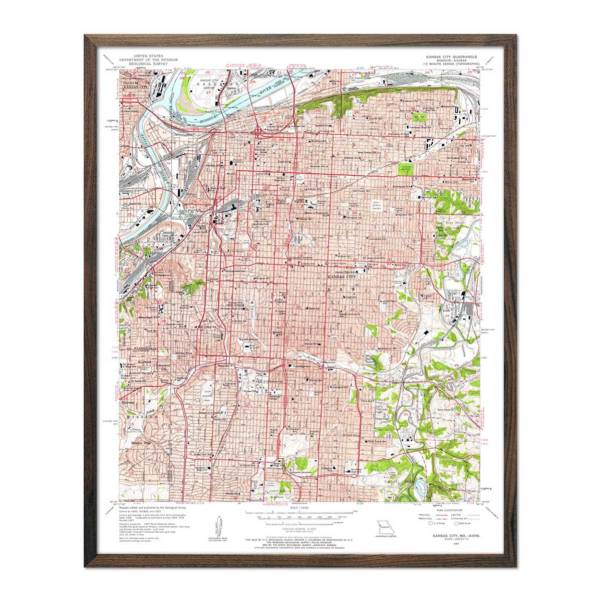
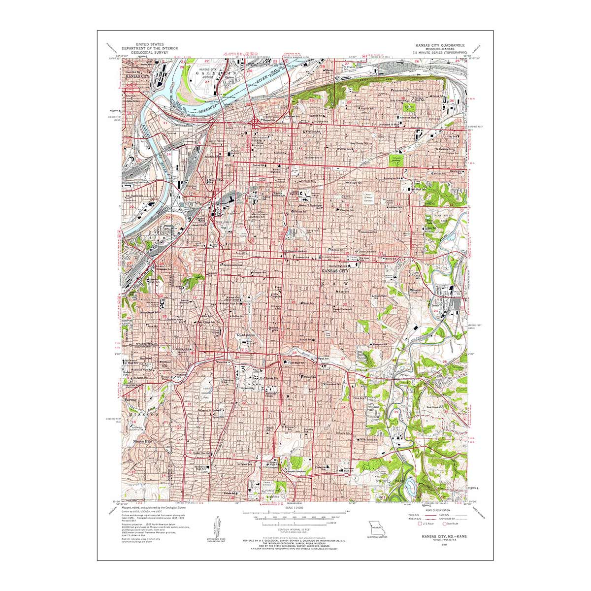
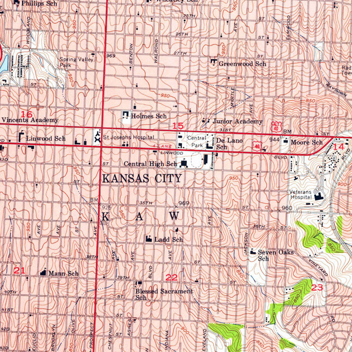
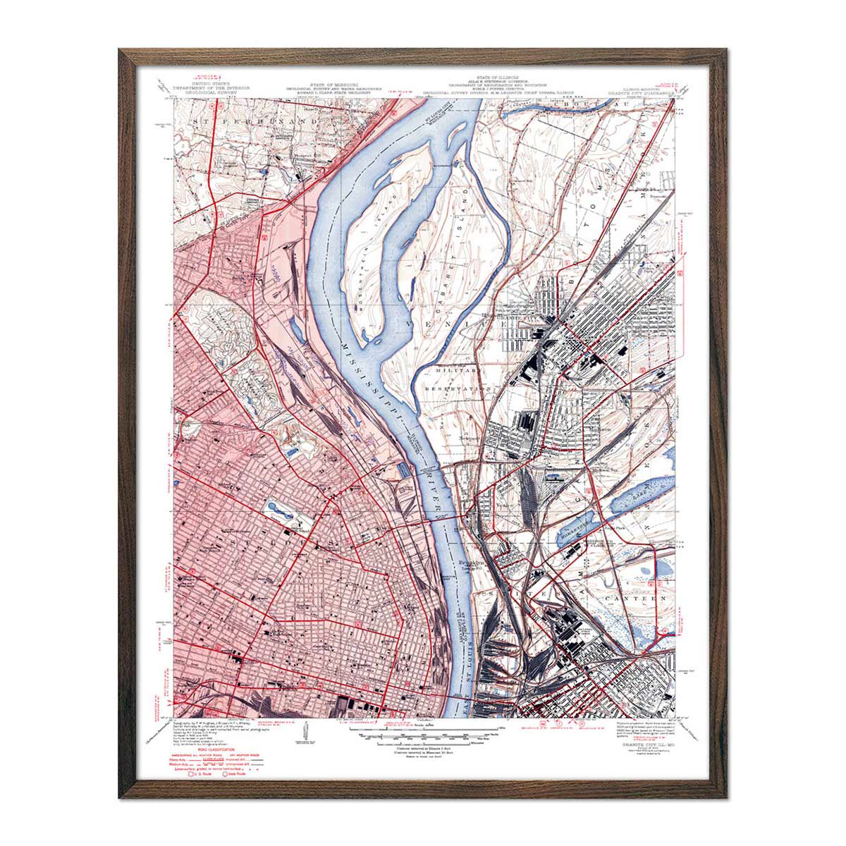
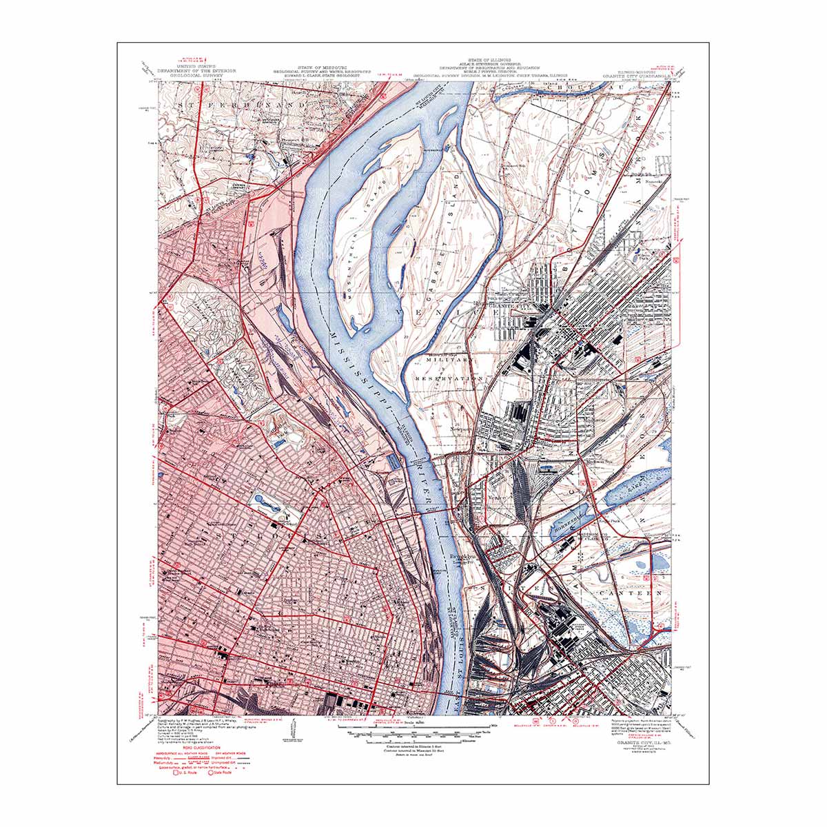
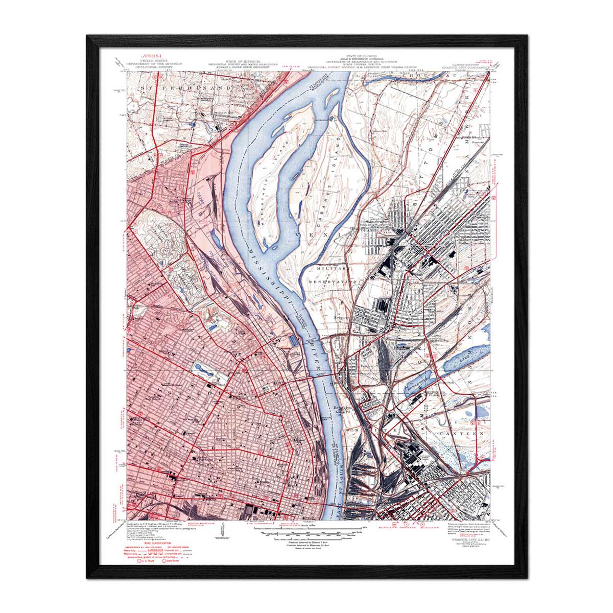
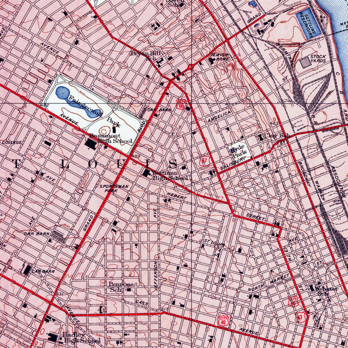
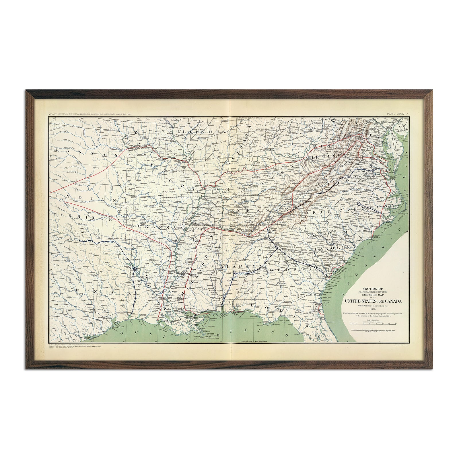
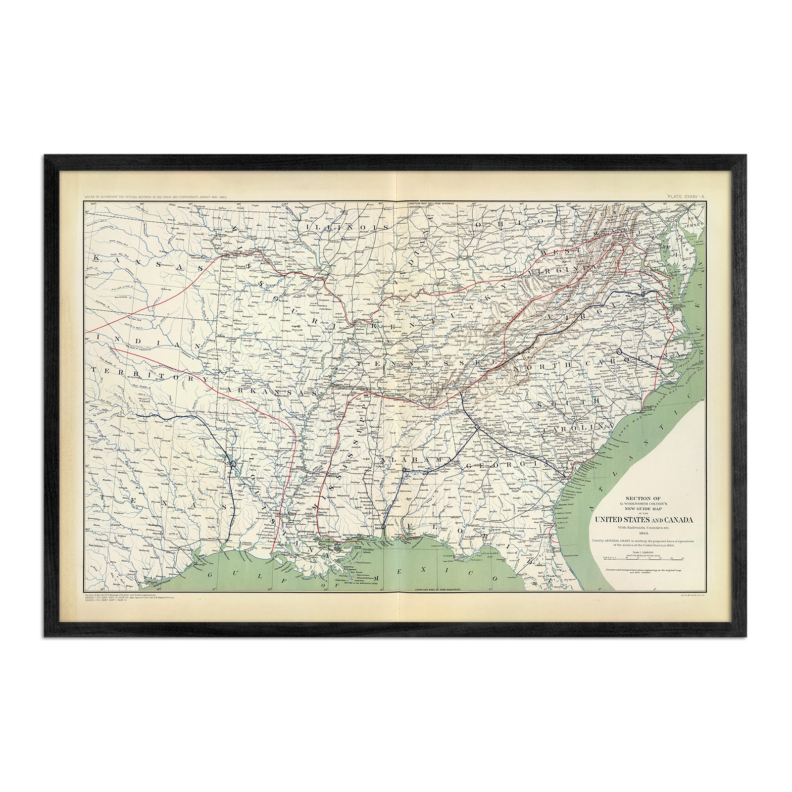
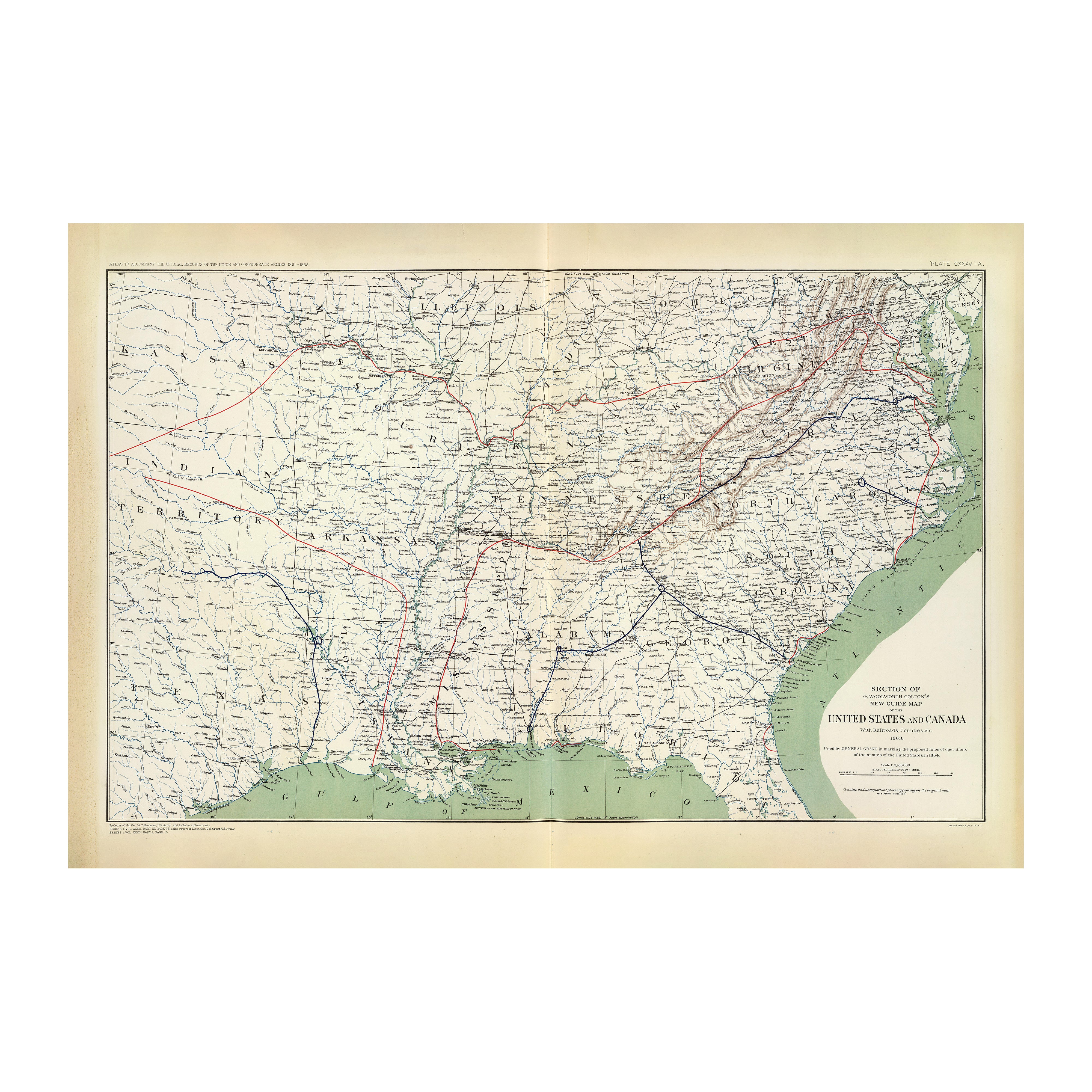
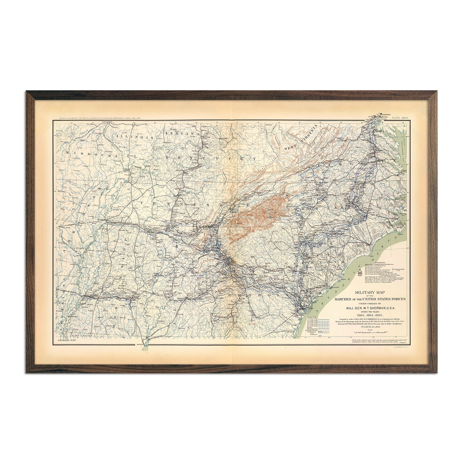
Vintage Missouri maps - If you like vintage maps, you’ll love our 1883 vintage Missouri map. Unlike our relief map series, our historical maps don’t feature elevation, but what they do feature is a record of history beautifully printed and ready to display. We also have restored vintage maps of Kansas City and St. Louis. Our vintage maps are reproduction prints of old maps, carefully restored to maintain their vintage charm without the wear & tear, and come custom printed using archival materials to preserve a snapshot of history for years to come.
What are some prominent features on the map of Missouri?
Missouri is bordered by an impressive eight states on all sides. No state in the country borders more states than Missouri does, with Tennessee coming in at a tie.
The eastern border of Missouri is outlined almost entirely by the mighty Mississippi River. This, along with the other waterways of Missouri, is beautifully detailed in the Missouri Hydrological Map.
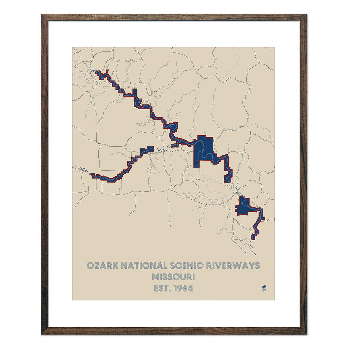
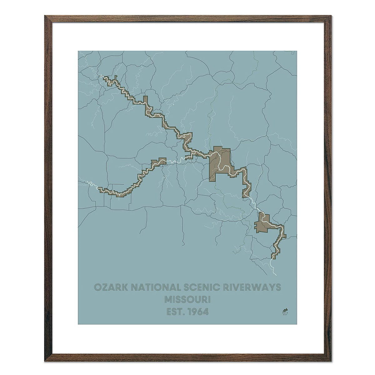
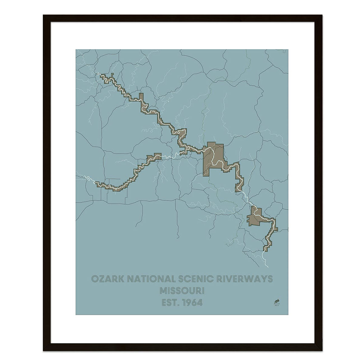
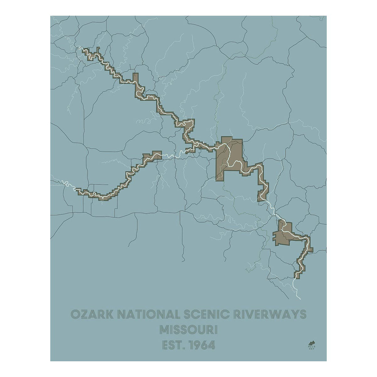
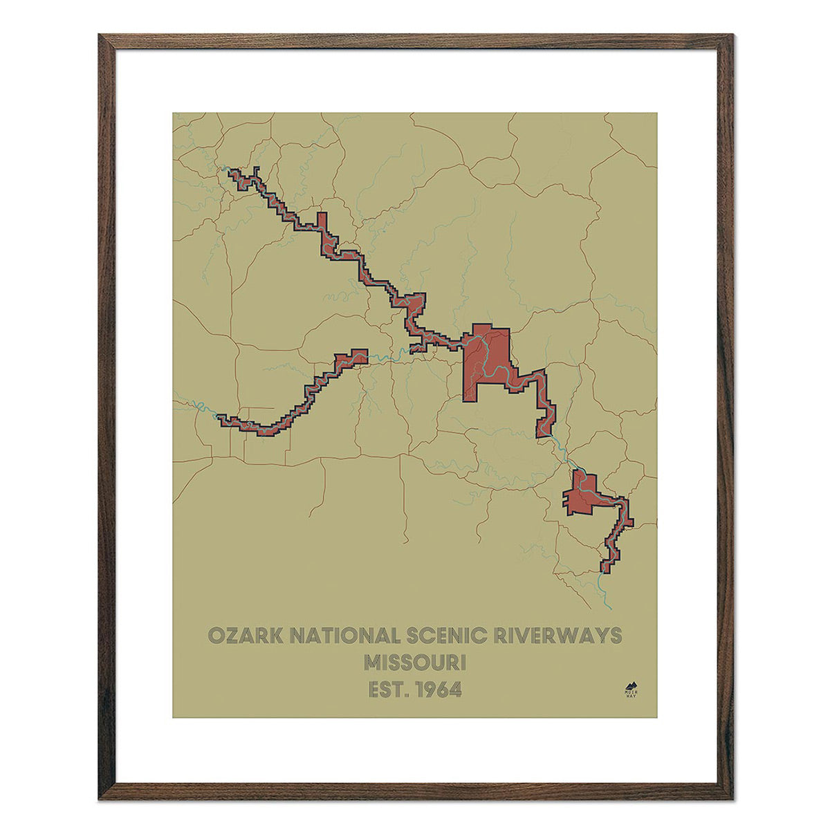
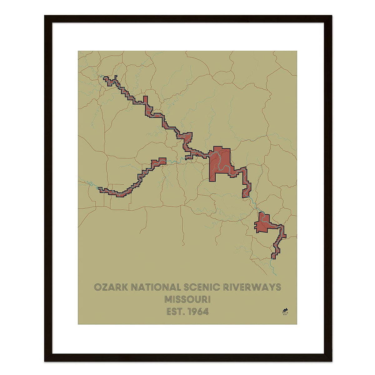
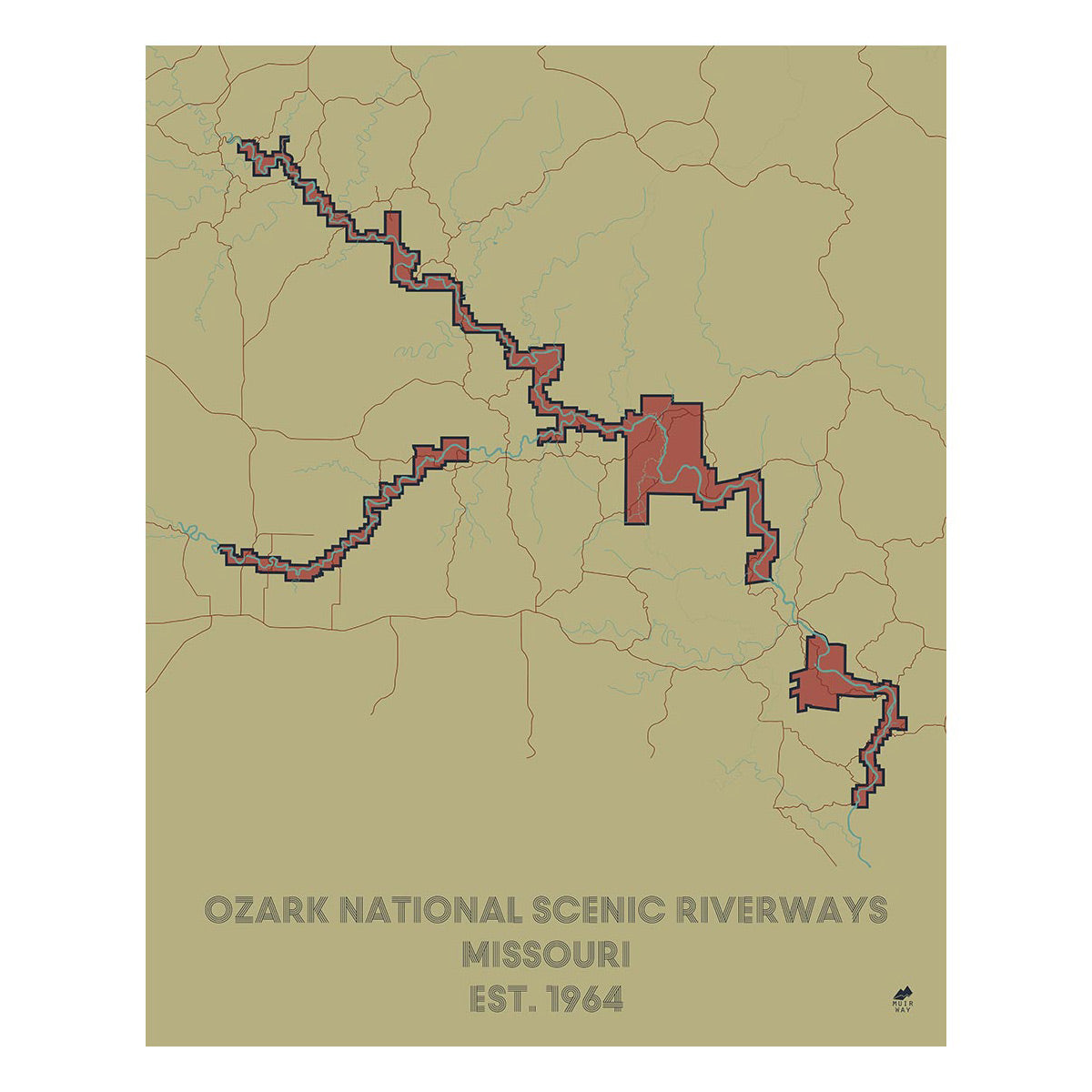
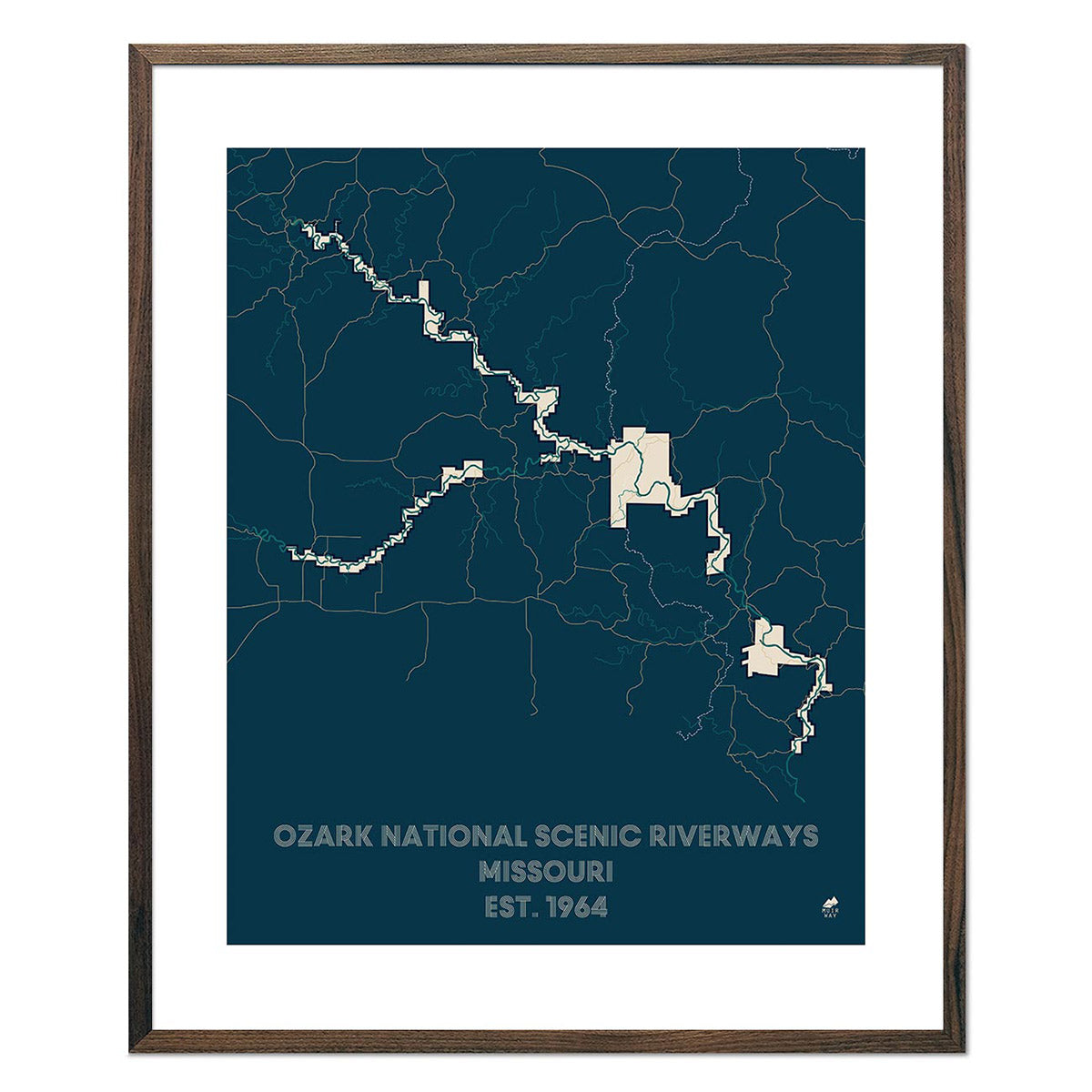
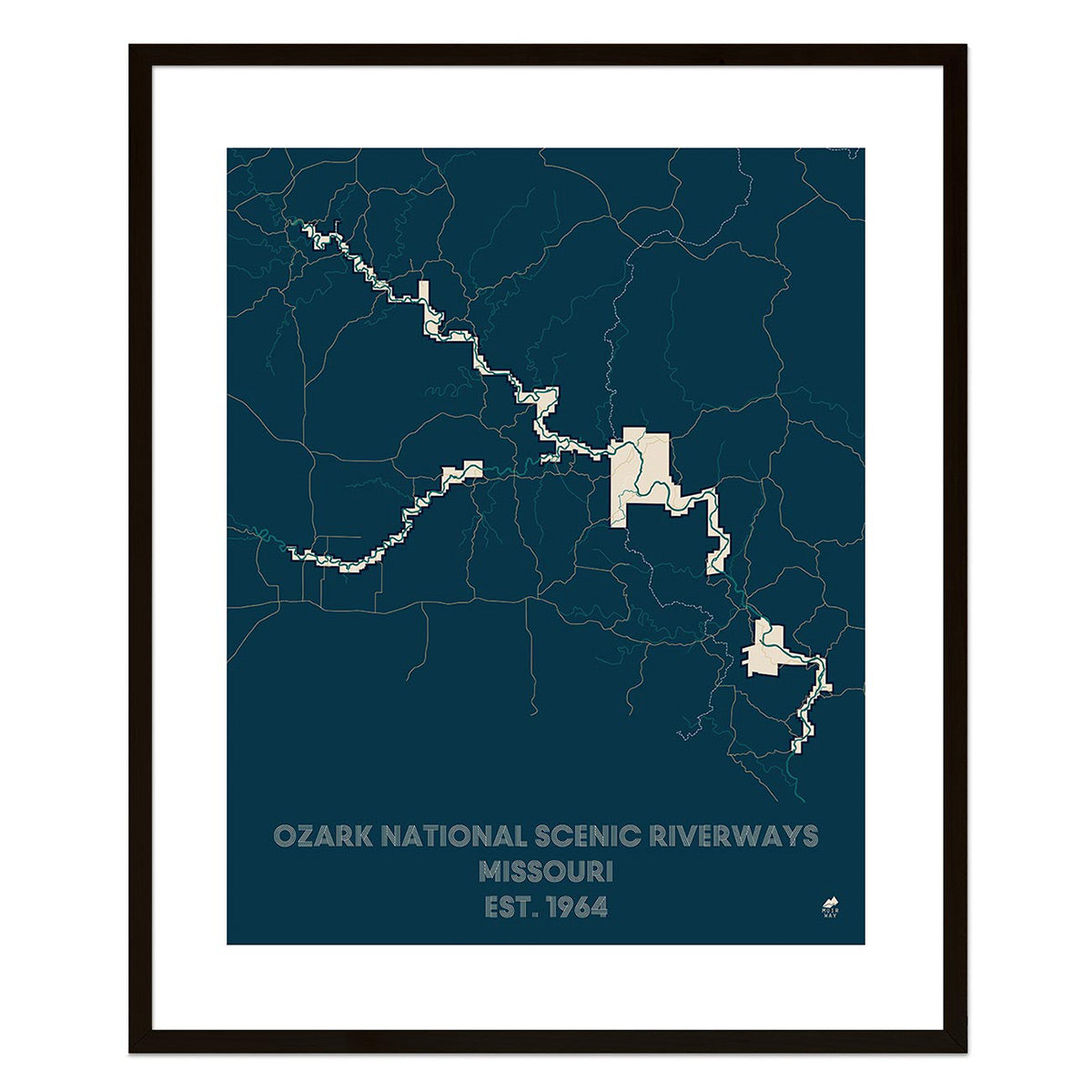
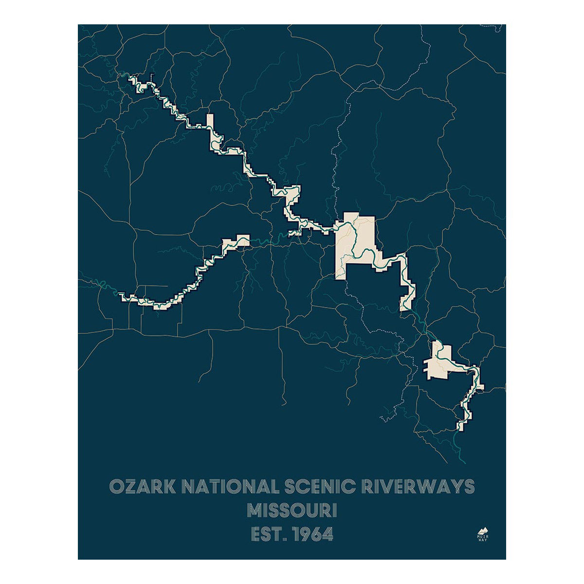
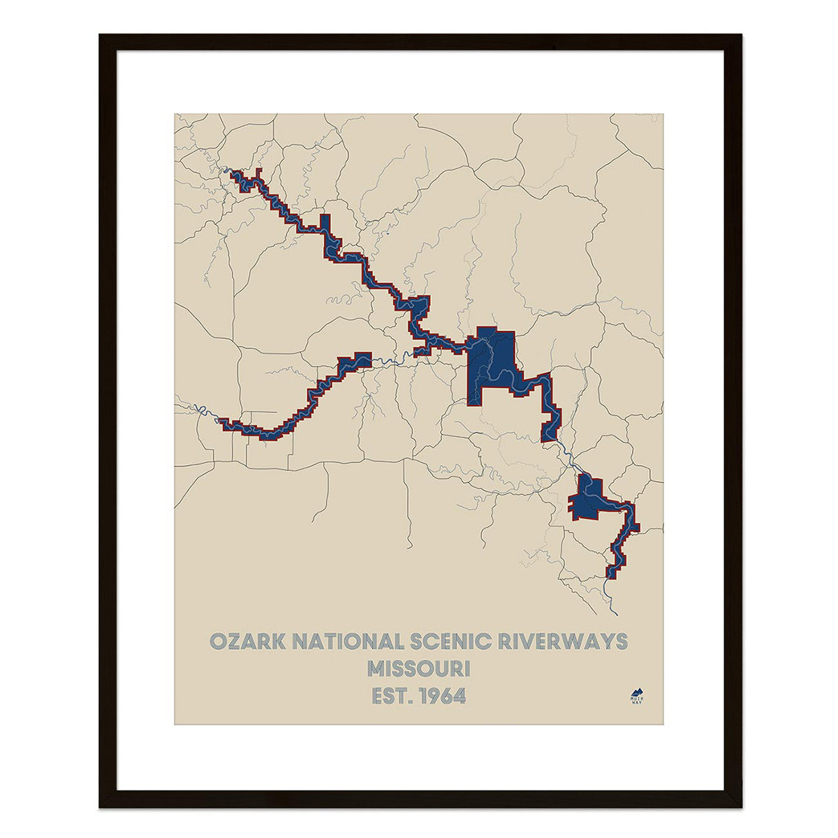
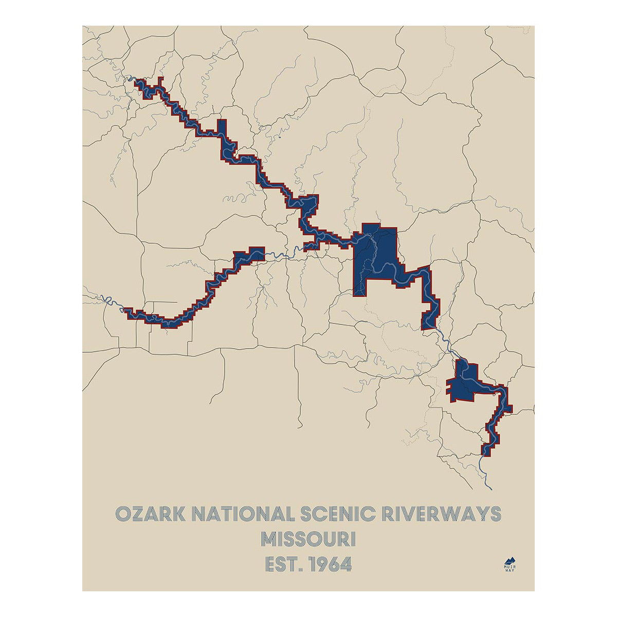
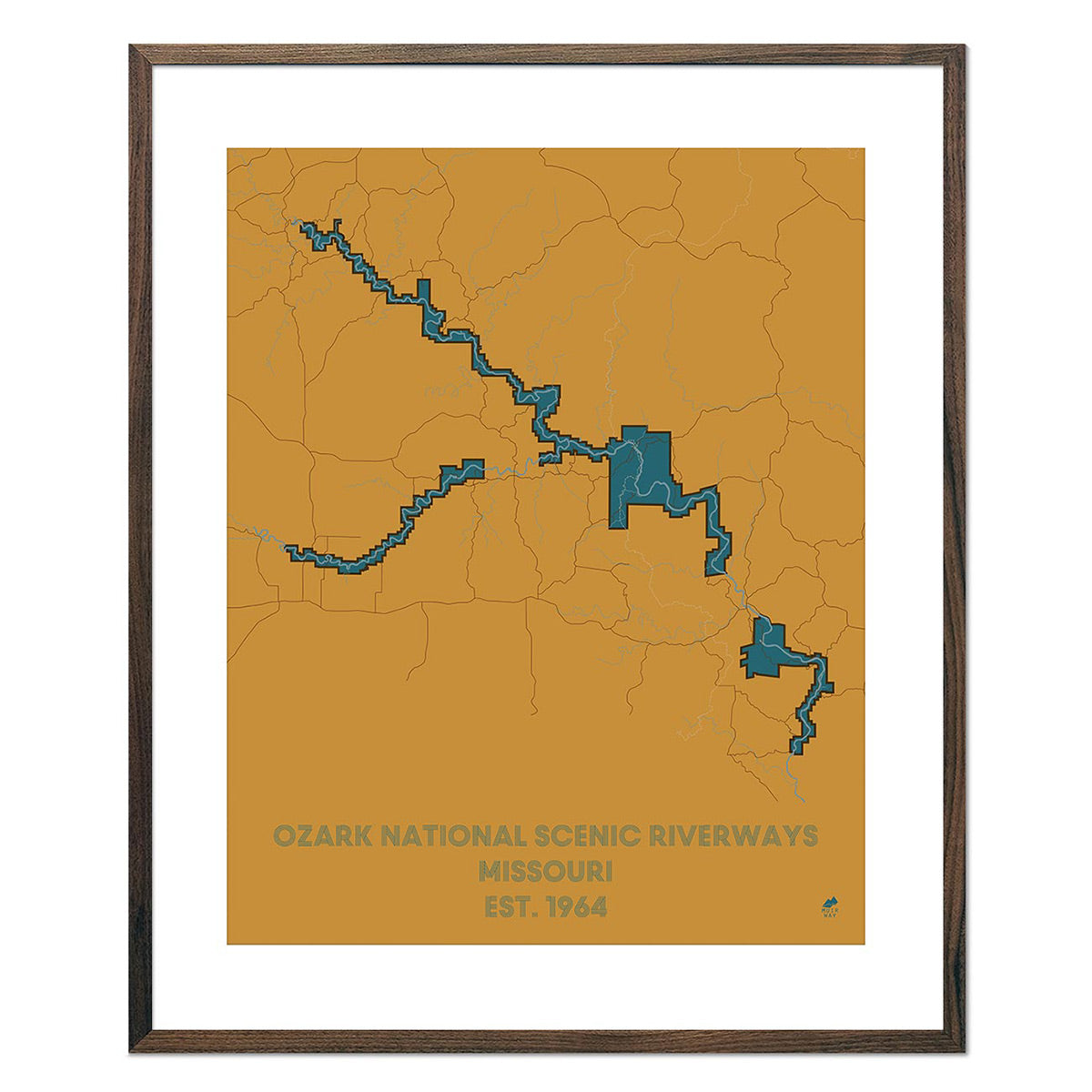
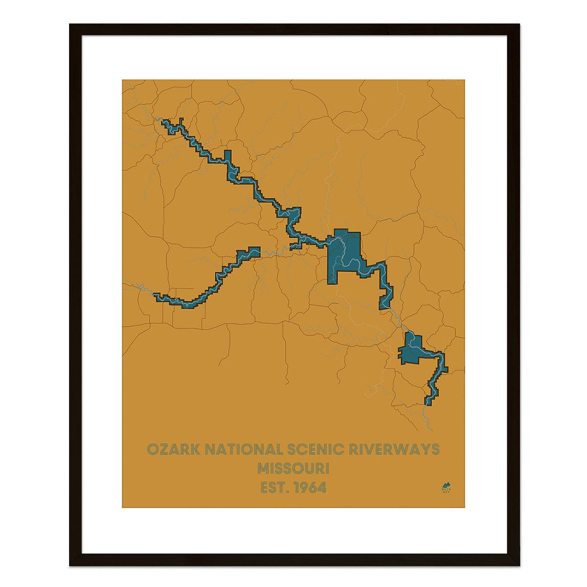
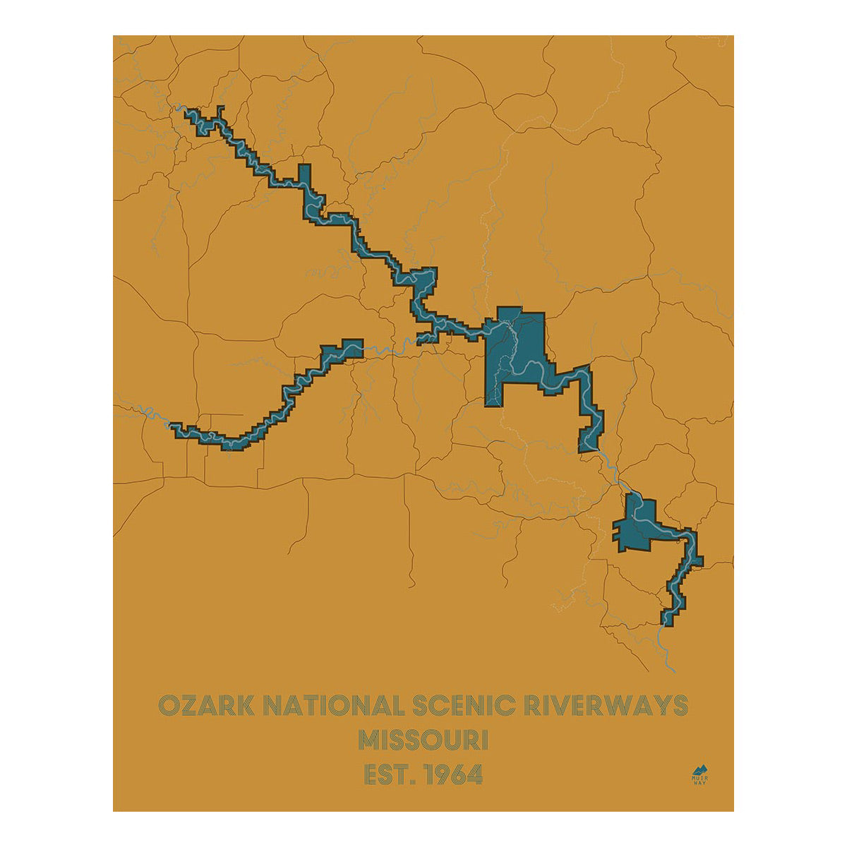
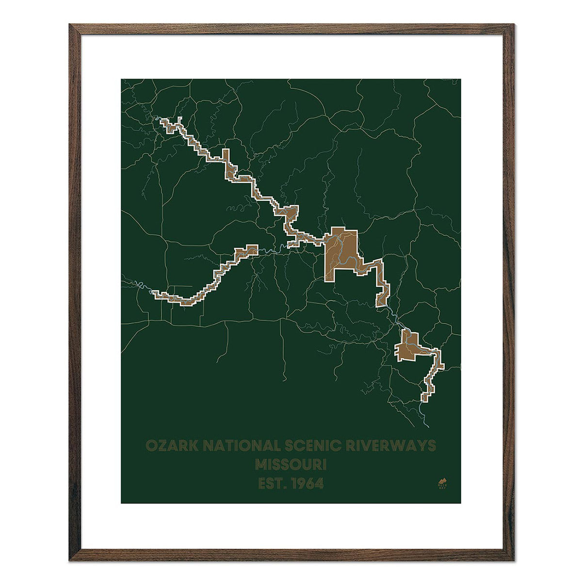
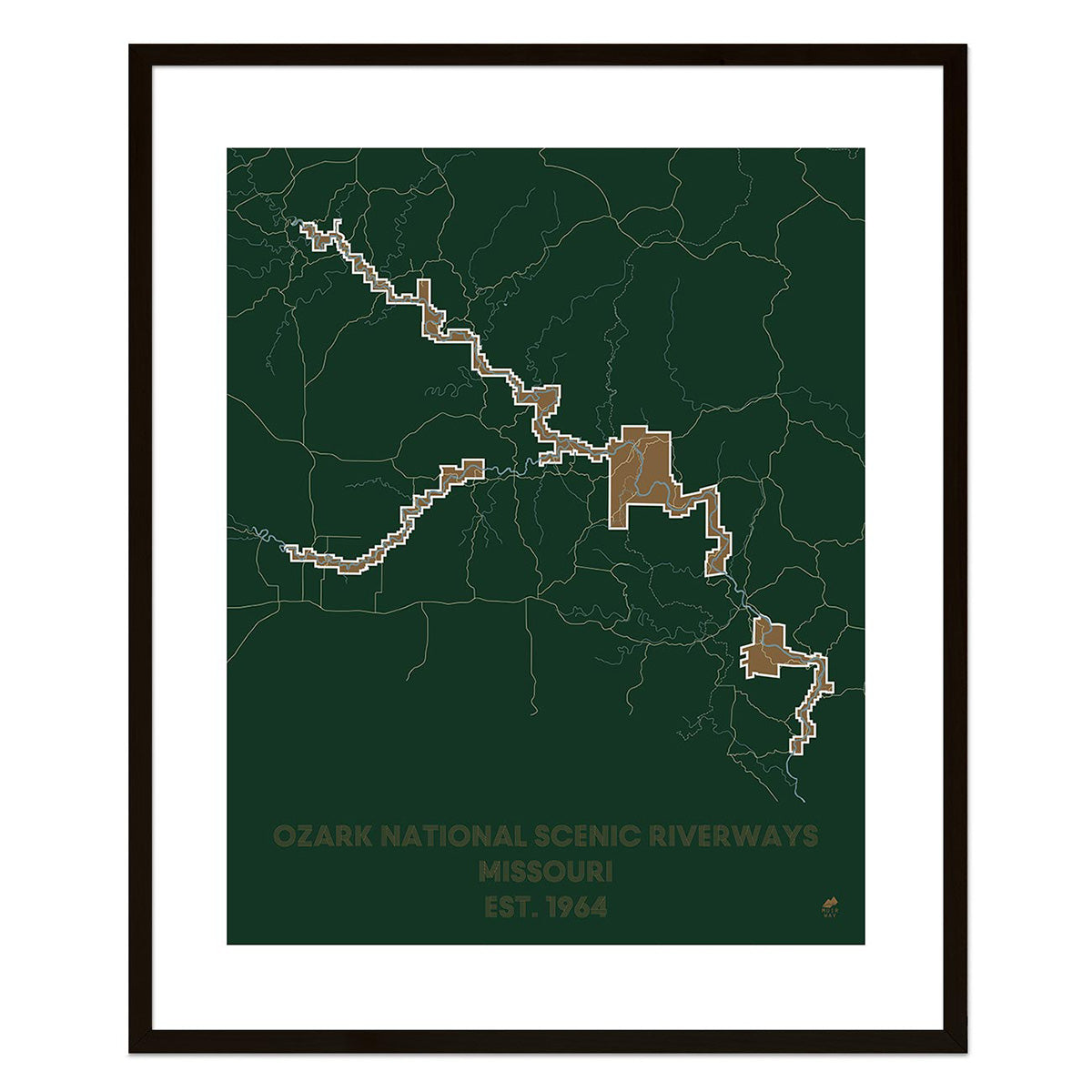
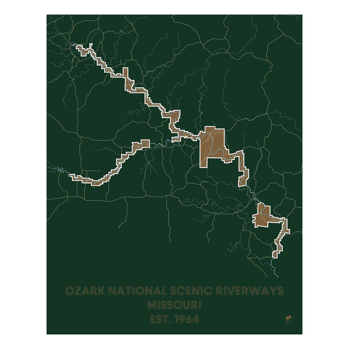
Missouri's largest geographical region is the Ozark Plateau. It's home to Missouri's tallest peak - Taum Sauk Mountain, as well as Lake of the Ozarks. You can find more detail on the Ozark National Scenic Riverways Map.
Missouri is known as 'Cave State' and is home to more than 6,000 caves! From mountains, to rivers, to plateaus and caves, Missouri is host to a variety of geological formations, all of which are enhanced by our custom made maps.
No matter which Missouri state map you choose, you’ll enjoy an up-close look at a state known for its sports, food, and culture.
What are the regions in Missouri?
Missouri is divided into four distinct geographical regions:
- Dissected Till Plains - Located north of the Missouri River, this region has rich soil for agriculture and is laced with rivers and streams. Spreading across Iowa, eastern Nebraska, and small areas of other states like Illinois, Minnesota and Kansas, the Dissected Till Plains is a region featuring mostly flat to rolling terrain and provides fertile farming land in Missouri for corn.
- Mississippi Alluvial Plains - This region’s farmland produces cotton, soybeans and rice. Once swampy and shaped by water, the Mississippi Alluvial Plains region in Missouri has been drained and is now fertile soil for crops.
- Osage Plains - Stretching across west-central Missouri into Kansas, Oklahoma and Texas, this southernmost tallgrass prairie consists of three subregions – The Osage Plains proper, the Flint Hills, and the Blackland Prairies and Crosstimbers.
- Ozark Plateau - This region of Missouri covers the largest area of the state in the southwestern corner and is known for its springs, lakes, and clear rivers. It is also home to the St. Francois Mountains (including Missouri’s highest peak, Taum Sauk Mountain), and is the most rugged area of the state.
If you like our collection of Missouri maps, you may also be interested in maps of other Midwest states. Click below to browse:


