


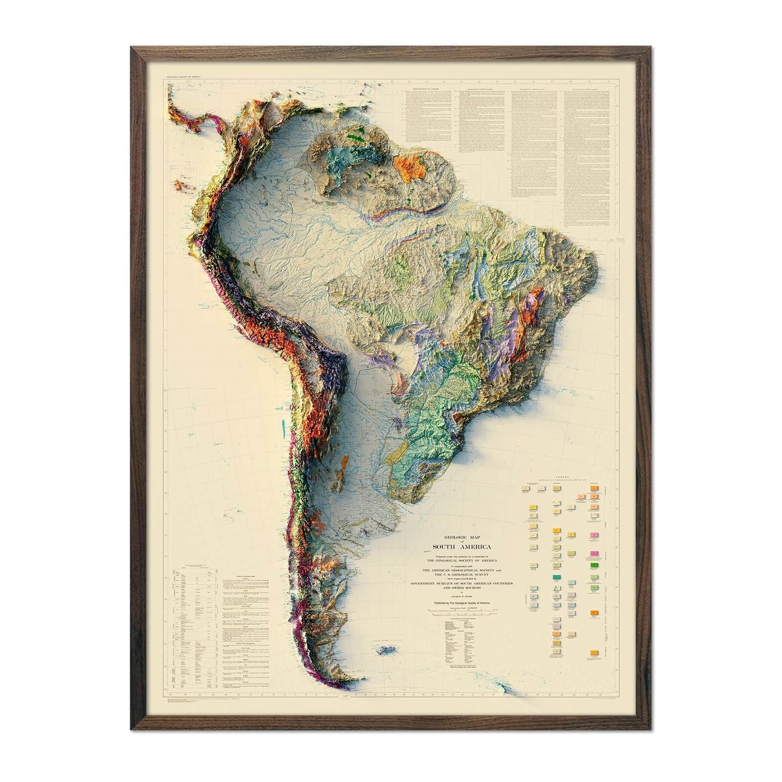
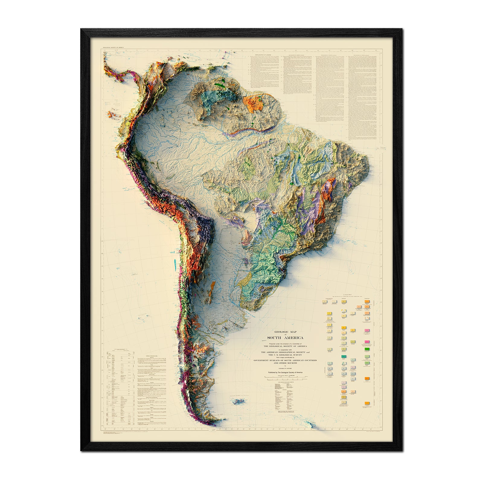
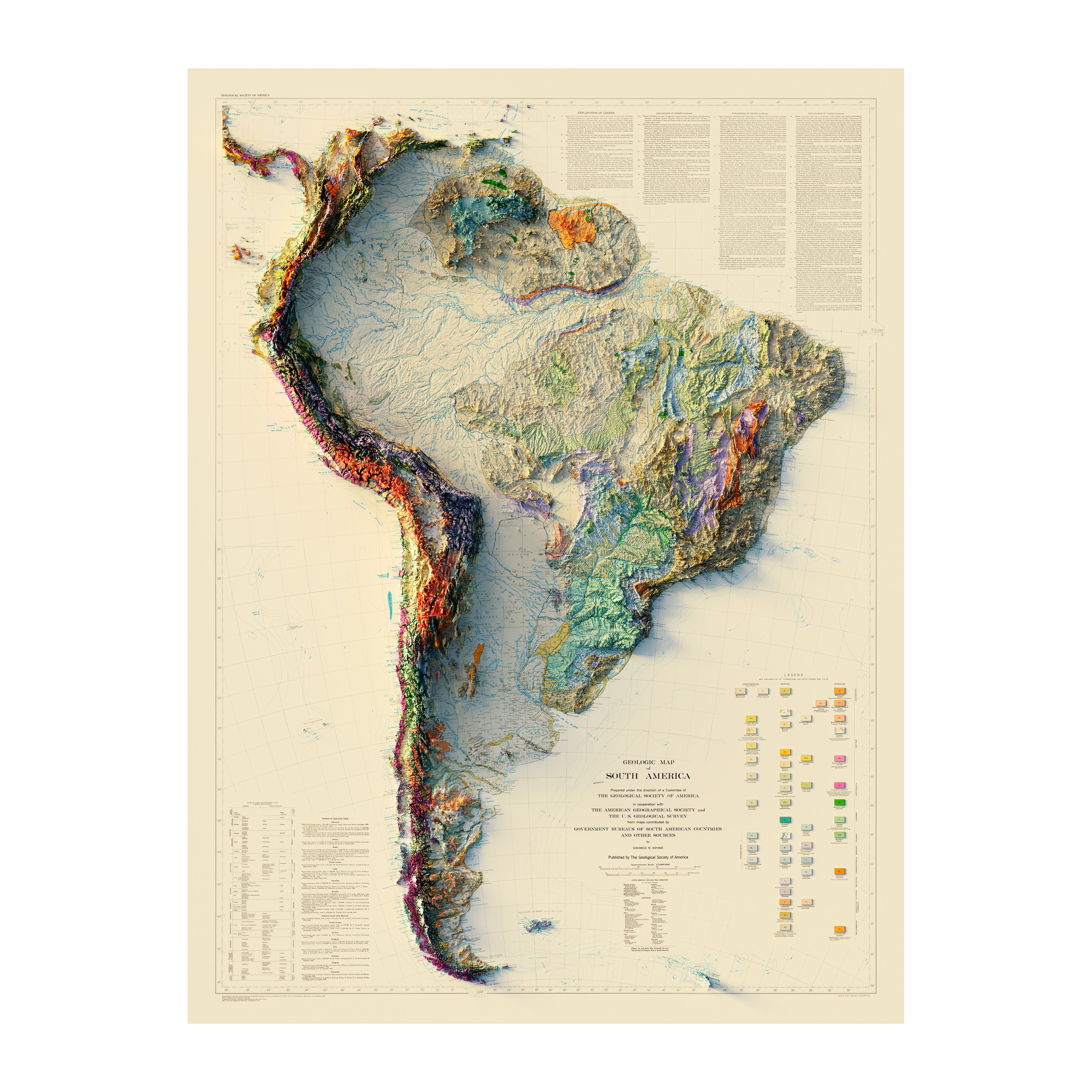
South America
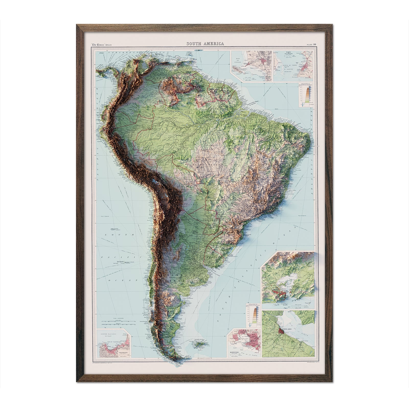
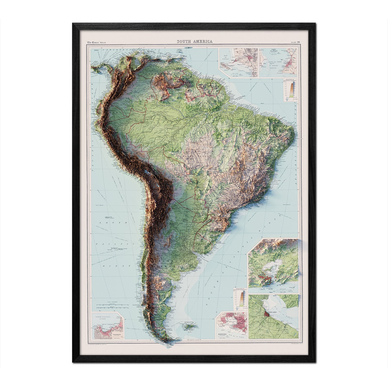
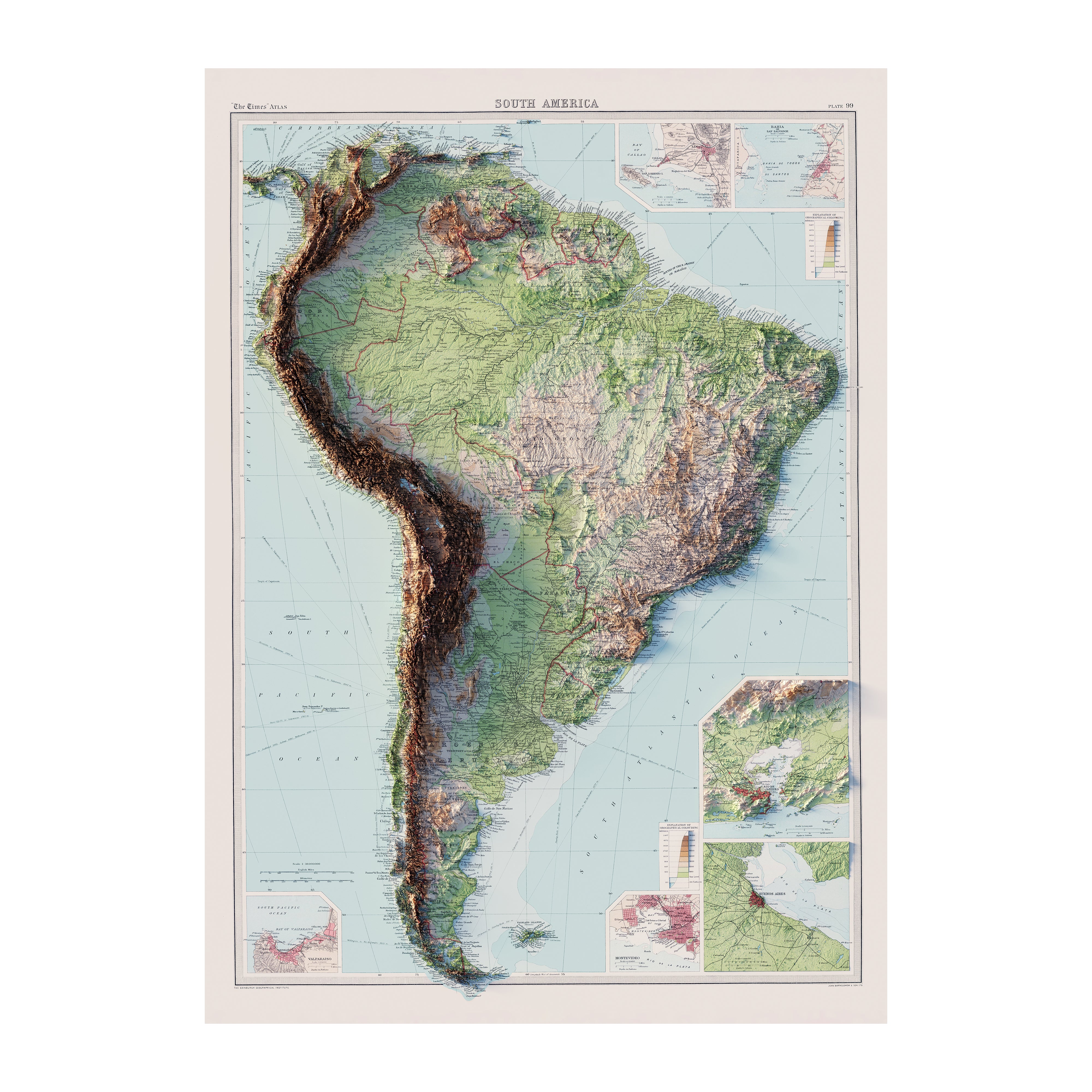


Shaded Relief & Hydrological Maps Prints of South America
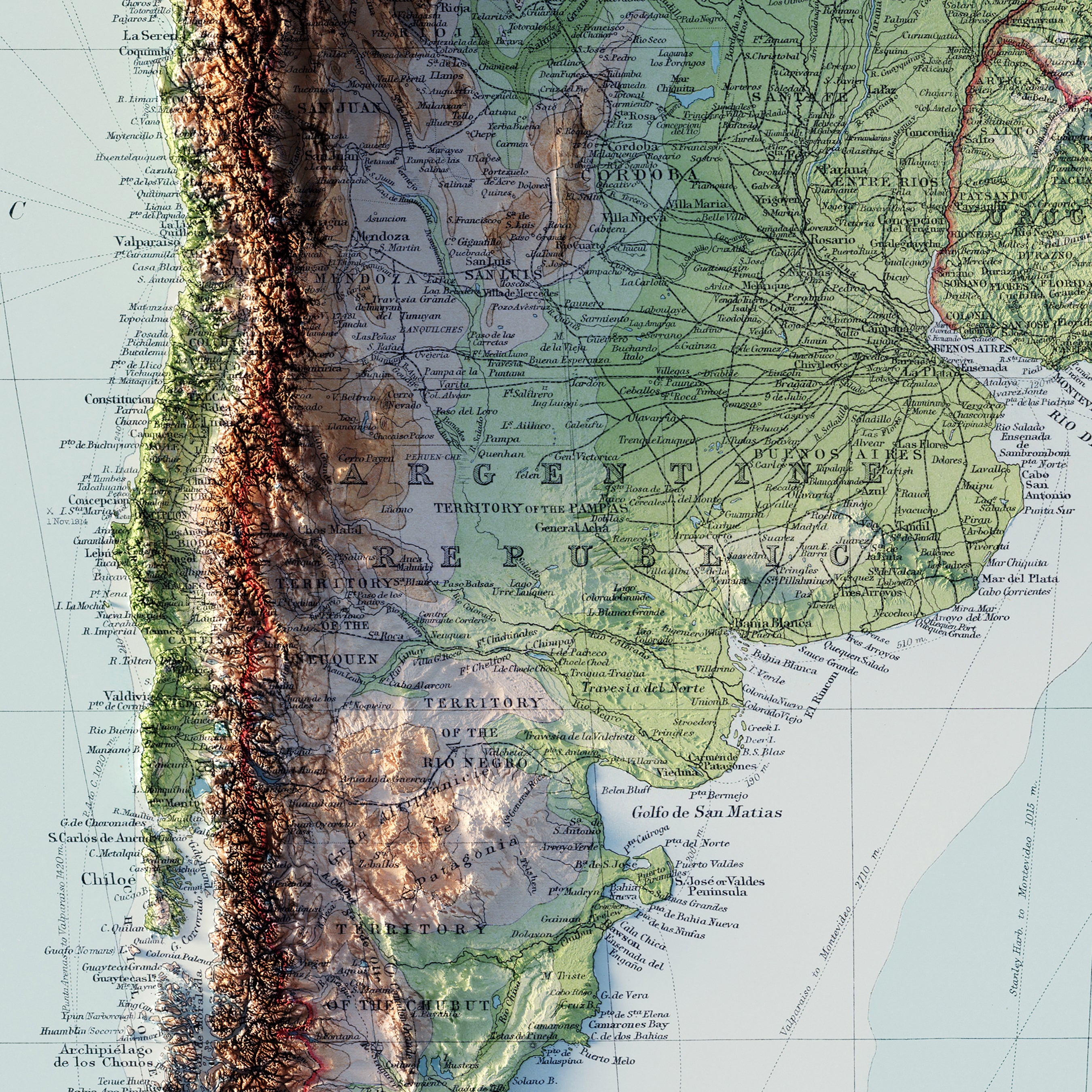
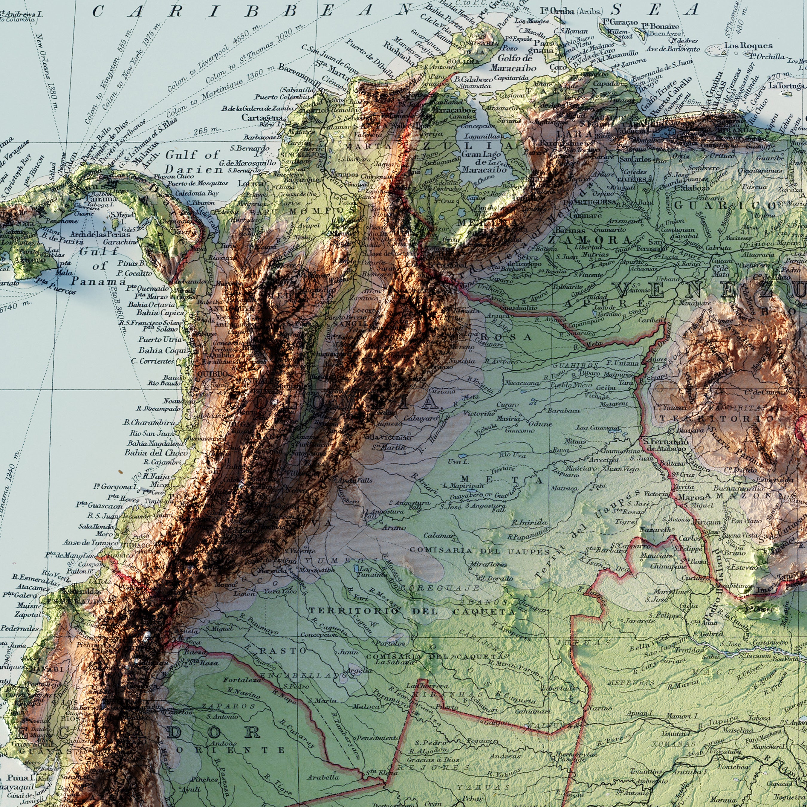
South America boasts a rich tapestry of topographical features that have fascinated travelers worldwide for centuries. Our fine collection of South America shaded relief and hydrological maps capture the rich and diverse landscape of the world's fourth-largest continent.
Muir Way map prints offer stunning detailed displays of South American landscape, including mountain ranges, valleys, plateaus, rainforests, rivers, basins, and deserts.
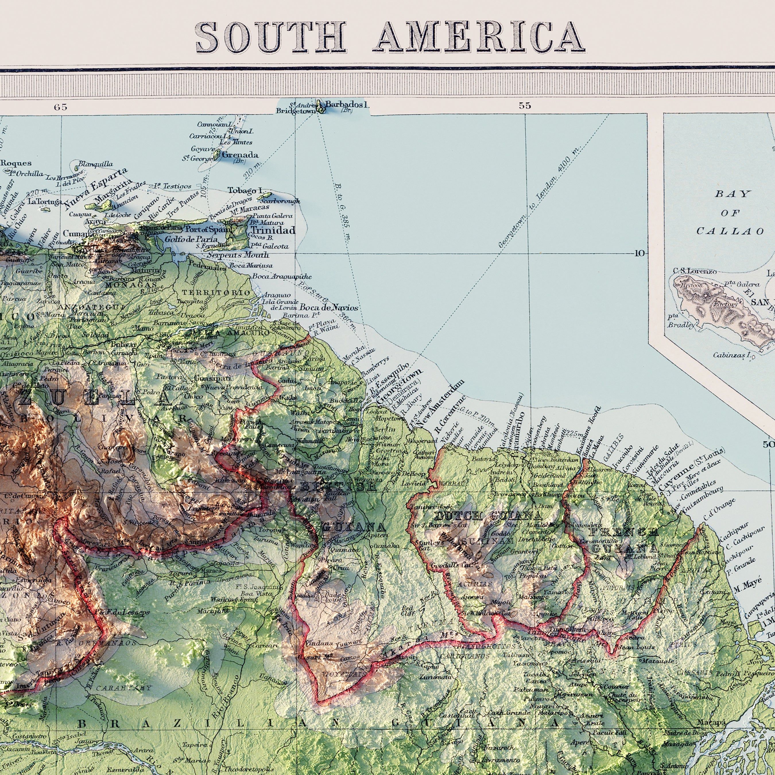
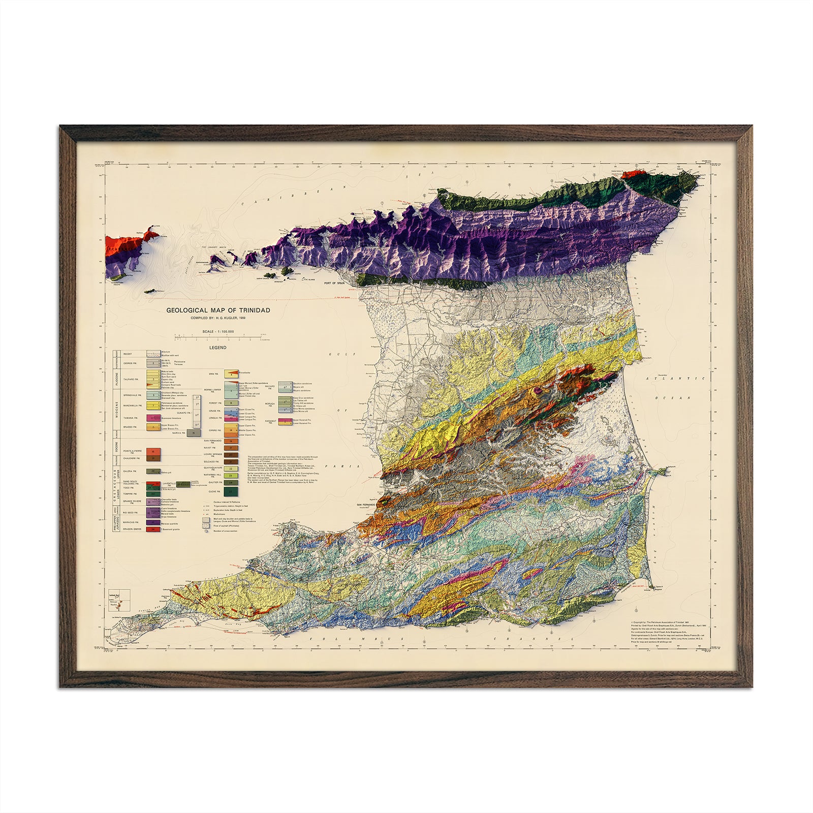
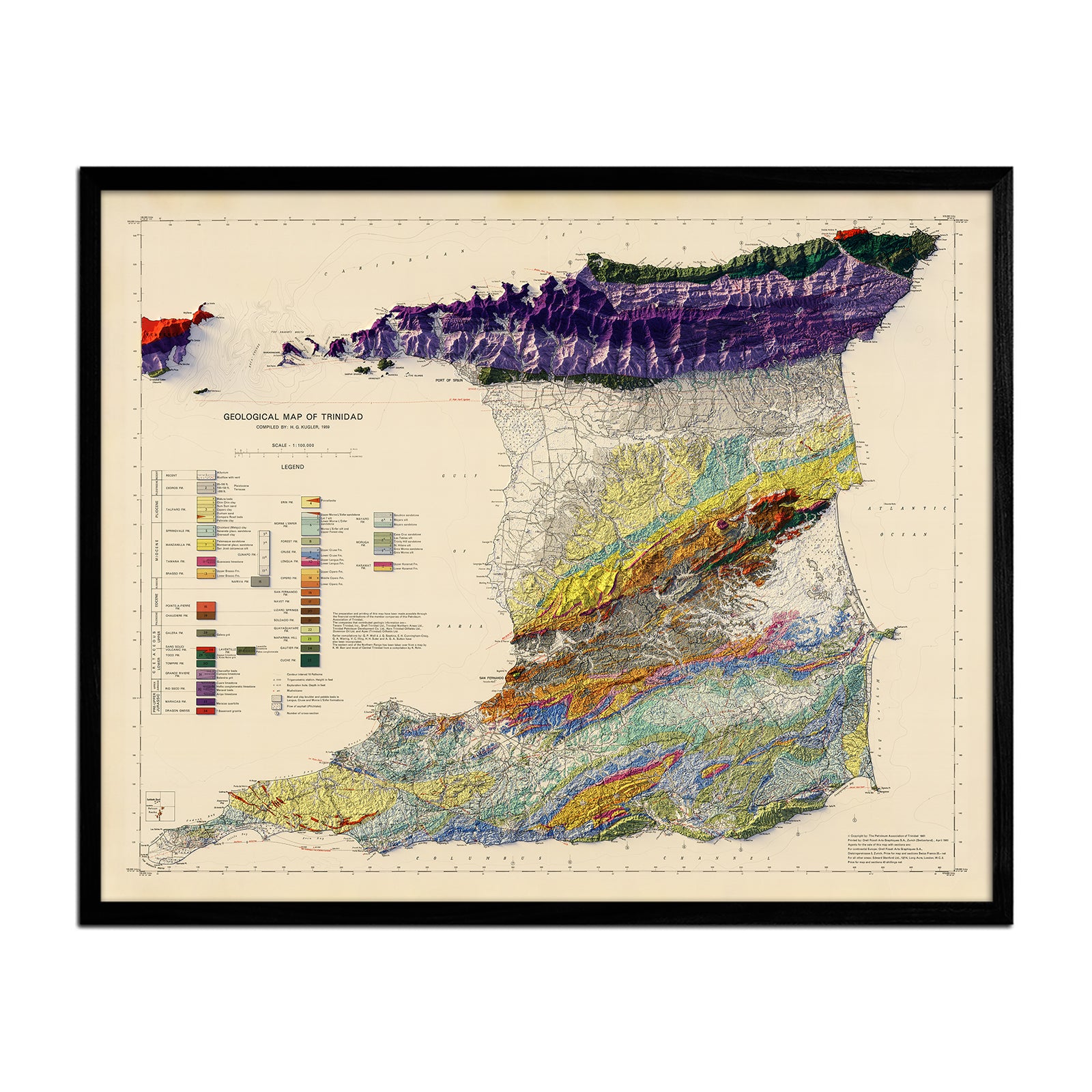
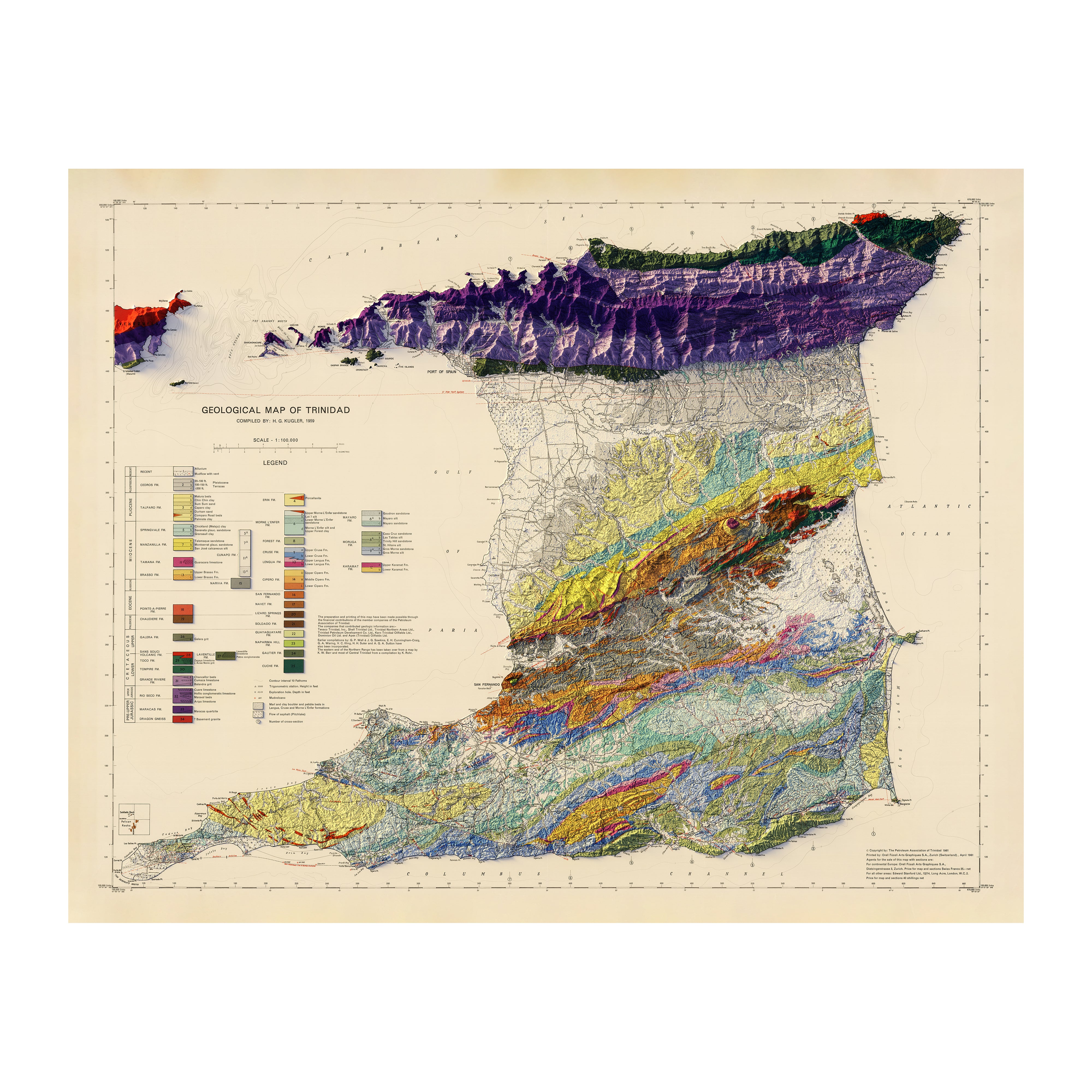
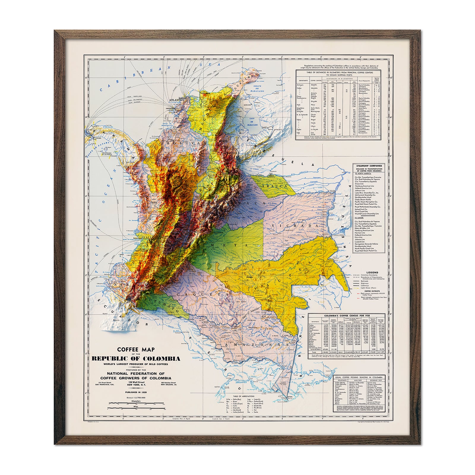
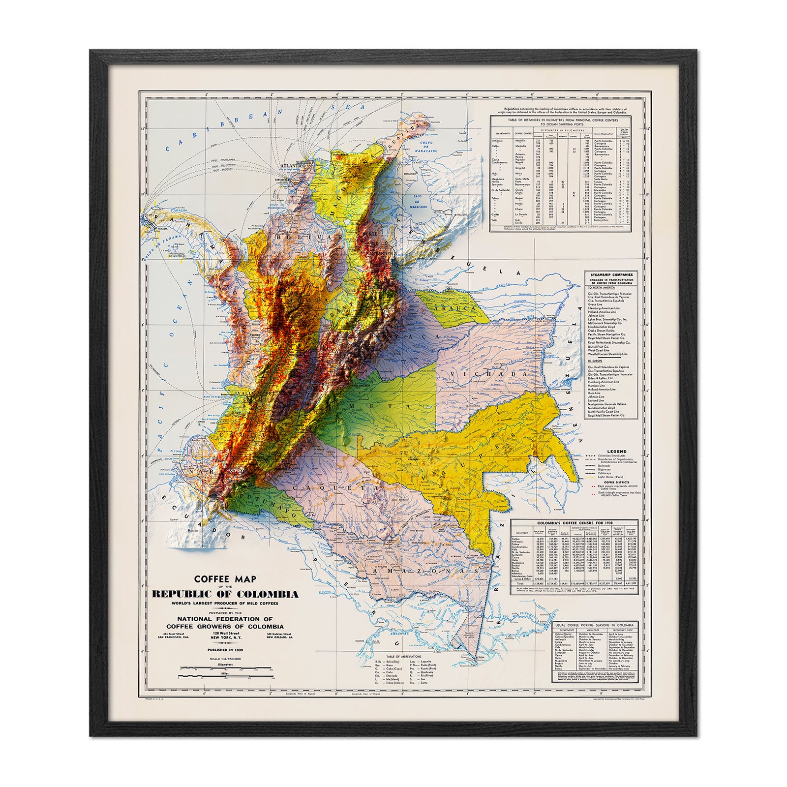
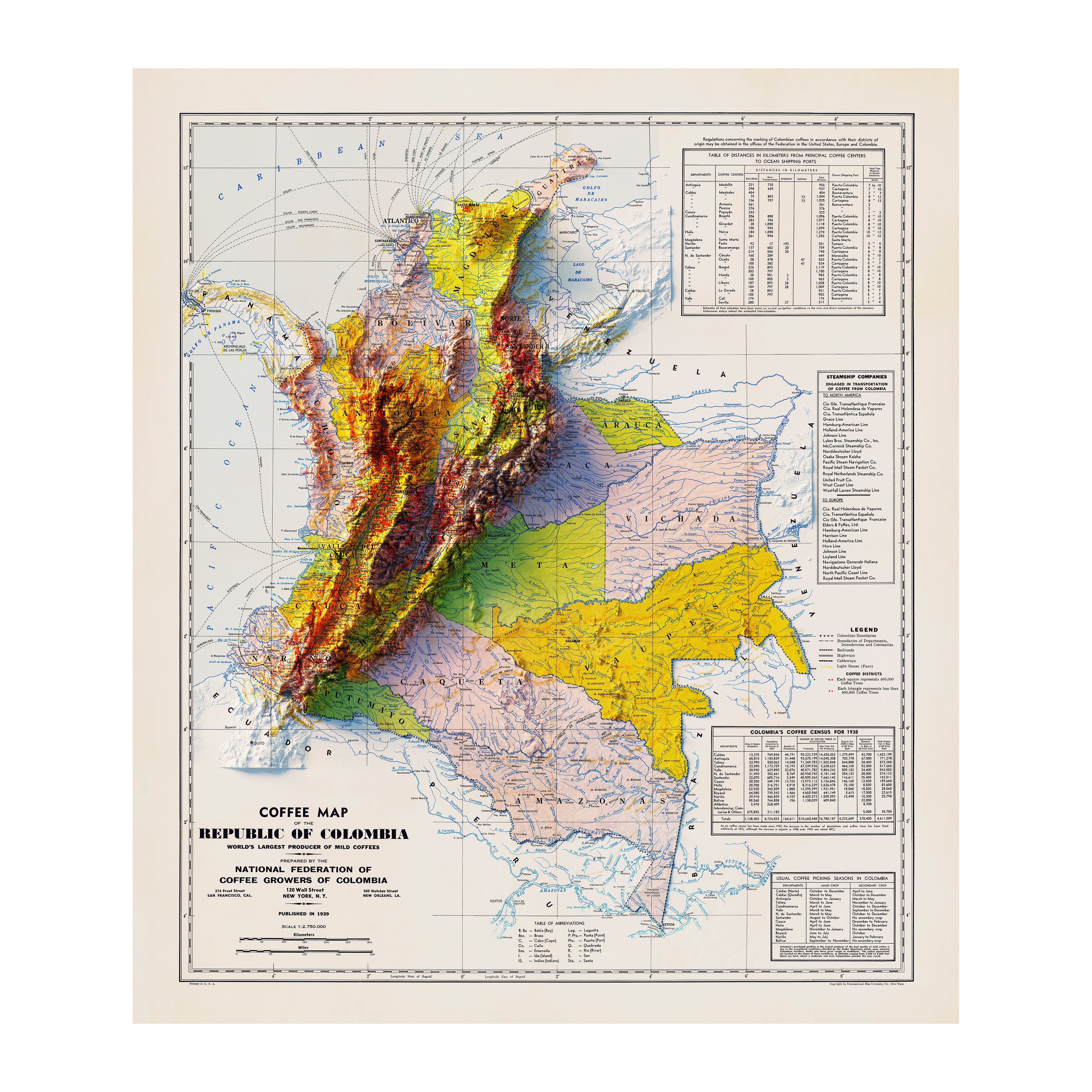
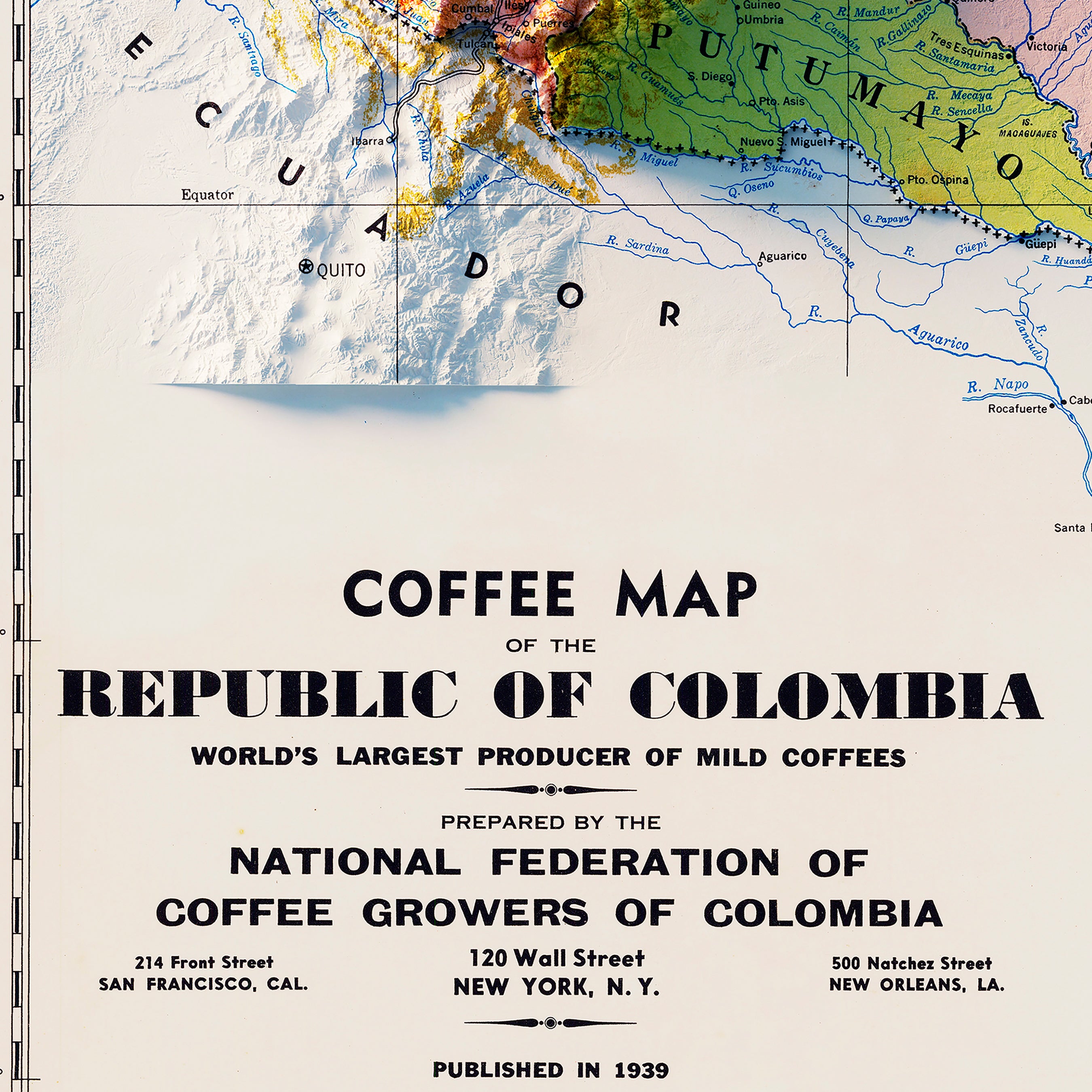
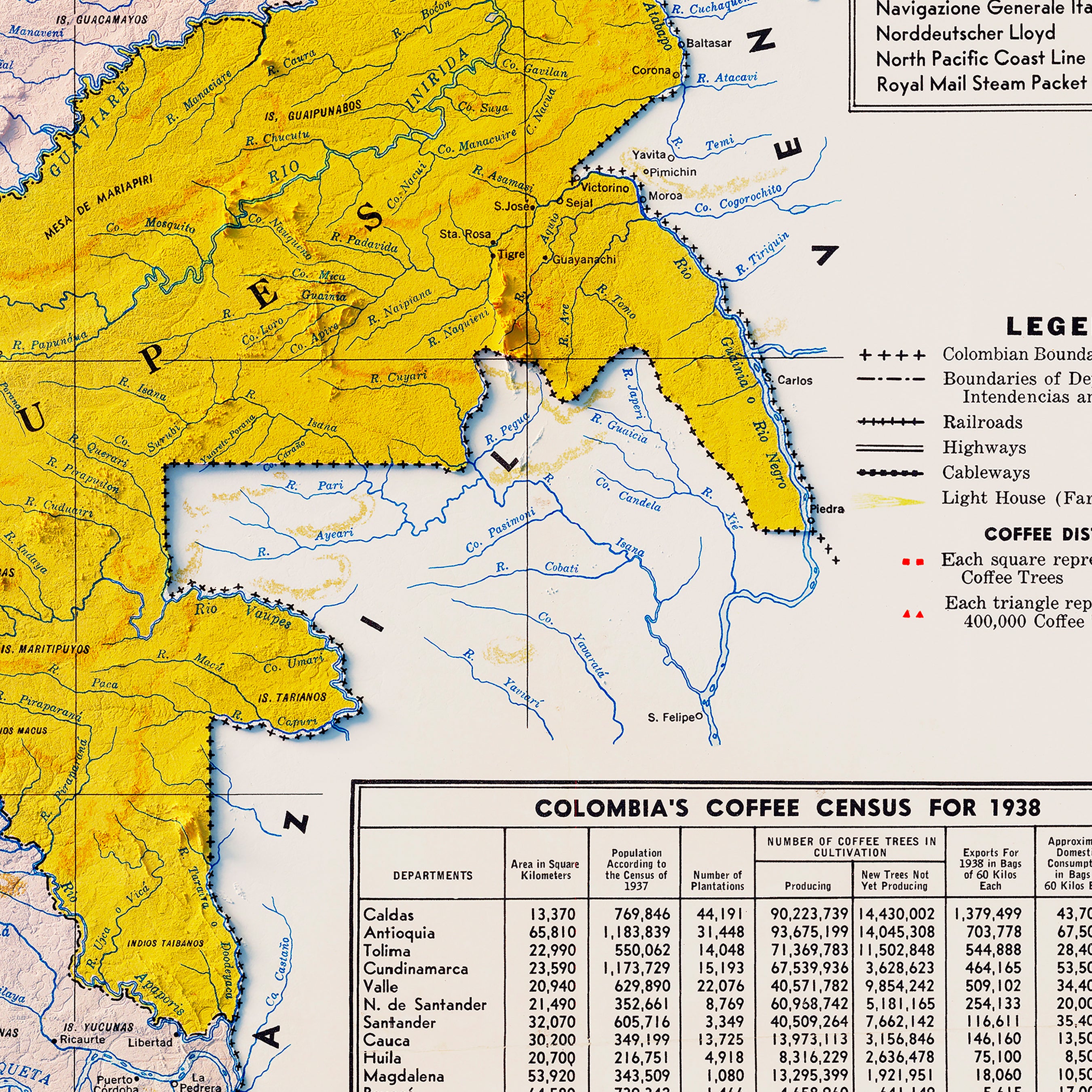
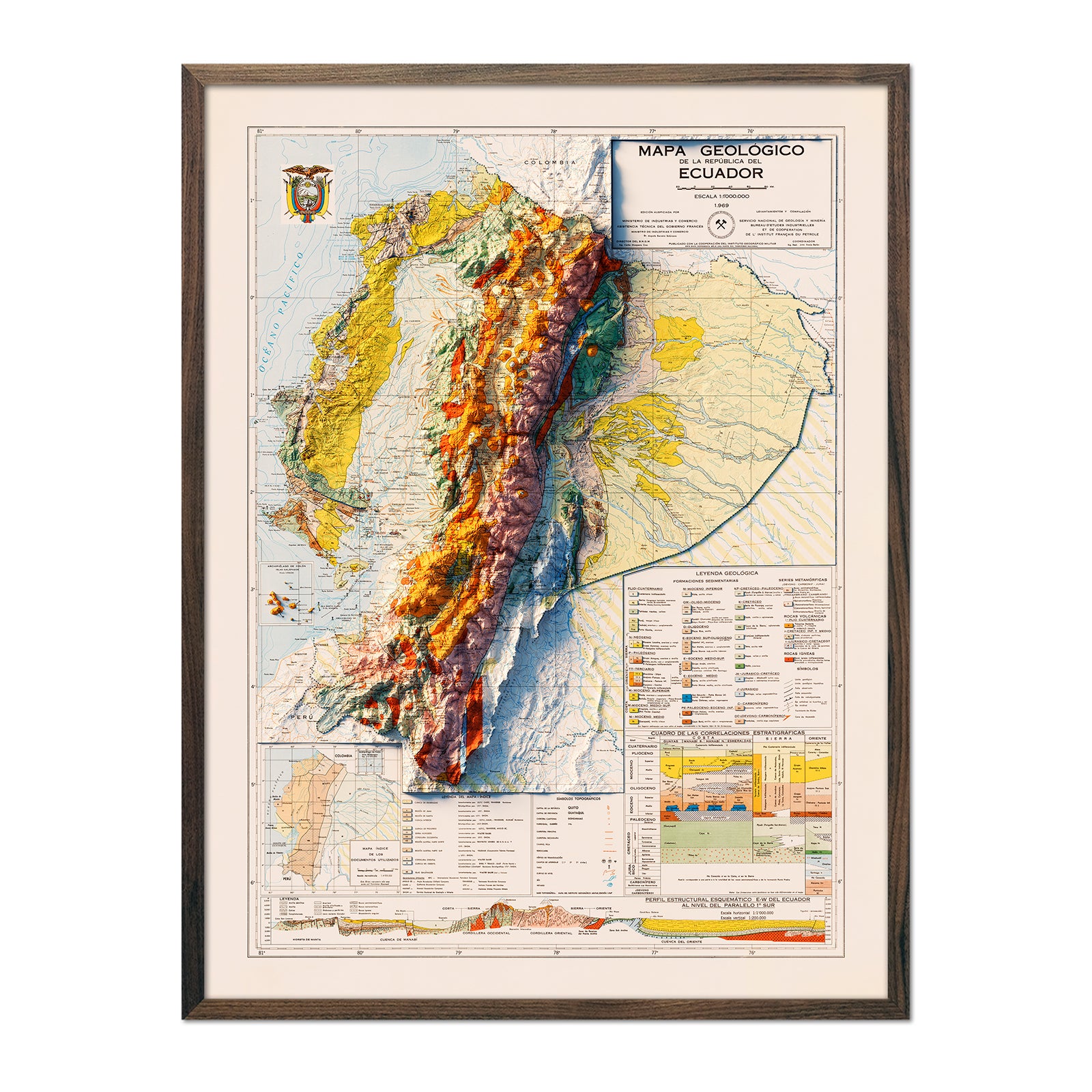
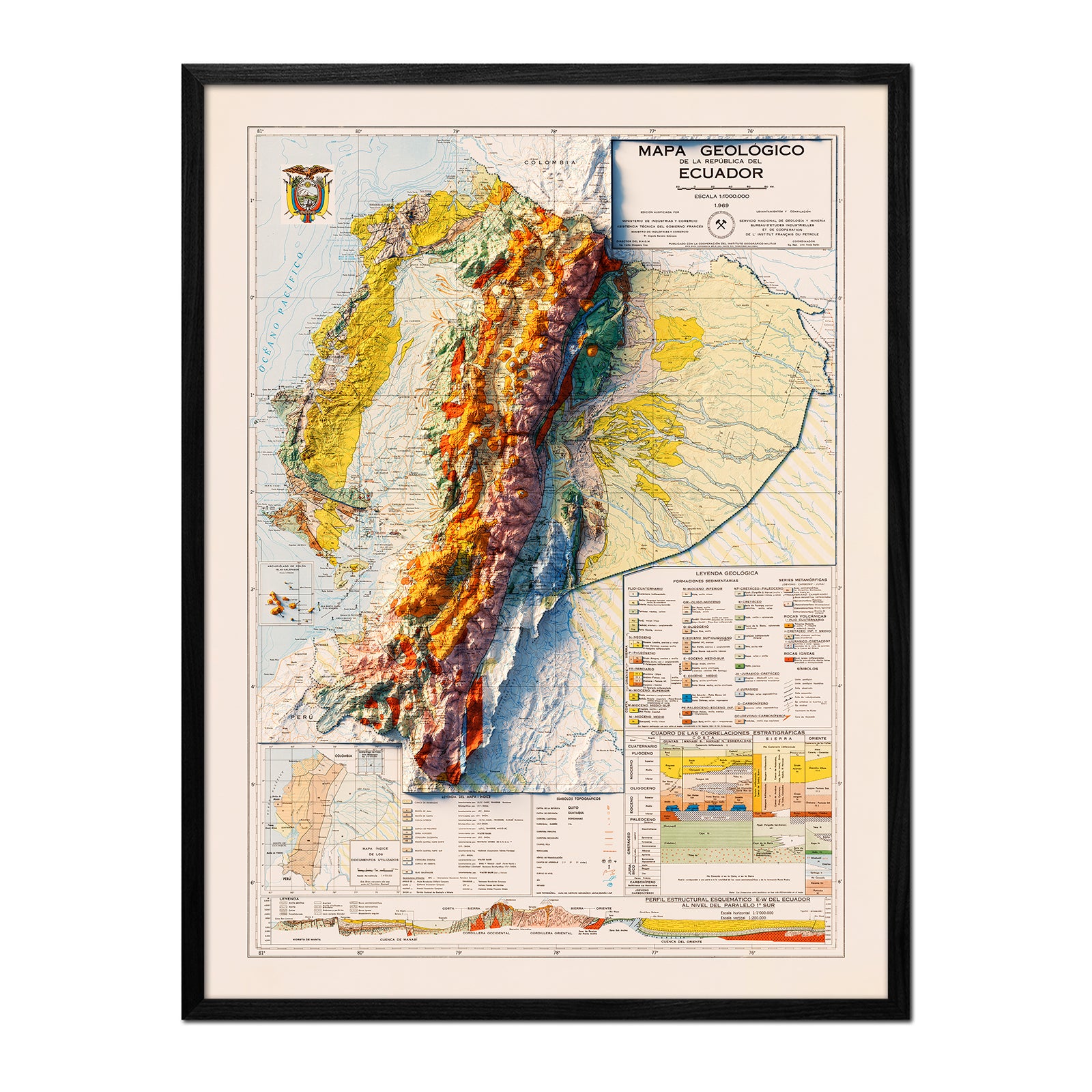
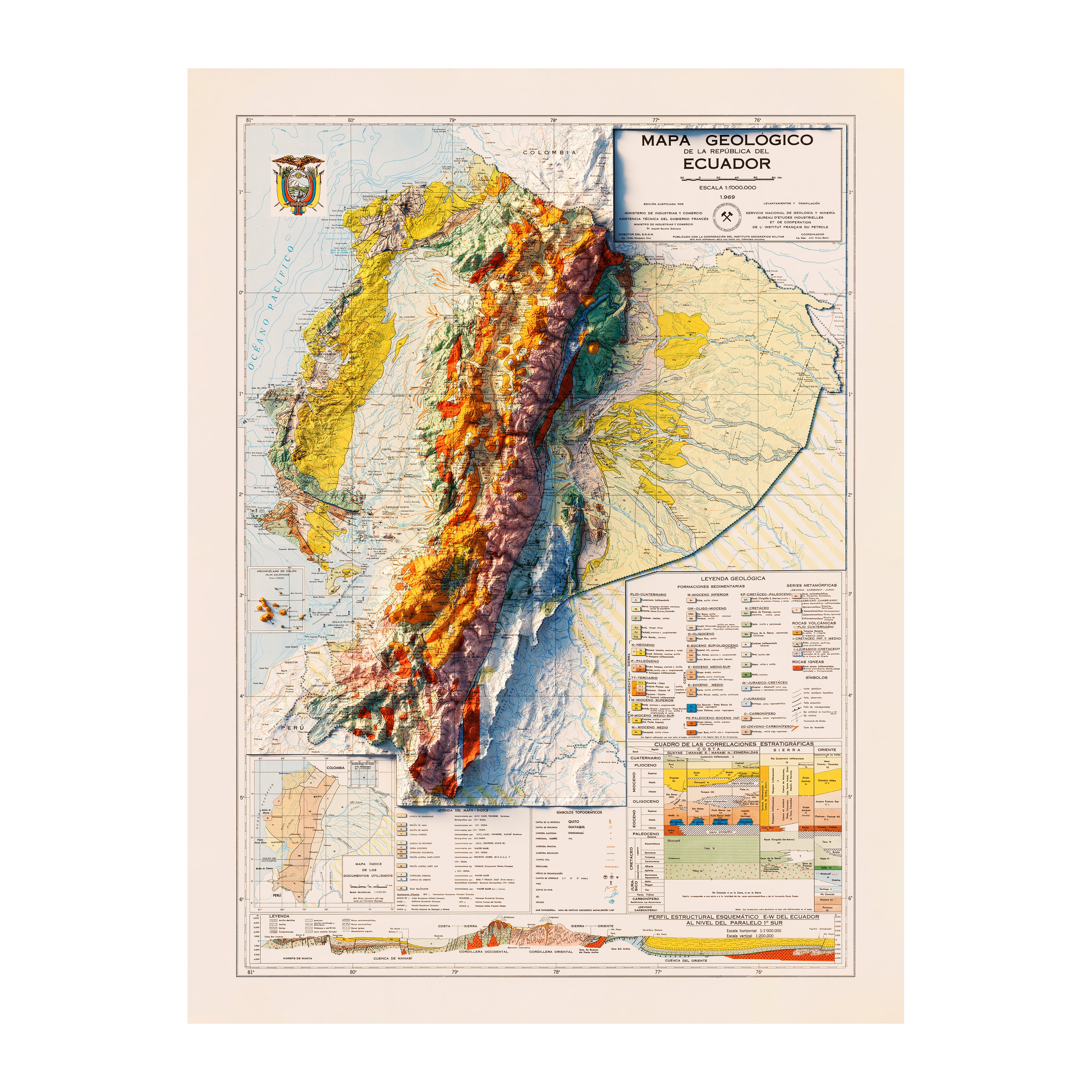
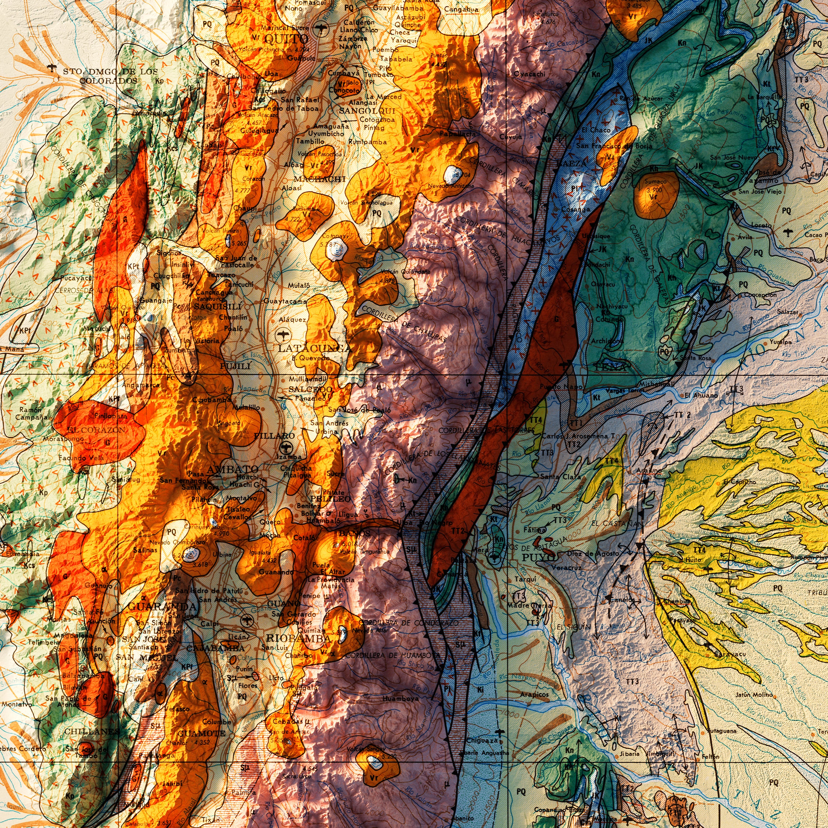
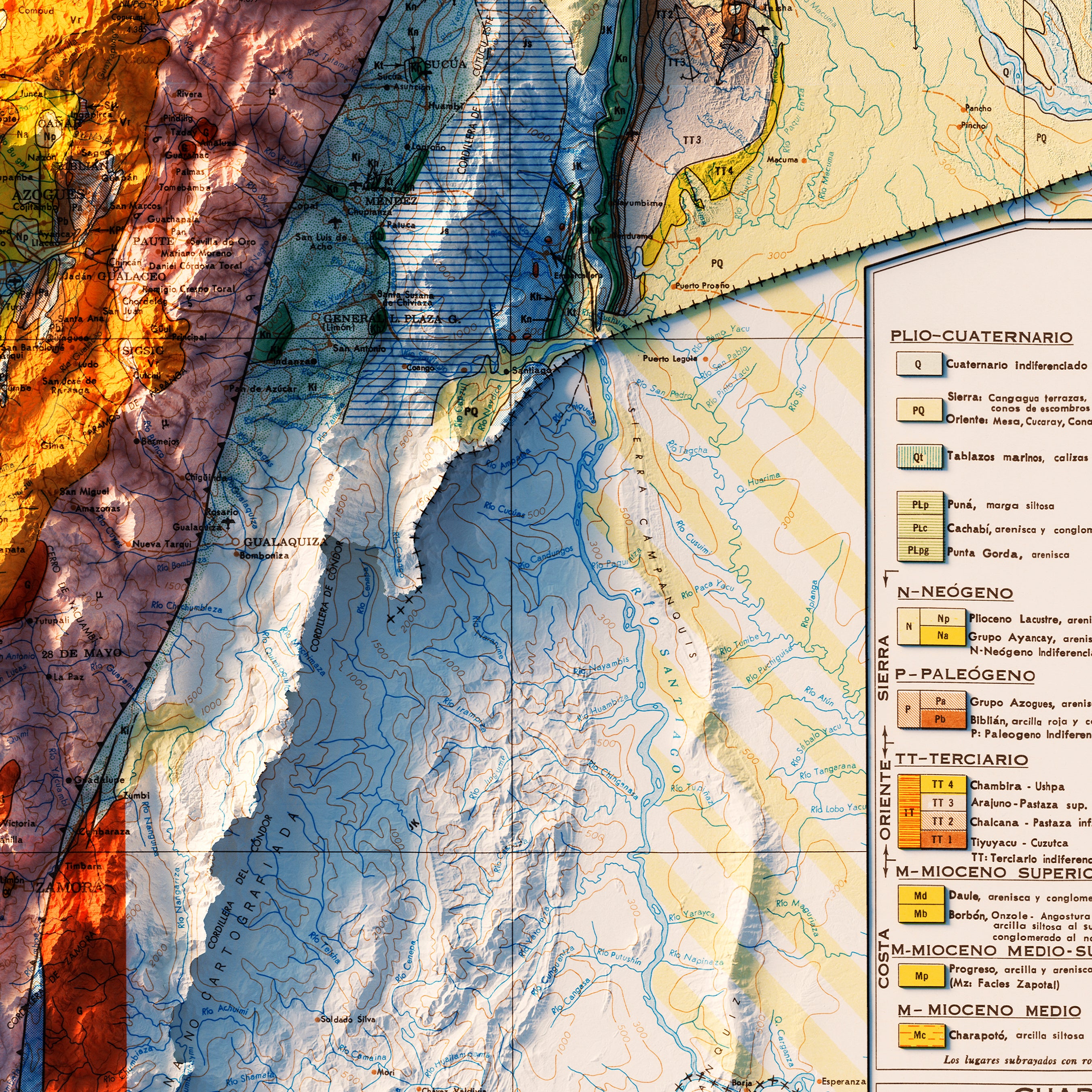
Take in world-famous highlights, such as the Andean Mountain Range, Brazilian Highlands, Amazon Basin and River, Patagonian Desert, and Tierra del Fuego, as well as notable cities and countries, including Brazil, Trinidad, Argentina, Ecuador, and even the Colombian coffee region.
Travel Back in Time with our Vintage Shaded Relief Maps of South America
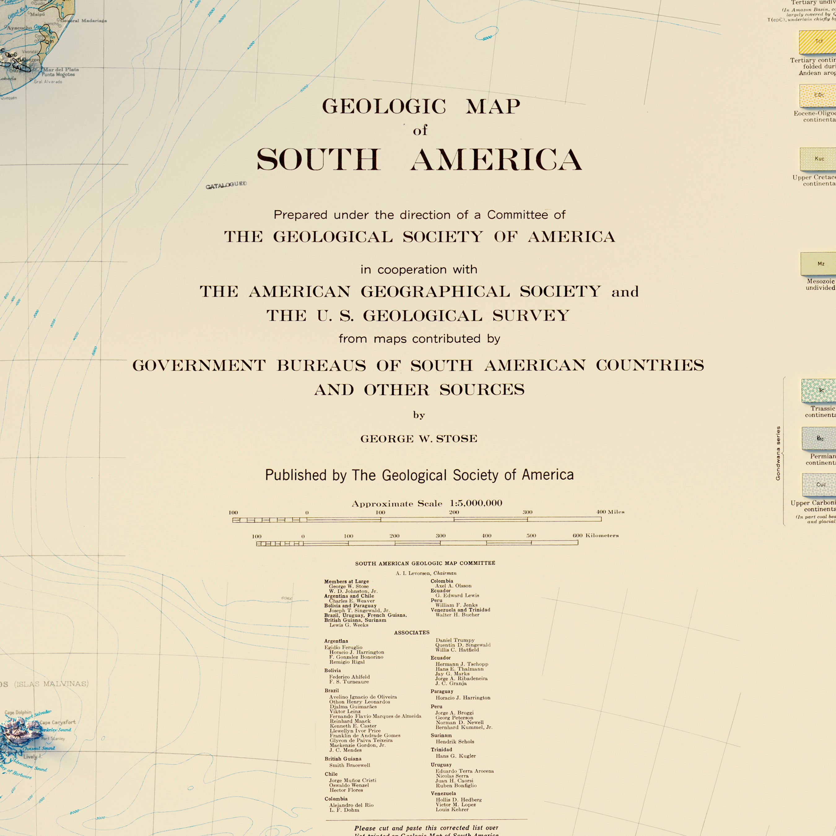
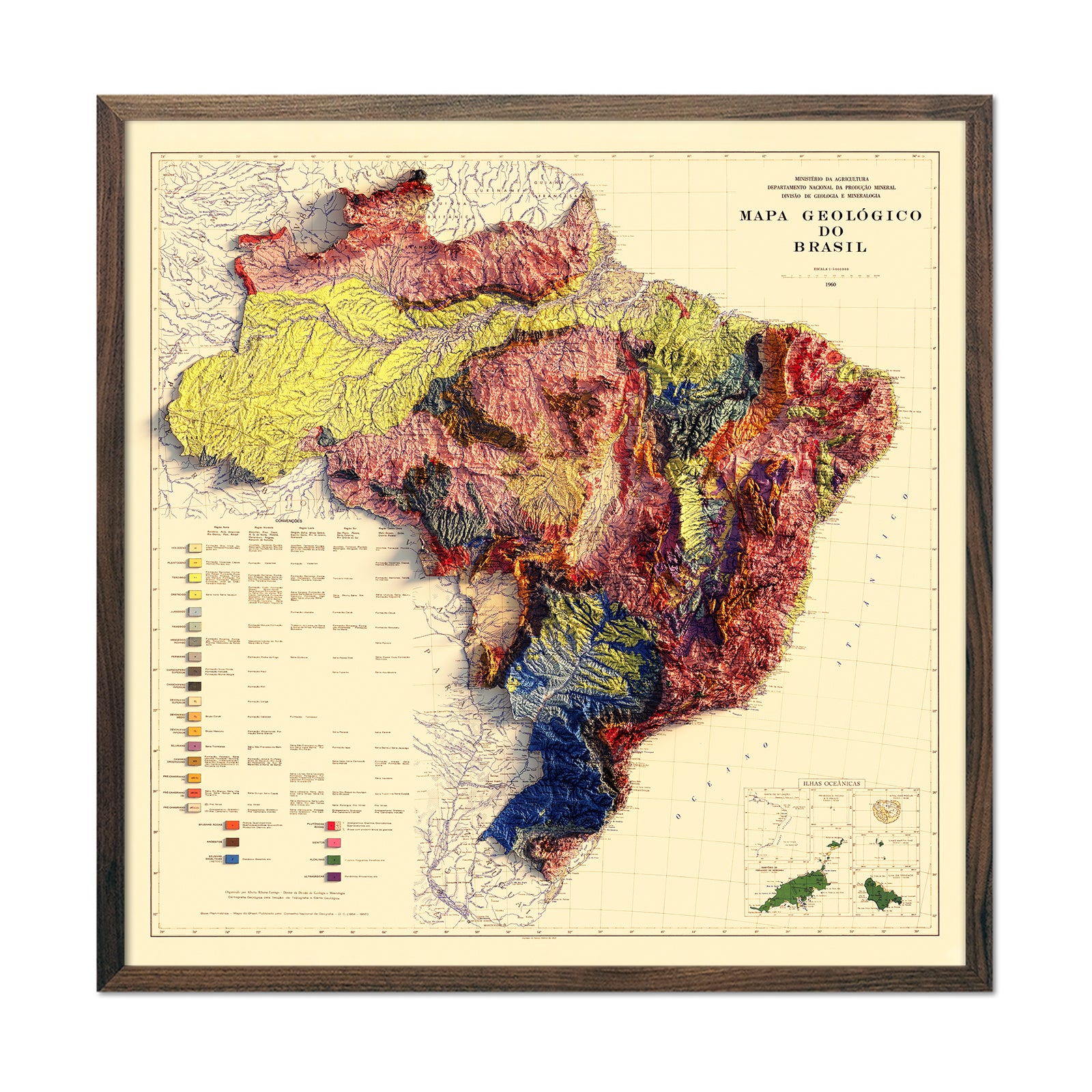
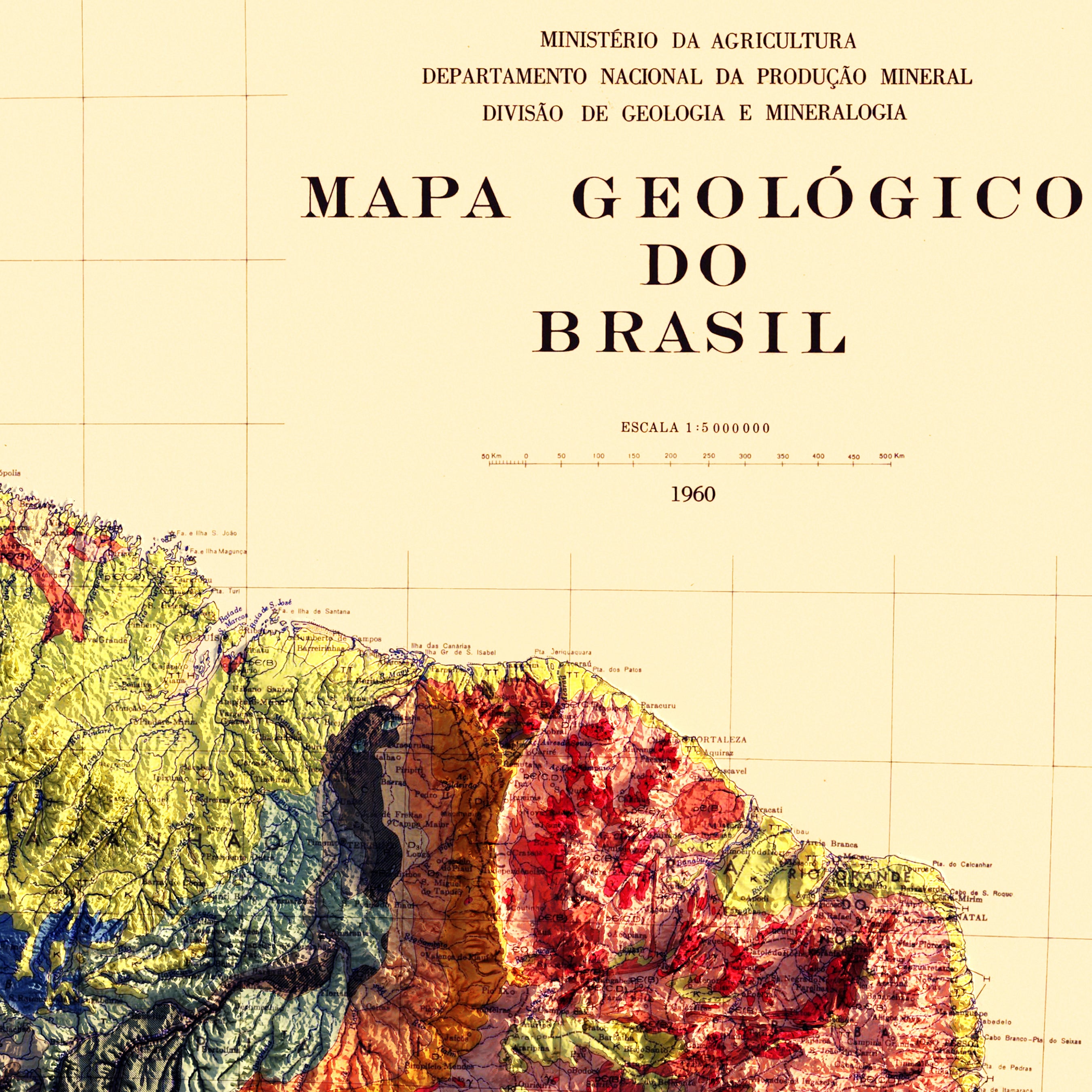
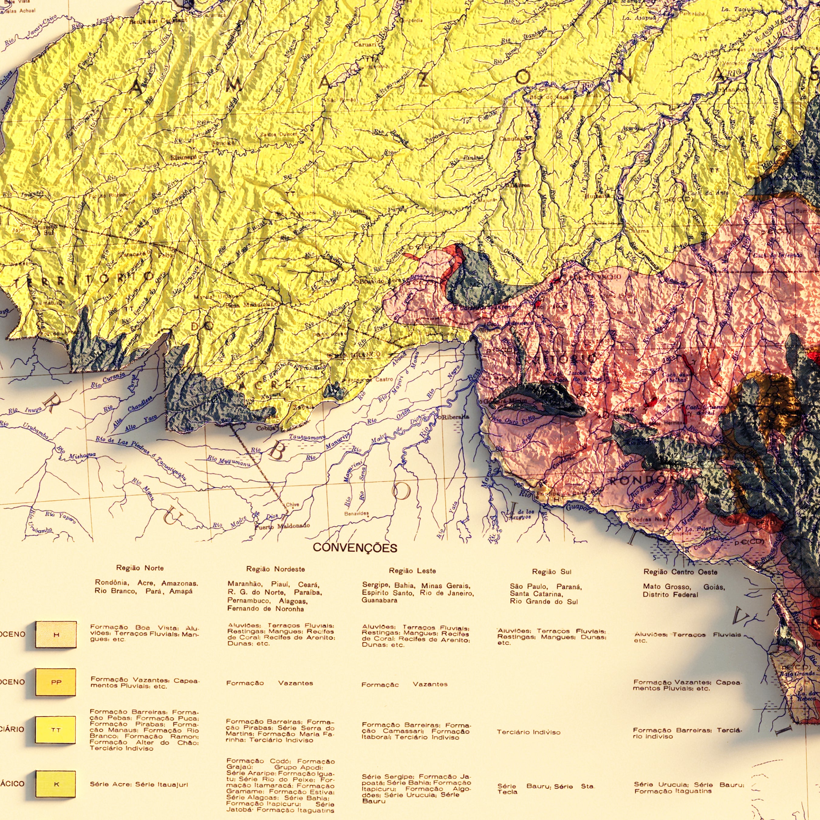
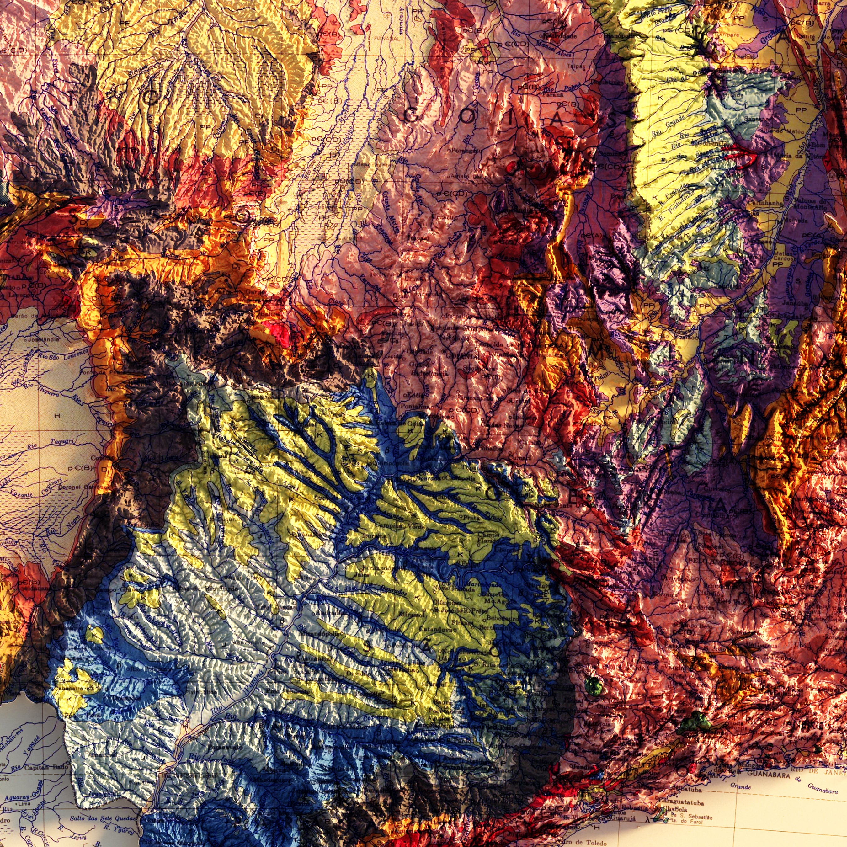
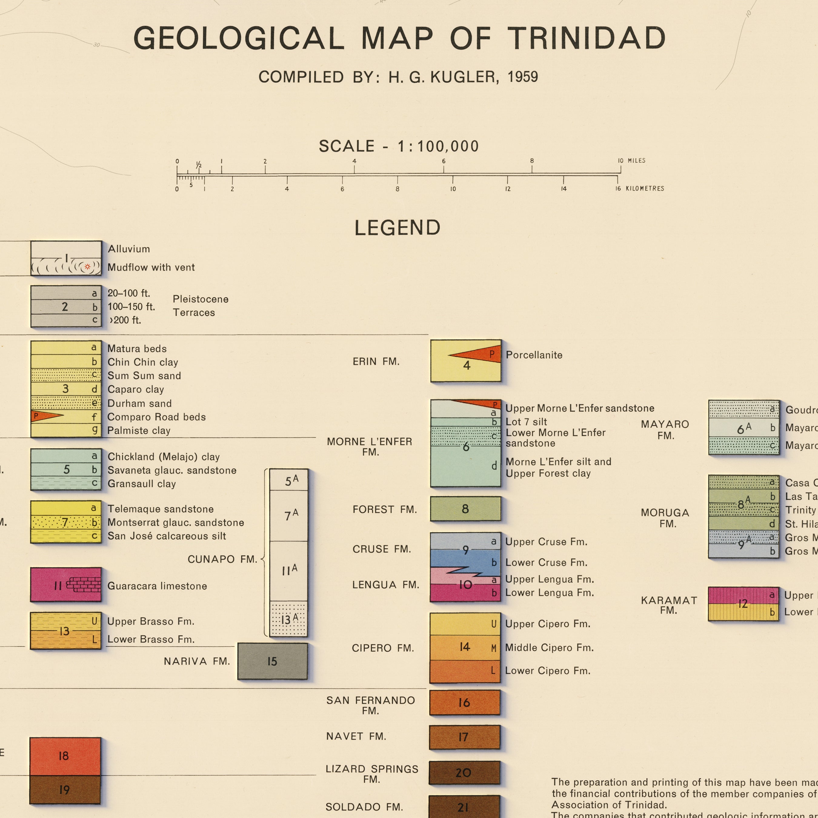
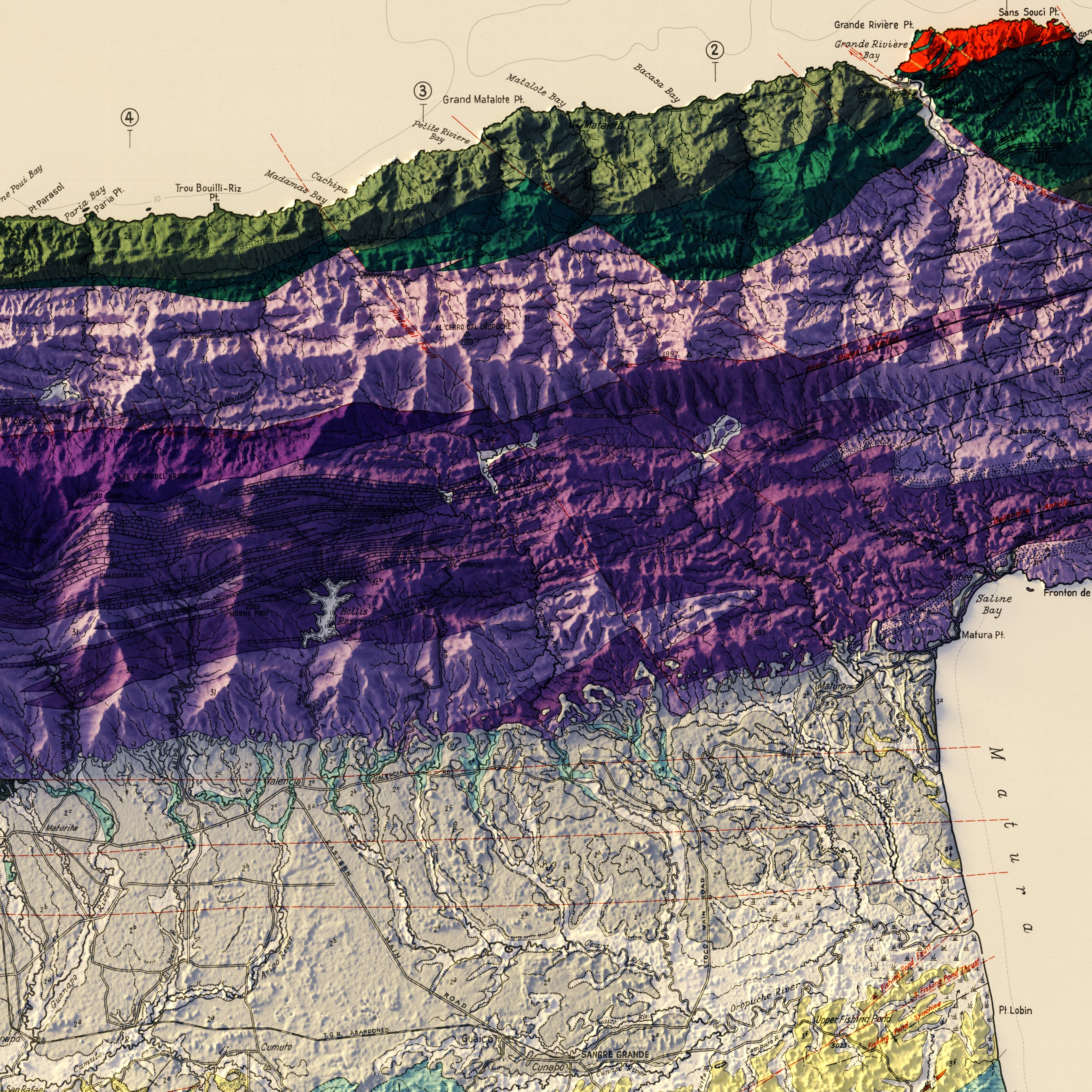
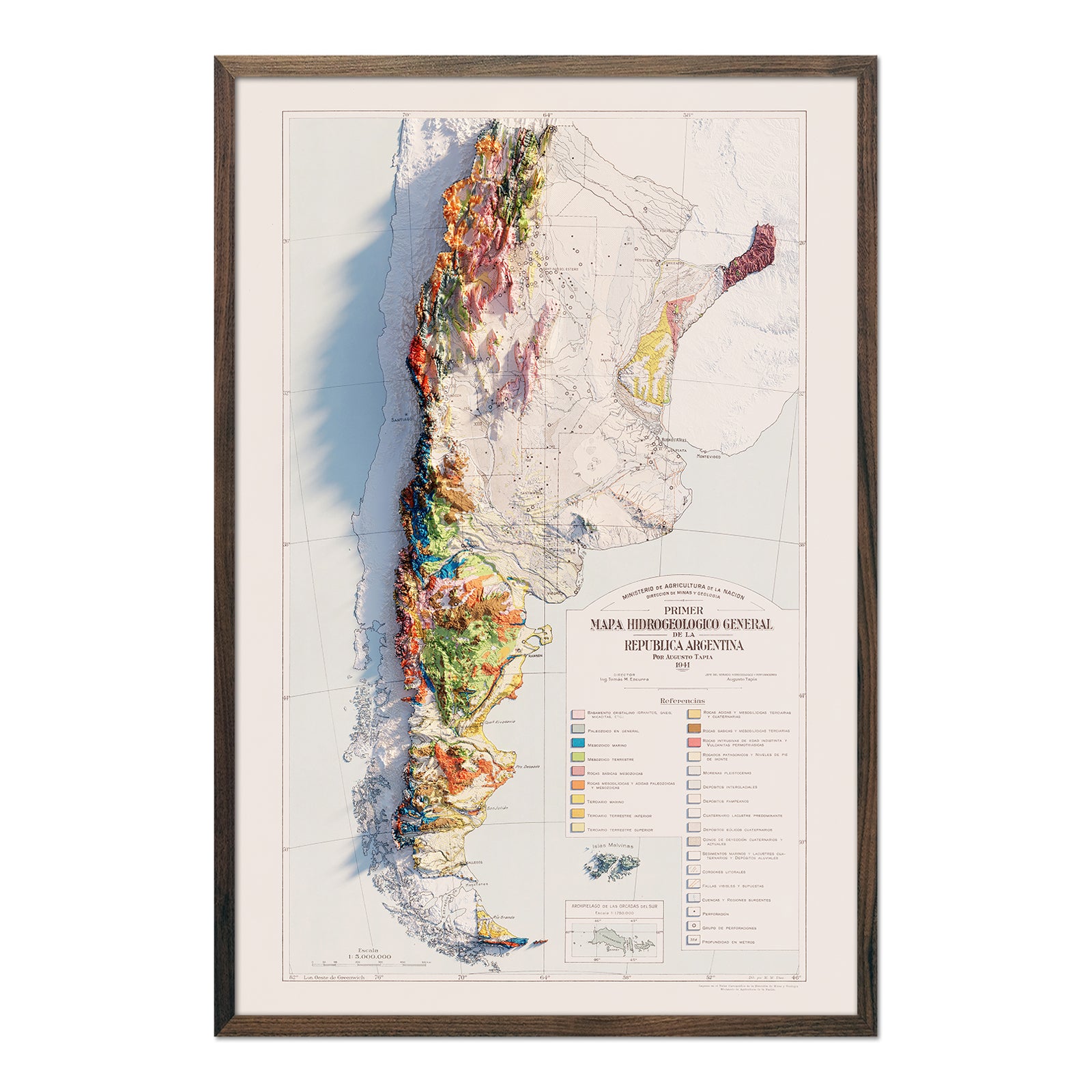
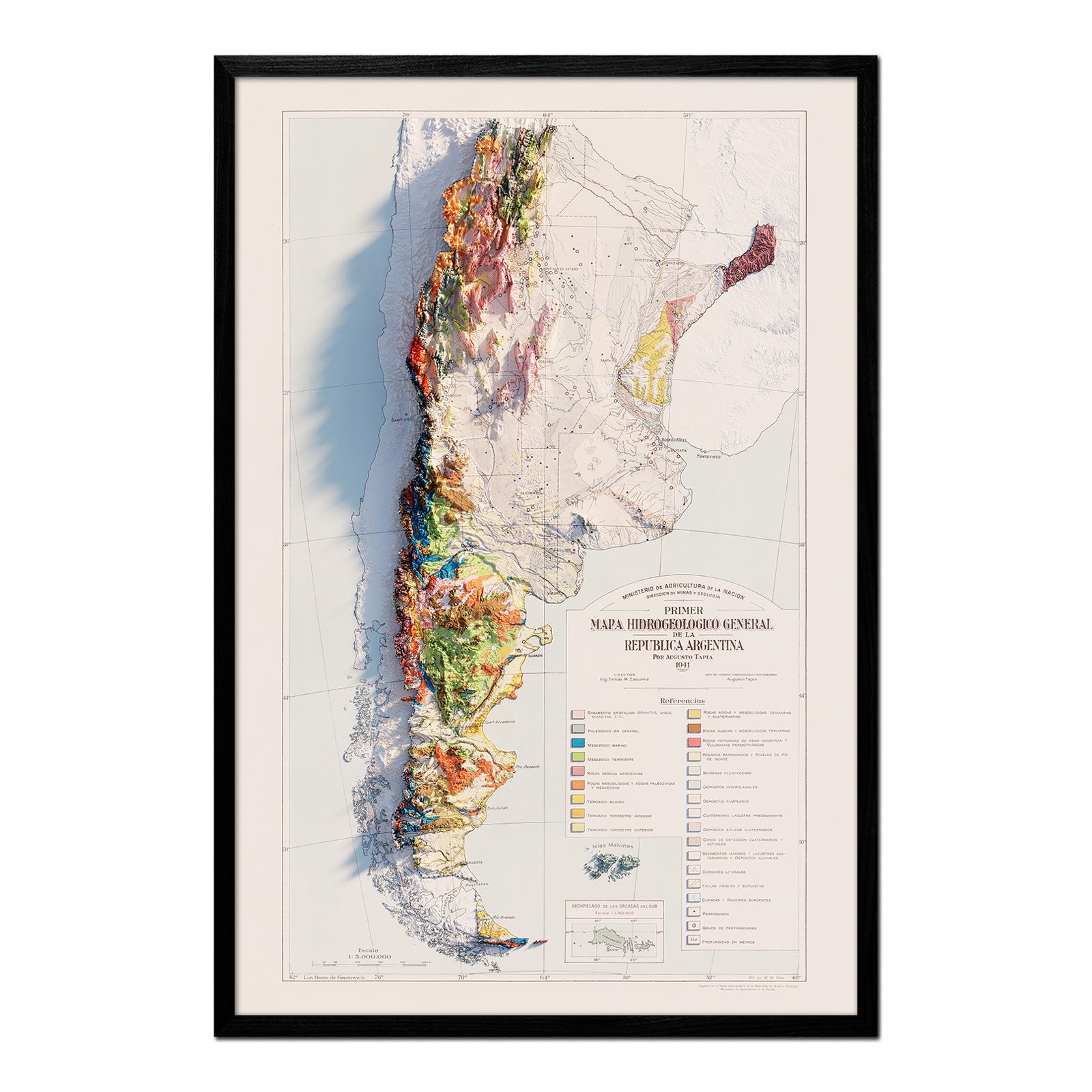
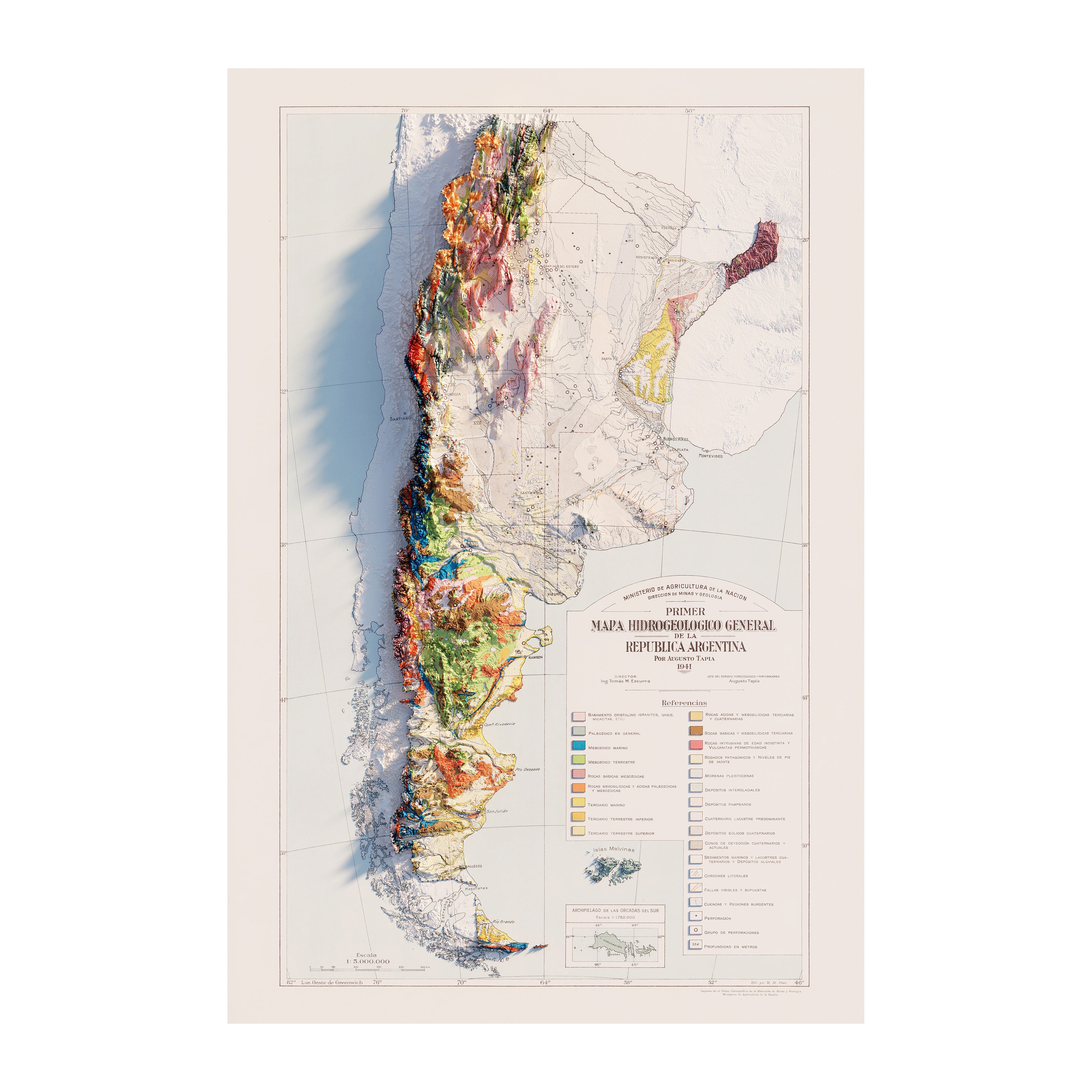
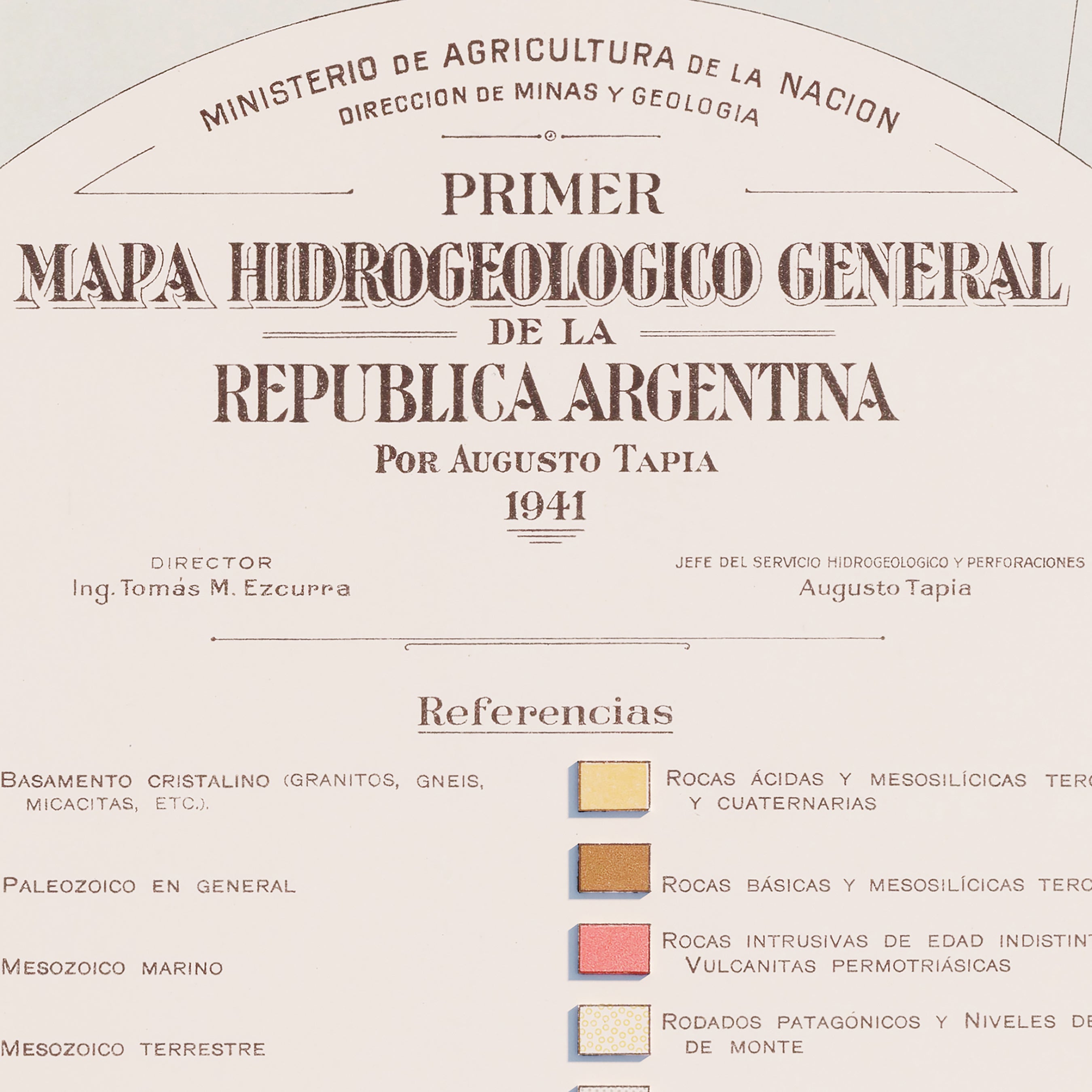
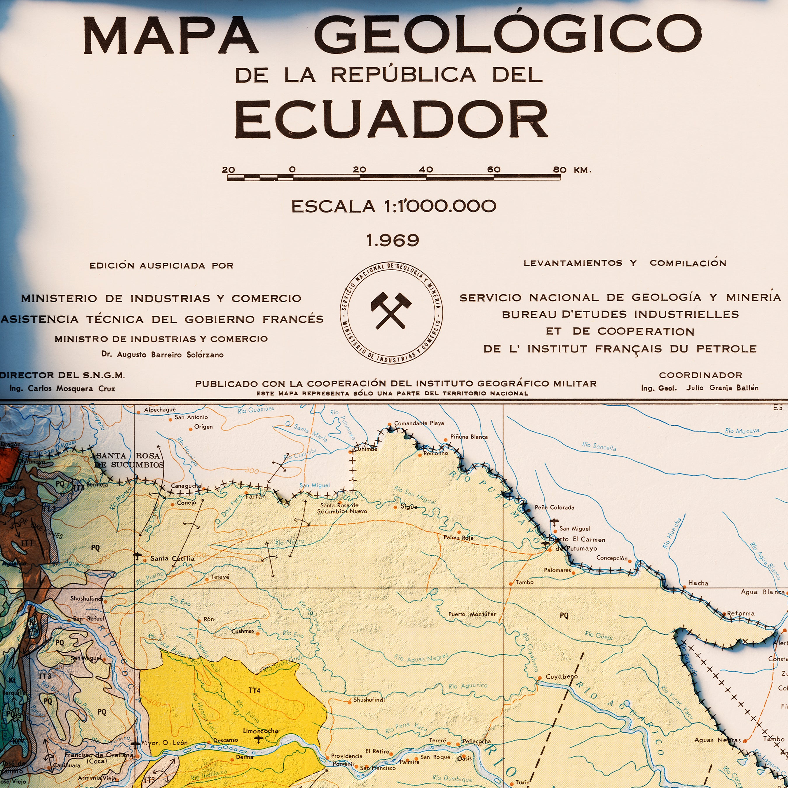
Some of South America's earliest historical maps stretch back over a century. Our faithful reproductions preserve the map layouts while enhancing their features with modern data and design. Some popular map prints include the 1922 shaded relief map and the 1950 shaded relief map.
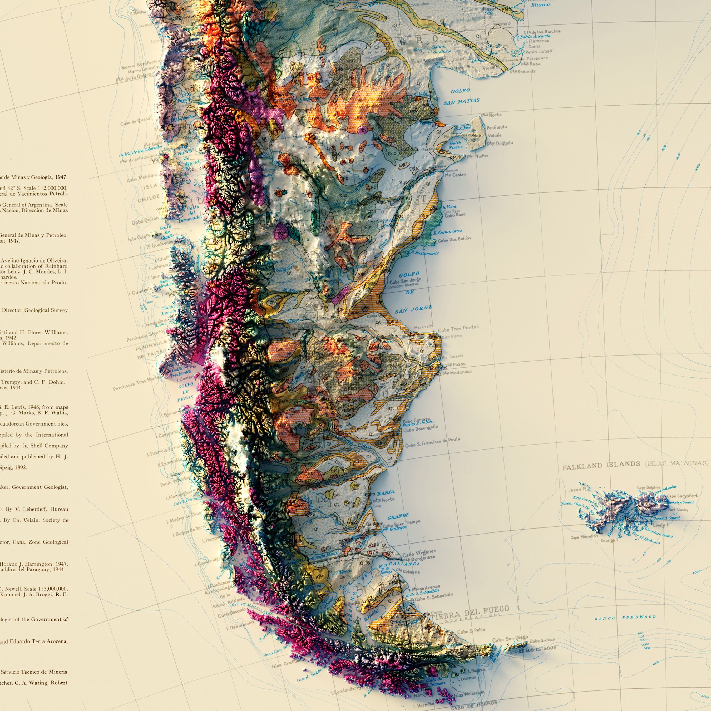
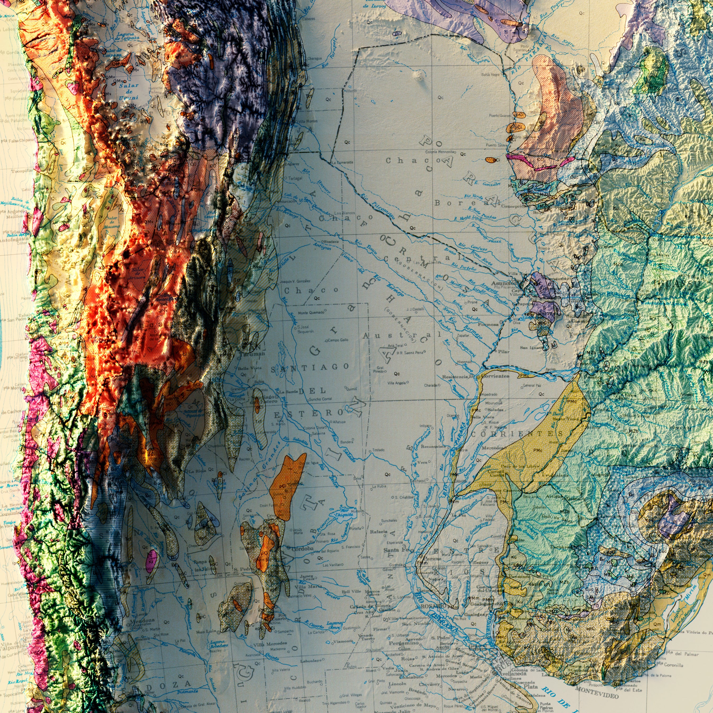
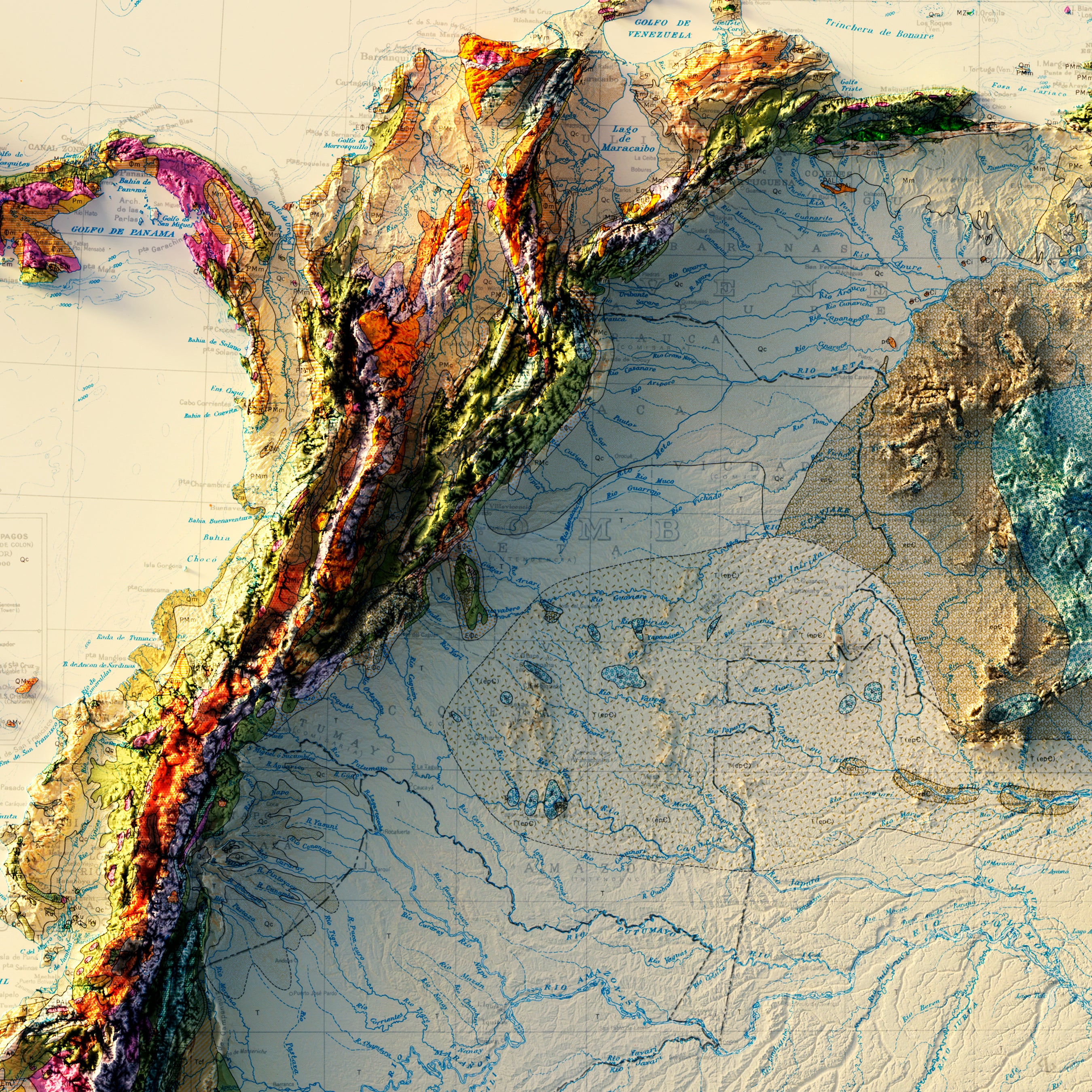
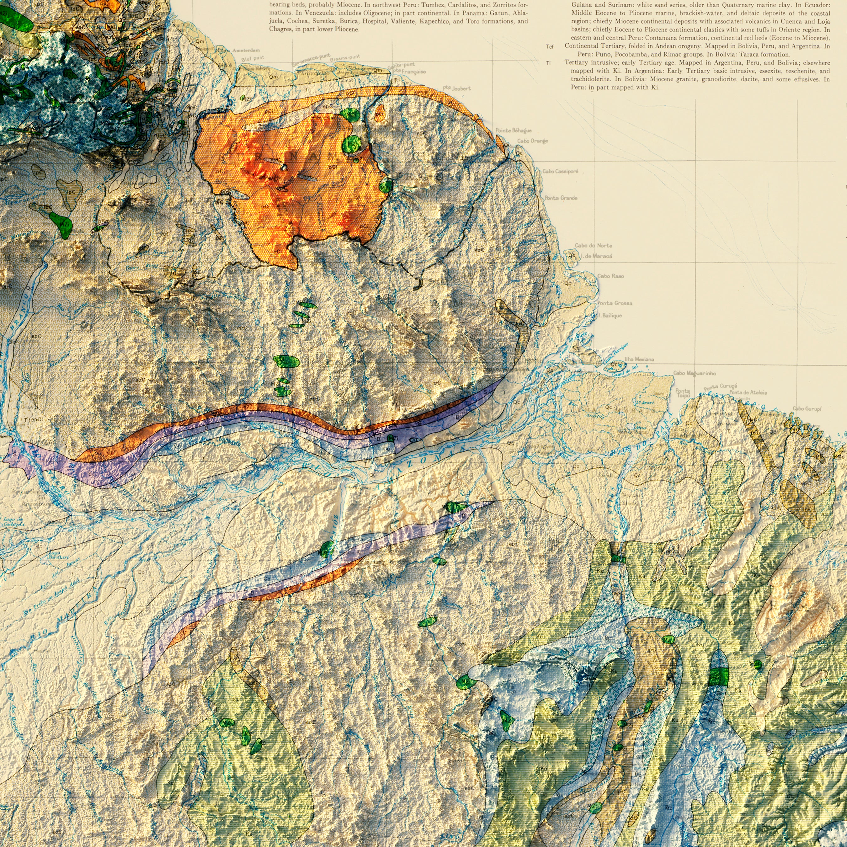
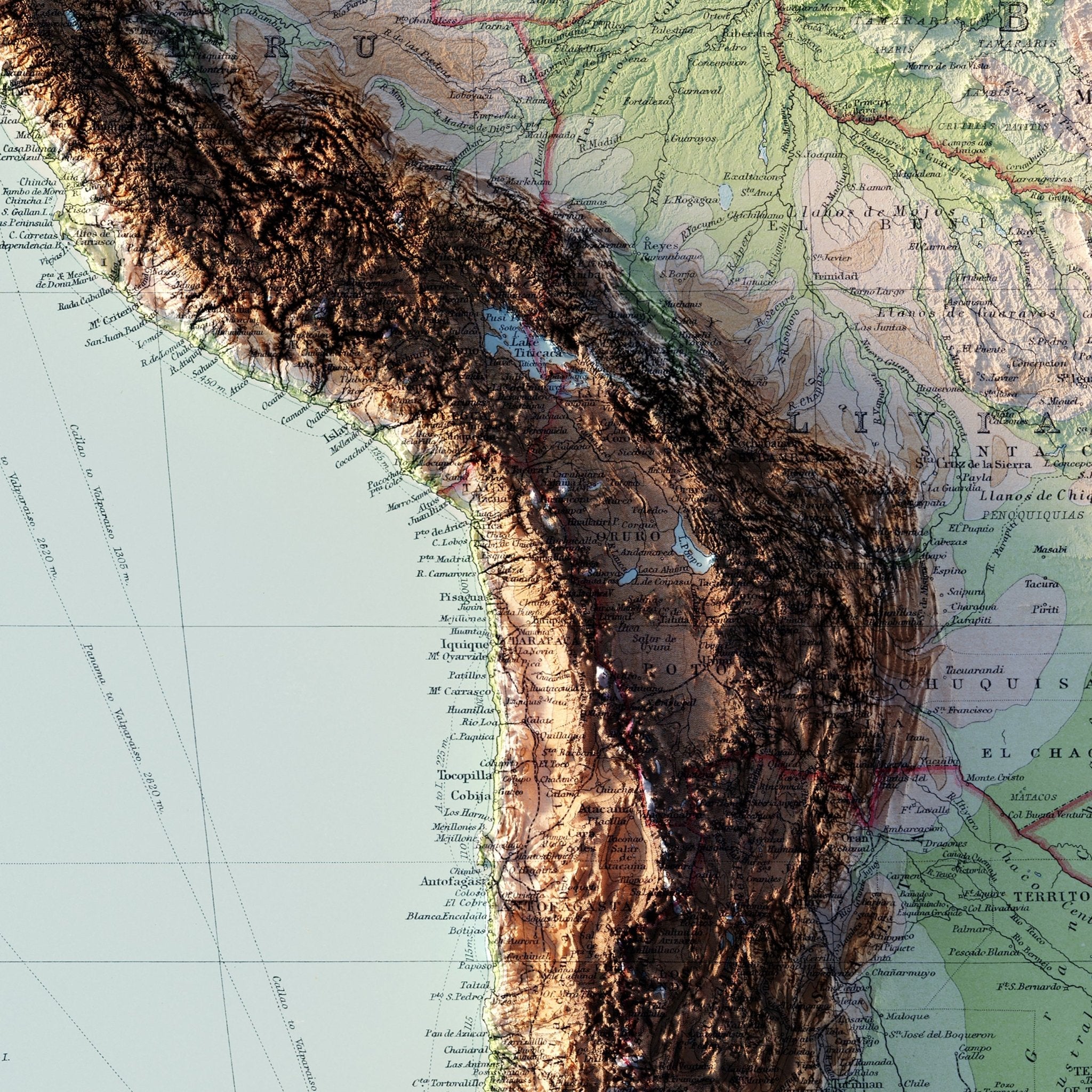
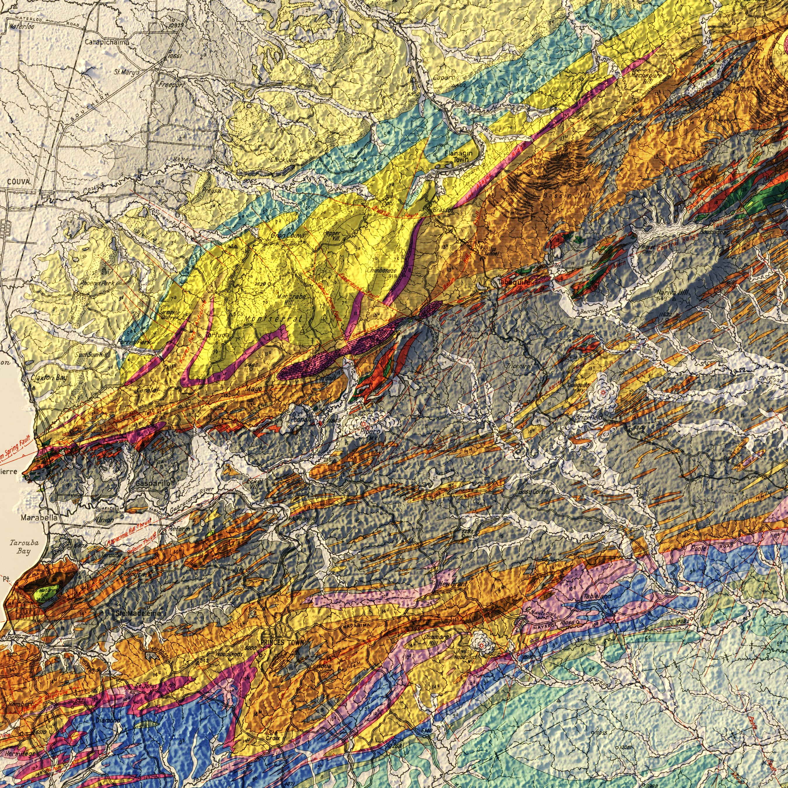
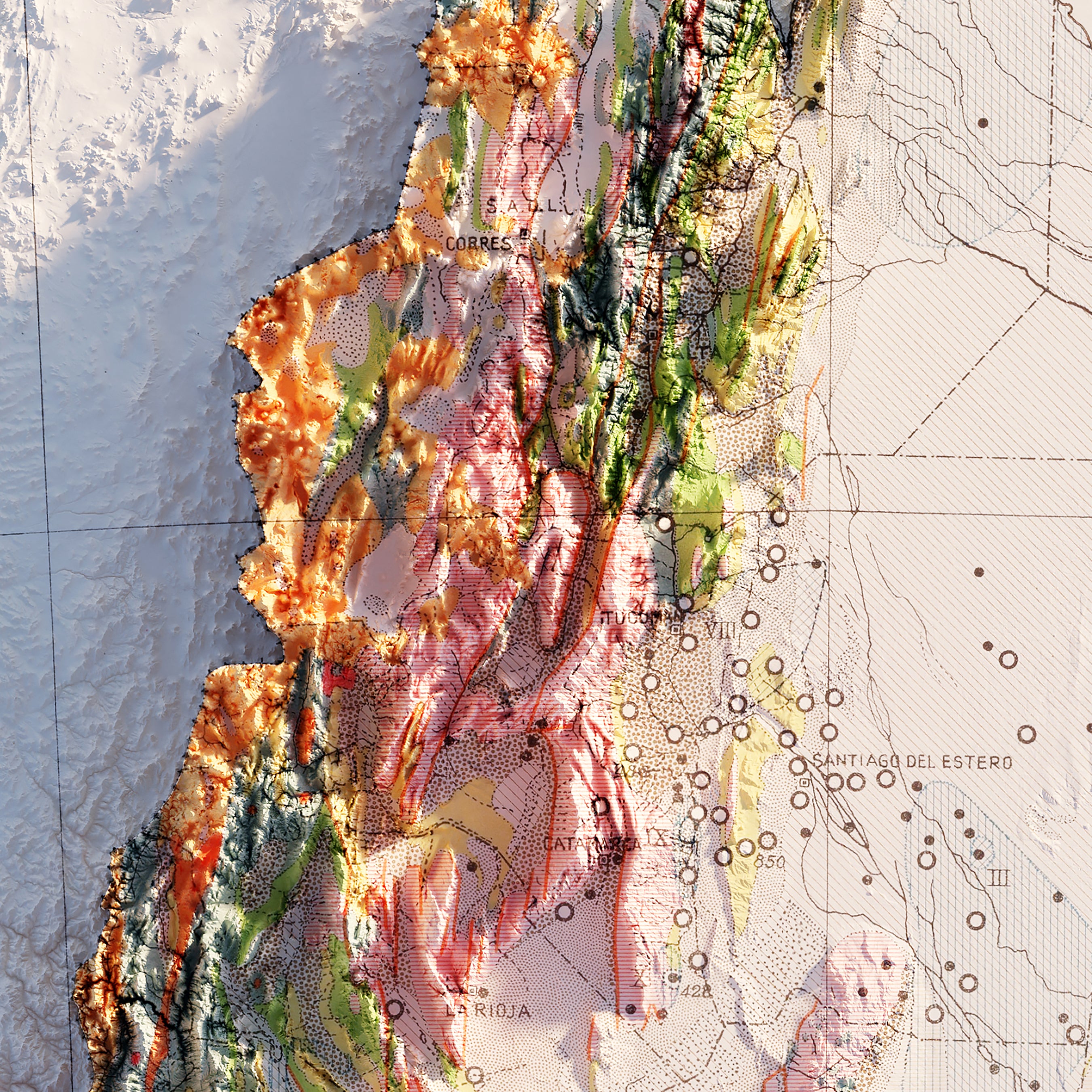
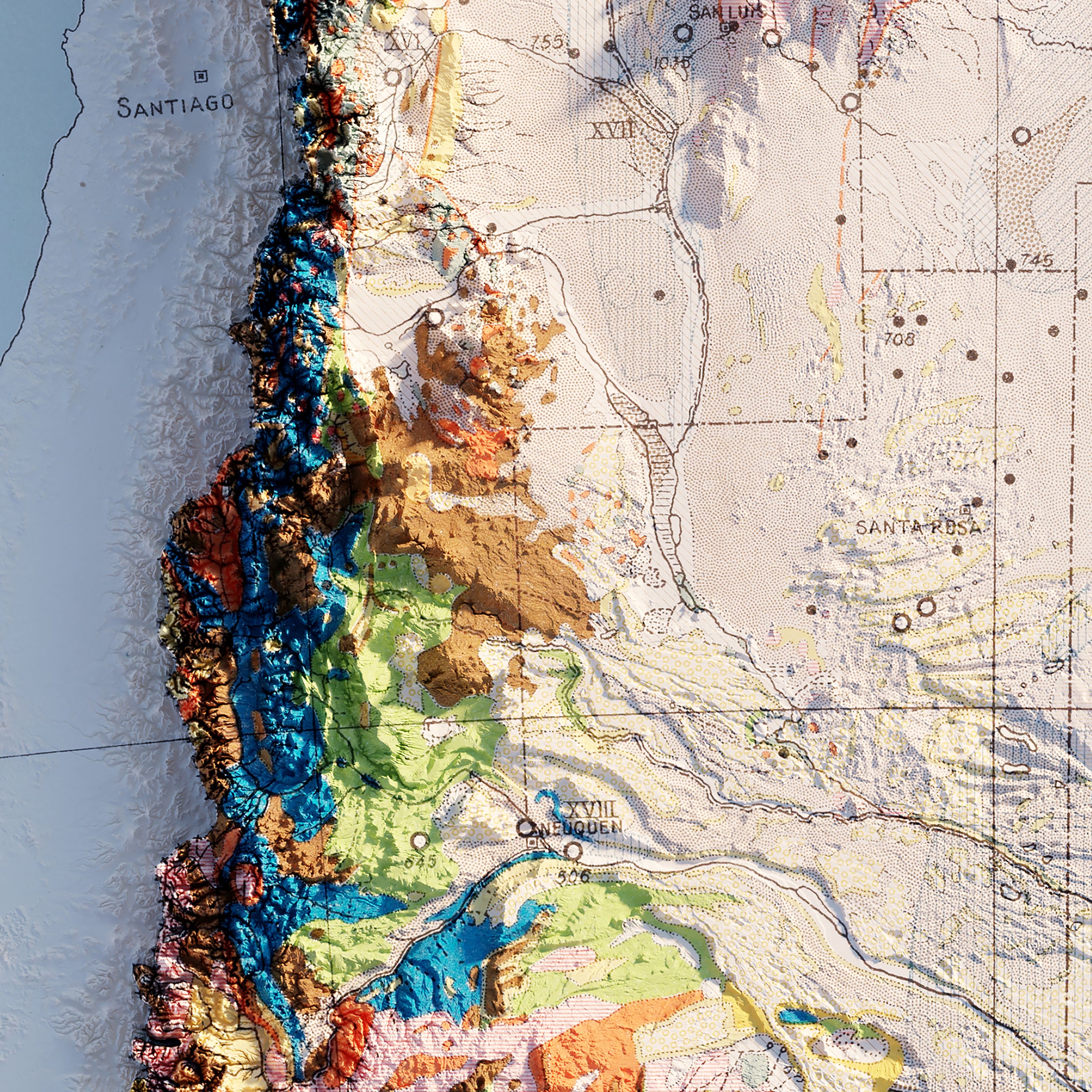
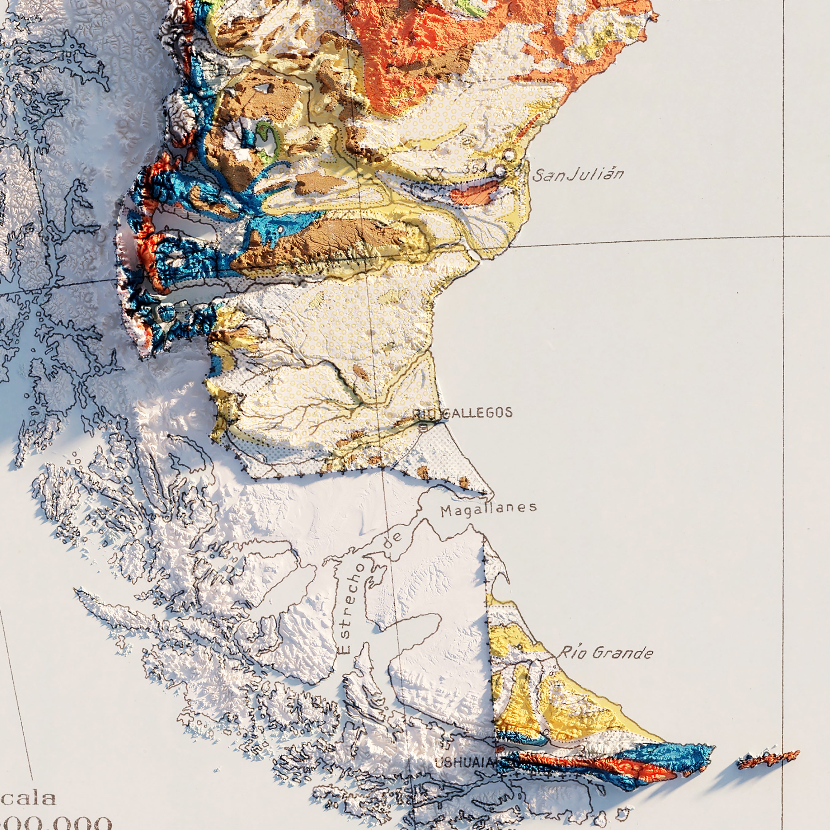
We created our historical map art with 3D effects by applying Digital Elevation Data and adding shaded relief to the landscape of the original maps. We print the shading directly on the paper and is not the result of the map protruding from the surface. The result is a display that instantly stands out in any room environment.
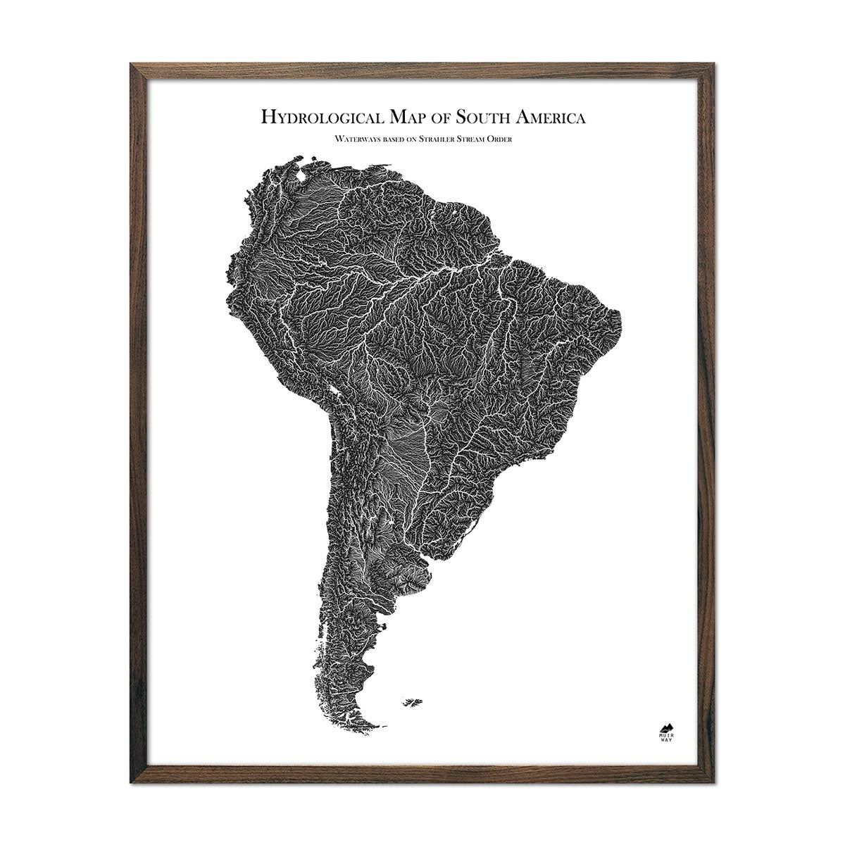
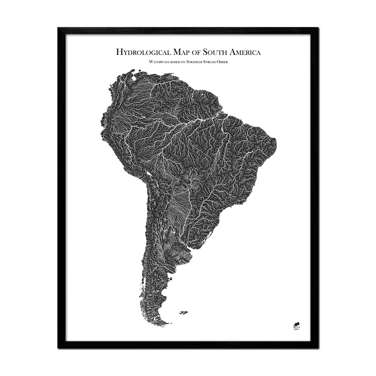
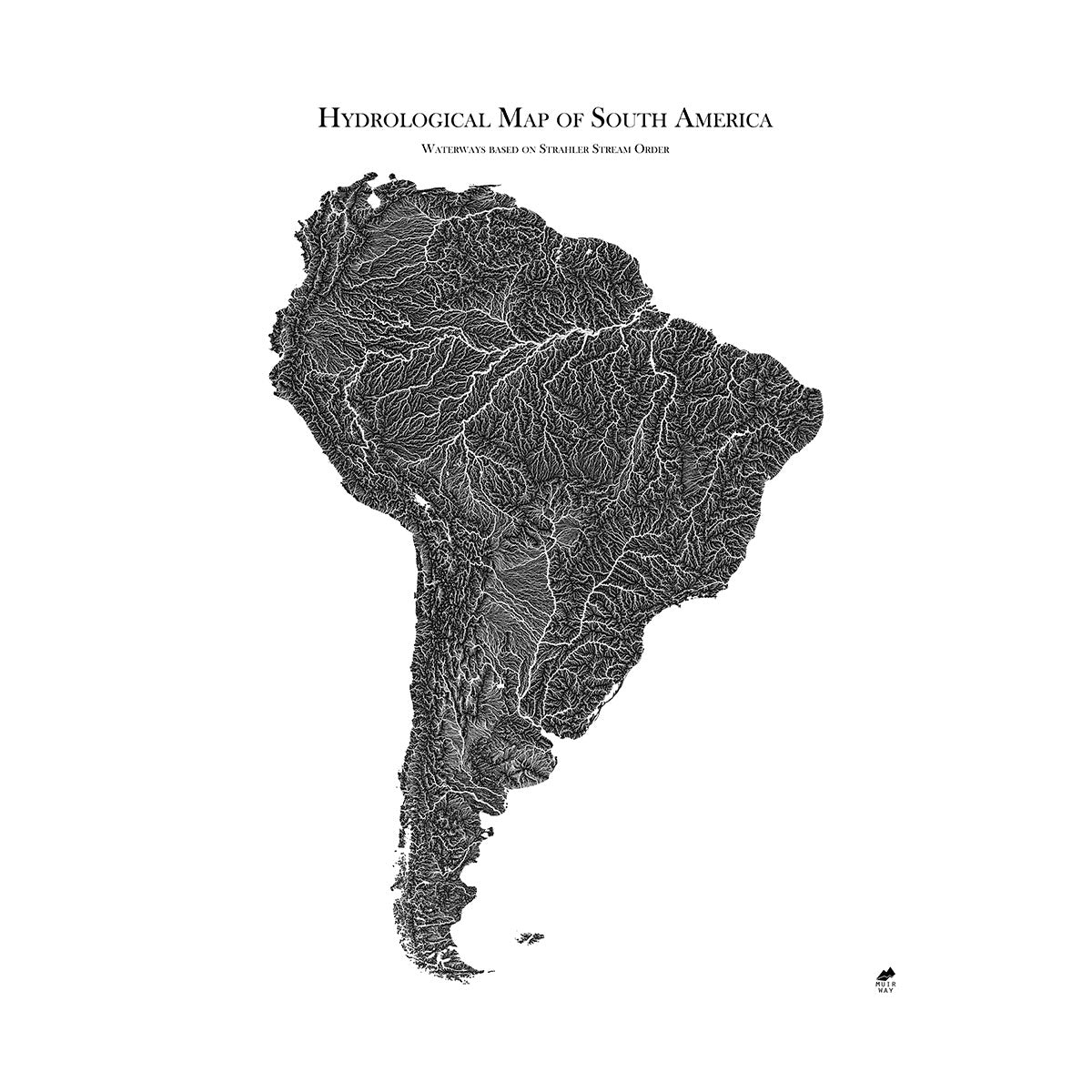
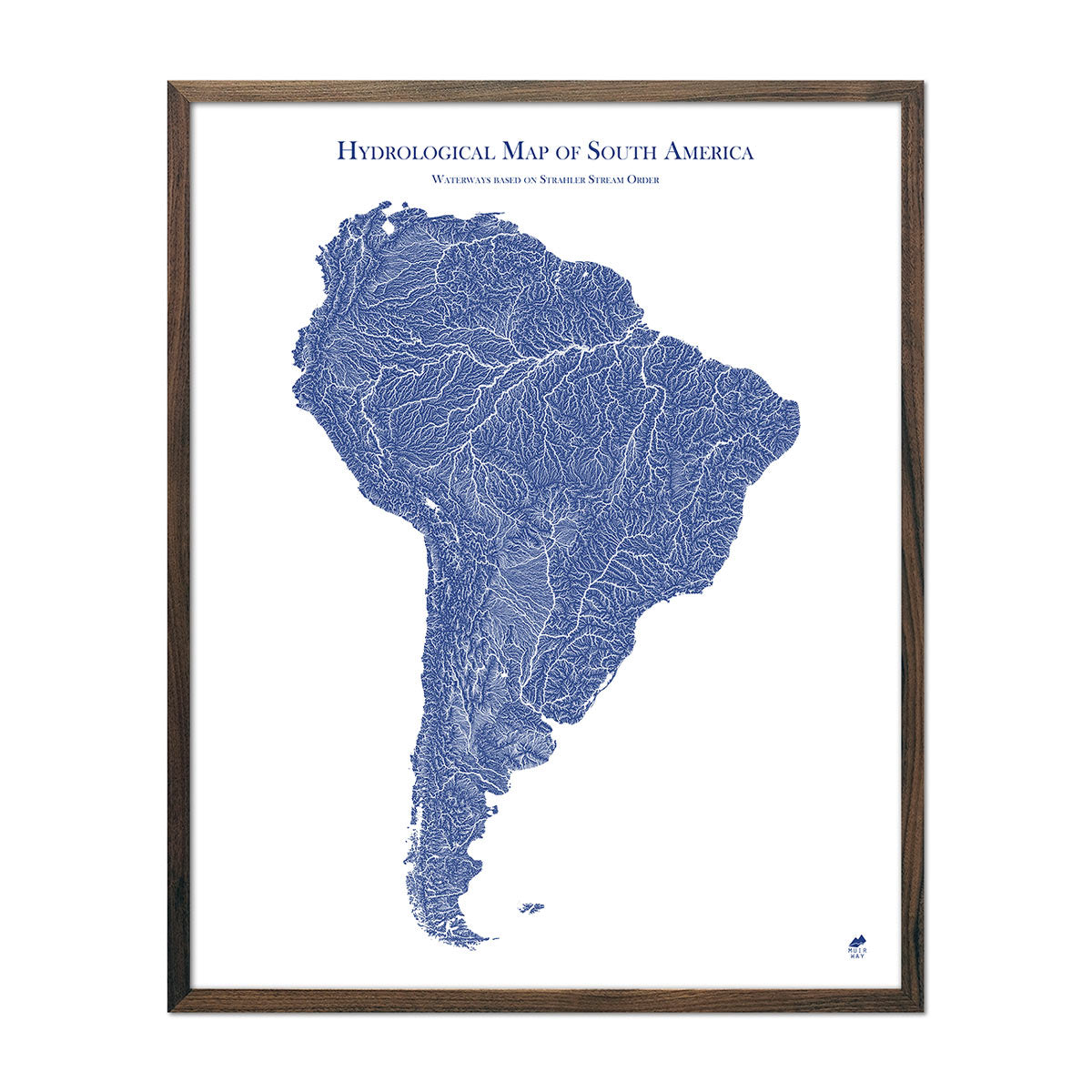
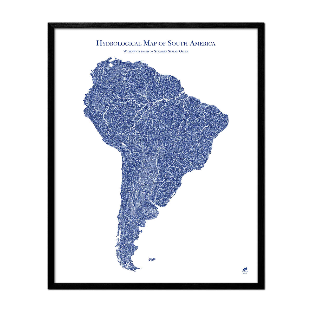
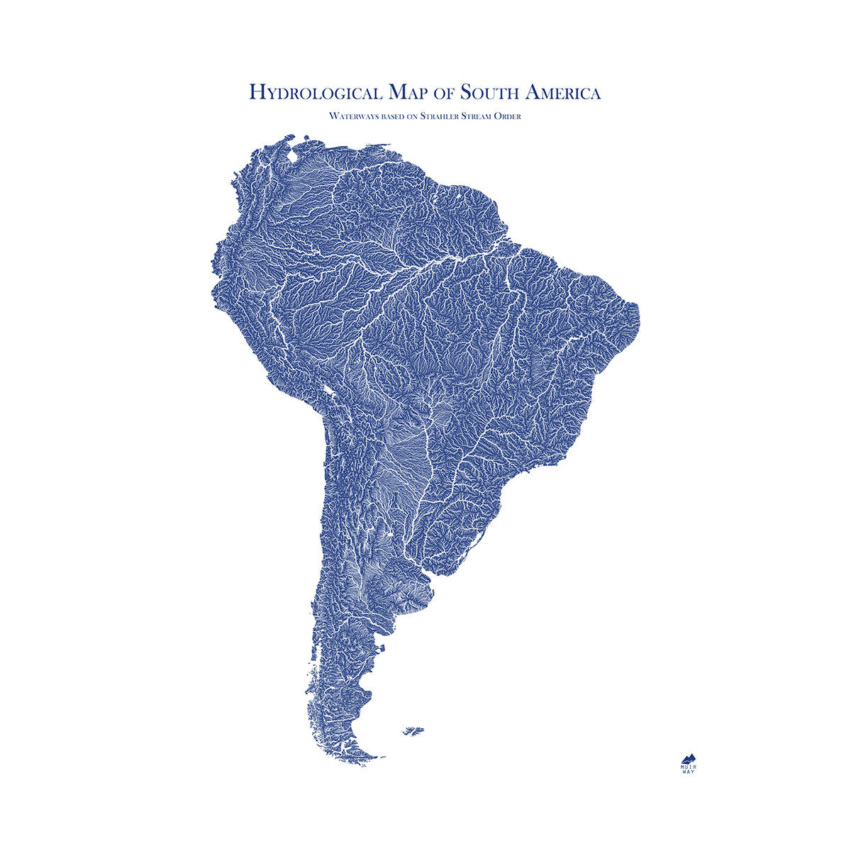
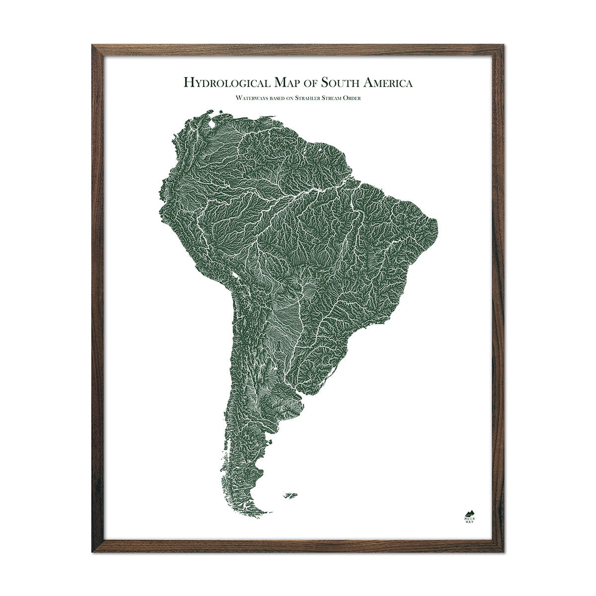
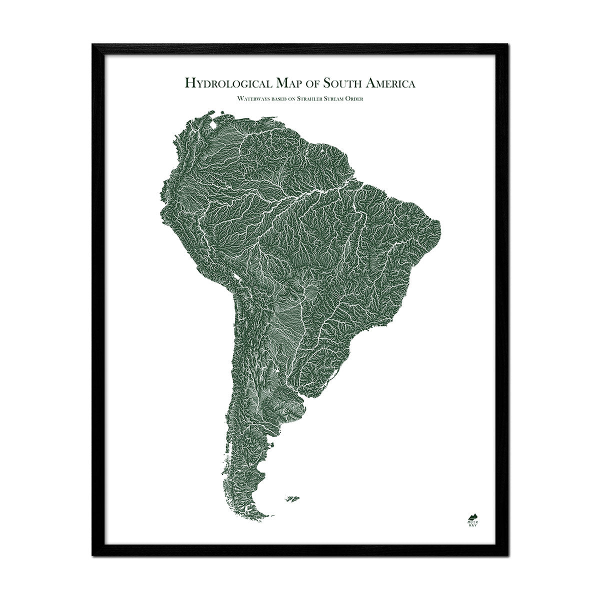
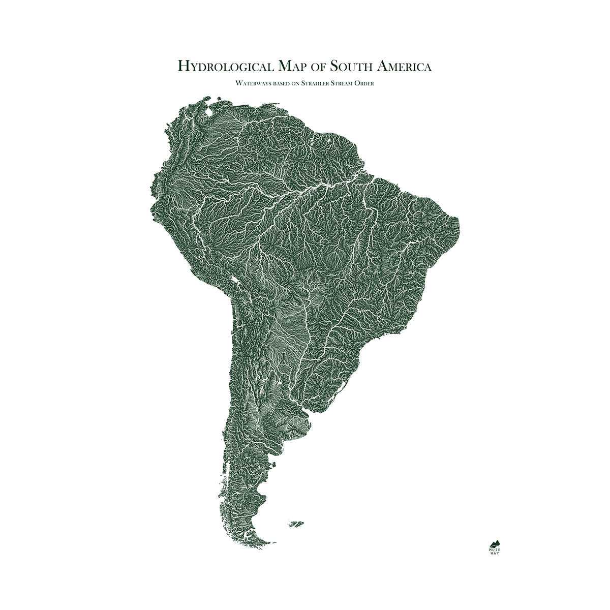
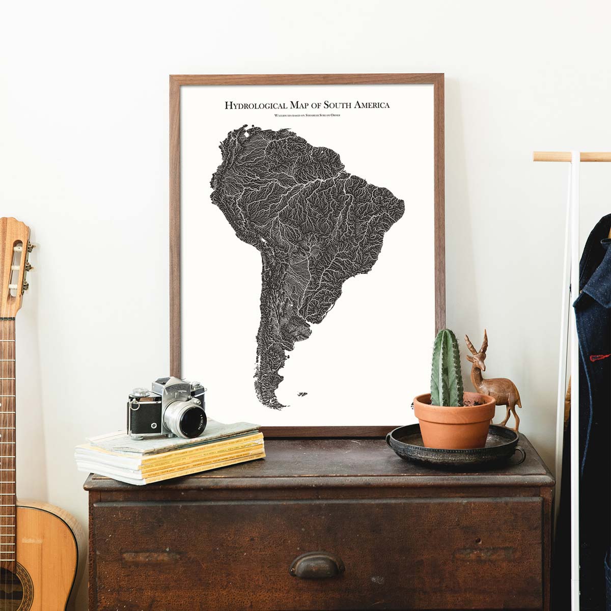
Explore the Waterways of an Entire Continent with our Hydrological Maps
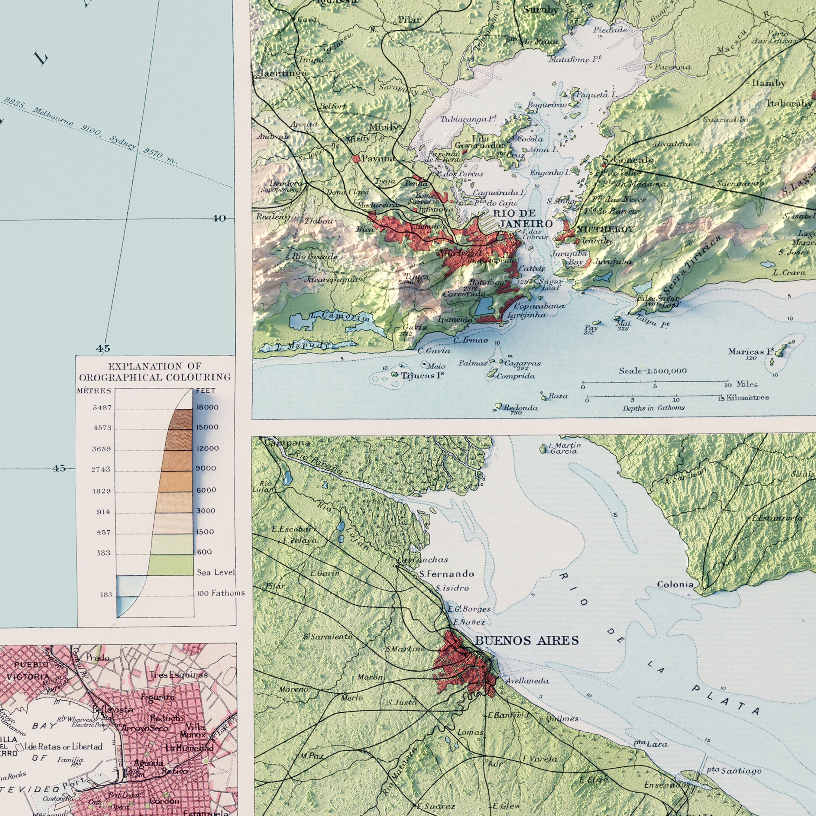
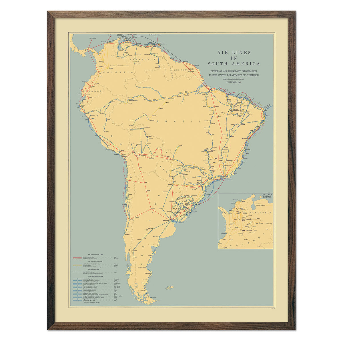
South America is home to some of the world's most interesting lakes and rivers that carve their way through rugged landscapes and provide crucial water sources for people and wildlife. The Amazon River, the world's second-longest and by far the largest by water volume, is the most prominent, flowing through nine countries and nurturing the incredibly biodiverse Amazon Rainforest.
Our hydrological maps also feature the Paraná River, one of the longest rivers in the world, which runs through Brazil, Paraguay, and Argentina. Lake Titicaca, nestled high in the Andes between Peru and Bolivia, holds the world's highest navigable lake title. Numerous glacial lakes in Patagonia punctuate the continent's southern region.
You can observe these water features with impressive clarity on our hydrological map of South America.
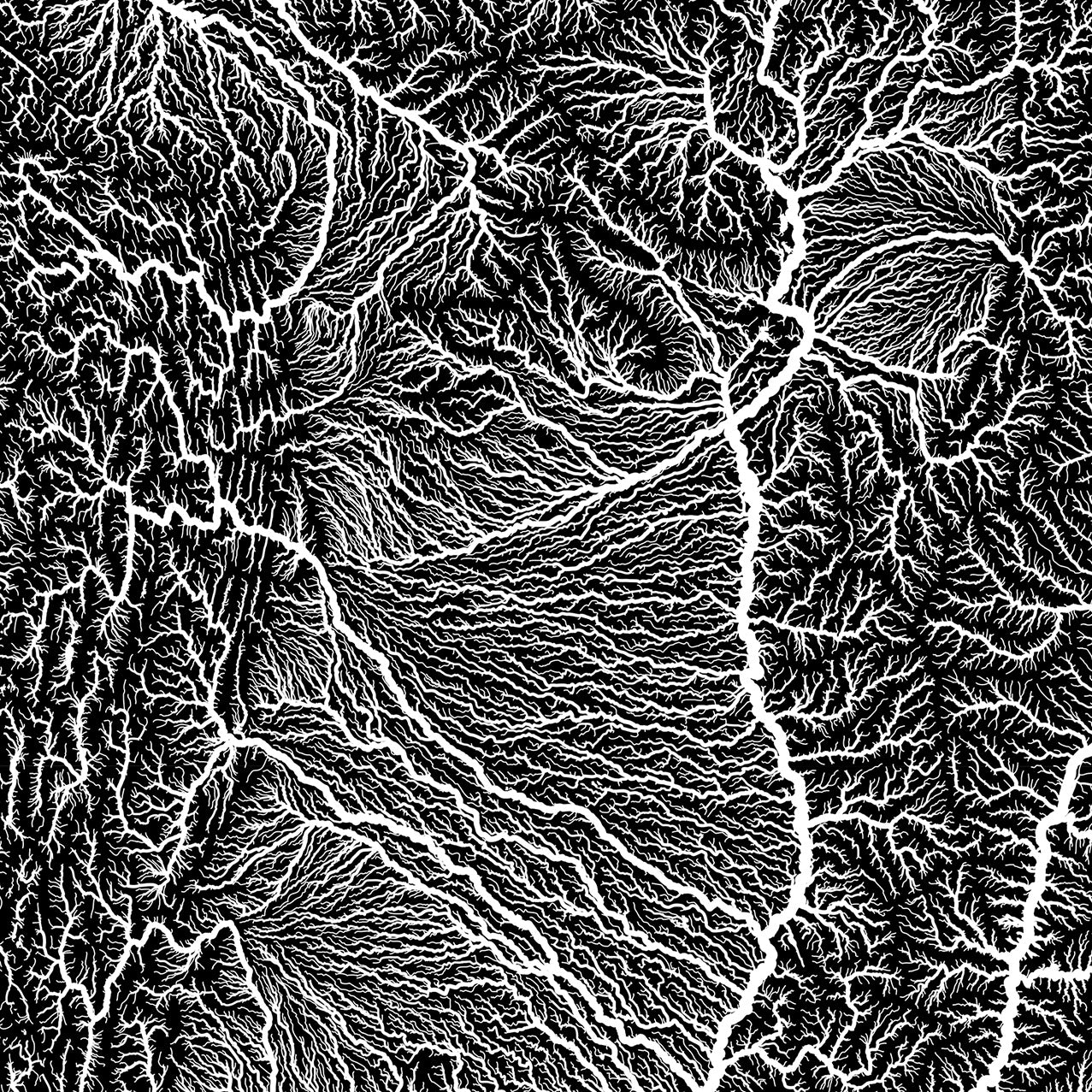
The thickness of the lines on the hydrological map denoting rivers and streams correlates with their Strahler number, which measures and classifies their size according to the hierarchical order of tributaries rather than their actual physical size.
Shop for South America Map Prints Online at Muir Way
We custom print every map you order. As such, each print is a work of art with the highest level of craftsmanship. We produce your map print on our 12-color giclée printer, using top-quality archival inks that never fade. Need a frame for your map? Choose from hardwood frames in walnut or black-stained walnut, handmade to order for your fine art paper print.
If you like our South America shaded relief maps collection, you may also be interested in other maps worldwide. Click below to browse:


