Skip to content
Facebook
Instagram
Pinterest
FREE SHIPPING on orders over $50 within US
Father's Day Sale – 10% OFF with code DAD10
Country/Region
United States (USD $)
United States (USD $)
Search
Account
Search
Cart
Popular Collections
3D Raised Relief Maps
Vintage Shaded Relief Maps
Hydrological Maps
Apparel
Best Sellers
Shop by Location
USA Maps
State Maps
International Maps
National Park Maps
Shop by Type
Collections
3D Raised Relief
2D Vintage Shaded Relief
Hydrology Series
TOPO Series
National Park Series
2D Elevation Relief
2D Shaded Relief
Mountain Range
3D Raised Relief Maps
Shaded Relief Maps
Hydrological Maps
Historical Prints
Illustrations and Photographs
1884 Fish Drawings
1875 Zoology Drawings
1868 Yosemite Photos
1873 Yellowstone Photos
1874 Moon Photos
Historical Maps
Astronomy
Civil War Maps
Assorted Vintage
USGS Quadrant Maps
1876 State Maps
1876 Geologic/Topographic
1883 State Maps
1904 Yellowstone Maps
1906 Hawaii Maps
1884 Fish Drawings
Astronomy
Civil War Maps
Apparel
About Us
Our Story
Reviews
FAQs
Shipping and Returns
Contact Us
All Muir Way Maps
Filter
Sort by
Best selling
Best selling
Alphabetically, A-Z
Alphabetically, Z-A
Date, old to new
Date, new to old
Filters
Continent Maps
Continent Map
6
US States
Alabama
2
Alaska
7
Arizona
7
Arkansas
2
California
19
CALIFORNIA
1
Colorado
11
Connecticut
4
Delaware
1
Georgia
2
Guam
1
Hawaii
3
Idaho
2
Illinois
2
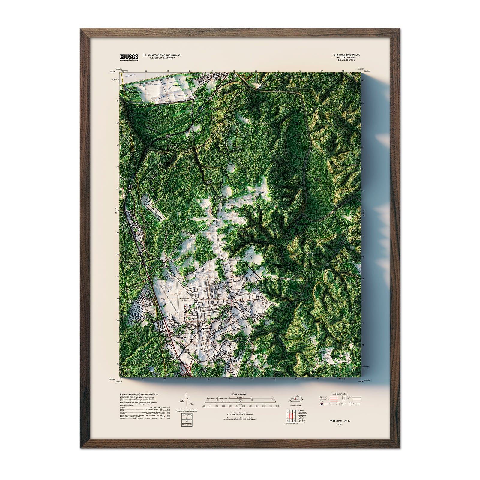
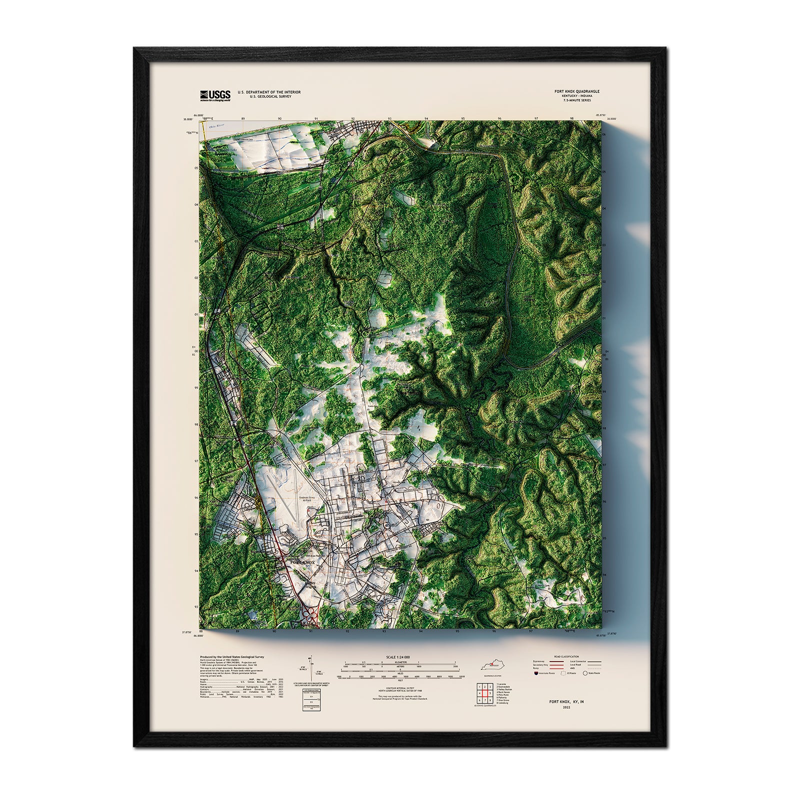
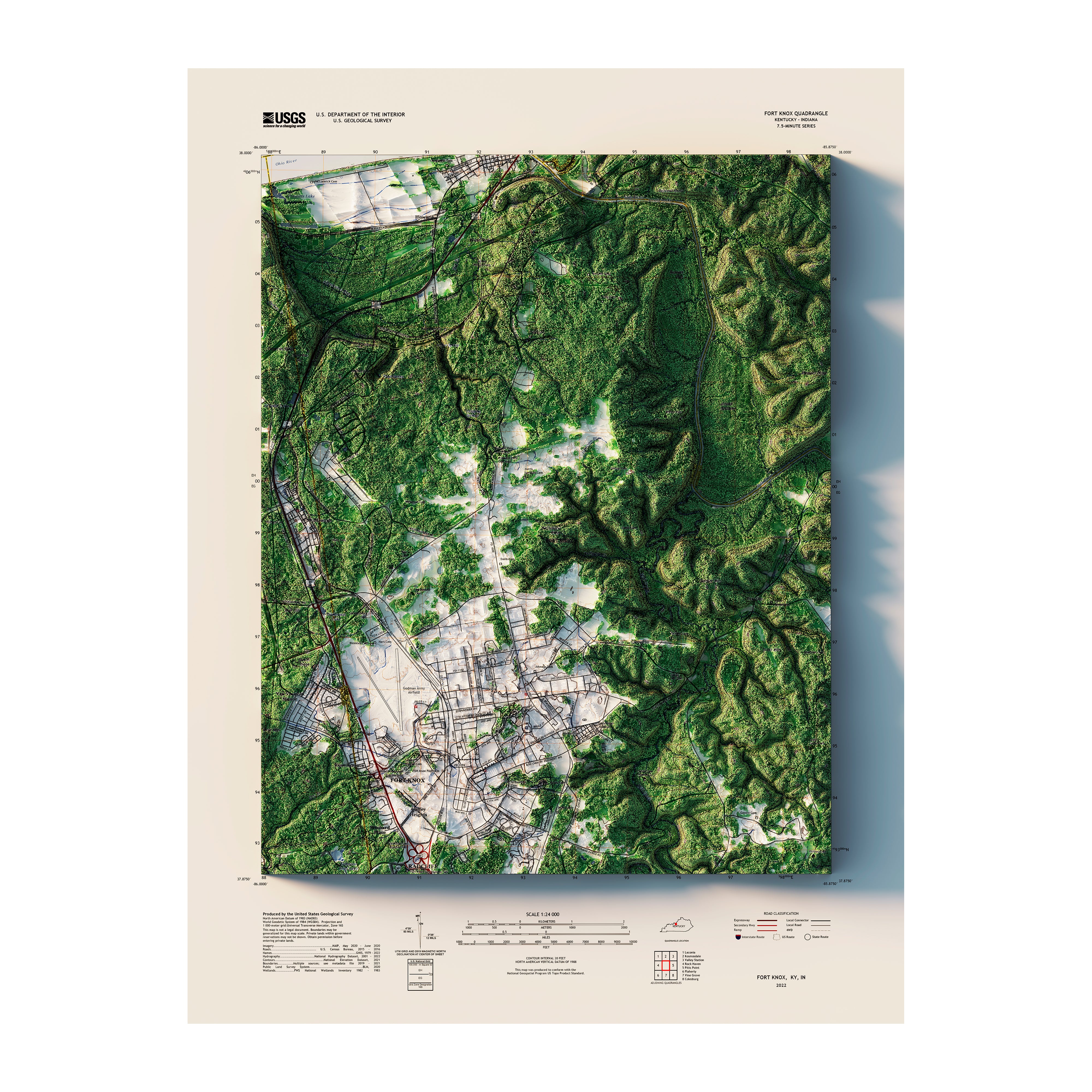
Indiana
1
Iowa
2
Kansas
2
Kentucky
5
Louisiana
1
Maine
6
Maryland
3
Massachusetts
4
Michigan
6
Minnesota
2
Missouri
1
Montana
7
Nevada
3
New Hampshire
2
New Jersey
3
New Mexico
5
New York
8
North Carolina
3
North Dakota
1
Ohio
3
Oklahoma
2
Oregon
5
Pennsylvania
8
Puerto Rico
3
Rhode Island
4
South Carolina
1
South Dakota
1
Tennessee
3
Texas
4
Utah
10
Vermont
2
Virginia
4
Washington
11
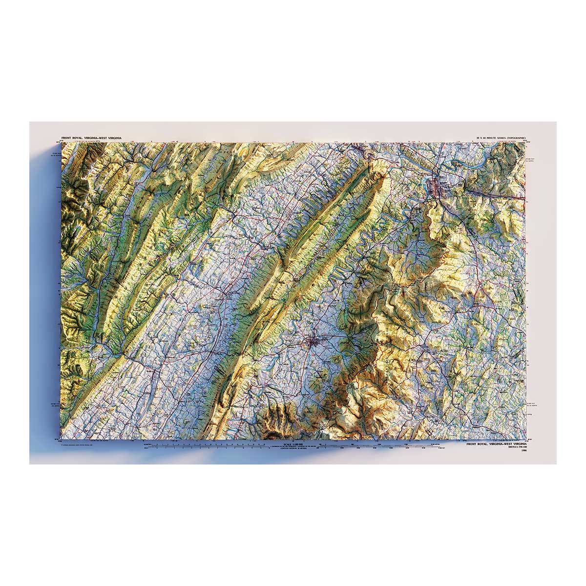
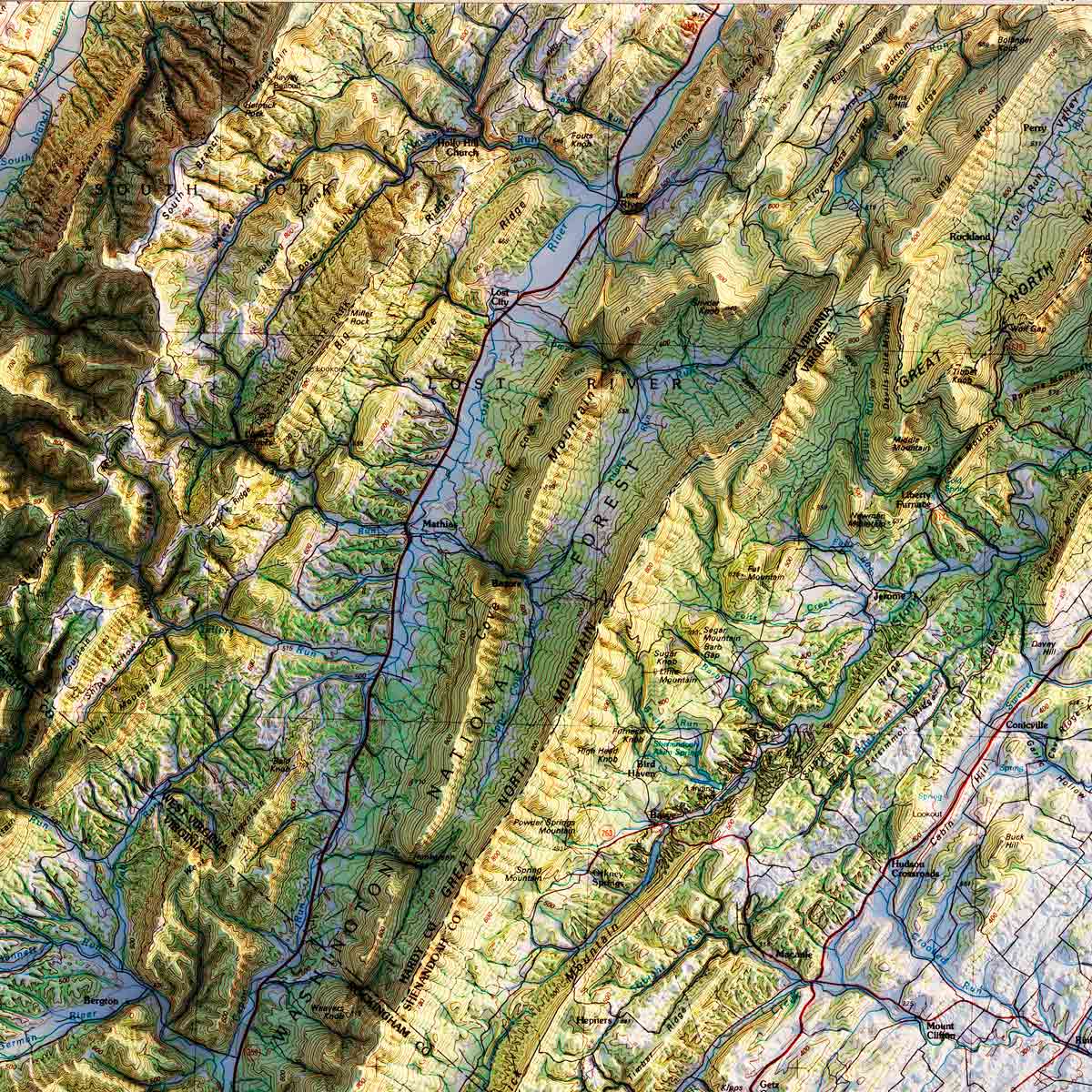
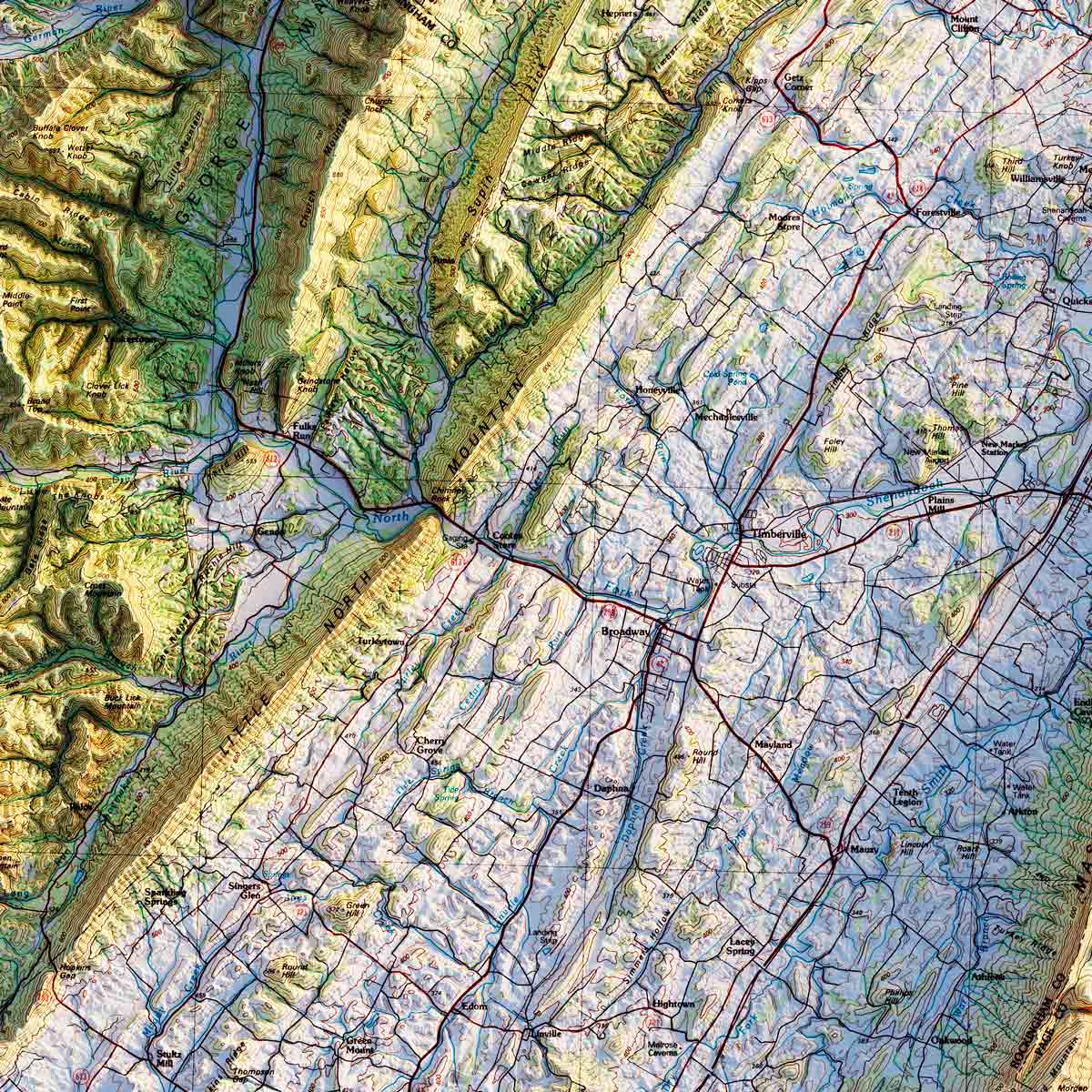
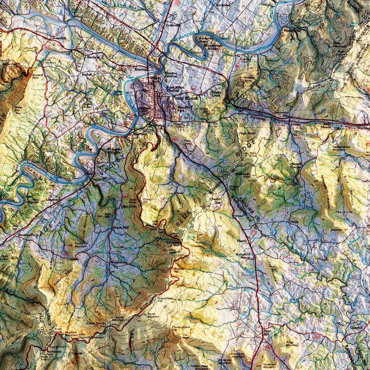
West Virginia
2
Wisconsin
3
Wyoming
2
Europe
Great Britain
1
Scandinavia
1
National Parks
Acadia
2
Arches
2
Big Bend
1
Canyonlands
2
Crater Lake
2
Death Valley
2
Denali
2
Glacier
2
Grand Canyon
3
Grand Teton
1
Great Sand Dune
1
Great Smoky Mountains
2
Isle Royale
1
Kings Canyon
1
Lassen
1
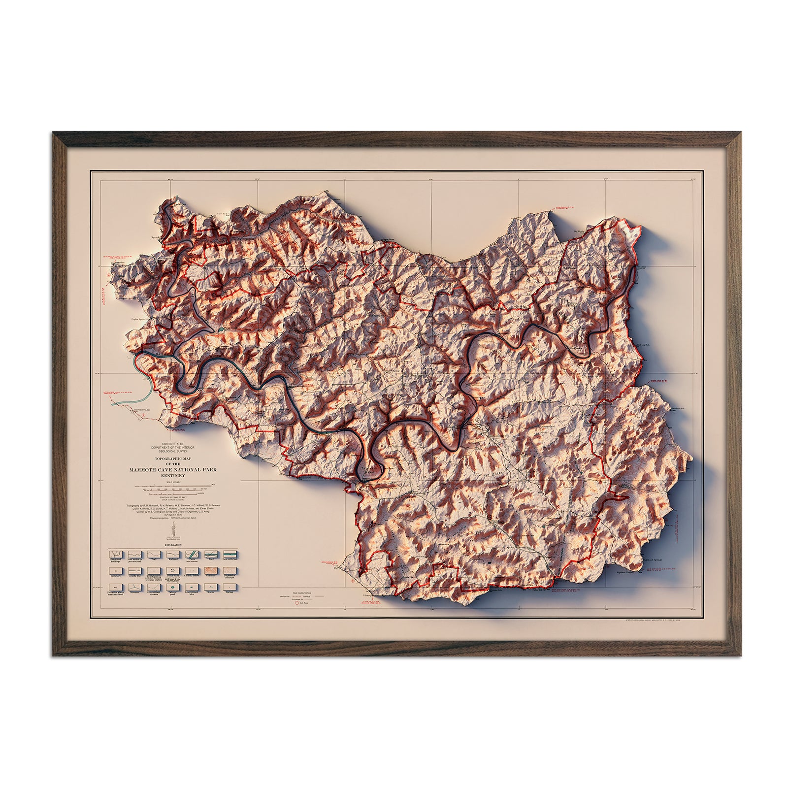
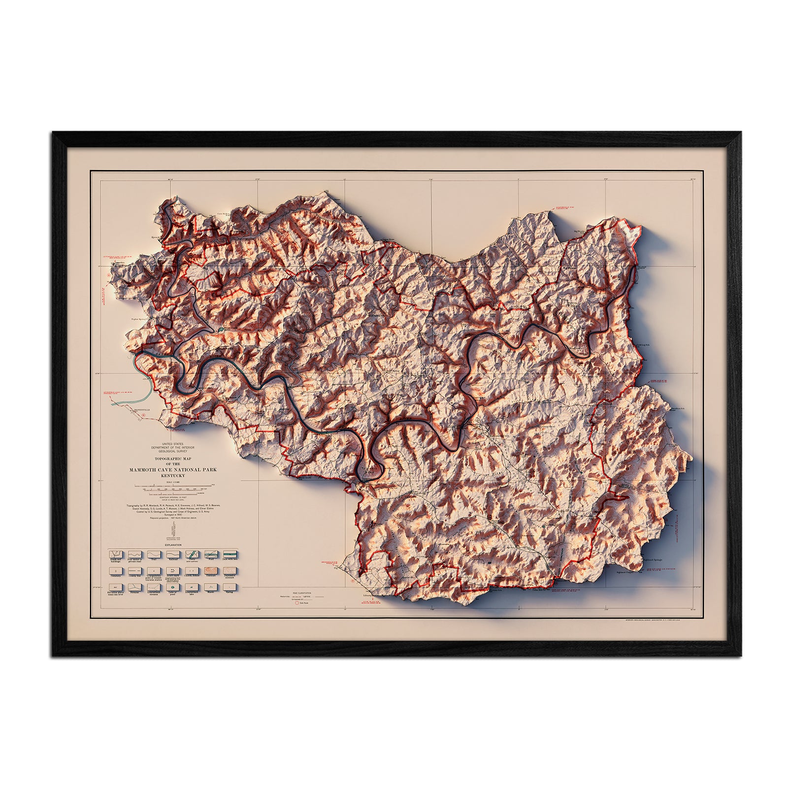
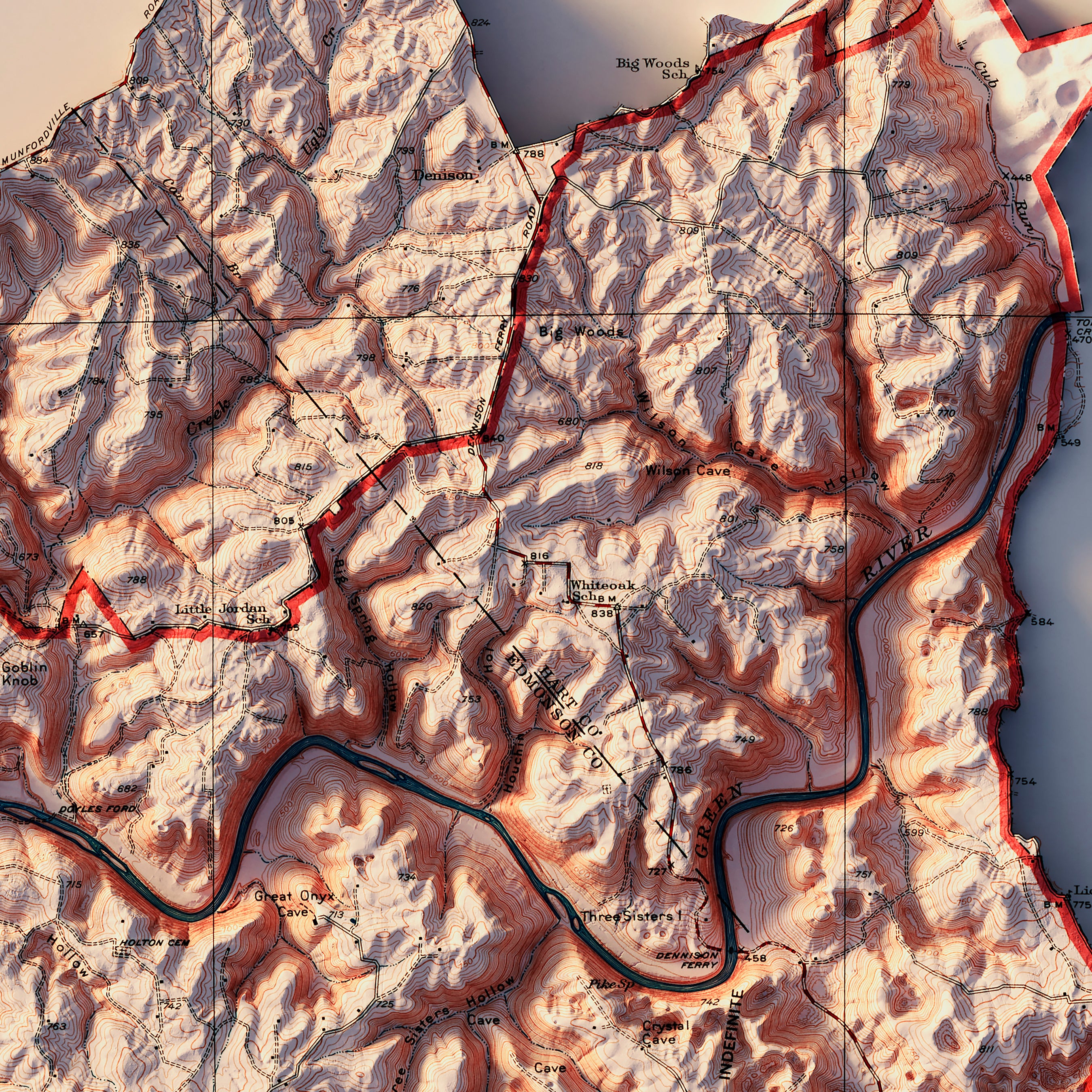
Mammoth Cave
1
Mesa Verde
1
Mount Rainier
2
Mt Rainier
2
North Cascades
1
Rocky Mountain
1
Sequoia
1
Shenandoah
2
Snoqualmie
1
St Elias
1
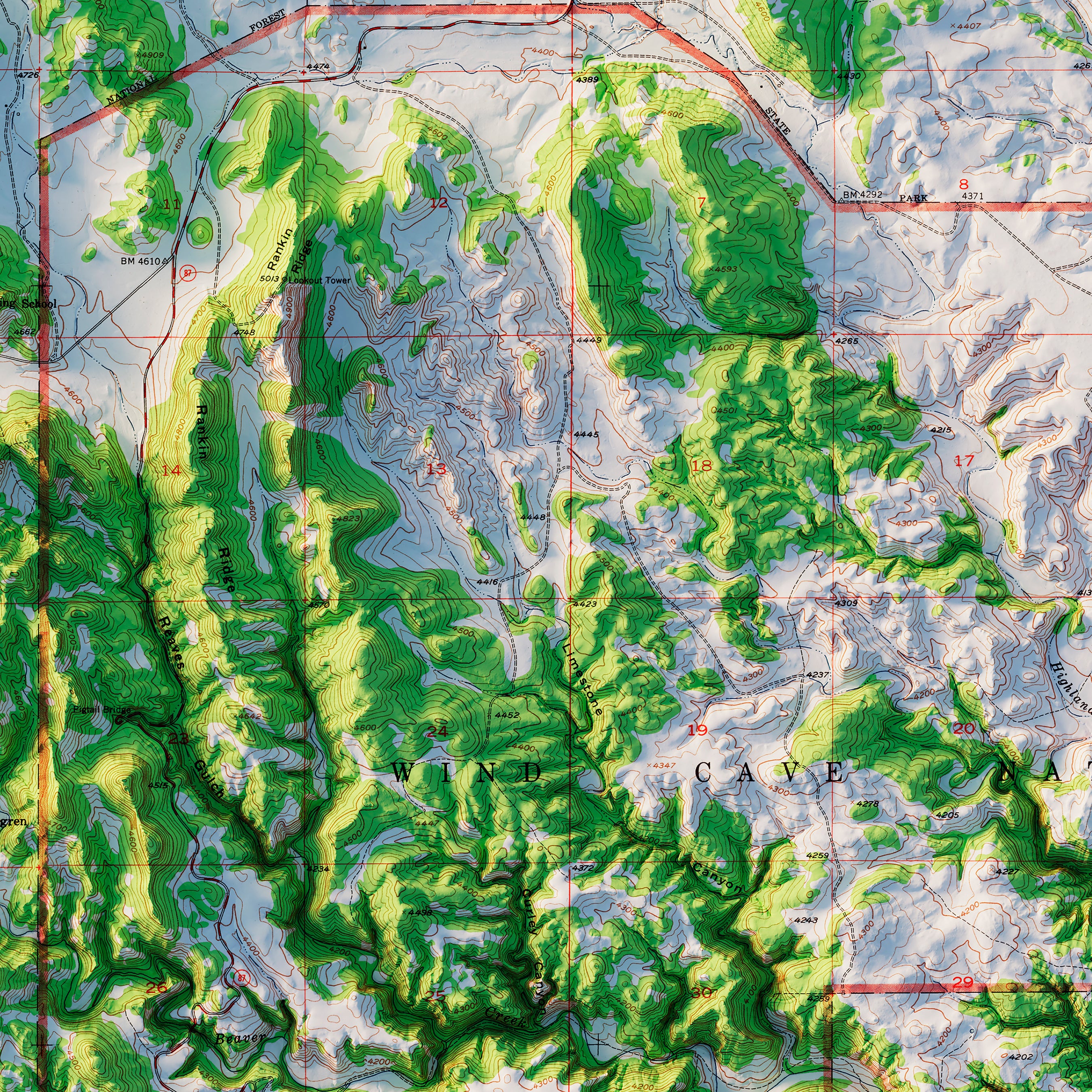
Wind Cave
1
Wrangell
1
Yellowstone
1
Yosemite
4
Zion
1
North America
Canada
25
Central America
1
Continent Map
6
Cuba
1
Jamaica
1
Mexico
4
North America
1
Sort by
Best selling
Alphabetically, A-Z
Alphabetically, Z-A
Date, old to new
Date, new to old
Apply
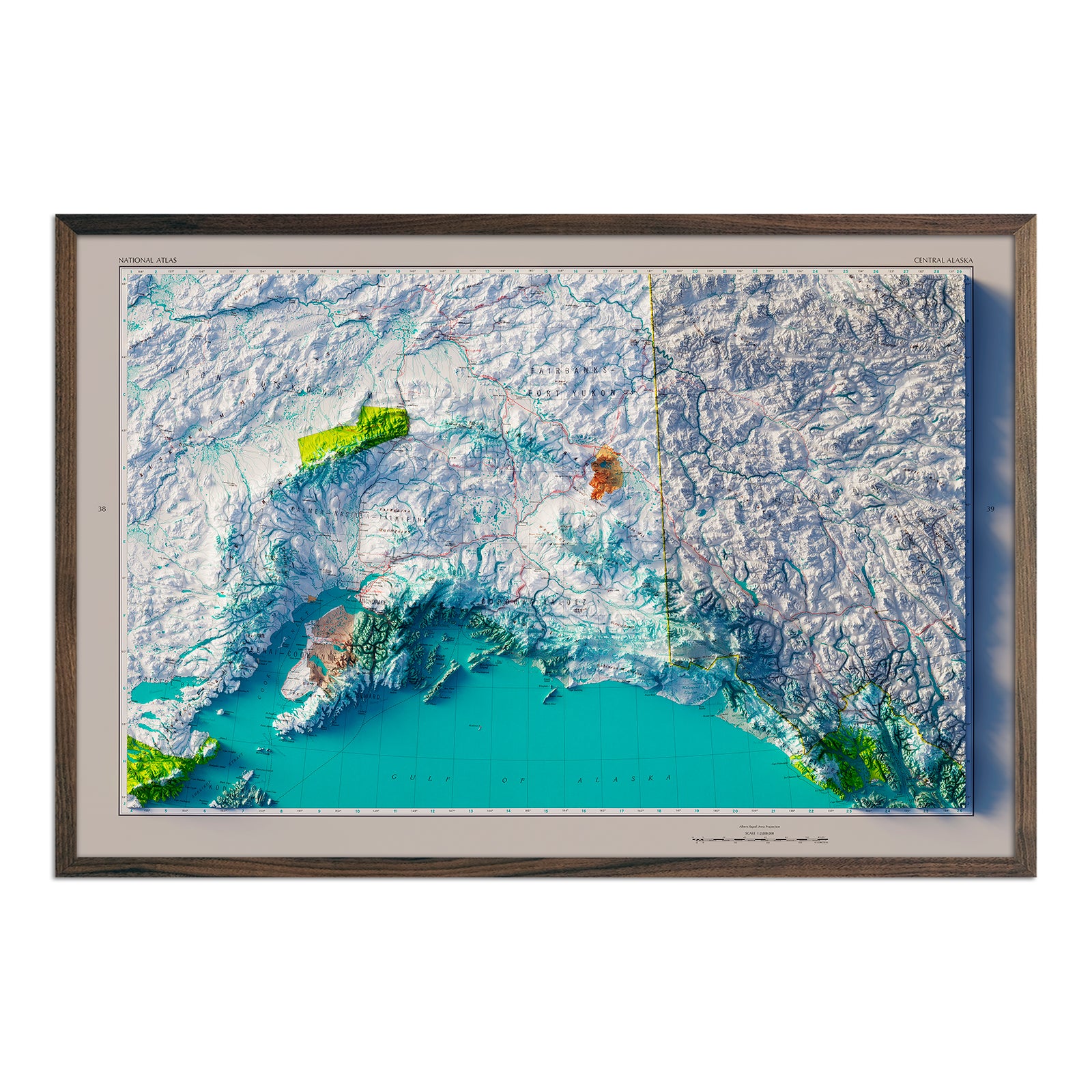
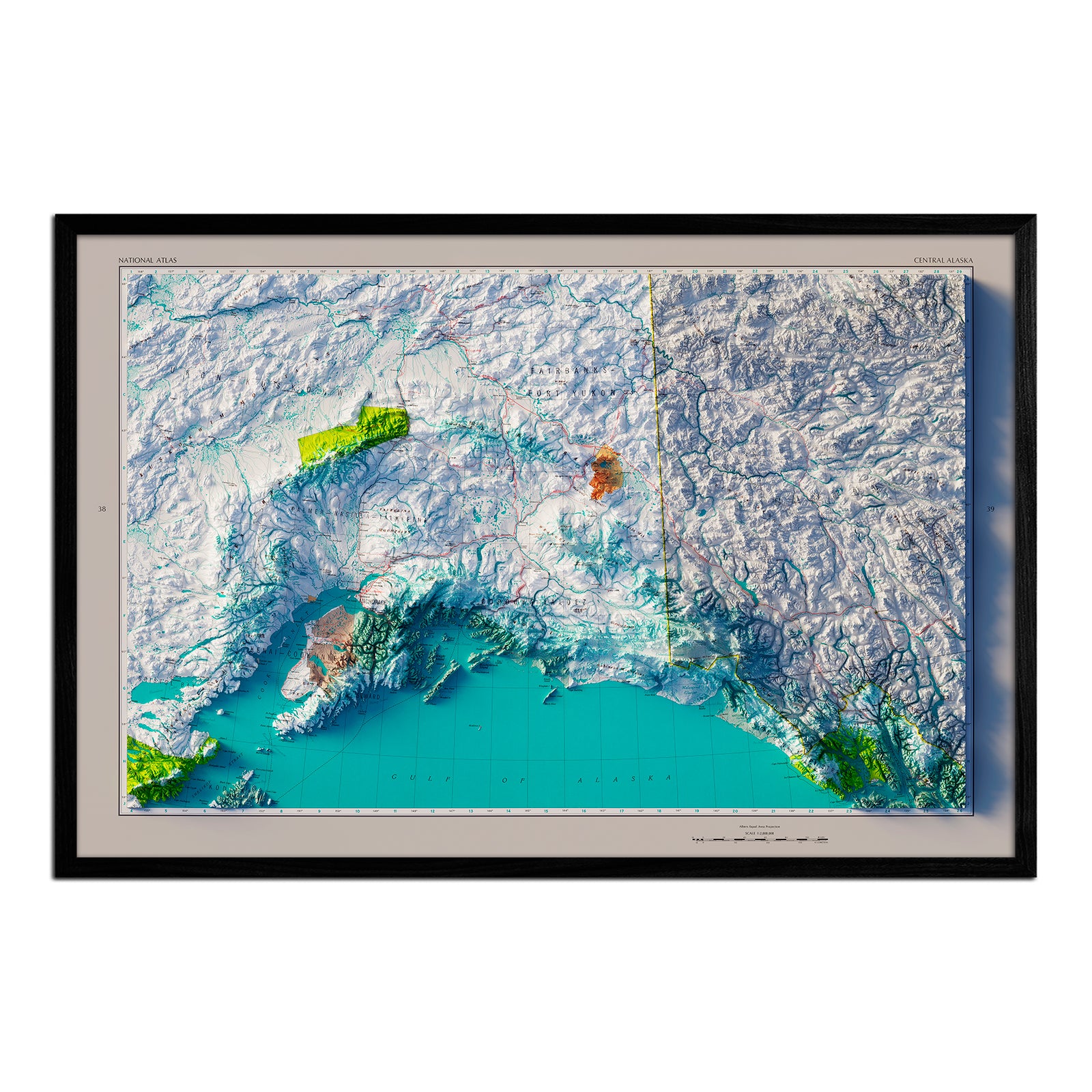
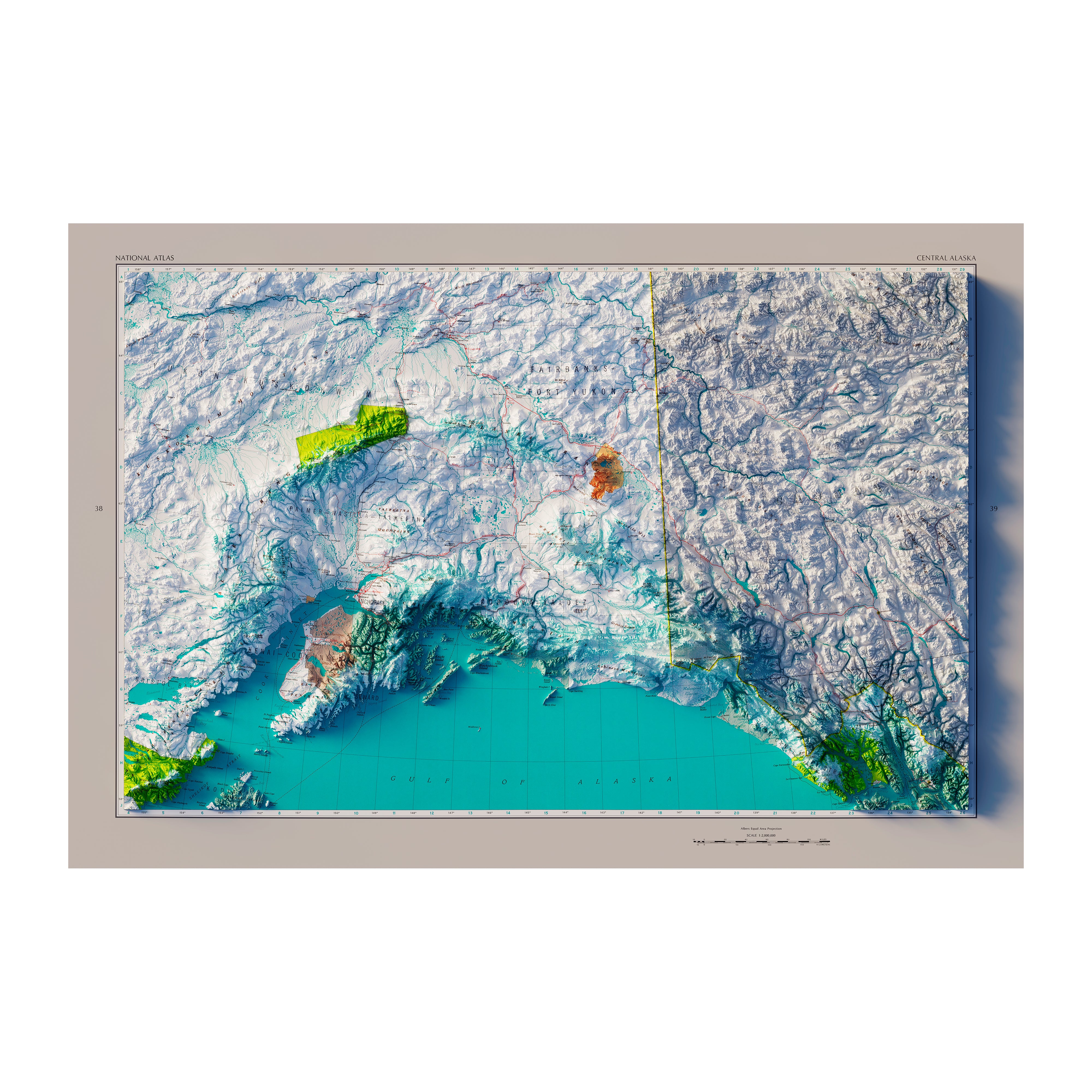
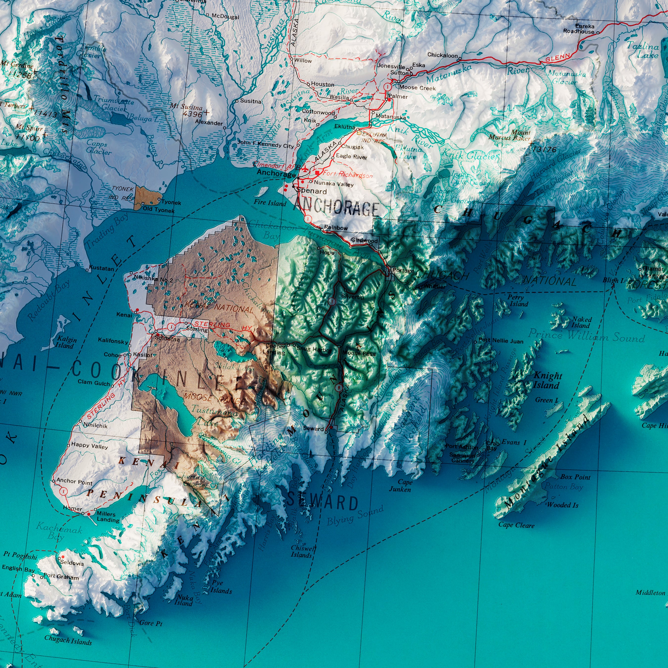
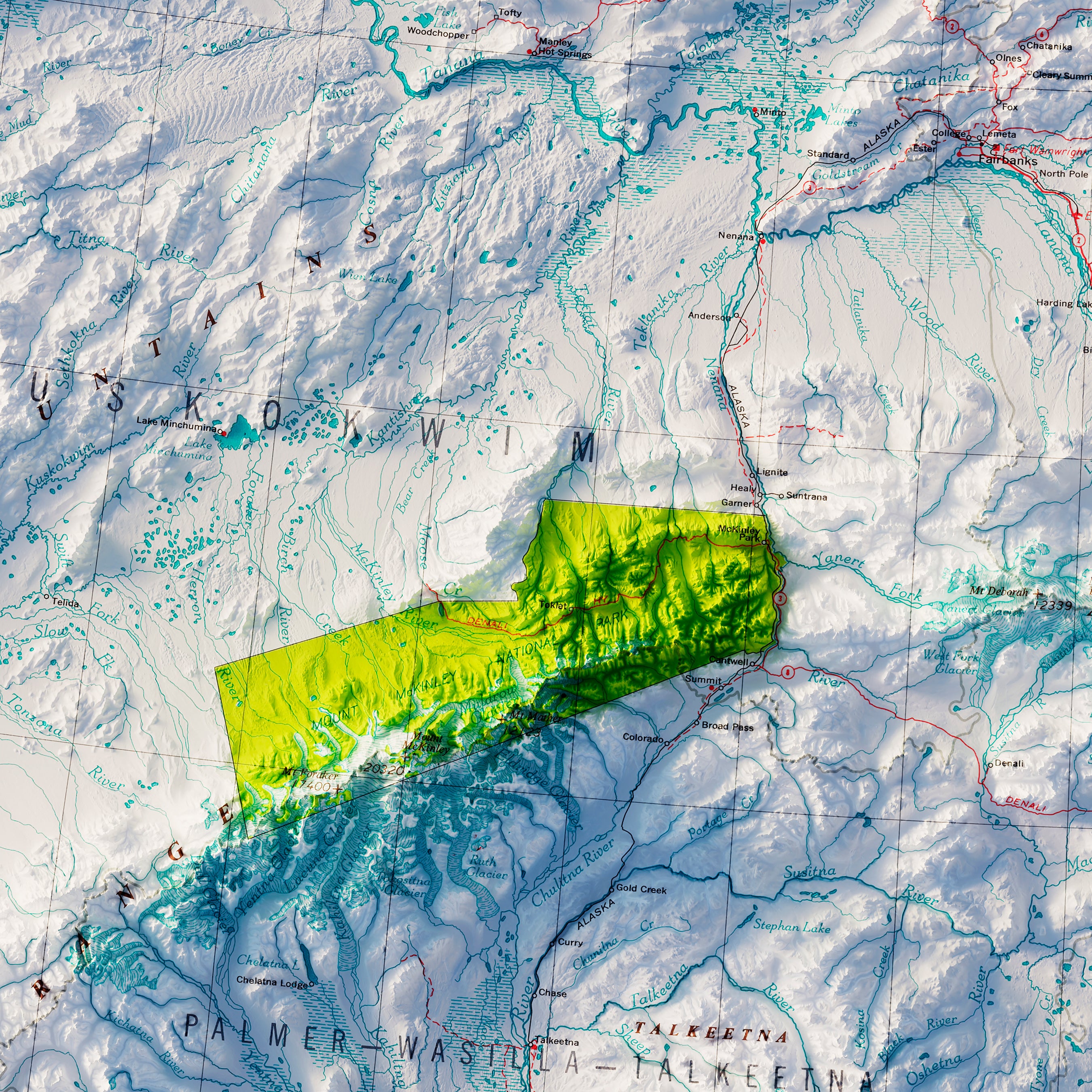
Central Alaska 1970 Shaded Relief Map
From
$ 79.00 USD
4.0 / 5.0
1 review
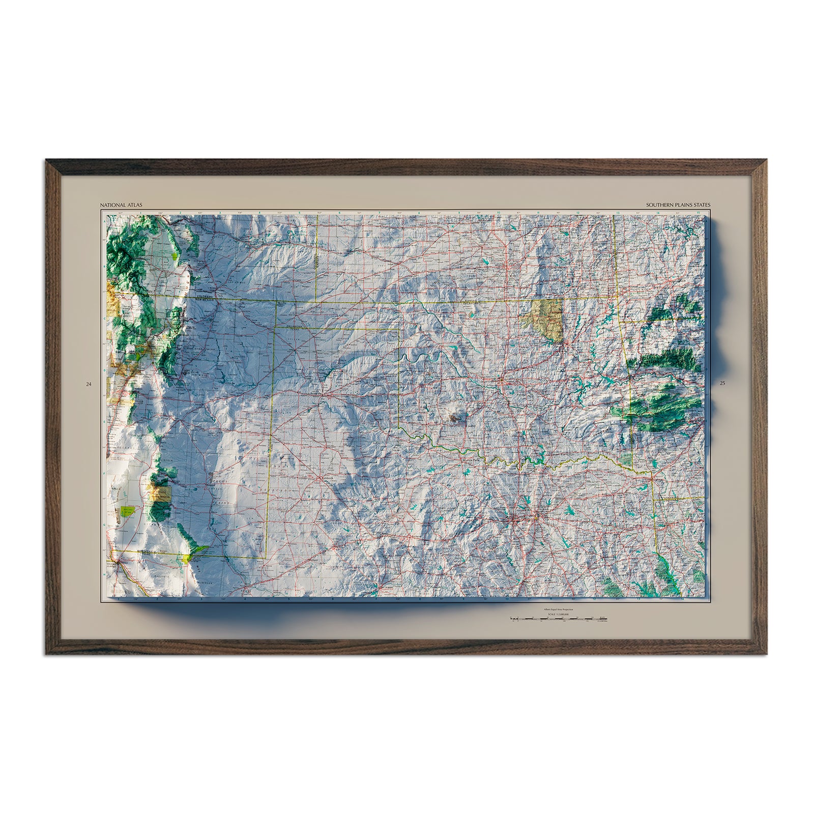
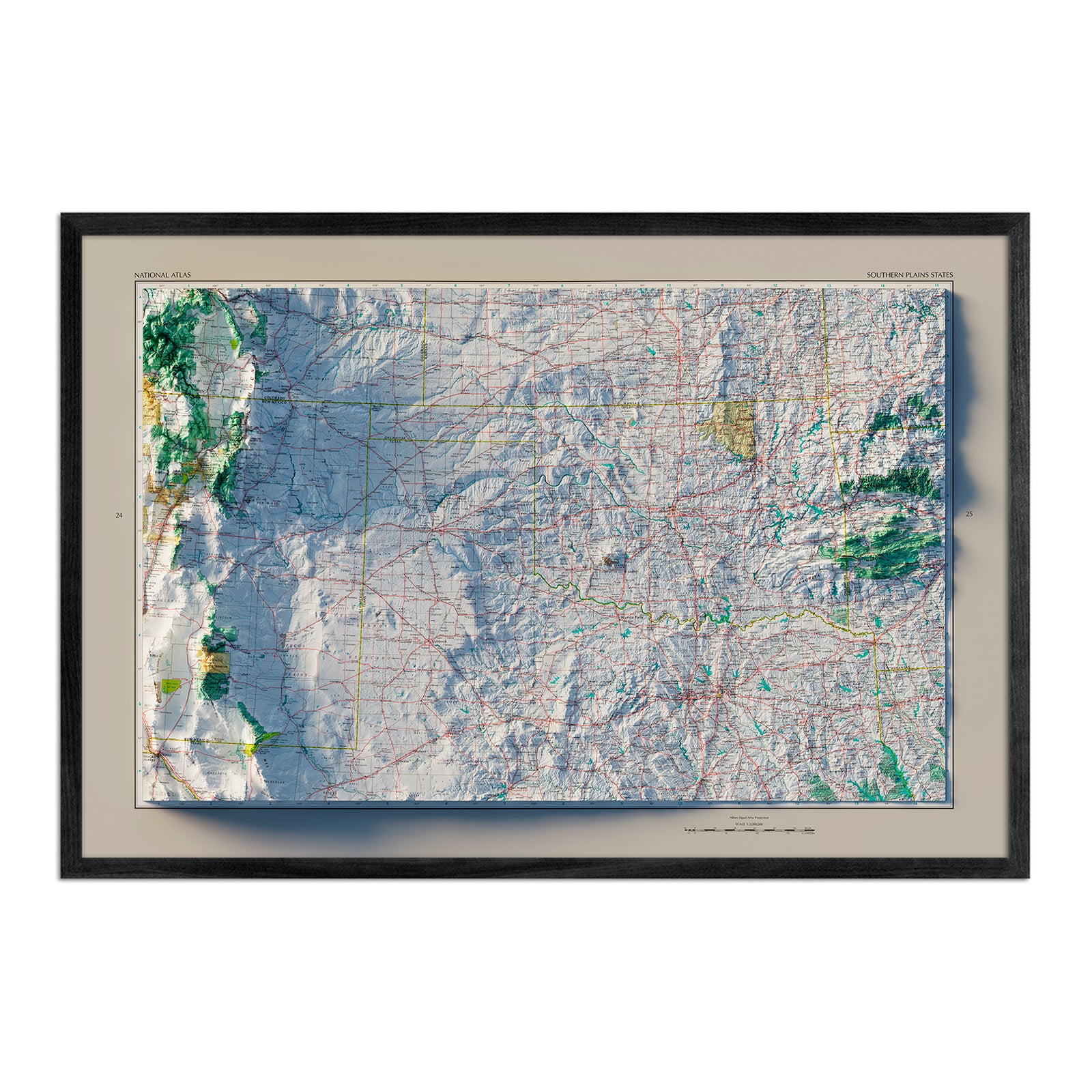
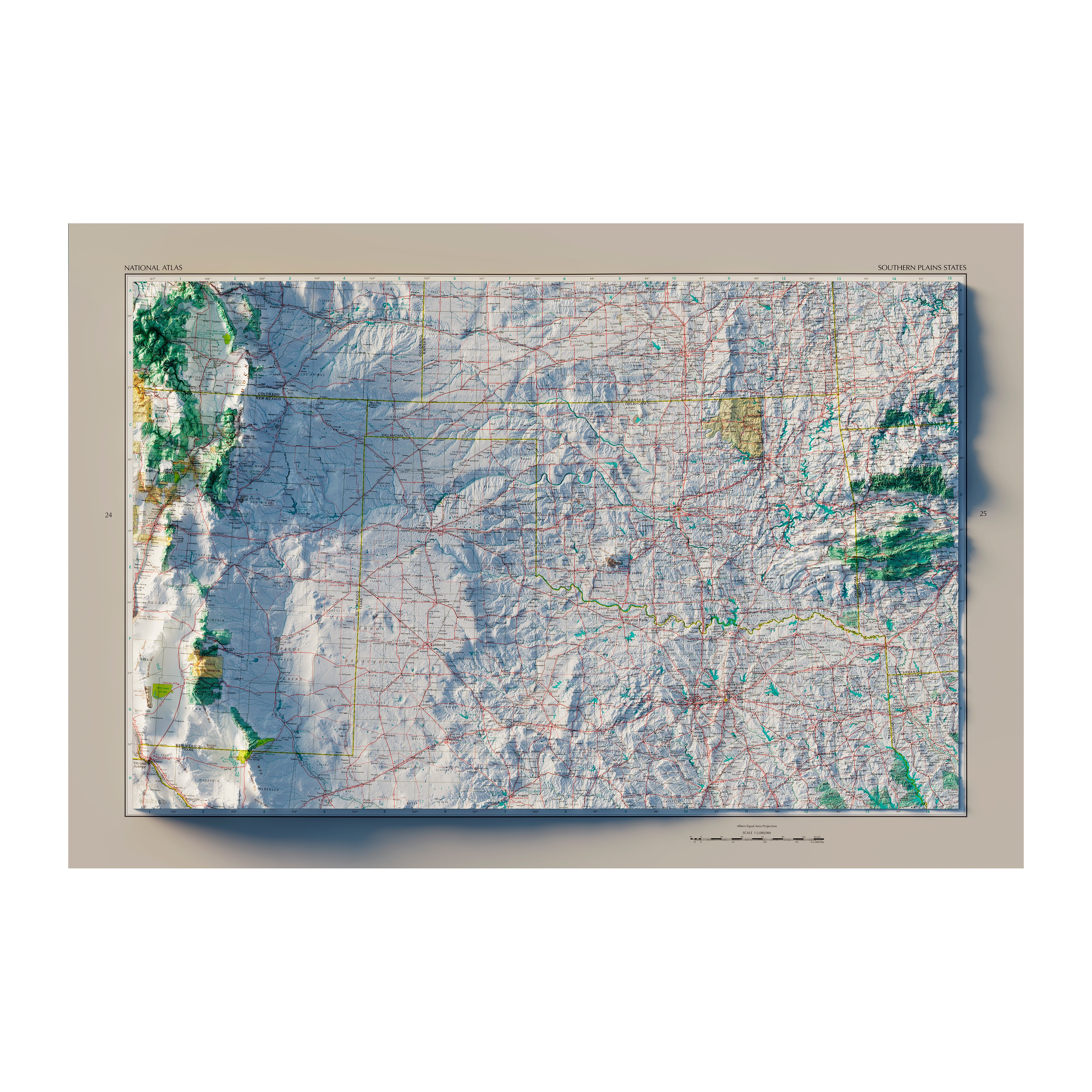
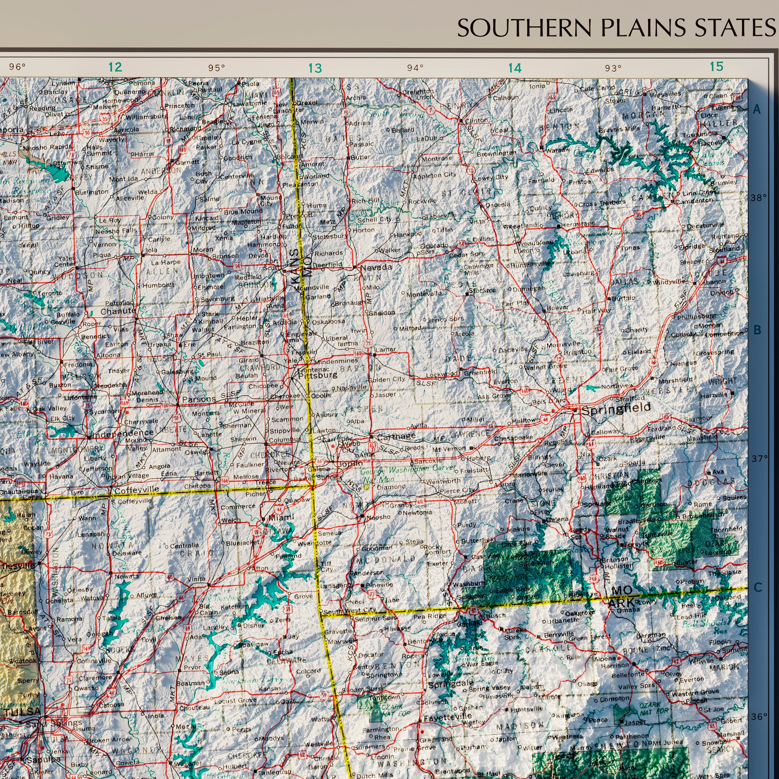
Southern Plains States 1970 Shaded Relief Map
From
$ 79.00 USD
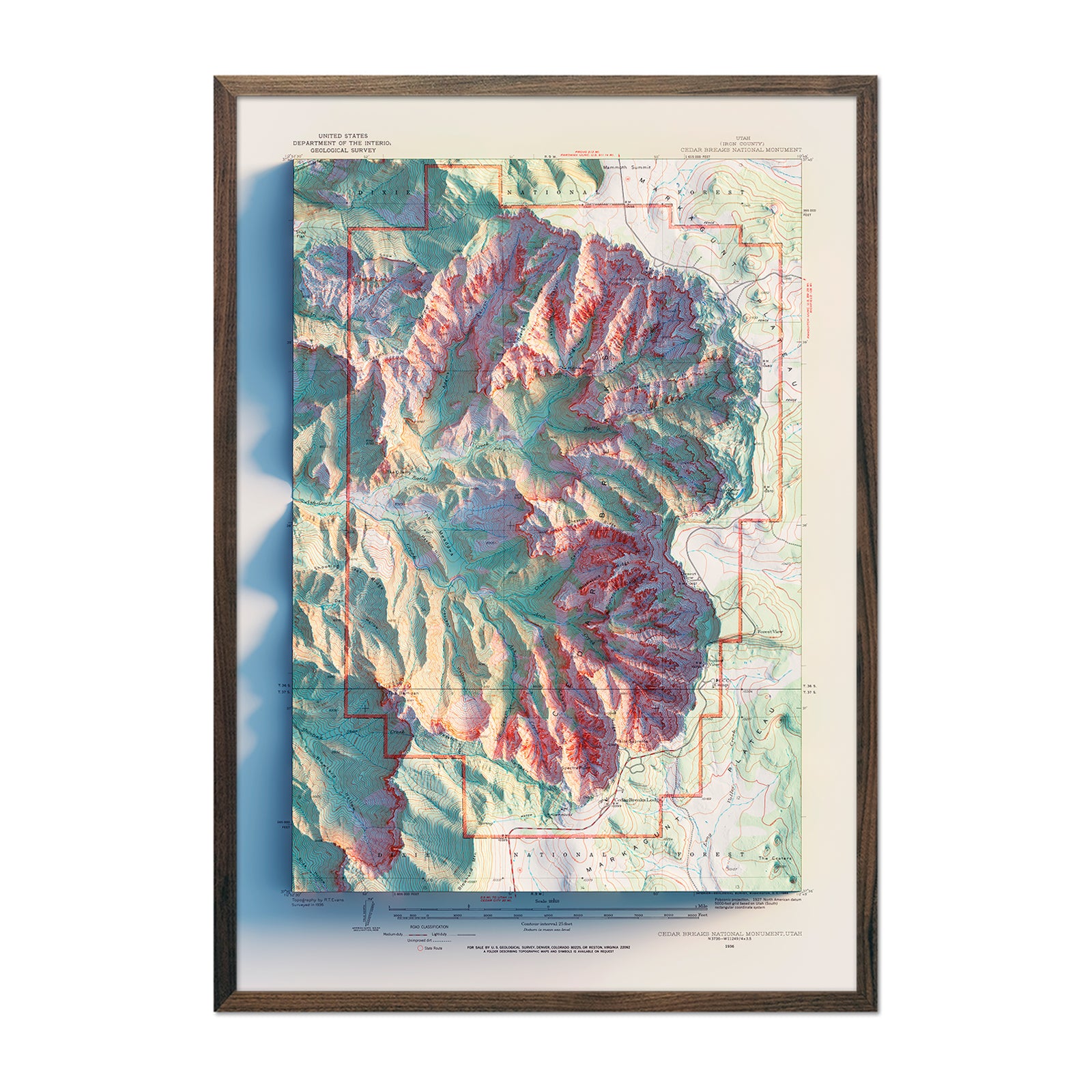
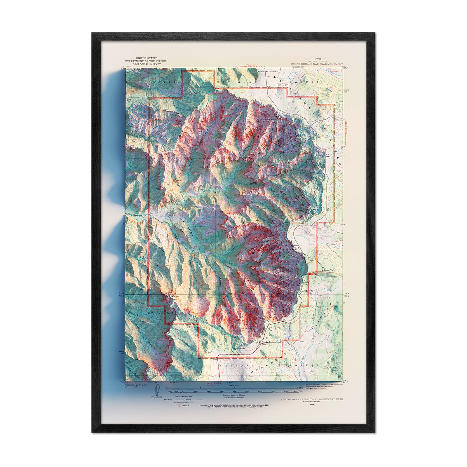
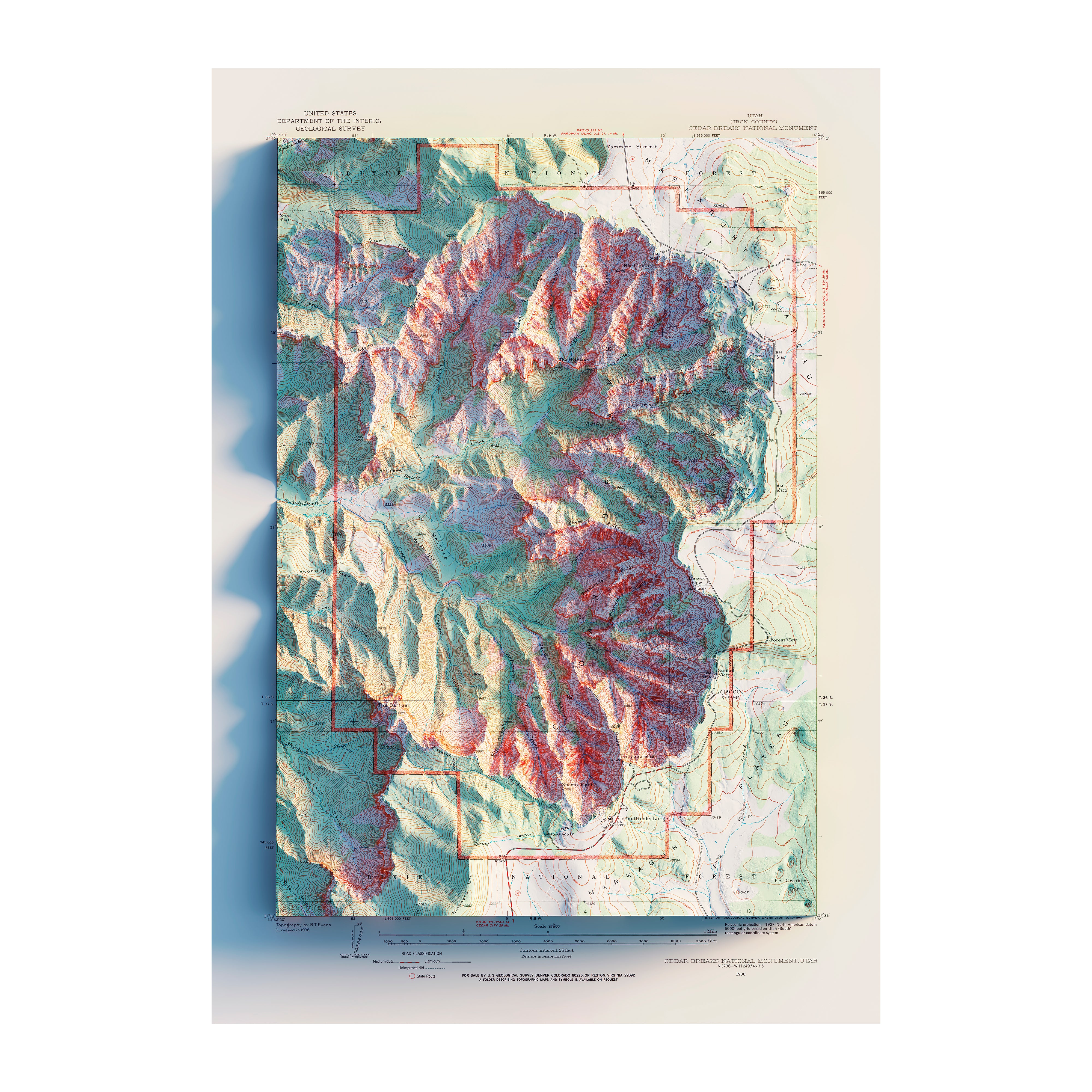
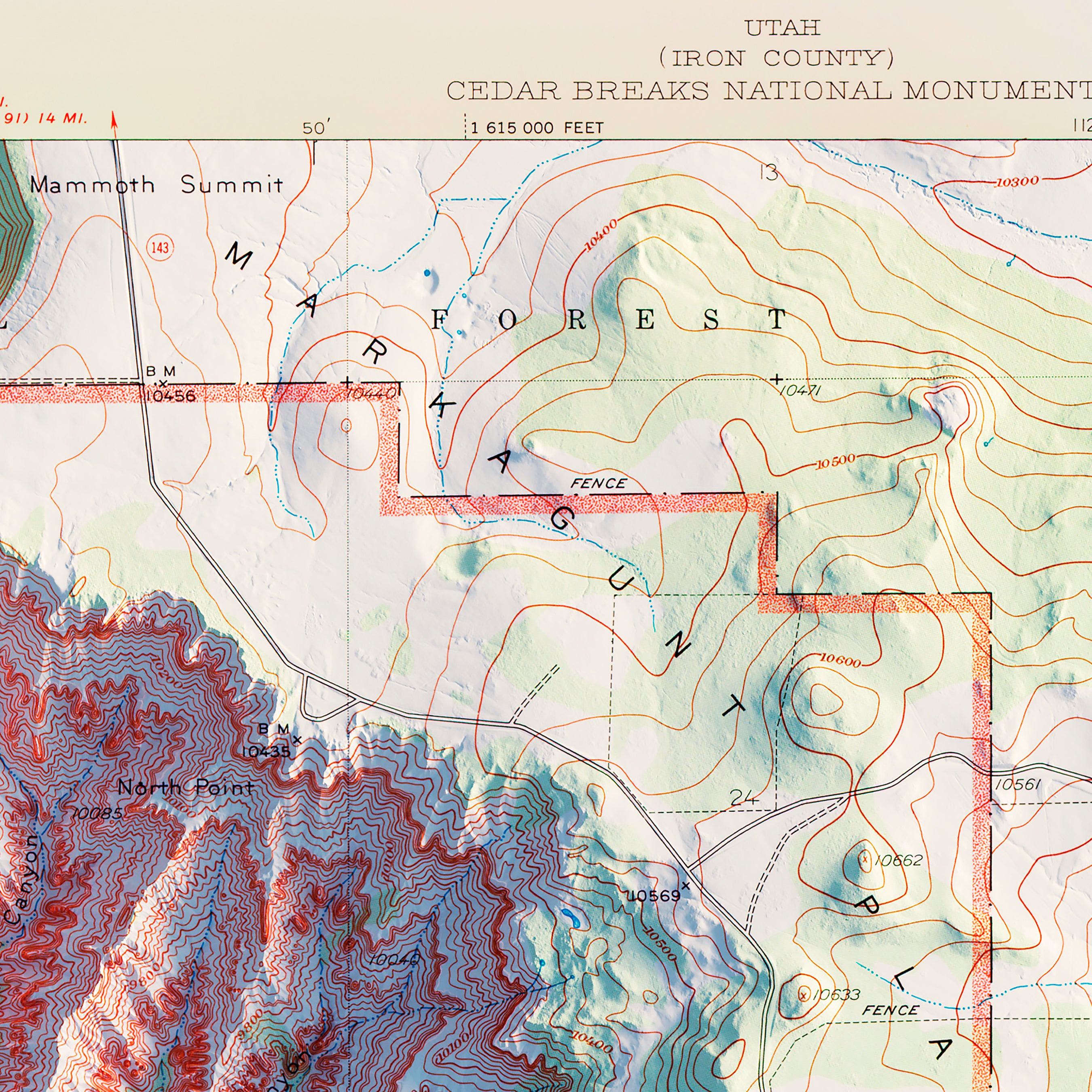
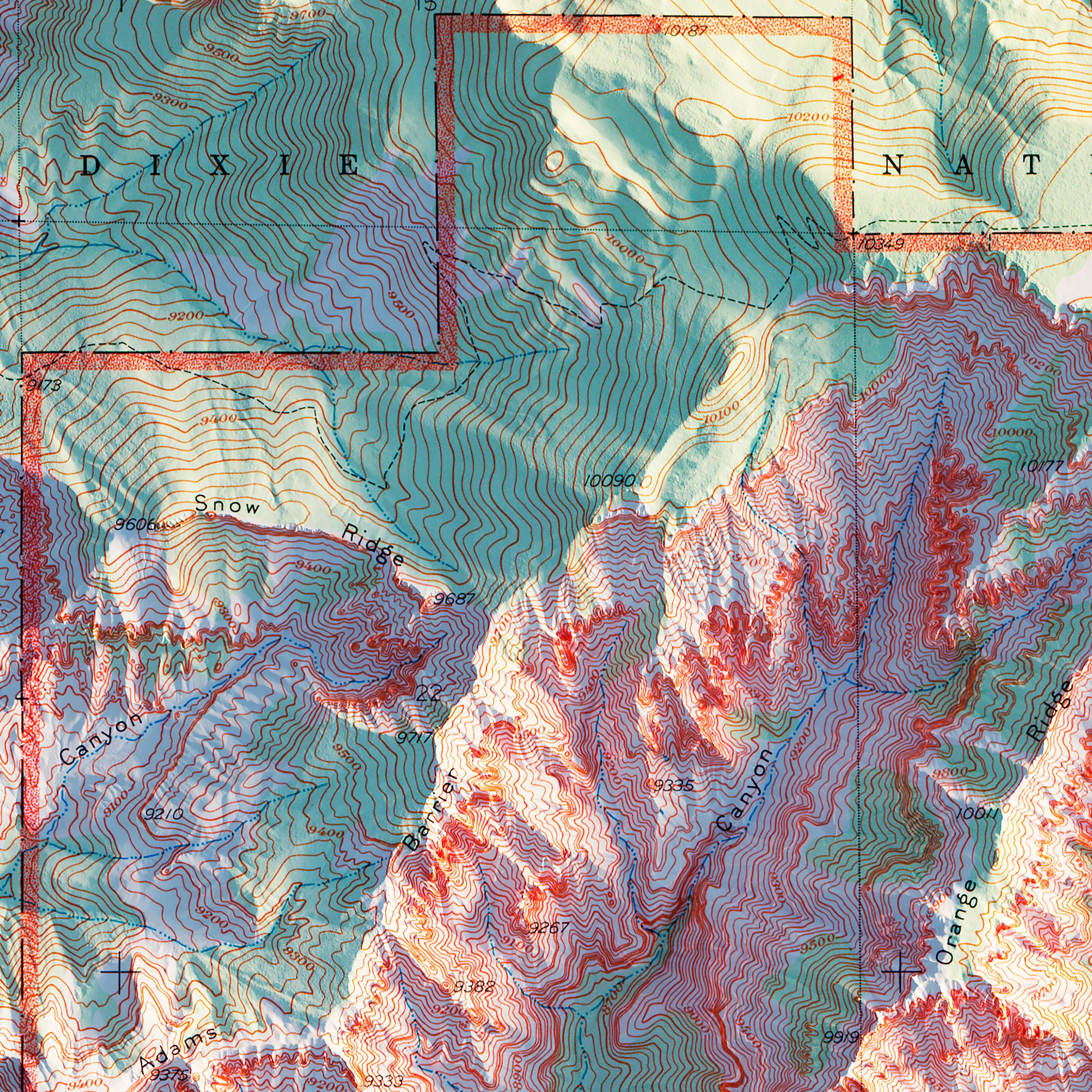
Cedar Breaks 1936 Shaded Relief Map
From
$ 79.00 USD
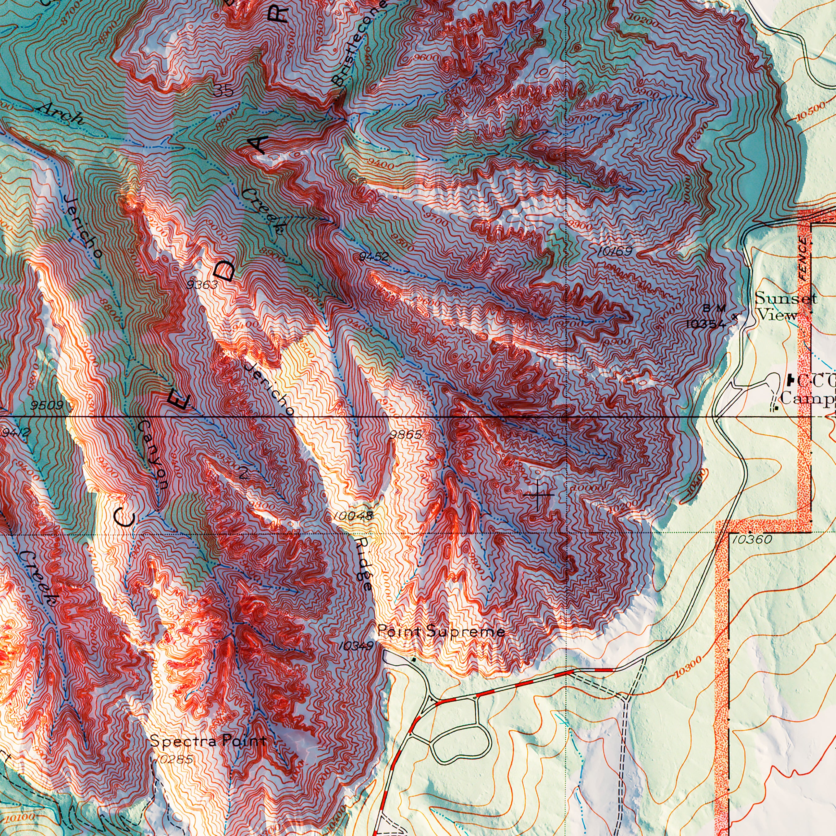
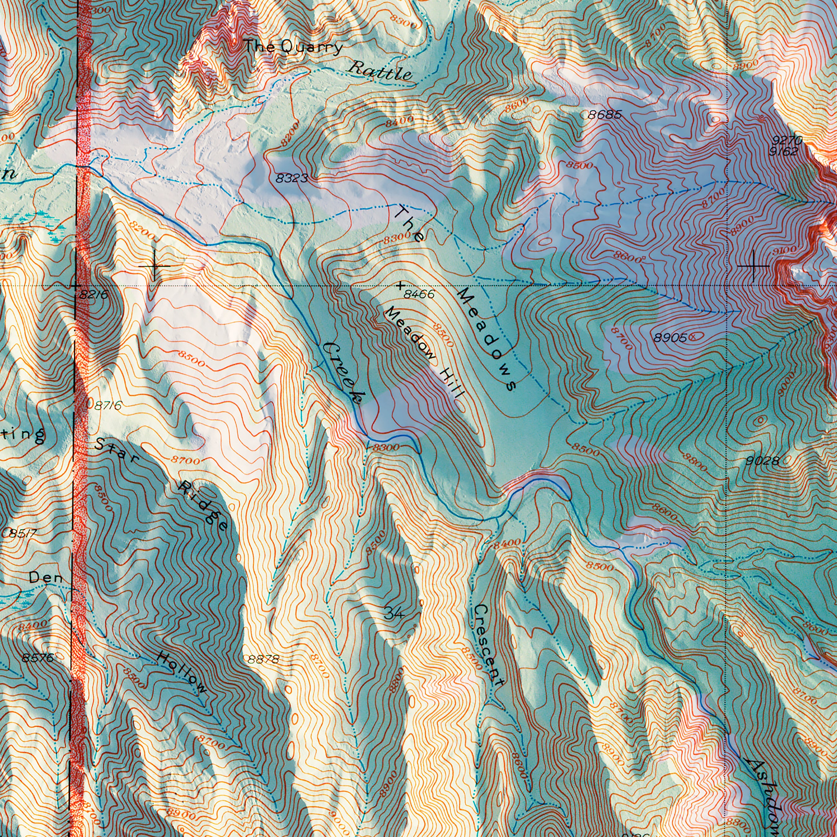
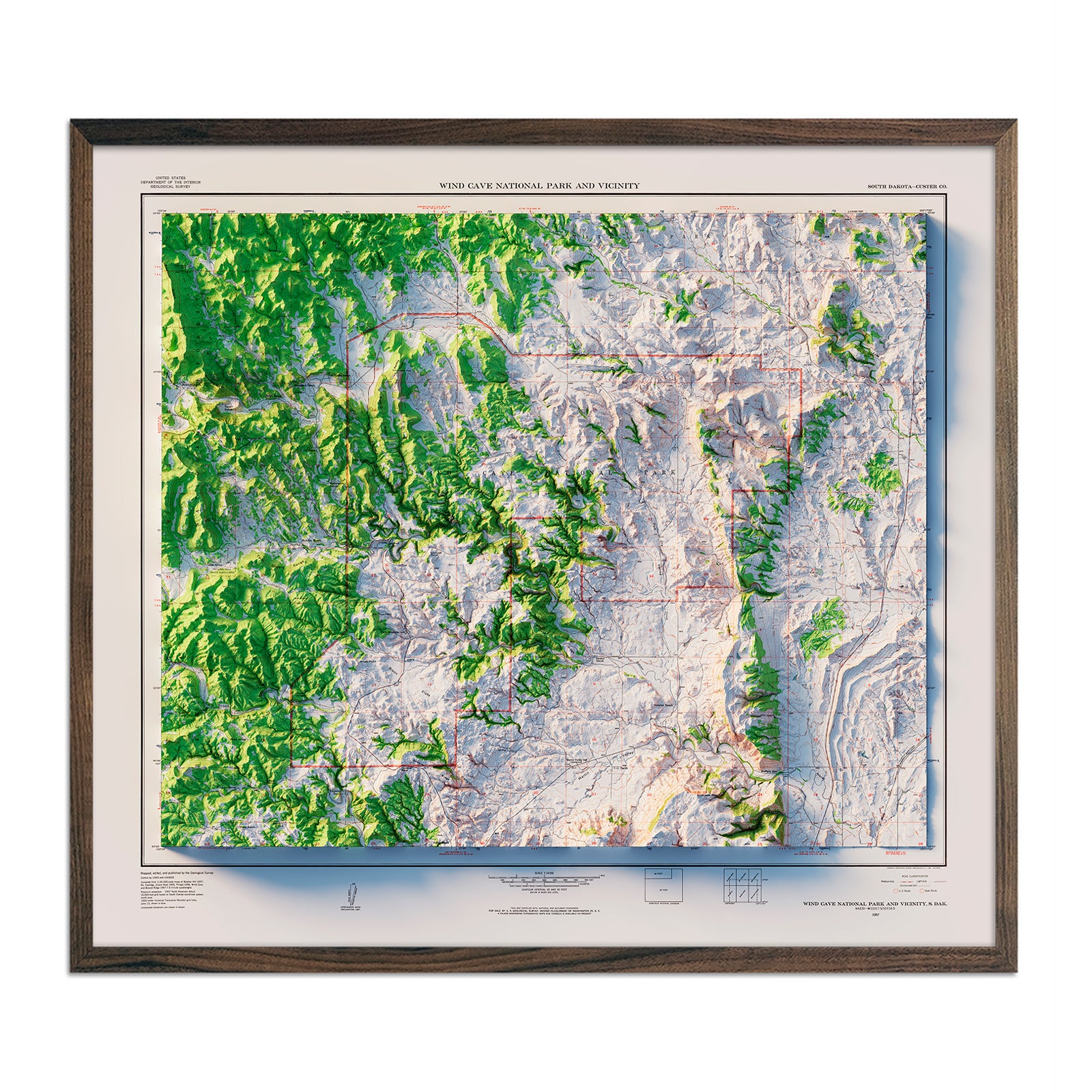
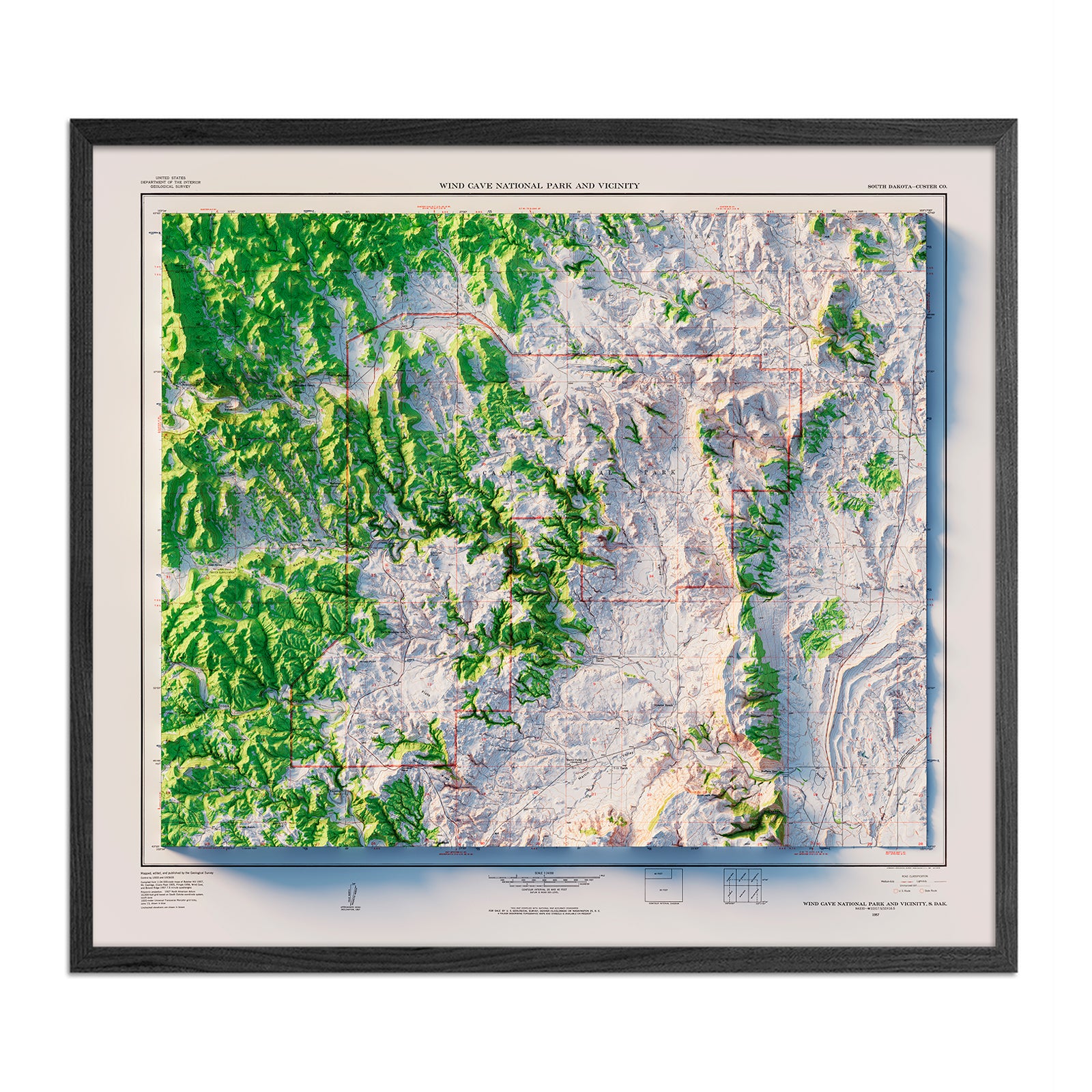
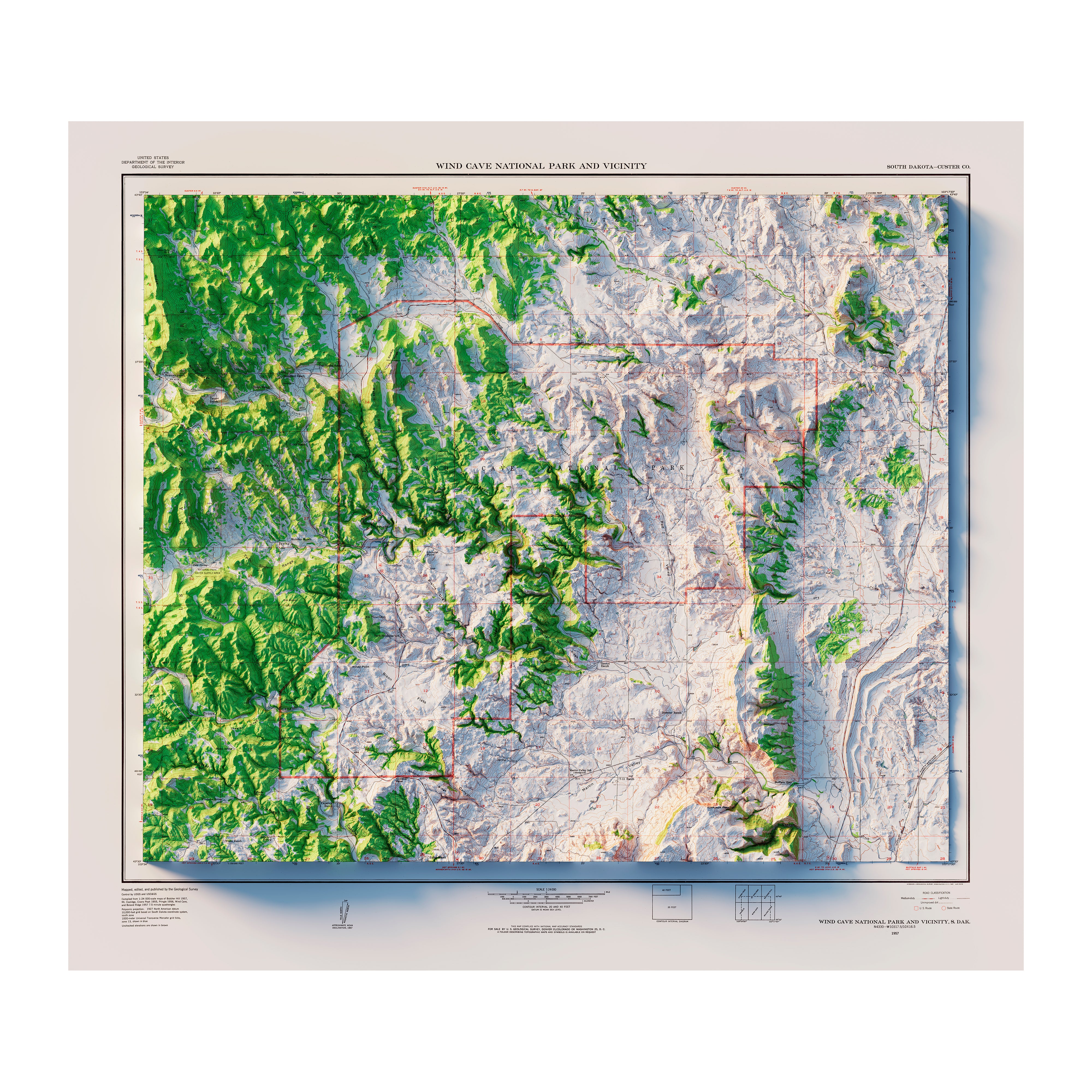
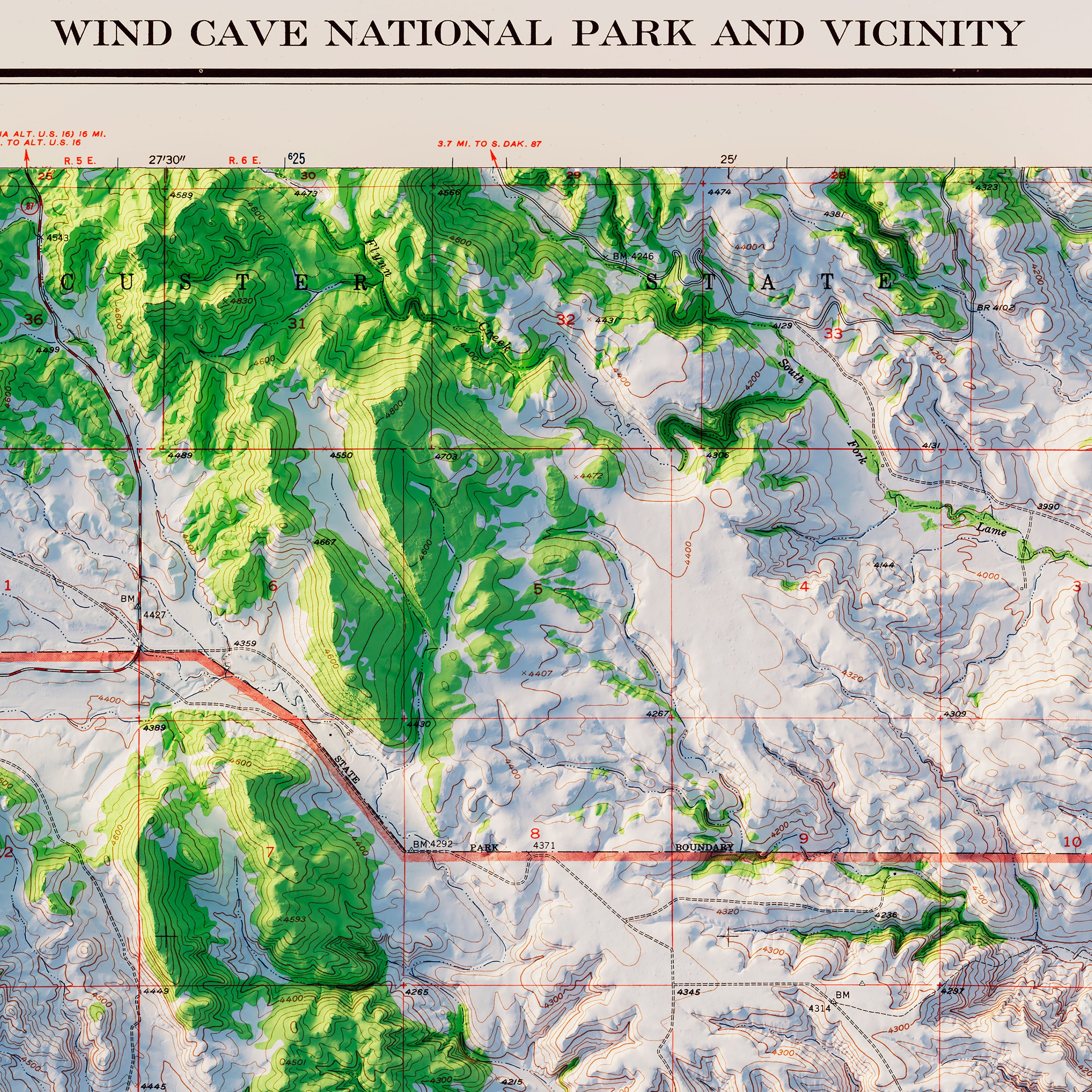
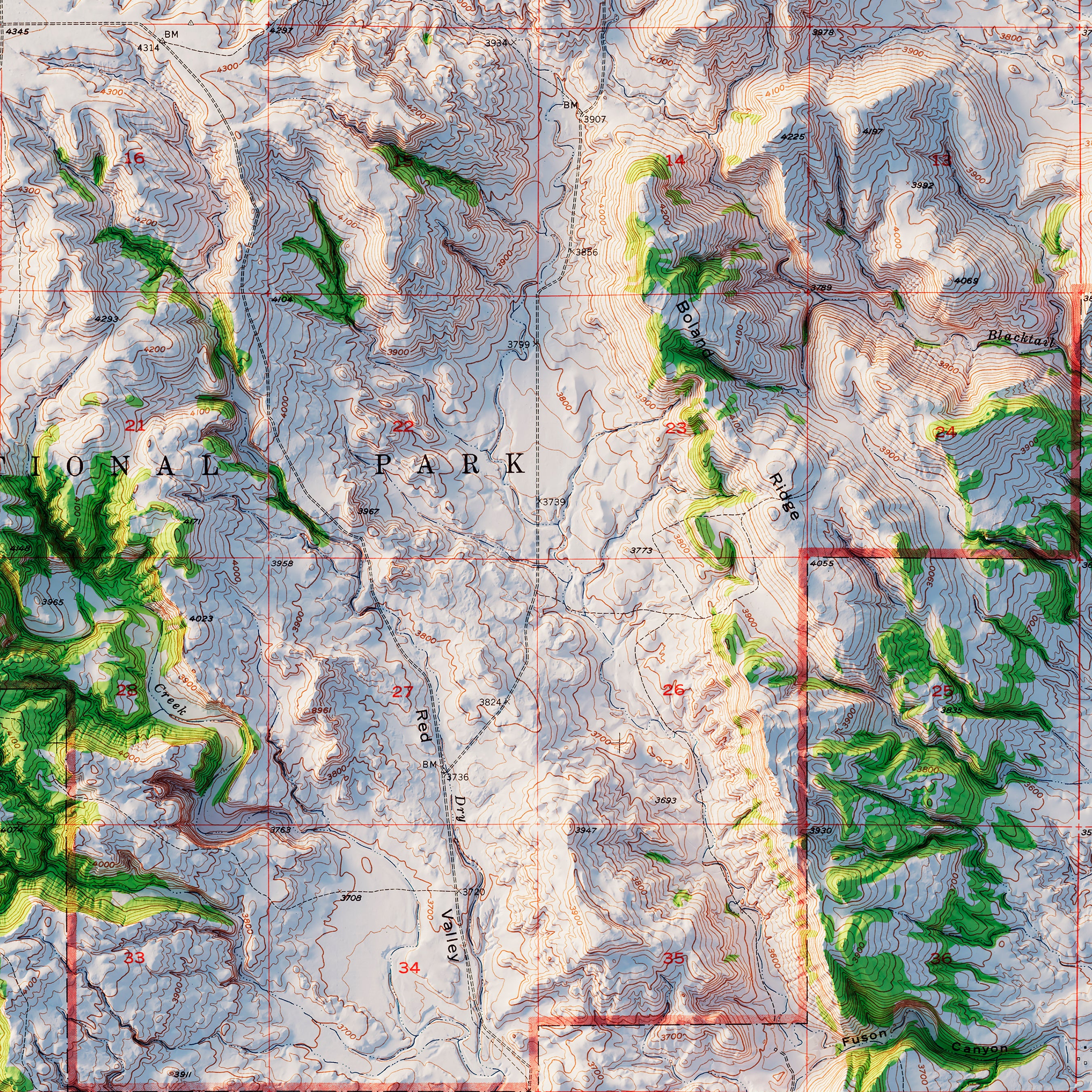
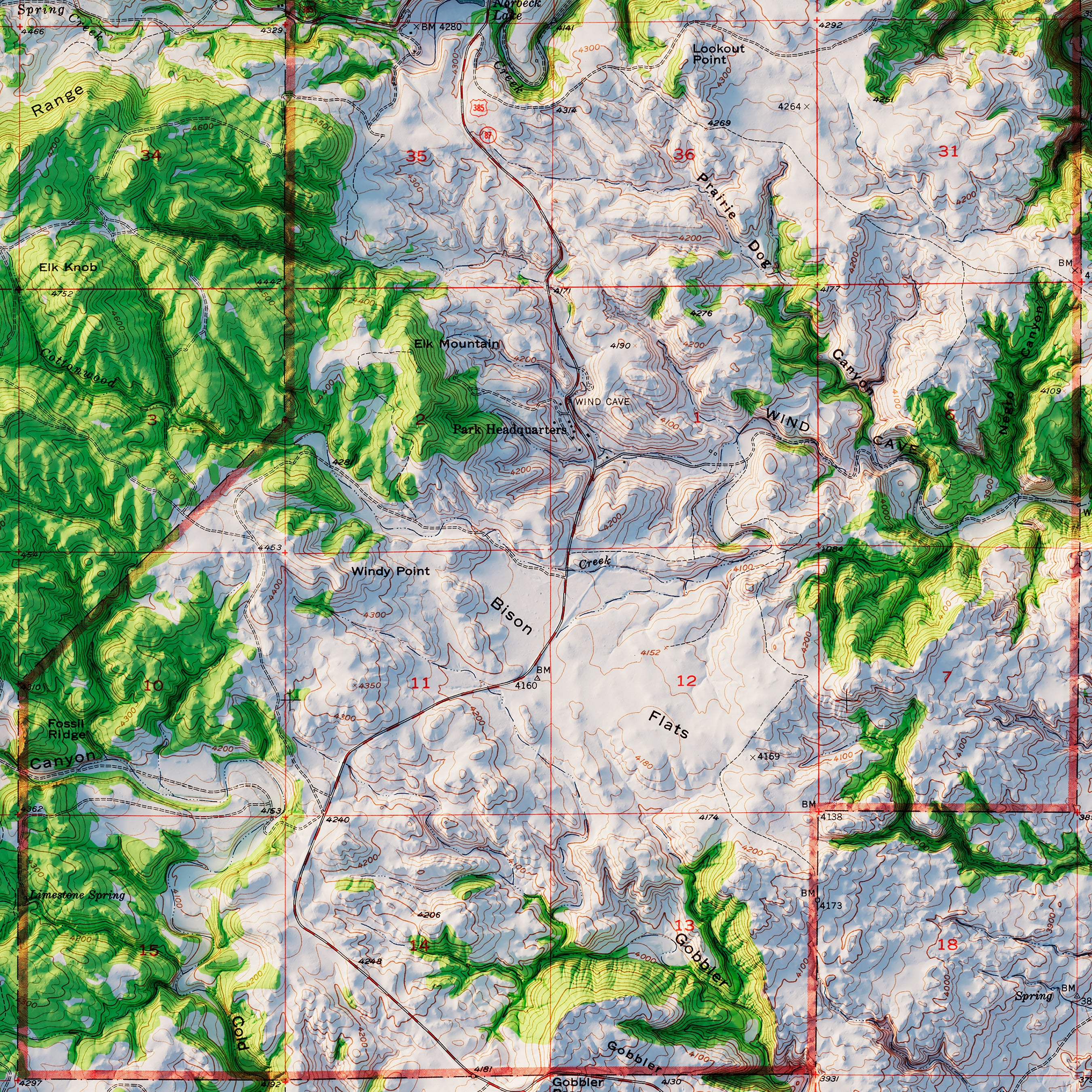
Wind Cave National Park 1957 Shaded Relief Map
From
$ 99.00 USD
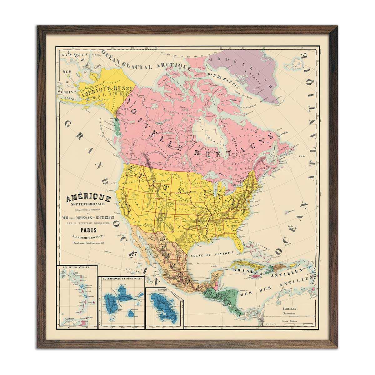
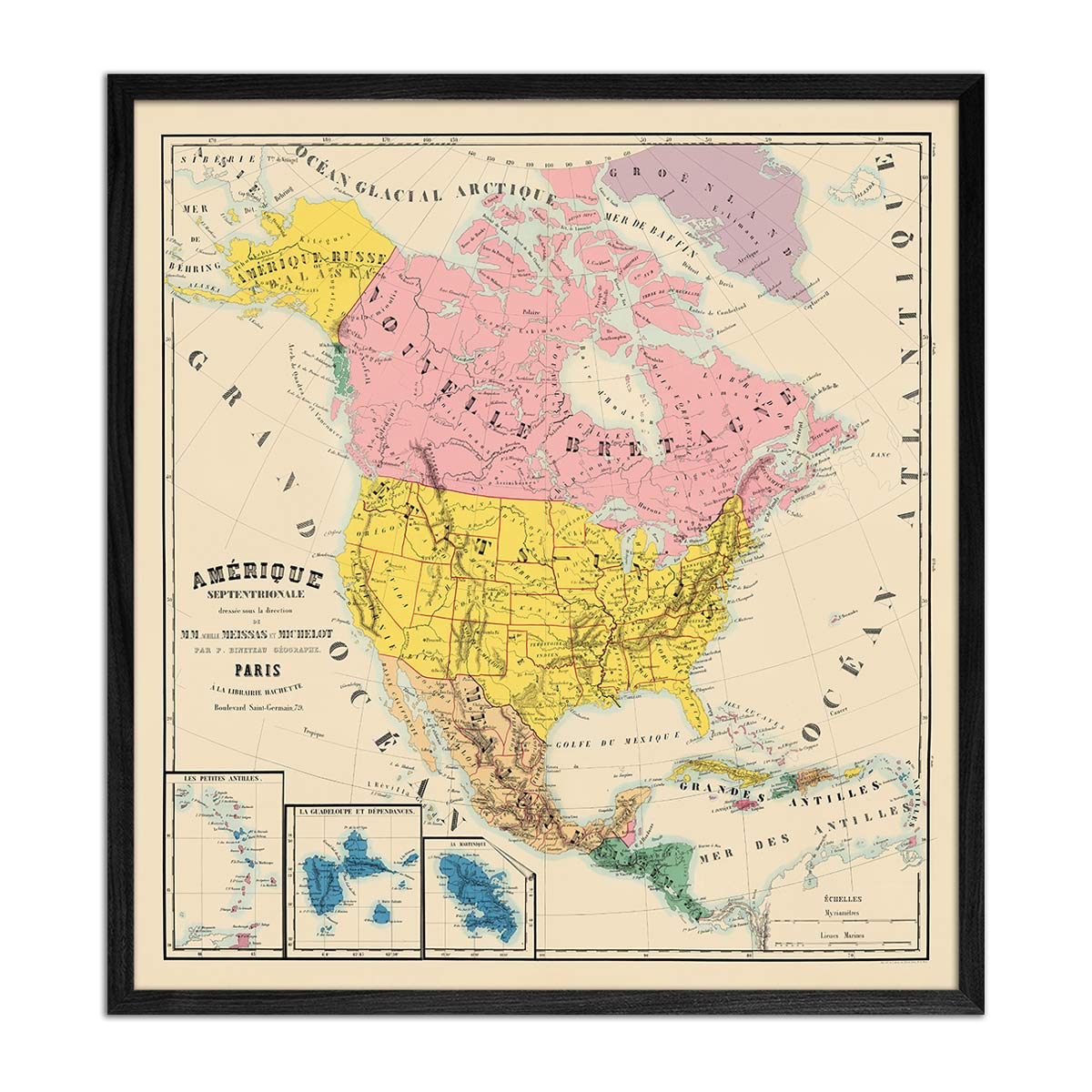
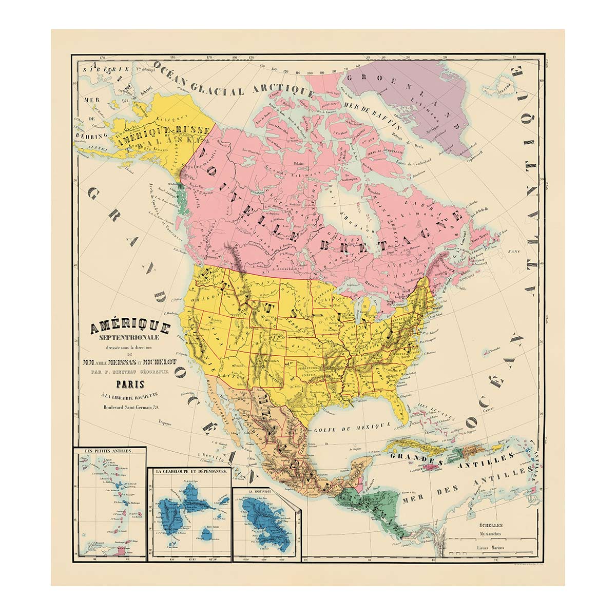
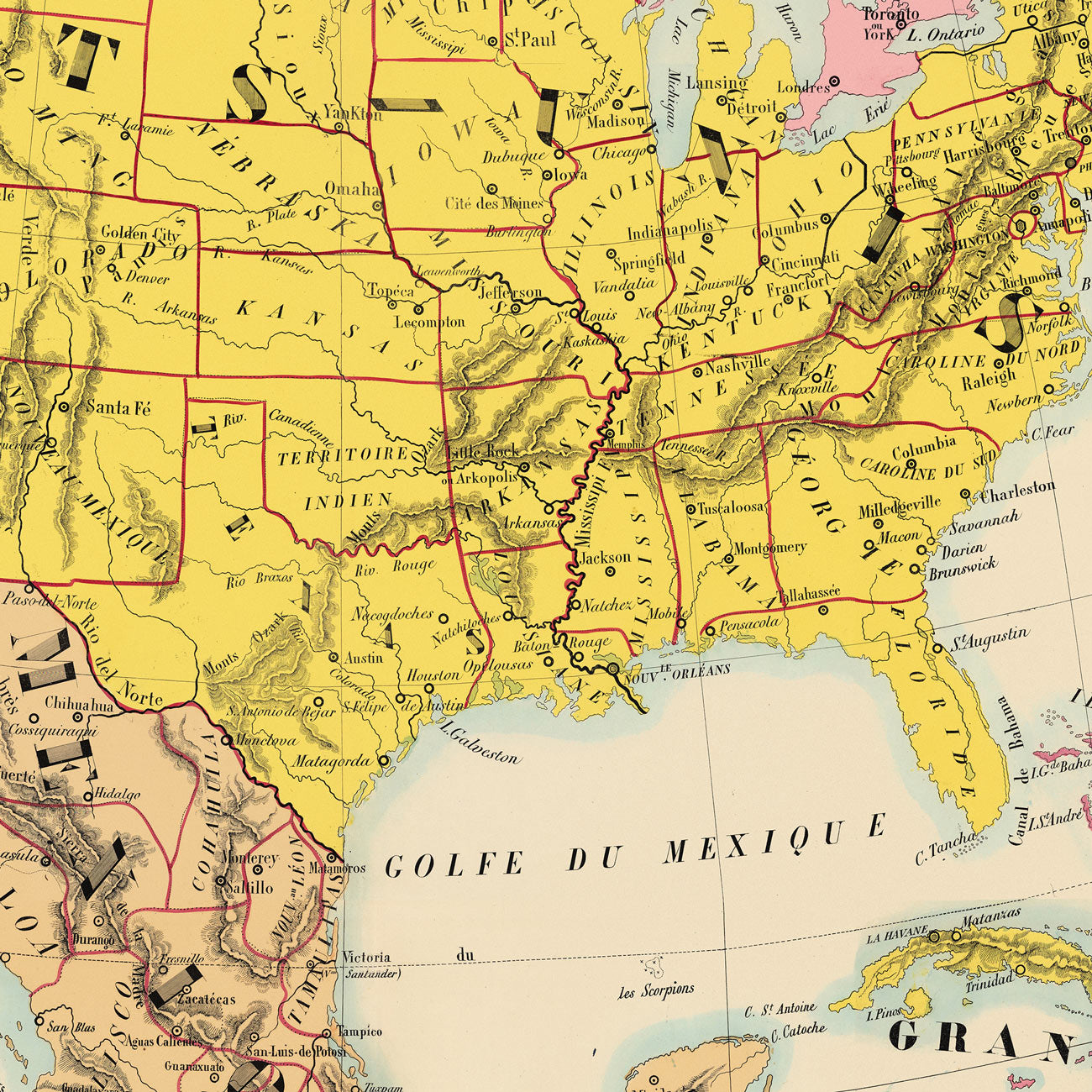
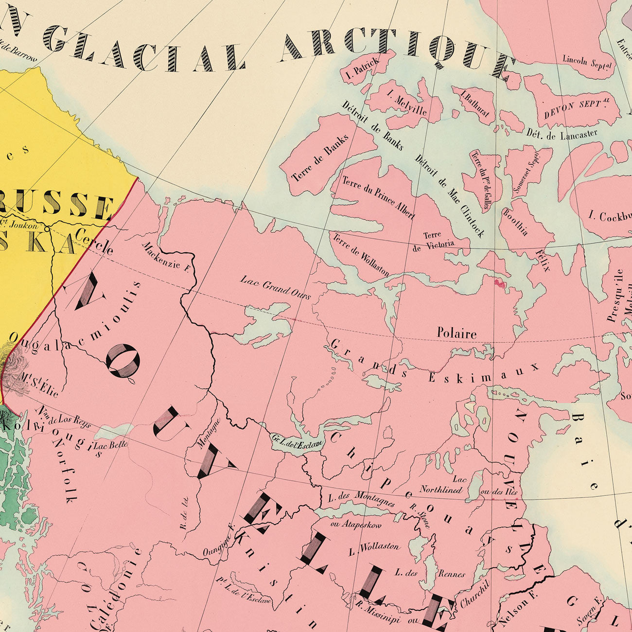
Amerique Septentrionale Composite 1844 Map
From
$ 89.00 USD
5.0 / 5.0
105 reviews
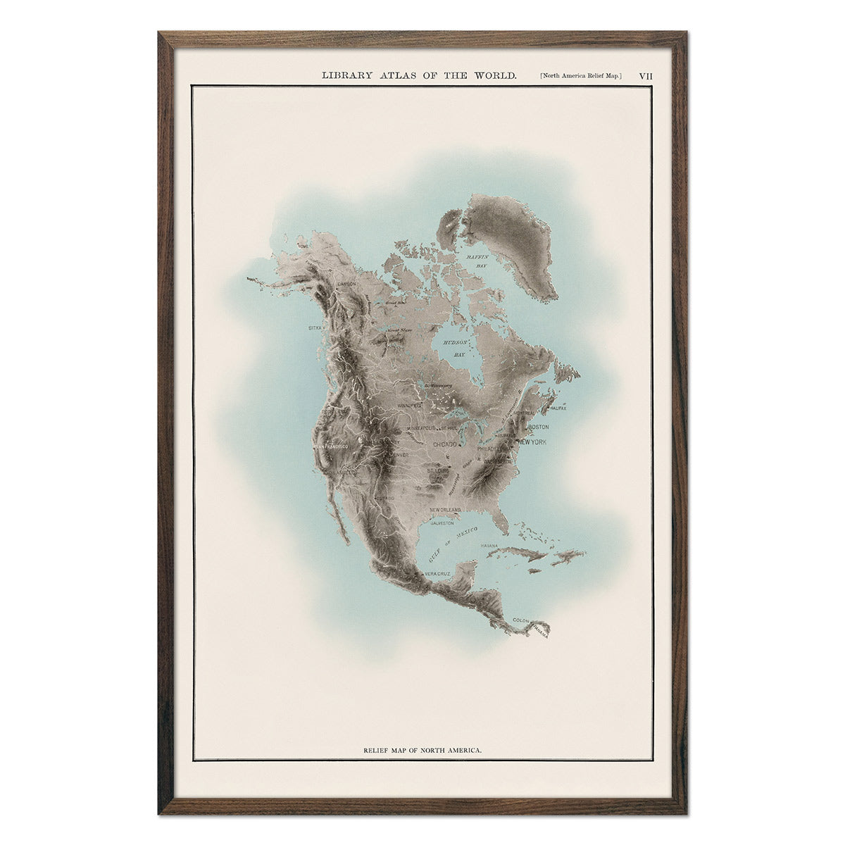
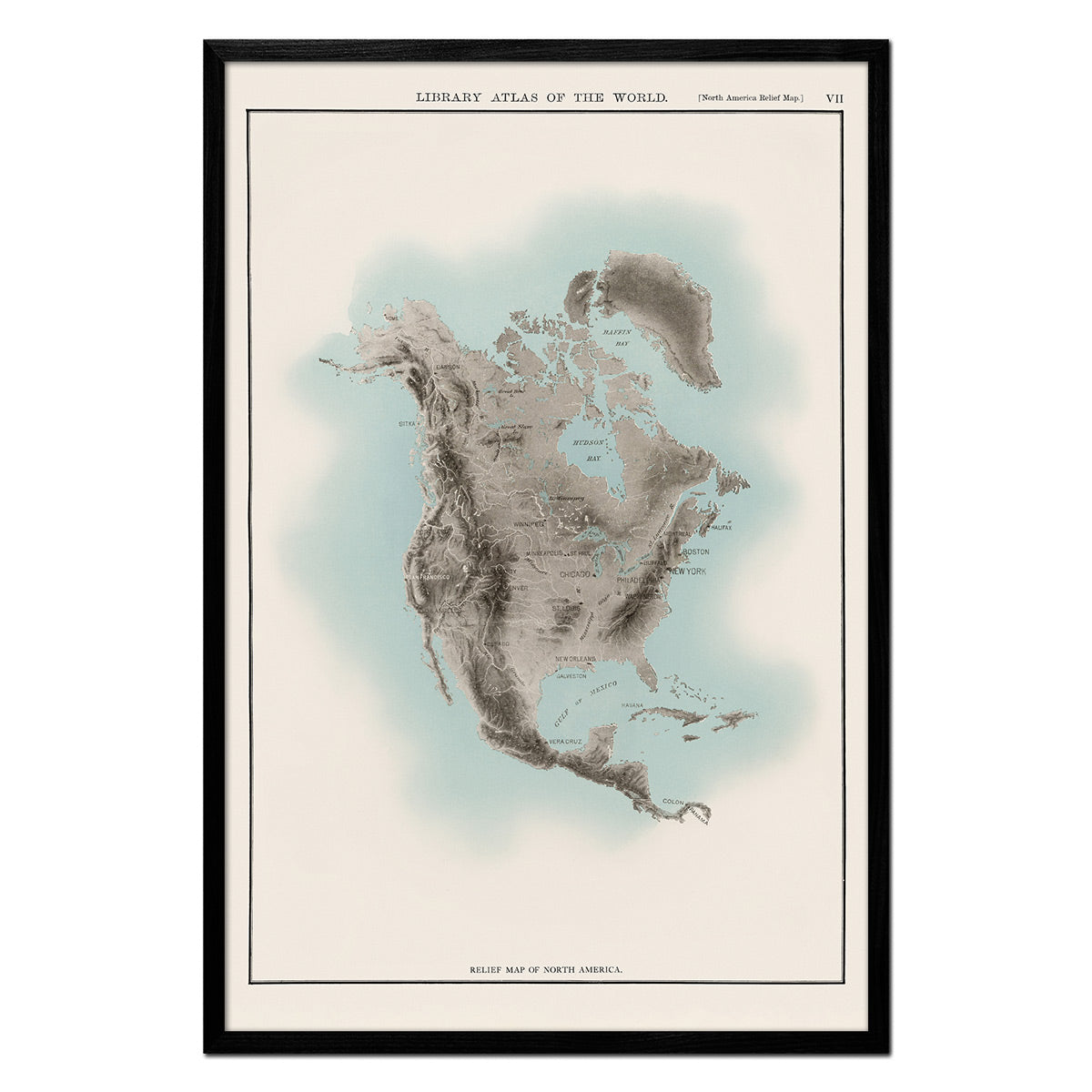
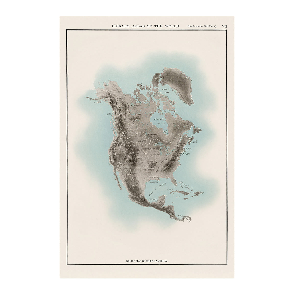
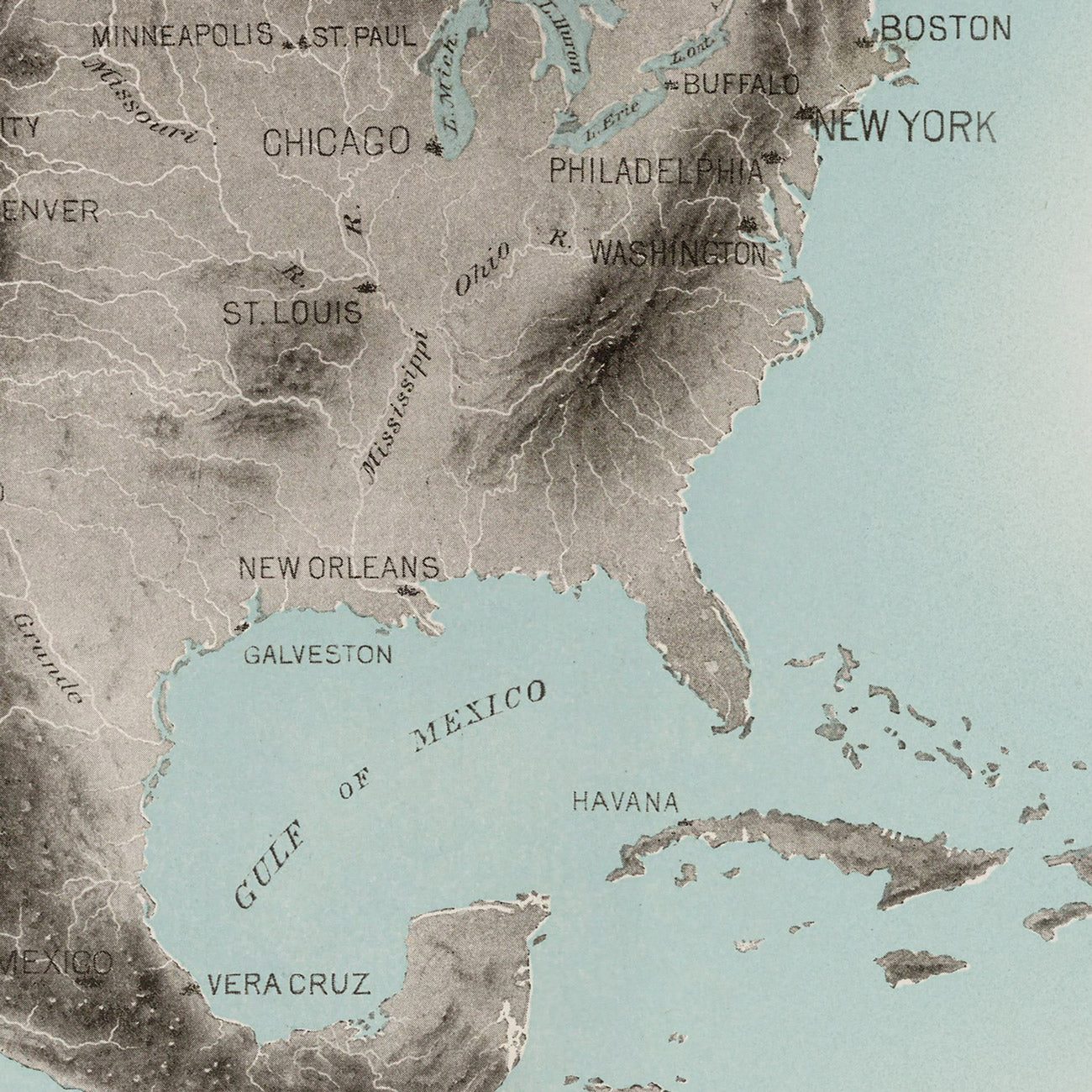
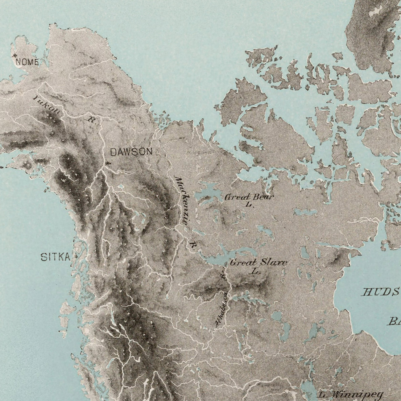
North America Atlas Map
From
$ 69.00 USD
5.0 / 5.0
105 reviews
New arrival
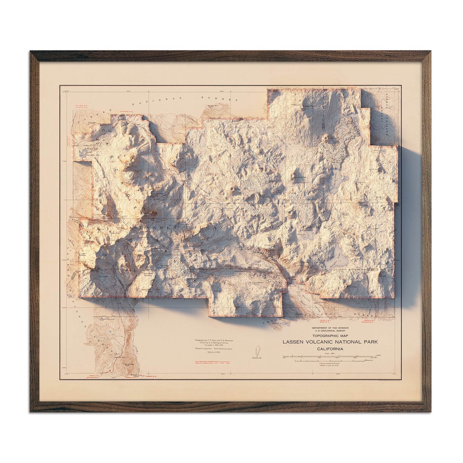
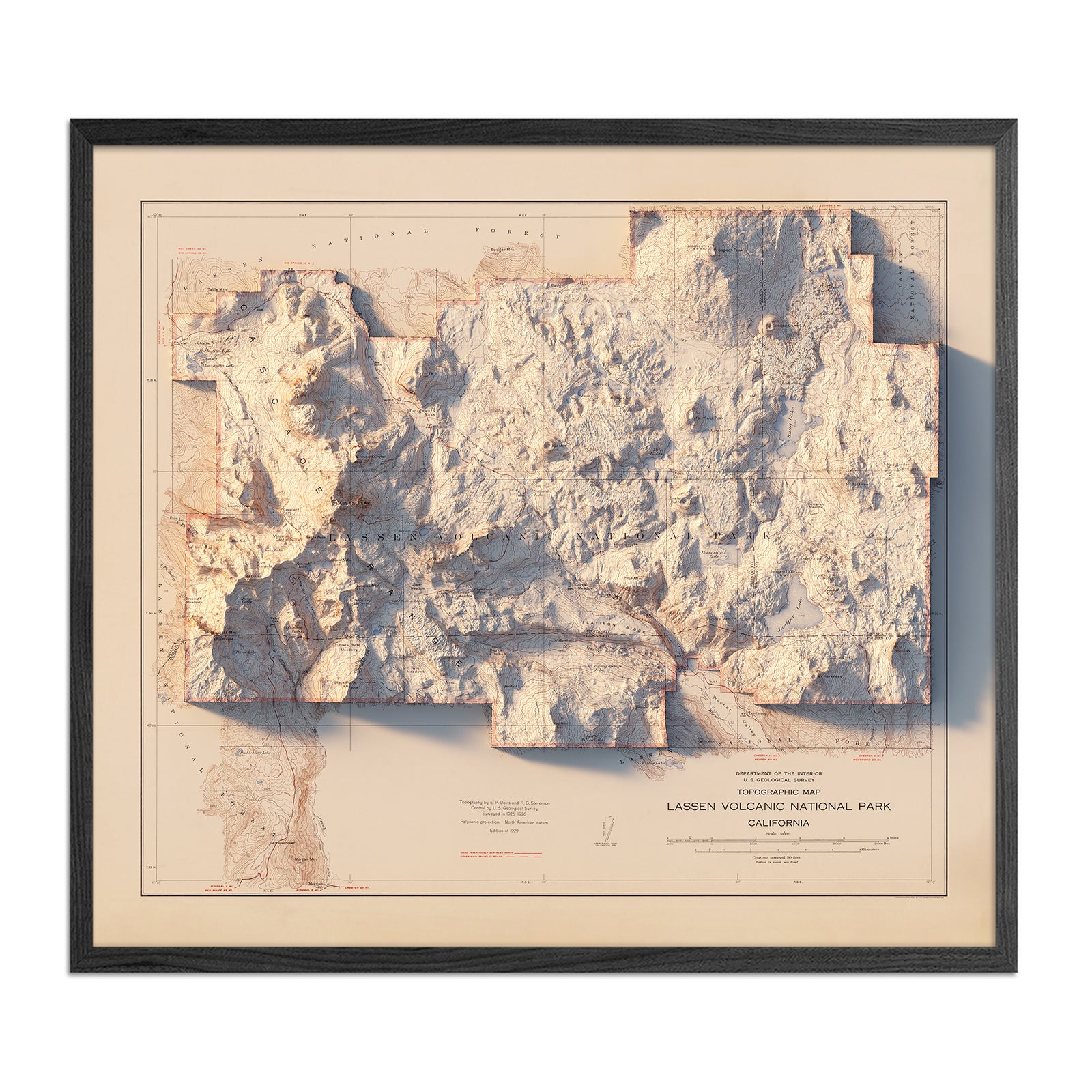
Lassen Volcanic National Park 1929 Shaded Relief Map
From
$ 99.00 USD
New arrival
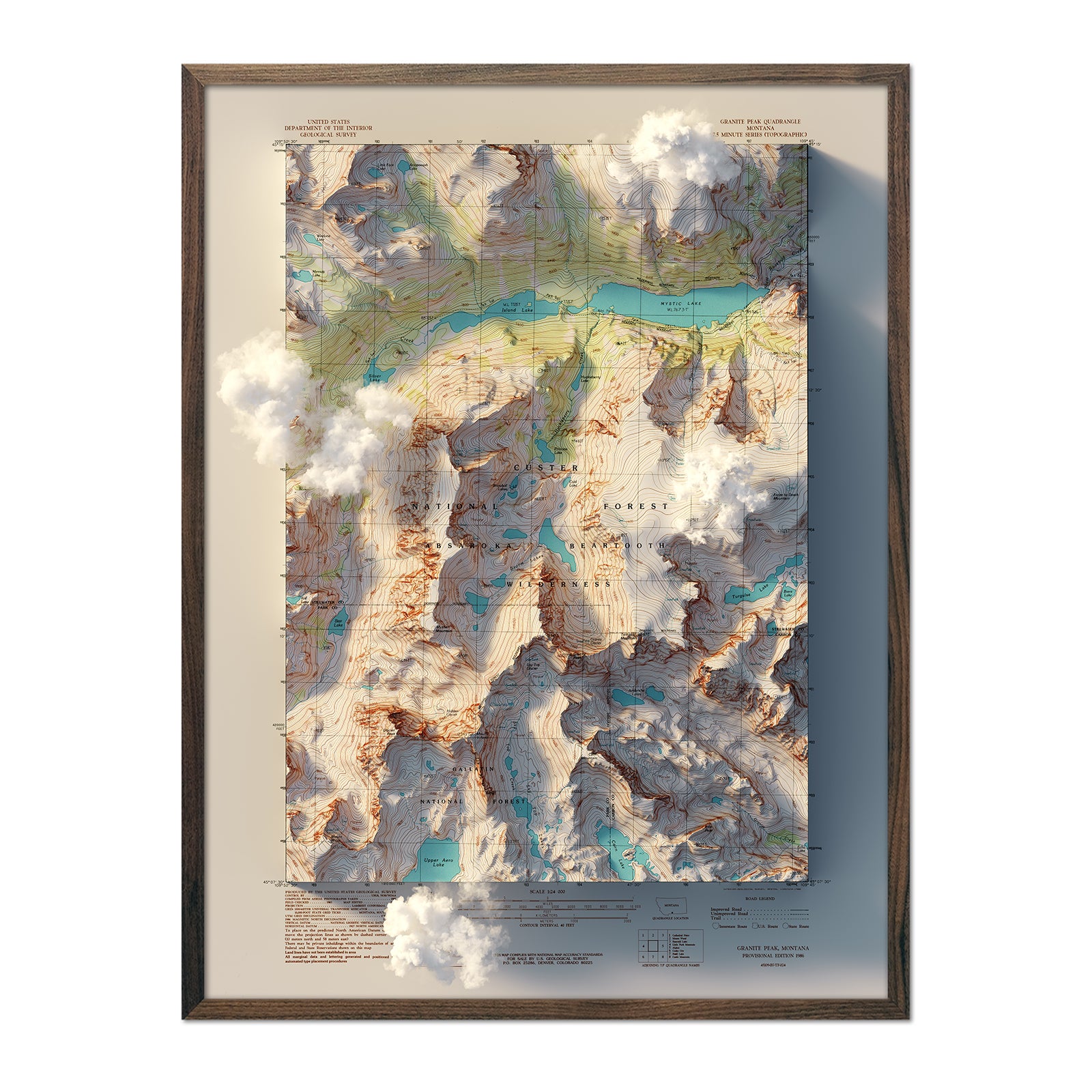
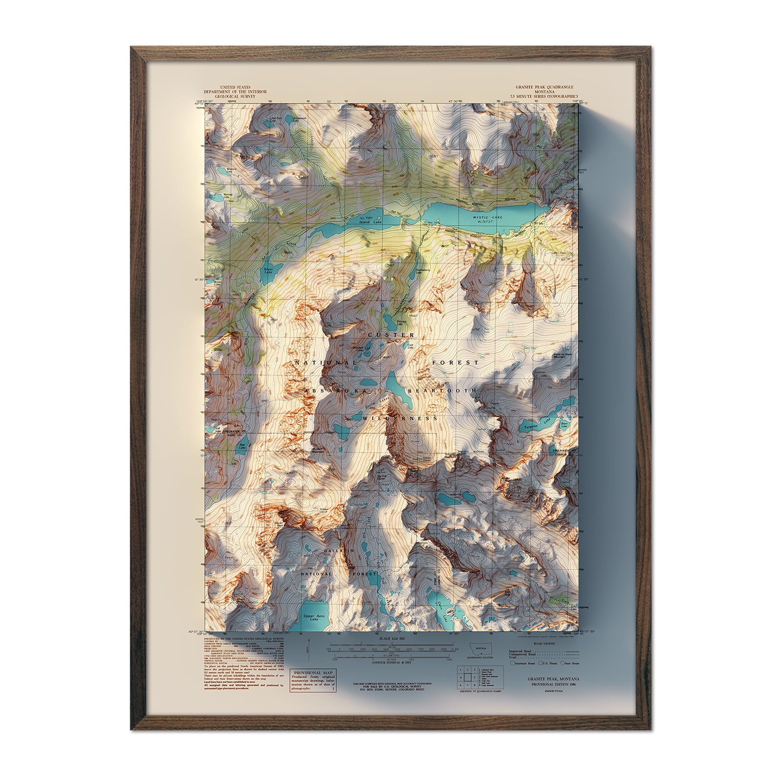
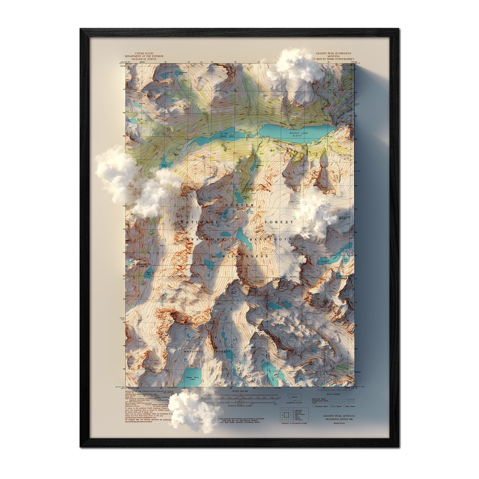
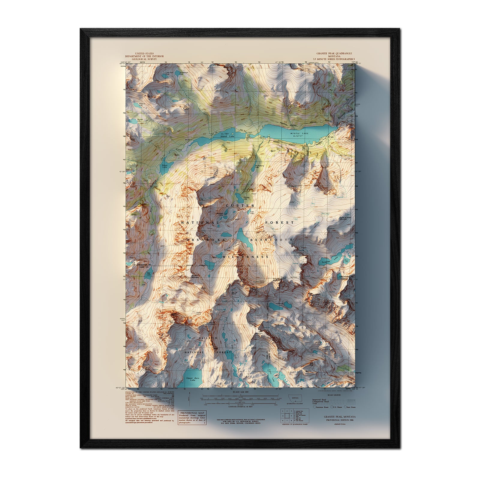
Granite Peak, Montana 1986 Shaded Relief Map
From
$ 79.00 USD
New arrival
Finger Lakes, New York 1962 Shaded Relief Map
From
$ 64.00 USD
New arrival
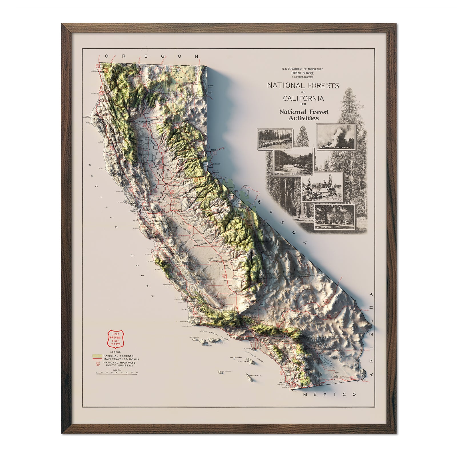
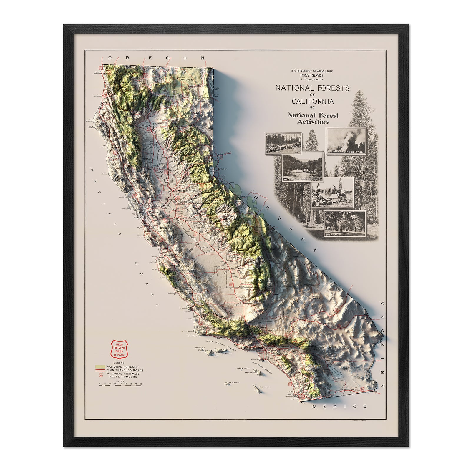
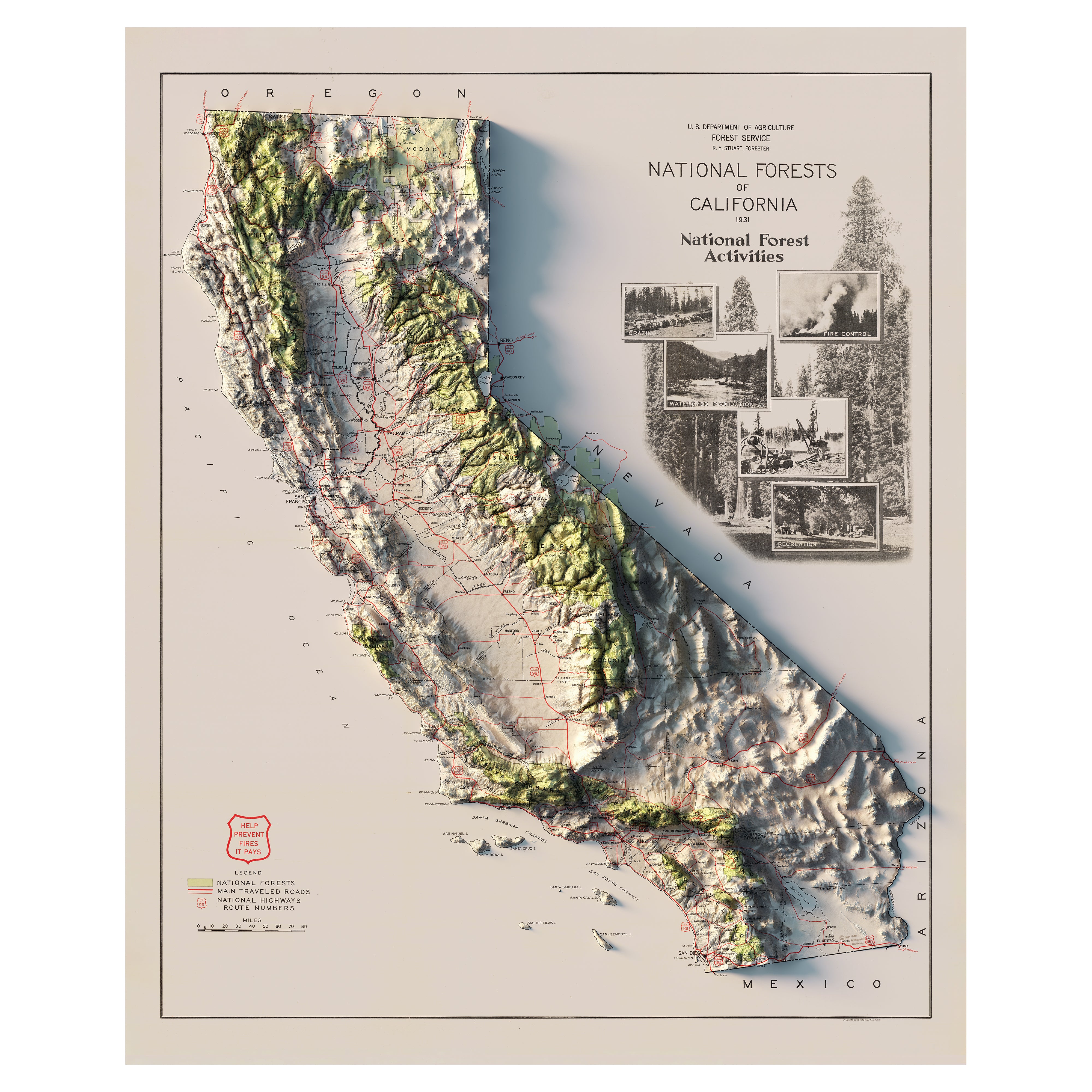
California 1931 National Forests Shaded Relief Map
From
$ 79.00 USD
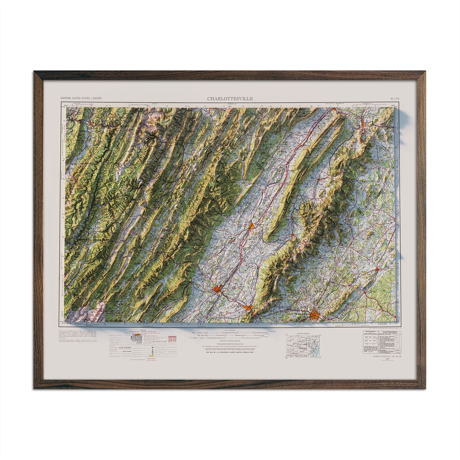
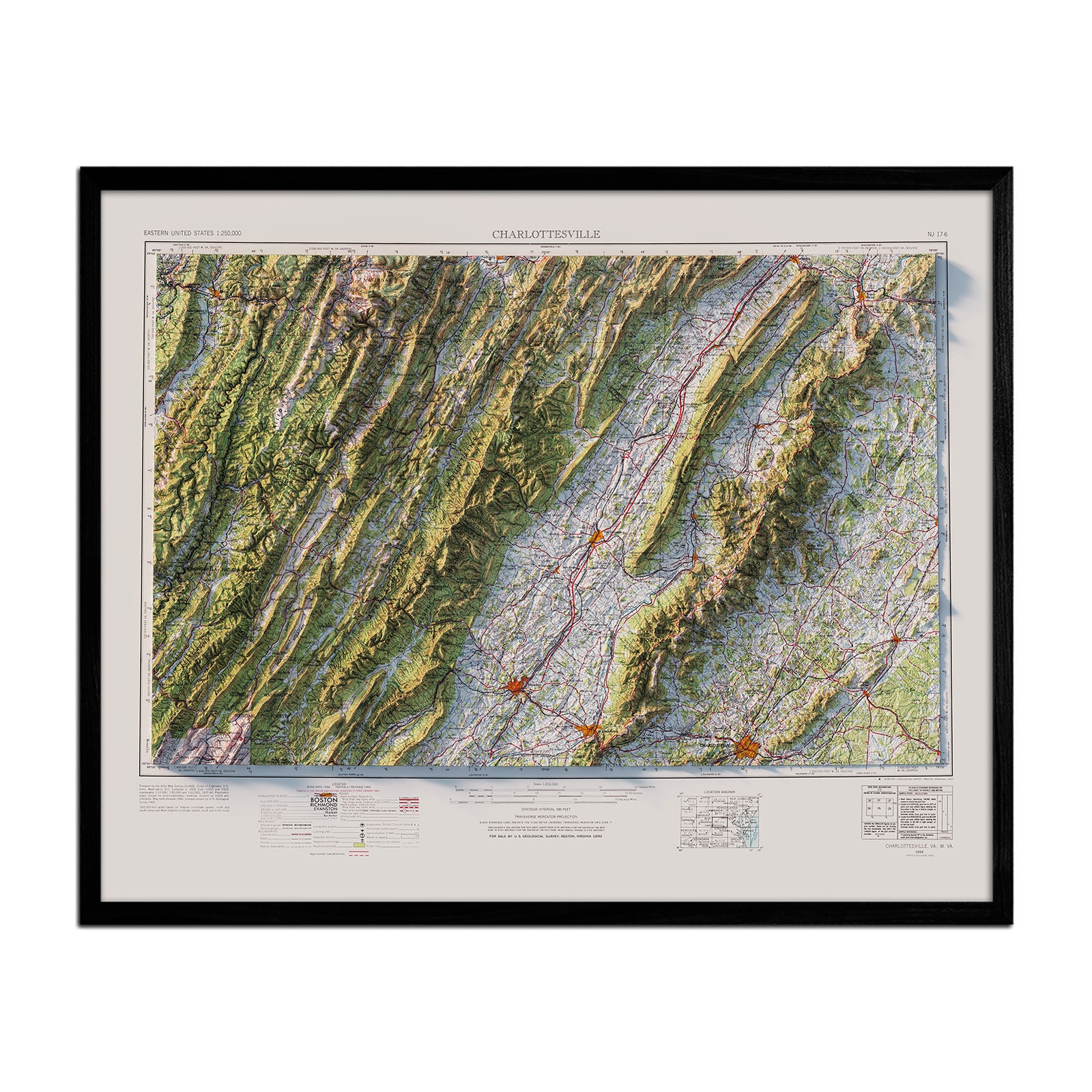
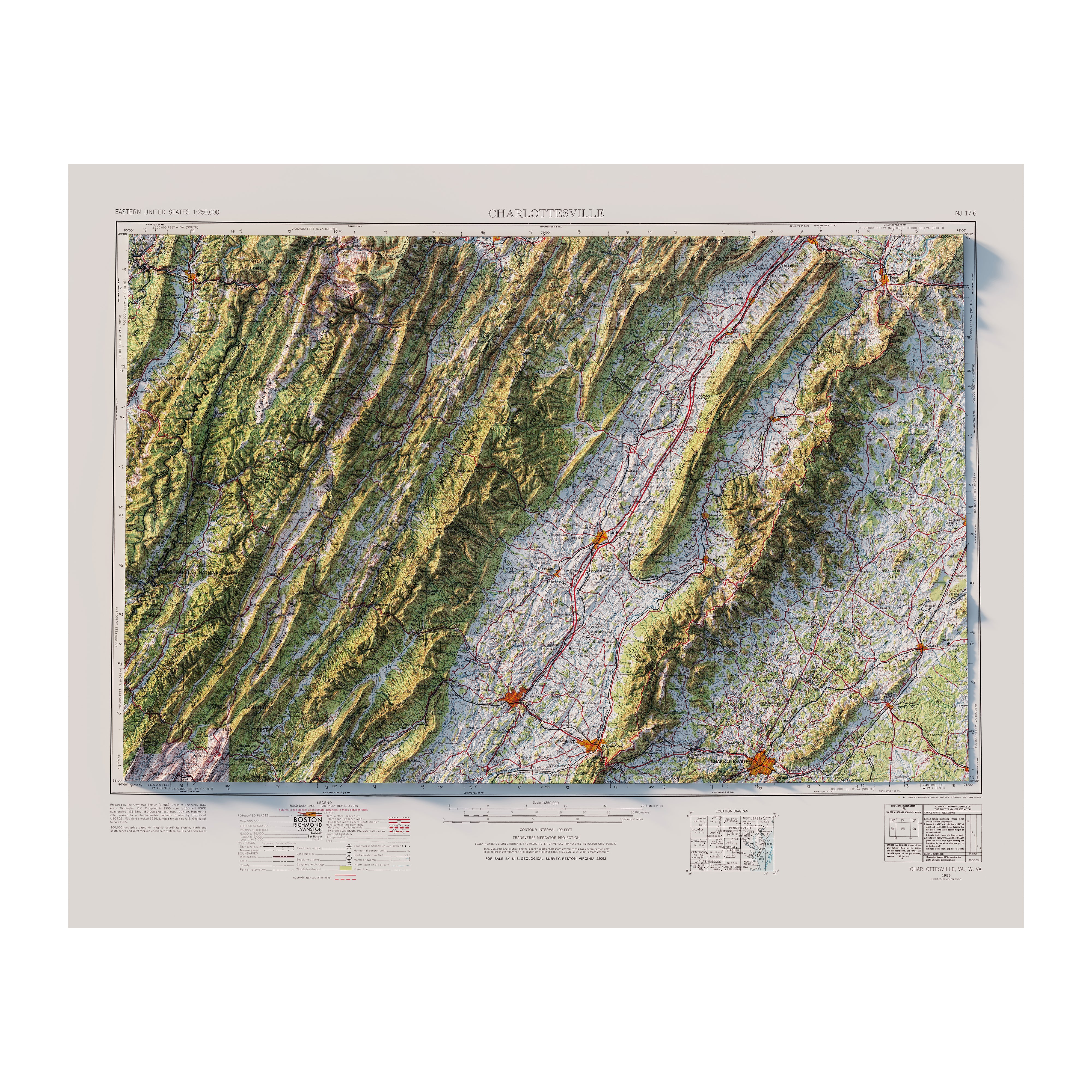
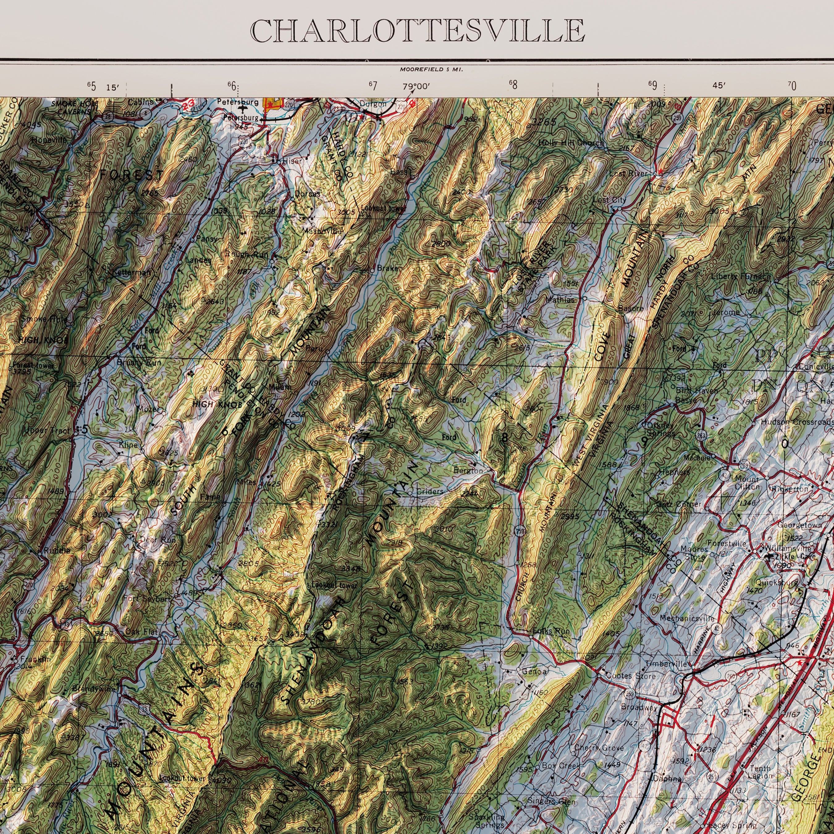
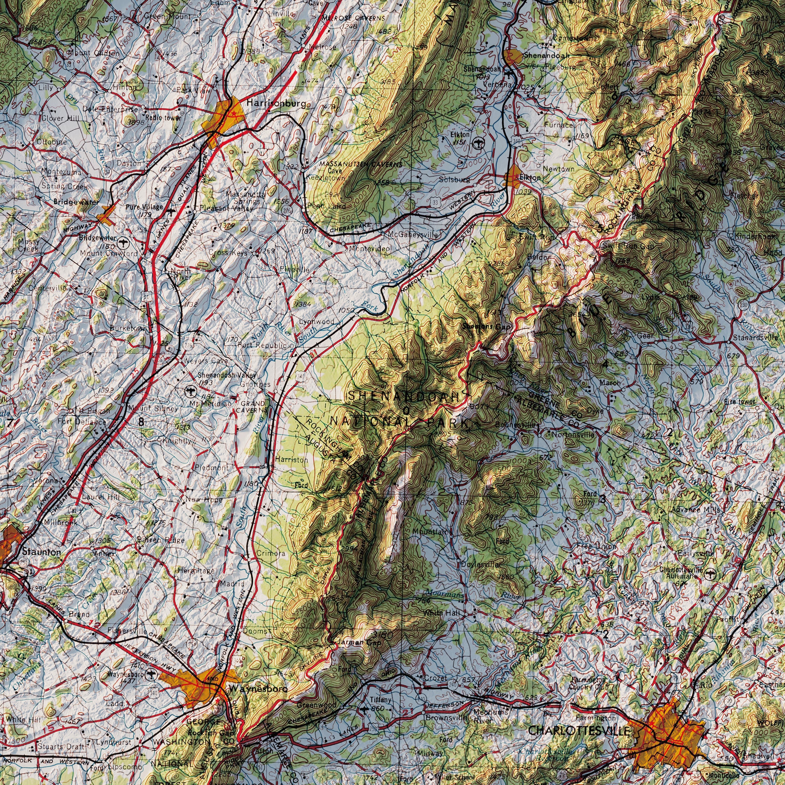
Charlottesville, VA 1965 Shaded Relief Map
From
$ 64.00 USD
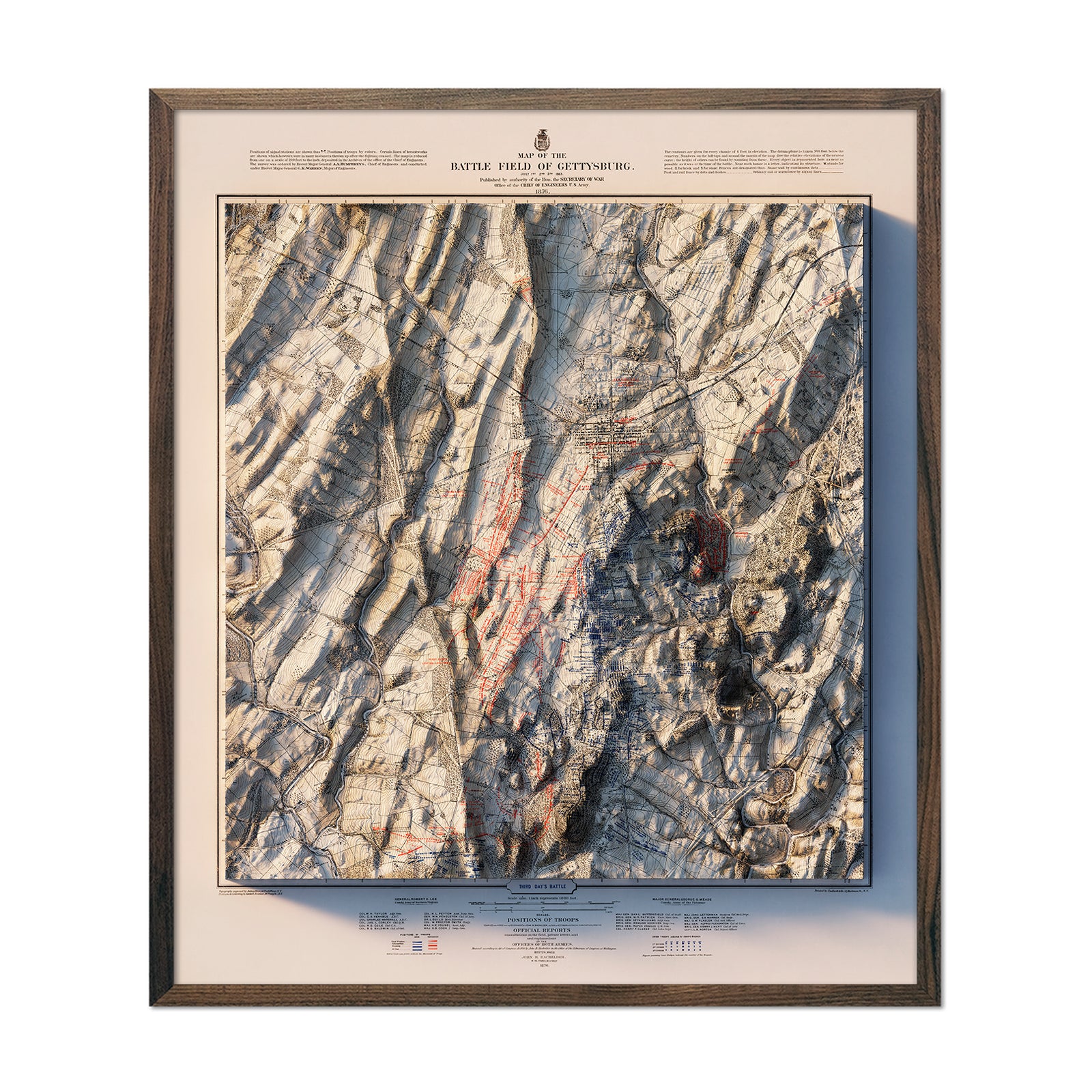
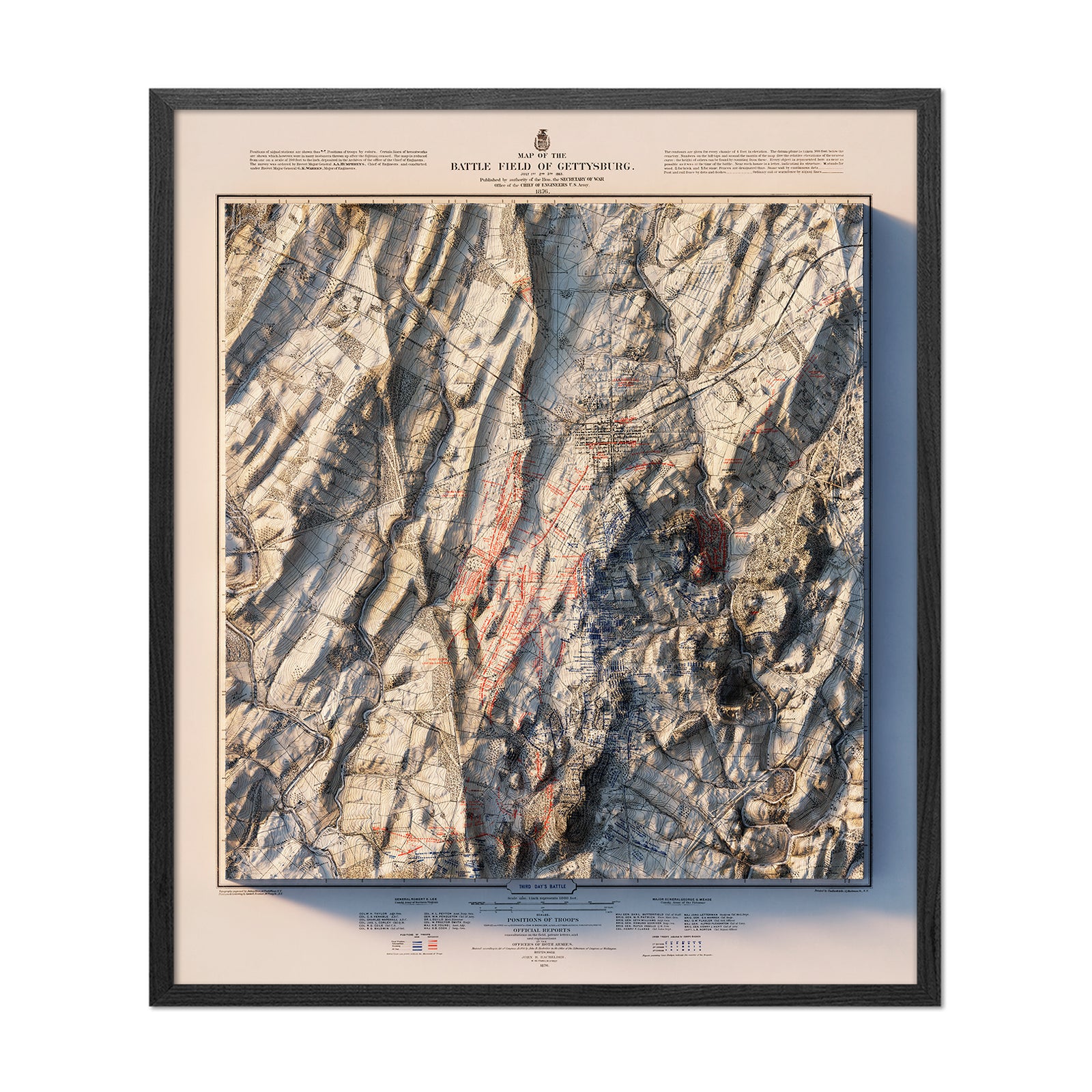
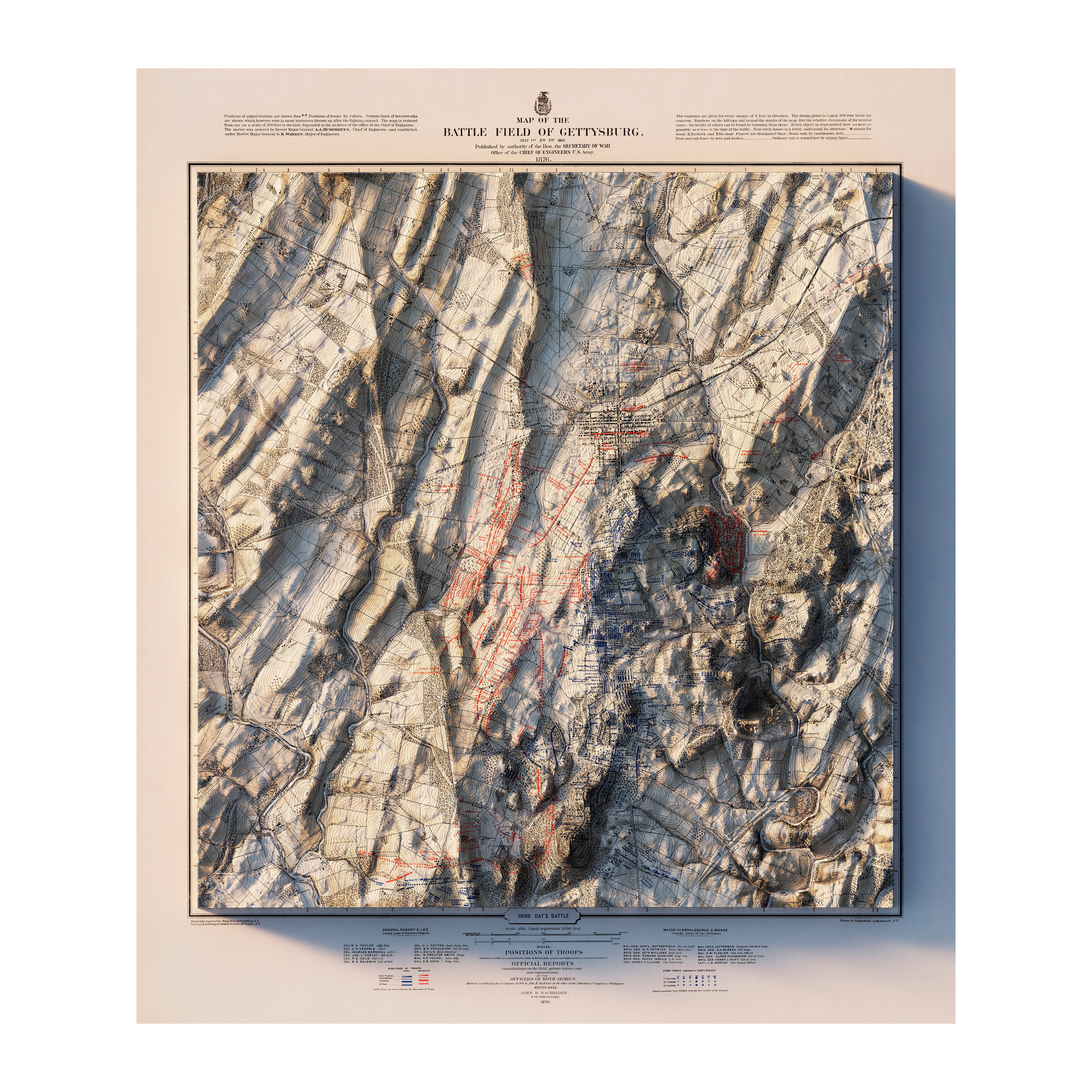
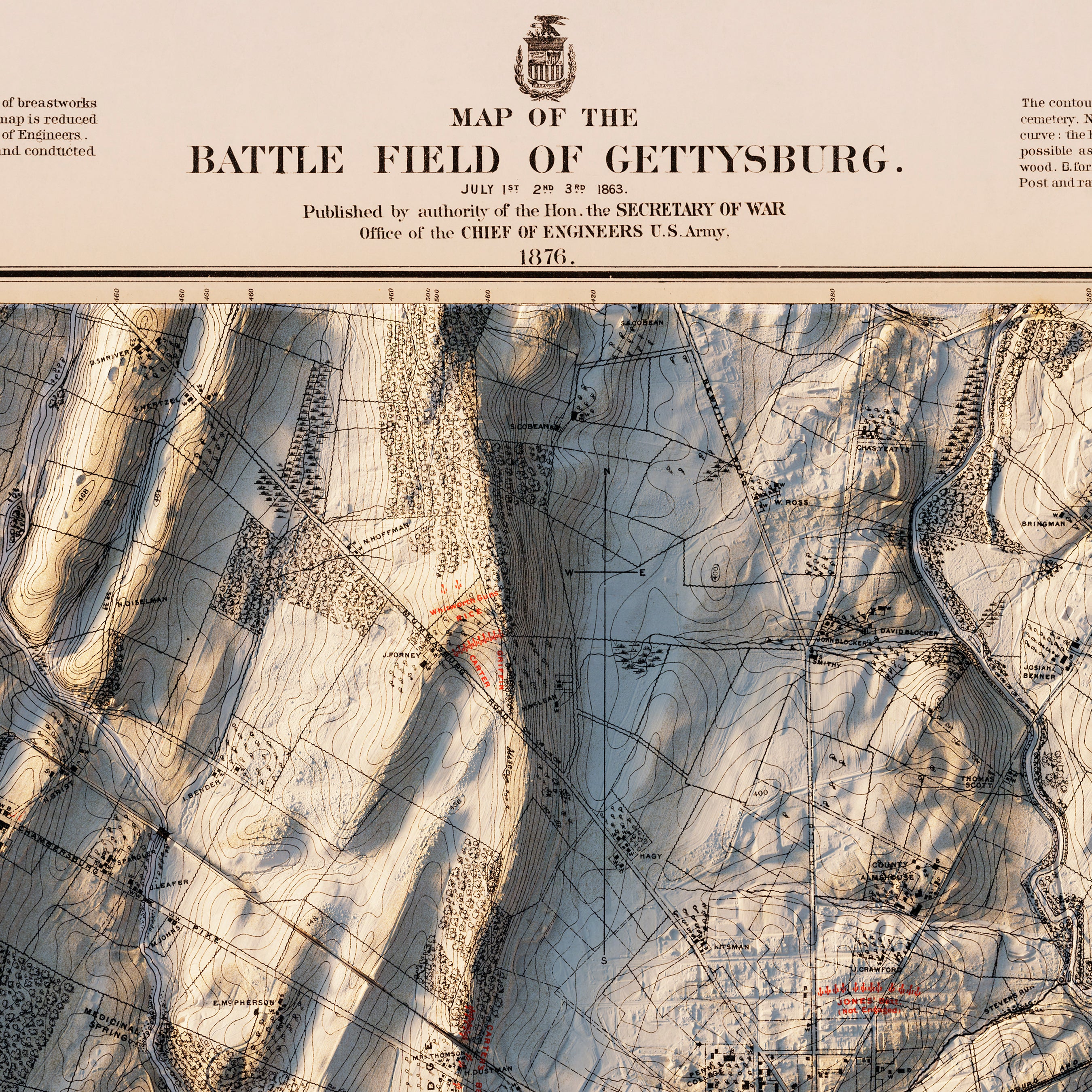
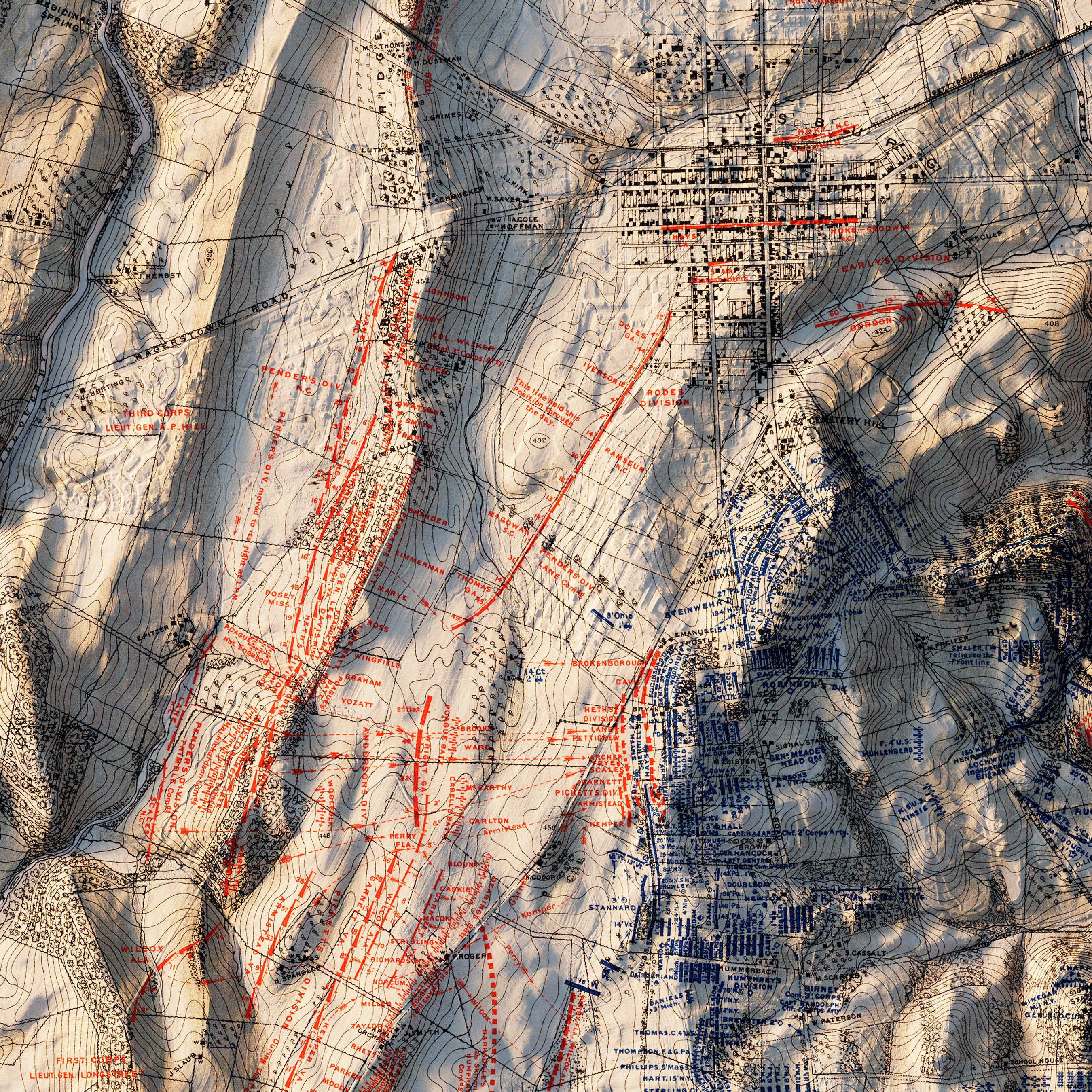
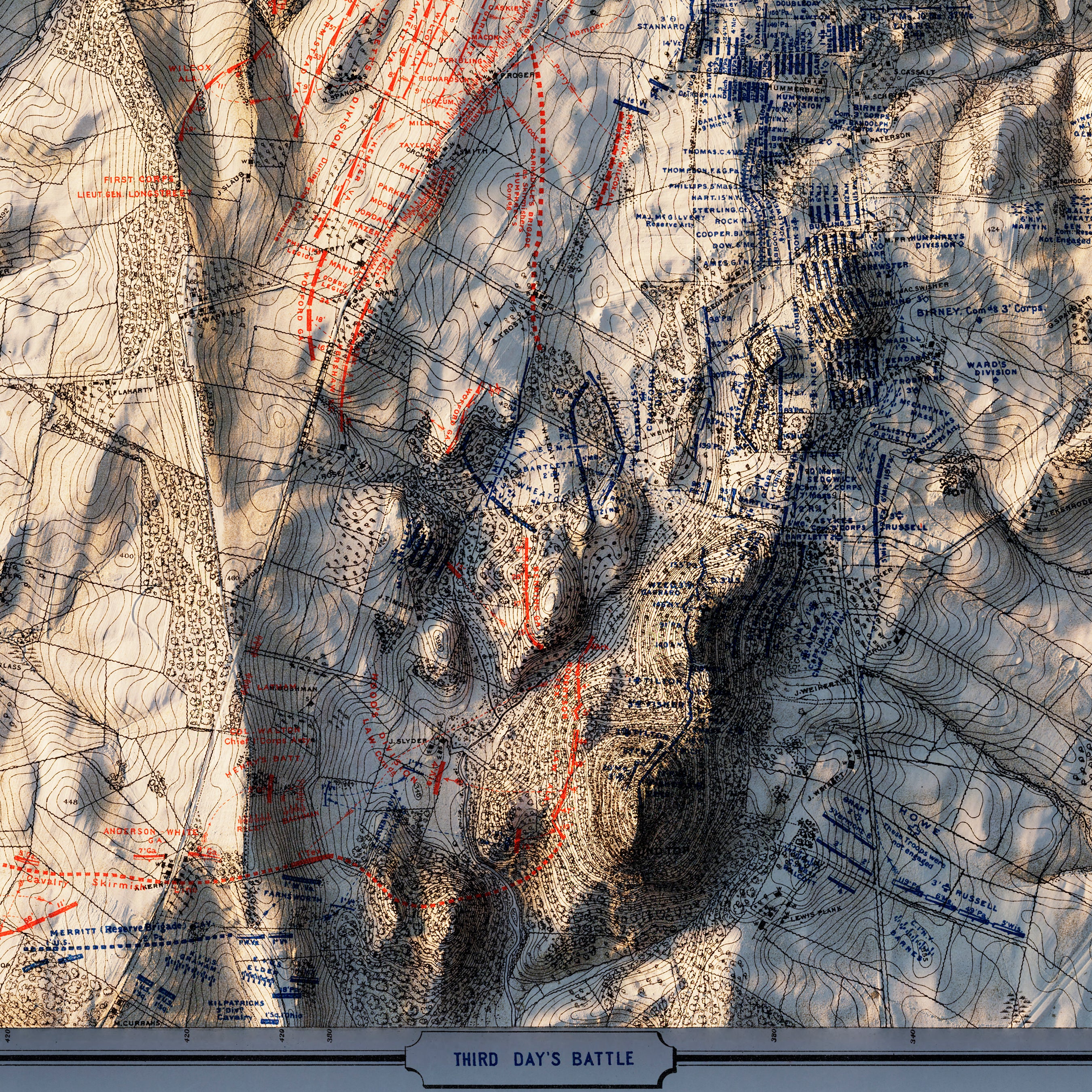
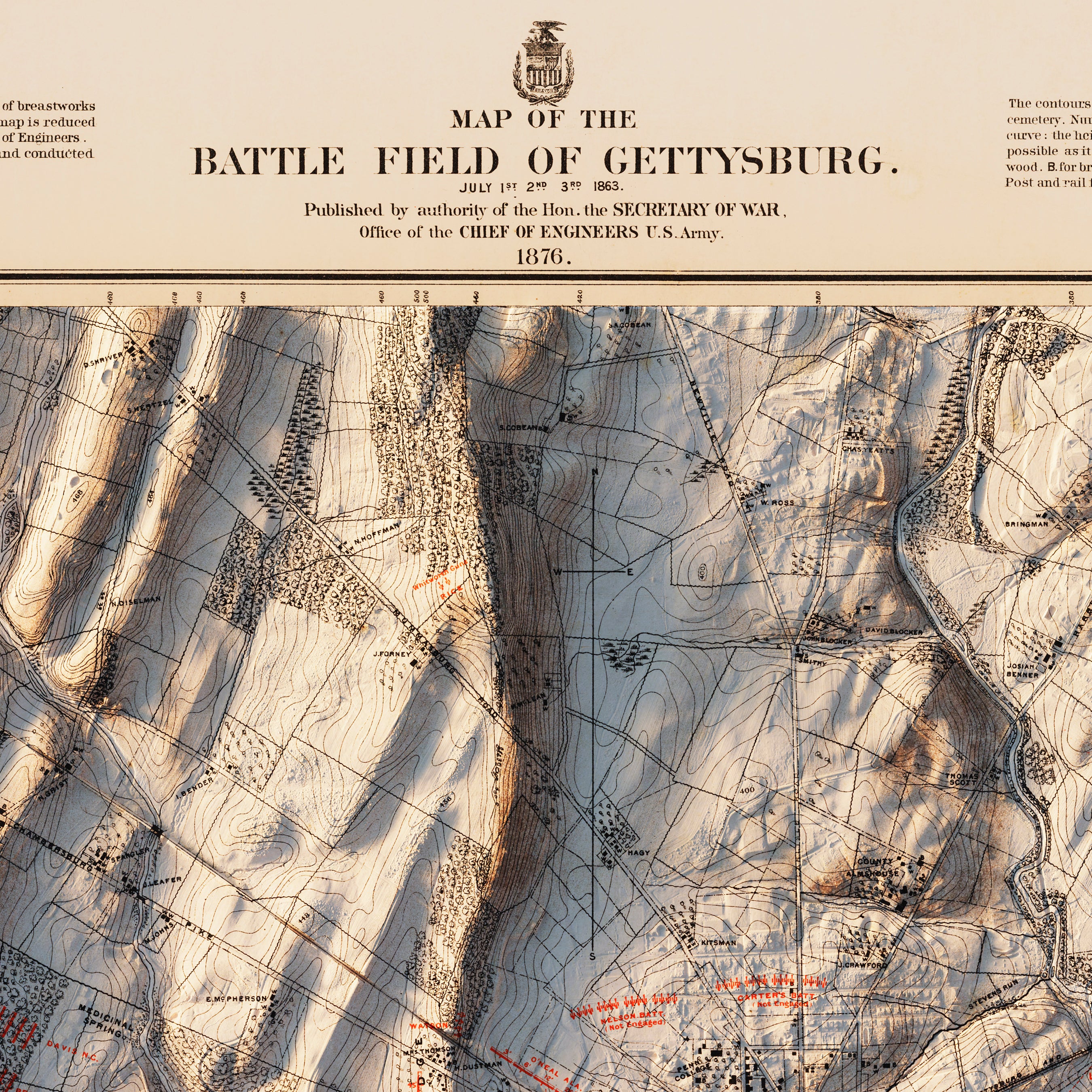
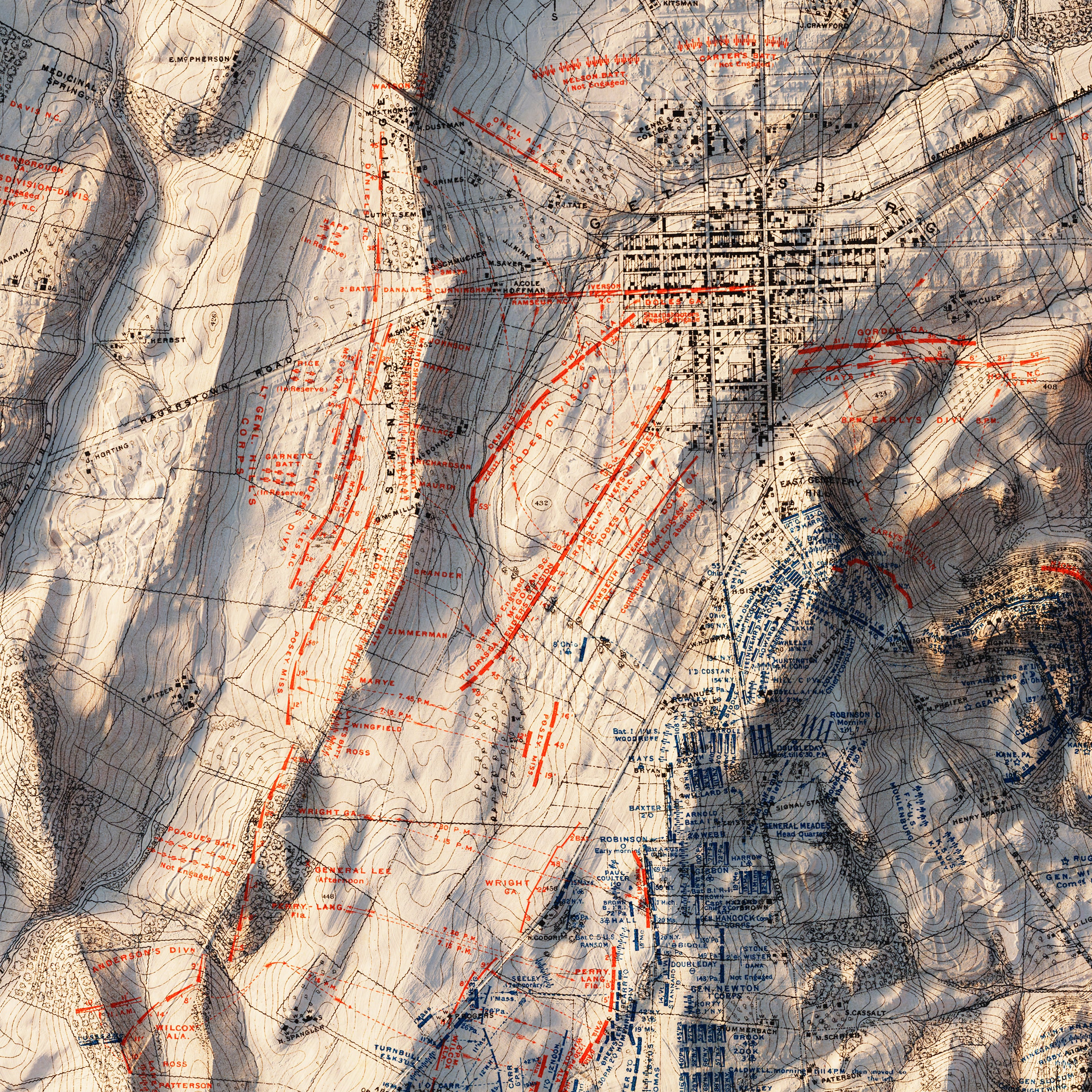
Gettysburg 3rd Day 1876 Shaded Relief Map
From
$ 99.00 USD
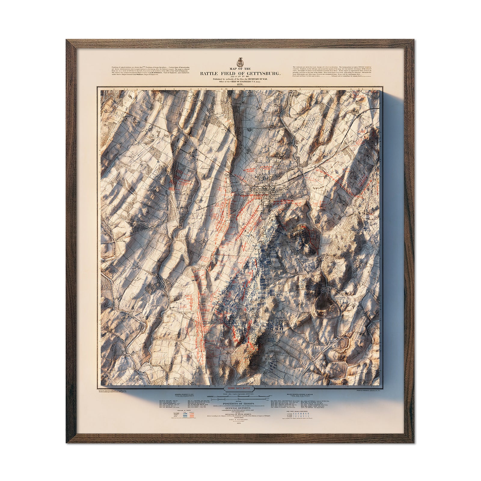
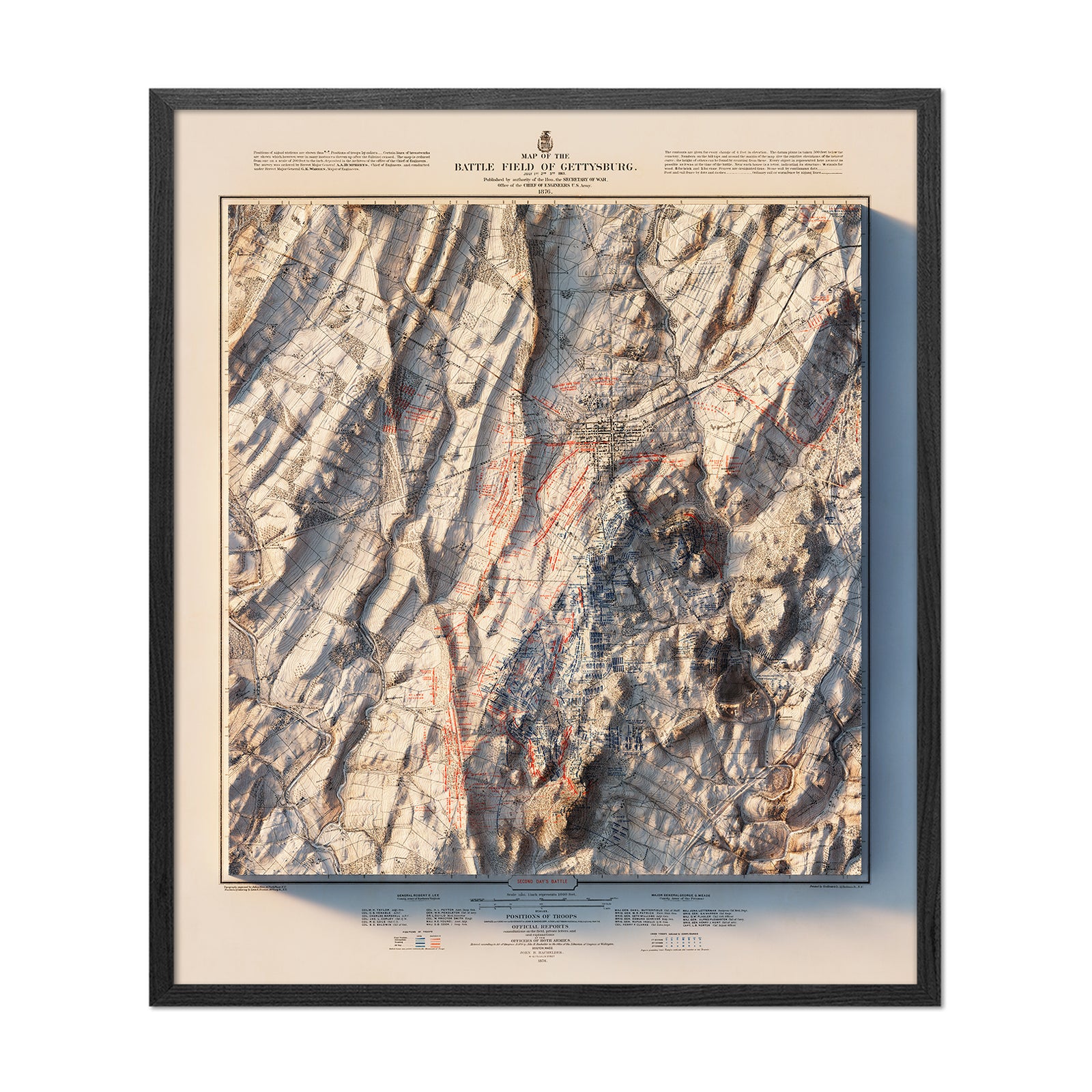
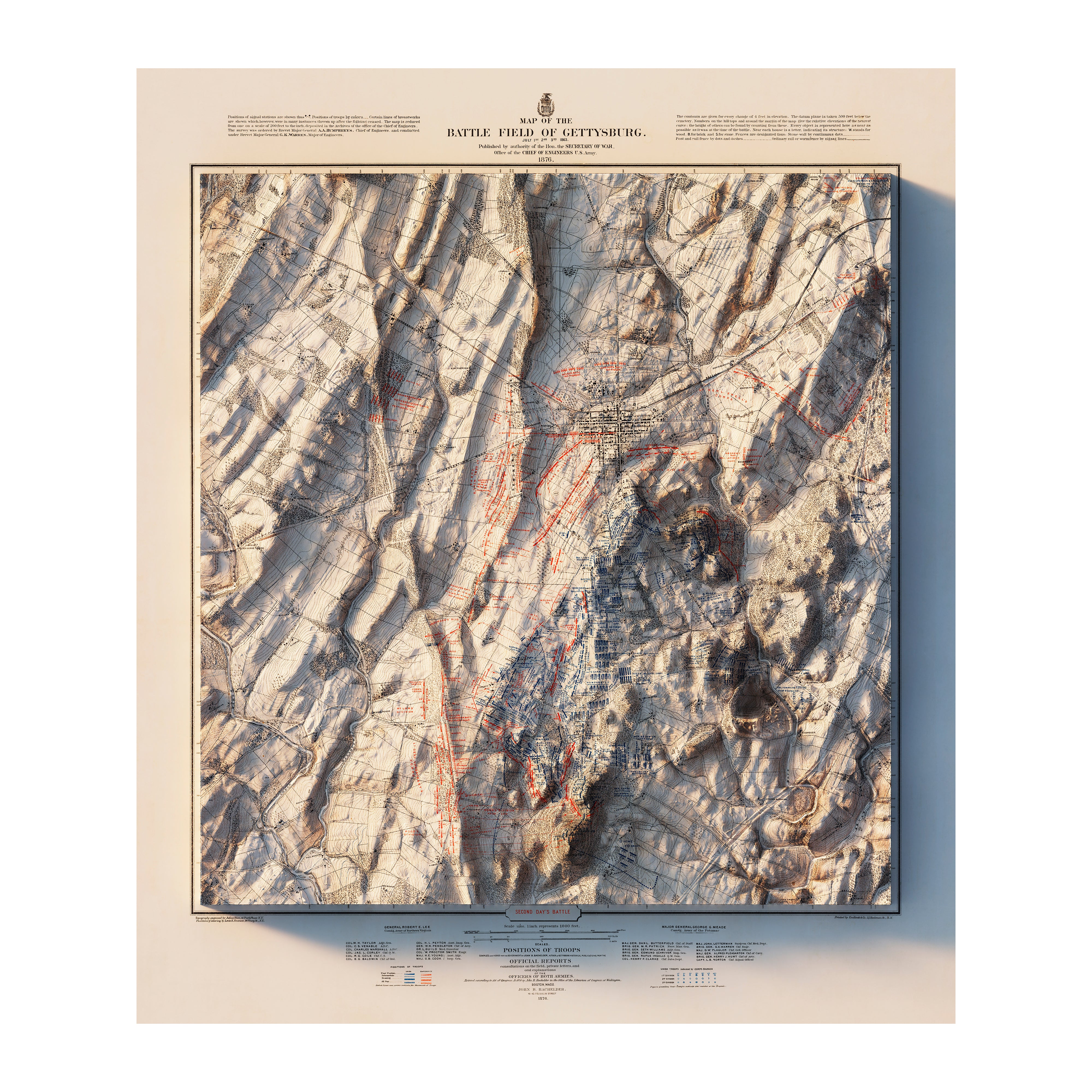
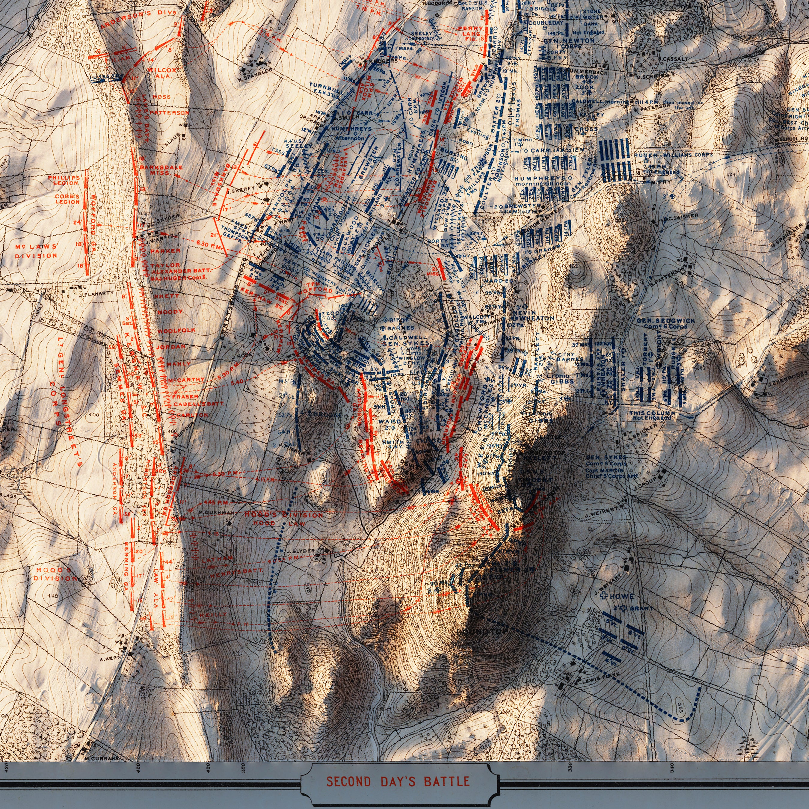
Gettysburg 2nd Day 1876 Shaded Relief Map
From
$ 99.00 USD
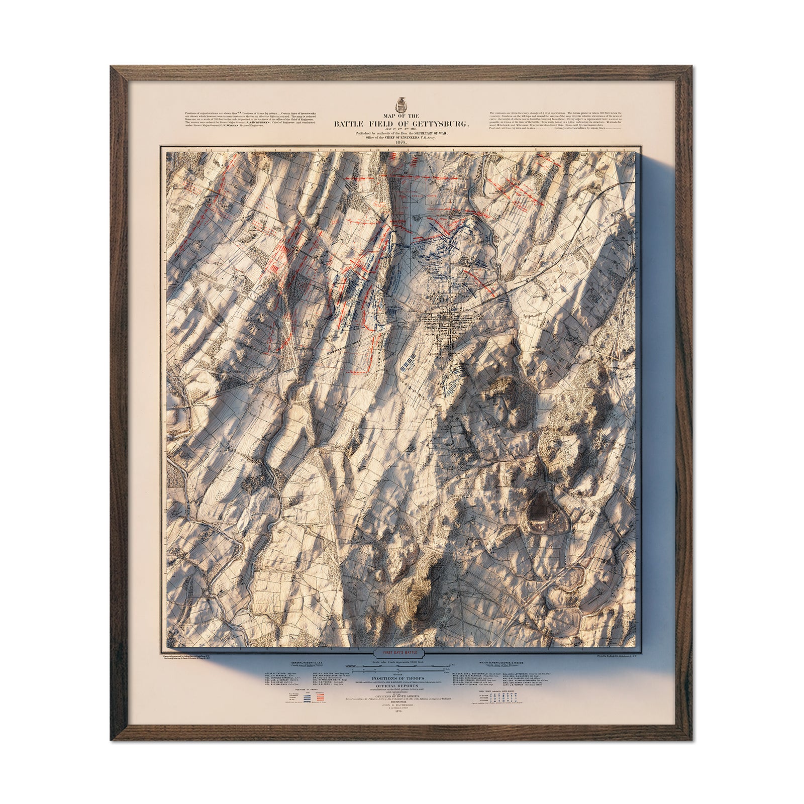
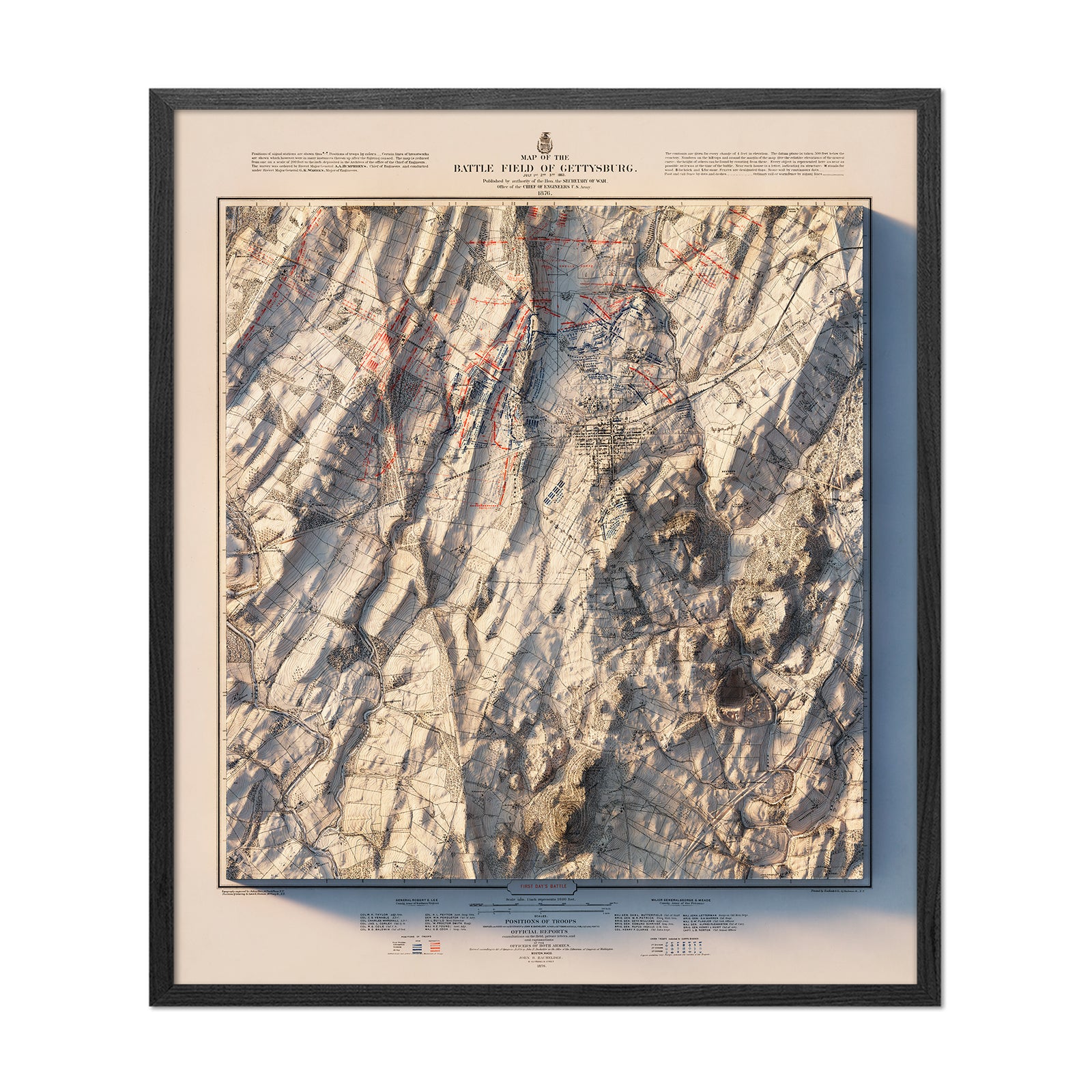
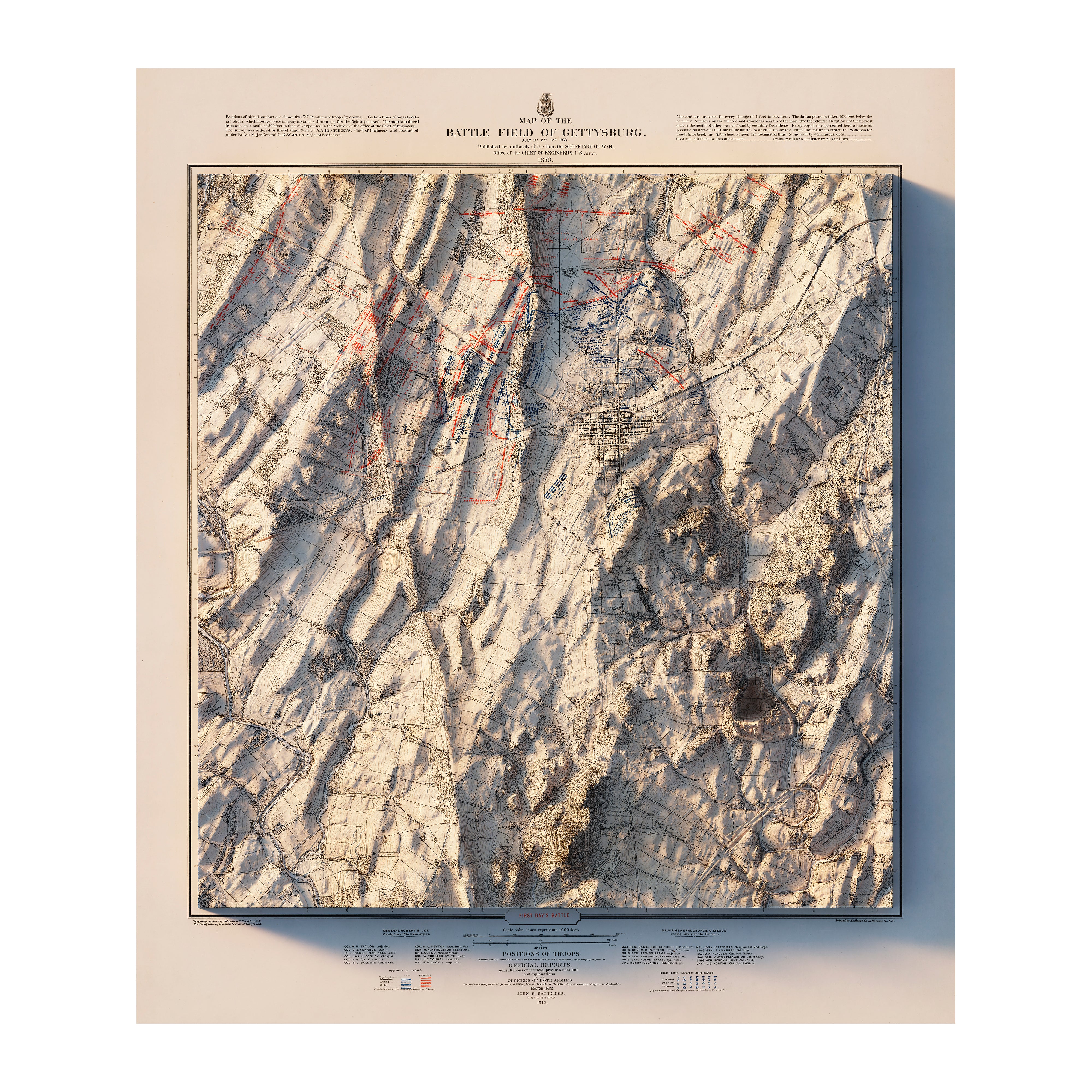
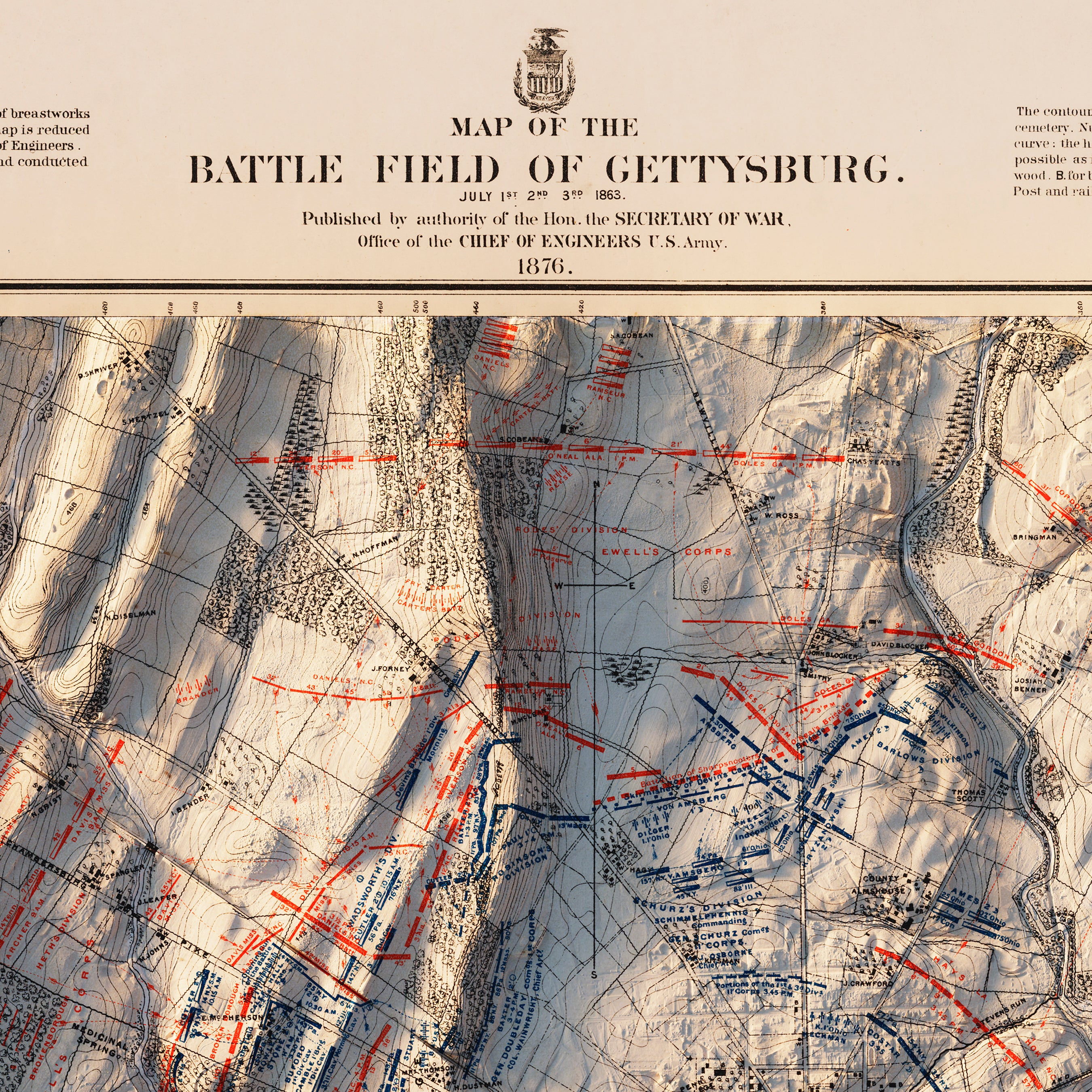
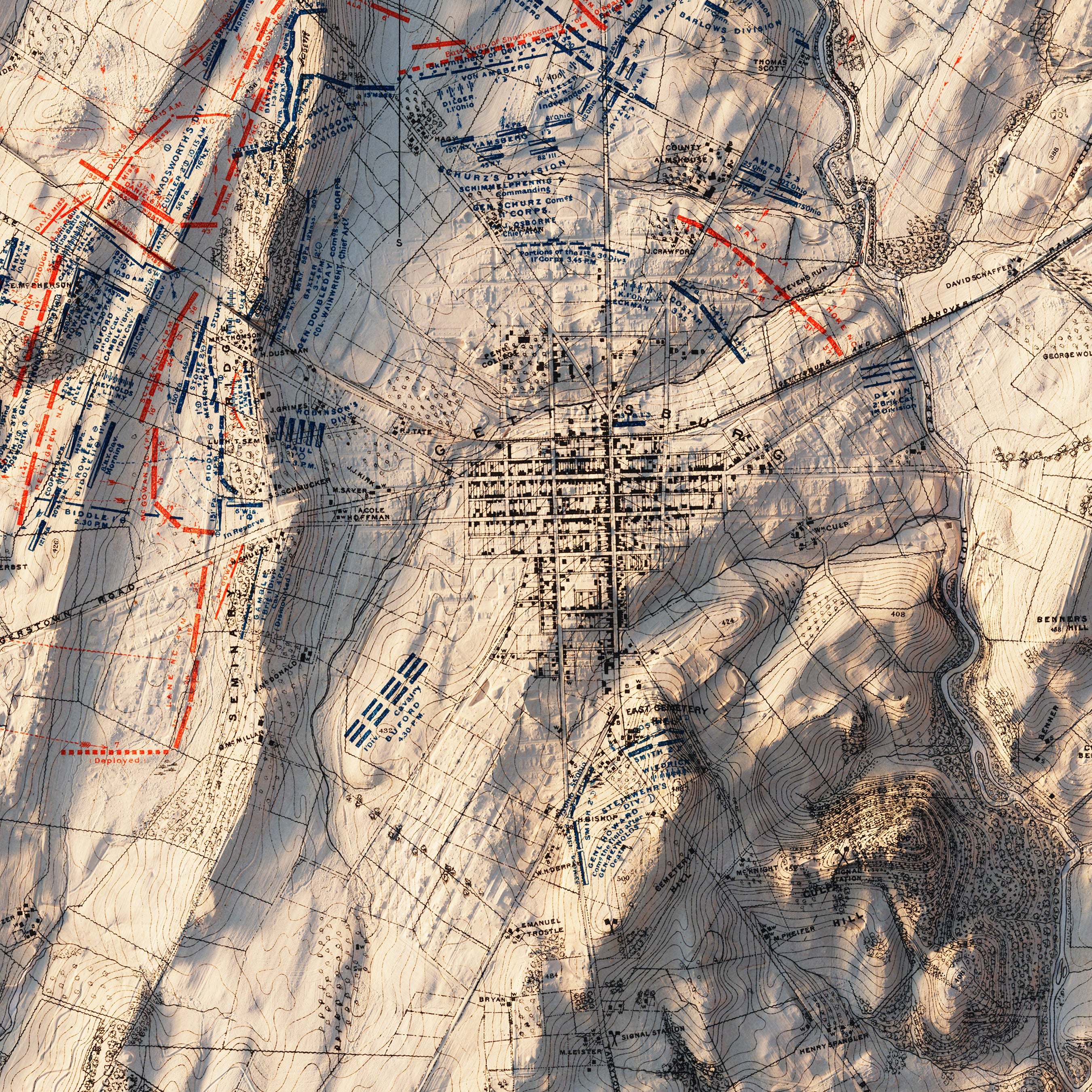
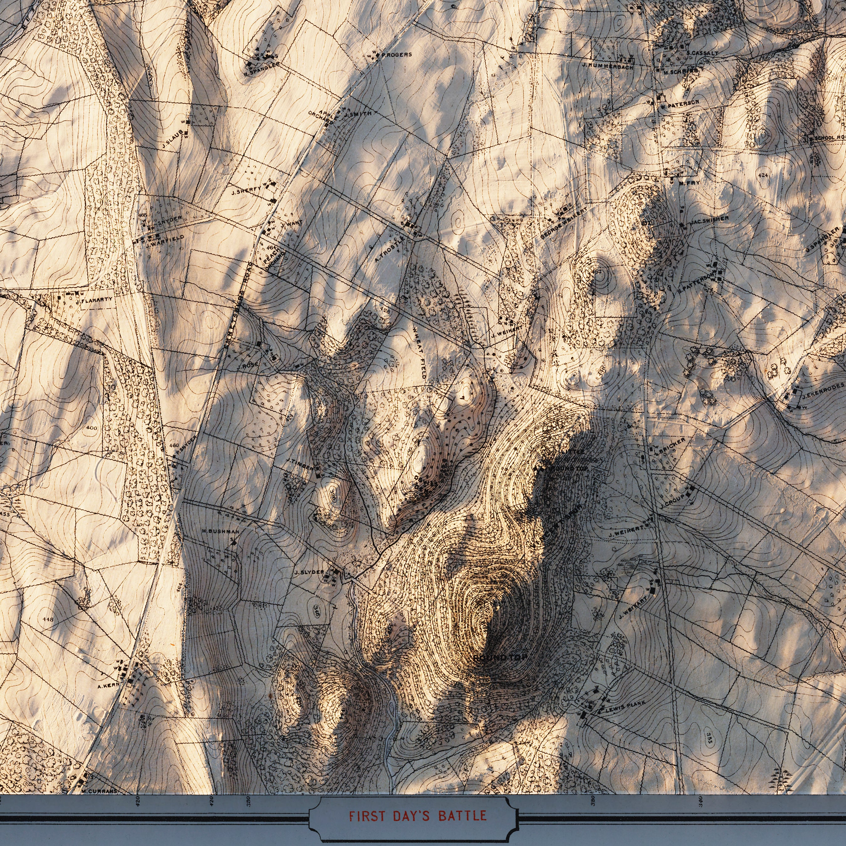
Gettysburg 1st Day 1876 Shaded Relief Map
From
$ 99.00 USD
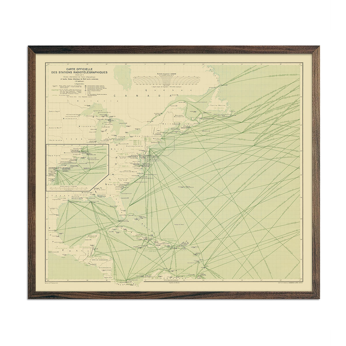
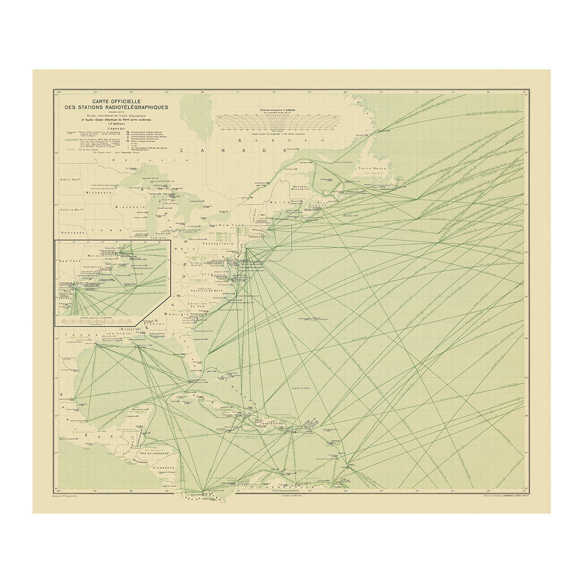
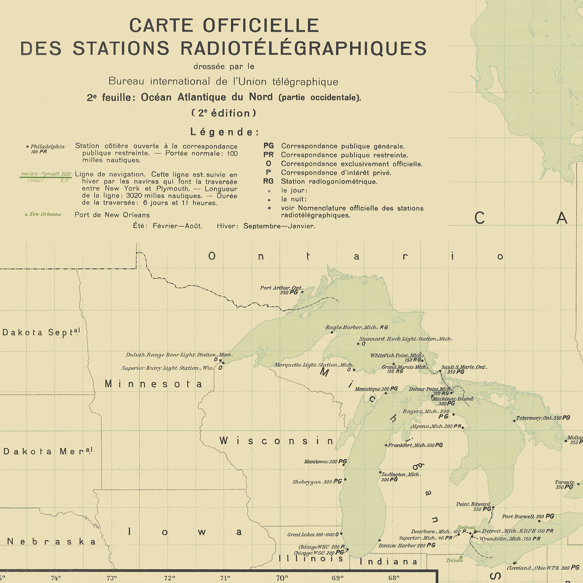
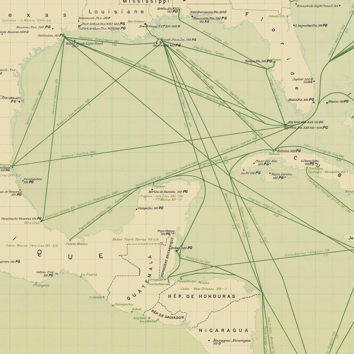
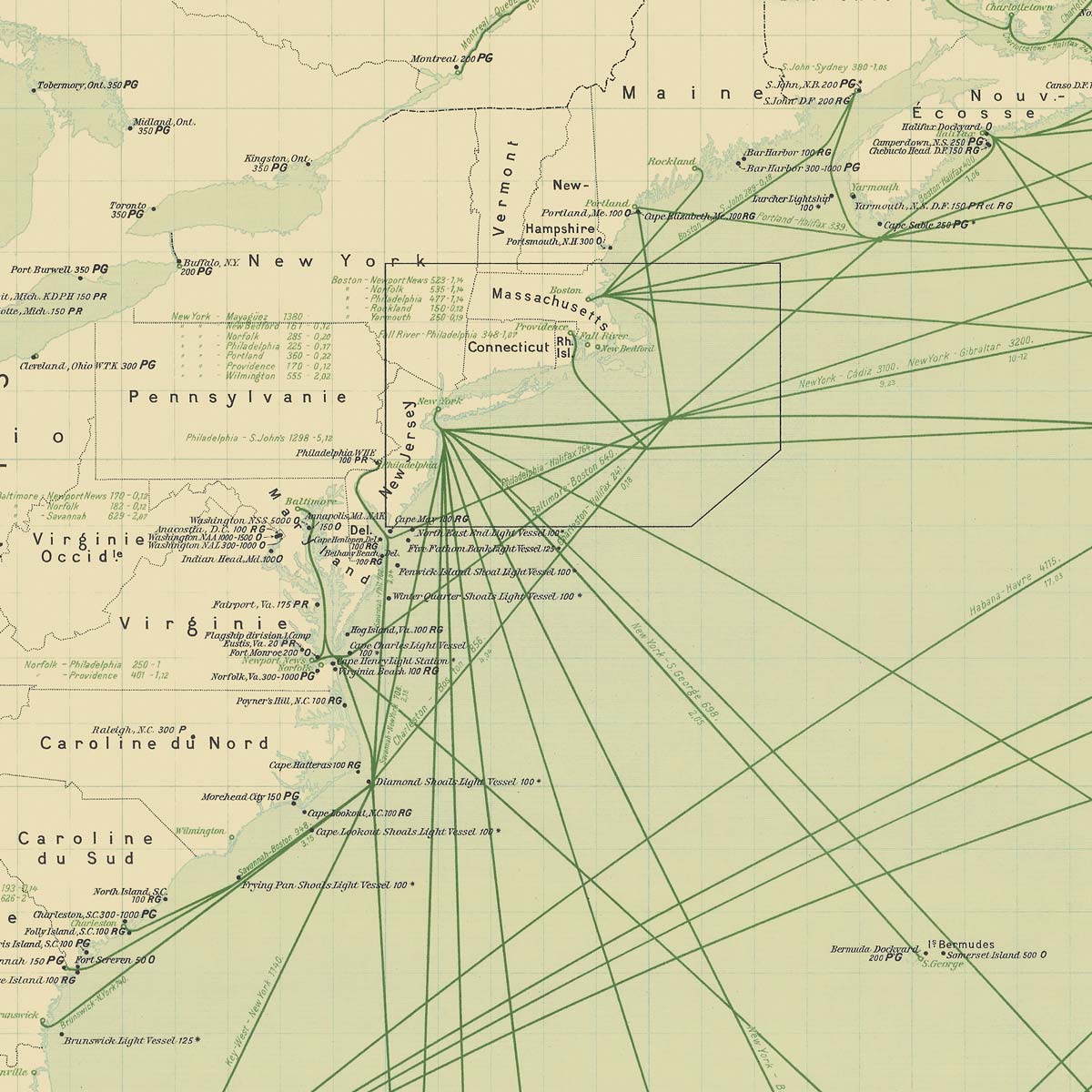
Carte Officielle des Stations Radiotelegraphiques of the Atlantic Ocean NW 1925
From
$ 64.00 USD
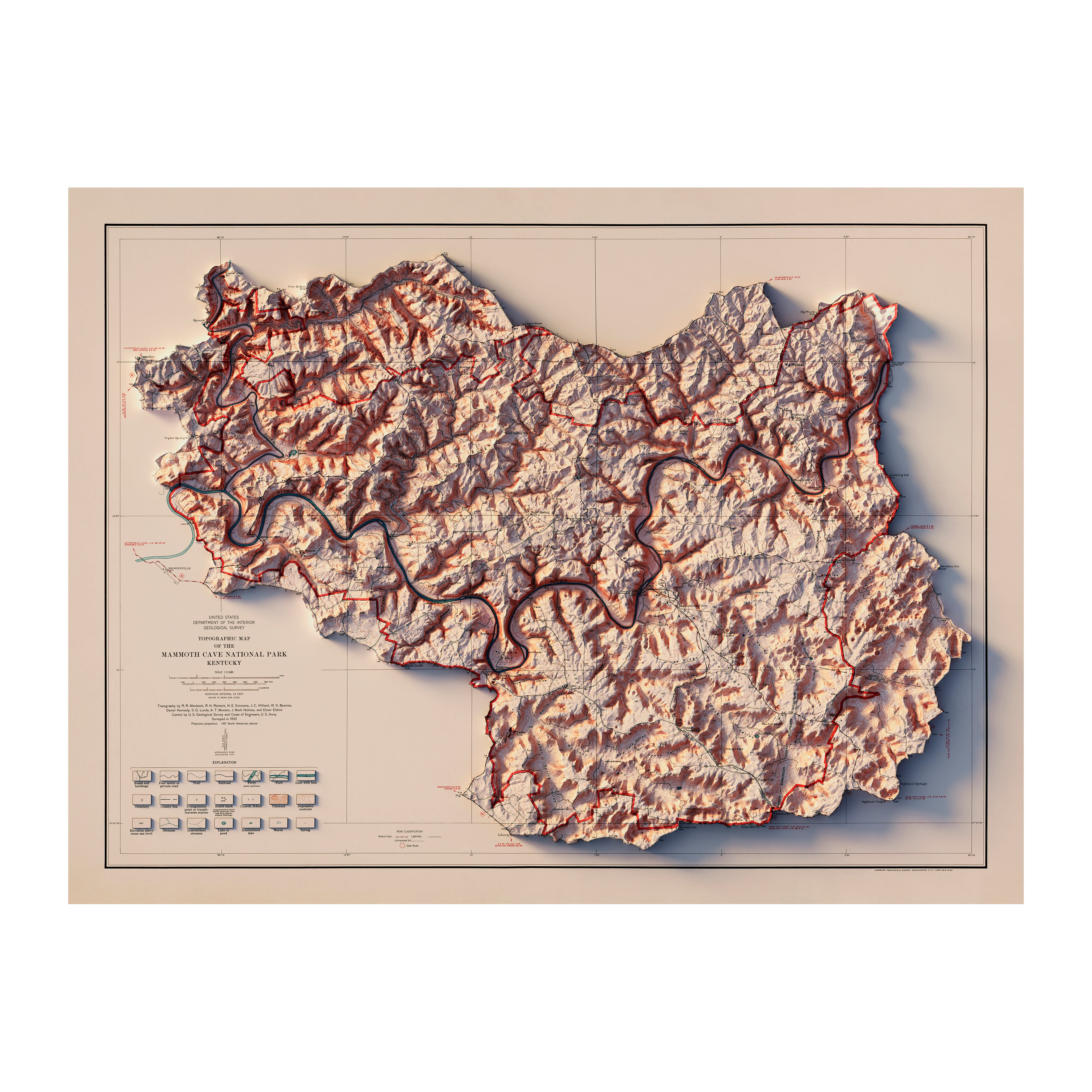
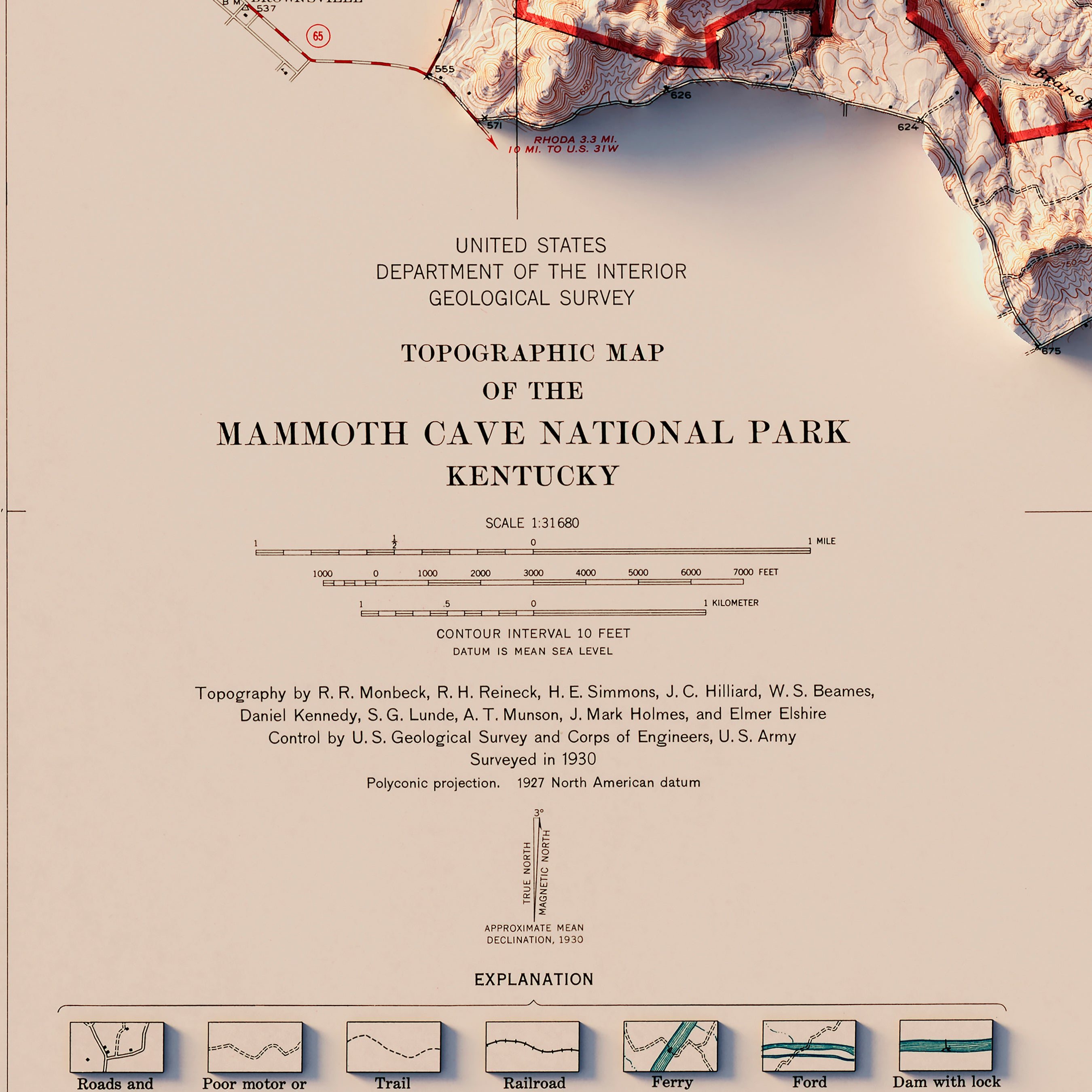
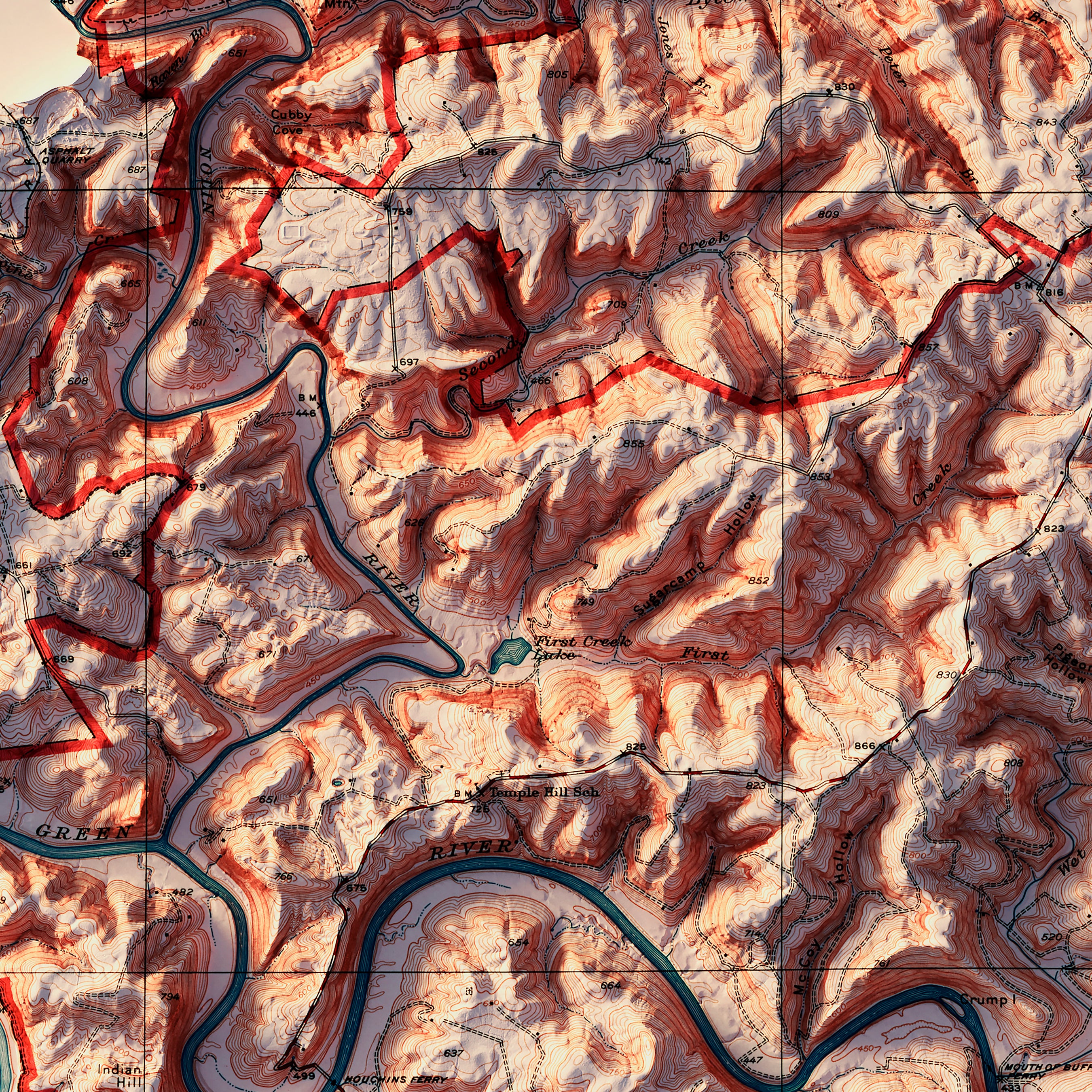
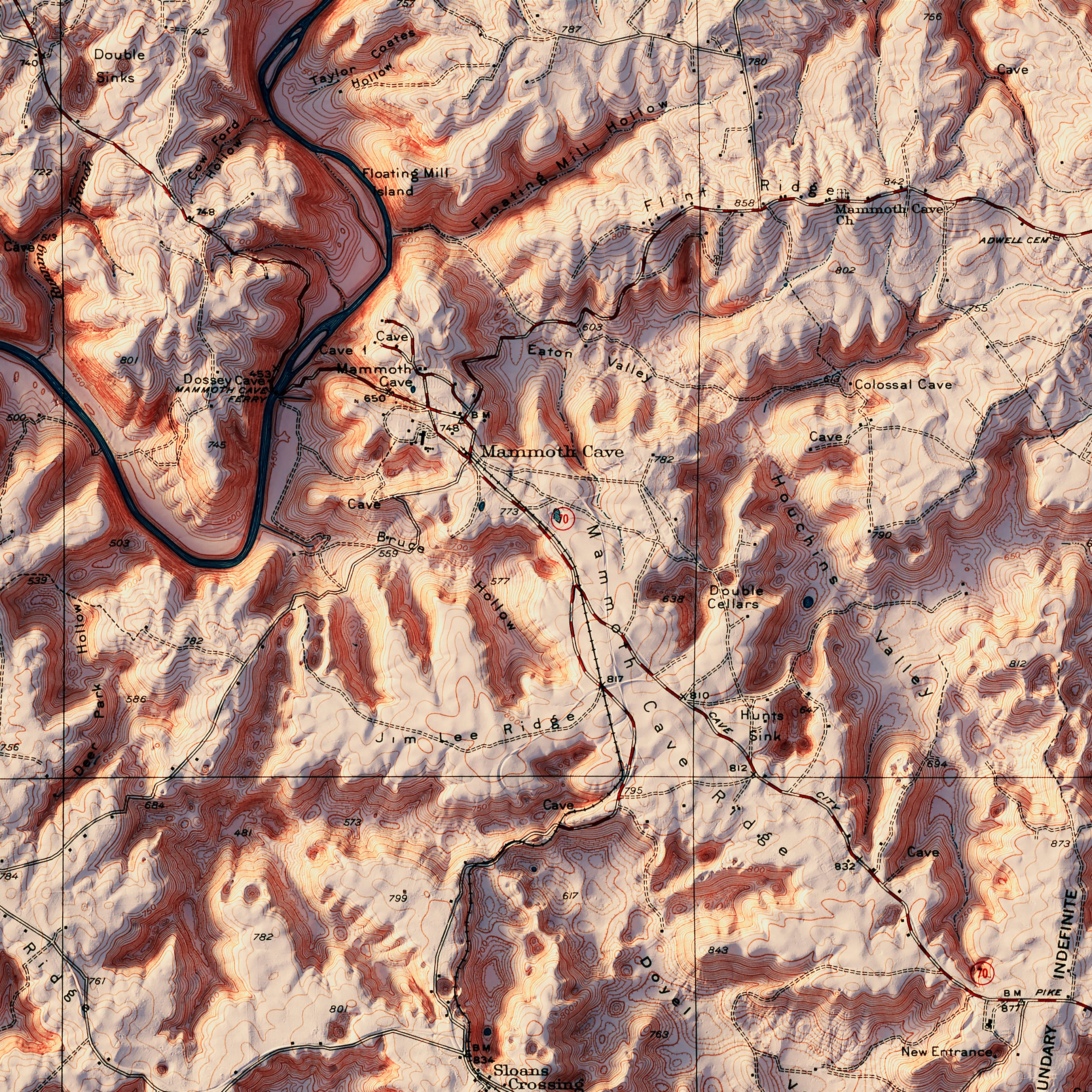
Mammoth Cave National Park 1930 Shaded Relief Map
From
$ 79.00 USD
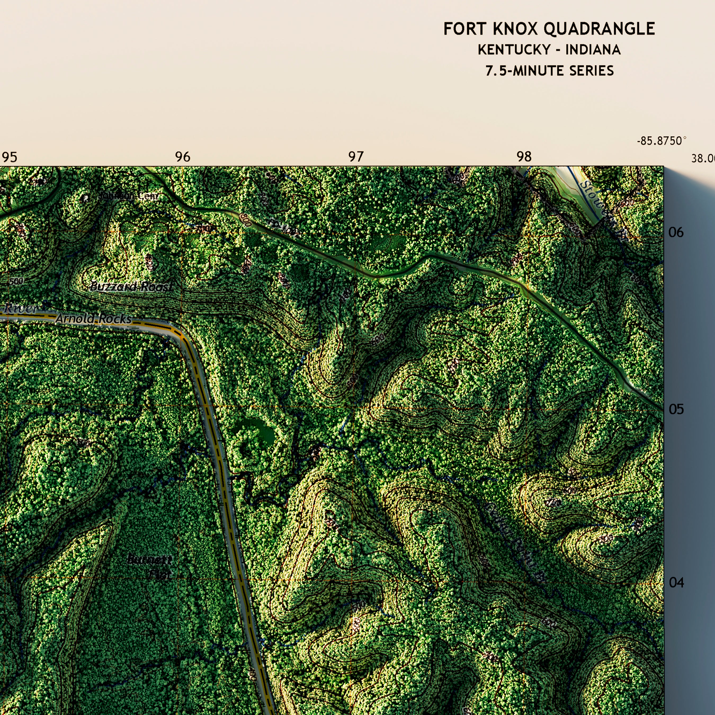
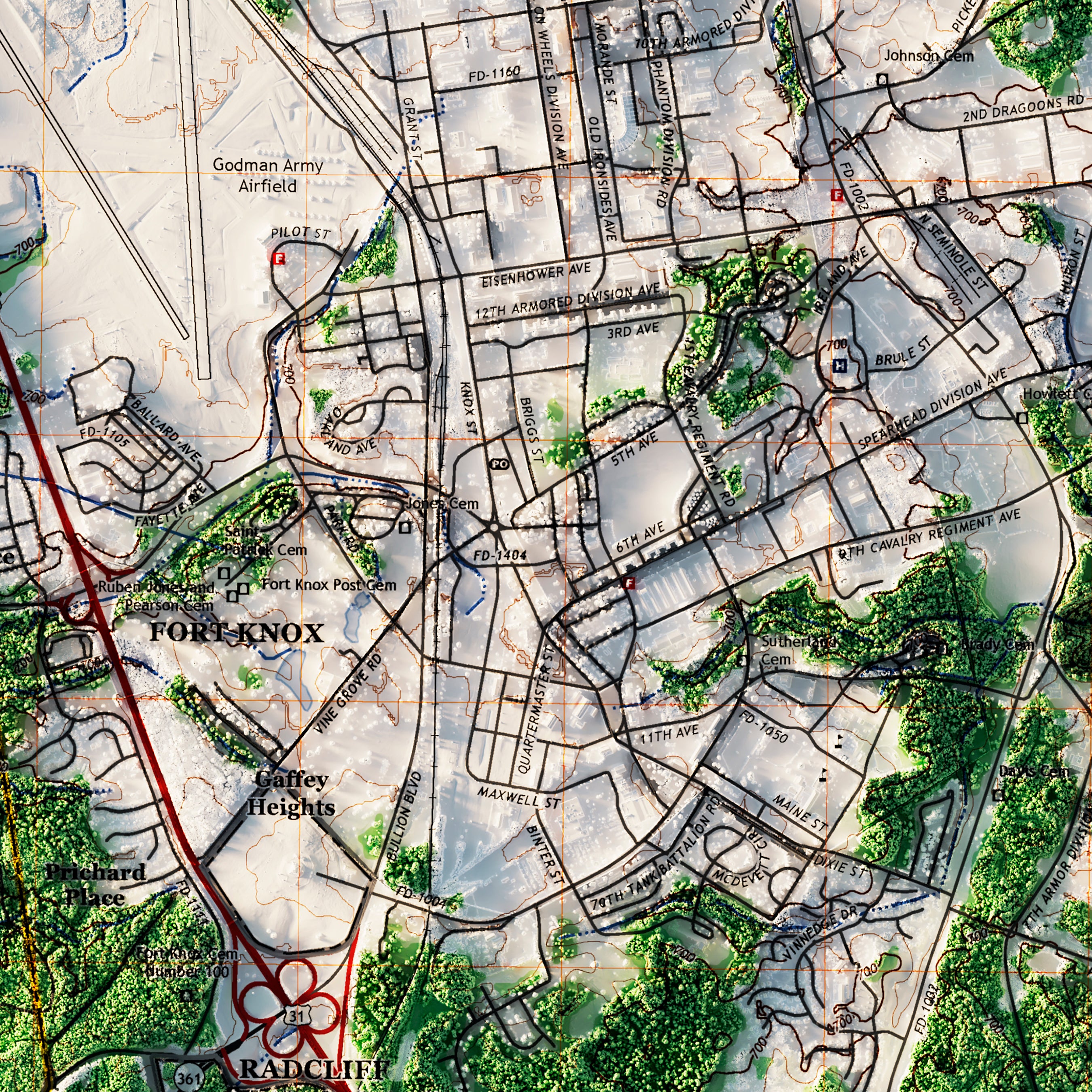
Ft. Knox, Kentucky 2022 Shaded Relief Map
From
$ 79.00 USD
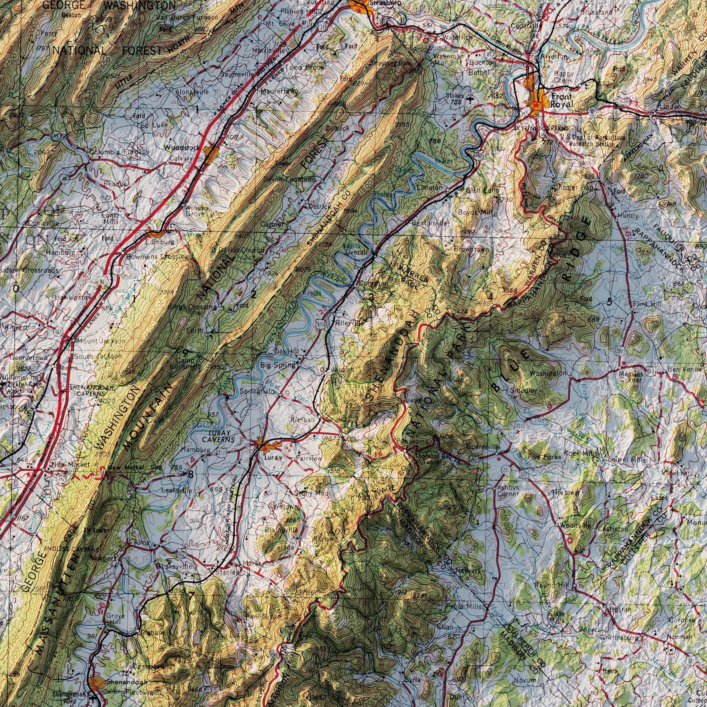
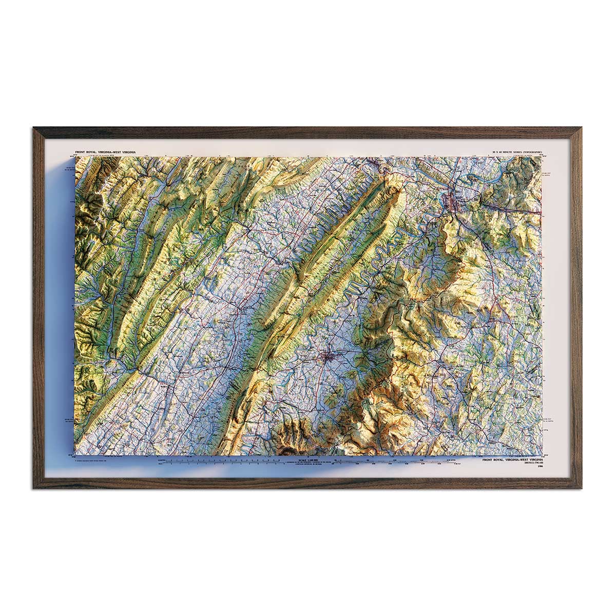
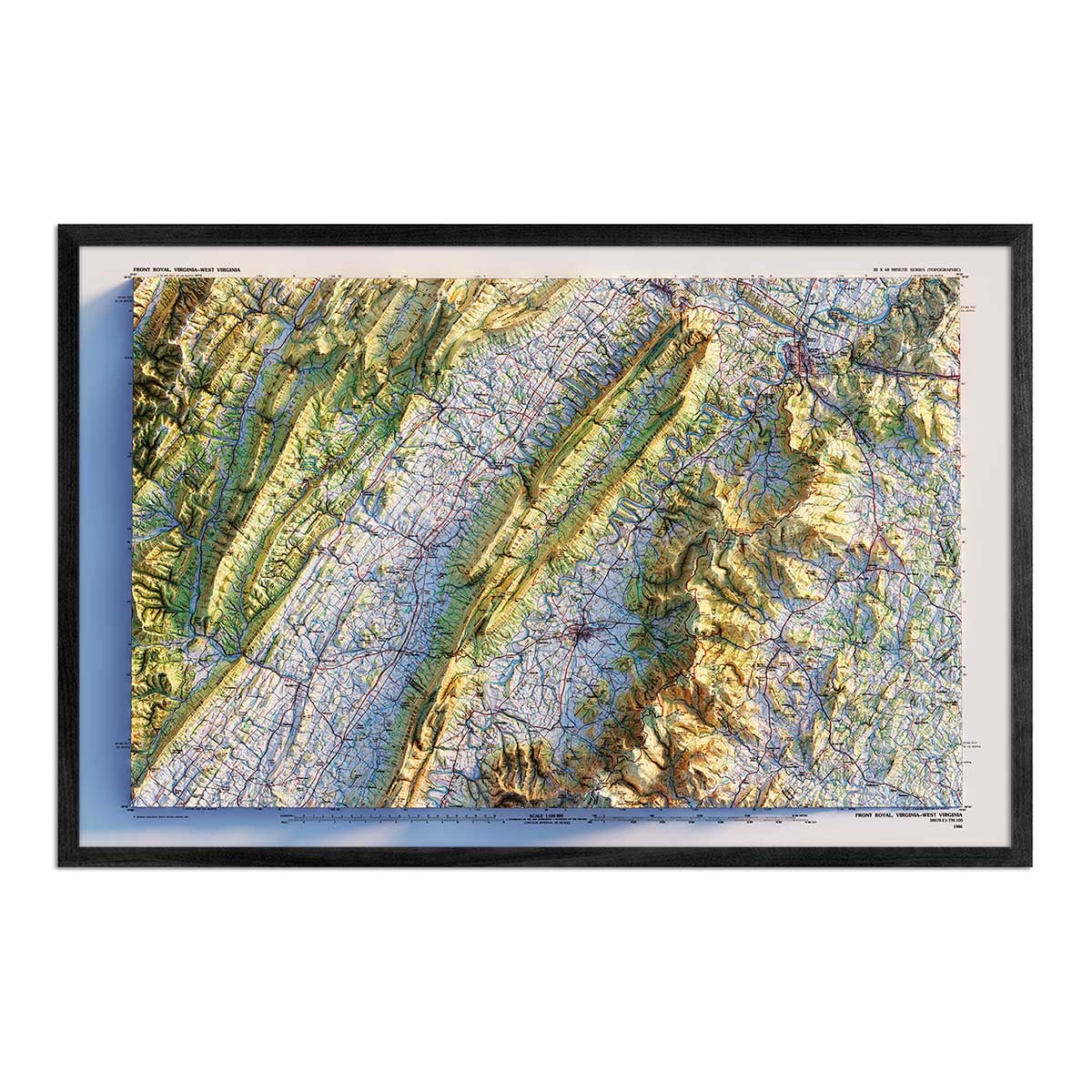
Shenandoah National Park 1986 Shaded Relief Map
From
$ 89.00 USD
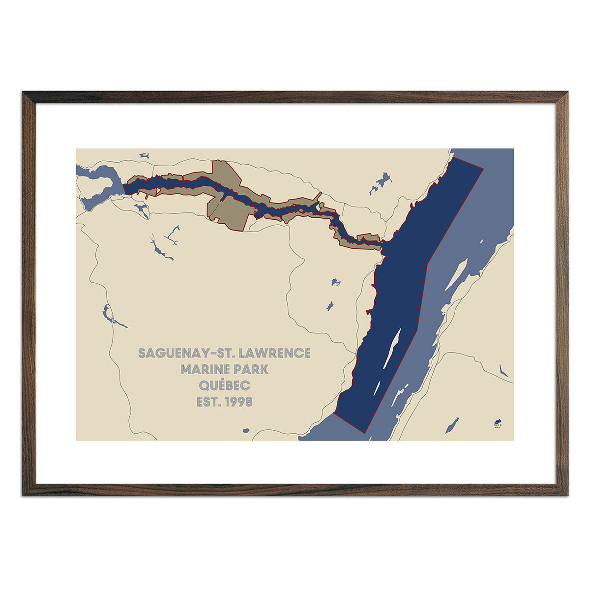
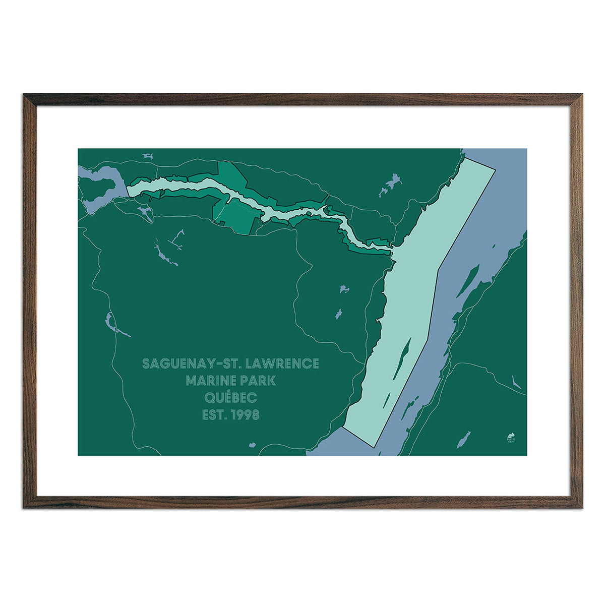
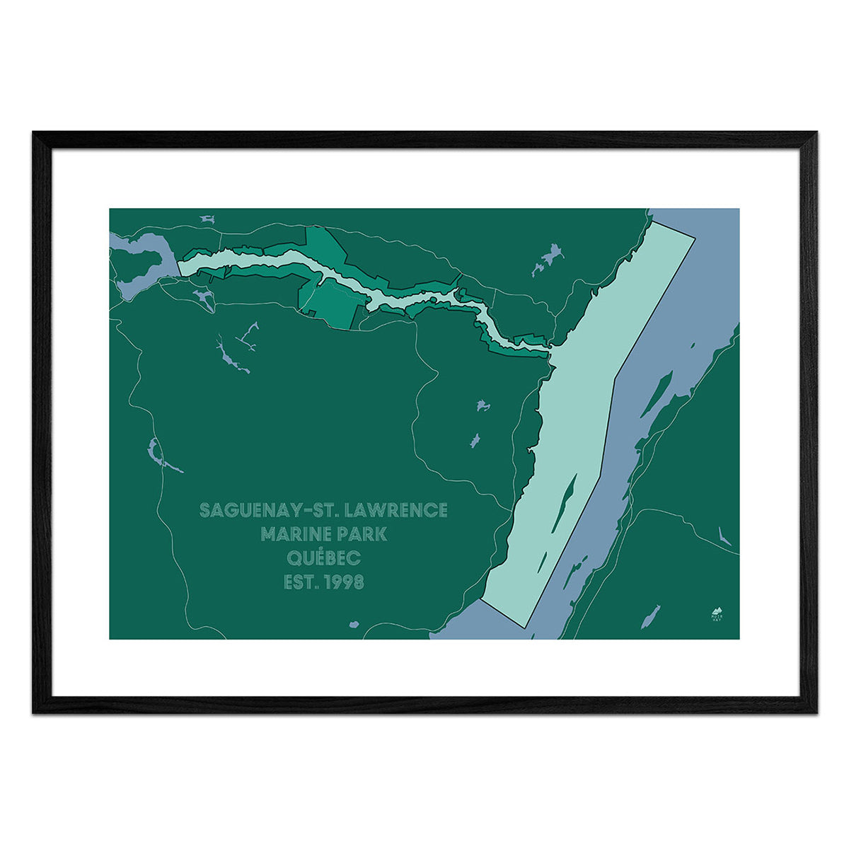
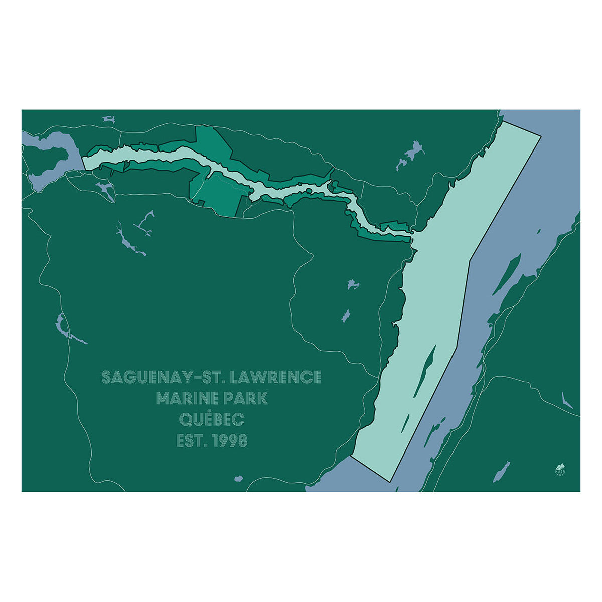
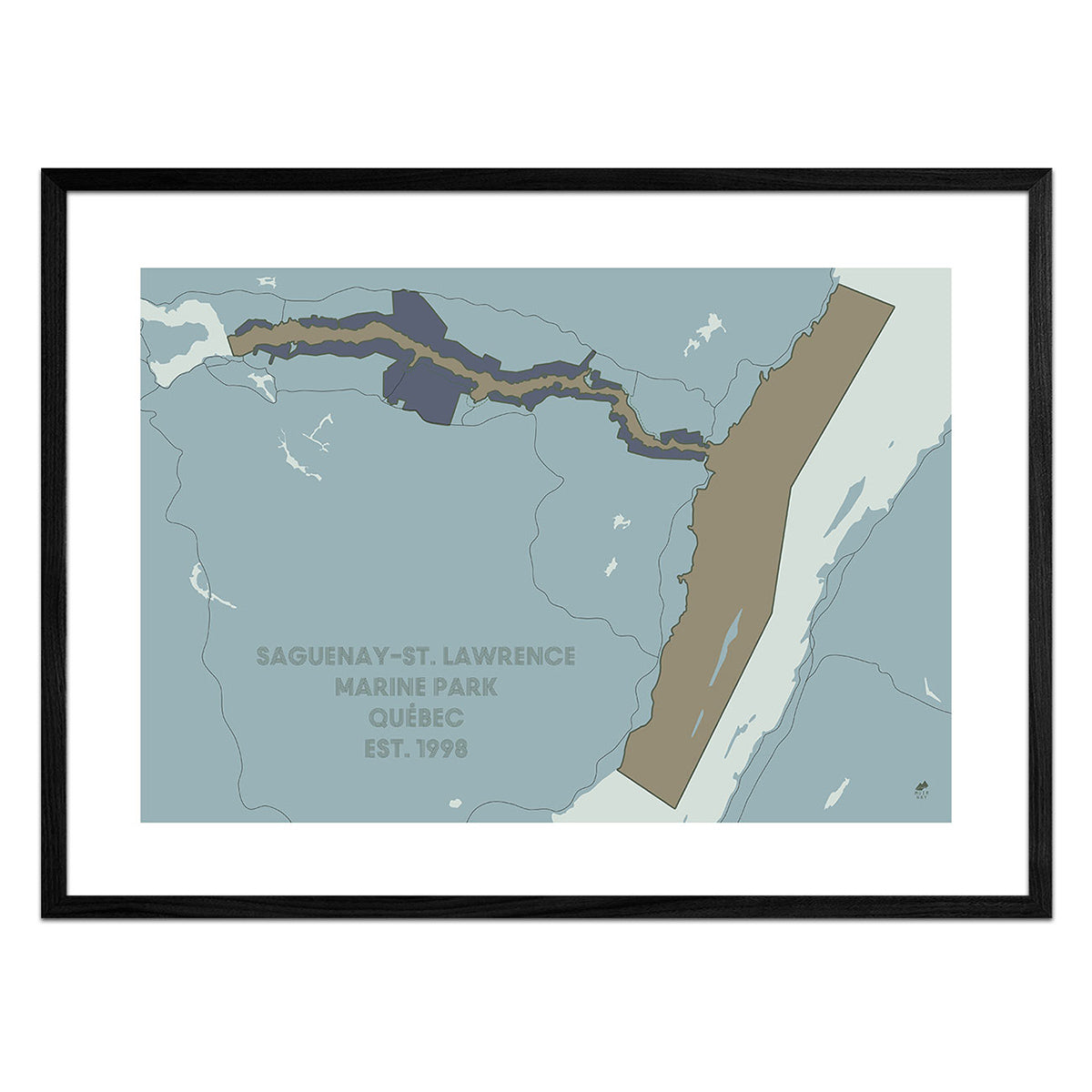
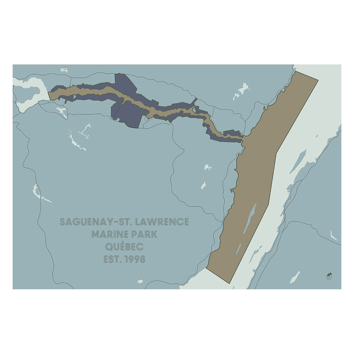
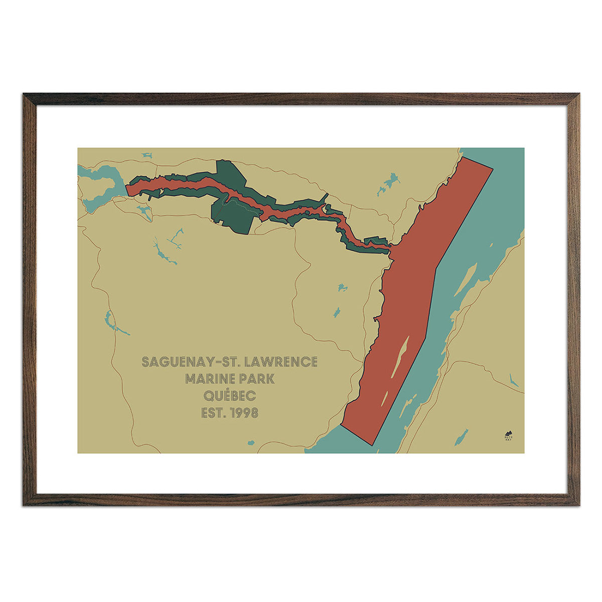
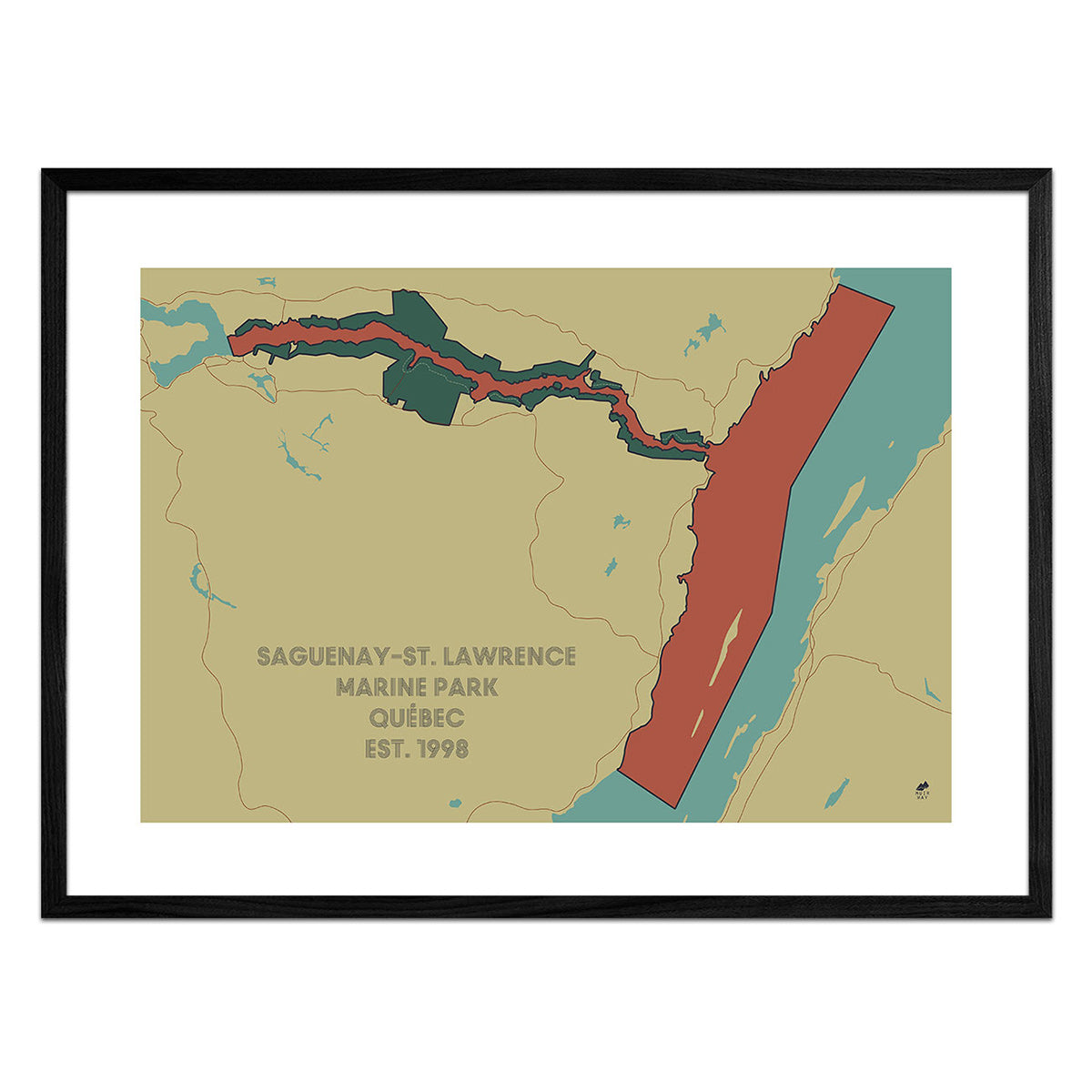
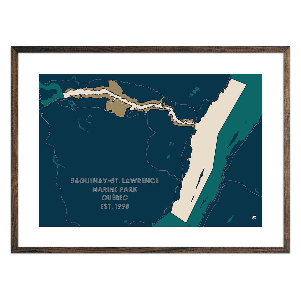
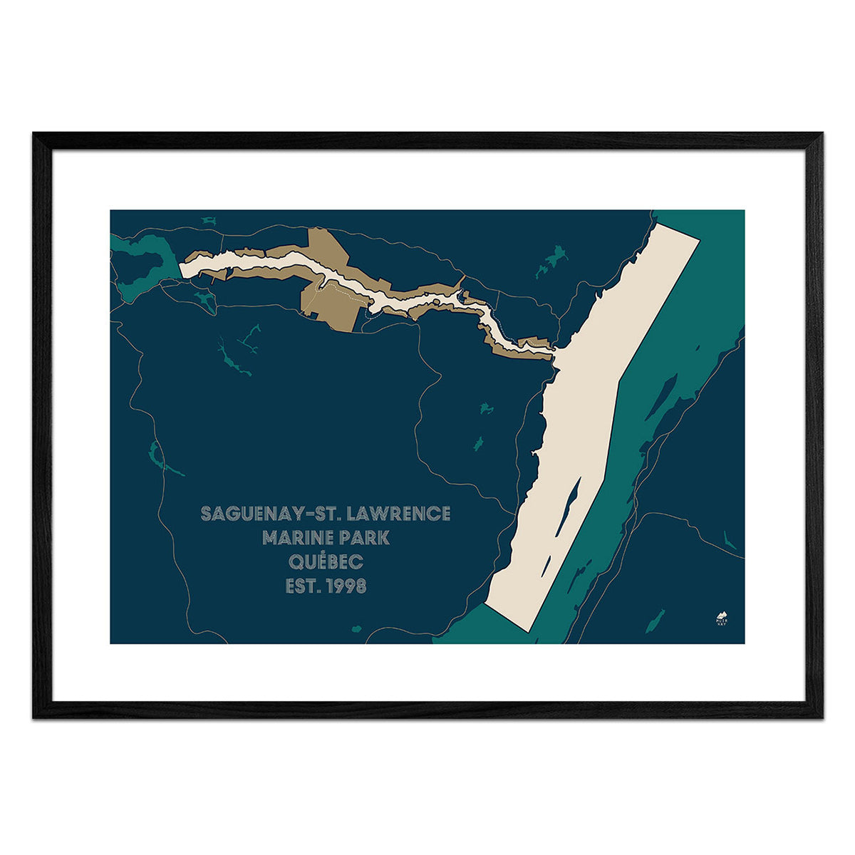
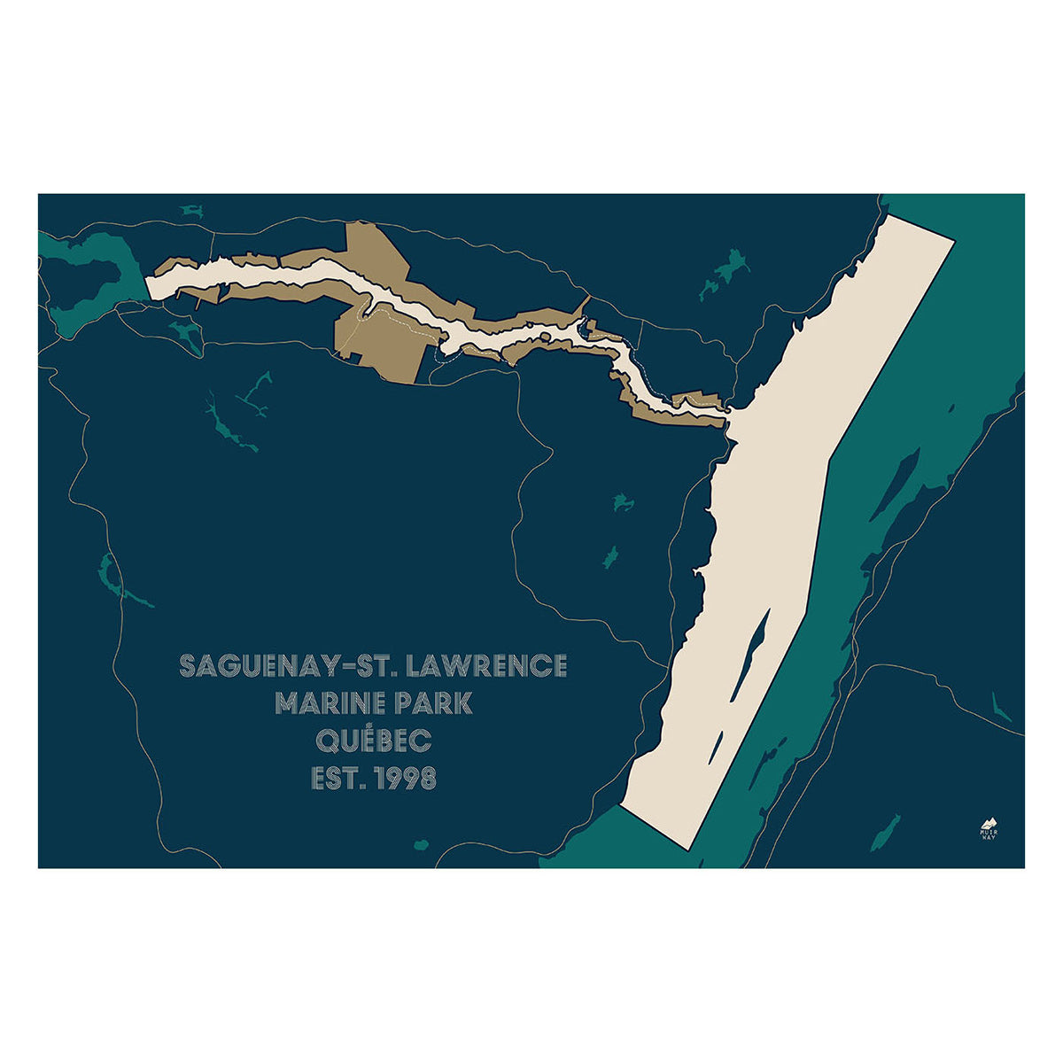
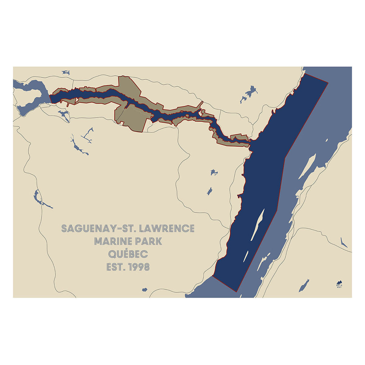
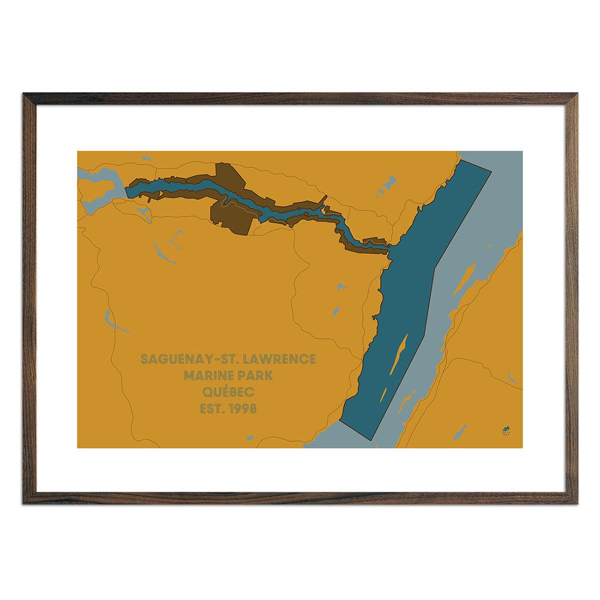
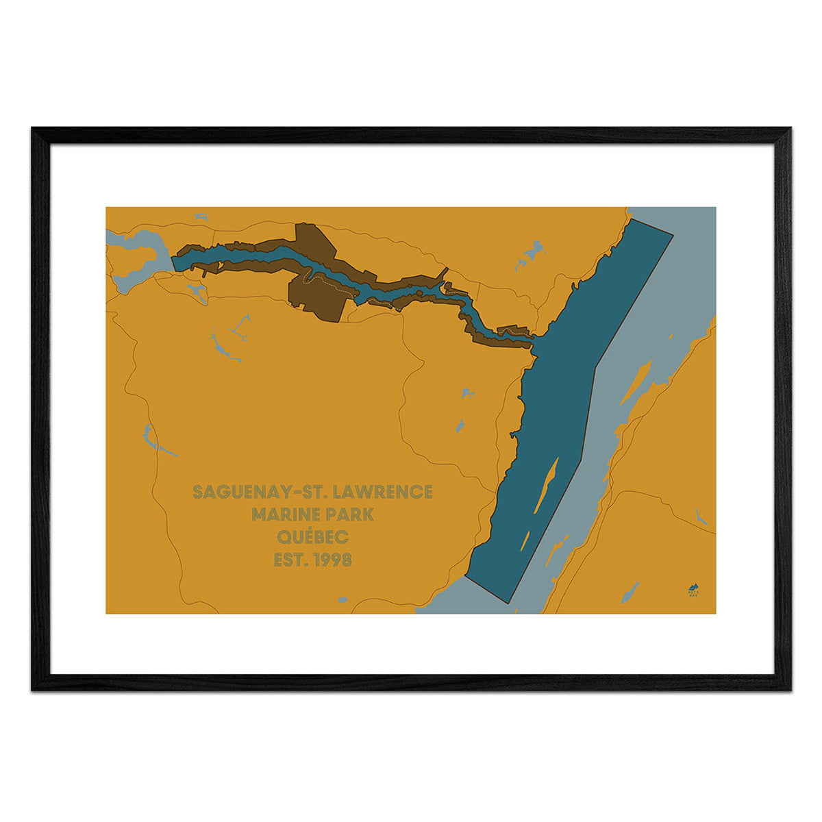
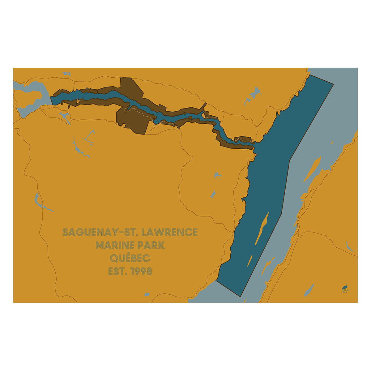
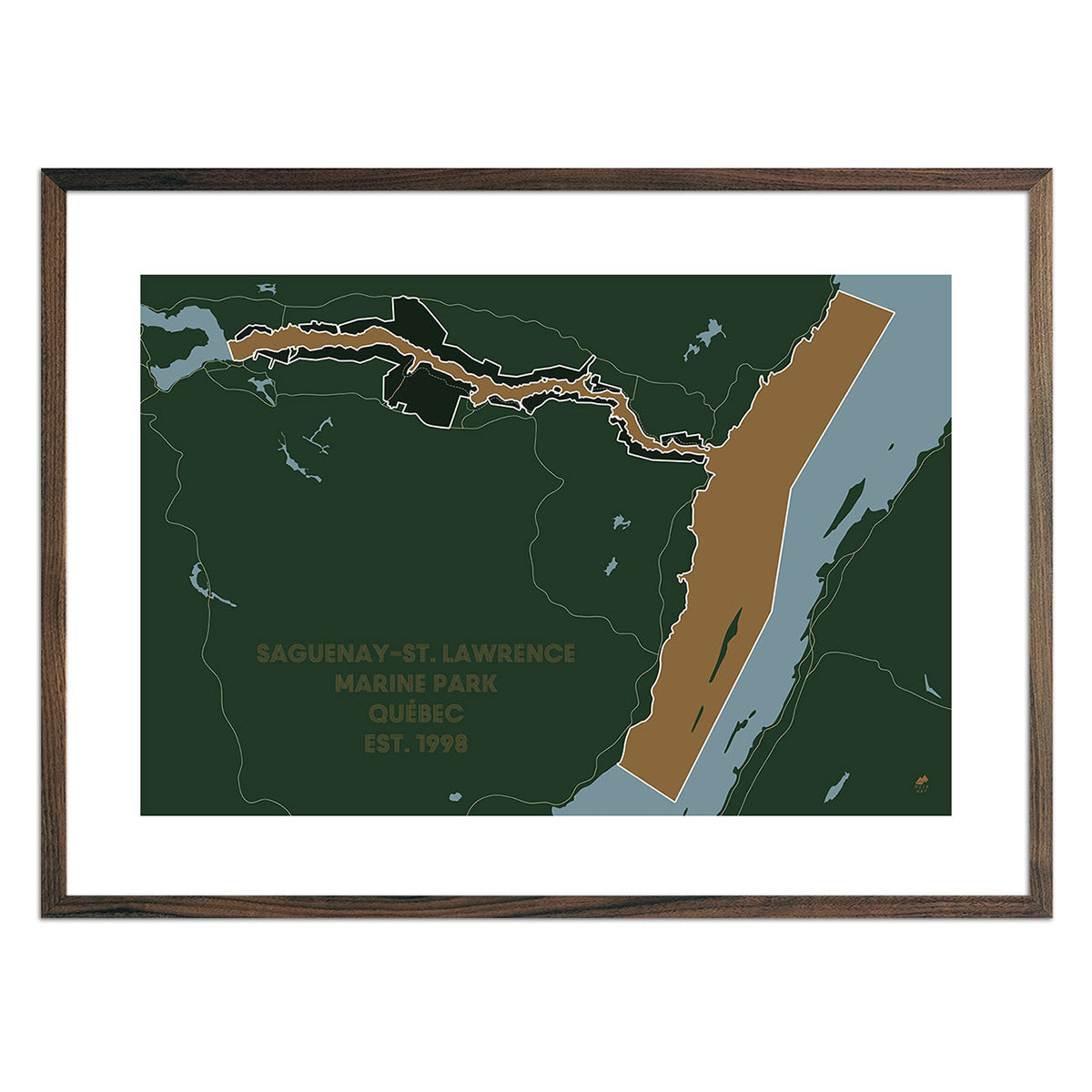
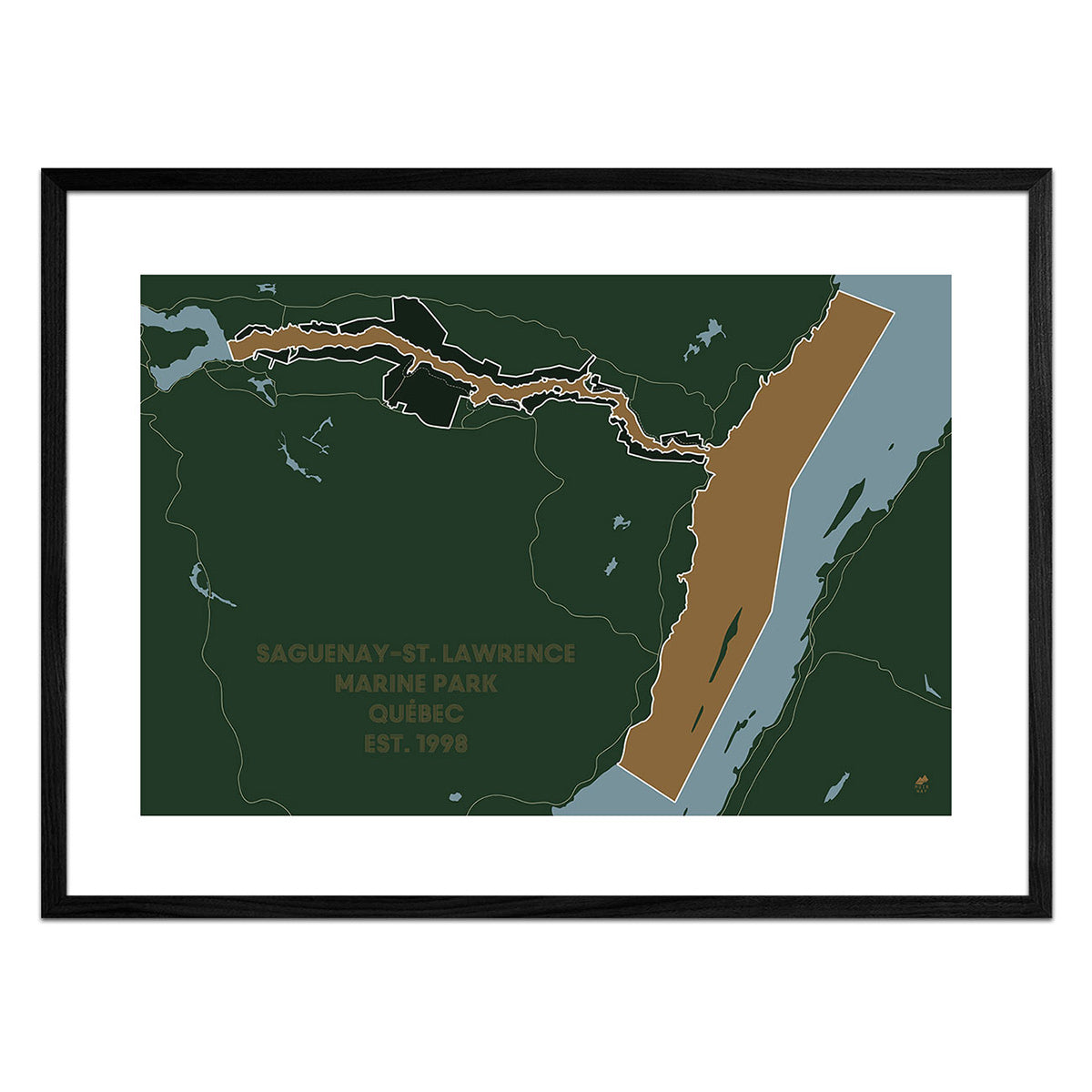
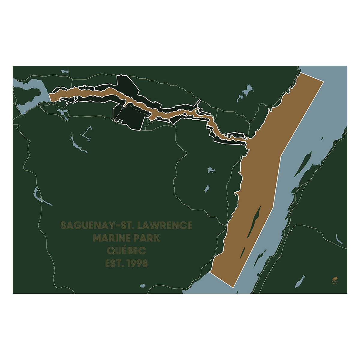
Saguenay and St. Lawrence Marine Park Map
From
$ 49.00 USD
5.0 / 5.0
283 reviews
« Previous
·
1
…
3
4
5
Your cart
Close
Close
Your cart is empty
Start shopping
Added to your
Cart