


Puerto Rico


Puerto Rico
Maps and Wall Art
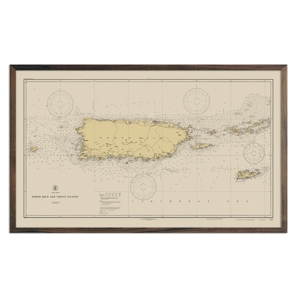
Whether you are from Puerto Rico, like to visit, or hope to see Mar Chiquita beach someday, our custom printed Puerto Rico wall maps will bring it to life. Our maps are beautifully rendered from a combination of historical data, modern technology, and hand design. From our eye-catching elevation maps and geological relief maps to our meticulously restored historical maps, every map of Puerto Rico we offer reflects the high quality and attention to detail our customers have come to love and expect from Muir Way. See why a map of Puerto Rico from Muir Way is more than your typical wall map.
What makes Muir Way maps of Puerto Rico unique?
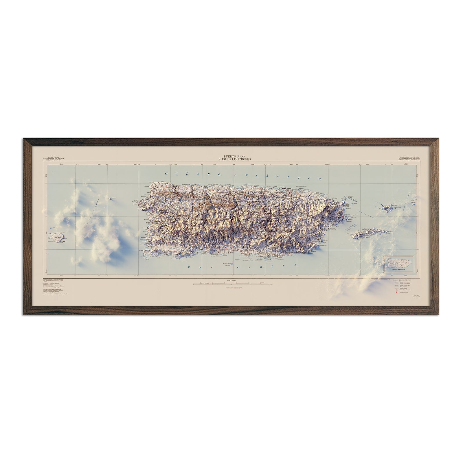
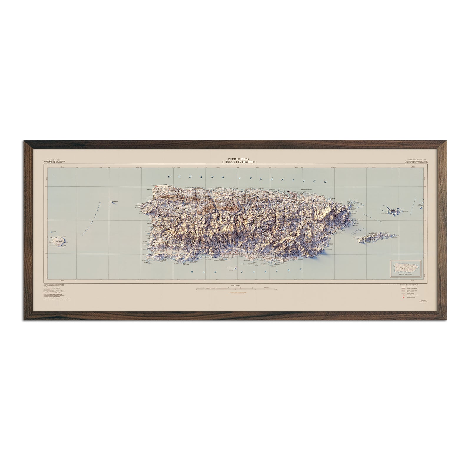
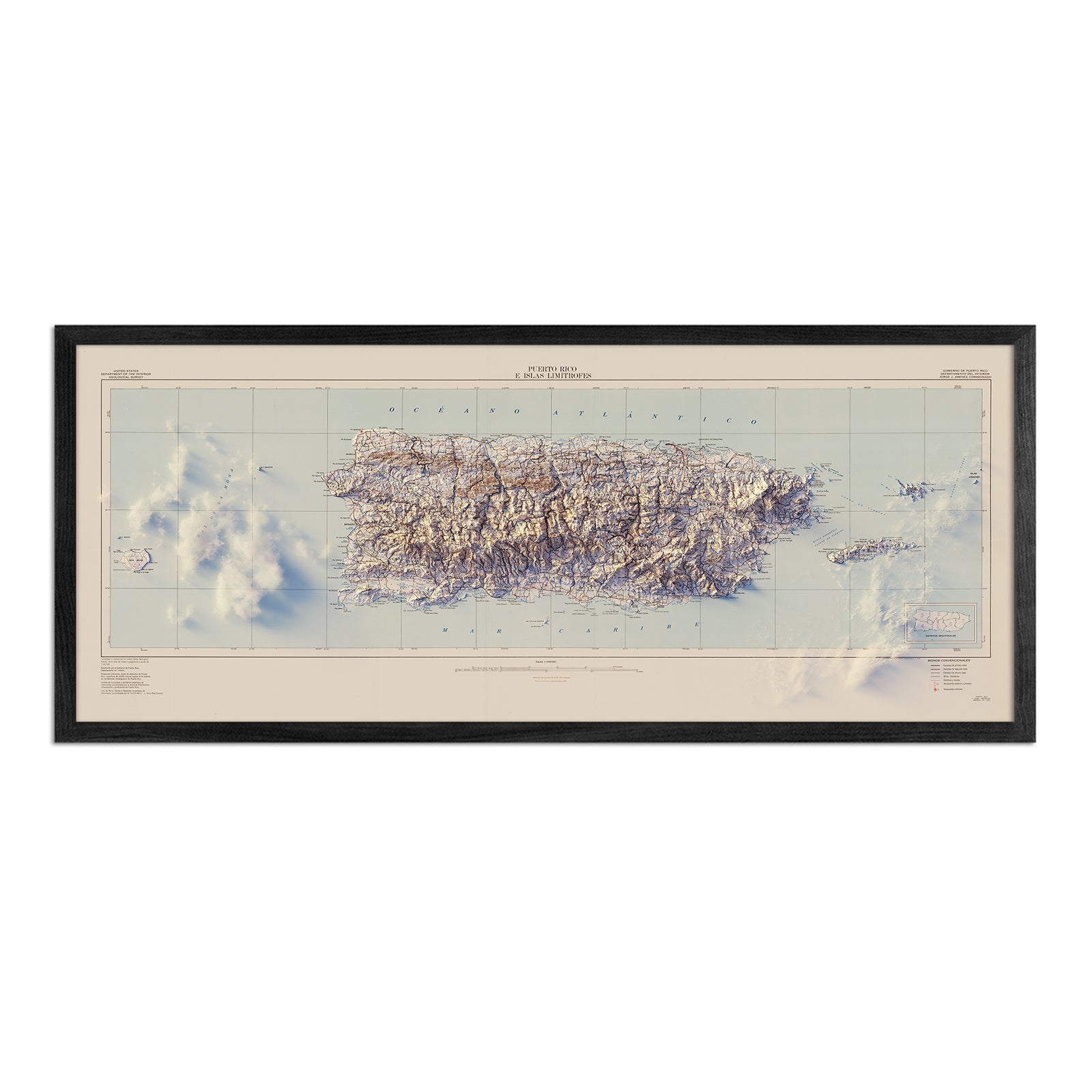
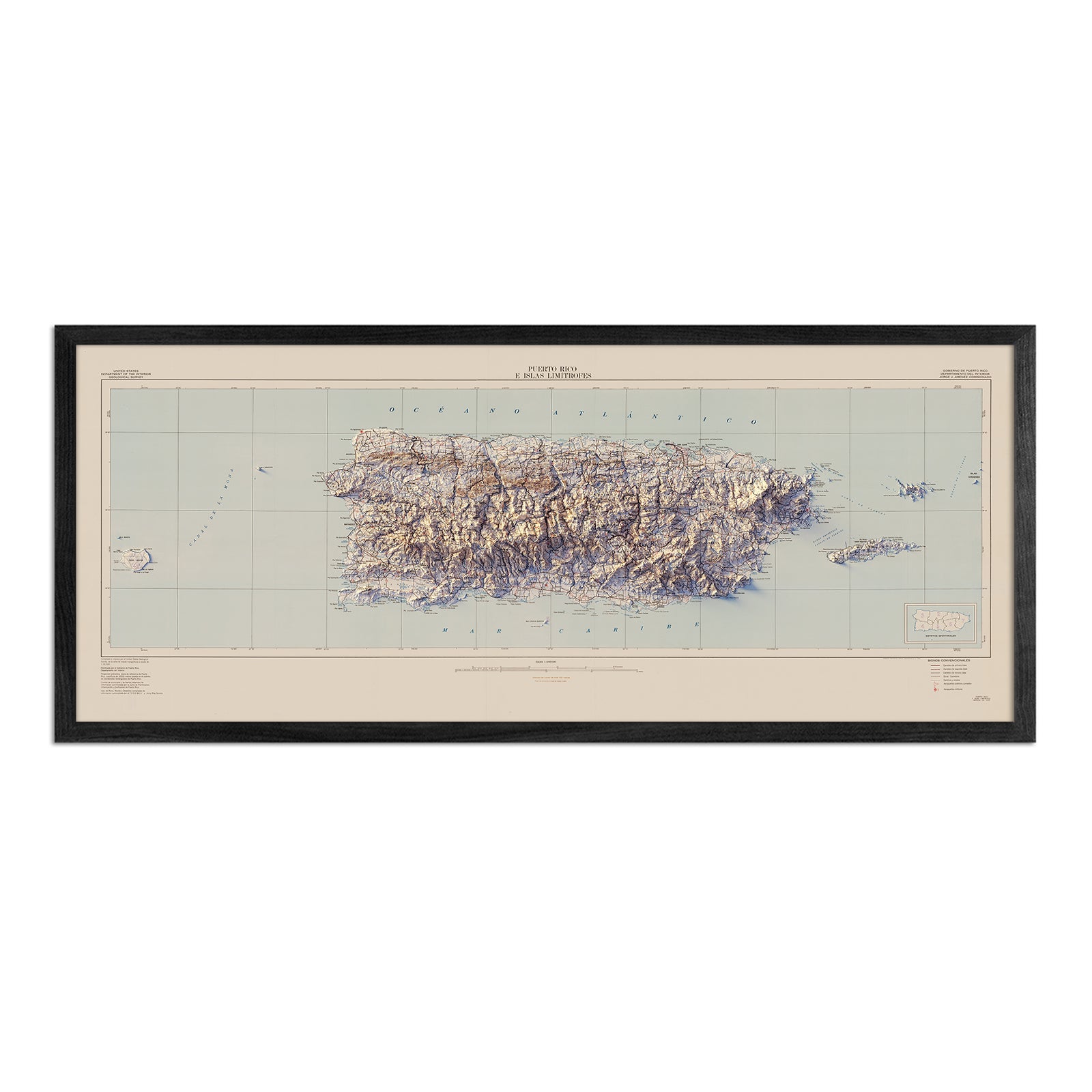
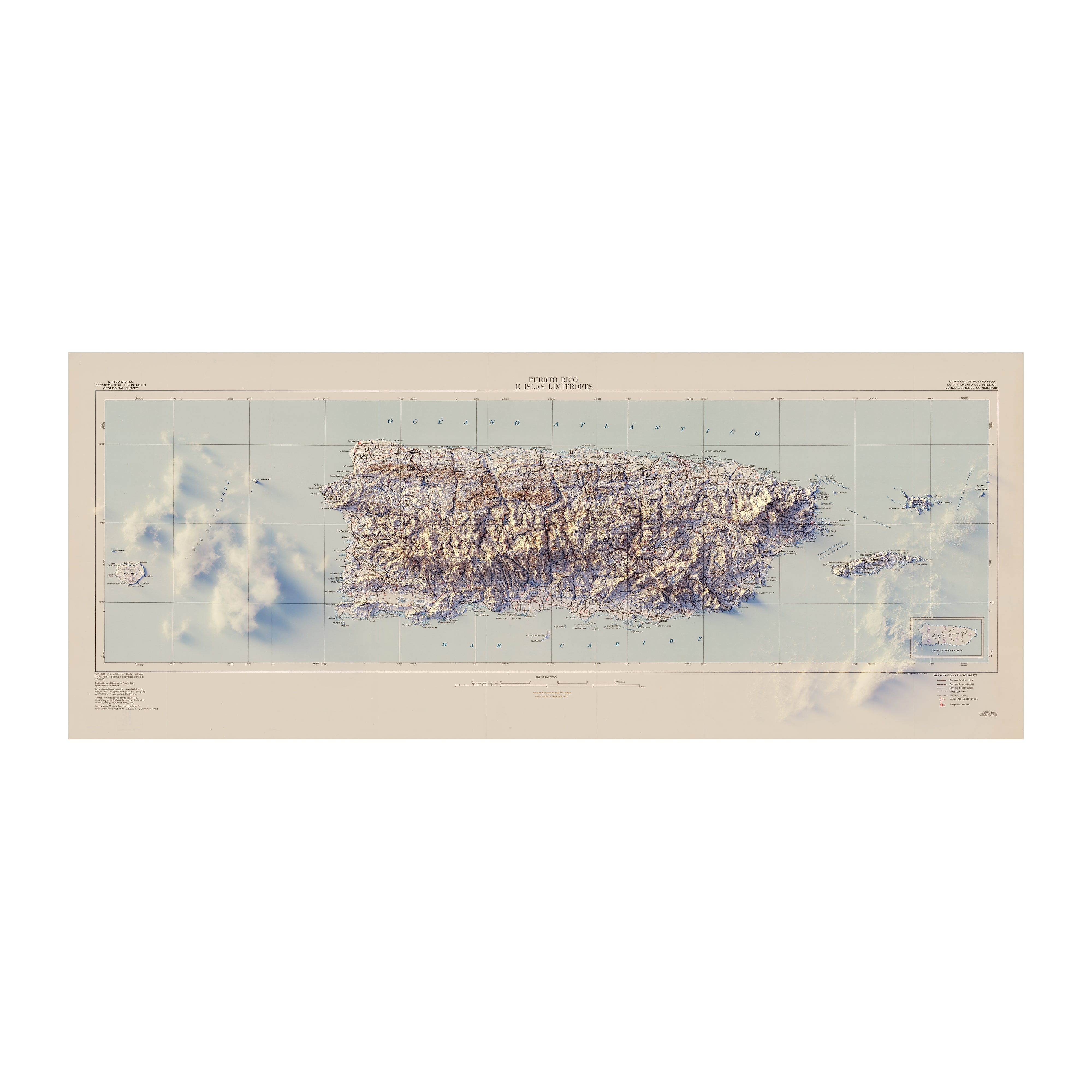
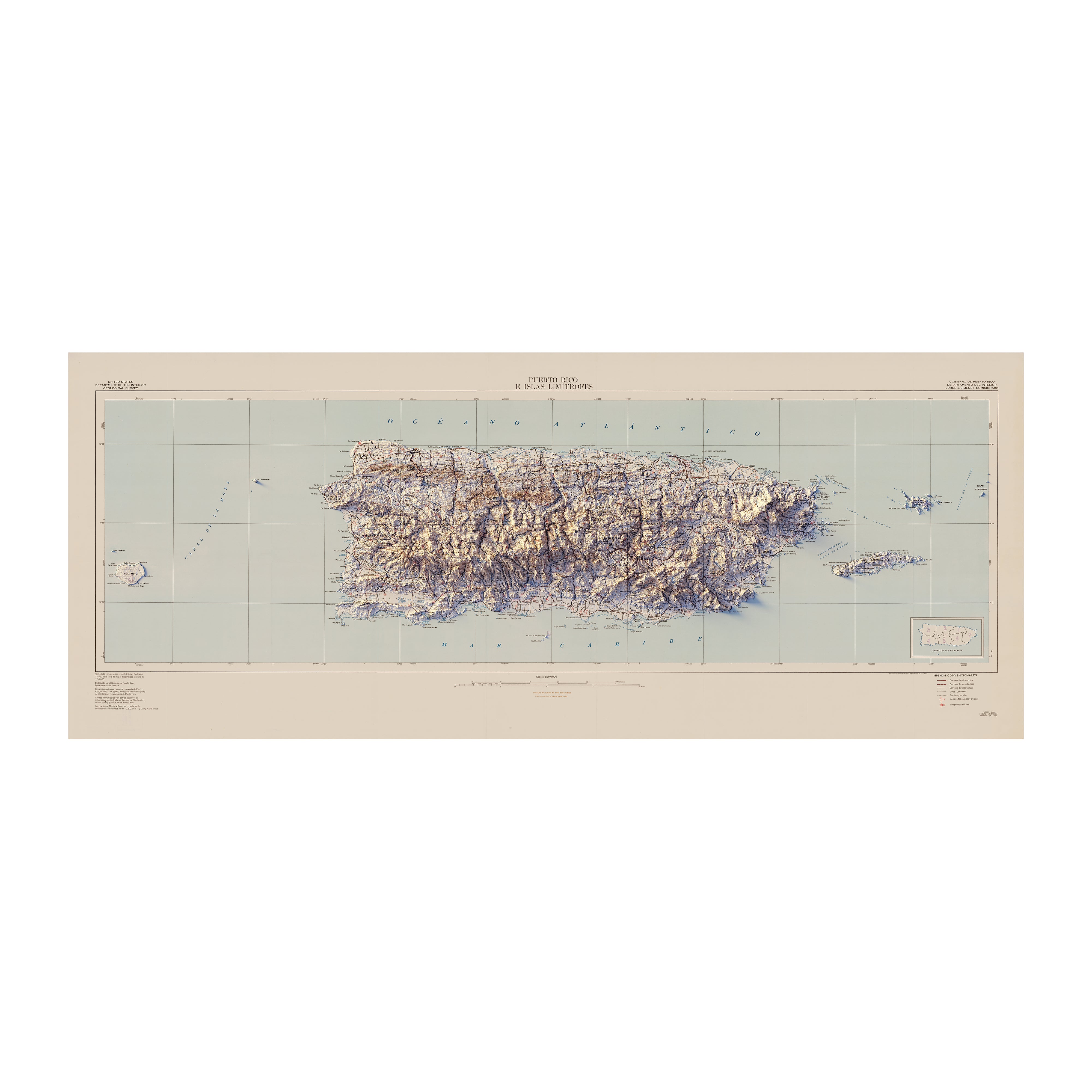
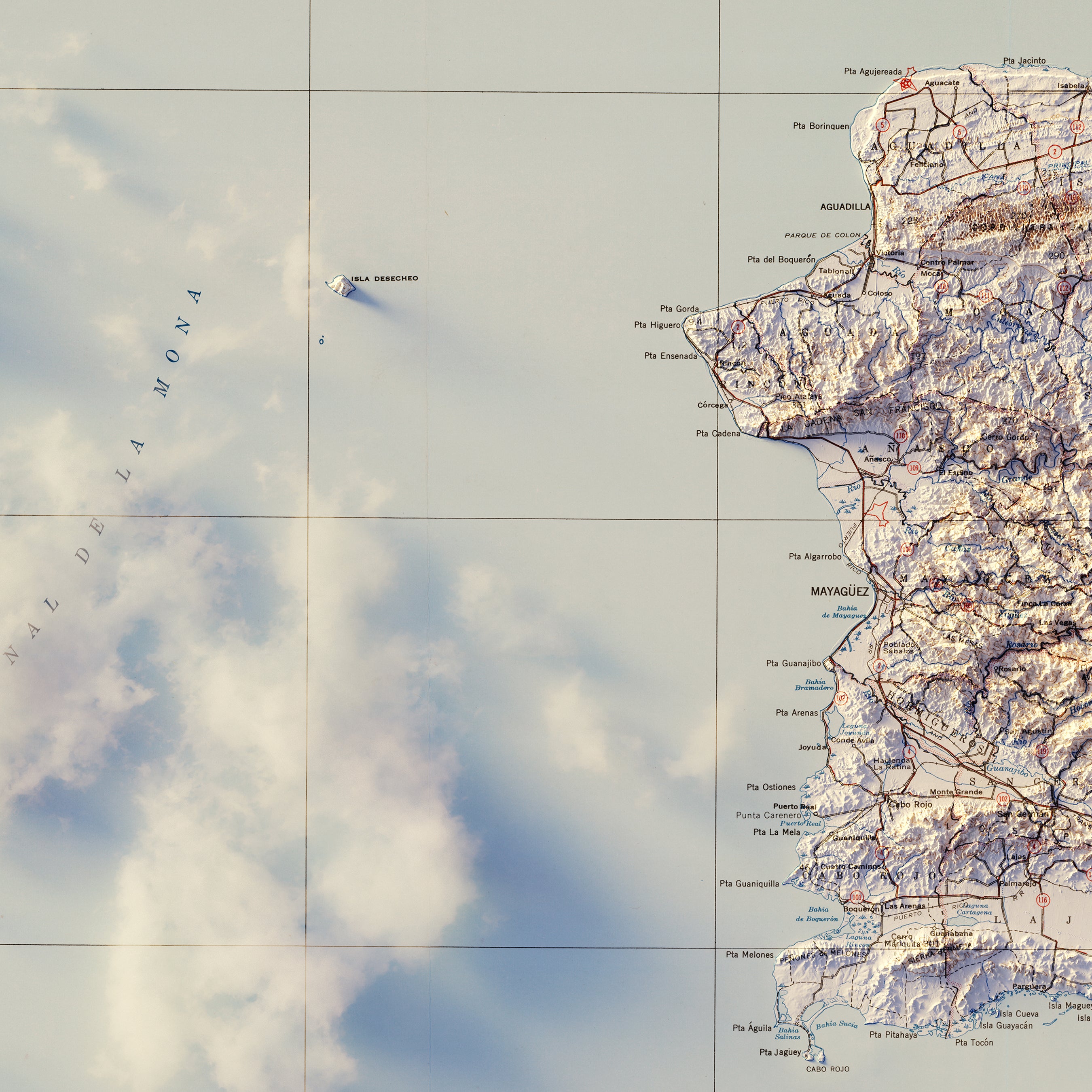
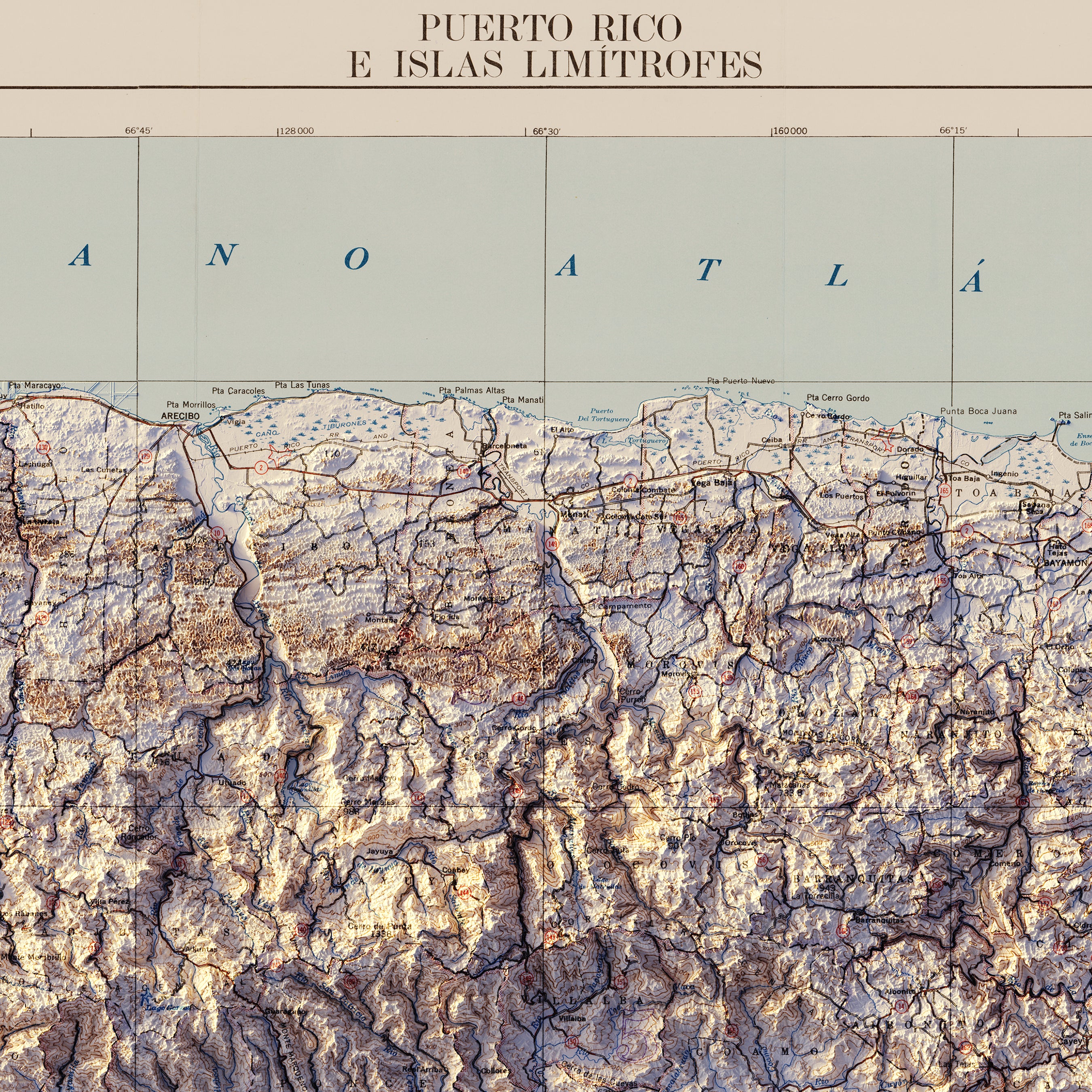
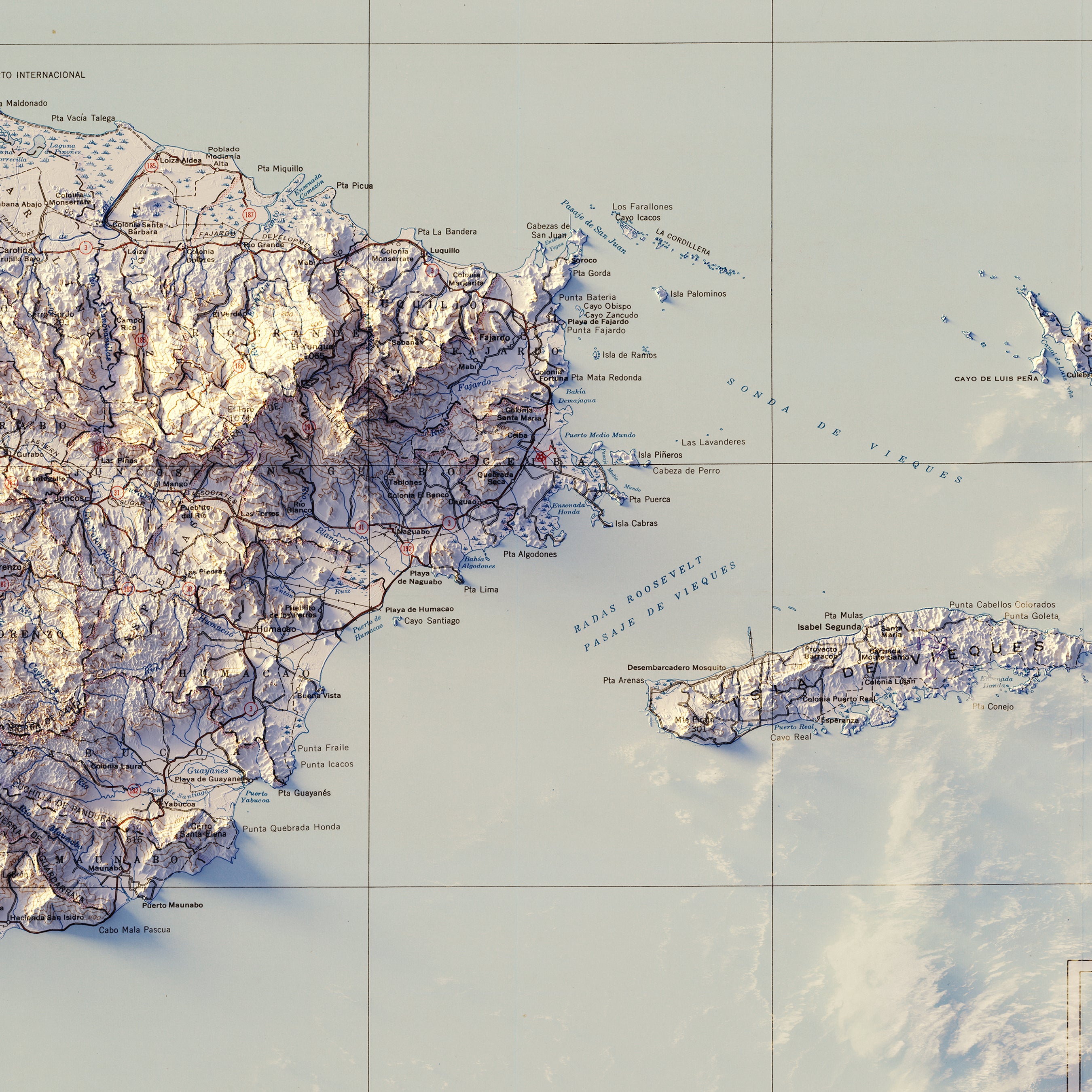
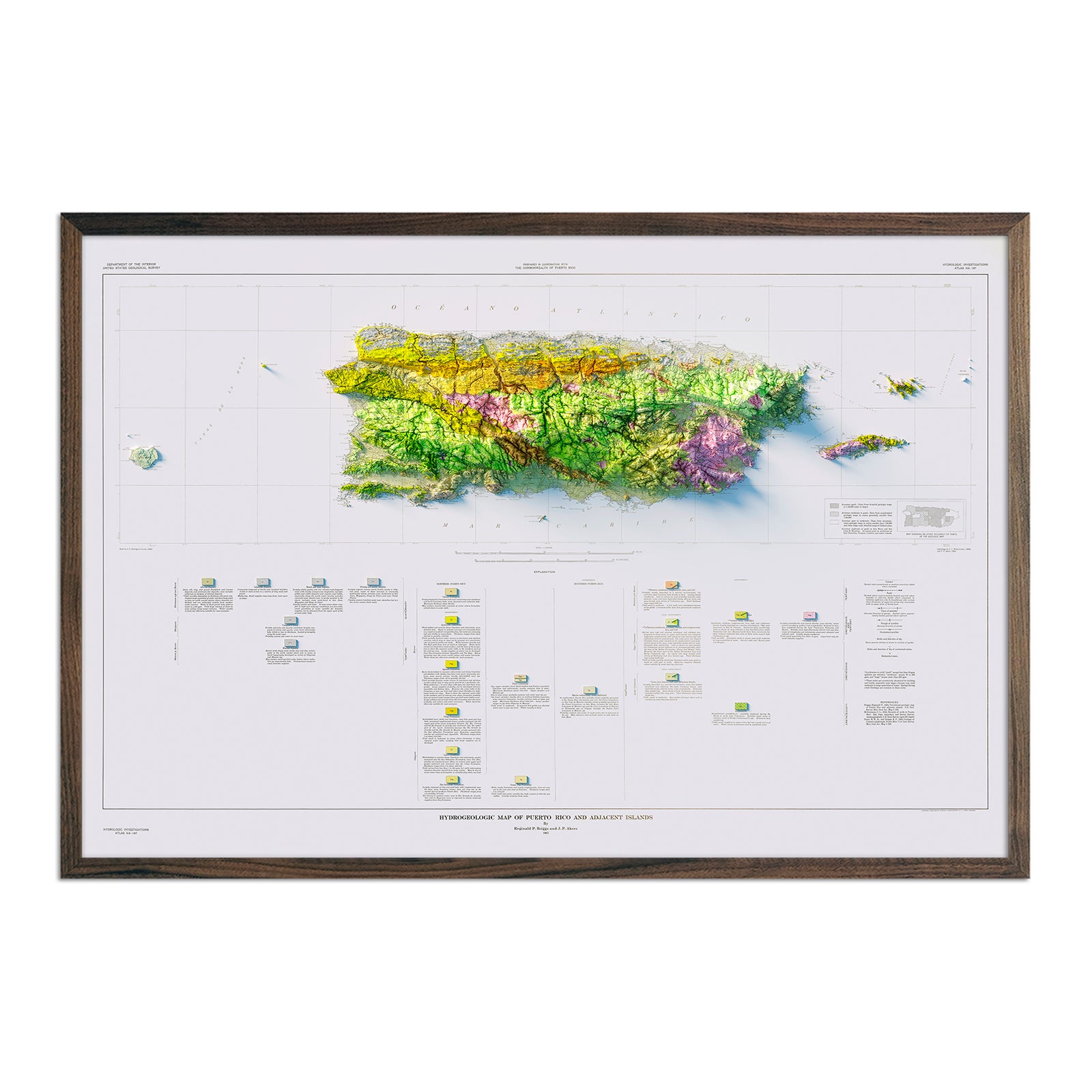
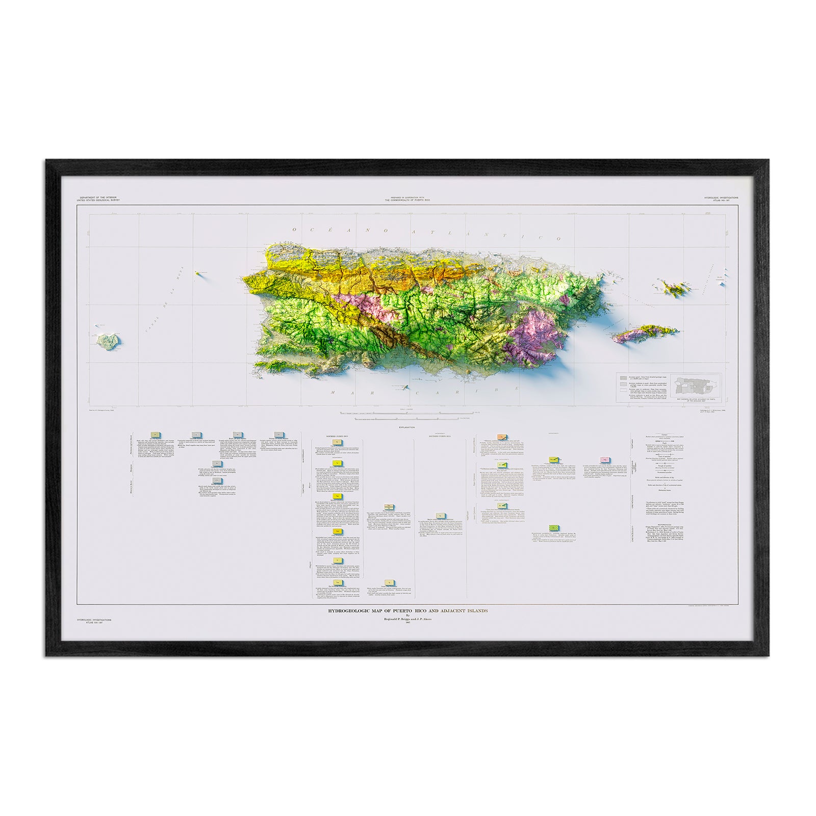
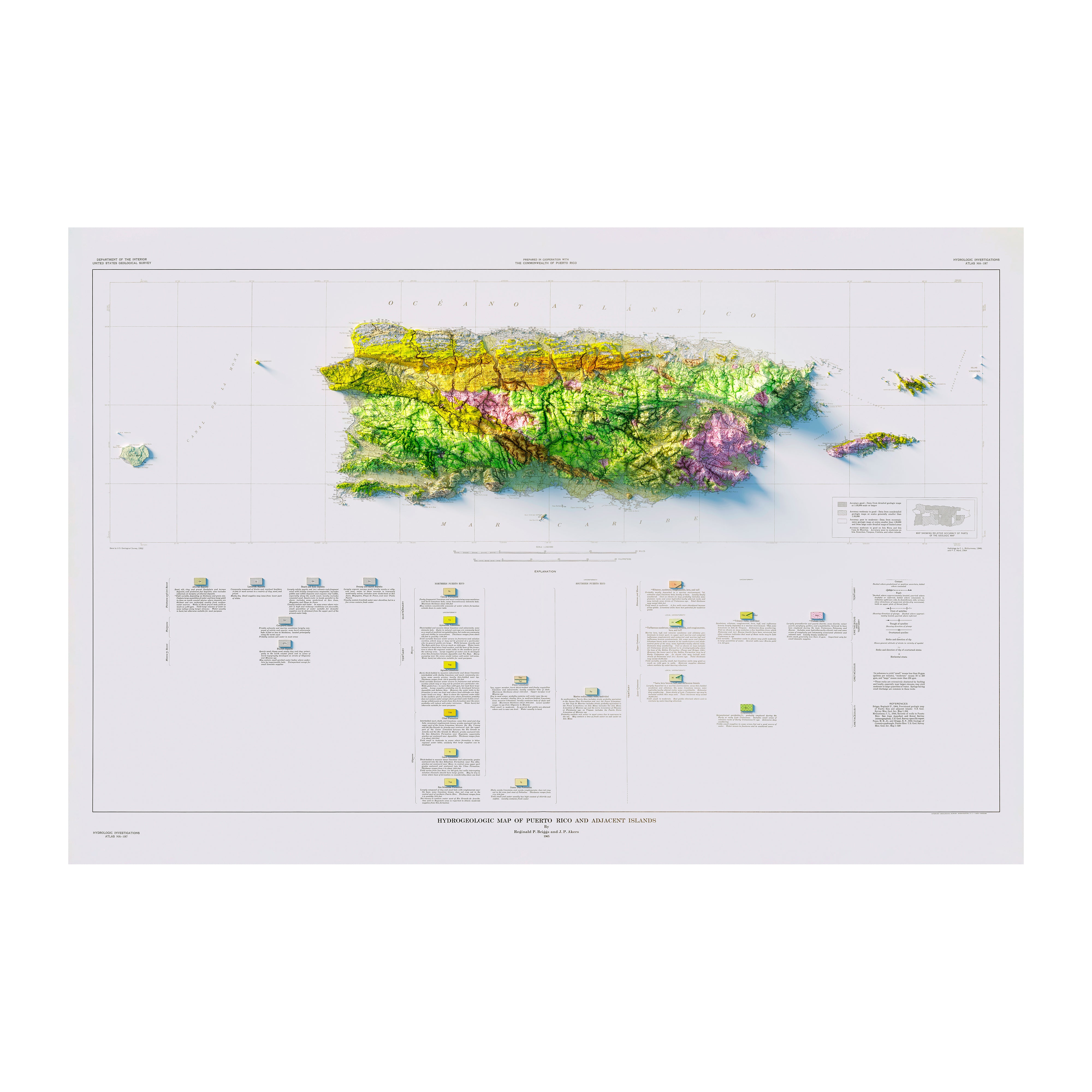
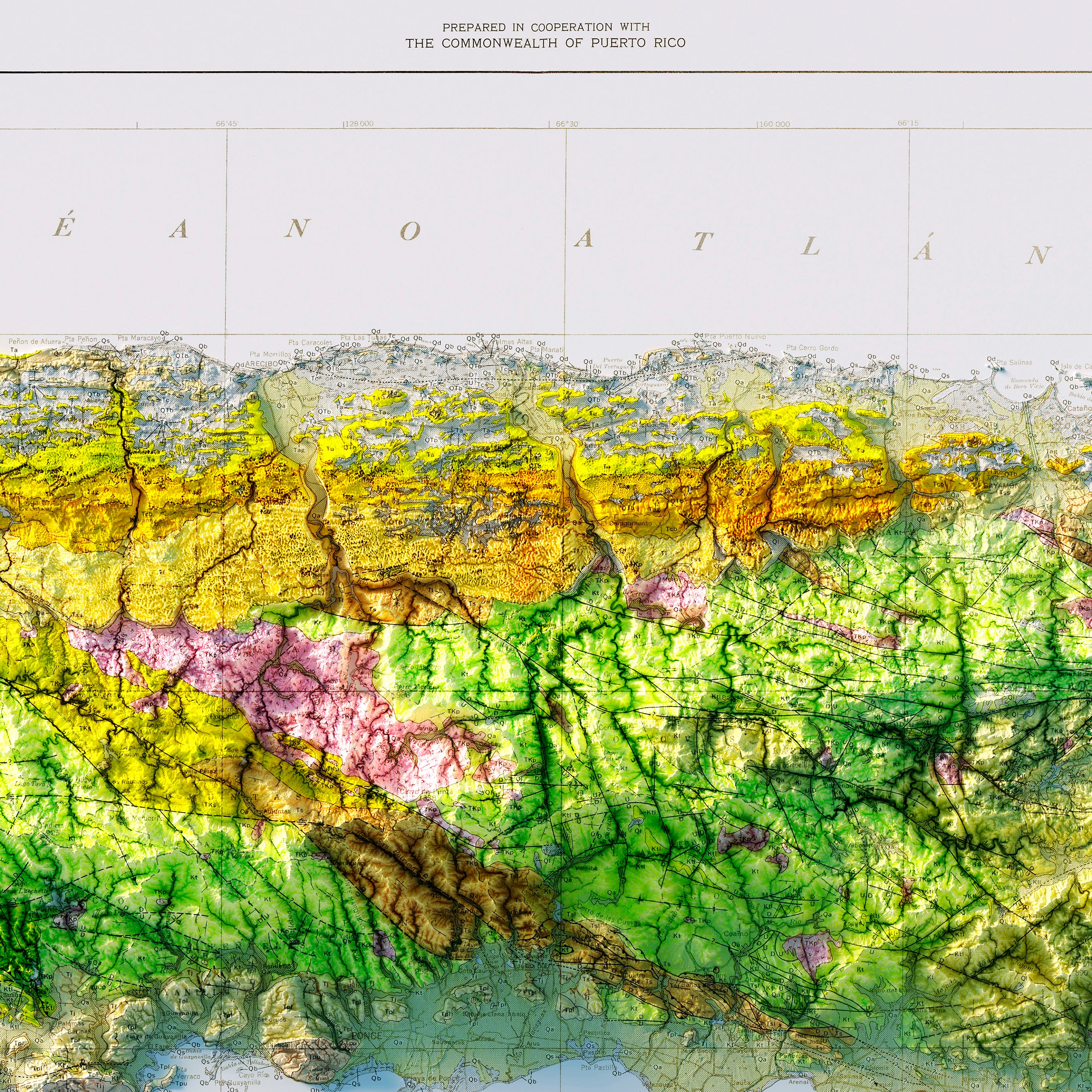
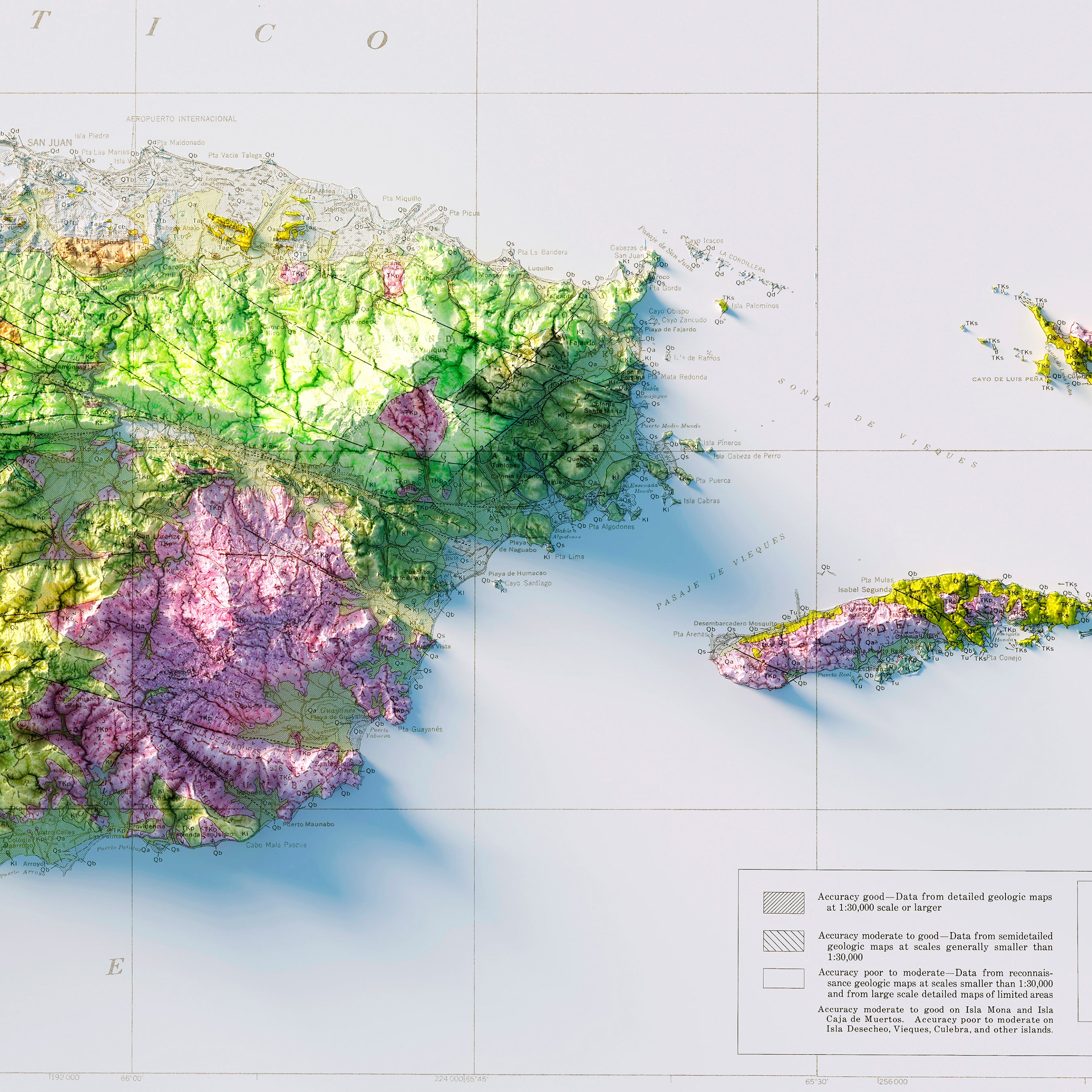
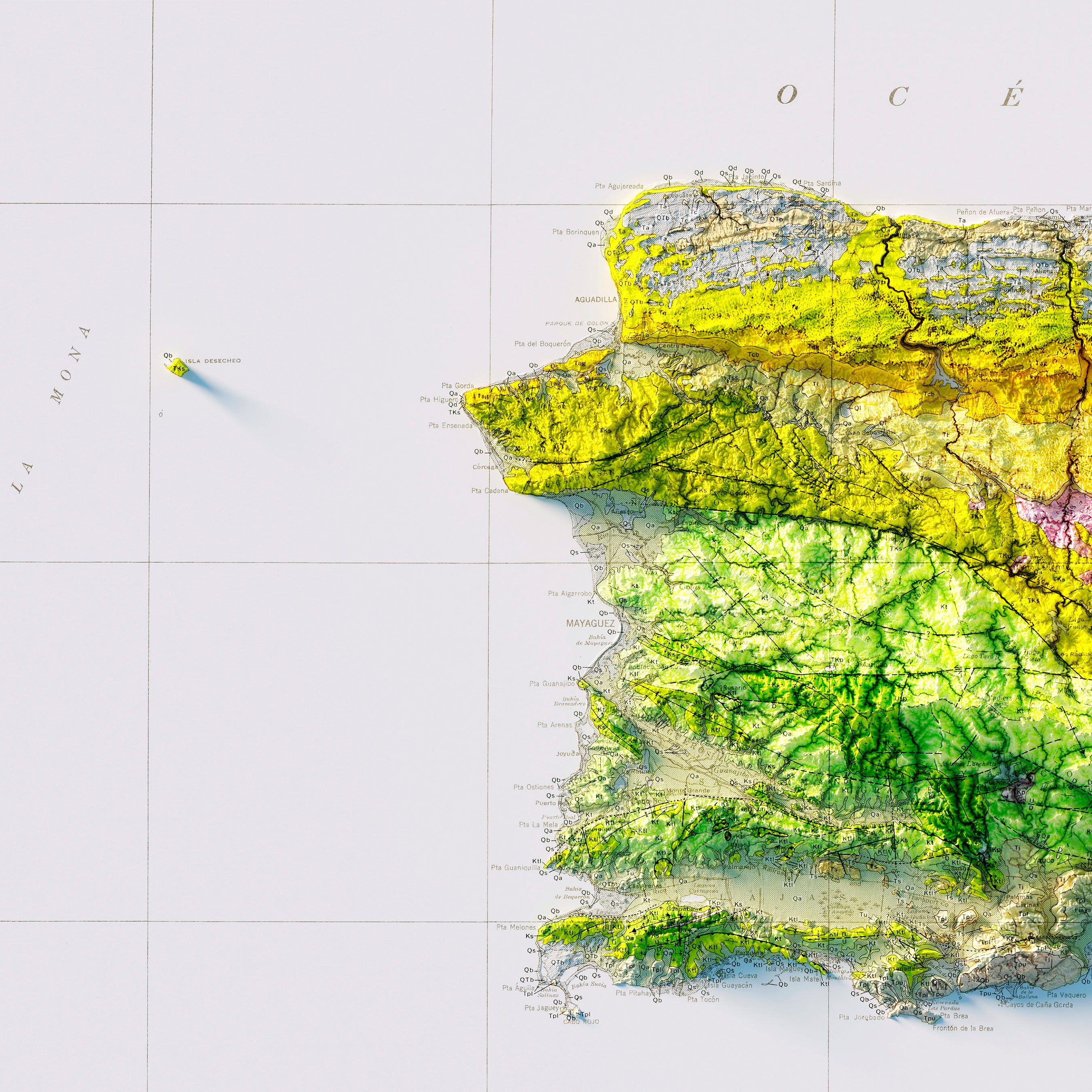
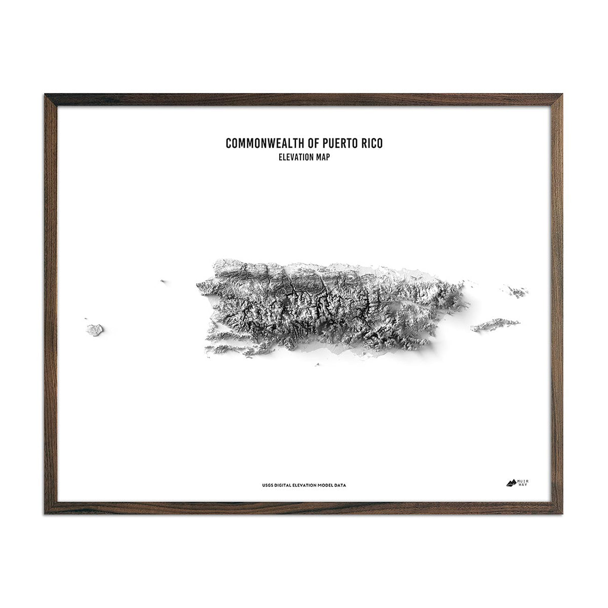
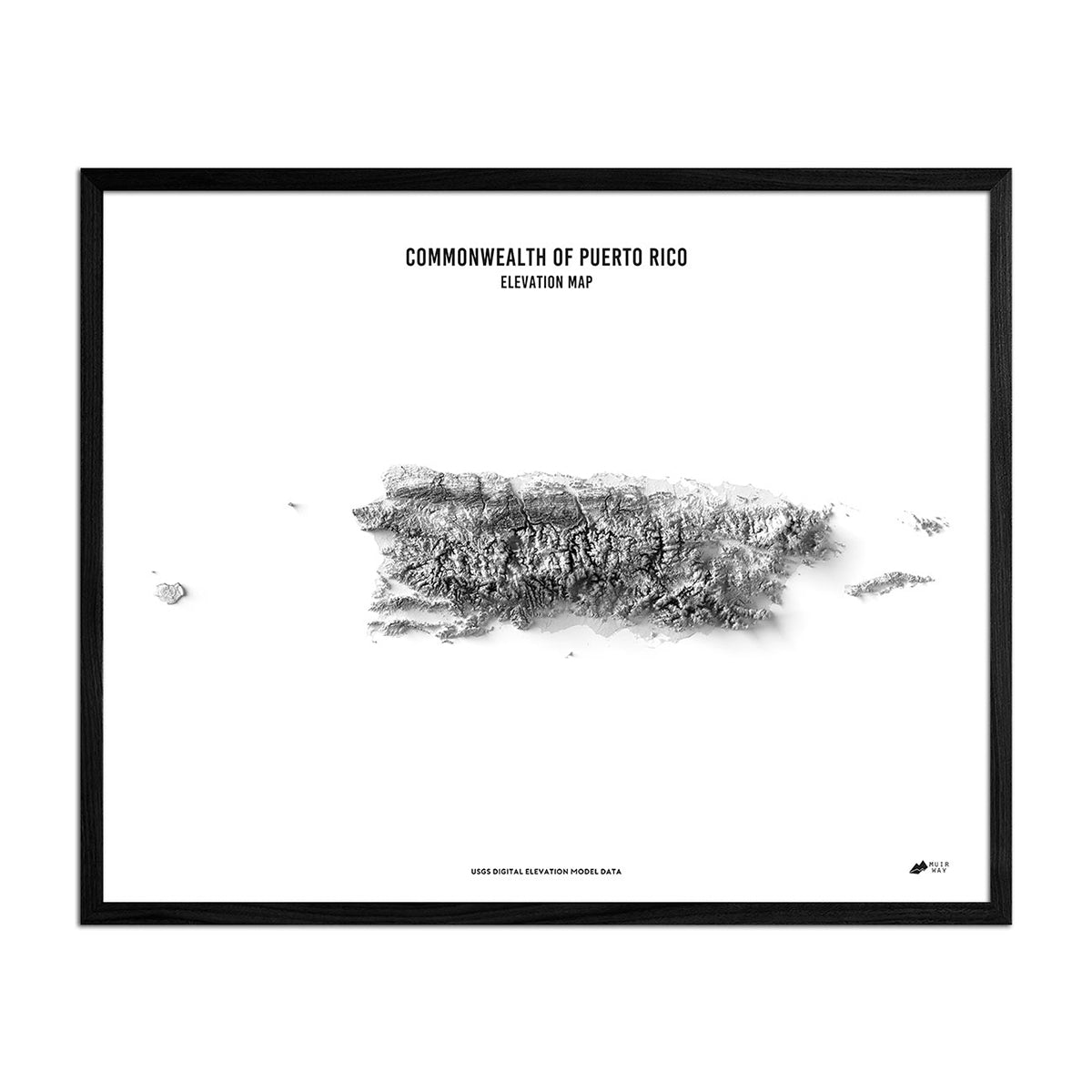
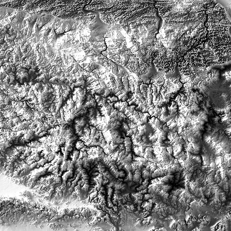
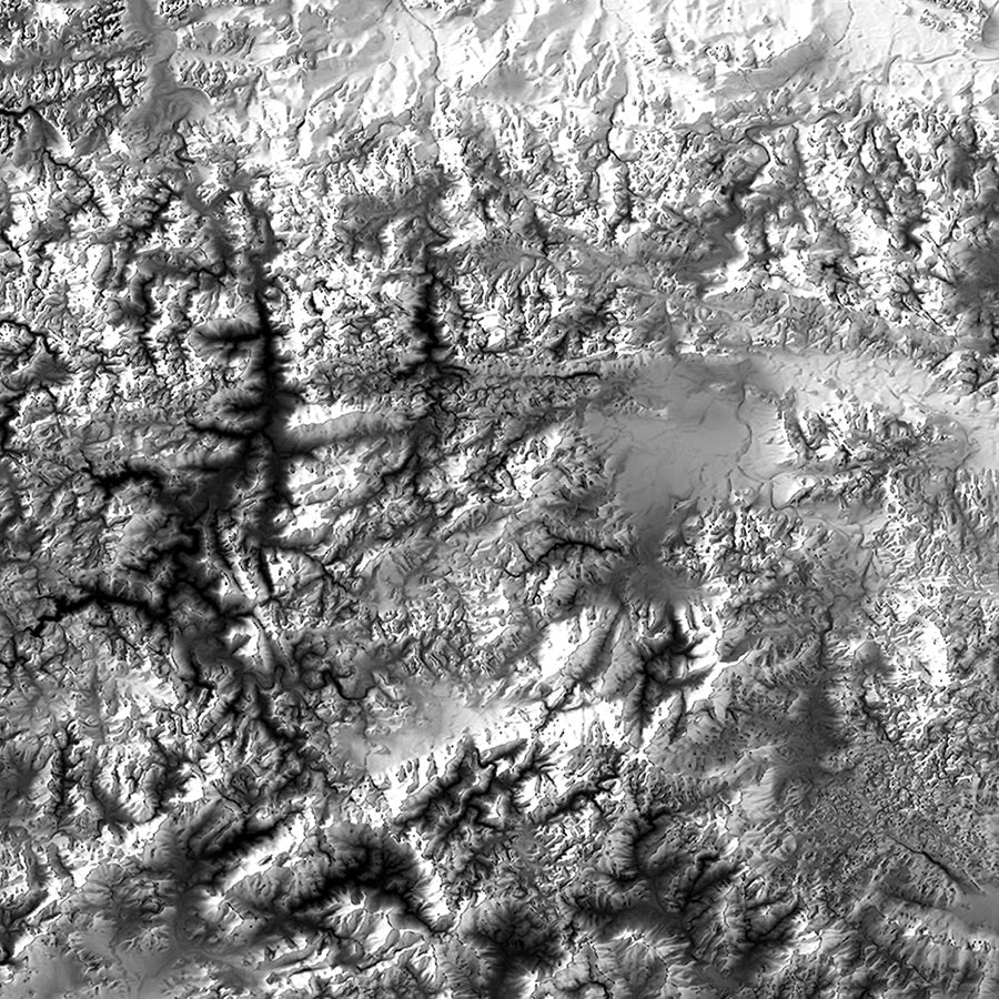
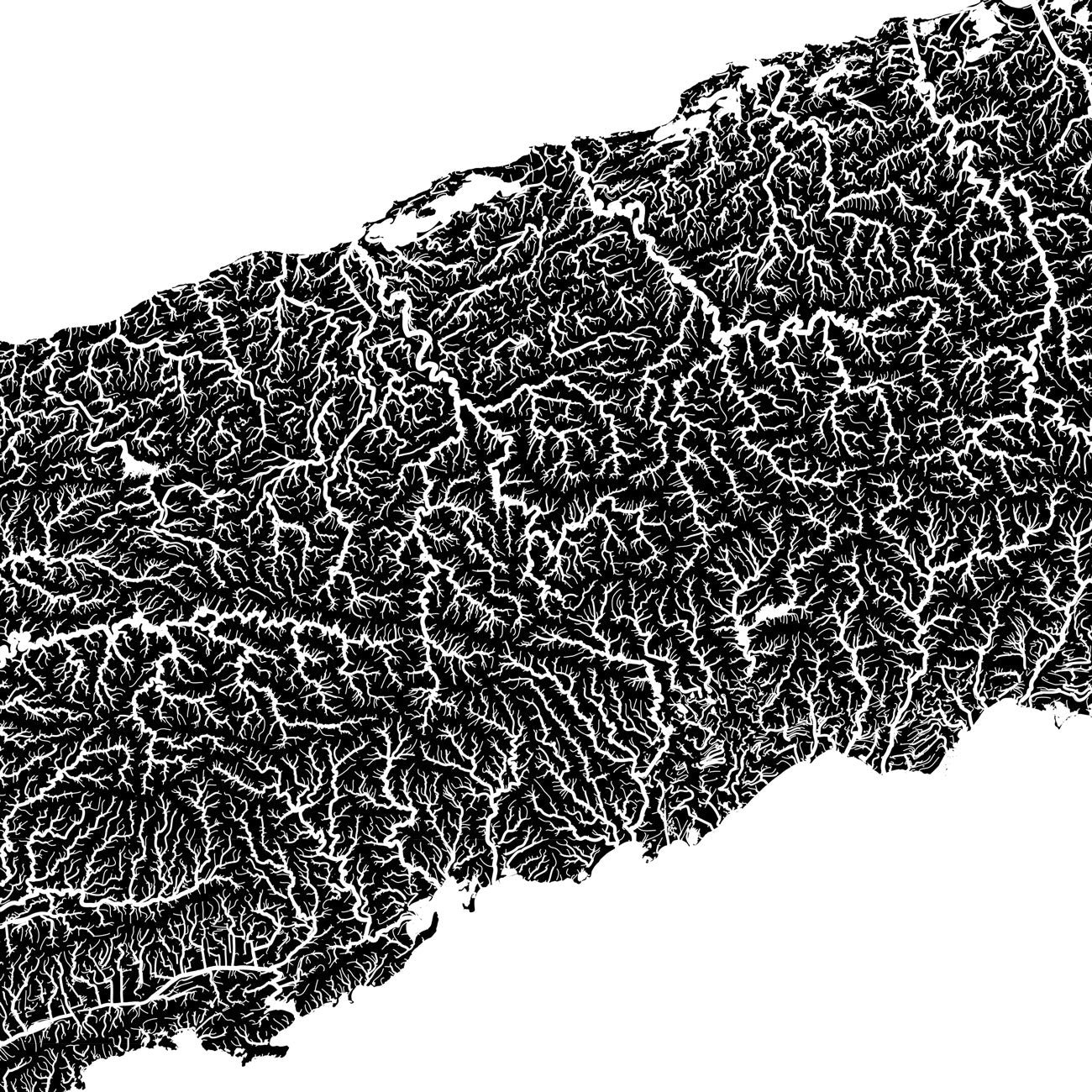
When you purchase a map of Puerto Rico from Muir Way, you are not purchasing a mass-produced poster or generic print. We custom print every Puerto Rico map using archival inks and fine art paper certified to last 100 years. The artwork of our maps themselves is designed to bring new light to the beautiful terrain they feature. For example, our elevation maps incorporate hand-shaded relief and Digital Elevation Data with historical map terrain for a unique 3D effect on a flat surface.
Does my Puerto Rico map come framed?
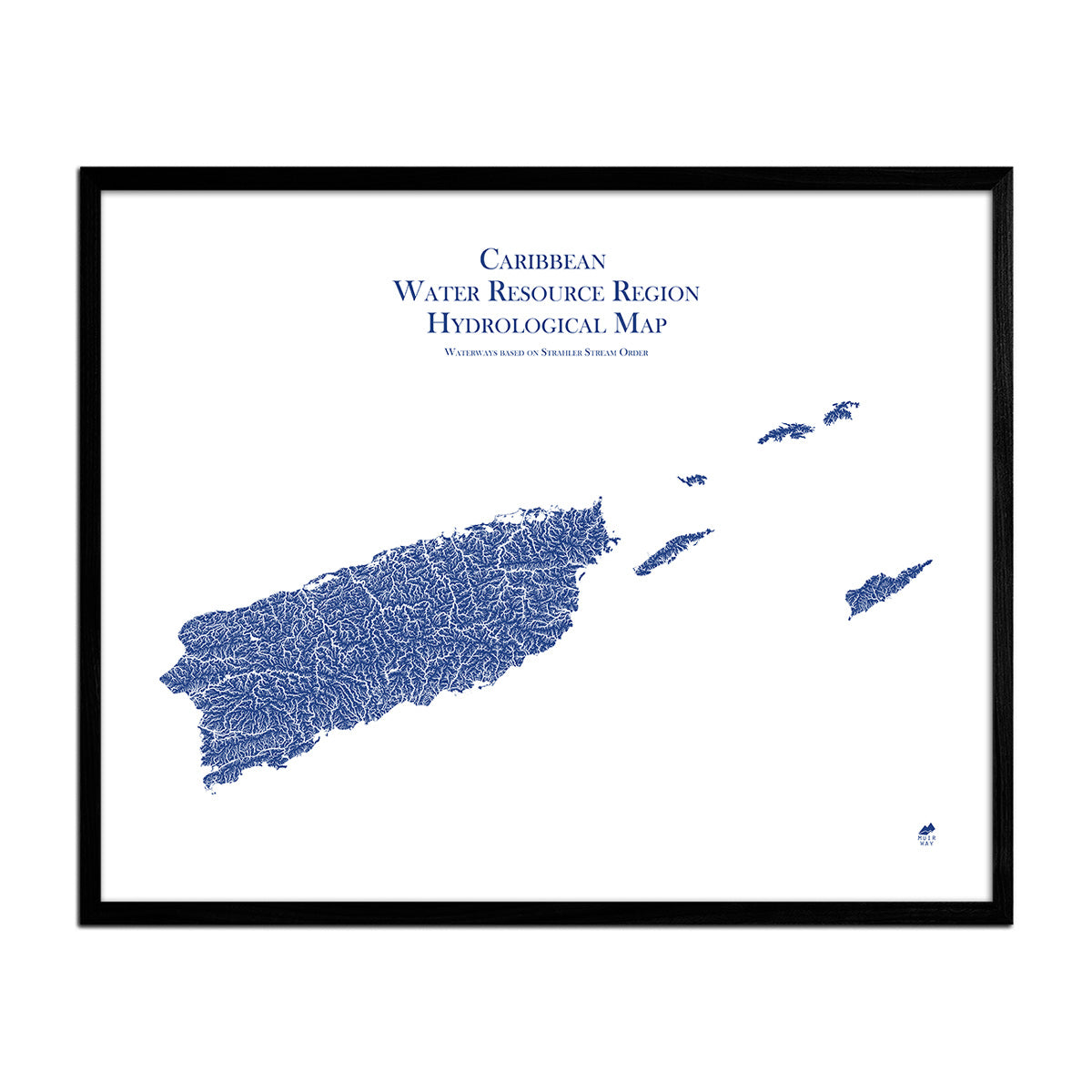
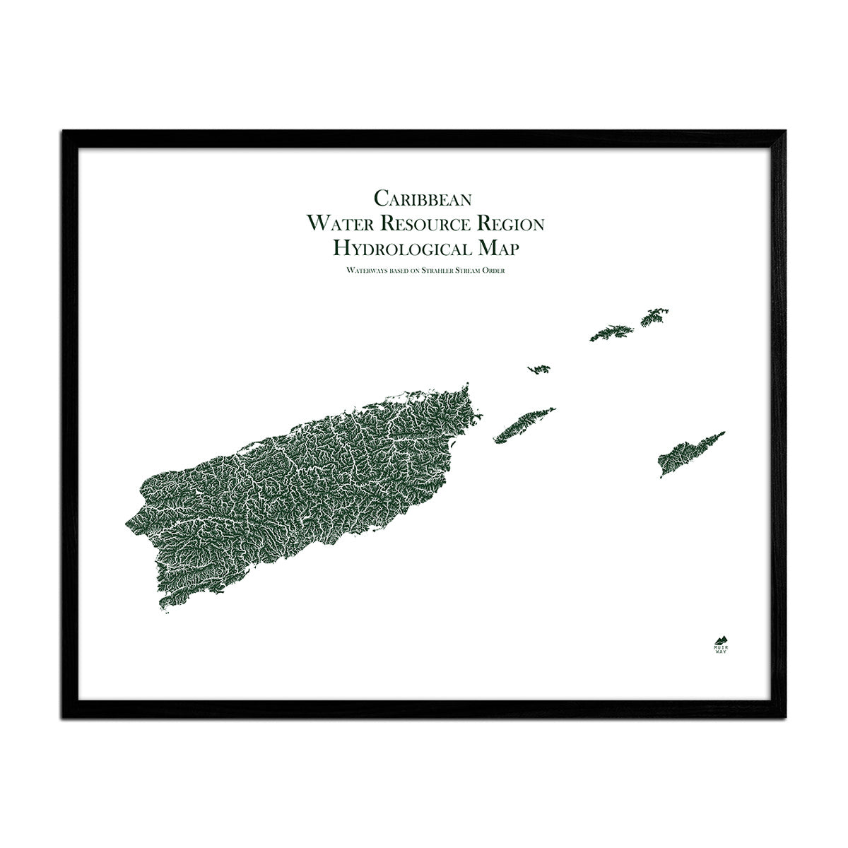
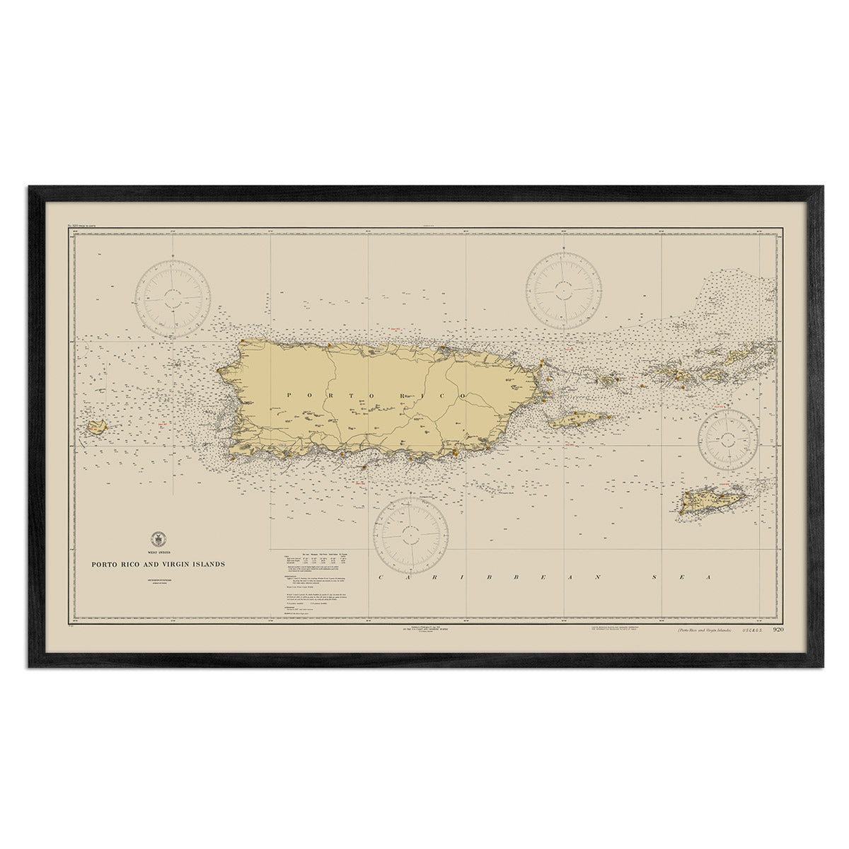
It can! You can purchase your Puerto Rico map professionally custom-framed with real wood, or unframed if you prefer to use your own. If you’d like to purchase a framed Puerto Rico wall map, there are several different wood finishes to choose from.
Does a Muir Way map of Puerto Rico make a good gift?
Yes! Our custom-printed maps of Puerto Rico make the perfect gift for outdoor enthusiasts, to commemorate a special vacation, or as a thank-you gift for someone special. Memorialize the experience of a special holiday to El Yunque, Toro Negro State Forest, or any of the other amazing Puerto Rico landscapes. One of our relief maps can be a perfect graduation gift for a student about to leave home for the first time, or a reminder of home for someone from Puerto Rico but who no longer lives there. Our maps also make beautiful corporate gifts that will remind your clients or colleagues of you every time they see it.
Where should I display my Puerto Rico map?
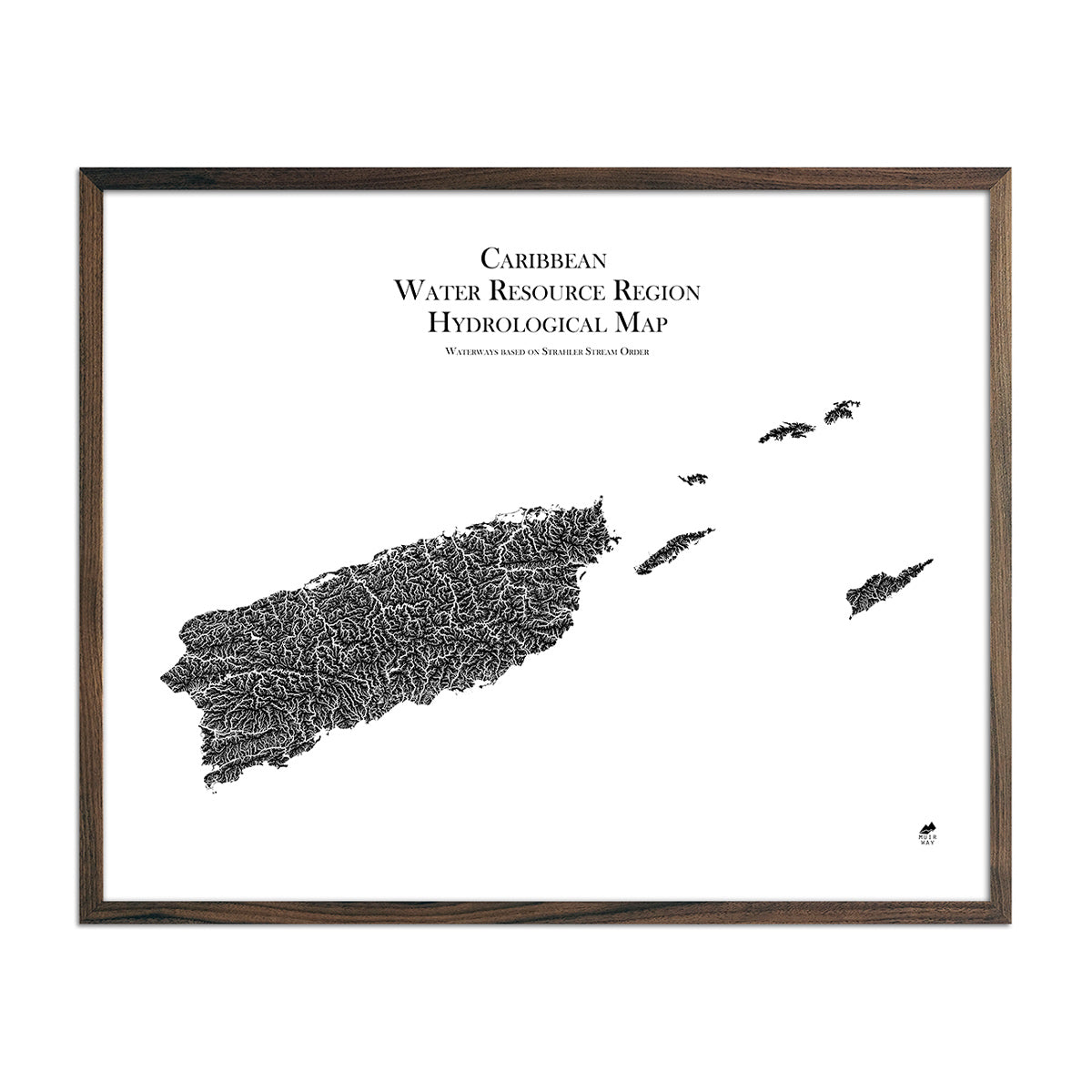
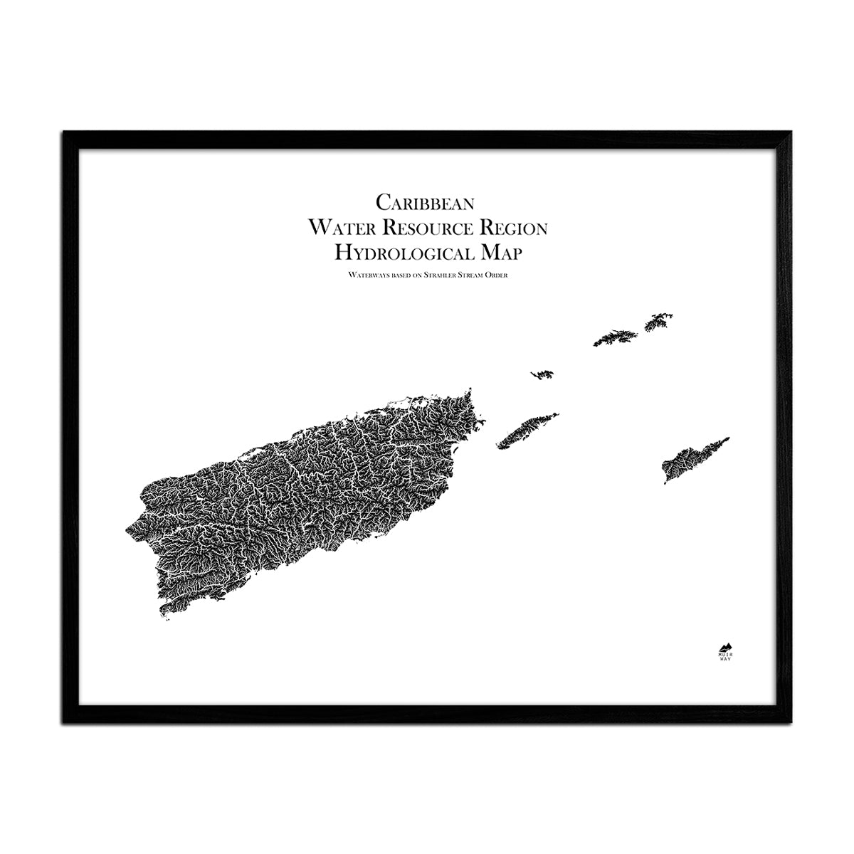
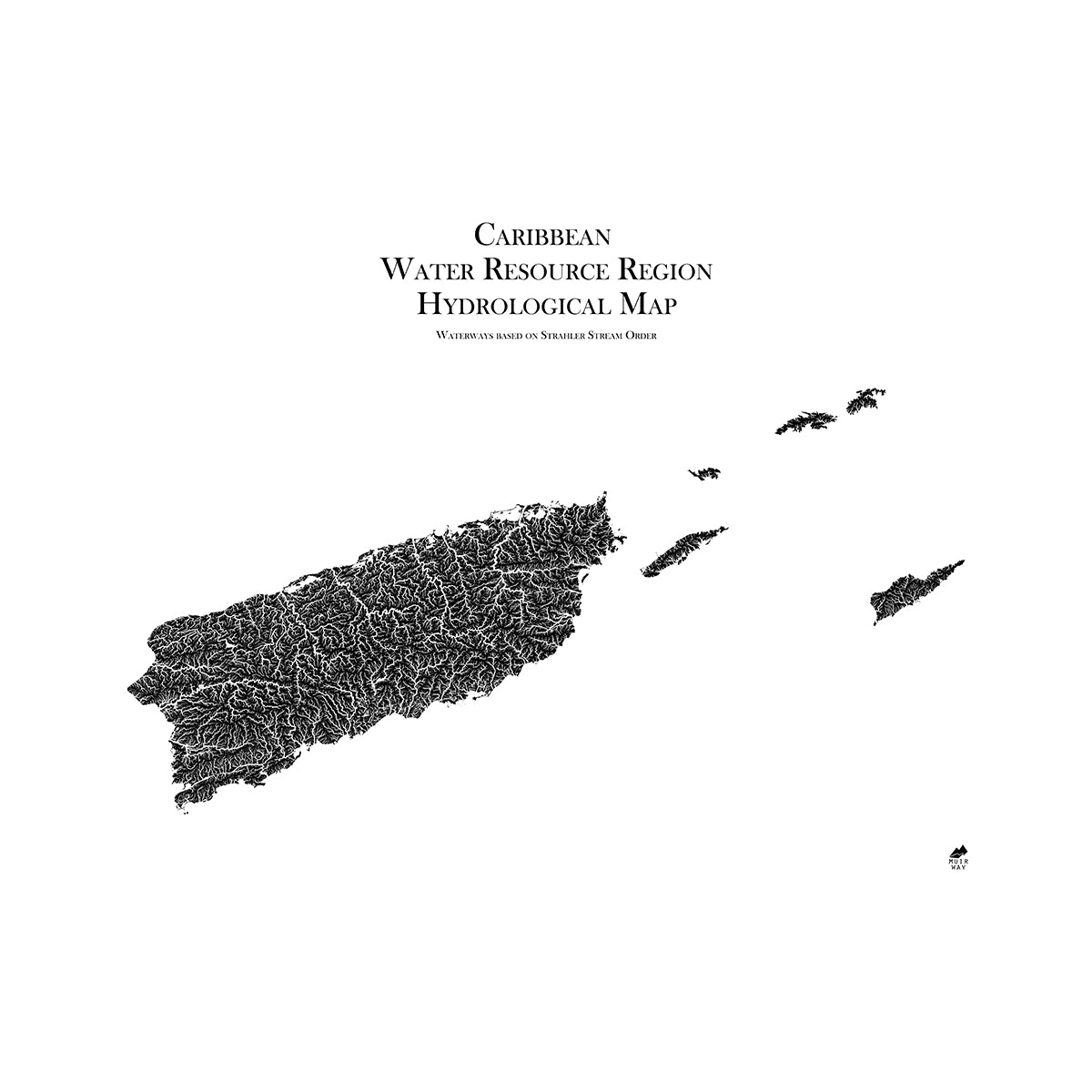
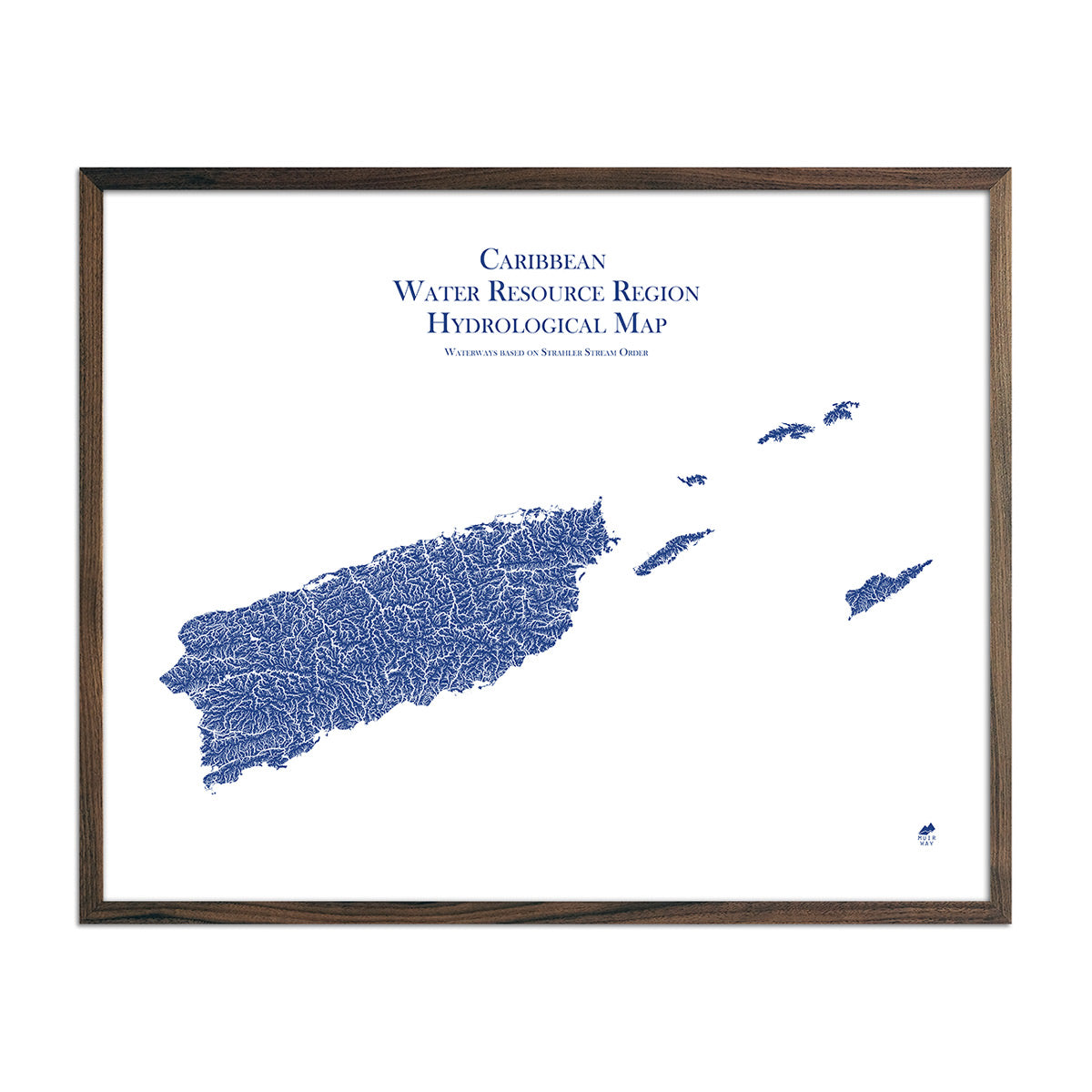
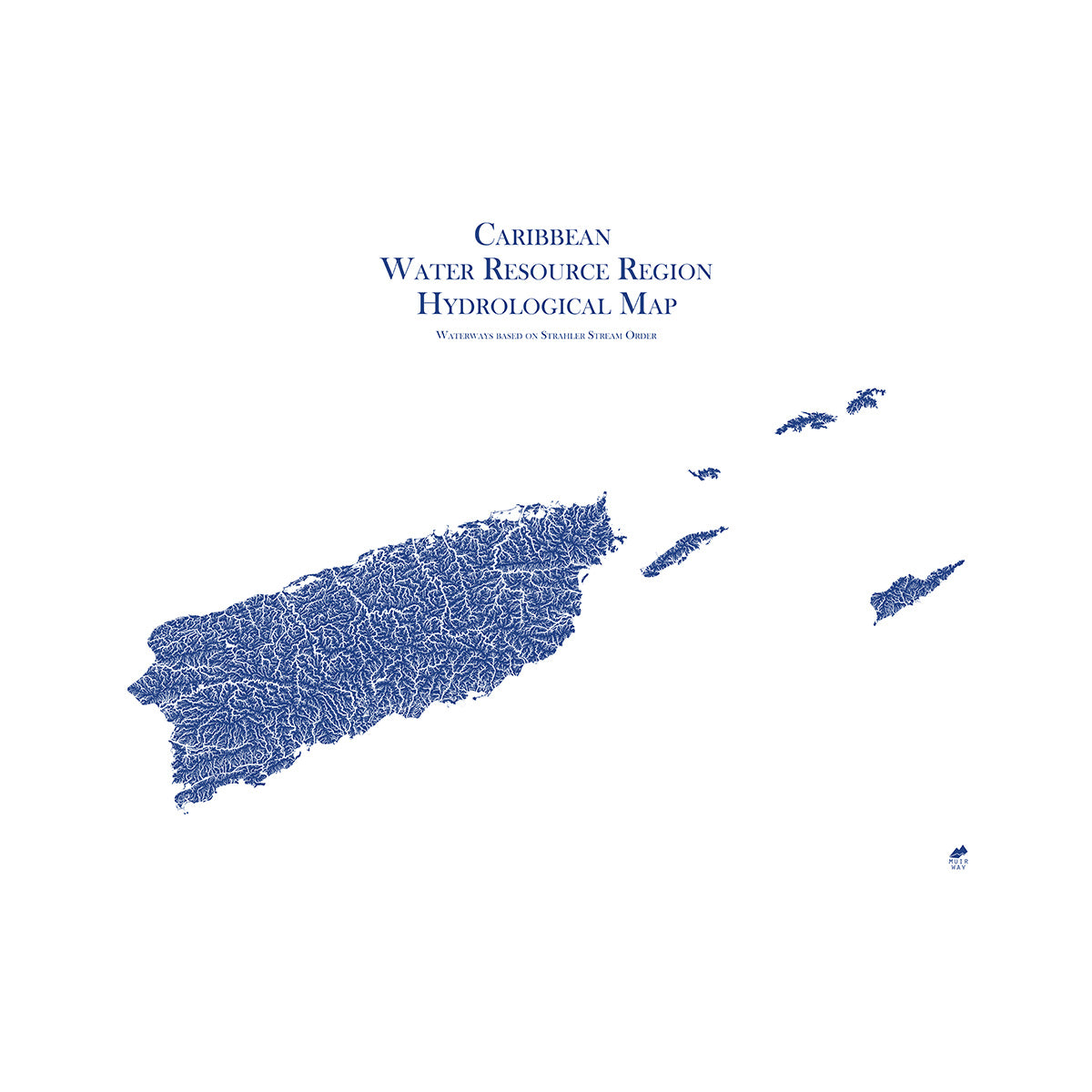
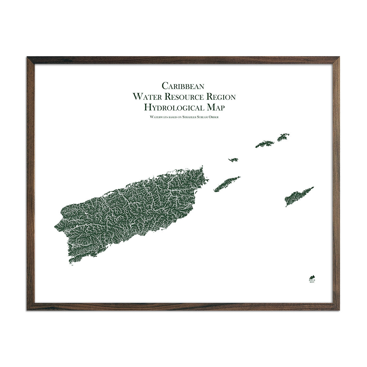
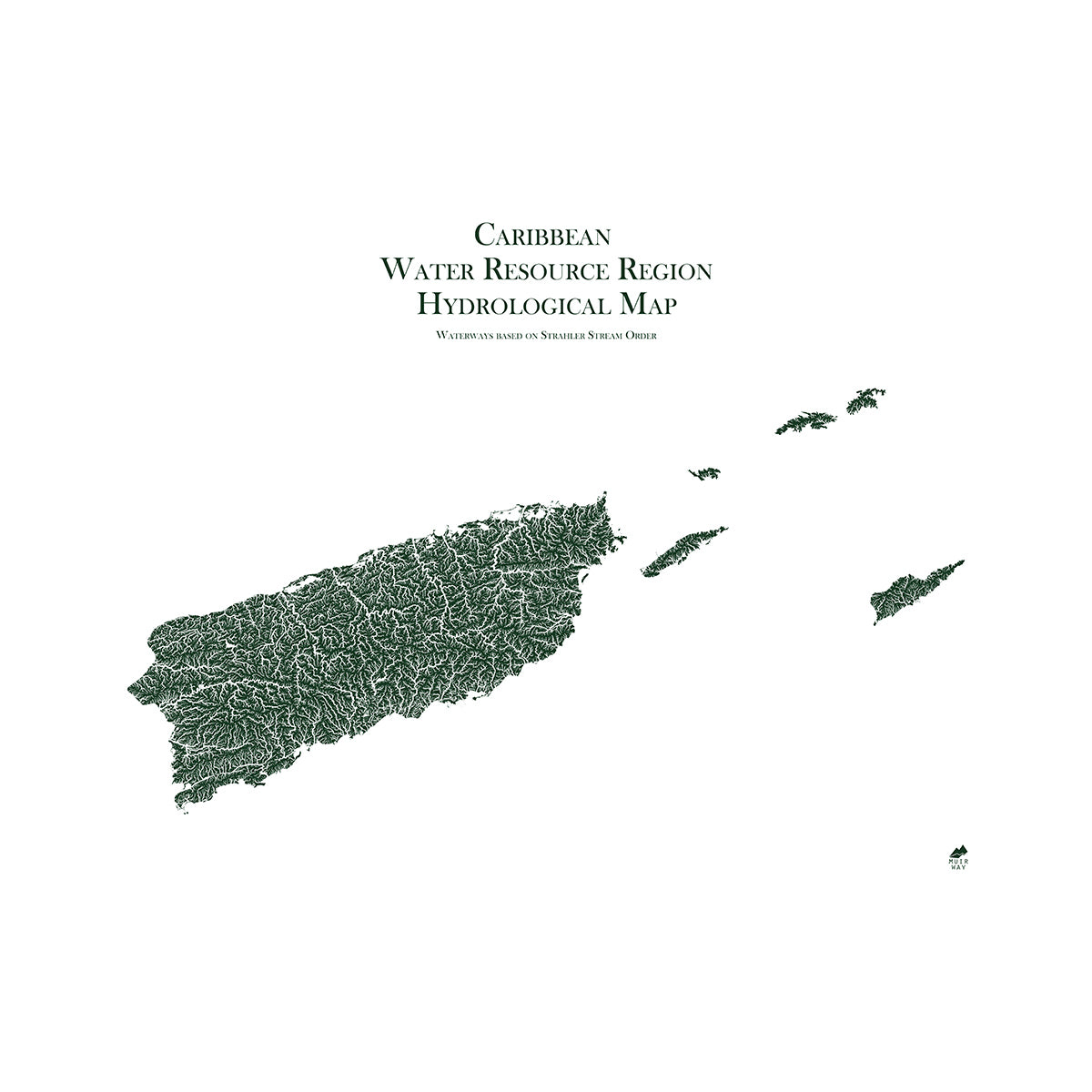
Our maps are eye-catching from across the room and up close. Hang a framed wall map as a central focus or purchase several maps in a similar style or from a particular region and arrange them near each other for a complementary series. Our hydrological maps come in several colors or the classic black and white, and our geological relief maps feature vibrant colors. No matter which you choose, you’re sure to find a Puerto Rico map that will look right at home.
What are the different types of maps of Puerto Rico available on Muir Way?
Our Puerto Rico maps are available in several different styles, including:
Puerto Rico relief maps - Our relief map of Puerto Rico brings historical map landscapes together with modern technology to show its landscapes in a new way. Using Digital Elevation Data and hand-shaded relief, we custom enhance vintage maps to create a 3D effect on a 2D surface. See Puerto Rico’s spectacular terrain in vibrant colors on our Puerto Rico 1965 Relief map or our Puerto Rico 1963 Relief map.
Puerto Rico elevation maps - Our Puerto Rico Elevation map uses Digital Elevation Data from the USGS and hand-shaded relief just like our relief maps to create a high-contrast 3-dimensional effect in stunning black and white.
What are some prominent features on the map of Puerto Rico?
Puerto Rico has many prominent features, including three bioluminescent bays: Mosquito Bay, Laguna Grande, and La Parguera. These bays are filled with microorganisms that glow when agitated.
In the interior of the island is San Cristóbal Canyon. It is the deepest canyon of the Antilles Islands. The canyon was created by tectonic movement that caused the rise of the superficial terrestrial crust in the region. It is home to 749 species of plants and wildlife that create an amazing ecosystem.
The island is also home to the El Yunque National Forest. It is a tropical rainforest in the northeastern part of the island. The forest is home to many clear rivers, plants and animals. It is the only tropical rainforest in the US forest system.
What are the regions in Puerto Rico?
Puerto Rico has three main geographic regions:
- The Mountains - More than half of the island is mountainous. There are four ranges: Cordillera Central, Sierra de Cayey, Sierra de Luquillo, and Sierra de Bermeja. The El Yunque rainforest is located in the Sierra de Luquillo range. Cordillera Central and Sierra de Luquillo ranges feature dramatic pointed peaks and lush tropical vegetation. Sierra de Cayey and Sierra de Bermeja are smaller in area and height, drier, and less forested.
- The Coastal Lowlands - Formed over time by erosion of the mountains, the coastal lowlands are important agricultural areas full of the rich soil and water that run down from the mountains. A large portion of the area includes sandy beaches and mangrove swamps.
- The Karst Region - Covering the island’s northern and southern interior, the Karst Region is a fascinating landscape of sinkholes, cliffs, caves, and conical, haystack-shaped hills called mogotes. Rain erosion created this landscape from limestone rock. This erosion has also created magnificent cave systems.


