


Maryland Maps

Maryland Map Prints, Elevation & Shaded Relief Maps
Whether you're a native Marylander, a frequent visitor to the Old Line State, or have family and friends there, our custom printed Maryland State wall maps will bring the rich history and beautiful geography of The Free State to your home or office. From our stunning elevation maps and geological relief maps to our meticulously restored historical maps, every product we offer reflects the high quality and attention to detail our customers have come to love and expect from Muir Way.
What makes Muir Way maps of Maryland unique?
When you buy a Maryland wall map from Muir Way, you're getting much more than a poster or generic print. Our Maryland maps are not only custom printed with archival inks and fine art papers that are estimated to last 100 years, but the artwork on every map is hand-crafted to uniquely highlight the beautiful countryside it represents.
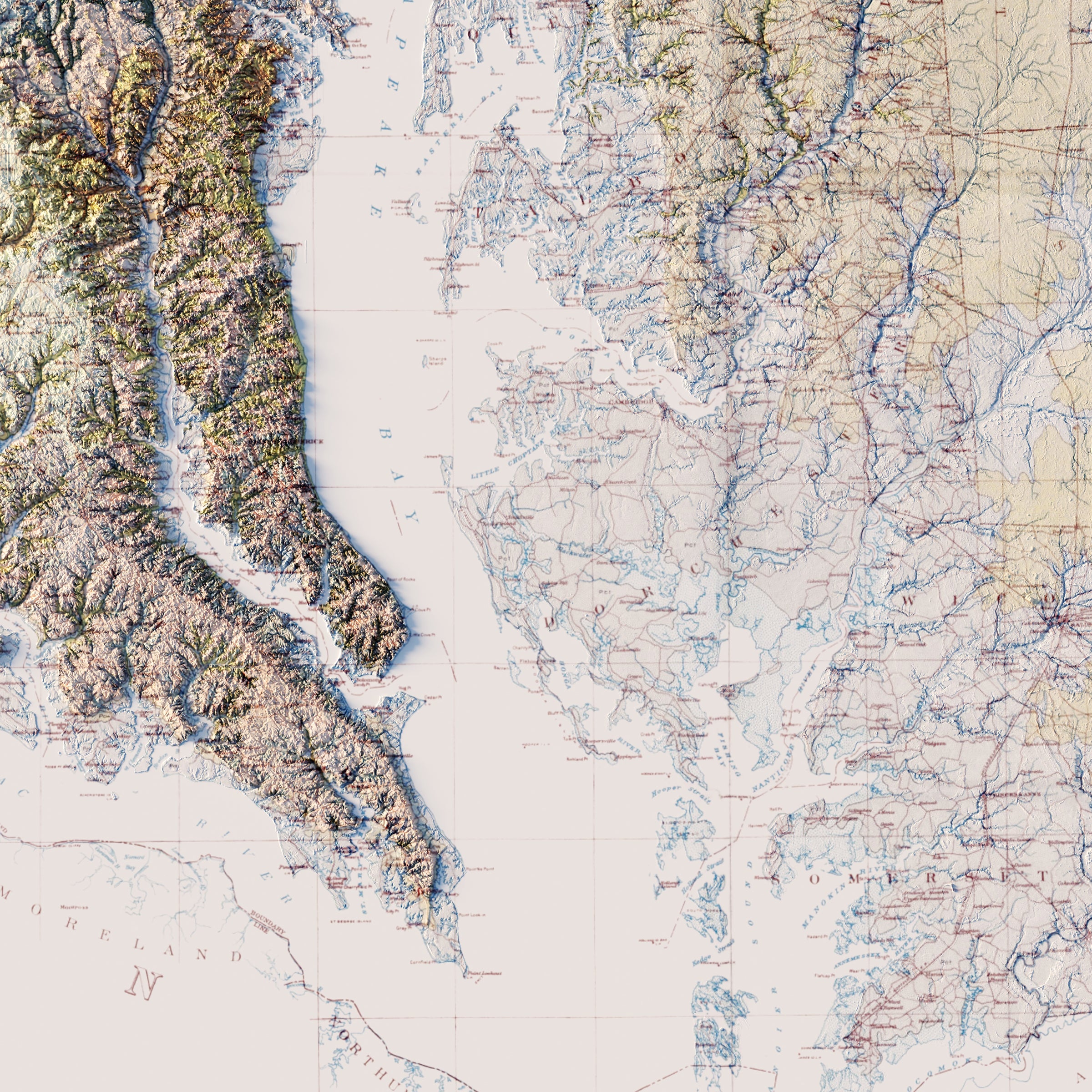
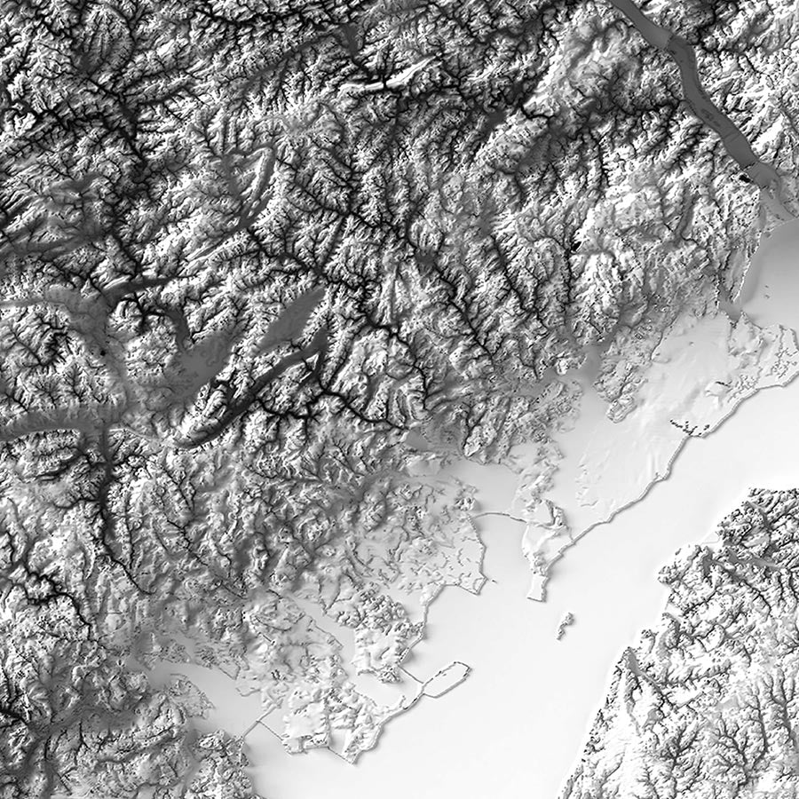
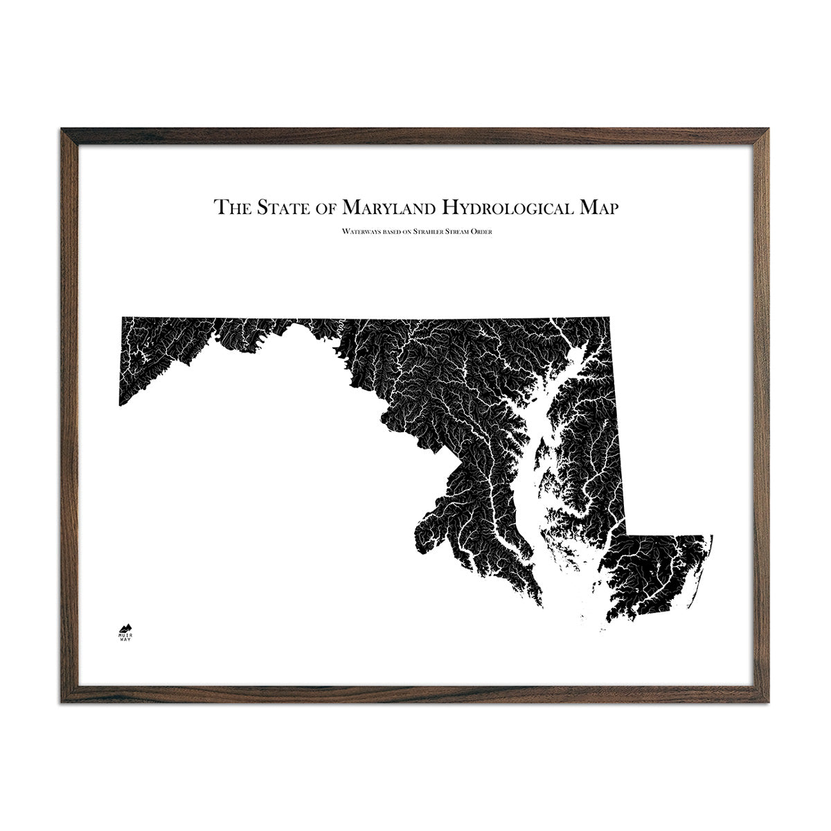
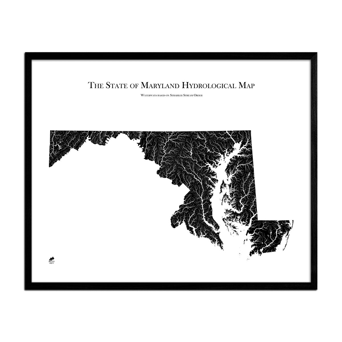
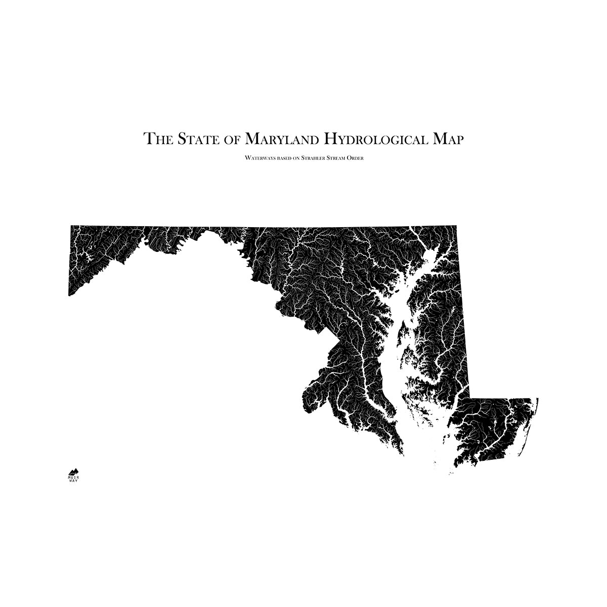
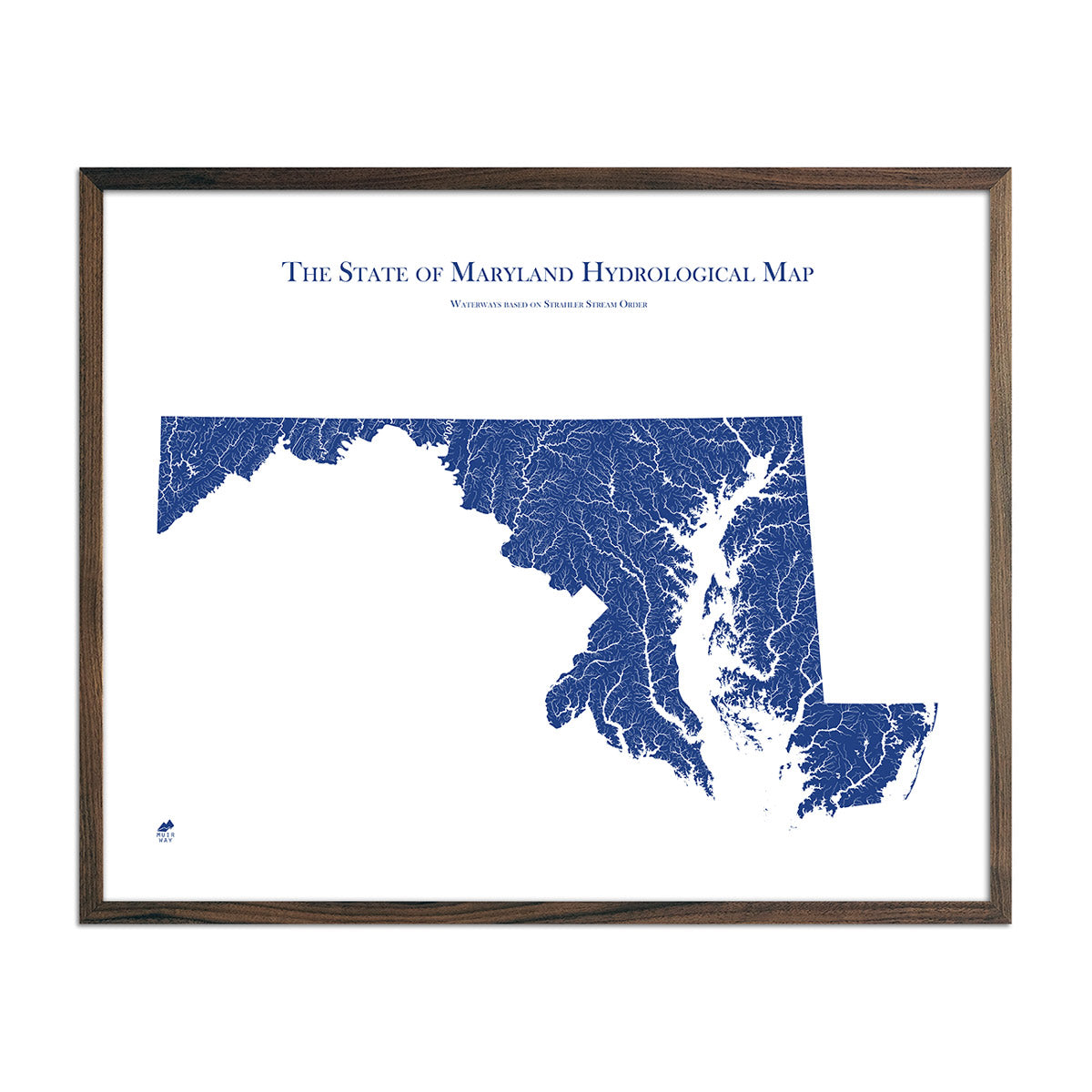
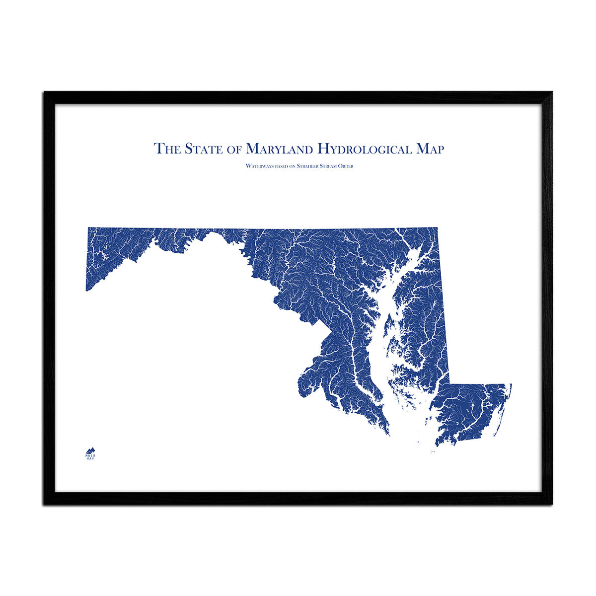
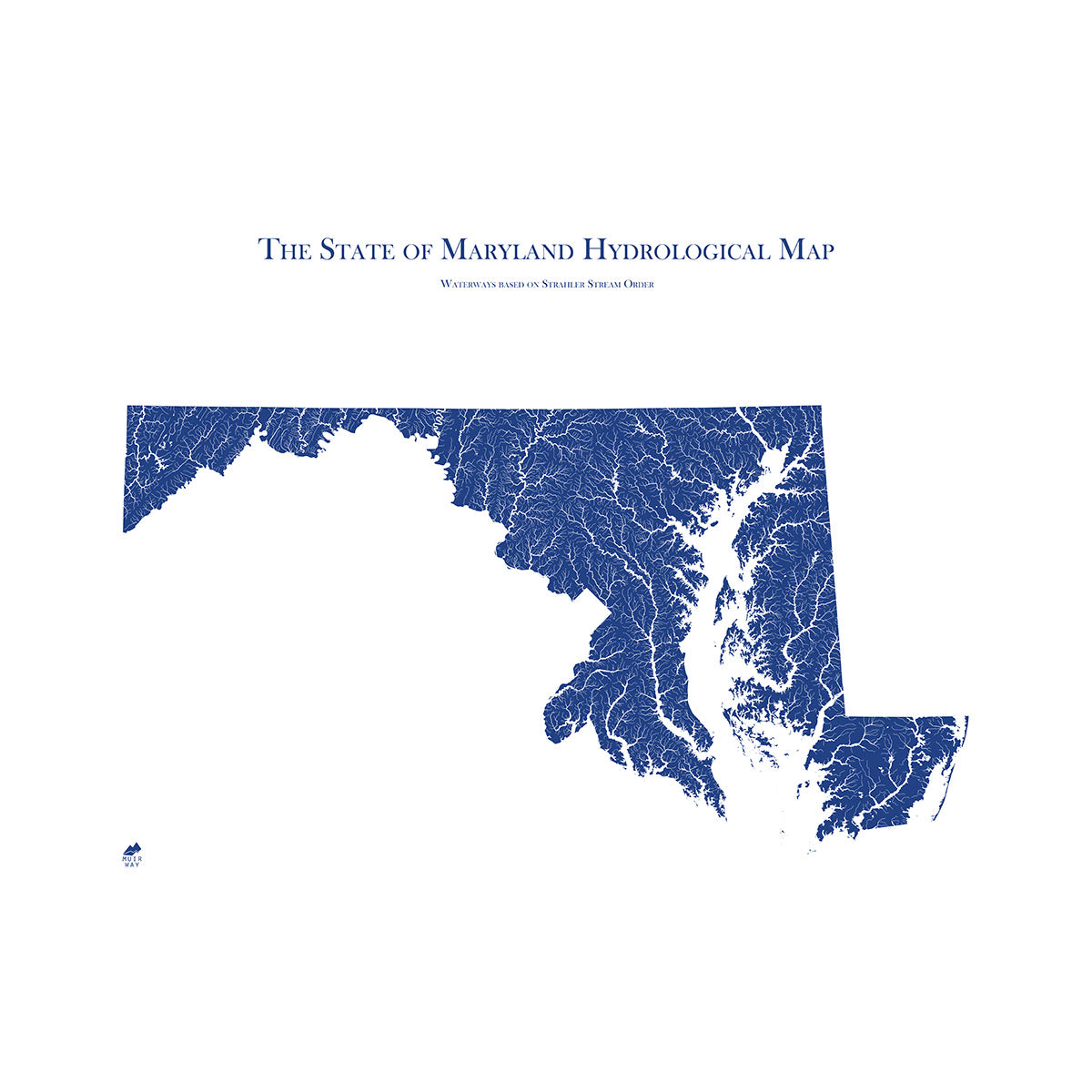
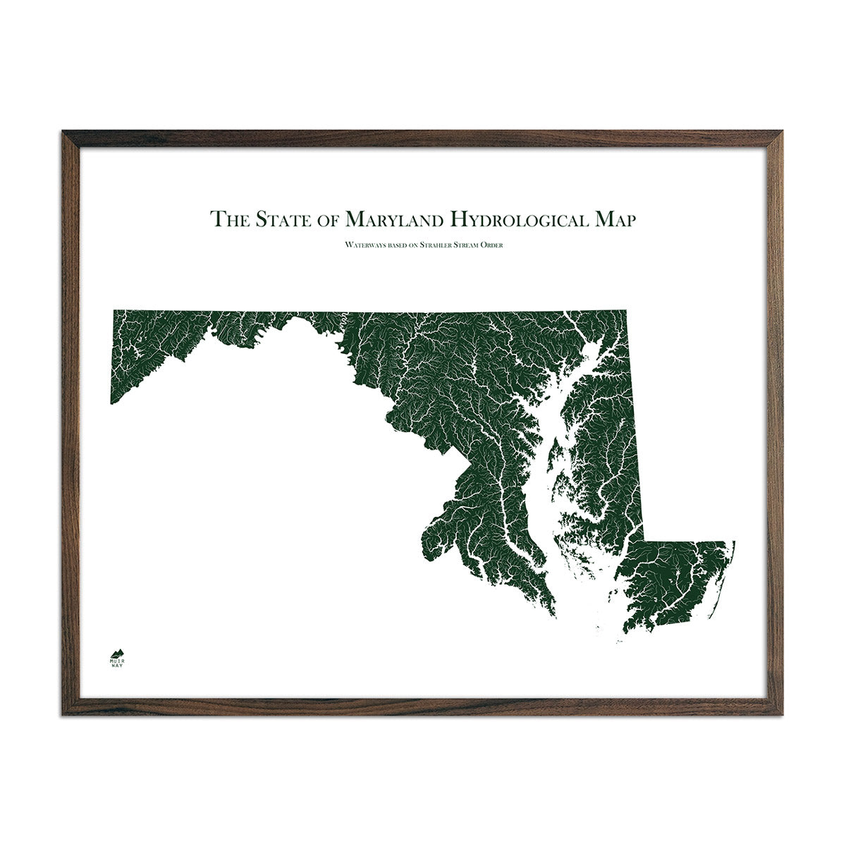
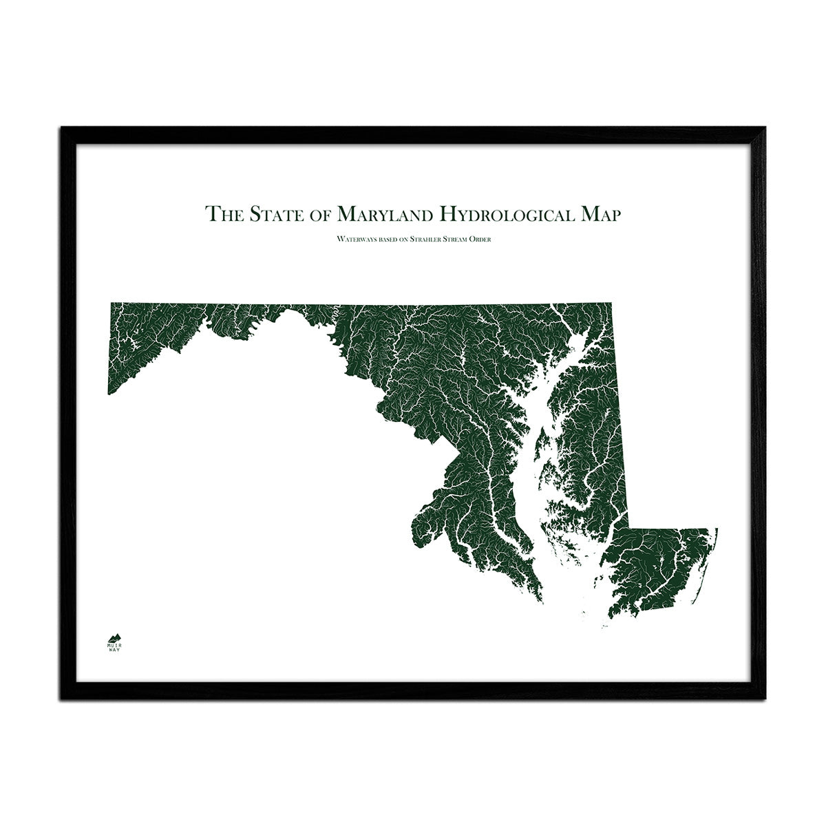
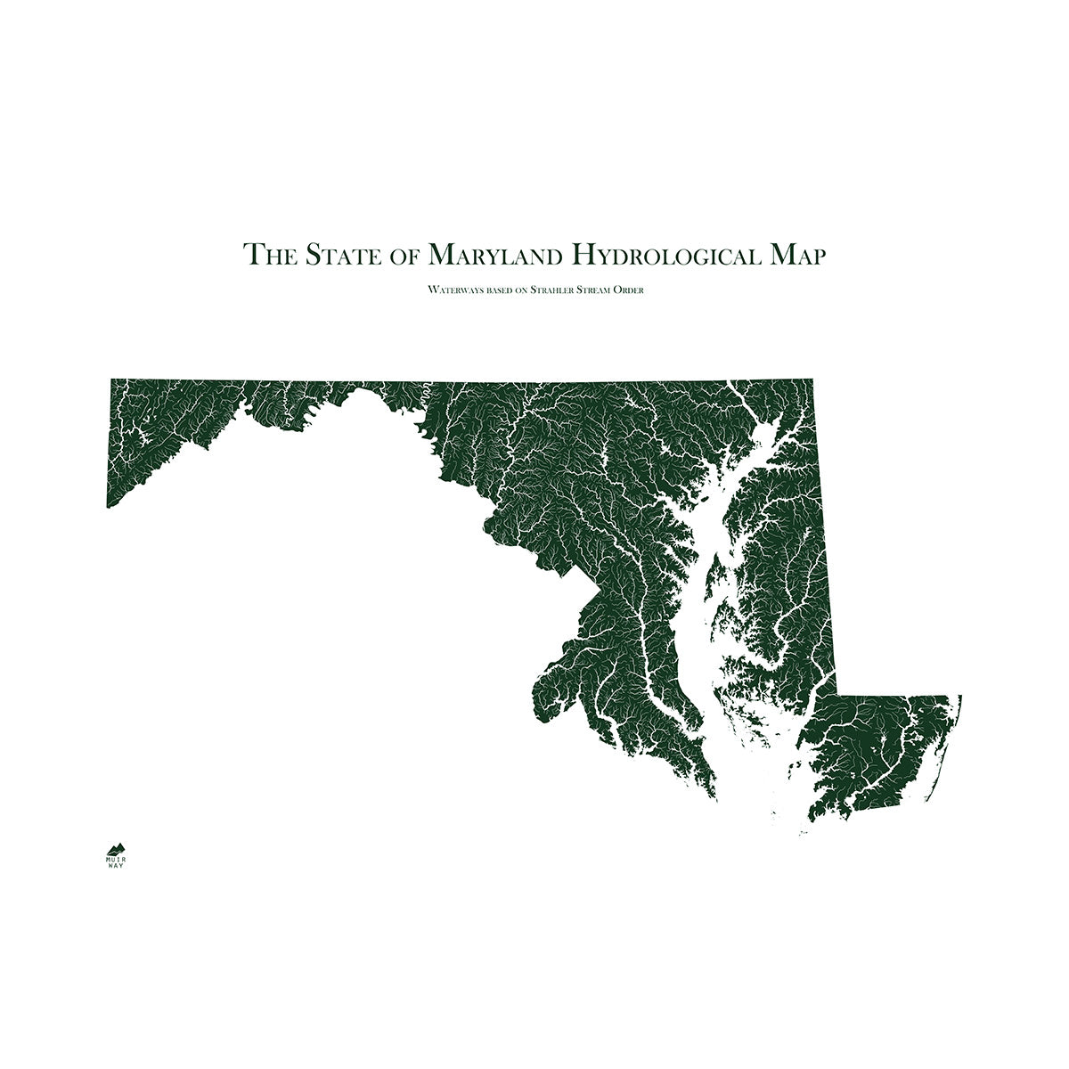
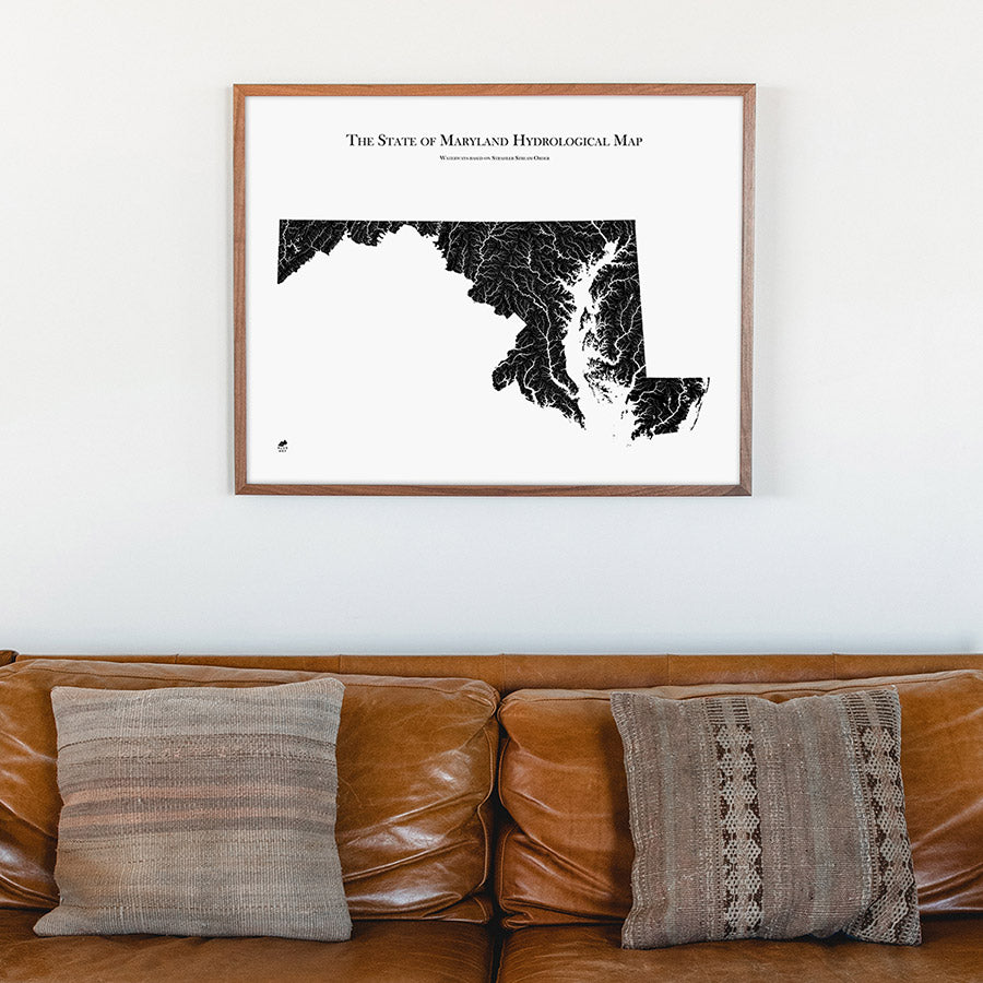
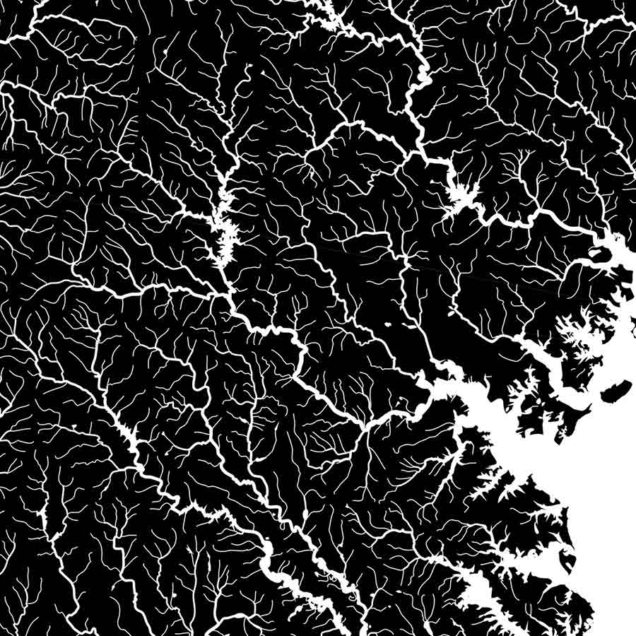
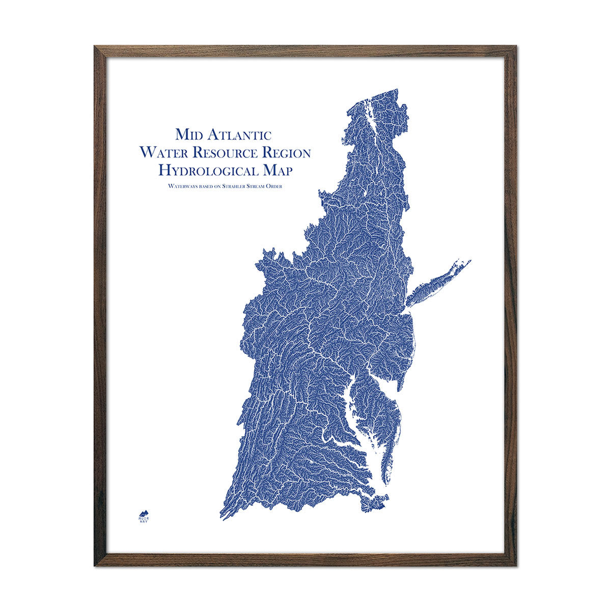
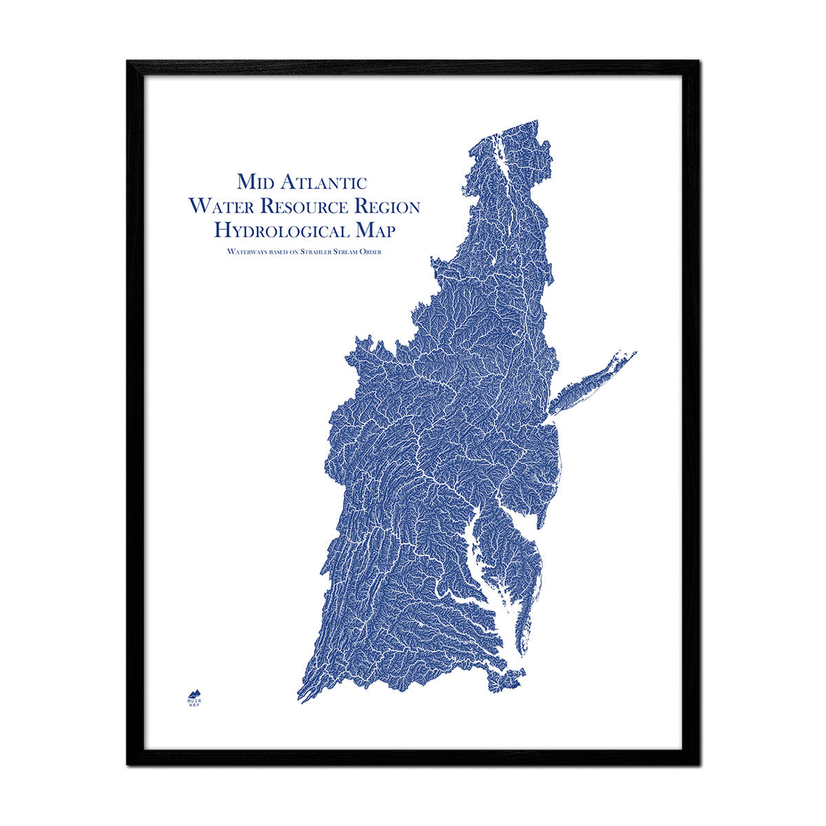
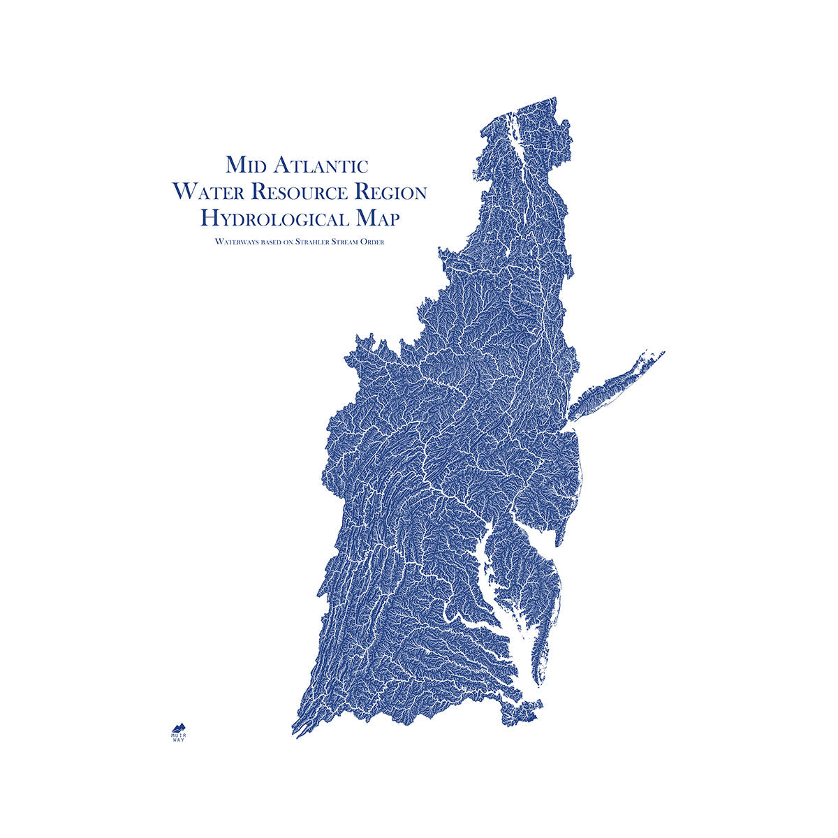
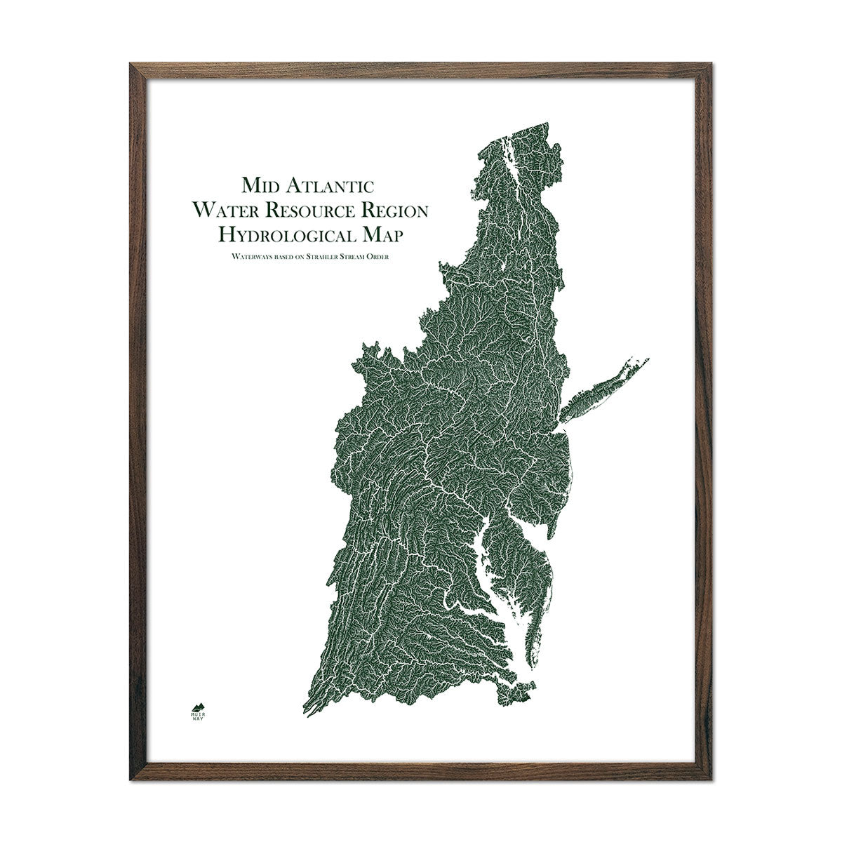
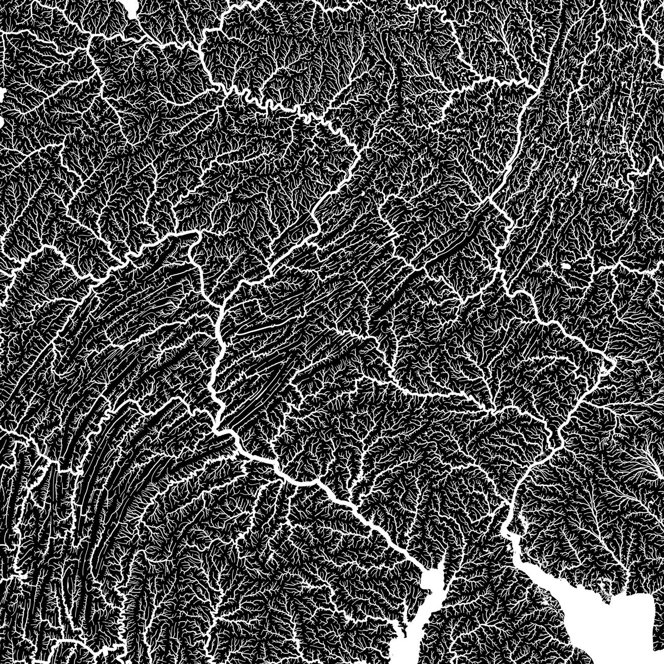
An astounding 3D effect on a flat surface is created by shading relief and combined with Digital Elevation Data. We show every river in the state--even intermittent streams--and every body of water larger than 0.2 miles in diameter on our hydrological maps.
Can I get my Maryland map framed?
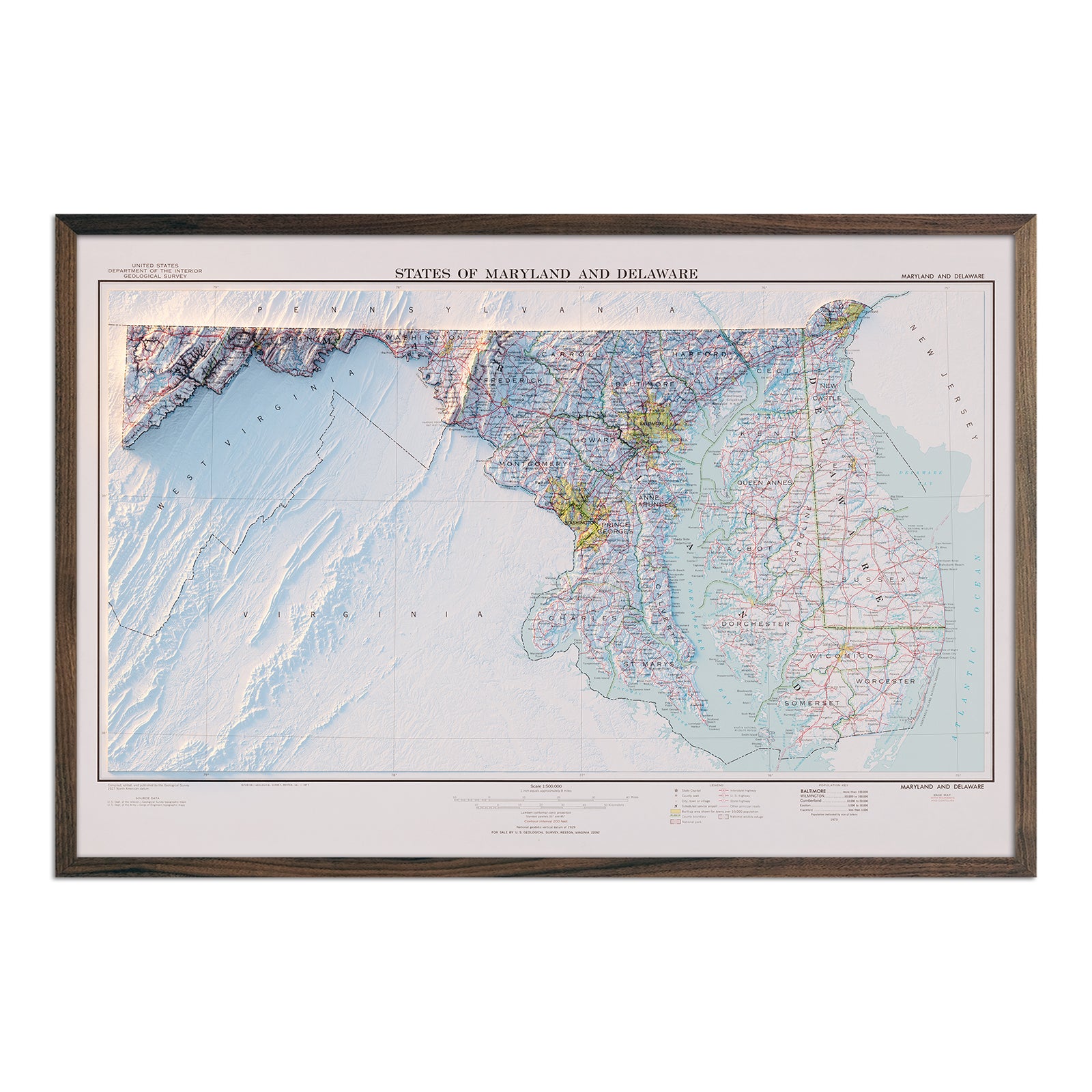
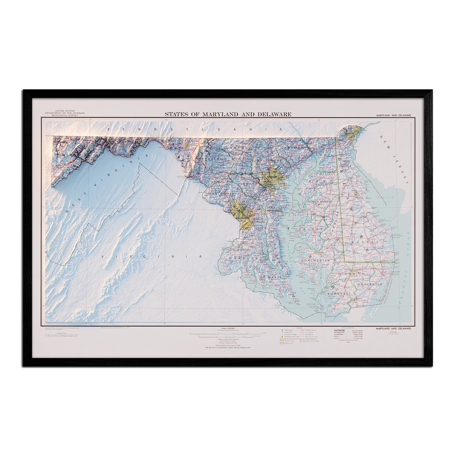
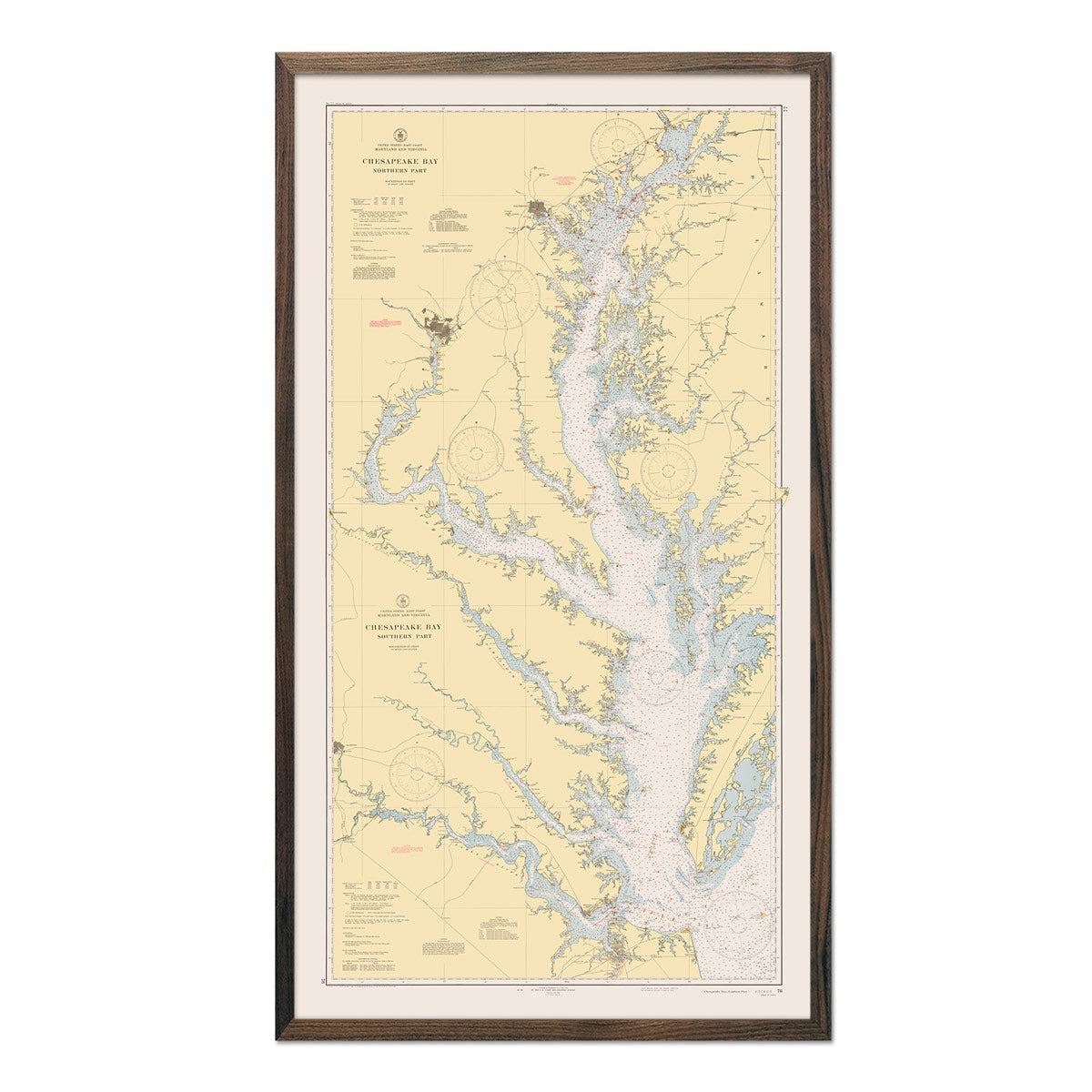
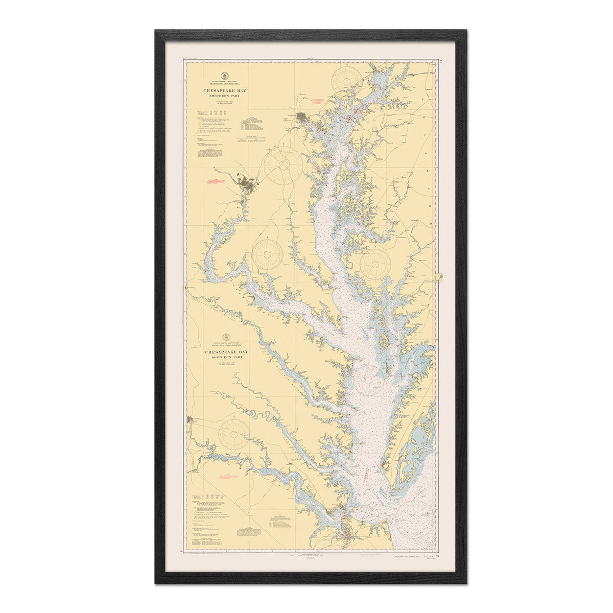
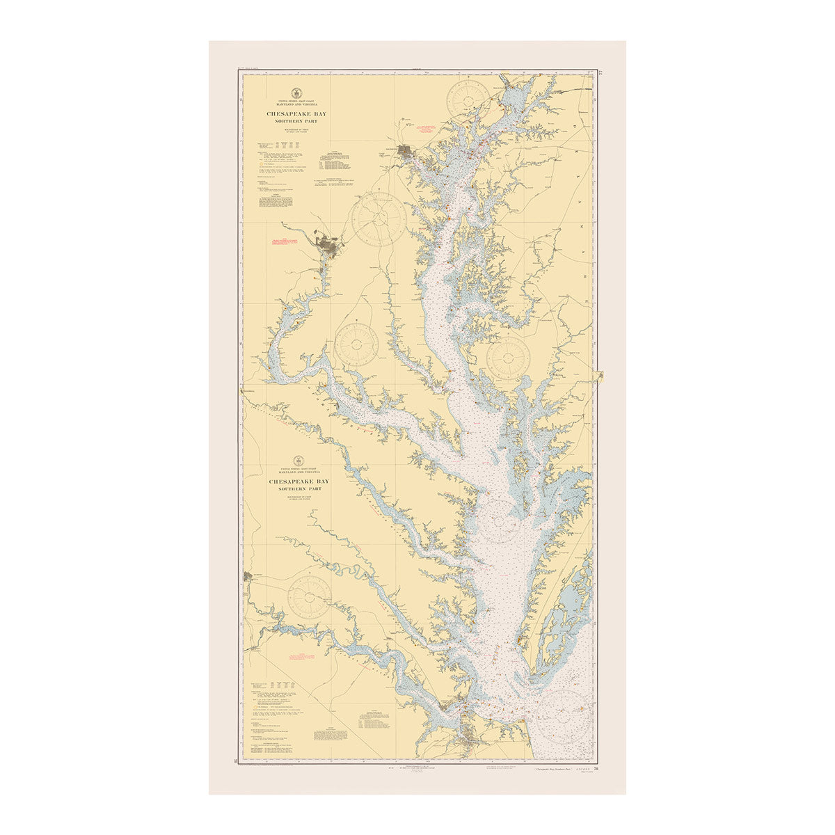
Yes! We offer Maryland maps on fine art paper and canvas as well as unframed and framed options. Maps can be ordered both unframed and framed. The choice of finishes and colors available will complement your décor.
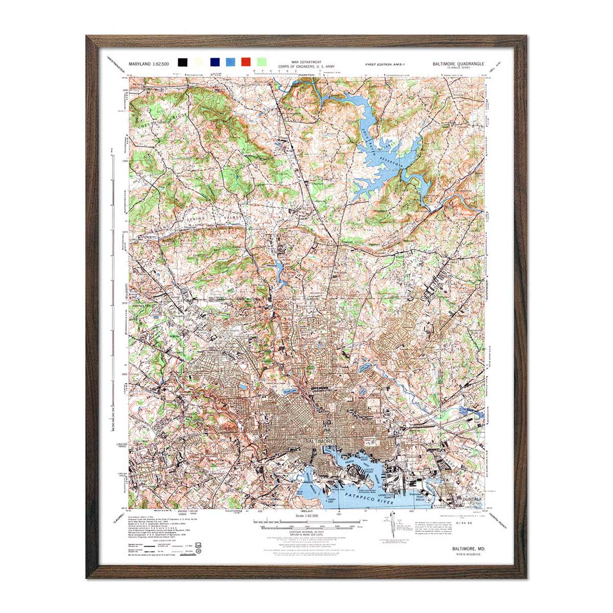
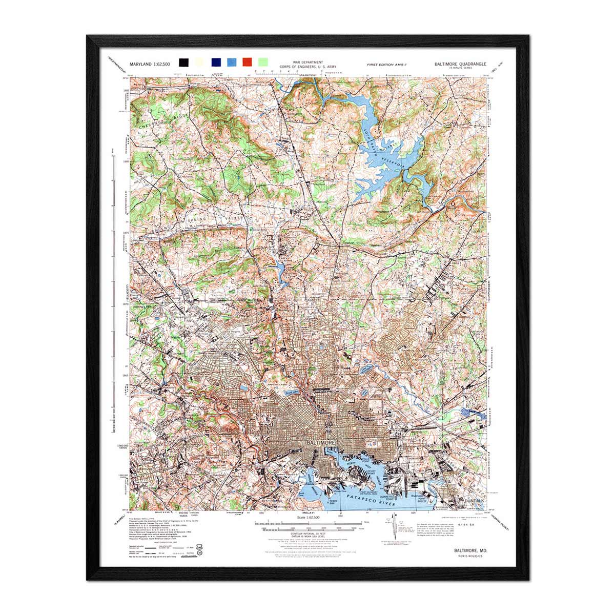
We offer standard frame sizes so you can give our maps as gifts easily if you want to use your own frame. We have black and walnut frames available for you to choose from.
Is a Muir Way map of Maryland a good gift idea?
Custom maps are popular presents for special occasions such as holidays and anniversaries. We see our thousands of happy customer reviews as a testament to the quality we stand by when you purchase one of our maps as a gift. Someone about to leave home for the first time will love receiving this graduation gift, or someone who has moved away from Maryland will be reminded of home when they receive it. Our maps also make stunning corporate gifts that will remind your clients or colleagues of you every time they look at their wall.
How should I display my Maryland map?
Our maps are designed to offer crisp detail and great visual effect whether viewing up close or from across the room. Hang a framed wall map as a central focus, or purchase several and arrange them near each other for a complementary series. Our hydrological maps come in several colors or the quintessential black and white, and our geological relief maps feature brilliant colors. Don’t be afraid to bring black and white to a colorful room and vice versa. No matter which you choose, you’re sure to find a Maryland illustration that will look right at home.
What are the different types of maps of Maryland available on Muir Way?
Our Maryland maps are available in several different styles, including:
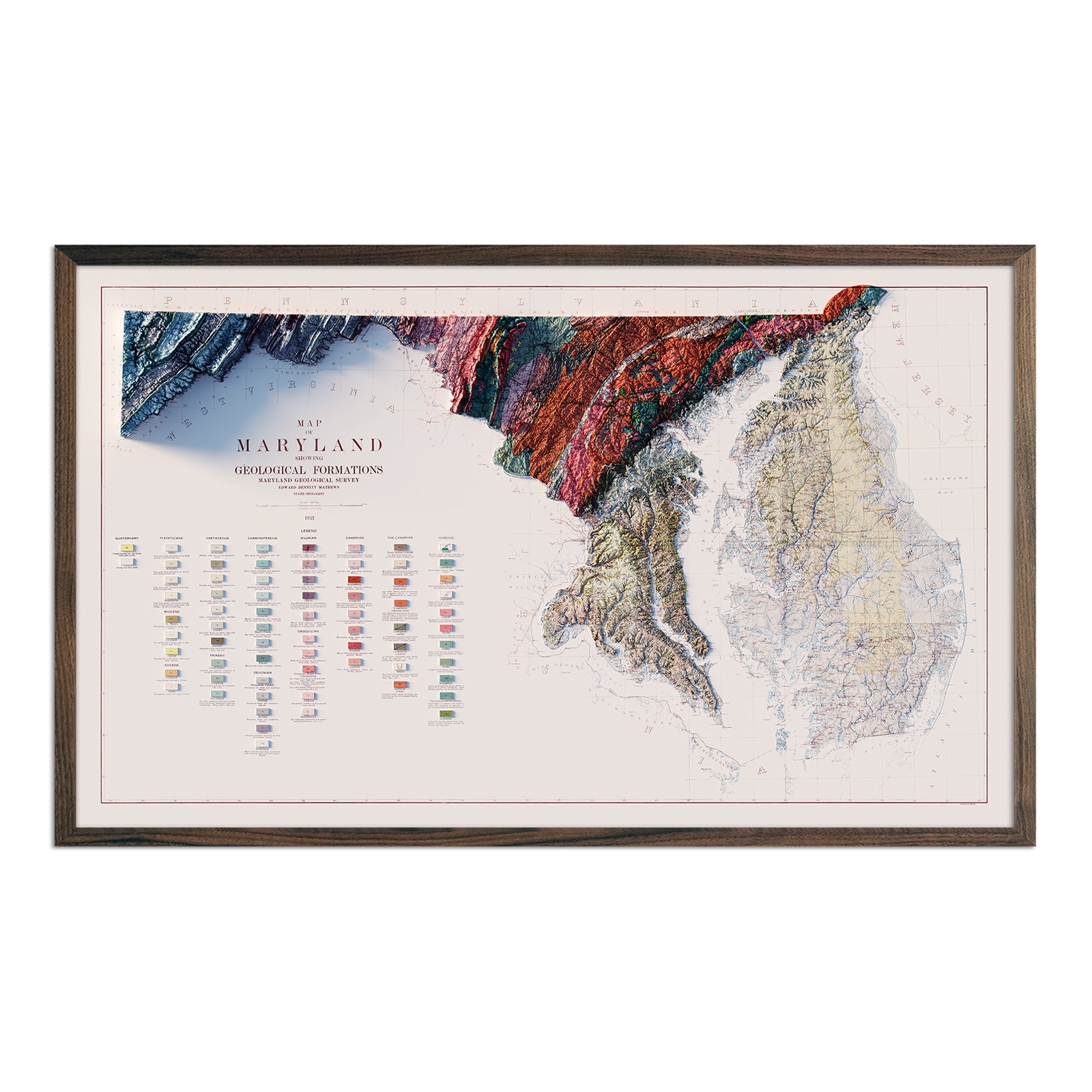
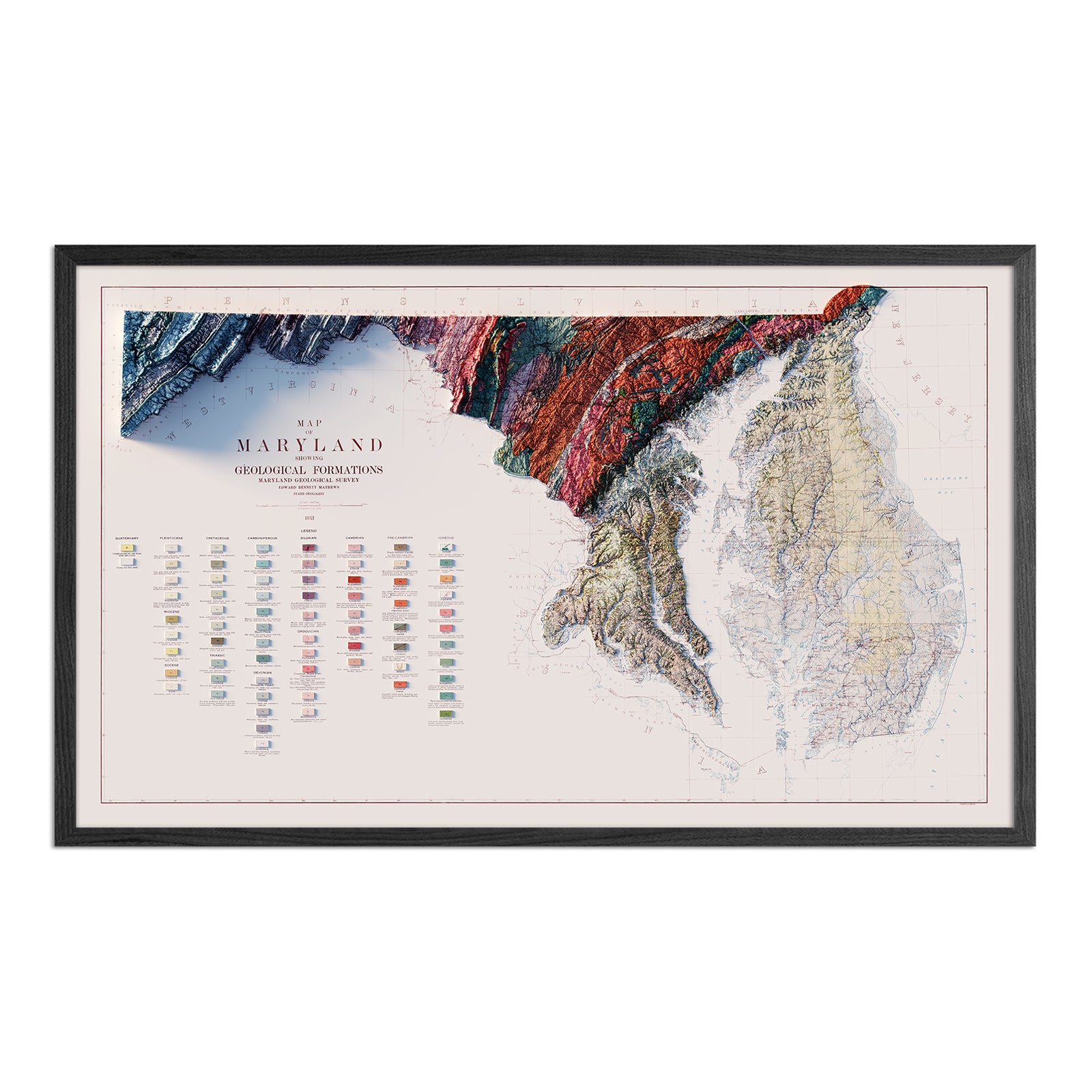
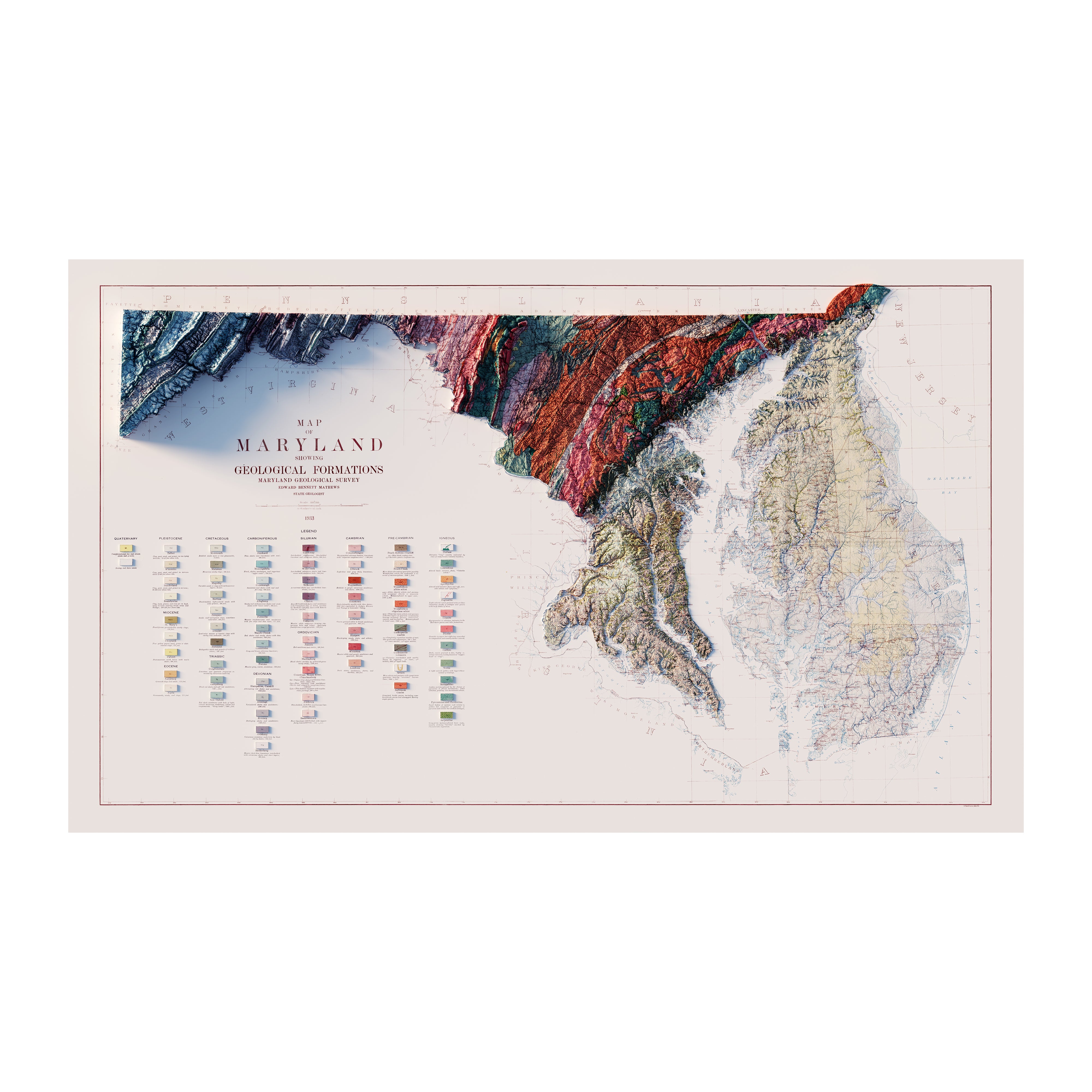
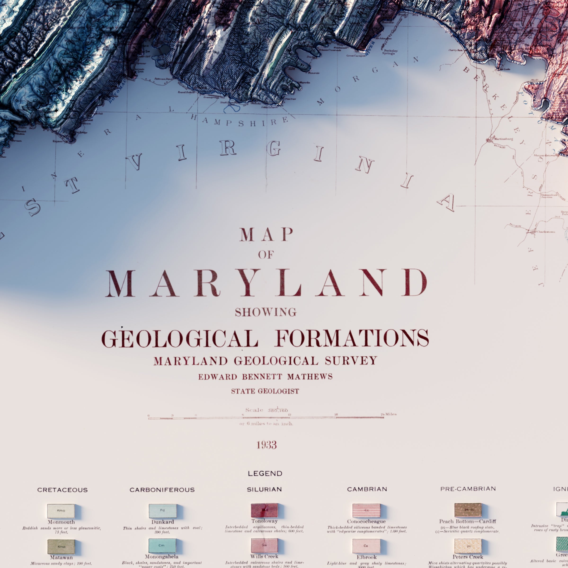
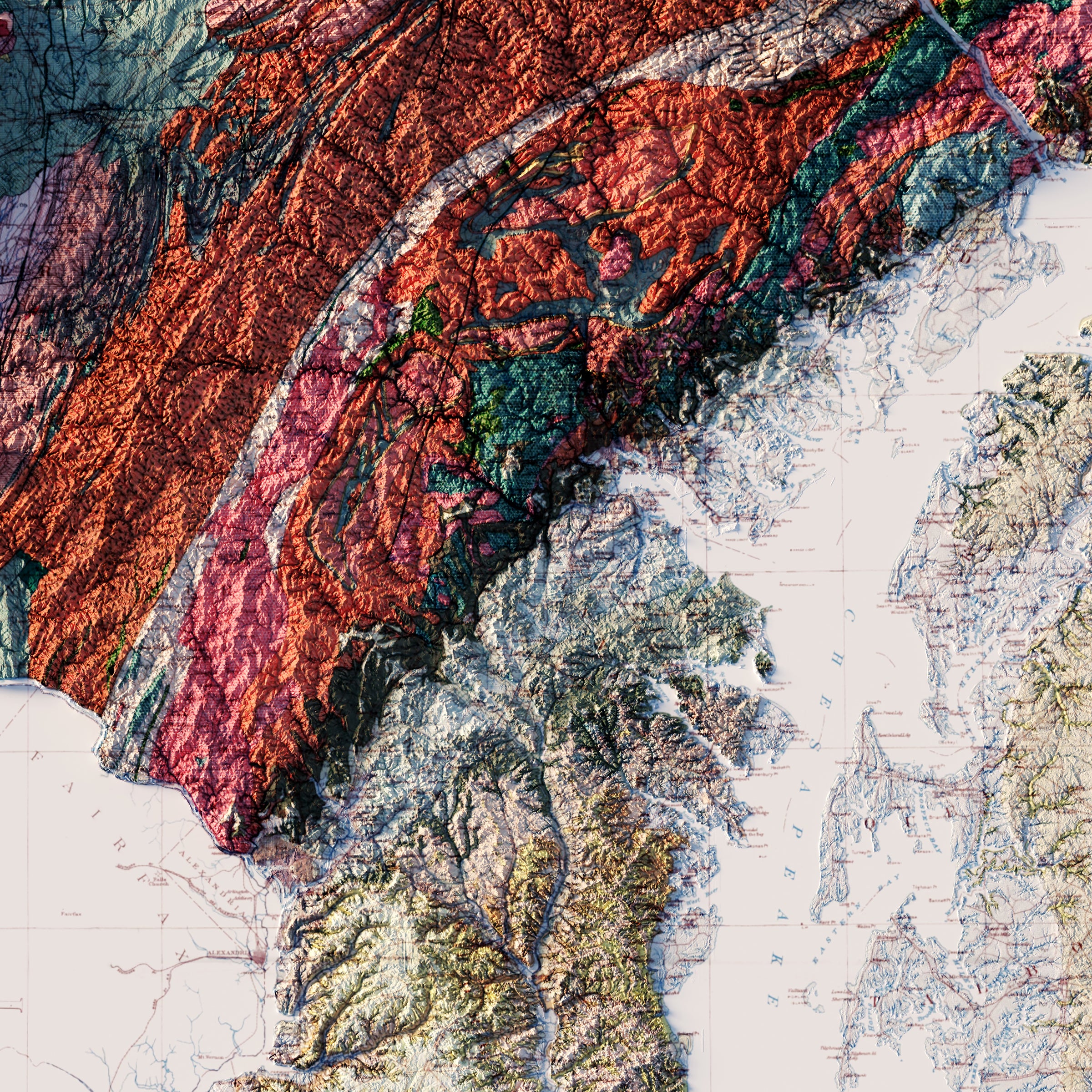
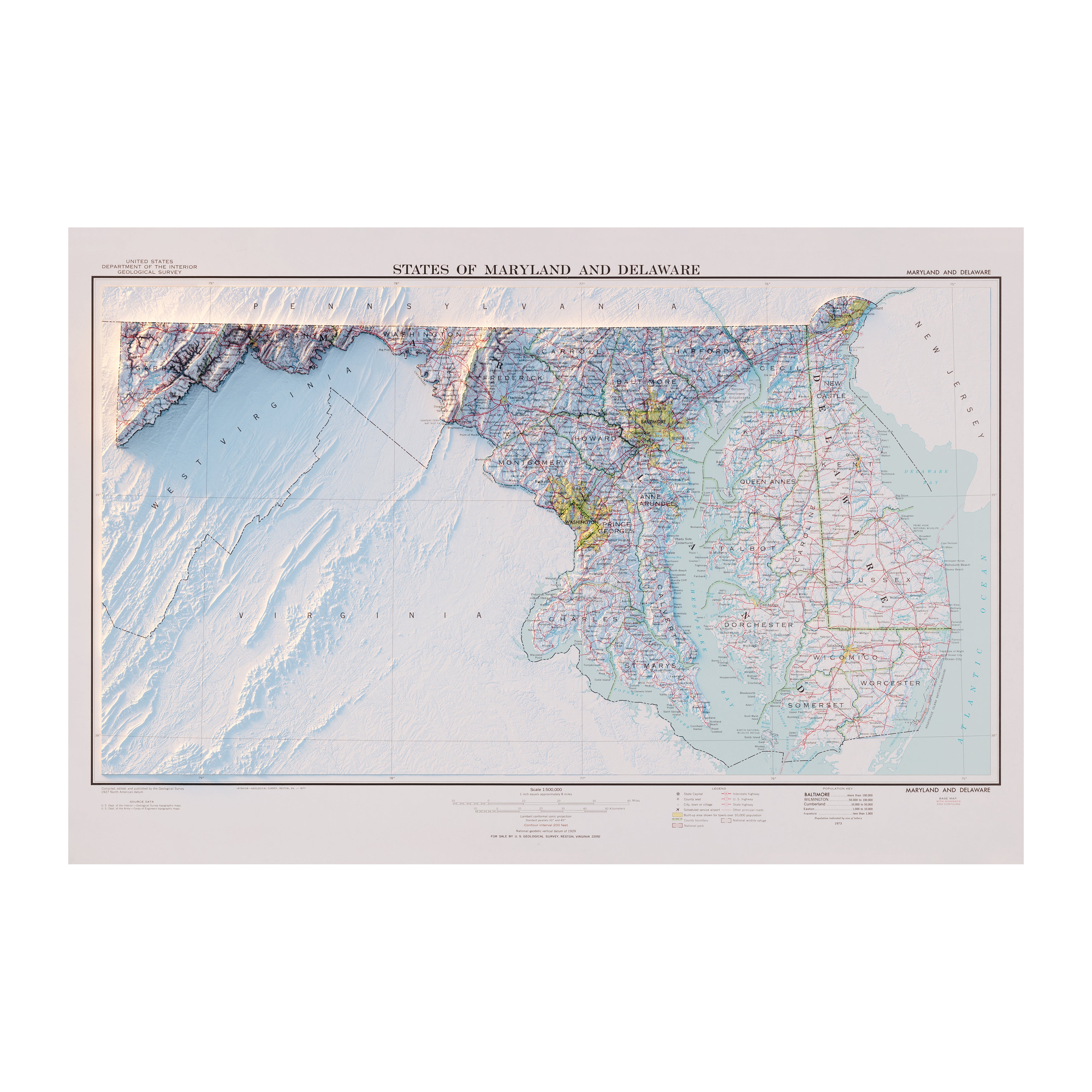
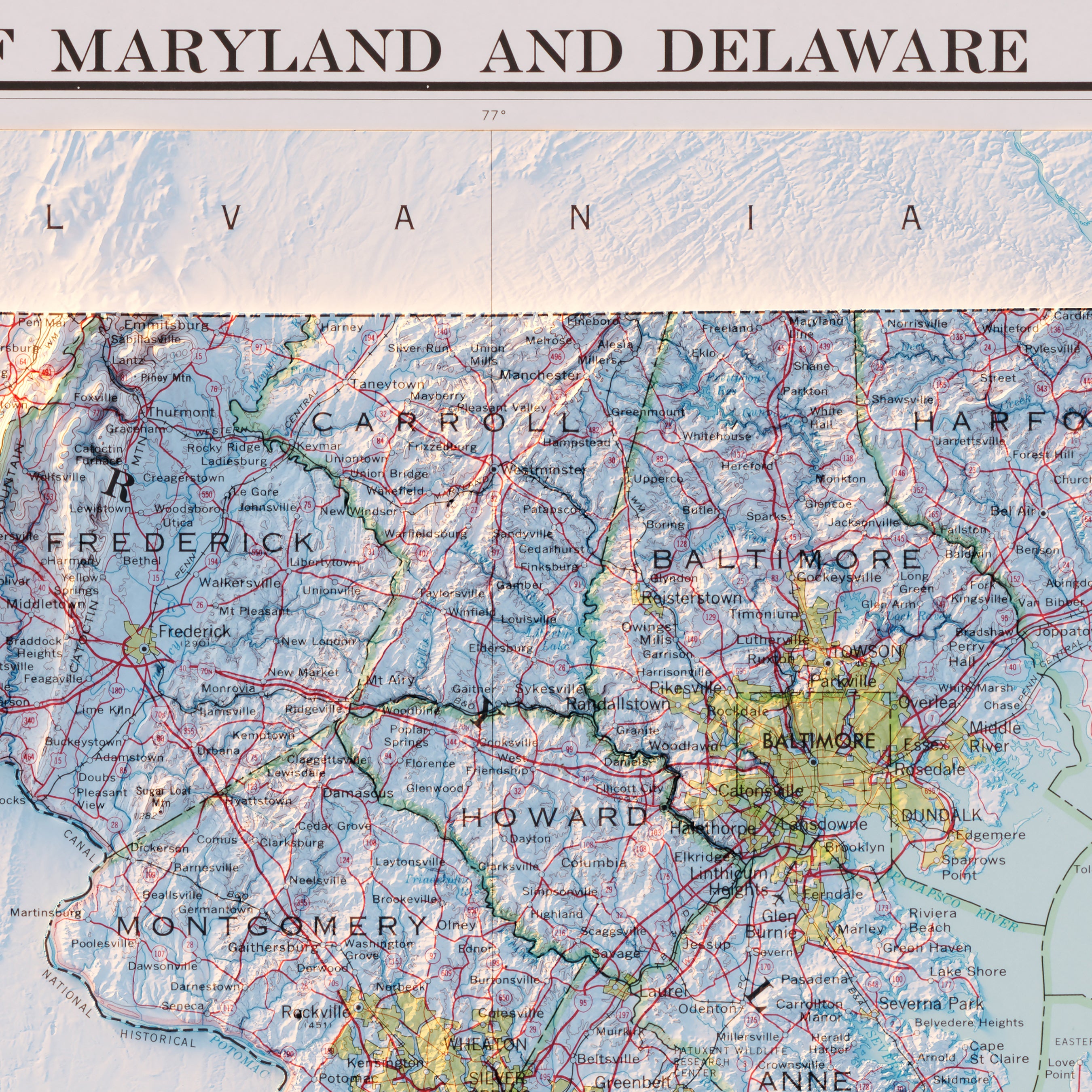
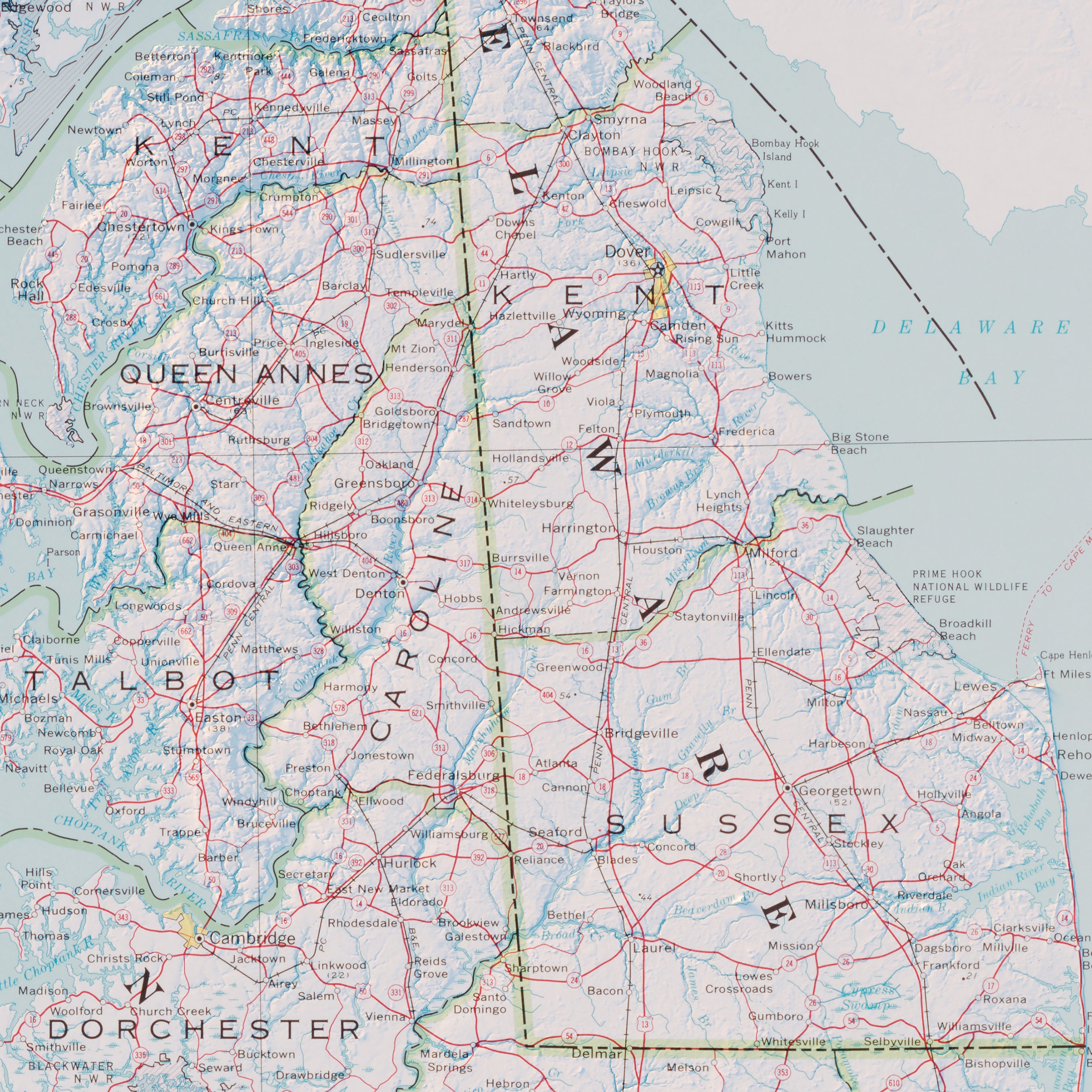
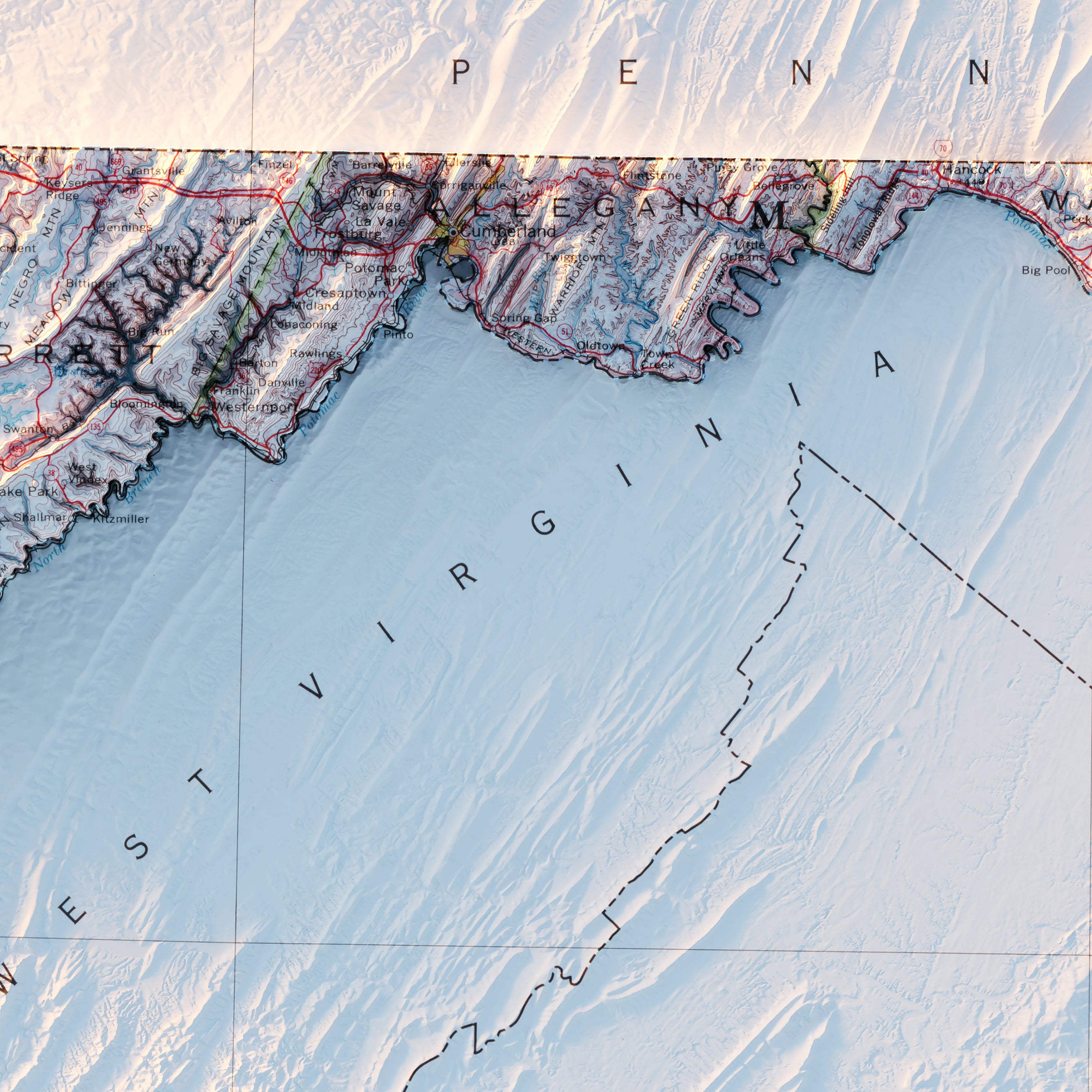
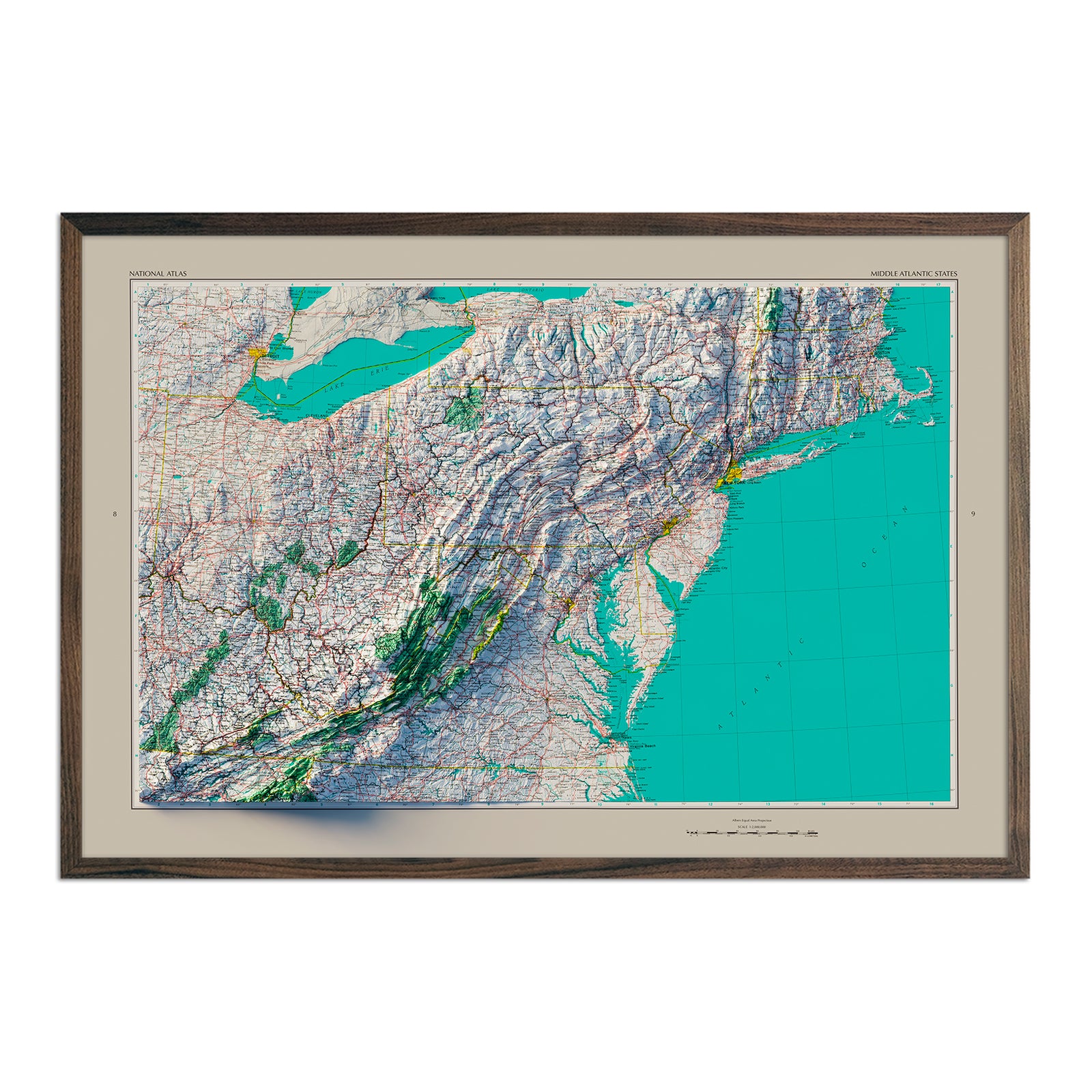
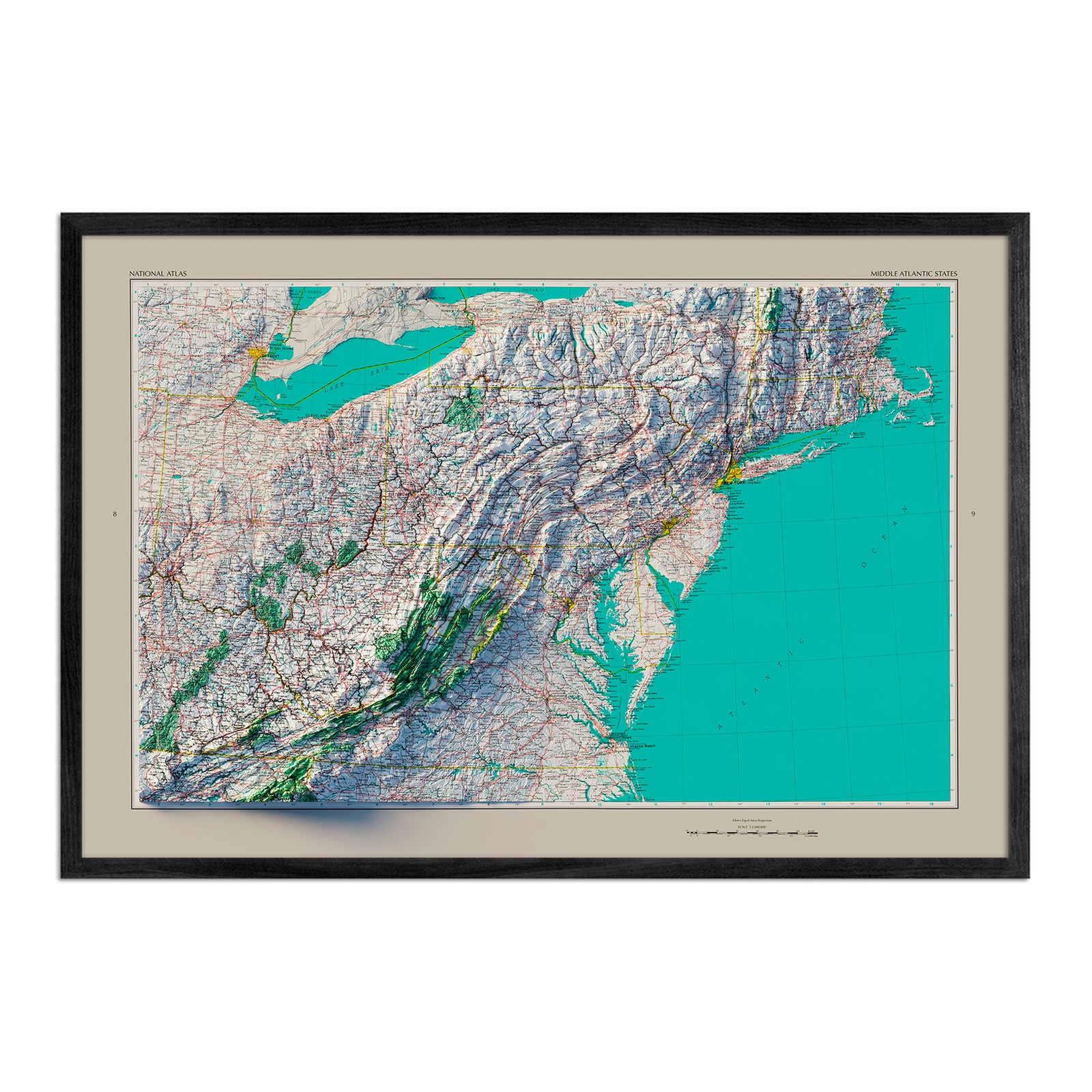
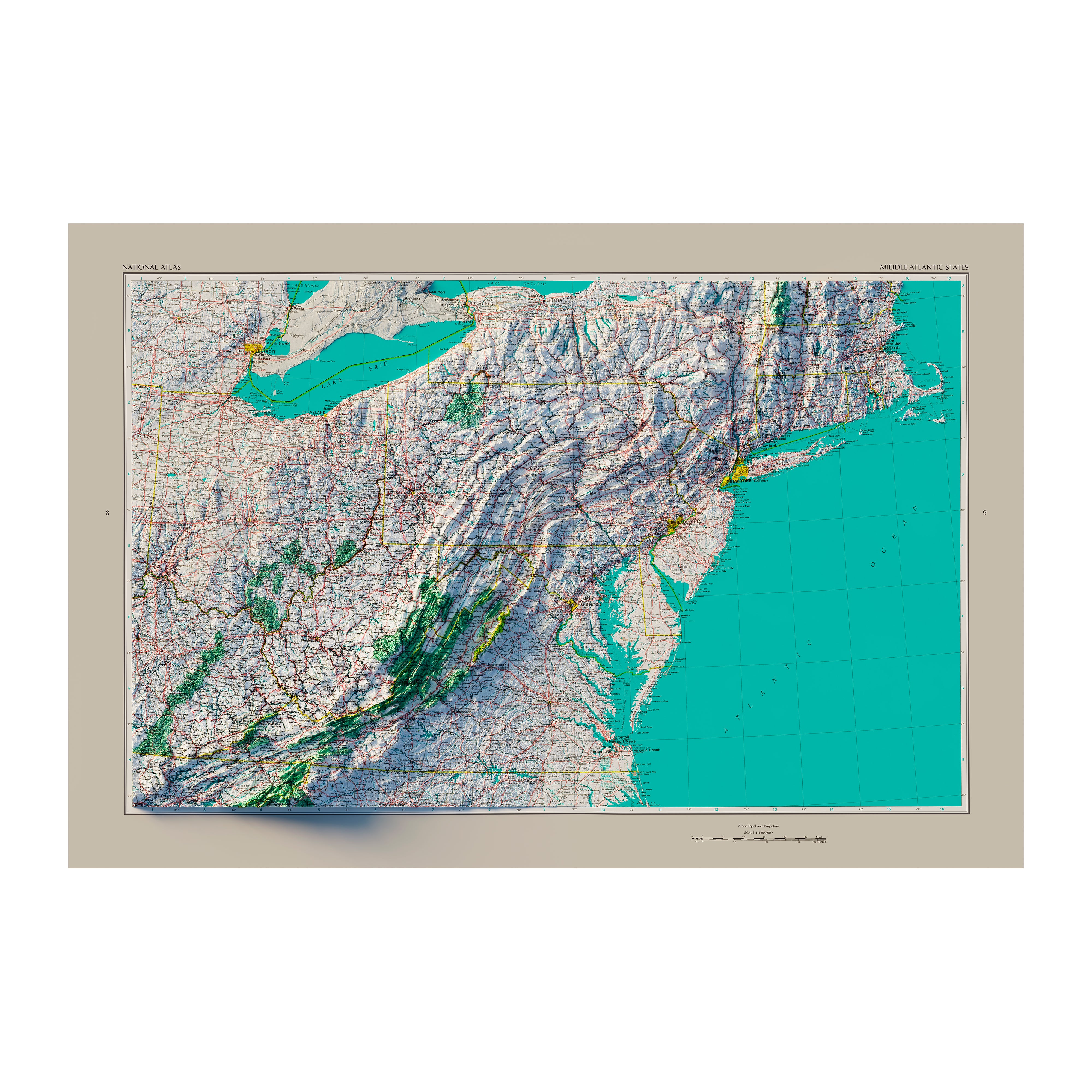
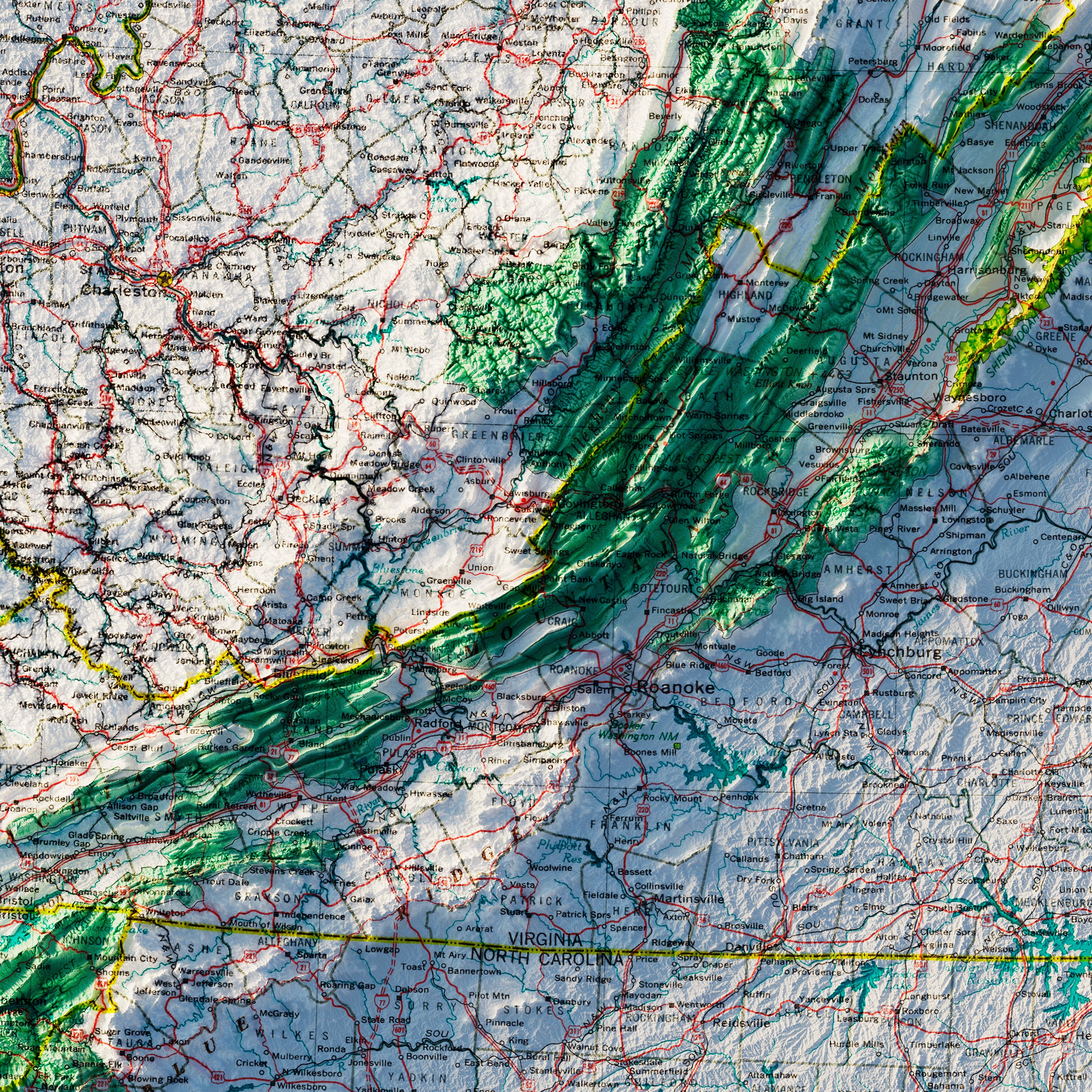
Maryland relief maps - With our 1933 Maryland relief map and 1973 Maryland and Delaware relief map, we've combined historic imagery and new technology to offer you a unique perspective on the topography of the state. Digital Elevation Data and custom relief shading are used to create a 3D effect on flat surfaces by enhancing vintage map imagery.
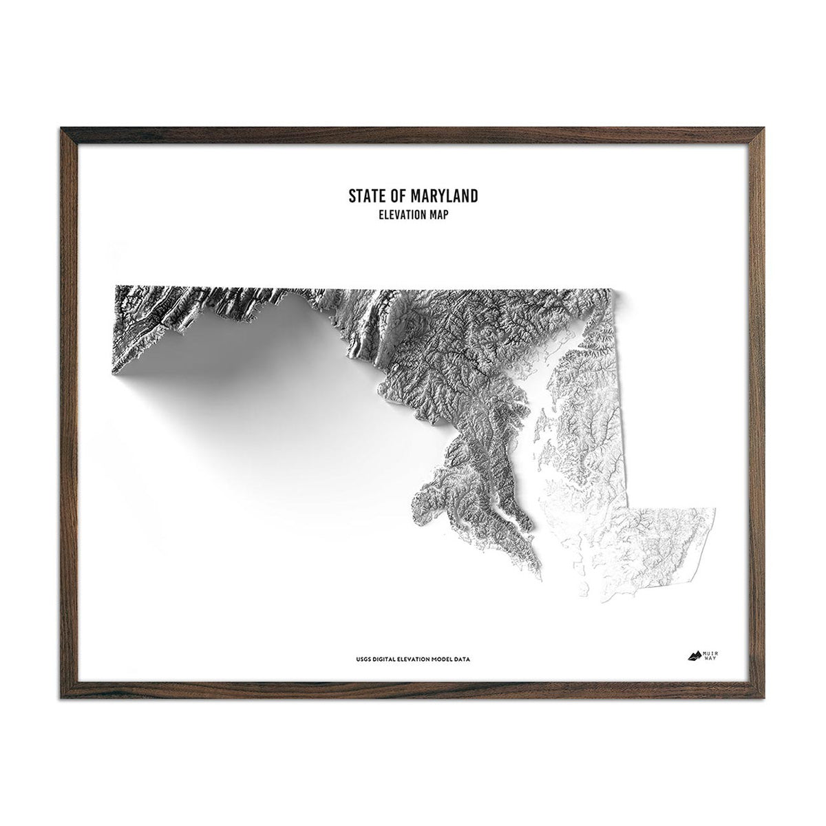
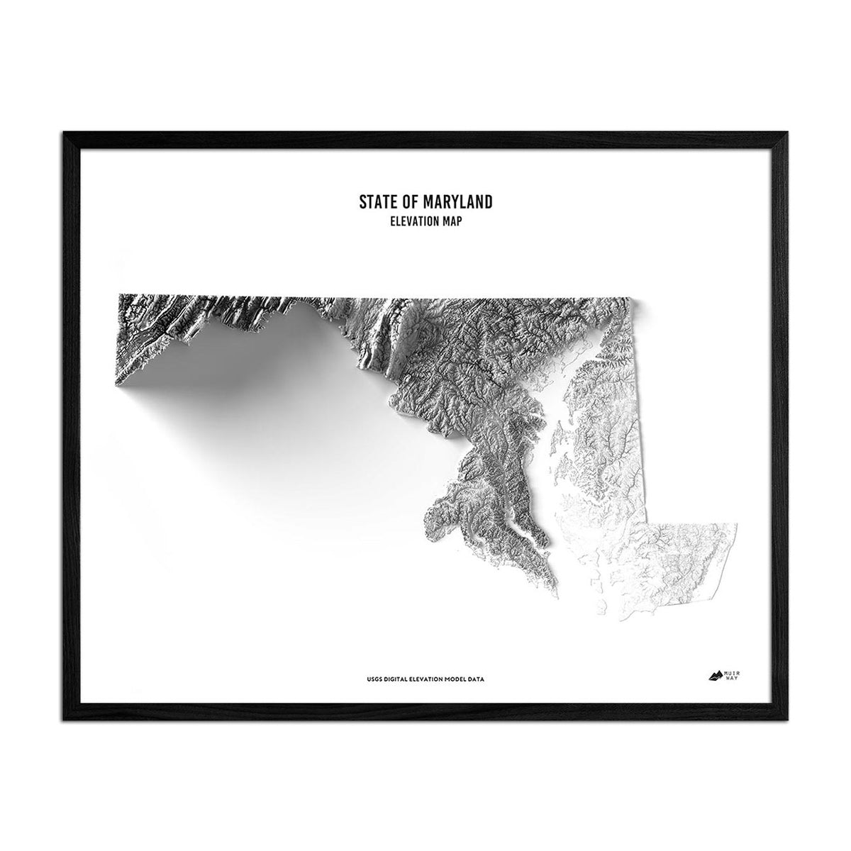
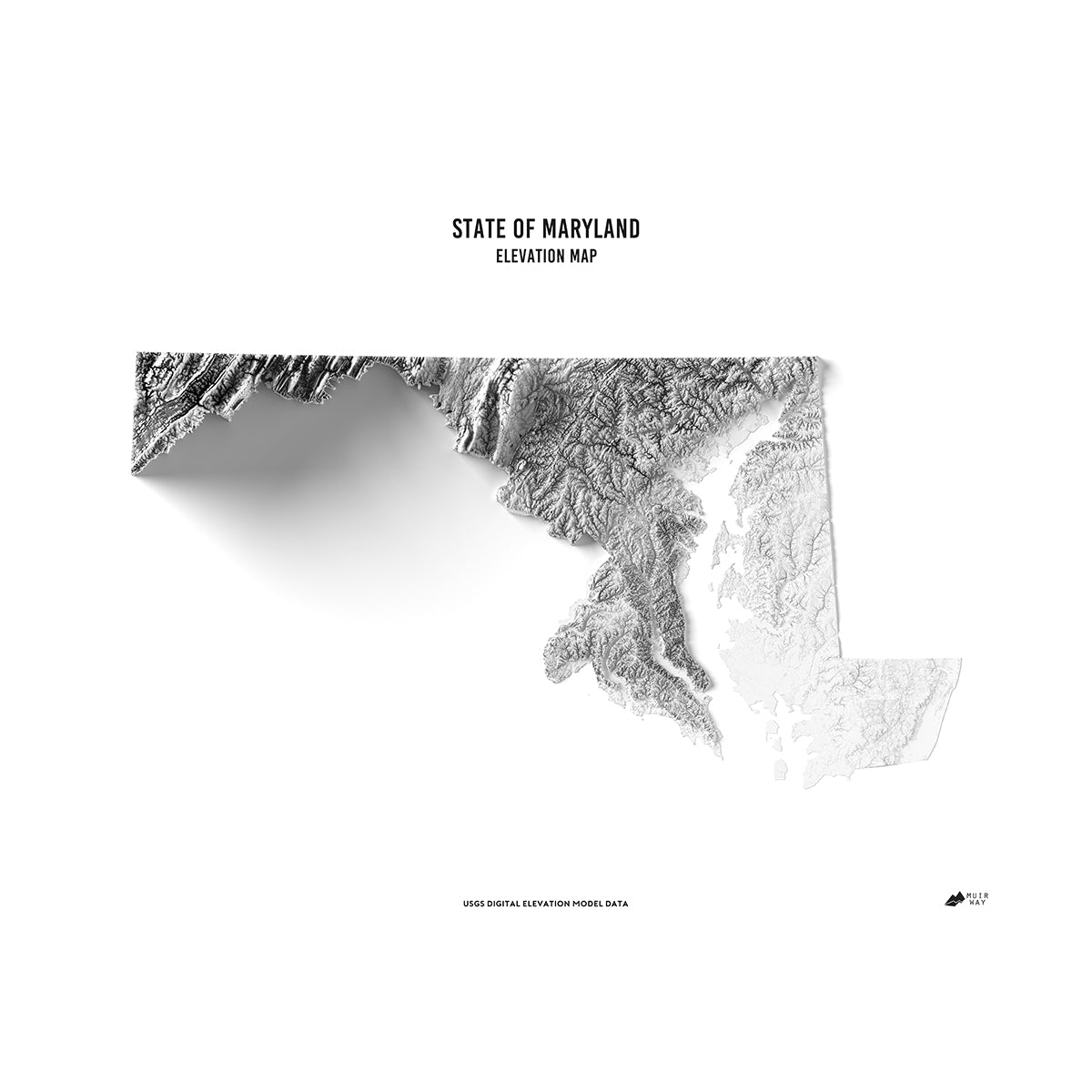
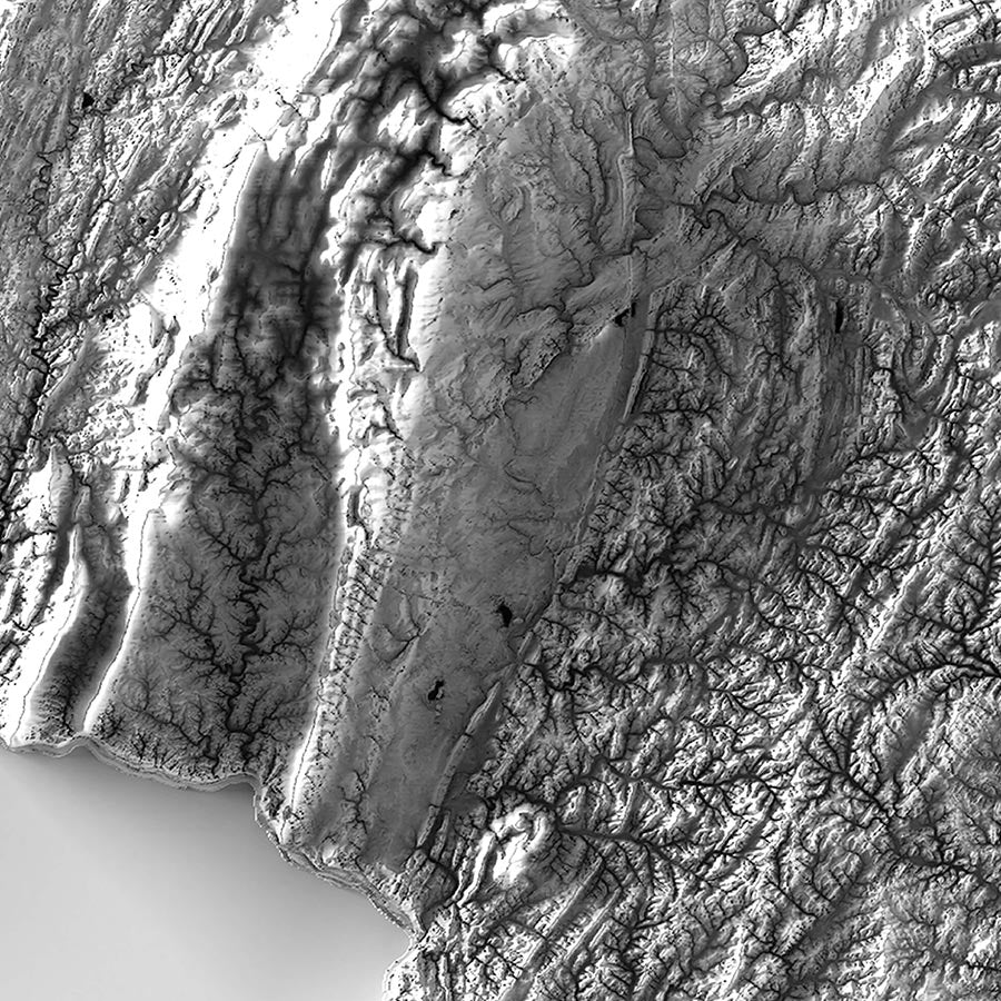
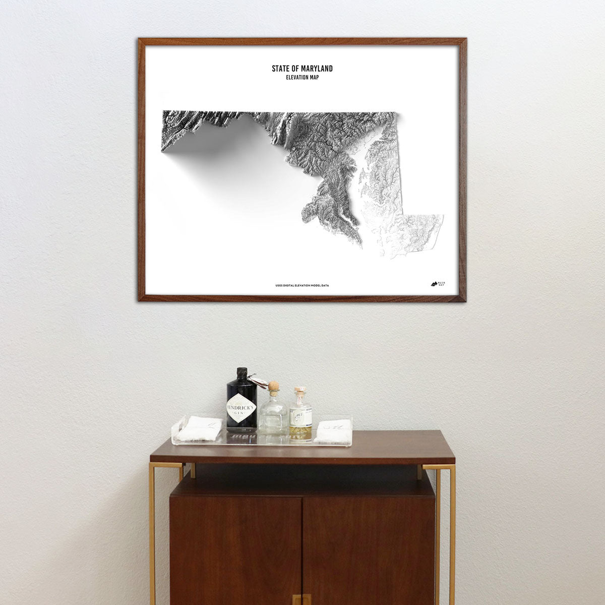
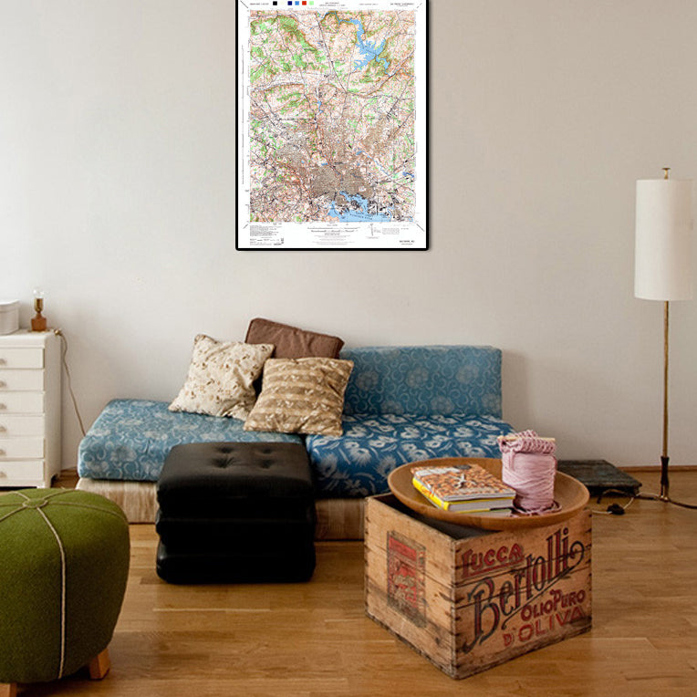
Maryland elevation maps - We use USGS Digital Elevation Data to create our Maryland elevation maps, which are created in striking black and white with sharp detail and provide a unique perspective on Maryland's landscape.
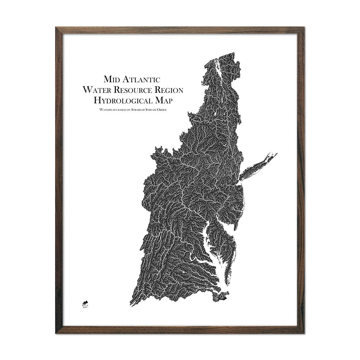
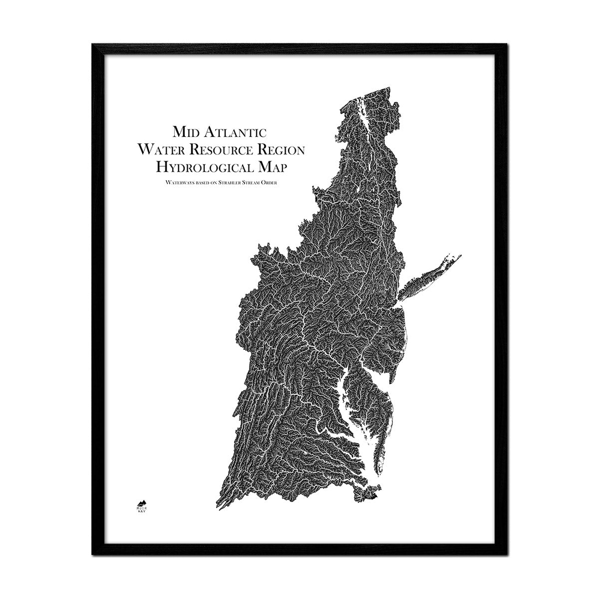
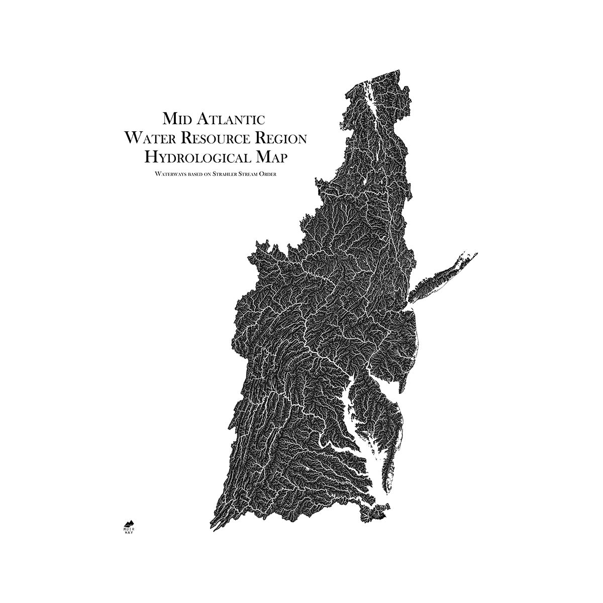
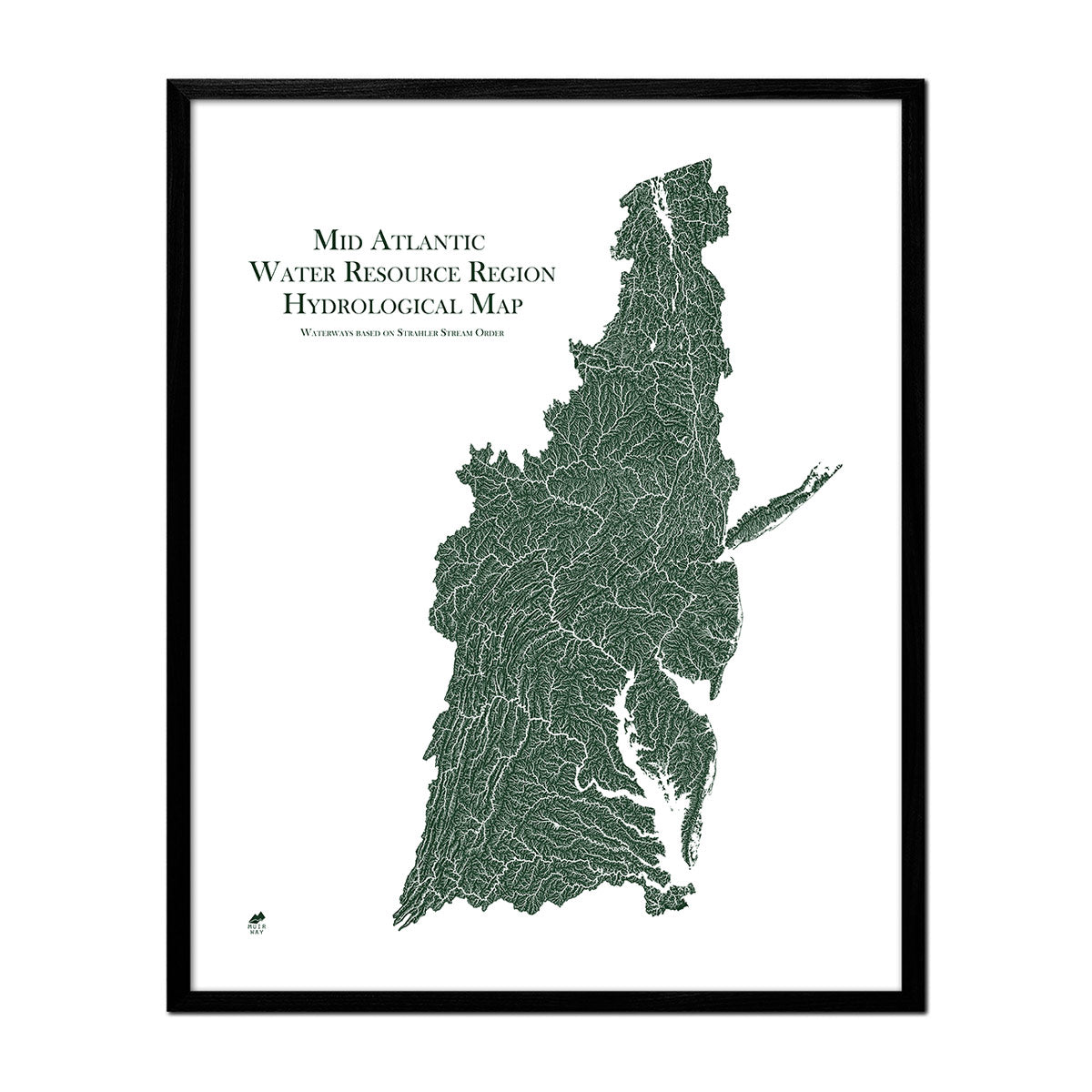
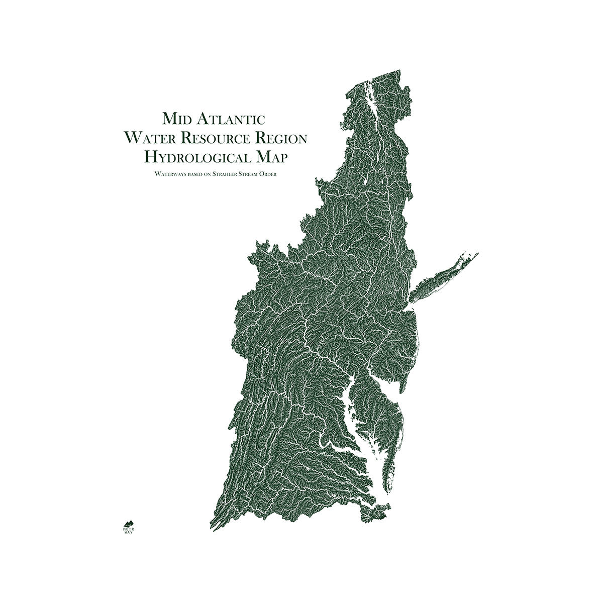
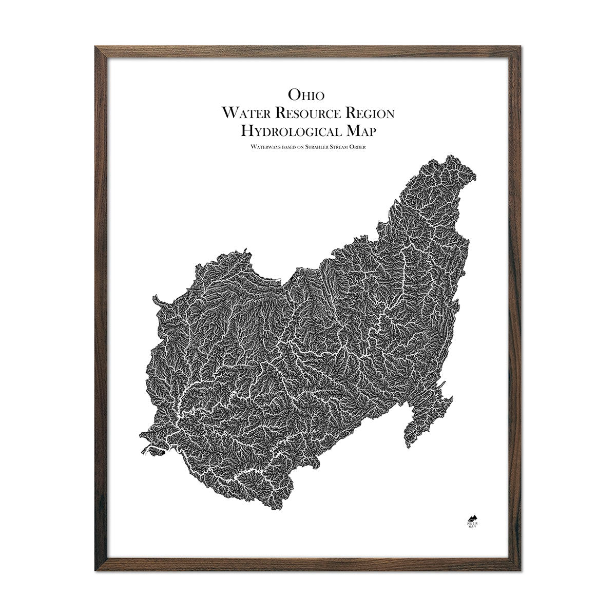
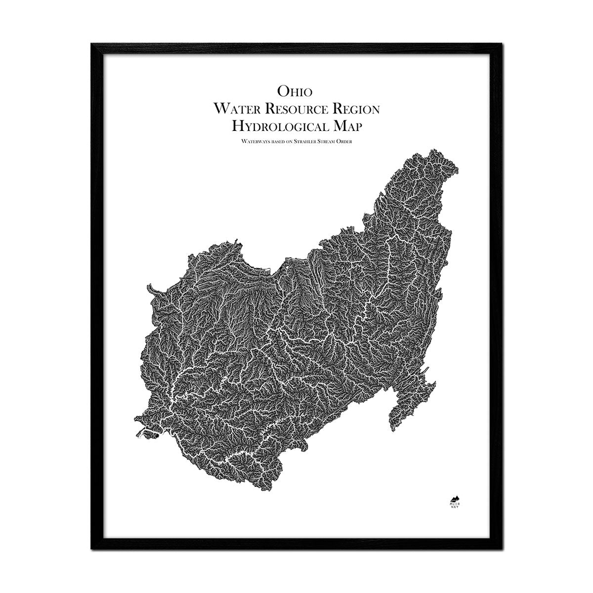
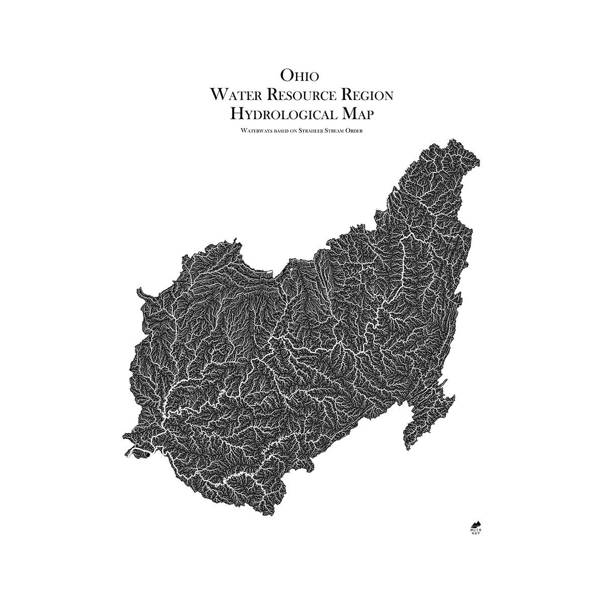
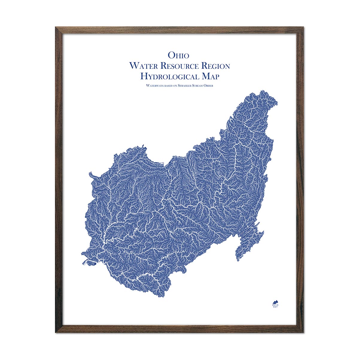
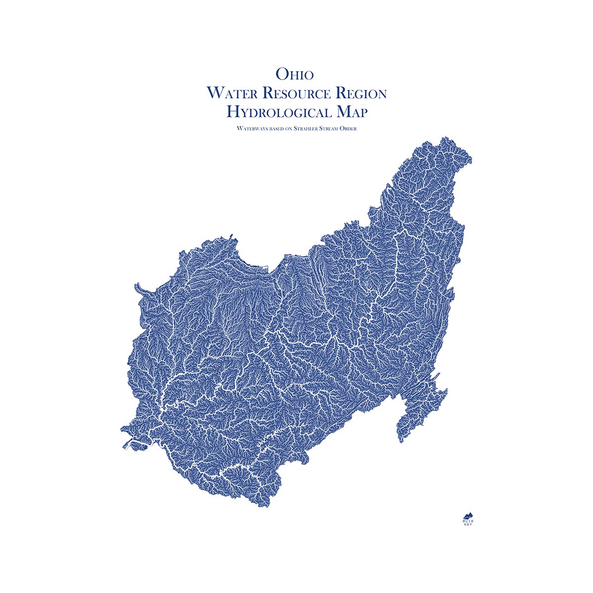
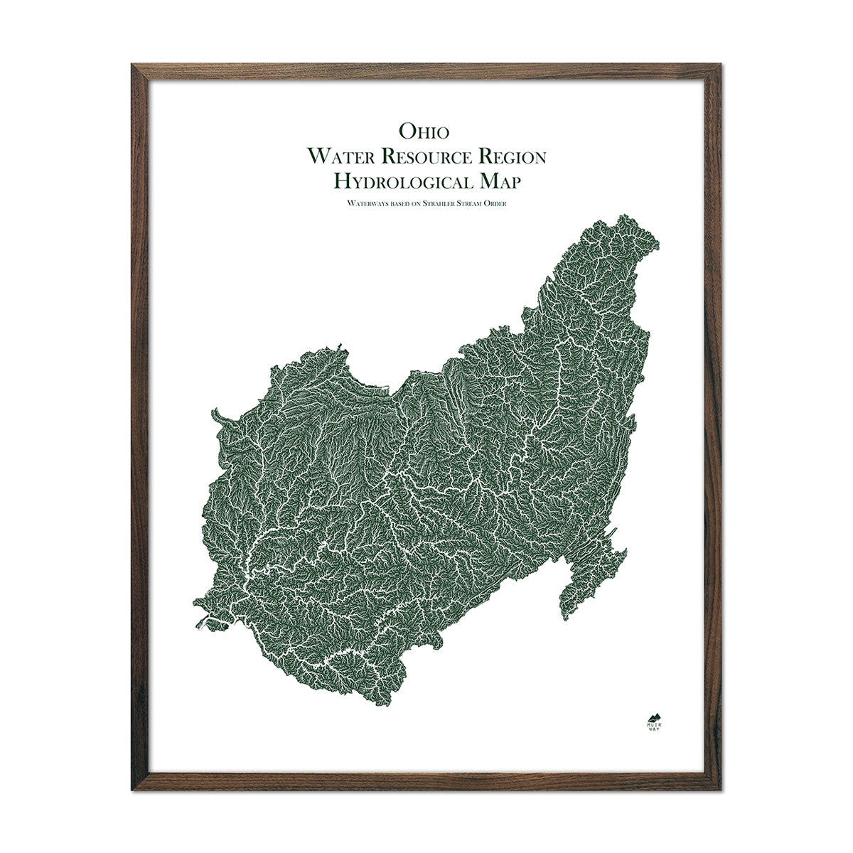
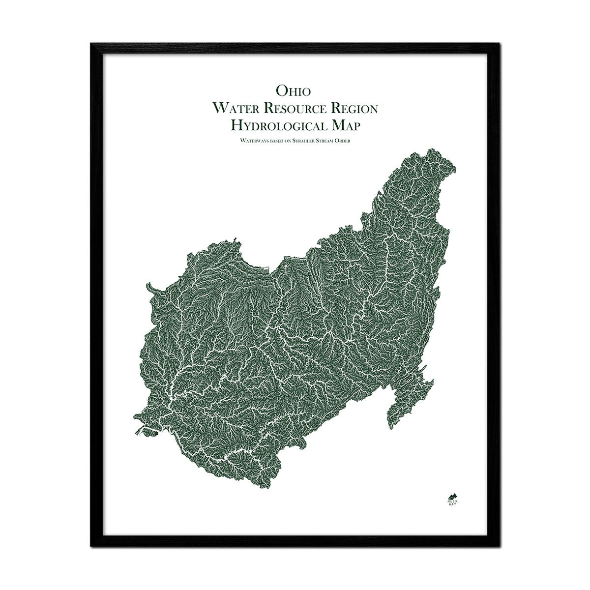
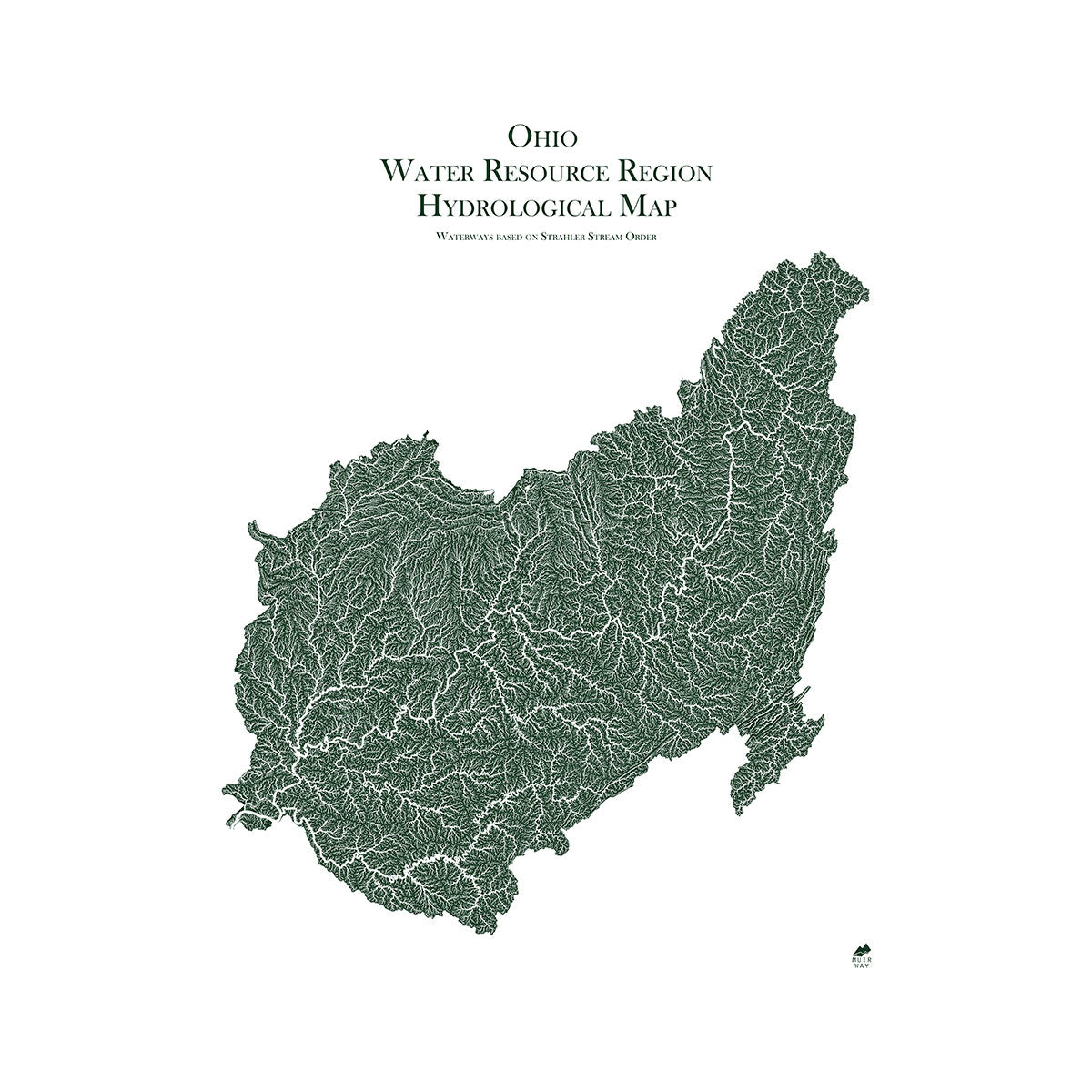
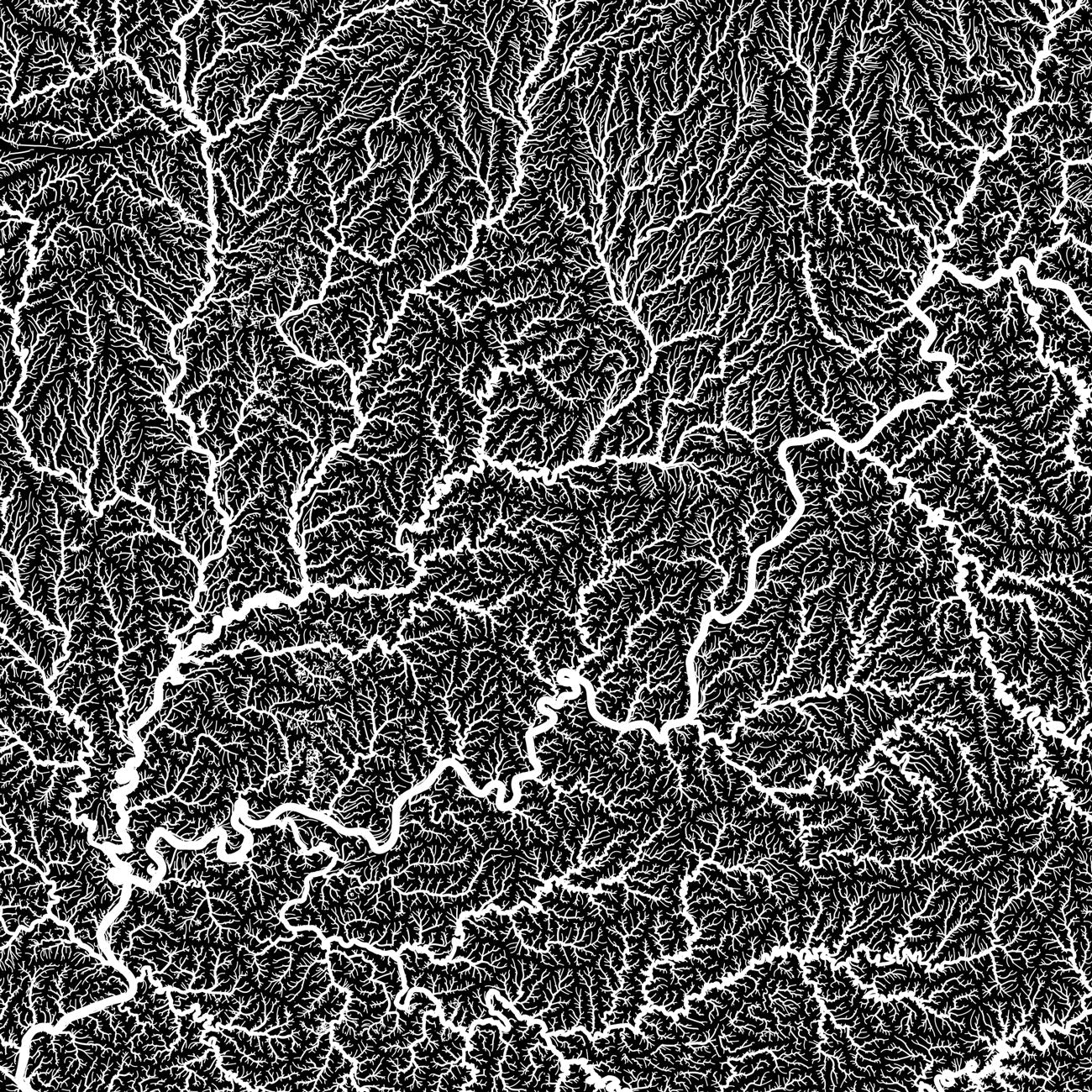
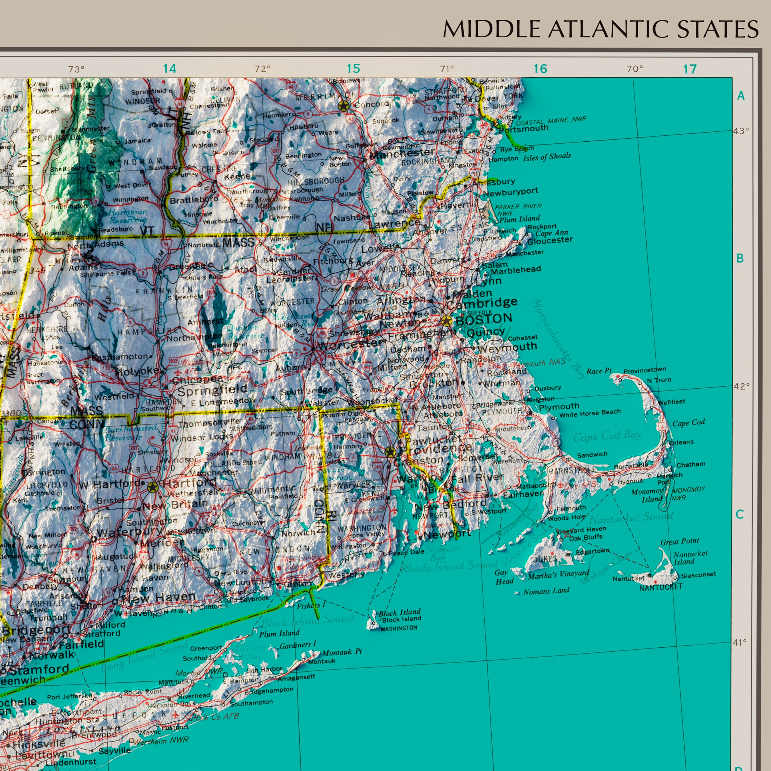
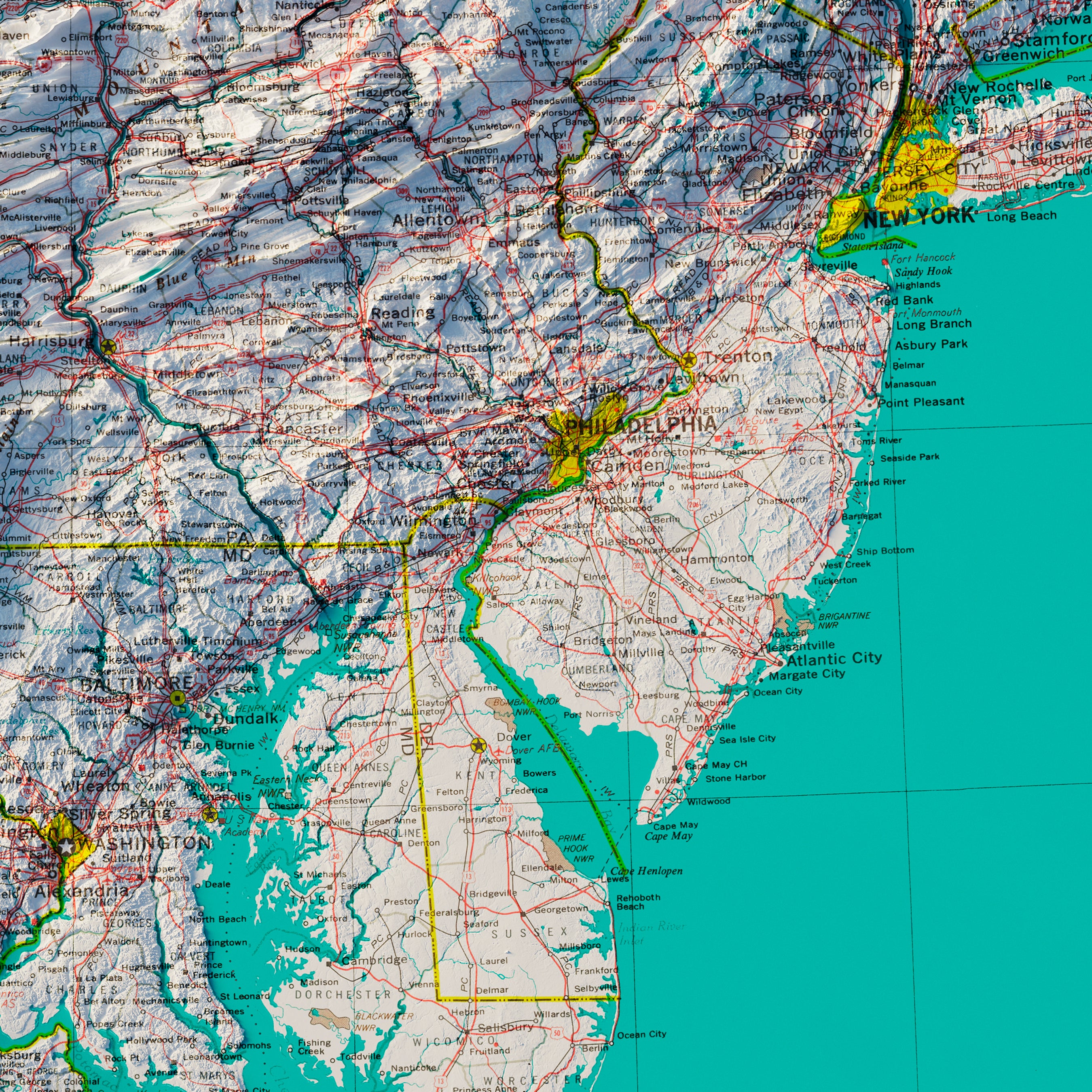
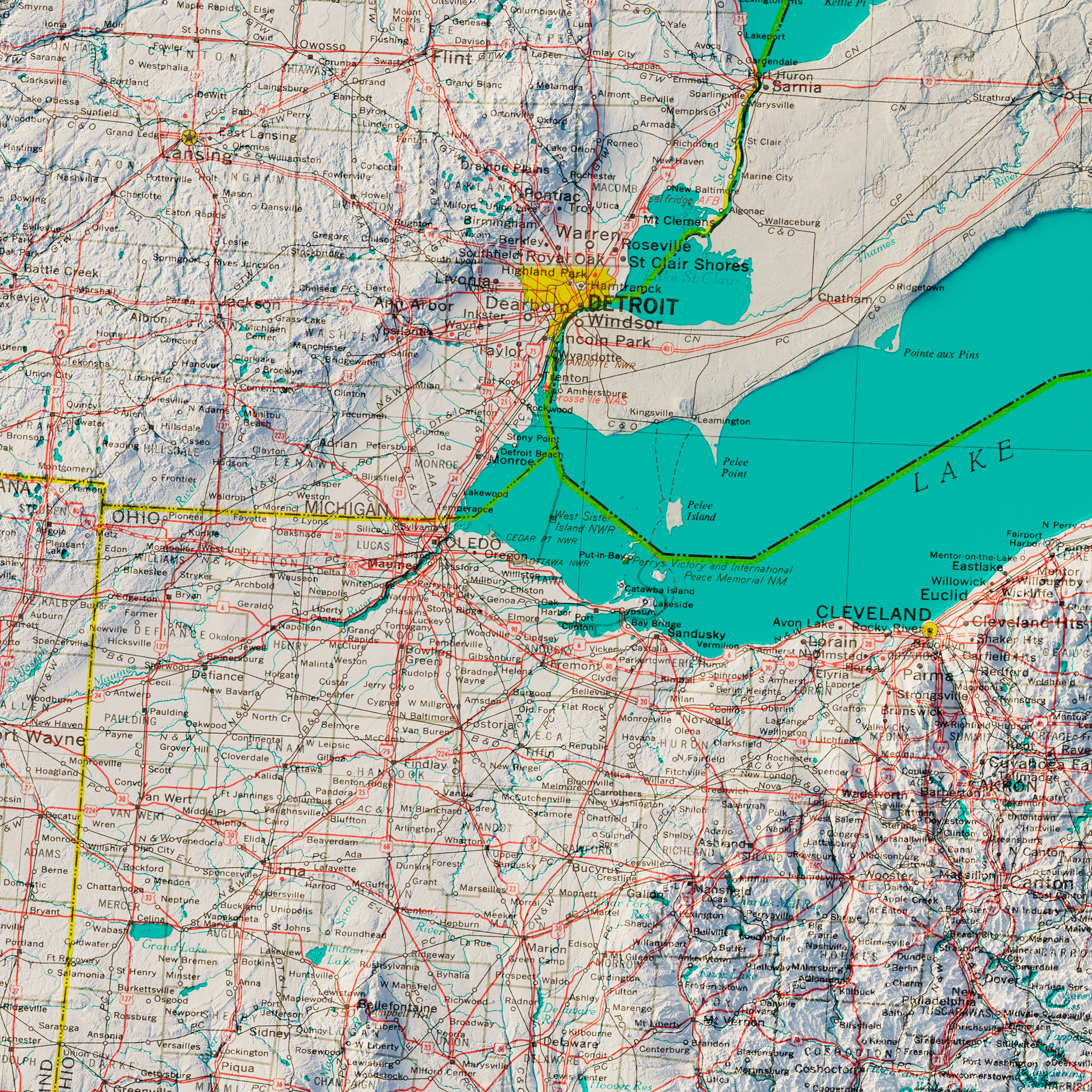
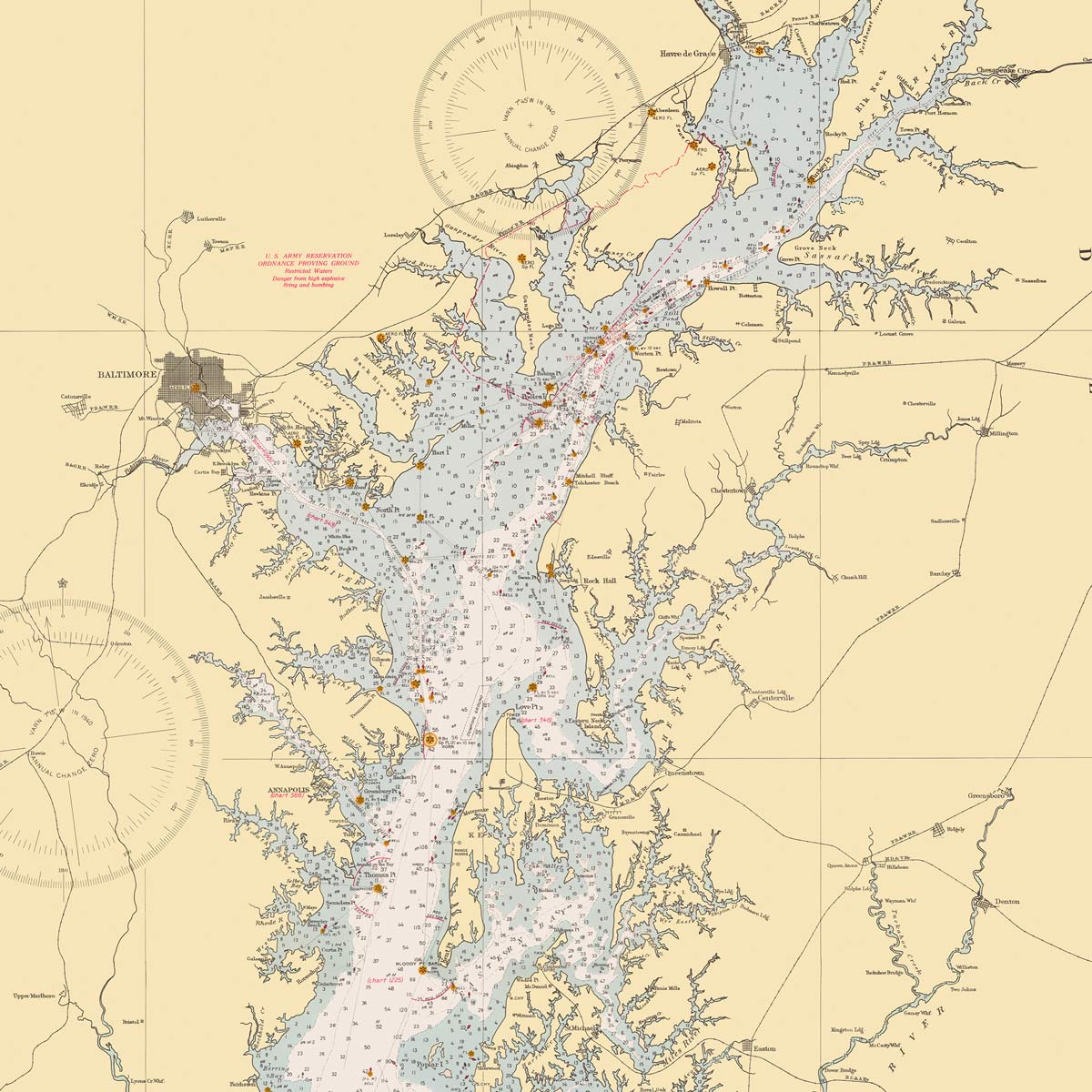
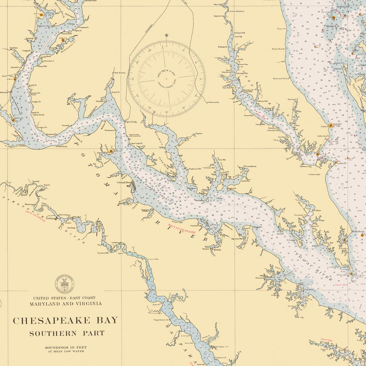
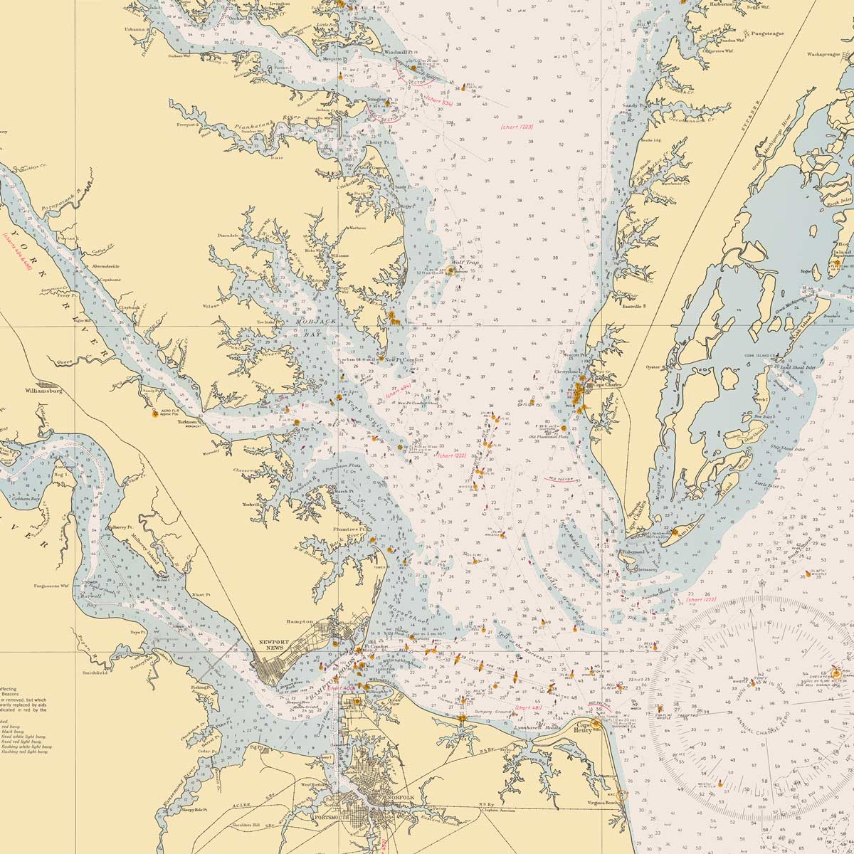
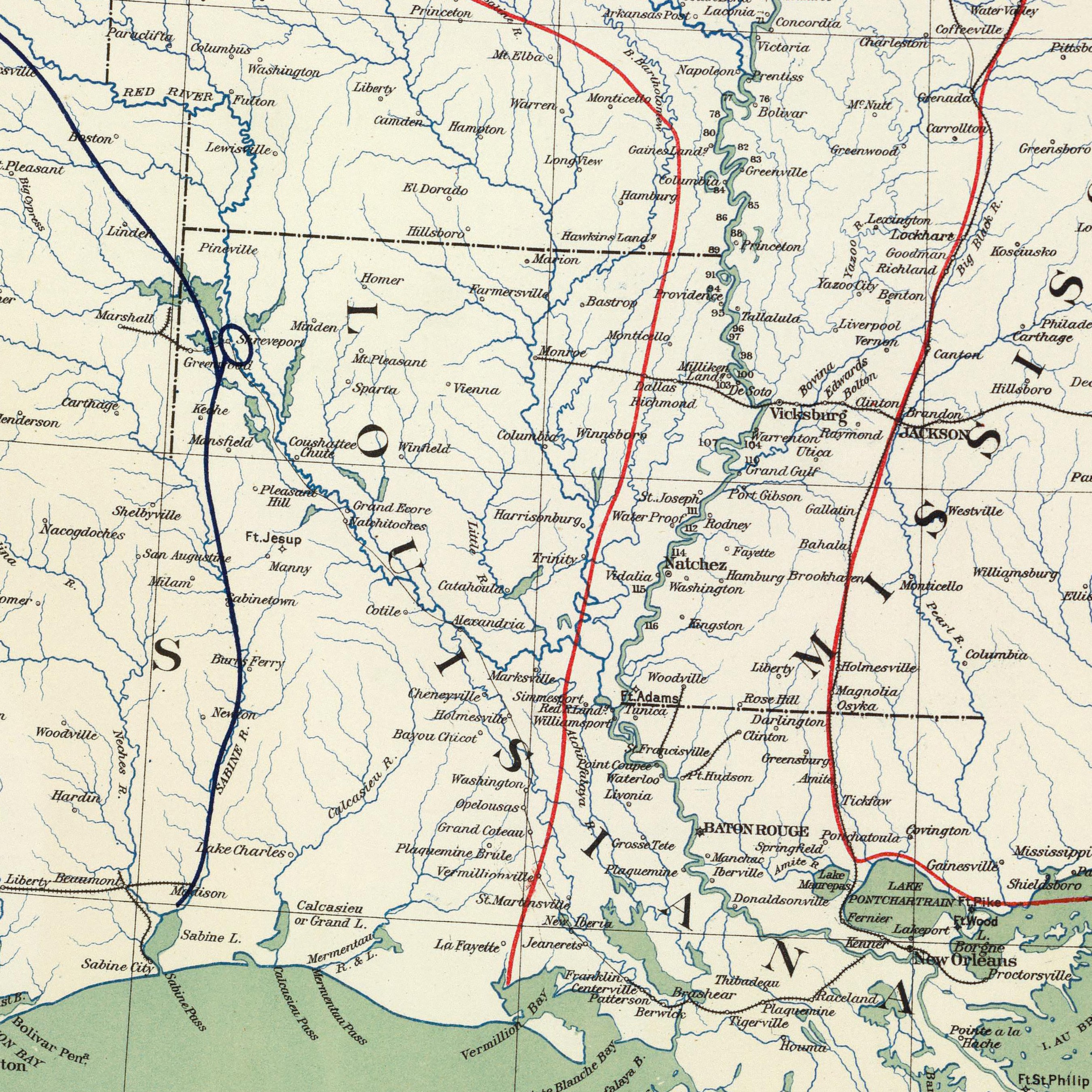
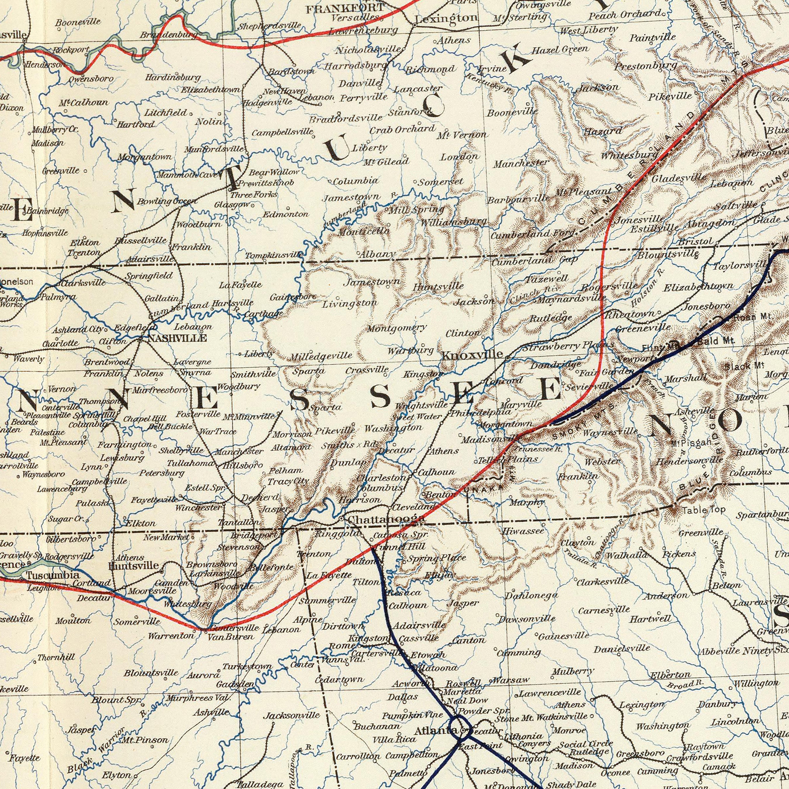
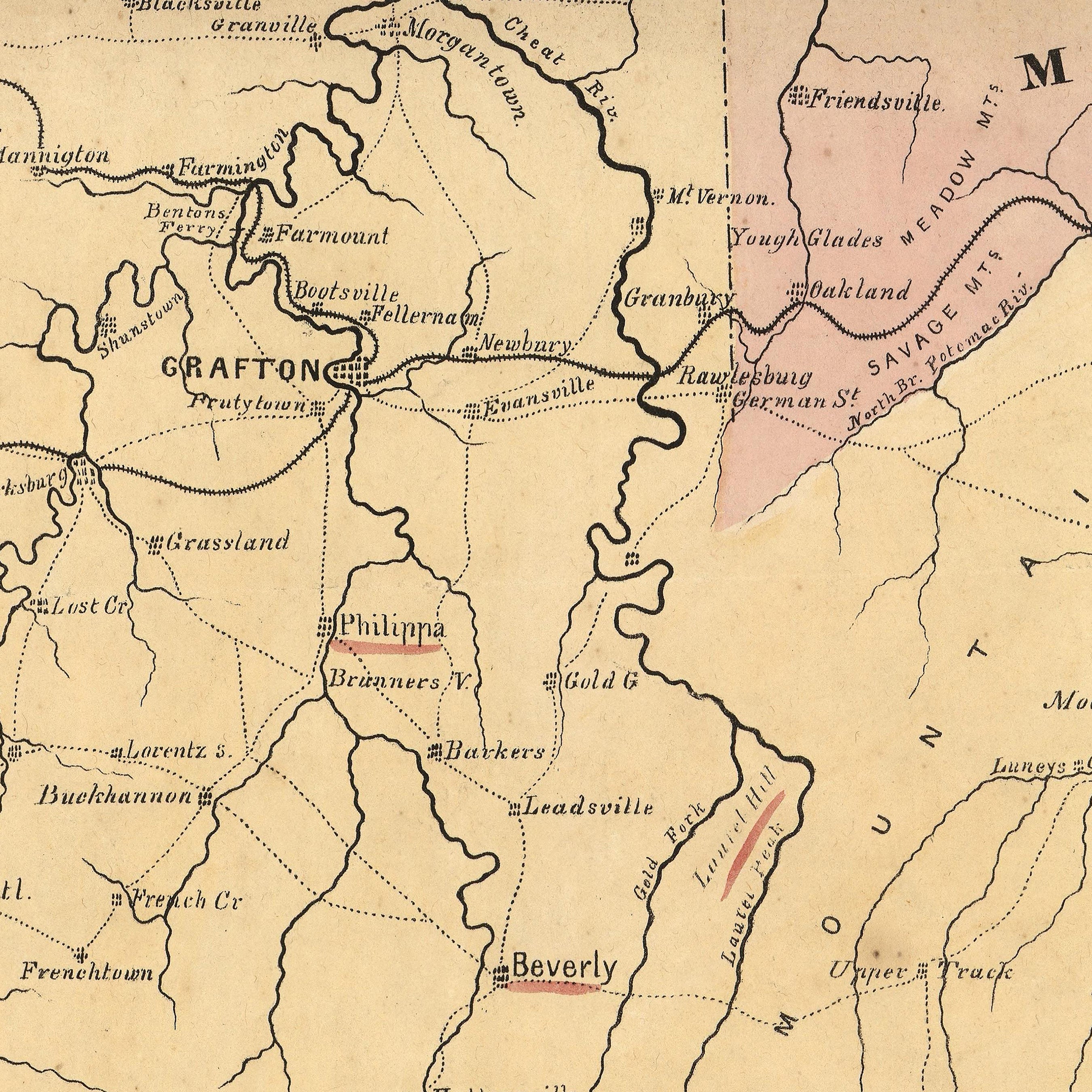
Maryland hydrological maps - From a distance, hydrological maps look entrancing, but up close, they provide a wealth of information. On our Maryland hydrological map or one of our regional hydrological maps ( Mid-Atlantic or Ohio), you can trace Maryland’s interconnected waterways, from wide rivers to intermittent streams, showcasing every body of water in the state greater than 0.2 miles in diameter.
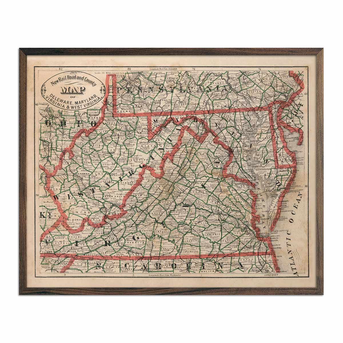
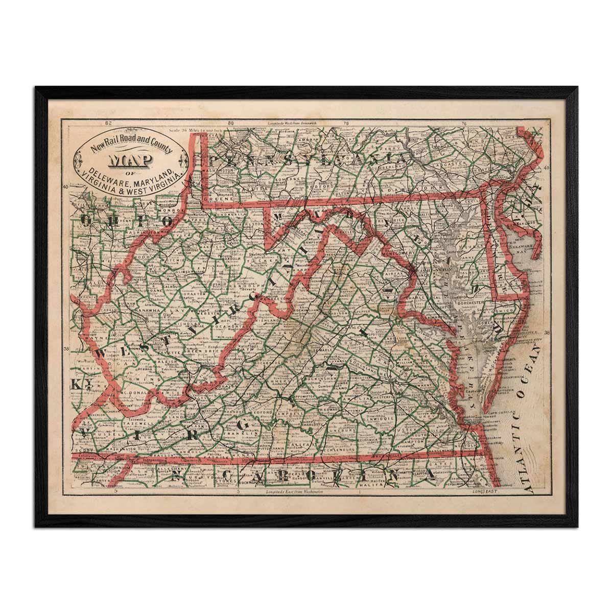
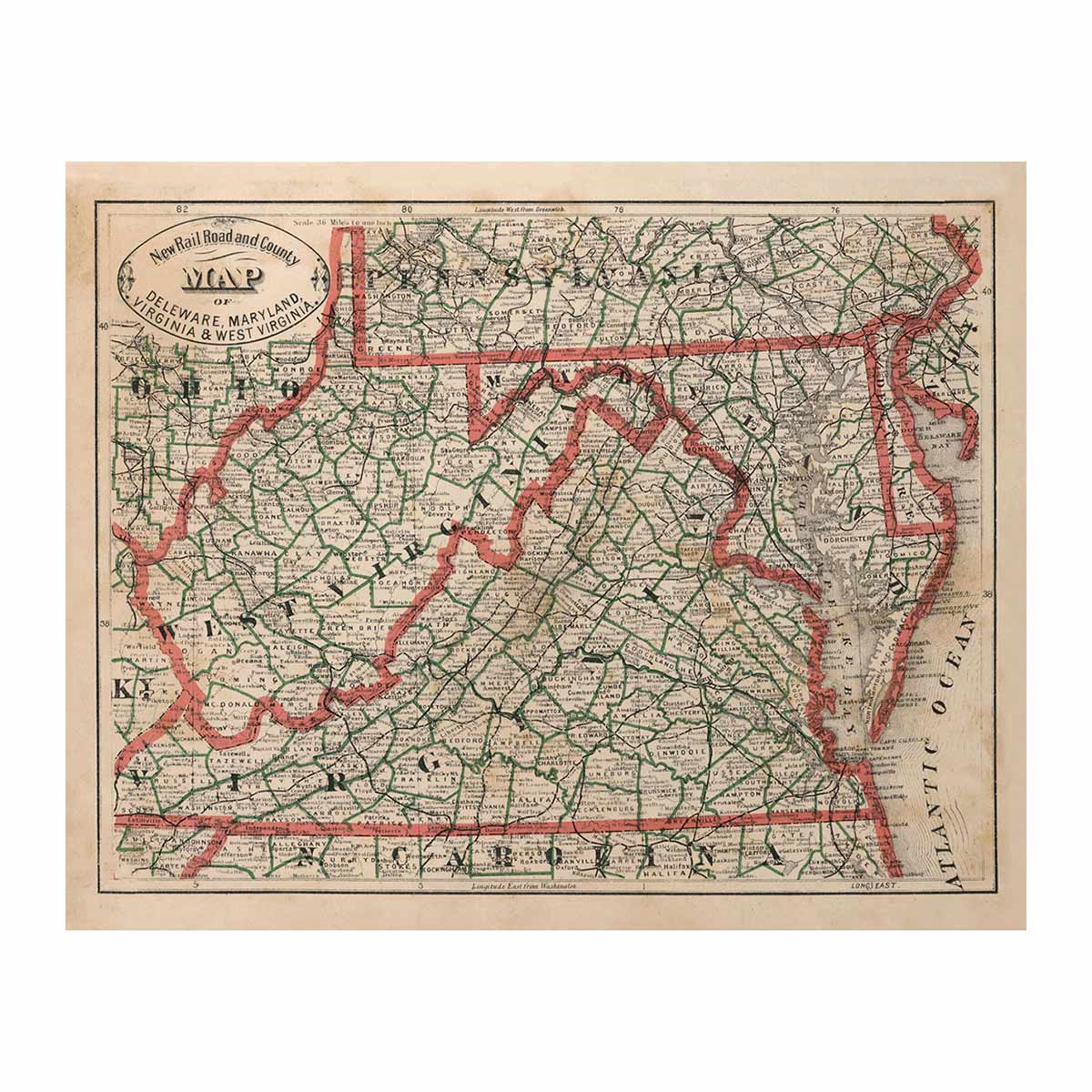
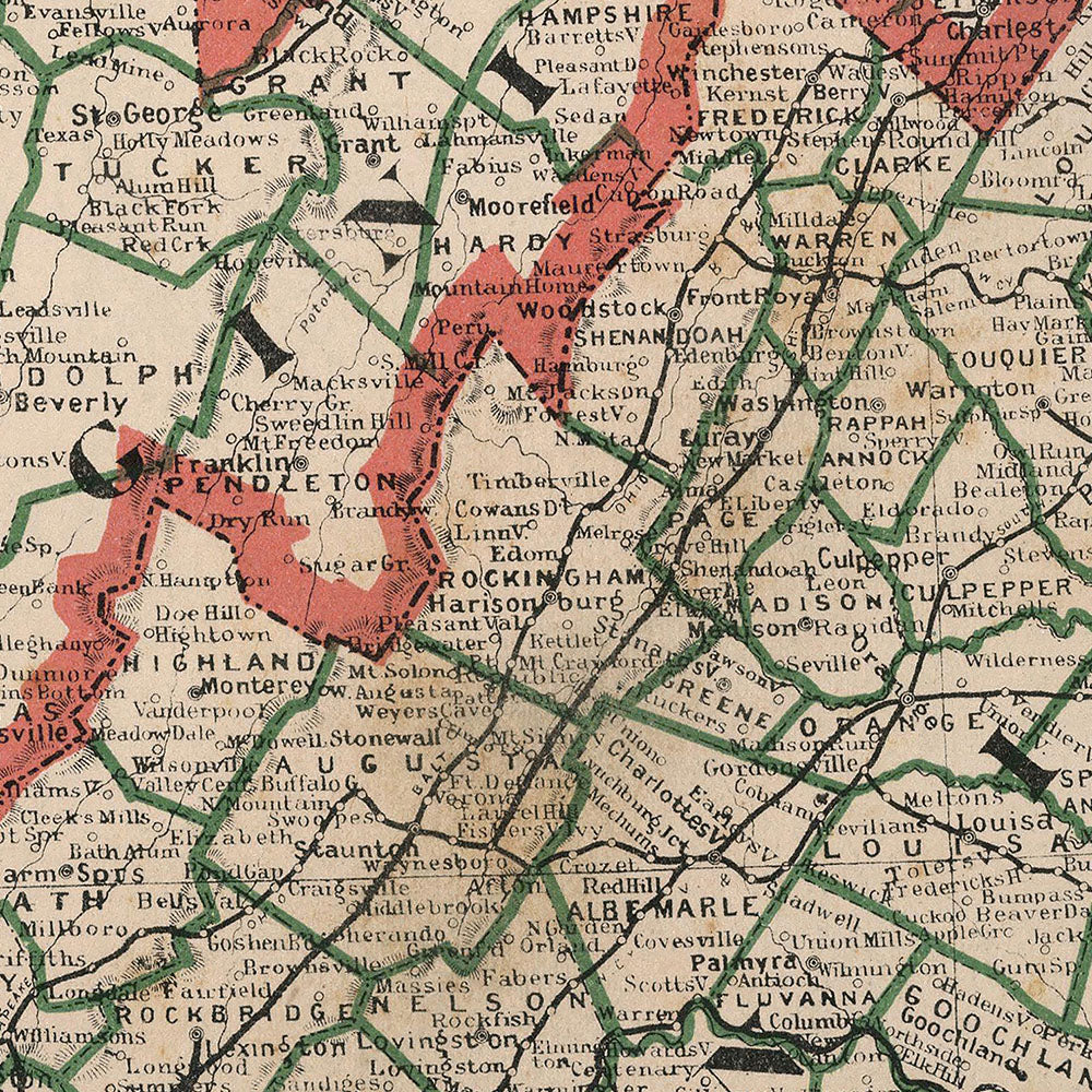
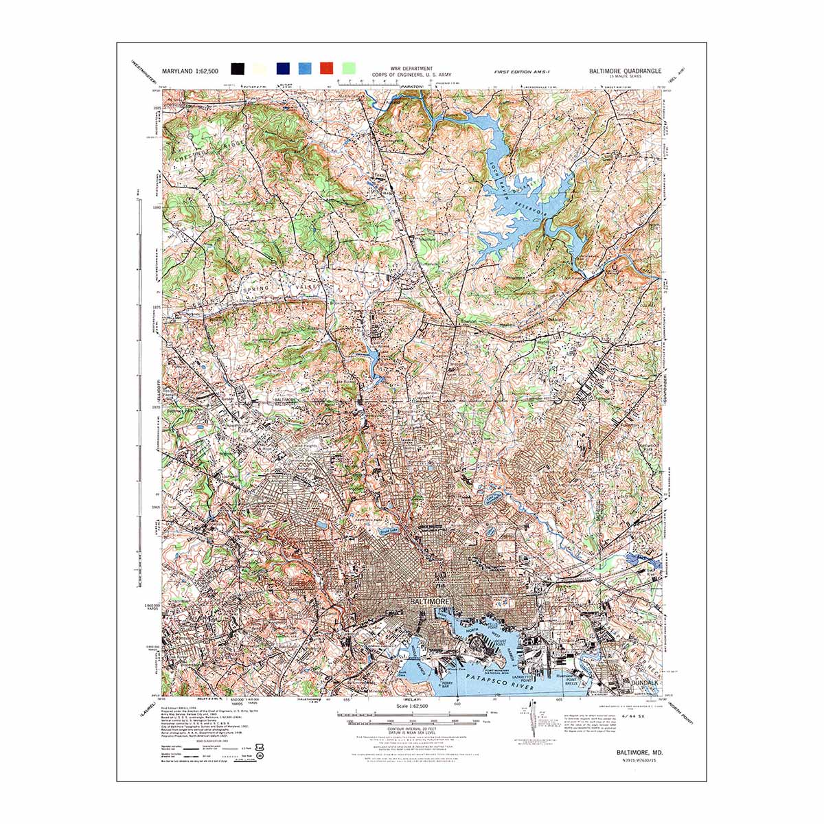
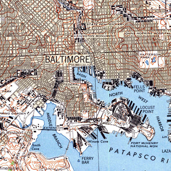
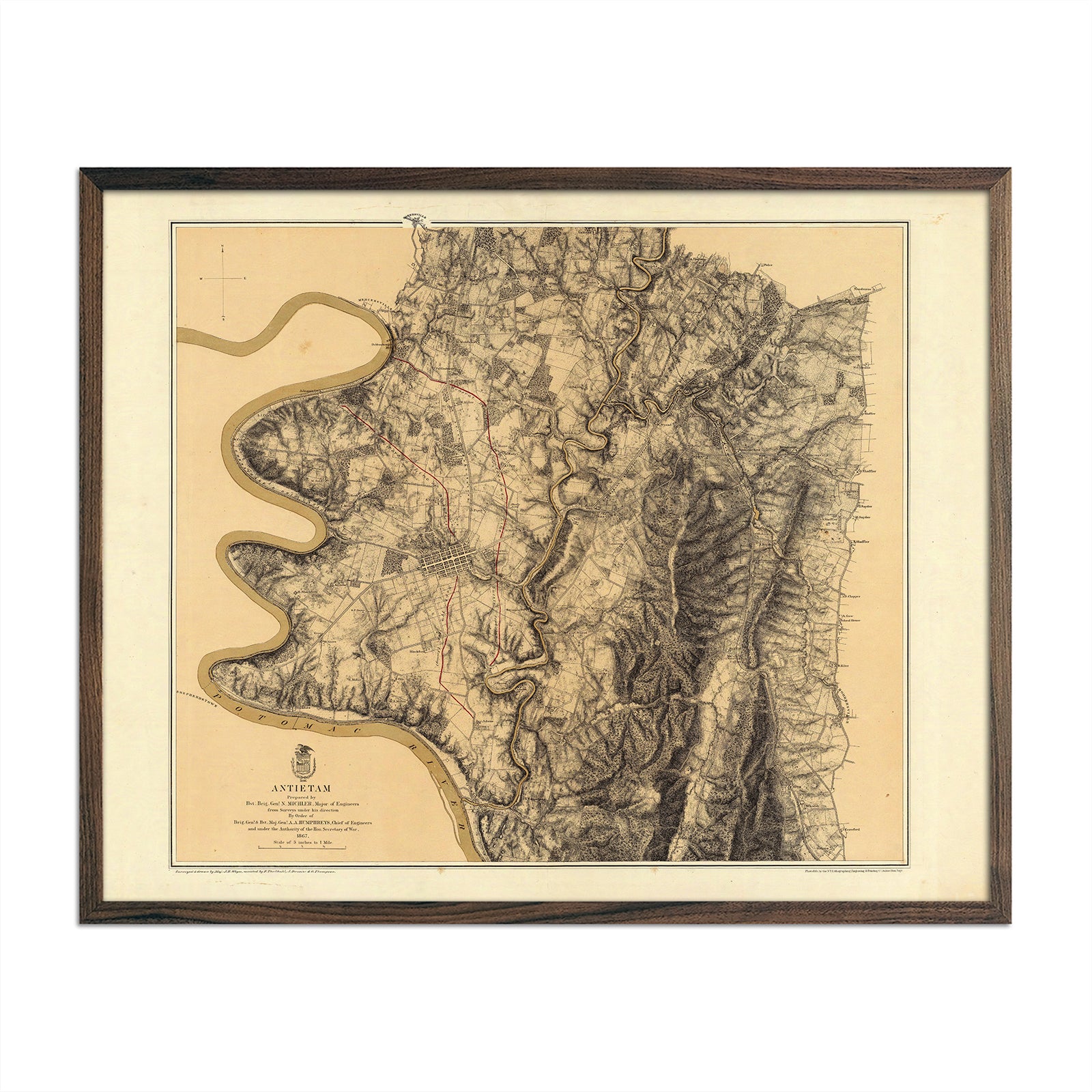
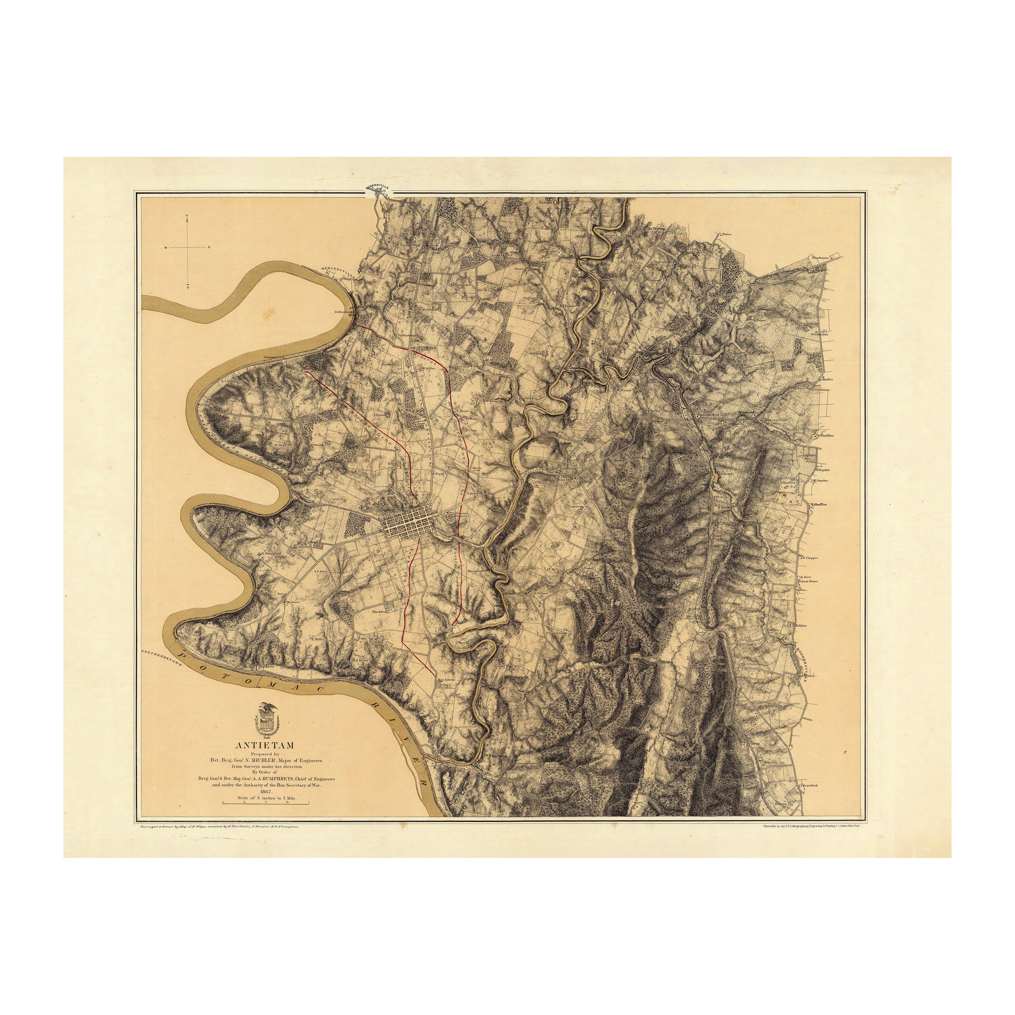
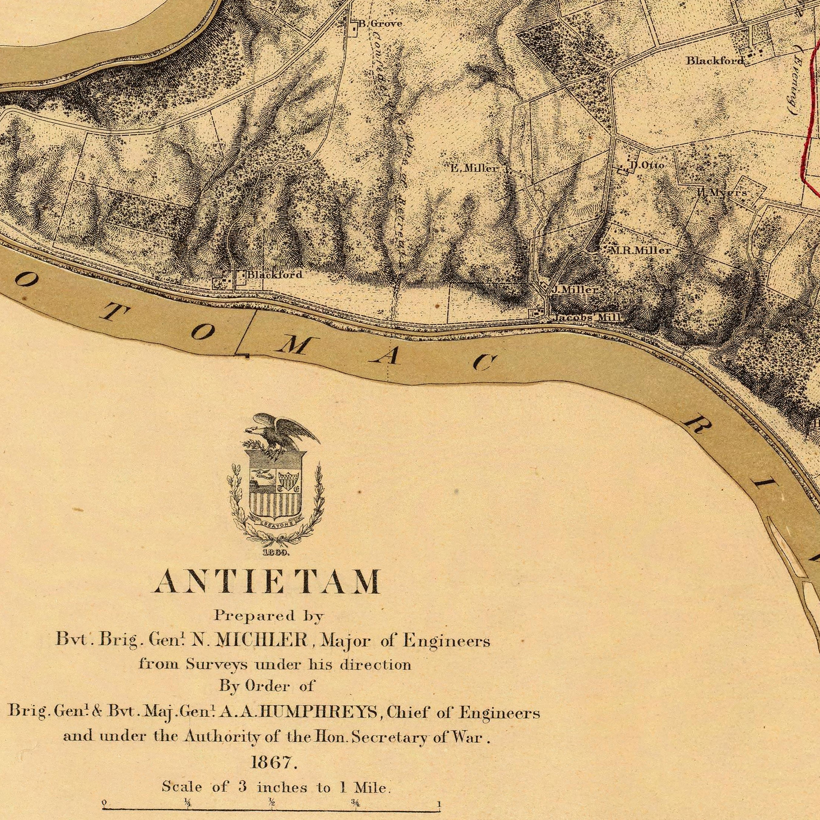
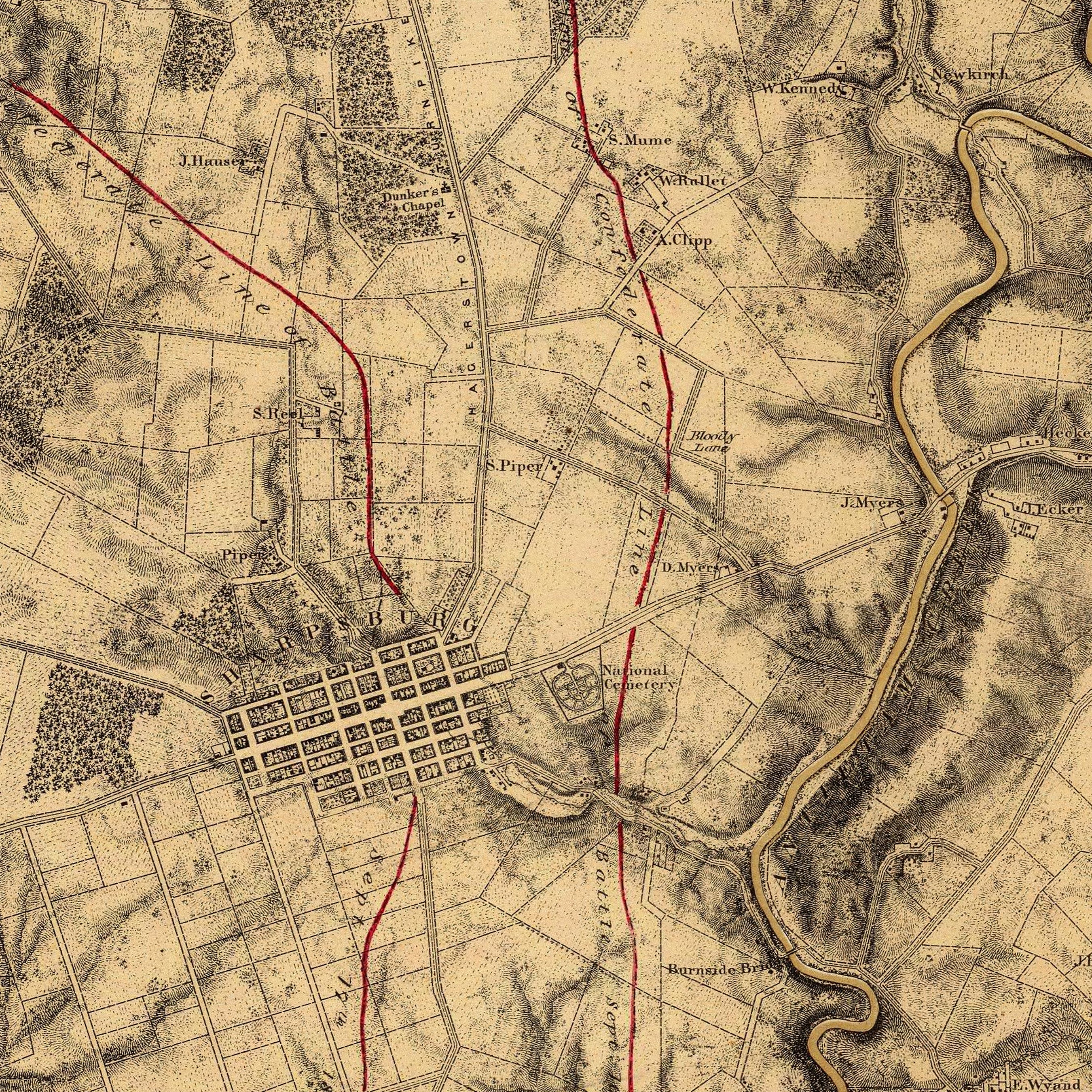
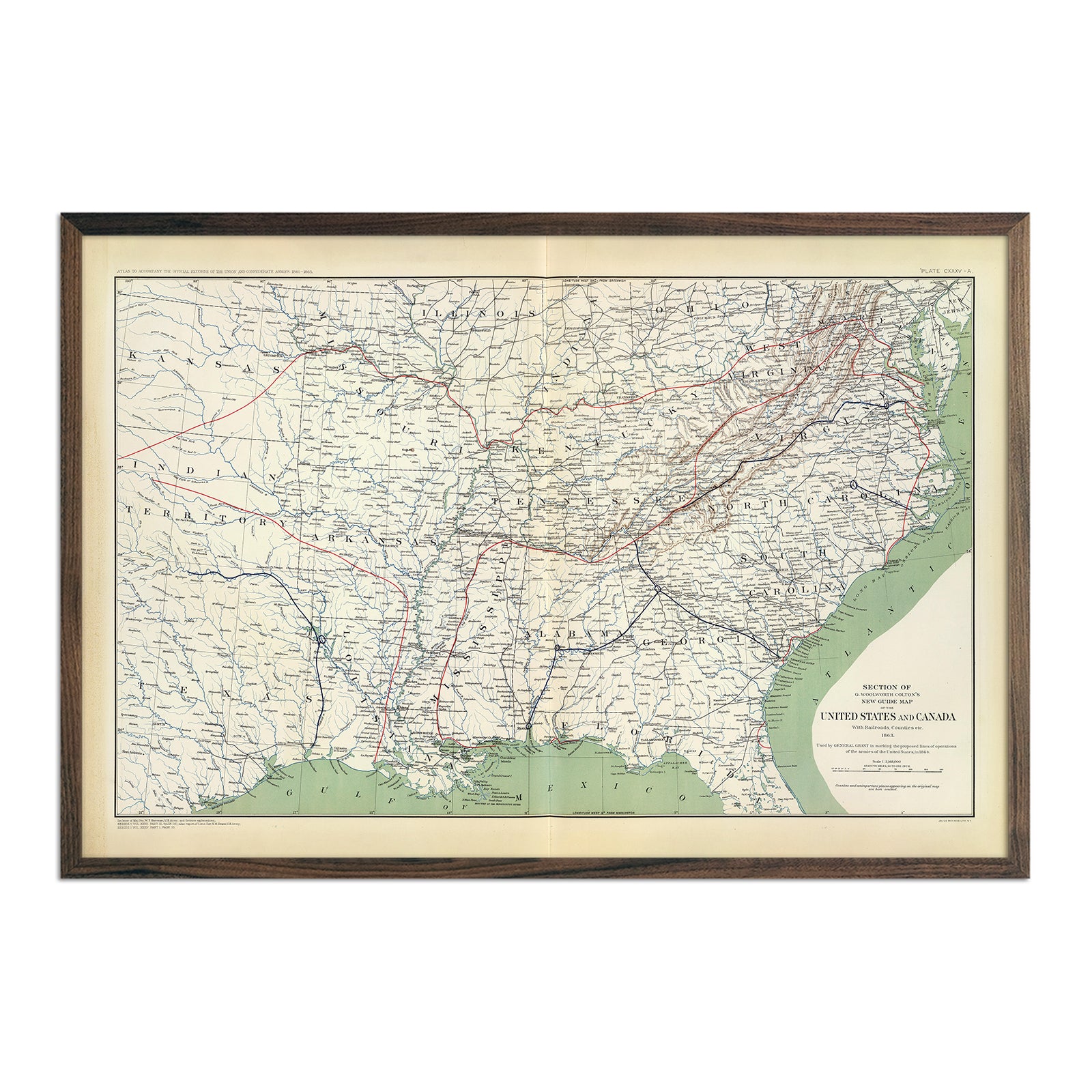
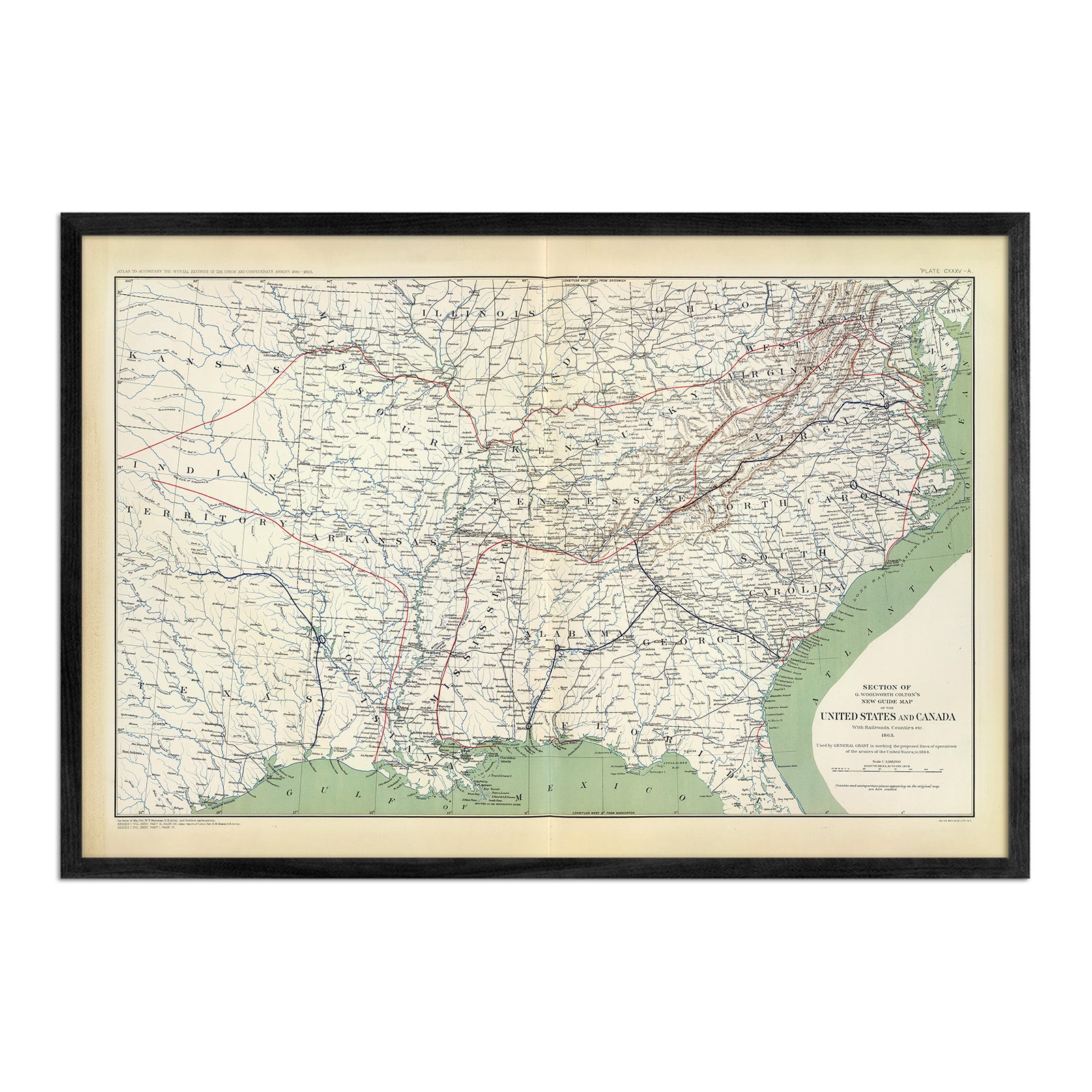
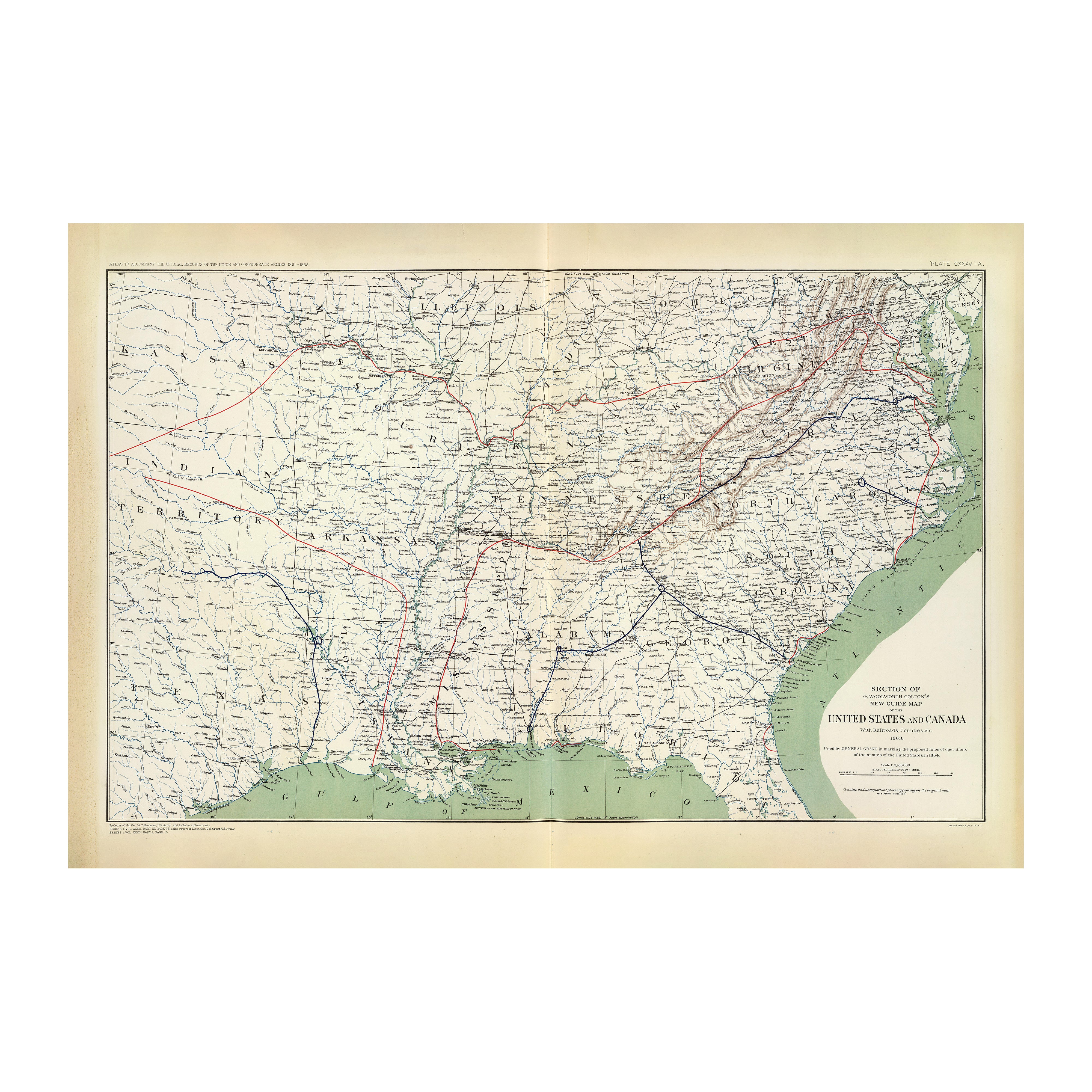
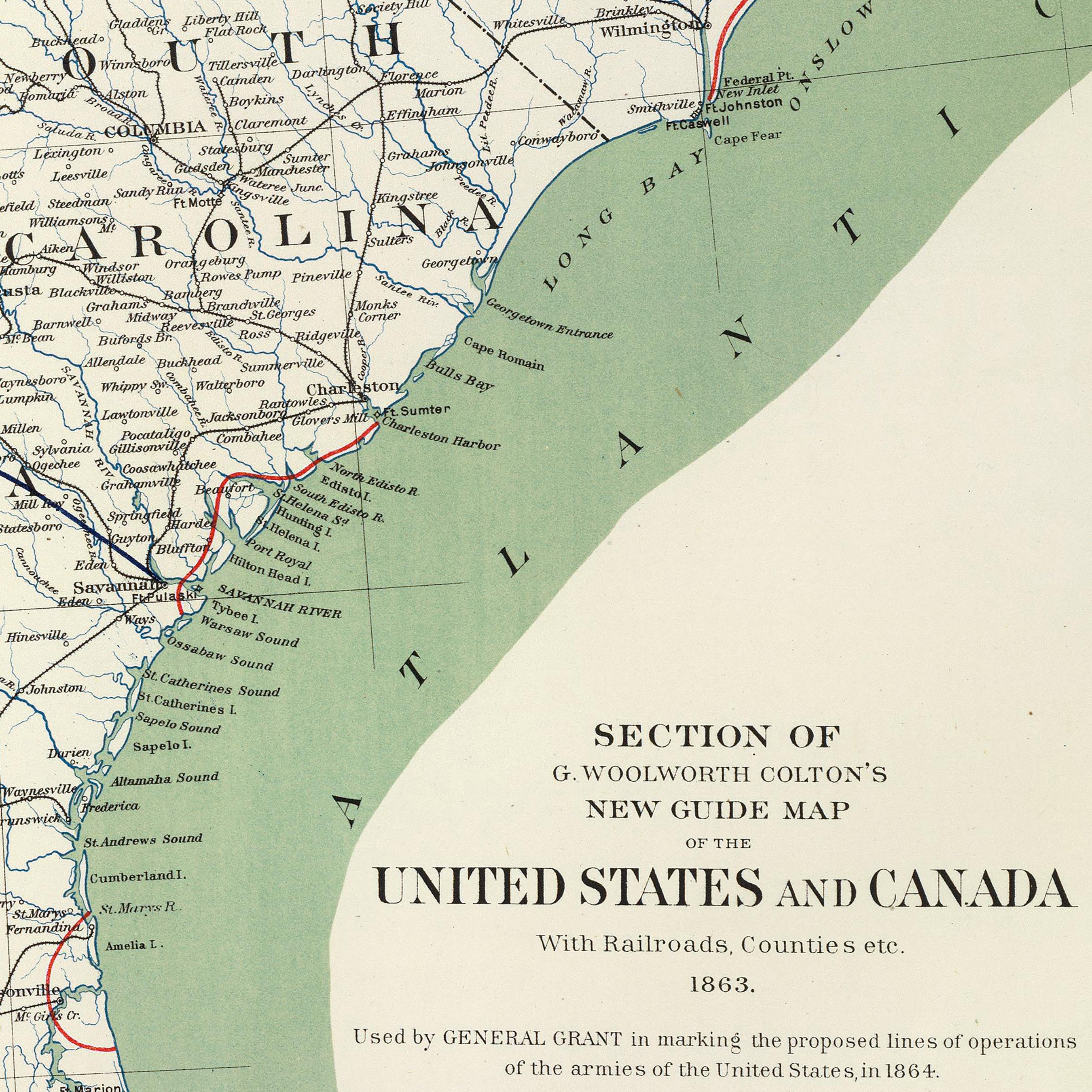
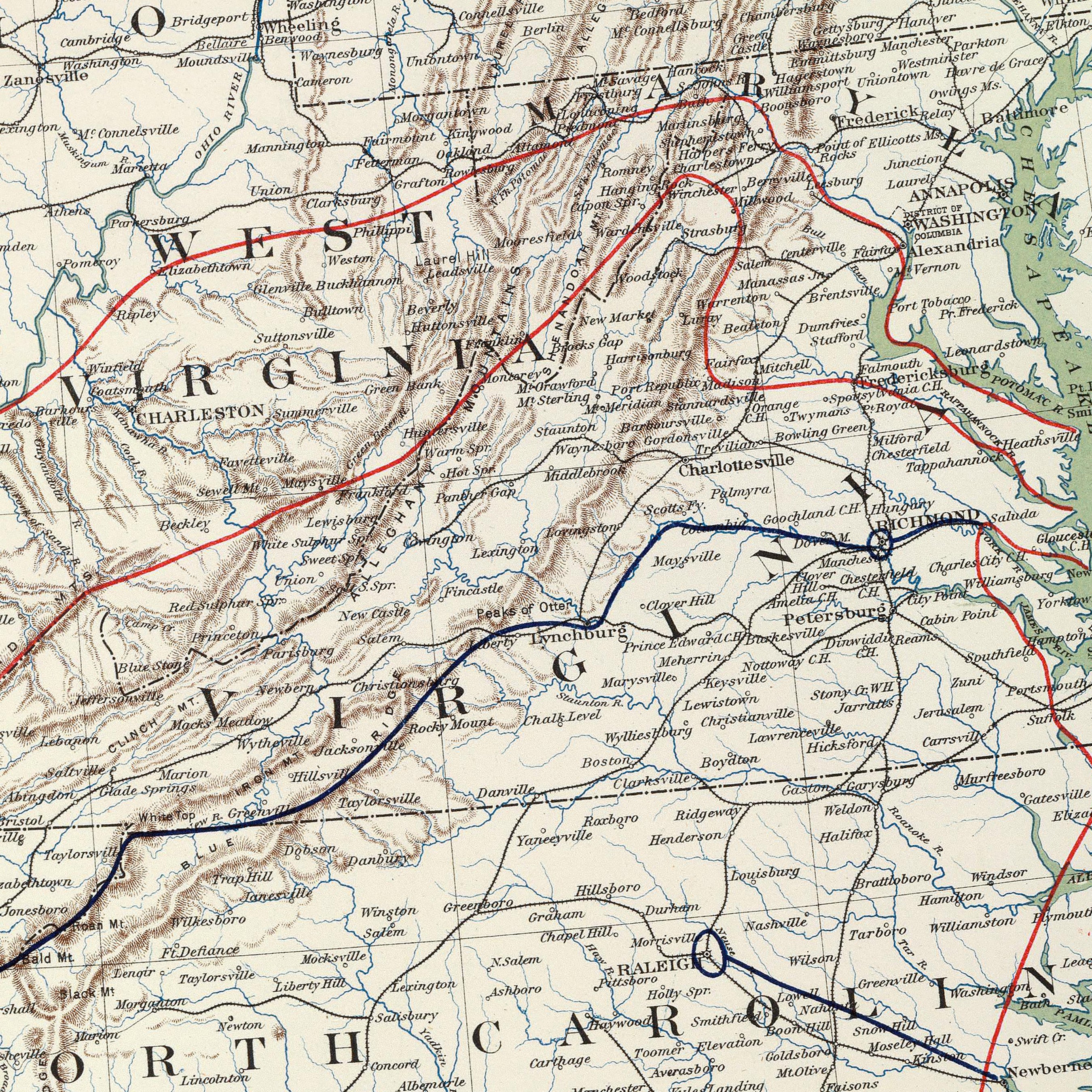
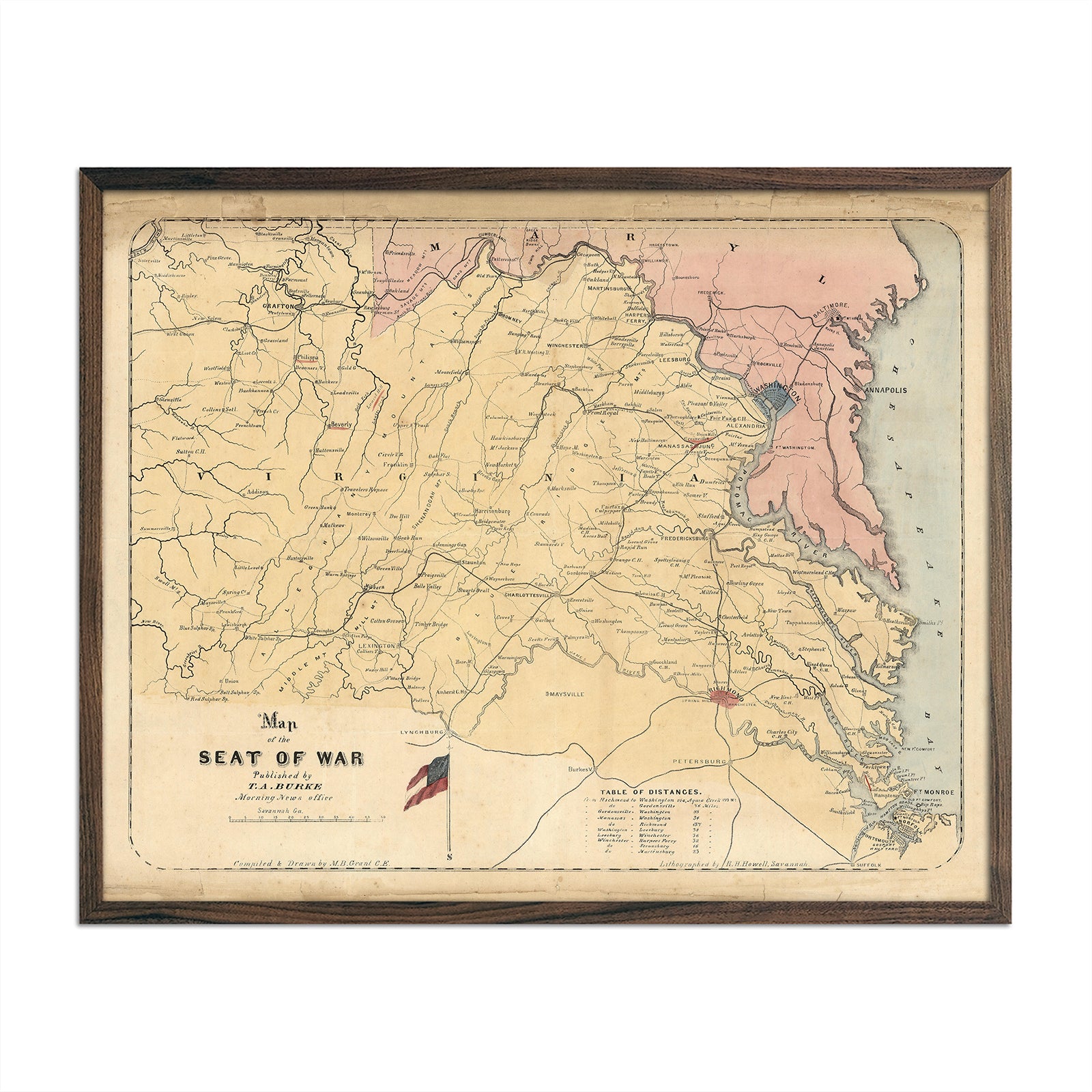
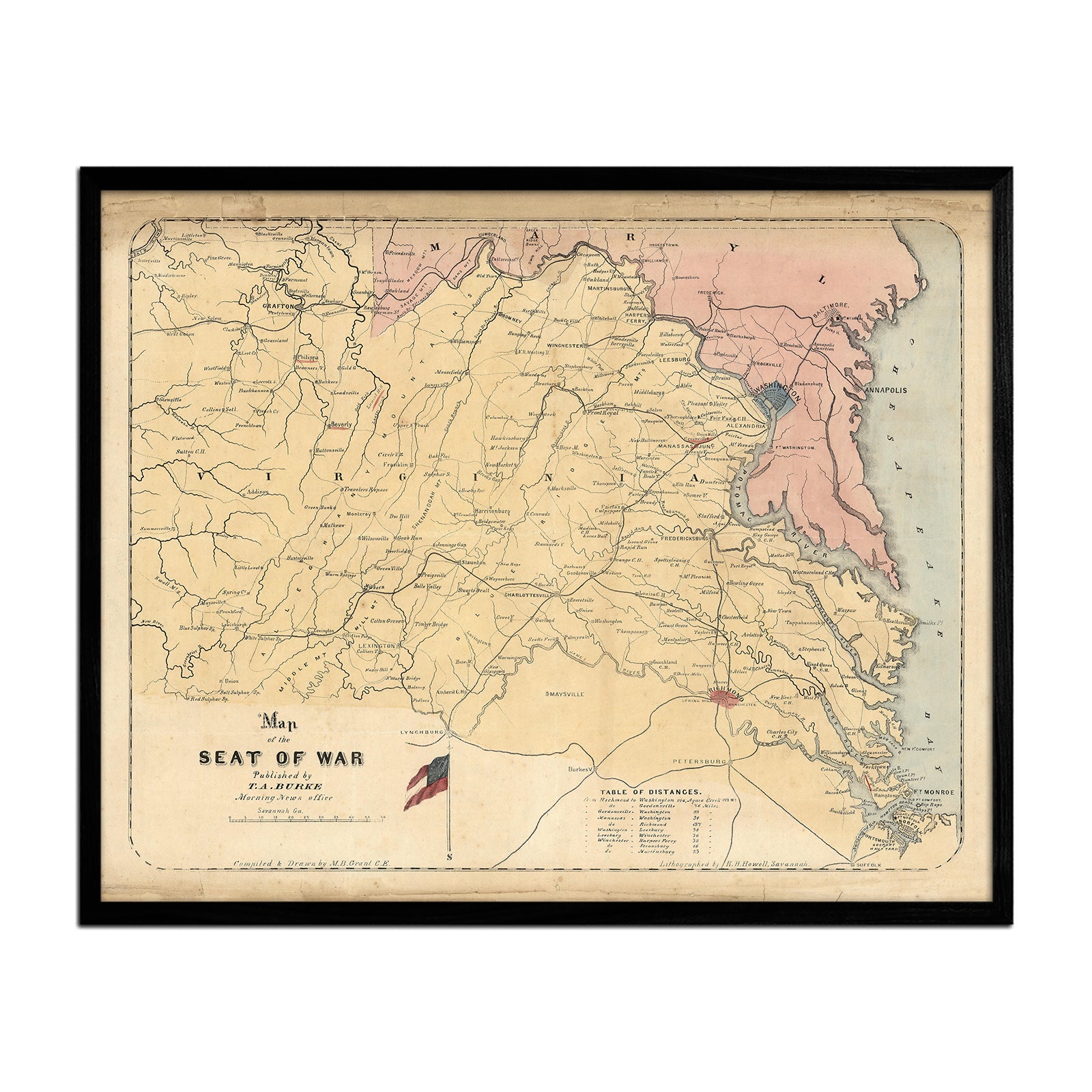
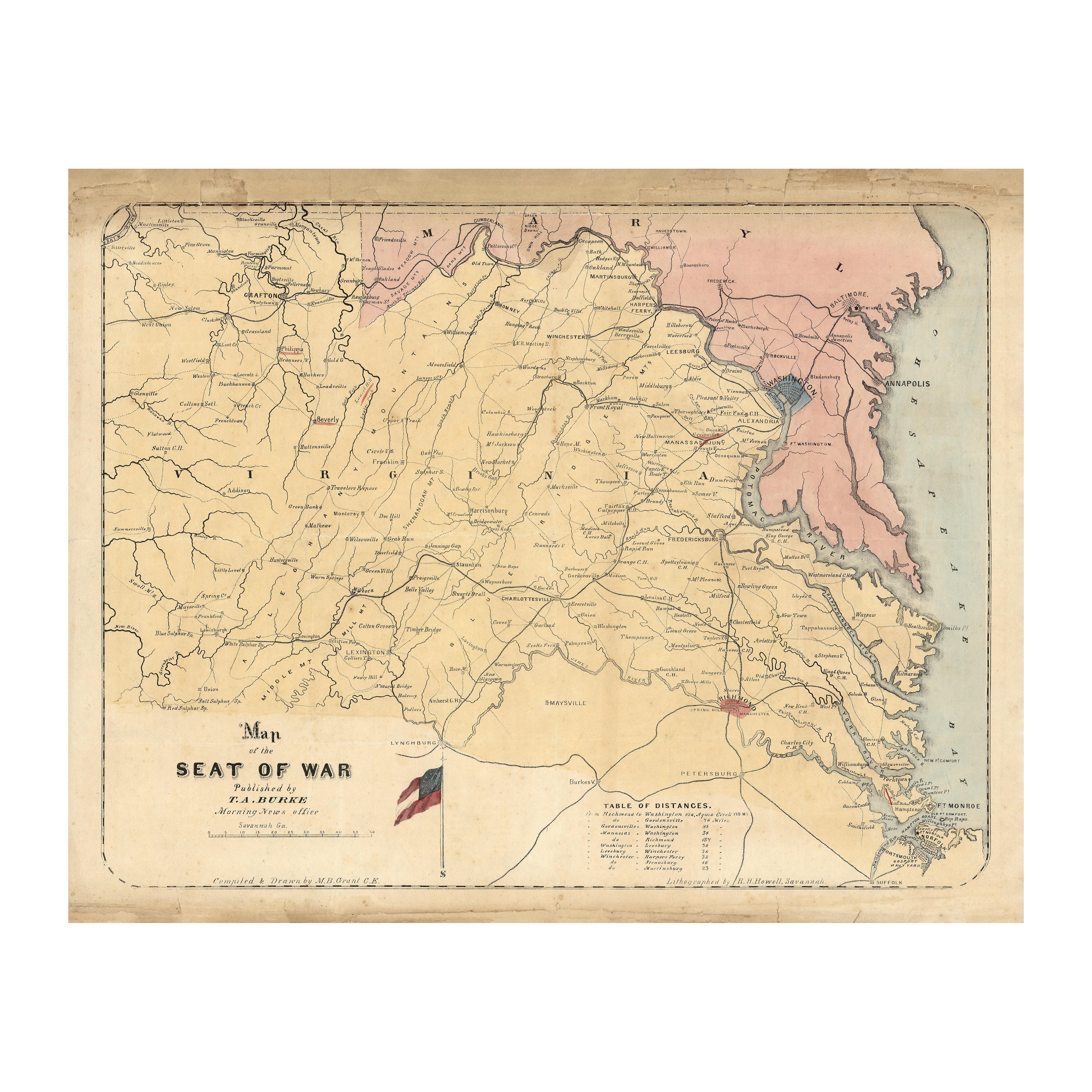
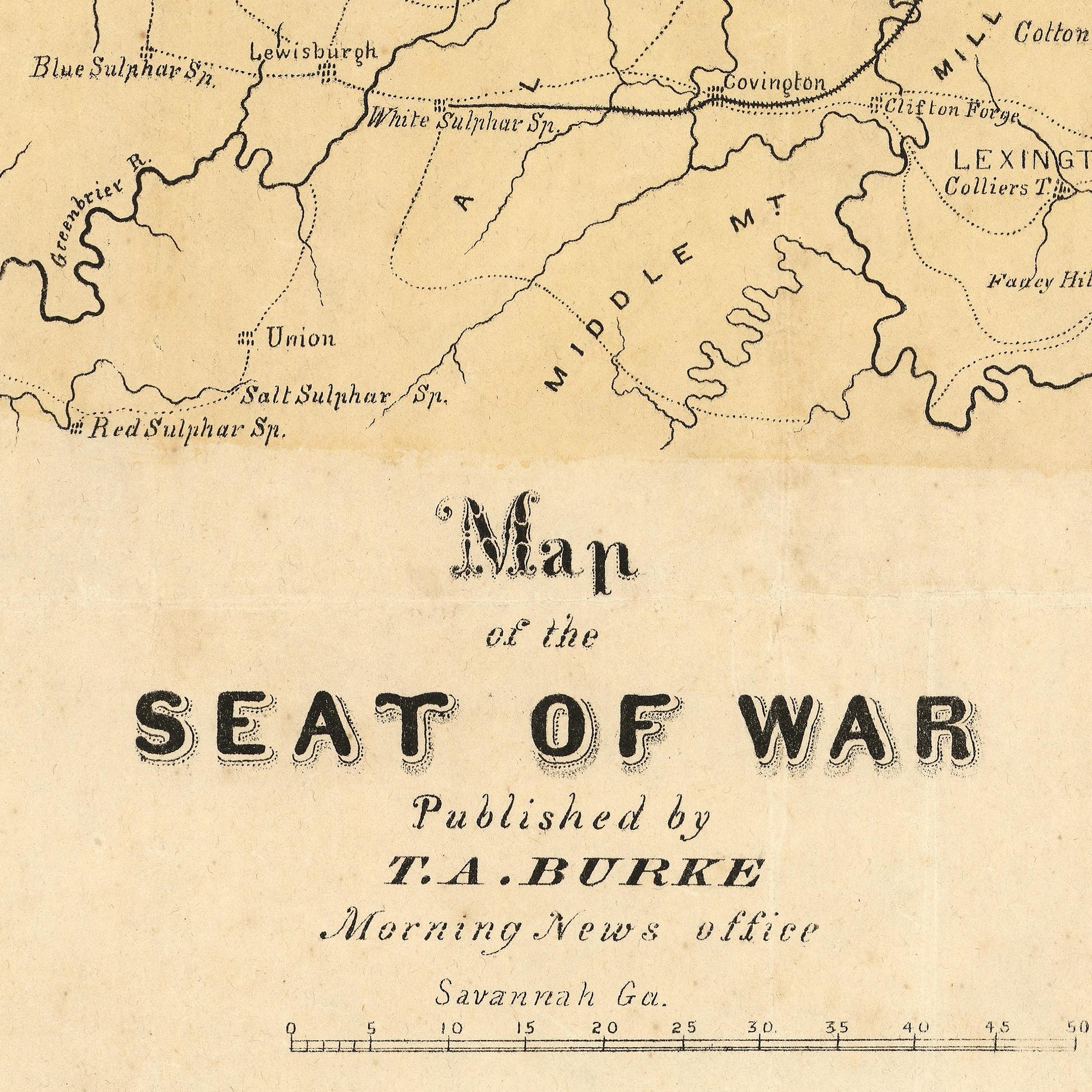
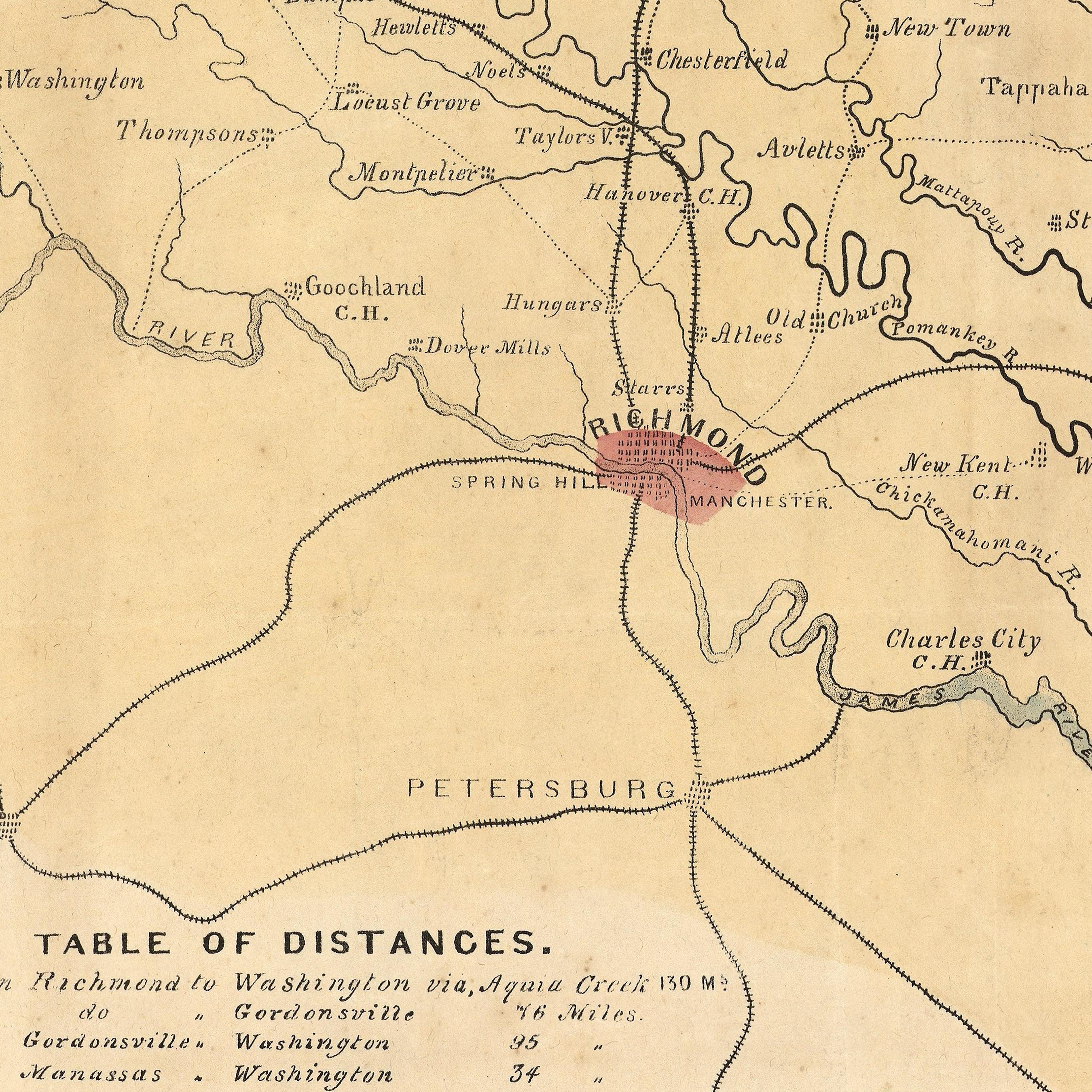
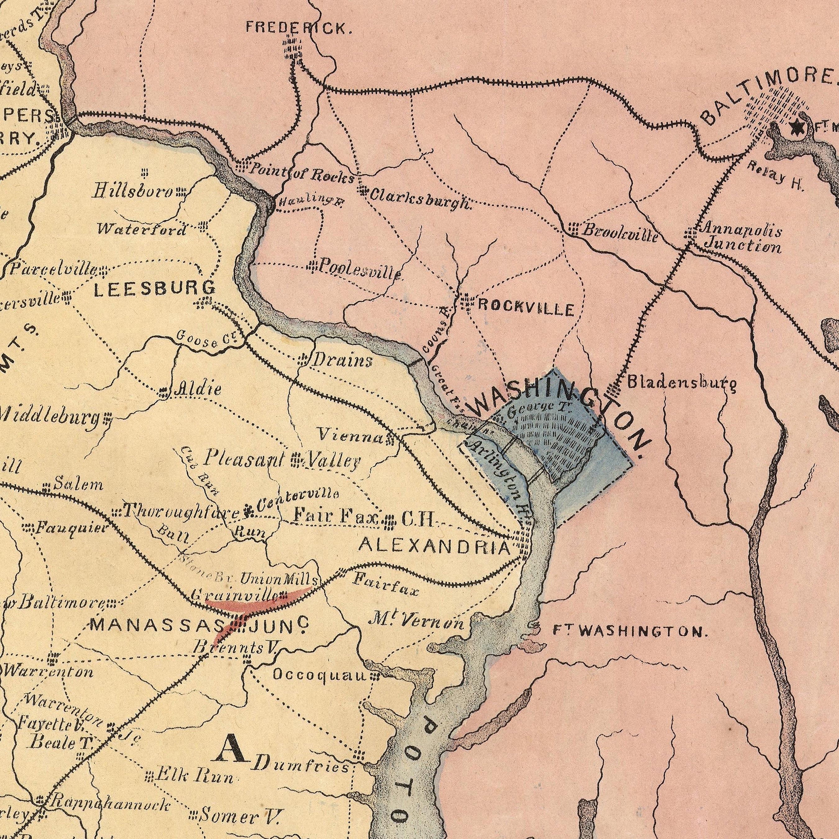
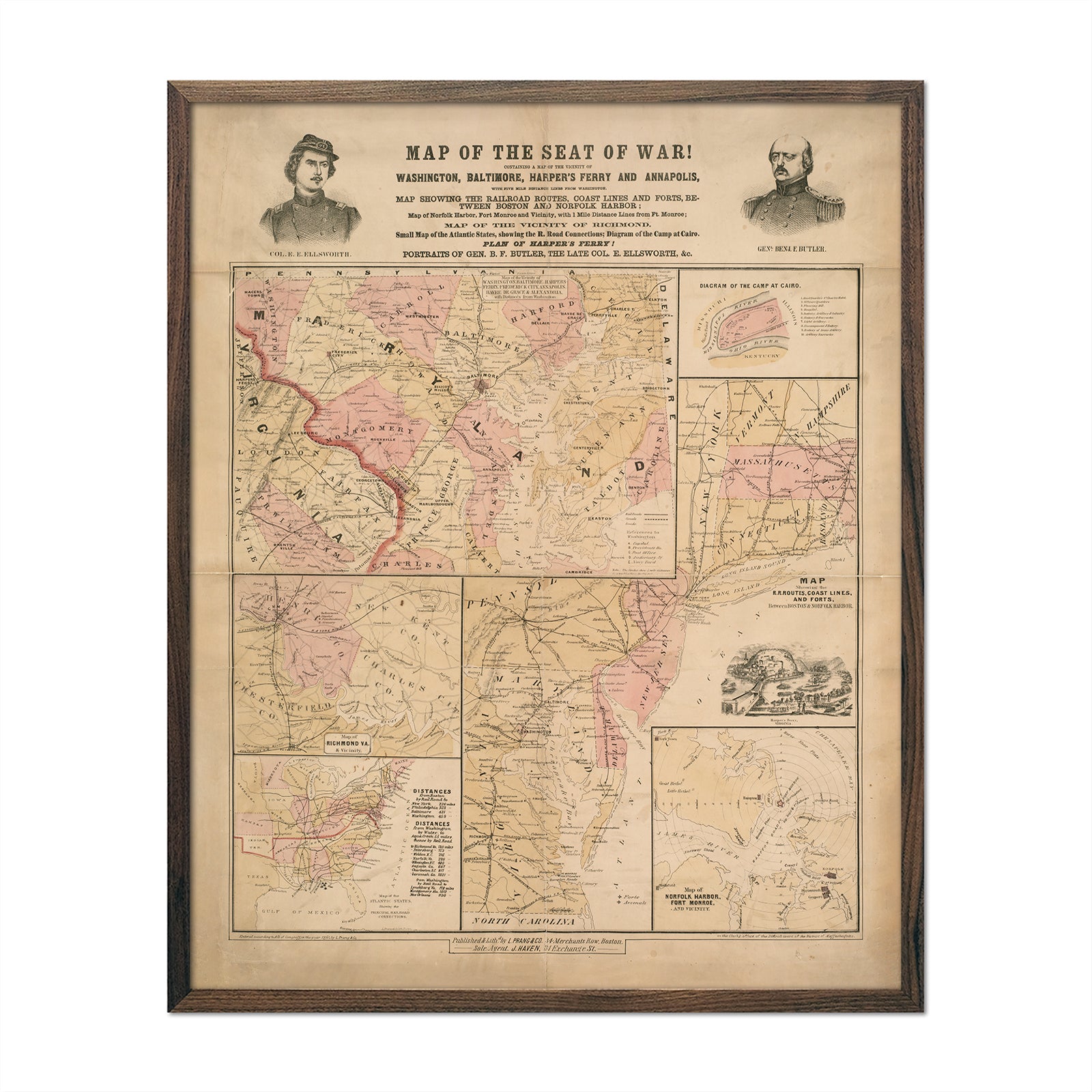
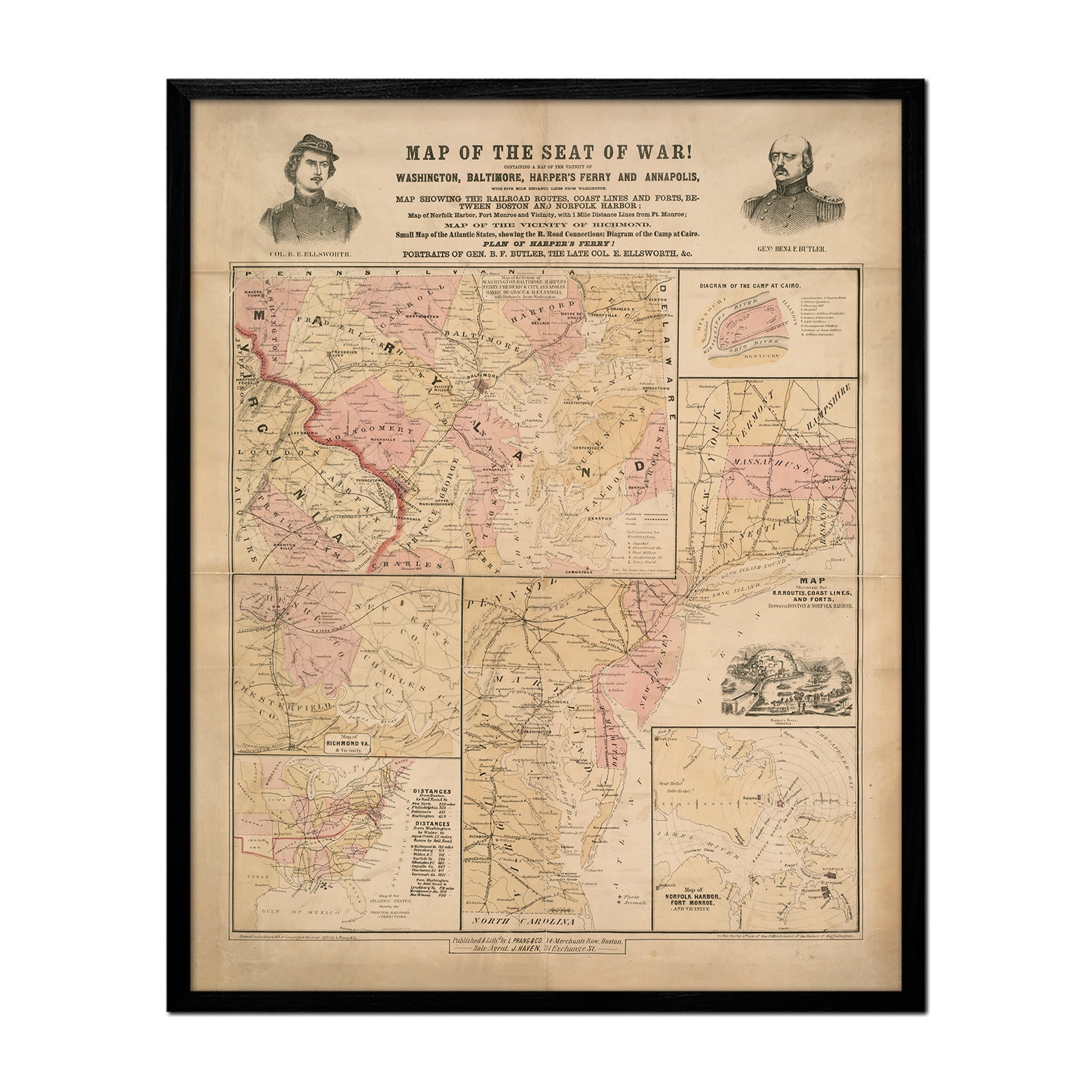
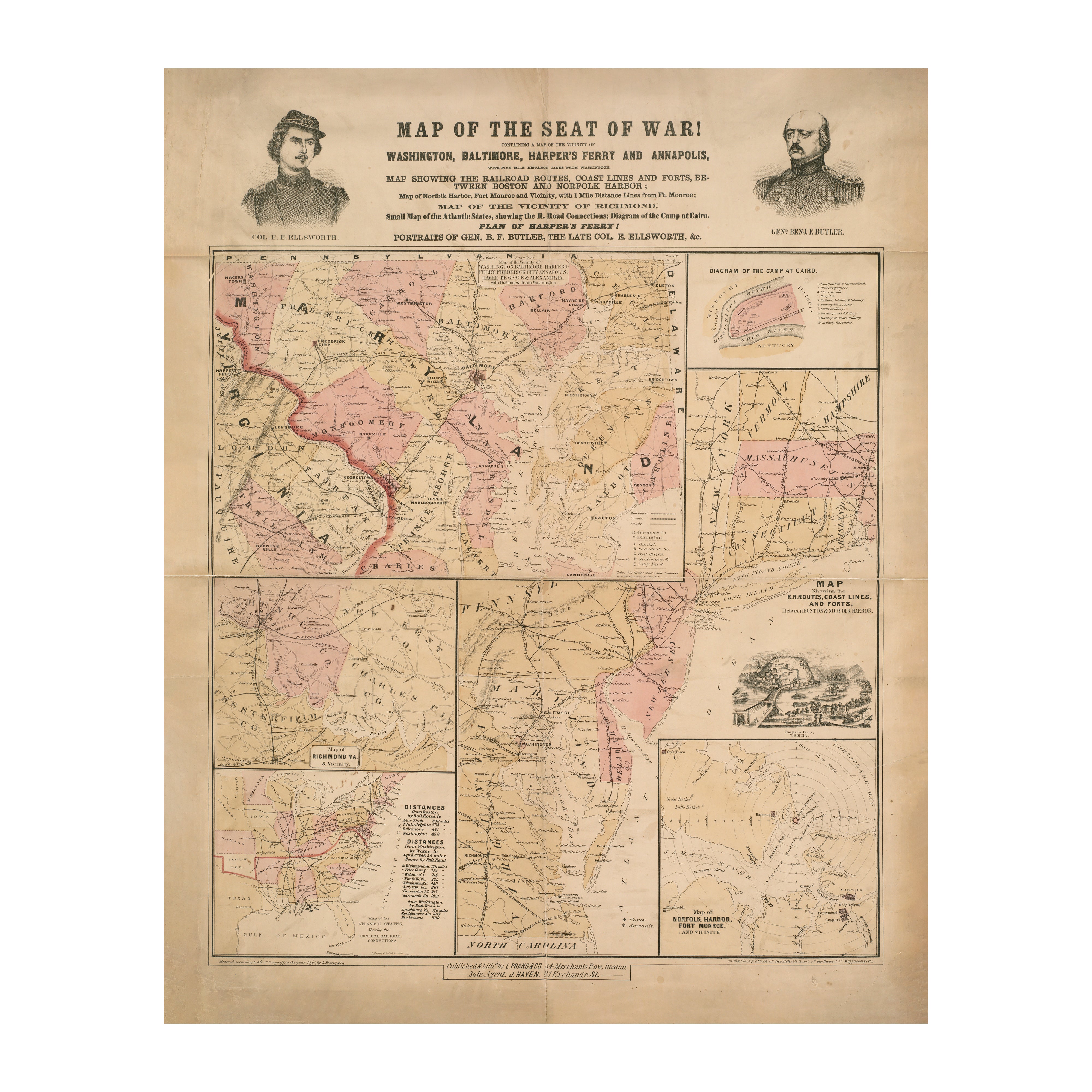
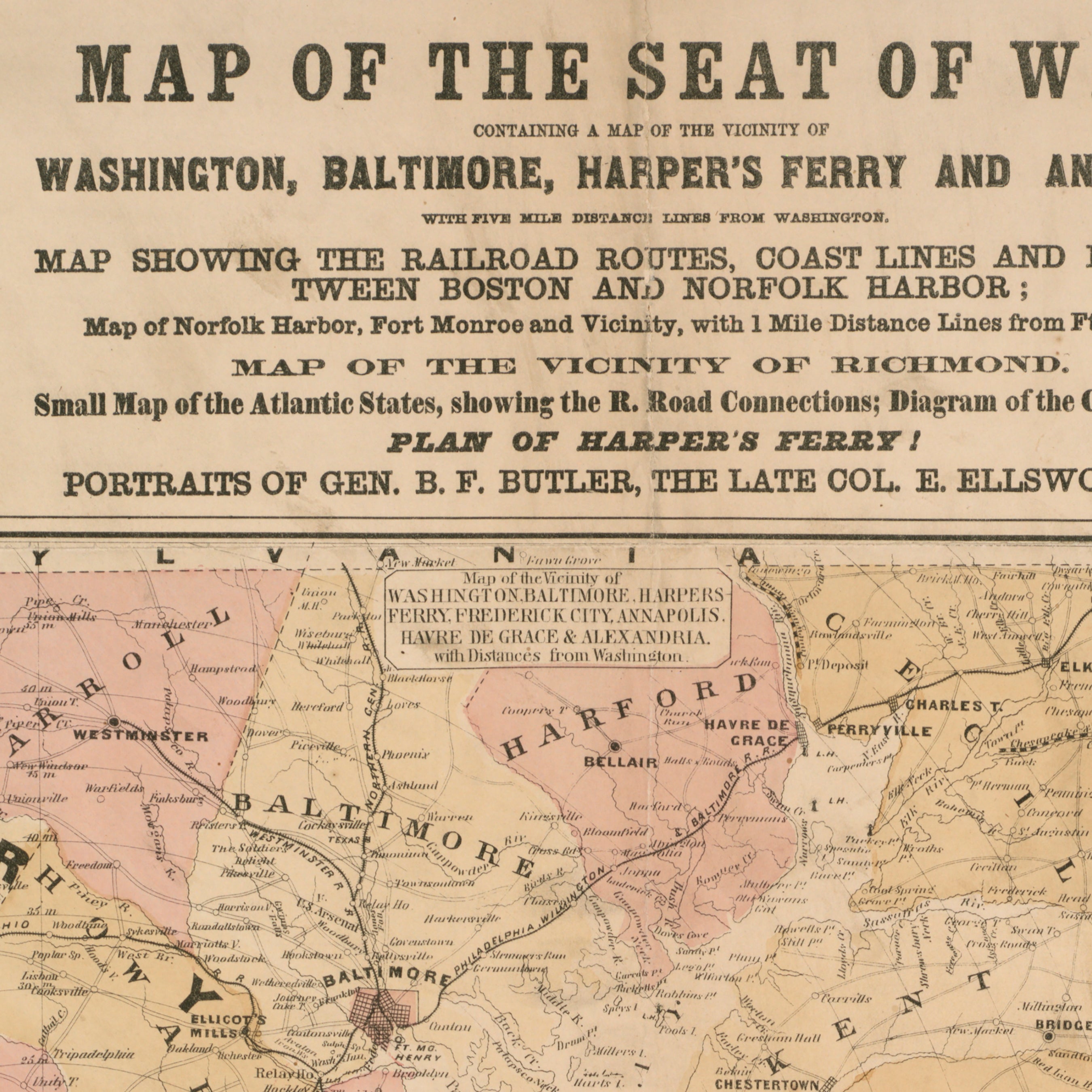
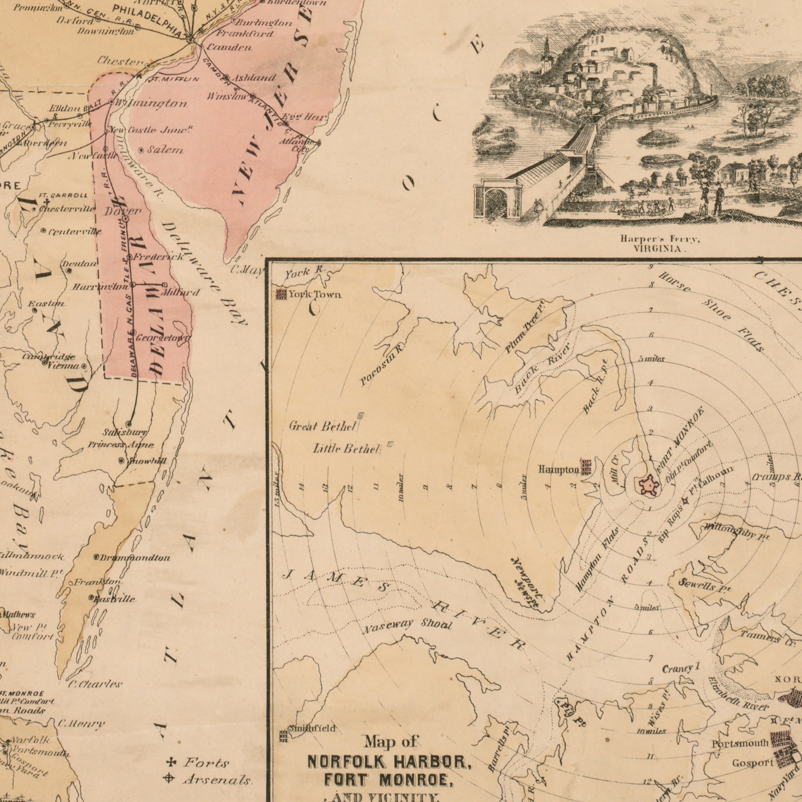
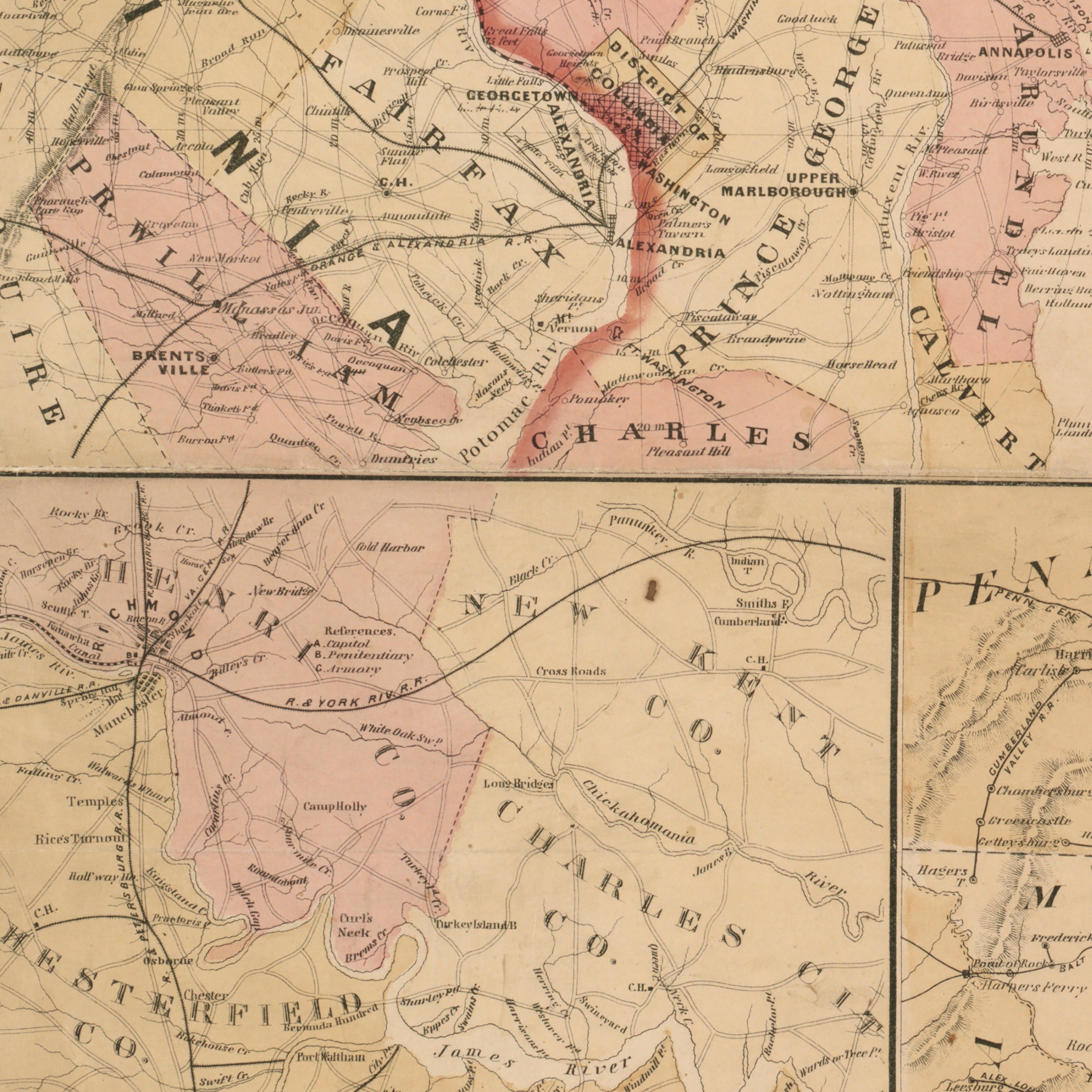
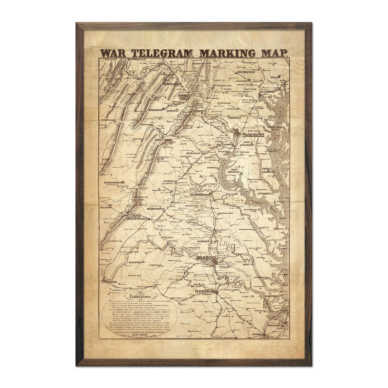
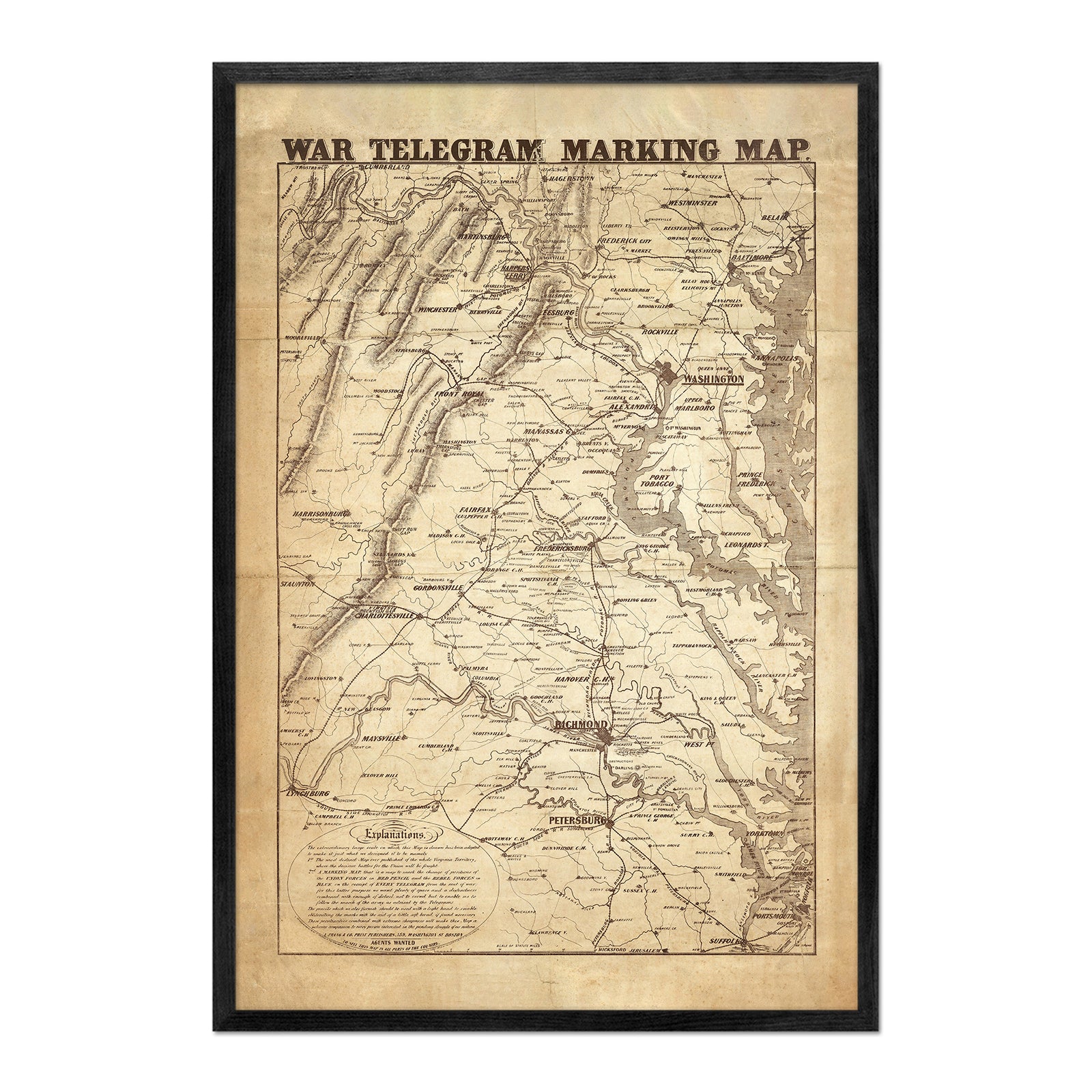
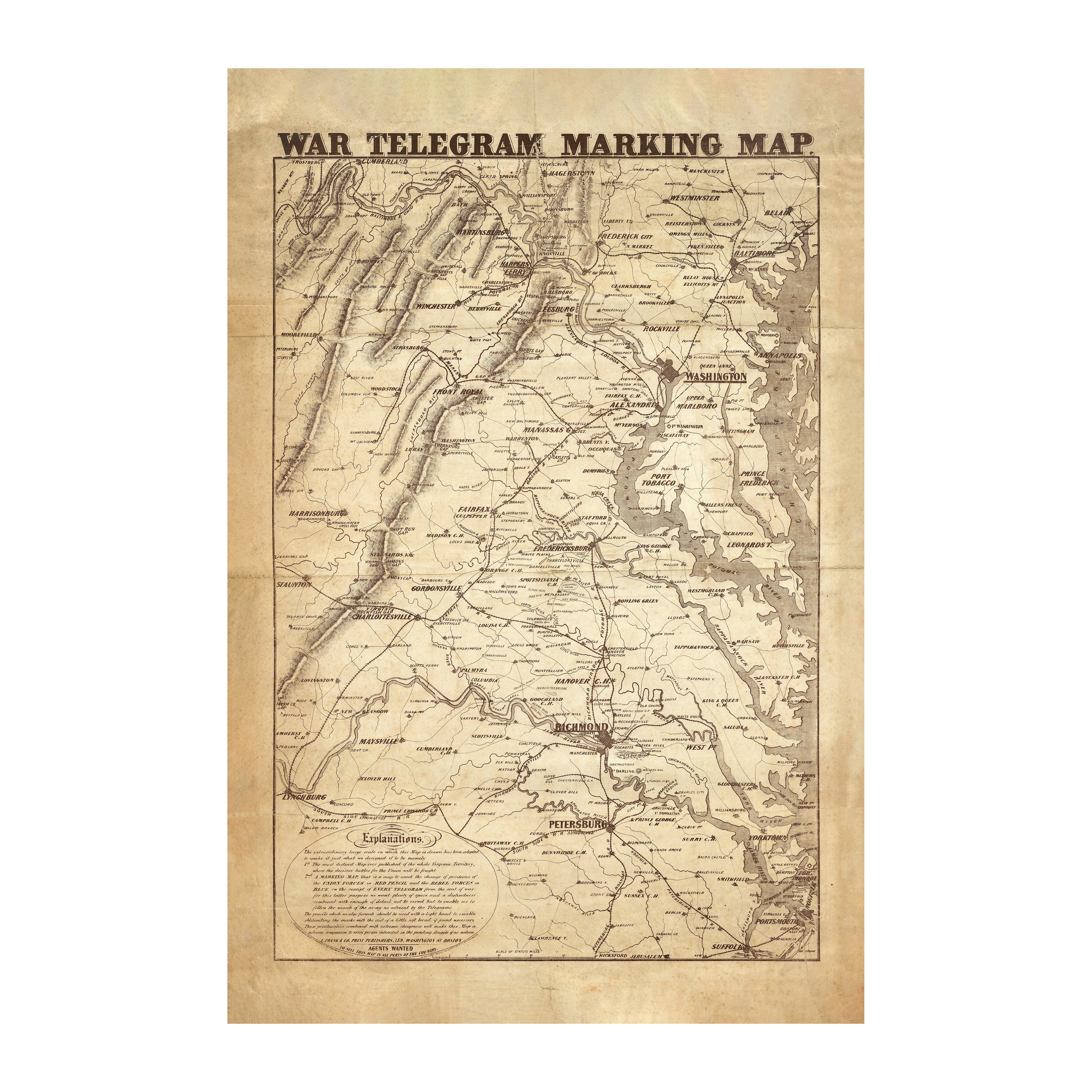
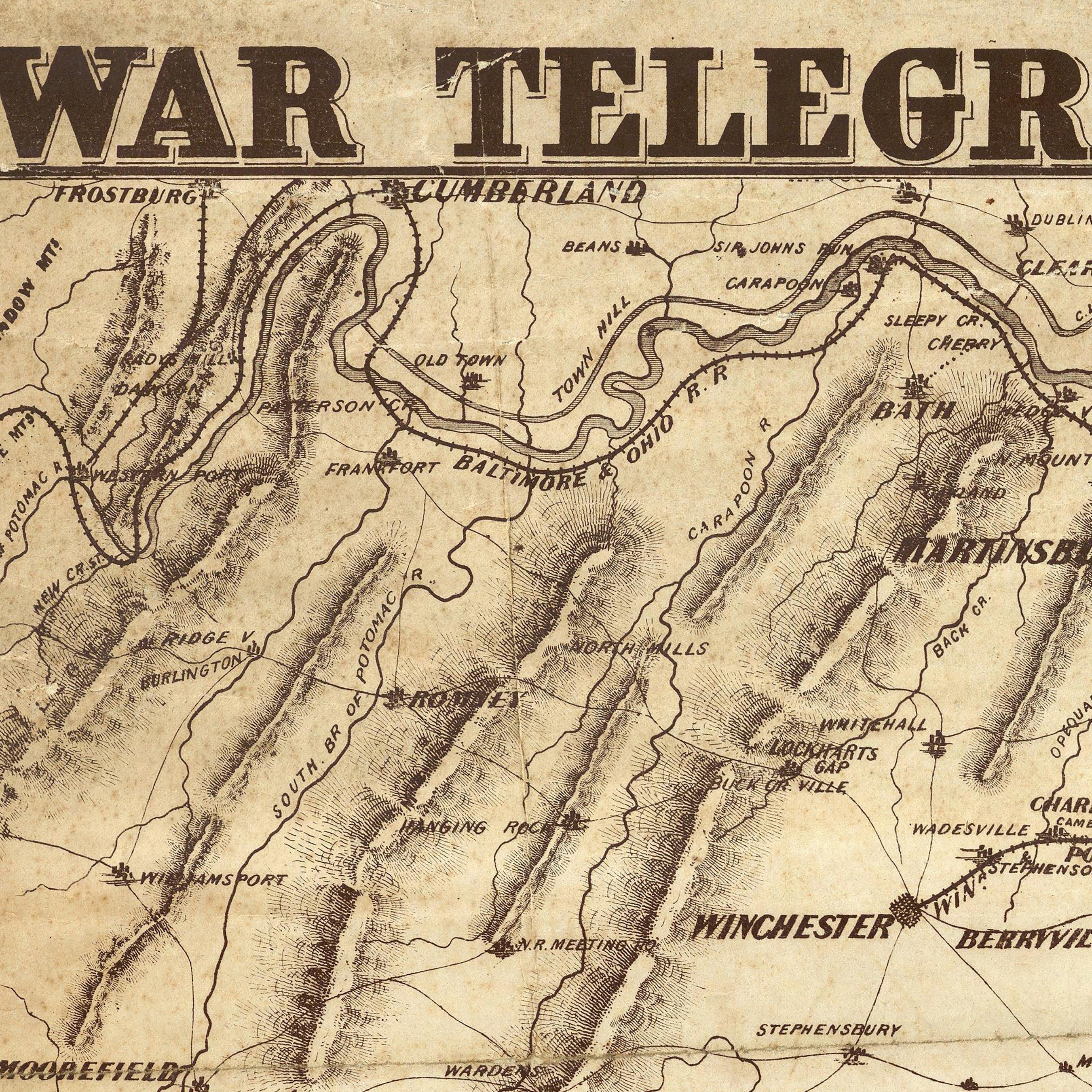
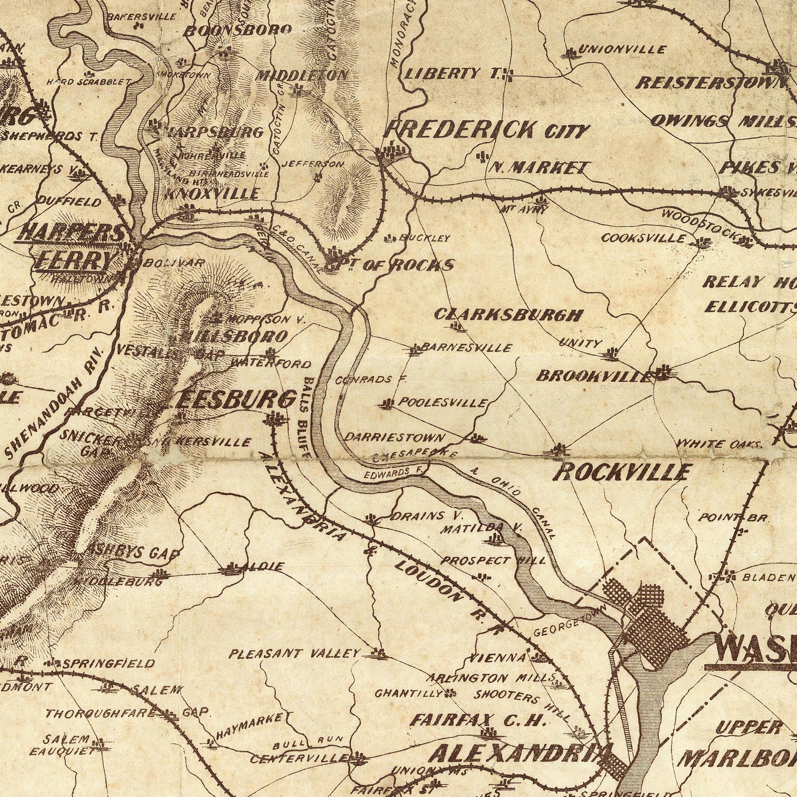
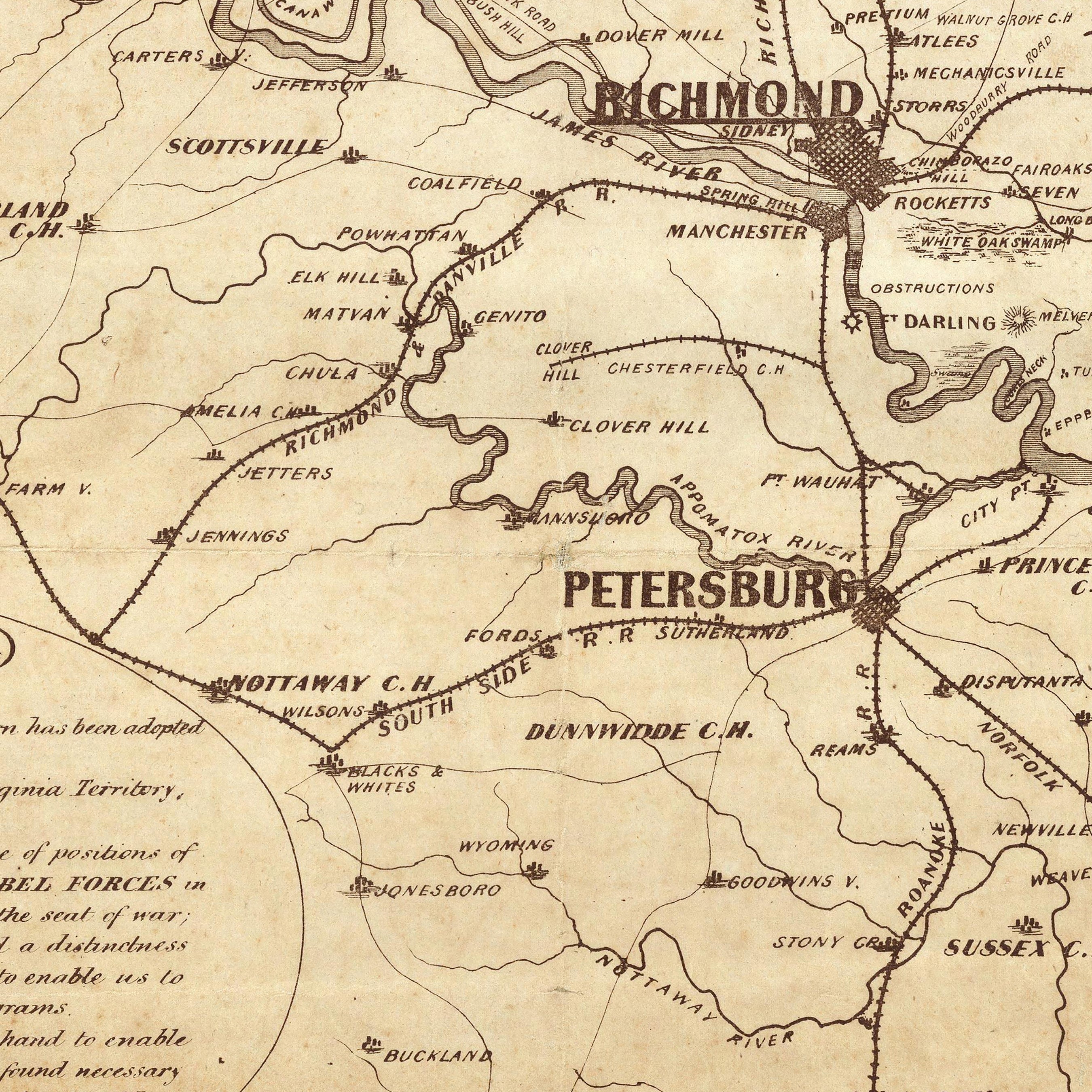
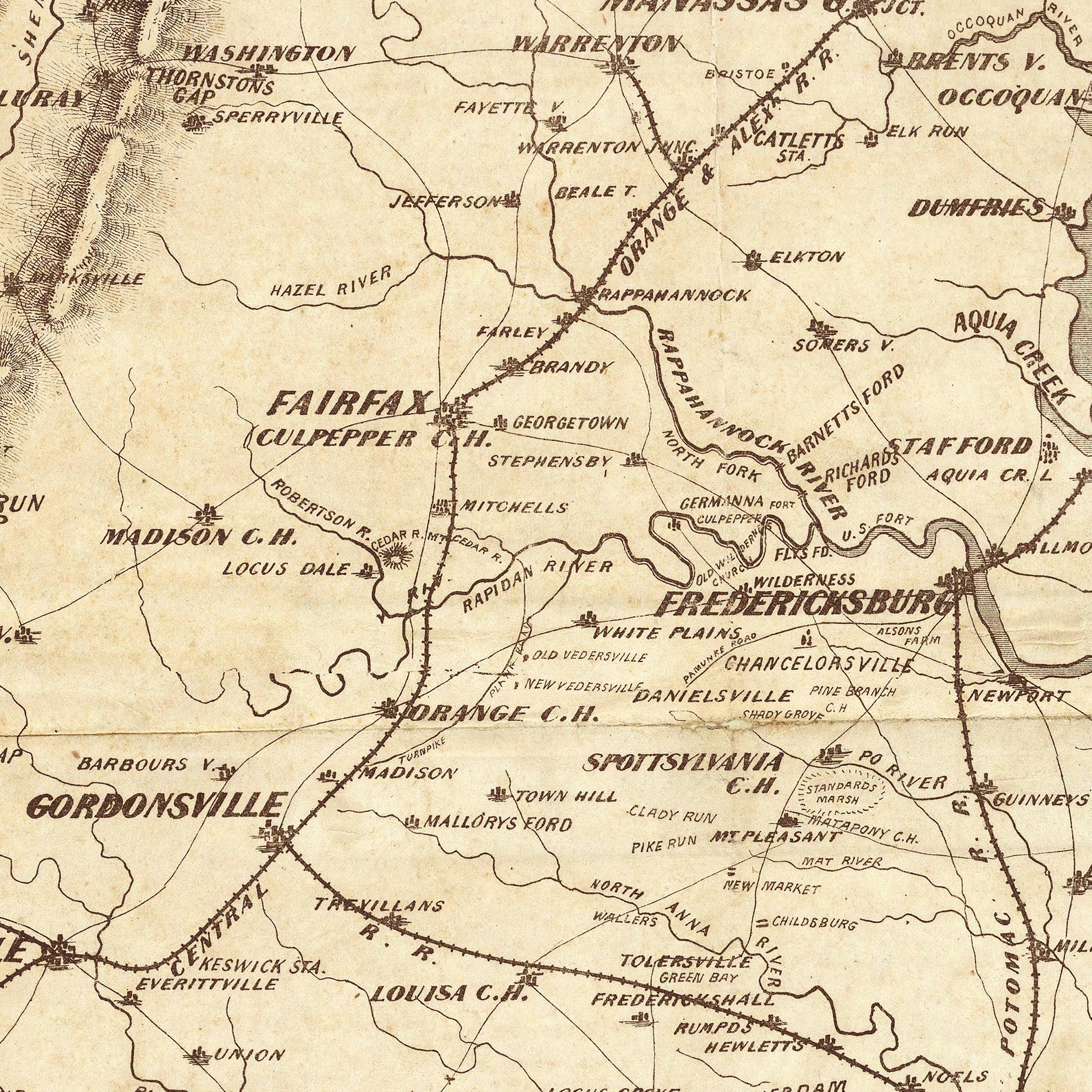
Vintage maps of Maryland - Enjoy the charm of an old map with the quality of a brand new one with our selection of enhanced vintage Maryland maps. Choose from a 1944 map of Baltimore or an 1883 regional map including Maryland, Virginia and Delaware. We hand-restore vintage map imagery to create art prints that stand the test of time.
What are some prominent features on the map of Maryland?
Our elevation and relief maps of Maryland showcase the Appalachian, Blue Ridge and Allegheny mountains, blanketed by Maryland’s forests.
Trace Maryland’s major rivers such as the Potomac River, Patapsco River, Patuxent River, and Susquehanna River on our hydrological maps all the way to the Chesapeake Bay.
On our Maryland relief map, see how elevation meets modern civilization with a mix of mountainous terrain and coastline and clearly marked state counties and cities for a vintage view of the home of the US capital.
No matter which Maryland state map you choose, you’ll enjoy an up-close look at a state known for being the birthplace of the National Anthem, and a state home to a prominent Atlantic trading port, beautiful state parks, and wildlife refuges.
What are the regions in Maryland?
Maryland is divided by the Chesapeake Bay into the Eastern Shore and the Western Shore, and is physiographically divided into three prominent regions:
- Atlantic Coastal Plain - This region extends from the Atlantic Ocean to the Fall Line, where the Piedmont region begins. Comprised of forested wetlands, salt marshes, and upland forests, the Atlantic Coastal Plain marks the first English settlement in North America, with a current population of nearly 11 million. This puts this region’s natural resources under strain and the landscape has been markedly changed over the centuries due to its colonial settlement.
- Piedmont - The Piedmont region stretches across central Maryland and is home to several types of minerals including limestone, gold, and volcanic rock, among others. 45% of its rolling landscape is covered by forests, with an equal portion used for agriculture, and the remaining percentage is urban, including Washington D.C.
- Mid-Atlantic Ridge and Valley - Primarily consisting of long mountainous areas with interspersed valleys, this region is home to portions of the Allegheny Mountains, the Appalachian Mountains, and the Blue Ridge Mountains. Heavily forested, this region also contains Maryland’s highest point, Backbone Mountain, rising to 3,360 feet above sea level.
If you like our collection of Maryland maps, you may also be interested in maps of other Northeast states. Click below to browse:


