


Delaware Maps
Delaware Map Prints, Elevation & Shaded Relief Maps
Our custom printed Delaware wall maps will bring the spirit of America’s first state to your home or office. From our eye-catching elevation maps and geological relief maps to our meticulously restored historical maps, every map of Delaware we offer reflects the high quality and attention to detail our customers have come to love and expect from Muir Way.
What makes Muir Way maps of Delaware unique?
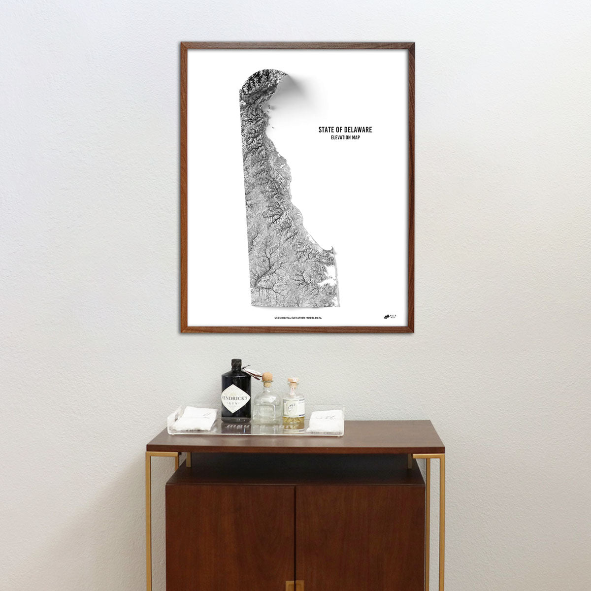
When you purchase a Delaware wall map from Muir Way, you get a custom-printed archival print designed to last for generations. Far from a rolled up poster, our maps are certified to last 100 years, and our map artwork is designed to bring new light to the beautiful terrain it features. Our elevation maps incorporate hand-shaded relief and Digital Elevation Data with historical imagery, creating a beautiful 3D effect on a flat surface, and our hydrological maps depict every river and stream in crisp detail. The meticulous craftsmanship and design we bring to our maps creates heirloom quality artwork we’re proud of.
Does my Delaware map come framed?
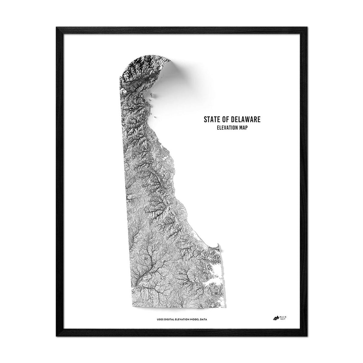
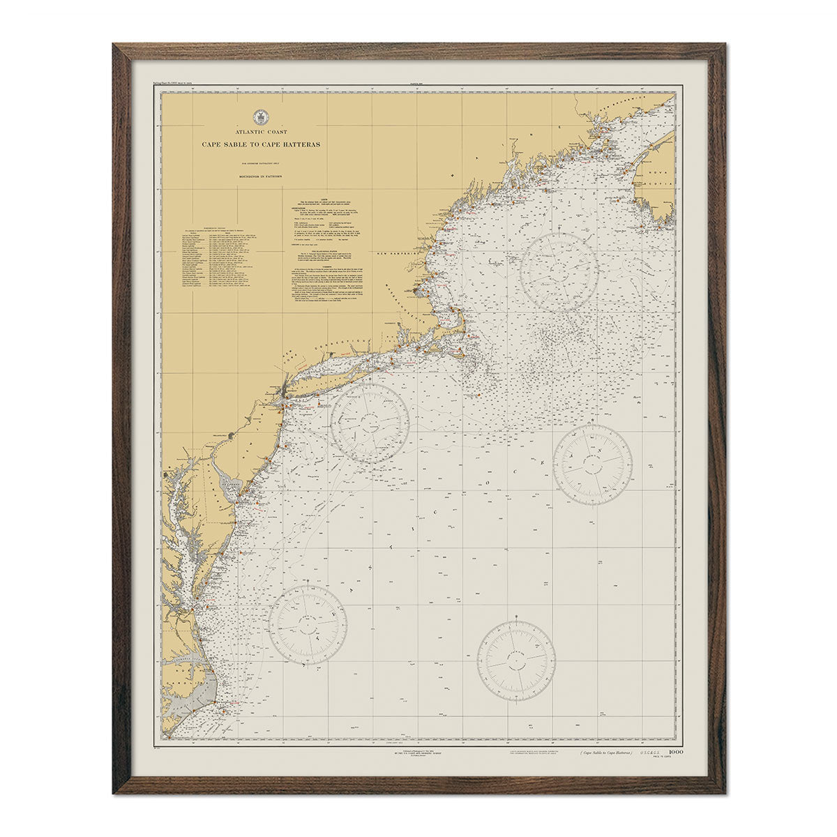
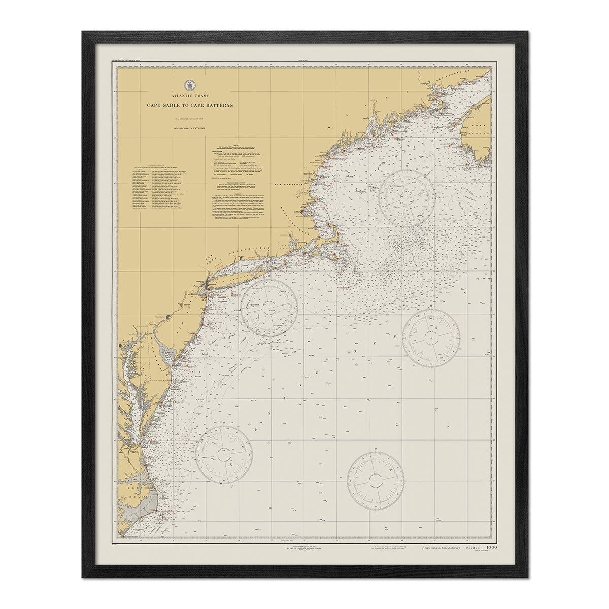
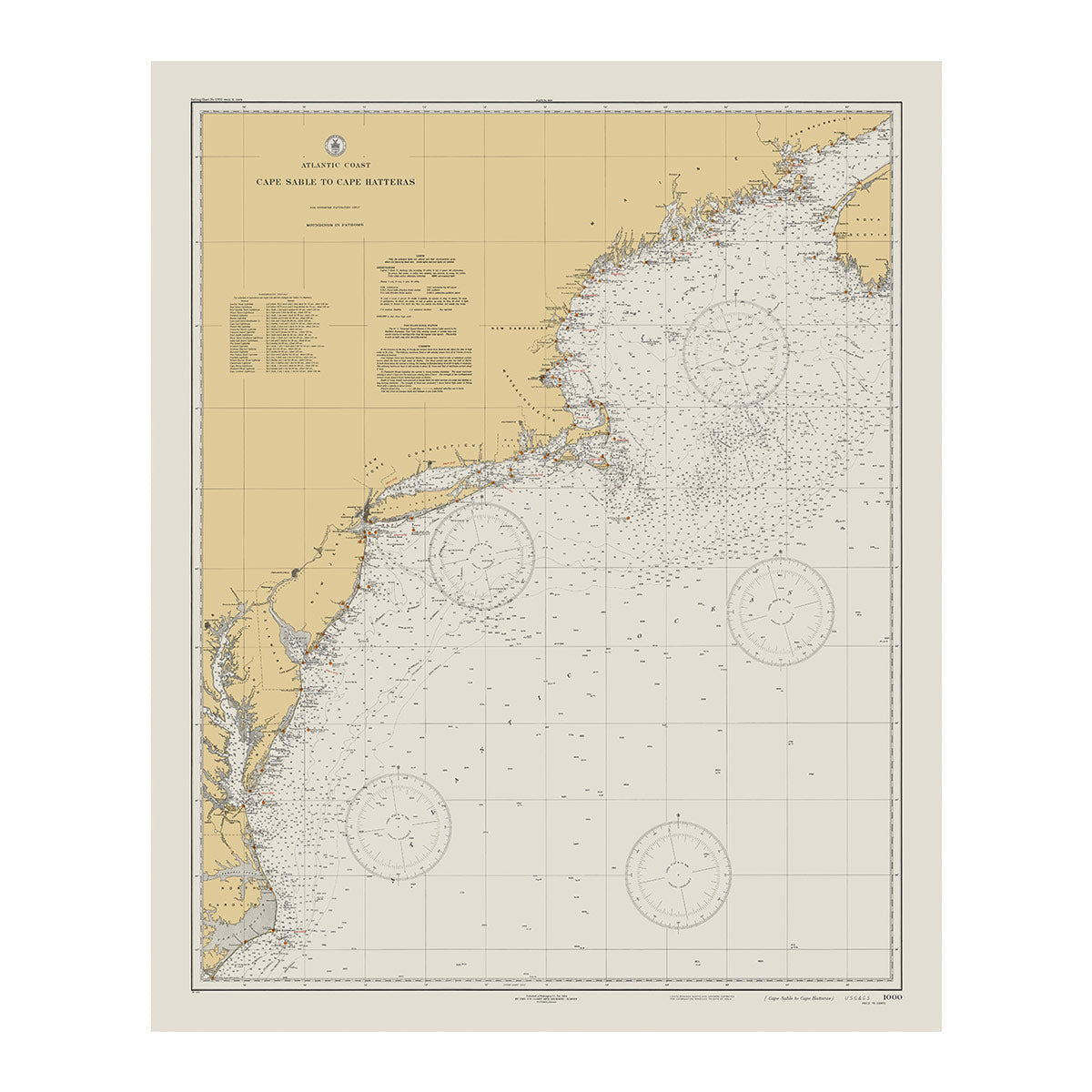
It can! Our Delaware maps are available professionally custom-framed with real wood, or unframed if you prefer to use your own. If you’d like to purchase a framed Delaware wall map, you can choose from several different wood colors and finishes. If you’d prefer to use your own frame, all of our maps come in standard sizes for easy gift giving.
Does a Muir Way map of Delaware make a good gift?
Yes! Our custom-printed maps of Delaware make the perfect gift for anniversaries, weddings, college graduations, placed under the tree as Christmas presents, or presented as a thank-you gift for someone special. Our maps also make beautiful corporate gifts that will remind your clients or colleagues of you every time they see it.
Where should I display my Delaware map?
Our maps are designed to catch your eye from afar or up close. Hang a framed wall map as a central focus, or purchase several maps in a similar style or from a particular region and arrange them near each other for a complementary series. No matter which you choose, you’re sure to find a map that will look right at home.
What are the different types of maps of Delaware available on Muir Way?
Our Delaware maps are available in several different styles, including:
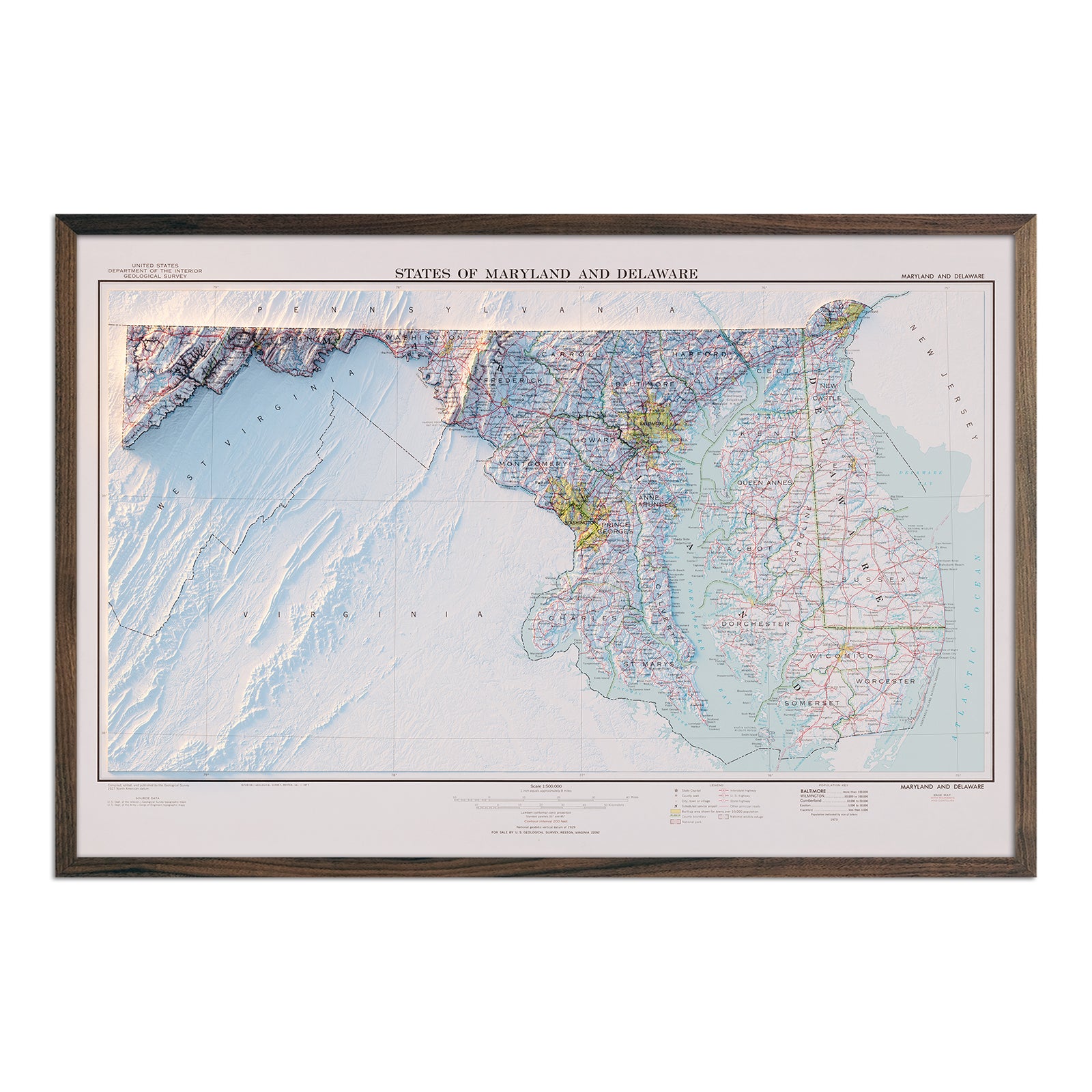
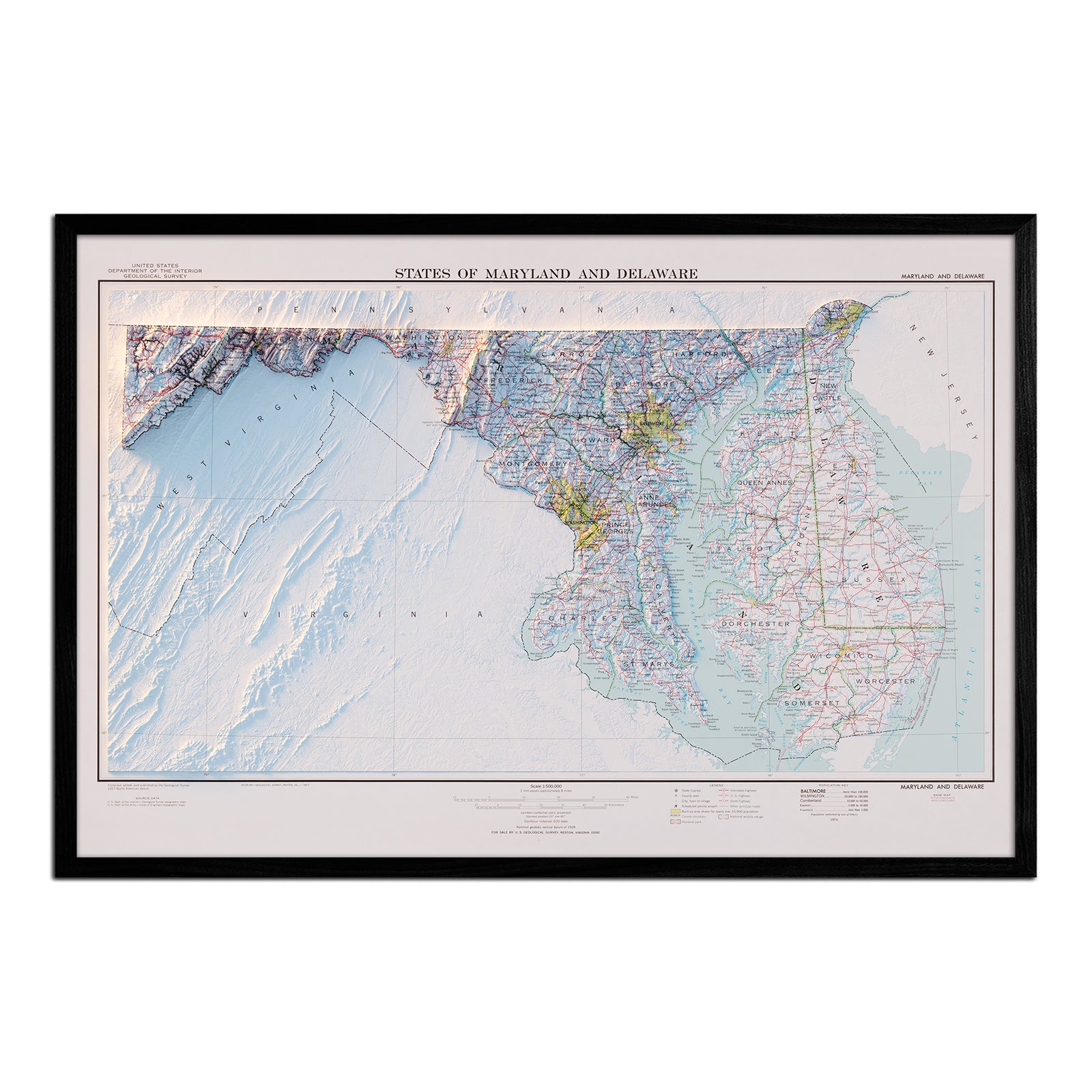
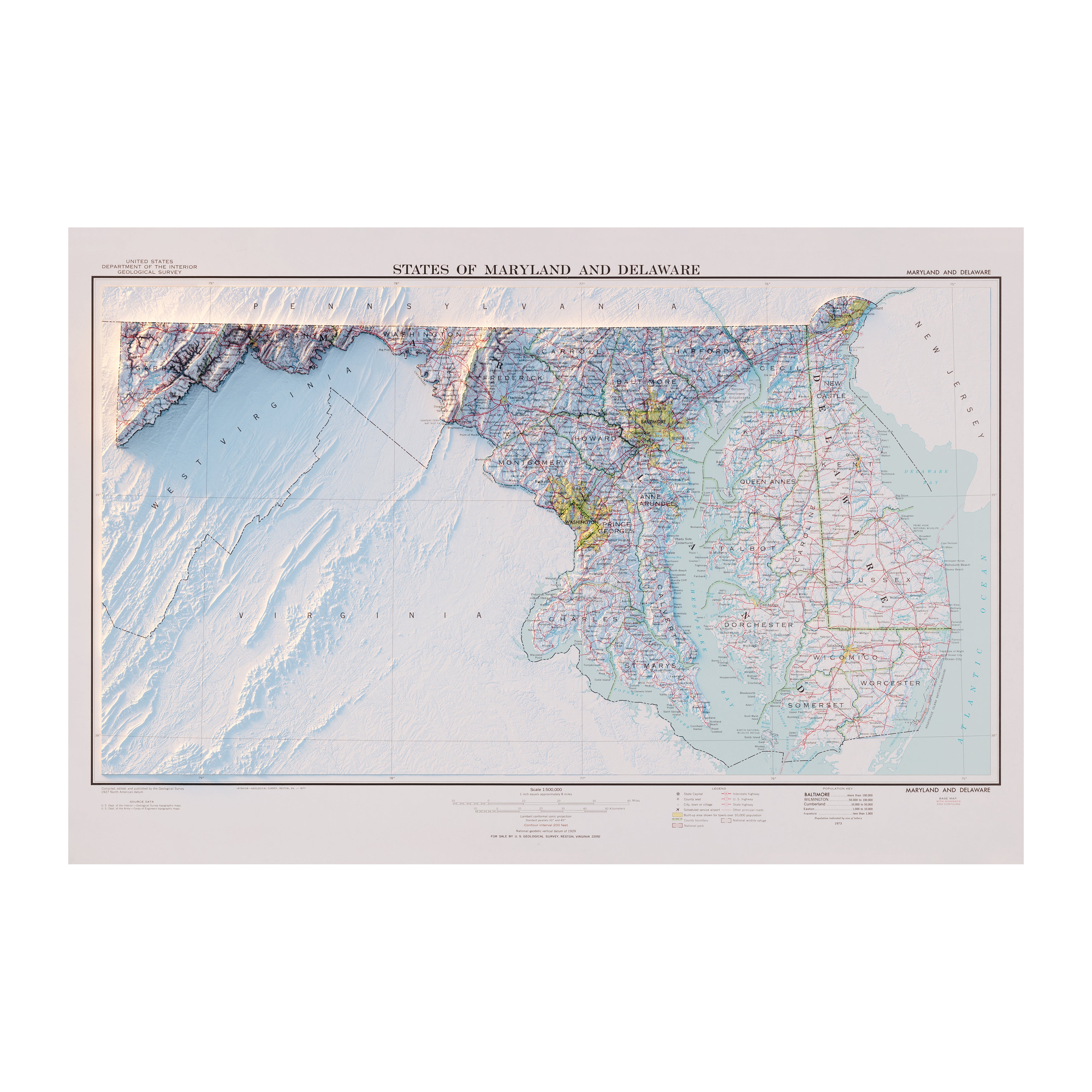
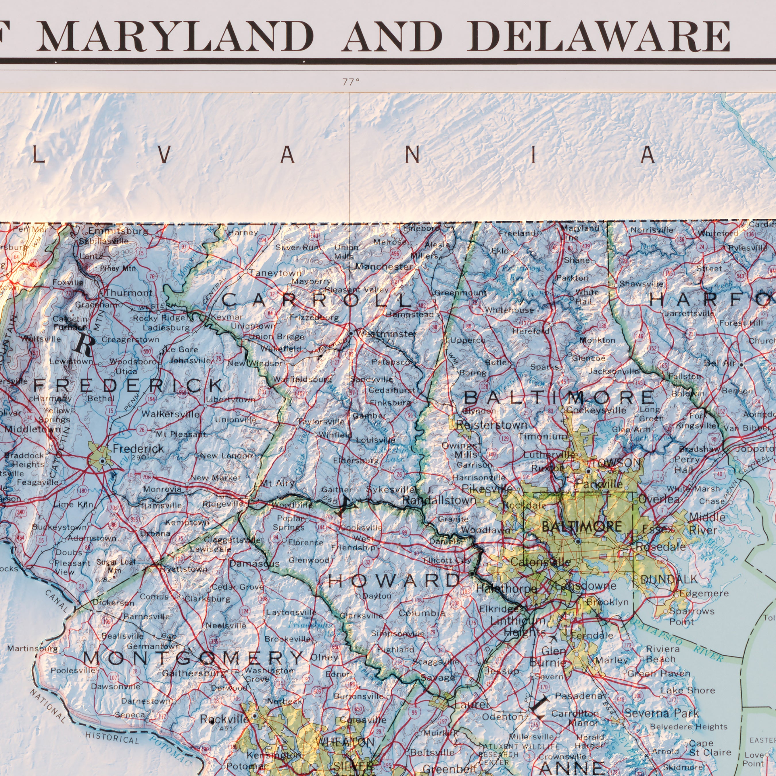
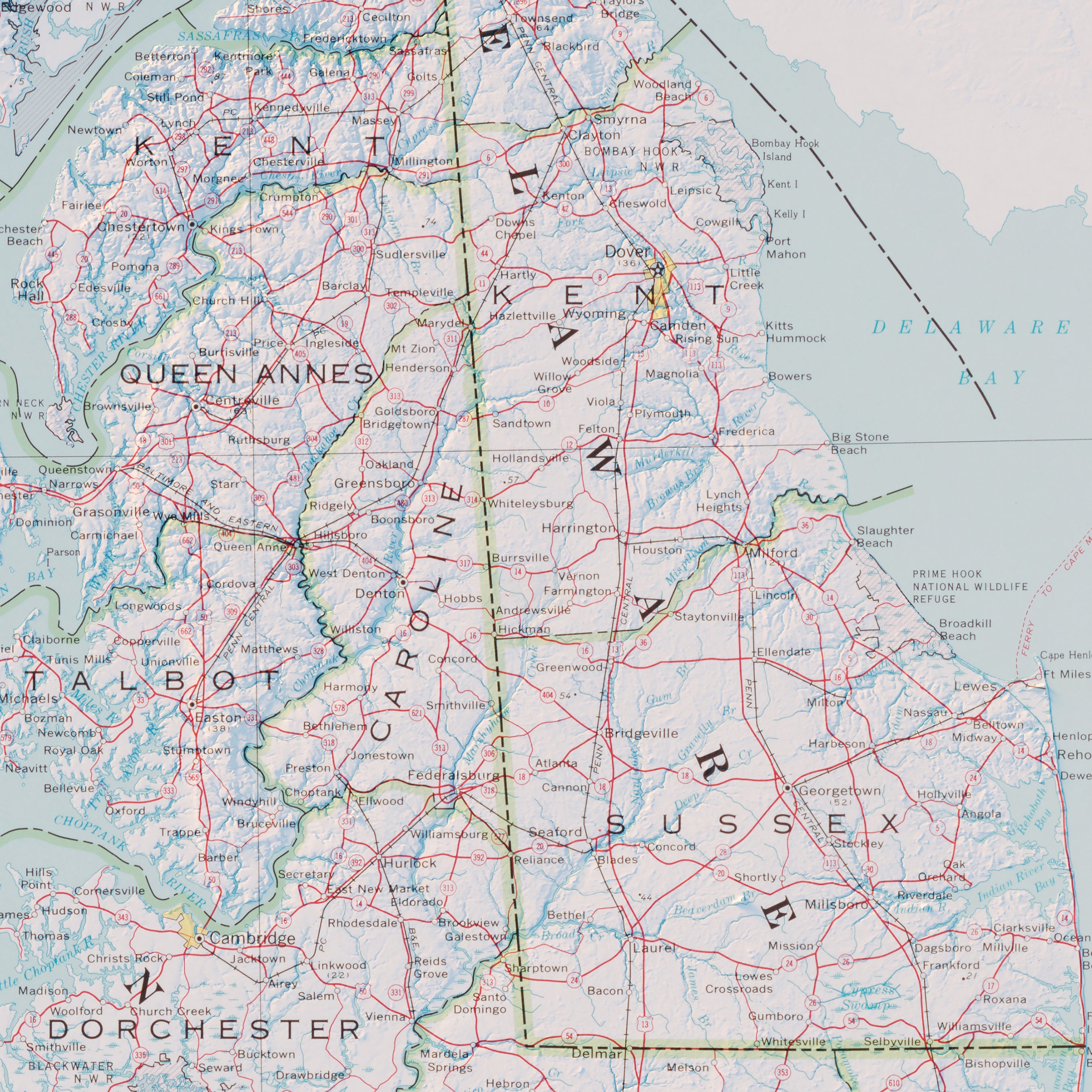
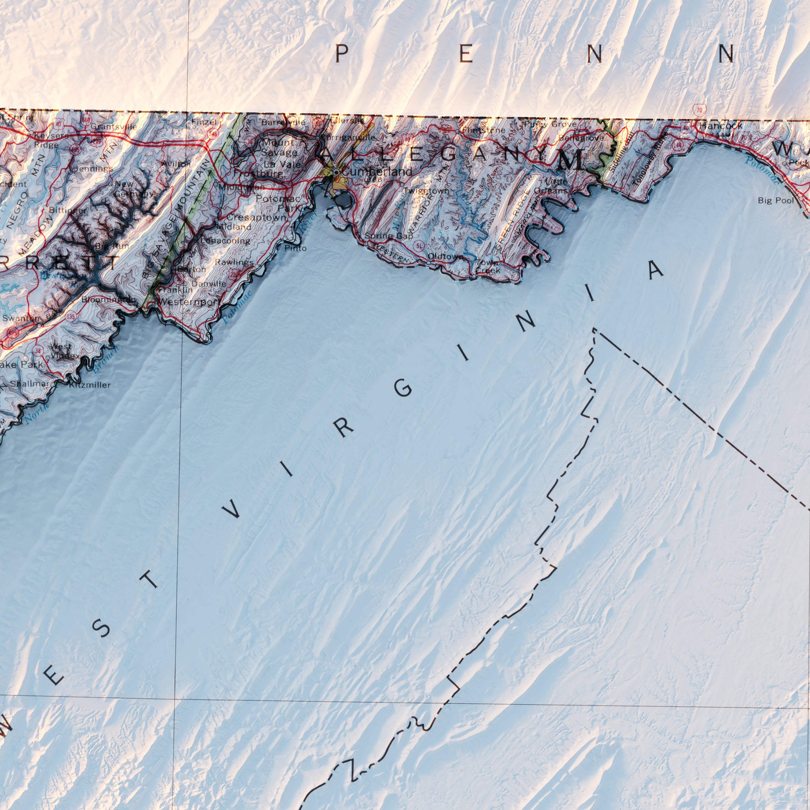
Delaware relief maps - Our relief map of Delaware and Maryland combines historical map topography from 1973 USGS data with modern technology to showcase geography in a new and exciting way. Using Digital Elevation Data and hand-shaded relief, we custom enhance vintage maps to create a 3D effect on flat paper.
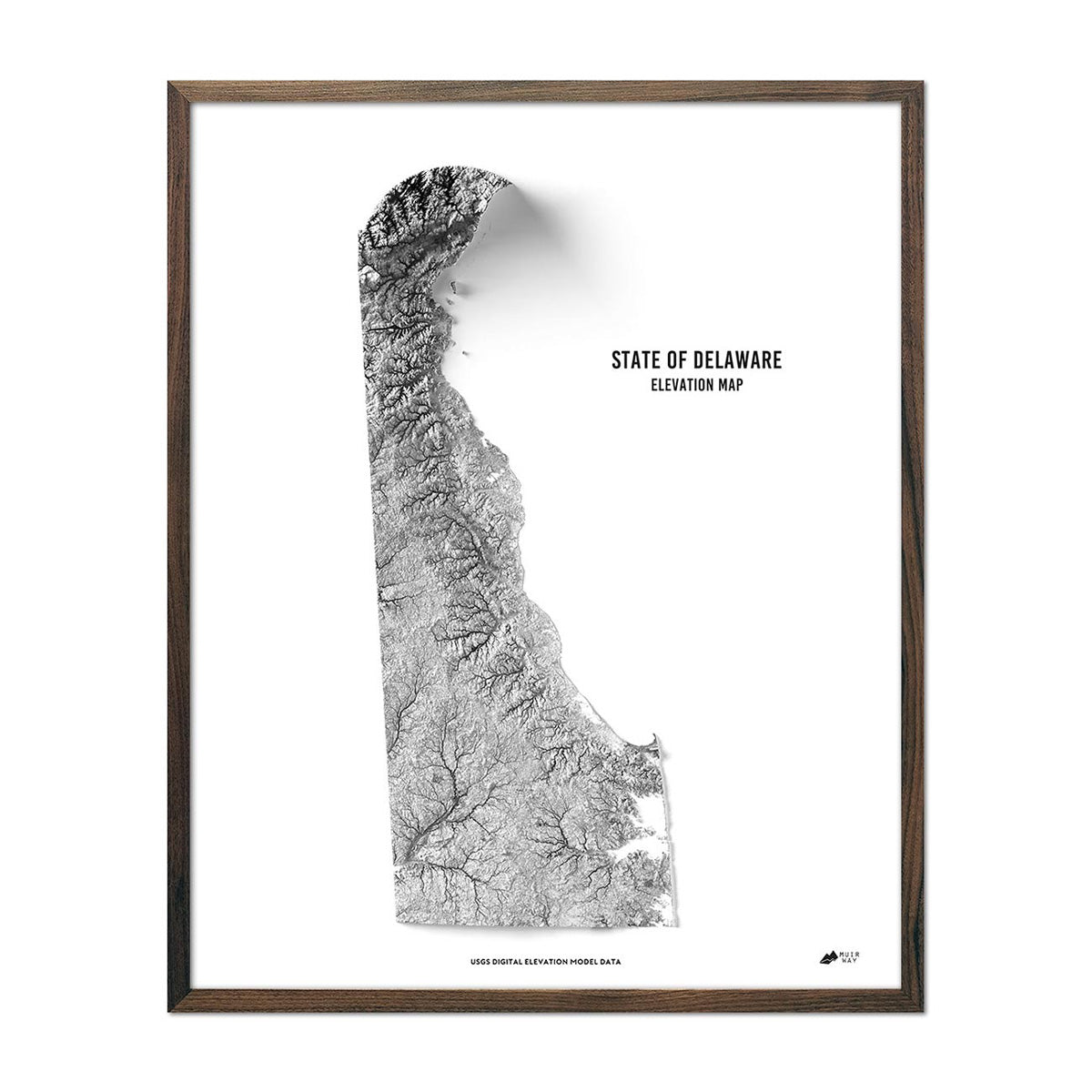
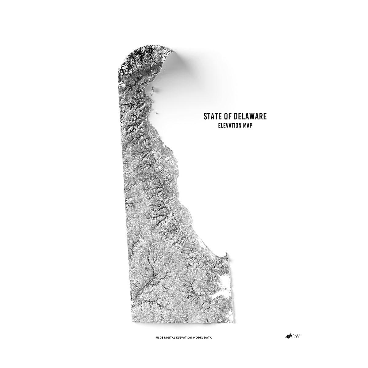
Delaware elevation maps - Our state of Delaware elevation map also uses Digital Elevation Data from the USGS to create a high-contrast 3-dimensional effect, this time in stunning black and white, for a modern, clean art piece that really “pops”.
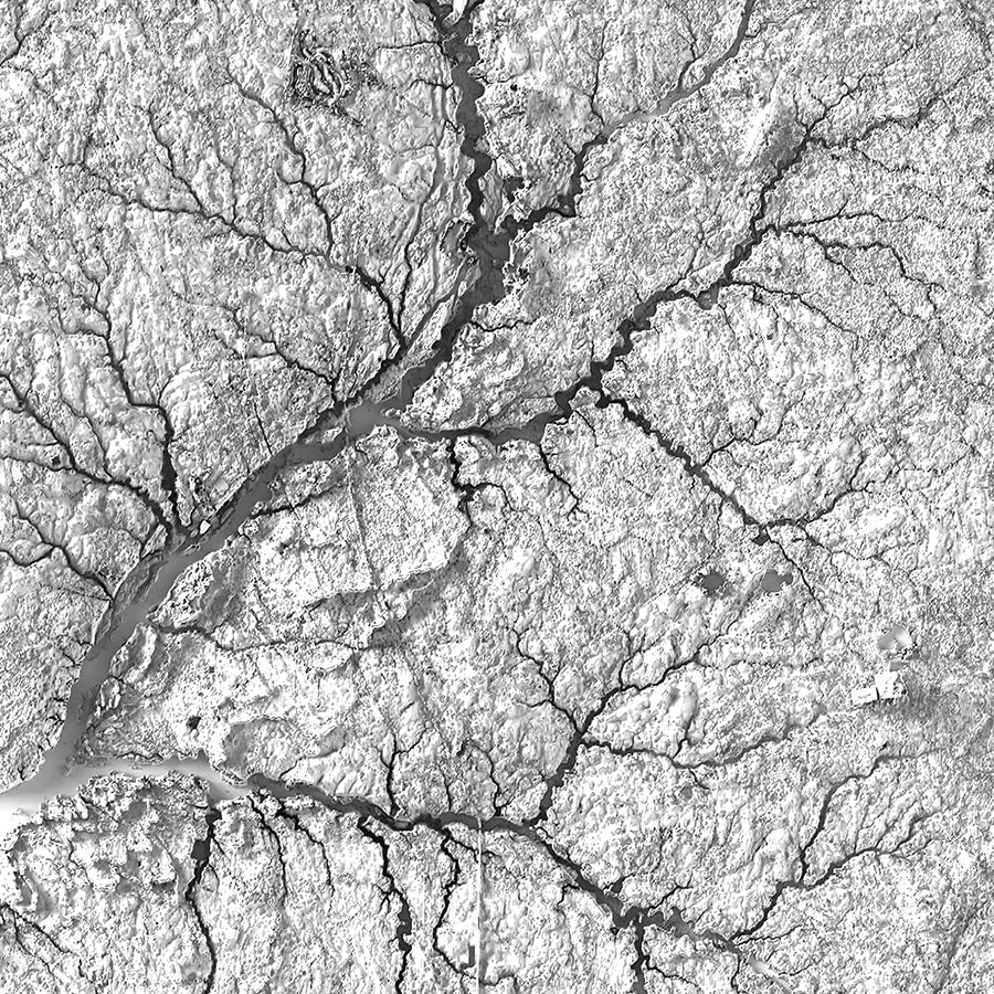
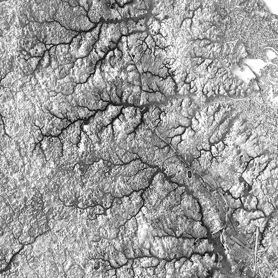
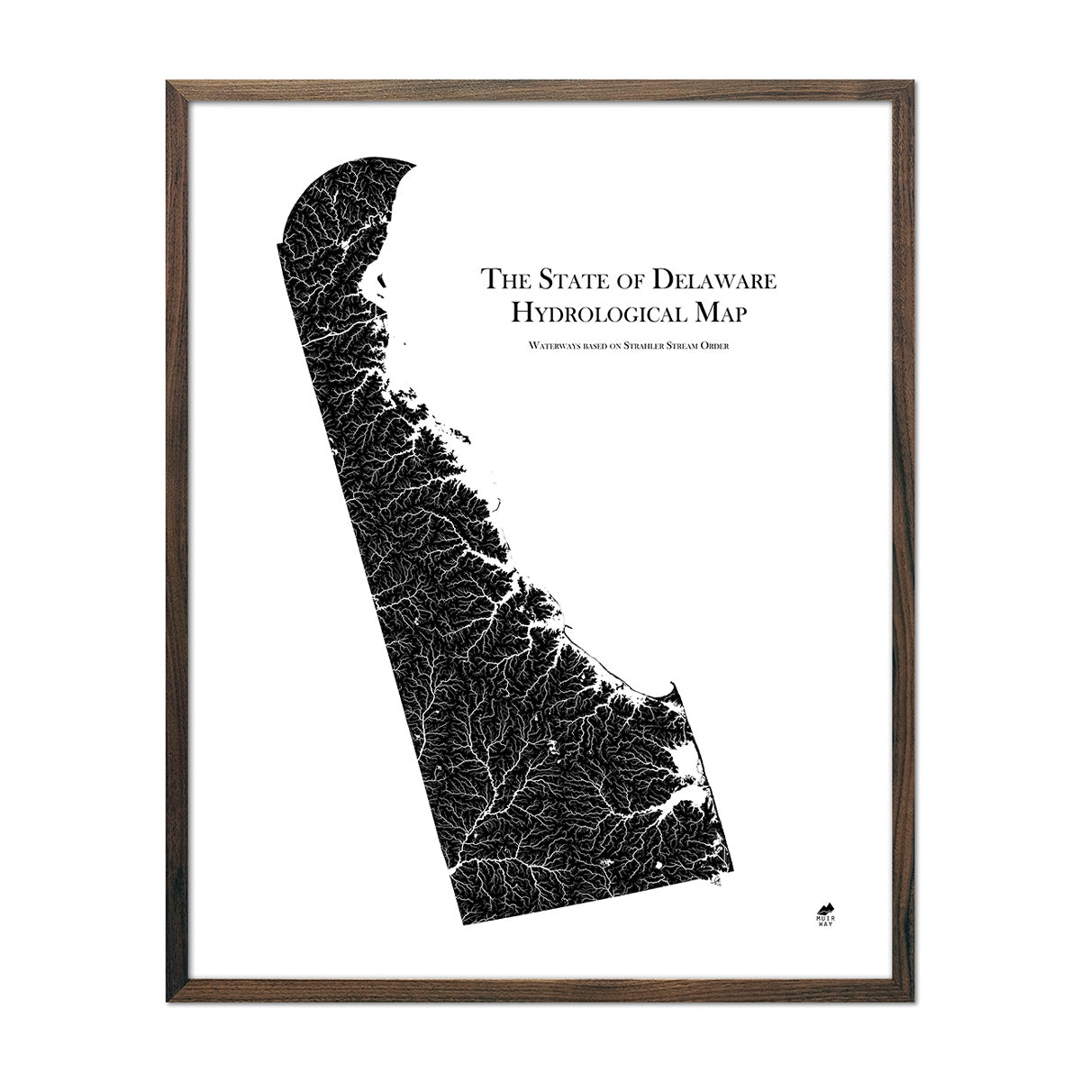
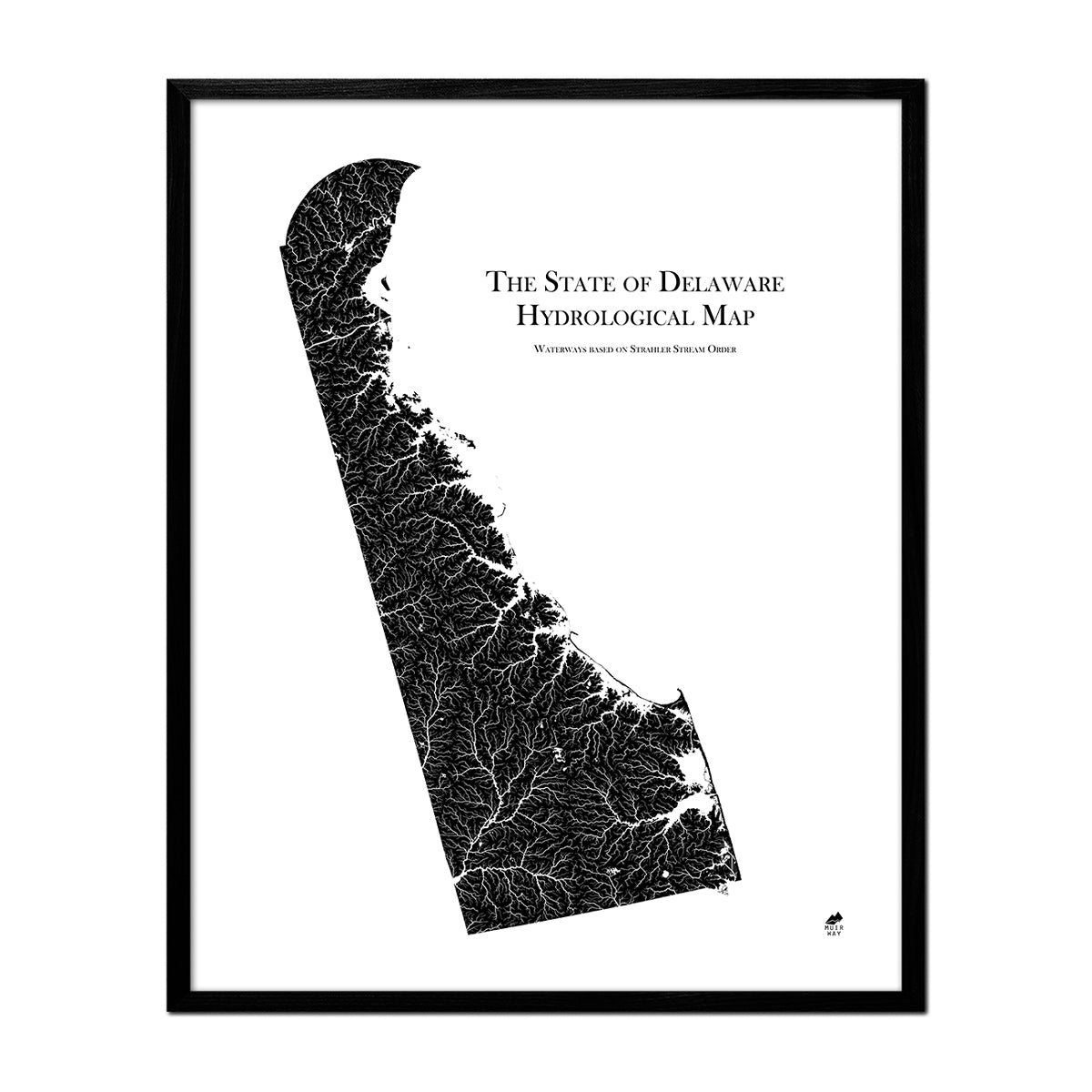
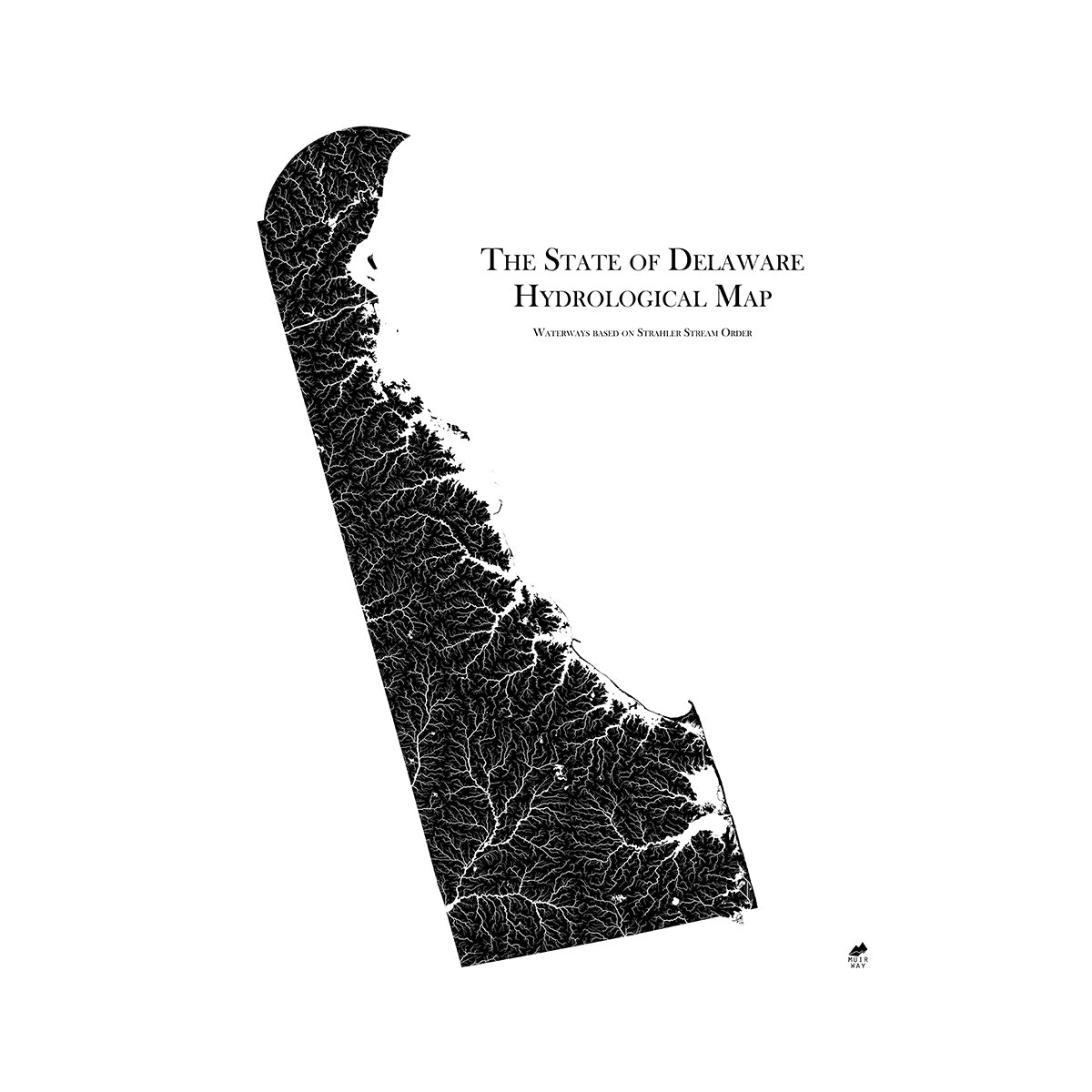
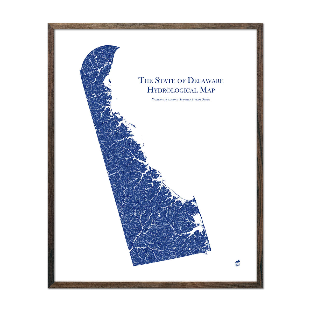
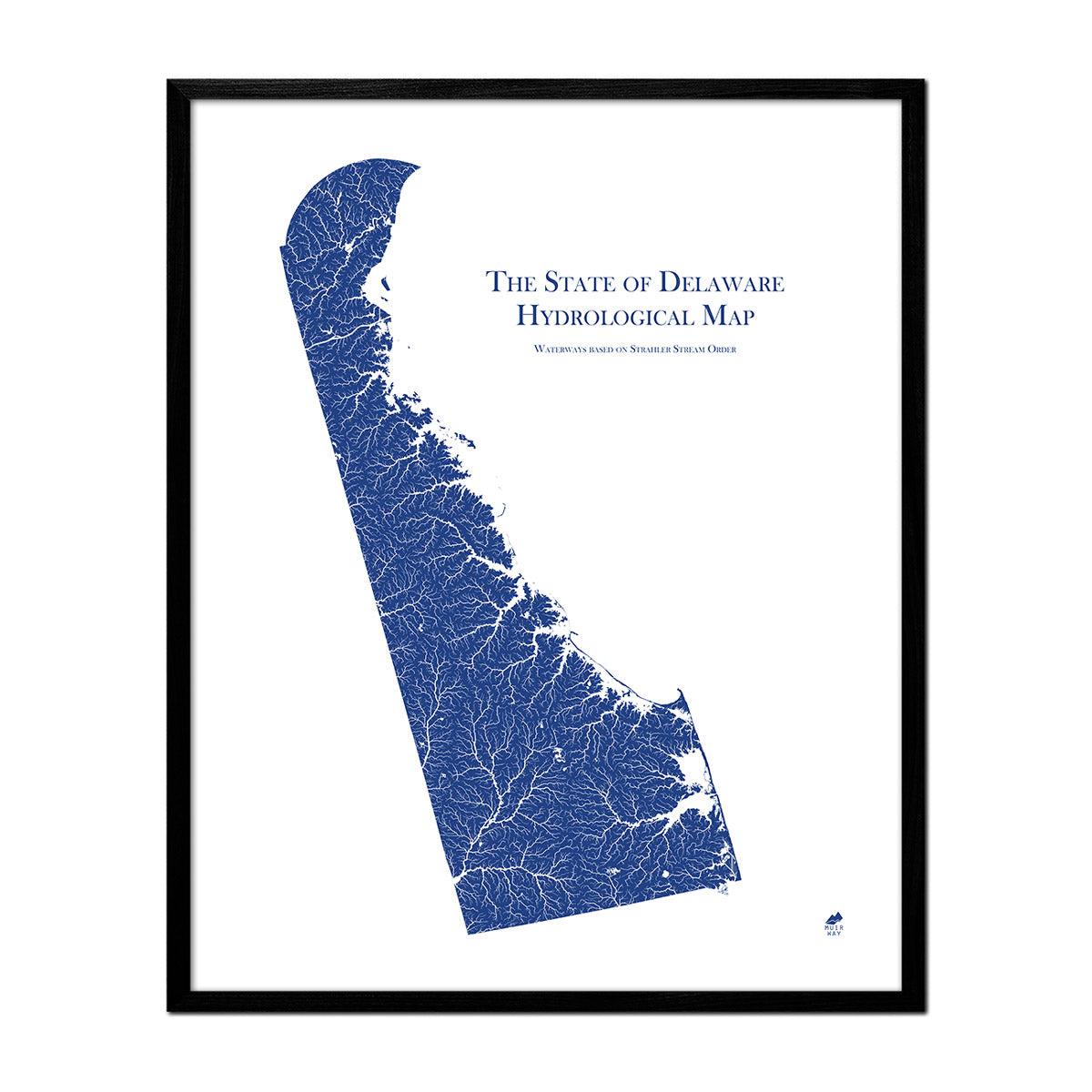
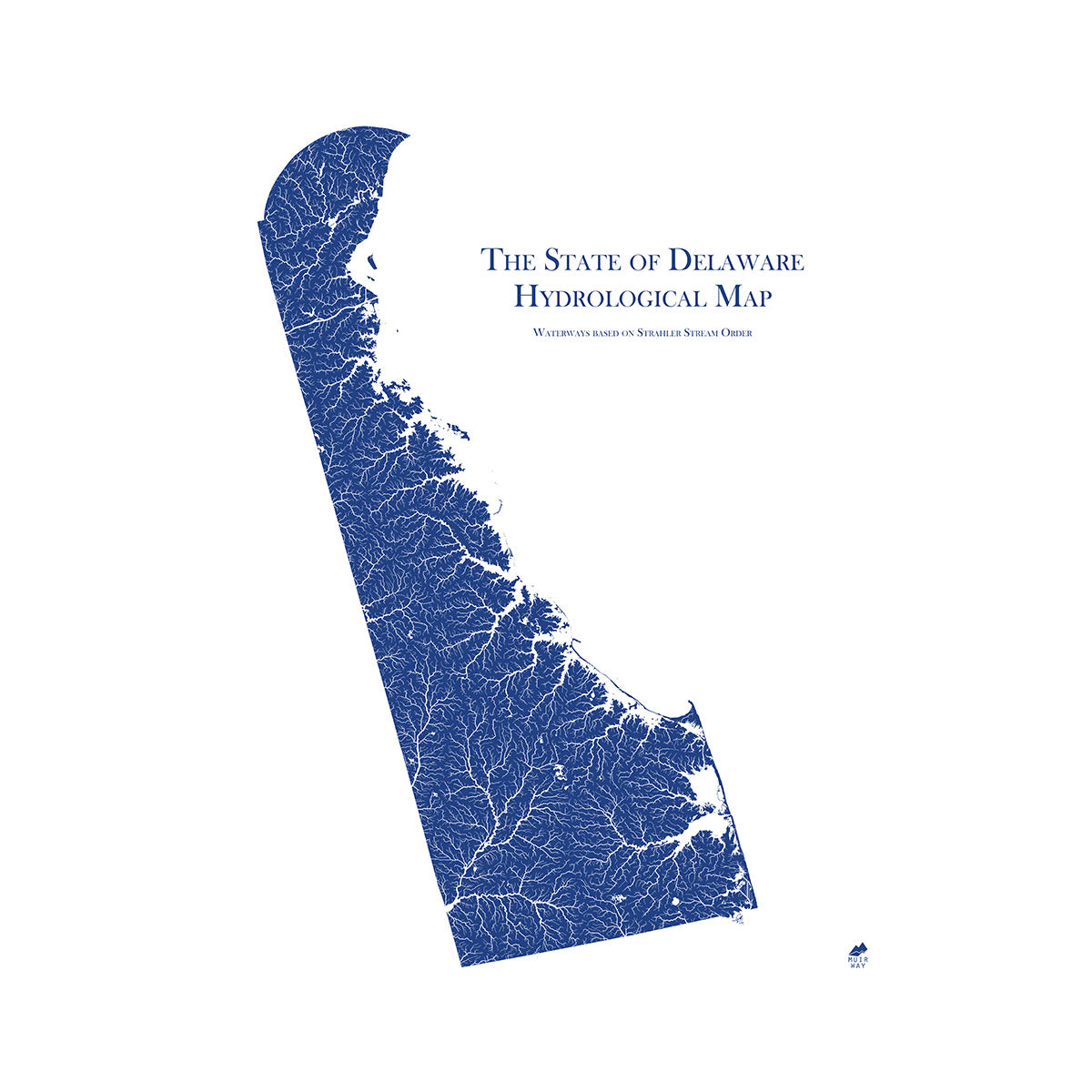
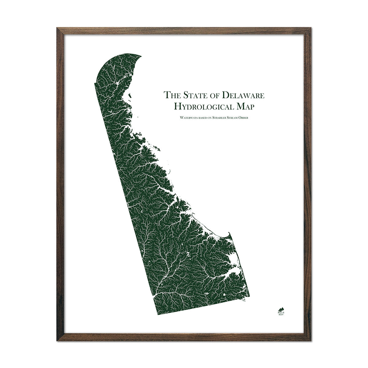
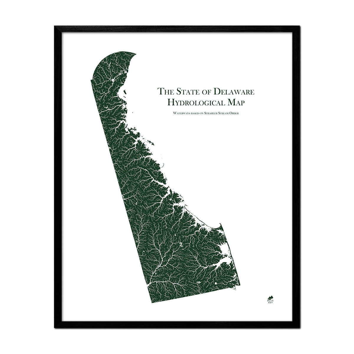
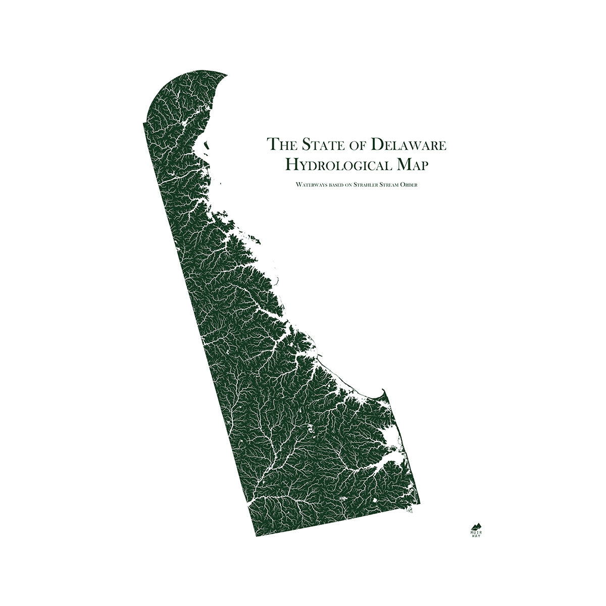
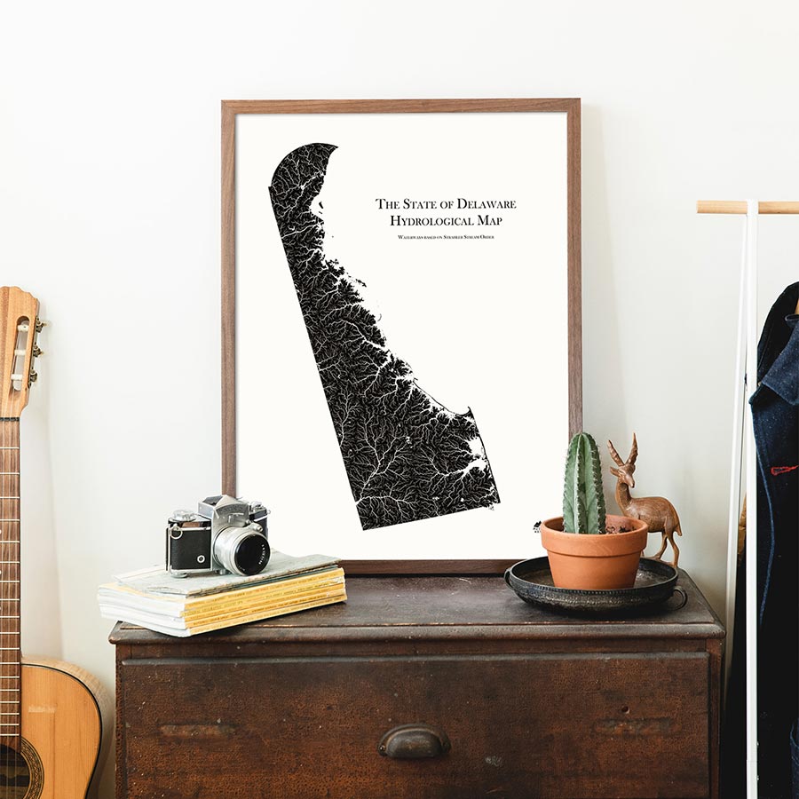
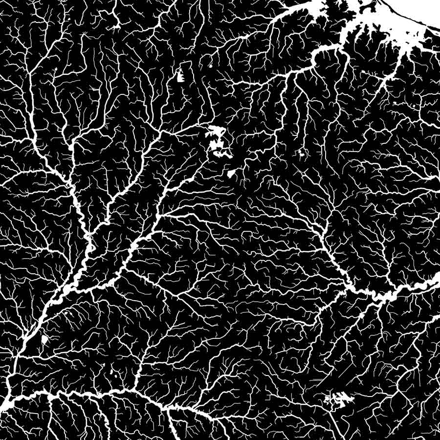
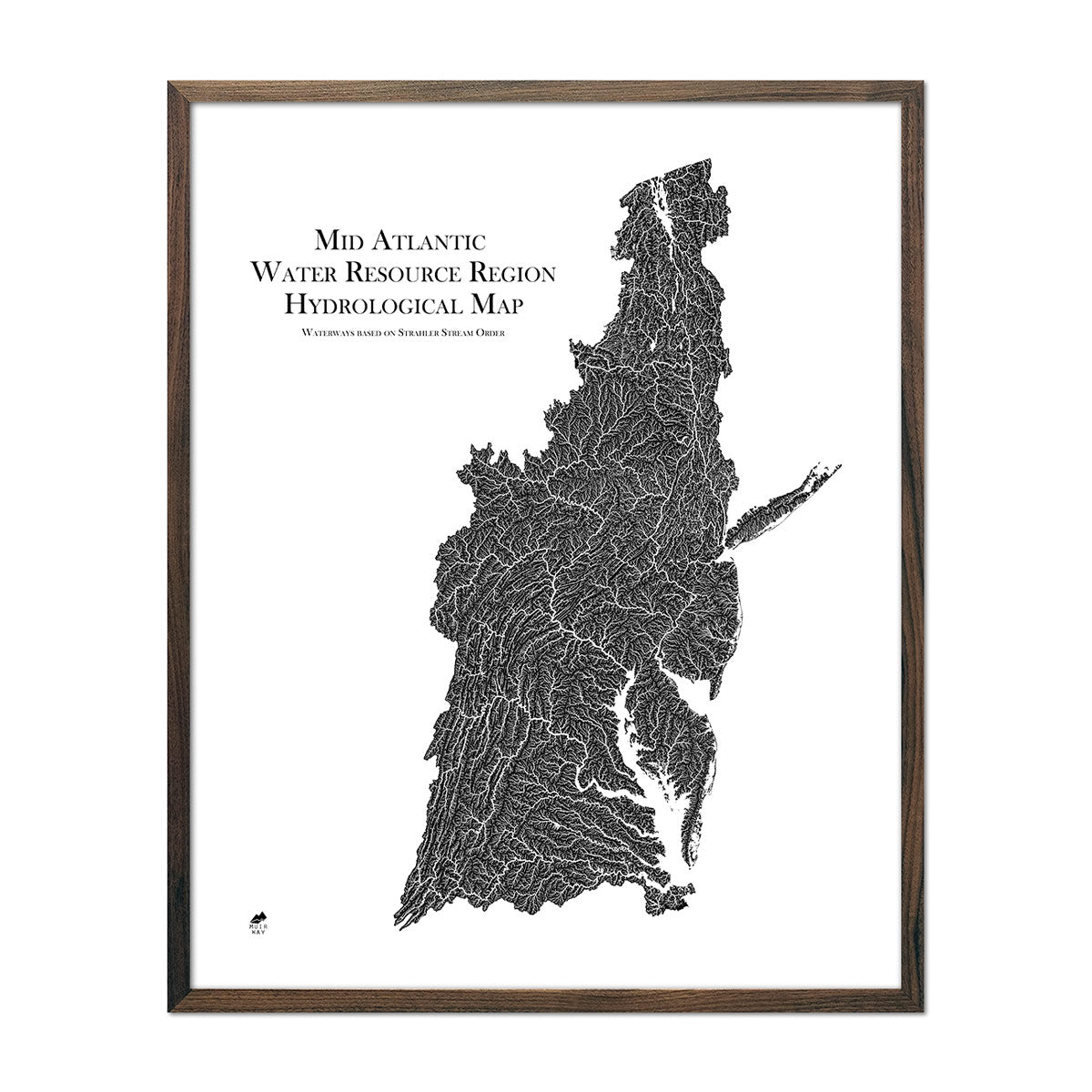
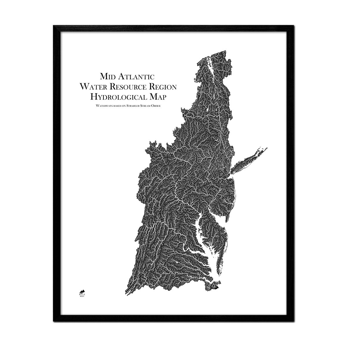
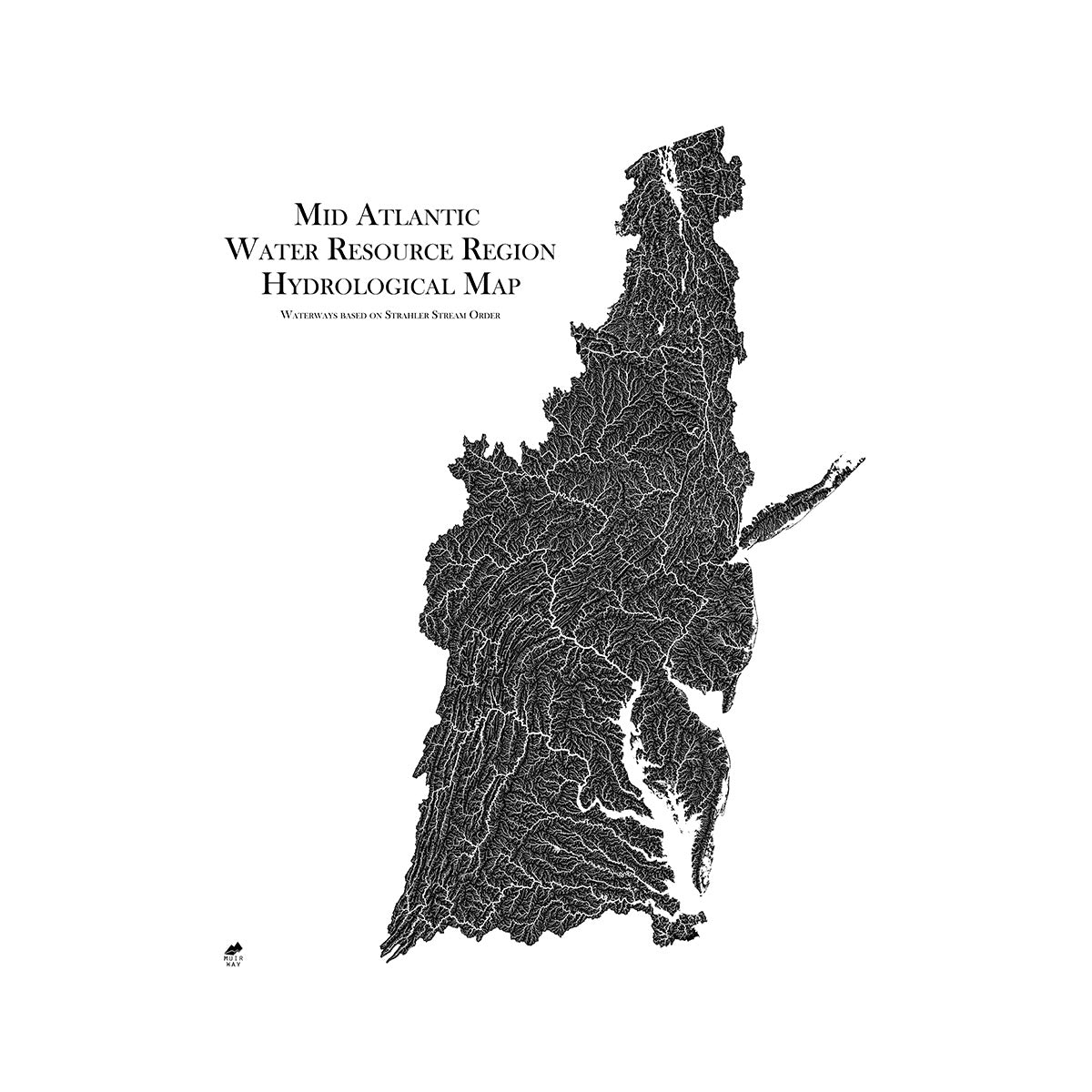
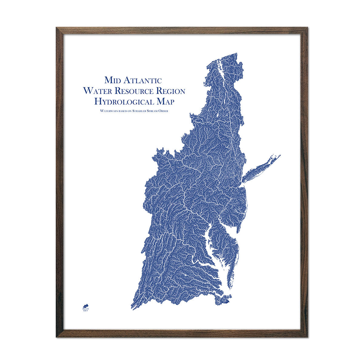
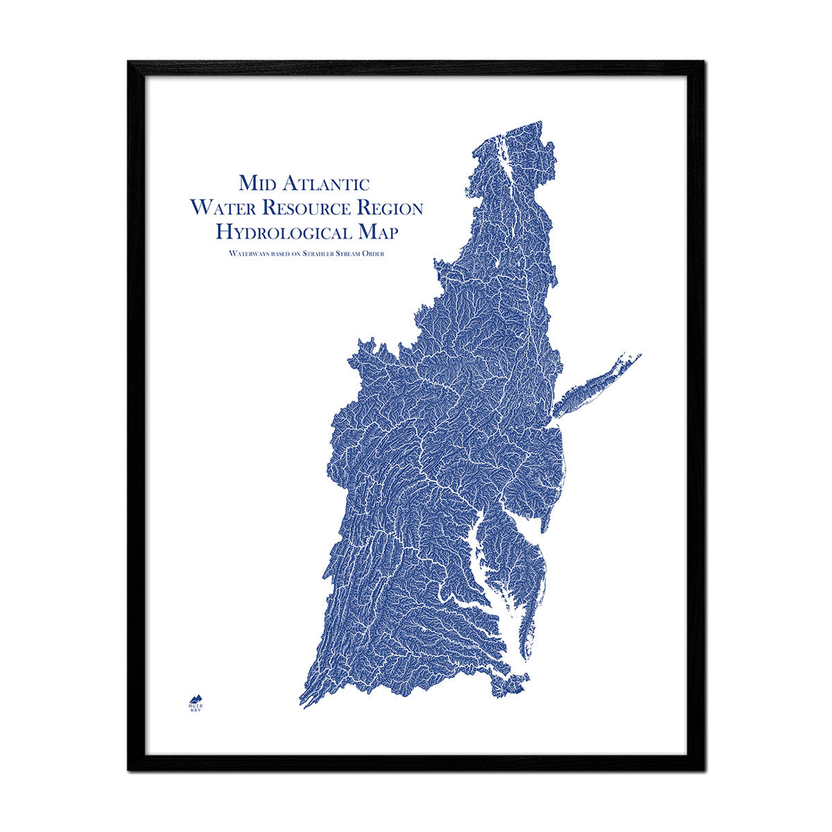
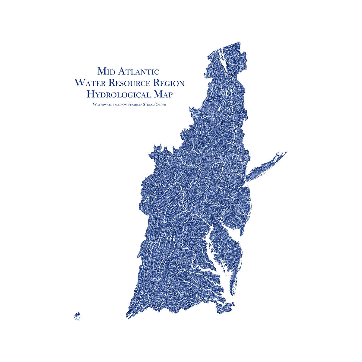
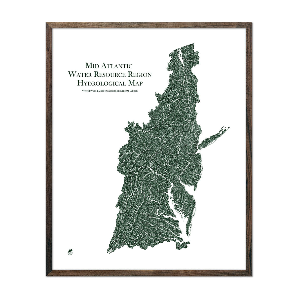
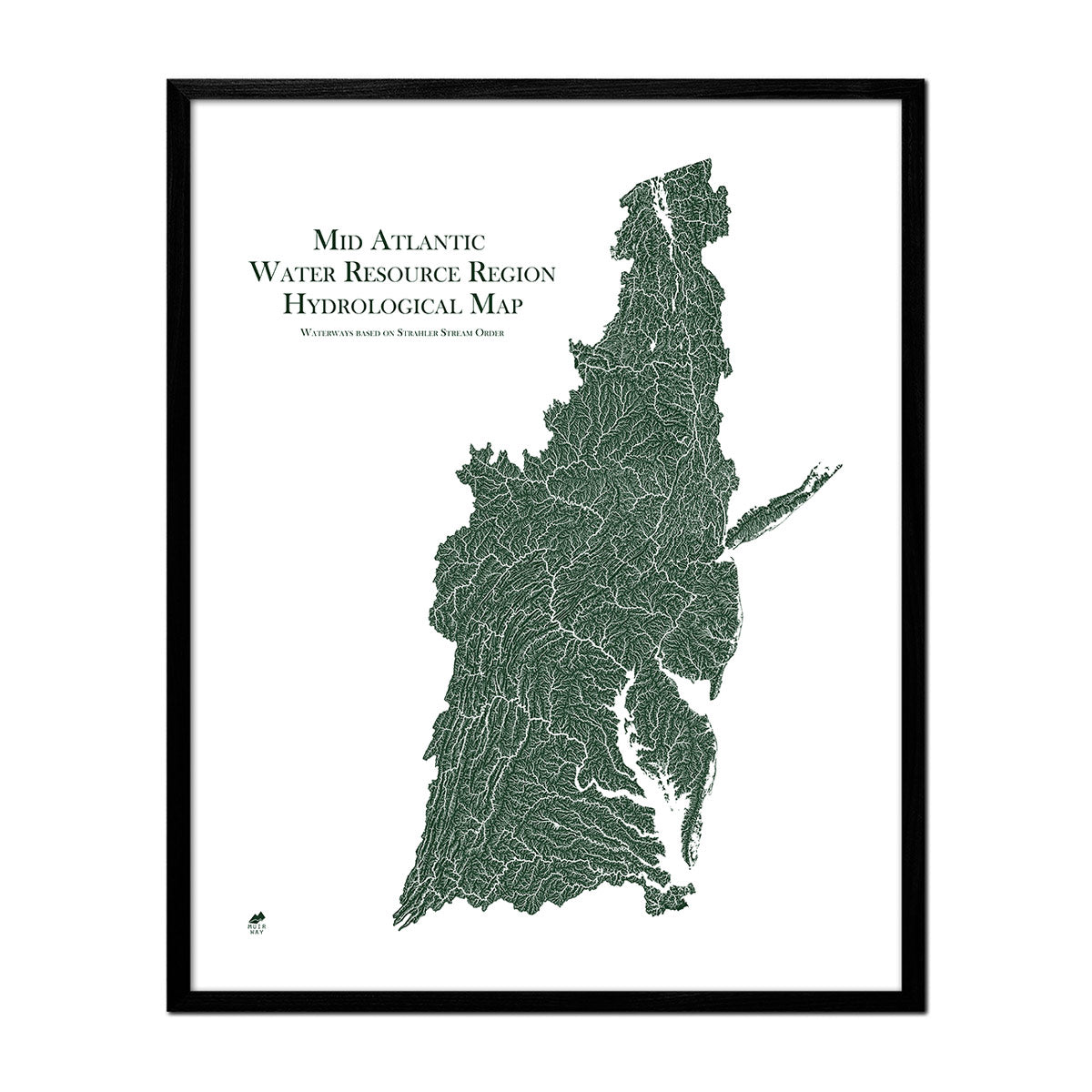
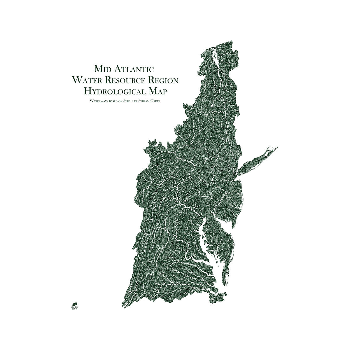
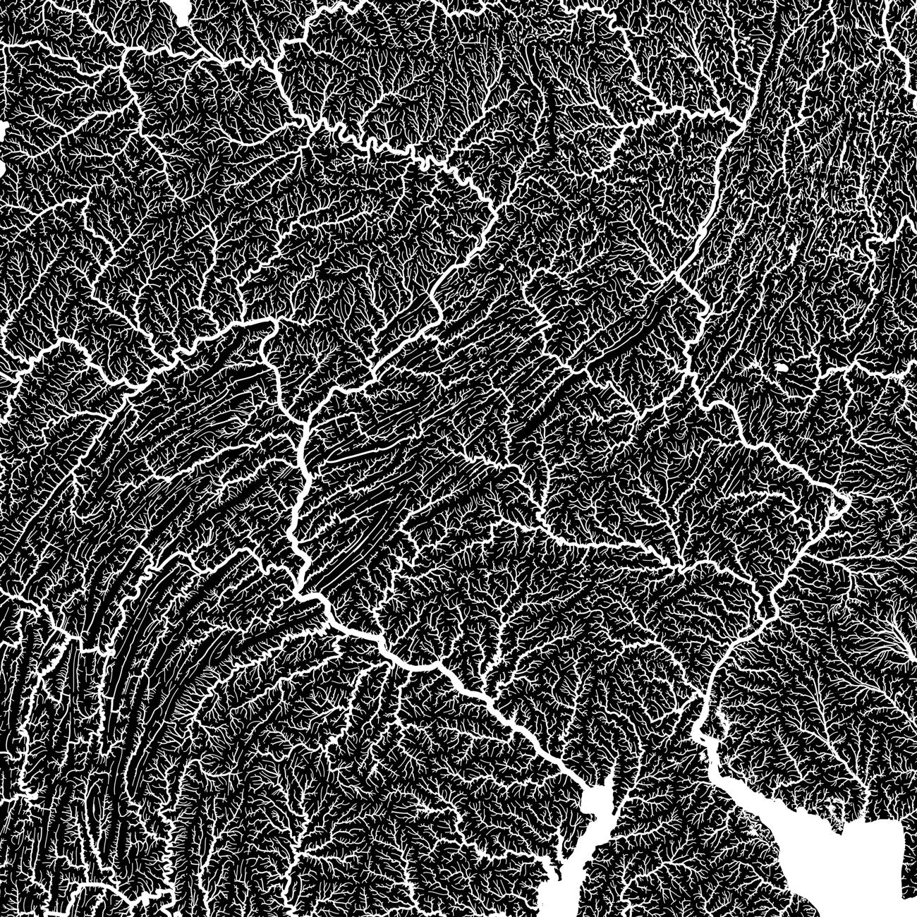
Delaware hydrological maps - Our hydrological maps showcase the intricate network of waterways, from the widest river to the smallest tributaries. Trace rivers and lakes on our Delaware hydrology map and you’ll see every single river and intermittent stream, as well as all bodies of water greater than 0.2 mi in diameter. Want to see the bigger picture? Try our Mid-Atlantic regional hydrological map. For extra clarity, we apply a method called the Strahler Stream Order to show the hierarchy of streams as they flow from their source, with rivers shown thicker as they acquire the flow of tributaries. Map available in black, blue, or green.
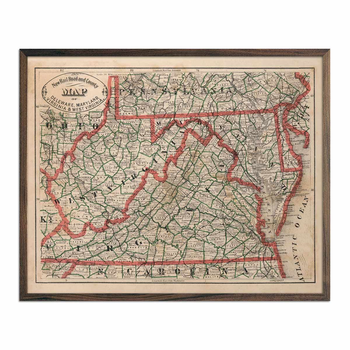
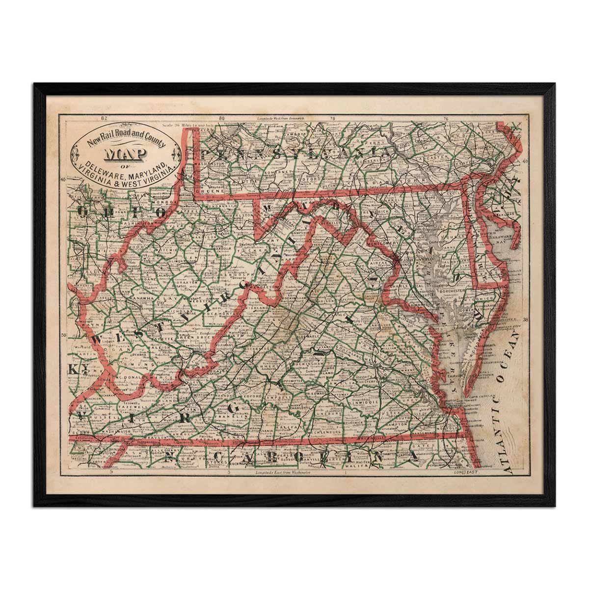
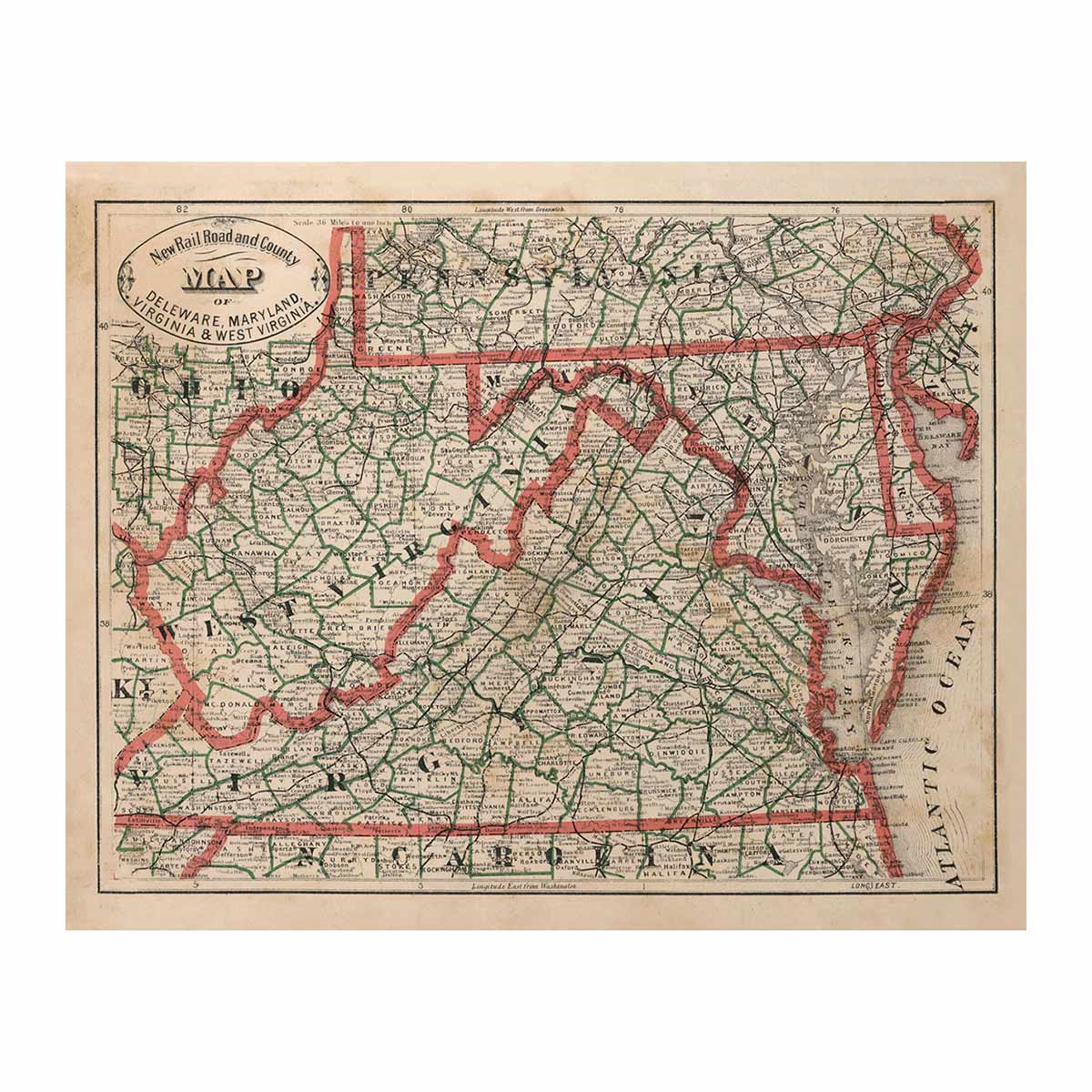
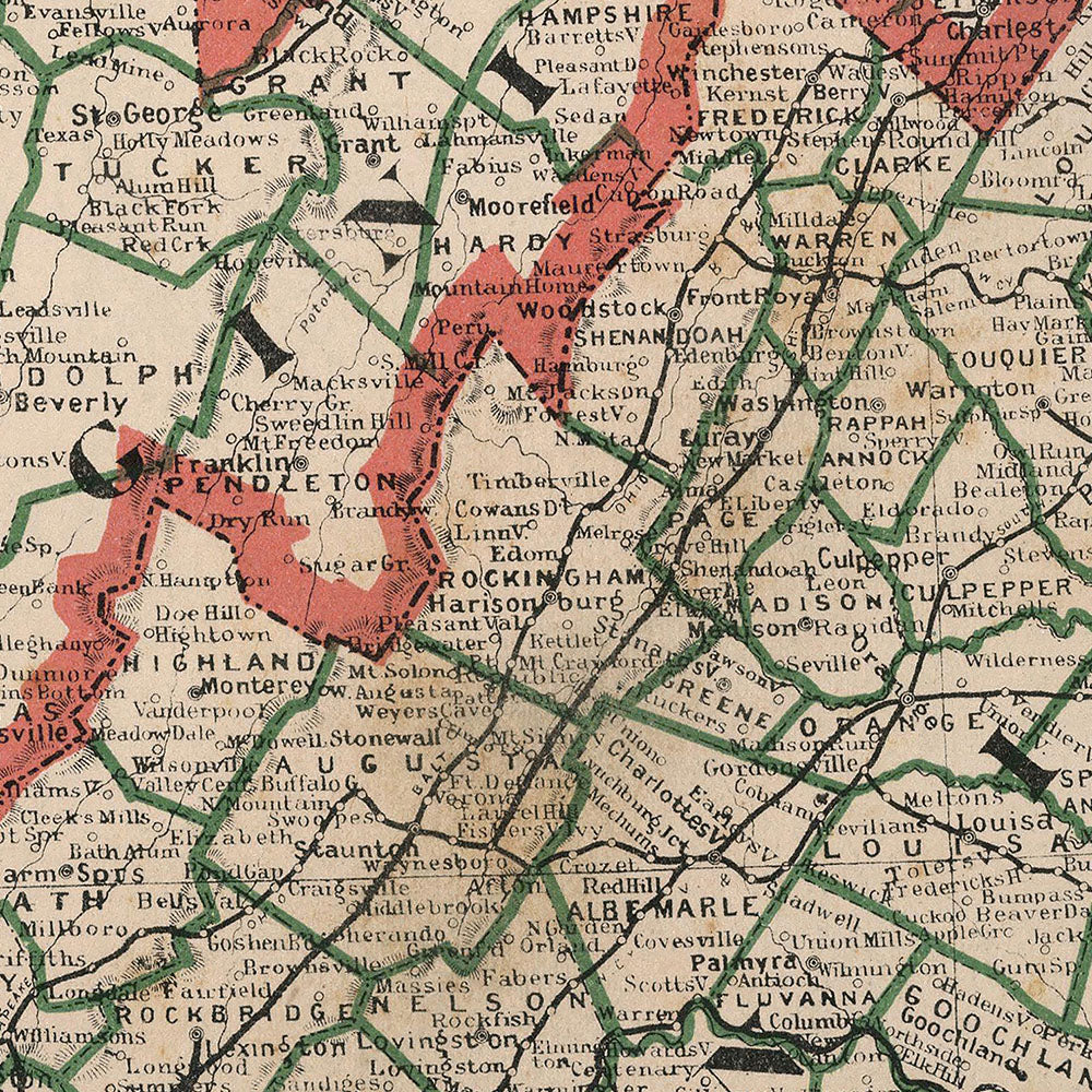
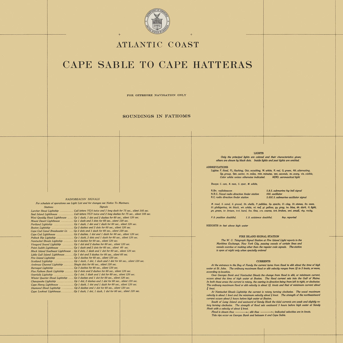
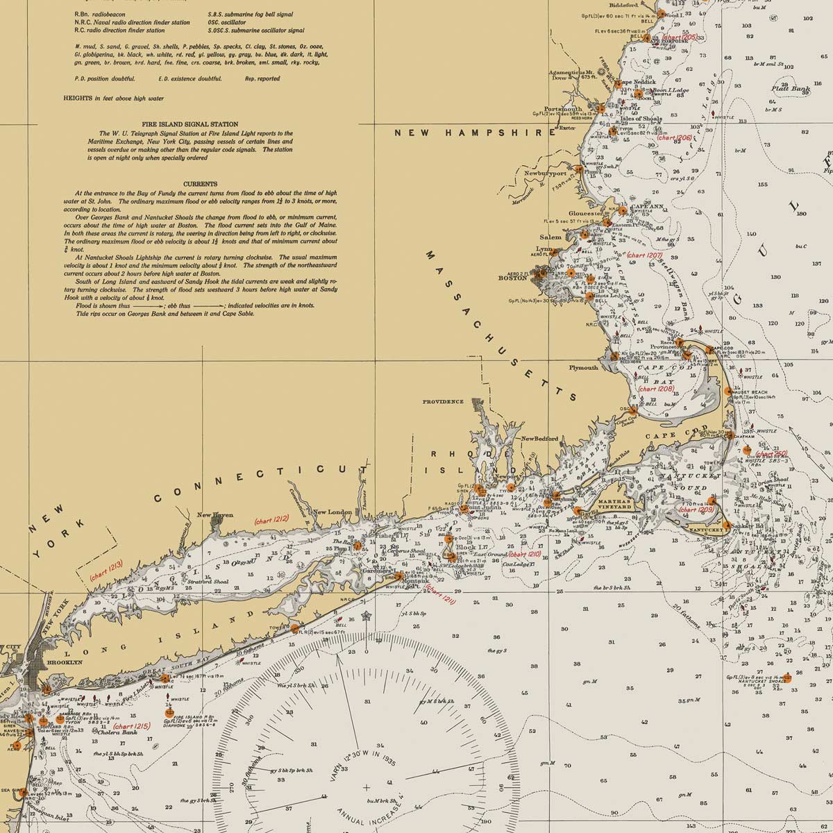
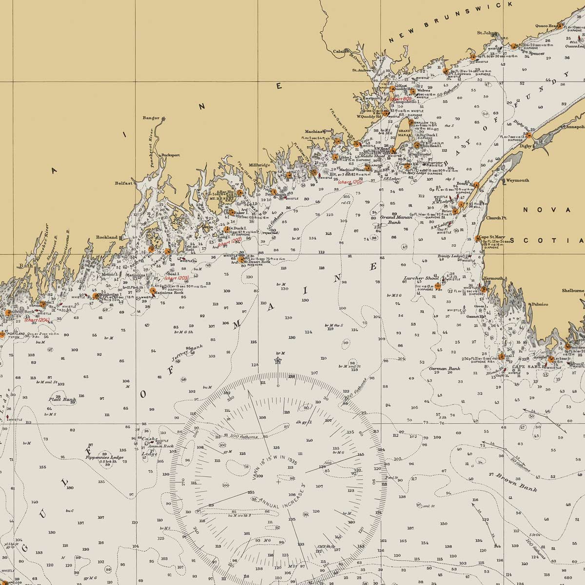
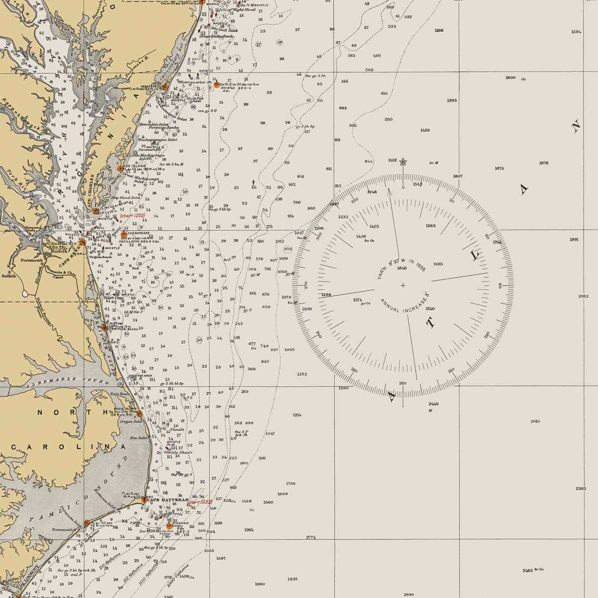
Enhanced vintage Delaware maps - If you like the history and charm of vintage maps, you’ll love our regional 1883 map of Delaware, Maryland, Virginia & West Virginia. Unlike our relief maps, Muir Way historical maps don’t feature enhanced elevation effects, but they do feature a record of history beautifully restored to retain its vintage charm without the wear & tear. Our vintage Delaware maps are custom printed just like our other maps using archival materials to preserve a snapshot of American history for years to come.
What are some prominent features on the map of Delaware?
Delaware is one of the smallest states in the country, second only to Rhode Island. Delaware is the lowest state in the country, and is the only state without a national park, but when it comes to Delaware’s natural landscape, there’s still a lot to see! Bordered by Pennsylvania in the north, the Delaware Bay, New Jersey, the Atlantic Ocean, and Maryland, Delaware is tucked amidst the political hub of the nation. From its rolling hills to its beautiful beaches, Delaware features several different landscapes to explore on our relief map.
Delaware is also home to many rivers, most notably the Delaware River which touches five different U.S. states and is a fresh water source for over 13 million people, and which is featured in the famous painting of George Washington crossing the river with his crew on Christmas night of 1776.
What are the regions in Delaware?
Delaware has two main geographical regions:
- Atlantic Coastal Plain - Most of Delaware is comprised of a low coastal plain known as the Atlantic Coastal Plain. The Atlantic Coastal Plain extends over 2,200 miles from Cape Cod in Massachusetts to the Gulf of Mexico on the Mexican border. Delaware’s elevation is so low that it contains over 30,000 acres of swamp land.
- Piedmont - Piedmont provides Delaware’s bump in elevation and encompasses a small area of the state on its northern edge, only 10 miles wide at its widest point. The highest point in Delaware is in the Piedmont region which features beautiful rolling hills.
If you like our collection of Delaware maps, you may also be interested in maps of other Northeast states. Click below to browse:


