


How accurate exactly were early maps?
A number of early printed maps are definitely inaccurate. You’ll find sea monsters jumping through the oceans and entire continents left off of the maps. But despite the obvious inaccuracies, many vintage world and national park maps are actually quite detailed and scientifically rigorous.
EARLY VINTAGE MAPS
Many early printed maps would now be considered goofily inaccurate. Printed mapmaking in general dates at least to Gutenberg’s invention of the printing press in the 15th century. Although there of course were maps before then, this was the first time maps could be mass printed for general use. Maps of this time were quick to combine everything the mapmakers knew about the world plus information from explorers like Columbus and Magellan returning from their journeys. Many of these early maps were woefully inaccurate. One map created by John Speed in 1627, shows California as an island and leaves the northwest of the United States completely blank. Still, local maps of the time were highly accurate.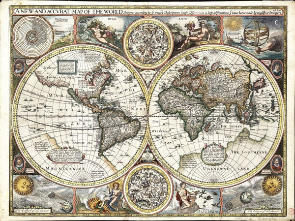
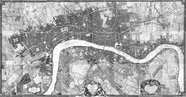
This map created in 1746 by John Rocque is so accurate it looks like a satellite photograph.
VINTAGE NATIONAL PARK MAPS
The first vintage national park maps were made as the first national parks were being created and established in the late 1800s. Yellowstone National Park, designated in 1872, was the first national park created in the world. Government mapping often begins with the mapping during the discovery and exploration phase. These early maps often left out important physical features but got the general orientations correct. This map of Mount Desert Island in Maine was produced in 1887, and is one of the earliest national park maps. It is considered a fairly accurate representation of the area that became the home to Acadia National Park.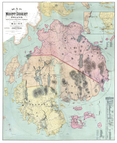
National park maps continued to grow and improve as they began to include unique physical features, geological attributes, and historical and cultural artifacts. The most current national park maps now are created for park brochures which are highly accurate showing roads, trails, campsites, and other amenities, and are what we at Muir Way base our national park designs off of.


